
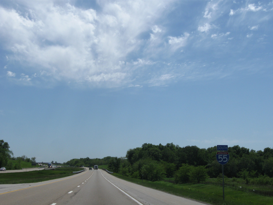
Interstate 55 South - Chenoa to Bloomington

 South
South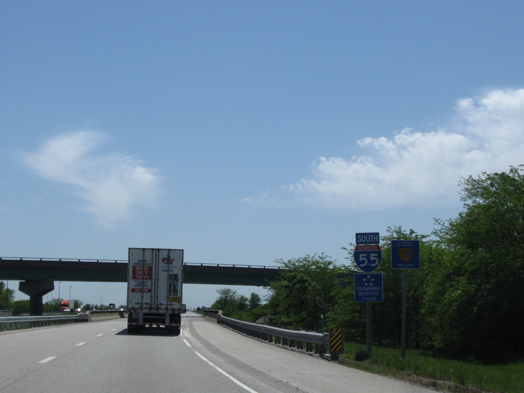
The confirming marker posted south of the Limestone Rest Area stands ahead of Rooks Creek and the E 1400 N Road overpass.
05/06/10
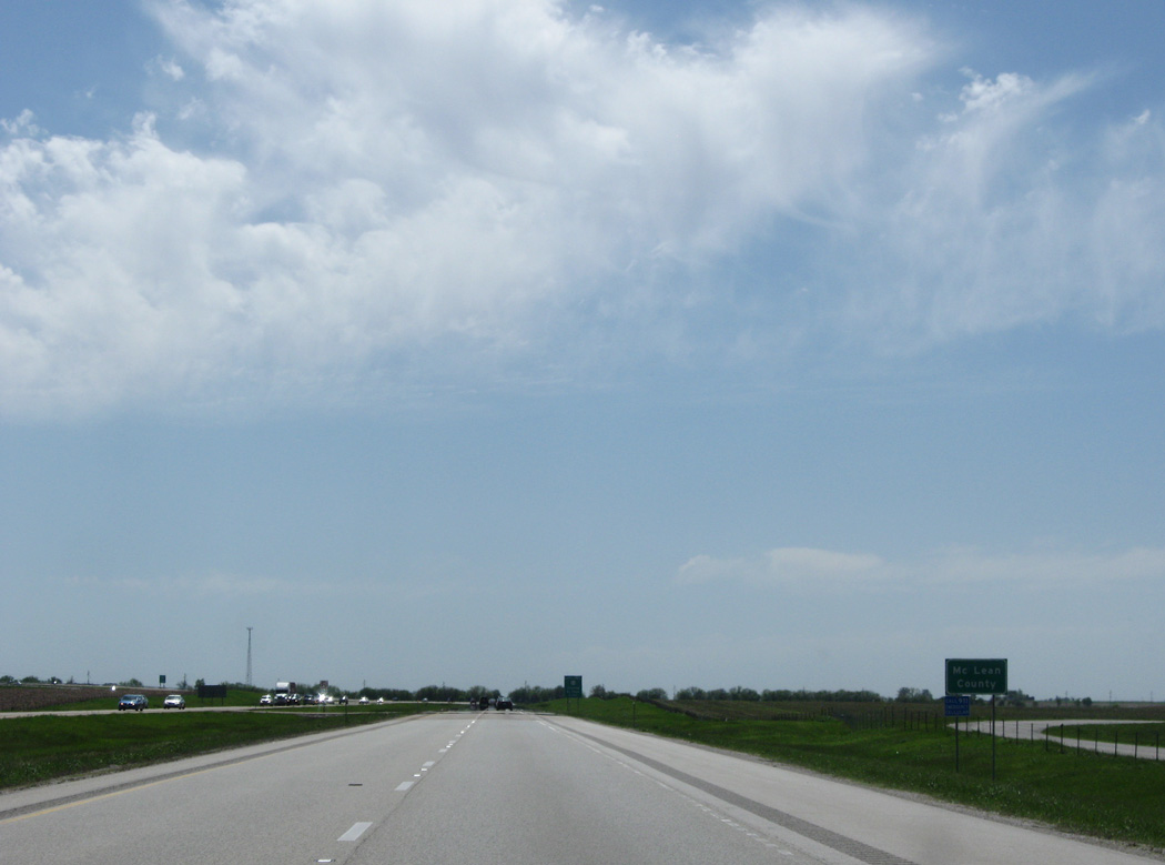
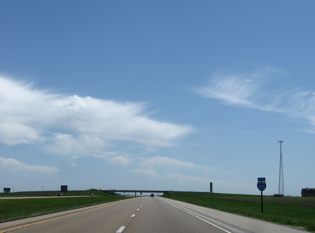
Interstate 55 angles southwest into Mc Lean County to the northwest of the Chenoa city limits.
05/06/10
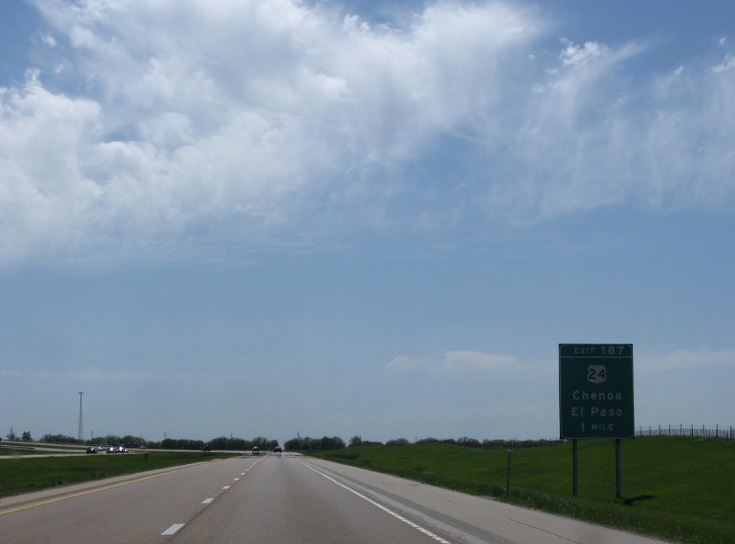
U.S. 24 (Cemetery Avenue) meets Interstate 55 at Exit 187 on the west side of Chenoa.
05/06/10
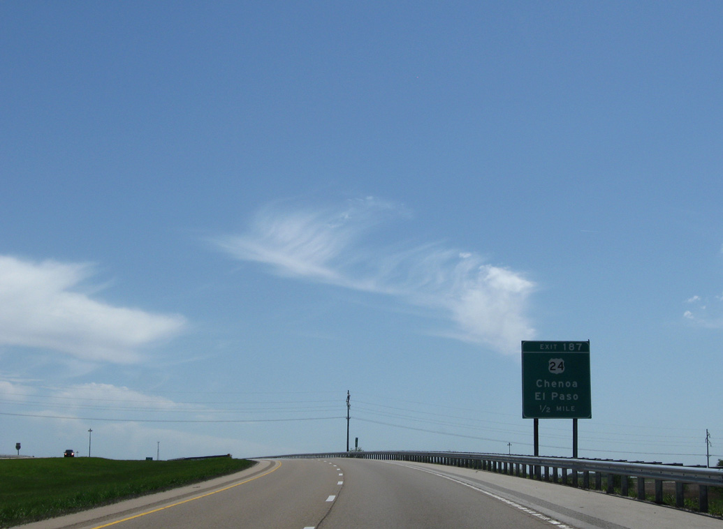
Curving south, Interstate 55 spans a Toledo, Peoria & Western Railroad line ahead of the folded diamond interchange (Exit 187) with U.S. 24 (Cemetery Avenue).
05/06/10

U.S. 24 bee lines west from Chenoa to Gridley and El Paso en route to Peoria. East from Chenoa, U.S. 24 continues to Fairbury and I-57 at Gilman.
05/06/10
Interstate 55 runs along the Chenoa city line south to rejoin Old Route 66 (Historic U.S. 66).
05/06/10
Historic U.S. 66 lines the east side of Interstate 55 on the ensuing stretch to the city of Lexington.
05/06/10
I-55 and Historic U.S. 66 parallel a Union Pacific Railroad line with AMTRAK service south from Chenoa to Lexington.
05/06/10
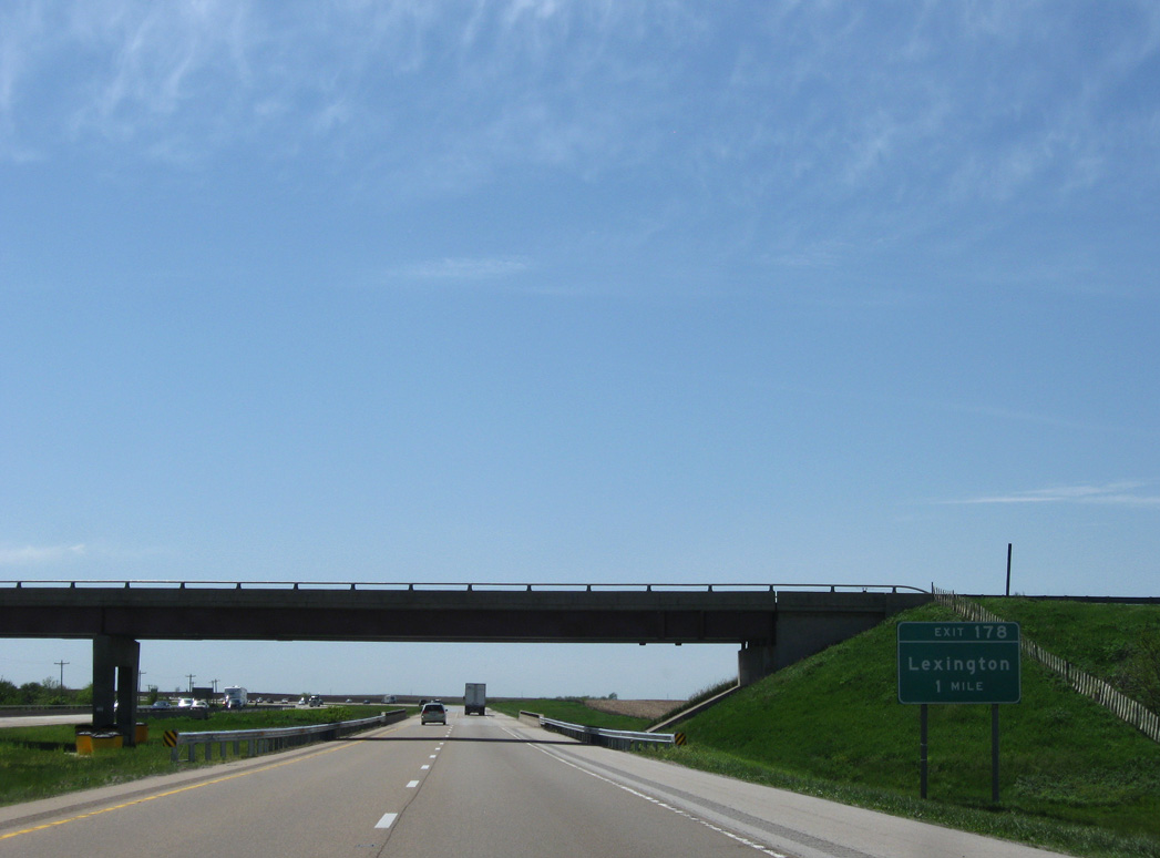
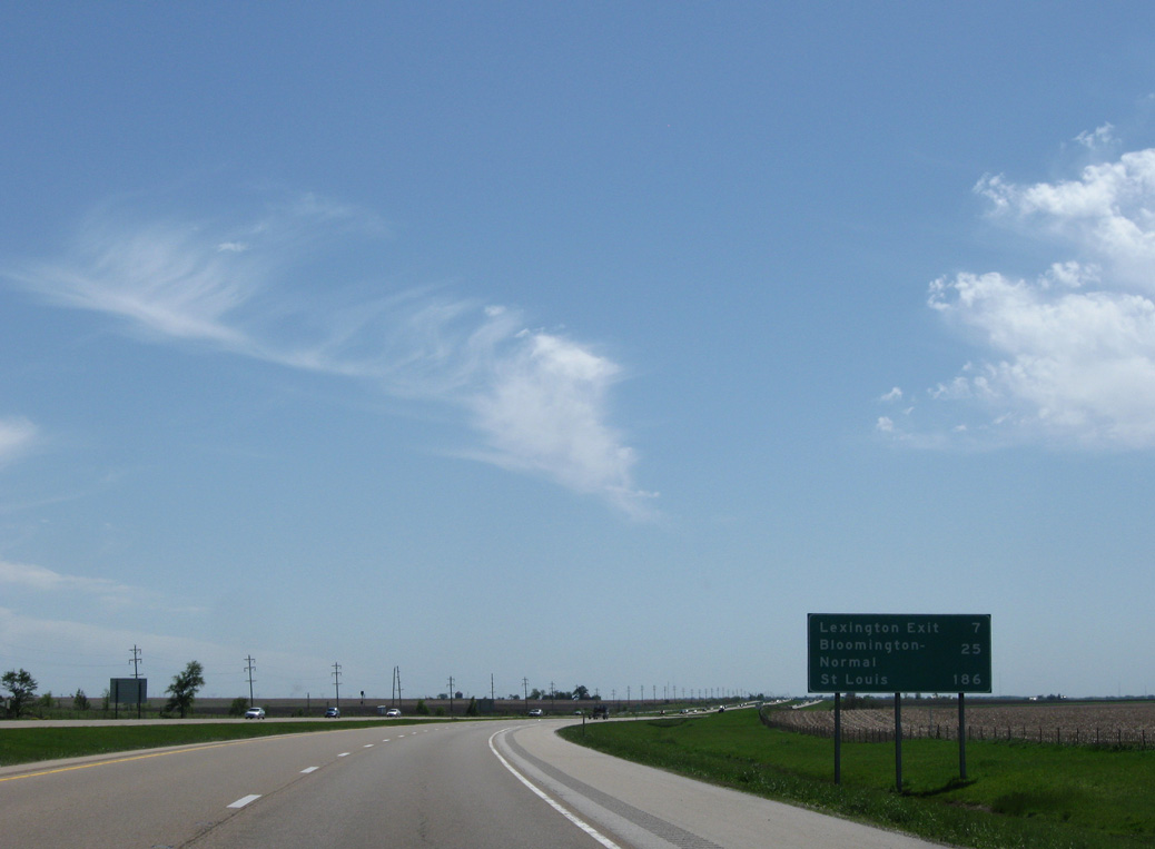
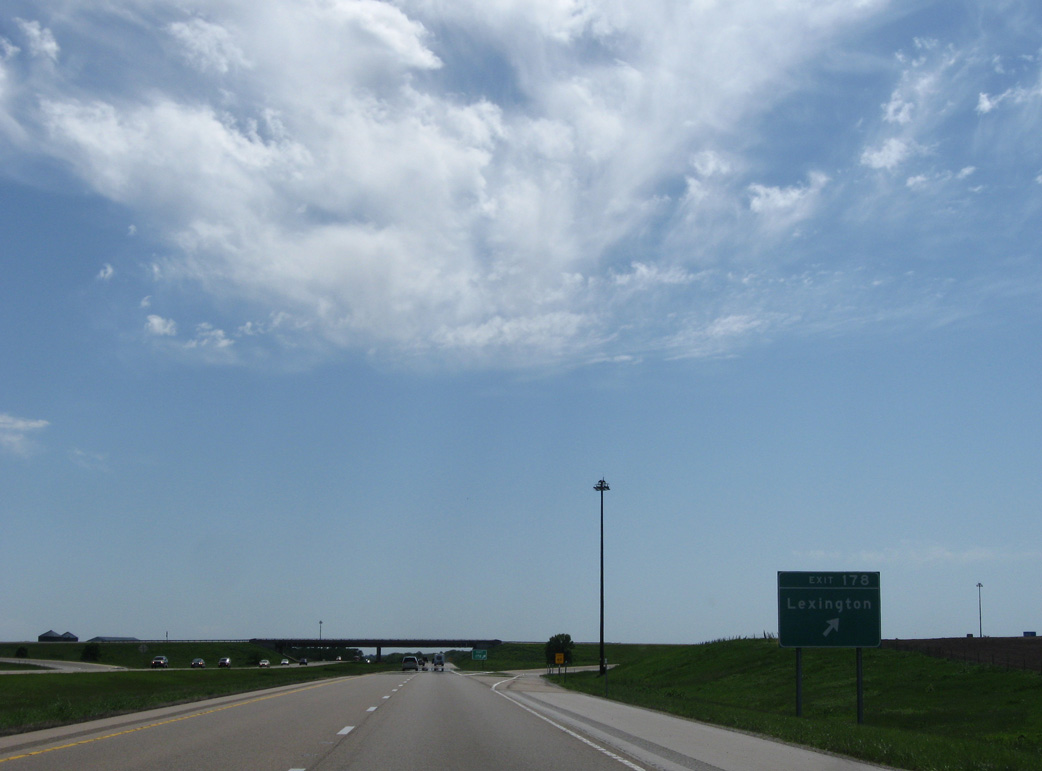
Shifting west to bypass Lexington, Interstate 55 passes below CR 23 one mile from the diamond interchange (Exit 178) with CR 8 (P.J. Keller Highway).
05/06/10
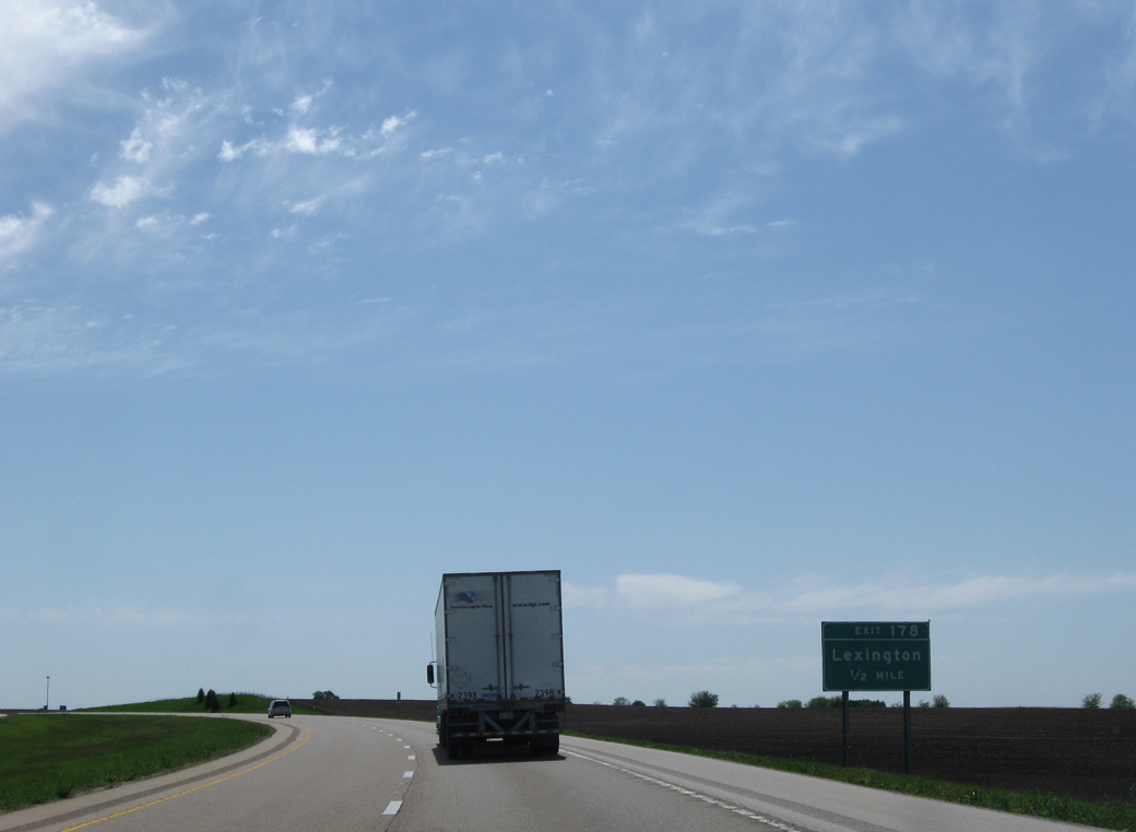
CR 8 (P.J. Keller Highway) heads 0.99 miles east from Exit 178 to CR 23 at Spencer Street. Spencer Street takes CR 8 south to Historic U.S. 66 and Main Street to the Lexington city center.
05/06/10
West from Exit 178, CR 8 (P.J. Keller Highway) travels to Clarksville, Lake Bloomington and Interstate 39 ahead of Evergreen Lake.
05/06/10
South from Exit 178, Interstate 55 crosses Turkey Creek and the Mackinaw River at Lexington Preserve.
05/06/10
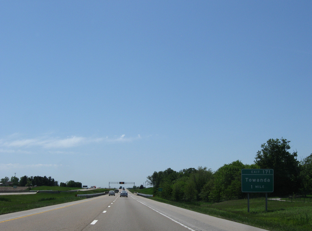
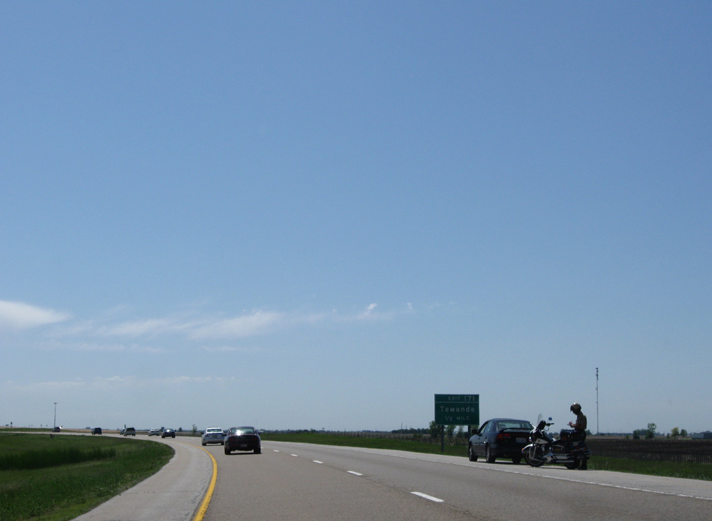
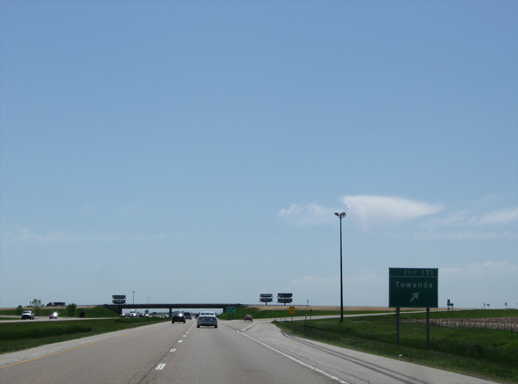
Shifting west away from Historic U.S. 66, Interstate 55 crosses Money Creek one mile ahead of the diamond interchange (Exit 171) with CR 29 (N 1900 E Road) outside Towanda.
05/06/10
CR 29 runs south from Exit 171 onto Jefferson Street to the Towanda village center.
05/06/10
North from Exit 171, CR 29 passes east of Lake Bloomington en route to Gridley. CR 29 south beyond Towanda runs along the eastern outskirts of both Normal and Bloomington.
05/06/10
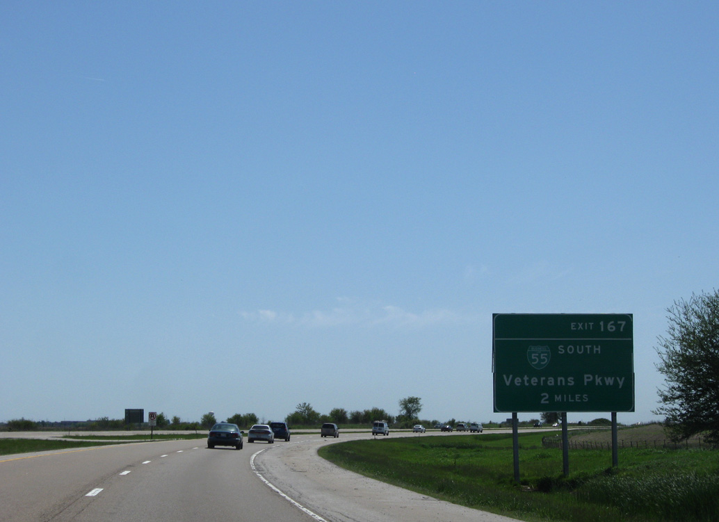
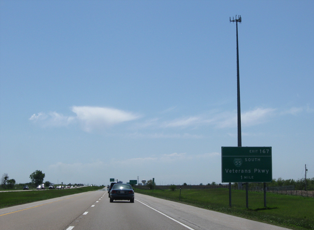
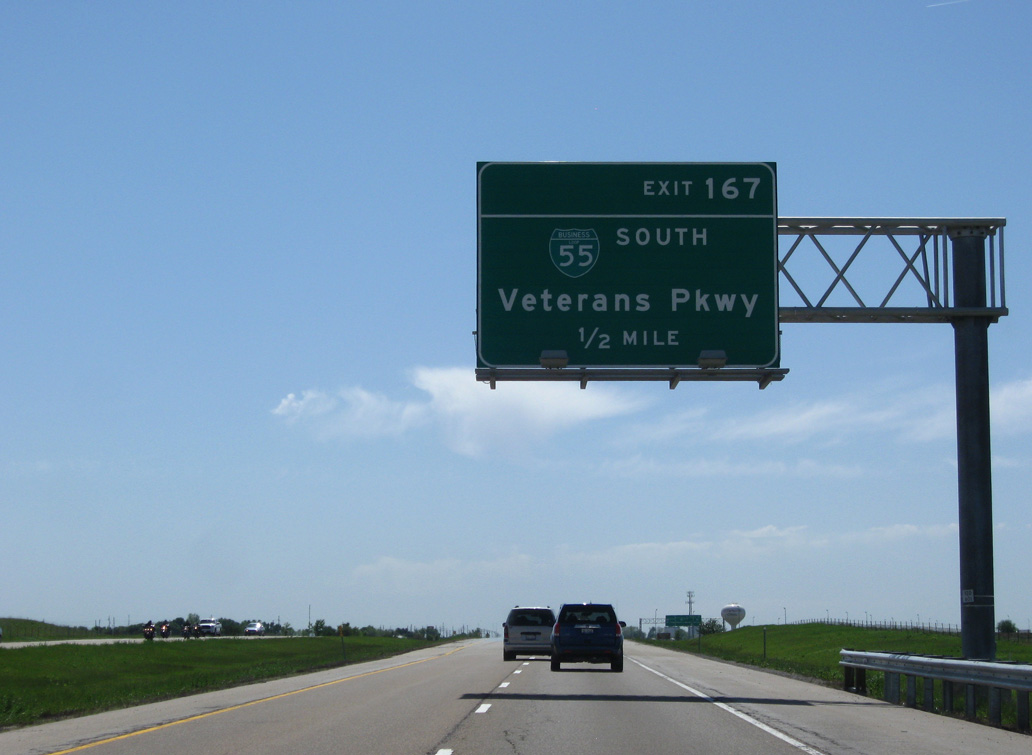
The first of three exits along Interstate 55 south within the city of Bloomington is for Business Loop I-55 (Veterans Parkway) south and CR 31 (Pipeline Road) north.
05/06/10
9.74 miles in length, Business Loop I-55 (Veterans Parkway) is an arterial bypass of Normal and Bloomington south along Historic U.S. 66.
05/06/10
Veterans Parkway is a commercial boulevard south of Old U.S. Route 66 to U.S. 150 (Morrisey Drive). The original alignment for U.S. 66 continued west and south to Downtown Normal.
05/06/10
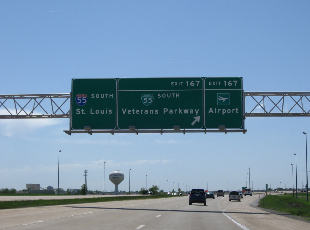
Business Loop I-55 (Veterans Parkway) south to IL 9 (Empire Street) east leads to Central Illinois Regional Airport at Bloomington-Normal (BMI).
05/06/10
CR 31 (Pipeline Road) extends north from the six-ramp parclo interchange at Exit 167 to Lake Bloomington.
05/06/10
Traveling west from the separation with Business Loop I-55 (Veterans Parkway) south, I-55 south advances two miles to I-39/U.S. 51 north to Rockford.
05/24/08
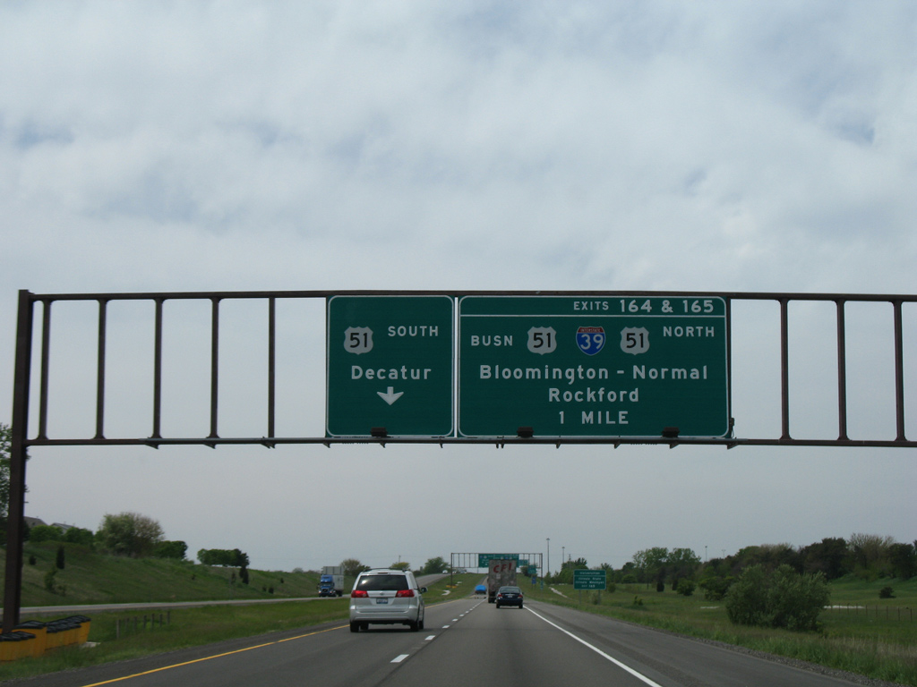
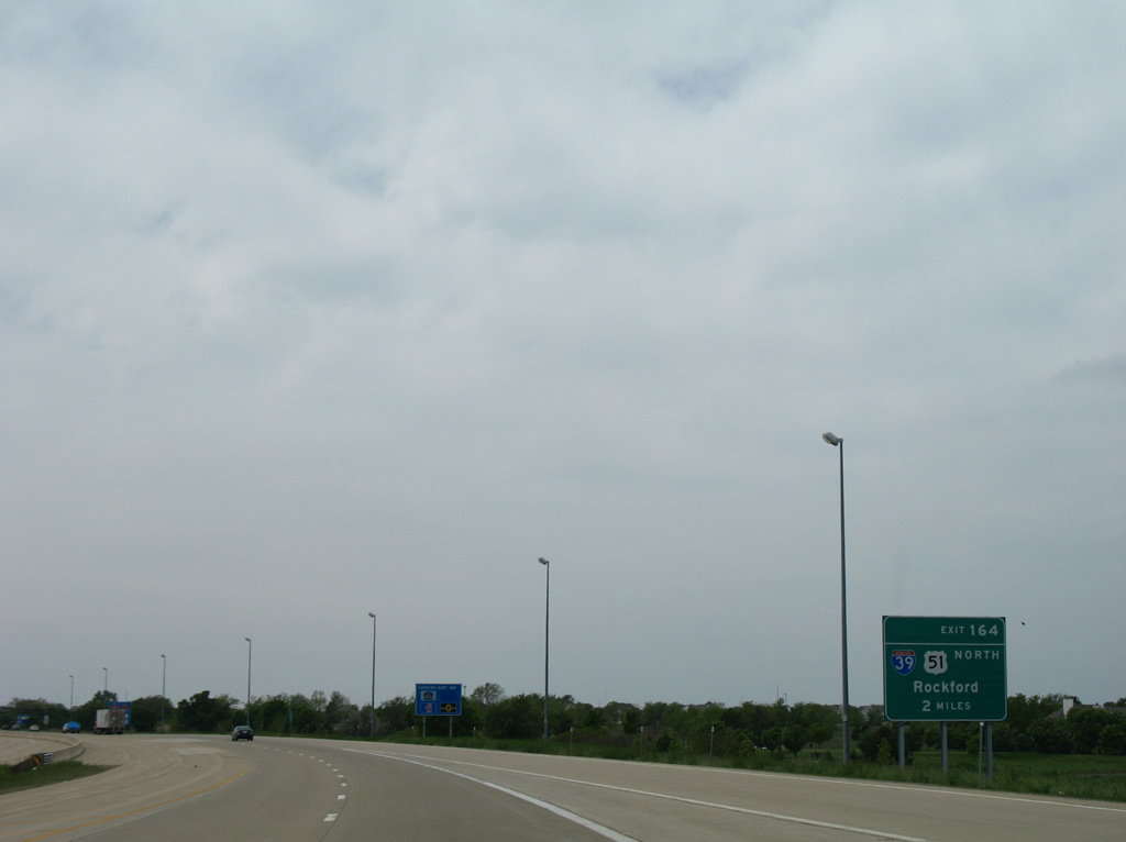
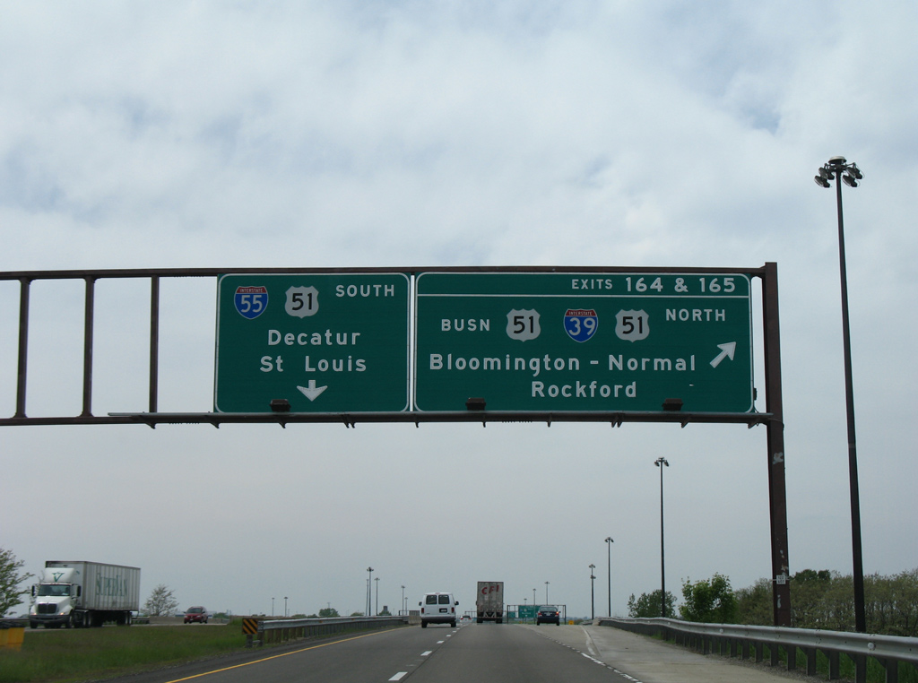
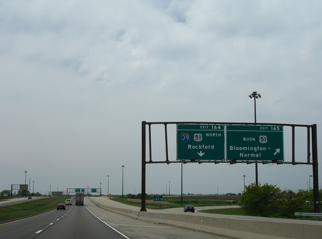
Exits 165 and 164 depart in succession from a collector distributor roadway for U.S. 51 Business (Main Street) and I-39/U.S. 51 north. Originally a cloverleaf interchange joined I-55 with U.S. 51. That changed in 1990 when the exchange was reconfigured into a folded diamond to accommodate the new trumpet with I-39 to the immediate west.
05/24/08
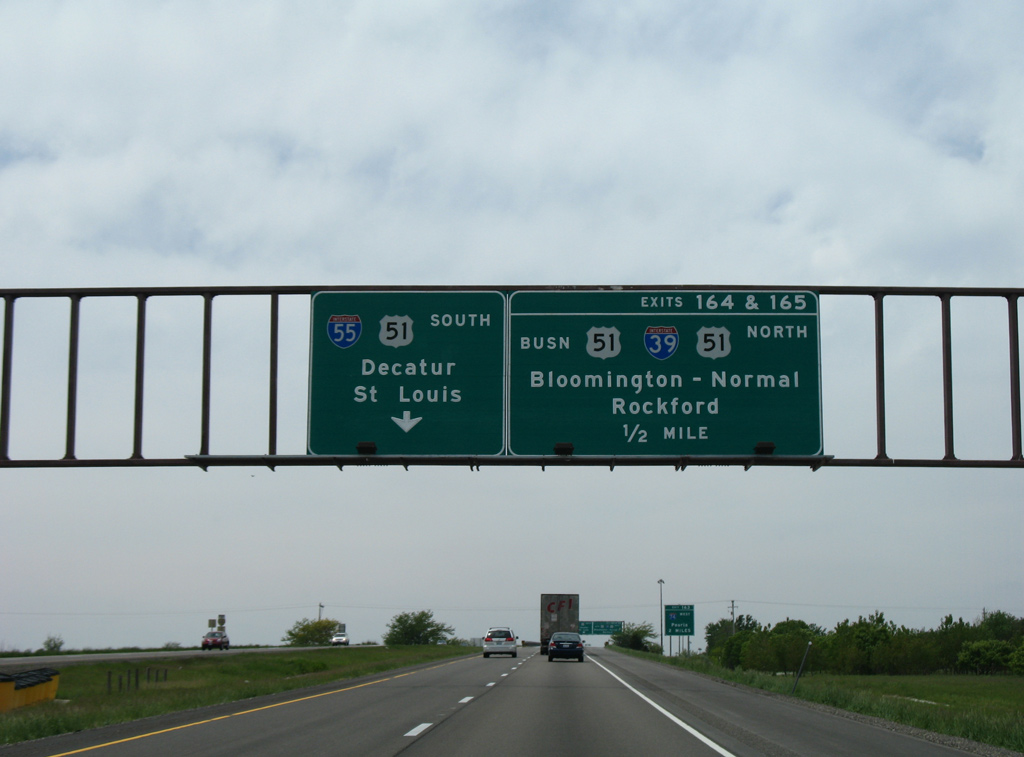
Interstate 39 replaced U.S. 51 northward from Normal to La Salle, Peru and Rockford by 1992. Older portions of the US route remain as a business loop or IL 251.
05/24/08
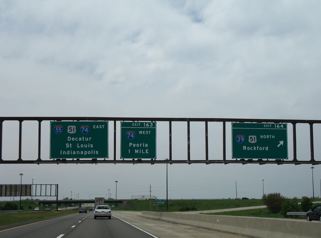
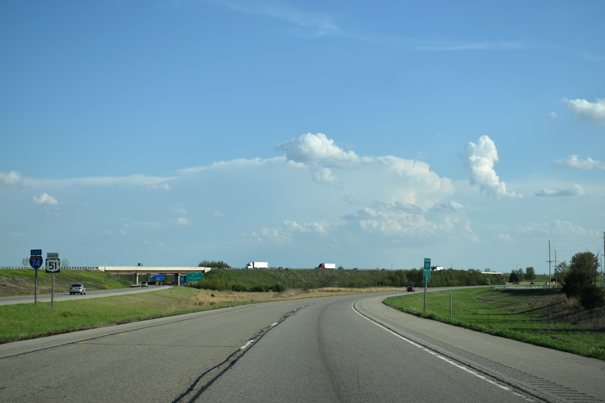
Interstate 55 south combines with I-74 east at the succeeding exchange beyond the south end of I-39. I-74 enters the Bloomington-Normal area from Peoria, 34 miles to the west.
05/24/08
The c/d roadway for U.S. 51 Business (Main Street) and I-39/U.S. 51 north parts ways with the I-55 southbound mainline. U.S. 51 Business travels a short distance north by an industrial park near Kerrick to I-39/U.S. 51 at Exit 2. Southward the route crosses the town of Normal en route to Downtown Bloomington.
05/24/08
Exit 165 leaves the c/d roadway as a single lane continues west to I-39/U.S. 51 north. I-39 travels 306.14 miles overall between Normal and Wis 29 at Wassau. AASHTO approved the northern extension of I-39 from I-90 (Northwest Tollway) into the Badger State on October 22, 1993.
05/24/08
U.S. 51 combines with Interstate 55 south to bypass Normal and Bloomington to I-74 east beyond the split with I-55. I-39/U.S. 51 north reach Rockford in 120 miles.
05/24/08
The c/d roadway returns from U.S. 51 Business onto I-55 south ahead of the overlap with U.S. 51 south.
05/24/08
 South
South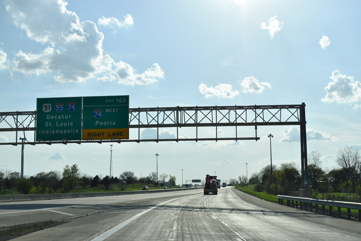
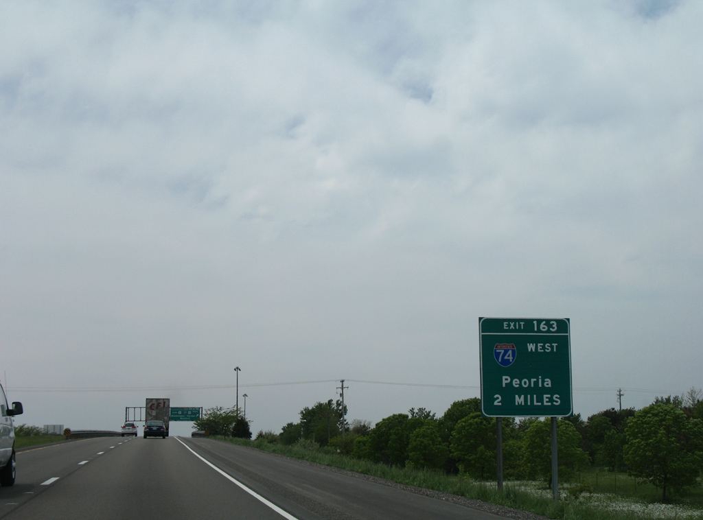
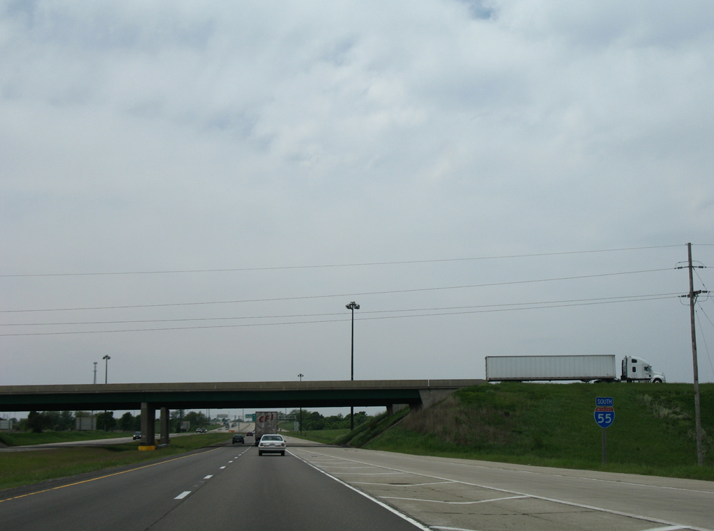
Traffic from the end of I-39 adds a fourth southbound lane along I-55/U.S. 51 to Exit 163 with Interstate 74. I-74 parallels U.S. 150 northwest from Normal to Peoria and the Quad Cities.
05/06/18
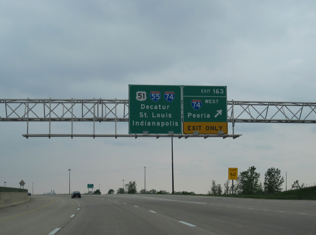
I-55/U.S. 51 south enter the trumpet interchange (Exit 163) with I-74 west. I-74 stretches 220 miles across Illinois, between Danville and the Mississippi River Bridge at Moline.
05/07/10
South  East
East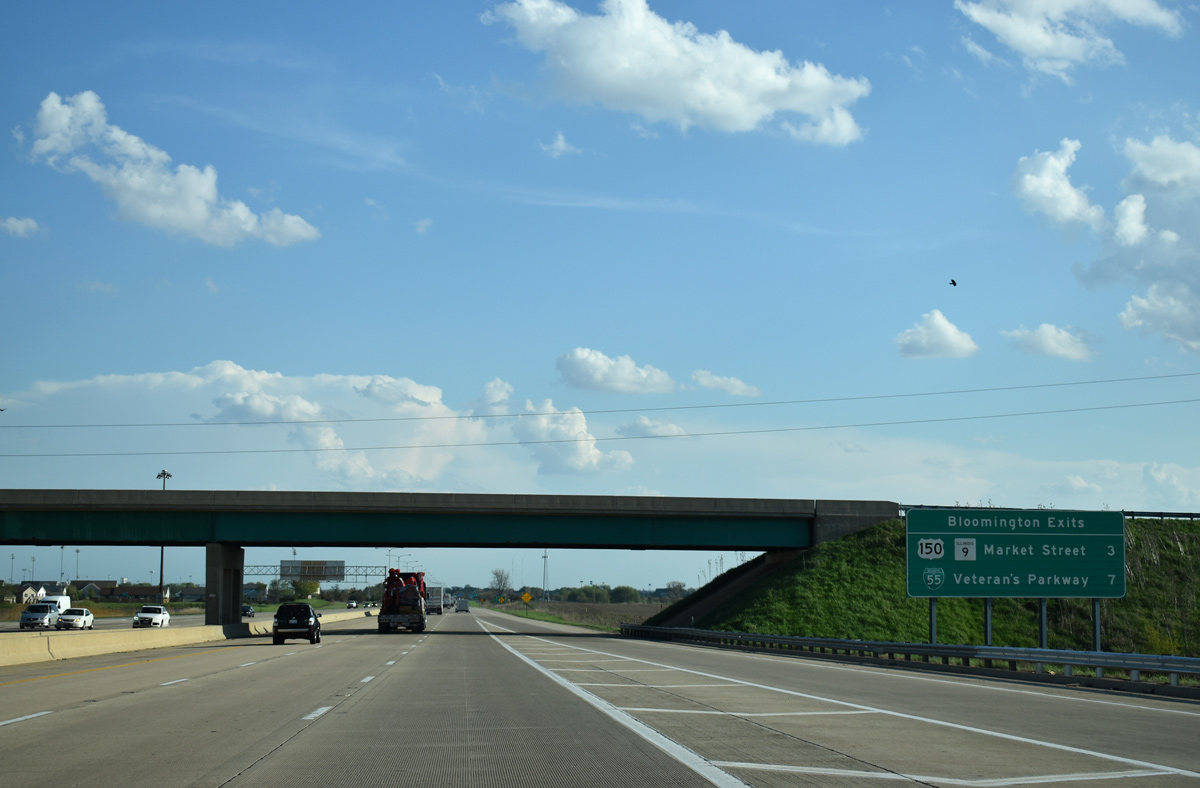
U.S. 150/IL 9 (Market Street) meet I-55/74 in three miles at the first of two exits for Bloomington on I-55 south.
05/06/18
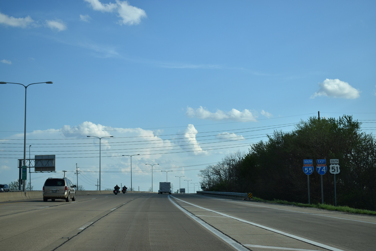
I-55/74 and U.S. 51 travel through west Normal and Bloomington with six overall lanes.
05/06/18
A six-ramp parclo interchange joins I-55-74/U.S. 51 with U.S. 150/IL 9 (Market Street). Loop ramps to Market Street were removed from the original full cloverleaf interchange.
05/06/18
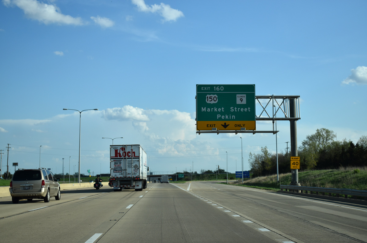
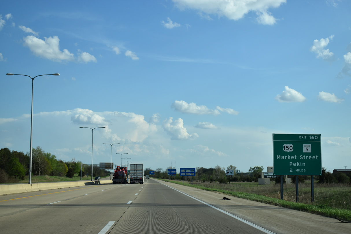
Exit 160 expands to two lanes as it leaves I-55/74 south for Market Street. Measuring 216 miles in length across the width of the state, IL 9 links Bloomington with Pekin, 36 miles to the west.
05/06/18
I-55/74-U.S. 51 confirming markers posted ahead of the Washington Street underpass.
05/06/18
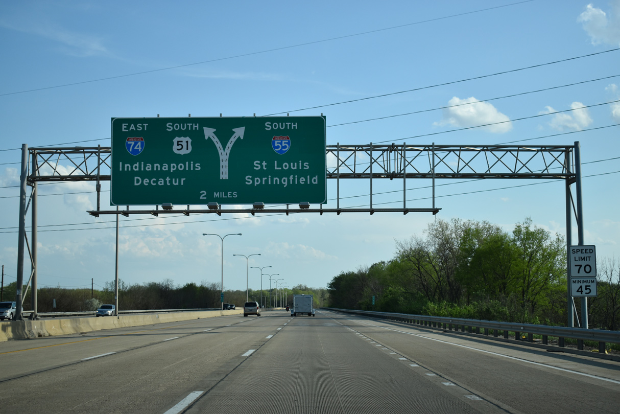
I-55/74-U.S. 51 part ways in two miles ahead of a three quarter cloverleaf interchange with Veterans Parkway (Business Loop I-55) north into Bloomington.
05/06/18
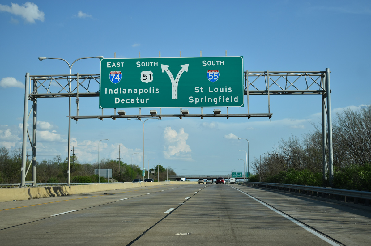
I-55 remains southwest along the original course of U.S. 66 to Lincoln and Springfield while Interstate 74 parallels the U.S. 150 corridor southeast to Farmer City, Champaign-Urbana and Danville. U.S. 51 leaves Bloomington along a four lane highway leading south to Clinton and Decatur, where the route merges with I-72.
05/06/18
South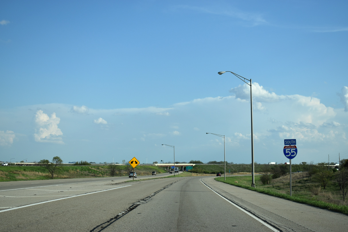
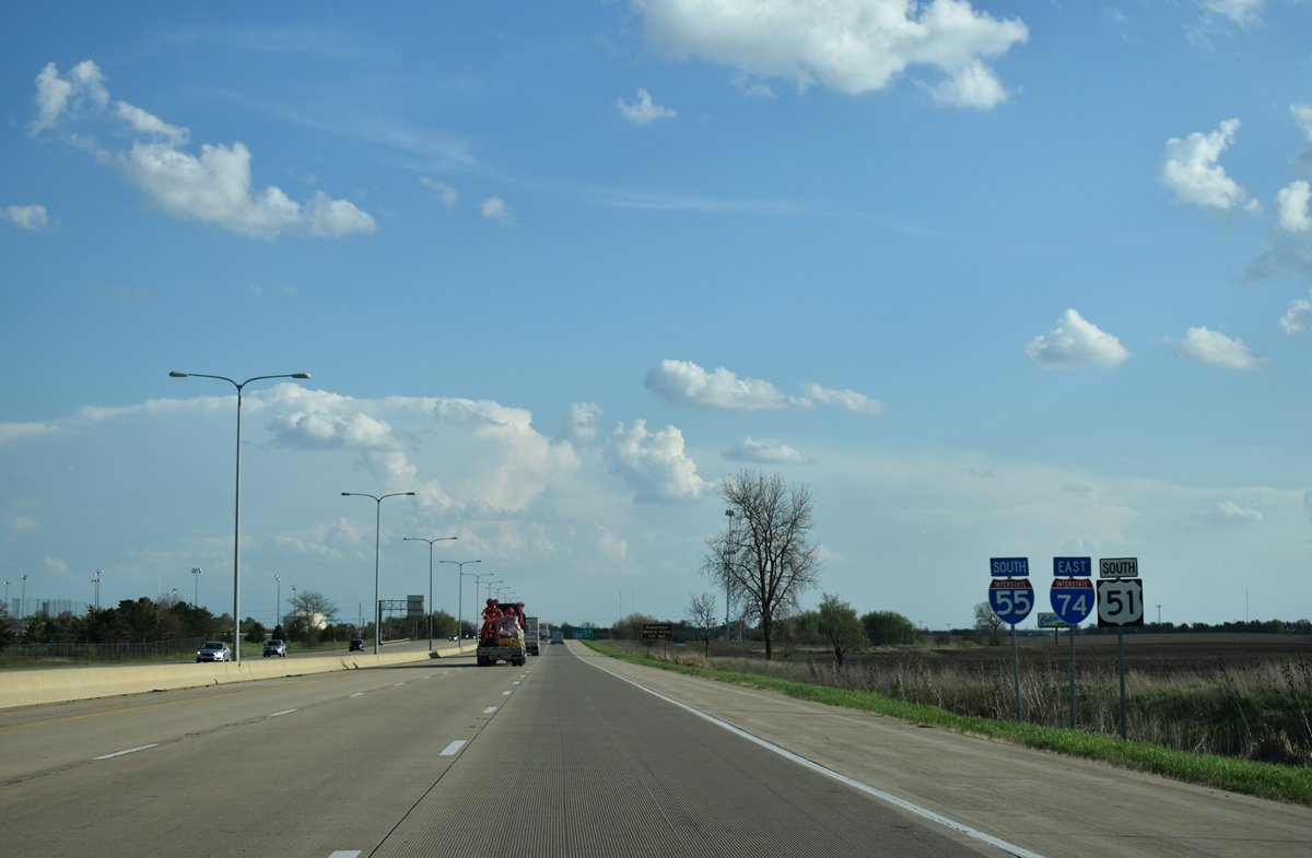
Reassurance markers for I-55/U.S. 51 south and I-74 east stand along the respective roadways beyond their separation.
05/06/18
Leaving the city of Bloomington, Interstate 55 again parallels Historic U.S. 66 to Lincoln. This shield assembly stands at the south end of Business Loop I-55 at the wye interchange with I-55.
05/06/10
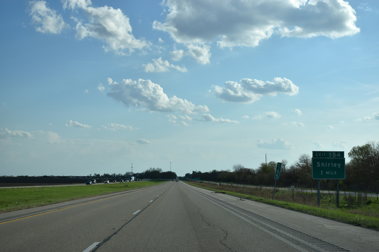
Historic U.S. 66 appears along the west side of Interstate 55 south ahead of Exit 154 with County Route 34 to Shirley.
05/06/18
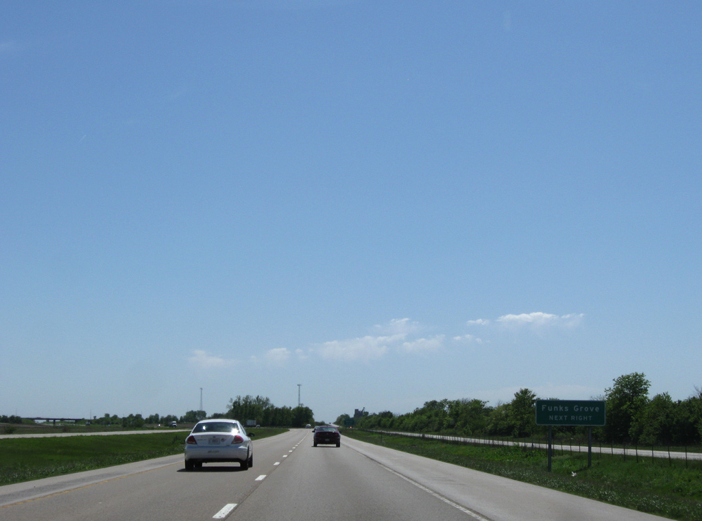
A nine mile exit less stretch ensues southwest from Shirley to McLean. Interests for Historic U.S. 66 to Funks Grove, located midway between the two communities, are directed to Exit 154.
05/06/10
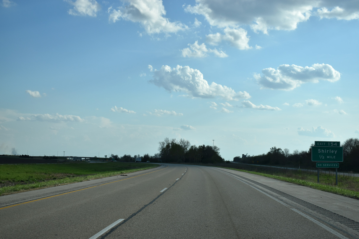
McLean County Route 34 stems west from U.S. 51 through a diamond interchange (Exit 154) with I-55 before joining Historic U.S. 66 through Shirley.
05/06/18
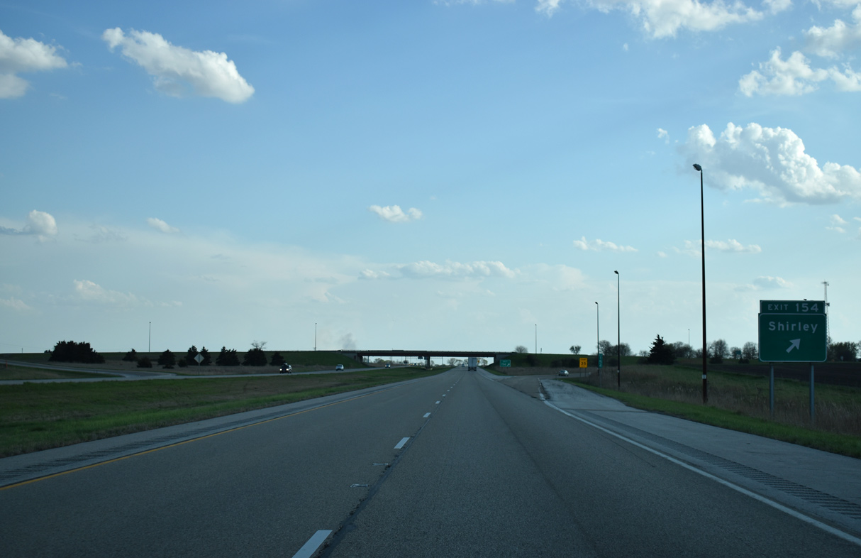
West from Shirley, CR 34 continues to Allin township south of Stanford. I-55 turns east to bypass Shirley through Exit 154.
05/06/18

Interstate 55 curves back to the west to again line Historic U.S. 66 south of Shirley.
05/06/18
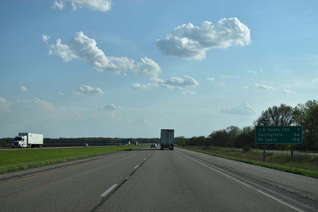
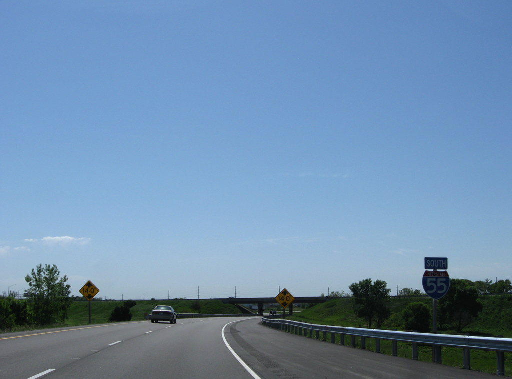
The capital city of Springfield is 54 miles to the southwest, with mileage to St. Louis mirroring the remaining mileposts of I-55 in Illinois.
05/06/18
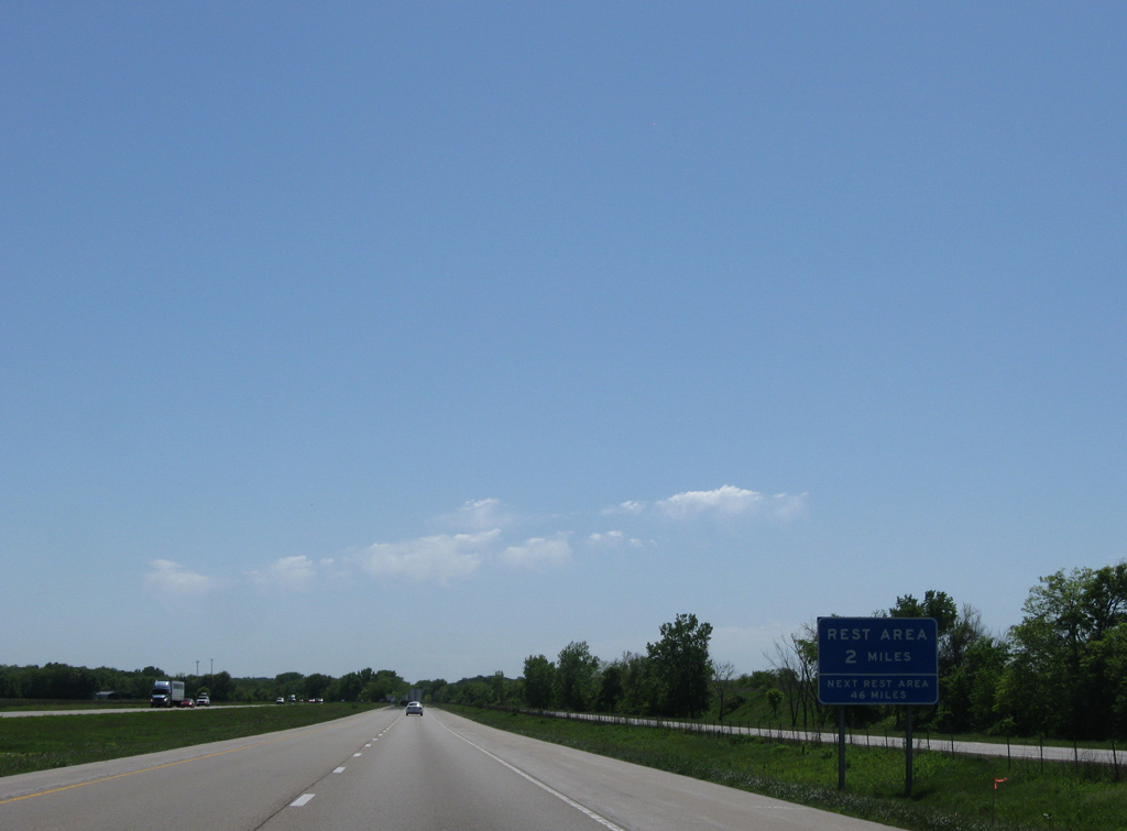
The fourth to last rest area along I-55 south in Illinois is reached in two miles.
05/06/10
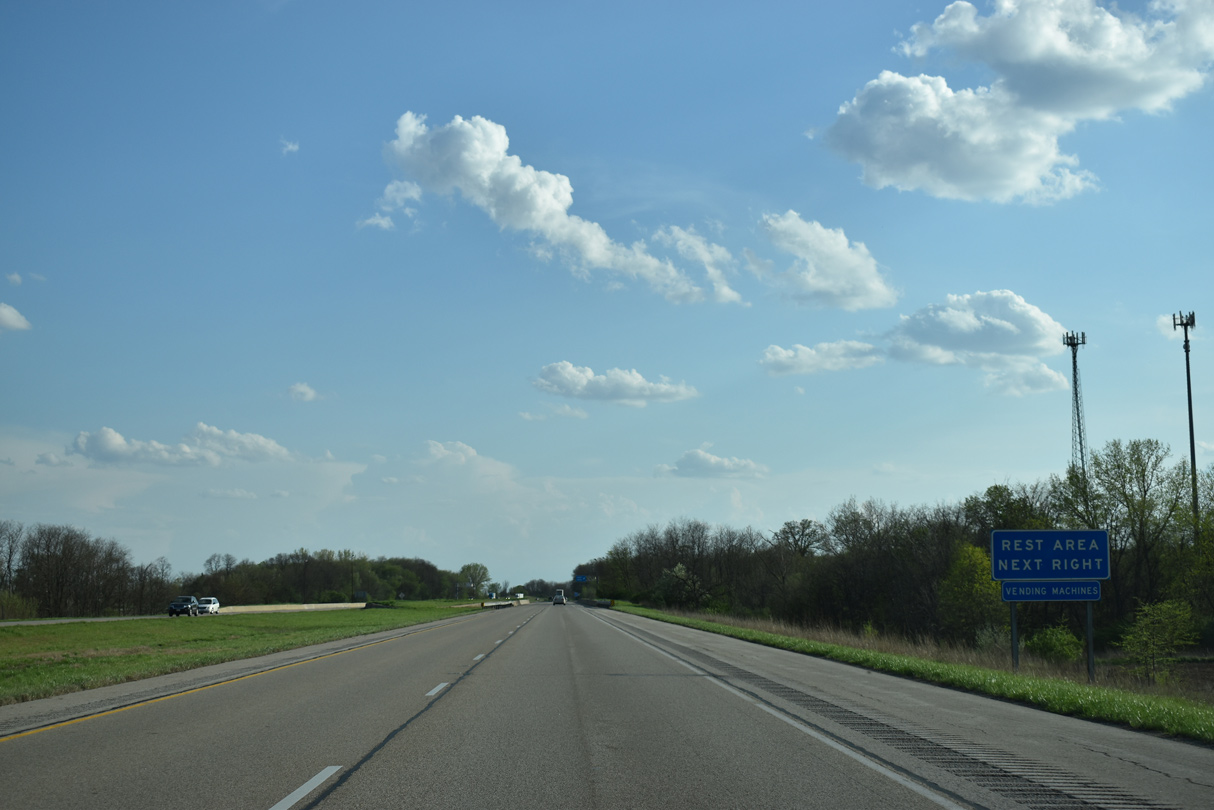
I-55 crosses Timber Creek through forest land ahead of the rest area.
05/06/18
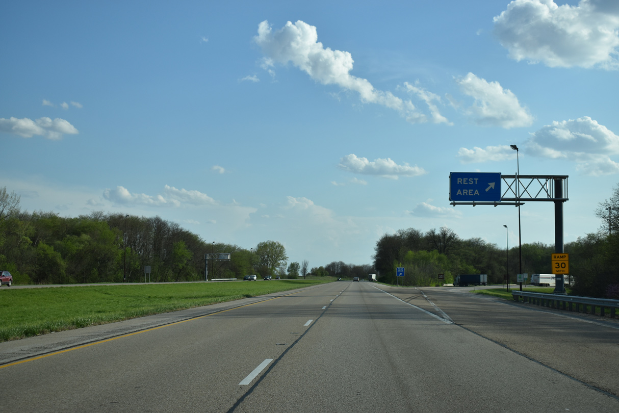
Veering east to bypass Funks Grove, Interstate 55 reaches the west side rest area. A trumpet interchange by CR 36 ties the facility into the northbound lanes.
05/06/18
A reassurance marker follows the rest area as I-55 again converges with Historic U.S. 66.
05/06/18
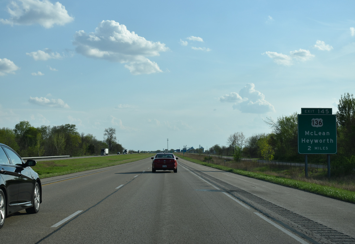
U.S. 136 and Interstate 55 come together at the village of McLean in two miles.
05/06/18
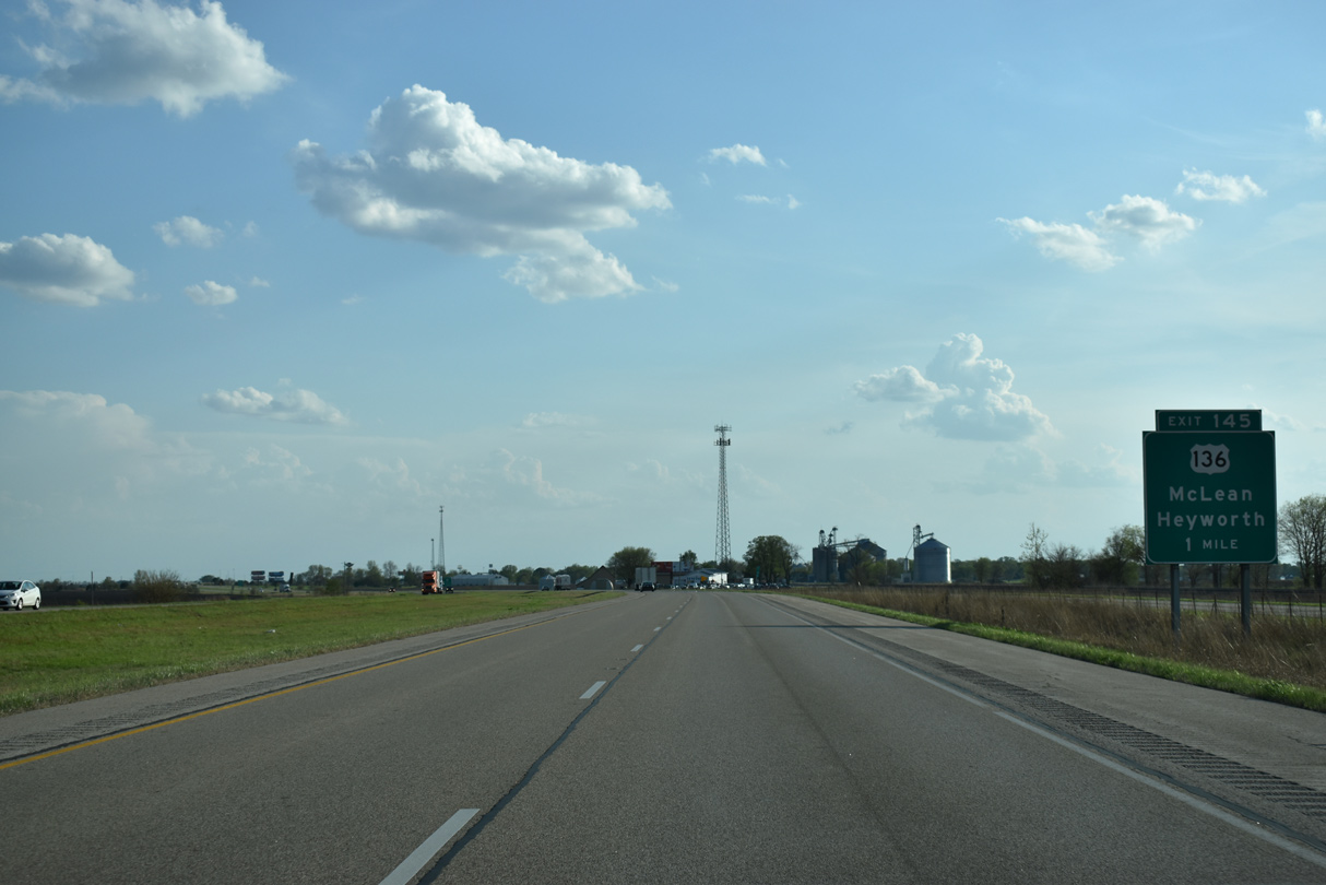
I-55 curves east to bypass McLean to the diamond interchange (Exit 145) with U.S. 136 (Dixie Road).
05/06/18
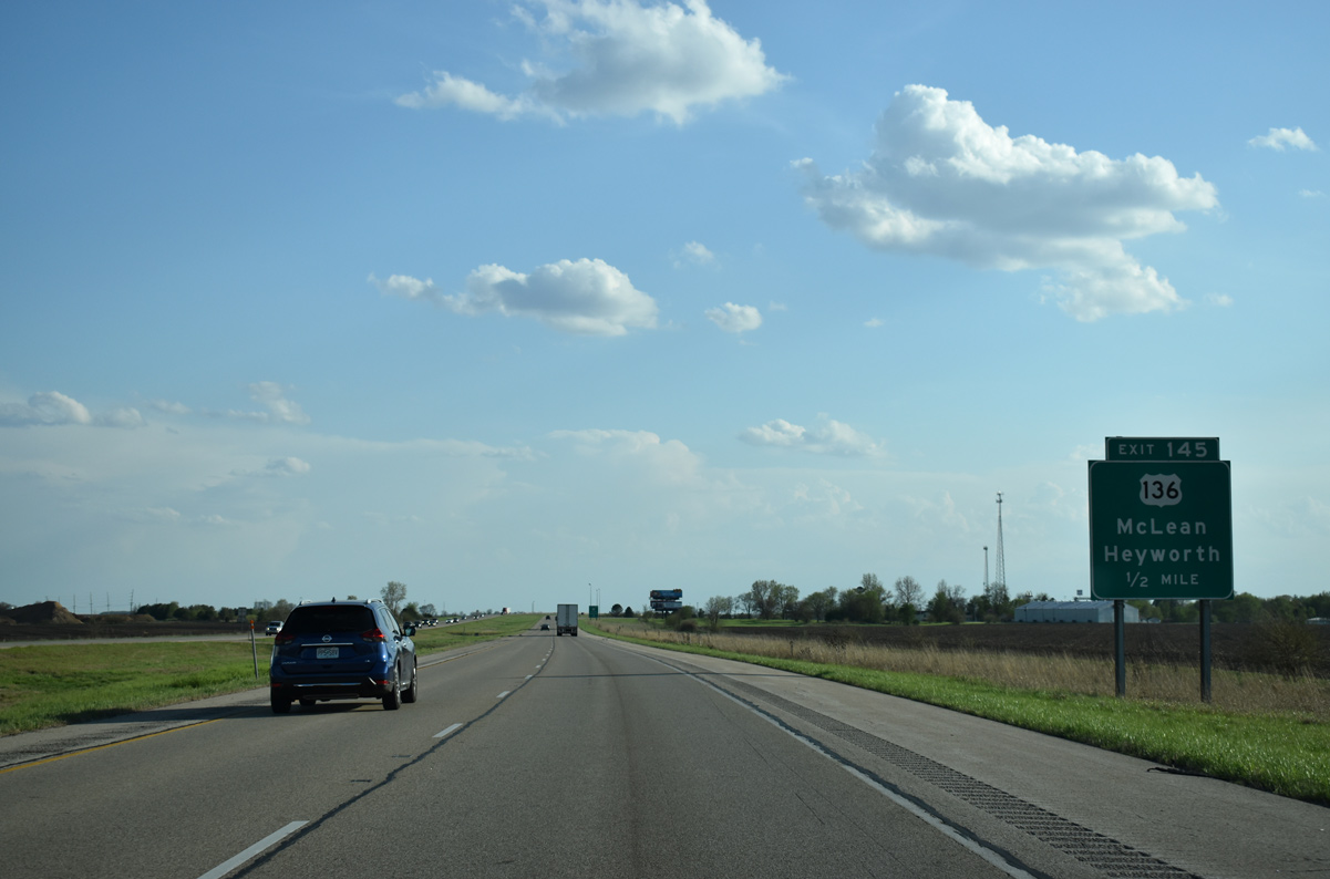
U.S. 136 travels nine miles east to U.S. 51 at the village of Heyworth. The route bee lines east from there to Rantoul.
05/06/18
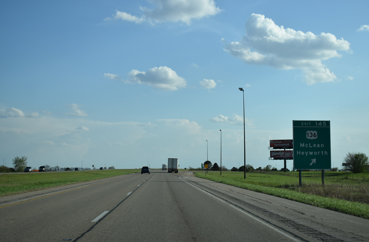
West from Exit 145, U.S. 136 passes along the south side of the McLean street grid on the 15 miles to I-155.
05/06/18
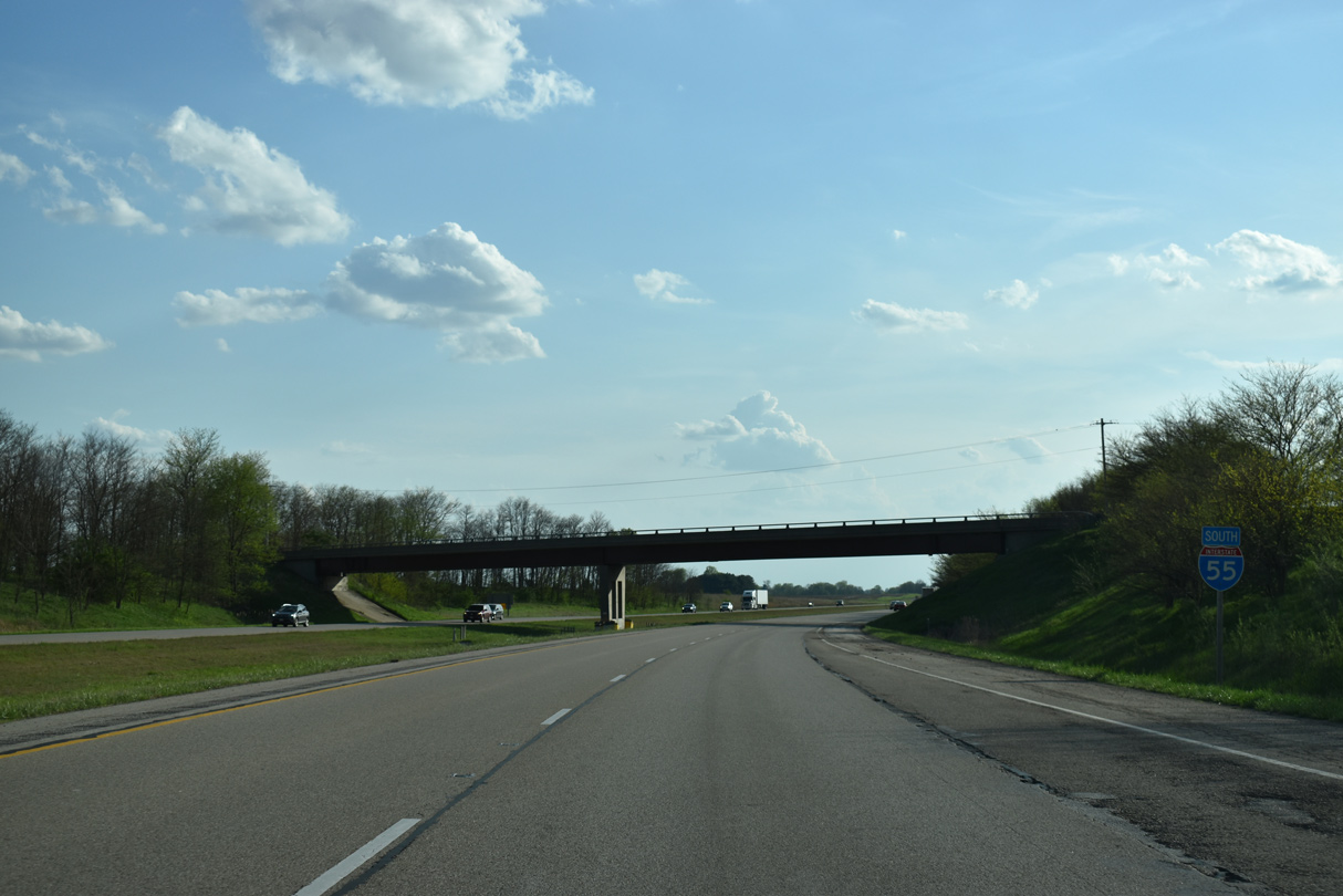
Interstate 55 curves west to run parallel with Historic U.S. 66 south from McLean.
05/06/18
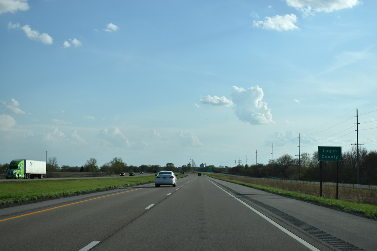
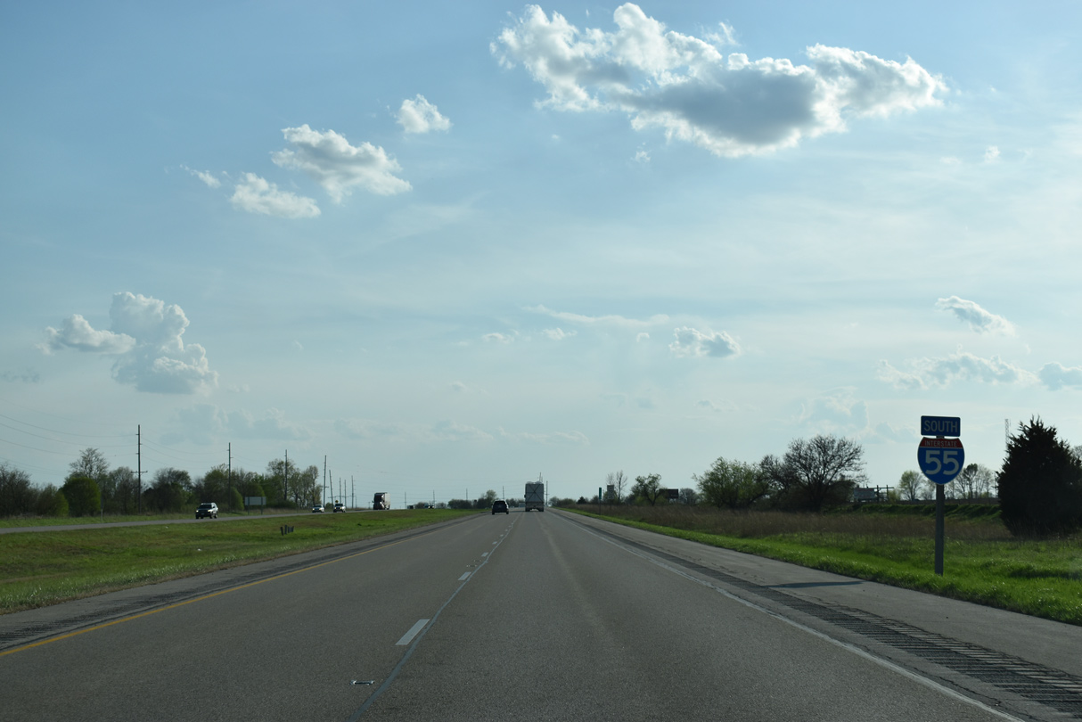
Historic U.S. 66 and I-55 diverge just south of the Logan County line on the outskirts of Atlanta.
05/06/18

Photo Credits:
- ABRoads: 05/06/10, 05/07/10
- AARoads: 05/24/08, 05/06/10
- Brent Ivy: 05/06/18
- aarabli: 05/06/18
Connect with:
Page Updated Wednesday January 10, 2024.