
Interstate 55 South - Jefferson County

 South
South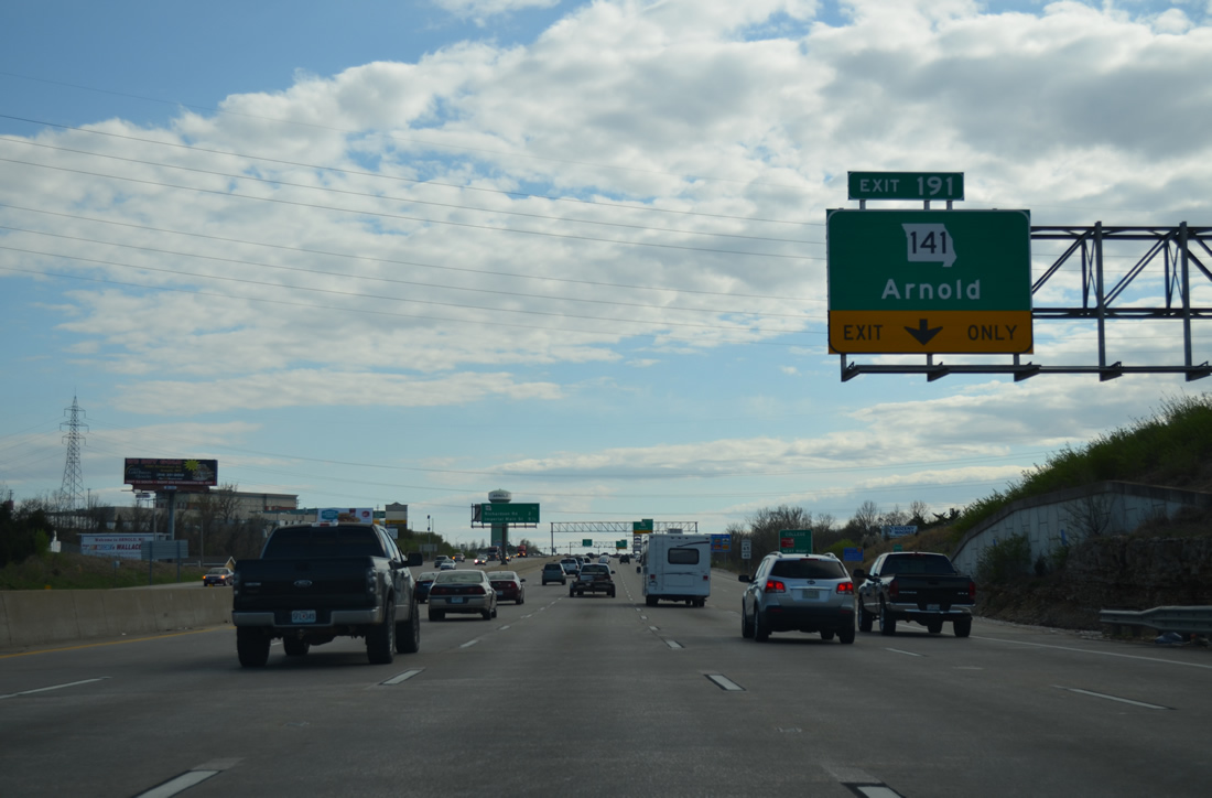
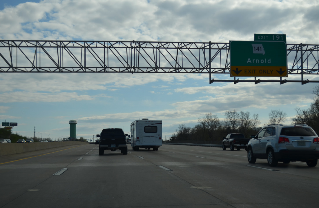
Interstate 55 was expanded from four to eight lanes between Arnold and Highway M / Exit 185 as part of a $54.6 million project carried out between 2001 and 2003. Included in the work was a $21.05 million upgrade of Exit 191 from a diamond to a single point urban interchange (SPUI).1
04/13/13
The next two exits serve the city of Arnold (population 20,800 per the 2010 census) while a diamond interchange (Exit 186) lies 5.5 miles ahead at Imperial.
04/13/13
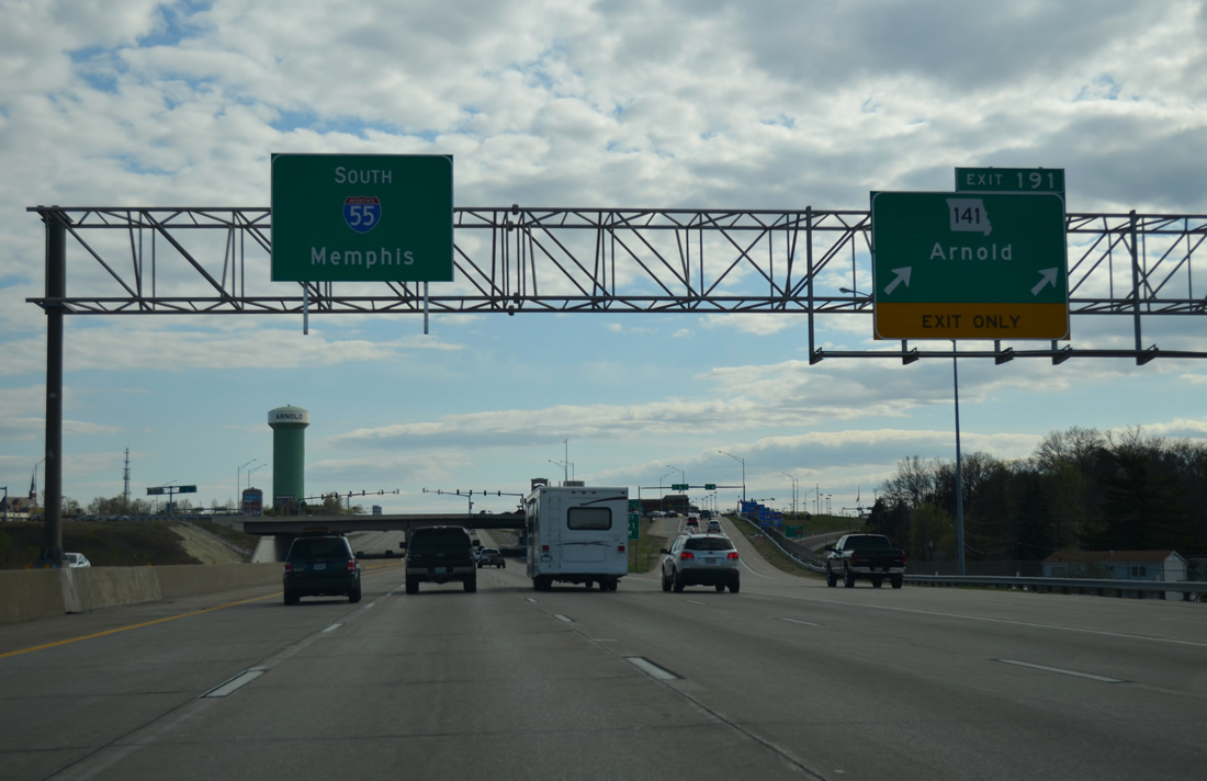
Route 141 ends just east of the SPUI with I-55 at a commercialized intersection with U.S. 61/67 (Jeffco Boulevard). U.S. 61/67 remain east of Interstate 55 to Festus and Crystal City.
04/13/13
Route 141 was initially constructed in Jefferson County in 1976. The highway was extended north over the Maryland Heights and Earth City Expressways in St. Louis County in July 2012.2
04/13/13

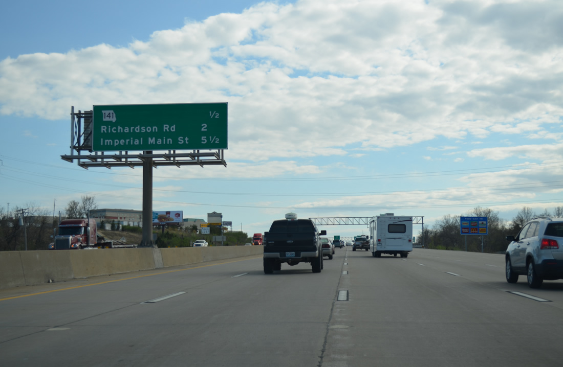
Continuing south through Arnold to the wye interchange (Exit 190) with Vogel Road at Richardson Road.
04/13/13
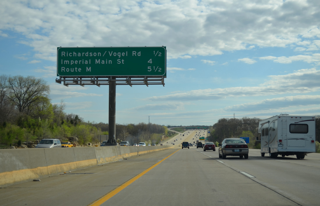
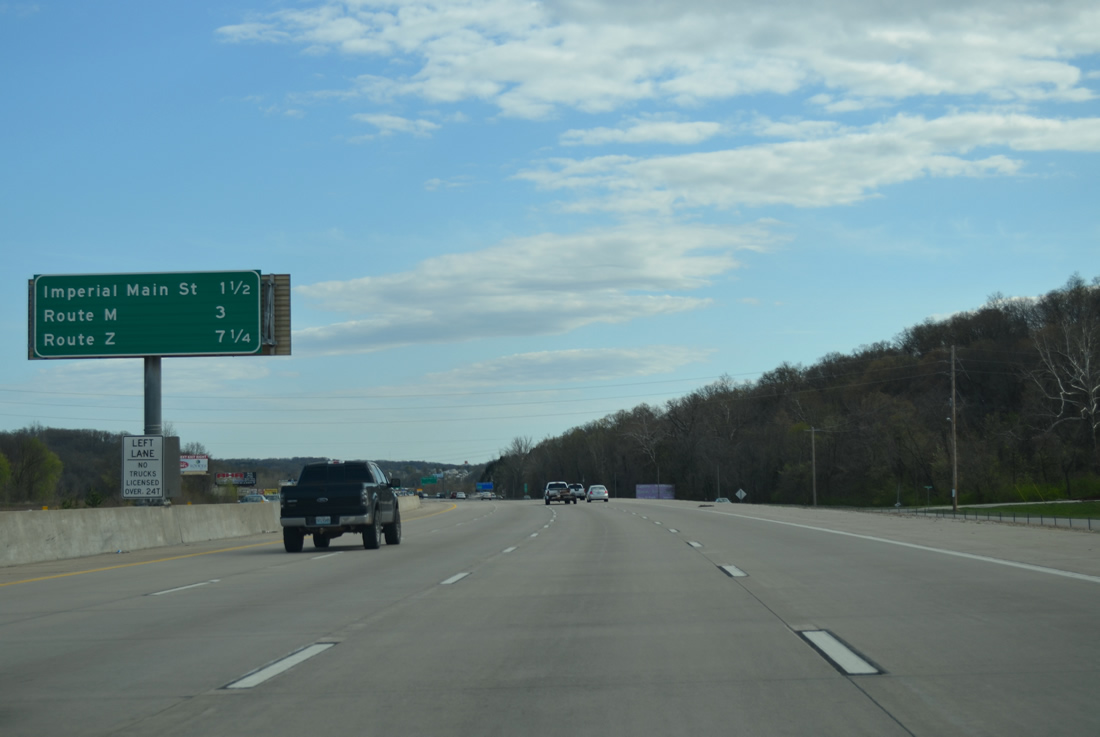
Beyond Arnold, travelers along Interstate 55 meet Imperial Main Street at Exit 186 in four miles and Highway M at Barnhart and Exit 185 in 5.5 miles.
04/13/13
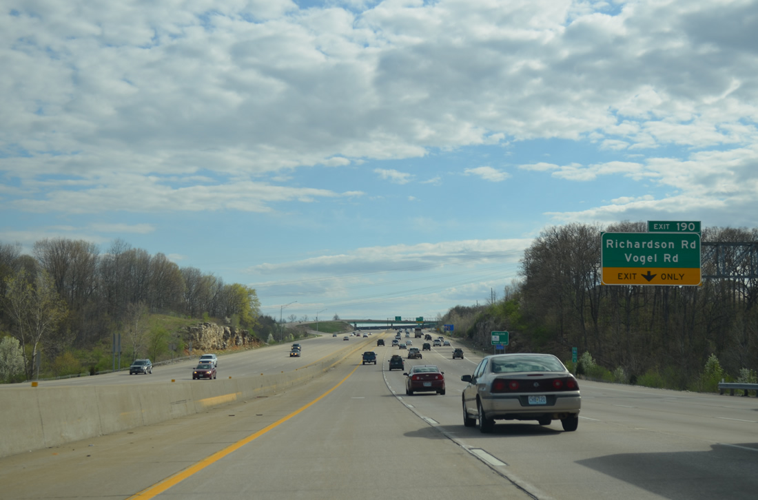
A forested area briefly interrupts the consistent suburban landscape along I-55 south to Exit 190. Originally just a diamond interchange connected the freeway with Richardson Road. This was before Vogel Road was extended east from Old Lemay Ferry Road in 1998.3
04/13/13
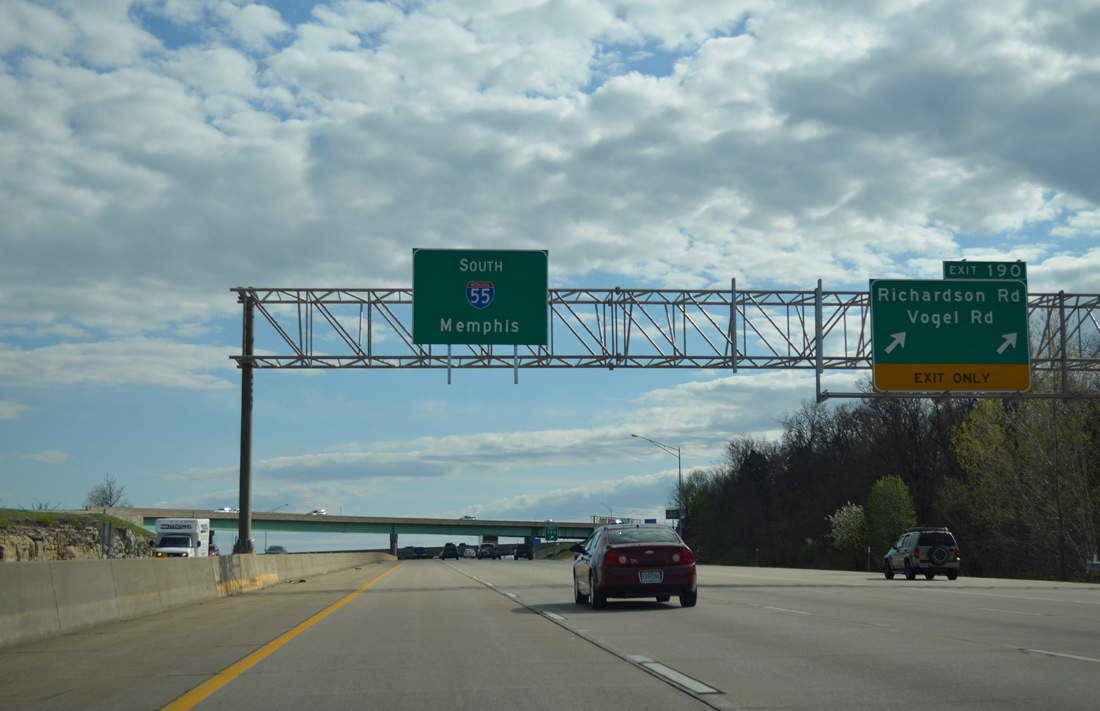
Exit 190 parts ways with I-55 south for Richardson Road south to U.S. 61/67 (Jeffco Boulevard) and north to subdivisions ahead of Old Lemay Ferry Road. Vogel Road comprises a commercial arterial westward to the National Geospatial-Intelligence Agency campus. The road was extended as part of $5.4 million contract by MoDOT in conjunction with work by the Jefferson County Highway Department in February 1997. Work included the addition of the wye interchange to the north.3
04/13/13
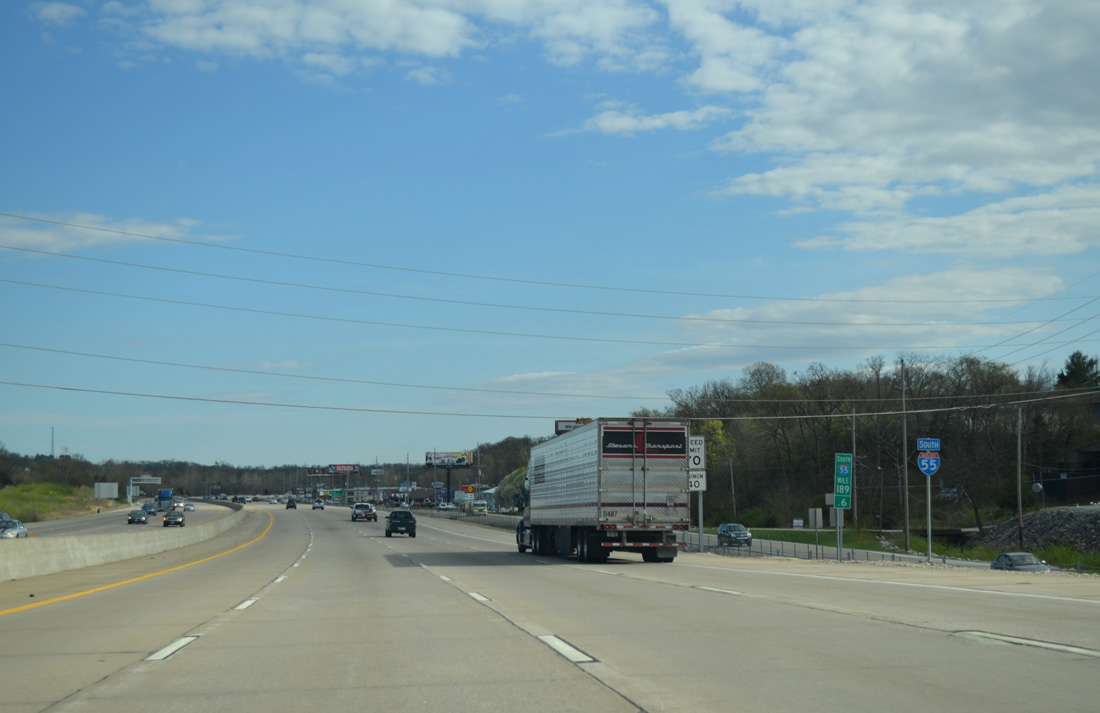
Four lanes of Interstate 55 south curve away from the Richardson Road on-ramp.
04/13/13
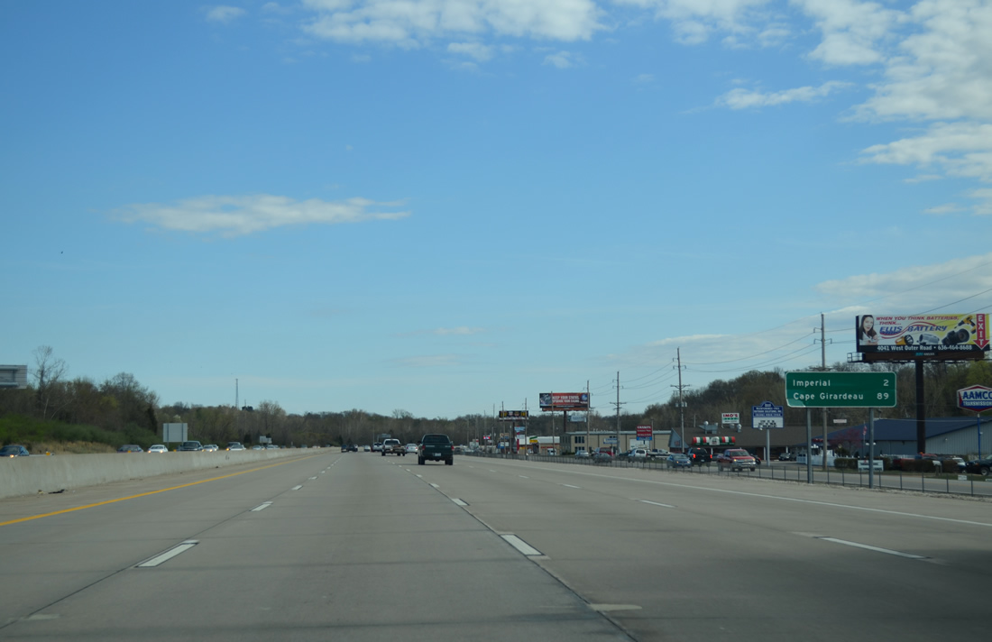
Cape Girardeau appears for the first time to southbound travelers on distance signs at 89 miles out.
04/13/13
Exits along I-55 south depart with less frequency as the freeway leaves Arnold for Imperial, Barnhart and Pevely over the next 7.25 miles.
04/13/13
Imperial Main Street connects Interstate 55 south with Imperial to the east and Old Antonia Road to the west in one mile. Old Antonia Road meanders west to a number of subdivisions and Old Highway M at Glaize Creek.
04/13/13
West Outer Road accompanies Interstate 55 south from Vogel Road to Mastodon State Park and Imperial Main Street outside forthcoming Exit 186. A Burlington Northern Railroad line parallels the east side of the freeway.
04/13/13
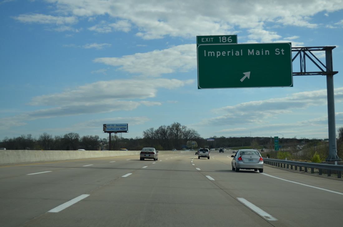
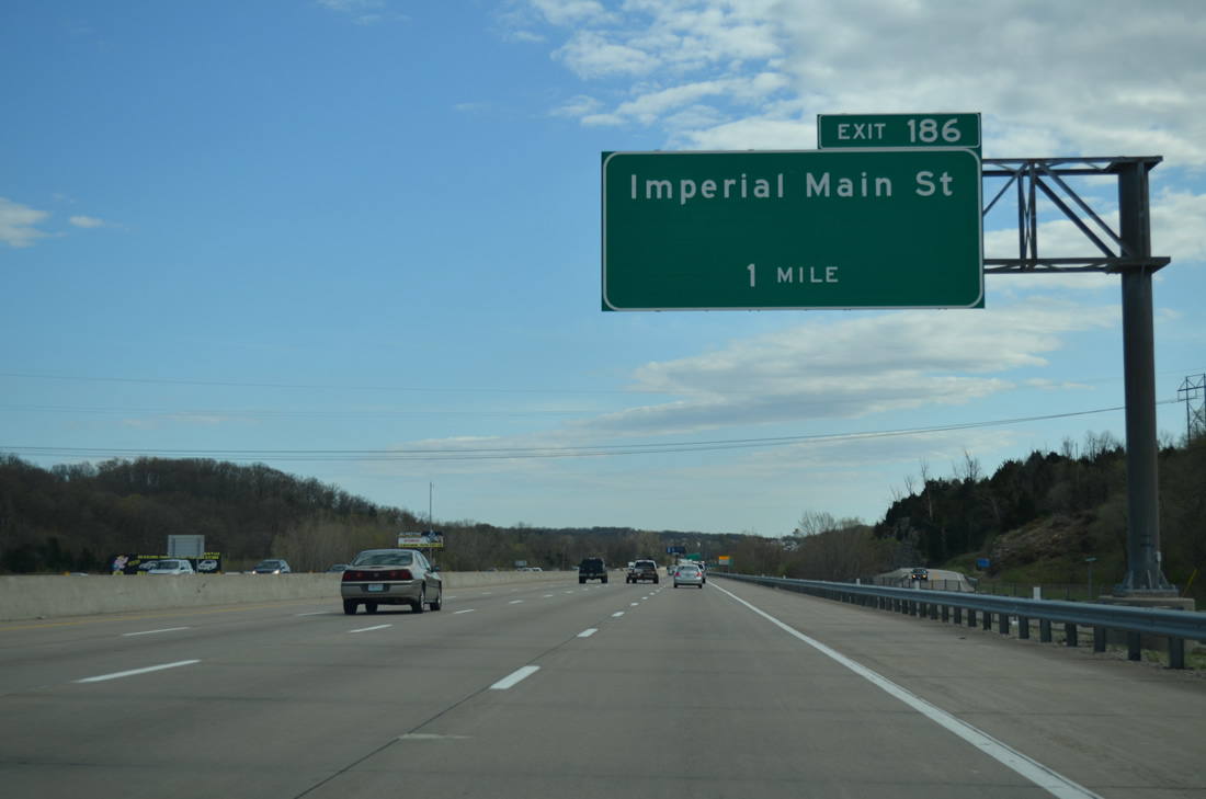
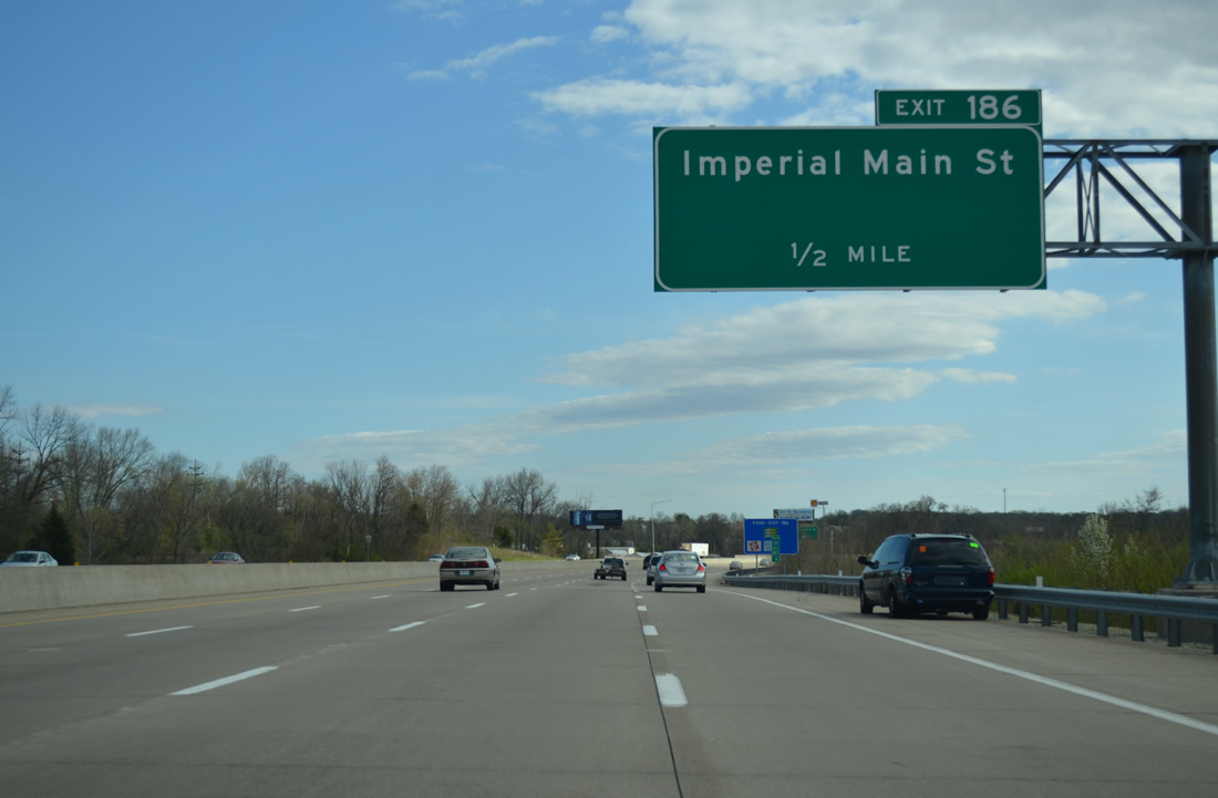
Passing over Rock Creek, southbound motorists bound for Imperial Main Street leave Interstate 55 south at Exit 186. Imperial Main Street becomes River Street east from U.S. 61/67 to Highway K and the city of Kimmswick.
04/13/13
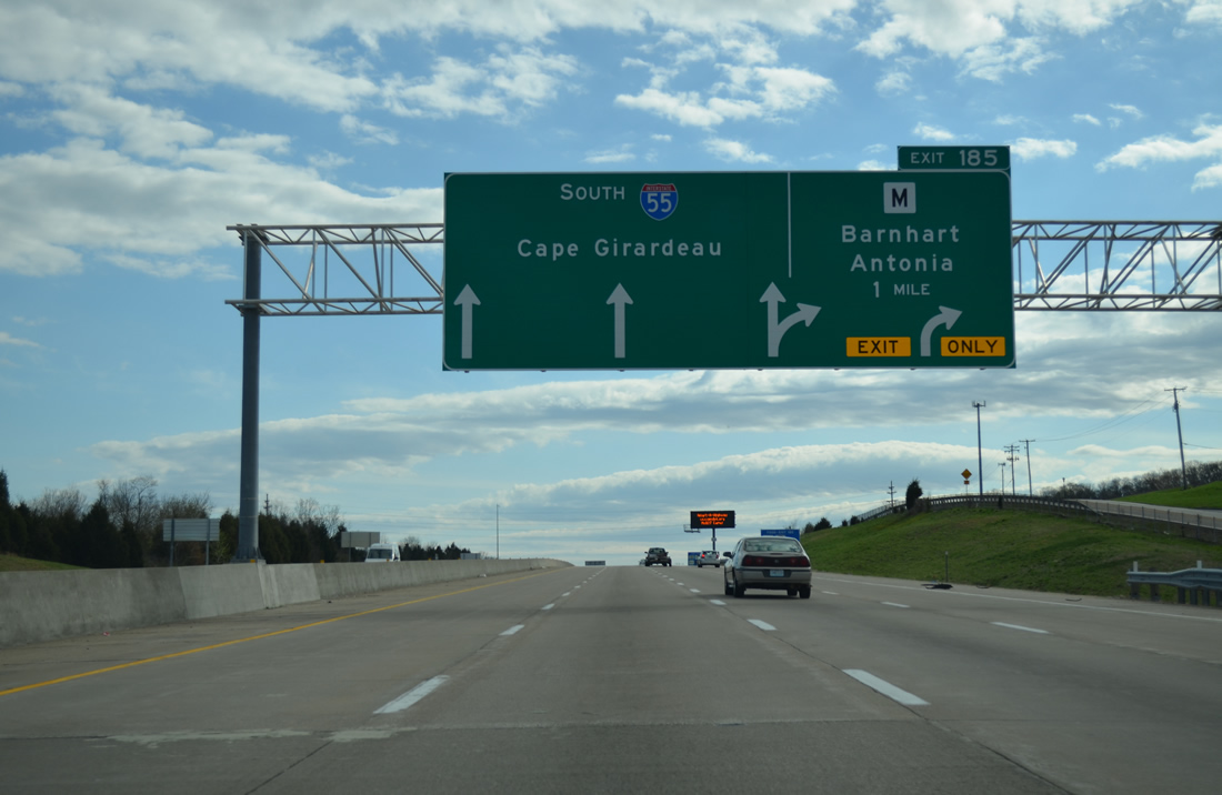
One-Arrow-Per-Lane (OAPL) signs precede the upcoming six-ramp parclo interchange (Exit 185) with Highway M.
04/13/13
Southbound shield assembly for I-55 and the Great River Road posted between Imperial and Barnhart.
04/13/13
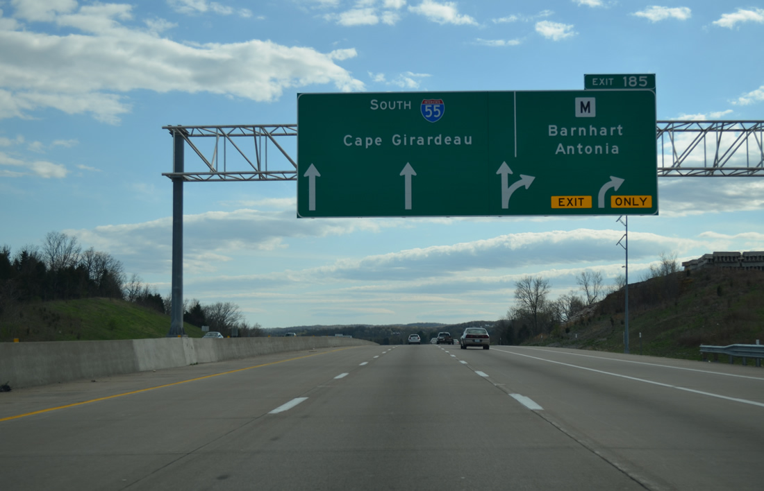
Interstate 55 reduces to six lanes south of Exit 185. Highway M is a 7.48 mile long controlled access expressway linking U.S. 61/67 to the east with Antonia, Otto and Route 21 to the west.
04/13/13

Highway M was relocated from a winding two lane road onto a $60 million expressway opened on January 22, 1999.4 Road work underway by December 2009 reconfigured the previous folded diamond interchange at Exit 185 with new ramps on the southeast quadrant and a roundabout between Metropolitan Boulevard and a new southbound on-ramp.5
04/13/13
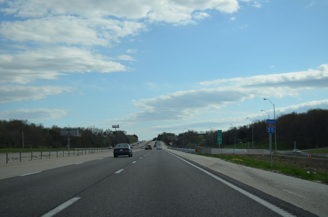
Metropolitan Boulevard appears along the west side of I-55 as it parallels the freeway from Highway M south to Highway Z at Pevely. A former weigh station lies at milepost 184.4 beyond this shield assembly.
04/13/13
Interstate 55 south from Highway M to Highway Z was expanded to six lanes between March 2010 and 2012.5
04/13/13
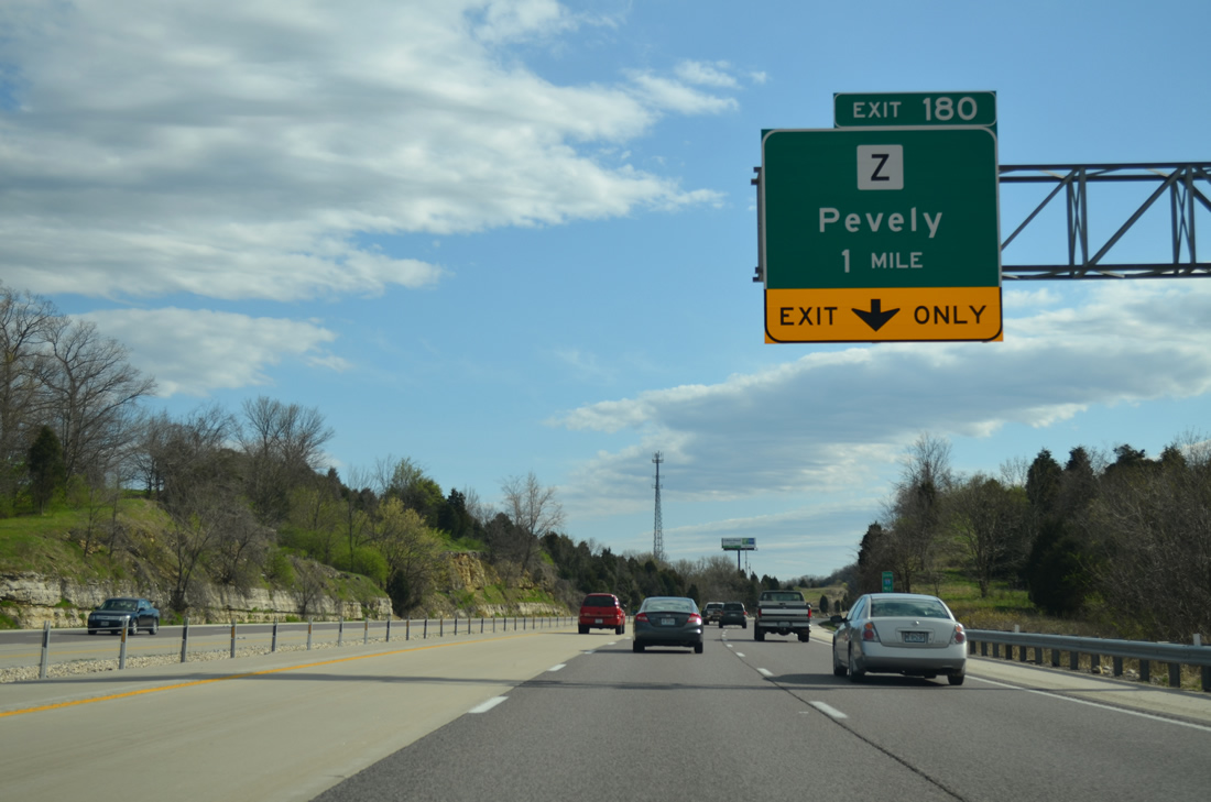
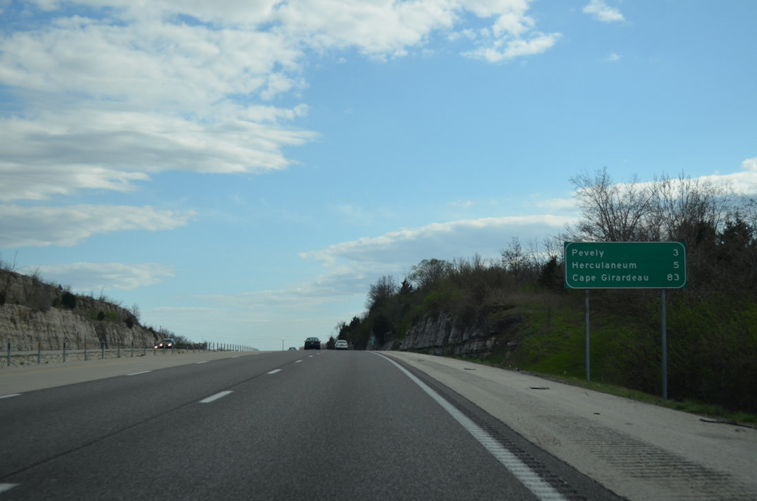
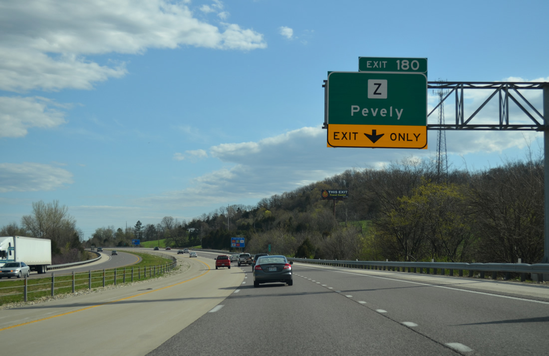
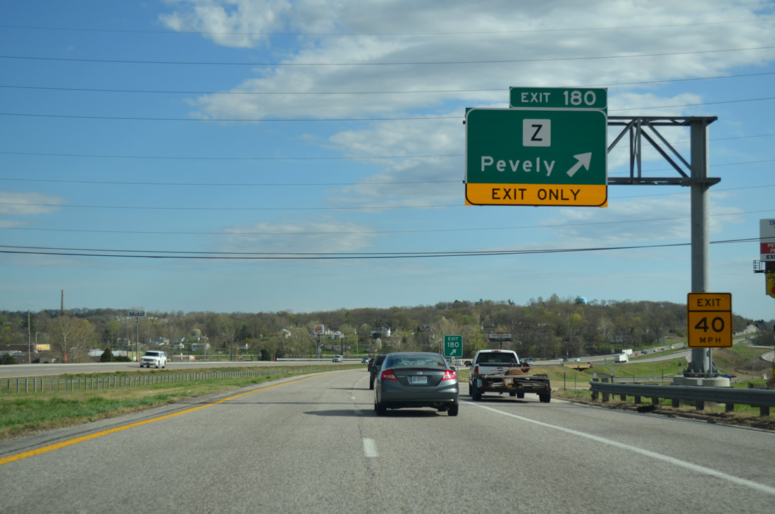
Entering the city of Pevely, Interstate 55 nears the diamond interchange (Exit 180) with Highway Z.
04/13/13
Highway Z runs 6.10 miles west from U.S. 61/67 (Commercial Boulevard) to Highway A at Mapaville.
04/13/13
Highway Z becomes Abbey Lane east of U.S. 61/67 to Riverside and Bushburg along the Mississippi River. The community of Horine lies 1.6 miles to the southwest.
04/13/13
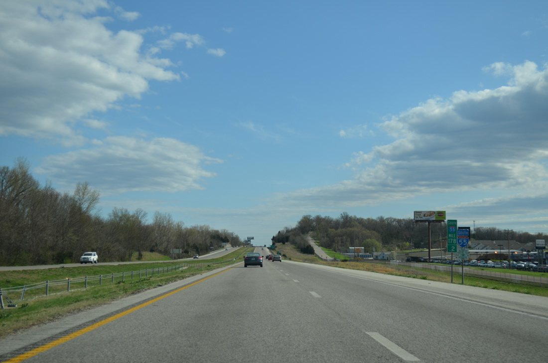
Interstate 55 climbs a plateau west of Herculaneum before dropping again to cross Joachim Creek.
04/13/13
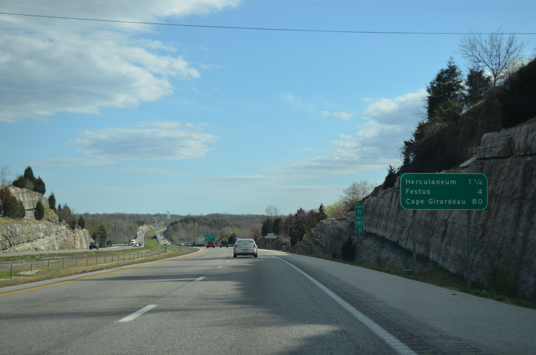
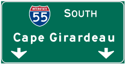
Festus rounds out the southern St. Louis area suburbs in four miles. I-55 angles southeast from there on the 80 mile drive to Cape Girardeau.
04/13/13
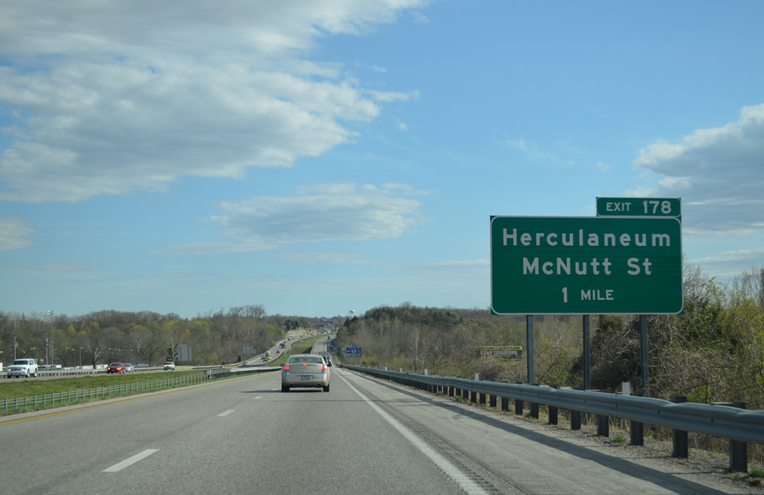
McNutt Street links Interstate 55 with U.S. 61/67 (Commercial Boulevard), 0.56 miles to the east. McNutt Street east to U.S. 61/67 south is part of the Herculaneum, Festus and Crystal City Business Loop for Interstate 55.
04/13/13
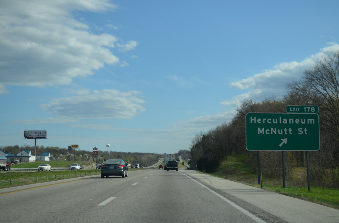
Entering the diamond interchange (Exit 178) with McNutt Street and Business Loop I-55 south to Herculaneum and Crystal City. The business route returns to I-55 at Exit 174.
04/13/13
McNutt Street turns south to parallel I-55 to an industrial park and McNutt School Road east from Munsons.
04/13/13
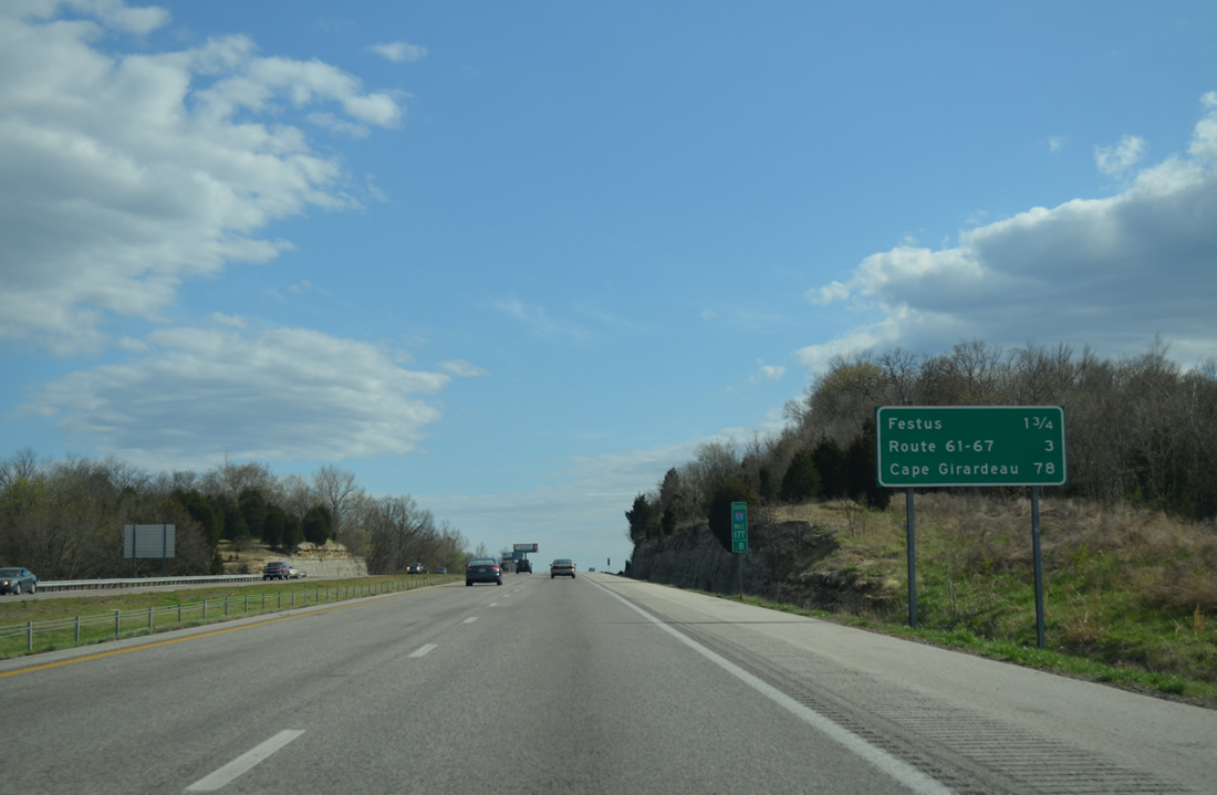
Interstate 55 south reaches the Festus city limits on the 1.75 miles leading to Exit 175 with Highway A. U.S. 67 converges with the freeway on the south side of town in three miles, just west of the split with U.S. 61.
04/13/13
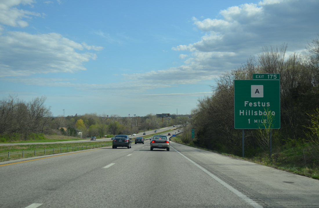
Highway A goes for 10.26 miles west from Business Loop I-55/U.S. 61-67 to Missouri Route 21 and Jefferson College Drive at Hillsboro.
04/13/13
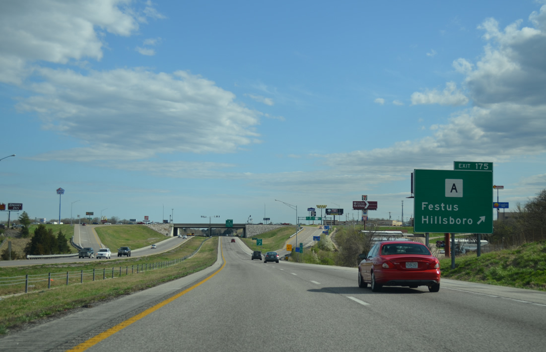
Exit 175 was upgraded from a diamond interchange to a single point urban interchange (SPUI) during a $5.8 million project between July 1999 and early July 2000.6
04/13/13
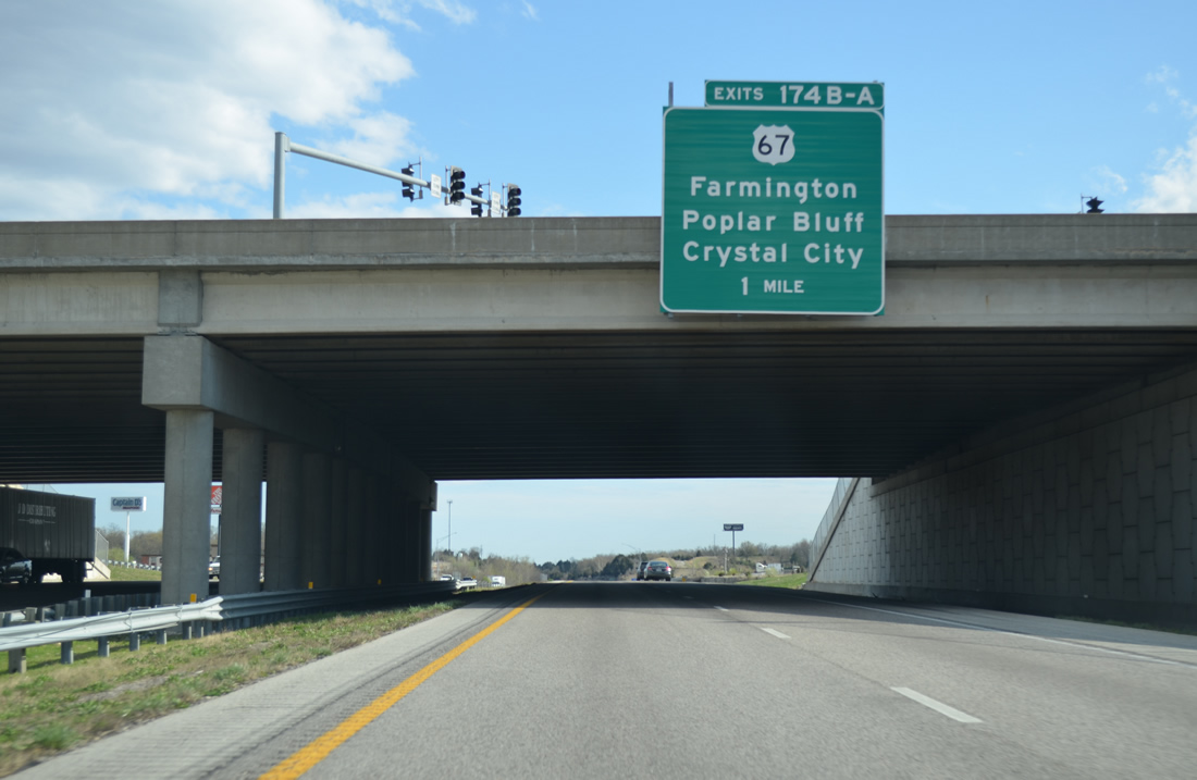
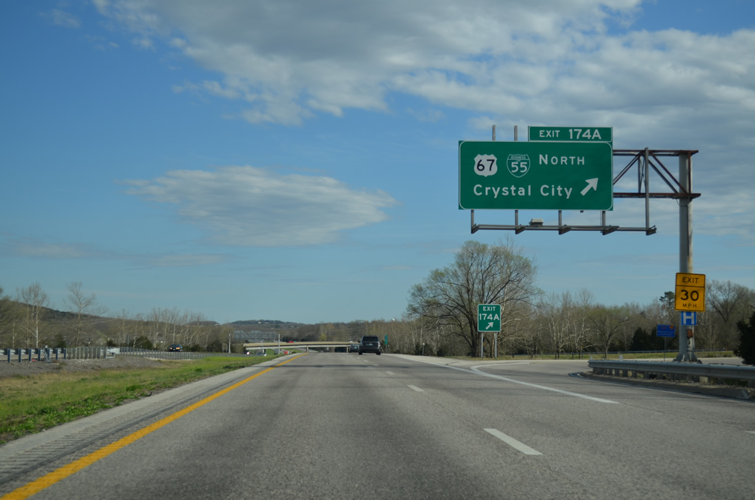
U.S. 67 branches southwest with Business Loop I-55 from U.S. 61 to meet I-55 at a cloverleaf interchange (Exits 174B/A) in one mile.
04/13/13
Interstate 55 begins turning more east, following the trajectory of the Mississippi River south from Festus to Cape Girardeau.
04/13/13
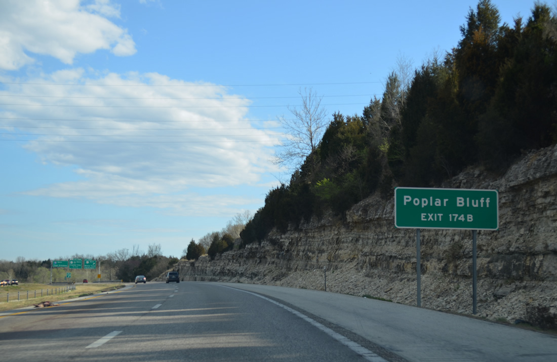
U.S. 67 constitutes a four lane highway south from Interstate 55 and Festus to Poplar Bluff and the U.S. 60 corridor west from Sikeston and Dexter to Springfield.
04/13/13
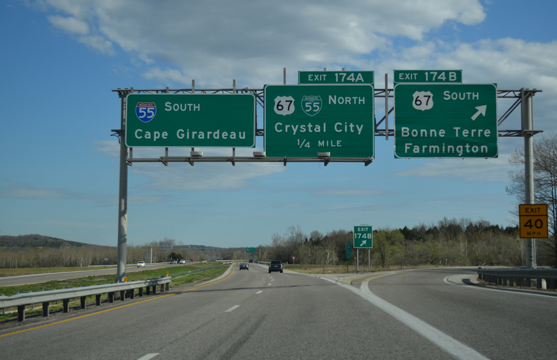
A 1,560 mile route between Sabula, Iowa and Presidio, Texas, U.S. 67 follows the I-55 corridor from Mehlville south to Festus. The route splits with I-55, 20 miles to Bonne Terre and 34 miles to the St. Francois County seat of Farmington.
04/13/13
Business Loop I-55 is acknowledged alongside U.S. 67 north from Exit 174A as the pair combine with U.S. 61 along Truman Boulevard through both Festus and Crystal City.
04/13/13
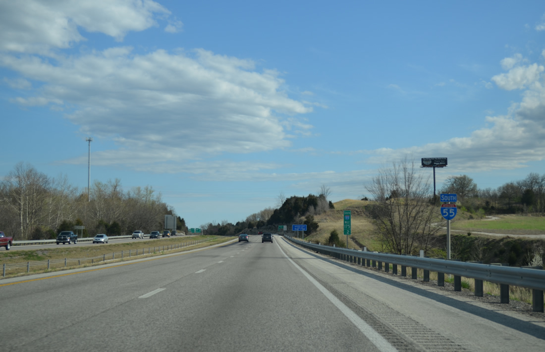
Interstate 55 and the Great River Road continue southeast from Festus another four miles to their split near Selma.
04/13/13
U.S. 61 passes over I-55 to the west before arcing back to the east at Exit 170 in three miles. Cape Girardeau is still over an hour away.
04/13/13
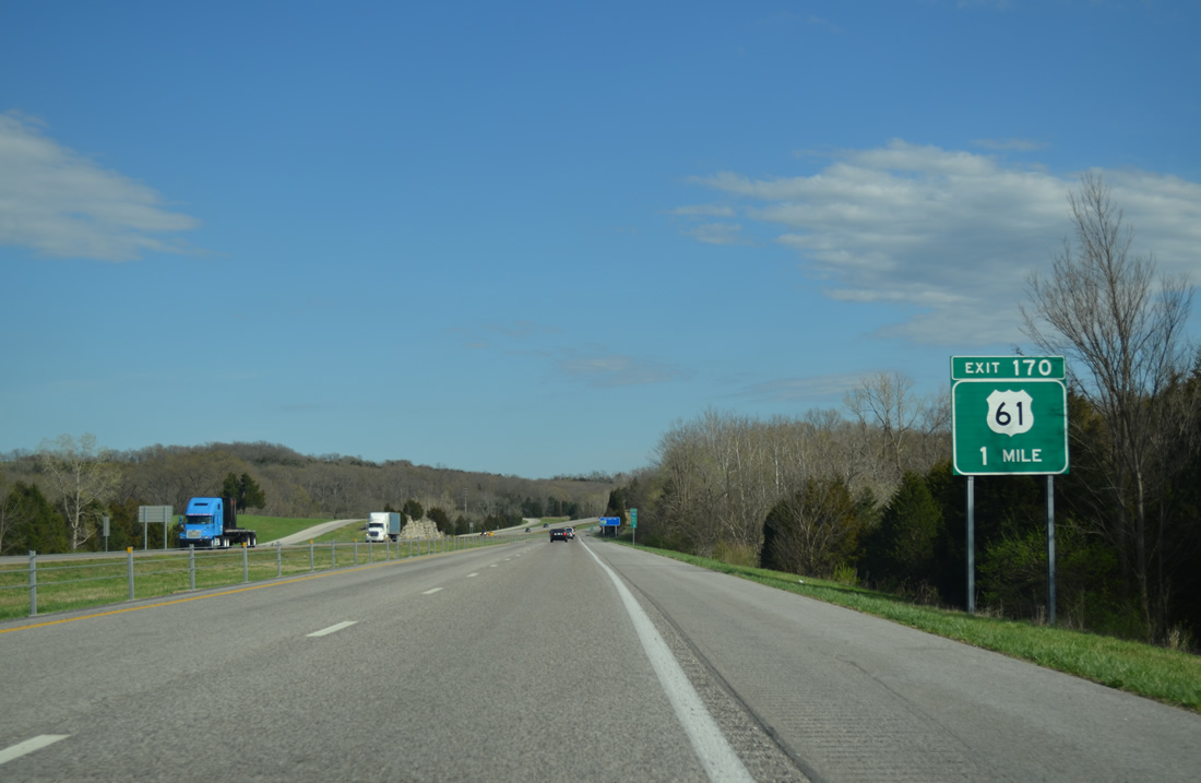
The Great River Road parts ways with Interstate 55 south to join U.S. 61 south from Exit 170 to Sainte Genevieve.
04/13/13
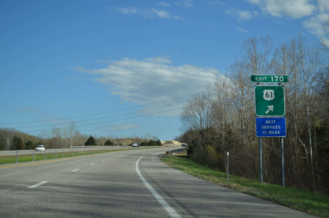
The diamond interchange at Exit 170 provides the last set of services for southbound travelers until Bloomsdale. U.S. 61 passes by newer subdivisions nearby at Selma before transitioning into agricultural areas ahead of Isle du Bois Creek and the county line. The new homes were built to support a local population increase anticipated by Summer 2009 opened Holcim, Inc. cement plant.7
04/13/13
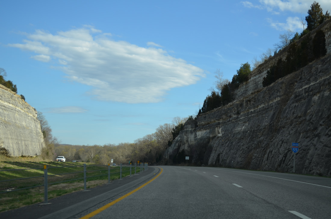
An impressive rock cut takes Interstate 55 by a 720 foot plus hill just south of Exit 170.
04/13/13
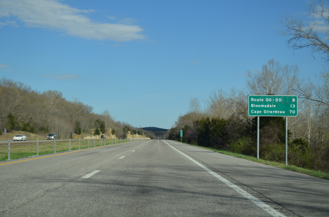
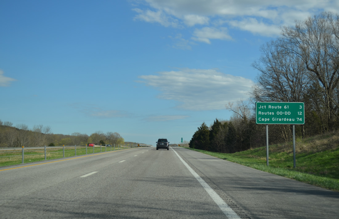
Southbound distance sign referencing Highways OO and DD at Valley View eight miles to the south. This sign predates the opening of the half diamond interchange (Exit 165) with Highway TT.
04/13/13
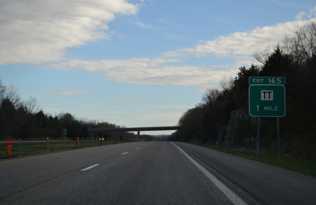
$9.3 million in area road improvements to support the nearby Holcim, Inc. cement plant included construction of Exit 165 to service the Mississippi River side facility.7
04/13/13
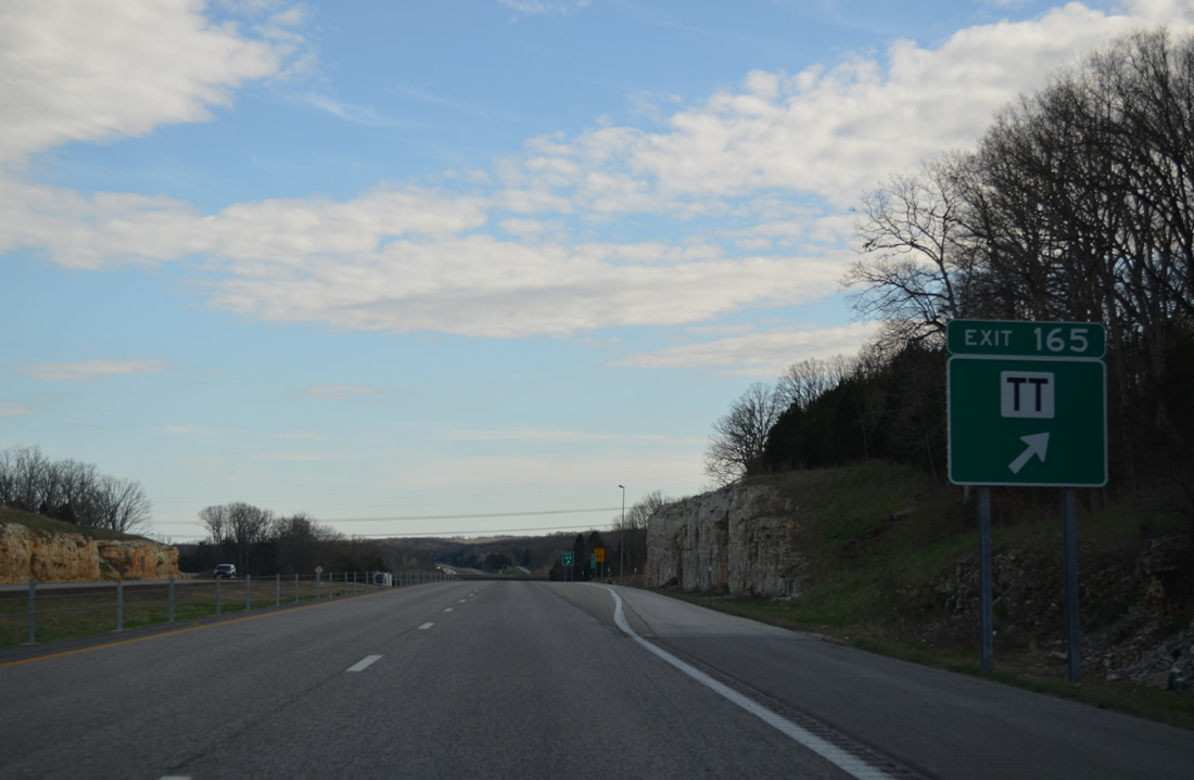
Highway TT winds 7.82 miles northwest from U.S. 61 near the Ste. Genevieve County line and U.S. 61 again west of Exit 170.
04/13/13
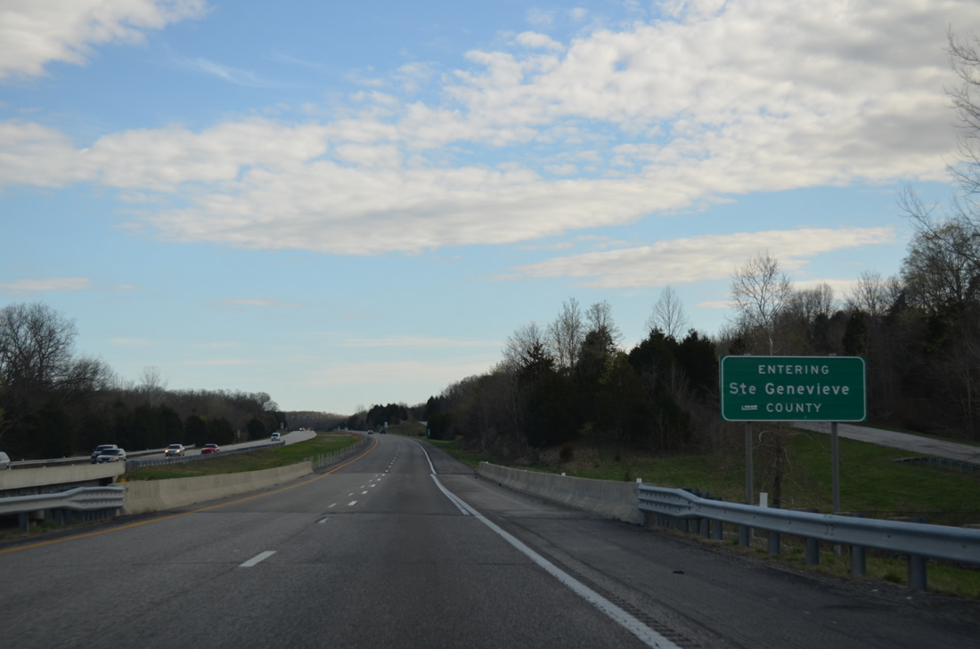
Interstate 55 ends a 27.81 mile stretch through Jefferson County at the crossing of Isle du Bois Creek. The waterway lines the Jefferson and Ste. Genevieve County border east from Skaggs Spring to the Mississippi River.
04/13/13

References:
- "I-55 Projects' Ultimate Cost is a Nice Surprise, MoDOT Reports." St. Louis Post-Dispatch, April 3, 2003.
- "Last link of Highway 141 in west St. Louis County to open this weekend." St. Louis Post-Dispatch, July 13, 2012.
- "Construction Stars on Road to New Defense Mapping Building." St. Louis Post-Dispatch, February 6, 1997.
- "Celebration Marks Opening of Long-awaited Expressway - Woman Whose Friend Died on Old Road Joins Dedication - 7 1/2-Mile Highway Cost $60 Million." St. Louis Post-Dispatch, January 25, 1999.
- "I-55 bottleneck targeted - MoDOT hearing today in Jefferson County will lay out plans for expansion and improvements to interstate from Highway M at Barnhart to Highway Z at Pevely." St. Louis Post-Dispatch, July 29, 2009.
- "WORK IS NEAR END AT I-55/HWY. A, OTHER I-55 WORK WILL START SOONER - THE I-55/A BRIDGE WAS SUPPOSED TO TAKE UNTIL OCTOBER." St. Louis Post-Dispatch, July 6, 2000.
- "New plant triggers boomlet." St. Louis Post-Dispatch, March 13, 2009.
Photo Credits:
- AARoads: 04/13/13
Connect with:
Page Updated Friday November 15, 2013.