
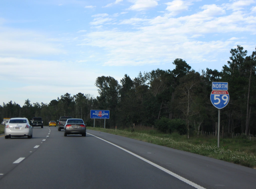
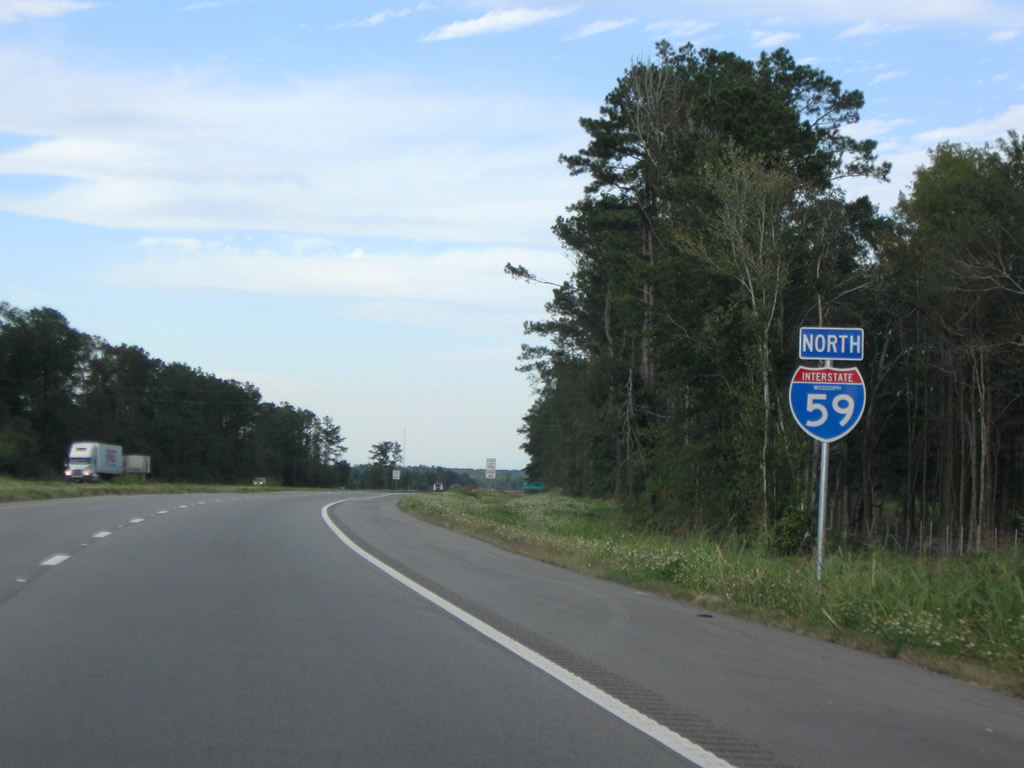
Interstate 59 North - Picayune to Hattiesburg

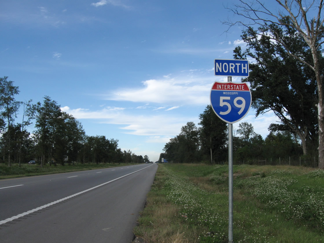
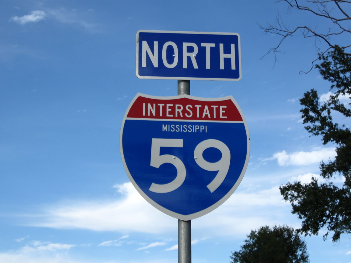
 North
North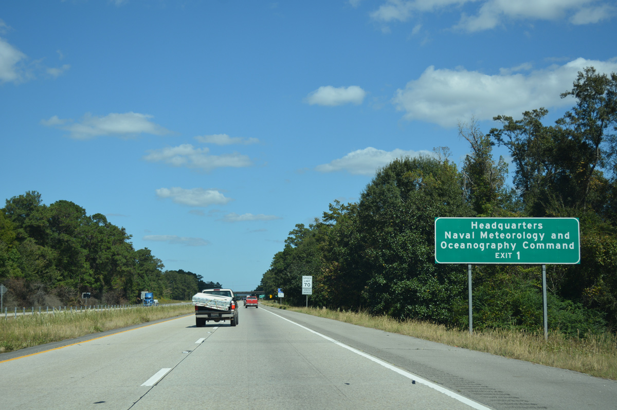
MS 607 travels 5.7 miles south from I-59 and U.S. 11 to the north gate of NASA's John C. Stennis Space Center. The installation is the headquarters for the Naval Meteorology and Oceanography Command.
10/12/16
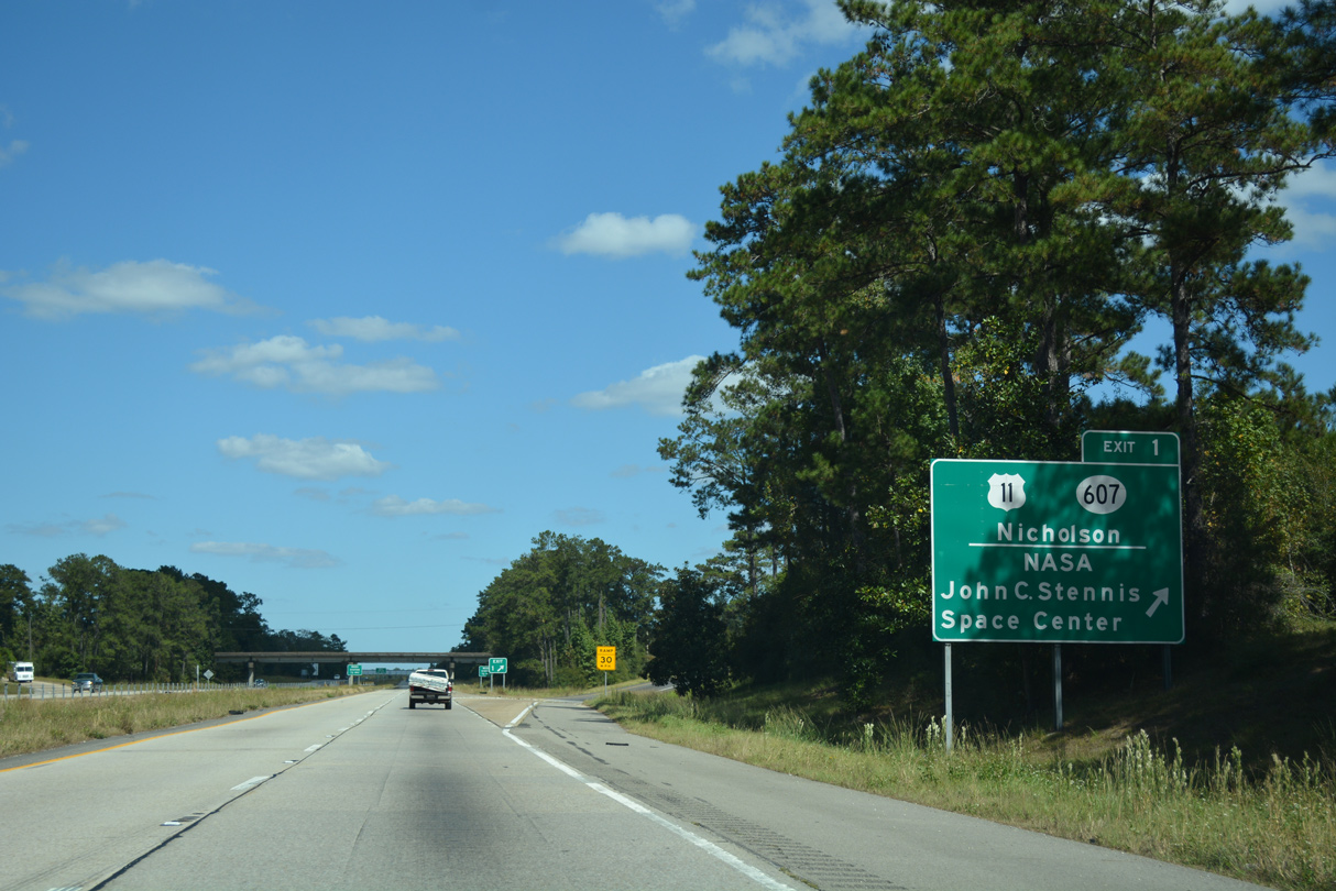
Entering the diamond interchange (Exit 1) where U.S. 11 branches northwest into Nicholson on Interstate 59 northbound.
10/12/16
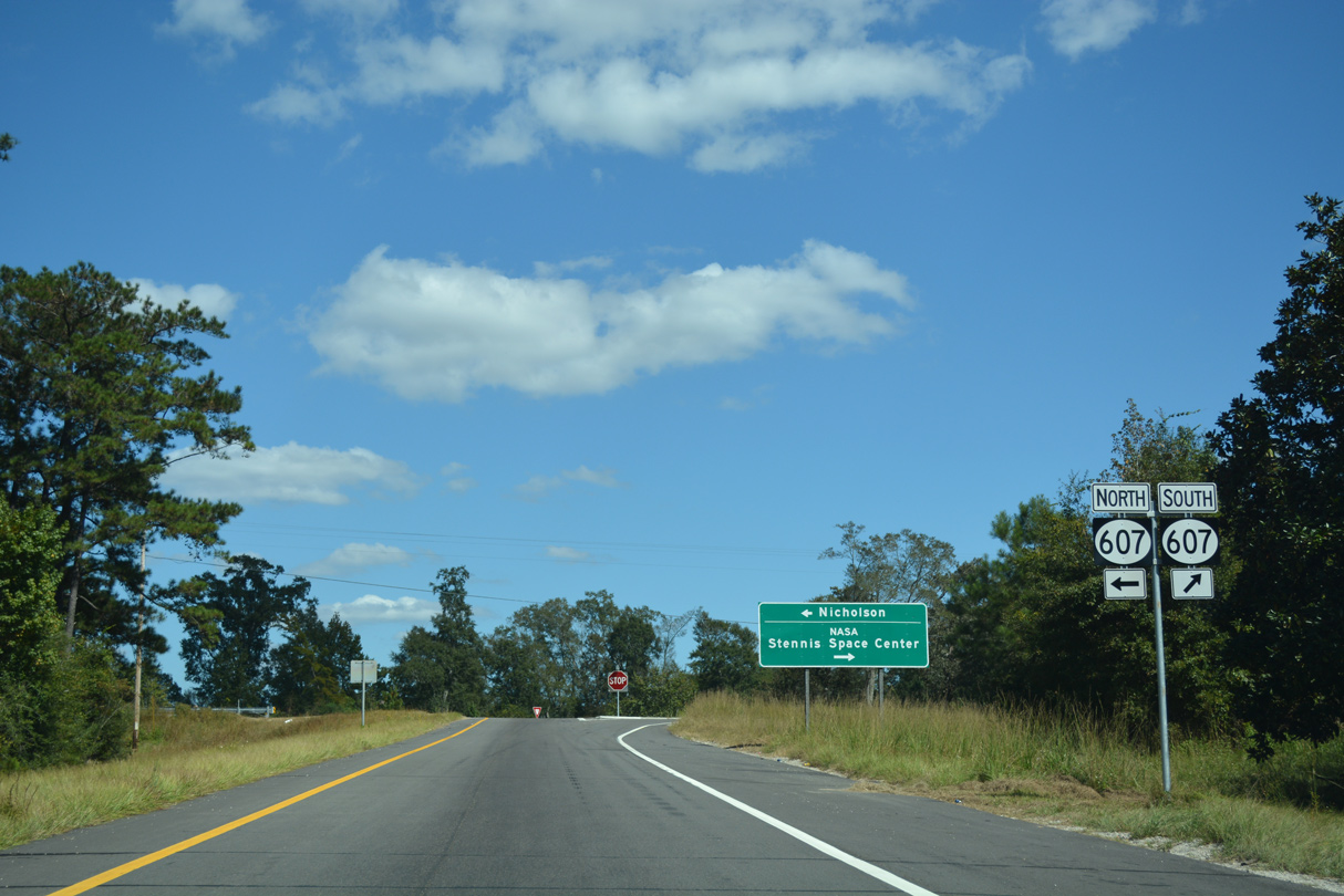
MS 607 is a discontinuous route, with a southern section joining John C. Stennis Space Center with Interstate 10, MS 604 south to Pearlington and U.S. 90 east to Bay St. Louis. Shuttle Parkway links the two segments through the NASA Space Center, but it is not open to the general public.
10/12/16
The first confirming marker for Interstate 59 in Mississippi stands beyond a set of weigh stations north of Exit 1.
10/24/09
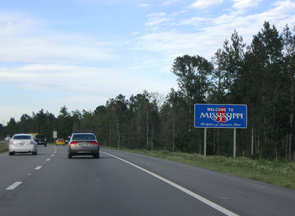
The Mississippi welcome sign follows along I-59 northbound. The rural freeway passes west of Picayune Municipal Airport (MJD) and The Crosby Arboretum along this stretch.
10/24/09
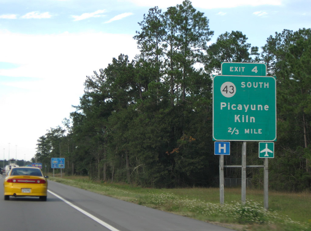
Memorial Boulevard east and Mississippi 43 north come together at a diamond interchange (Exit 4) with Interstate 59 next.
10/24/09
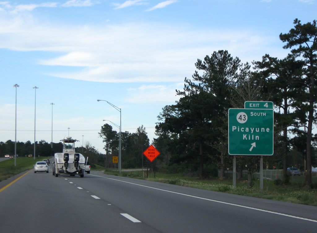
Mississippi 43 circumvents the NASA Stennis Space Center, connecting I-59 and the city of Picayune with Bay St. Louis along a 29 mile long course to U.S. 90 via Kiln.
10/24/09
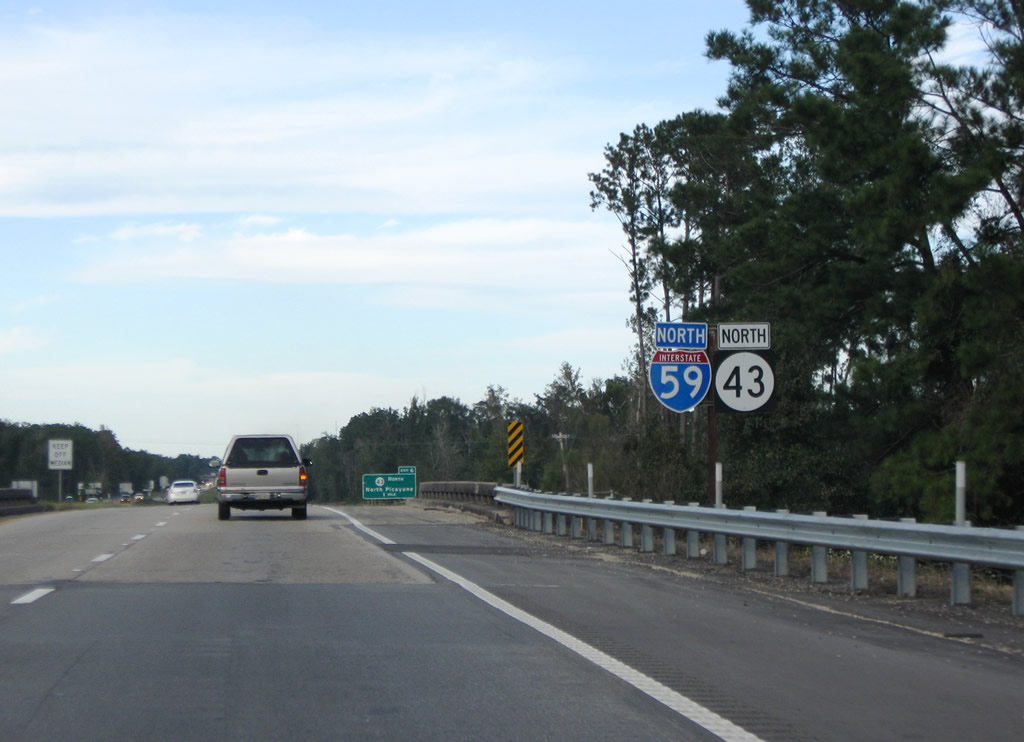
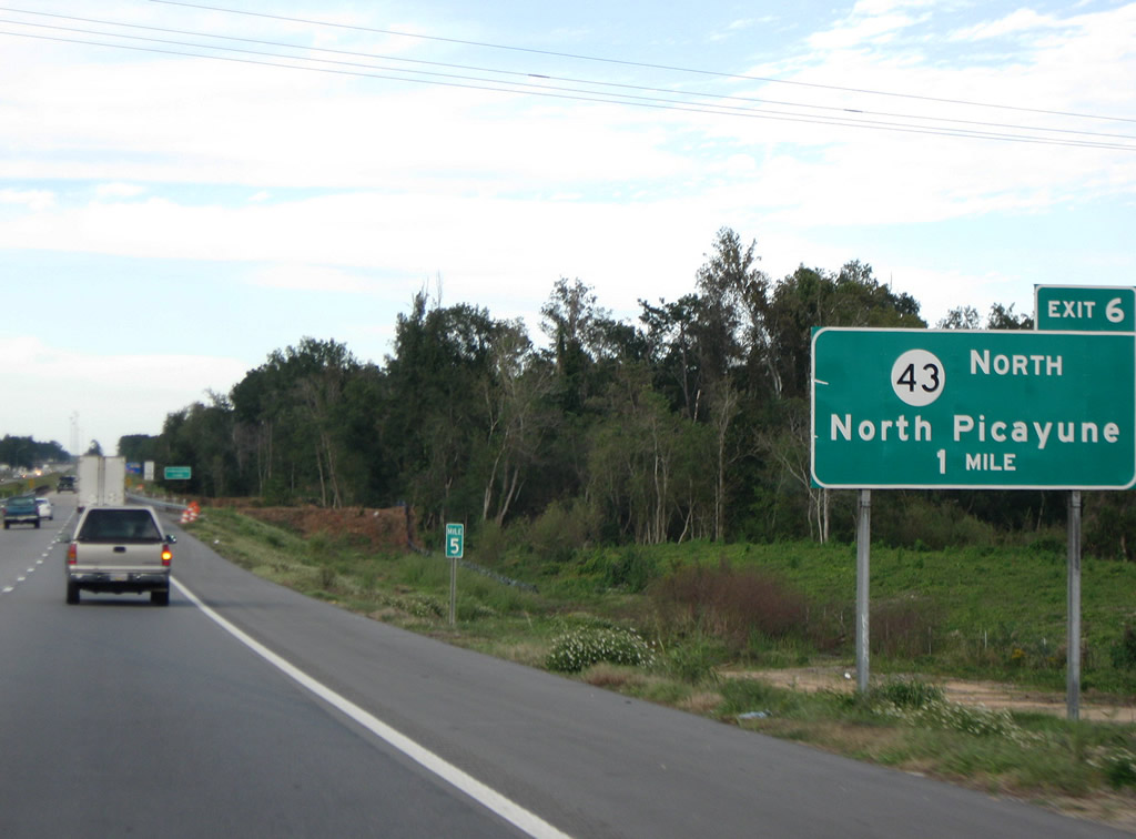
MS 43 merges onto I-59 north for 1.5 miles to the succeeding exit for Sycamore Road in north Picayune.
10/24/09

MS 43 follows Sycamore Road west from a diamond interchange (Exit 6) with I-59, 1.25 miles to a commercialized intersection with U.S. 11. Leaving Picayune, the state highway turns northward and parallels the Pearl River to Columbia.
10/24/09
Northbound confirming marker posted ahead of Hide-A-Way Lake and a shuttered parking area.
10/24/09
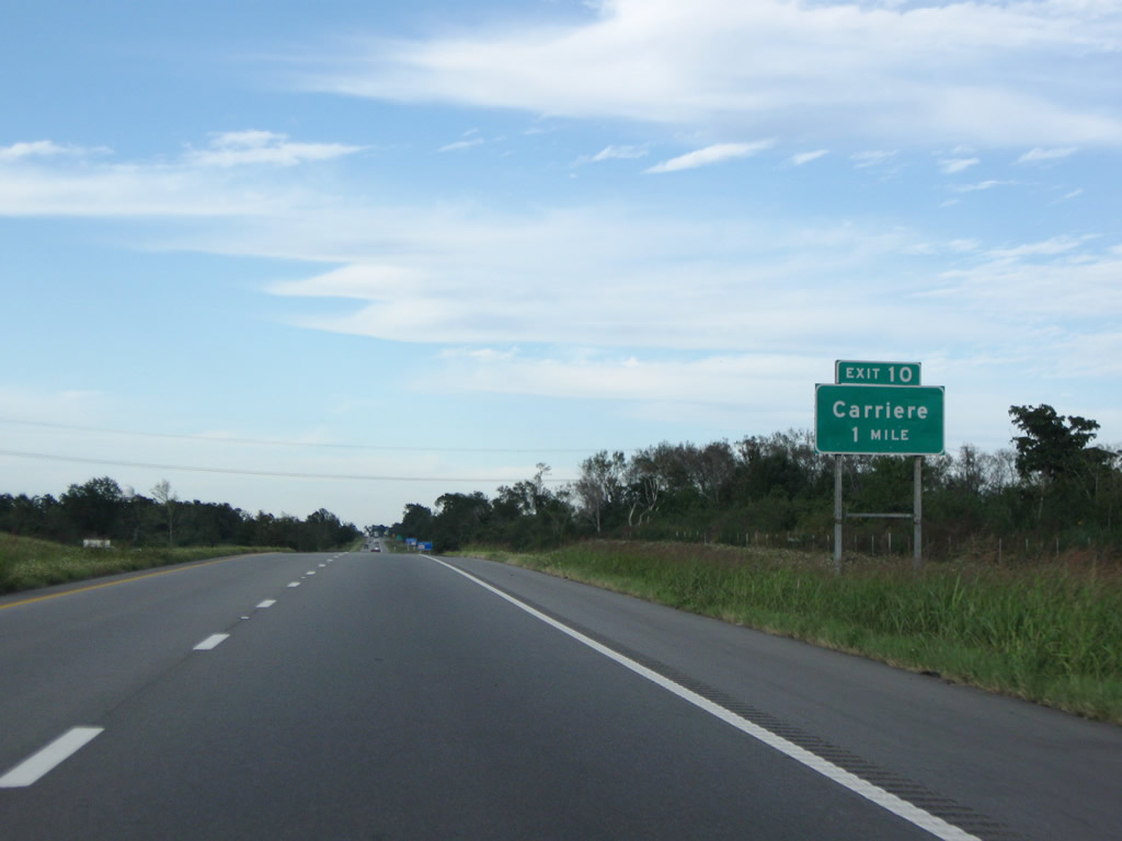
A rural diamond interchange (Exit 10) joins Interstate 59 with Union Road in one mile.
10/24/09
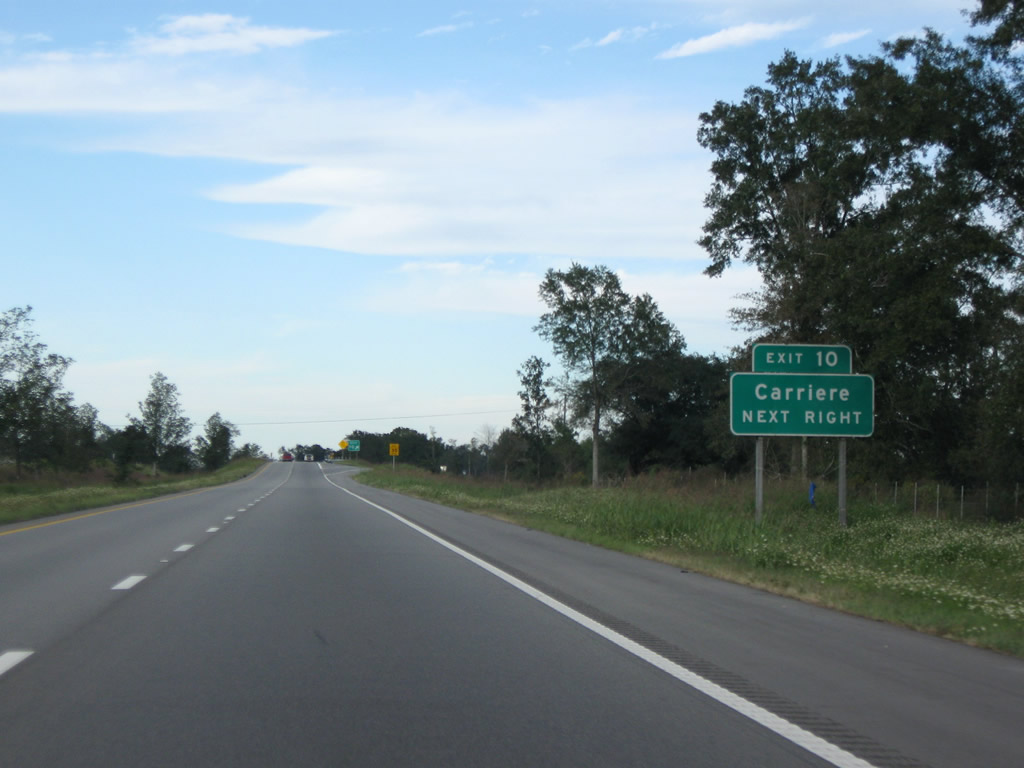
Union Road crosses paths with I-59 west from the settlement of Caesar. The unincorporated community of Carriere lies 2.3 miles to the northwest off of U.S. 11.
10/24/09
Interstate 59 continues north from Union Road toward Anchor Lake.
10/24/09
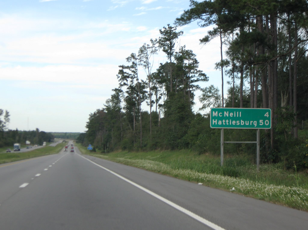
The ensuing exit along I-59 northbound connects with the unincorporated community of McNeill in four miles.
10/24/09
Interstate 59 runs along the east side of Anchor Lake beyond the Anchor Lake Road overpass. A shuttered parking area lines the southbound roadway.
10/24/09
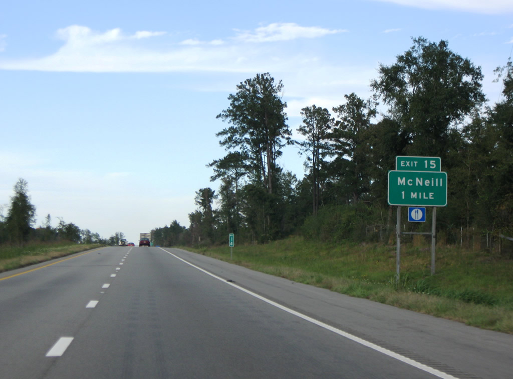
McNeill Steephollow Road connects Interstate 59 with McNeill, located four miles to the west of upcoming Exit 15.
10/24/09
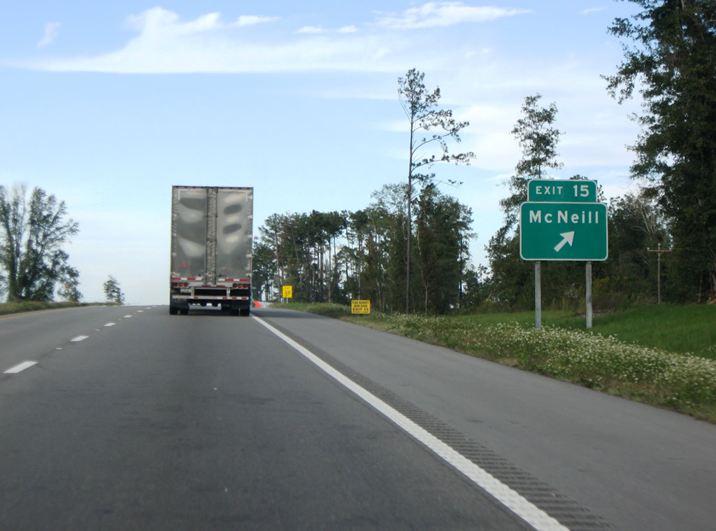
East from the diamond interchange (Exit 15) with I-59, McNeill Steephollow Road meanders 8.3 miles to Mississippi 53 via Rowlands.
10/24/09
Interstate 59 traverses timberland northward from Exit 15 to East Hobolochitto Creek.
10/24/09
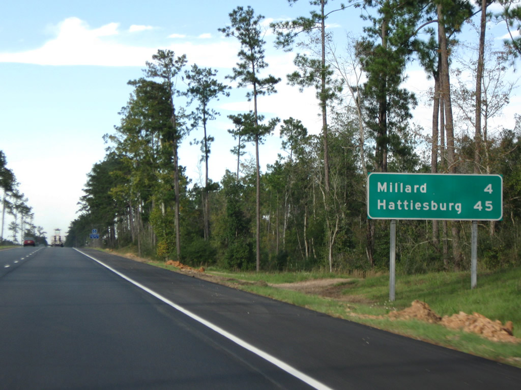
Hattiesburg lies 45 miles to the northeast along U.S. 11 and 49.
10/24/09
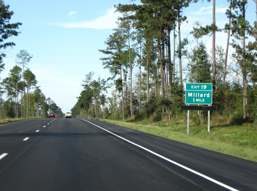
Savannah Millard Road runs 2.3 miles east from U.S. 11 and the settlement of Millard to Interstate 59 at Exit 19.
10/24/09
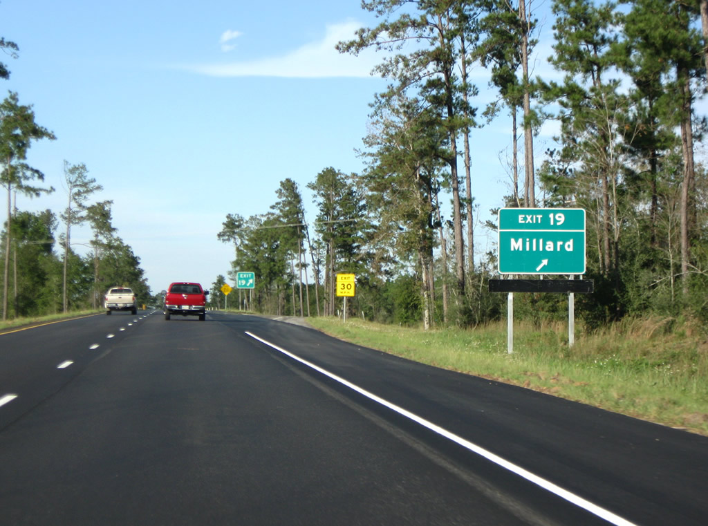
Savannah Millard Road arcs eastward from the diamond interchange (Exit 19) with I-59, 4.6 miles to Mississippi 53 at Savannah.
10/24/09
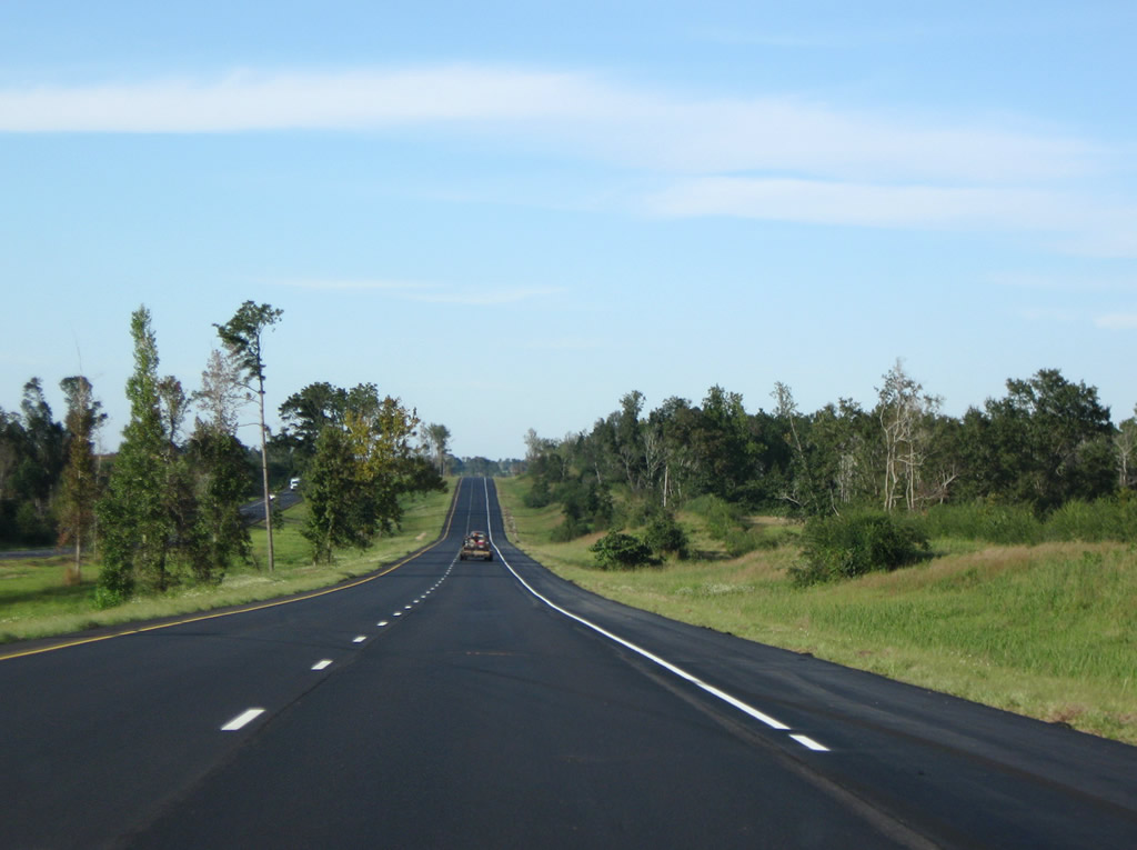
A 6.9 mile long exit less stretch takes Interstate 59 northward through timberland spreading west of Poplarville-Pearl River County Airport (M13) and MS 53.
10/24/09

MS 53 and Interstate 59 converge at a diamond interchange (Exit 27) just south of the city of Poplarville.
10/24/09
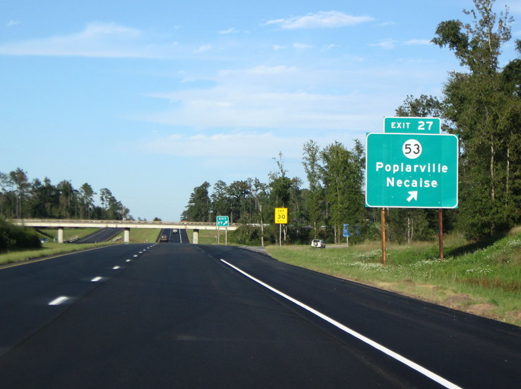
Mississippi Highway 53 travels 39.6 miles overall from U.S. 49 on the north side of Gulfport to U.S. 11 and MS 26 in Poplarville via Lyman and Necaise.
10/24/09
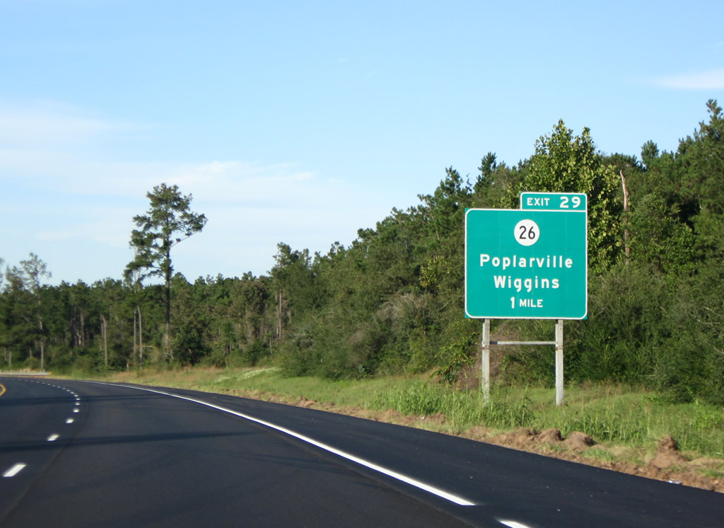
Interstate 59 bypasses Poplarville to the east, next meeting Mississippi 26 at Exit 29.
10/24/09
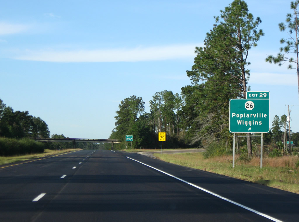
MS 26 follows Brainard Street west across Poplarville en route to Bogalusa, Louisiana (via LA 10). East from I-59, MS 26 travels across the width of Stone County to Wiggins and the George County seat of Lucedale.
10/24/09
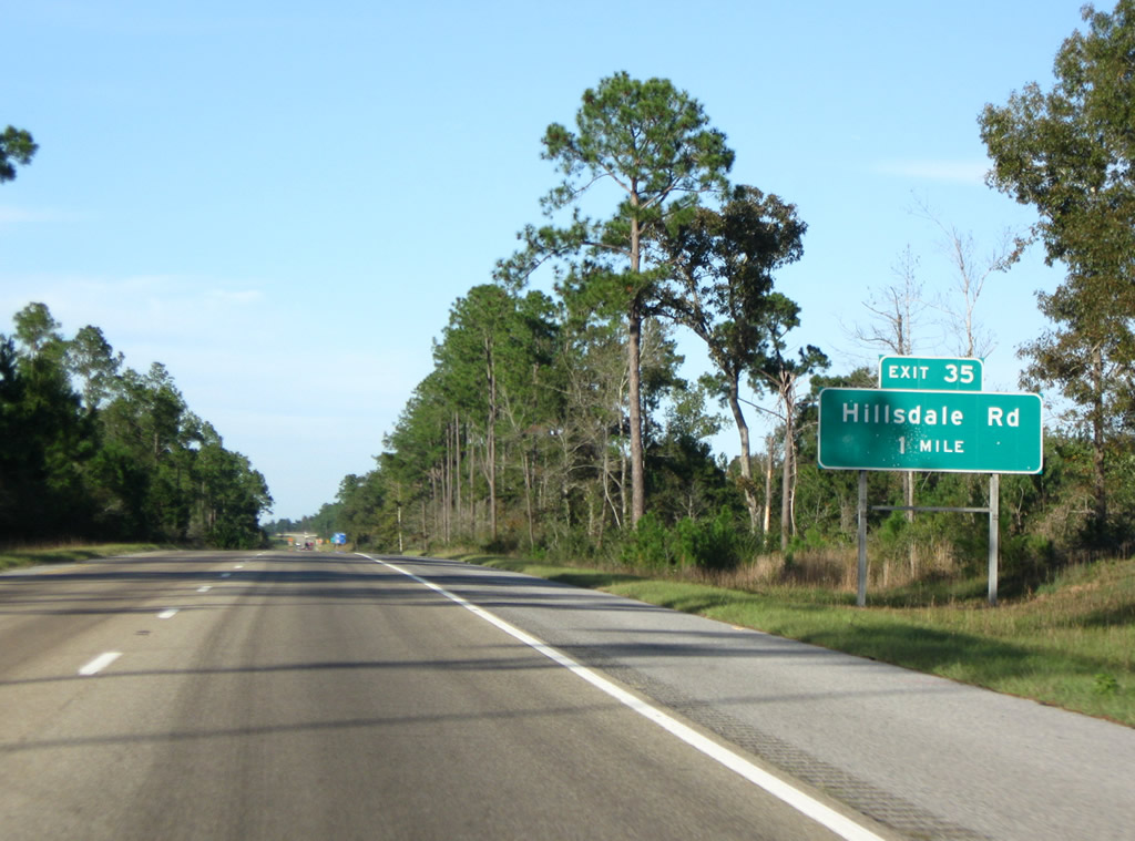
Interstate 59 bee lines northeast to a rural diamond interchange (Exit 35) with Hillsdale Road.
10/24/09
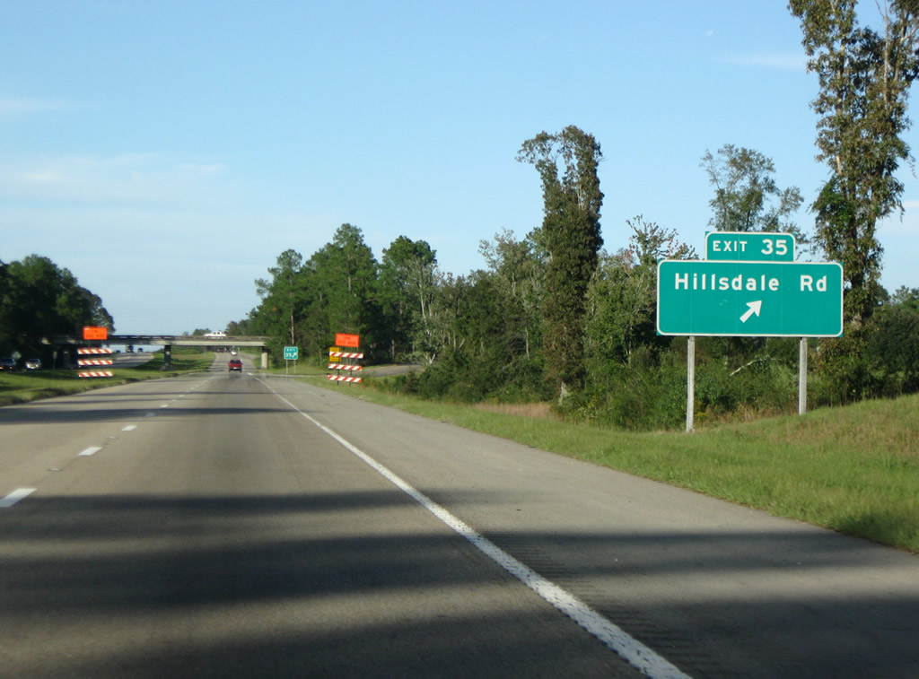
Hillsdale Road winds westward to the Norfolk Southern Railroad siding of Hillsdale and U.S. 11. Hillsdale Gunpoint Road continues the road east from Exit 35 by Lake Hills Golf Club to DeSoto National Forest.
10/24/09
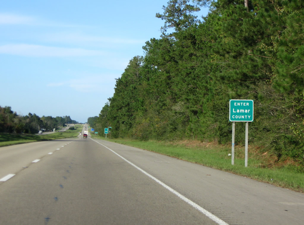
Interstate 59 nips a corner of south Lamar County beyond the Gumpond Beall Road overpass.
10/24/09
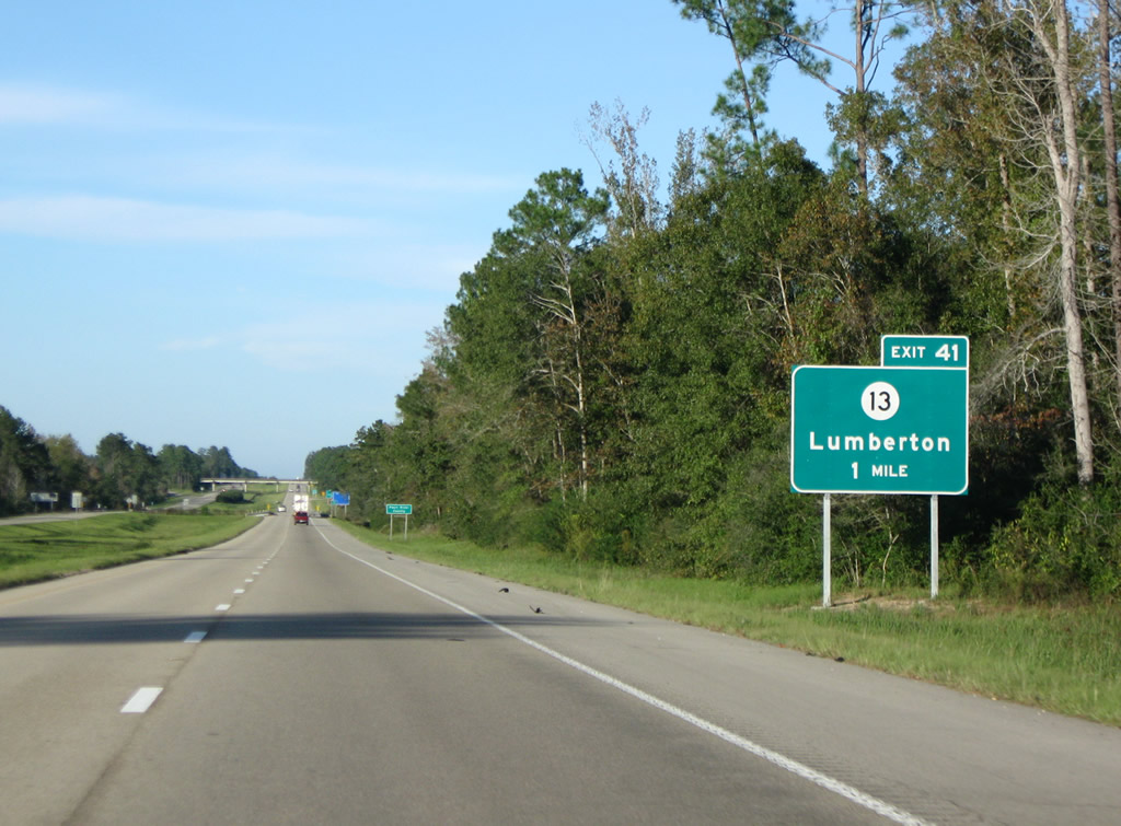
The forthcoming diamond interchange (Exit 41) with Mississippi 13 falls the east side of the city of Lumberton.
10/24/09
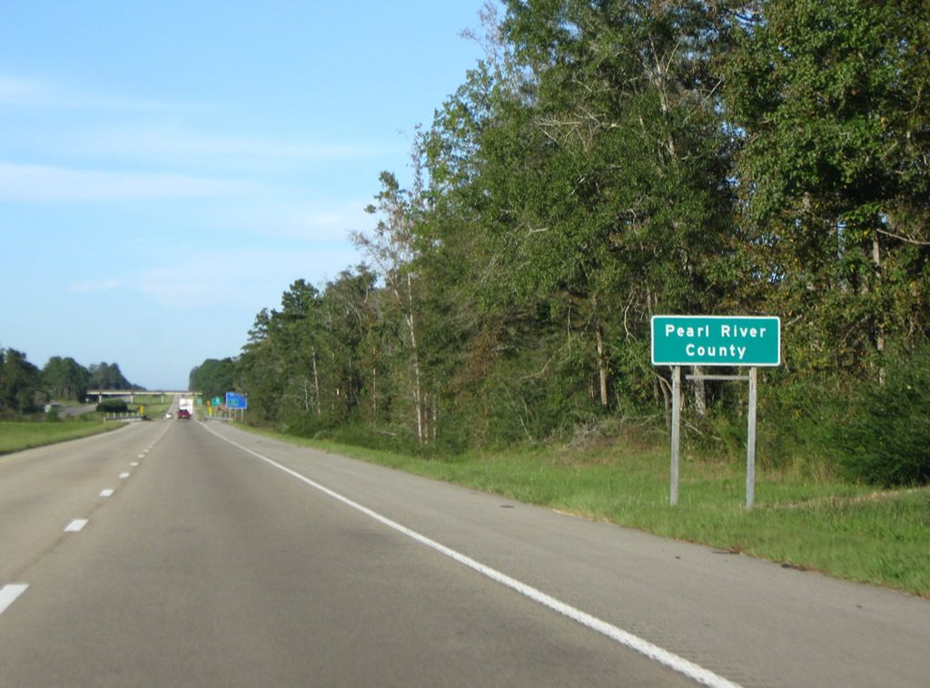
Reentering Pearl River County, I-59 also passes through a section of DeSoto National Forest ahead of MS 13.
10/24/09
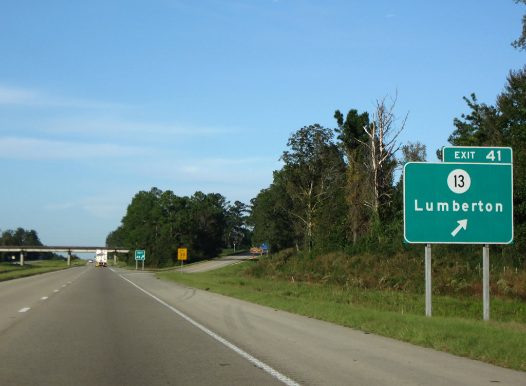
Exit 41 departs Interstate 59 north for MS 13 west to the Lumberton city center and Little Black Creek Water Park. MS 13 east navigates 15 miles along a rural course through the settlements of Young and Carnes to U.S. 49 in Forrest County.
10/24/09
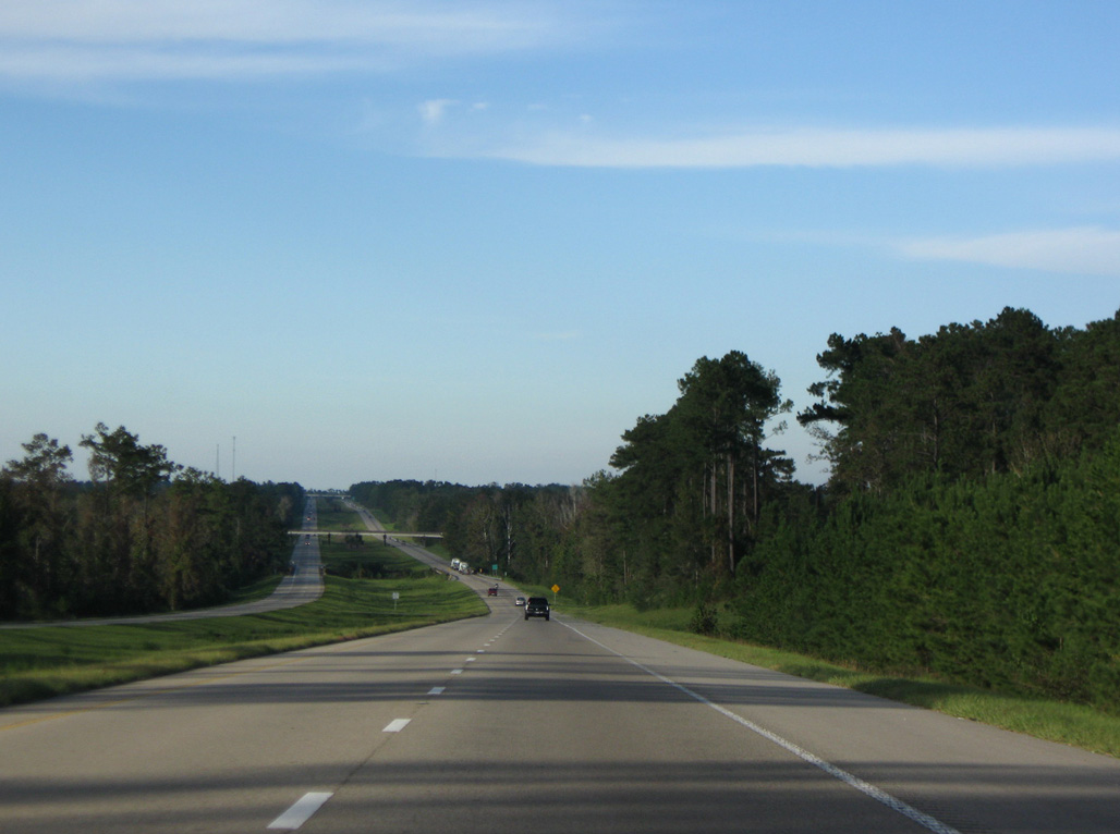
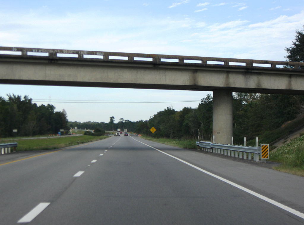
Old Highway 11 intertwines with Interstate 59 along the 9.7 mile long exit less stretch between Lumberton and MS 589. Pictured here is the crossing of Little Black Creek and Old Highway 11.
10/24/09
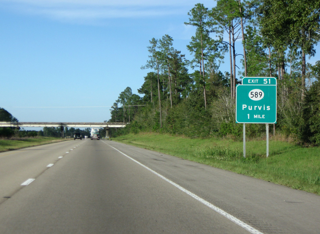
Exit 51 joins Interstate 59 with the south end of MS 589 and Browns Bridge Road east to Beaver Lake and Pine Creek Golf Club.
10/24/09
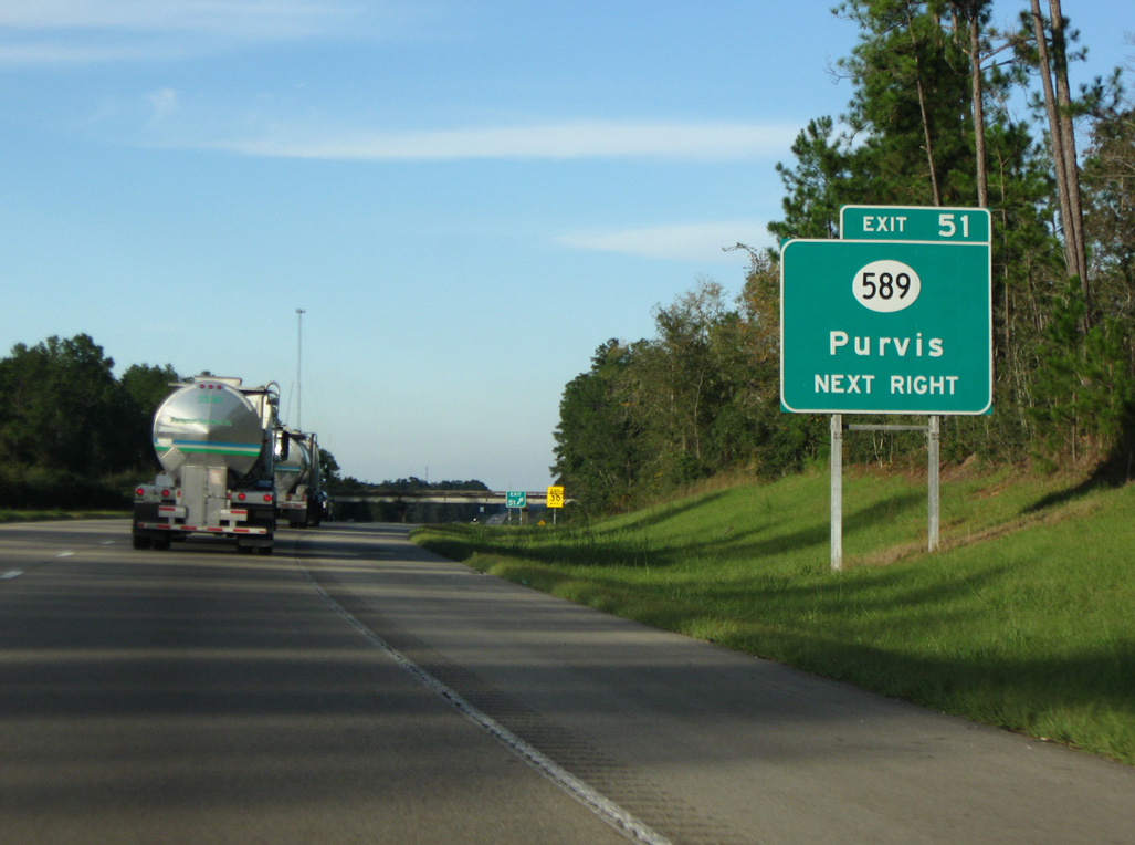
Mississippi 589 constitutes a 36 mile loop west from I-59 and U.S. 49 through the city of Purvis and town of Sumrall.
10/24/09
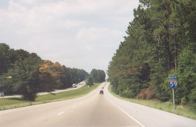
Northbound reassurance marker posted ahead of Little Beaver Creek.
June 2001
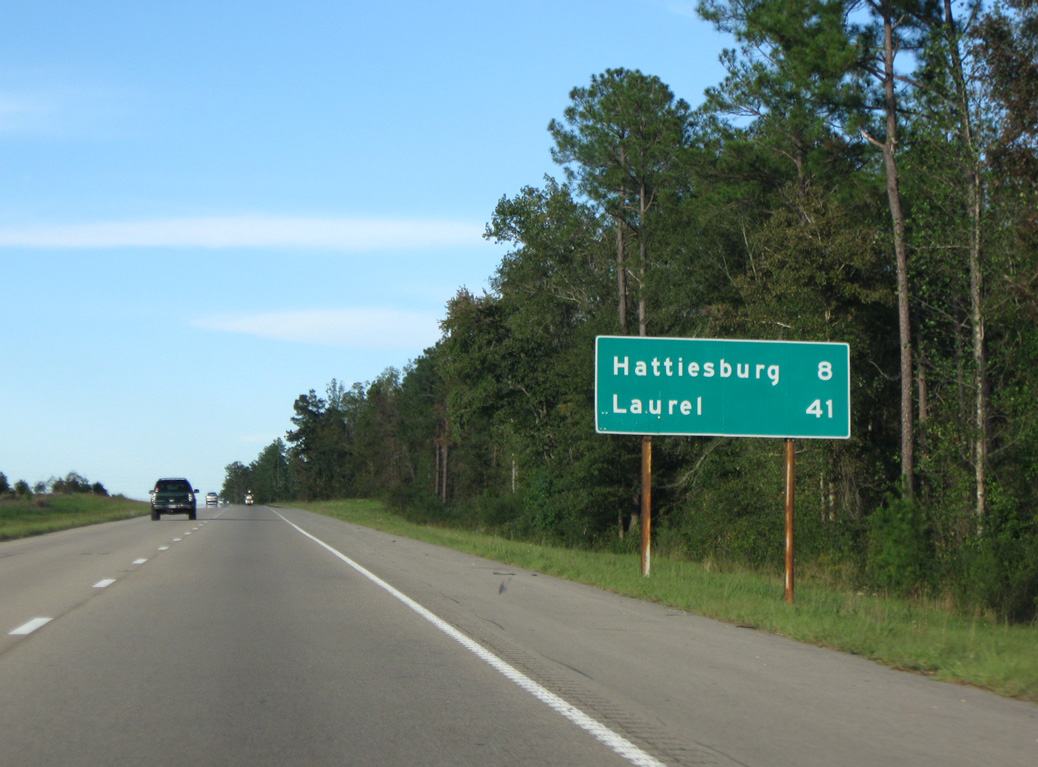
U.S. 11 converges with Interstate 59 in eight miles on the southwest side of Hattiesburg. Laurel debuts to northbound motorists at 41 miles away.
10/24/09
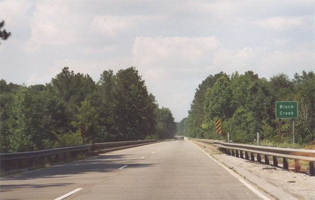
The 1961 bridges carrying Interstate 59 across Black Creek were reconstructed in 2015.
June 2001
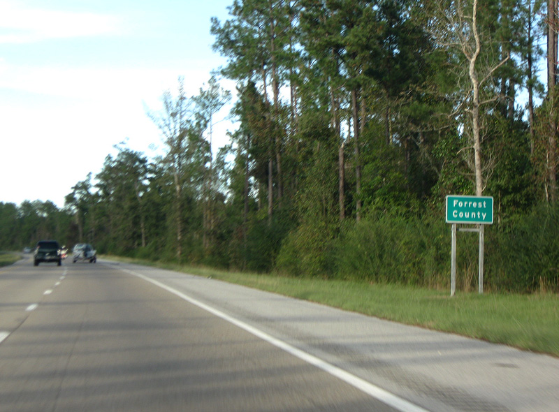
Interstate 59 enters Forrest County just beyond Black Creek. A set of parking areas follow along both north and southbound roadways.
10/24/09
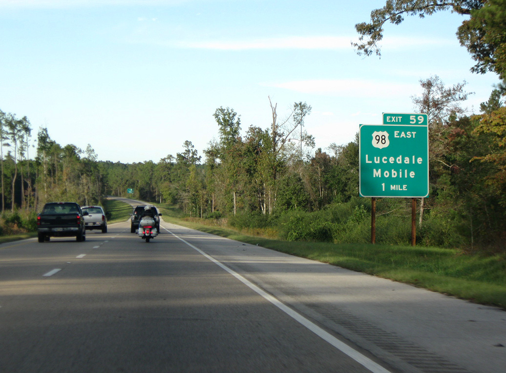
U.S. 98 connects with Interstate 59 at a trumpet interchange (Exit 59) in one mile. A four lane corridor, U.S. 98 joins Hattiesburg with Lucedale and Mobile, Alabama.
10/24/09
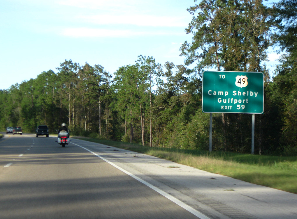
U.S. 98 was realigned to bypass Hattiesburg with completion of a 3.3 mile long freeway spur east from I-59 to U.S. 49 in 1980. Camp Shelby follows along the at-grade, expressway portion of U.S. 98 to the southeast.
10/24/09
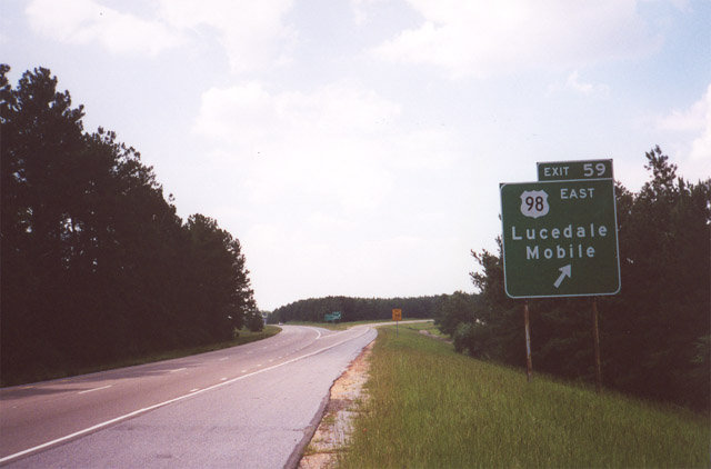
Exit 59 leaves Interstate 59 north for U.S. 98 east to Mobile, Alabama. The exchange here includes a graded loop ramp for an unbuilt extension of the freeway west.
June 2001
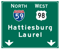
Photo Credits:
- Alex Nitzman: 10/12/16
- Brent Ivy: 10/24/09
- AARoads: June 2001
Connect with:
Page Updated Thursday March 28, 2019.