
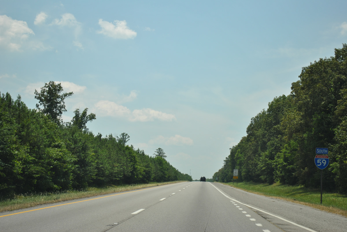
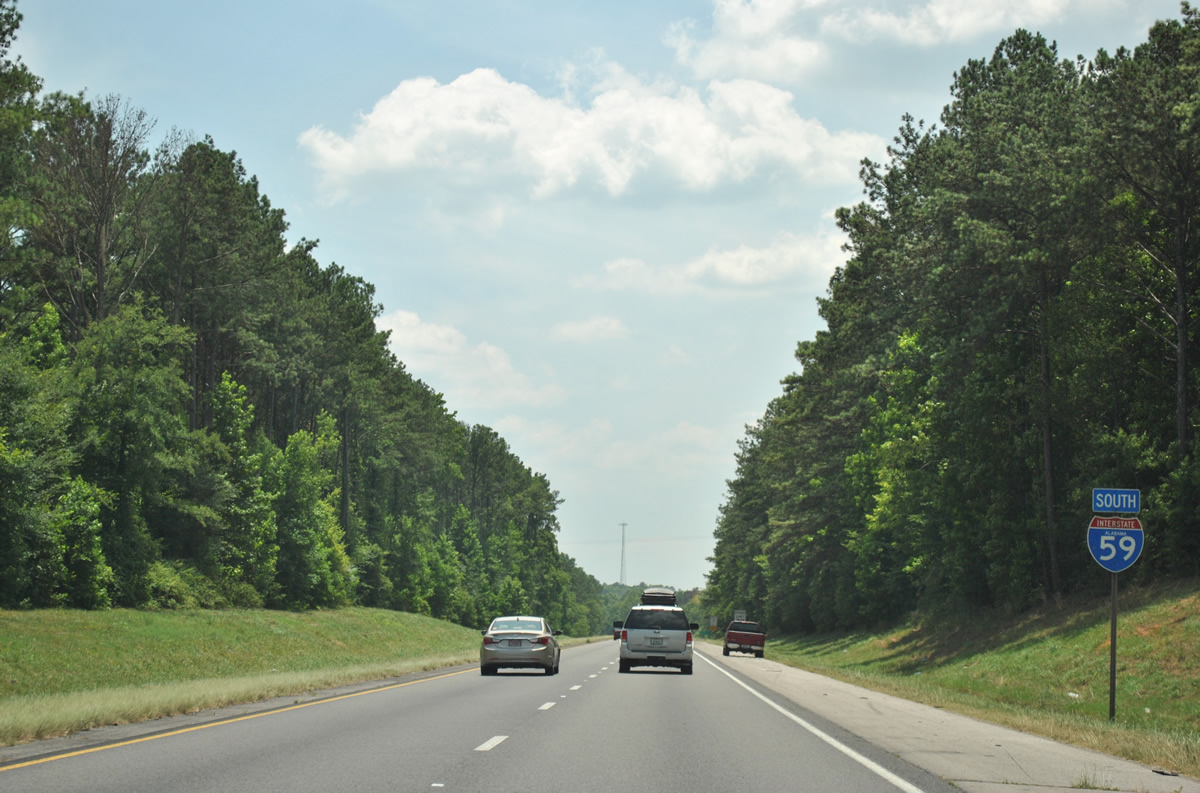
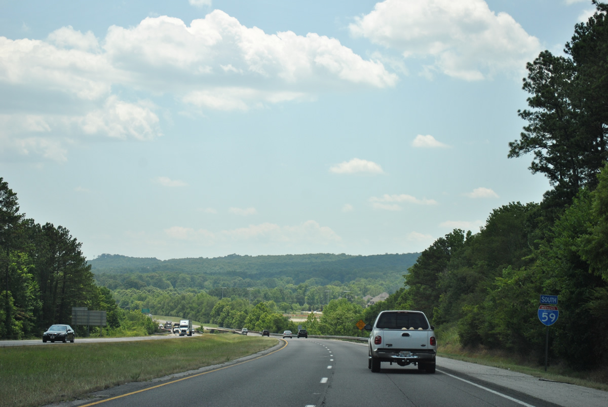
Interstate 59 South - Gadsden to Birmingham

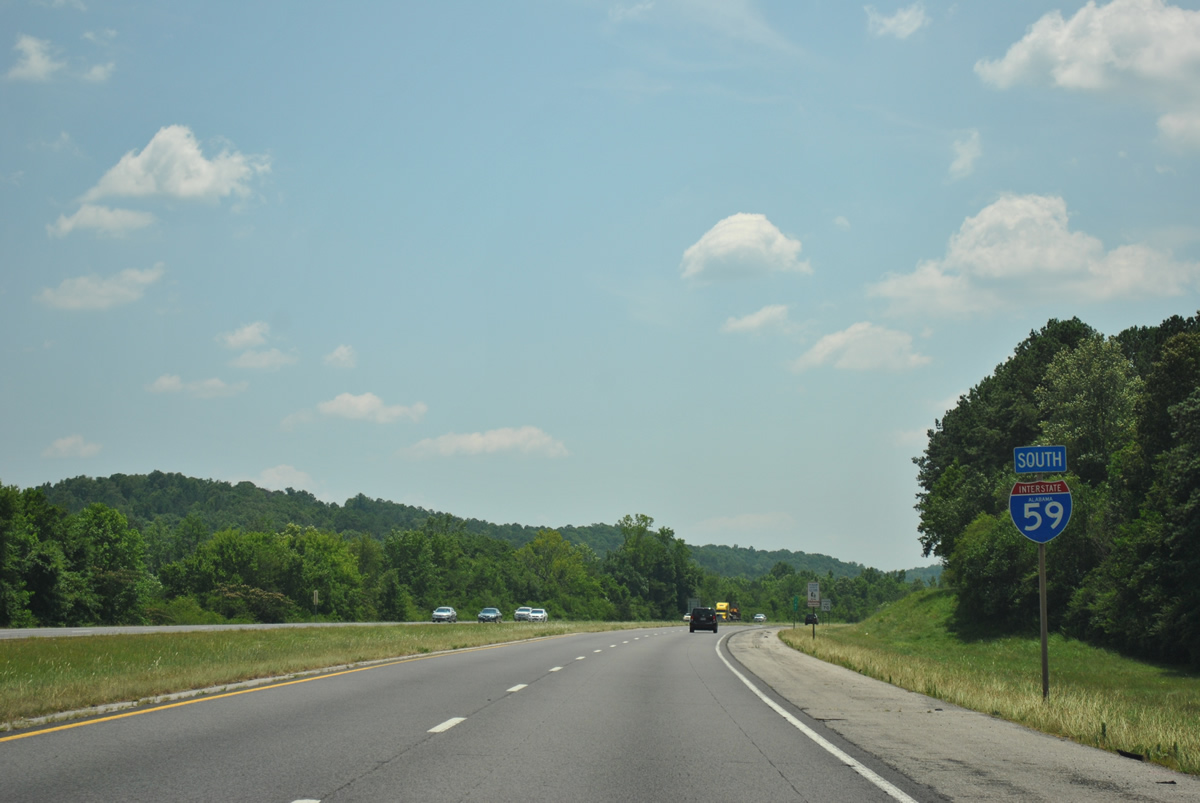
 South
South
A second reassurance shield posted along the stretch between Attalla and Steele follows the county line. This stretch of freeway is designated the Korean War Memorial Highway.
06/25/12
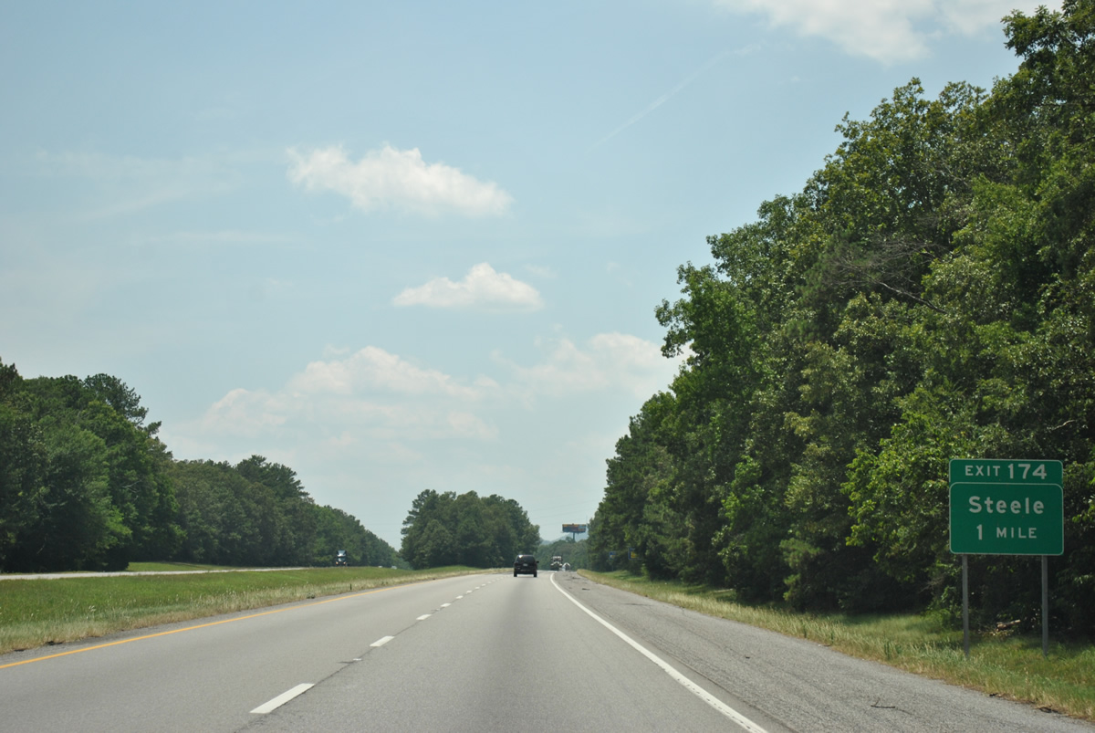
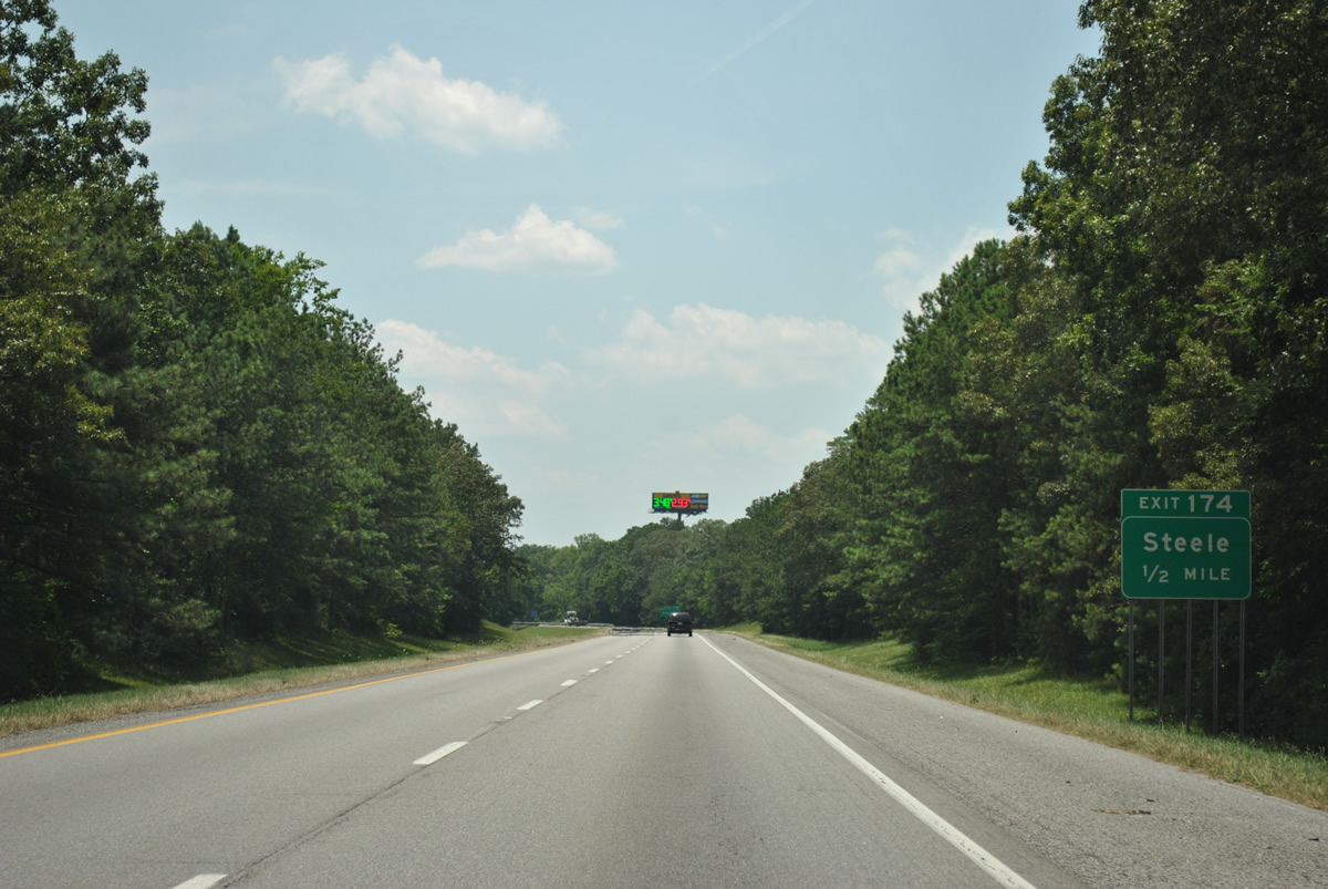
The diamond interchange at Exit 174 joins Interstate 59 with Steele Station Road in one mile.
06/25/12
Steele Station Road originates at Black Creek Parkway and Sutton Street, by Interstate 759 at Rainbow City, and arcs southwest by Northeast Alabama Regional Airport to U.S. 11 (Main Street) in the town of Steele.
06/25/12
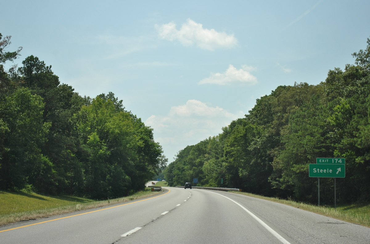
Exit 174 leaves Interstate 59 south for Steele Station Road. St. Clair County Route 42 stems west from U.S. 11 at Steele along Chandler Mountain Road onto the adjacent mesa.
06/25/12
A forested median remains in place along much of the drive south to Ashville from Steele.
06/25/12
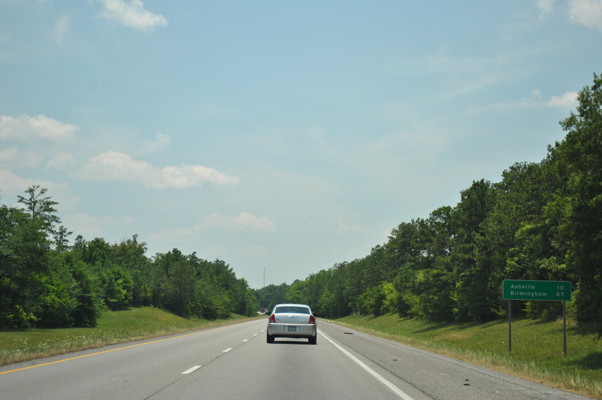
The city center of Ashville is ten miles away from Steele via I-59 south and U.S. 231 south while Birmingham is 47 miles to the southwest.
06/25/12
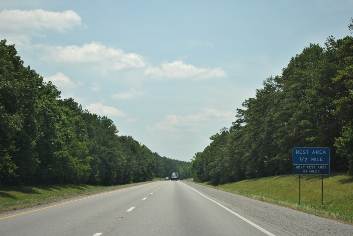
The first rest area on I-59 south since the welcome center near the Georgia state line is next.
06/25/12
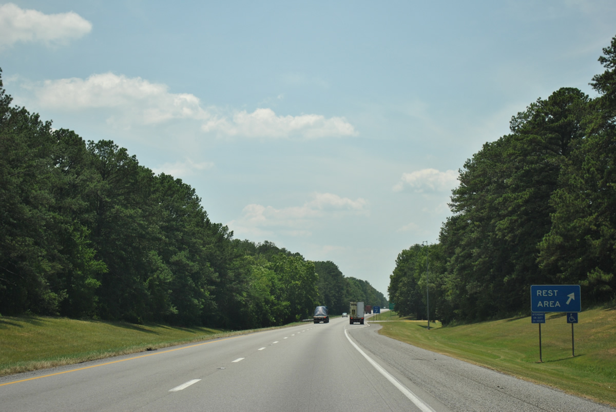
The southbound rest area along Interstate 59 straddles the Ashville city line.
06/25/12
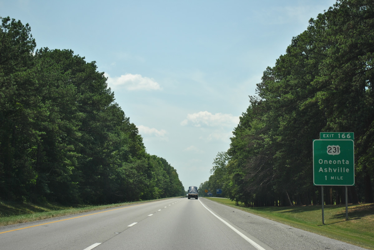
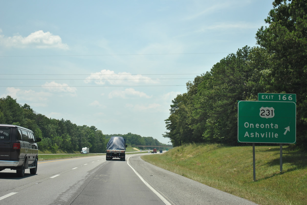
U.S. 231 follows 5th Avenue northwest from central Ashville to meet Interstate 59 at a diamond interchange (Exit 166) in one mile. The US route leaves I-59 on a 14 mile trek to the Blount County seat of Oneonta.
06/25/12
U.S. 231 south merges with U.S. 411 in 2.69 miles for the start of a 4.10 mile overlap. South from the split, U.S. 231 continues to Pell City while U.S. 411 branches southwest to Odenville and its terminus at Leeds. Northward, U.S. 231 intersects U.S. 11 in 1.12 miles at Whitney Junction.
06/25/12
Southbound Interstate 59 shield posted at the crossing of Muckleroy Creek.
06/25/12
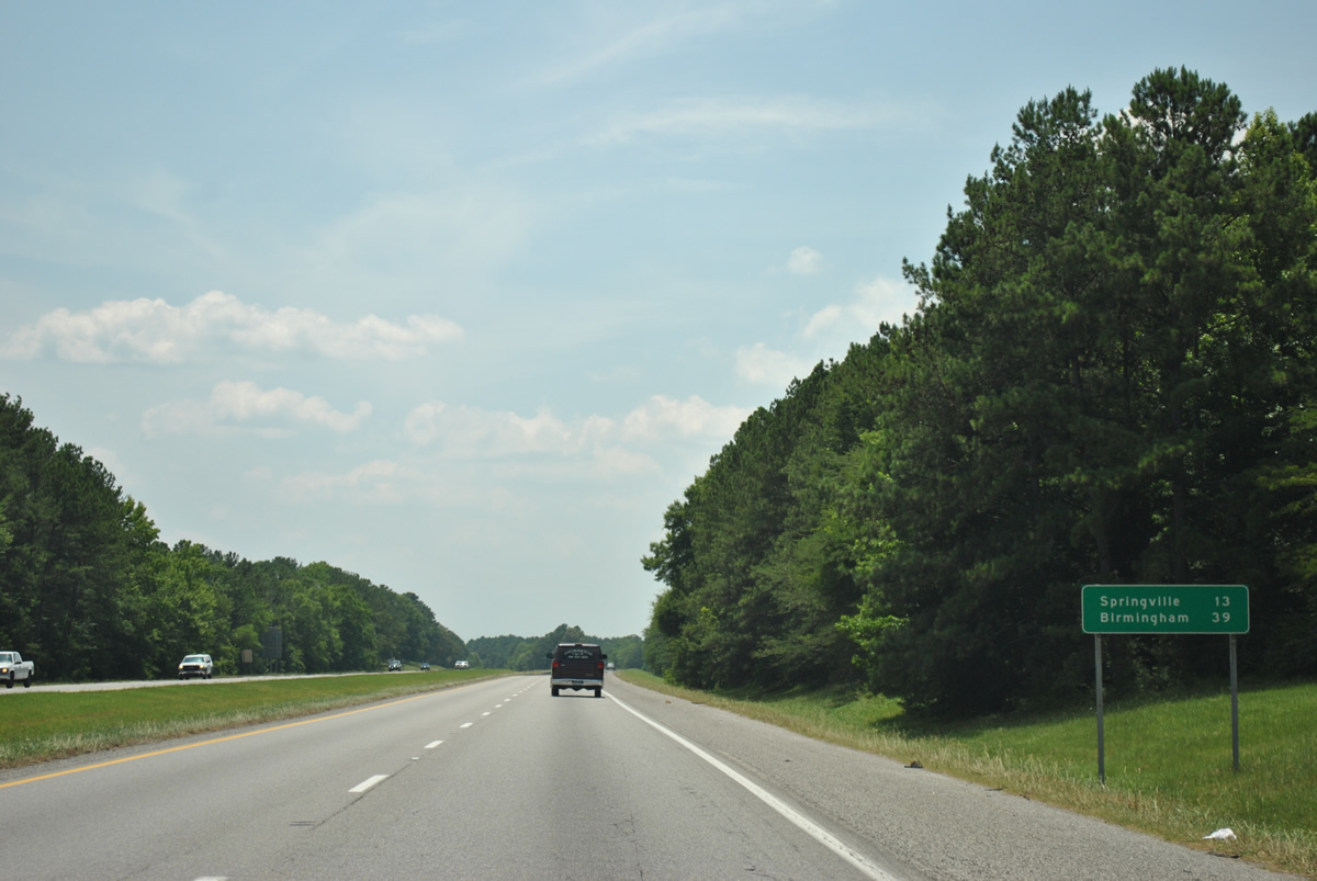
The city of Springville lies 13 miles to the west along Interstate 59 south. Birmingham is 39 miles out.
06/25/12
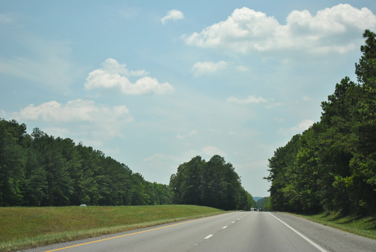
Seemingly uninterrupted stands of pine forest line both sides of Interstate 59 and a swath of median between County Roads 36 and 31.
06/25/12
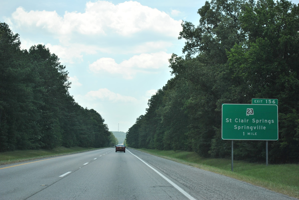
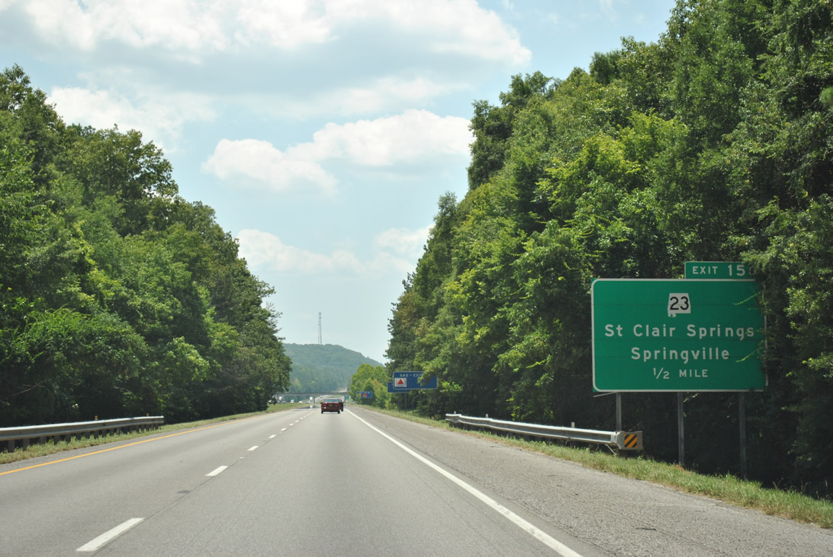
SR 23, a 12.61 mile route from Springville east to Ashville, meets Interstate 59 at Exit 156 in one mile.
06/25/12
Simmons Mountain comes into view along I-59 south ahead of the diamond interchange (Exit 156) with SR 23.
06/25/12
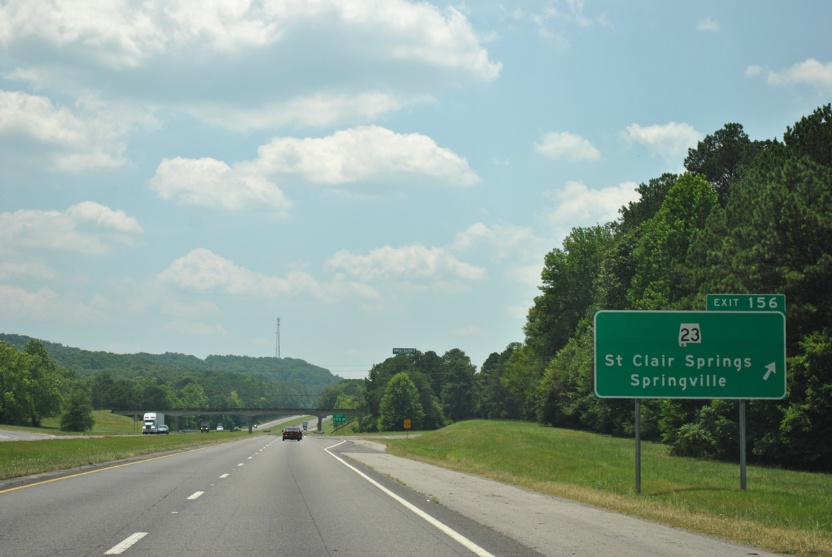
Exit 156 parts ways with Interstate 59 south for SR 23. SR 23 concludes 0.39 miles to the north at U.S. 11 (Main Street) in Springville. Eastward, the state route reaches St. Clair Springs in 1.82 miles and Cool Springs in 6.98 miles.
06/25/12
Interstate 59 traverses the north end of Jones Mountain and skirts by central Springville.
06/25/12
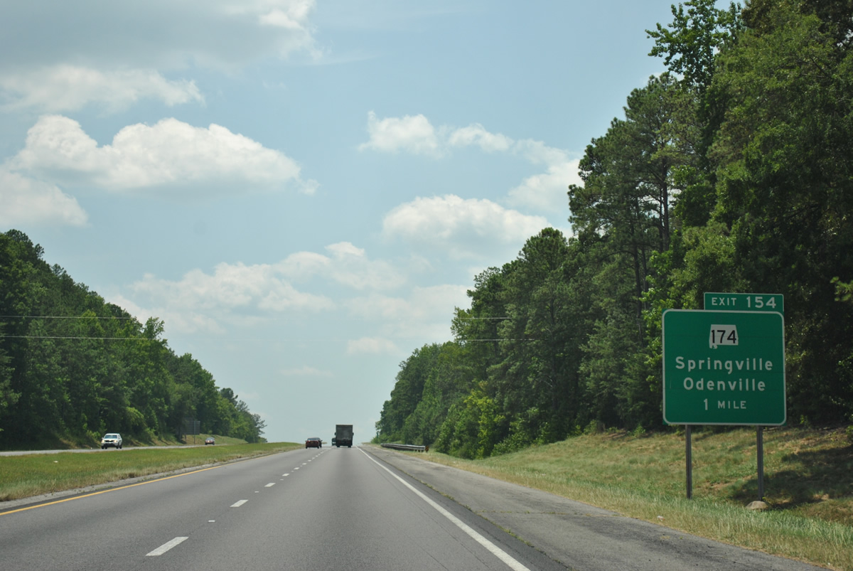
SR 174 (Marietta Road) meets the freeway at the next southbound exit in one mile.
06/25/12
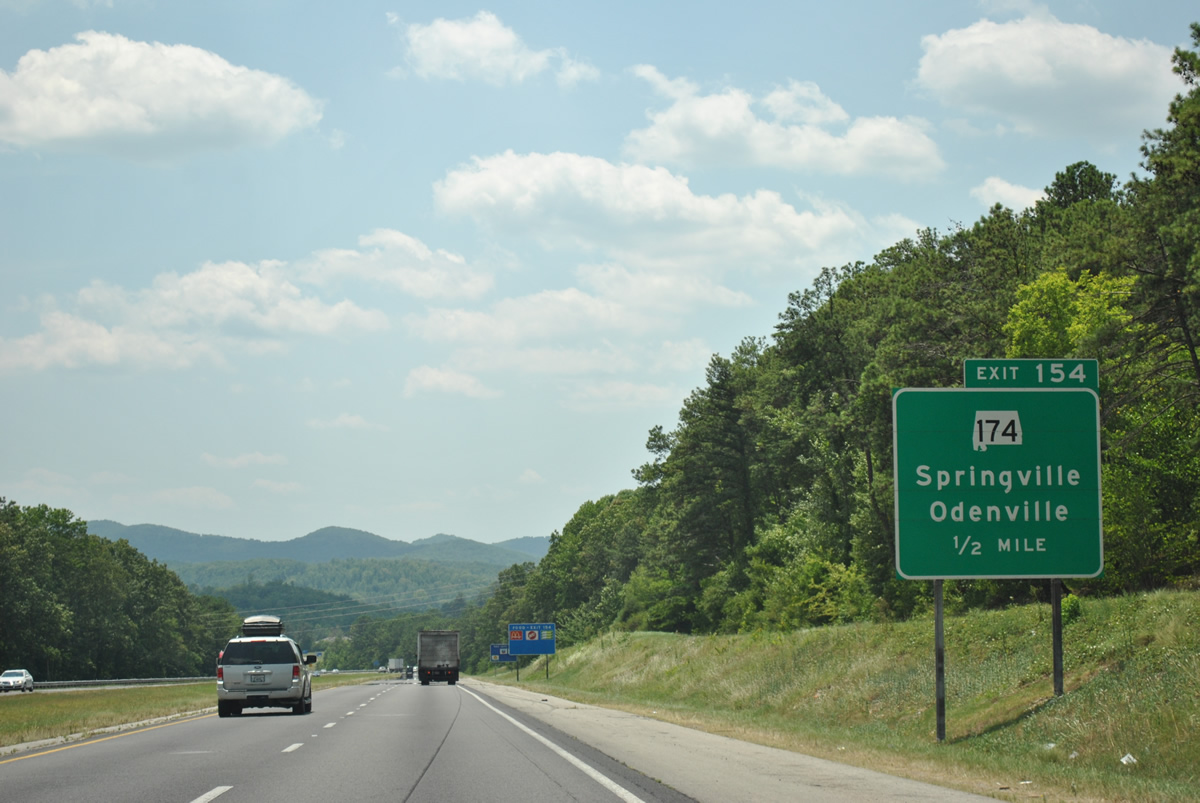
Cahaba and Red Mountains appear on I-59 south before the diamond interchange (Exit 154) with SR 174. SR 174 ties into U.S. 11 (Main Street) in Springville, 0.64 miles to the west.
06/25/12

Heading east from Exit 154, SR 174 encircles Simmons Mountain southward on a 7.81 mile course to U.S. 411 at Odenville. The state route shares a brief overlap with the US highway before turning east ten miles to end at U.S. 231 outside Pell City.
06/25/12
Turning more to the south, Interstate 59 curves around the periphery of Simmons Mountain before passing through a portion of the Springville city limits.
06/25/12
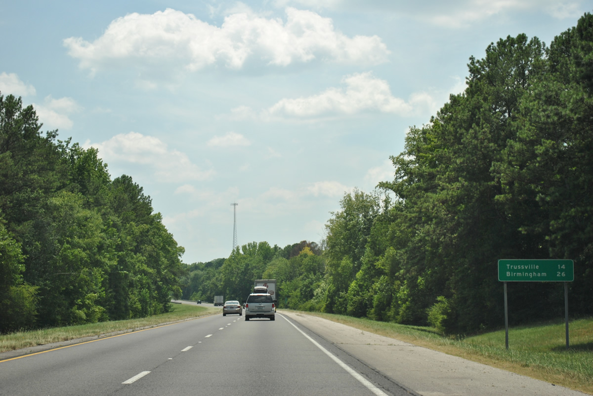
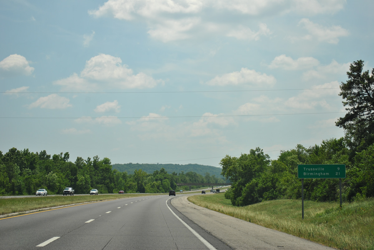
Trussville, a suburb of Birmingham, is 11 miles to the southwest. Downtown Birmingham is 12 miles further.
06/25/12
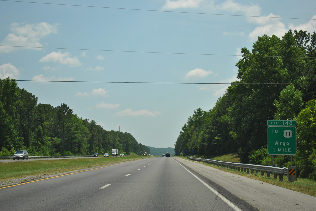
U.S. 11 and Interstate 59 swap sides through the town of Argo. Exit 149 connects the two via Liles Lane in one mile.
06/25/12
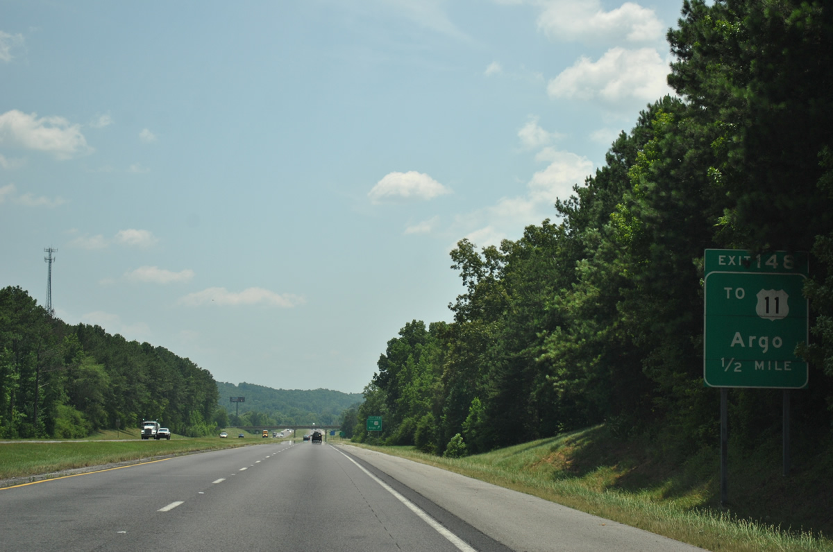
The diamond interchange at Exit 148 links Interstate 59 with Liles Lane in a half mile.
06/25/12
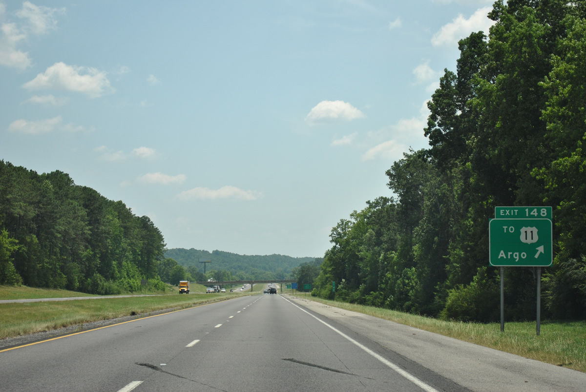
U.S. 11 (Gadsden Highway) remains east of Interstate 59 from Argo southward through the city of Trussville. Liles Lane spurs west from Exit 148 to Chinquapir Ridge and Advent Circle.
06/25/12
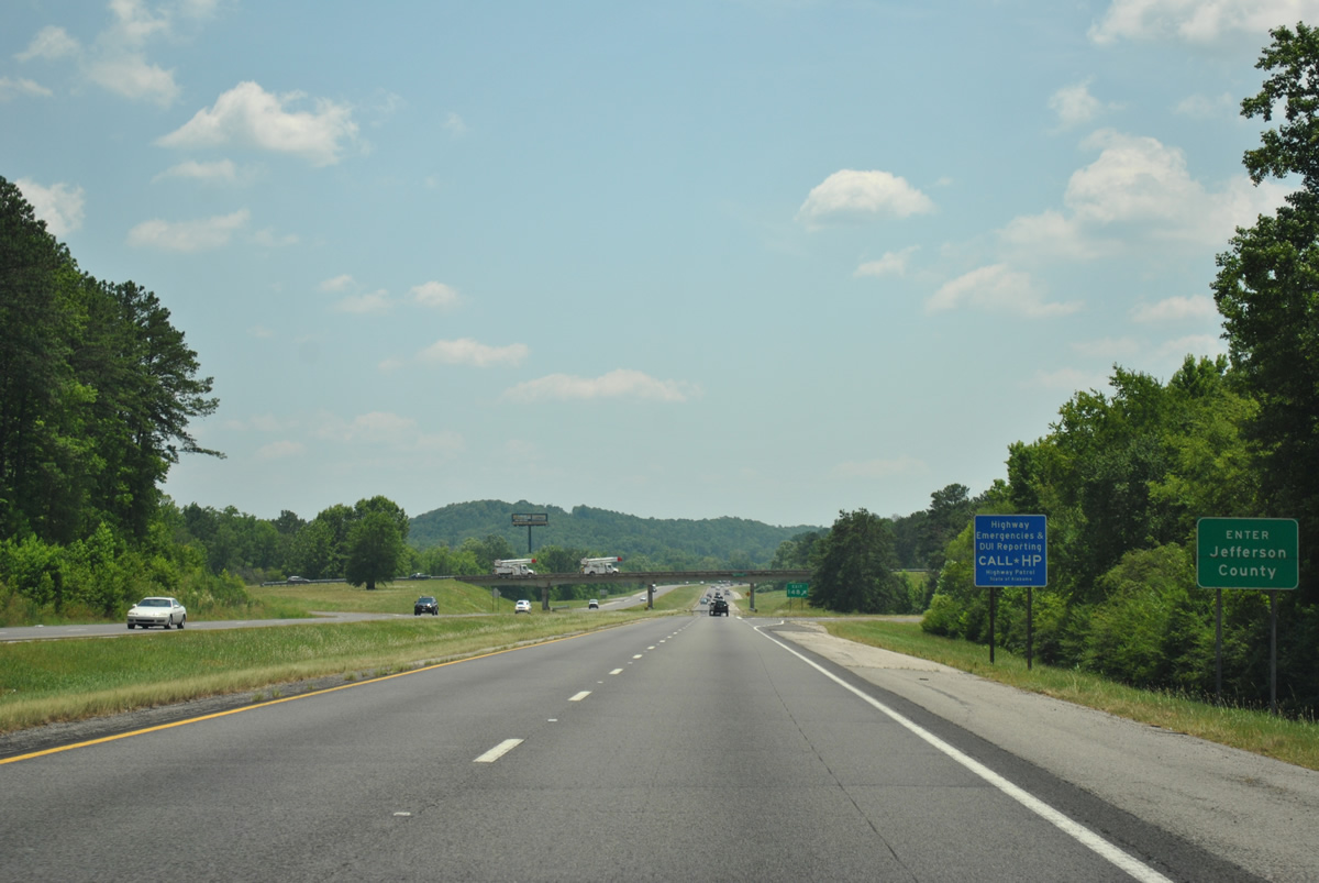
Interstate 59 crosses into Jefferson County just ahead of Exit 148 to Liles Lane.
06/25/12
Interstate 59 enters the city limits of Trussville ahead of Exit 145. Downtown is still nine miles away via I-59 south to Chalkville Road from Exit 141.
Beyond the first Advent Circle overpass is the proposed location of the east end of the Birmingham North Beltine (Interstate 422).
06/25/12
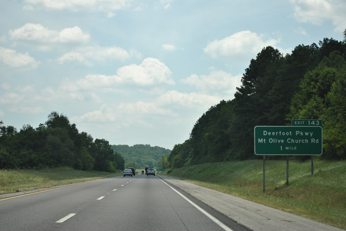
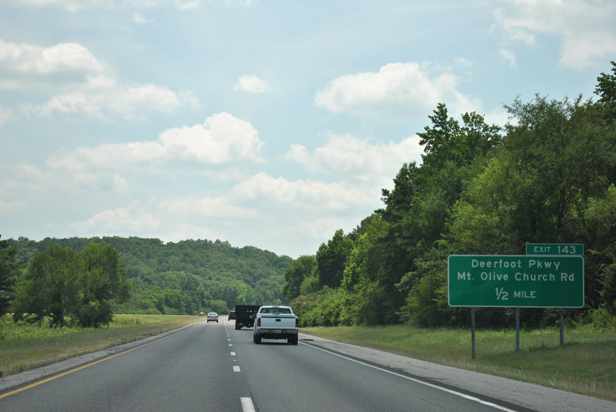
The first of two interchanges in Trussville joins Interstate 59 with Deerfoot Parkway at Mt. Olive Church Road. This exit opened to traffic in 1989.
06/25/12
Deerfoot Parkway crosses Red Mountain north of Interstate 59 to link Trussville with the city of Clay.
06/25/12
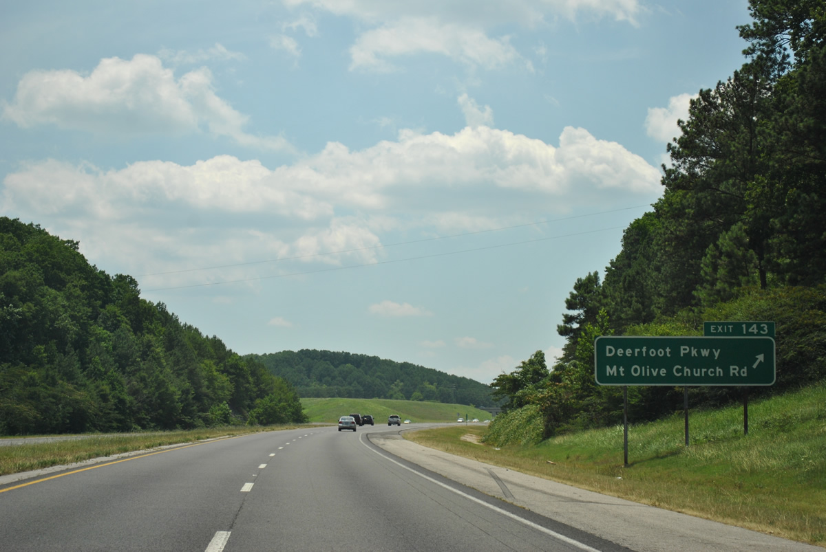
Entering the folded diamond interchange with Deerfoot Parkway on Interstate 59 south. Mt. Olive Church Road stems west from the end of the off-ramp at Exit 143 to a local church. Southward, Deerfoot Parkway meets Happy Hollow Road on the south side of the freeway en route to U.S. 11 (Gadsden Highway).
06/25/12
Vann Valley spreads out ahead of Interstate 59 south beyond the bridge across the Cahaba River. The headwaters of the river rise nearby on Red Mountain.
06/25/12

A short distance further is a diamond interchange (Exit 141) with Chalkville Road.
06/25/12
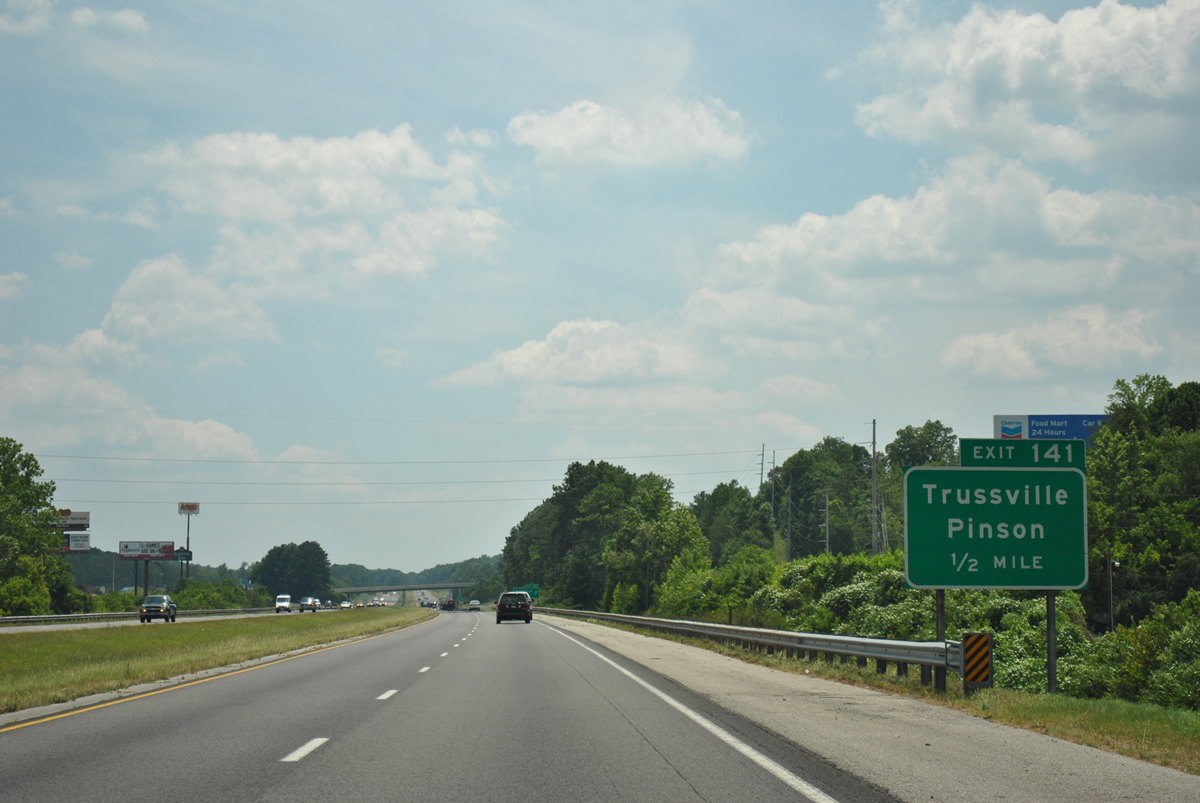
Chalkville Road comprises a busy commuter route as it joins Interstate 59 with central Trussville, eastern reaches of Center Point and the city of Pinson.
06/25/12
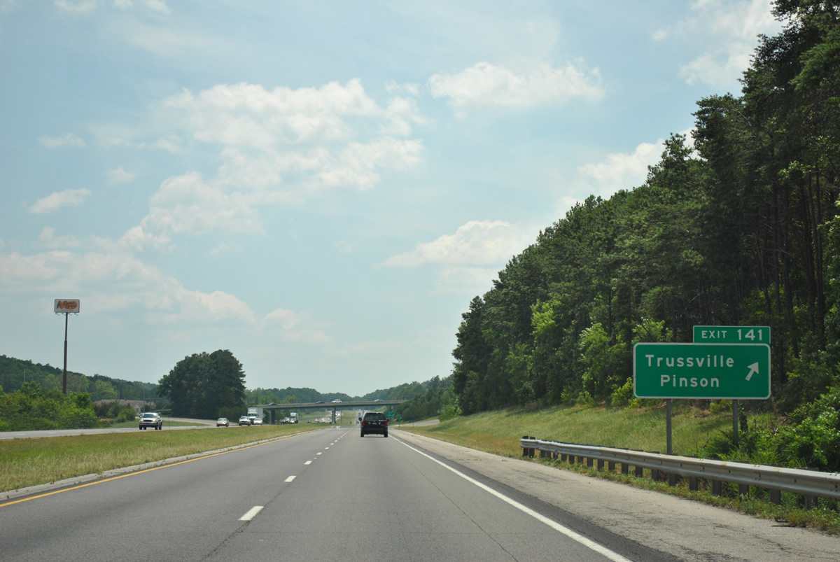
Exit 141 leaves Interstate 59 south for Chalkville Road. A number of travel amenities and retail shopping centers lie both west and east of the exchange.
06/25/12
Interstate 59 south enters a valley between Red and Little Sand Mountains and parallel Pinchgut Creek.
06/25/12
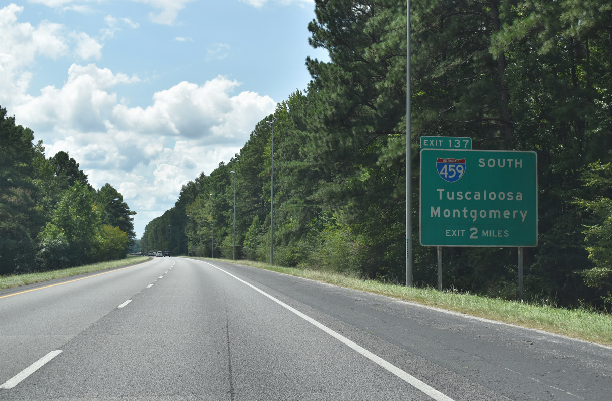
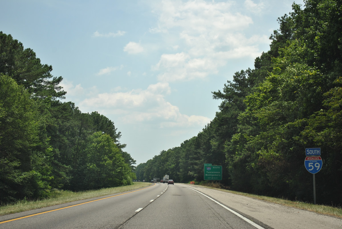
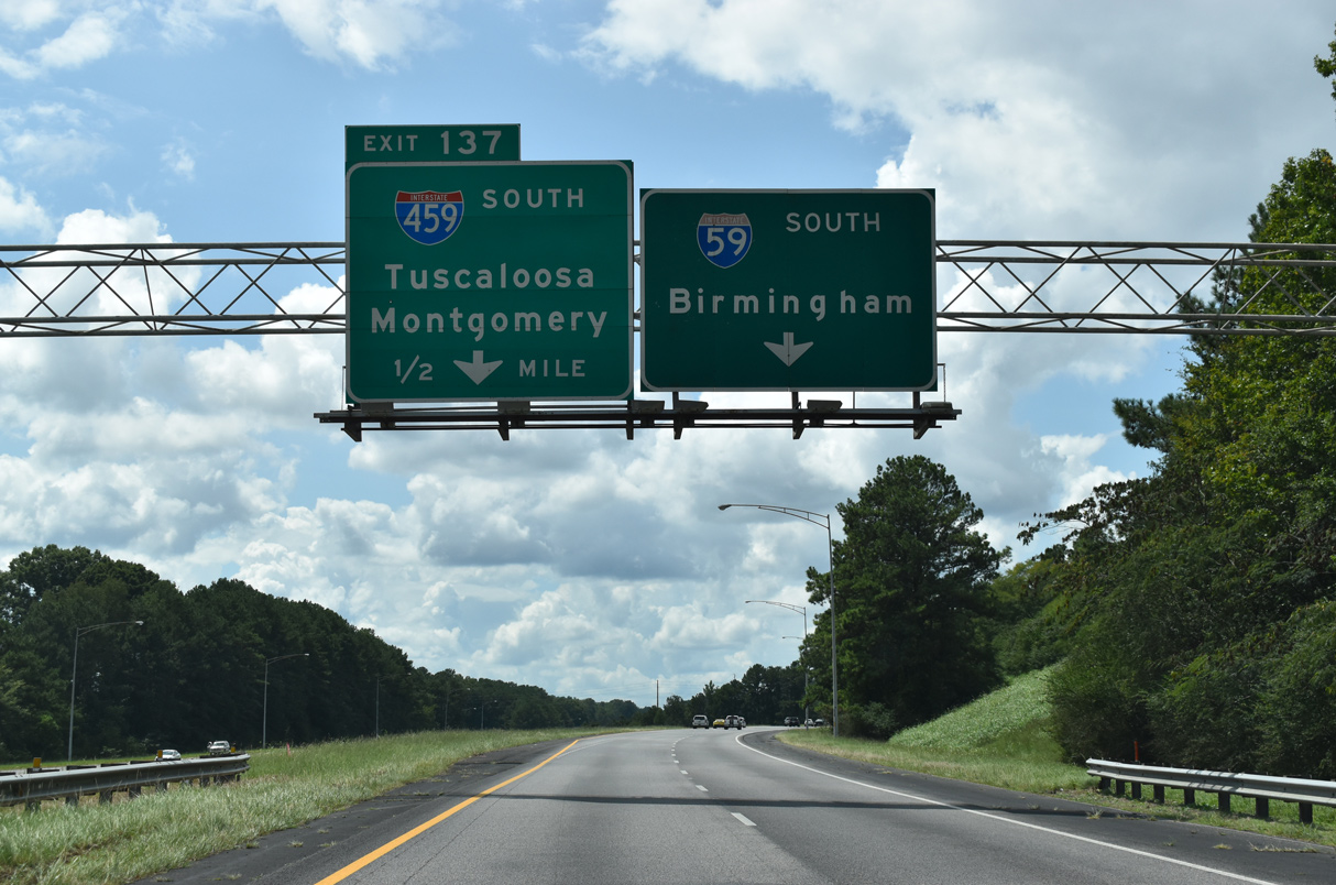
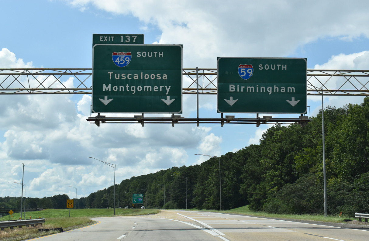
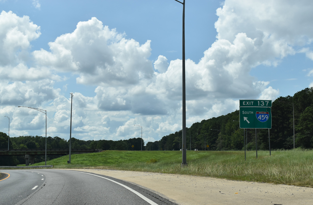
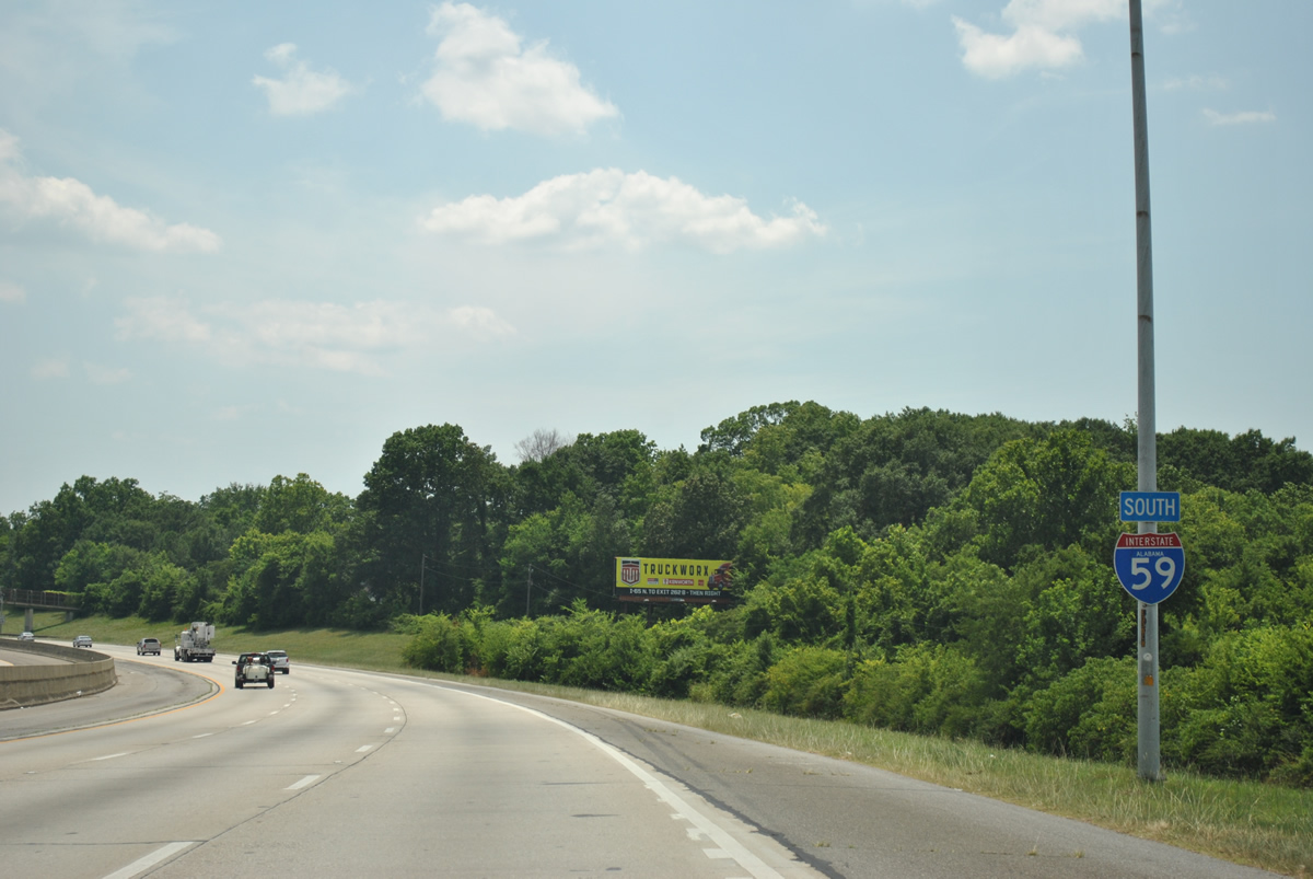
Interstate 459 branches south from I-59 in two miles at Left Exit 137.
09/11/20
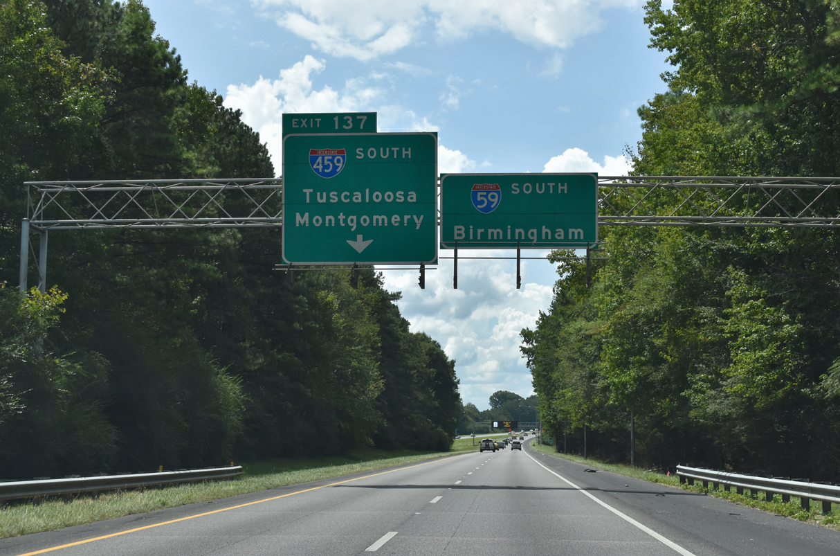
Forthcoming Left Exit 137 with Interstate 459 south is a three-wye interchange.
09/11/20
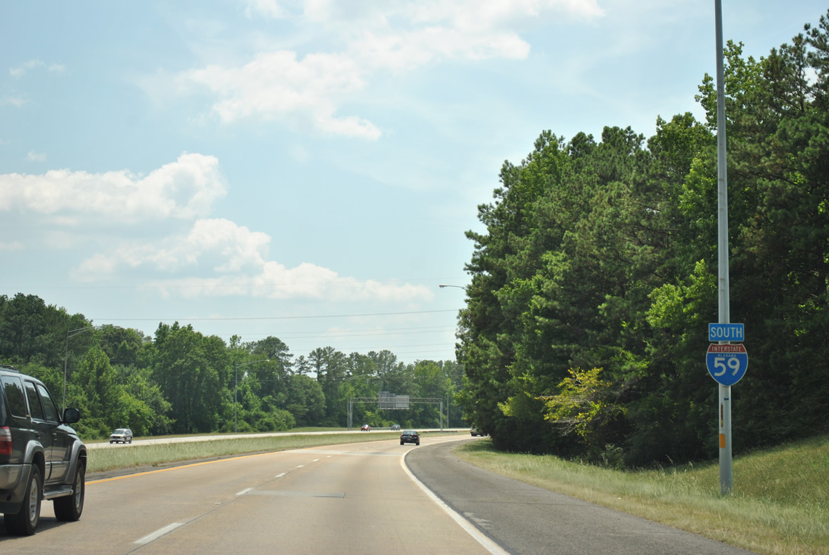
Interstate 459 connects southbound I-59 with I-20, between Irondale and Leeds, in four miles and I-65 at Hoover in 18 miles. Travel times for the Birmingham area began to appear on dynamic message boards by 2009.
09/11/20
Interstate 459 opened to traffic south between I-59 at Exit 137 and I-20 in 1978.
09/11/20
Bypassing Birmingham, I-459 doubles as a commuter route through suburban areas of Irondale, Mountain Brook, Vestavia Hills and Hoover.
09/11/20
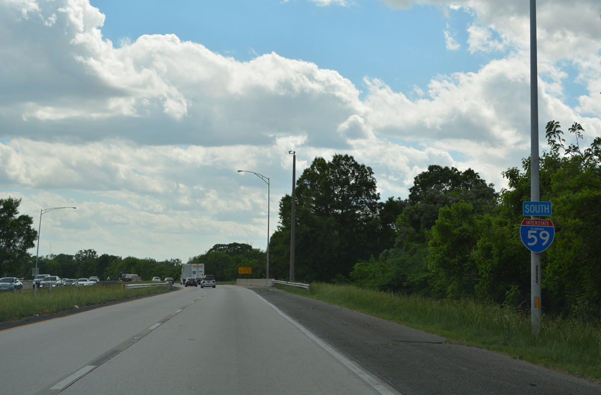
I-459 connects with U.S. 11 (Gadsden Highway) to the immediate south for Roebuck Plaza and Trussville. The bypass returns to I-59/20 at Bessemer.
09/11/20
South from I-459 and Trussville, Interstate 59 enters the city of Birmingham.
06/25/12
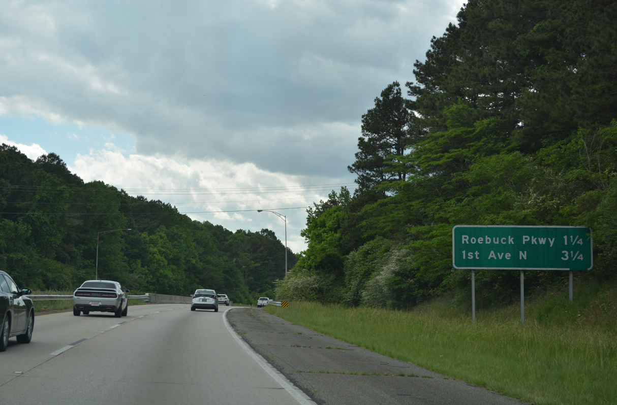
Roebuck Parkway (SR 75) meets I-59 at a diamond interchange (Exit 134) in 1.25 miles. Exit 134 serves the Huffman and Roebuck neighborhoods of Birmingham.
05/06/22
The speed limit reduces to 60 miles per hour along Interstate 59 south ahead of Exit 134 to SR 75 (Roebuck Parkway). SR 75 ends 0.07 miles south of the freeway ahead of Esplanade Drive.
05/06/22
U.S. 11 shifts to the north side of I-59 from Roebuck Plaza to East Lake. Roebuck Parkway intersects U.S. 11 north ahead of the SR 75 transition onto Parkway East.
05/06/22
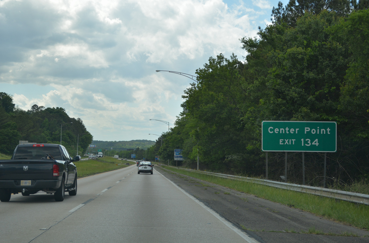
SR 75 along Parkway East comprises a commercial arterial northward through Jones Valley to Center Point.
05/06/22
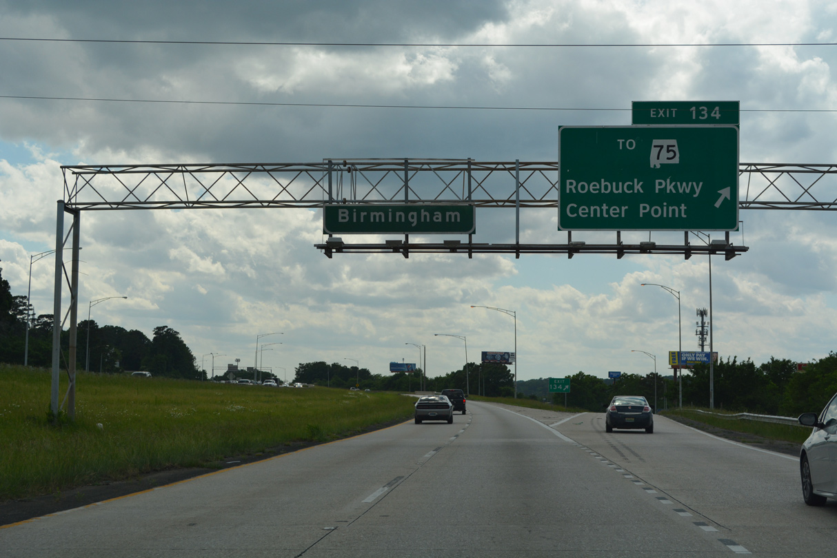
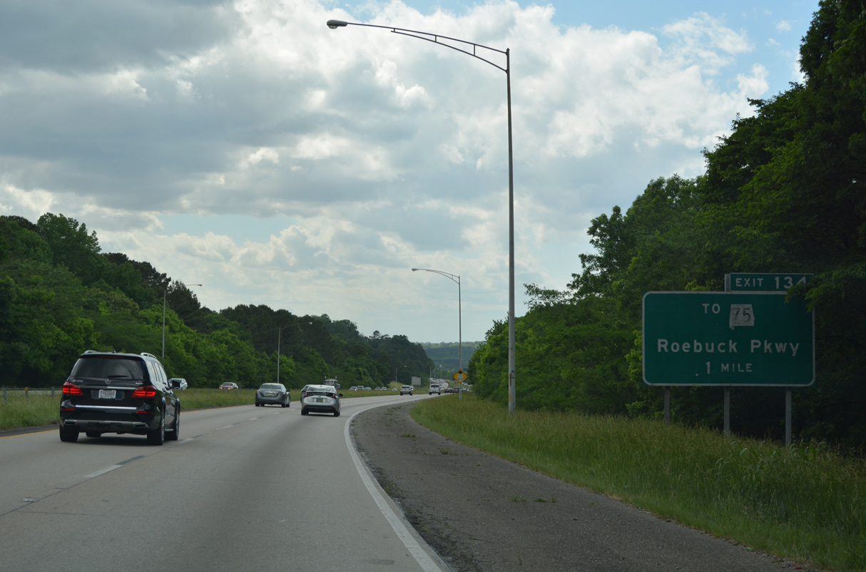
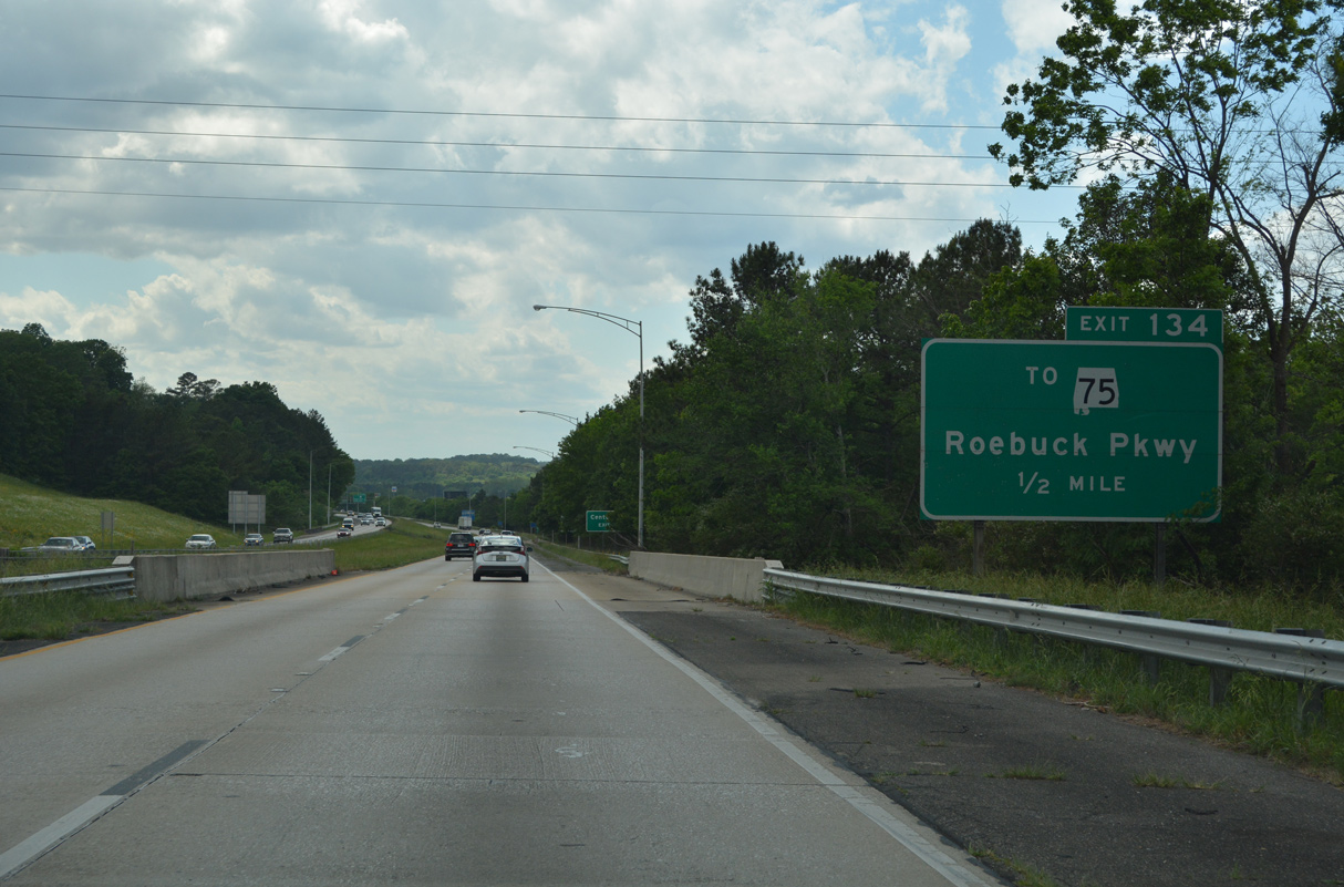
Exit 134 leaves Interstate 59 south for Roebuck Parkway (SR 75). 113.22 miles in length, SR 75 runs north from Birmingham to Pinson, Oneonta, Albertville and the Georgia state line in Dekalb County.
05/06/22
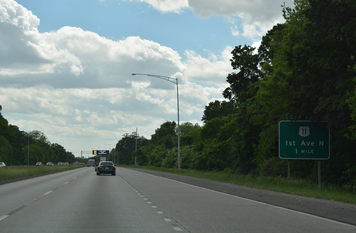
U.S. 11 (1st Avenue N) meets I-59 again at a half diamond interchange (Exit 132) between the East Lake neighborhood and Wahouma.
05/06/22
Preceding the Red Oak Road under crossing, this confirming marker appears beyond the half diamond interchange (Exit 133) joining 4th Avenue S with Interstate 59 southbound.
05/06/22
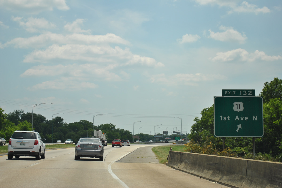
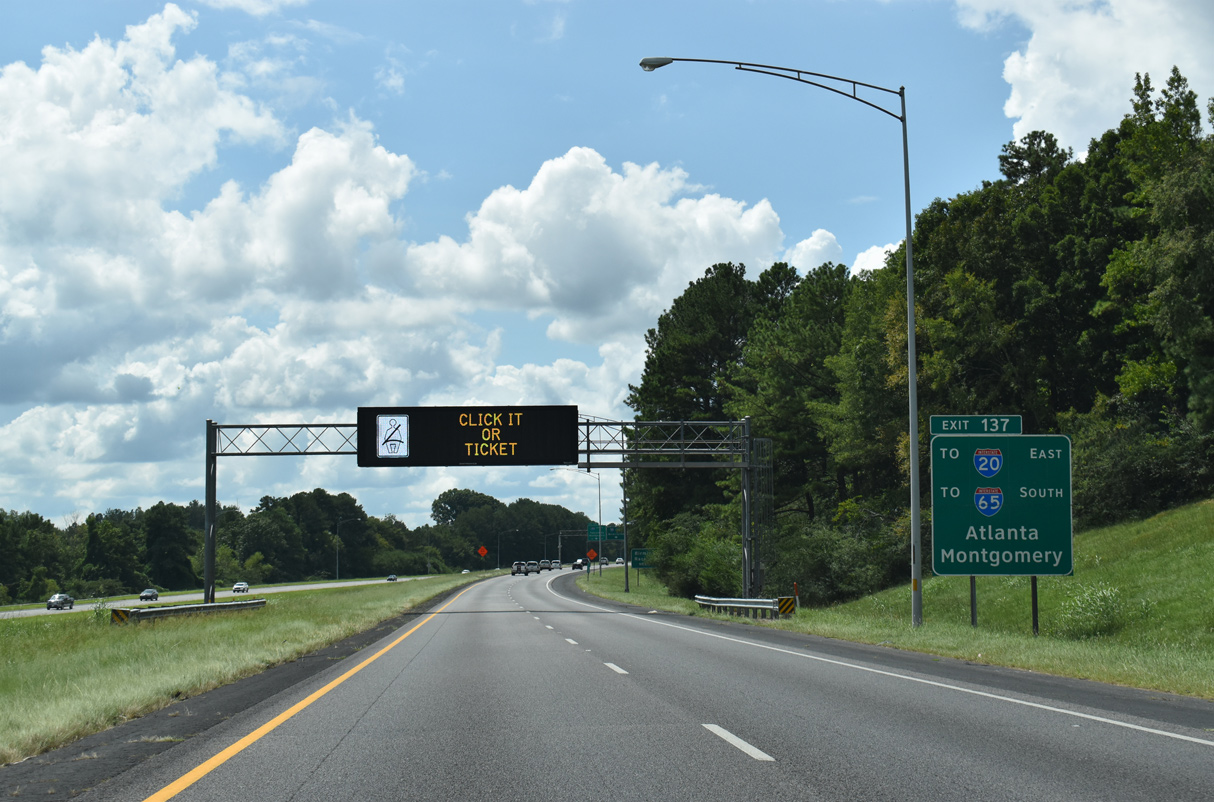
U.S. 11 (1st Avenue N) continues south from Exit 132 to I-20 at Exit 130 B. I-20/59 and U.S. 11 come together to the southwest at Exit 108 in Bessemer.
06/25/12
A wye interchange connects U.S. 11 (1st Avenue N) southbound with I-59 south two miles ahead of the trumpet interchange (Exit 130) with Interstate 20 east.
06/25/12
Interstate 59 expands to six overall lanes beyond the half diamond interchange (Exit 131 from I-59 north) with Oporto-Madrid Boulevard.
06/25/12
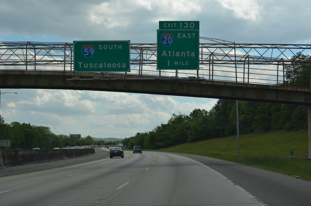
Exit 130 departs in one mile for Interstate 20 east to Leeds and Moody.
05/06/22
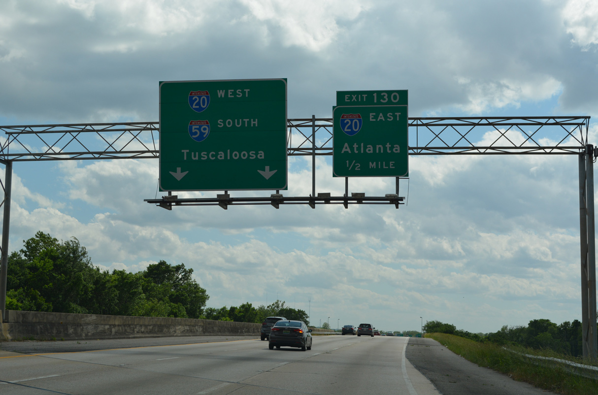
I-59 converges with I-20 a half mile beyond 66th and 65th Streets N. Interstate 20 heads west to Birmingham from Oxford and Anniston to the east. The 1,539 mile route crosses the Deep South region to Atlanta and Augusta, Georgia and Columbia and Florence, South Carolina.
05/06/22
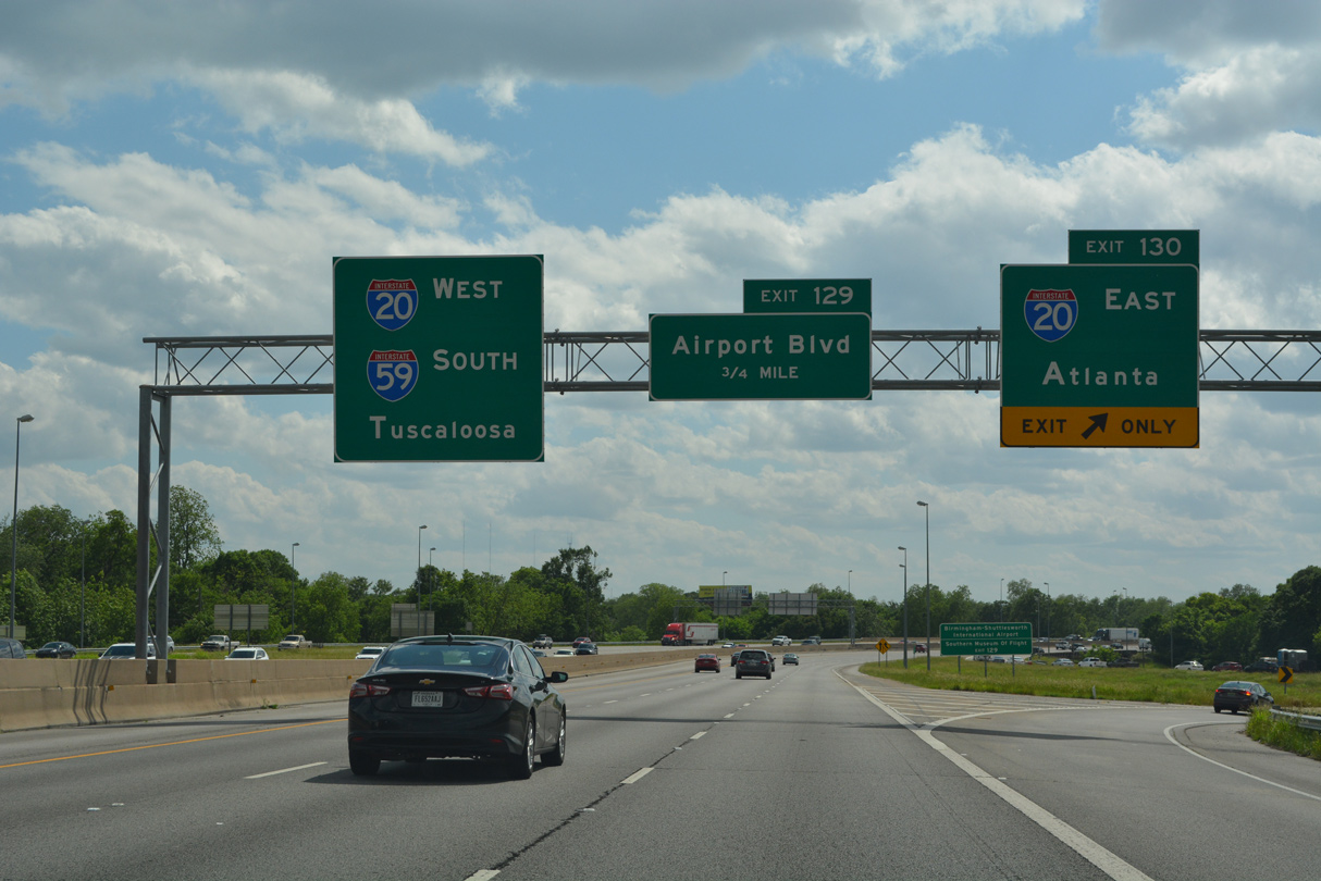
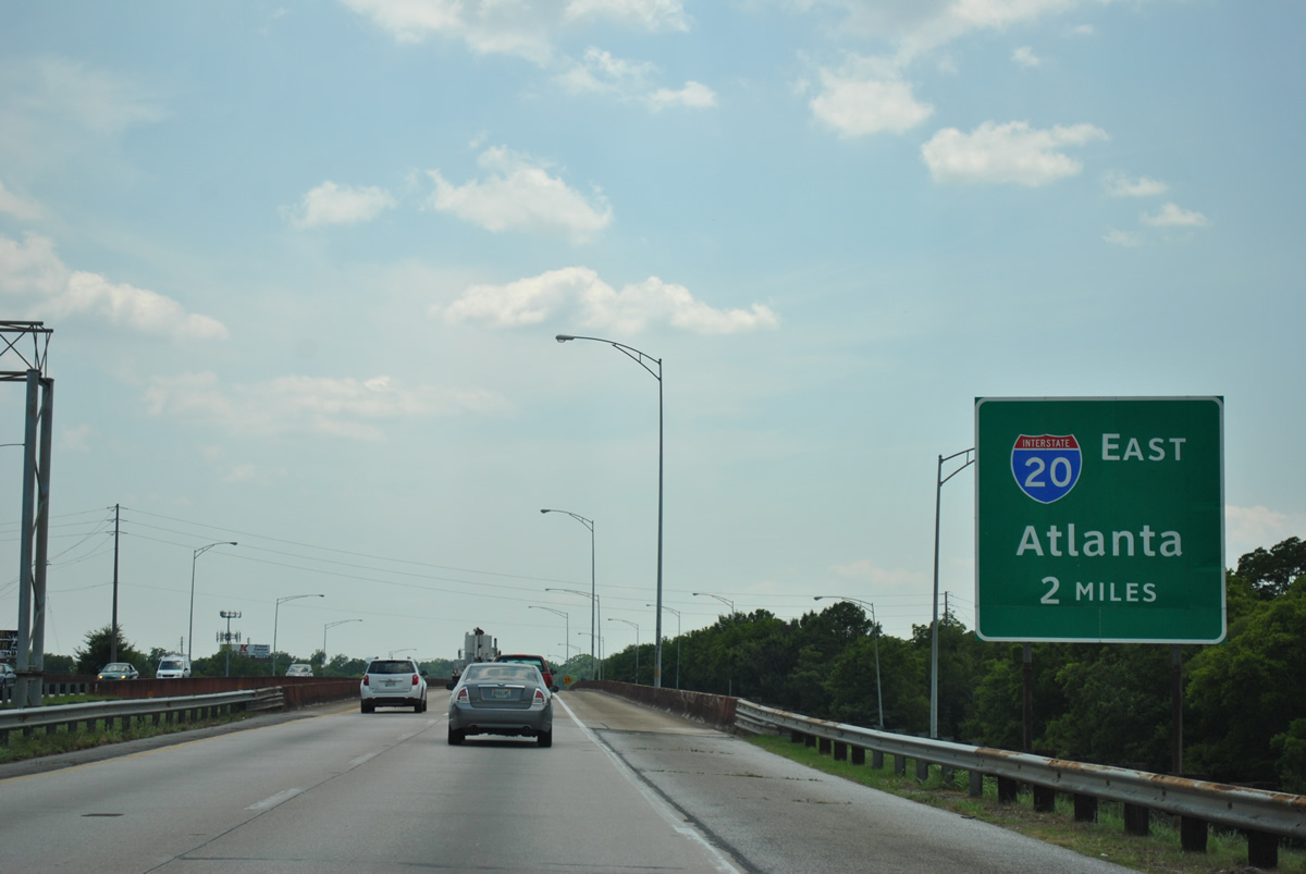
Exit 130 constitutes a sharp loop ramp onto Interstate 20 east ahead of Red Mountain and Irondale. I-20 travels 148 miles from I-59 to Atlanta.
05/06/22
The gore point sign at Exit 130 includes an I-20 shield, which is typical ALDOT practice for freeway to freeway junctions.
06/25/12

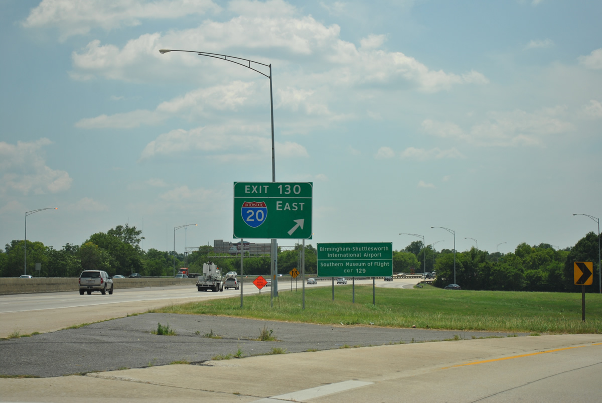
The succeeding exit on I-59/20 leads to Birmingham-Shuttlesworth International Airport (BHM).
05/06/22
Photo Credits:
- ABRoads: 06/25/12, 09/11/20, 05/06/22
Connect with:
Page Updated Tuesday December 19, 2023.