
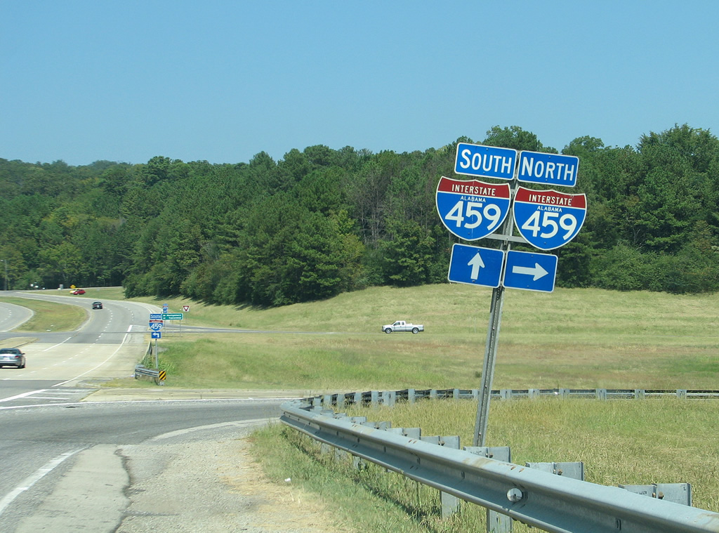
Interstate 459
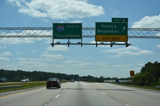
Interstate 459 branches east from I-20/59 at McCalla and Jones Valley to cross Red Mountain at Owens Gap. Advancing east with four lanes, I-459 travels across Shades Valley to southern reaches of Bessemer. The freeway widens to six lanes from Exit 6 / CR 52 into suburban areas of Hoover, where it turns northeast over Shades and Pine Mountains.
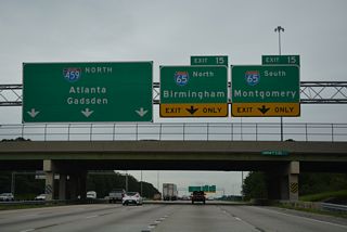
Continuing northeast through Hoover, I-459 converges with U.S. 31 (Montgomery Highway) along a heavily developed commercial corridor anchored by Riverchase Galleria mall. A four-level interchange follows with Interstate 65 north to Birmingham and south to the Shelby County suburbs. The freeway gradually turns northward over the ensuing stretch through suburban areas of Vestavia Hills. A busy interchange, where some improvements were made by 2004, joins the belt line with U.S. 280 in east Birmingham.
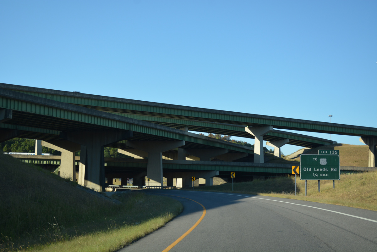
Paralleling the Cahaha River, Interstate 459 reenters Vestavia Hills ahead of Mountain Brook, Flat Ridge and Irondale. A four-level interchange connects the bypass with I-20 before it arcs back to the west with six lanes to Exit 32 / U.S. 11. The final link with I-59 by Red Mountain and Trussville is four lanes wide.
The southern beltway around Birmingham, Interstate 459 varies between four and six lanes with a 65 to 70 mph speed limit. It is the preferred route for I-20 and I-59 through traffic in the area. The loop is 33.64 miles in length between I-59 at Trussville and I-59/20 at Bessemer.
Interstate 459 Alabama Guides
North - Bessemer to Hoover - 32 photos
North - Vestavia Hills to Birmingham - 43 photos
South - Irondale to Vestavia Hills - 45 photos
South - Hoover to Bessemer - 29 photos
Initial construction of the Birmingham bypass commenced in 1968.2 Interstate 459 first opened between I-20 and I-59 northeast of Birmingham, which occurred by 1978. The final stretch of I-459 to open was the 5.2 mile long segment from south of Bessemer to Alabama State Route 150 at a cost of $28.7 million.1 The freeway was completed by the end of 1984.3
Road work along Interstate 459 involved the expansion and redesign of the congested interchange (Exit 19) with U.S. 280 near Mountain Brook. A three-phase project was planned to address problems with the busy junction. Phase I widened the U.S. 280 overpasses over I-459 and eliminated a four-lane bottleneck at the east entrance to the Summit Shopping Center. Next completed was the realignment and extension of the right turn lane from I-459 north to U.S. 280 eastbound. The bridge above Colonnade Parkway was also expanded to accommodate two lanes for each direction of U.S. 280.
Phase II of the project, scheduled to start in Summer 2004 but never completed, was to include construction of new flyover ramps from U.S. 280 west onto I-459 south and north. This would have eliminated the U.S. 280 ramp to Blue Lake Drive, with a relocation of Blue Lake Drive to Grandview Parkway. $24 million was previously earmarked for this phase of the roadwork. Proposed Phase III focused on the construction of a half mile long flyover ramp from Interstate 459 north to U.S. 280 west.1
Interstate 459 passes under the I-65 mainline at their systems interchange near Patton Chapel. - 11/03/2011
A second four level interchange along Interstate 459 joins the belt line with I-20 at Irondale. - 10/08/2016
Northern Beltine (Interstate 422)
The Birmingham Northern Beltine Interstate 422 is a proposed 52 mile long loop encircling northern reaches of the Birmingham metropolitan area. The projected route takes I-422 northeast from the south end of I-459 to I-22 between Exits 87 and 89 and to I-65 north of Exit 272. Continuing east across Gardendale and Pinson, the alignment for I-422 ties into Interstate 59 south of Exit 148. Work on the initial 3.4 mile segment of the North Beltline, between SR 79 and SR 75, was delayed due to environmental concerns.4 Construction finally got started on February 24, 2014 involving a $46 million project to build 1.34 miles of roadway.5 Construction however only completed grading for the short section.
 scenes
Shields posted at the Jefferson County Road 18 on-ramp to I-459 northbound. The formerly rural exchange changed dramatically with area residential and commercial development including the bustling Colonial Promenade Tannehill center.
08/10/02
An older shield that was posted at the 1982 date stamped overpass for CR 18 over Interstate 459. A residential area of 20 or so homes just north of this exchange was replaced with the Colonial Promenade Tannehill. The retail center was mostly completed by 2010.
08/10/02
Looking east from the Jefferson County Road 18 (Eastern Valley Road) overpass at Interstate 459. Much has changed since this photo was taken with development abutting the north side right of way.
08/10/02
Interstate 459 shield and guide sign formerly posted at the southbound entrance ramp from Eastern Valley Road. Traffic lights were eventually added here, coinciding with a major increase in traffic from adjacent Promenade Parkway and residential subdivisions.
08/10/02
SR 150 (John Hawkins Parkway) meets Interstate 459 at a diamond interchange between two retail areas in southwest Hoover. Pictured here is the northbound on-ramp. Montgomery is a control point for the connection with I-65 south in five miles.
06/25/12
Grants Mill Road northbound at the diamond interchange (Exit 27) with Interstate 459. Grants Mill Road provides an alternate route for U.S. 280 and the Shelby County suburbs between I-459 and SR 119 (Cahaba Valley Road).
08/30/11
References:
- "Nashville firm low bidder." Gadsden Times (AL), January 24, 1981.
- "Section of I-459 may be open soon." The Tuscaloosa News (AL), November 28, 1984.
- "Alabama Department of Transportation to delay construction of Northern Beltline for in-depth study of route." The Birmingham News, November 15, 2011.
- "Northern Beltline construction scheduled to begin Monday." The Birmingham News (AL), February 19, 2014.
Photo Credits:
- AARoads: 08/10/02
- ABRoads: 06/25/12
- Carter Buchanan: 08/30/11
Connect with:
Page Updated Sunday December 17, 2023.