
I-64-U.S. 40 East / U.S. 61 South - St. Louis County


 East
East  South
South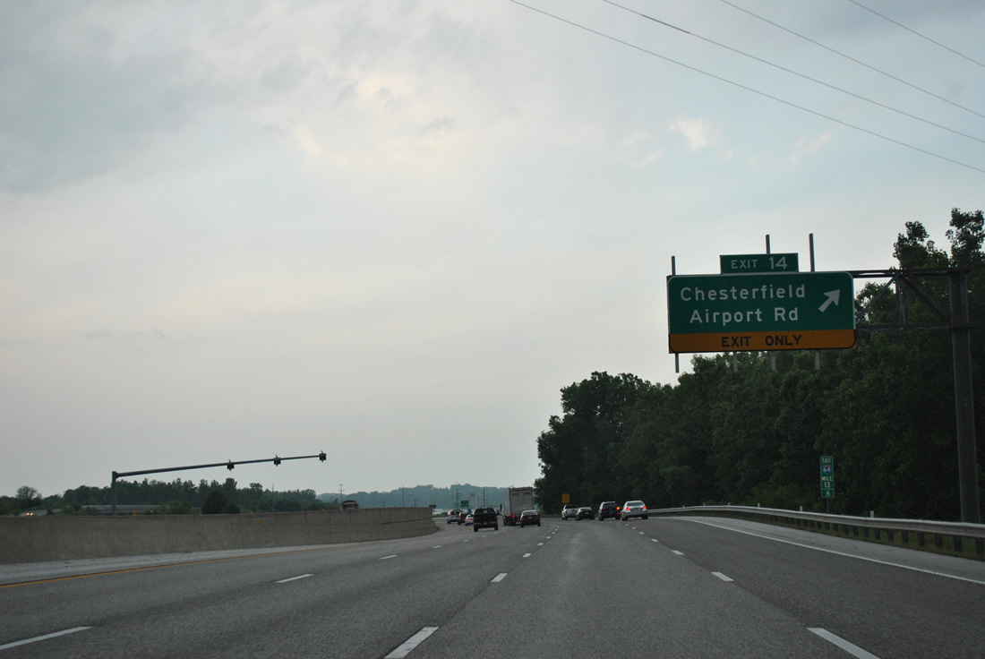
Chesterfield Airport Road shifts south and east from Exit 14 to Spirit of St. Louis Airport (SUS) to follow the original alignment of U.S. 40/61 (Olive Street Road) to Gumbo and a sprawling retail corridor north of Bonhomme Creek.
05/04/12
Shields for I-64/U.S. 40-61 follow Exit 14 to Chesterfield Airport Road east. A frontage road (N Outer 40 Road) accompanies the north side of the freeway by the Chesterfield Athletic Complex.
05/04/12

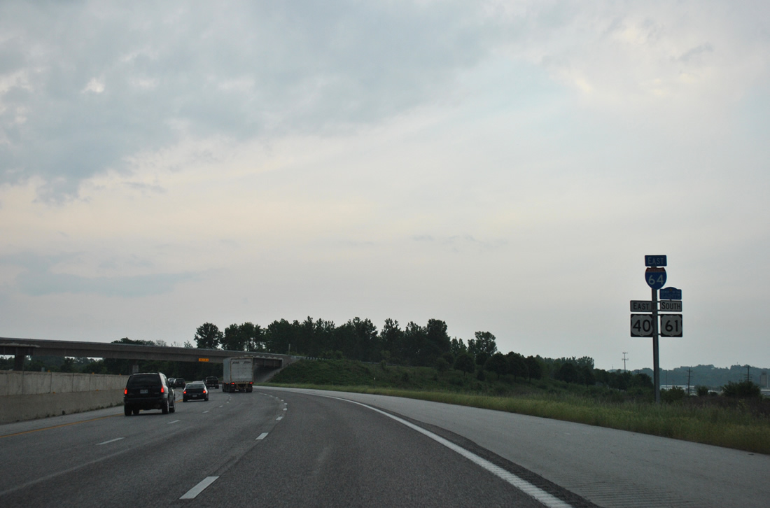
Boone's Crossing is the next eastbound off-ramp in two miles. Chesterfield Parkway and Missouri 340 round out the Chesterfield city exits in 4.5 miles.
05/04/12
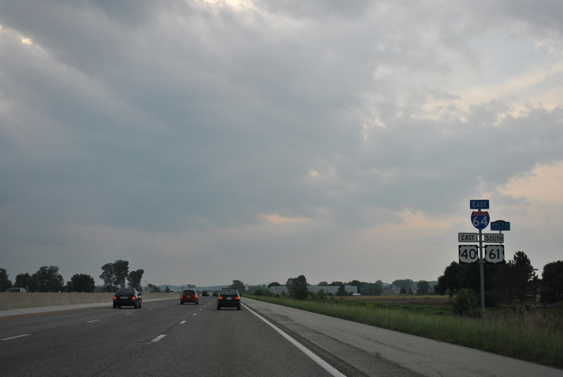
A wye interchange (Exit 16 of I-64 west) adds traffic from Long Road north onto I-64-U.S. 40/61 east ahead of this shield assembly.
05/04/12
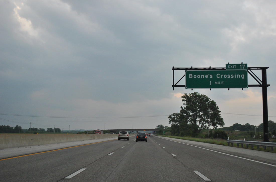
One mile out from the diamond interchange (Exit 17) with Boone's Crossing on I-64 east.
05/04/12

Boone's Crossing comprises a north-south access road between North Outer 40 Road and Chesterfield Airport Road at the entrance to Chesterfield Commons shopping center.
05/04/12
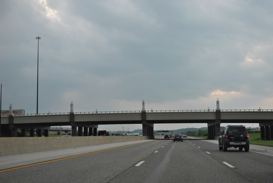
A decorative overpass accommodates seven lanes of traffic along Boone's Crossing above I-64/U.S. 40-61.
05/04/12
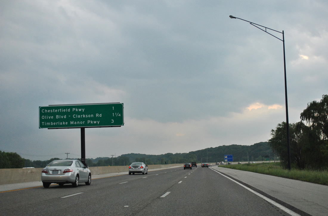
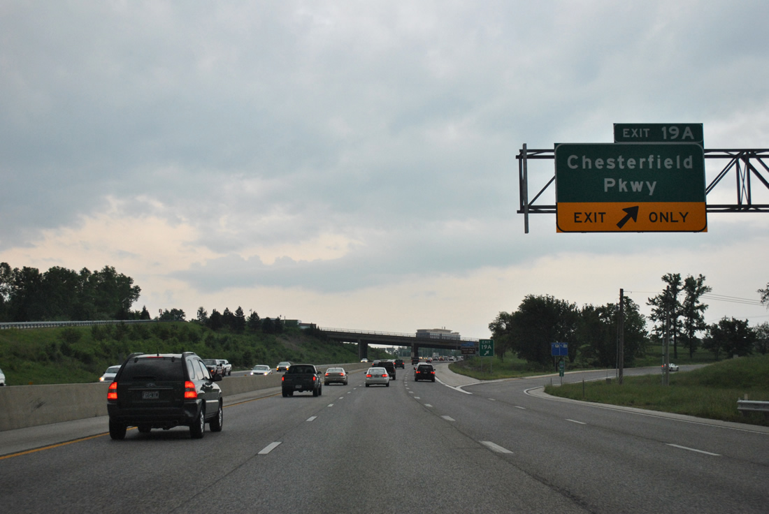
A split diamond interchange (Exit 19A) joins I-64/U.S. 40-61 with Chesterfield Parkway in one mile. Missouri 340 (Olive Boulevard north / Clarkson Road south) follows at another split-diamond (Exit 19B).
05/04/12
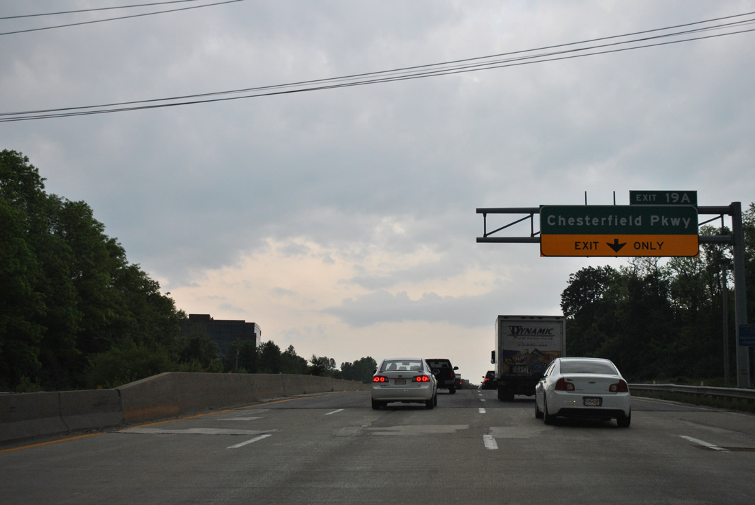
Crossing Bonhomme Creek, I-64-U.S. 40/61 east near the Chesterfield Parkway off-ramp (Exit 19A). Chesterfield Parkway entails a full loop both west and east of MO 340, encircling Chesterifld Mall by the Bellefontaine community.
05/04/12
Exit 19A peels away from Interstate 64 east for adjacent Wild Horse Creek Road ahead of its intersection with Chesterfield Parkway. Highway CC follows Wild Horse Creek Road west from Baxter Road 5.38 miles to Missouri 109 in Wildwood.
05/04/12
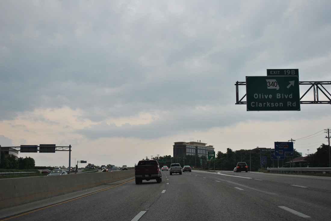
Exit 19B follows as a slip ramp onto parallel Wild Horse Creek Road ahead of both Chesterfield Mall and Missouri 340 (Olive Boulevard / Clarkson Road).
05/04/12
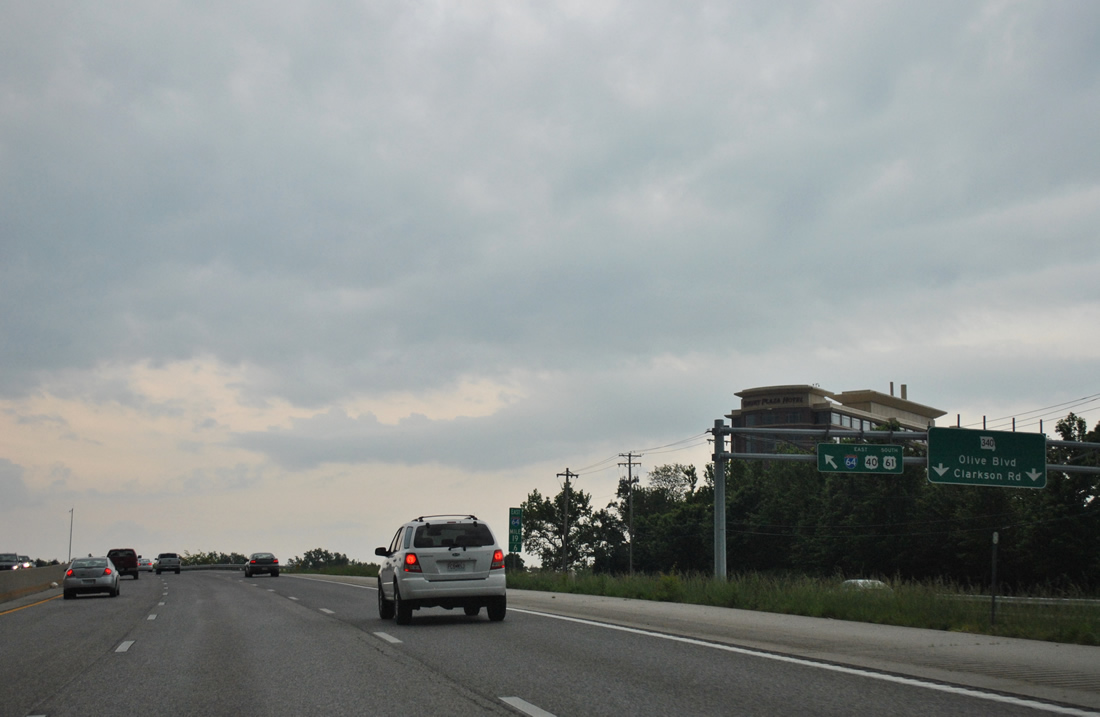
A second slip ramp provides return access to I-64-U.S. 40/61 east from Chesterfield Parkway. The frontage road continues otherwise to Missouri 340. MO 340 travels 19.28 miles from Missouri 100 in Ellisville to Ferguson Avenue in University City.
05/04/12
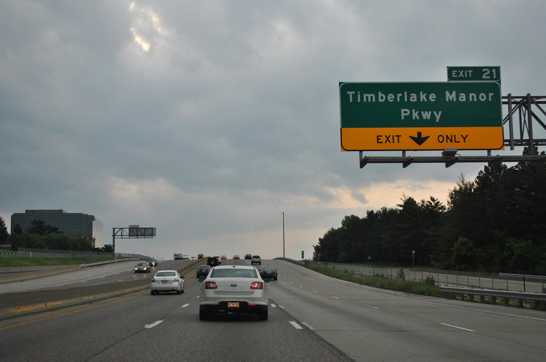
A half diamond interchange adds a fourth eastbound lane from Chesterfield Parkway East to the split diamond interchange (Exit 21) with Timberlake Manor Parkway.
05/04/12
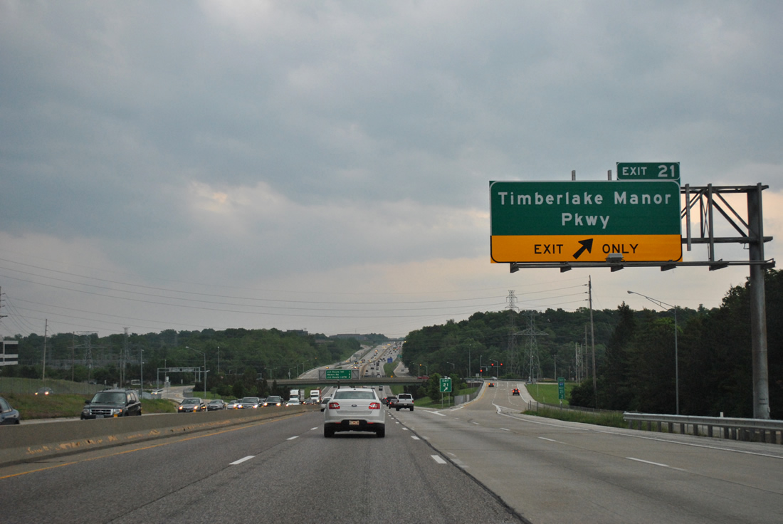
Timberlake Manor Parkway ends to the north of Exit 21 at Timerlake Corporate Center and southward as the main drive into the Thousand Oaks sudivisions.
05/04/12
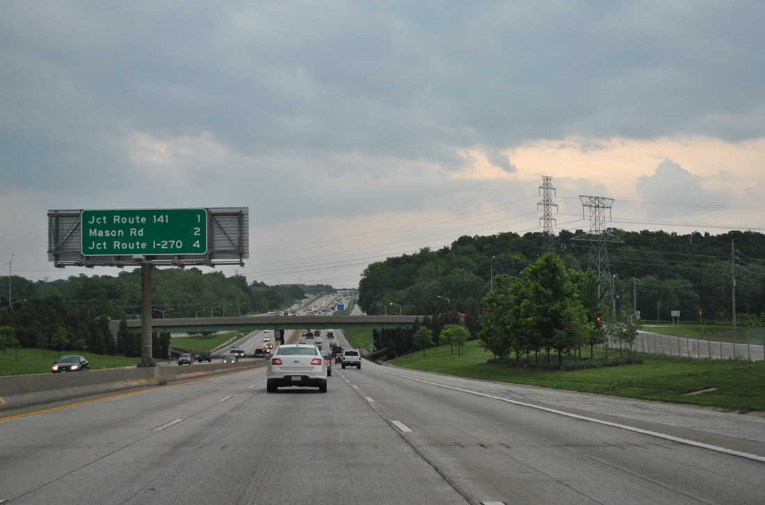
Interstate 270 appears for the first time to eastbound drivers at four miles out.
05/04/12
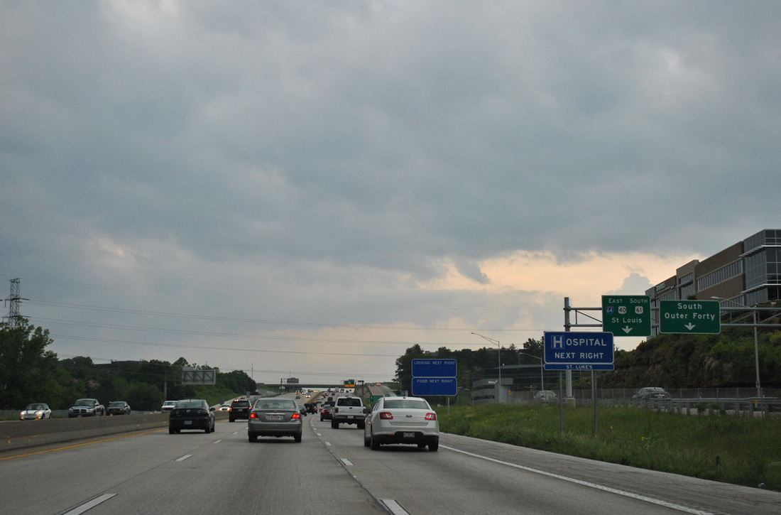
North and South Outer Forty Roads provide access between the freeway and Timberlake Manor Parkway.
05/04/12
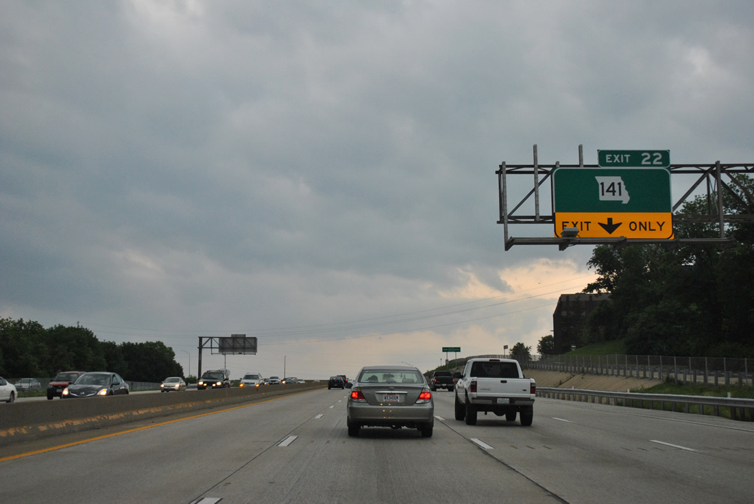
Missouri 141, a 30.90 mile route between U.S. 61/67 at Arnold and Missouri 370 at Bridgeton, crosses paths with I-64/U.S. 40-61 at a parclo interchange (Exit 22) in less than a mile.
05/04/12
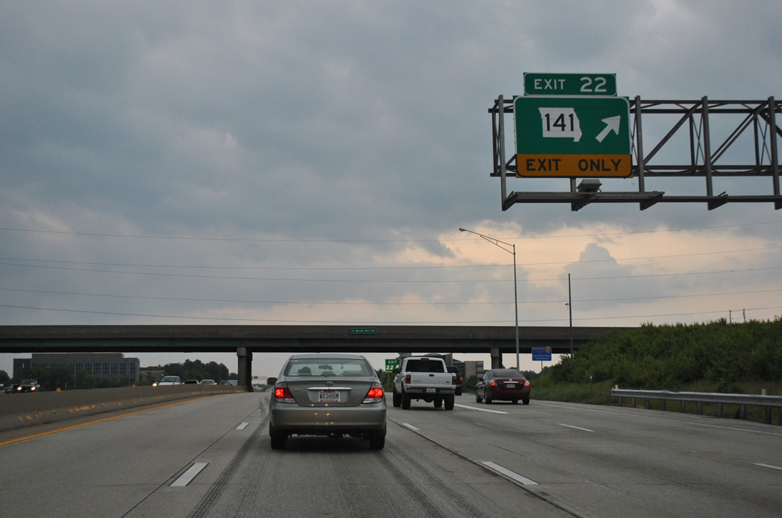
Missouri 141 constitutes an outer belt route from Jefferson County northward to the Earth City Expressway through Bridgeton. The corridor varies between arterial and expressway standards throughout, with origins in 1976 construction in Jefferson County. Locally the route follows Woods Mill Road north from Maryville University to northeast Chesterfield an south through western Town and Country and Manchester.
05/04/12
A u-turn ramp connects the two frontage roads (Outer Forty Road) ahead of the return ramp for Interstate 64 east.
05/04/12
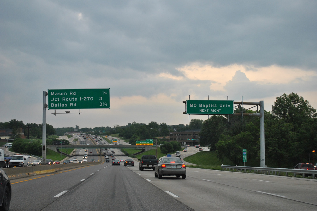
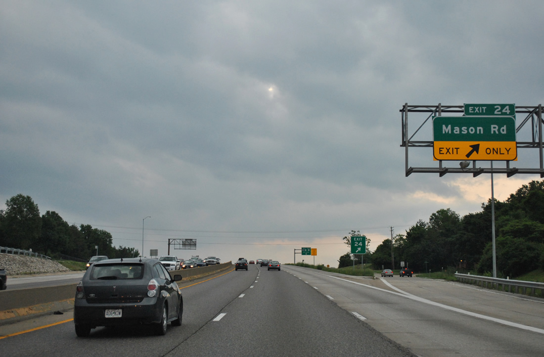
Descending ahead of the Mayrville Centre Drive overpass, eastbound drivers next meet Mason Road in one quarter mile and Interstate 270 in three miles.
05/04/12
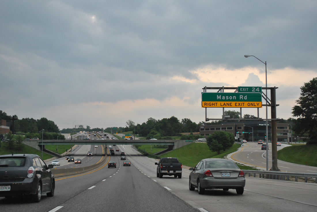
Exit 24 departs immediately after the Maryville Centre Drive overpass for South Forty Road east to Mason Road. Mason Road heads north to Conway Road in Town and Country.
05/04/12
South from Exit 24, Mason Road concludes a 3.87 mile course via Edgar M. Queeny Park and Missouri 100 (Manchester Road).
05/04/12
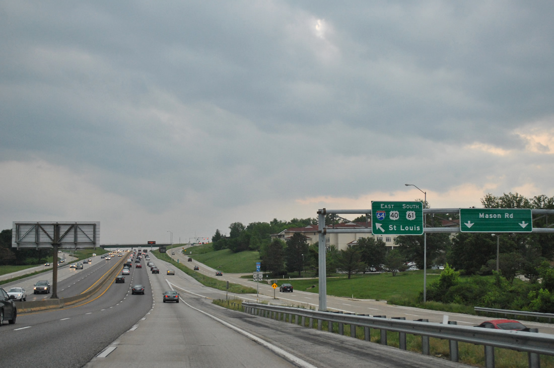
An on-ramp joins Interstate 64 east, shuttling motorists from Maryland Centre Drive onto the freeway toward St. Louis.
05/04/12

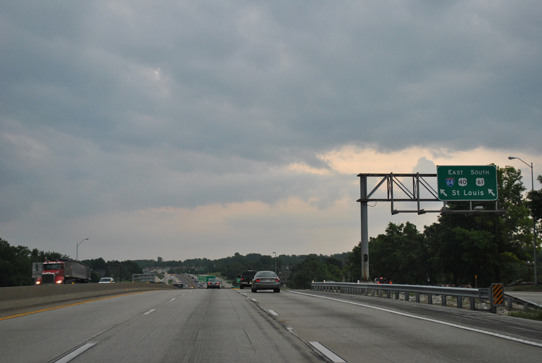
A sign welcomes motorists along I-64-U.S. 40/61 east to St. Louis ahead of the Mason Road over crossing. Wayfinding signs of this format are found throughout the metropolitan area, with most touting tourist attractions and other points of interest.
05/04/12
Interstate 64 and its frontage road system (Forty Drive) roll eastward through Town and Country.
05/04/12

A turbine interchange joins Interstate 64 with Interstate 270, the St. Louis beltway leading south to Mehlville and north to Bridgeton.
05/04/12
The final Town and Country interchange lies one half mile east of Interstate 270. I-64 enters Frontenac from there to Spoede Road.
05/04/12
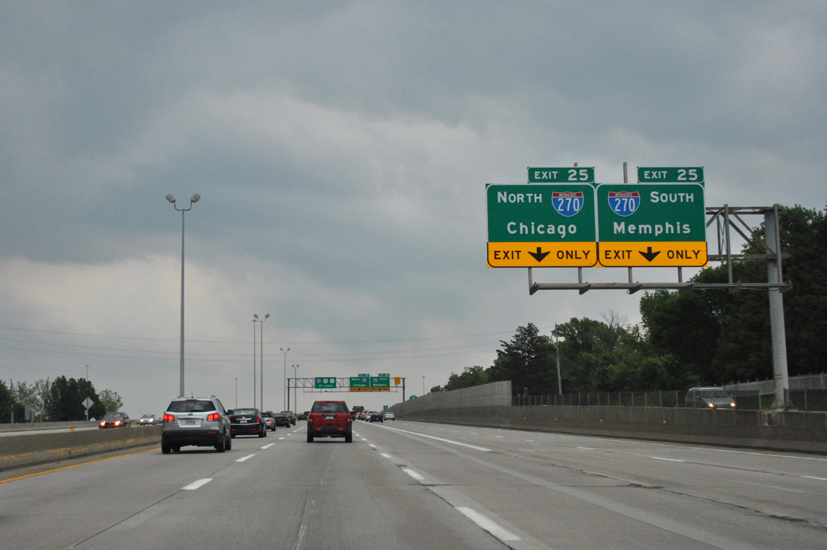
Formerly a cloverleaf interchange, Exit 25 with Interstate 270 was upgraded during a lengthy construction project between 1988 and 1993. Both freeways were expanded at the junction.
05/04/12
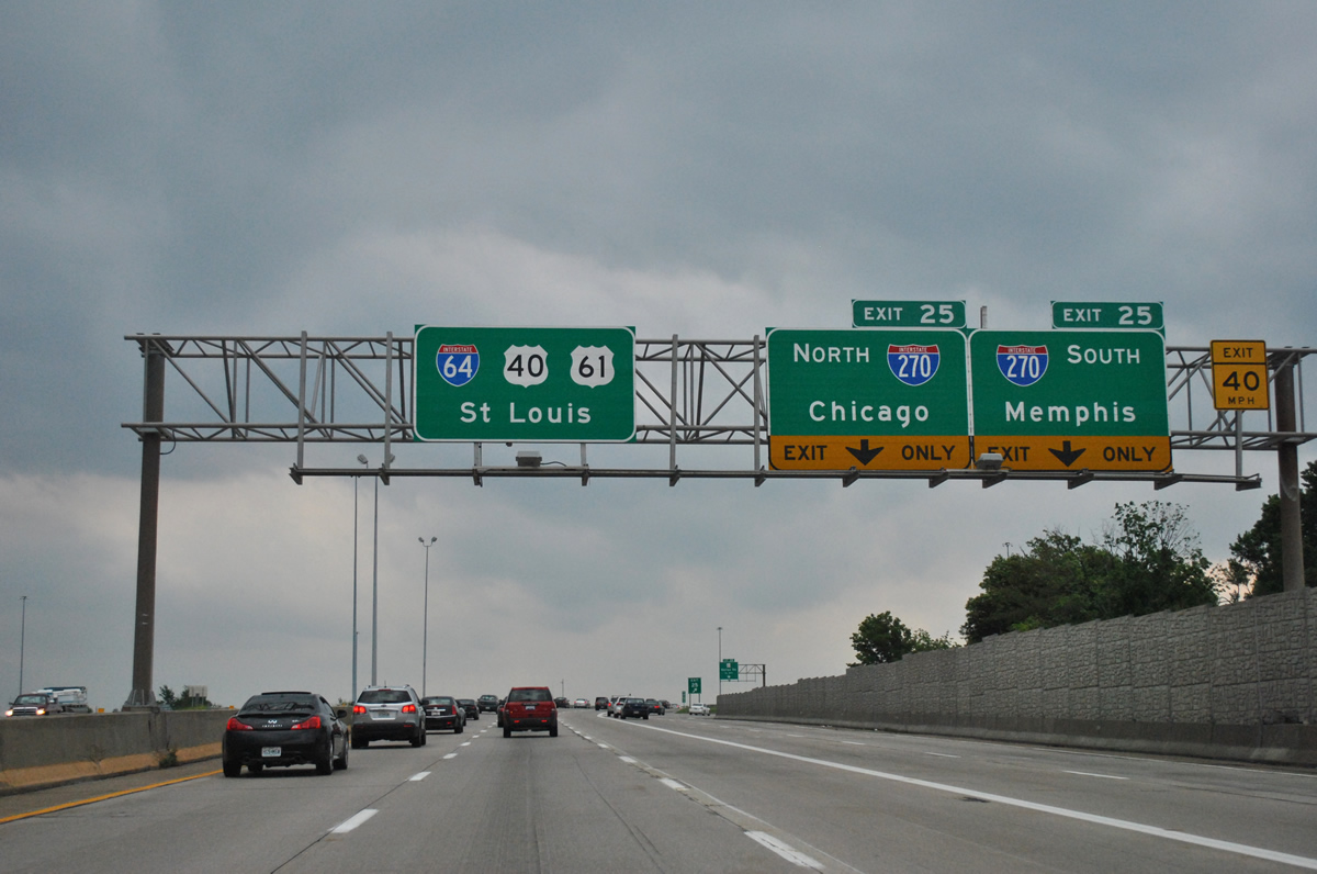
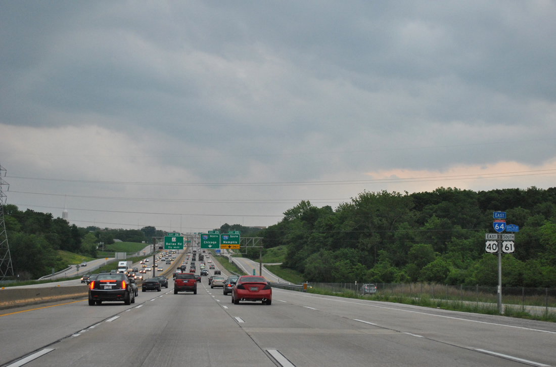
Interstate 270 south travels through Des Peres, Kirkwood and Sunset Hills to Jefferson County and the exchange with I-55 and I-255. Memphis is highlighted for the connection to I-55 leading away from St. Louis.
05/04/12

Traffic along Exit 25 partitions with drivers bound for I-270 north utilizing a flyover for Creve Coeur, Maryland Heights and Hazelwood. Interstate 270 turns east from its first meeting with I-70 to the Chain of Rocks Bridge and Granite City, Illinois. Chicago is used for the connection to Interstate 55 north at Troy, Illinois.
05/04/12
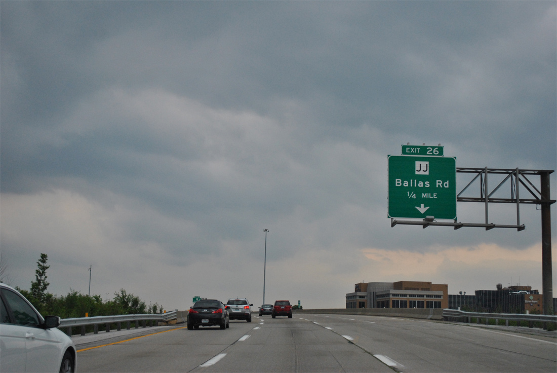
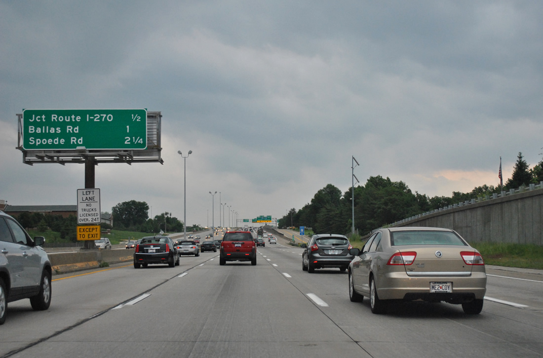
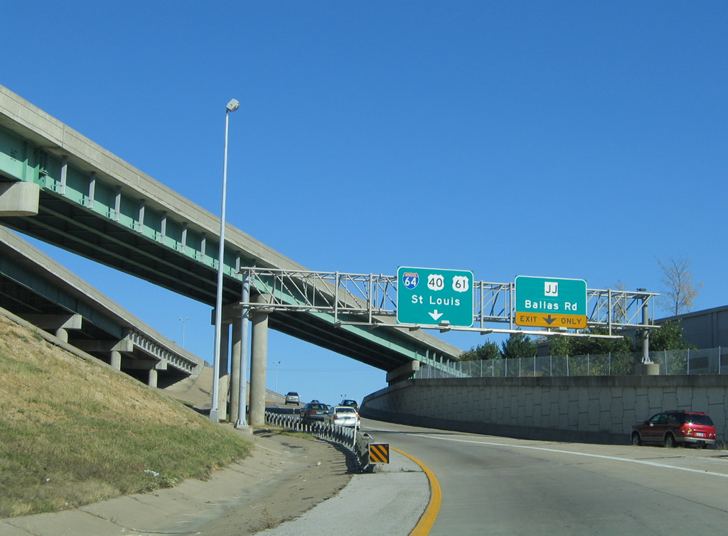
Exit 26 departs I-64/U.S. 40 east from within the turbine interchange with Interstate 270. Highway JJ formerly followed Ballas Road south from a parclo interchange through eastern portions of Town and Country to Missouri 100 at Des Peres.
05/04/12
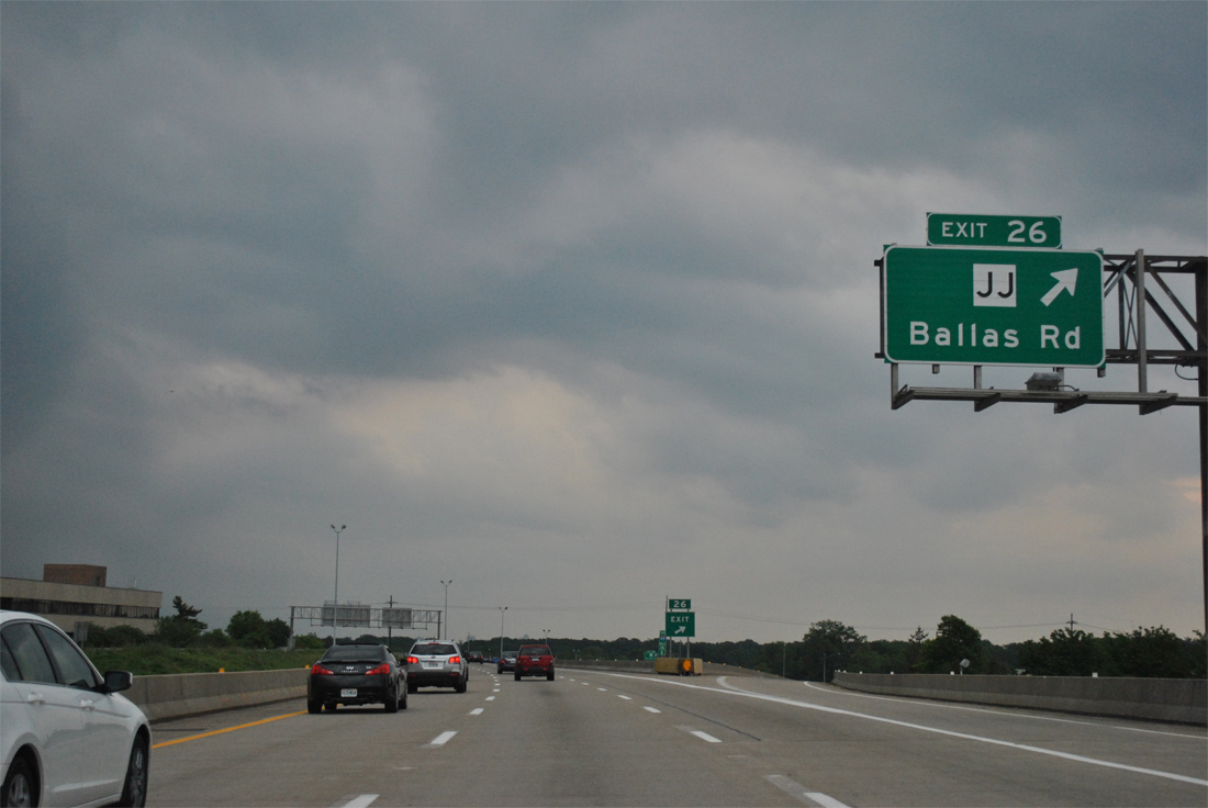
Ballas Road becomes New Ballas Road north from I-64/U.S. 40 by Mercy Hospital into the city of Creve Coeur. The road ends at Missouri 340 (Olive Boulevard), just east of the SPUI with Interstate 270.
05/04/12
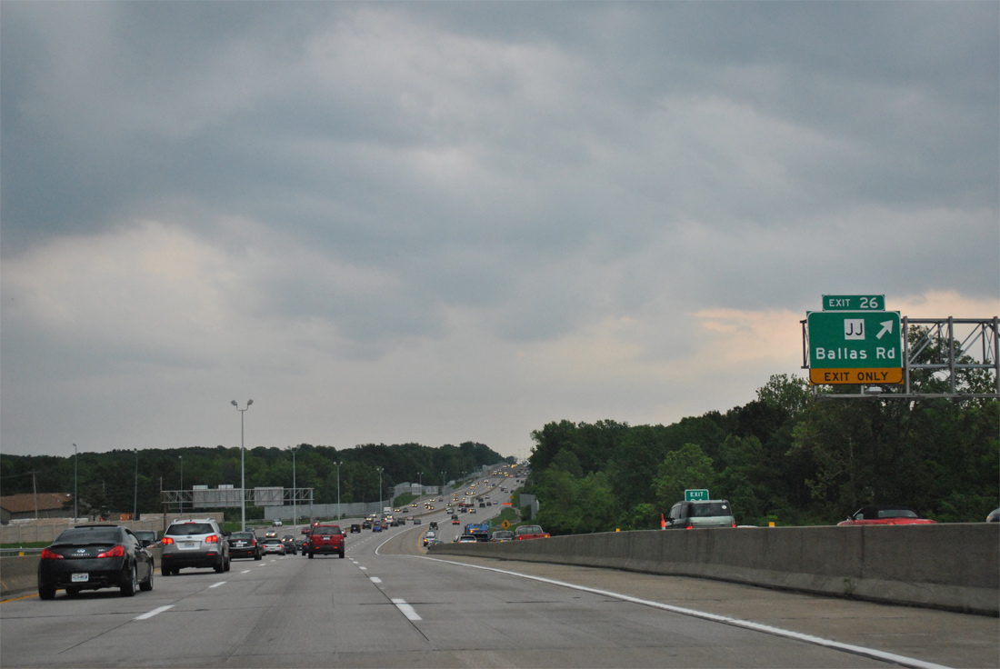
Motorists taking the ramps from Interstate 270 onto I-64/U.S. 40 east are provided with a loop ramp to Ballas Road and Highway JJ south as well.
10/16/04
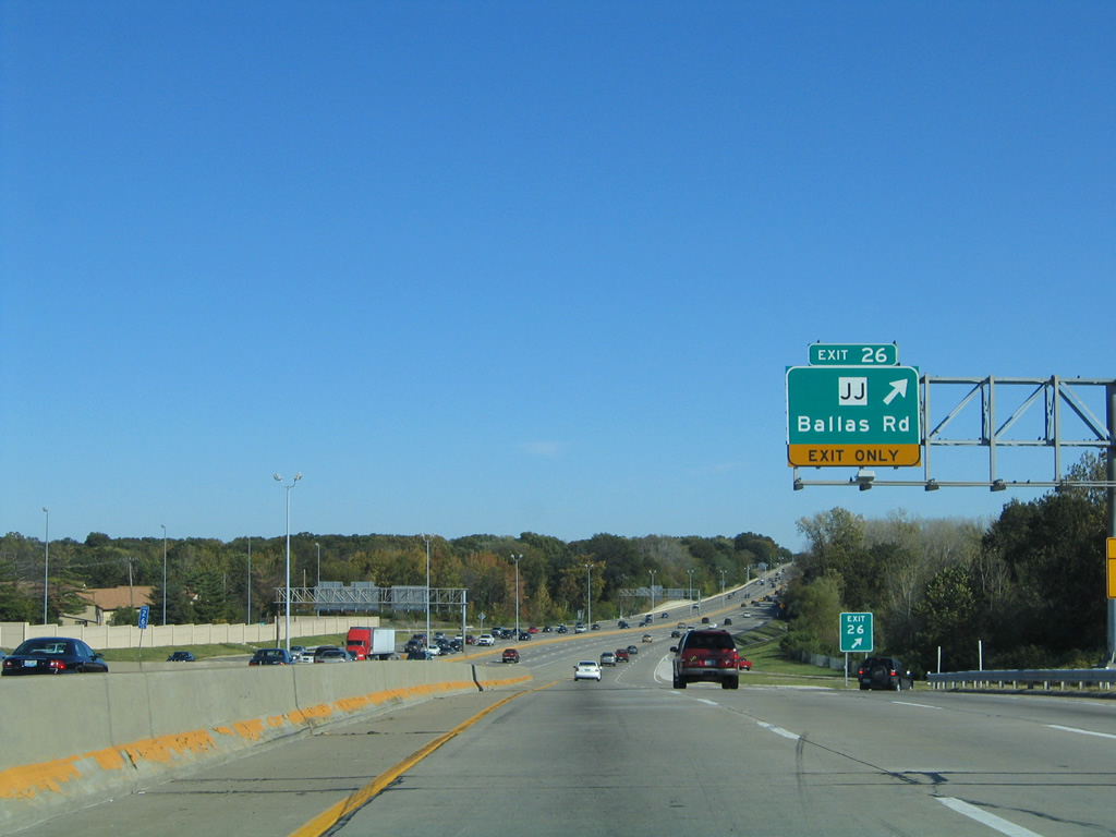
The loop ramp used here is a left-over from the tight folded diamond interchange that originally joined Ballas Road with the freeway.
05/04/12
10/16/04
Construction between 2000 and December 7, 2009 completely redesigned all of I-64/U.S. 40 east from Ballas Road to Kingshighway Boulevard in St. Louis. The work brought the 1950s freeway up to modern standards and redesigned all interchanges, replaced overpasses and expanded the roadway.
05/04/12
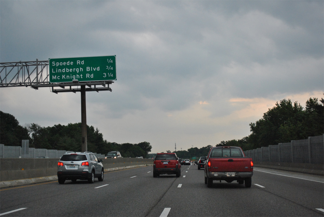
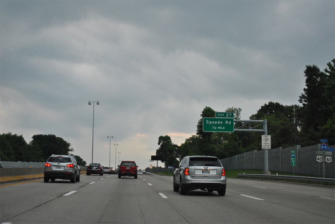
A folded diamond interchange (Exit 27) joins I-64/U.S. 40-61 with Spoede Road in the city of Frotenac in one quarter mile. Roundabouts were added between the ramps and the parallel frontage roads (North and South Forty Drive) to replace a pair of loop ramps with sharp curves during the "The New I-64" road work.
05/04/12
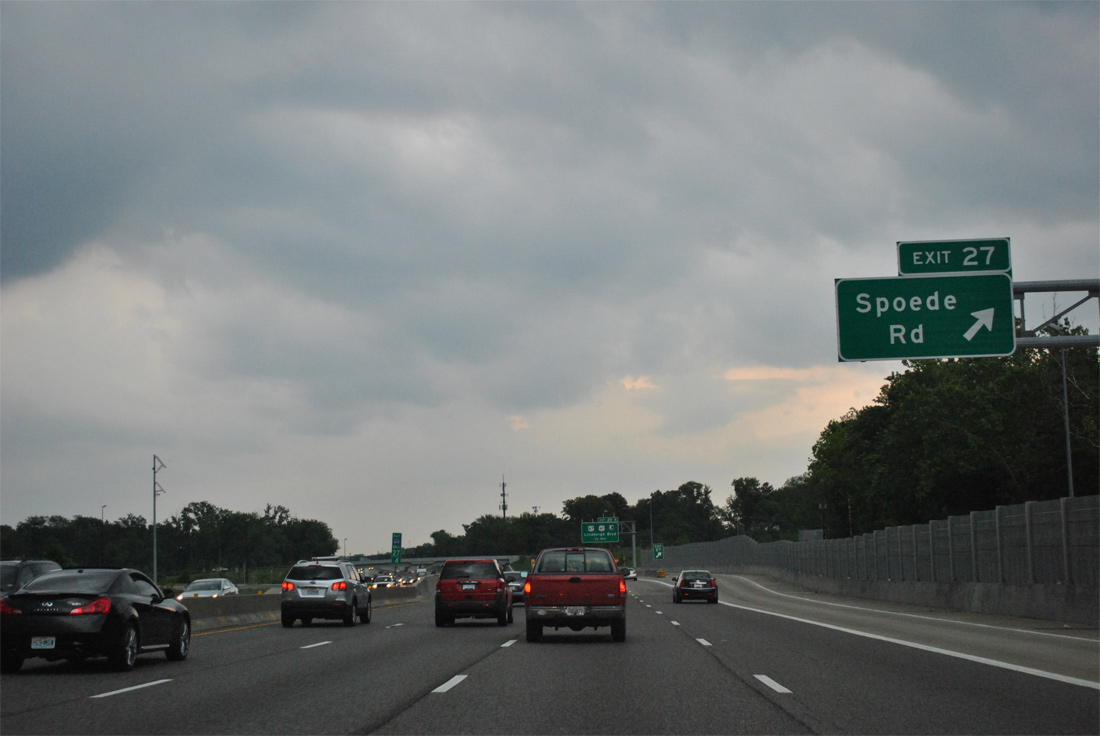
Spoede Road stems north from adjacent Clayton Road as a residential through road leading north from Exit 27 to Ladue Road (former Highway AB) and Missouri 340 (Olive Road) in east Creve Coeur.
05/04/12
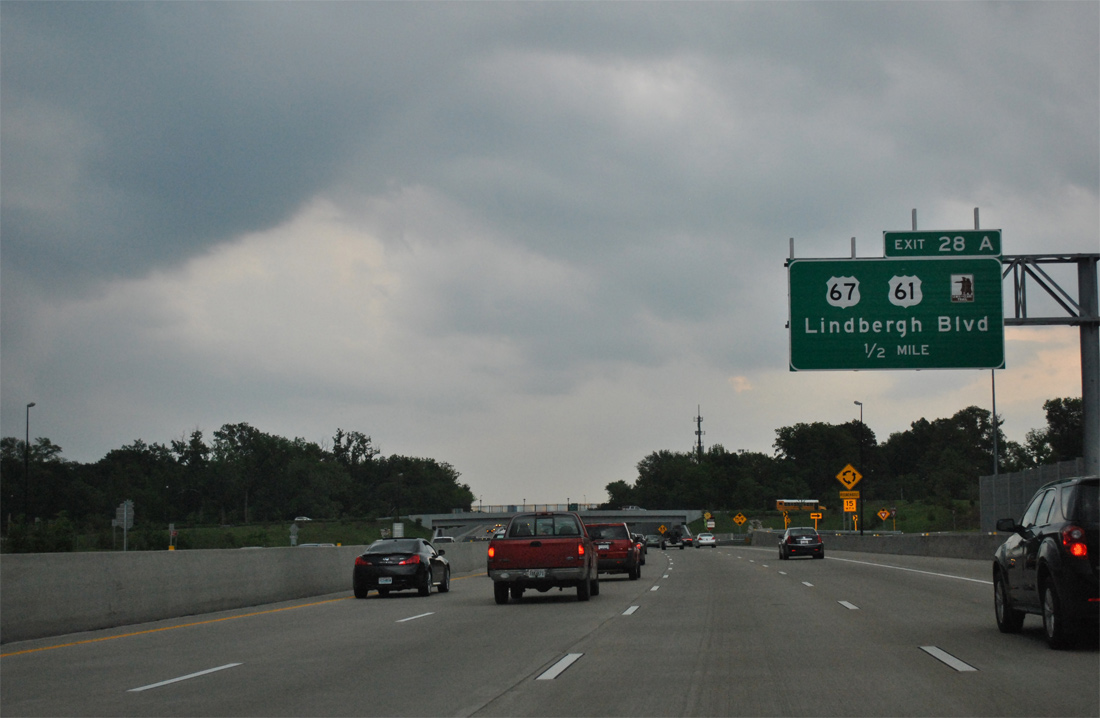
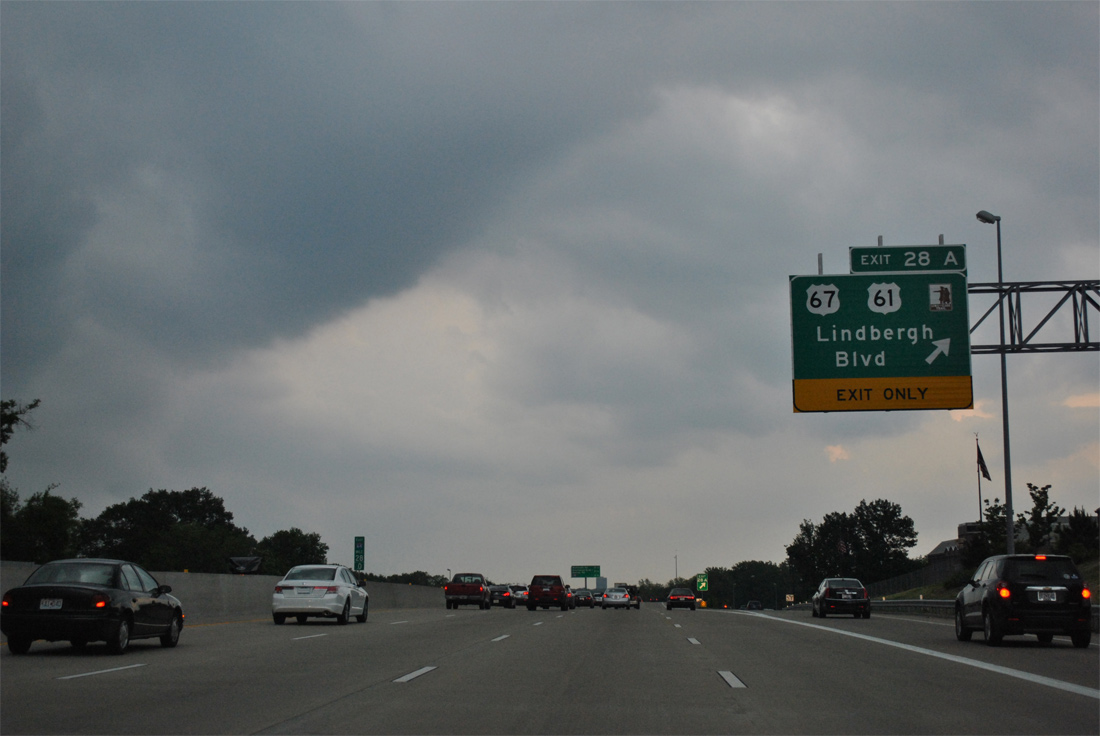
U.S. 61 parts ways with I-64/U.S. 40 east at a single point urban interchange (SPUI) next in a half mile. Originally a compact cloverleaf interchange joined the freeway with U.S. 67 (Lindbergh Boulevard) ahead. The A in Exit 28 is a leftover from when two ramps joined U.S. 40 with the north-south arterial.
05/04/12
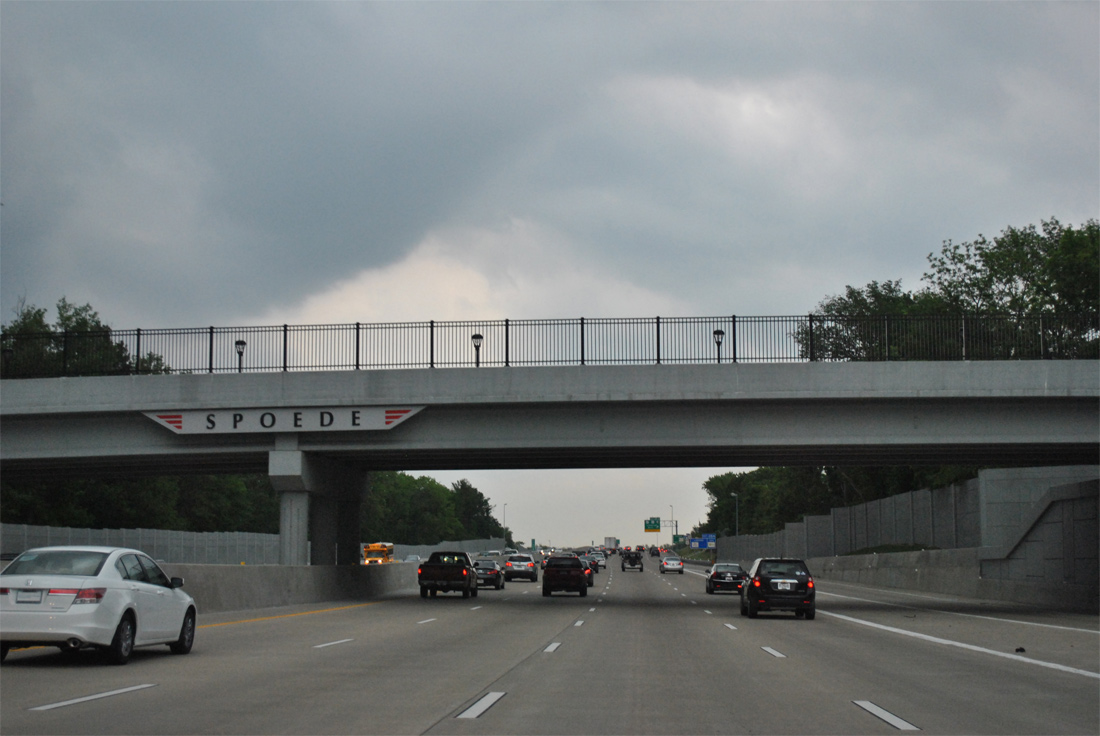
Decorative overpasses identify the street name of all roads passing over I-64/U.S. 40 leading into St. Louis. The theme continues throughout "The New I-64" project area.
05/04/12
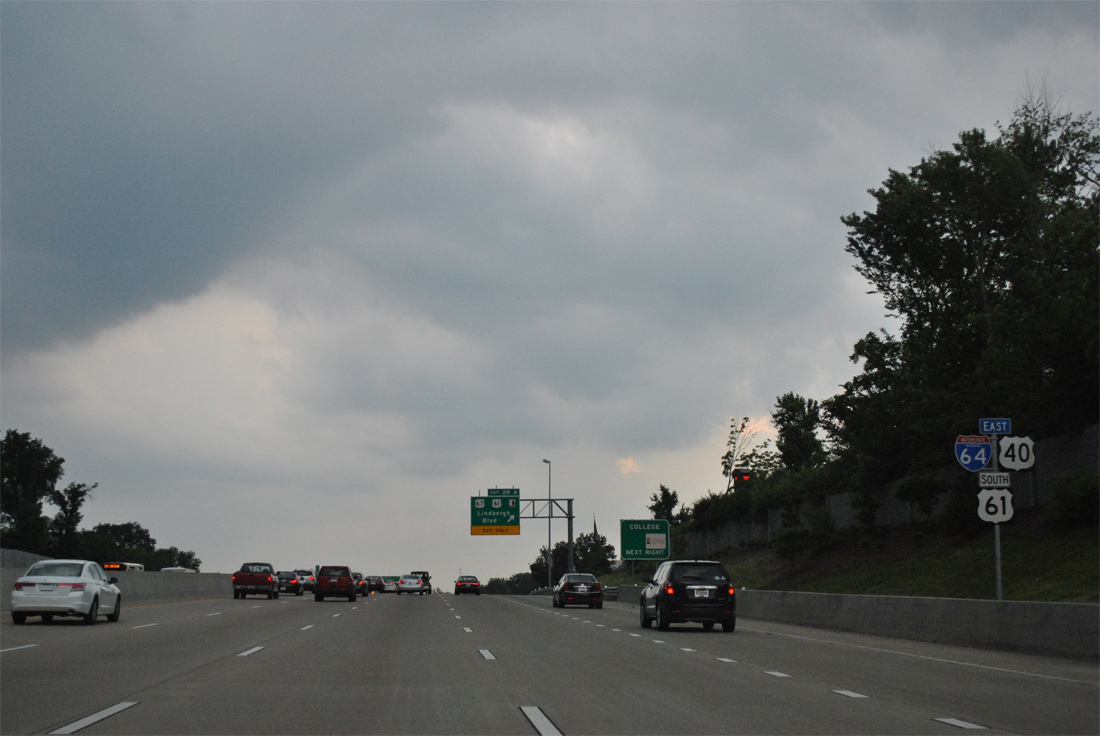
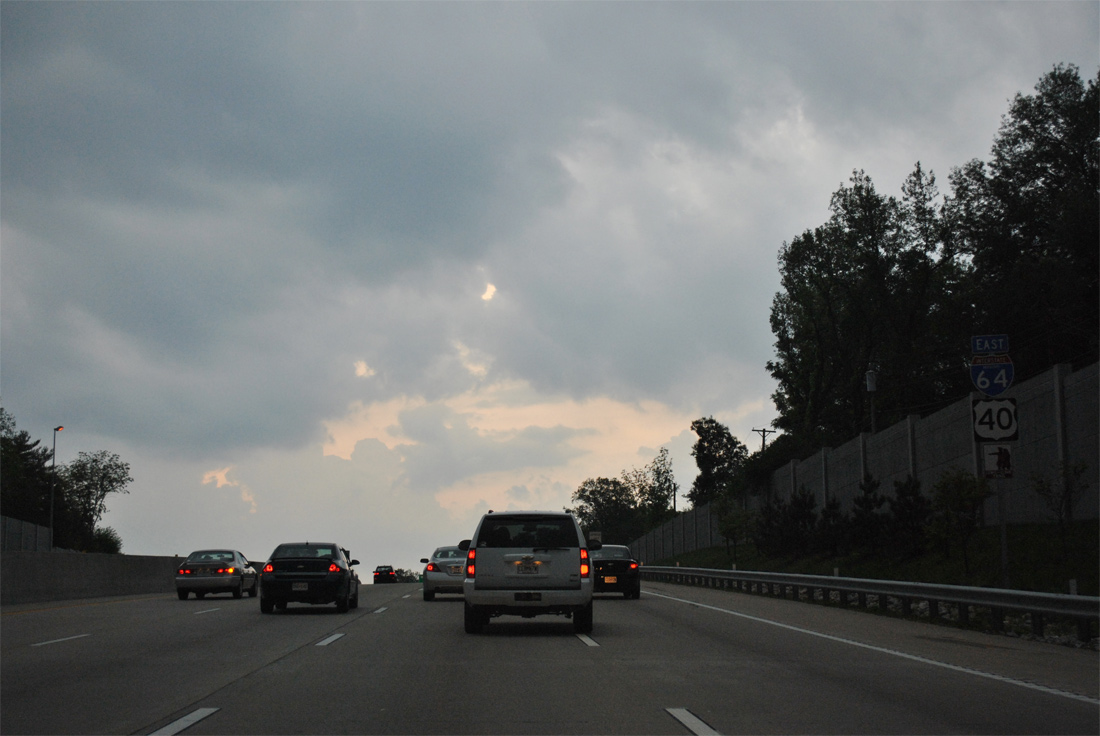
The final shield assembly identifying U.S. 61 alongside I-64/U.S. 40 east. U.S. 61 is the Avenue of the Saints corridor leading south from near Keokuk, Iowa to Exit 28A.
05/04/12
U.S. 61 joins U.S. 67 (Lindbergh Boulevard) south along the Frontenac and Ladue city line to Huntleigh, Kirkwood, Sunset Hills and Mehlville. U.S. 67 north continues along Lindbergh Boulevard to Creve Coeur, Bridgeton, Hazelwood and Florissant. The divided highway also carried Bypass U.S. 67, Bypass U.S. 66 and Truck U.S. 40 at one point.
05/04/12
East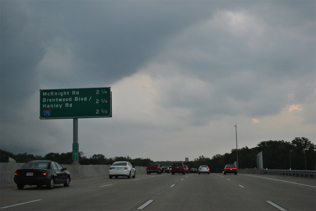
I-64/U.S. 40 enter the city of Ladue and a 2.25 mile exit less stretch leading to a diamond interchange (Exit 30) with McKnight Road. Interstate 170, an 11.17 mile freeway between Richmond Heights and Hazelwood, appears for the first time at 2.75 miles out.
05/04/12
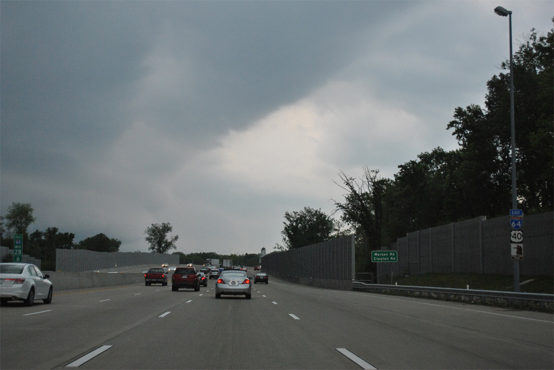
The freeway elevates over both Warson and Clayton Roads as it winds eastward alongside Deer Creek.
05/04/12
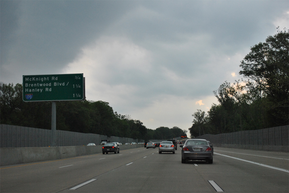
Three quarters of a mile ahead of Exit 30 to McKnight Road. McKnight Road straddles the Ladue and Brentwood city line south to a crossing of Deer Creek. The residential through road ventures north to Ladue Road, just west of its interchange with Interstate 170, in eastern reaches of Ladue.
05/04/12
The South Forty Drive frontage road merges onto I-64/U.S. 40 east after its intersection with Rolling Rock Lane. A reassurance shield assembly follows.
05/04/12
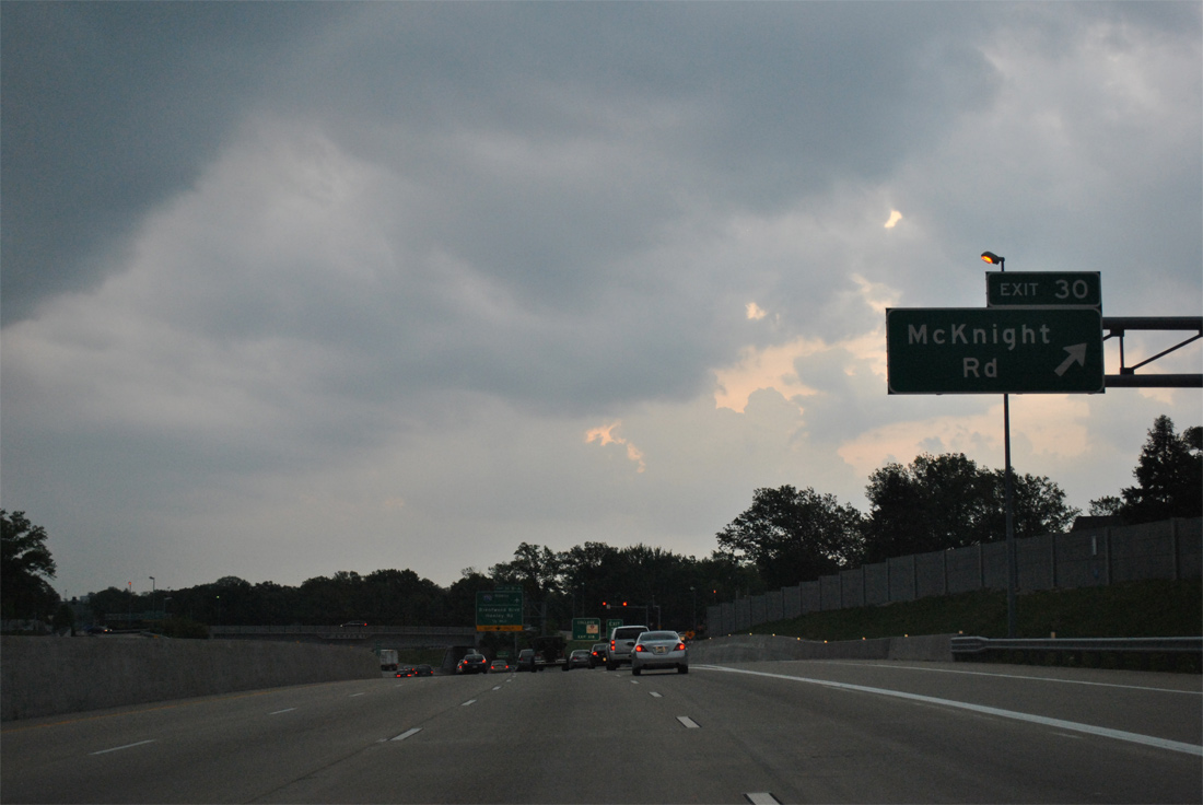
Exit 30 parts ways with I-64/U.S. 40 east for McKnight Road. McKnight Road south ends at Missouri 100 (Manchester Road) in the city of Rock Hill while north ends at Ladue Road.
05/04/12
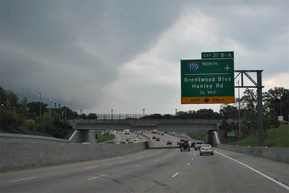
The southern terminus of Interstate 170 is reached in one half mile along I-64/U.S. 40 east. Ramps with the freeway overlay a split diamond interchange with Brentwood Boulevard and Haley Road at Richmond Heights.
05/04/12
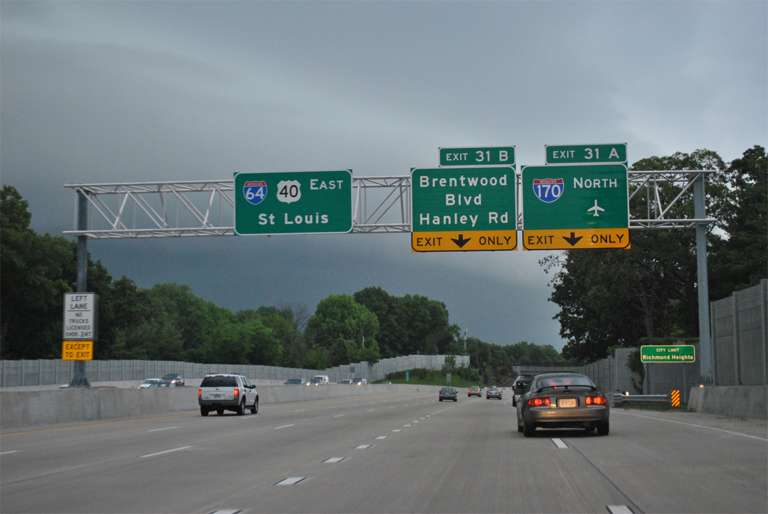
Eastbound travelers nip the northwestern corner of Brentwood before entering Richmond Heights ahead of Interstate 170 north to University City, Olivette and Overland and parallel Brentwood Boulevard.
05/04/12
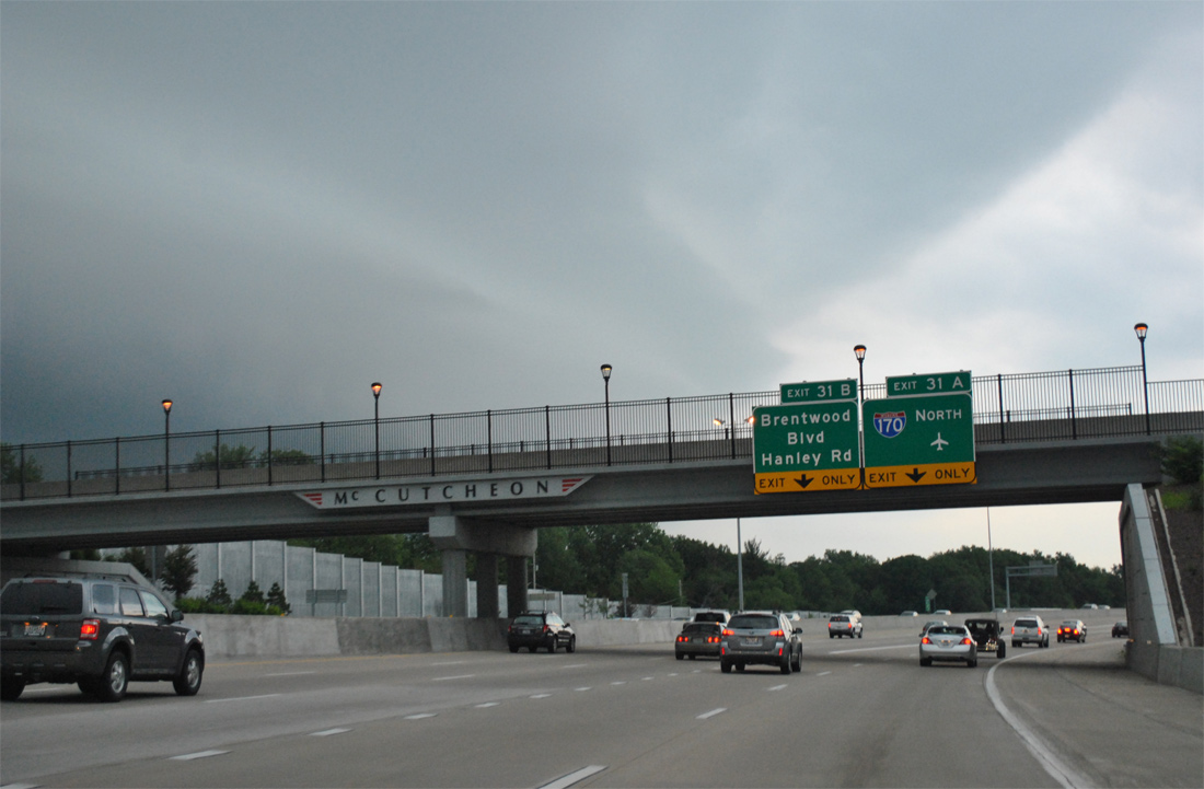
Attached to the McCutcheon Road overpass, which was realigned during "The New I-64" construction, is the final set of signs for Exit 31A (Interstate 170 north) and Exit 31B for both Brentwood Boulevard and Hanley Road. Hanley Road heads north from Maplewood on a parallel course to I-170 to Berkeley. Brentwood crosses paths with I-170 north of the St. Louis Galleria mall to Downtown Clayton.
05/04/12
![Exit 31 carries all traffic in unison and separates with a flyover onto Interstate 170 north for St. Louis Lambert International Airport [STL] and a collector distributor roadway east to Brentwood Boulevard and Hanley Road.](../../mo/064/i-064_eb_exit_031_04.jpg)
Exit 31 carries all traffic in unison and separates with a flyover onto Interstate 170 north for St. Louis Lambert International Airport [STL] and a collector distributor roadway east to Brentwood Boulevard and Hanley Road.
05/04/12
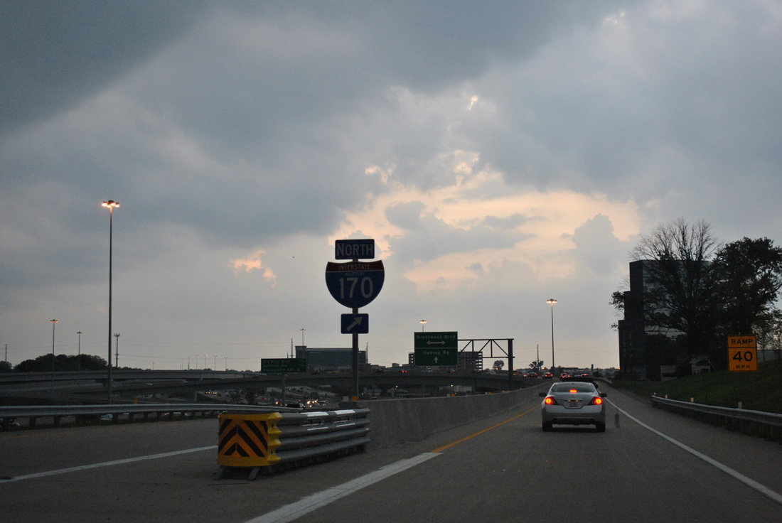
An Interstate 170 shield stands at the gore point for Exit 31A. Originally there was no direct connection between I-64/U.S. 40 east onto I-170 north. The parclo interchange that preceded the directional exchange here required motorists bound for I-170 to take Brentwood Boulevard north to Galleria Parkway east to access the freeway to Hazelwood.
05/04/12
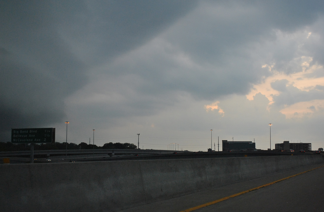
As a thunderstorm looms to the north, an interchange sequence sign appears 1.25 miles ahead of Big Bend Boulevard, the second Richmond Heights interchange (Exit 33A).
05/04/12
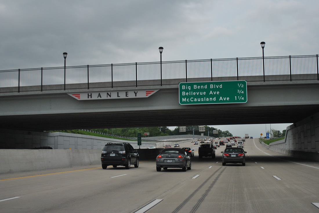
Passing below Hanley Road, I-64/U.S. 40 near the diamond interchange (Exit 33A) with Big Bend Boulevard. McCausland Avenue, the first exit within the city of St. Louis, is 1.25 miles away.
05/04/12
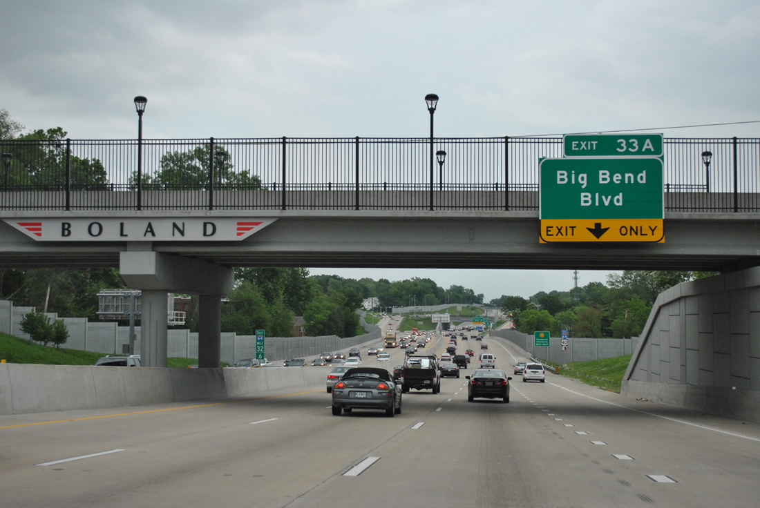
I-64/U.S. 40 east lose a lane to the Big Bend Boulevard off-ramp. Big Bend Boulevard forms an arc south to Maplewood and Webster Groves and north to Clayton, Fontbonne University, and University City.
05/04/12
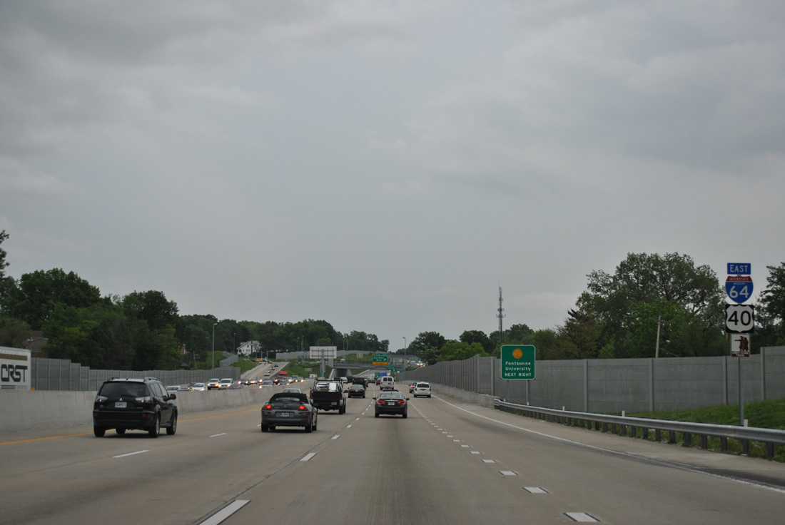
Reassurance markers posted for Interstate 64, U.S. 40 east and the Lewis and Clark Trail.
05/04/12
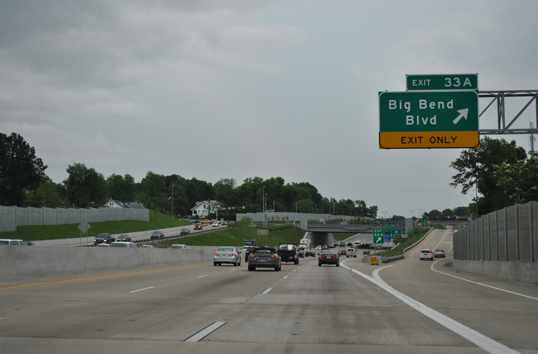
Exit 33A split from the freeway mainline for Big Bend Boulevard. Commercial frontage lines the arterial in both directions, with Missouri 100 (Manchester Road) 1.1 miles to the south and Forest Park Parkway 1.6 miles to the north.
05/04/12
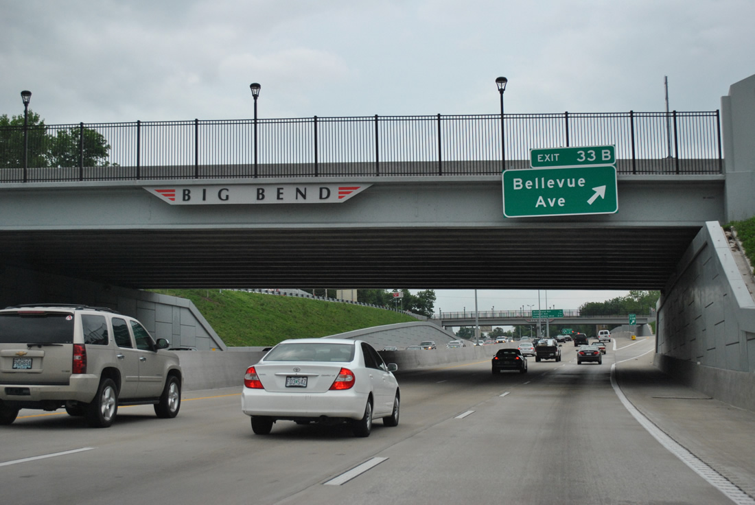
A half diamond interchange (Exit 33B) lies immediately east of Big Bend Boulevard with Bellevue Avenue.
05/04/12
Continuing east, I-64/U.S. 40 enter St. Louis at the diamond interchange (Exit 33C) with McCausland Avenue. This interchange was redesigned to eliminate a loop ramp from westbound to southbound McCausland Avenue during "The New I-64" road work.
05/04/12
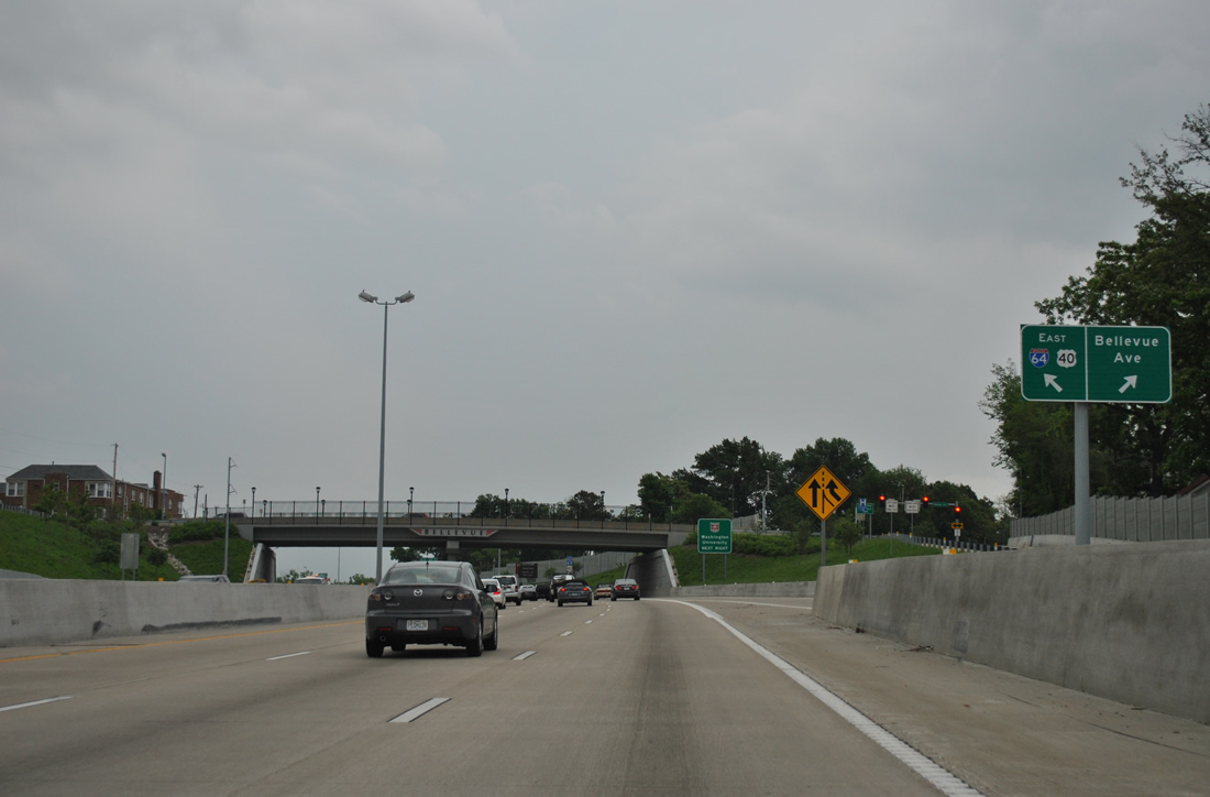
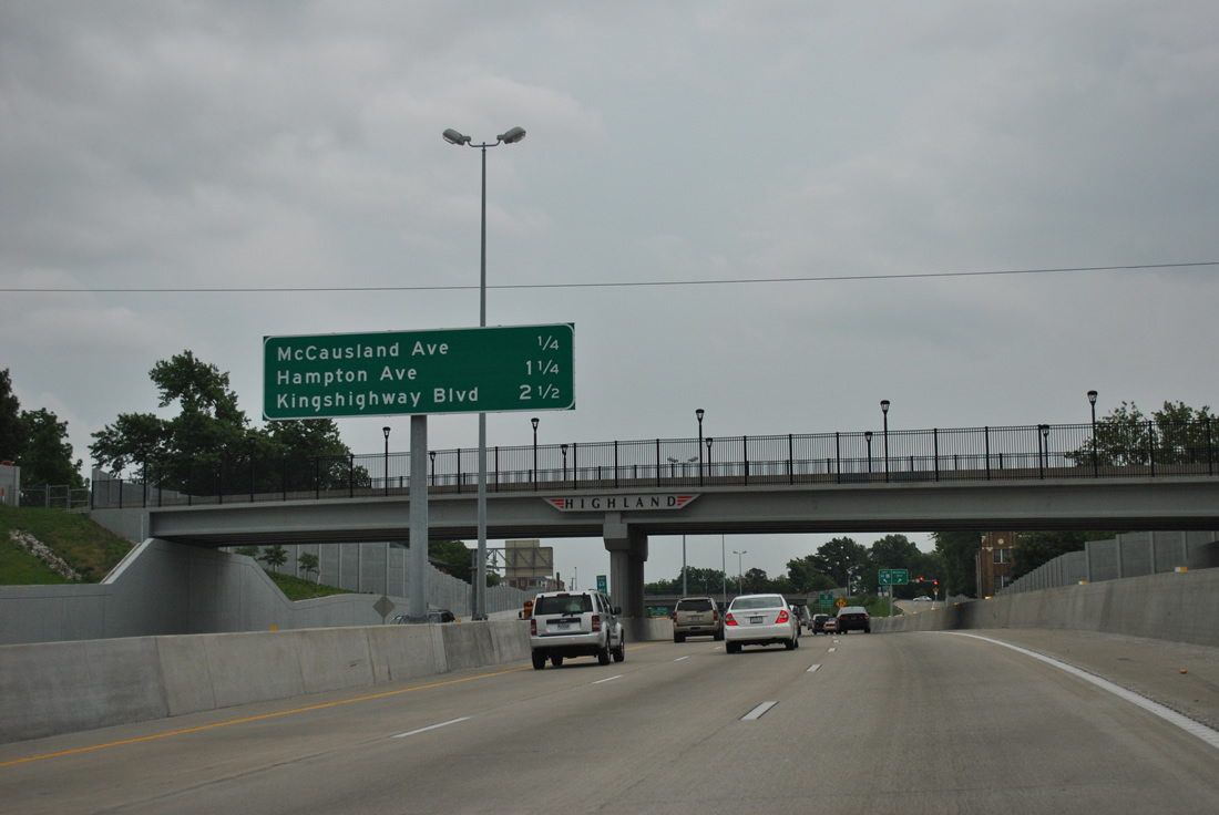
Motorists that take Exit 33B join a c/d roadway between Big Bend Boulevard and Bellevue Avenue, which serves residential areas to the south and SSM St. Mary's Health Center to the north.
05/04/12
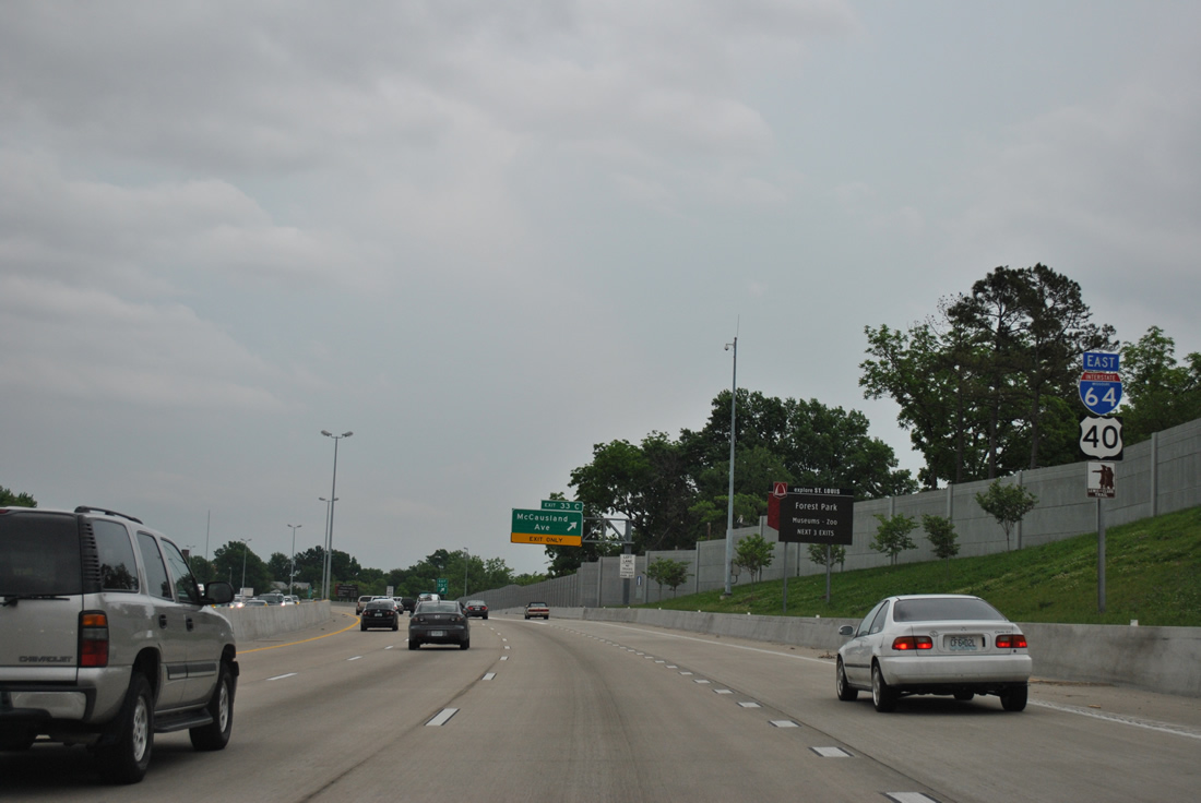
I-64/U.S. 40 gain a lane from the Exit 33A/B c/d roadway to the Exit 33C off-ramp to McCausland Avenue. An attractions sign, common throughout the St. Louis area, indicates Exit 33C is the first of three exits from the freeway to serve Forest Park. City maintained, Forest Park was established in 1874 and encompasses 1,370 acres on the north side of U.S. 40. The park is home to several memorials, a fountain, The Muny theater and the St. Louis Art Museum among a number of athletic facilities.
05/04/12
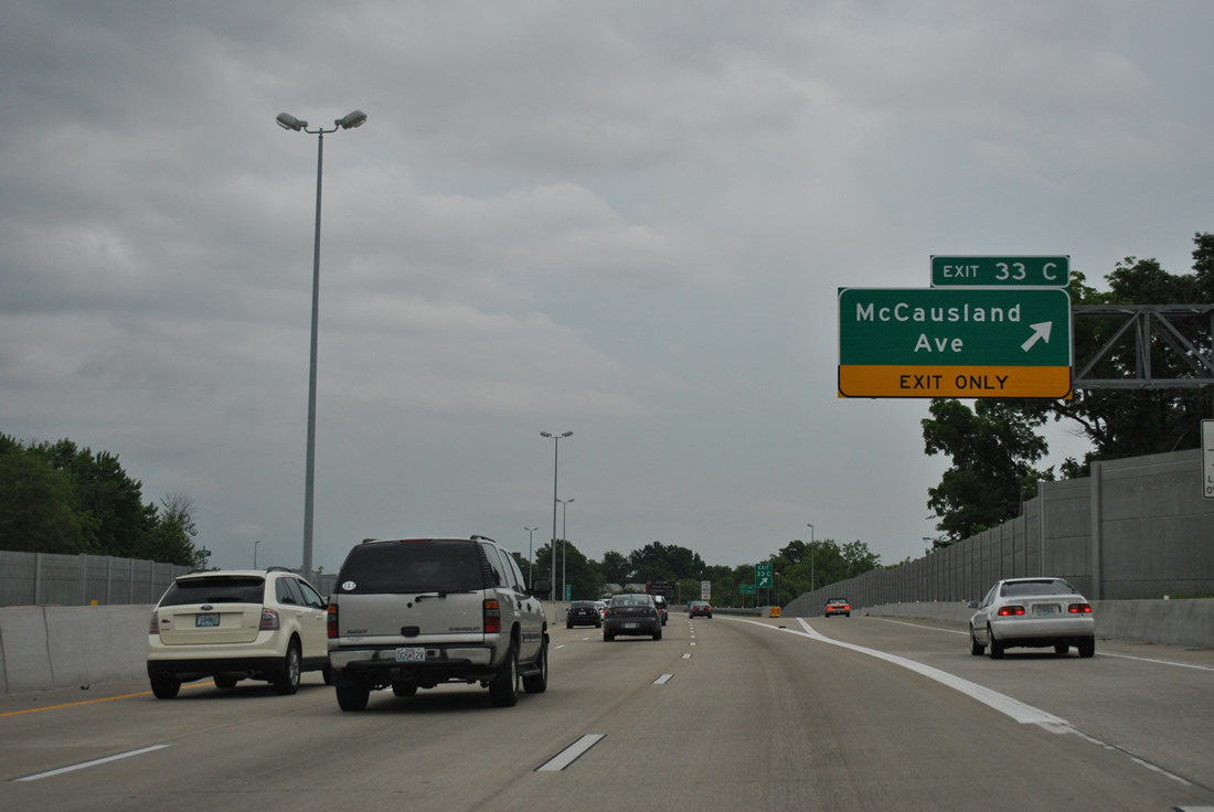
McCausland Avenue leads south from Exit 33C to the Hi-Pointe and Franz Park neighborhoods and north to become Skinker Boulevard along the west side of Forest Park to the Skinker DeBaliviere community.
05/04/12

Photo Credits:
- ABRoads: 05/04/12
- AARoads: 10/16/04
Connect with:
Page Updated Monday May 14, 2018.