
Interstate 64 West - Hampton Roads - Suffolk to Norfolk


 Outer
Outer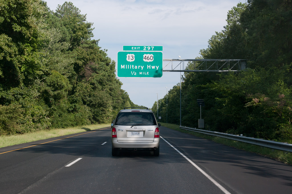
Branching south from I-264/664, Interstate 64 advances to a diamond interchange (Exit 297) with U.S. 13/460 (Military Highway).
09/05/10
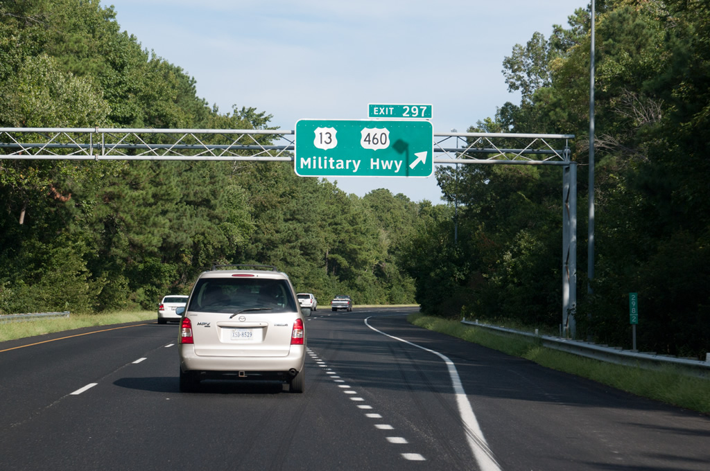
U.S. 13/460 (Military Highway) runs east from U.S. 58 at Bowers Hill to Loxley Gardens and Broadmoor in Chesapeake and across the Elizabeth River Southern Branch (ICWW) to SR 166 (Bainbridge Boulevard) near Portlock.
09/05/10
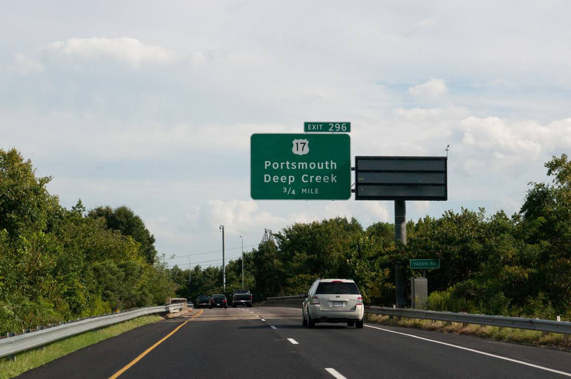
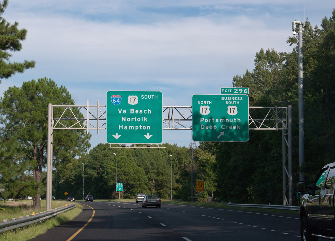
Interstate 64 arcs southeast across Yadkin Road and a Norfolk Southern Railroad line to a cloverleaf interchange (Exit 296) with U.S. 17 north and U.S. 17 Business (George Washington Highway) south.
09/05/10
U.S. 17 Business (George Washington Highway) heads 5.28 miles south from I-64 at Deep Creek in Chesapeake to U.S. 17 east of the Great Dismal Swamp Canal. U.S. 17 was realigned onto I-64 east by Winter 2002, with the realignment away from the Great Dismal Swamp completed in 2006.
09/05/10
Outer  South
South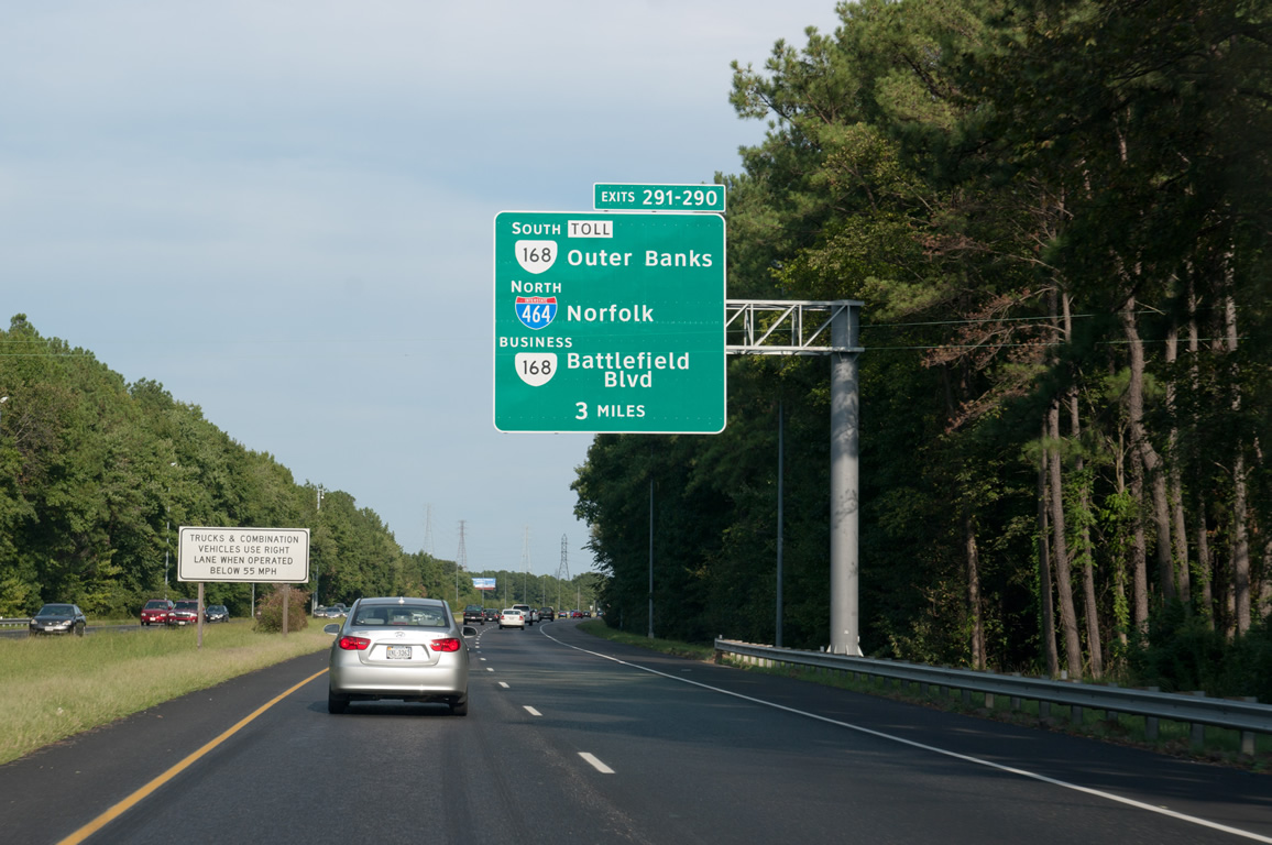
I-64/U.S. 17 overlap 4.31 miles eastward to SR 190 (Great Bridge Boulevard). The exchange with I-464 north to Norfolk, SR 168 (Oak Grove Connector) south to Great Bridge and Battlefield Boulevard (SR 168 Business) follows.
09/05/10
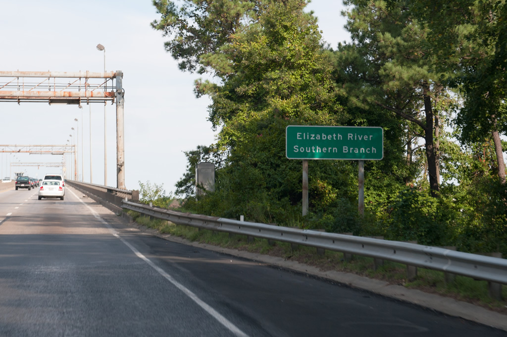
I-64/U.S. 17 parallels Deep Creek east to the High Rise Bridge spanning the Elizabeth River Southern Branch.
09/05/10
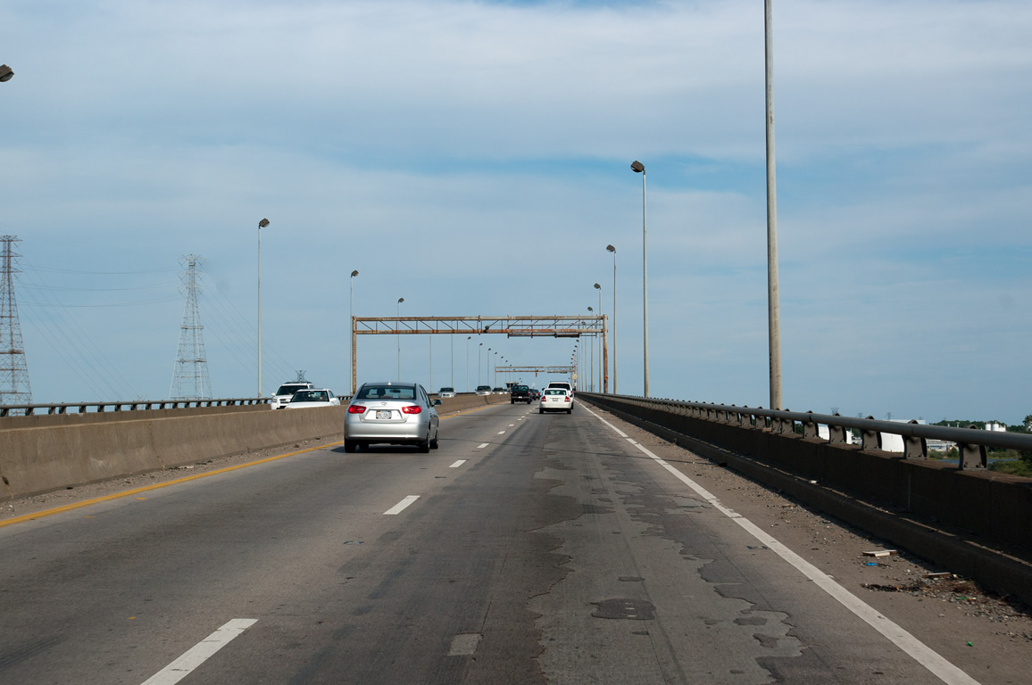
Construction from Summer 2018 to December 2022 constructs a new 100 foot high fixed high rise span for I-64 westbound to the south of the 65 foot high draw bridge crossing the Elizabeth River Southern Branch.
09/05/10
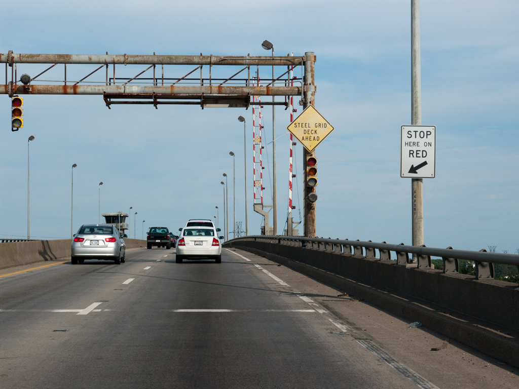
The $409.6 million I-64 Southside / High Rise Bridge project reconstructs the draw bridge built in 1967 for eastbound traffic.
09/05/10
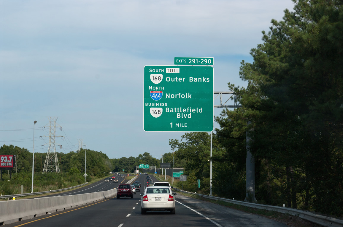
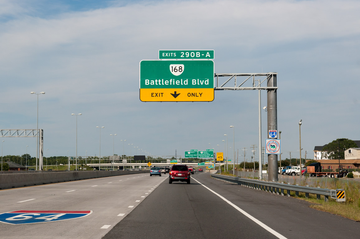
A lengthy collector distributor roadway departs one mile beyond the High Rise Bridge for Exit 291 to SR 168 south to the North Carolina Outer Banks and I-464 north to Norfolk and Exit 290 for SR 168 Business (Battlefield Boulevard).
09/05/10
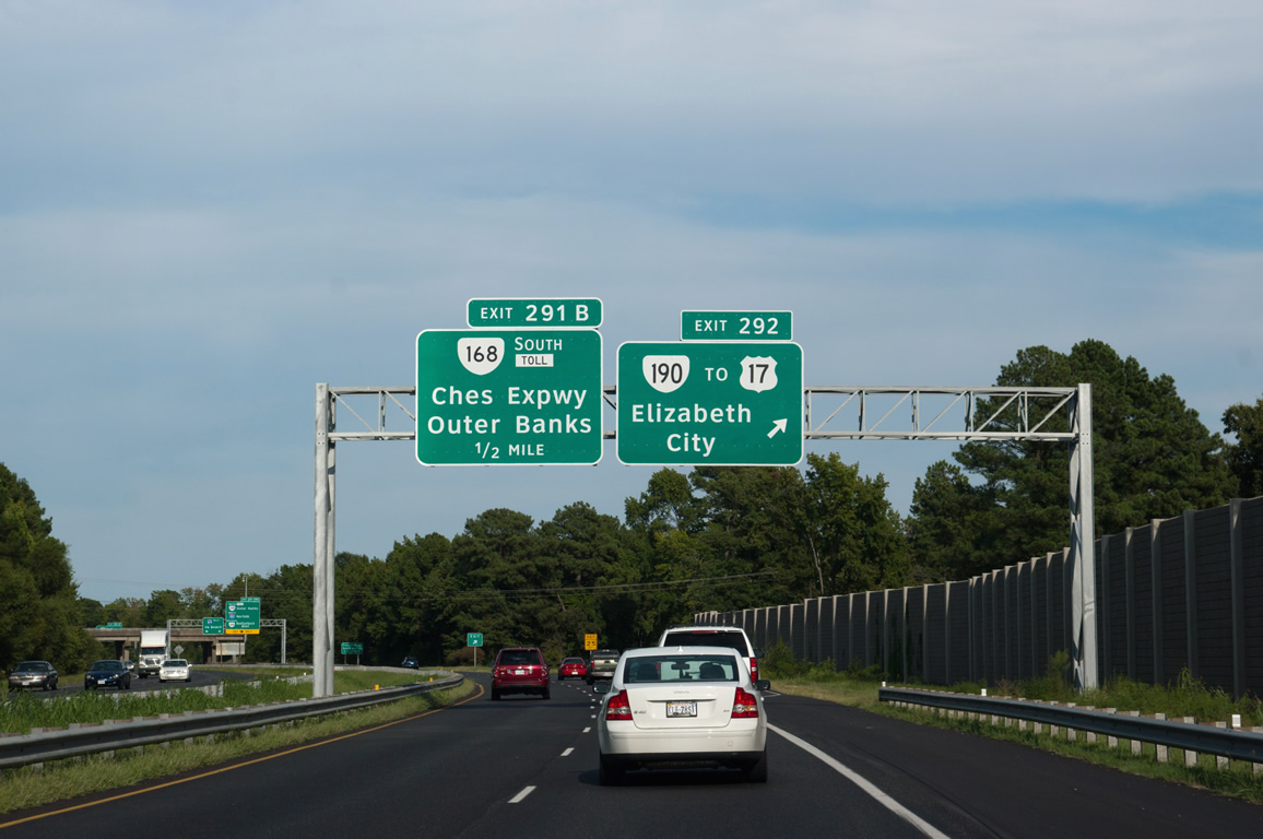
U.S. 17 southbound is discontinuous as there is no direct connection from I-64 to Dominion Boulevard. Instead SR 190 (Great Bridge Boulevard) links U.S. 17 south from Exit 292 to Dominion Boulevard.
09/05/10
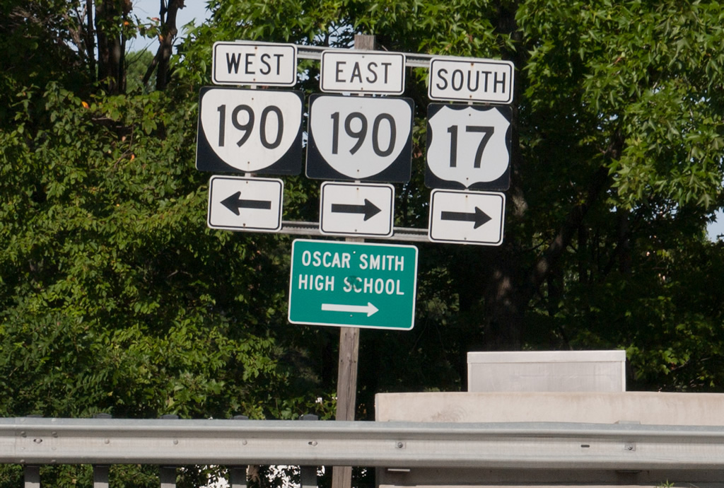
SR 190 constitutes a circuitous route 15.43 miles from SR 166 (Bainbridge Boulevard) nearby to SR 225 (Independence Boulevard) in Virginia Beach. U.S. 17 continues southwest from SR 190 along an expressway and toll bridge across the Elizabeth River Southern Branch to Herberts Corner.
09/05/10
Outer 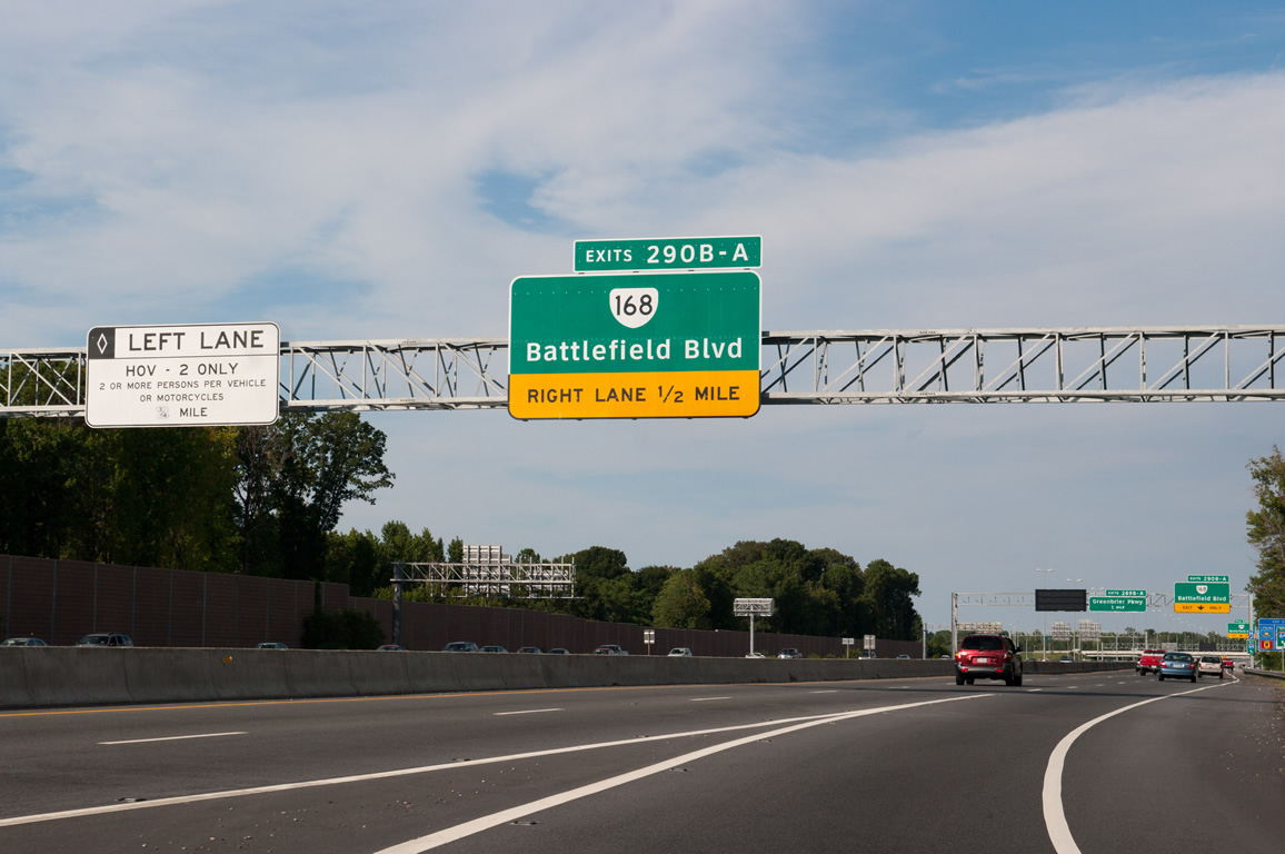
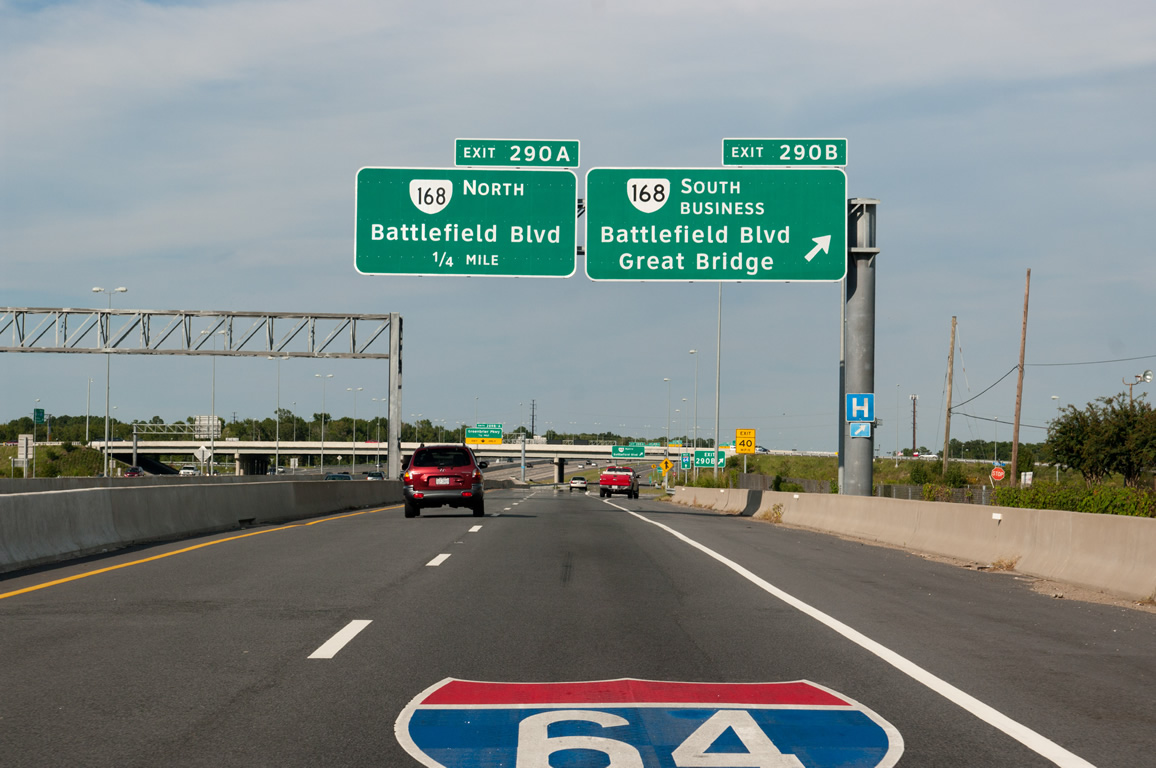
SR 168 north joins the collector distributor roadway of Interstate 64 outer (west) to Exit 290A.
09/05/10
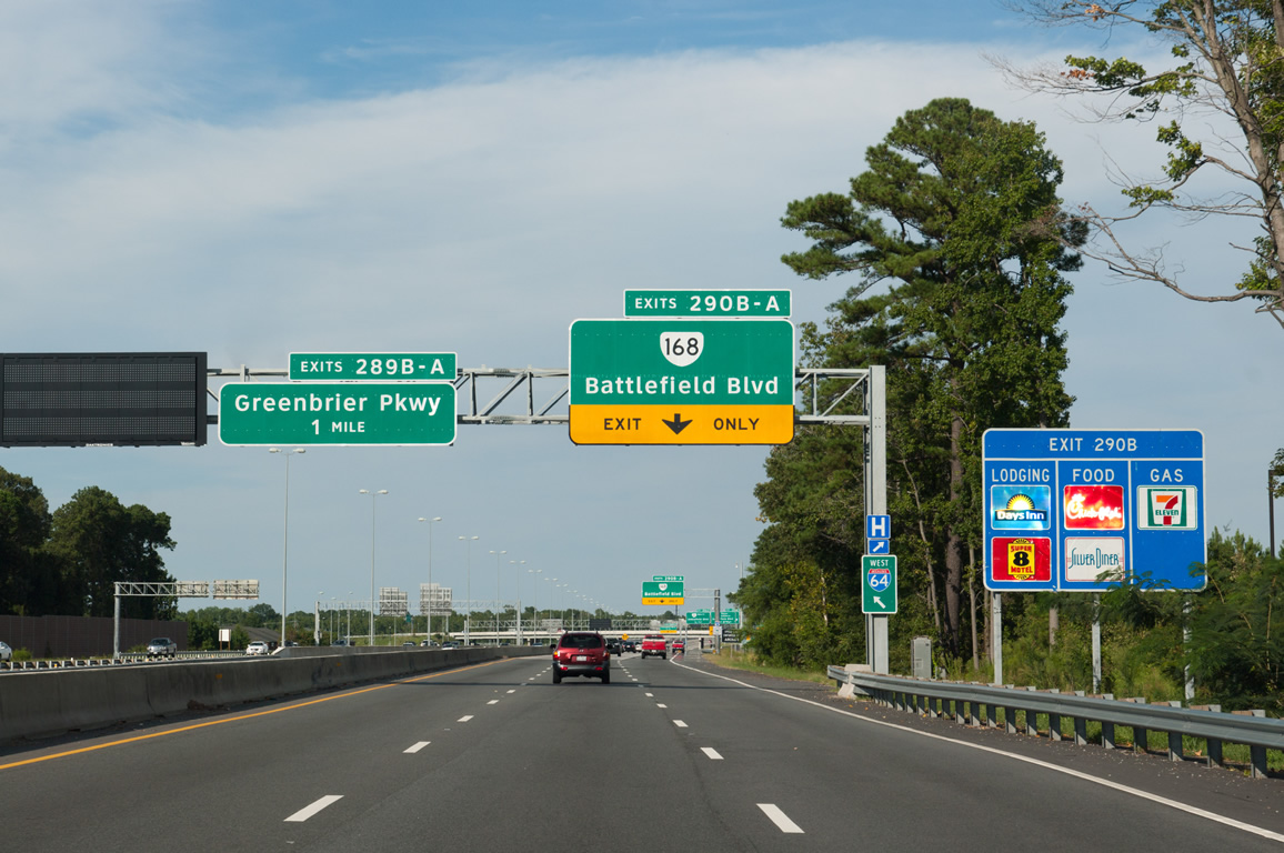
SR 168 Business heads south from Exit 290B along commercialized Battlefield Boulevard to Oak Grove. SR 168 continues Battlefield Boulevard north to industrial areas of Norfolk at Edmonds Corner.
09/05/10
Big box retail and numerous office complexes spread south from the cloverleaf interchange (Exit 290) with Battlefield Boulevard to Volvo Parkway and east to Greenbrier Parkway.
09/05/10
SR 168 Business measures 14.68 miles in length between I-64 and the south end of the Chesapeake Expressway. First signed in 1981 when the Great Bridge Bypass opened, extensions followed in 1999 along Battlefield Boulevard north to Exit 209 and in 2001 through Hickory when the toll road opened.3
09/05/10
The 31.19 mile long route of SR 168 (Battlefield Boulevard) extends north to U.S. 60 at Ocean View in Norfolk.
09/05/10
Outer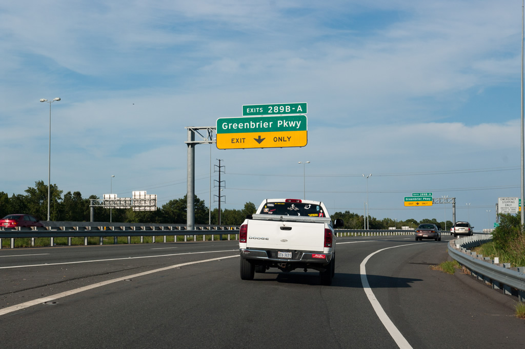
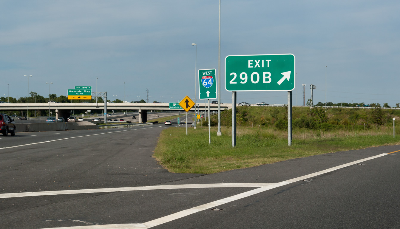
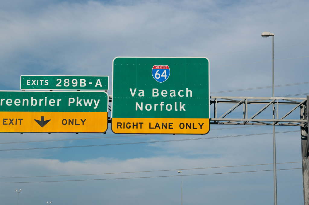
Completed in July 2009, a $98.6 million project expanded I-64 from six to ten overall lanes and extended the c/d roadways east from the exchange with I-464/U.S. 17/SR 168 to Exit 289 with Greenbrier Parkway.
09/05/10
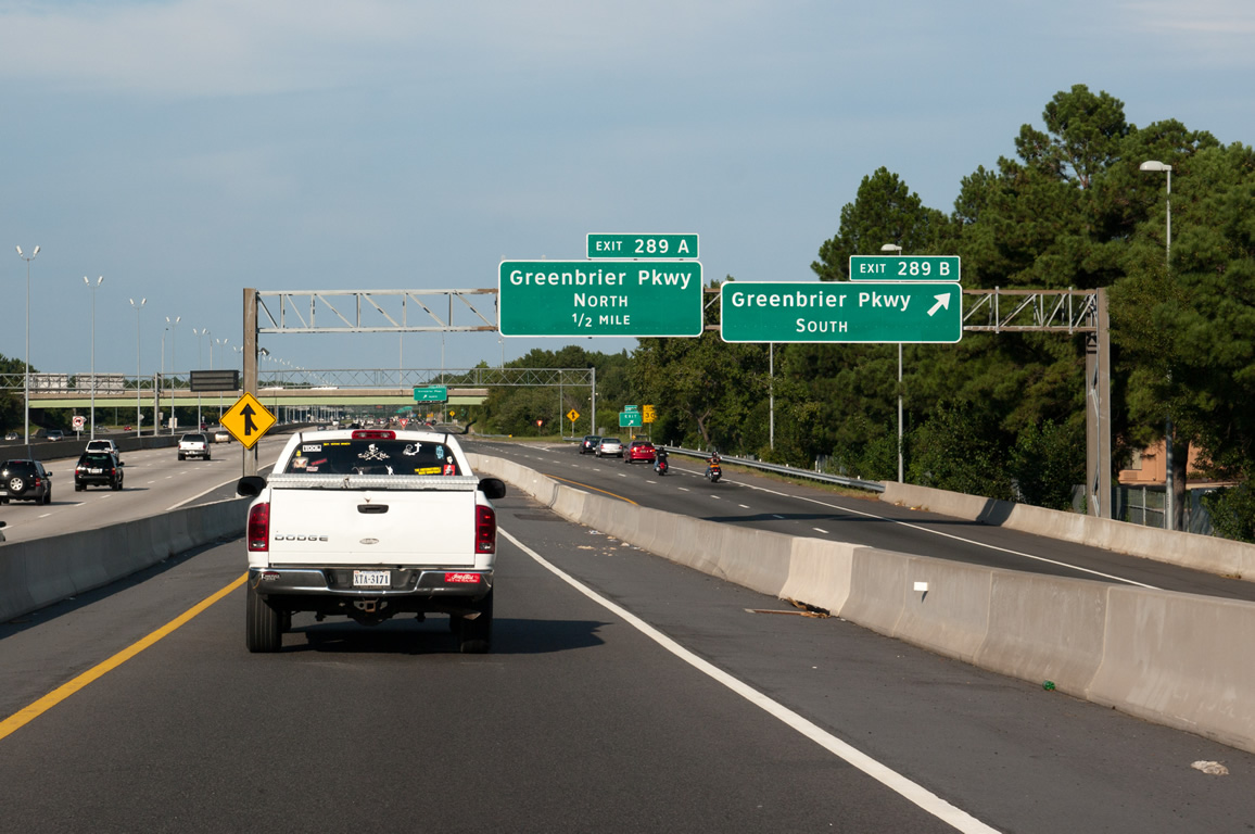
Exit 289B follows onto Greenbrier Parkway southbound to Greenbrier Mall and SR 190 (Kempsville Road) at Butts.
09/05/10
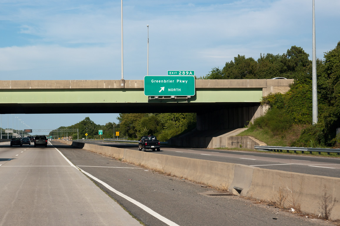
Greenbrier Parkway concludes 0.94 miles north of the cloverleaf interchange (Exit 289A) with I-64 at U.S. 13 (Military Highway) and Dunbarton Drive north.
09/05/10
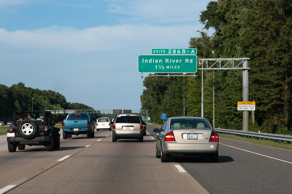
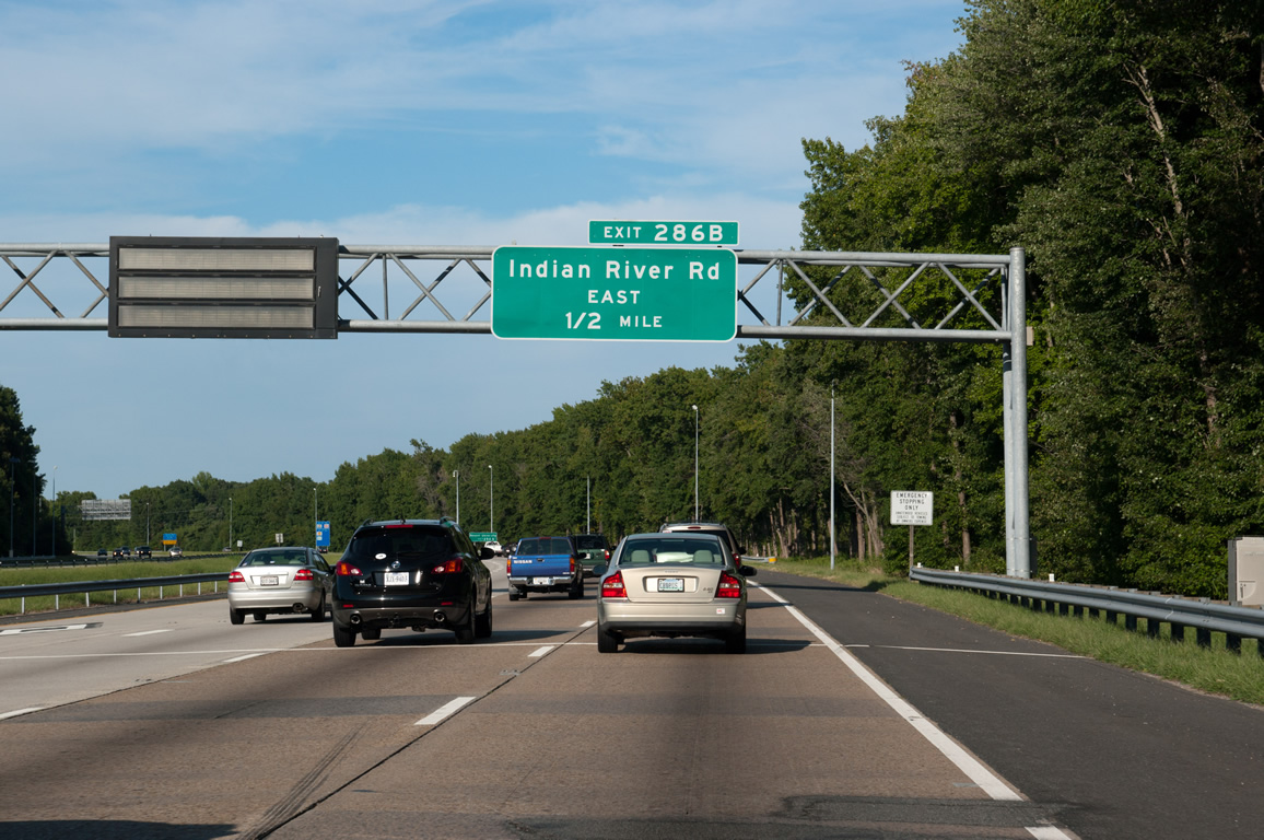
The succeeding exit along Interstate 64 is for Indian River Road (SR 407).
09/05/10
Shields for Interstate 64 along the Hampton Roads Beltway between Bowers Hill and I-264 in east Norfolk omit cardinal direction banners.
09/05/10
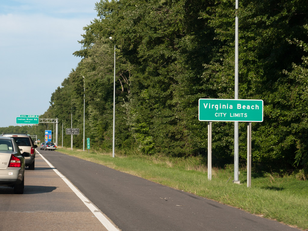
Entering the most populous city in the state of Virginia, Virginia Beach.
09/05/10
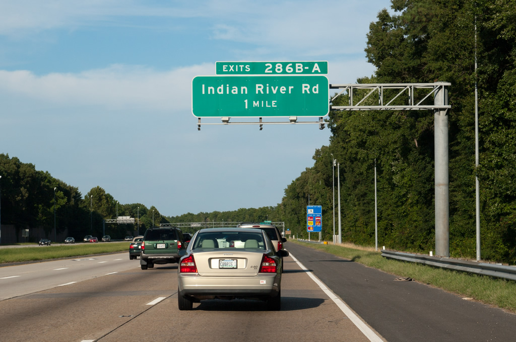
Indian River Road (SR 407) constitutes a suburban route running southeast from Exit 286B to Ferrel Parkway at Acredale in Virginia Beach. Ferrell Parkway extends the arterial 2.66 miles east to SR 165 (Princess Anne Road) near Salem.
09/05/10
An unsigned route, SR 407 follows Indian River Road 18.02 miles southeast to SR 615 (Princess Anne Road) at Pungo and northwest to Berkley Avenue beyond Campostella Heights in Norfolk.
09/05/10

Indian River Road winds southeast to wetlands and remaining agricultural areas at Muddy Creek Road west of North Bay.
09/05/10
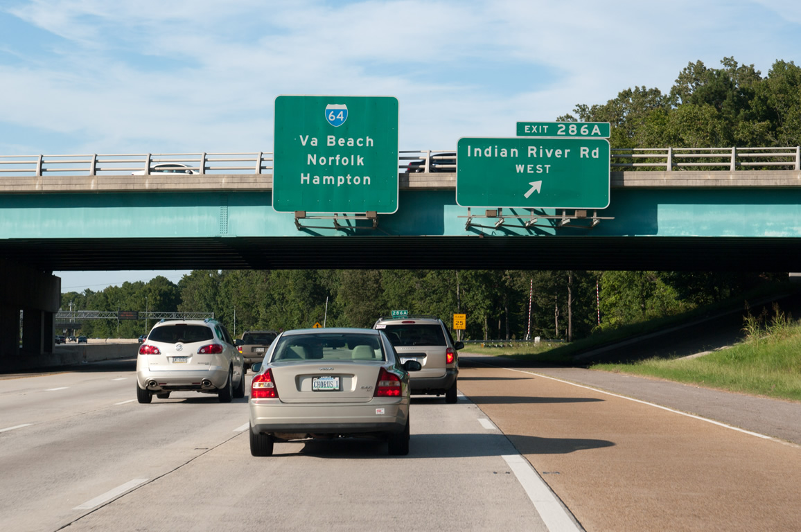
Exit 286A loops onto Indian River Road west to Providence Road (SR 409) beyond the Woodhaven neighborhood and Norfolk Highlands in the city of Chesapeake.
09/05/10
West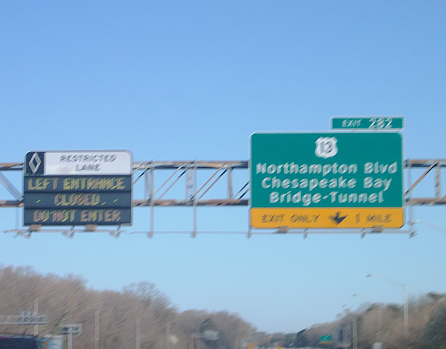
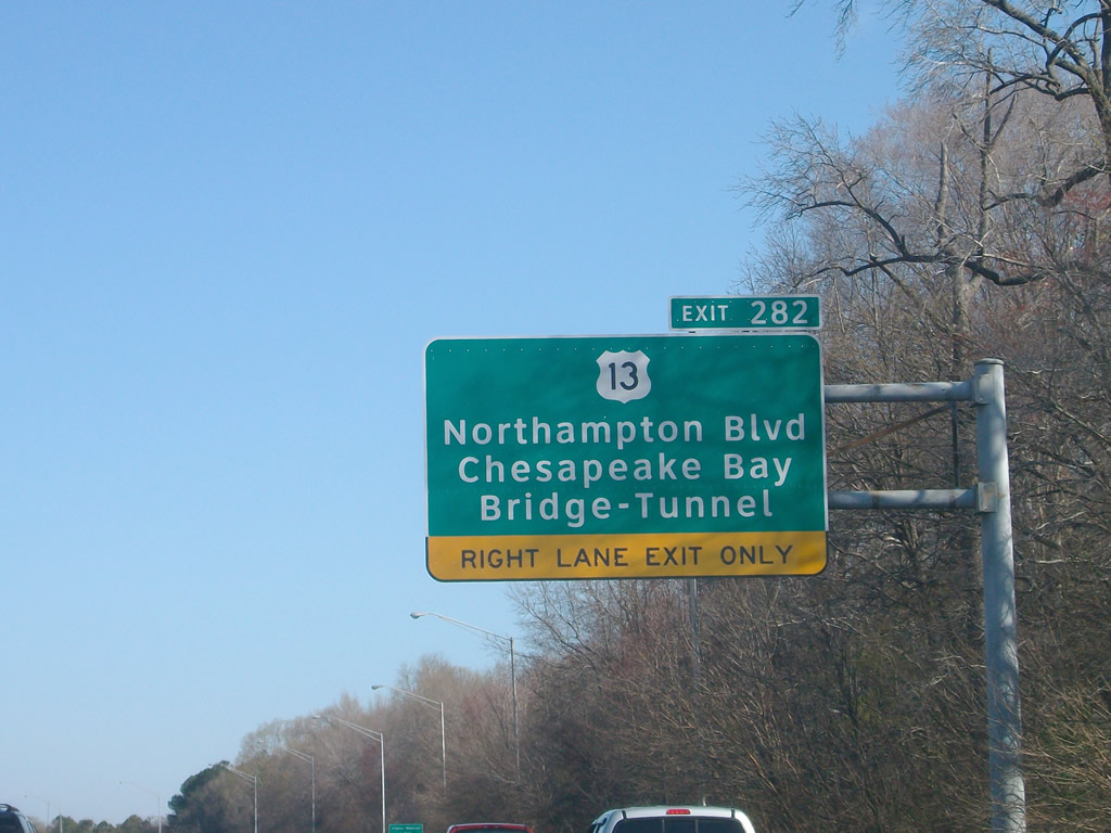
Interstate 64 crosses Lake Taylor beyond an ingress point for the tolled Express Lanes. A parclo interchange (Exit 282) follows with U.S. 13 (Northampton Boulevard) to the Chesapeake Bay Bridge Tunnel (CBBT).
03/21/09
U.S. 13 (Northampton Boulevard) overlaps with SR 166 for 2.03 miles west to Military Highway and east to Diamond Springs Road in Virginia Beach. SR 166 extends north to U.S. 60 (Shore Road) while U.S. 13 continues east as a six lane expressway to U.S. 60 south of the CBBT.
03/21/09
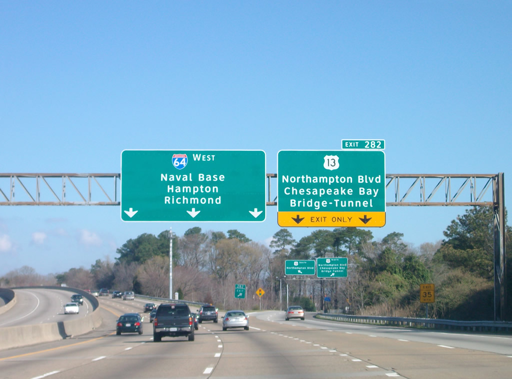
The CBBT leads U.S. 13 north to Virginia'ss Eastern Shore. U.S. 13 joins the Hampton Roads region with Salisbury, Maryland.
03/21/09
I-64 west doubles as the Hampton Roads Beltway outer loop to Interstate 664 in Hampton.
03/21/09
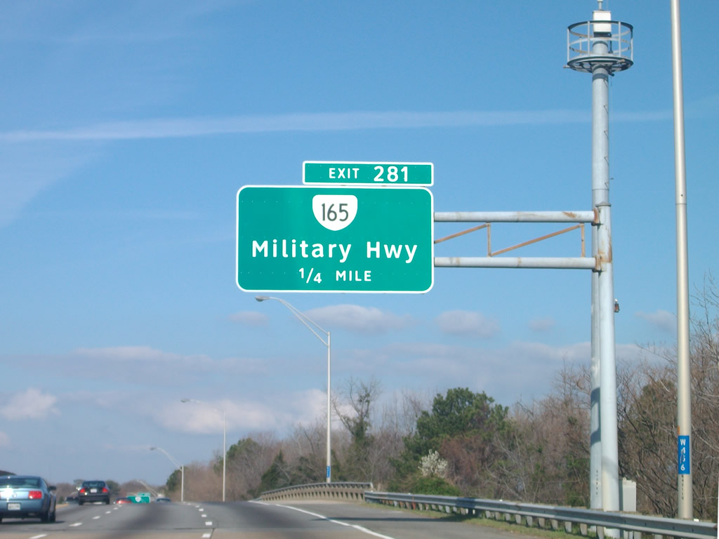
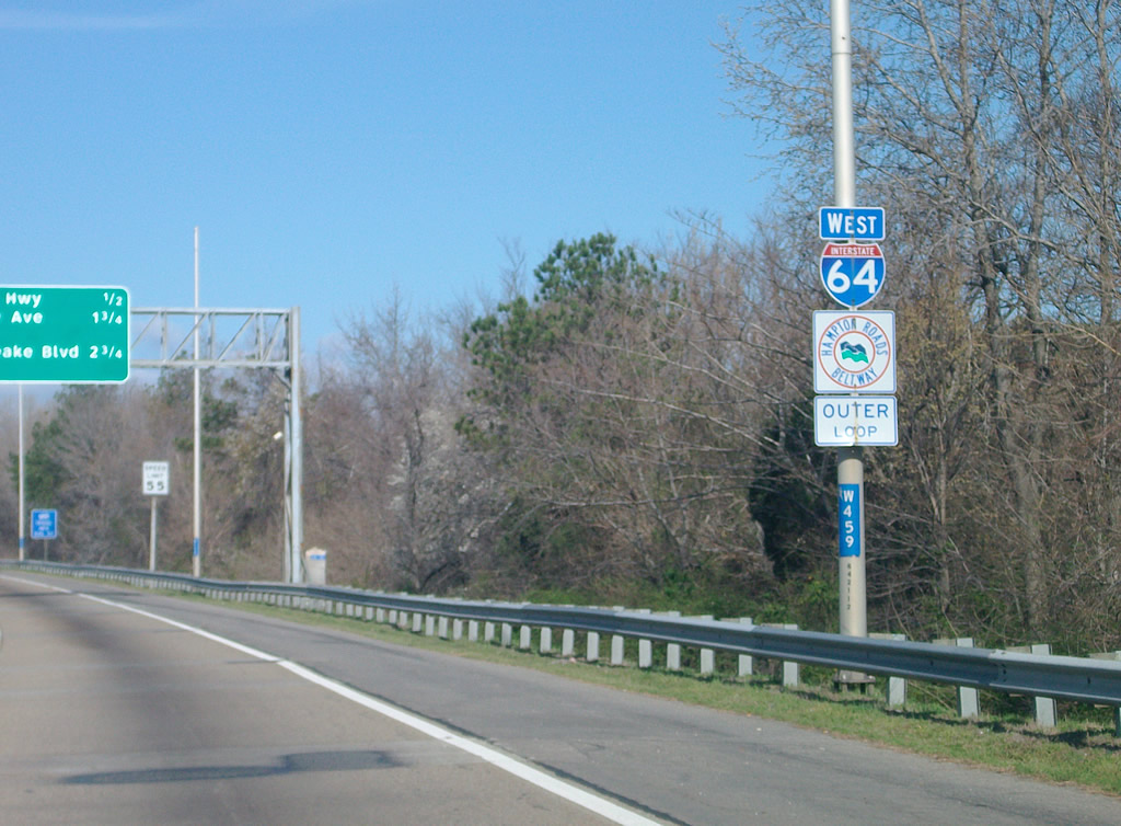
SR 165 continues Military Highway north from U.S. 13 and SR 166 (Princess Anne Road) to a parclo interchange (Exit 281) with Interstate 64.
03/21/09
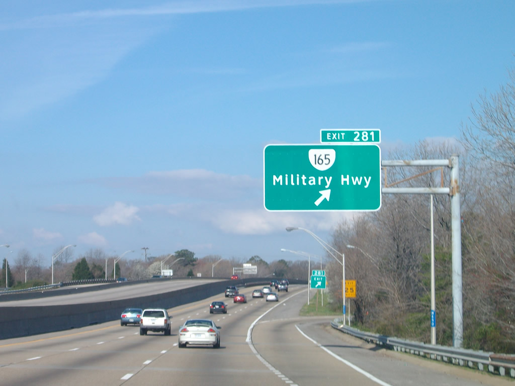
SR 165 (Military Highway) parallels I-64 and SR 194 (Chesapeake Boulevard) north to the west end of SR 170 at Little Creek Road near Lincoln Park.
03/21/09
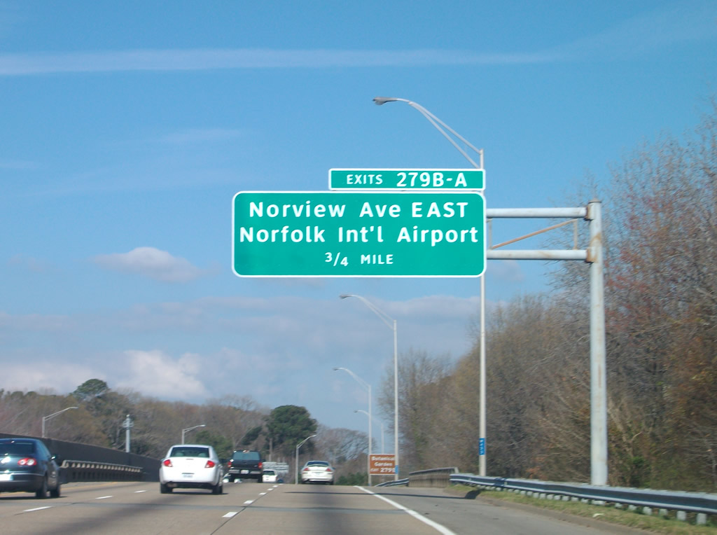
I-64 west spans Azalea Garden Road (former SR 192) between the Elmhurst and Norvelia Heights neighborhoods ahead of Exit 279 with Norview Avenue (SR 247) to Norfolk International Airport (ORF).
03/21/09
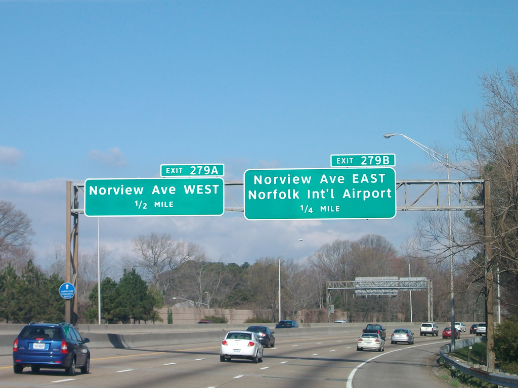
SR 247 is unmarked along Norview Avenue. The state route spurs east across Lake Whitehurst to the passenger terminal at Norfolk International Airport (ORF).
03/21/09
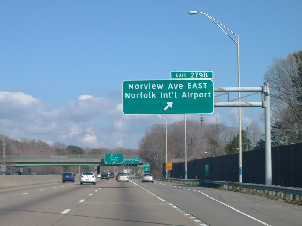
SR 247 (Norview Avenue) east connects Interstate 64 with SR 165 (Military Highway) by the Lakeland community.
03/21/09
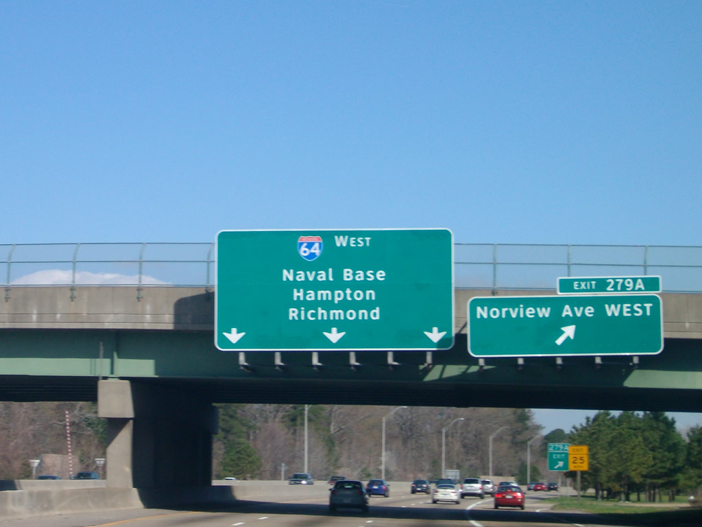
SR 247 runs 6.03 miles overall west to SR 337 (Hampton Boulevard) beyond Park Place in Norfolk.
03/21/09
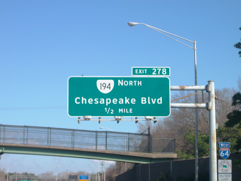
SR 194 (Chesapeake Blvd) converges with I-64 at Exit 278 by the Coronado neighborhood.
03/21/09
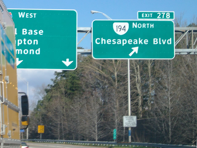
A 5.75 mile long route, SR 194 originates from SR 166 (Princess Anne Road) south of Pennystown and concludes along Chesapeake Boulevard north at U.S. 60 (Ocean View Avenue) in Oceanview.
03/21/09
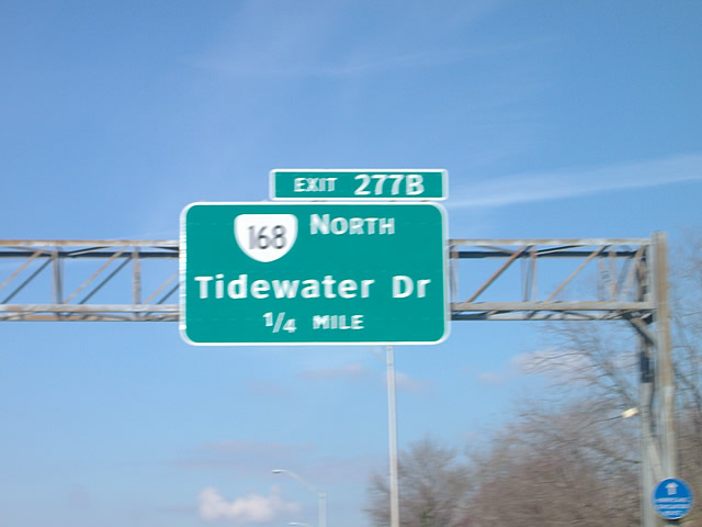
Turning west, I-64 advances between Coronado and Washington Park in Norfolk to Exit 277 with SR 168 (Tidewater Drive).
03/21/09
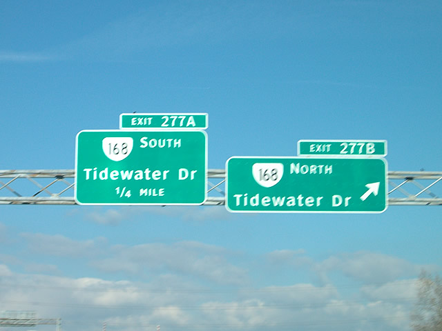
SR 168 (Tidewater Drive) forms a multi state route with NC 168 north from U.S. 158 and the Outer Banks to U.S. 60 at Ocean View in Norfolk.
03/21/09
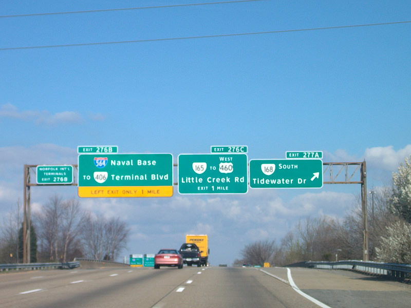
SR 168 (Tidewater Drive) heads south to Willard Park, Lafayette Annex and Huntersville en route to U.S. 460/SR 337 (Brambleton Avenue) outside Downtown Norfolk. Interstate 564 spurs west to Naval Station Norfolk (NSN) in one mile.
03/21/09
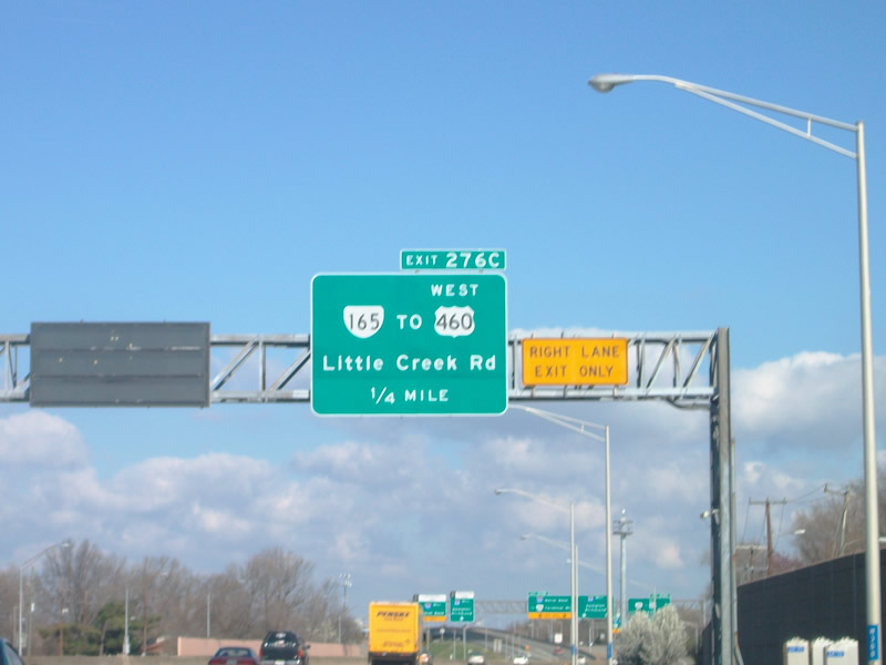
A half diamond interchange (Exit 276C) joins I-64 west with SR 165 (Little Creek Road) at Denby Park, east of U.S. 460 (Granby Street) at Wards Corner.
03/21/09
SR 165 (Little Creek Road) concludes 1.59 miles west of Exit 276C at SR 337 (Hampton Boulevard) south of SR 406 (International Terminal Boulevard) and NSN. SR 165 forms a 39.75 mile long loop southeast to Virginia Beach and west to U.S. 17 Business at Deep Creek in Chesapeake.
03/21/09

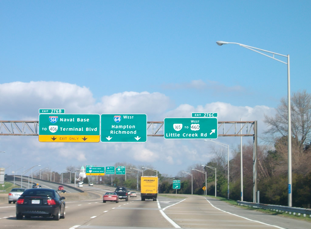
Interstate 564 (Admiral Taussig Boulevard) branches west from I-64 and U.S. 460 (Granby Street) at a three wye interchange (Exit 276B) to SR 337 at NSN.
03/21/09
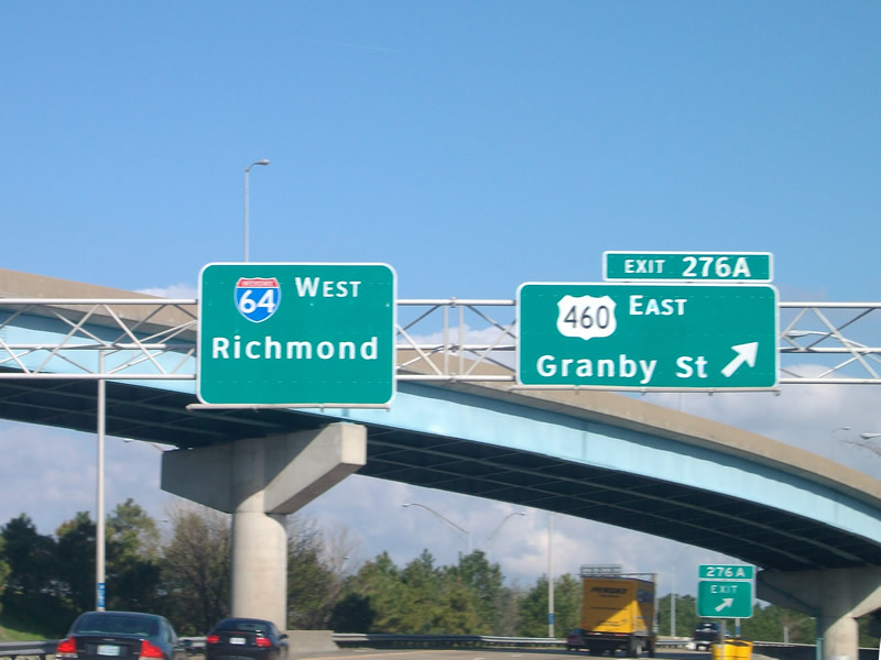
Exit 276A links I-64 west with U.S. 460 (Granby Street) eastbound. U.S. 460 parallels I-64 northward to Commodore Park, Lenox and U.S. 60 at Ocean View.
03/21/09
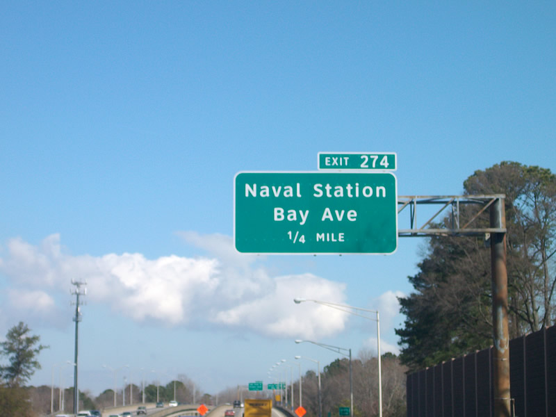
I-64 reduces to four overall lanes north of I-564 and through the Hampton Roads Bridge Tunnel (HRBT) until after Exit 268 with SR 169 in Hampton. I-64 crosses an arm of Masons Creek ahead of Exit 274 for Bay Avenue west to NSN Gate 4.
03/21/09
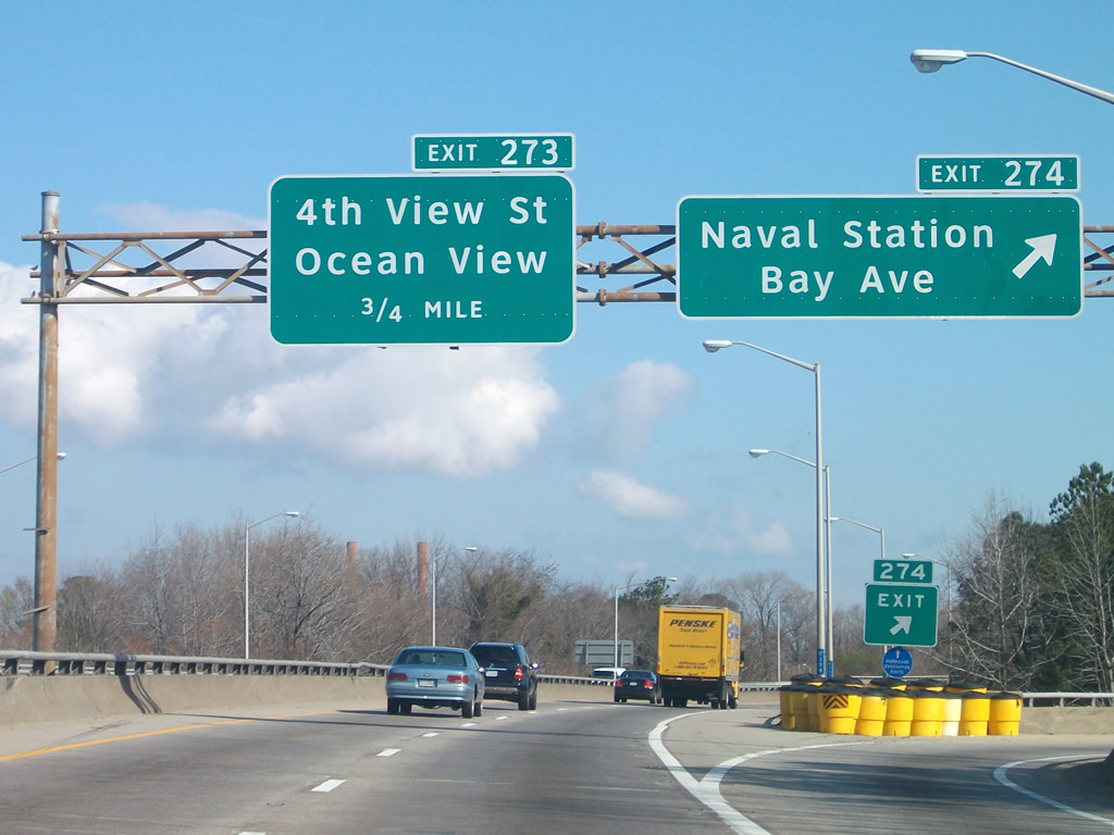
Exit 274 loops onto Bay Avenue west between Merrimack Park and Willoughby Terrace. U.S. 60 west ties into the Hampton Roads Beltway at the succeeding exit via 4th View Street.
03/21/09
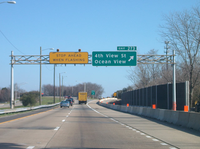
U.S. 60 shifts west from Ocean View Avenue (former SR 168) onto I-64 at the diamond interchange (Exit 273) with 4th View Street. U.S. 60 east runs along the south shore of Chesapeake Bay through the Ocean View section of Norfolk.
03/21/09
 West
West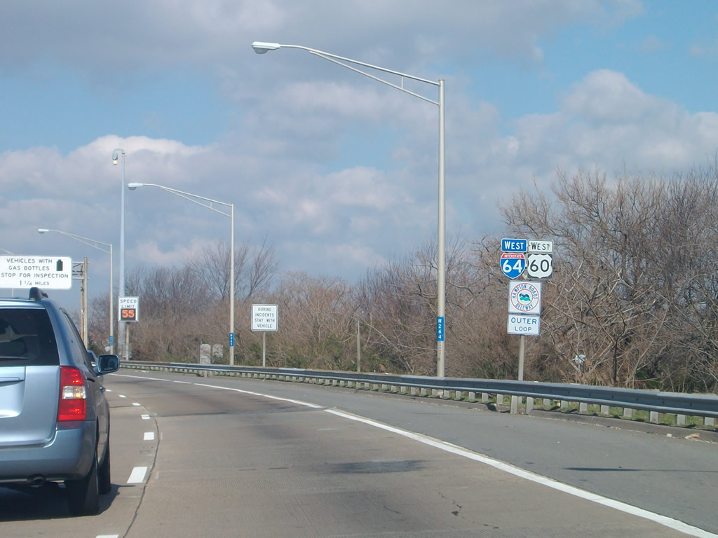
I-64/U.S. 60 curve west onto a viaduct spanning Willoughby Bay ahead of Willoughby Split and the HRBT.
03/21/09
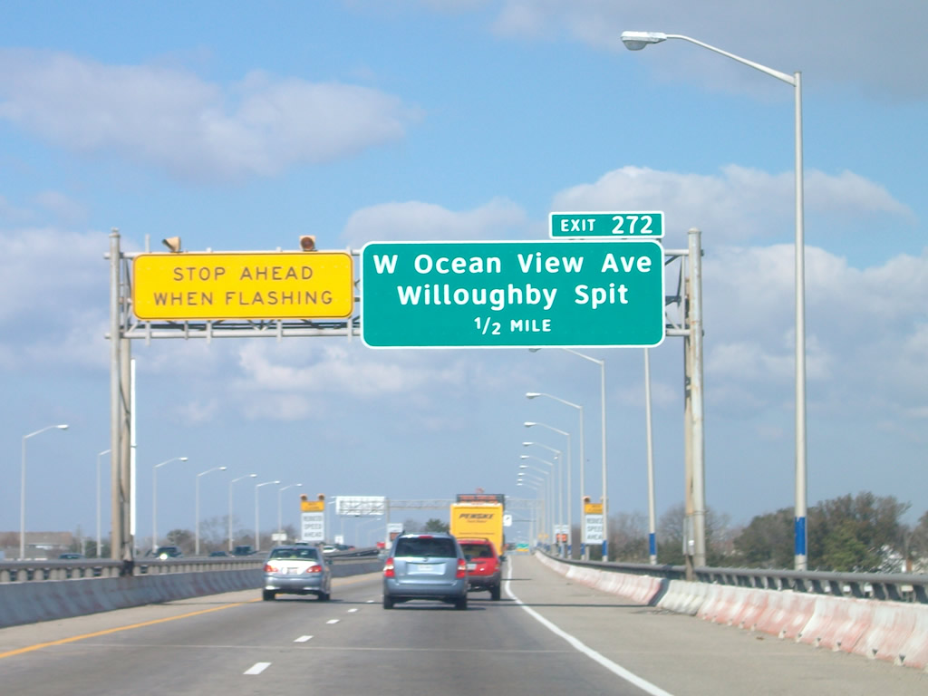
Right in right out (RIRO) ramps connect I-64/U.S. 60 westbound with parallel Ocean View Avenue (old U.S. 60) at exit 272.
03/21/09
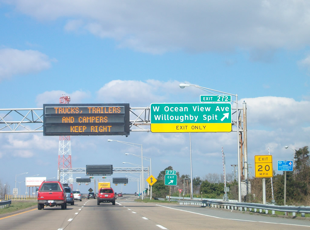
Exit 272 departs I-64/U.S. 60 west for W Ocean View Avenue ahead of the HRBT. Ocean View Avenue through Willoughby Beach was also a part of SR 168 until 1980.2
03/21/09

References:
- US 60. Virginia Highways Page.
- VA 161 to 180YVirginia Highways Page.
- VA 161 to 180 Virginia Highways Page.
Photo Credits:
- Will Weaver: 09/05/10
- Mark Moore: 03/21/09
Connect with:
Page Updated Monday April 12, 2021.