
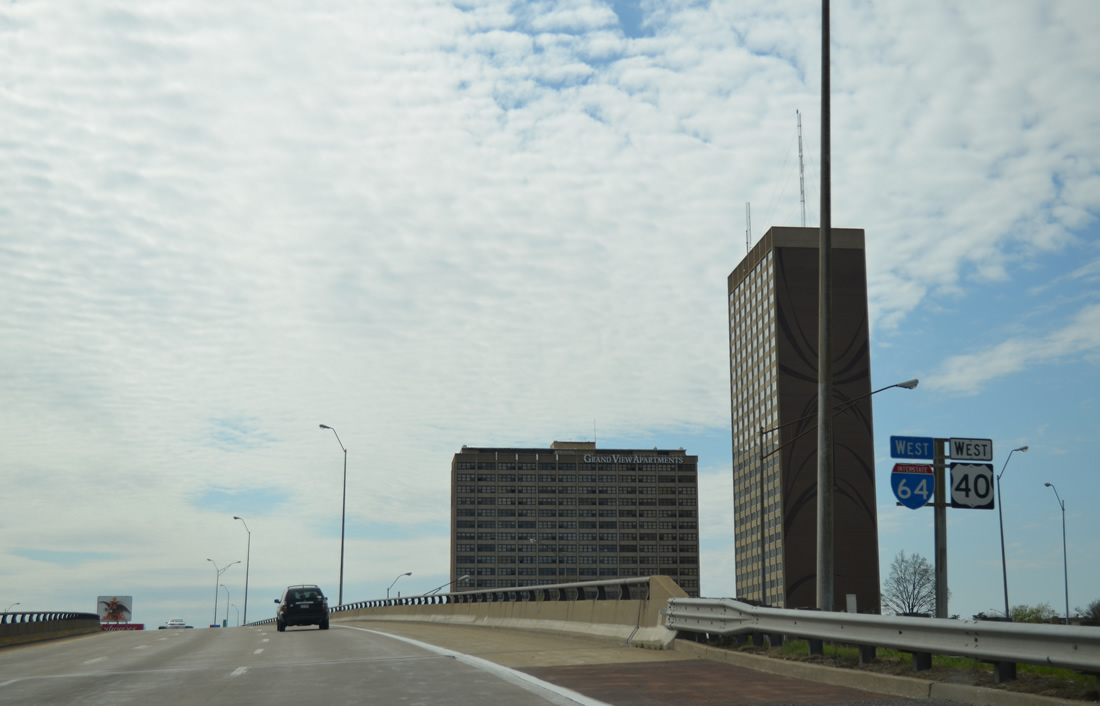
I-64/U.S. 40 West - St. Louis


 West
West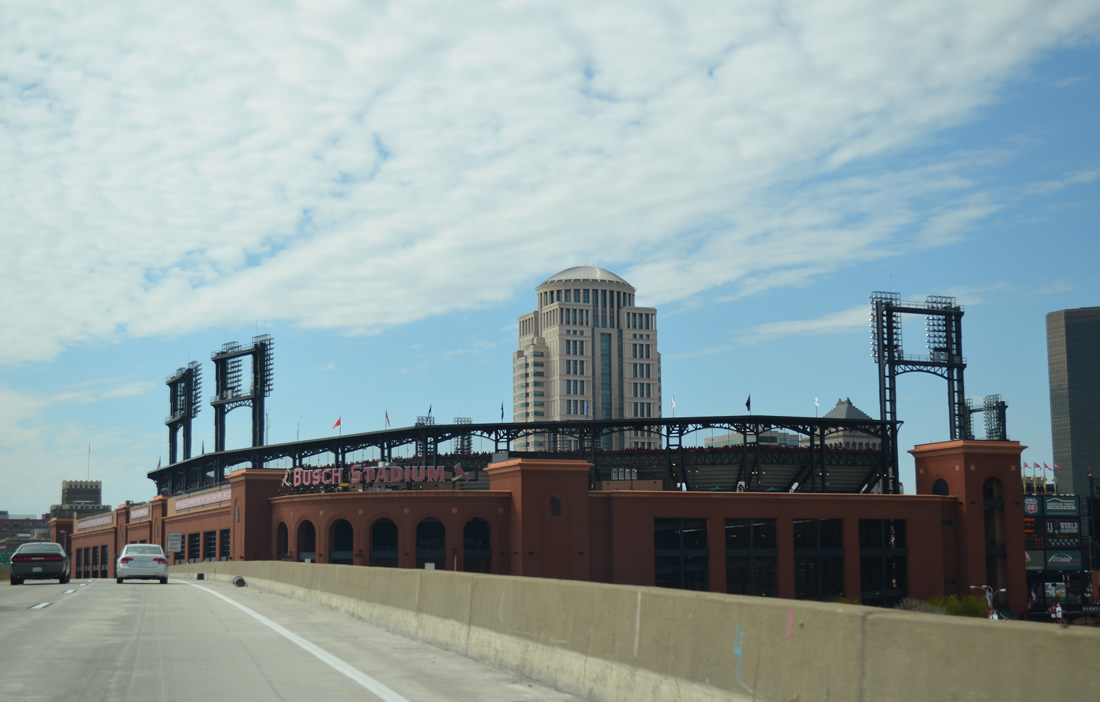
Busch Stadium, home of the St. Louis Cardinals MLB franchise, lies along the north side of the viaduct along I-64/U.S. 40 between Broadway and S 8th Street. The venue opened on April 4, 2006, replacing the previous Busch Stadum built in 1966 that stood on the north side of the new ball park.
04/13/13
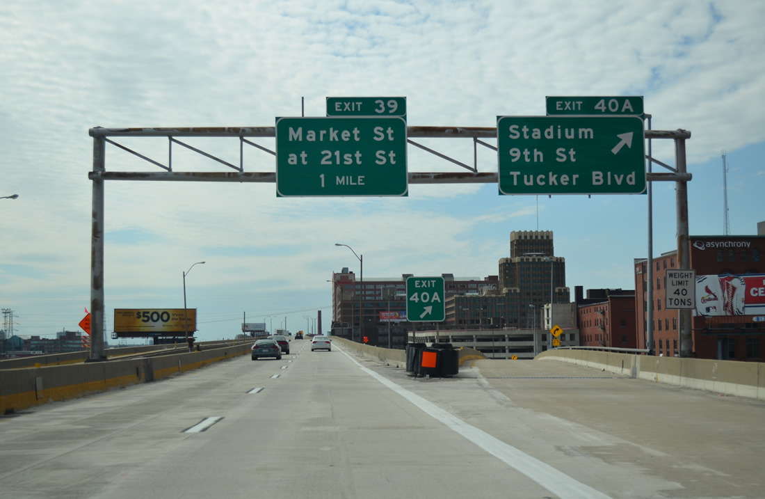
Exit 40A drops from the I-64/U.S. 40 westbound viaduct to intersect Clark Avenue at 9th Street, one block west of Busch Stadium.
04/13/13
Taking Exit 40B, the ramp passes over 8th Street south of its partition into Stadium Plaza and 7th Street.
05/04/12
Ramps join the double decker freeway of I-64/U.S. 40 from both 10th and 11th Streets south as Exit 40A curves to Clark Avenue.
05/04/12
04/13/13
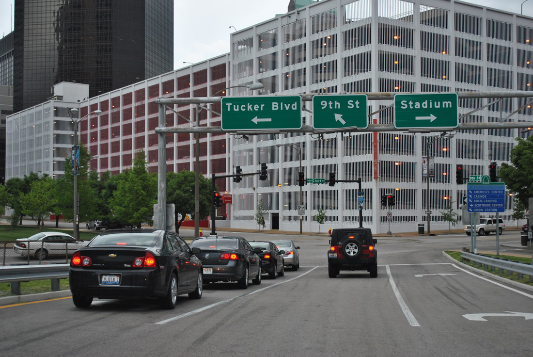
Tucker Boulevard travels three blocks to the west. The north-south boulevard joins Downtown with LaSalle Park to the south and with Columbus Square and Interstate 70 at the Stan Musial Veterans Memorial Bridge to the north.
05/04/12
The first reassurance marker for Interstate 64 in Missouri is posted as the viaduct passes over 14th Street.
04/13/13
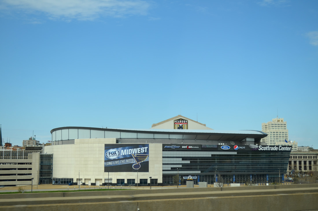
The Enterprise Center appears to the north of I-64/U.S. 40 along Clark Avenue between 16th and 14th Streets. Home of the NHL St. Louis Blues, the 19,150-seat venue opened in 1994.
04/13/13
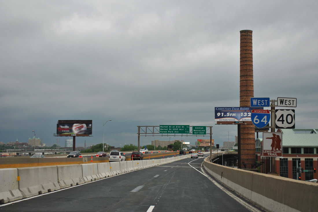
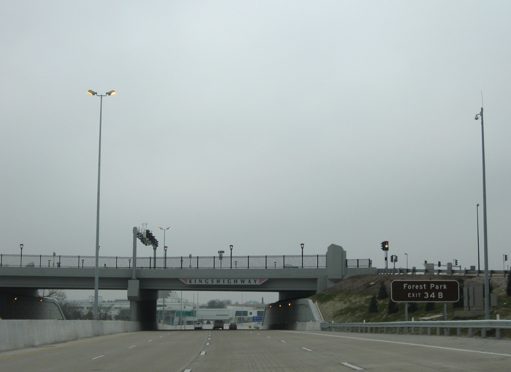
A third entrance ramp joins I-64/U.S. 40 west from Clark Avenue at 14th Street ahead of this shield assembly. St. Louis Union Station lies just north of this stretch.
05/04/12
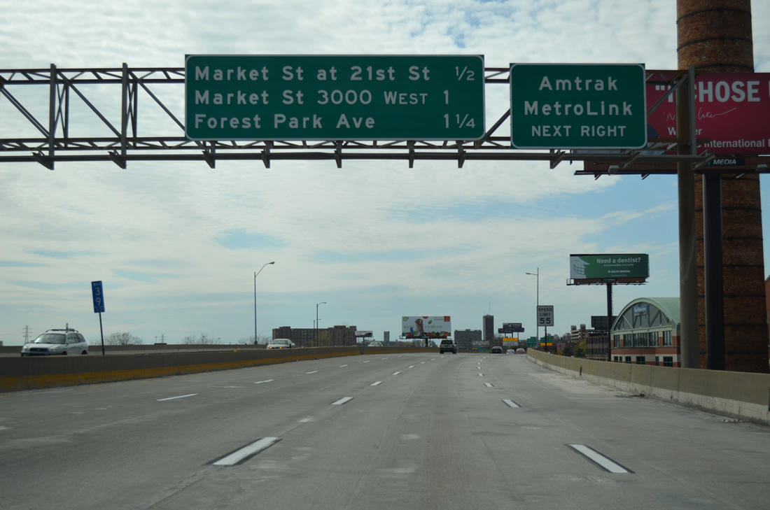
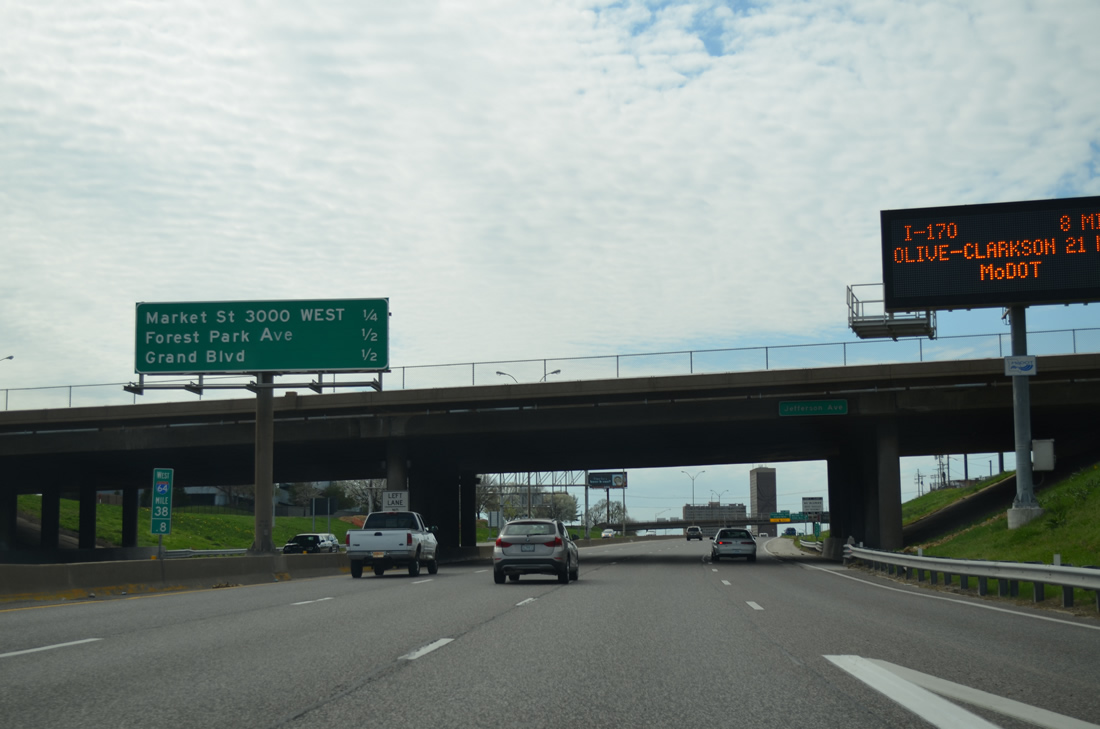
Exit 39 previously departed from the west end of the viaduct along I-64/U.S. 40 for Market Street at 21st Street with connections to Amtrak and MetroLink at Union Station. Utilizing a portion of the cancelled North South Distributor Freeway, ramps at Exit 39 tied into Market Street (old U.S. 40) east of I-64 at Compton Avenue.
04/13/13
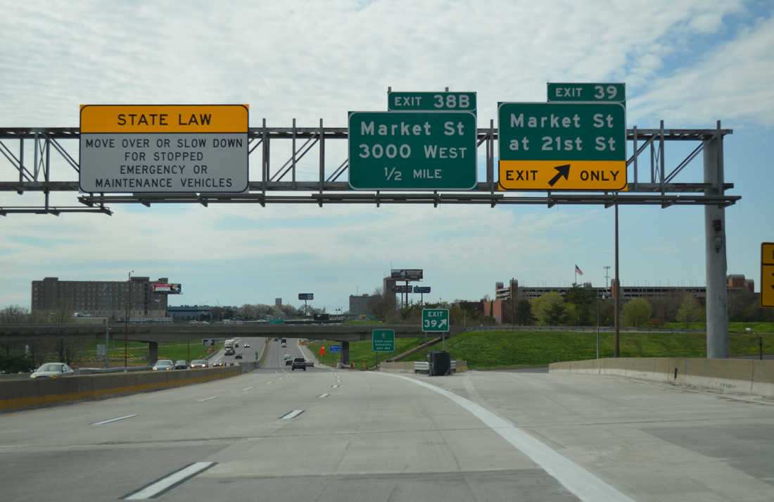
Previously numbered Exit 39A, the ramps at Exit 39 were demolished to make way for construction of Centene Stadium. The Distributor (Missouri Route 755) was a planned freeway north from I-44 and I-55 at LaSalle Park to I-70 at Old North St. Louis. Ramps for the loop were built on U.S. 40 and at I-44/55.
04/13/13
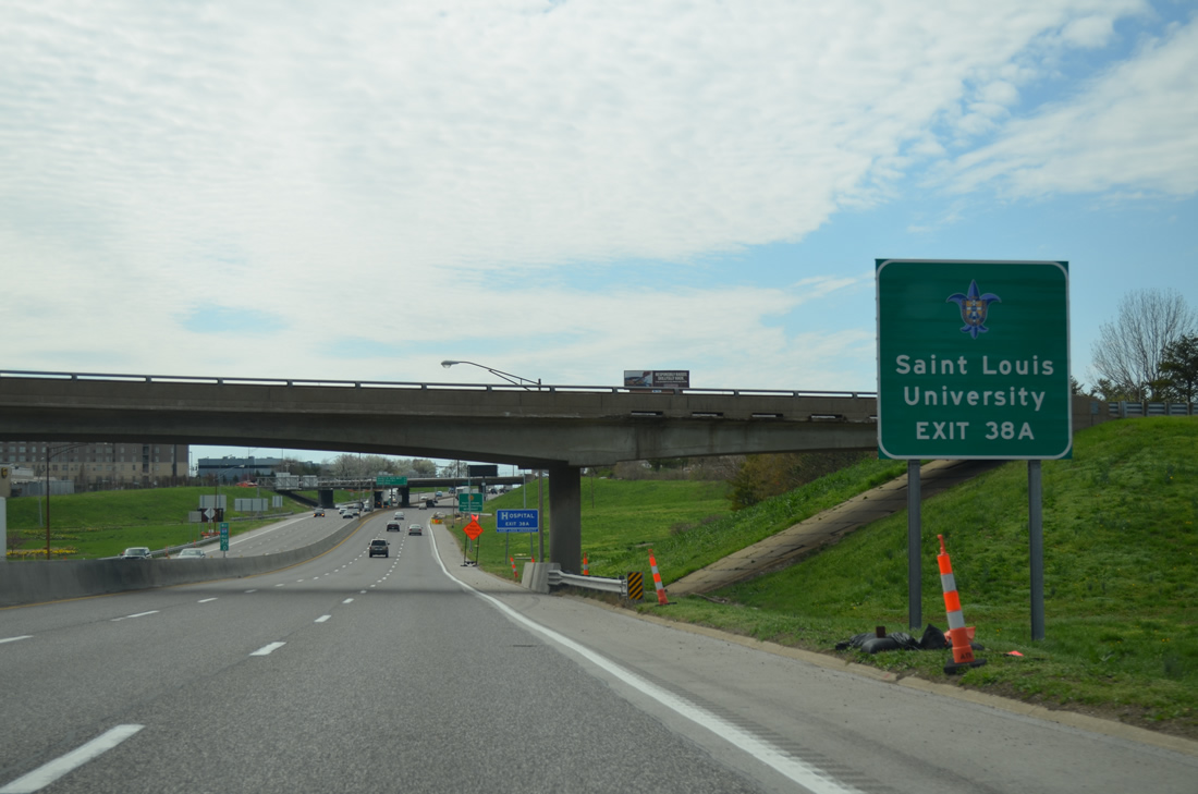
A directional ramp from the removed North South Distributor Freeway linked with I-64/U.S. 40 east by this sign for St. Louis University via Exit 38 A /Forest Park Avenue. Roadway stubs remained here from the planned continuation of Route 755 southeast to Truman Parkway at Chouteau Avenue (Route 100 / old Truck U.S. 40).
04/13/13
Passing under Jefferson Avenue, I-64/U.S. 40 enter Midtown St. Louis on the quarter mile approach to Exit 38B with Market Street at Garrison Avenue. Exit 38A immediately follows Exit 38B for Forest Park Avenue west ahead of Grand Boulevard.
04/13/13
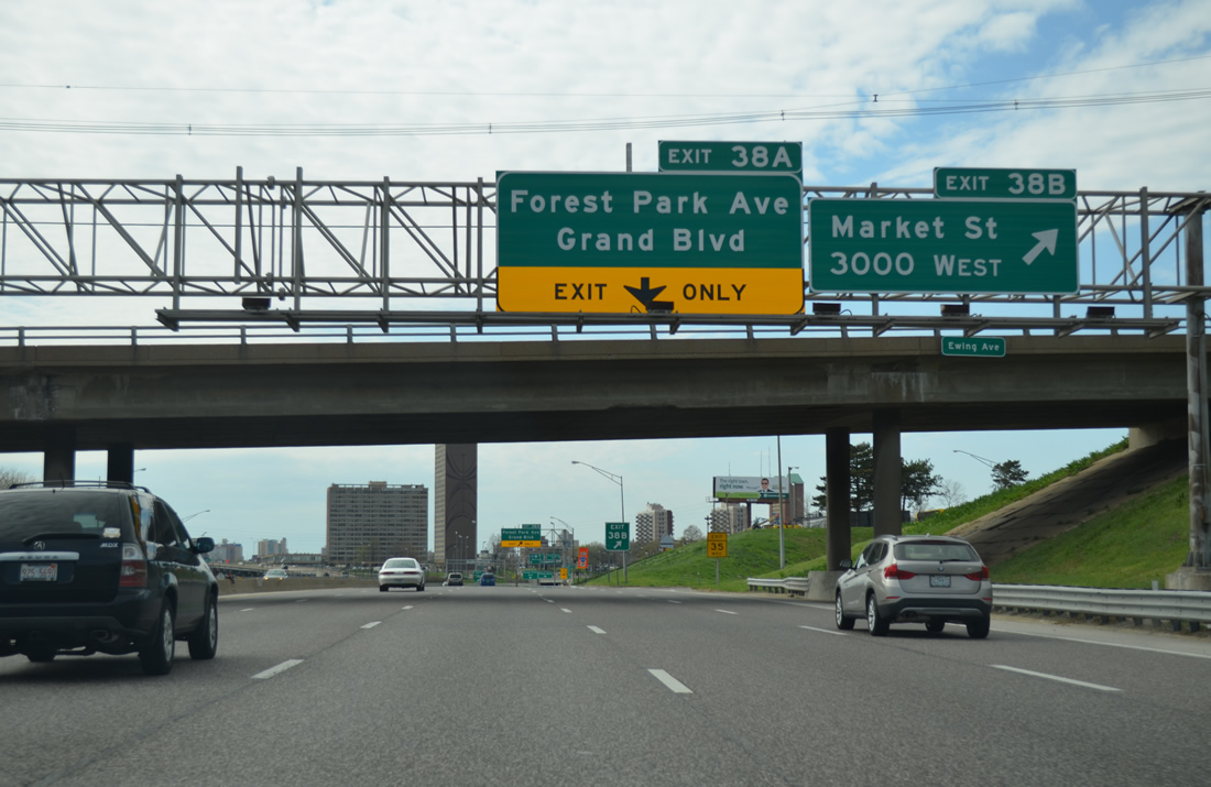
Exit 38 B leaves I-64/U.S. 40 west for Market Street at Harris-Stowe State University. Market Street is the historic alignment of U.S. 40 west from Memorial Drive (old U.S. 50/66) to the original Oakland Express Highway.
04/13/13
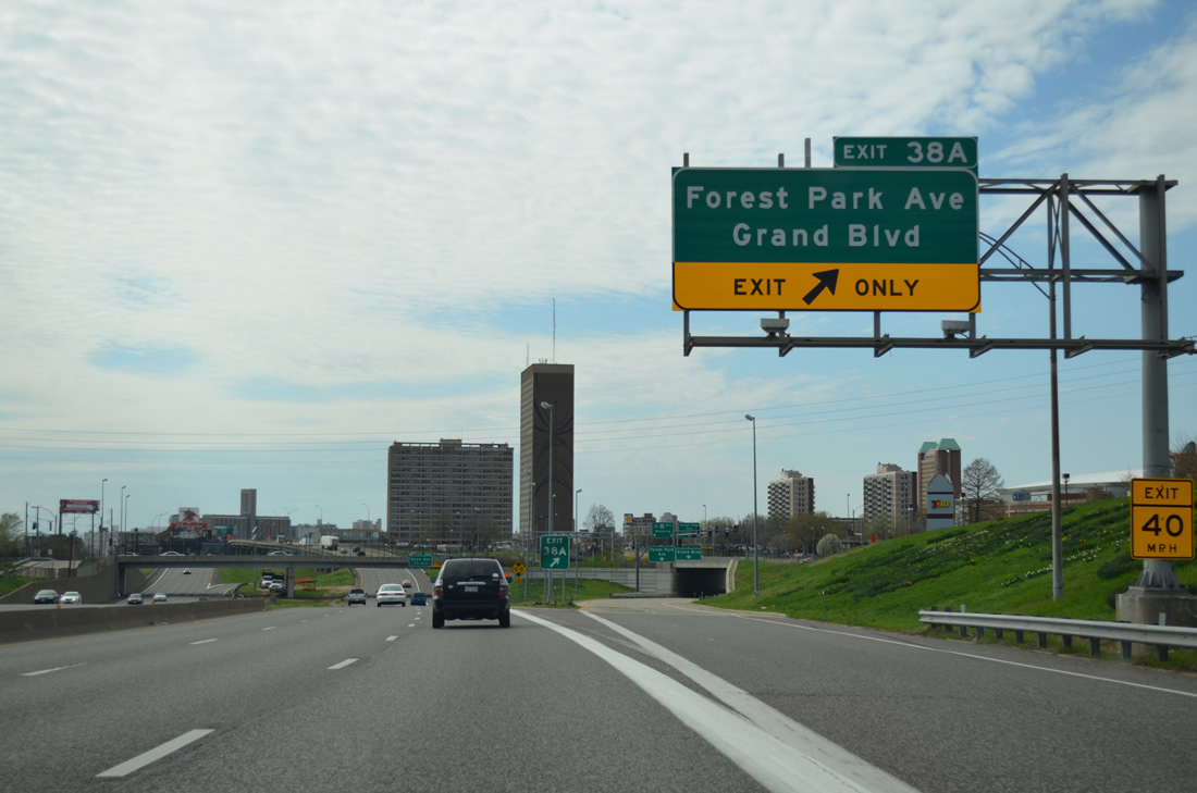
A wye interchange provides direct access to Forest Park Avenue west ahead of Grand Boulevard to St. Louis University and Central West End. Points of interest for Exit 38A include Powell Symphony Hall and Fox Theatre via Grand Boulevard.
04/13/13
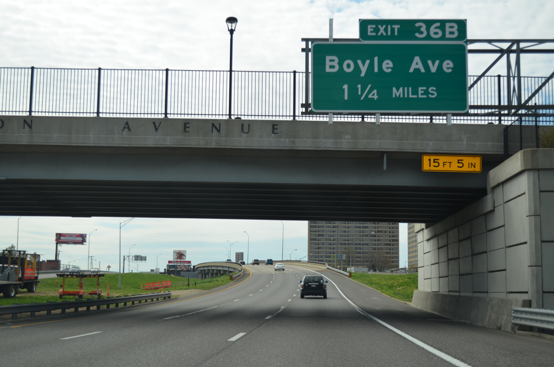
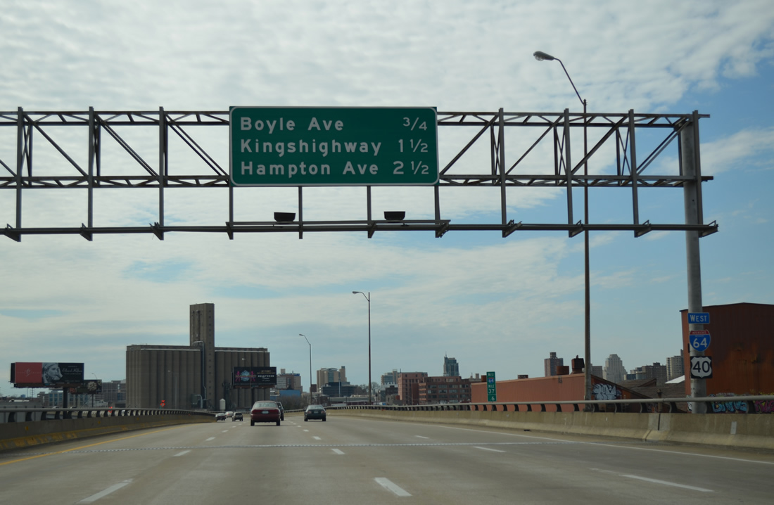
I-64/U.S. 40 continue west between the Central West End and Forest Park South East neighborhoods beyond Vandeventer Avenue. Departing in 1.25 miles is Exit 36B for Boyle Avenue.
04/13/13
I-64/U.S. 40 overtake the original Oakland Express Highway from a wye interchange with Market Street east through the industrial area of Midtown.
04/13/13
Westbound traffic travels a viaduct above the eastbound lanes from Market Street to just west of Spring Avenue.
04/13/13
An on-ramp joins the upper deck of I-64/U.S. 40 from Grand Boulevard. The half diamond interchange (Exit 36B) with Boyle Avenue lies 0.75 miles ahead. It coincides with a wye interchange with the Vandeventer Avenue connector westbound.
04/13/13
The double deck configuration of I-64/U.S. 40 ends as side by side viaducts above Vandeventer Avenue, a Metrolink line and Clayton Avenue.
12/20/09
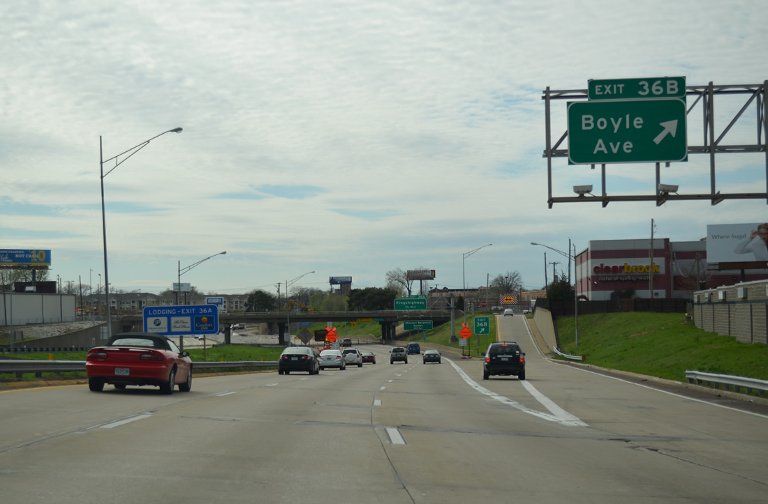
Boyle Avenue heads north from Vandeventer Avenue to become Pendleton Avenue through the Central West End community. A $17.9 million project kicked off on January 21, 2013 along I-64 from Exit 36B to Kingshighway Boulevard (Exit 36A). Bridges for Newstead and Taylor Avenues were replaced by November 2013. This accommodated expansion of the freeway below to ten overall lanes. This work coincided with the addition of a new on-ramp from Boyle Avenue to I-64/U.S. 40 west and a new off-ramp from eastbound to Tower Grove Avenue. Work ran through June 1, 2014.1
04/13/13
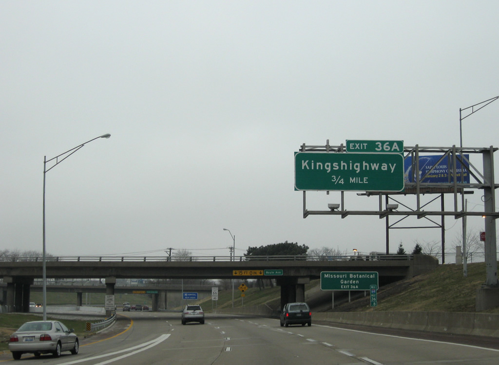
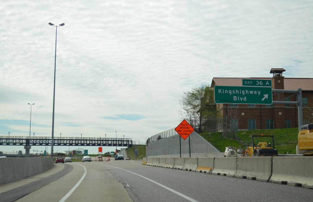
Kingshighway Boulevard (old U.S. 67) meets I-64/U.S. 40 at a single point urban interchange (SPUI) in three quarters of a mile.
12/20/09
One quarter mile out from Exit 36A to Kingshighway Boulevard. The boulevard lines the east side of Forest Hill Park northward. South from I-64/U.S. 40, the former route of U.S. 67 continues to The Hill and Southwest Garden. Hampton Avenue follows in one mile as the main entrance to Forest Hill Park.
12/20/09
Starting at Kingshighway Boulevard, the entire freeway of I-64/U.S. 40 west to I-270 was rebuilt over the course nine years. "The New I-64" project entailed 10.5 miles of roadway and $535 million. Work modernized the freeway, improved interchanges and replaced overpasses. This sign touted the days to completion, which occurred on December 7, 2009.2
12/20/09
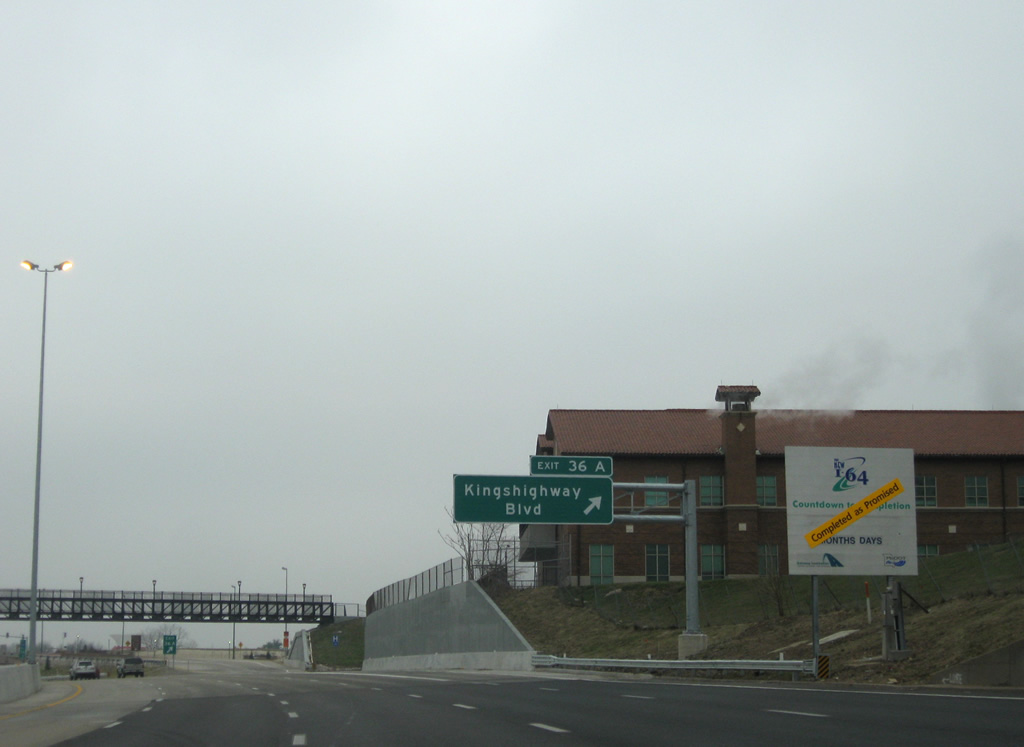
Exit 36A leaves I-64/U.S. 40 west under a pedestrian bridge linking parallel Chouteau and Clayton Avenues at the campus of Barnes-Jewish Hospital.
04/13/13
A cloverleaf interchange with Kingshighway Boulevard was converted to a SPUI as part of the "The New I-64" road work. Kingshighway Boulevard was a part of U.S. 67 between Gravois Avenue at Bevo Mill and Bircher Boulevard at Penrose Park.
12/20/09
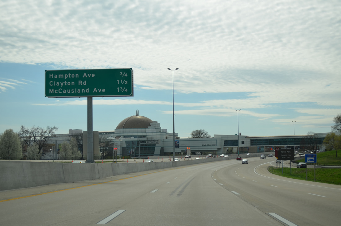
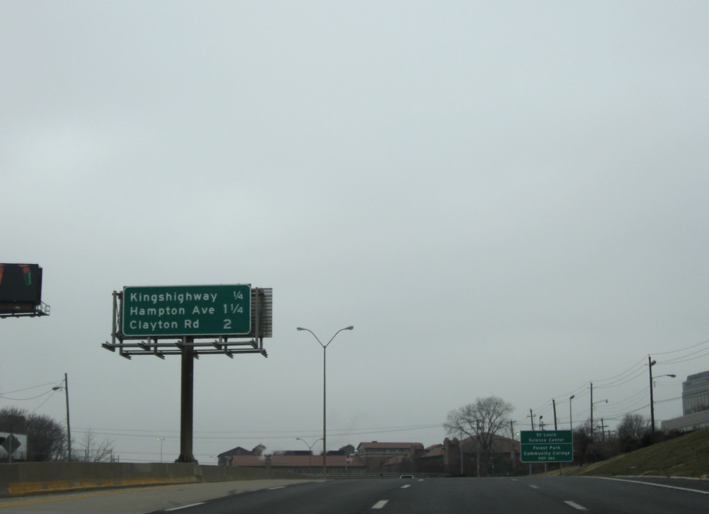
The St. Louis Science Center spreads into view as I-64/U.S. 40 reach Forest Park. An enclosed pedestrian walkway links the St. Louis Science Center on Oakland Avenue with the James S. McDonnell Planetarium in Forest Park.
04/13/13
Reassurance shields posted after the Kingshighway Boulevard on-ramp. Athletic fields in Forest Park line the north side of the freeway along this stretch.
04/13/13
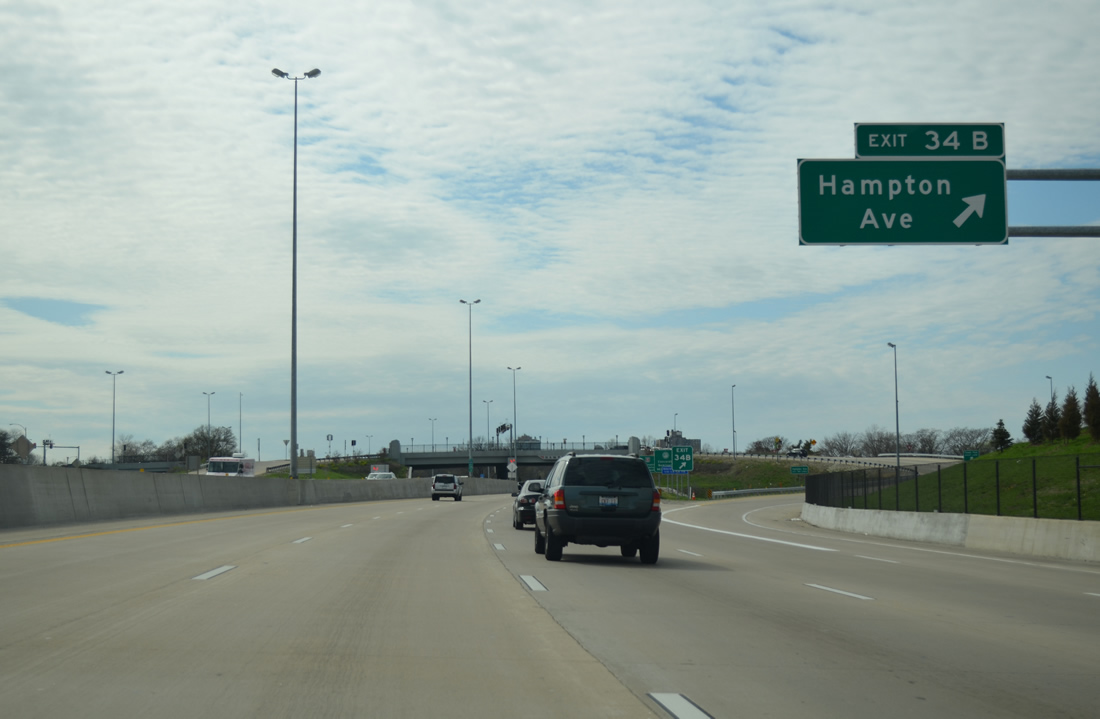
Hampton Avenue joins I-64/U.S. 40 west with Forest Park at a roundabout with Wells Drive. Southward, the boulevard passes between Cheltenham and Clayton-Tamm to Missouri 30 (Gravois Avenue) at Princeton and Boulevard Heights.
04/13/13
The SPUI with Hampton Avenue replaced a compact cloverleaf interchange during "The New I-64" construction.
12/20/09
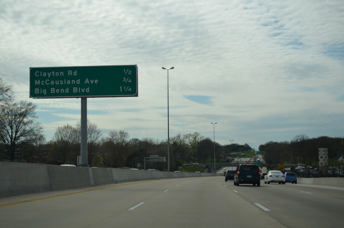
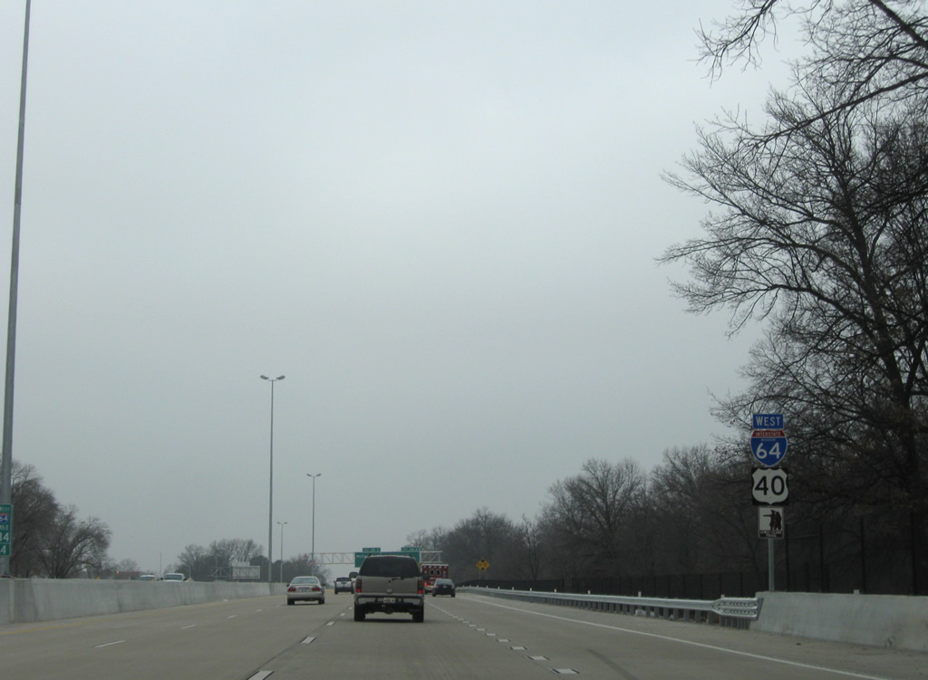
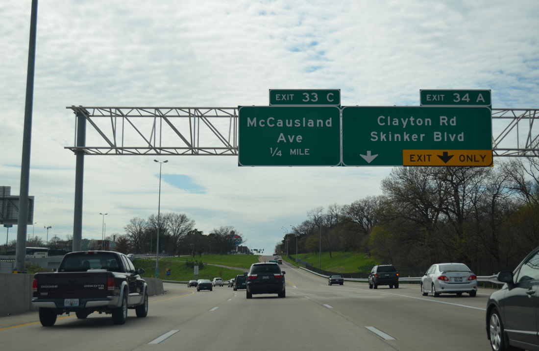
I-64/U.S. 40 west pass by St. Louis Zoo on the half mile preceding the wye interchange with Clayton Road. McCausland Avenue (Exit 33 C) represents the final St. Louis exit in 0.75 miles.
04/13/13
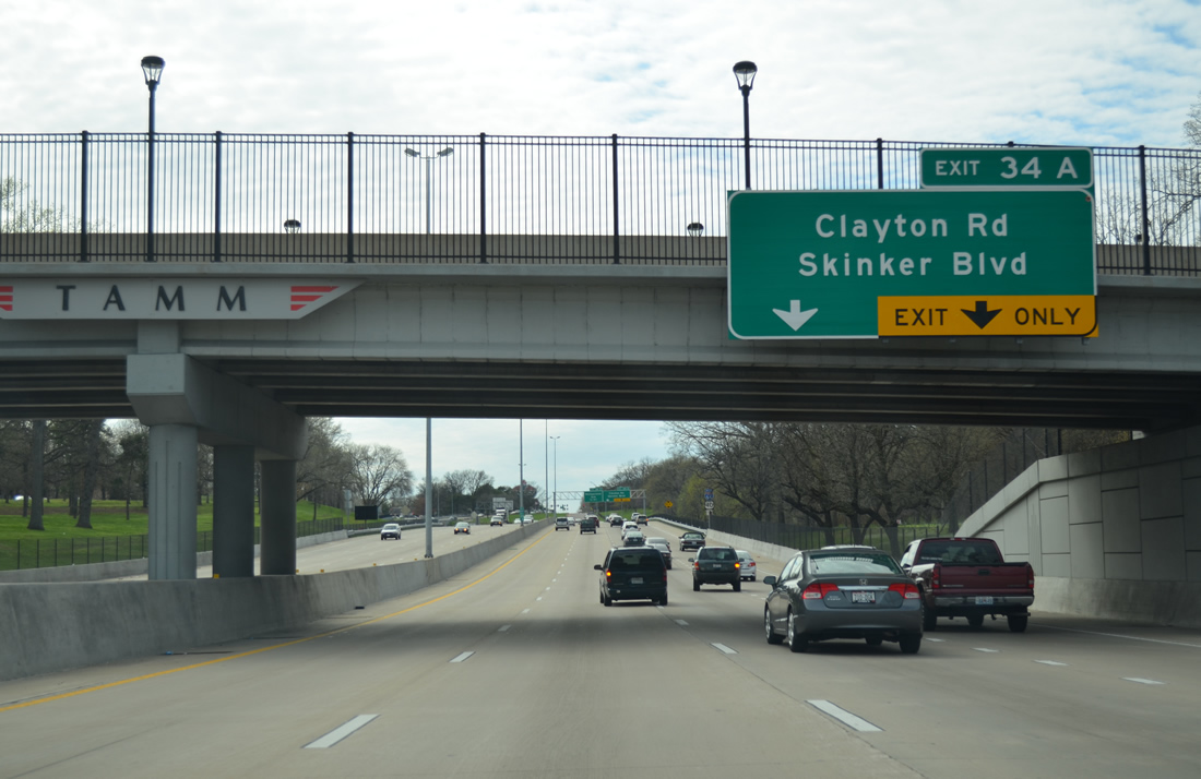
Clayton Road stems west from Exit 34A and Skinker Boulevard to the Wydown Skinker neighborhood and the city of Clayton in St. Louis County.
04/13/13
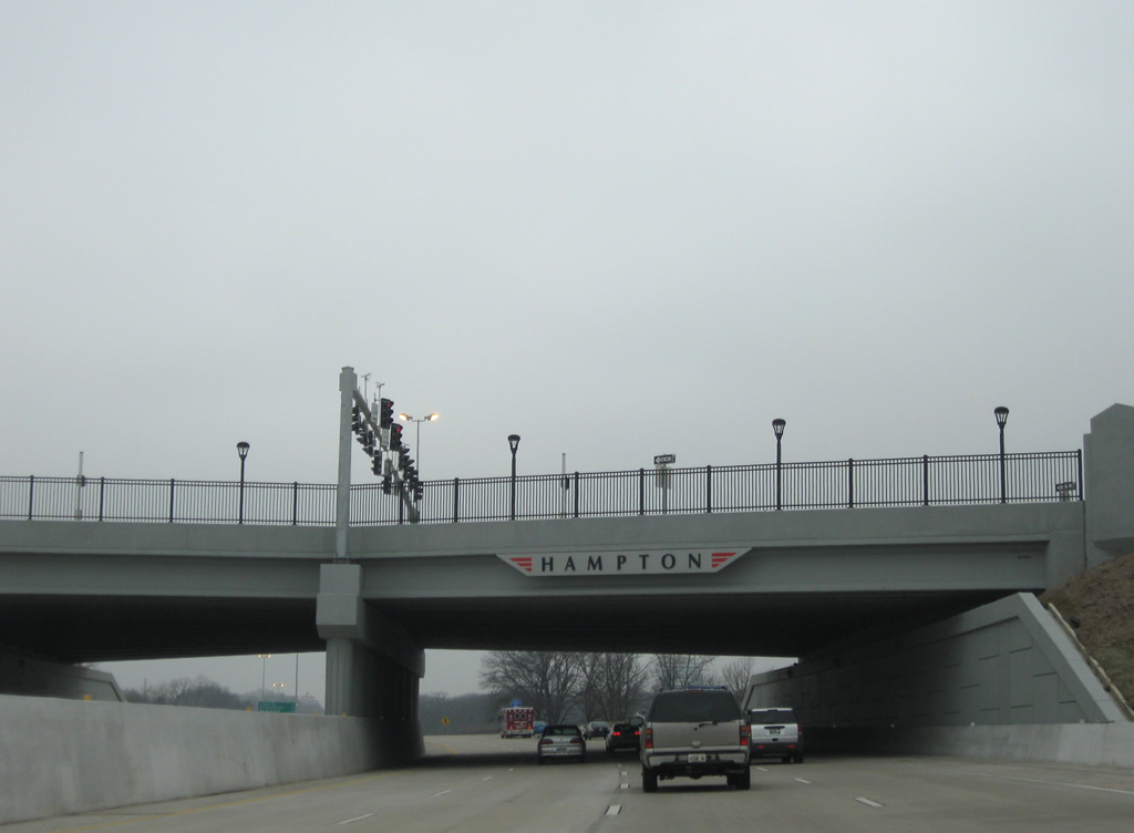
Shields for I-64/U.S. 40 west follow the Hampton Avenue on-ramp beyond Tamm Drive.
12/20/09
I-64/U.S. 40 west curve away from Forest Park as Exit 34 A departs for Clayton Road west. Skinker Boulevard lines the west side of the park north to Skinker DeBaliviere and Washington University.
04/13/13
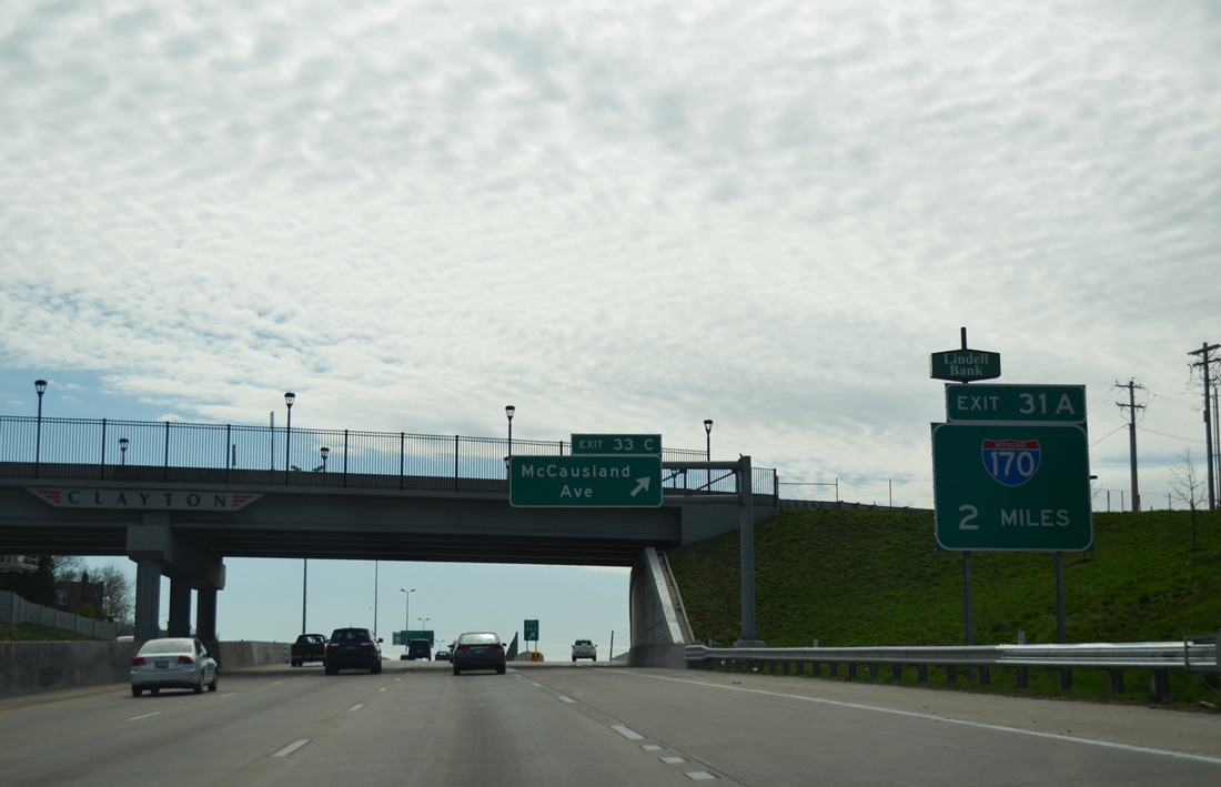
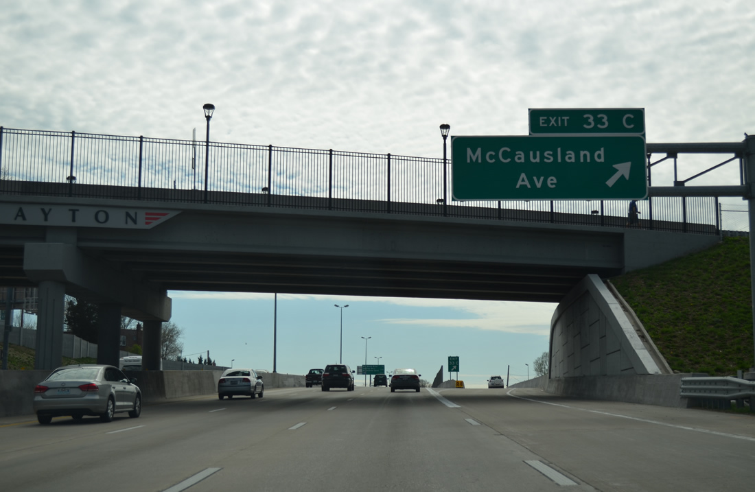
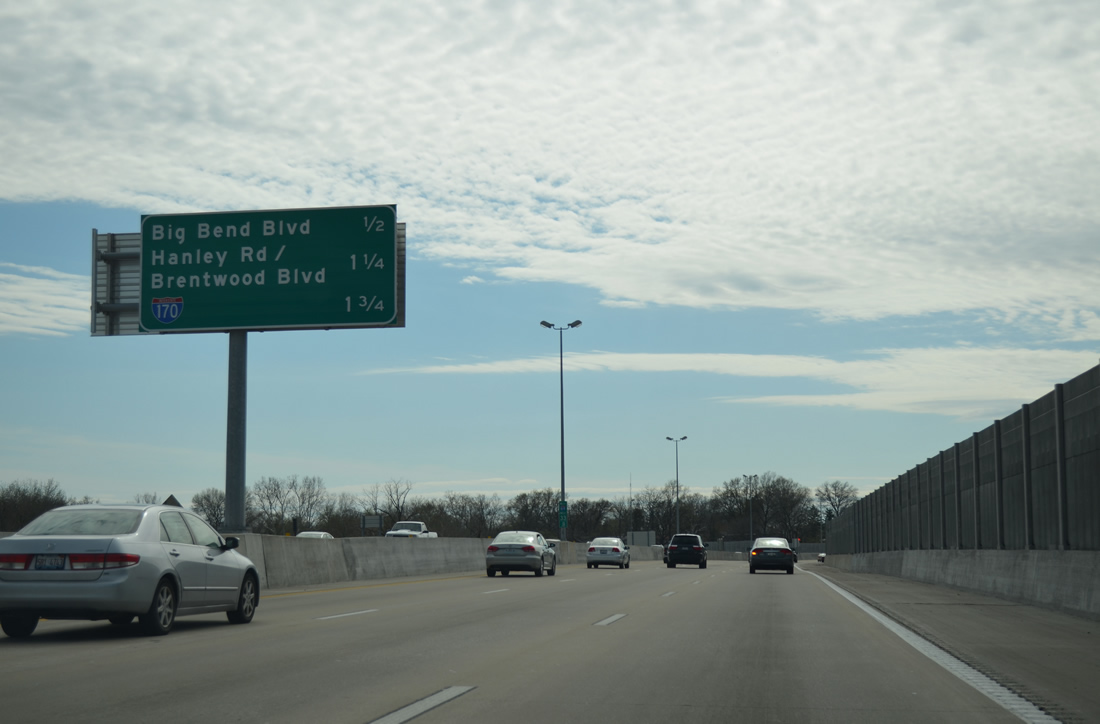
The first sign for Interstate 170 north from Richmond Heights precedes the diamond interchange (Exit 33C) with McCausland Avenue.
04/13/13
Skinker Boulevard south transitions into McCausland Avenue through the Hi-Pointe neighborhood southward to Franz Park and Manchester Avenue (Missouri 100).
04/13/13
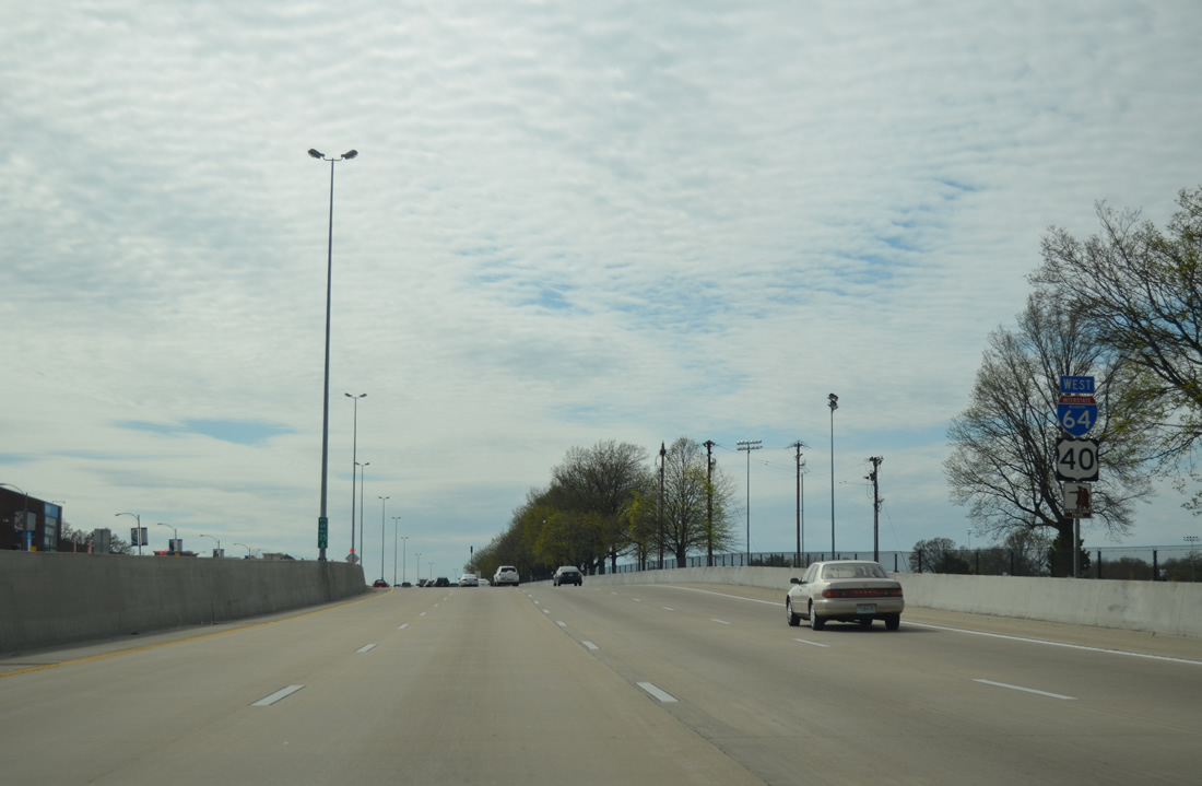
The next three exits lie within the city of Richmond Heights. Interstate 170, an 11.26 mile freeway to Hazelwood, begins in 1.75 miles.
04/13/13

7.15 miles of Interstate 64 through the city of St. Louis end as U.S. 40 enters St. Louis County and Richmond Heights.
04/13/13

References:
- "Coming Soon: Interchange at I-64 and Tower Grove!" Washington University Medical Center Redevelopment Corporation, January 14, 2013.
- The New I-64 - Missouri Department of Transportation - http://www.thenewi64.org/ (MoDOT project web site).
Photo Credits:
- AARoads: 04/13/13
- ABRoads: 05/04/12, 04/13/13
- Alex Nitzman: 12/20/09
Connect with:
Page Updated Thursday November 14, 2013.