
Interstate 64 West - Waynesboro to Staunton

 West
West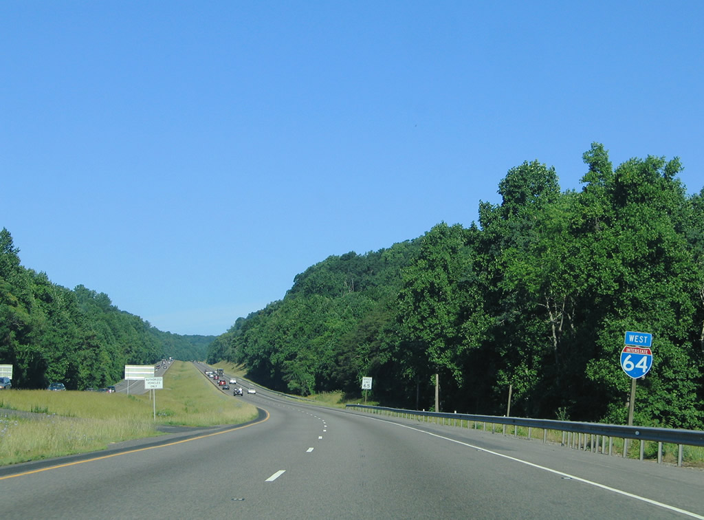
Interstate 64 continues westward from Charlottesville toward the Ragged Mountain Natural Area and Charlottesville Reservoir.
06/17/05
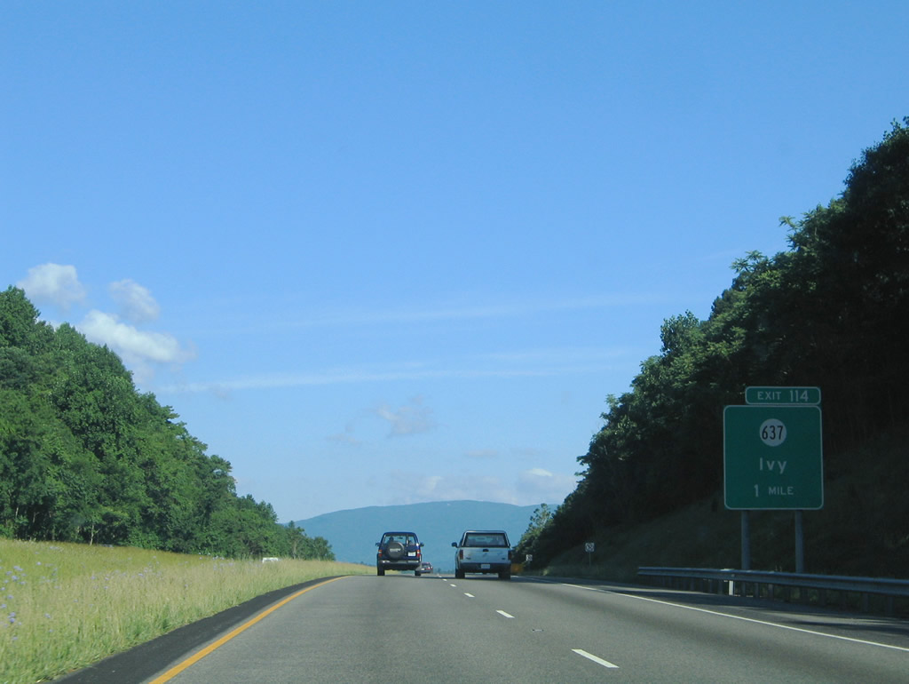
Exit 114 connects Interstate 64 with the community of Ivy via SR 637 (Dick Woods Road) north to U.S. 250.
06/17/05
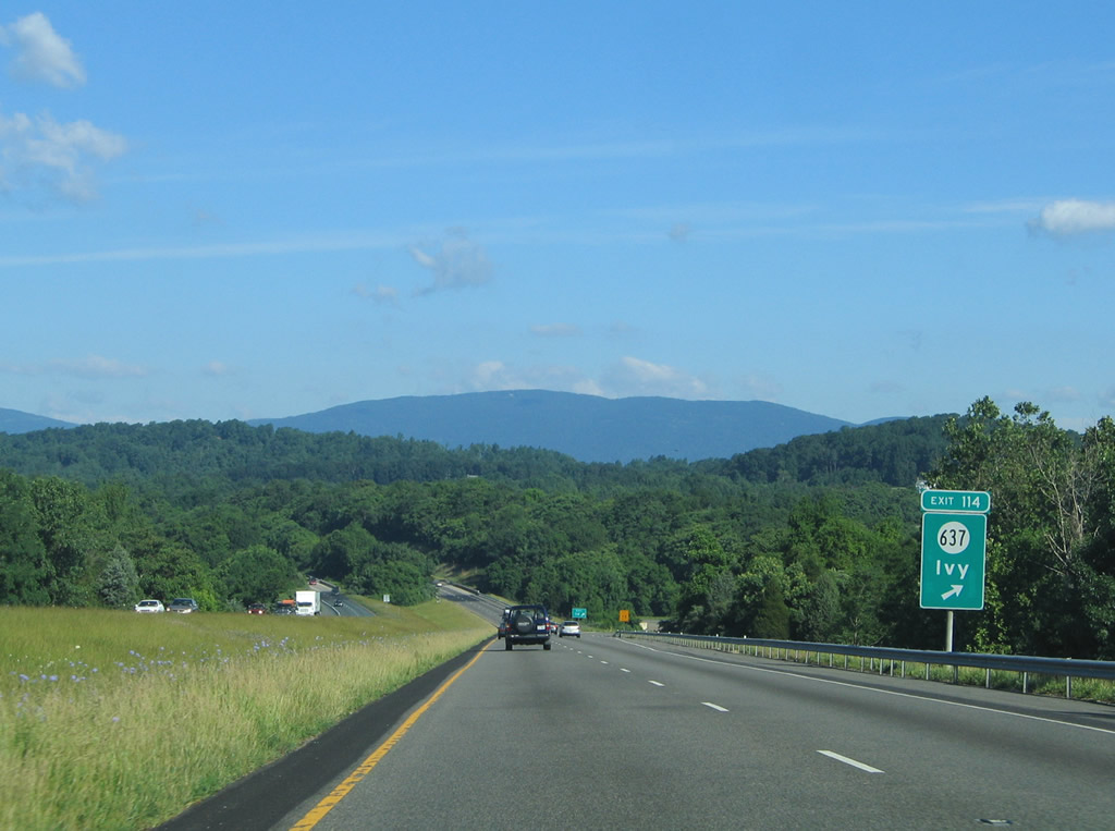
A diamond interchange (Exit 114) joins I-64 with SR 637 to Ivy. SR 637 continues southwest from I-64 to Miller School Road near the settlement of Batesville.
06/17/05
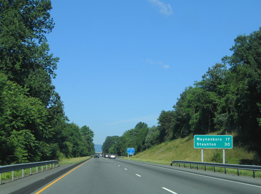
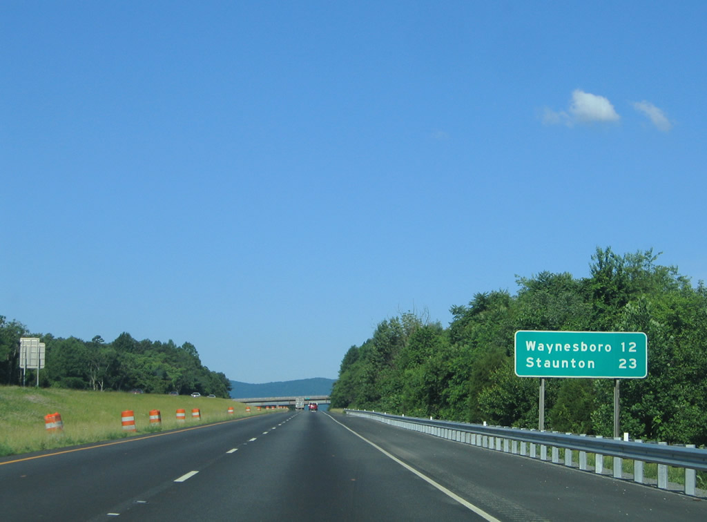
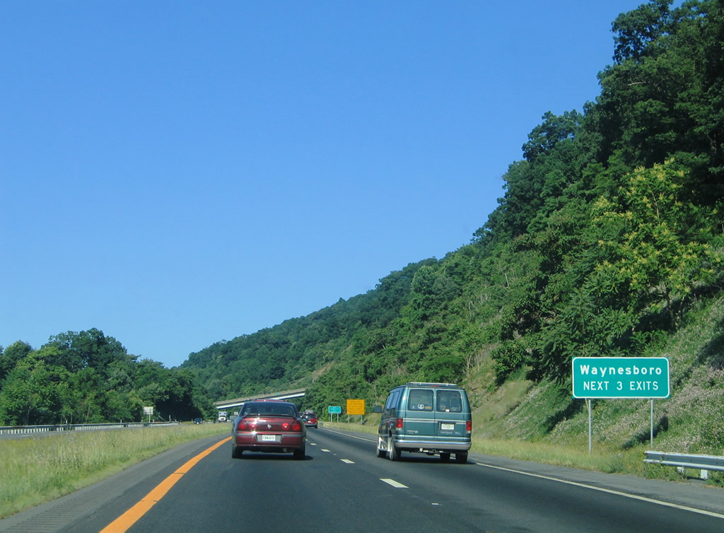
Waynesboro is another 17 miles west along Interstate 64. Staunton follows at 30 miles out.
06/17/05
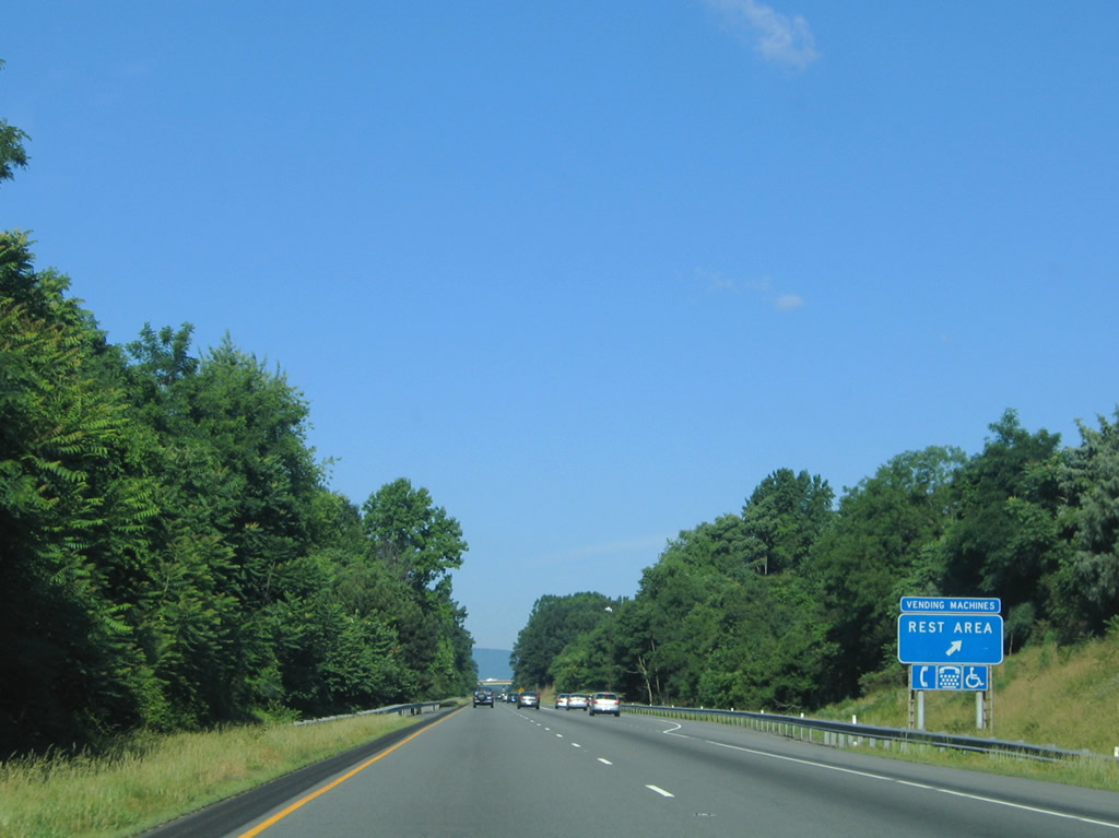
A westbound only rest area lies 1.3 miles west of Exit 114 (SR 637).
06/17/05

U.S. 250 (Rockfish Gap Turnpike) crosses paths with I-64 again midway between Brownsville and Newtown at Exit 107.
06/17/05
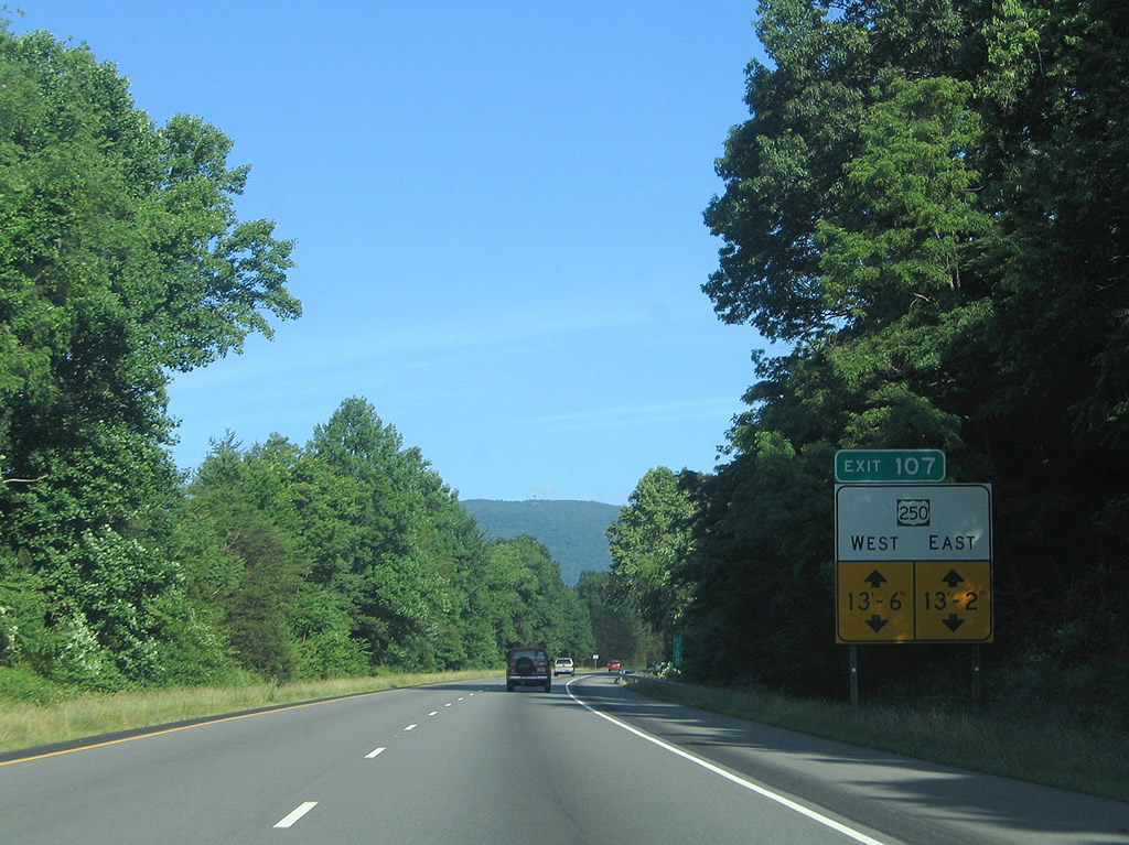
Low clearance railroad bridges span U.S. 250 east and west of the ensuing interchange (Exit 107) with I-64.
06/17/05
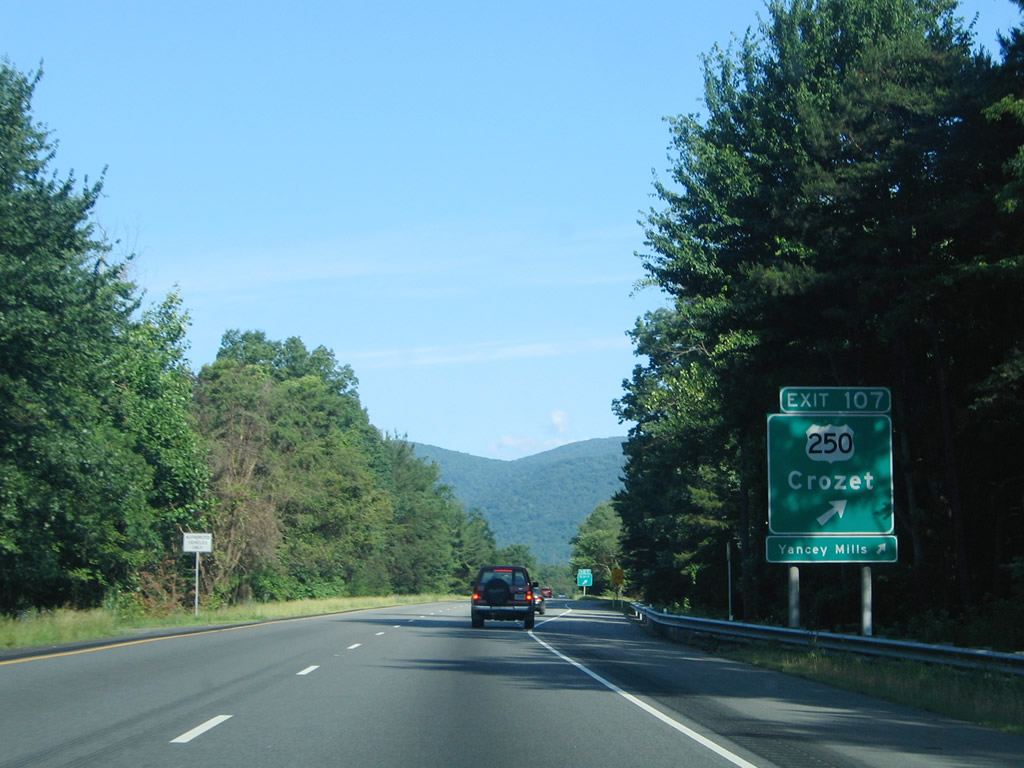
Exit 107 departs I-64 west for U.S. 250 (Rockfish Gap Turnpike). The town of Crozet lies nearby via SR 240 (Crozet Avenue) north. SR 240 represents the pre-1944 alignment of U.S. 250 through Crozet.1
06/17/05
I-64 westbound slowly ascends 600 feet in elevation on the 12 mile drive to Waynesboro.
06/17/05
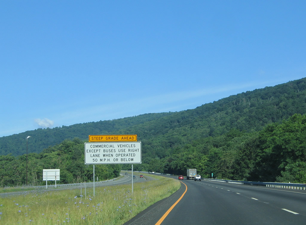
Interstate 64 enters the Blue Ridge mountain range as it curves to the south of Bear Den Mountain, visible since before Exit 114 (SR 637).
06/17/05
Approaching the Nelson County line outside Waynesboro on I-64 west.
06/17/05
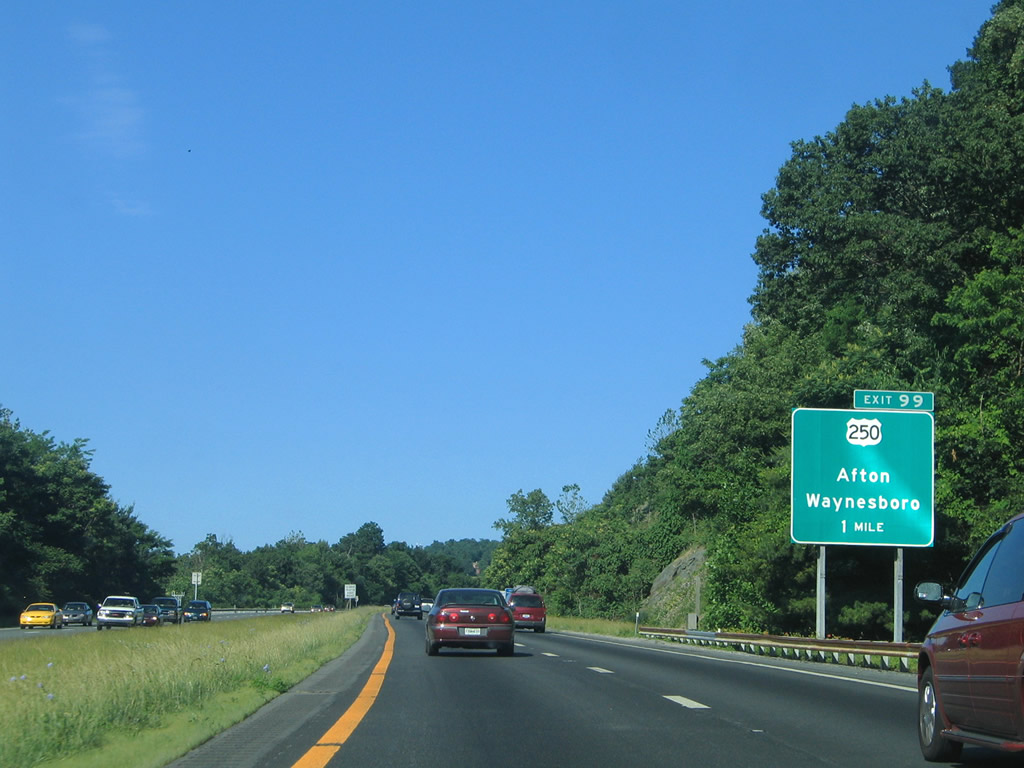
U.S. 250 (Rockfish Gap Turnpike) meets I-64 once more west of Afton at Exit 99 in one mile.
06/17/05
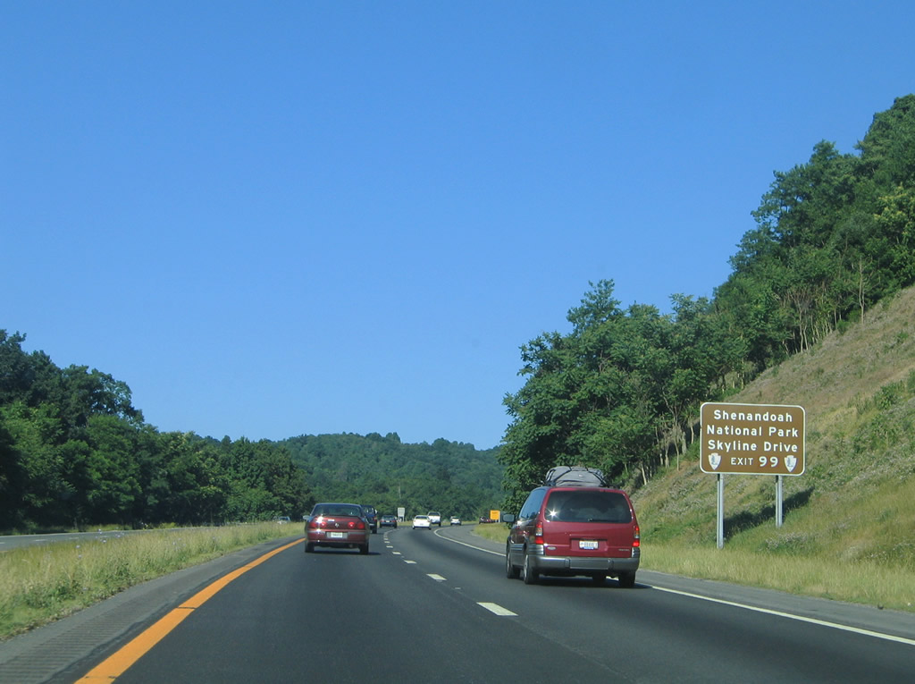
U.S. 250 (Exit 99) east connects I-64 with Shenandoah National Park and Skyline Drive.
06/17/05
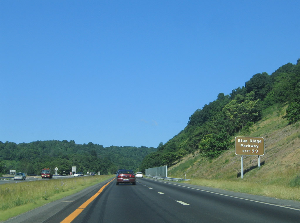
Skyline Drive becomes Blue Ridge Parkway leading south from Swannanoa, though both facilities are operated by the National Park Service.
06/17/05

Skyline Drive passes over Interstate 64 ahead of the U.S. 250 under crossing and trumpet interchange at Exit 99. U.S. 250 and I-64 meet at Swannanoa in Rockfish Gap. Northward, U.S. 250 winds downward to Main Street in Waynesboro, providing the first of three interchanges to the independent city.
06/17/05
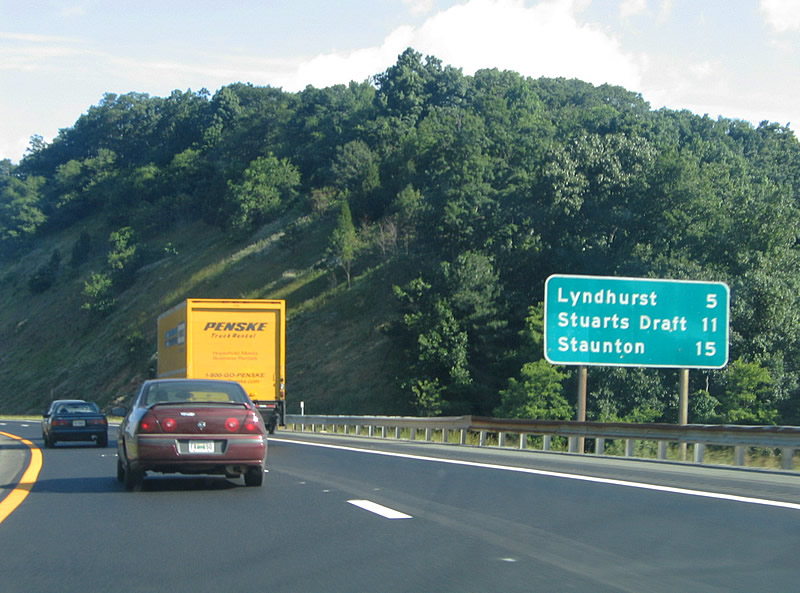
Beyond the Blue Ridge Mountains, Interstate 64 travels between the communities of Lyndhurst and Fishersville toward I-81 outside Staunton.
06/17/05
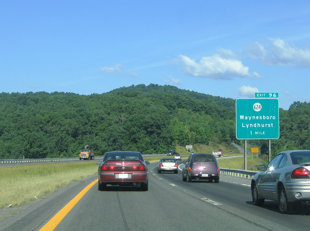
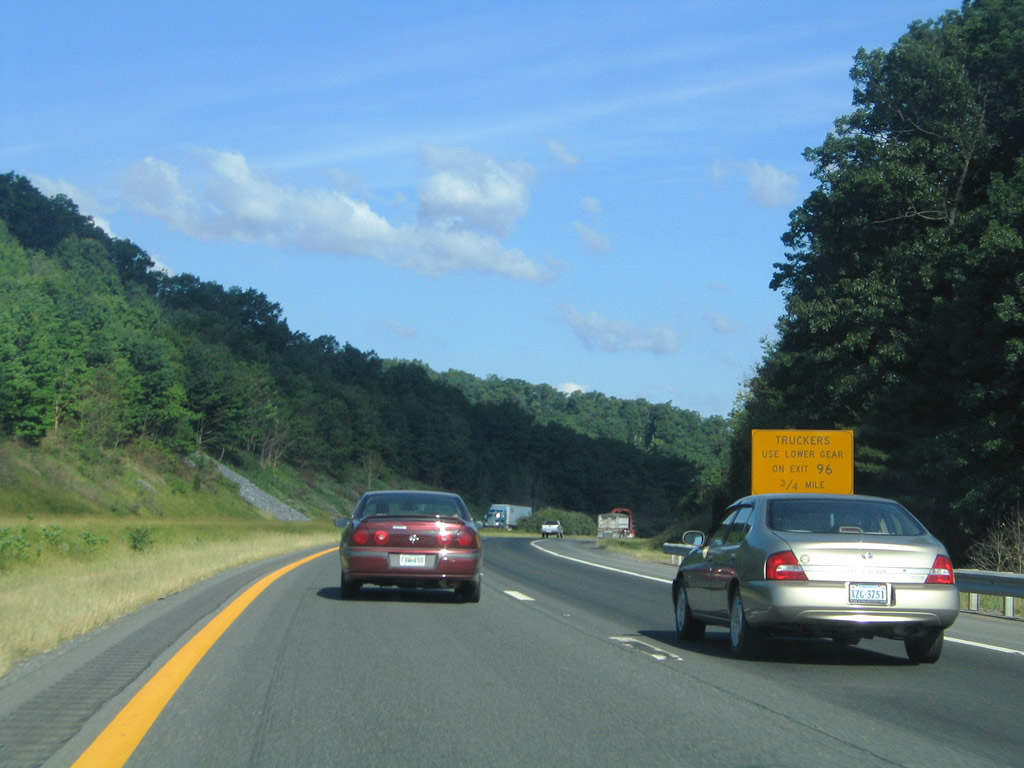
Interstate 64 navigates through an S-curve between Jones Hollow and Miller Knob to the parclo interchange (Exit 96) with SR 624 (Delphine Avenue).
06/17/05

SR 624 (Mt. Torry Road) heads southwest alongside George Washington National Forest to SR 664 (Lyndhurst Road) in Lyndhurst. SR 664 travels south toward Sherando Lake.
06/17/05
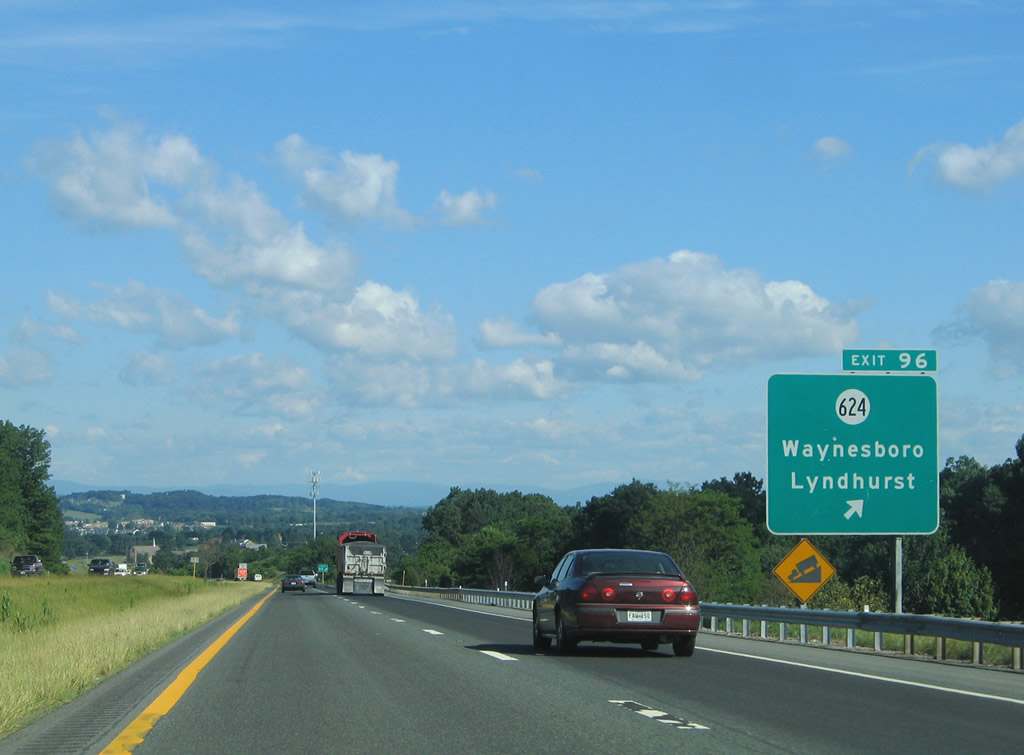
Delphine Avenue continues 2.25 miles north from the exchange with I-64 to U.S. 250/340 (Main Street) east of Downtown Waynesboro.
06/17/05
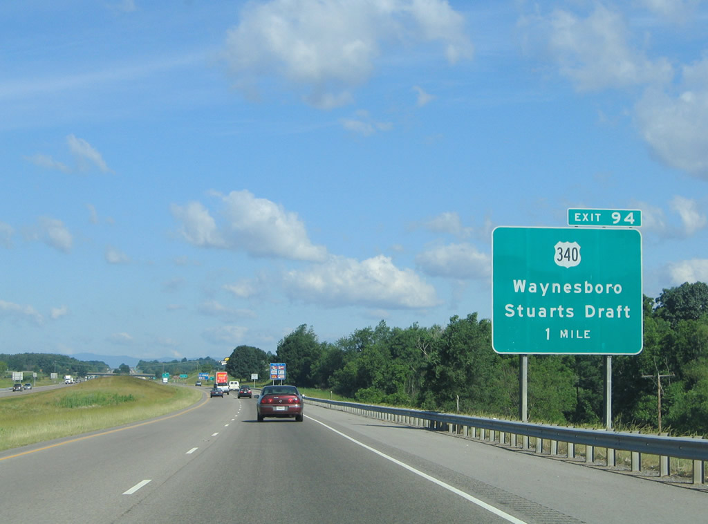
U.S. 340 separates from U.S. 250 along Broad and Main Streets in Downtown Waynesboro and continues 2.52 miles west on Rosser Avenue (P. Buckley Moss Drive) to the parclo interchange at Exit 94.
06/17/05
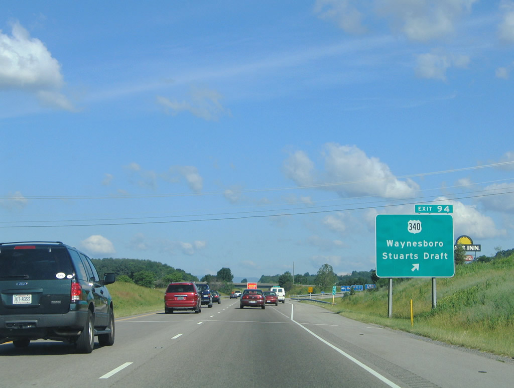
U.S. 340 (Stuarts Draft Highway) runs west from Waynesboro to Stuarts Draft and U.S. 11 near I-64/81 at Exit 213. Points of interest for Exit 94 include the Artisans Center of Virginia in Waynesboro.
06/17/05
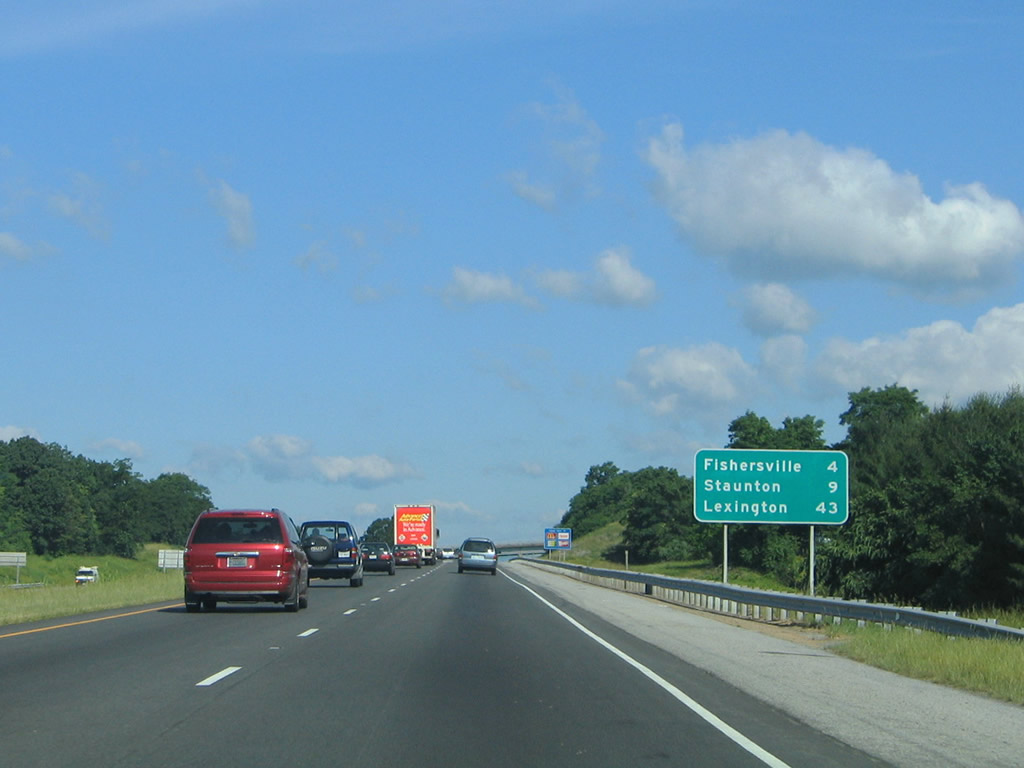
I-64 passes south of Fishersville between Waynesboro and Interstate 81 outside Staunton.
06/17/05
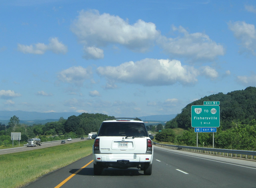
A 1.85 mile long route from SR 631 (Ladd Road) to U.S. 250 (Jefferson Highway), SR 285 (Tinkling Springs Road) links Interstate 64 with Fisherville. SR 285 was signed in 1999.1
06/17/05
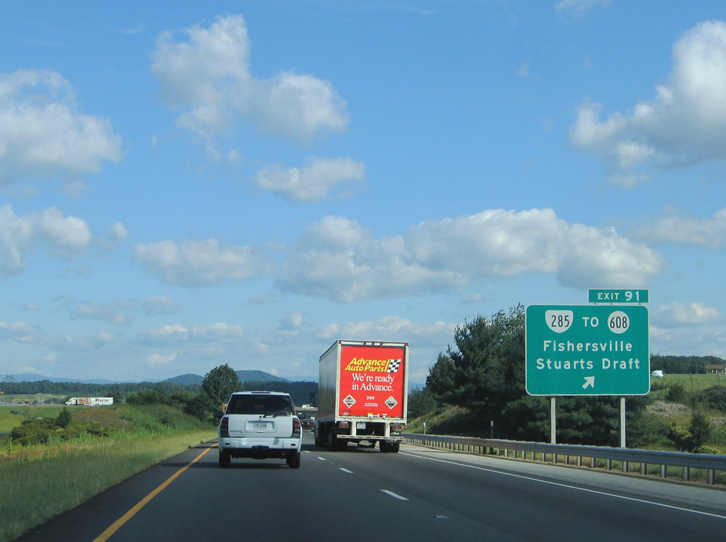
SR 608 extends Tinkling Spring Road 4.66 miles southwest from SR 285 and the diamond interchange at Exit 91 to U.S. 340 (Stuarts Draft Highway) at Stuarts Draft.
06/17/05
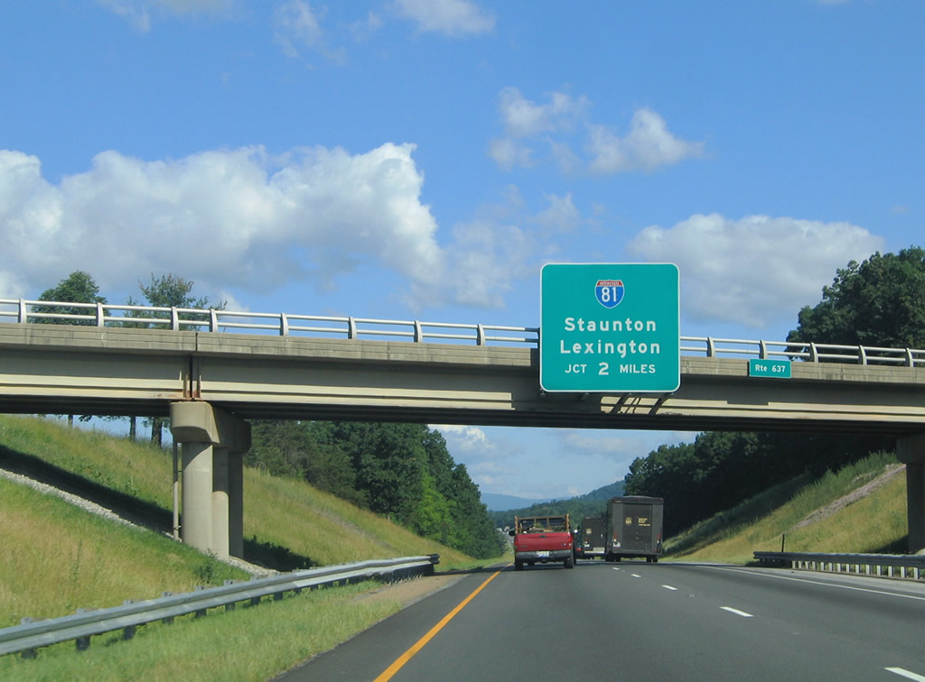
I-64 converges with I-81 two miles west of SR 637 (Jericho Road) and Christians Creek. I-81 runs along the Appalachian Mountain chain southwest to I-40 near Knoxville, Tennessee and northward to the Thousand Islands Bridge into Ontario, Canada.
06/17/05
Measuring 324.92 miles from Bristol to the West Virginia line north of Winchester, I-81 in Virginia connects several mid-sized cities including Wytheville, Roanoke and Harrisonburg.
06/17/05
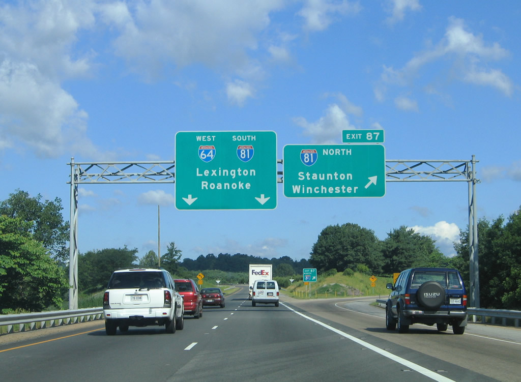
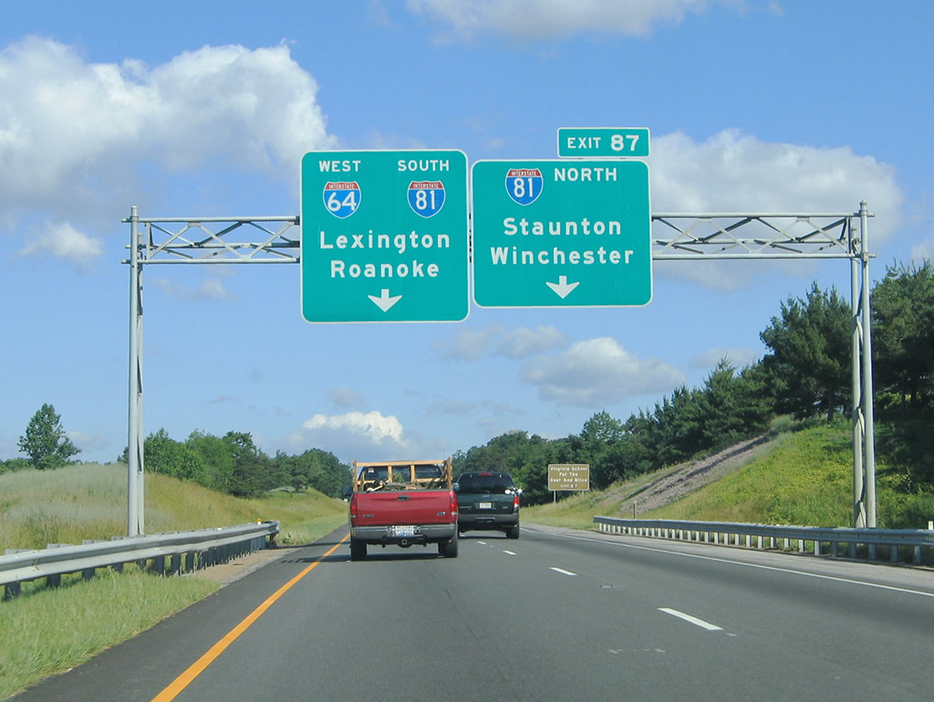
Exit 87 departs from I-64 west for Interstate 81 north to adjacent Staunton. I-81 continues north to Winchester, Martinsburg, West Virginia and Hagerstown, Maryland.
06/17/05
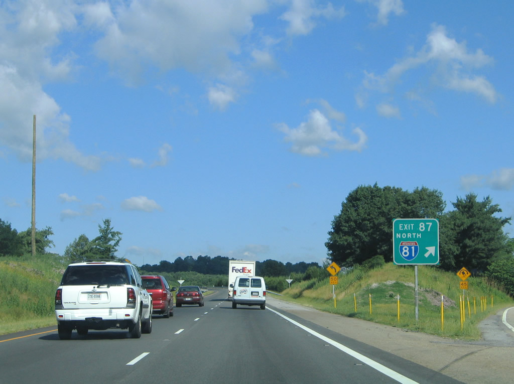
Interstate 64 turns south alongside I-81 from a directional T interchange at Exit 87.
06/17/05


References:
- VA 285. Virginia Highways Page.
Photo Credits:
- Alex Nitzman: 06/17/05
Connect with:
Page Updated Thursday April 15, 2021.