
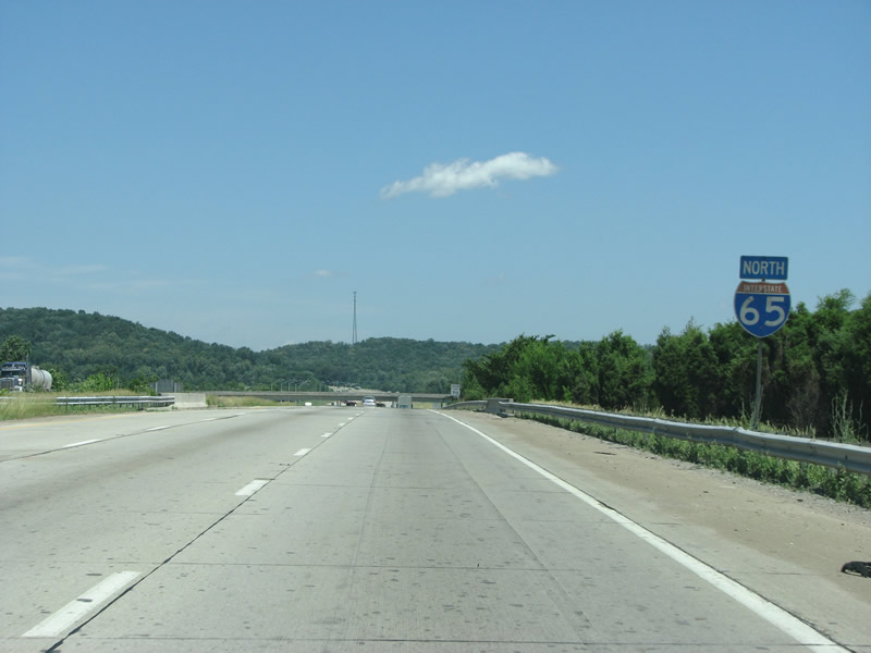
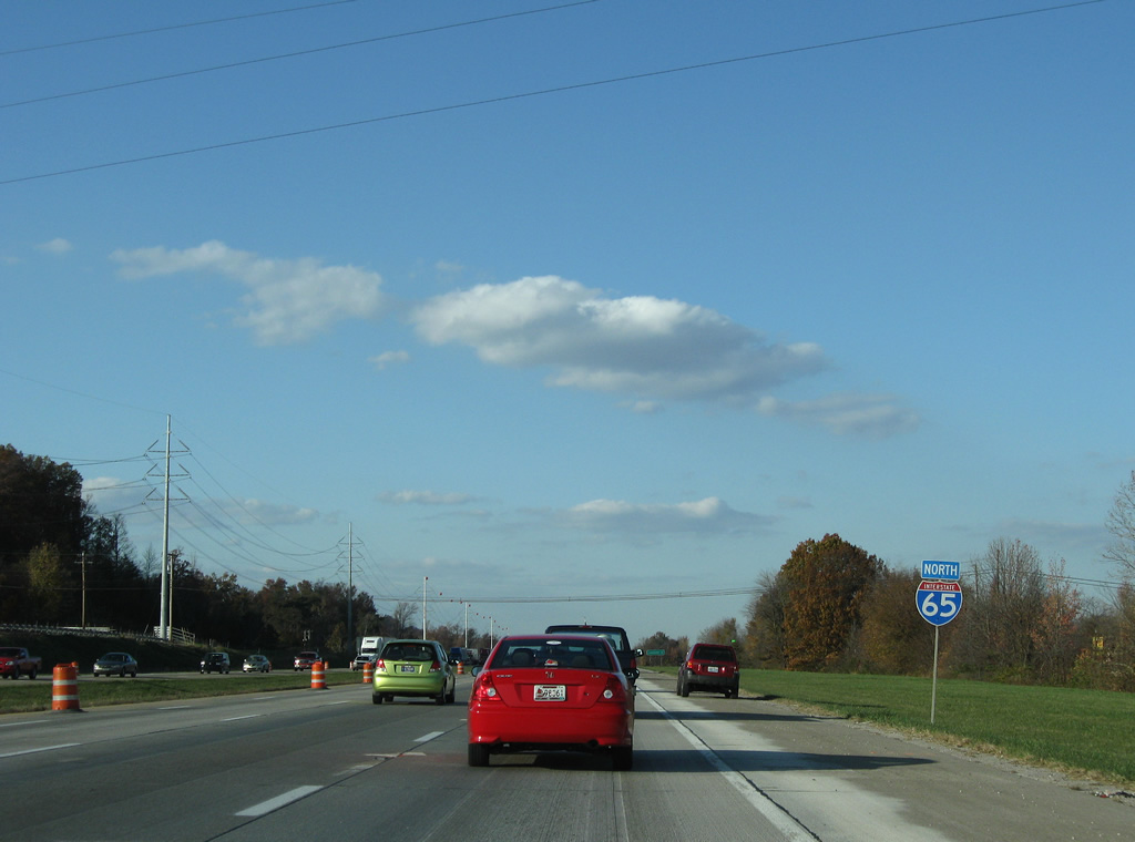
Interstate 65 North - Hardin / Bullitt Counties

 North
North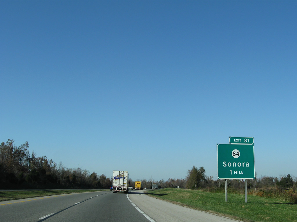
U.S. 31W (Dixie Highway) again shifts sides with Interstate 65 along the Larue/Hardin County line. KY 84 (Western Avenue) intersects Dixie Highway just west of the diamond interchange at Exit 81 and east of Sonora.
11/04/09
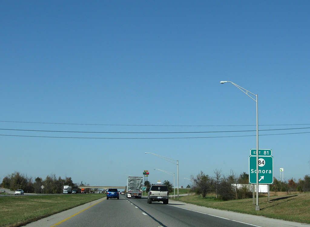
Northbound Interstate 65 at the first of six Hardin County interchanges. KY 84 (Western Avenue) dog legs northward from Main Street in Sonora to Sonora Hardin Springs Road. The east-west route continues to White Mills and Wendell H. Ford-Western Kentucky Parkway (Exit 124). Heading east, KY 84 travels Sonora Road to Mathers Mill, overtaking KY 357 (Tanner Road) north to Hodgenville.
11/04/09
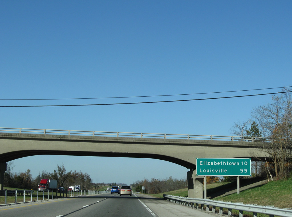
A pair of closed rest areas line the sides of Interstate 65 south and north of the Old Sonora Road overpass. A northbound distance sign follows the shuttered facility, ten miles south of Elizabethtown.
11/04/09
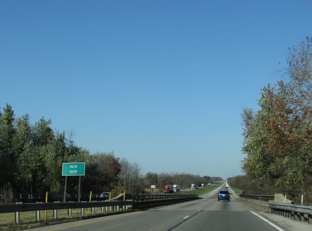
Two substandard bridges, constructed in 1958, carry Interstate 65 over the Nolin River.
11/04/09
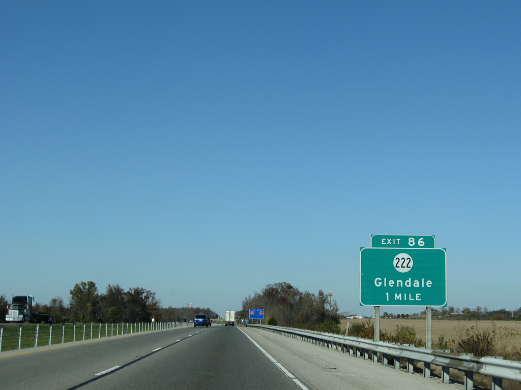
The diamond interchange at Exit 86 joins I-65 north with KY 222 (Glendale Hodgenville Road) by Glendale Junction.
11/04/09
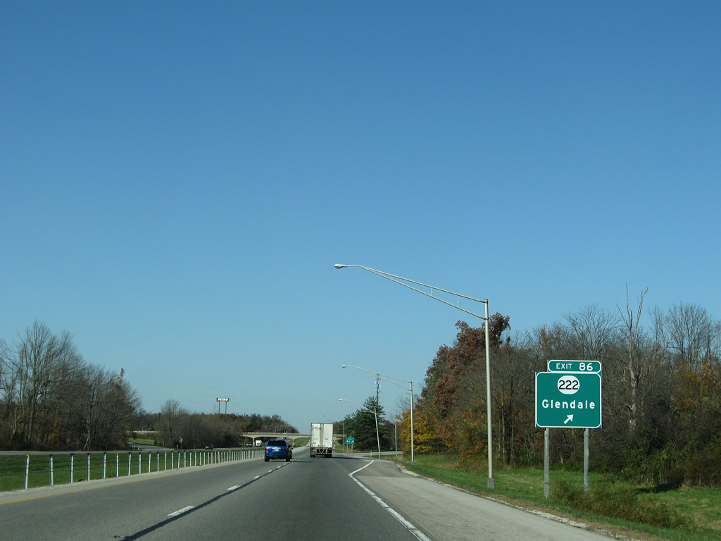
KY 222 follows a circuitous route eastward from U.S. 31W (Dixie Highway) to KY 84 (Tanner Road) outside Hodgenville. Westward from Exit 86, KY 222 runs to Glendale and U.S. 62 (Leitchfield Road) near Stephensburg.
11/04/09
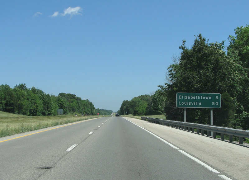
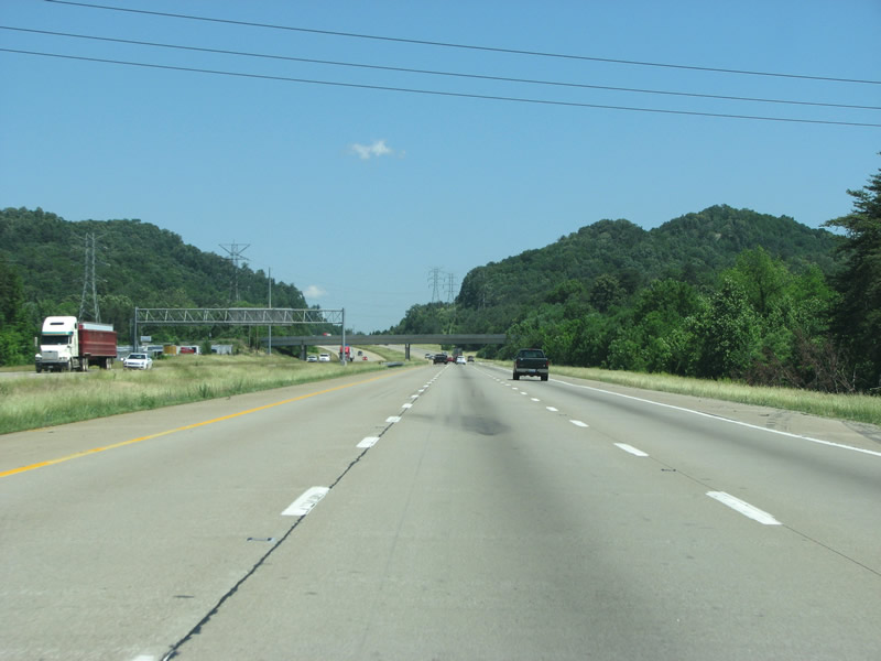
This view looks northbound at a four lane Interstate 65, five miles south of Elizabethtown in Central Kentucky.
06/06/08
Elizabethtown, along with Bowling Green, are the largest cities along Interstate 65 between Louisville and Nashville.
06/06/08
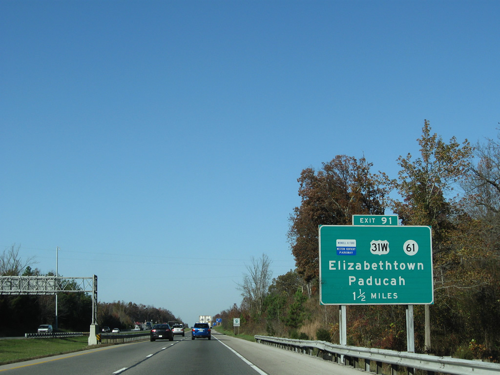
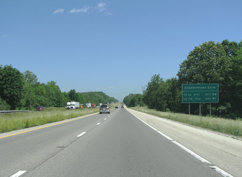
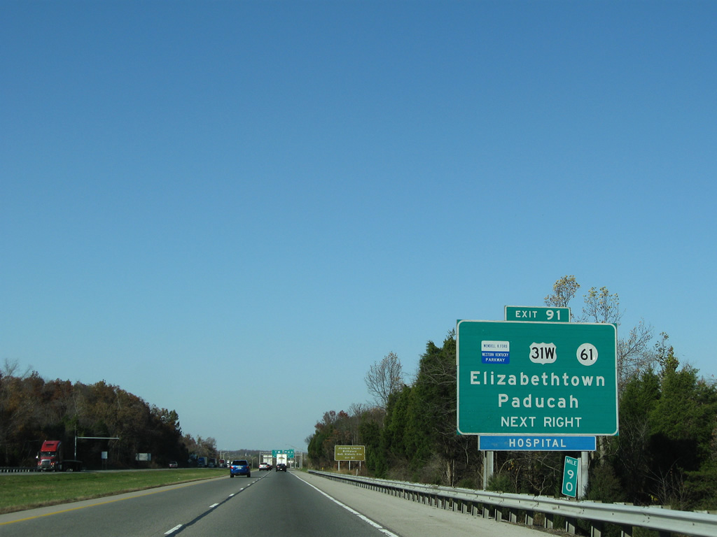
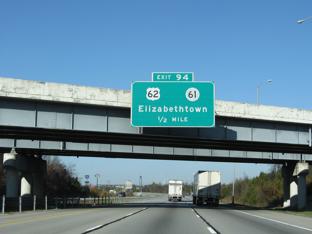
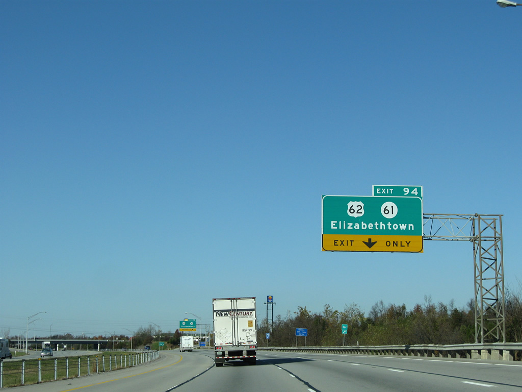
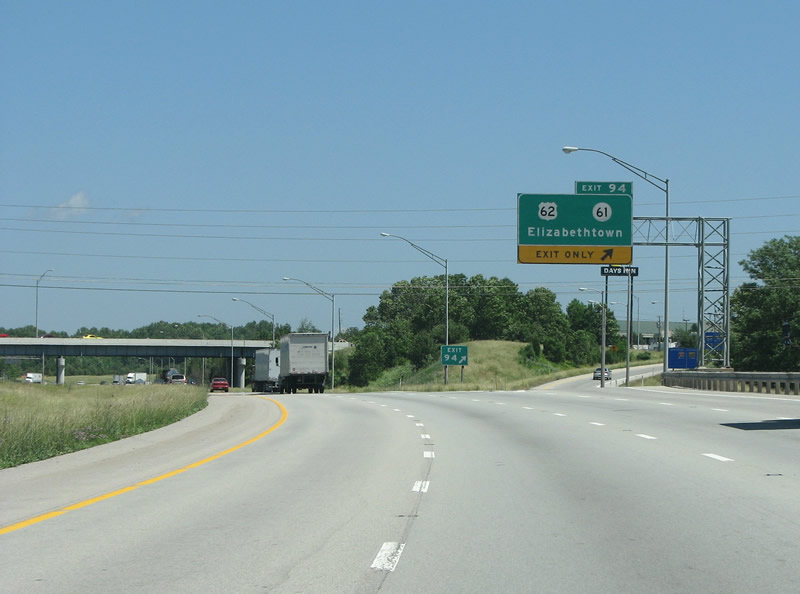
The first Elizabethtown exit is a cloverleaf interchange at KY 61, Western Kentucky Parkway, and U.S. 31W (Elizabethtown Bypass). The exit is on the south side of town. KY 61 continues east and south from here to Hodgenville.
11/04/09
Western Kentucky Parkway is a controlled access parkway that runs west to Paducah and Interstate 24. I-69 follows the parkway west of Pennyrile Parkway (I-169).
11/04/09
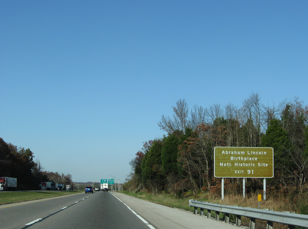
Abraham Lincoln was born near here south of Hodgenville along what became KY 61. The state route is also known as Lincoln Parkway.
11/04/09
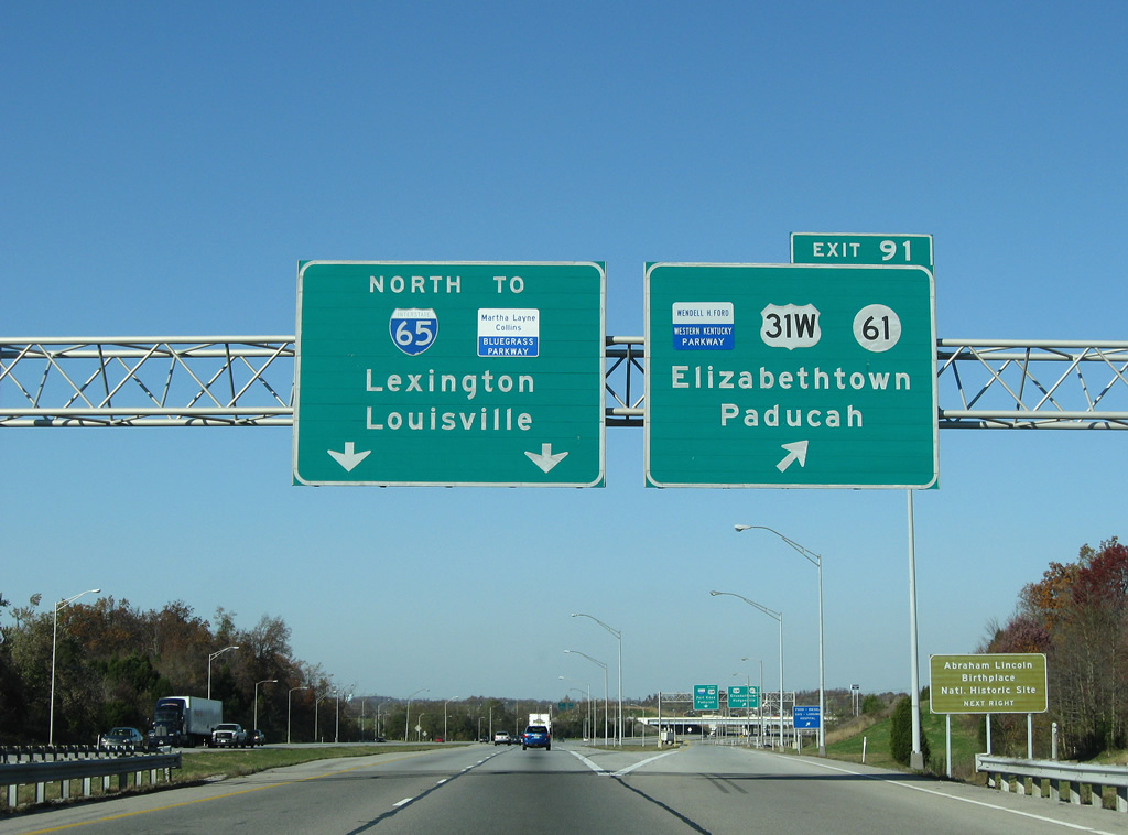
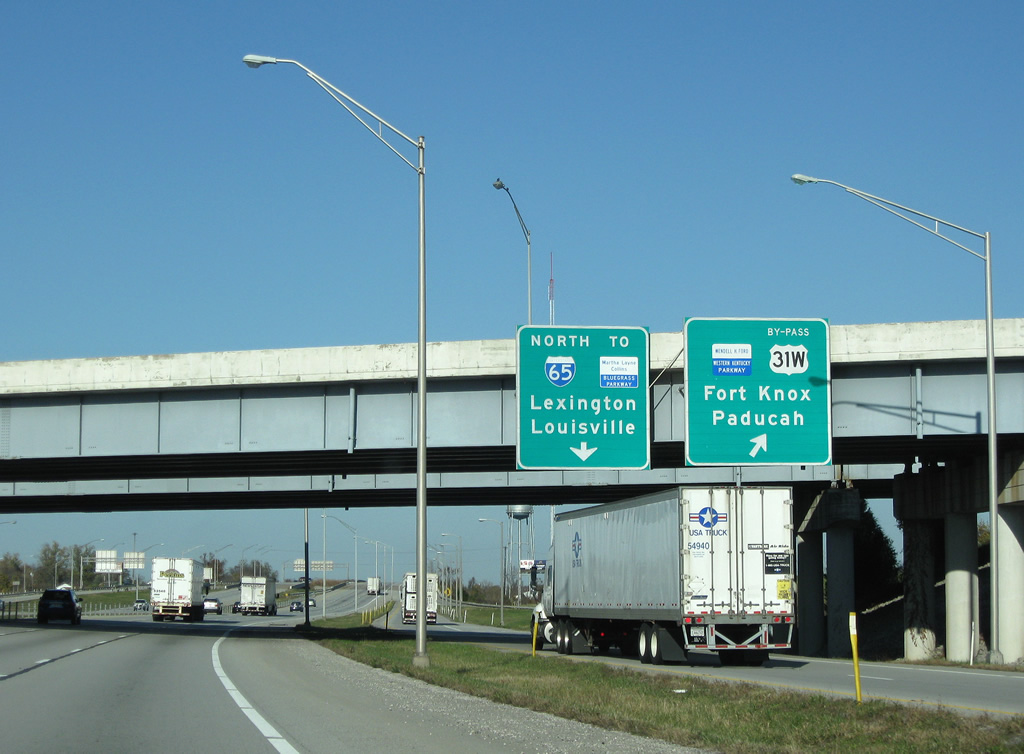
Two parkways are seen on these overhead signs, with blue and white parkway markers that are very difficult to read. US 31W runs north and west past Fort Knox and into Louisville. Lexington is seen here as a control city even though I-65 does not go there, but the Bluegrass Parkway, seen alongside, does.
11/04/09

A collector distributor roadway connects with Wendell H. Ford Western Kentucky Parkway (U.S. 31W Bypass at I-65) and its connections to U.S. 31W (Dixie Highway), KY 61 (Lincoln Parkway), and the Elizabethtown Bypass (U.S. 31W Bypass north). U.S. 31W/KY 61 combine along Dixie Avenue nearby to Downtown Elizabethtown.
11/04/09
A loop ramp joins U.S. 31W Bypass north / Wendell H. Ford Western Kentucky Parkway west to Fort Knox and Paducah respectively. Western Kentucky Parkway opened between Elizabethtown and Eddyville in 1963. Connections to I-24 west were made by 1968. The parkway was tolled until 1987 and renamed to honor former U.S. Senator Wendell H. Ford in 1998.1
11/04/09
Winding northward over Valley Creek, Interstate 65 reaches the next Elizabethtown exit in three miles and continues 42 miles to Louisville.
11/04/09
With the difficult shield to read, the Bluegrass Parkway is also signed in plain text alongside. Although the route has the designation of KY 9002, it is never signed as such. Tolls were collected on the parkway until 1991.
11/04/09
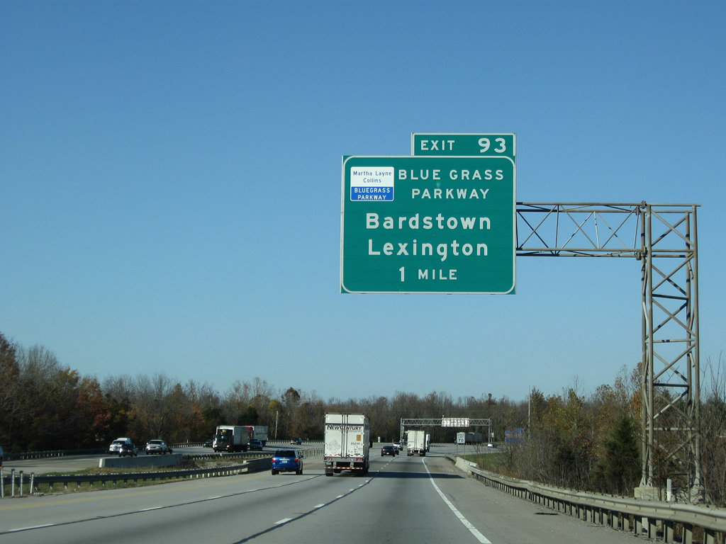
Approaching the Exit 93 off-ramp to Martha Layne Collins Blue Grass Parkway on Interstate 65 north. Points of interest served by the parkway include My Old Kentucky Home State Park and Makers Mark Distillery. Bardstown, the Nelson County seat, lies 21 miles east along the road.
11/04/09
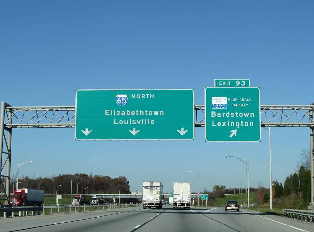
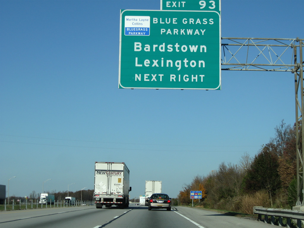
I-65 northbound at the western end of the Bluegrass Parkway. The Parkway ends here in a trumpet interchange. It extends 71 miles eastward towards Lexington. It opened in 1966 and in 2003 the name was edited to include the first female governor of the state - Martha Layne Collins.
11/04/09
I-65 meets US 62 at the succeeding exit along with the ever present KY 61. US 62 is a true border-to-border highway as it runs from Mexico at El Paso, Texas to Niagara Falls and the Canadian border. Here, it forms a leisurely two lane rural route through Kentucky.
11/04/09
I-65 begins its six lane section here, which continues all the way to Indiana. In 2005 the governor of Kentucky unveiled a plan to six lane I-65 throughout the entire state.
06/06/08
An auxiliary lane runs from the Bluegrass Parkway entrance ramp north to US 62/KY 61. U.S. 62/KY 61 overlap 12 miles from Elizabethtown northeast to Younger Creek and Boston.
11/04/09
Elizabethtown is locally referred to almost exclusively as E-town. The city has about 25,000 people, it was founded in 1797. The 2005 film Elizabethtown was based on the city, but was mostly filmed elsewhere as E-town lost much of its historic downtown to development.
06/06/08
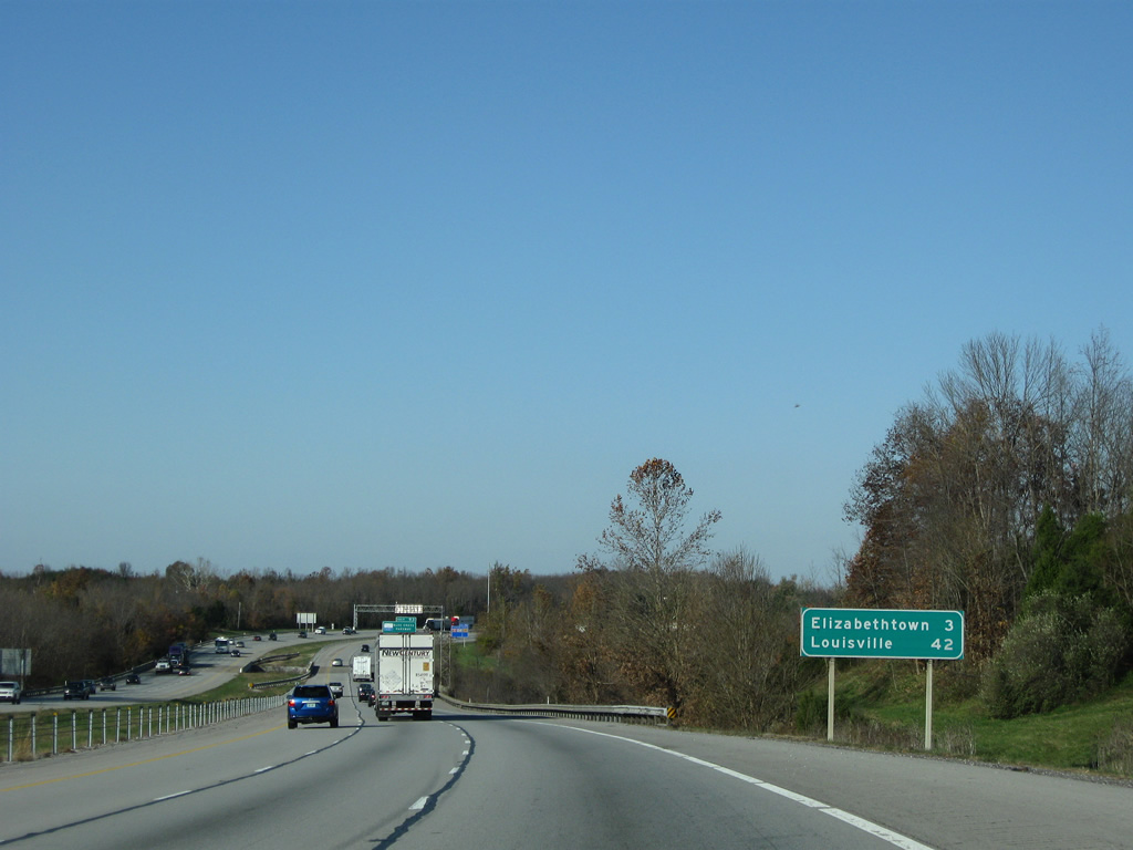
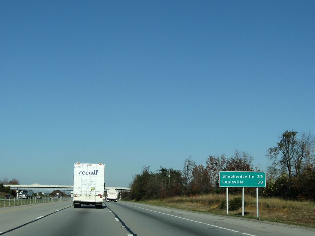
Shepherdsville is the next town along the route and sits 22 miles up the road. Elizabethtown sees very little of I-65, as the city sits mostly to the west.
11/04/09
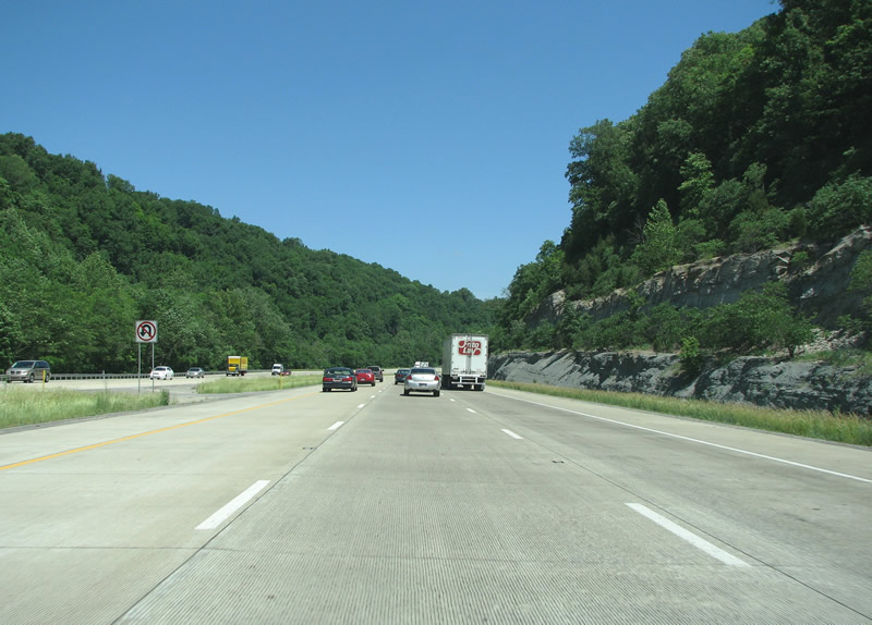
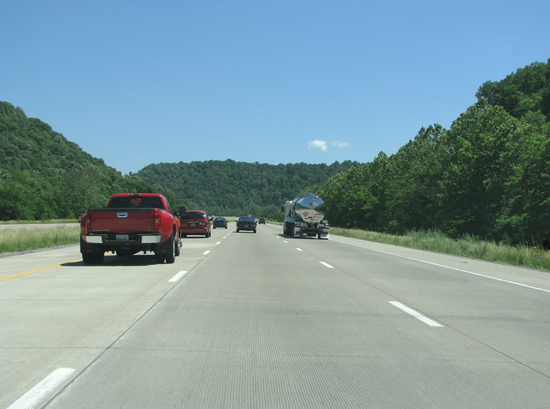
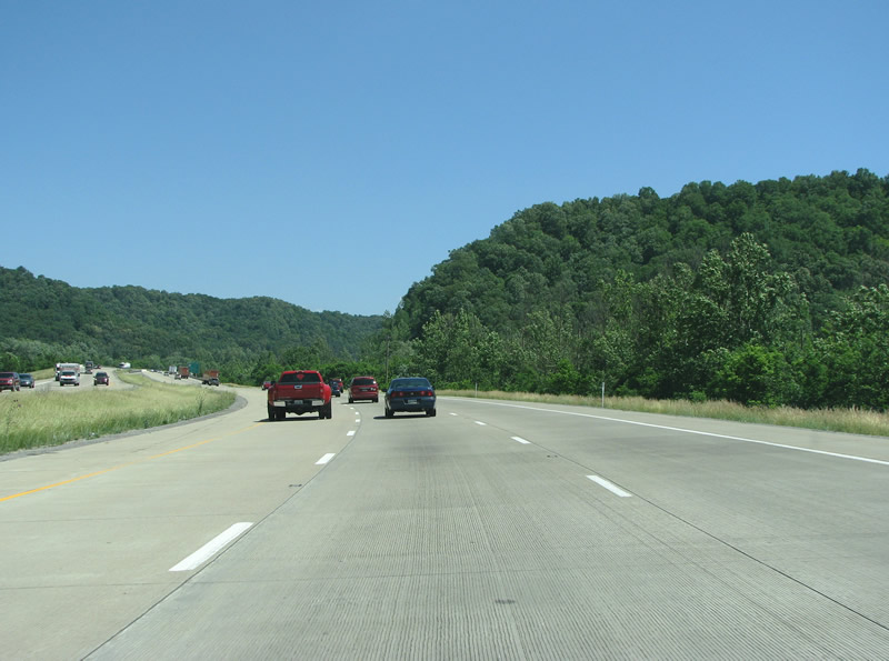
North of town, I-65 climbs into a region known as the Knobs. Geologically, the knobs are an eroded area where the flat Bluegrass region meets the Pennyroyal Plateau, part of the larger Mississippi plateau. The 6 lane freeway sees some steep rock cuts to each side of the road.
11/04/09
06/06/08
This area of the Knobs is called Muldraugh Hill, which runs through southern Bullitt County and through Fort Knox.
11/04/09
06/06/08
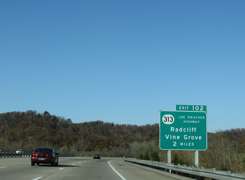
Interstate 65 meets KY 313 (Joe Prather Highway) just beyond the knobs. SR 313 runs due west through Fort Knox to Radcliff and US 31W (Dixie Highway). The state route was extended east from U.S. 31W between 1995 and 1997.
11/04/09
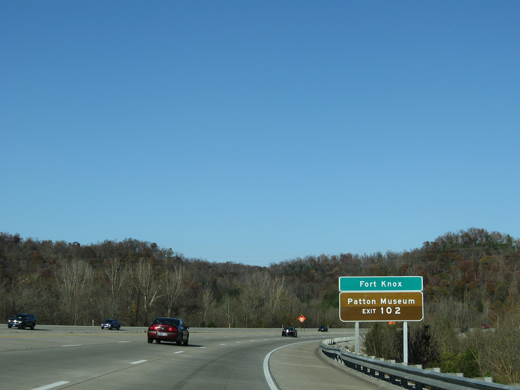
Fort Knox, the largest employer in the region, is shown here as being the main control point for the next exit.
11/04/09
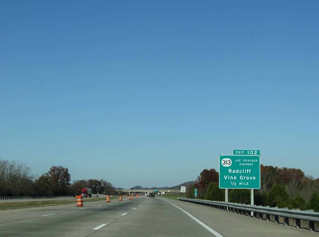
Radcliff has about 22,000 residents, almost all of them there because of Fort Knox. Vine Grove, a community of over 4,000, lies west of Radcliff along the original KY 313 alignment.
11/04/09
A KY 313 trailblazer posted within the trumpet interchange ar Exit 102. SR 313 is named for the Secretary of the KY Transportation Cabinet Joe Prather.
11/04/09
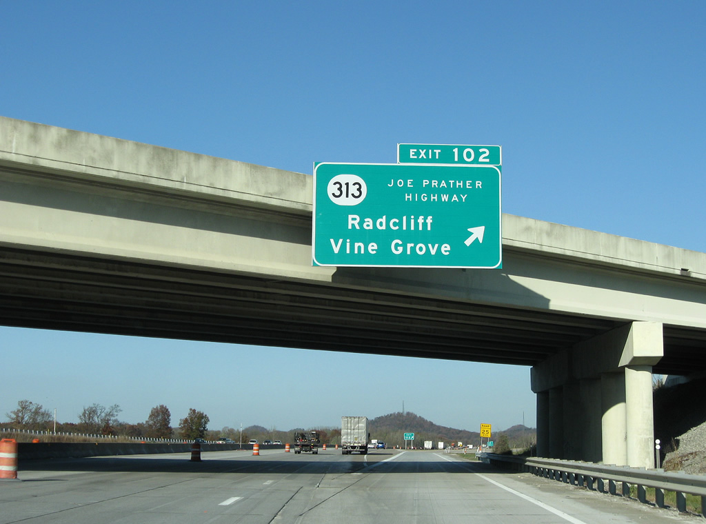
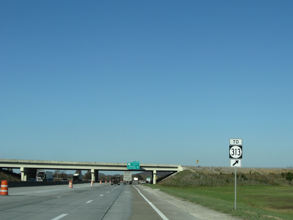
SR 313 (Joe Prather Highway) haa a folded diamond interchange with parallel KY 414 (Battle Training Road) at Booth nearby. KY 313 runs 14.553 miles overall between Exit 102 and KY 1500 (Knox Avenue).
11/04/09
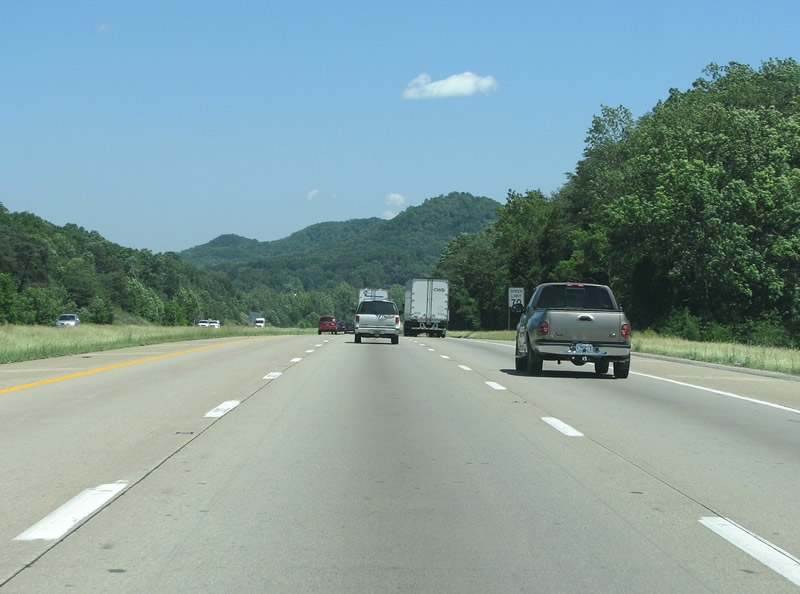
An area of flatlands lies precedes a higher climb along Interstate 65 north into the knobs. Trucks are relegated to the right two lanes.
11/04/09
KY 61 remains parallel to Interstate 65 until Downtown Louisville. The interstate spans the Rolling Fork River and enters Bullitt County here, the last before metro Louisville.
11/04/09
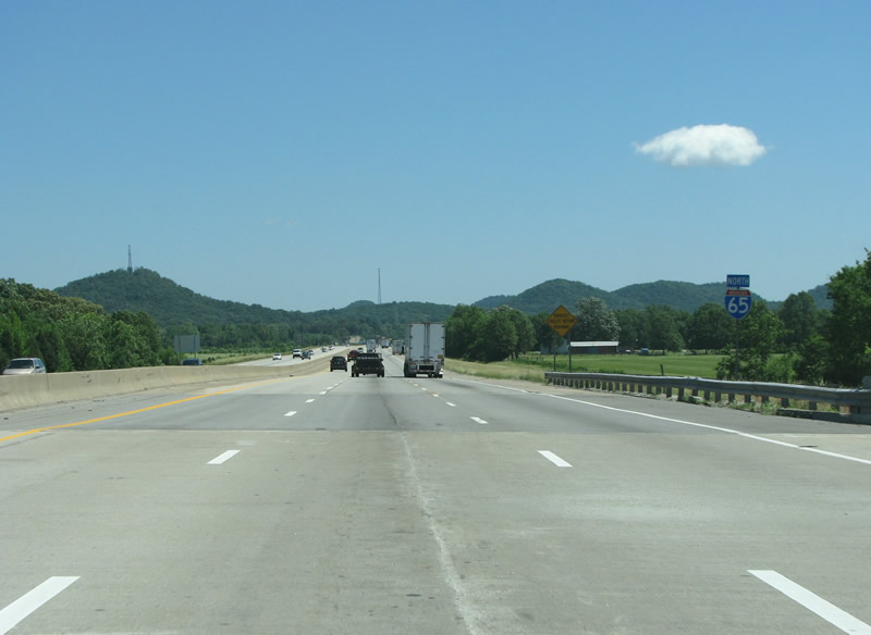
An I-65 northbound reassurance marker (since removed), with the knobs in the background. The knobs form the edge of a plateau the runs north from here into Indiana, where it is known as the Floyd Knobs. The plateau edge forms the Falls of the Ohio at Louisville, which is the reason the city exists where it does.
06/06/08
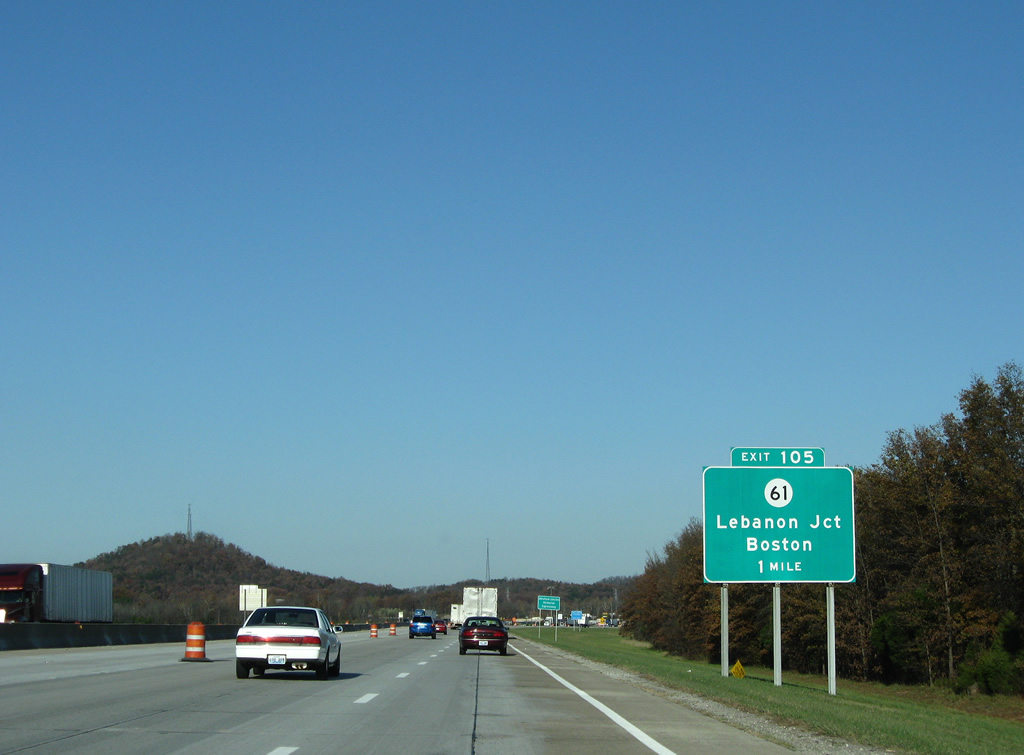
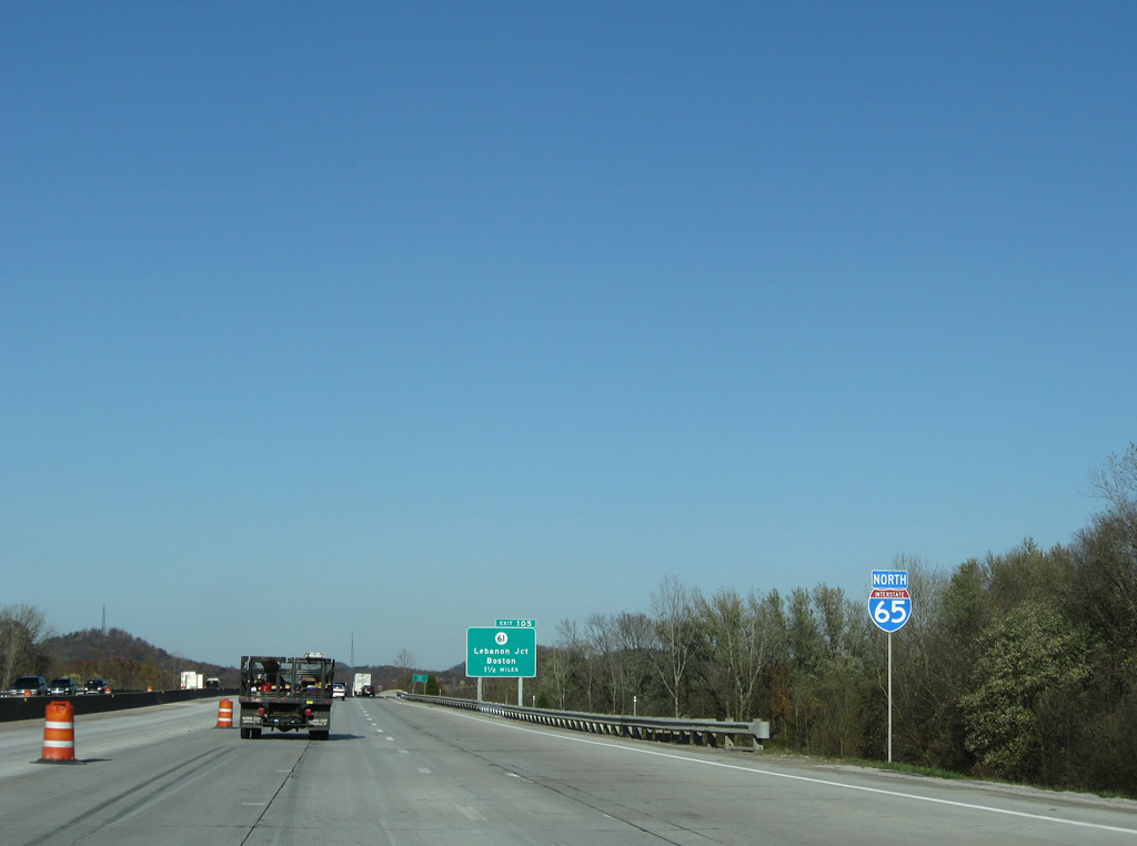
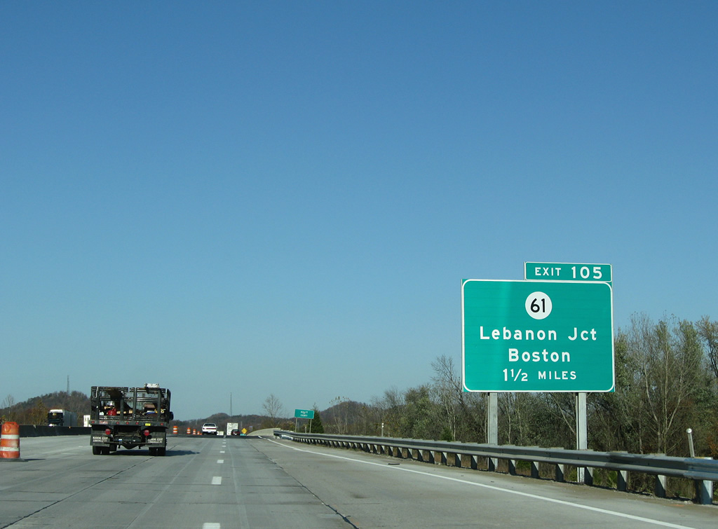
Lebanon Junction and Boston are the control points here at the first exit in Bullitt County. Boston sits to the southeast at US 62.
11/04/09
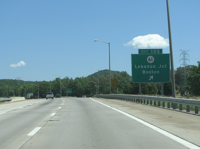
I-65 northbound at Lebanon Junction. The town was founded as a railroad switch and incorporated in 1895, making it fairly youthful by Kentucky standards.
06/06/08

An I-65 northbound reassurance marker north of the KY 61 exit.
06/06/08
I-65 between Elizabethtown and I-264 (Watterson Expressway) was originally constructed as the Kentucky Turnpike. The 39 mile toll road opened on August 1, 1956. When bonds that financed road construction were paid off, tolls were removed and the Turnpike designation was retired. This occurred on June 30, 1975.2
06/06/08
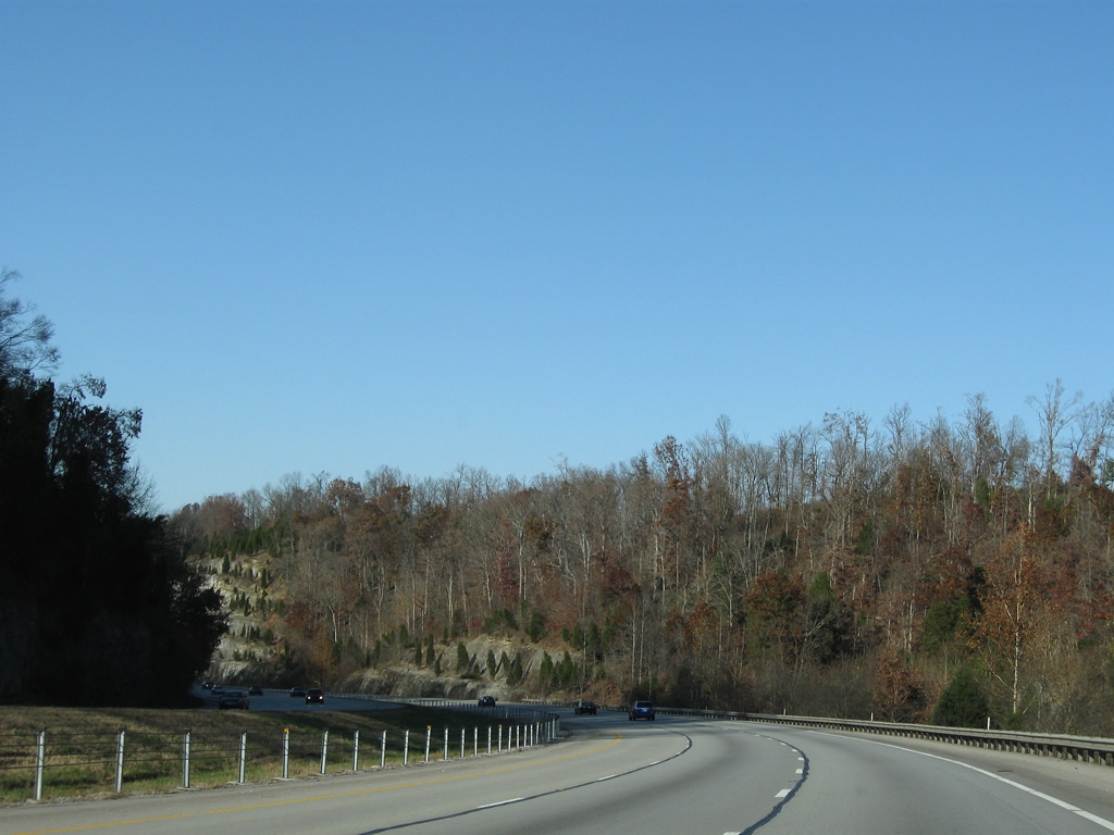
Several scenic views are to be had through the knobs, and a new state forest sits through here along the east side of the interstate.
06/06/08
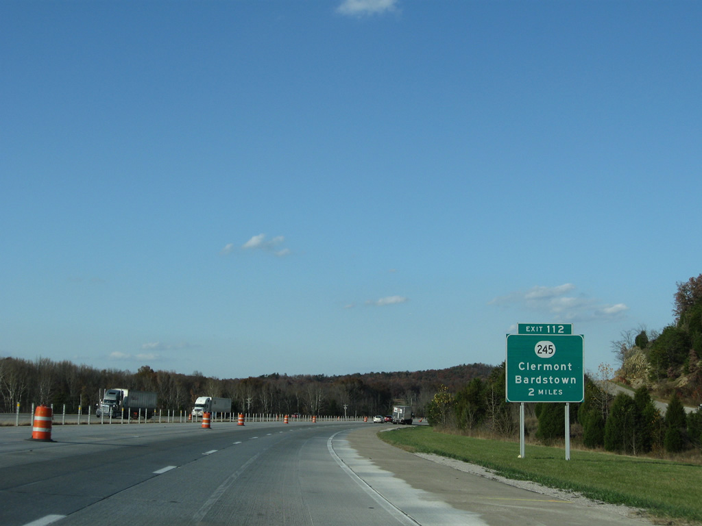
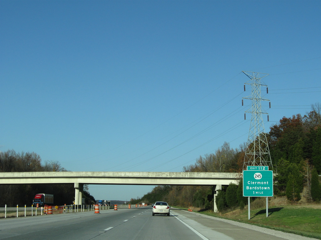
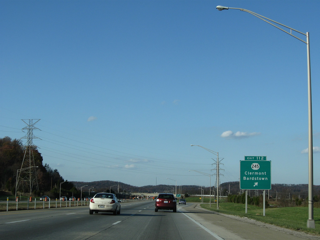
KY 245 (Clermont Road) can be considered the first exit in the sprawl of Louisville. KY 245 runs east to the town of Clermont.
11/04/09
Through here, KY 61 follows the right-of-way of I-65 immediately to the west, and can be seen in several locations winding through the trees. KY 245 has many advance warning signs, and exits are few and far between along this stretch.
11/04/09
Clermont was recognized as a place only in 1979, when the USGS added place names due to expanding sprawl. The area is home to the famous Jim Beam distillery.
11/04/09
An I-65 reassurance marker north of the Clermont exit.
06/06/08
I-65 begins to descend into the Ohio River valley ahead of the diamond interchange (Exit 116) with SR 480.
06/06/08
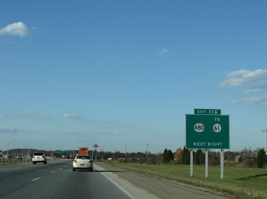
SR 480 runs along the south side of Shepherdsville to SR 61 (Preston Highway), where it was recently realigned and widened. The road runs east to US 31E / US 150 (Louisville Road) through residential areas and farms.
11/04/09
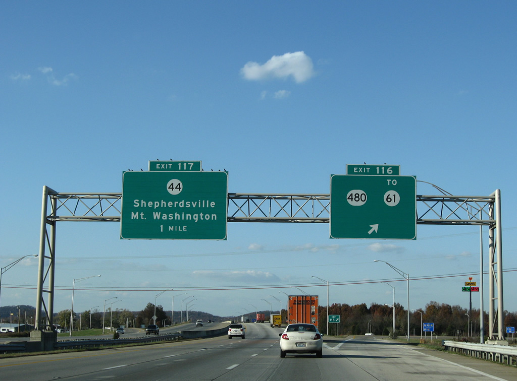
Exit 116 leaves Interstate 65 north for KY 480. KY 480 follows Charles Hamilton Way west and Cedar Grove Road east to Cedar Grove. The state route travels 13.477 miles.
11/04/09
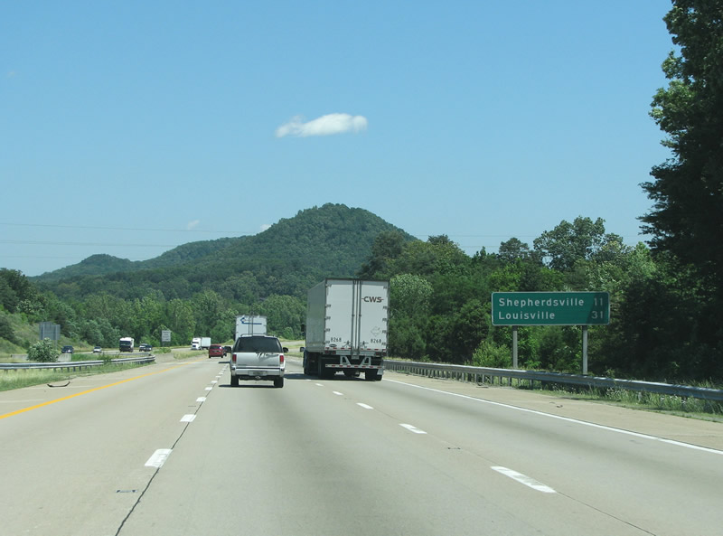
Shepherdsville is the county seat of Bullitt County. The town was founded in 1793 and named after Adam Shepherd. It is perhaps best known as the home of a famous mineral water spa known as Paroquet Springs, which opened in 1836.
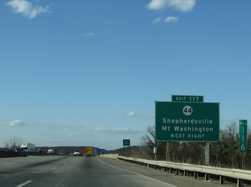
11/04/09
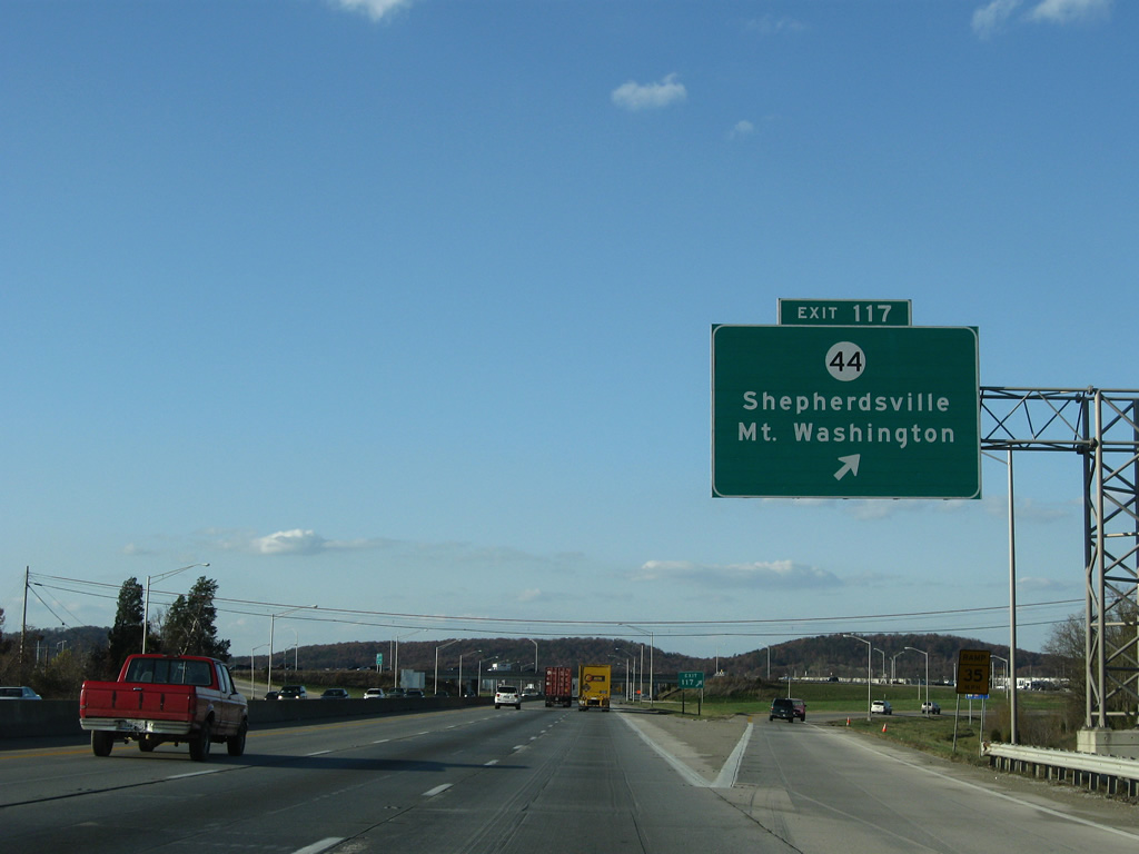
I-65 northbound at KY 44, this forms the main route into Shepherdsville. The route runs 70 miles from the Ohio River at West Point east to US 62/127.
11/04/09
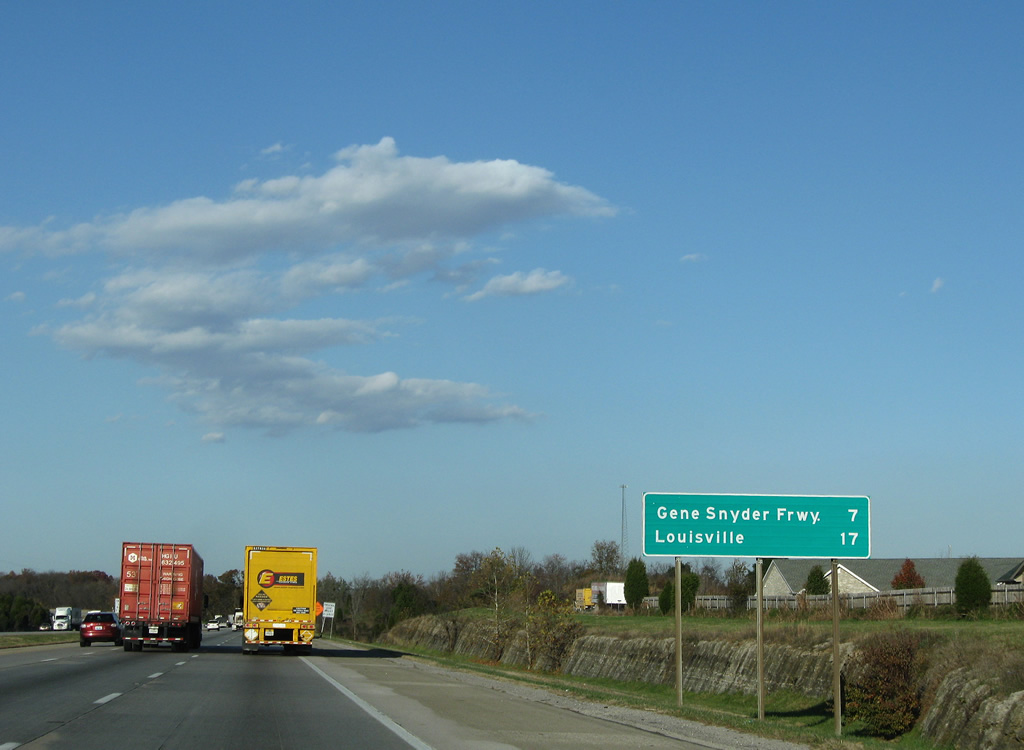
The Gene Snyder Freeway, I-265, sits 7 miles north of Shepherdsville. The stretch of road from E-town to Indiana was built in the 1950s as the Kentucky Turnpike. State law requires toll roads be made free once the bonds are paid off, and thus the turnpike became toll-free I-65.
11/04/09
Brooks Road is the first exit north of Shepherdsville. From here, each exit gets more and more developed with residences and retail.
06/06/08
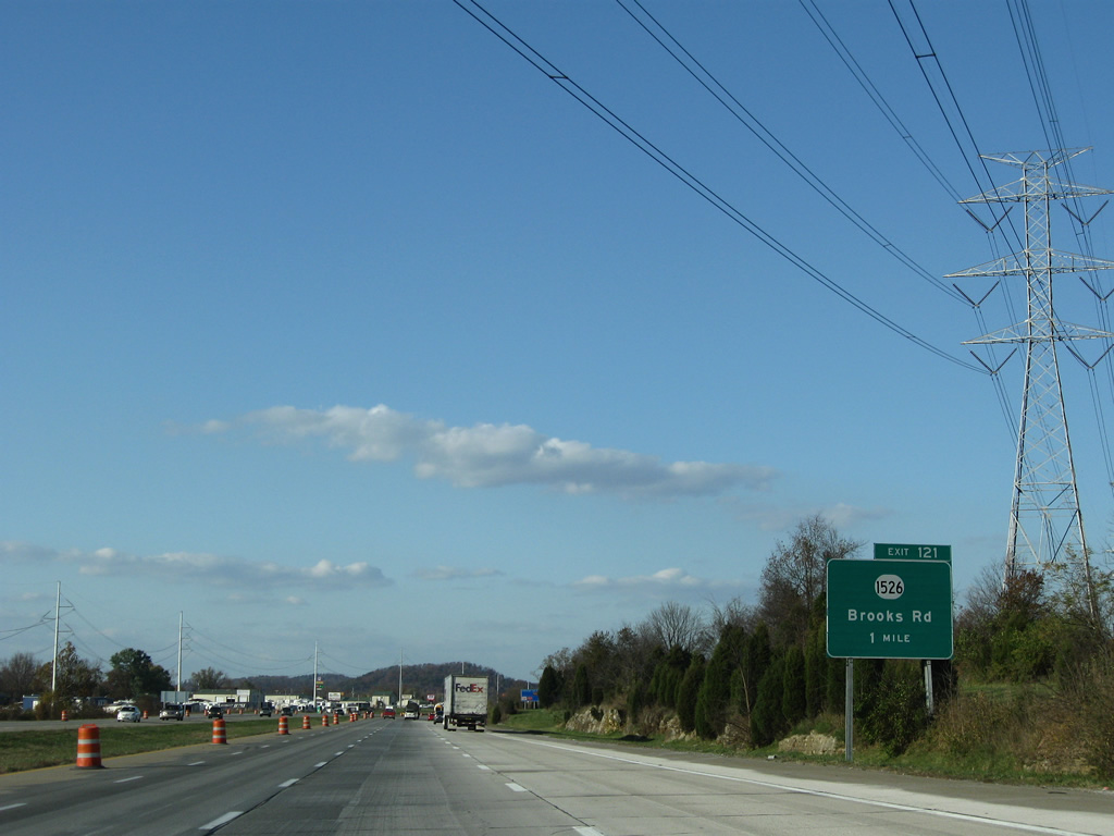
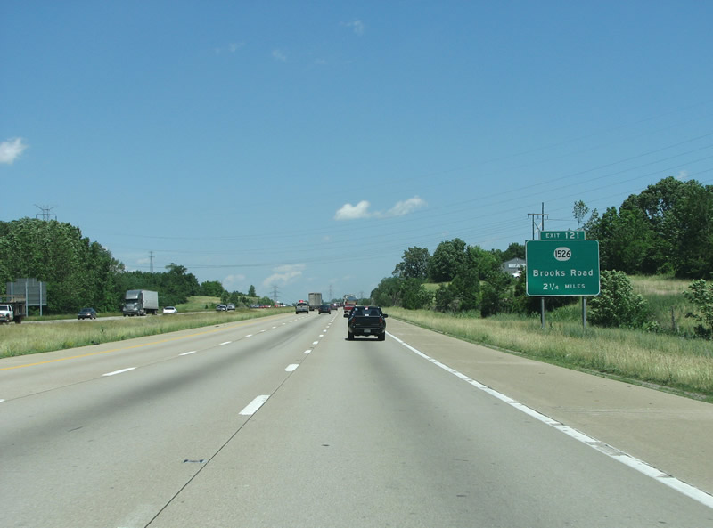
One mile south of the diamond interchange (Exit 121) with Brooks Hill Road (KY 1526). KY 1526 arcs north from KY 44 west and east of Brooks 12.967 miles.
11/04/09
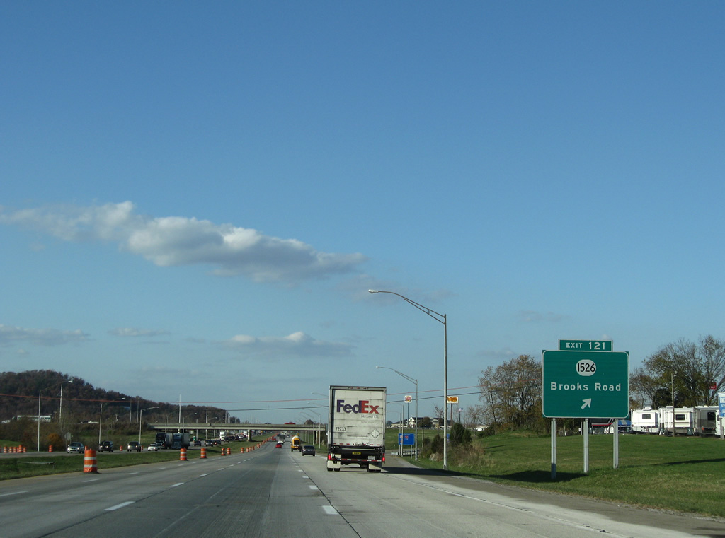
I-65 gets very busy here. Brooks continues north into suburban Louisville from here.
11/04/09
Heavy development lies just east of Interstate 65 along the parallel KY 1450 (Bluelick Road) corridor through Hunters Hollow. Buttonmold Knob rises to the west as I-65 advances north to Jefferson County.
11/04/09

Forthcoming Exit 125 is a directional cloverleaf interchange with KY 841 west and I-265/KY 841 east. These designations are better known as the Gene Snyder Freeway.
11/04/09
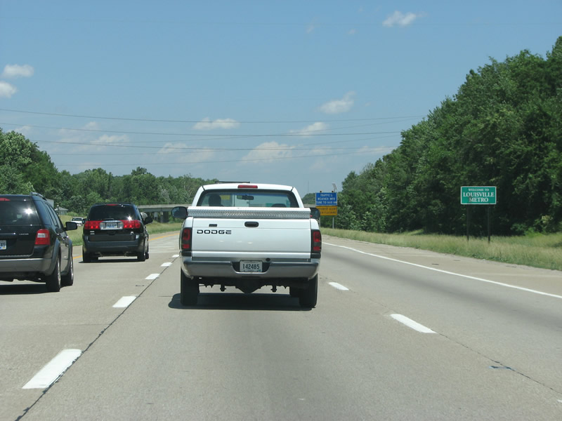
I-65 enters Louisville Metro here, which is contiguous with Jefferson County. The city merged with the county in 2003 after the 2000 census revealed that Lexington was the largest city in the state.
06/06/08
Photo Credits:
- ABRoads: 11/04/09
- Justin Cozart: 06/06/08
Page Updated Saturday May 21, 2011.