
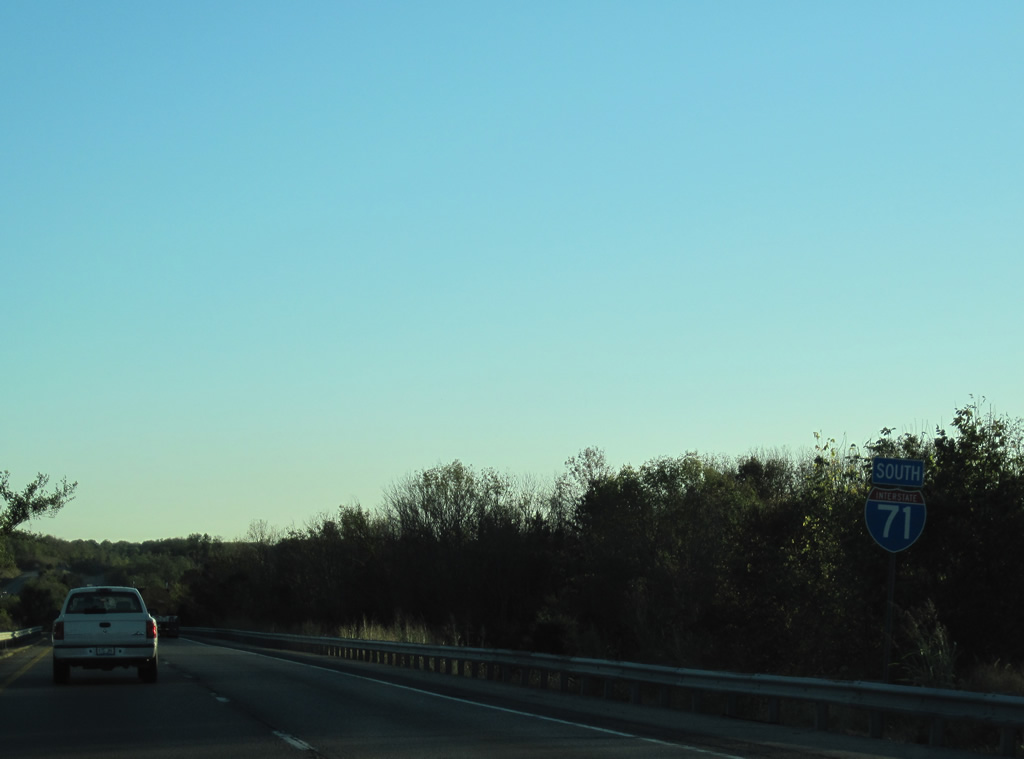
Interstate 71 South - Walton to La Grange
 South
South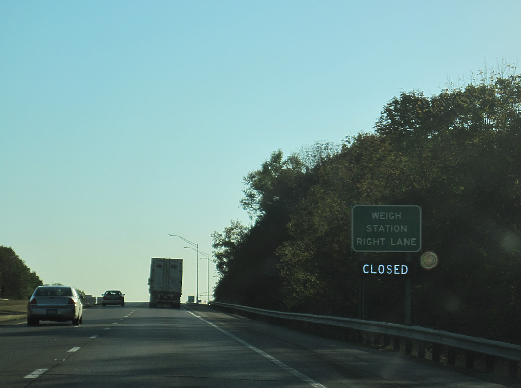
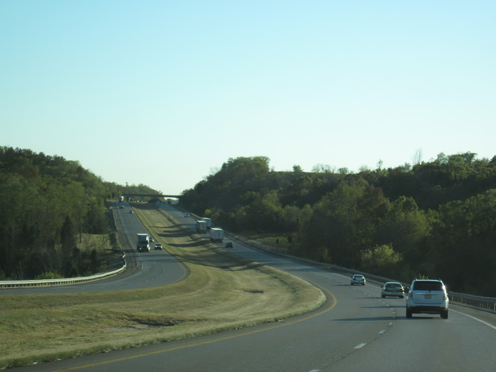
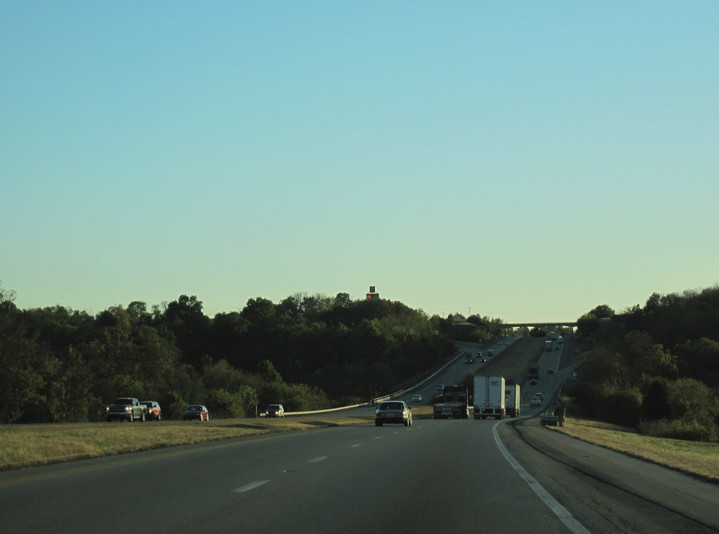
Resuming a southwest trajectory, Interstate 71 leaves the Walton area ahead of a weigh station and truck rest haven.
10/01/10
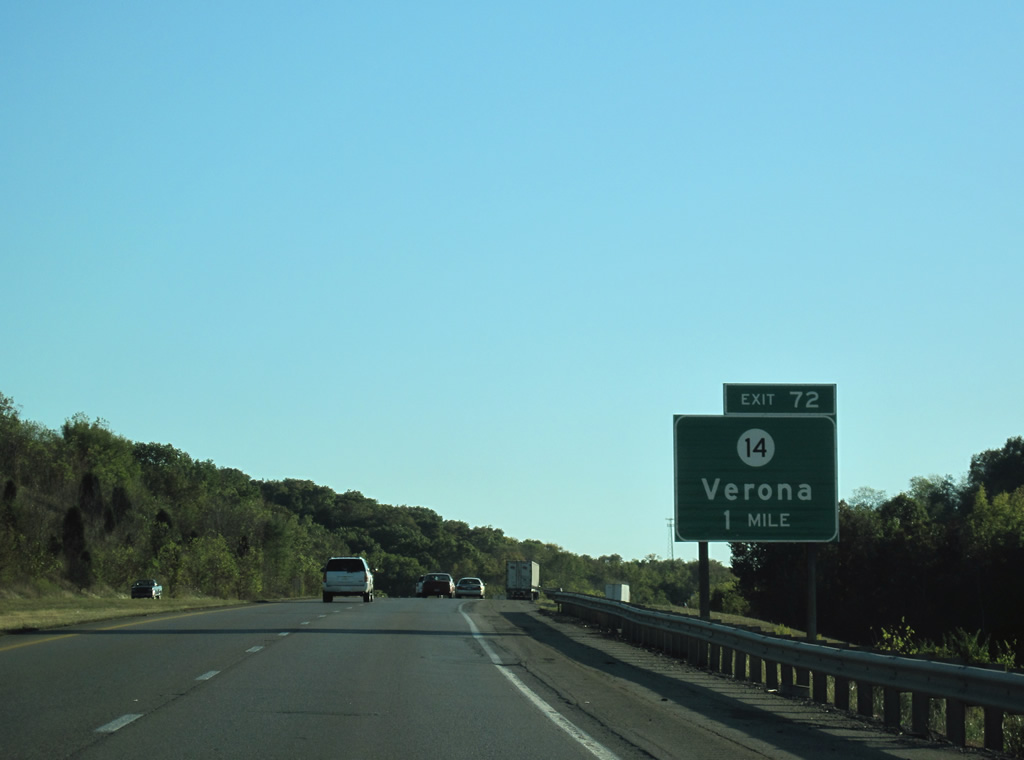
KY 14 (Verona Mudlick Road) loops south with KY 16 from Walton and Interstate 75 to a split at Verona, 1.75 miles south of the diamond interchange at Exit 72.
10/01/10
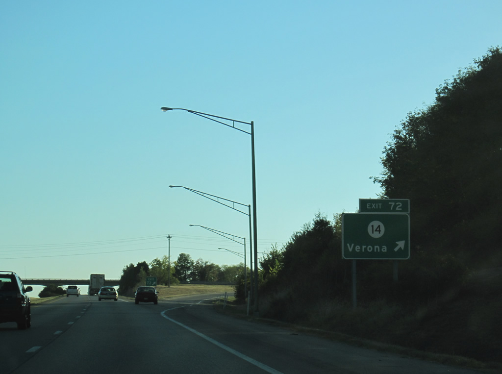
KY 14 (Verona Mudlick Road) continues west from Exit 72, 2.25 miles to end in the Mud Lick Creek valley at Hume and U.S. 42/127.
10/01/10
Curving toward the KY 562 over crossing along Interstate 71 southbound.
10/01/10
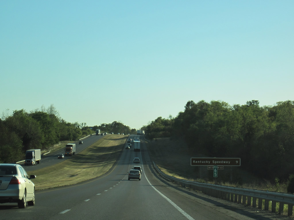
A recreational distance sign for Kentucky Speedway stands along I-71 southbound by milepost 65 and the settlement of Napoleon along KY 16. These types of signs are commonly used for points of interest throughout the Kentucky Interstate system. The forthcoming race track, with a seating capacity ranging from 69,000-107,000, opened in 2000.1
10/01/10
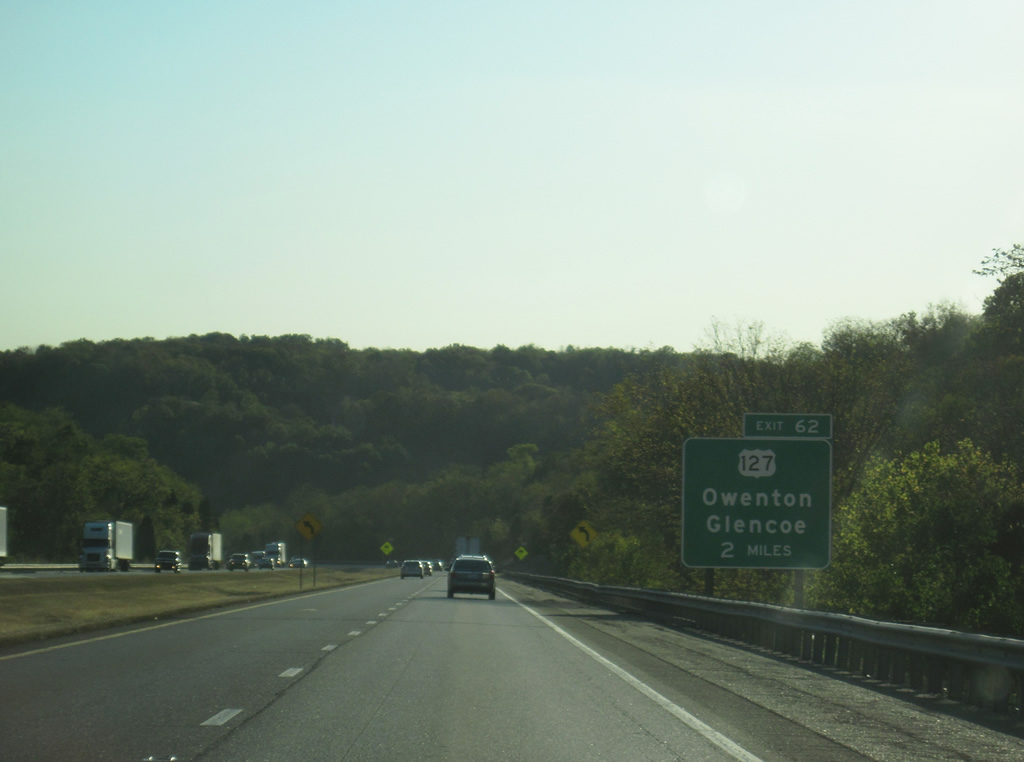
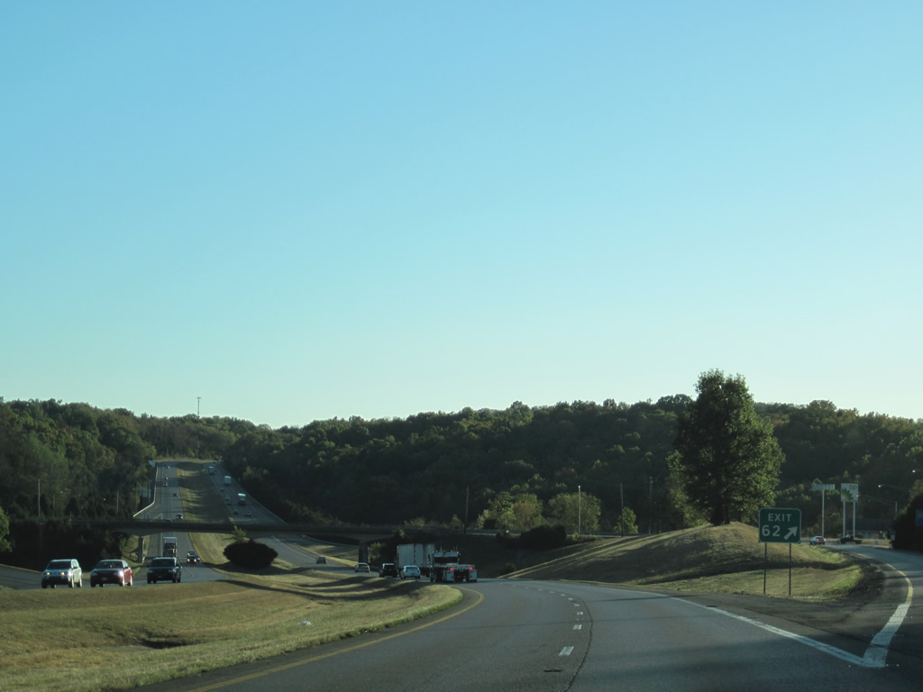
Two miles ahead of the diamond interchange (Exit 62) with U.S. 127 in a valley west of Napoleon.
10/01/10
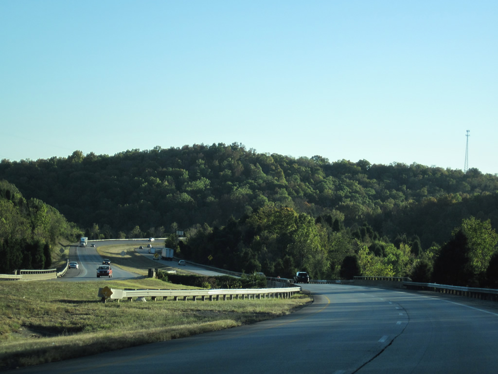
Spanning an unnamed stream, Interstate 71 winds across the hillsides east of U.S. 127 in this scene. The freeway was completed in 1967 throughout Gallatin County.
10/01/10

U.S. 42/127 overlap from Covington southwest to a point along the Ohio River, 3.3 miles north of Exit 62. U.S. 127 continues south into adjacent Glencoe and 28 miles from there to the Owen County seat of Owenton.
10/01/10
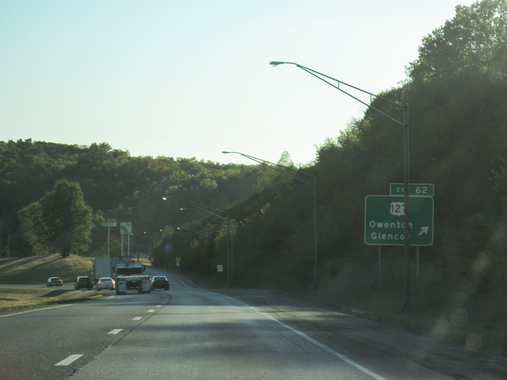
Exit 62 departs Interstate 71 south for U.S. 127. U.S. 127 travels 176 miles through Kentucky between Static and the C.W. Bailey Bridge at Covington.
10/01/10
Overall U.S. 127 travels 758 miles from Chattanooga, Tennessee to Grayling, Michigan.
10/01/10
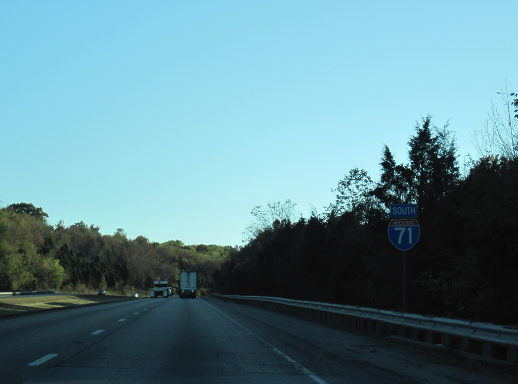
Reassurance marker for Interstate 71 south posted after the on-ramp from U.S. 127.
10/01/10
A high level overpass carries KY 465 (Boone Road) above Interstate 71 after the Indian Camp Creek valley.
10/01/10
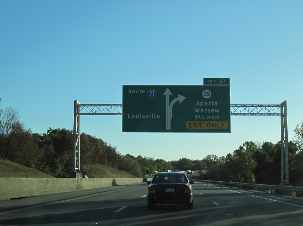
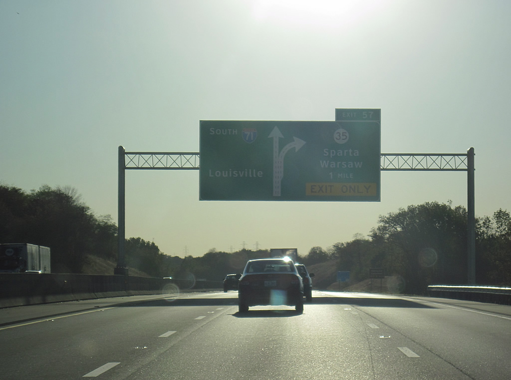
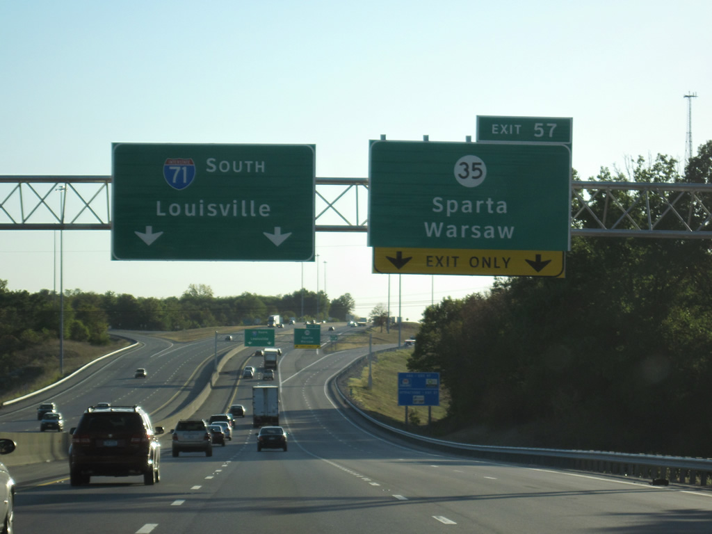
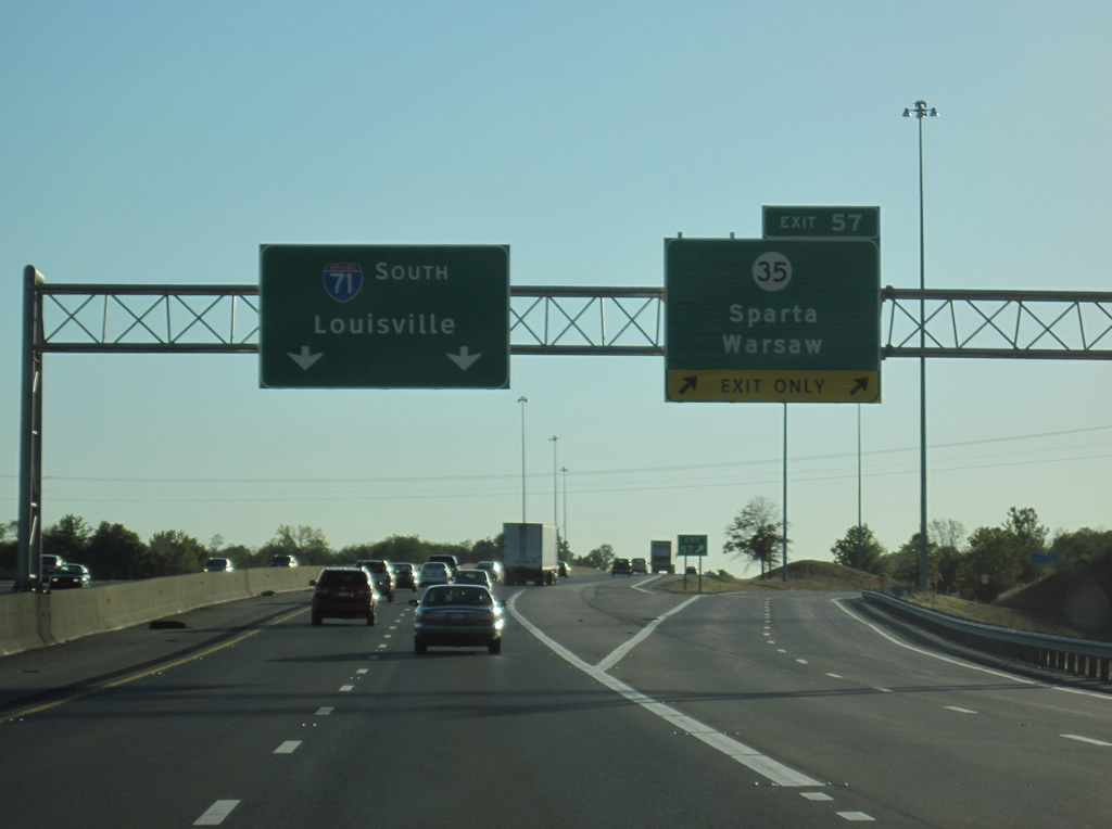
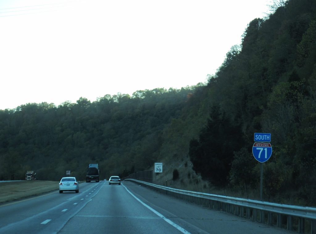
Interstate 71 expands to six overall lanes ahead of the diamond interchange (Exit 57) with KY 35 (Sparta Pike) at Sparta.
10/01/10
Interstate 71 and the off-ramp at Exit 57 to KY 35 (Sparta Pike) were expanded in separate projects between 2004 and 2007 to increase capacity for nearby Kentucky Speedway.
10/01/10
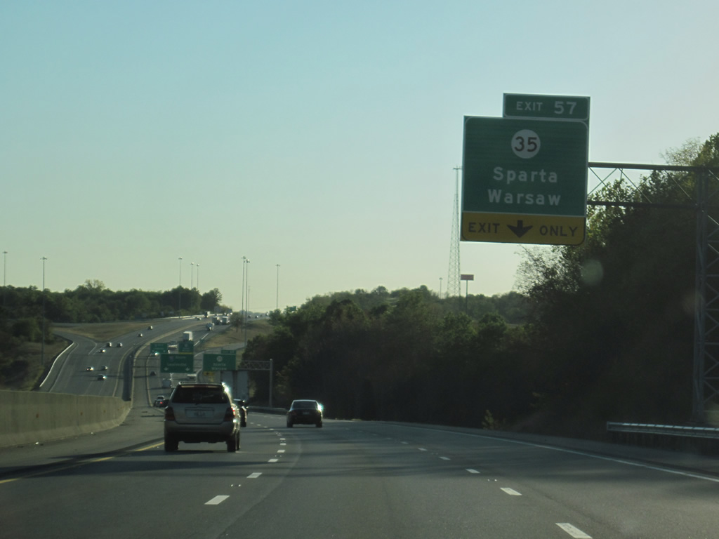
KY 35 constitutes a 12.83 mile route from U.S. 127, four miles south of Sparta, to U.S. 42 at the Gallatin County seat of Warsaw.
10/01/10
Kentucky Speedway lies between KY 35 (Sparta Pike) and KY 1039 along Kentucky Speedway Boulevard. The 1.5 mile tri-oval speedway hosts a number of NASCAR events throughout the year, including the Quaker State 400 and the KY 300.
10/01/10
I-71 southbound reduces to two lanes on the overpasses above KY 35 that were rebuilt in 2007. Capacity improvements were meant to aid in race day traffic at the adjacent speedway. This proved to be inadequate for the 2011 Quaker State 400, as all grandstand tickets were sold and the ensuing traffic jam resulted in an estimated 20,000 fans unable to reach the venue.1
10/01/10
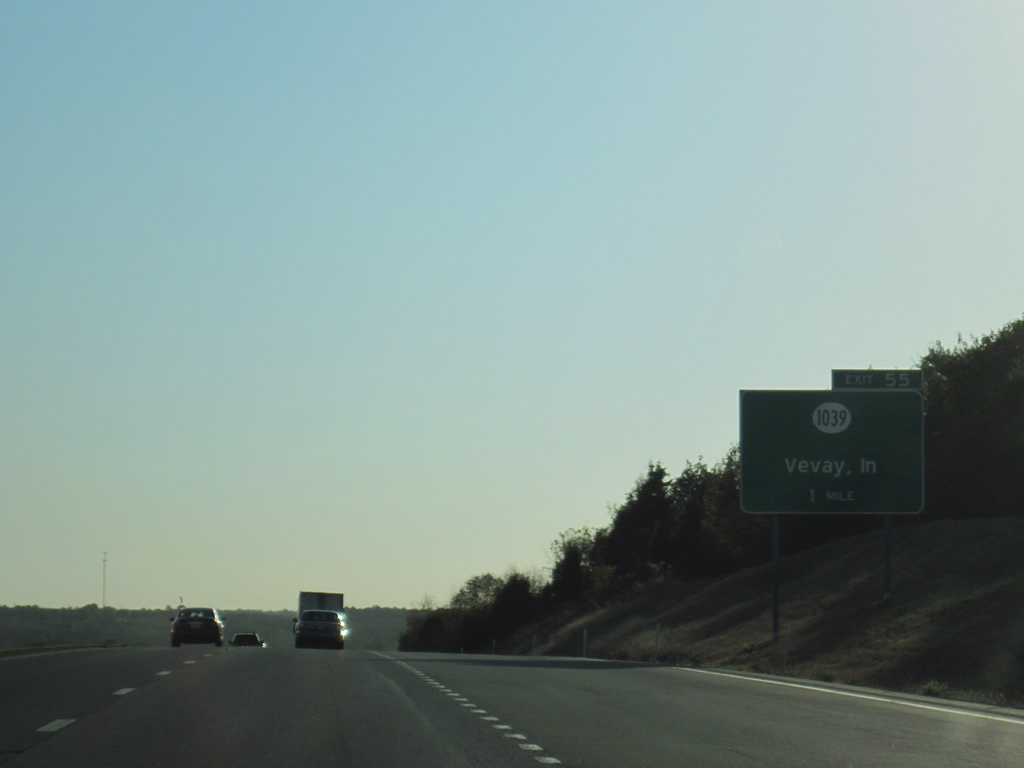
KY 1039 was widened and extended north from the diamond interchange with Interstate 71 opened in 2002 to U.S. 42 at Etheridge. The 7.11 mile route connects I-71 with the Markland Dam Highway Bridge to Markland, Indiana.
10/01/10
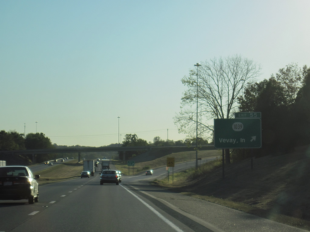
KY 1039 ends at parallel KY 465 (Boone Road) to the south of Exit 55 and intersects Kentucky Speedway Boulevard (KY 1130) one mile to the north. Connections with Indiana State Road 156 lead motorists west to the Switzerland County seat of Vevay.
10/01/10
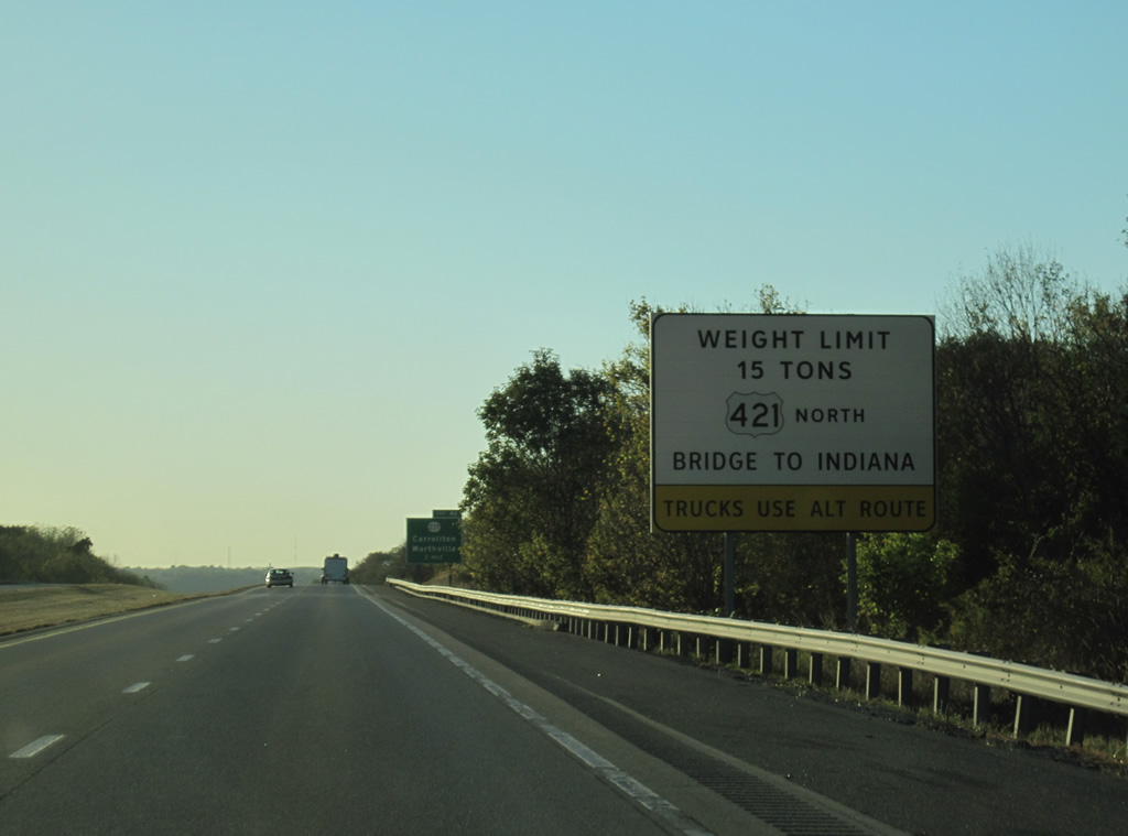
I-71 leaves Gallatin County for Carroll County at Carson and continues on a ten mile exit less stretch west to meet KY 227 near Langstaff. KY 227, the former U.S. 227, provides the first leg in a 13 mile drive from I-71 to the Milton-Madison Bridge taking U.S. 421 across the Ohio River. Prior to 2010-15 construction, heavy truck traffic (above 15 tons) was restricted from the span.2
10/01/10
KY 227 is a 47 mile route that goes from U.S. 460 near Georgetown to U.S. 42 at Carrollton. The state route was a part of U.S. 227 that ran 120 miles from Carrollton to Richmond, until 1972.
10/01/10
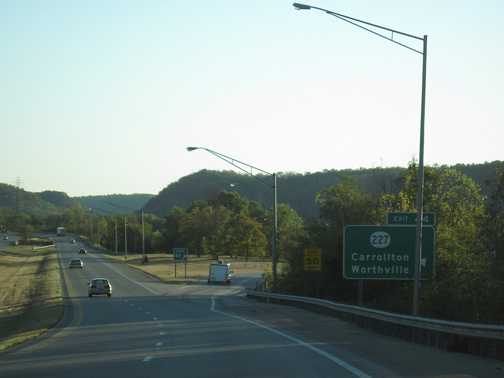
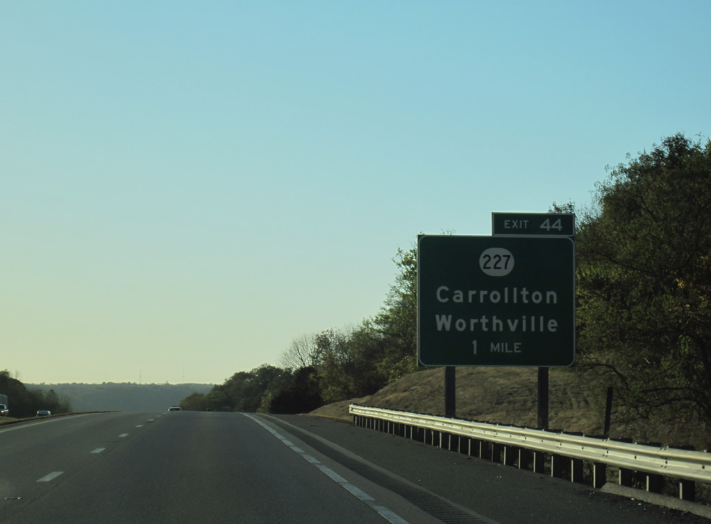
The diamond interchange at Exit 44 links I-71 with KY 227 at Langstaff. KY 227 follows the Kentucky River southward to Worthville, where the state route turns east to Wheatley and Owenton.
10/01/10
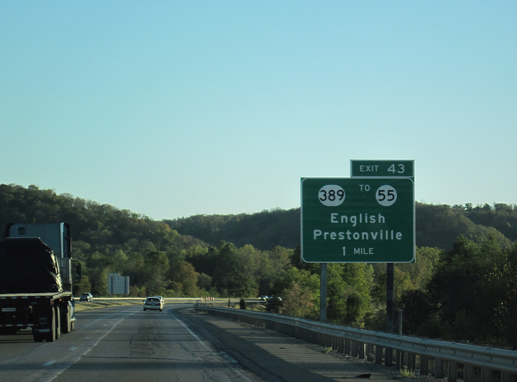
Beyond the Kentucky River, a diamond interchange (Exit 43) connects Interstate 71 with KY 389.
10/01/10
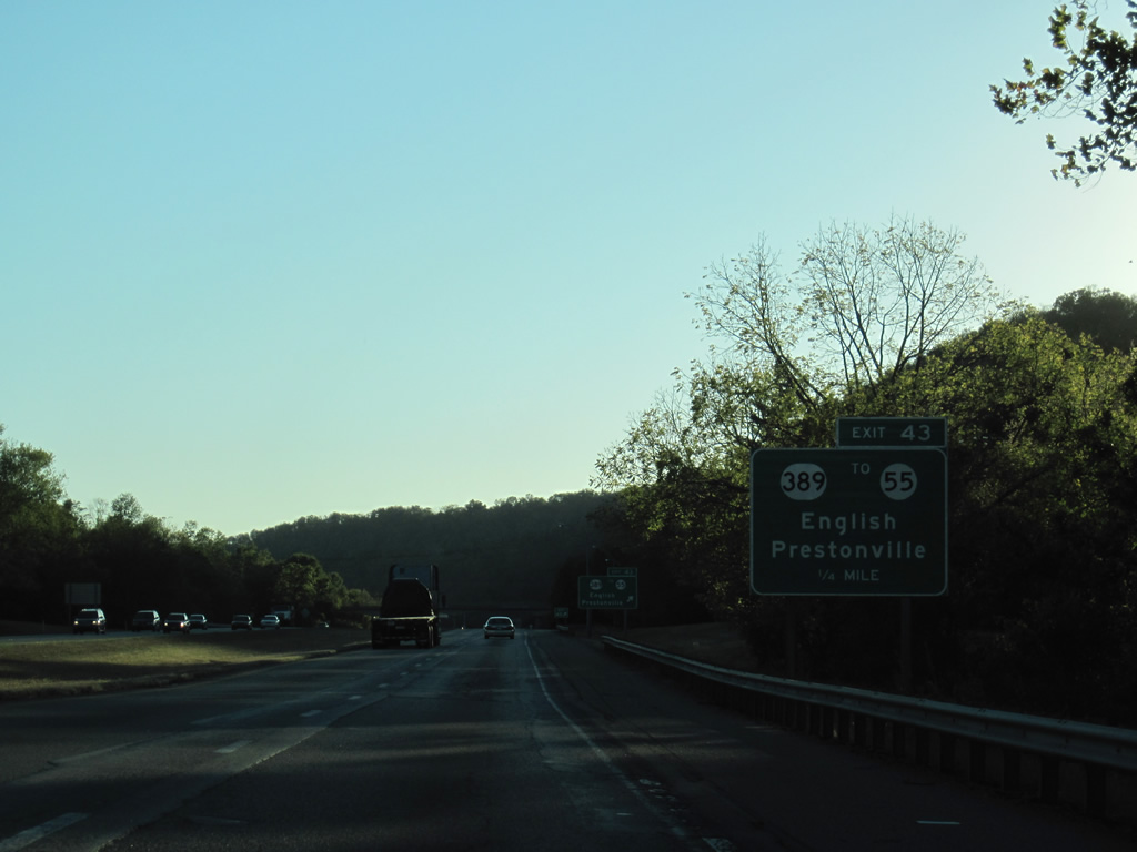
Exit 43 links I-71 with KY 389 and the adjacent settlement of English. KY 389 generally follows the Kentucky River for much of the 29.03 mile route between KY 561, in southeast Henry County, to KY 55, southeast of Prestonville.
10/01/10

There is no direct access between Interstate 71 and KY 55. Instead motorists are directed northward onto KY 389 to KY 55, a 115 mile highway between U.S. 42 at Prestonville and U.S. 127 at Freedom (near Lake Cumberland).
10/01/10
Interstate 75 enters the Mill Creek valley west from English in southwestern Carroll County.
10/01/10
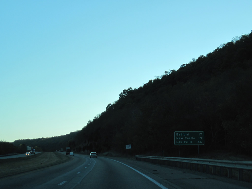
Bedford and New Castle, county seats for Trimble and Henry Counties respectively, are served by U.S. 421 in nine miles. The south end of Interstate 71 and downtown Louisville follow in 46 miles.
10/01/10
Just west of the location along I-71 south where one of the deadliest bus crashes in US history took place. The crash occurred May 14, 1988 when a drunk driver drove the wrong way along the freeway and collided with a bus resulting in the deaths of 27 people. Signs are posted in each direction (not pictured here) marking the site.
10/01/10

A pair of bridges cross over separate sections of Mill Creek Road (KY 2997) and the West Fork of Mill Creek ahead of the Trimble County line.
10/01/10
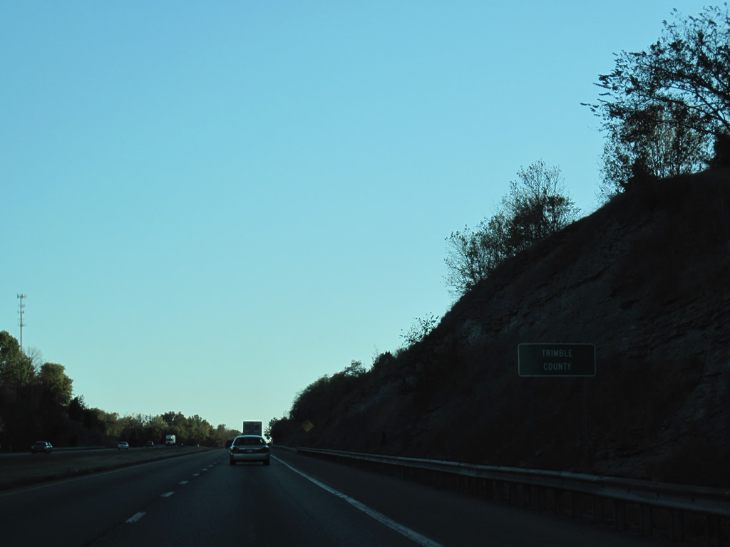
I-71 nips the easternmost wedge of Trimble County for only a few hundred feet. The county sits along the Ohio River and has about 8,100 inhabitants.
10/01/10
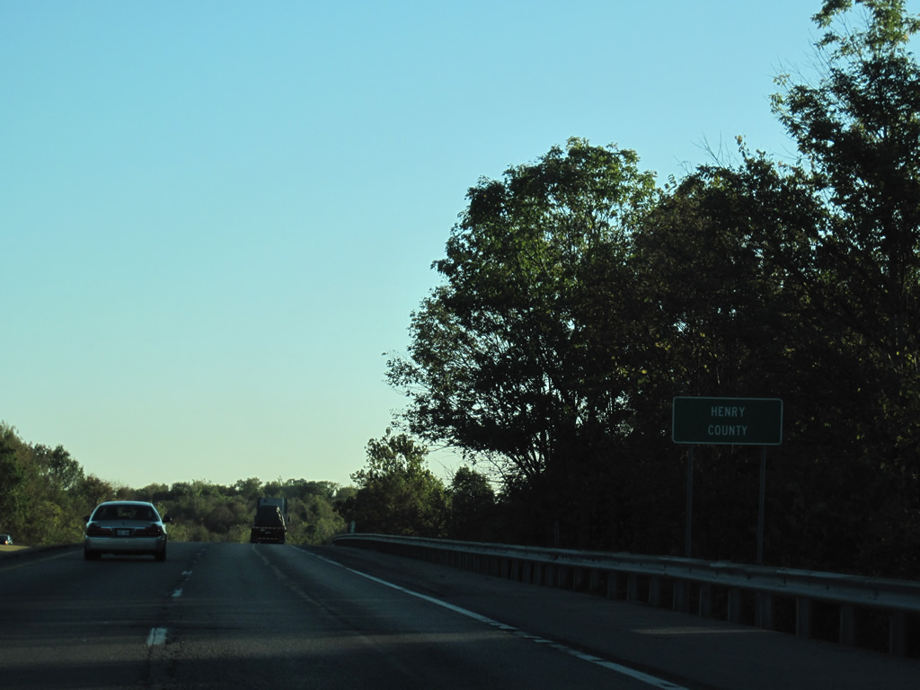
Interstate 71 quickly crosses into Henry County ahead of the KY 55 overpass west of Turners Station.
10/01/10
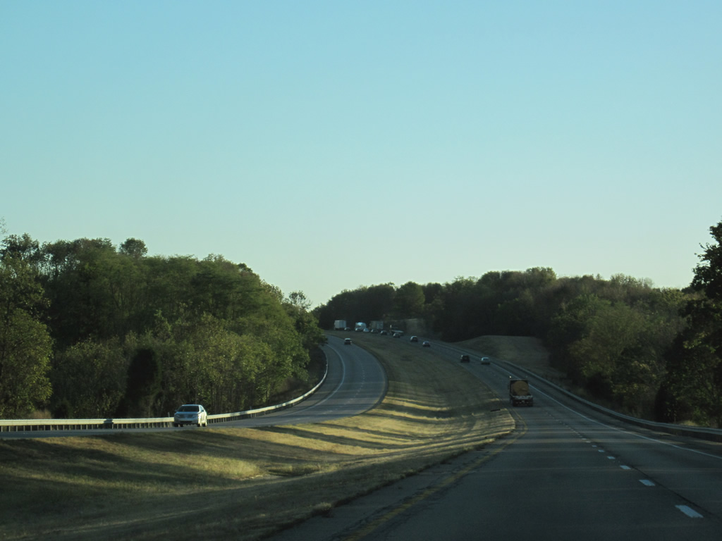
Continuing southwest of KY 55, Interstate 71 spans Daughterty Creek ahead of a set of abandoned weigh stations.
10/01/10
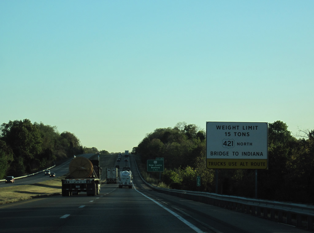
U.S. 421 spans the Ohio River between Milton, Kentucky and Madison, Indiana. An innovate construction project completed in November 2015 replaced the bridge superstructure with a method called "truss sliding". Started in late 2010, work slid a 2,427 foot long truss into place over rehabilitated pier supports.2
10/01/10
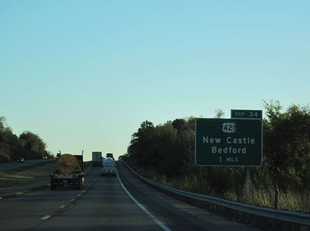
A diamond interchange joins U.S. 421 (Campbellsburg Road) with Interstate 71 in one mile. U.S. 421 follows Main Street east through nearby Campbellsburg ahead of KY 55 and a southern turn to New Castle.
10/01/10
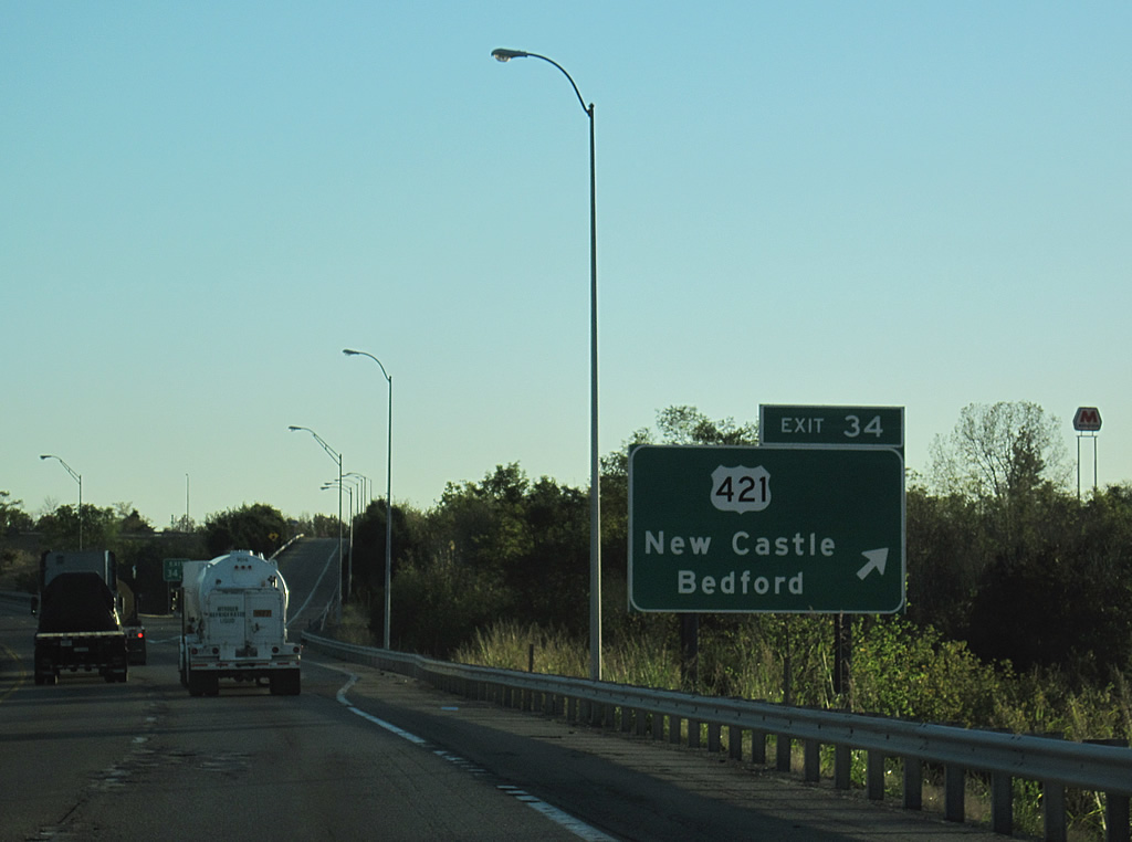
U.S. 421 continues northwest from Exit 34, eight miles to Bedford and U.S. 42. The Milton-Madison Bridge is a 21 mile drive to the north.
10/01/10
Interstate 71 continues southwest 12 miles to the Oldham County seat of La Grange and 34 miles into Louisville.
10/01/10
A roadway split along Interstate 71 southbound occurs at the crossing of Fallen Creek near Sulphur.
10/01/10
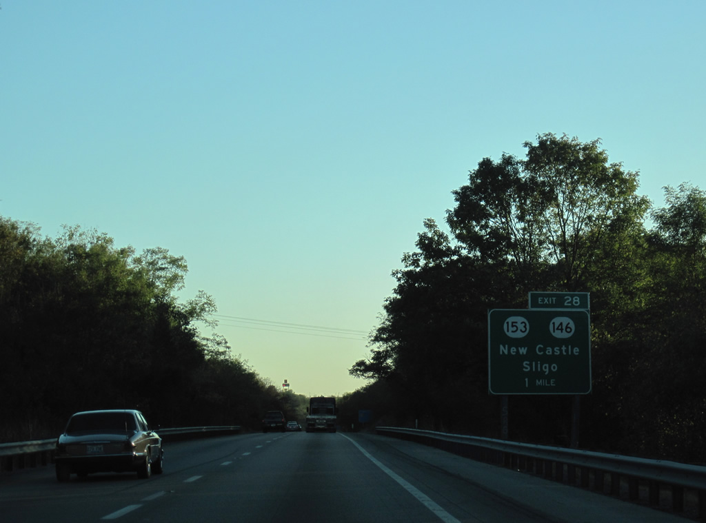
KY 153 (Pendleton Road) converged with I-71 at a diamond interchange (Exit 28) between Pendleton and KY 146 (La Grange Road) in one mile.
10/01/10
Interstate 71 lowers to cross the Little Kentucky River ahead of Exit 28 to KY 153.
10/01/10
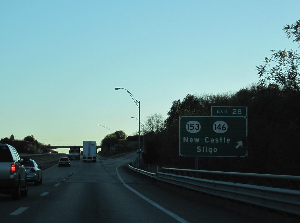
KY 153 goes for 8.51 miles from KY 1861 near Smithfield north by Lake Jericho to Exit 28 and U.S. 42 in Sligo. KY 146 joins La Grange with New Castle as part of a 33 mile long route to Louisville.
10/01/10

Ballardsville appears in place of La Grange as the next destination of Interstate 71 south via Exit 22. 28 miles of I-71 remain into Louisville.
10/01/10
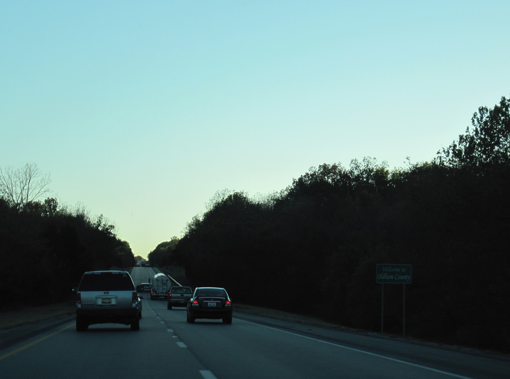
Interstate 71 splits again at the crossing into Oldham County. Areas surrounding the freeway become vastly more suburban as the freeway progresses 13.41 miles through the county named for Colonel William Oldham.
10/01/10

References:
- Kentucky Speedway. Wikipedia.
- "Milton-Madison Bridge is Complete." http://www.miltonmadisonbridge.com/news-center Milton-Madison Bridge Project web site.
Photo Credits:
- ABRoads, Carter Buchanan: 10/01/10
Page Updated Wednesday March 14, 2012.