
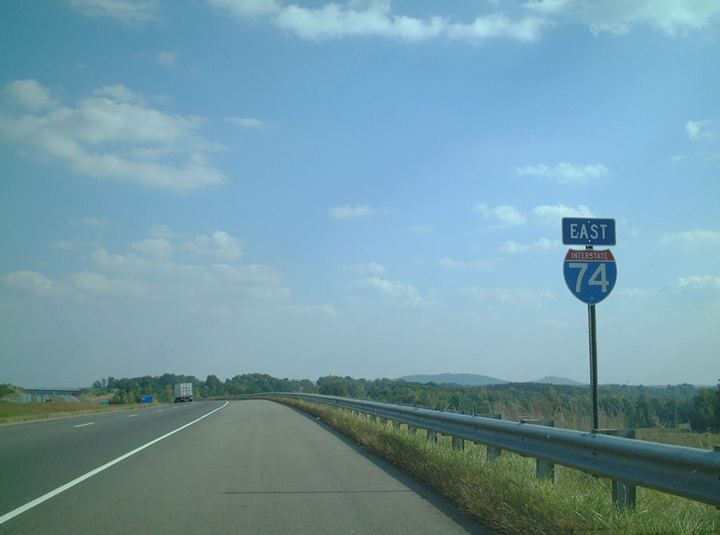
Interstate 74 East - Mount Airy

 East
East  South East
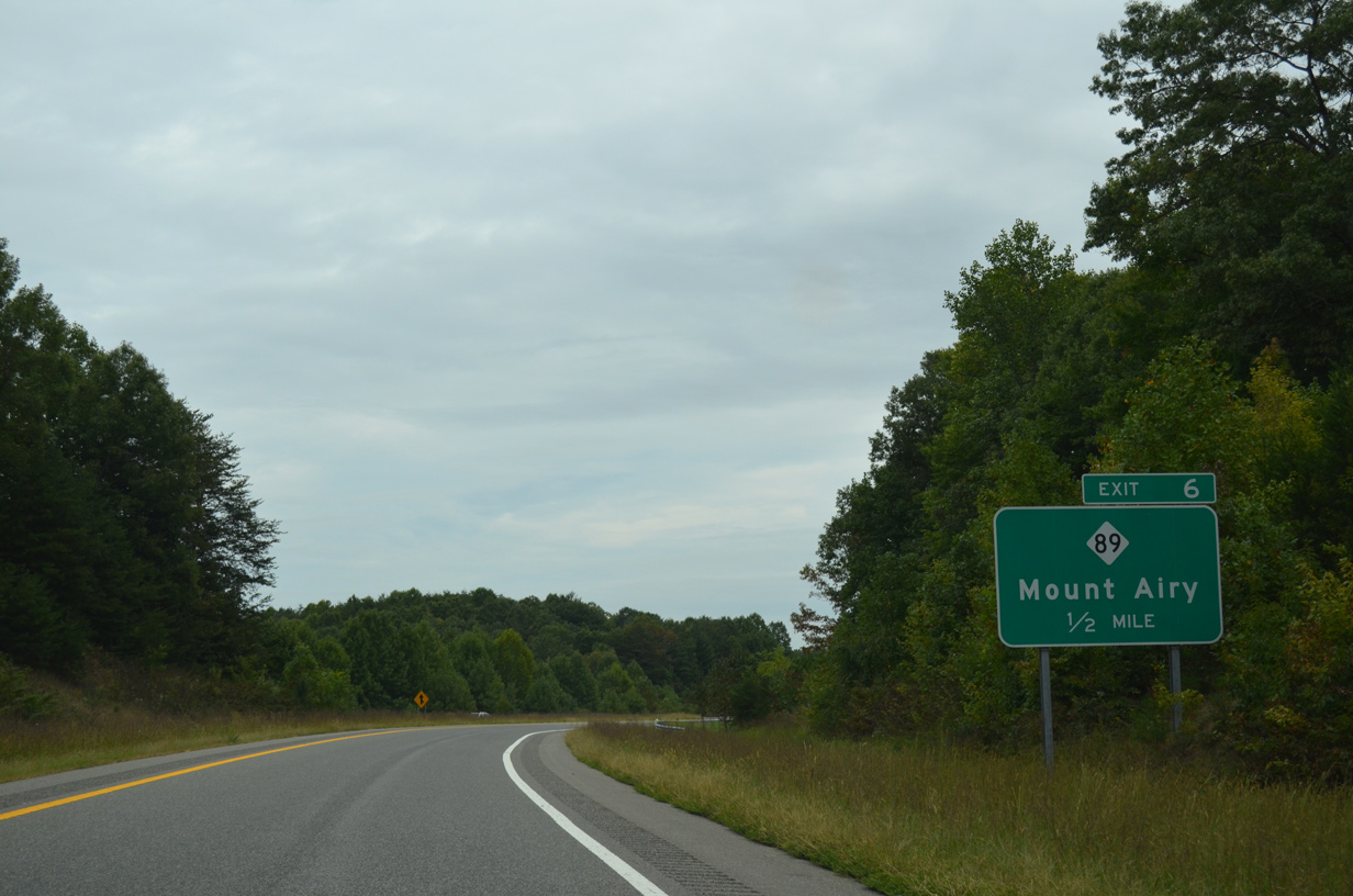
A folded diamond interchange (Exit 6) joins I-74 with NC 89 just east of I-77 at Pine Ridge.
09/23/14
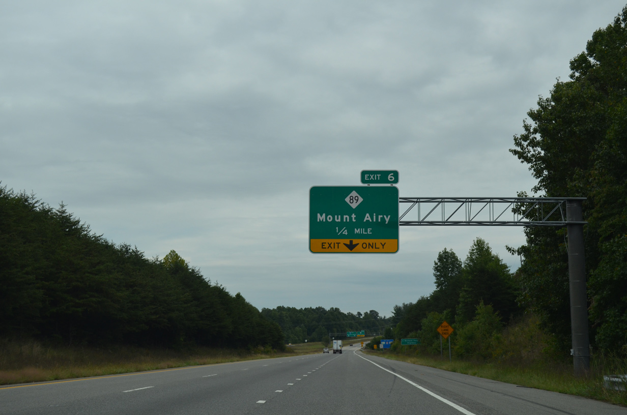
Interstate 74 leads east initially with three lanes. A lane drop occurs at Exit 6 for NC 89.
09/23/14
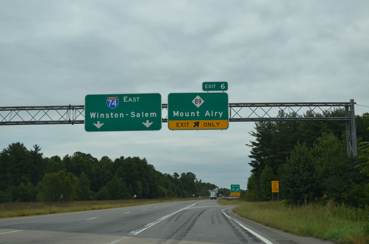
NC 89 (W Pine Street) meanders west to I-77 nearby at Exit 100 and the unincorporated community of Beulah. Heading east, NC 89 passes through Pine Ridge.
09/23/14
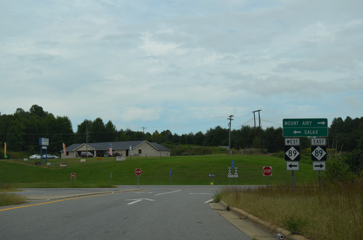
NC 89 is part of a 67 mile long multi-state route between U.S. 311 at Walnut Cove and U.S. 58/221 at Galax, Virginia. NC 89 runs east along Pine Street to Toast and Independence Boulevard ahead of Downtown Mount Airy.
12/31/13
This reassurance marker precedes the diamond interchange (Exit 8) joining Interstate 74 with Red Brush Road (SR 1350).
10/05/01
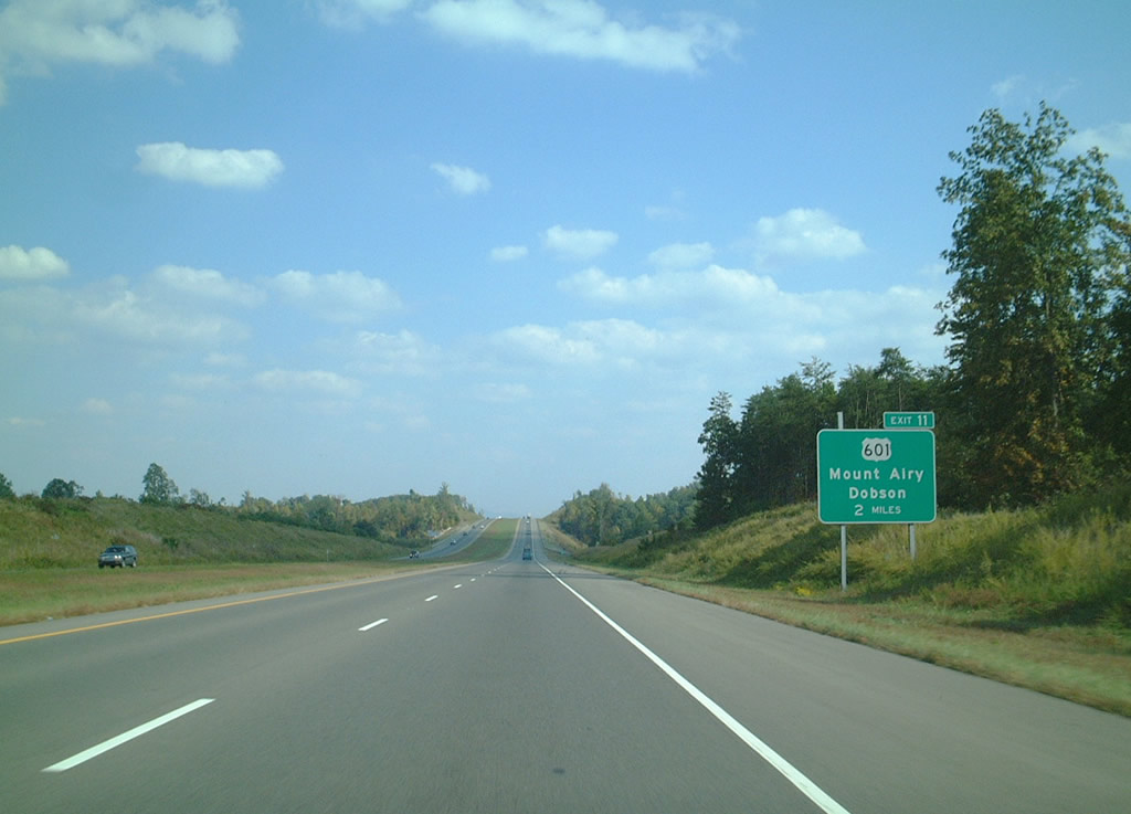
I-74 advances two miles east to meet U.S. 601 at the community of White Plains. Originating 2.36 miles to the north at U.S. 52 (S Andy Griffith Parkway), U.S. 601 travels 7.5 miles south from Exit 11 to the town of Dobson.
10/05/01

Entering the folded diamond interchange (Exit 13) with Park Drive (SR 2000) on I-74 east. Park Drive winds 3.75 miles north from Siloam Road (SR 1003) to the commercial strip along U.S. 601 (Rockbridge Street) in Mount Airy.
10/05/01
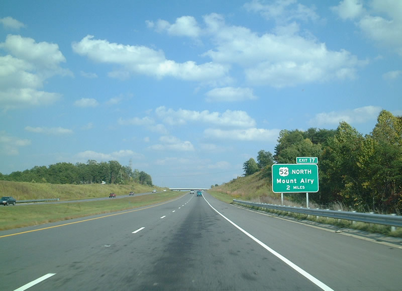
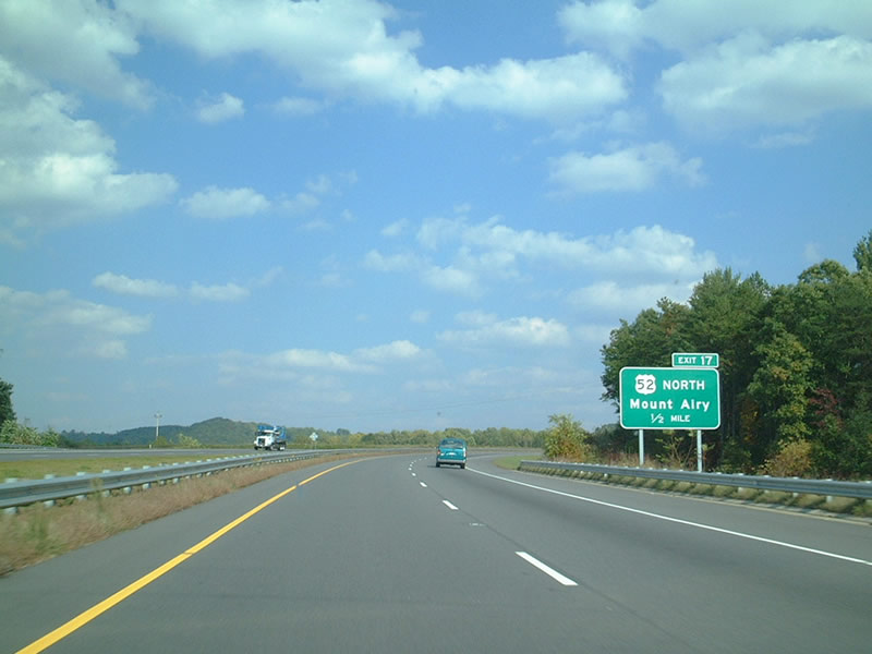
The Mount Airy segment of Interstate 74 concludes in two miles at the trumpet interchange (Exit 17) with U.S. 52 southbound.
10/05/01
Part of the Future I-74 corridor, U.S. 52 predates Interstate 74 as a freeway southeast from Mount Airy to the city of Winston-Salem.
10/05/01
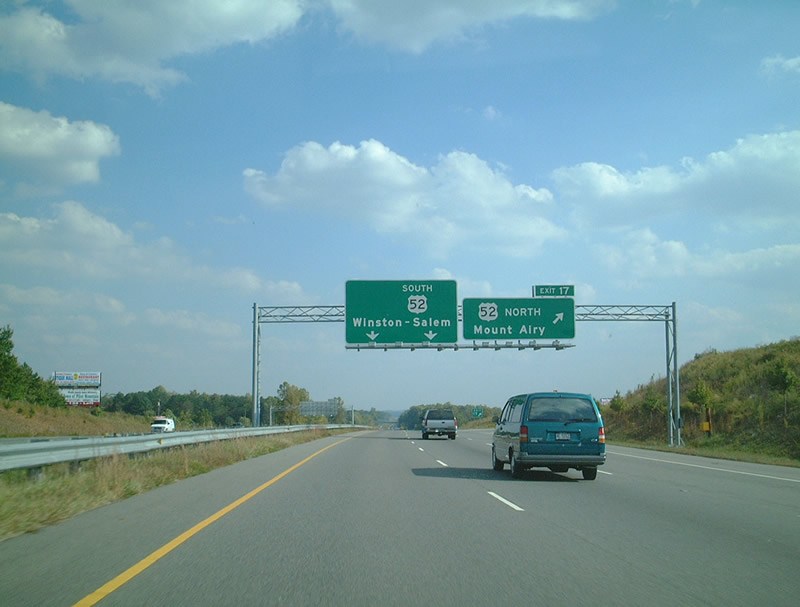
Exit 17 loops onto U.S. 52 (Andy Griffith Parkway) north while two lanes default onto U.S. 52 south ahead of Pilot Mountain. Downtown Mount Airy lies 5.5 miles to the northwest via U.S. 52 Business.
10/05/01
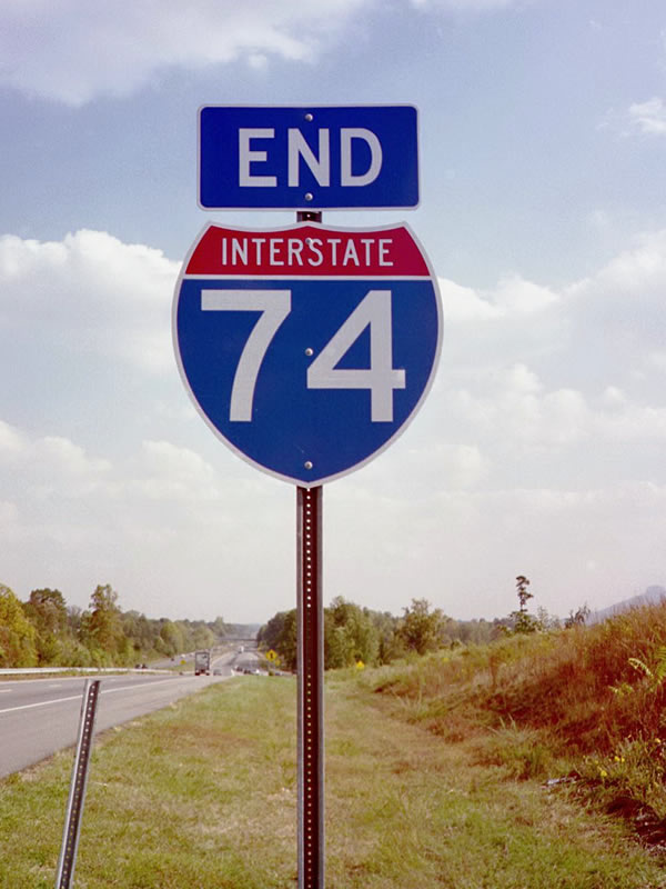
An end shield stands just ahead of the entrance ramp for U.S. 52 south. U.S. 52 continues 32 miles to Downtown Winston-Salem. Interstate 74 resumes southeast from I-40 to High Point, Asheboro and Rockingham.
10/05/01
Photo Credits:
- ABRoads: 09/23/14
- Alex Nitzman, Carter Buchanan: 12/31/13
- AARoads: 10/05/01
Connect with:
Page Updated Tuesday October 20, 2015.