
Interstate 74 West


 West
West  North
North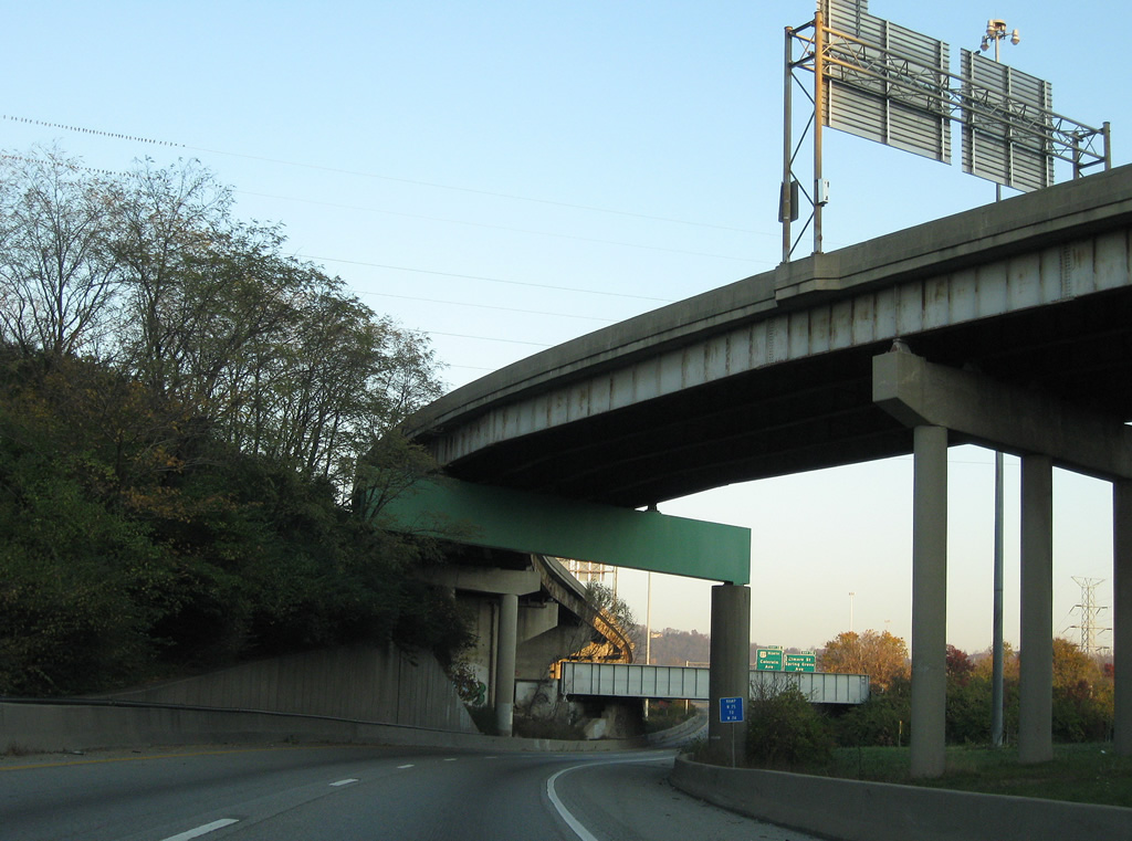
U.S. 27 north and U.S. 52 west shift from I-75 north to I-74 west. Two lanes pass below the I-75 mainline, ramps to Central Parkway and a CSX Railroad line.
11/08/09
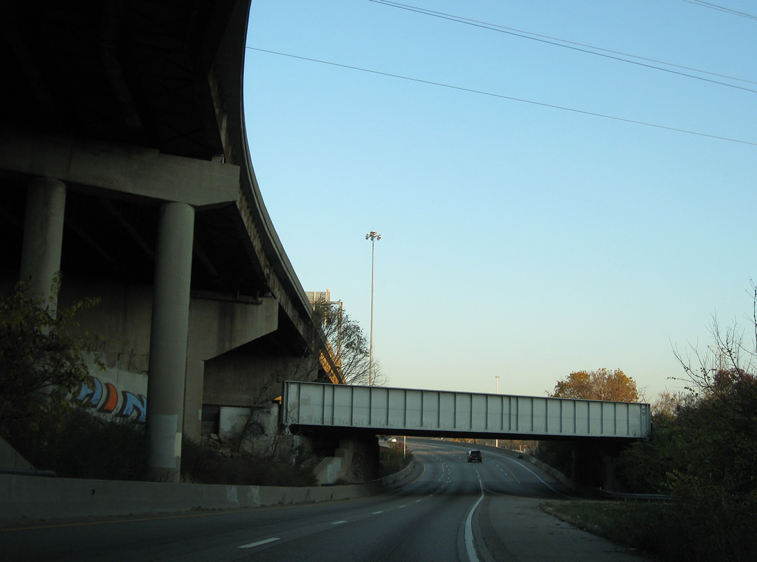
I-74/U.S. 27-52 span Mill Creek ahead of former ramps (Exit 19) for the Northside and South Cumminsville neighborhoods.
11/04/11
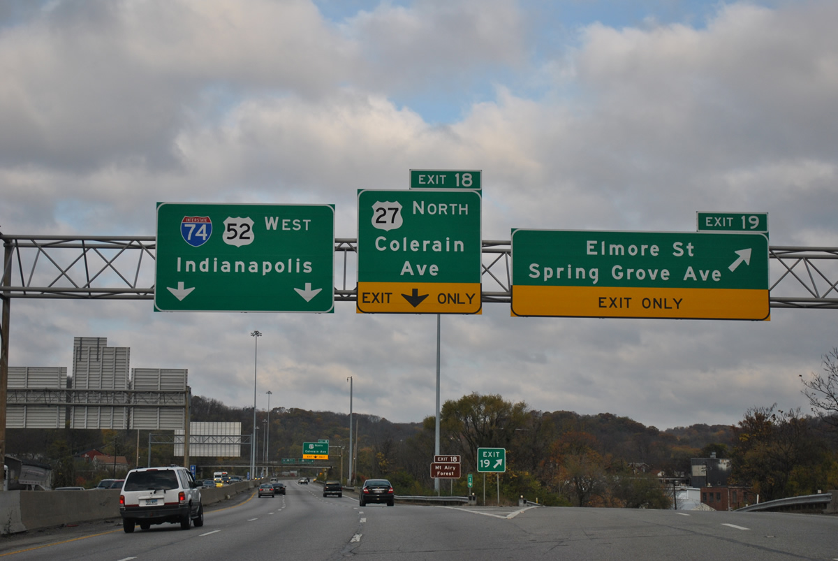
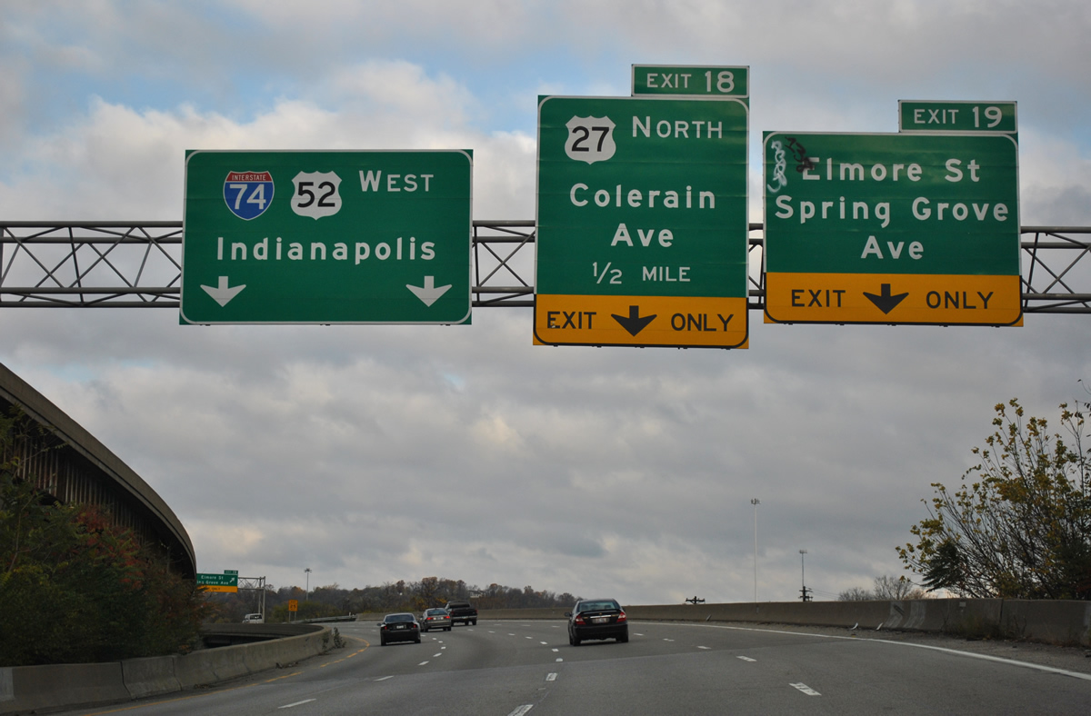
U.S. 27 previously departed at Exit 19 for parallel Colerain Avenue north from Spring Grove Avenue and Elmore Street at Northside. With Exit 19 removed, U.S. 27 was redirected to Exit 18 as it connects with Colerain Avenue ahead of Mount Airy.
11/04/11
West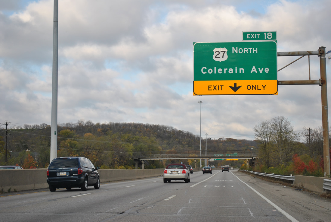
Exit 18 consists of two wye interchange with Beekman Street to the south and U.S. 27 (Colerain Avenue) to the north. Since removed, provisions were added to the exchange for the unconstructed Colerain Expressway, a cancelled freeway between I-74 and I-275 by Northgate.
11/04/11
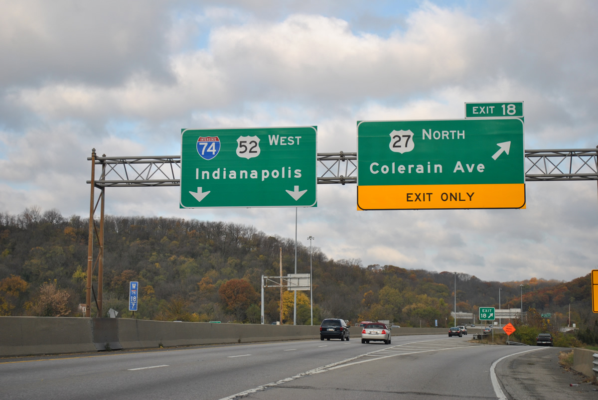
U.S. 27 follows Colerain Avenue north from Exit 18 and Mt. Airy in Cincinnati to White Oak, Grosbeck, and Northgate.
11/04/11
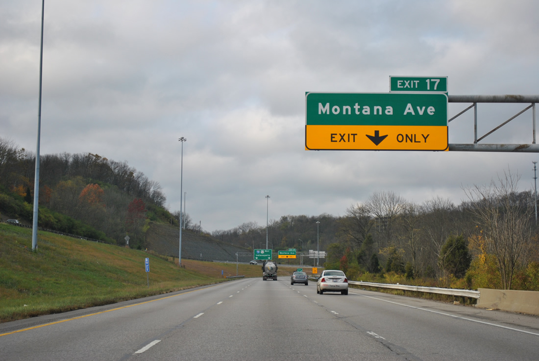
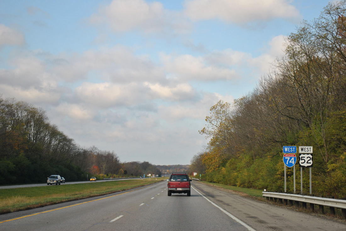
An auxiliary lane opens along I-74/U.S. 52 west from the Beekman Street entrance ramp to the half diamond interchange (Exit 17) with Montana Avenue.
11/04/11
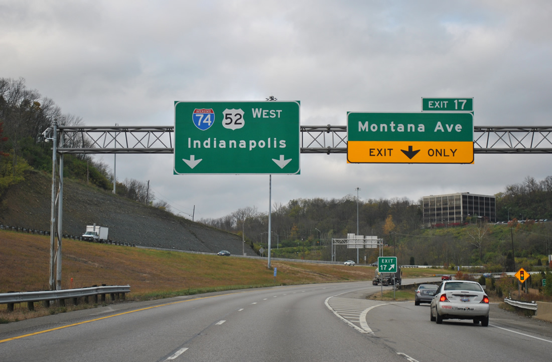
Montana Avenue branches south from parallel Fork Road to Exit 17 and the Westwood neighborhood in west Cincinnati.
11/04/11
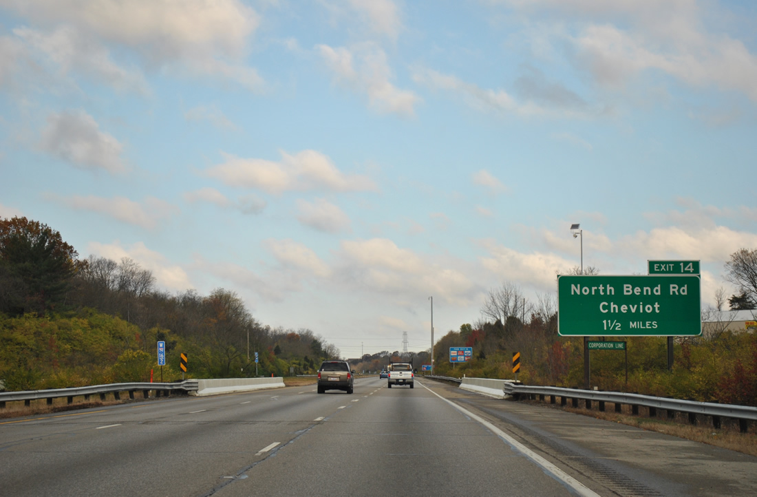
I-74/U.S. 52 wind through Mount Airy Forest, a 1,459 acre preserve, ahead of the Cincinnati city line and Exit 14.
11/04/11
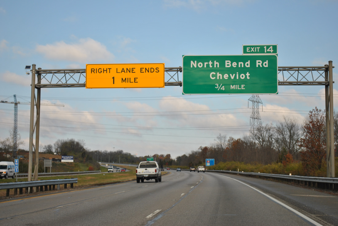
A lane drop occurs along I-74 westbound at the six-ramp parclo interchange (Exit 14) with North Bend Road. North Bend Road leads south from the freeway to the city of Cheviot.
11/04/11
North Bend Road turns east at Cheviot Road nearby to Mt. Airy and College Hill in Cincinnati.
11/04/11
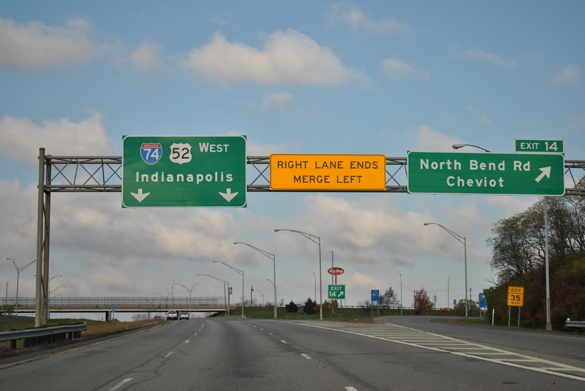
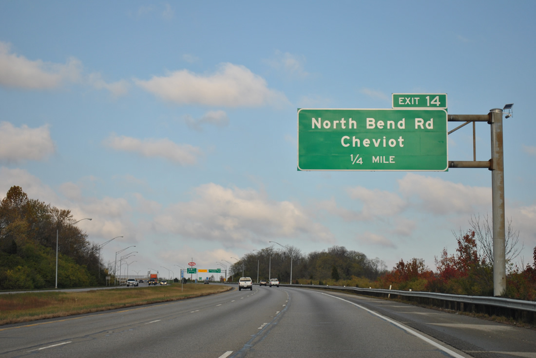
Exit 14 departs I-74/U.S. 52 west for North Bend Road at Monfort Heights. Retail development lines North Bend Road to Cheviot Road.
11/04/11
I-74/U.S. 52 confirming markers posted west of Exit 14 at Monfort Heights.
11/04/11
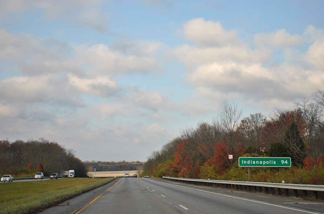
A distance sign follows listing Indianapolis as the lone destination for Interstate 74 west.
11/04/11
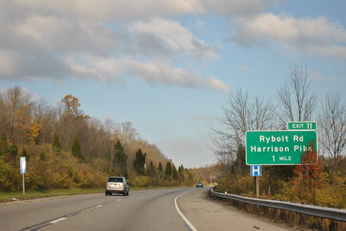
Curving northward, I-74/U.S. 52 parallel Taylor Creek in a valley to Exit 11 with Harrison Avenue at Dent.
All guide signs for Exit 11 along I-74 reference Harrison Avenue as Harrison Pike.
11/04/11
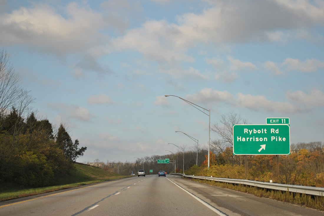
Harrison Avenue leads southwest from Exit 11 and Dent to Cheviot. Rybolt Road stems south from Harrison Avenue nearby to Taylor Road and the community of Mack North.
11/04/11
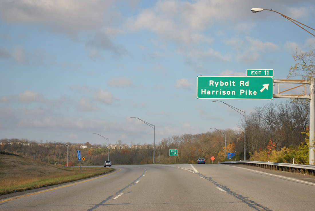
A parclo interchange (Exit 11) joins Interstate 74 with Harrison Avenue at Old Rybolt Road in Dent. Harrison Avenue continues northward alongside the freeway to Taylors Creek and Miami Station.
11/04/11
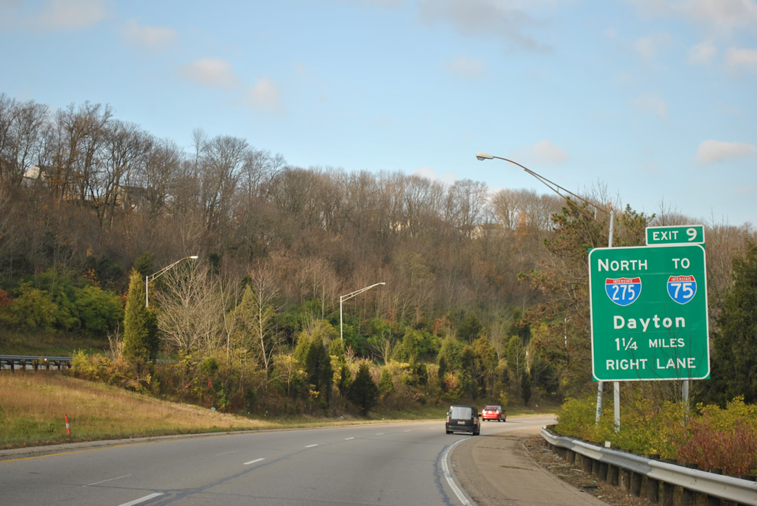
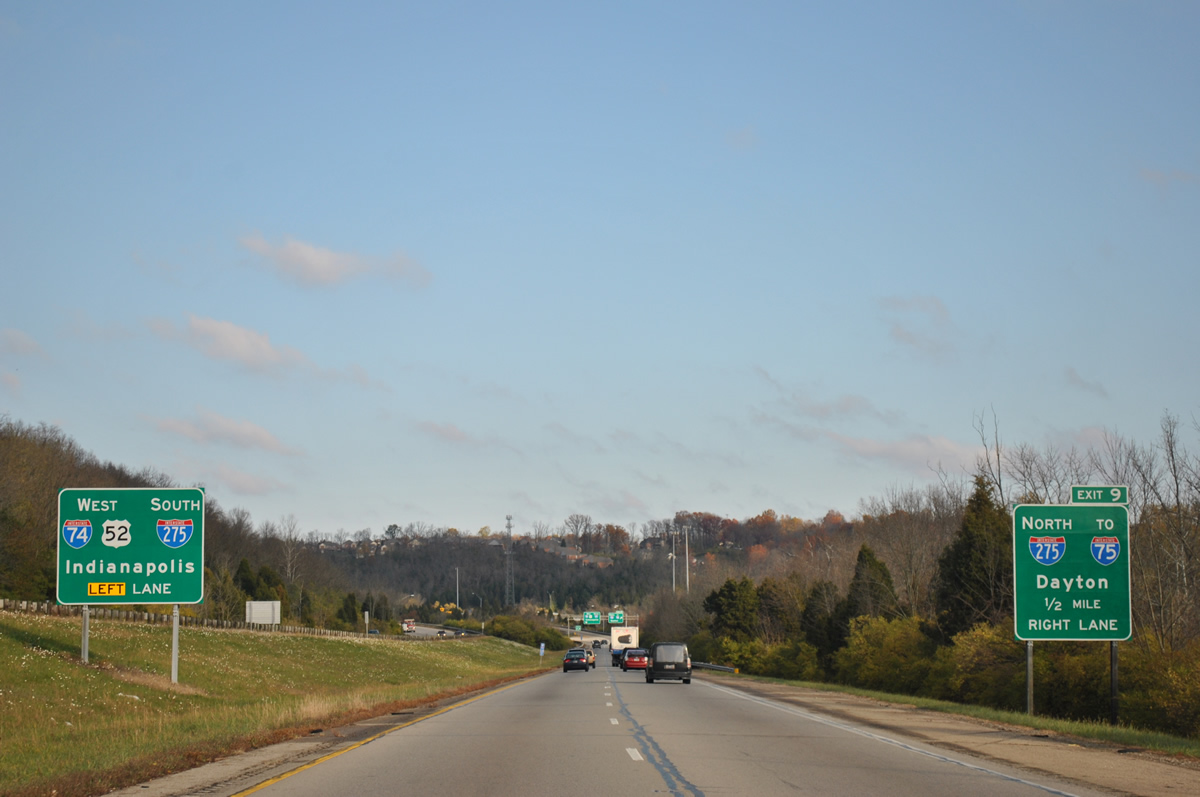
Turning northward and alongside Taylor Creek, I-74/U.S. 52 advance to Exit 9 with Interstate 275, the Cincinnati beltway.
11/04/11
Reassurance shield posted on the northern turn from Dent to Taylors Creek.
11/04/11

Indianapolis is 91 miles to the west via I-74 beyond I-275. U.S. 52 also travels to the capital city of Indiana but via a less direct route through Brookville and Rushville.
11/04/11
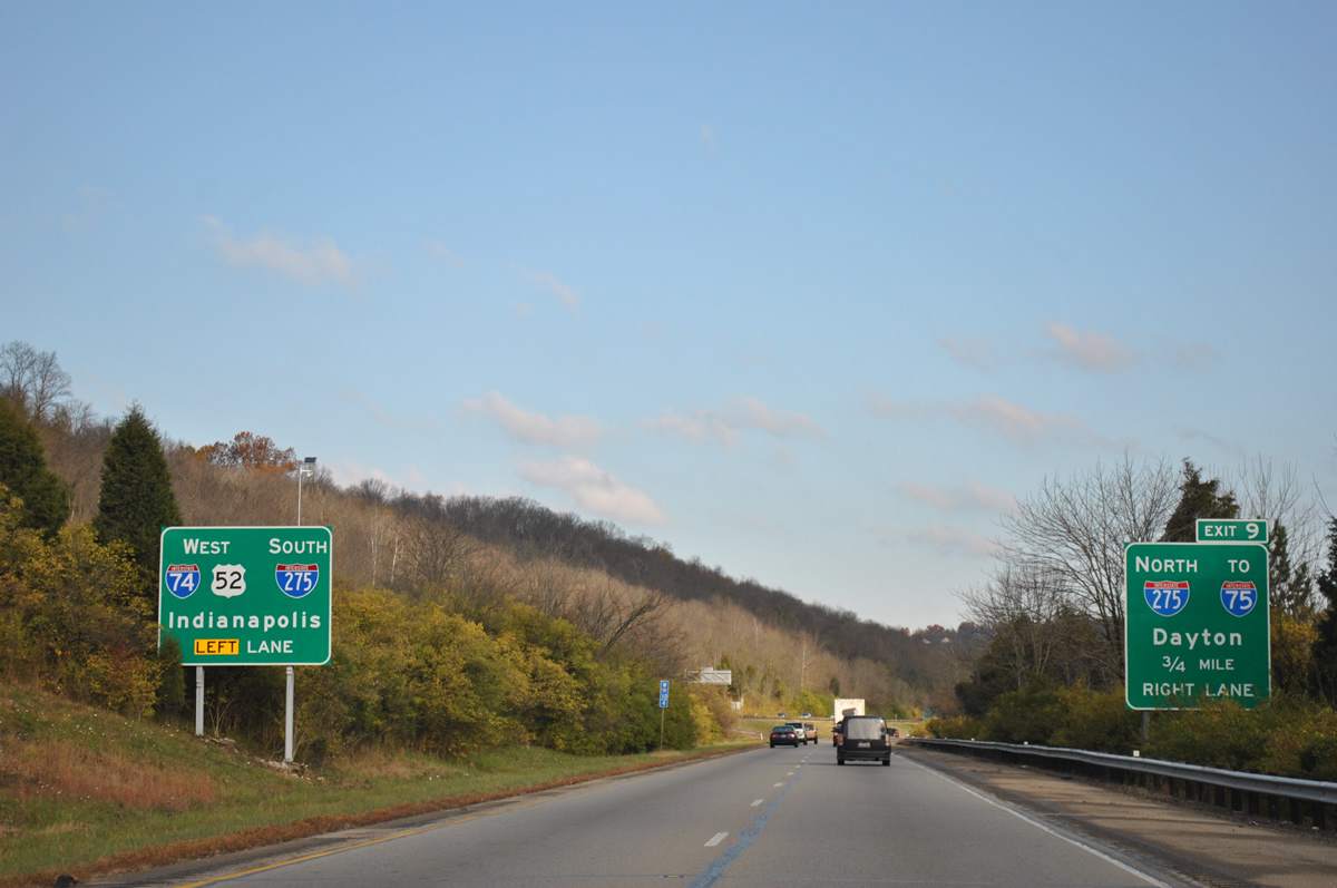
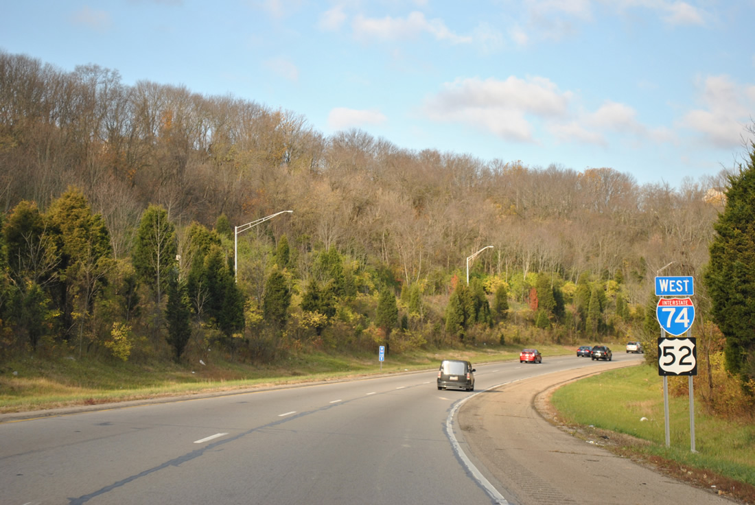
I-74/U.S. 52 west combine with I-275 south for 2.99 miles to Miamitown and Blue Jay. Interstate 275 north continues to Northgate, Forest Park and Springdale among other Cincinnati suburbs.
11/04/11
Interstate 275 travels 21 miles north and east to I-75, which connects Cincinnati with Dayton and Toledo.
11/04/11
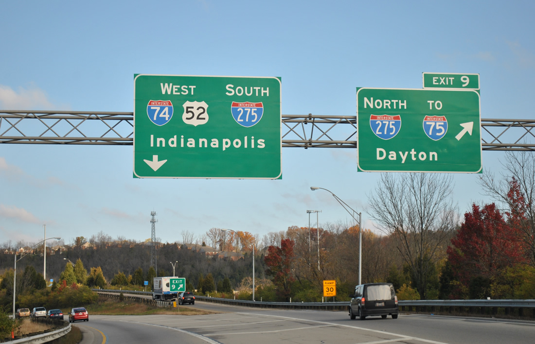
Single lane ramps split from I-74/U.S. 52 west at Exit 9. Interstate 275 encircles Cincinnati and the Covington, Kentucky area along an 84 mile long loop. The westernmost reaches are the lightest traveled and most rural.
11/04/11
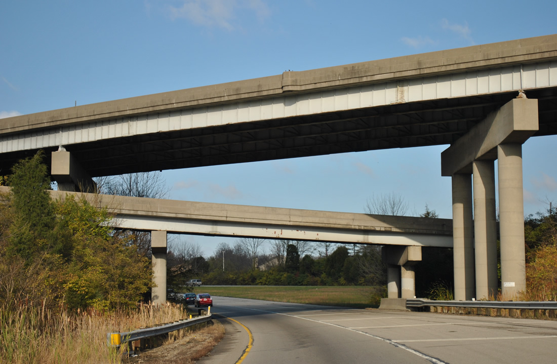
I-74/U.S. 52 west and I-275 south converge at a three-wye interchange.
11/04/11
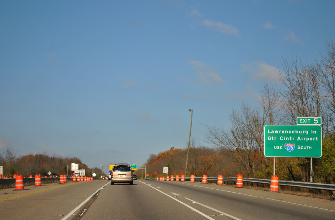
Providing access to U.S. 50 at Lawrenceburg, I-275 nips the southeastern corner of Dearborn County, Indiana. Cincinnati / Northern Kentucky International Airport (CVG) is 21 miles to the southeast at Hebron, Kentucky.
11/04/11
West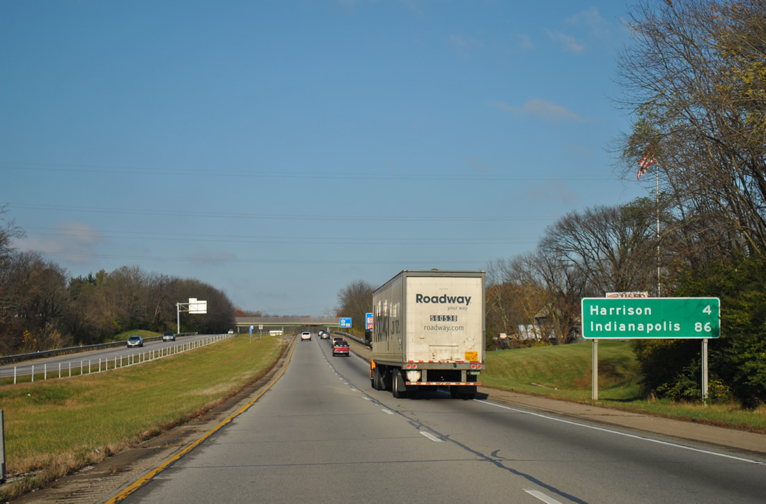
The last two exits along I-74/U.S. 52 west in Ohio are for the city of Harrison. Harrison Avenue, the former alignment of U.S. 52, parallels I-74 from Blue Jay west into the Harrison street grid.
11/04/11
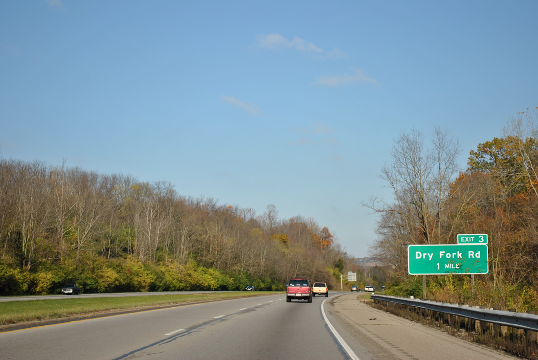
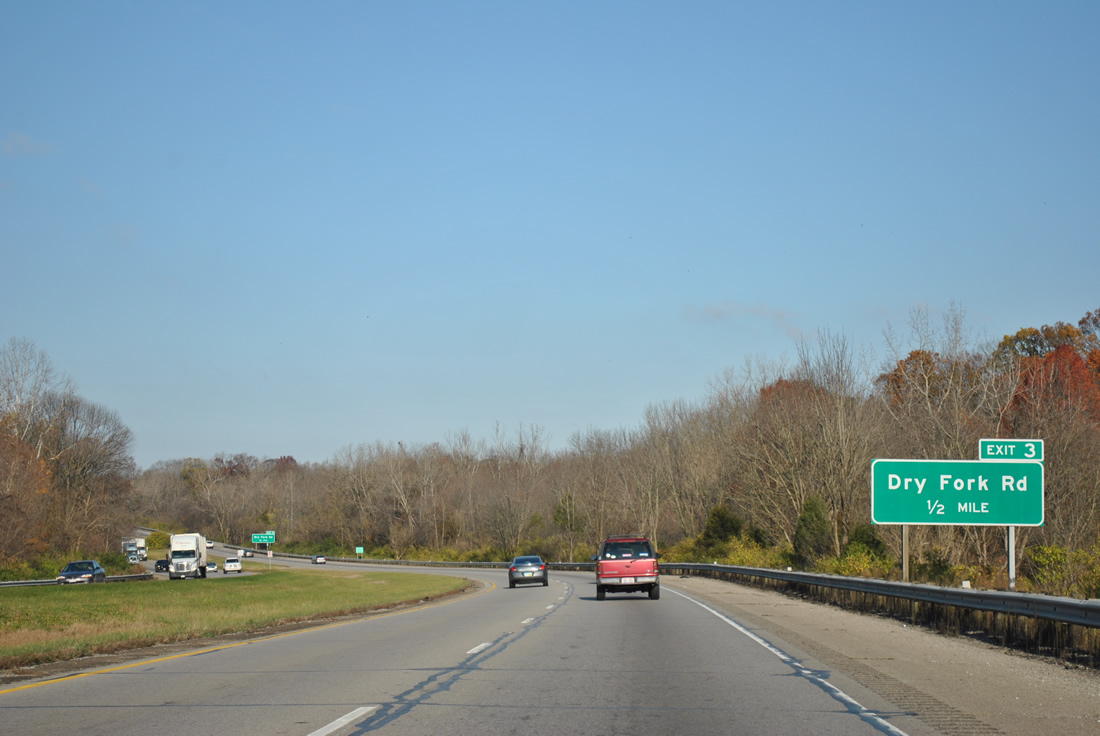
A diamond interchange joins I-74/U.S. 52 with Dry Fork Road at Exit 3.
11/04/11
Dry Fork Road mirrors the course of the Dry Fork of the Whitewater River north from Harrison Avenue and Exit 4 to New Haven.
11/04/11
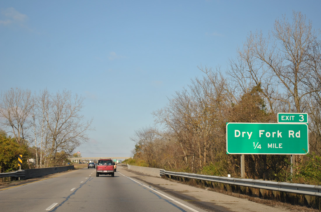
Passing through Miami Whitewater Forest, Interstate 74 spans the Dry Fork of the Whitewater River ahead of Exit 3 to Dry Fork Road eastern reaches of Harrison.
11/04/11
A weigh station operates along I-74/U.S. 52 eastbound just beyond this shield assembly and Exit 3 in Harrison.
11/04/11
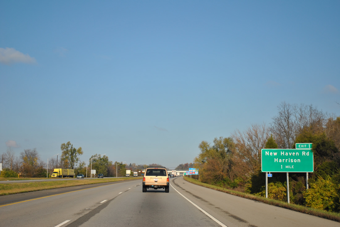
New Haven Road meanders west from New Haven and Dry Fork Road to meet I-74/U.S. 52 at a diamond interchange (Exit 1) in one mile.
11/04/11
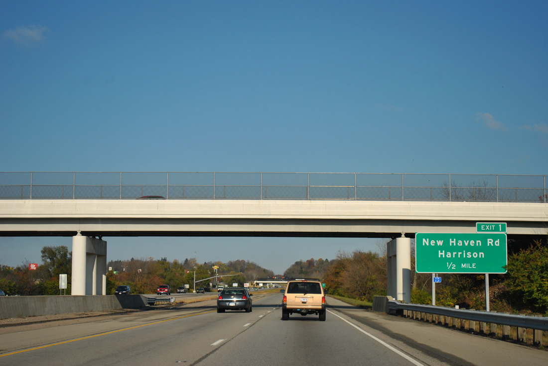
West Road passes over I-74/U.S. 52 one half mile from Exit 1. Commercial development lines both sides of the freeway ahead of New Haven Road.
11/04/11
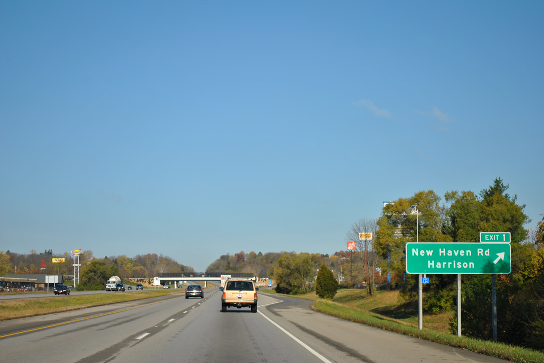
Exit 1 leaves I-74/U.S. 52 west for New Haven Road near Harrison Avenue (old U.S. 52). U.S. 52 previously followed State Street north along the Indiana state line from Harrison Avenue to Harrison Brookville Road west.
11/04/11
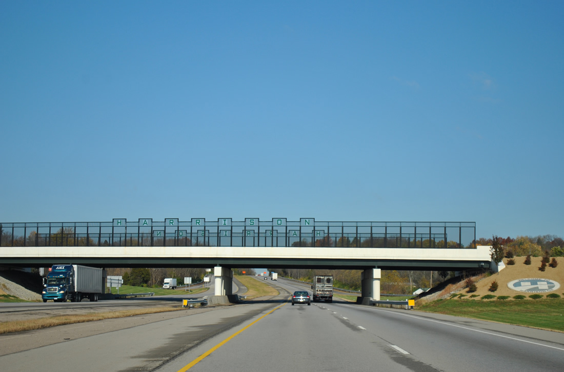
New Haven Road spans I-74/U.S. 52 across a decorative overpass. Named after President William Henry Harrison, Harrison was incorporated in 1850.1 The city was home to 9,897 per the 2010 census and over 12,000 by 2019.
11/04/11
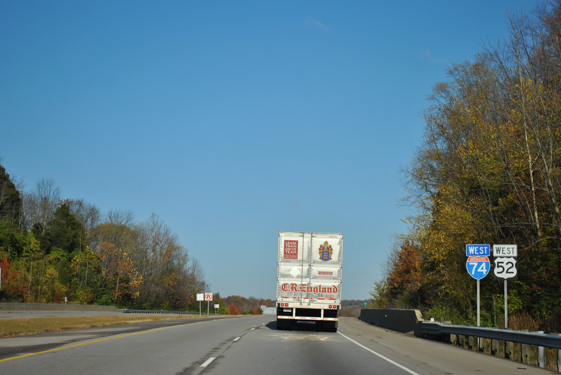
I-74/U.S. 52 curve northward across a hilly area past the Harrison city center and West Harrison, Indiana.
11/04/11
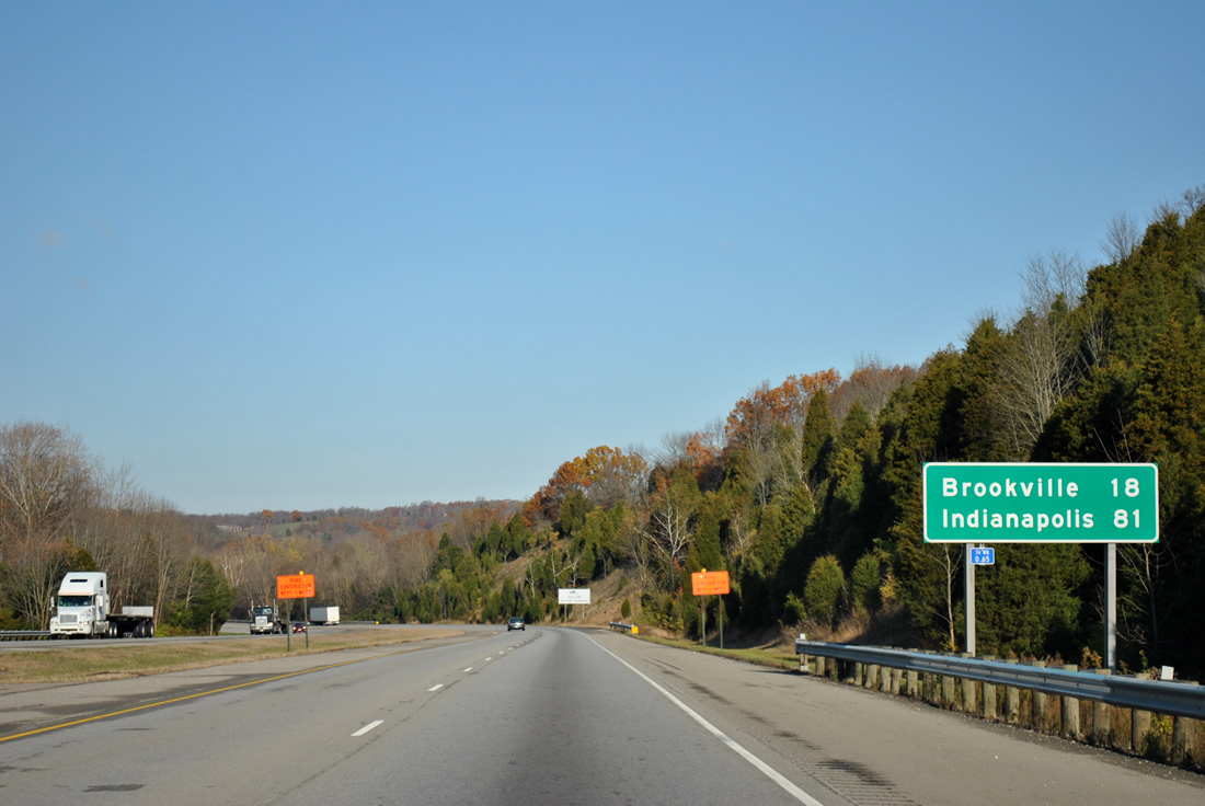
Brookville, Indiana lies 18 miles to the northwest along U.S. 52 from the succeeding exit. Indianapolis is 81 miles away.
11/04/11
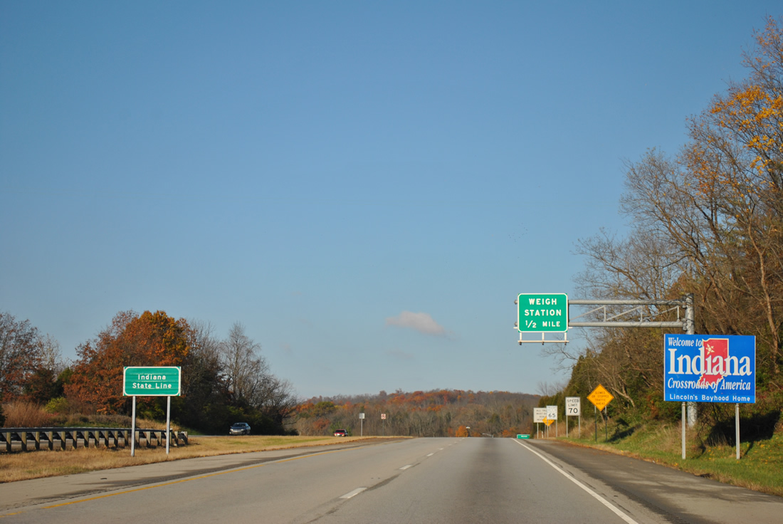
A welcome sign stands along I-74/U.S. 52 at the Hoosier State line.
11/04/11


References:
- Harrison, Ohio. Wikipedia.
Photo Credits:
- ABRoads: 11/08/09, 11/04/11
Connect with:
Page Updated Tuesday September 07, 2021.