
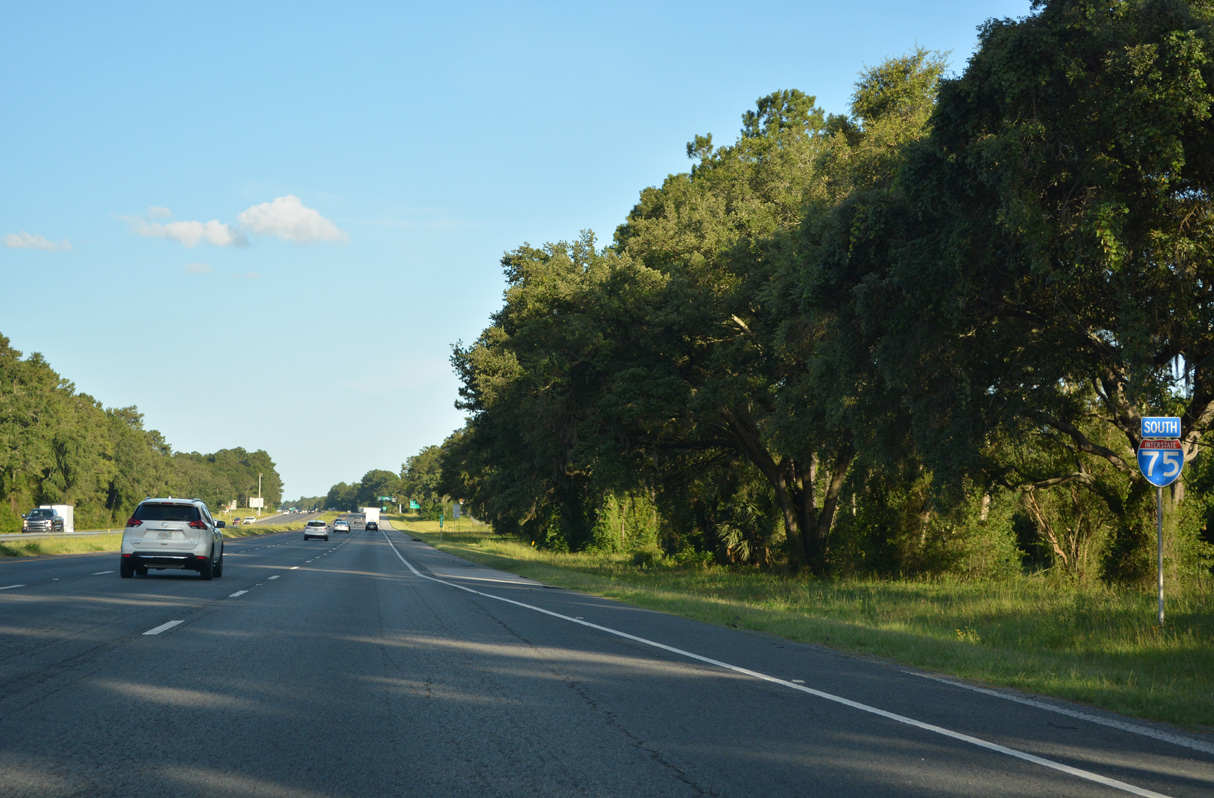
Interstate 75 South - Jennings to Lake City
 South
South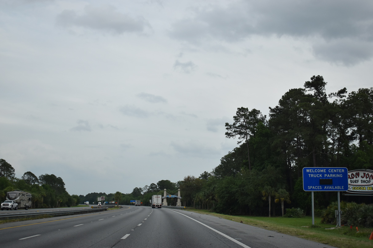
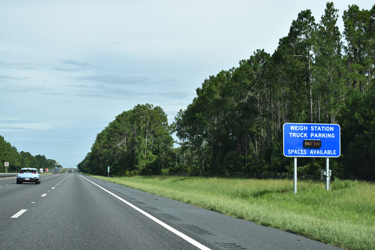
Dynamic messages signs are posted throughout the Florida Interstate system indicating the number of truck parking spaces available at rest areas and weigh stations.
04/18/20
Interstate 75 enters Florida and Hamilton County near mile marker 471. Construction projects through 2019 completed six lane expansion of the entire route between the Georgia line and Exit 101 in Collier County.
06/26/22

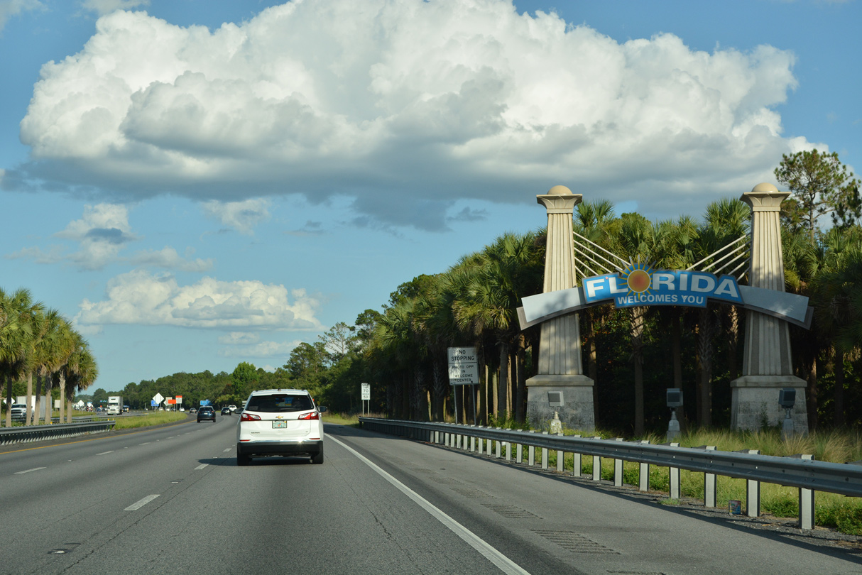
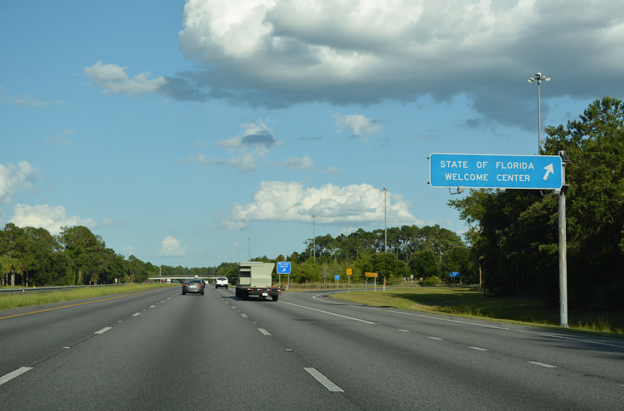
The Florida Welcome Center is located southbound near mile marker 469.
04/18/20
Florida Welcome Centers offer travelers complimentary Florida orange or grapefruit juice. Official state highway maps are also available at the tourist information center upon request.
06/26/22
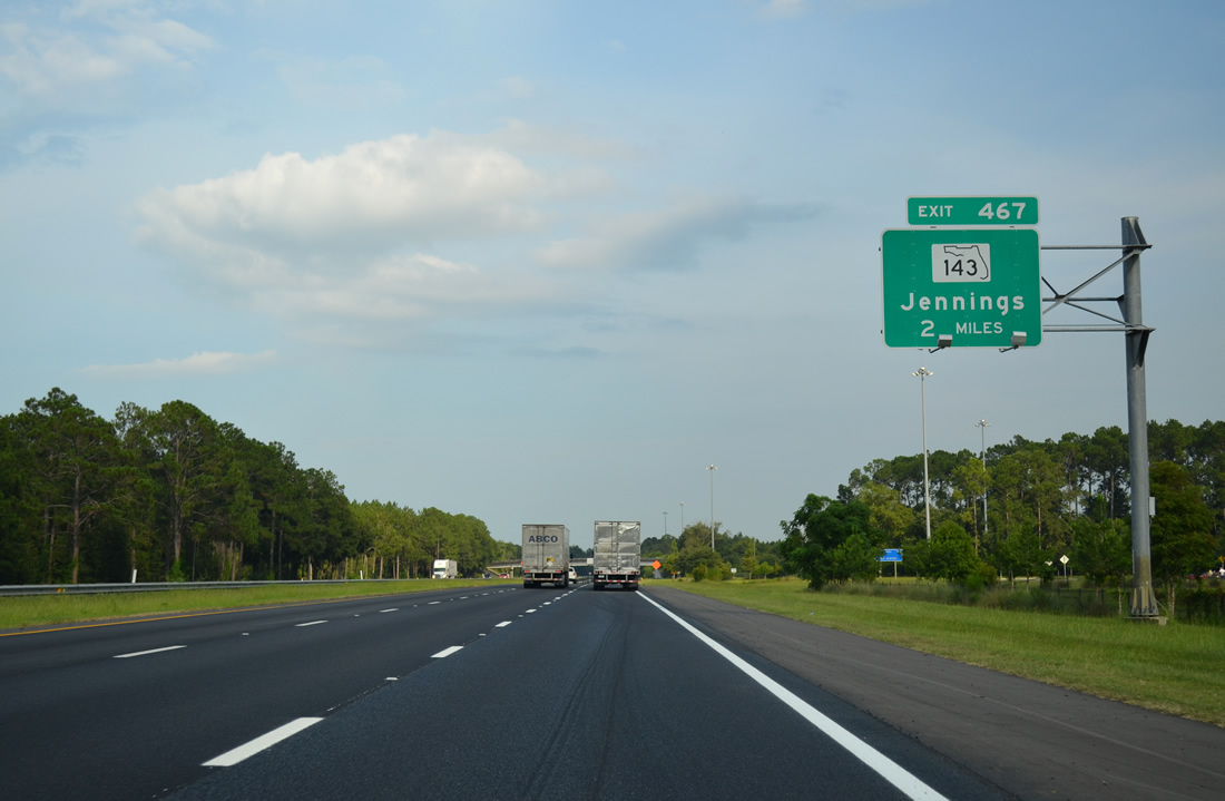
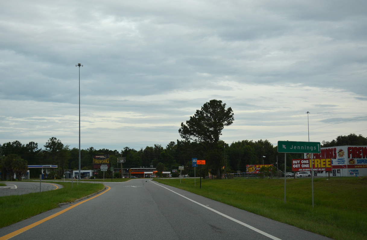
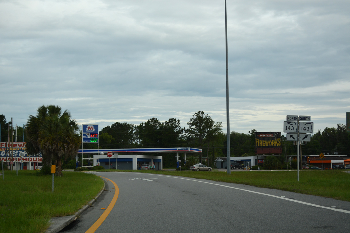
Exit 467 connects I-75 with SR 143 to the rural community of Jennings, located along U.S. 41. CR 143 continues southwest 10.10 miles to link with SR 6 in the western part of Hamilton County.
This overhead assembly was removed by 2015.
08/07/13
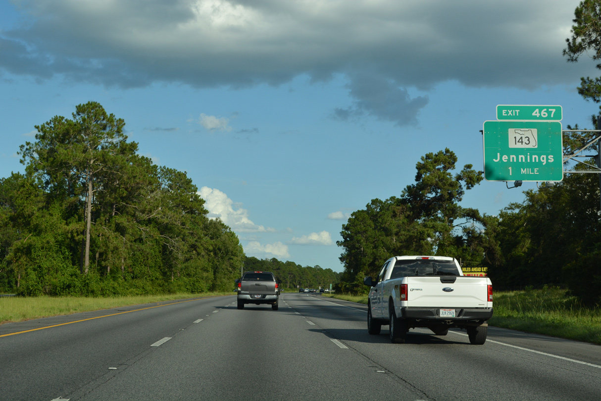
SR 143 leads 1.57 miles east from Exit 467 to Jennings, where the state road ends at U.S. 41 opposite CR 141 north. Parallel U.S. 41 stays east of I-75 from Valdosta, Georgia south to Lake City.
06/26/22
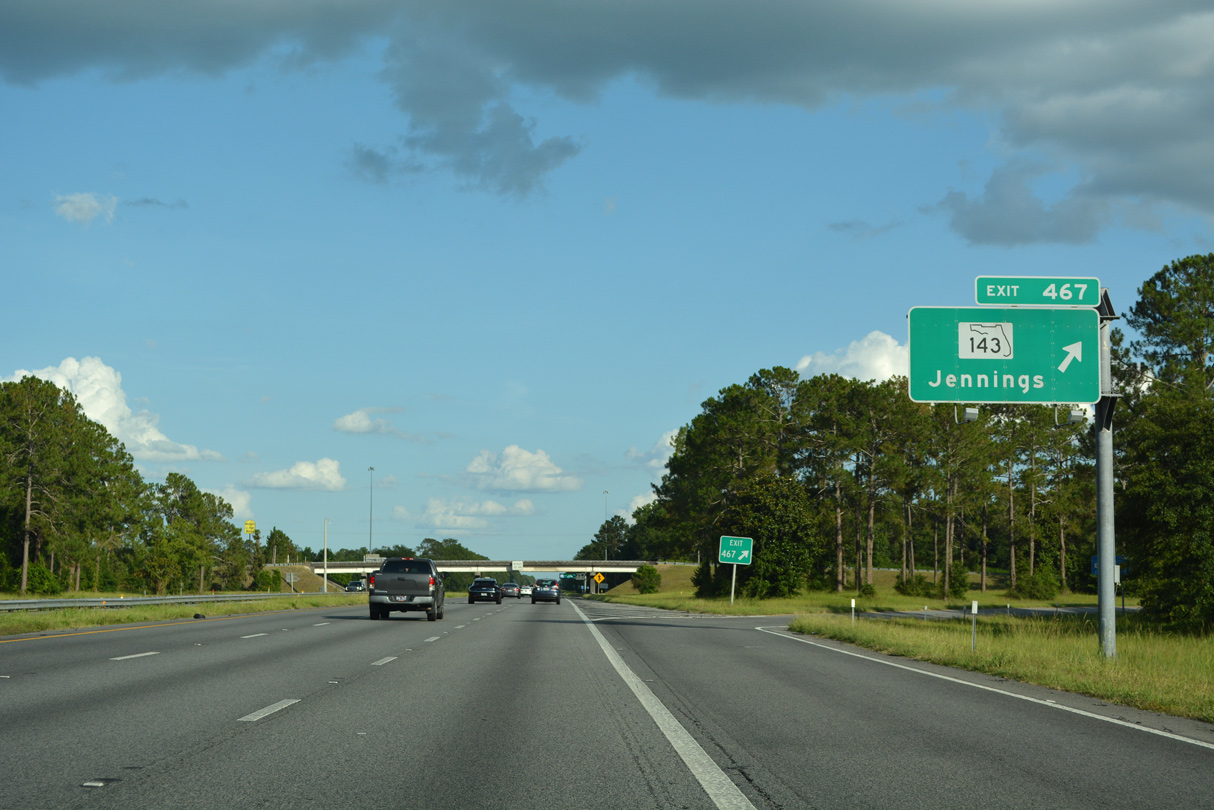
Entering the diamond interchange (Exit 467) with SR 143 along Interstate 75 south. The town of Jennings lies 1.5 miles to the east.
06/26/22
06/12/17
The first reassurance marker for Interstate 75 south in Florida stands along an area of wetlands beyond Jennings.
04/18/20
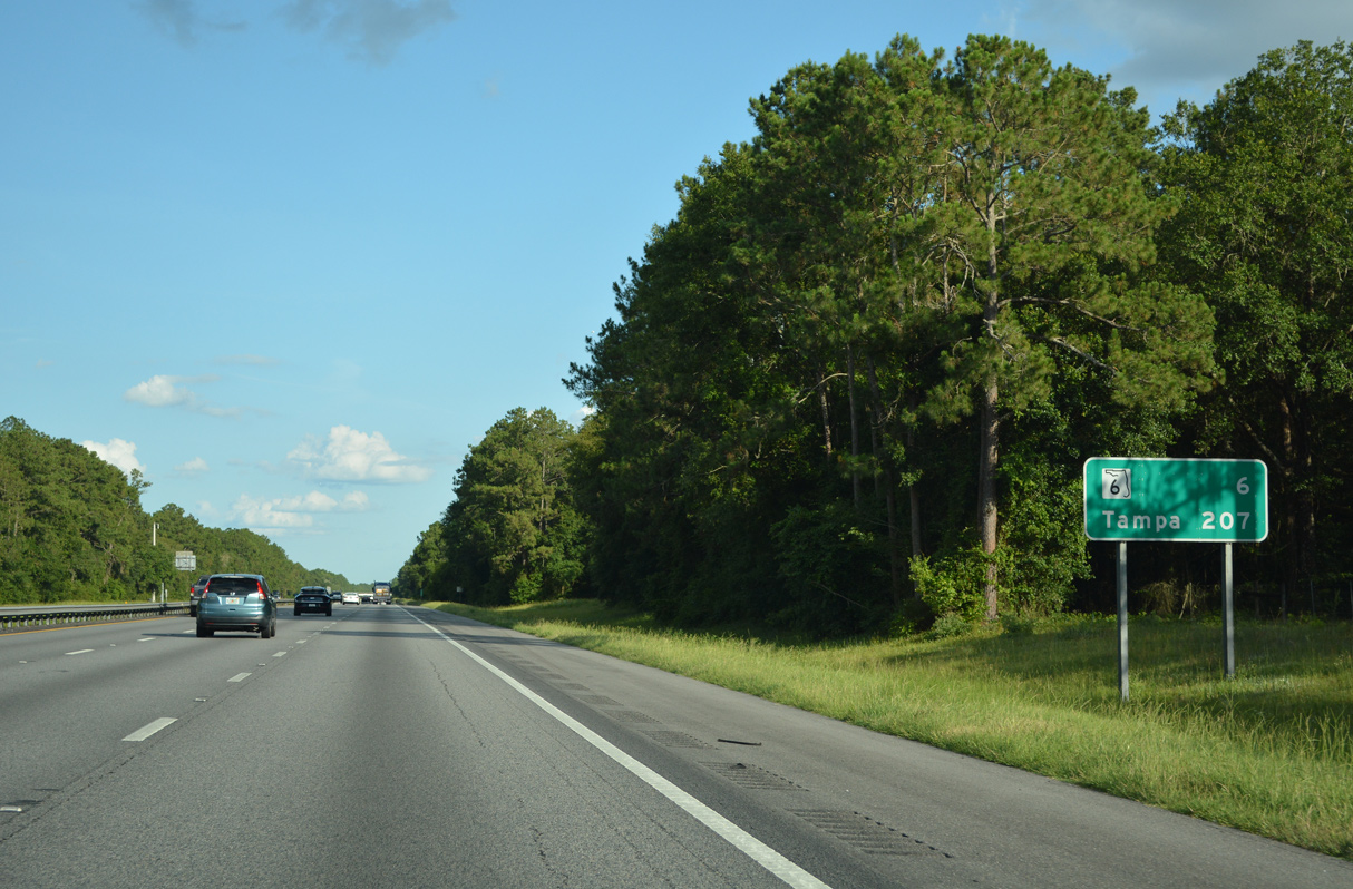
Interstate 75 advances southeast six miles to meet State Road 6 for the town of Jasper. Tampa lies 201 miles further south.
06/26/22
SR 6 measures 21.46 miles between U.S. 90 near the city of Madison and U.S. 41 west of the city of Jasper.
06/26/22
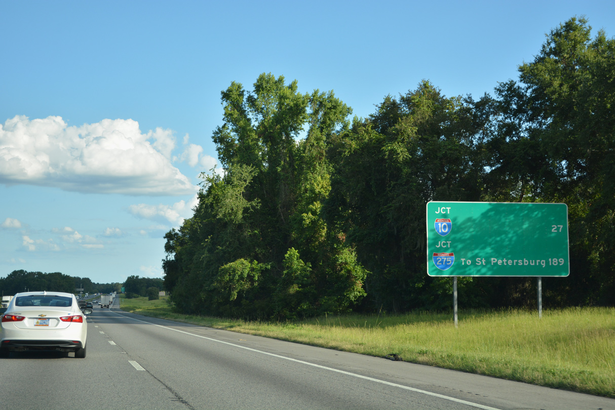
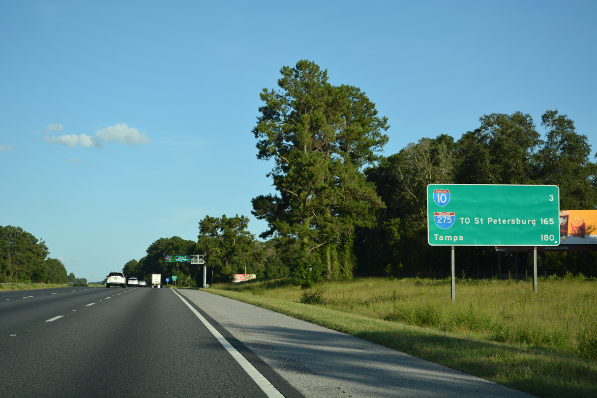
Distance signs outlining the mileage to other Interstate highways and Florida's Turnpike were added throughout Florida by the mid 2000s. Interstate 275 branches southwest from I-75 to Tampa Bay in 189 miles.
06/26/22
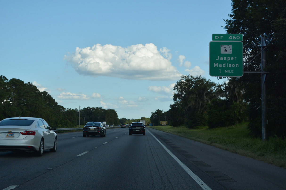
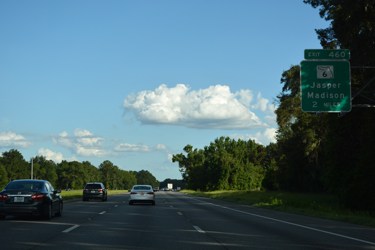
One mile out from the diamond interchange (Exit 460) with SR 6 on I-75 south.
06/26/22
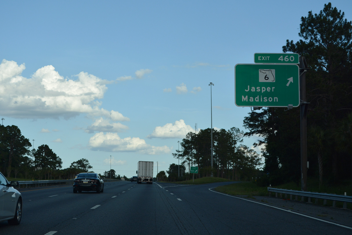
Home to over 4,000, Jasper, seat of Hamilton County, lies six miles to the east. Suwannee River State Park can be reached using SR 6 west.
06/26/22

Continuing southeast from SR 6, I-75 converges with U.S. 129 in eight miles.
07/22/20
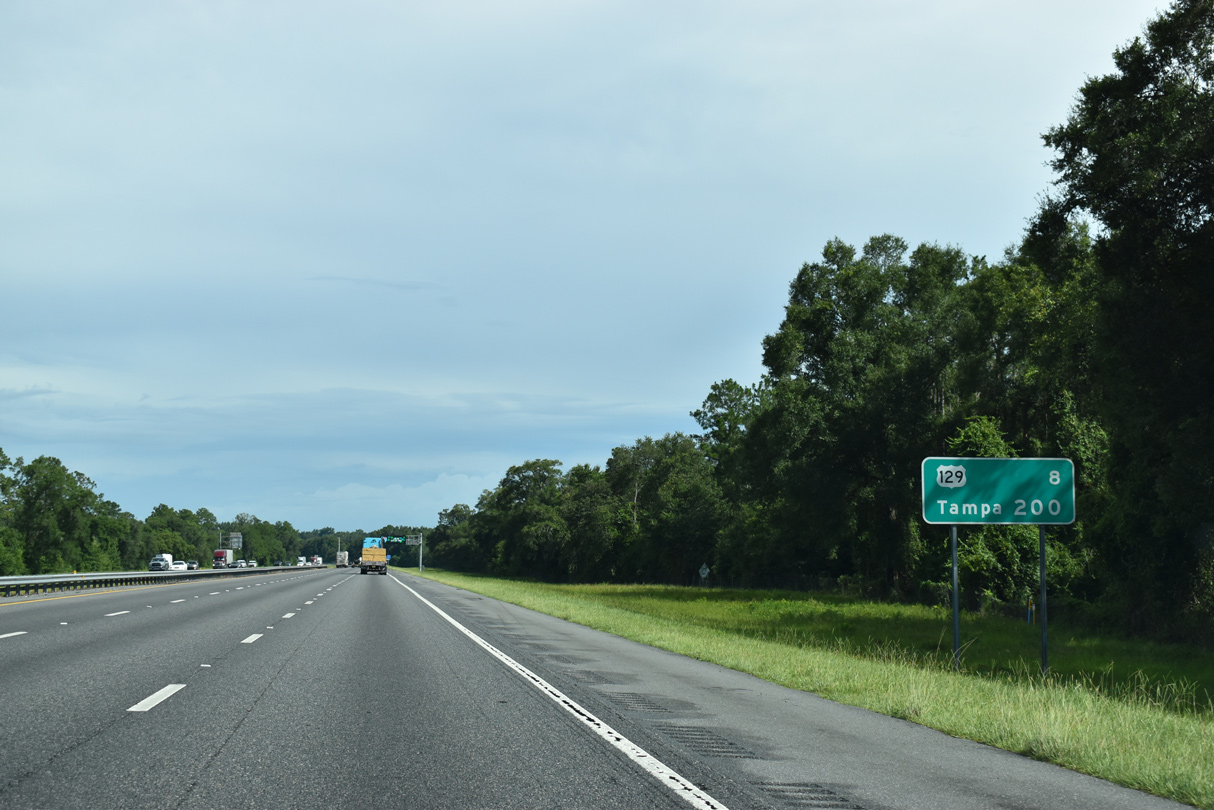
Traversing three states, U.S. 129 is a 582 mile long highway traveling south to U.S. 19/98 in Chiefland and northward to Interstate 40 in Knoxville, Tennessee.
07/22/20
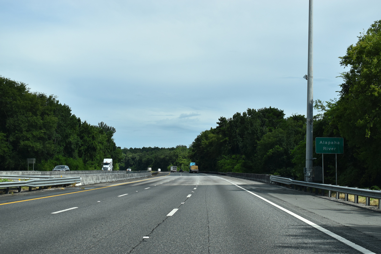
A tributary of the Suwannee River, the 190 mile long Alapaha River originates in Dooly County, Georgia.
07/22/20
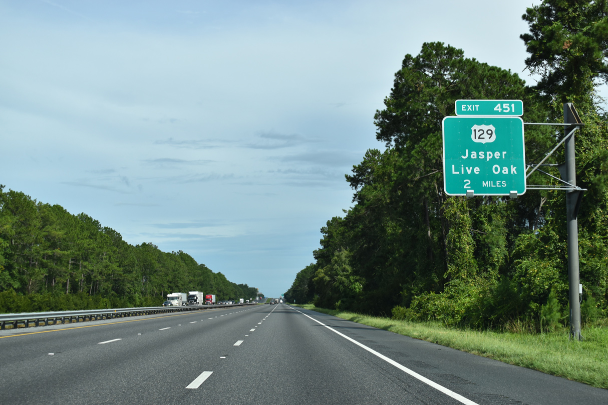
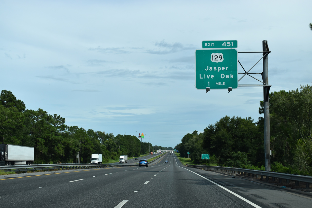
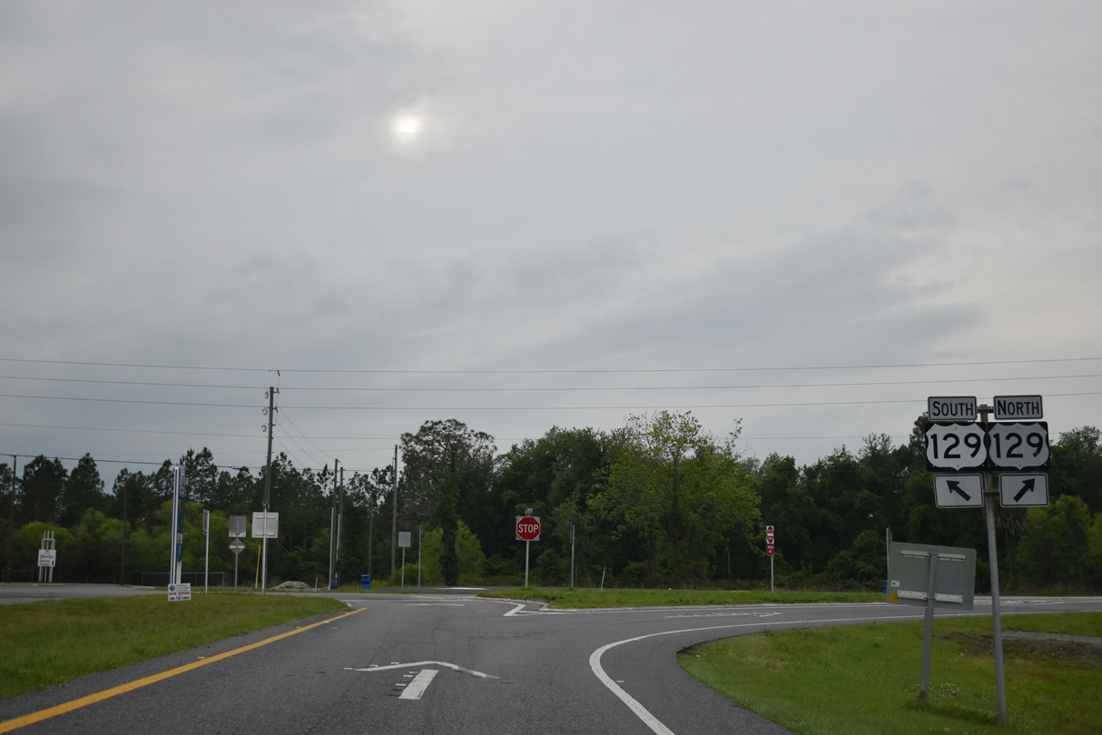
A parclo interchange (Exit 451) connects Interstate 75 with U.S. 129 south to Live Oak and north back to Jasper in two miles.
07/22/20
The first of three weigh stations along Interstate 75 in Florida follows the exchange with U.S. 129.
07/22/20
U.S. 129 extends 74 miles southward to U.S. 19 and U.S. 98 in Chiefland. Traveling northward through four counties before crossing into south Georgia, U.S. 129 briefly overlaps with U.S. 27 near Branford and U.S. 41 near Jasper.
07/22/20
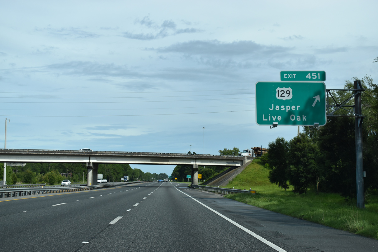
Exit 451 leaves Interstate 75 south for U.S. 129.
07/22/20
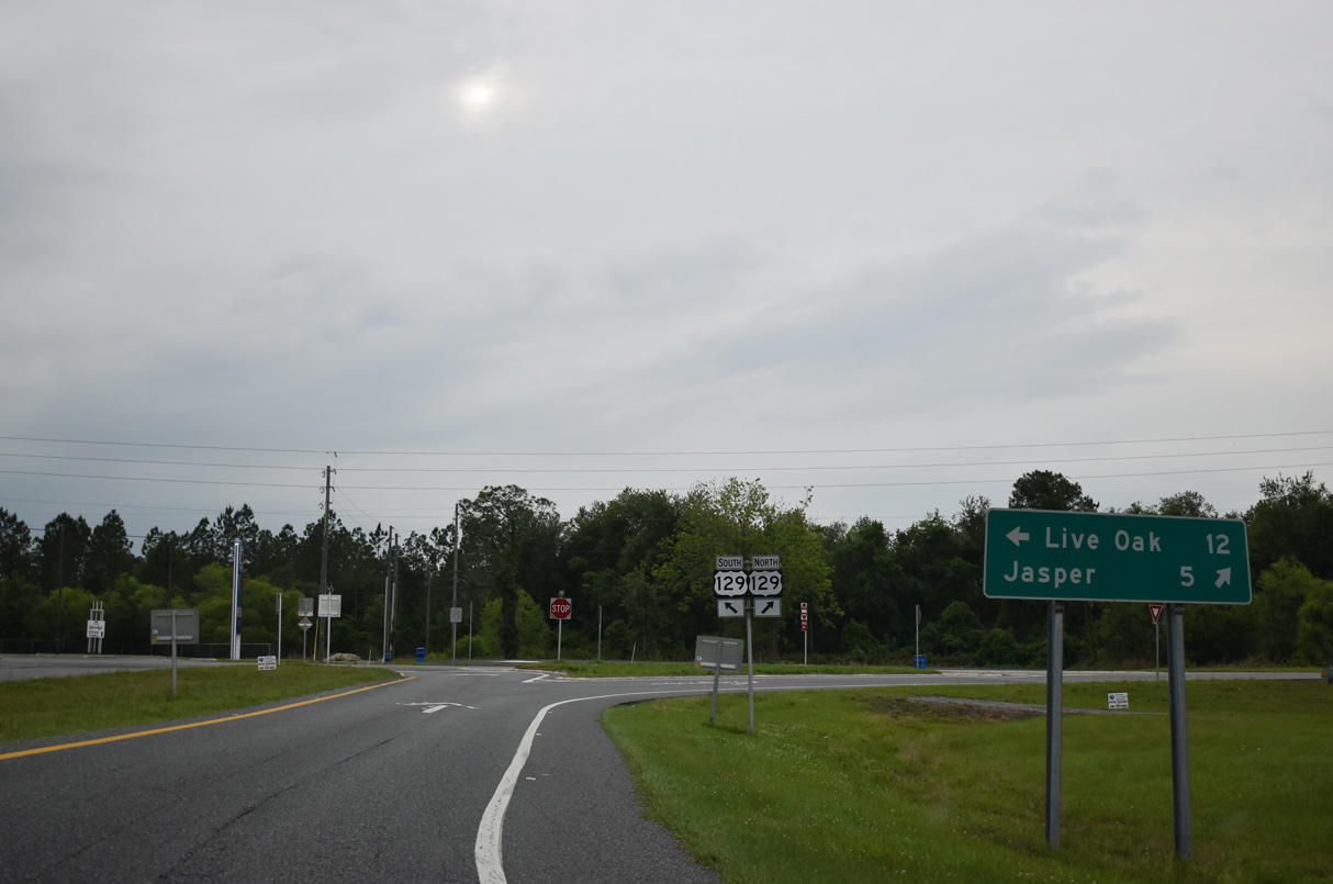
U.S. 129 ventures 8.4 miles south to Interstate 10 on the northern outskirts of Live Oak. There the route expands into a commercial arterial to Downtown.
04/18/20
Interstate 75 traverses wetlands at an elevation of around 150 feet above sea level south of Jasper. The area to the east is home to a number of phosphate mines.
07/22/20
An 11 mile exit less stretch precedes Lake City and the cross roads with Interstate 10 on I-75 southbound.
07/22/20
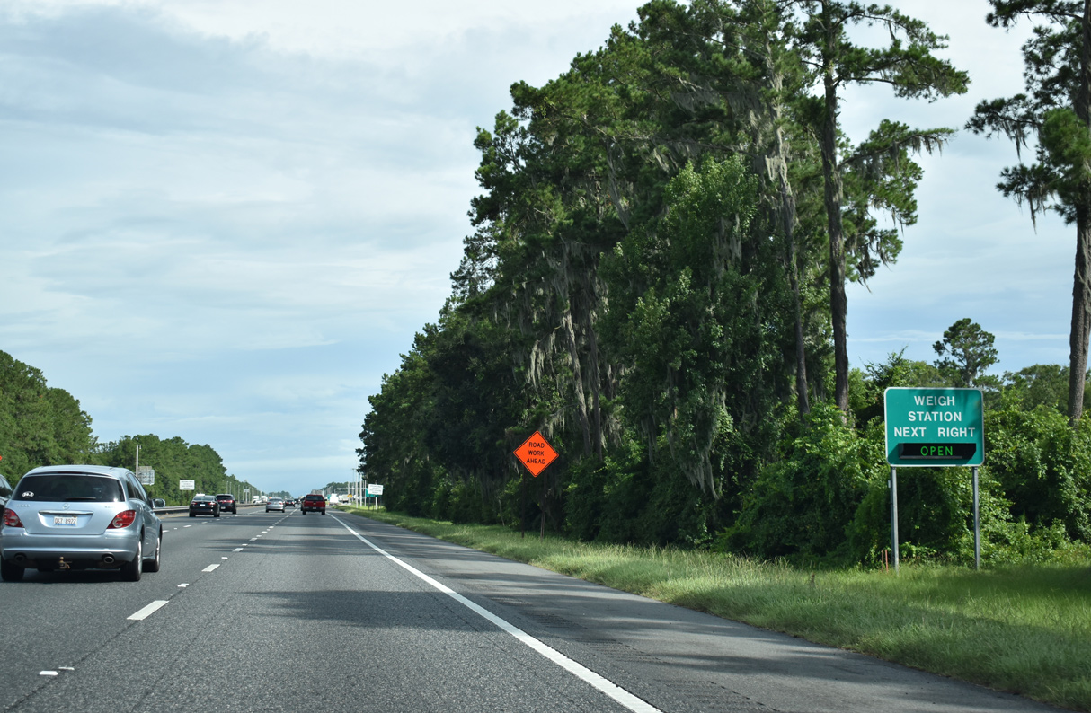
A weigh station for commercial truckers lies 2.8 miles south of Exit 451.
07/22/20
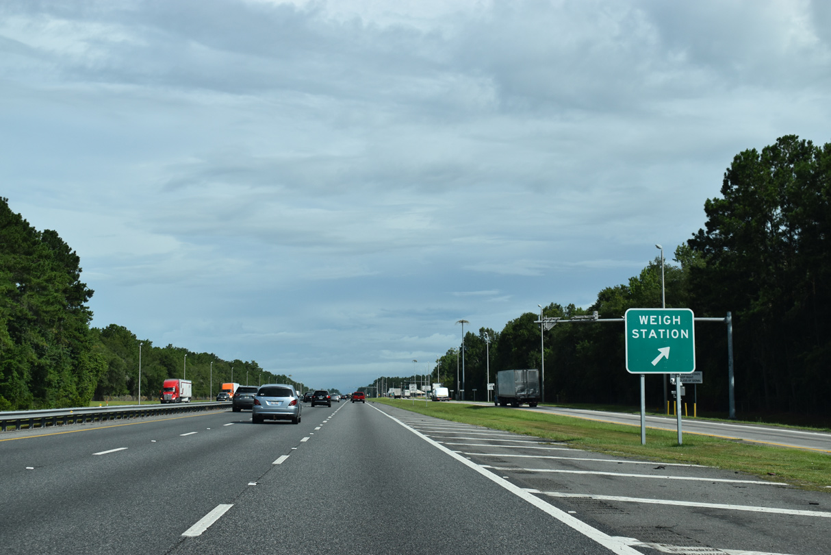
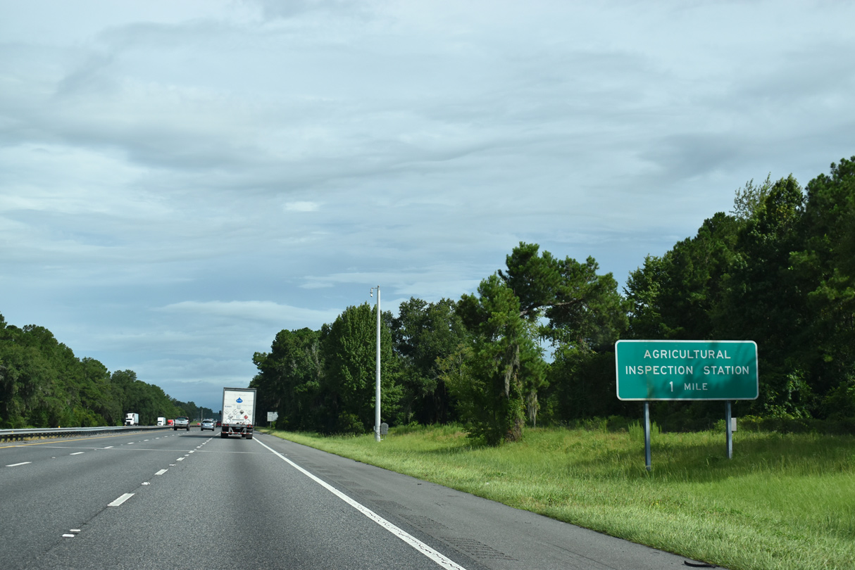
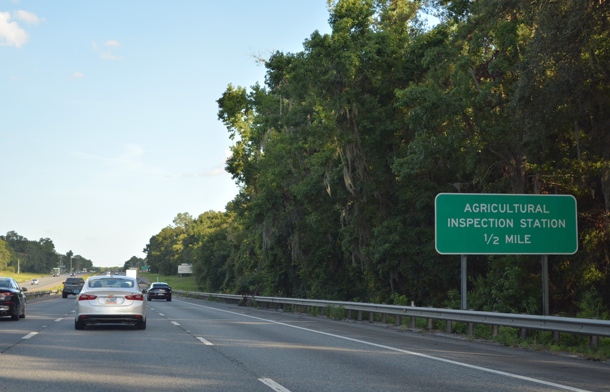
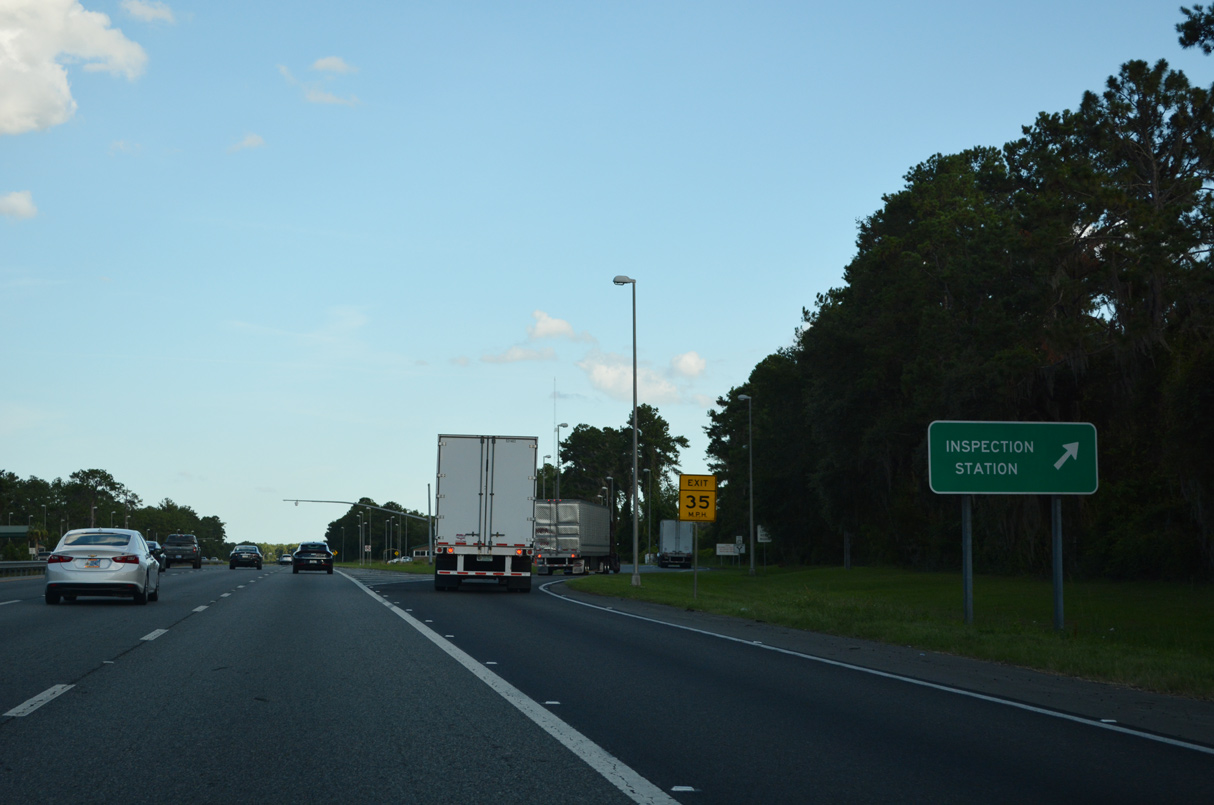
The weigh station is the first of two stops for most truckers in Hamilton County, as a subsequent agricultural inspection station lies two miles further south.
07/22/20
All commercial trucks, vehicles towing commercial trailers, and rented trucks including moving trucks and cargo vans must enter the agricultural inspection station.
07/22/20
06/26/22
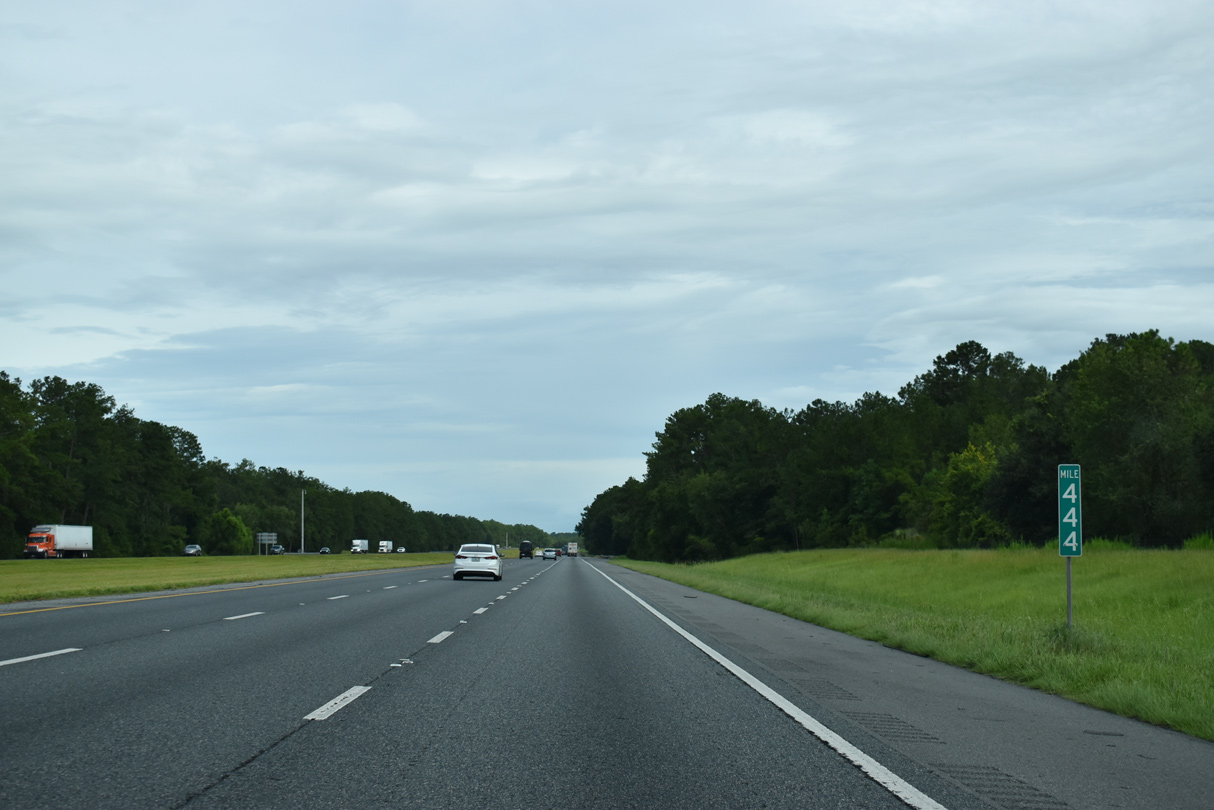
An abandoned rest area lines Interstate 75 southbound at mile marker 444.
07/22/20
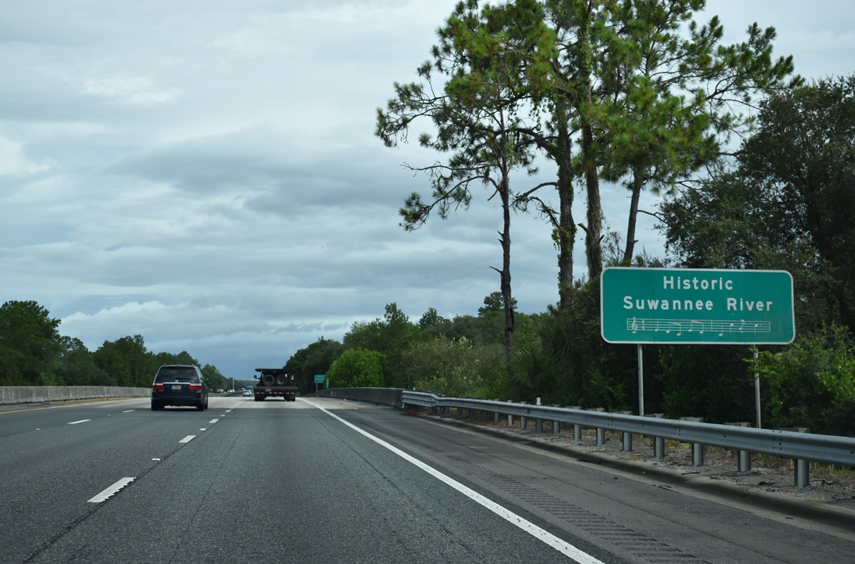
Originating within Okefenokee swamp in south Georgia, the 266 mile long Suwannee River weaves southwestward to the Gulf of Mexico. The river was made famous for being in Stephen Foster's "Old Folks at Home" song.
07/22/20
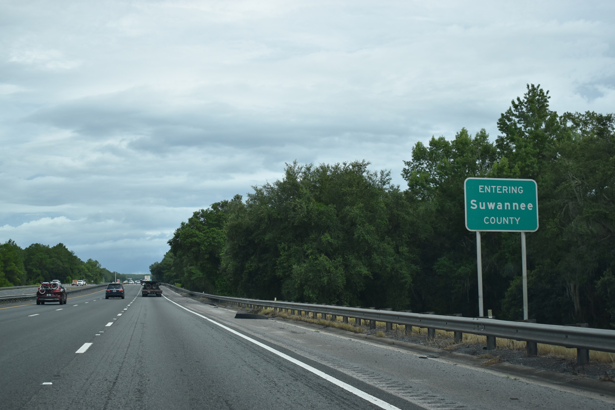
Spanning the Suwannee River, Interstate 75 crosses into northeastern Suwannee County.
07/22/20
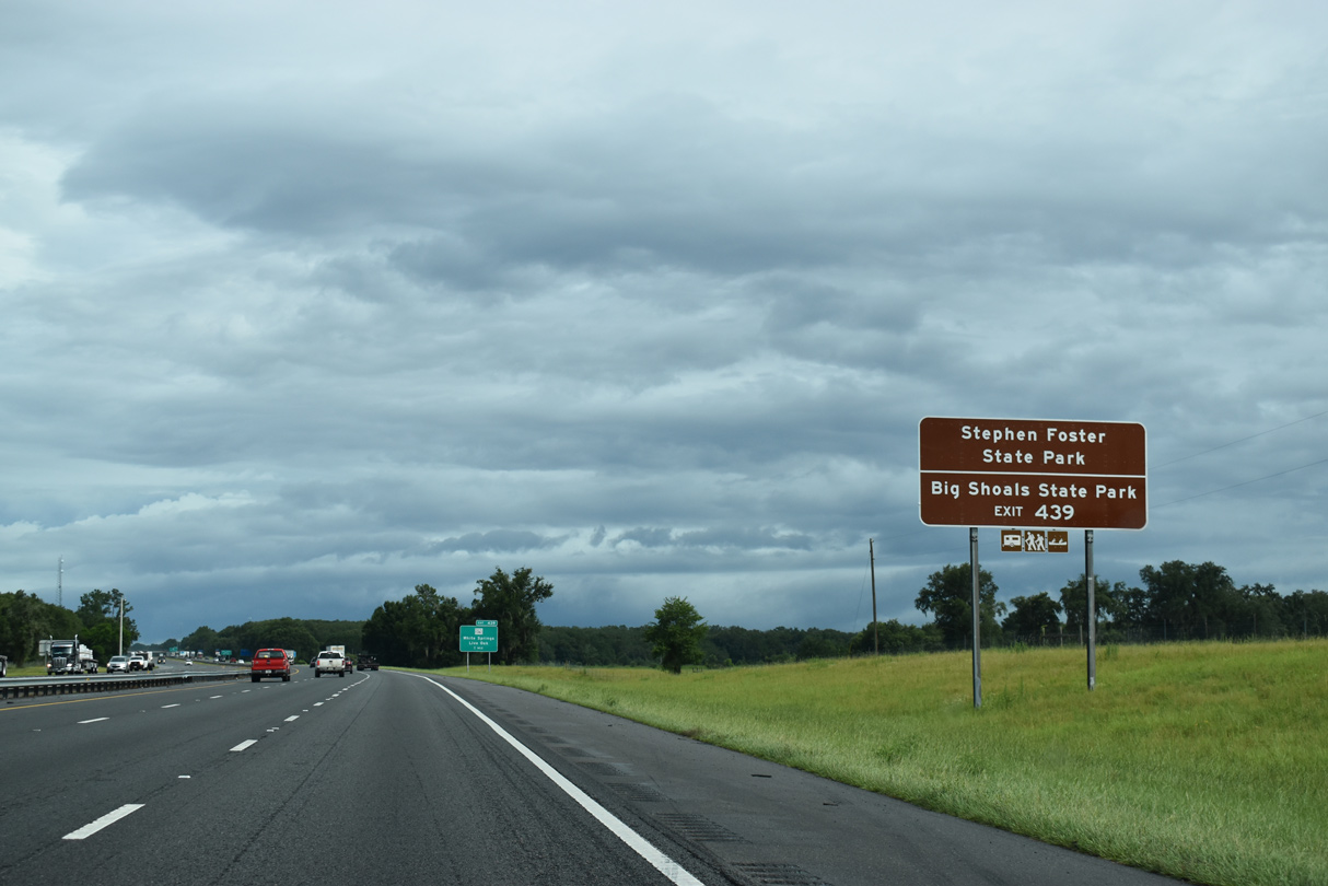
Stephen Foster State Park and Big Shoals State Parks lie along the Suwannee River east of Exit 439 by White Springs.
07/22/20
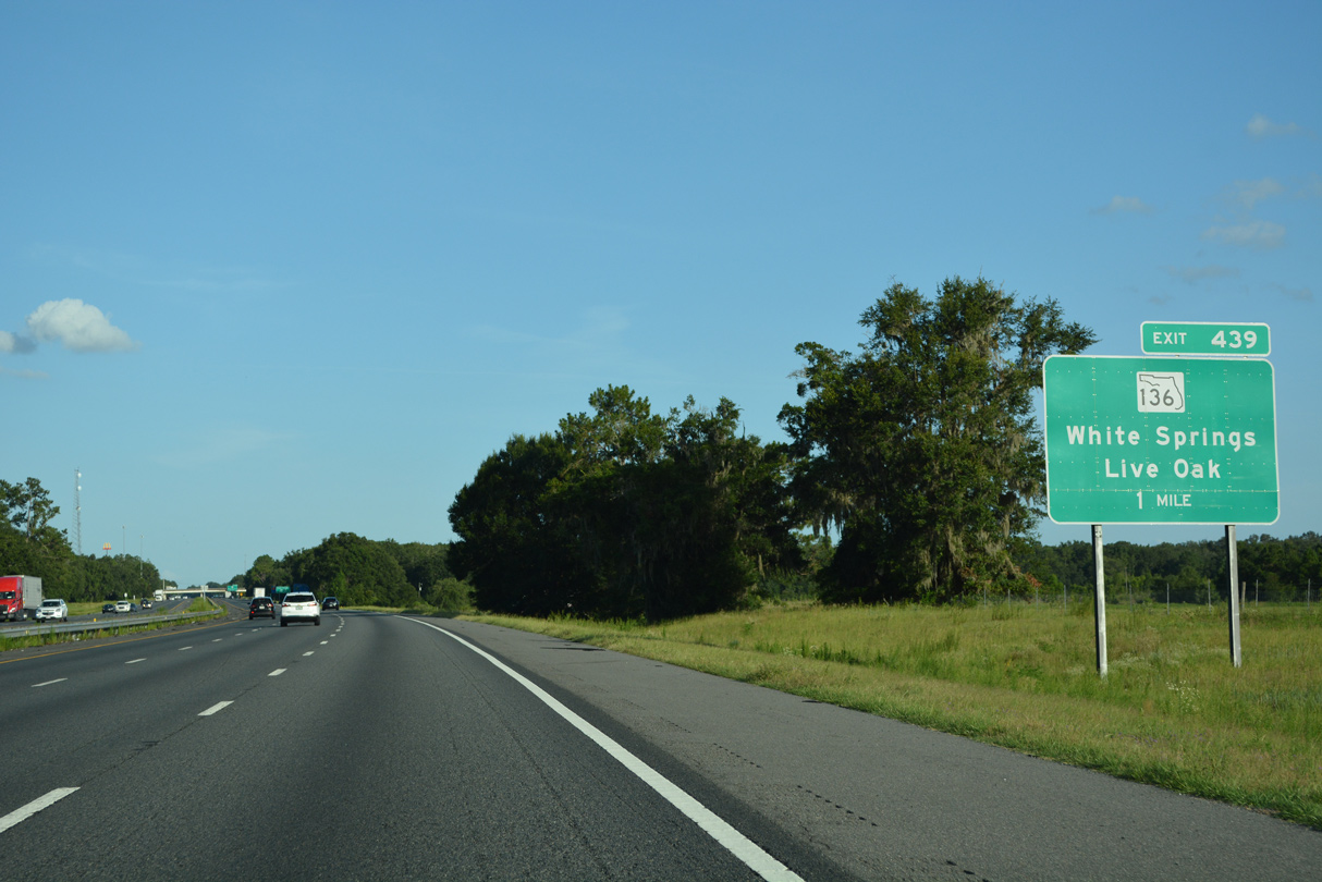
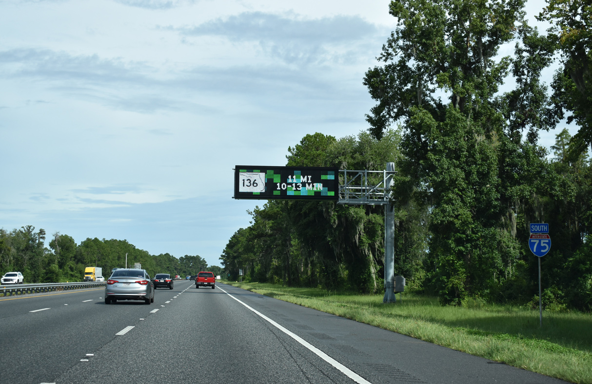
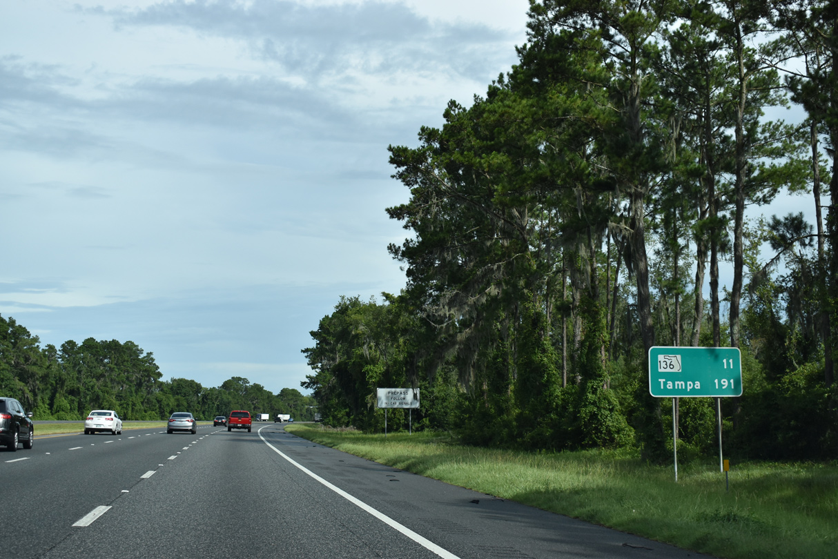
SR 136 and CR 136 meet at Exit 439 in one mile. SR 136 comprises a 3.40 mile long route east to White Springs. CR 136 extends the route 11.03 miles west to Live Oak.
06/26/22
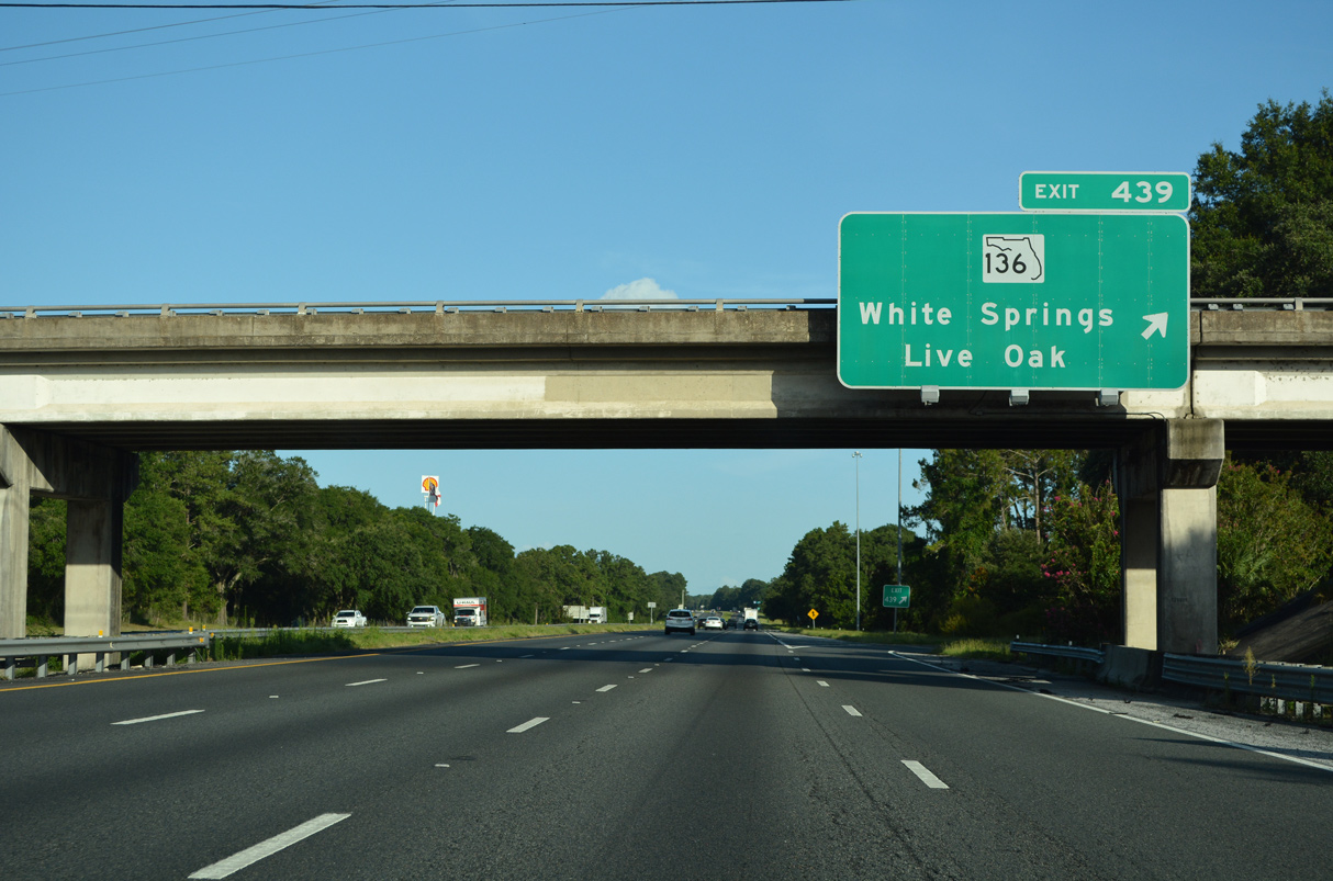
SR 136 ties into U.S. 41 just across the Suwannee River in White Springs. Live Oak, seat of Suwannee County, is located 11 miles west of Exit 439 at the crossroads of U.S. 90 and U.S. 129.
06/26/22
Leaving the parclo B2 interchange with SR 136, Interstate 75 angles southeast through a wooded area preceding Tiger Branch.
06/26/22
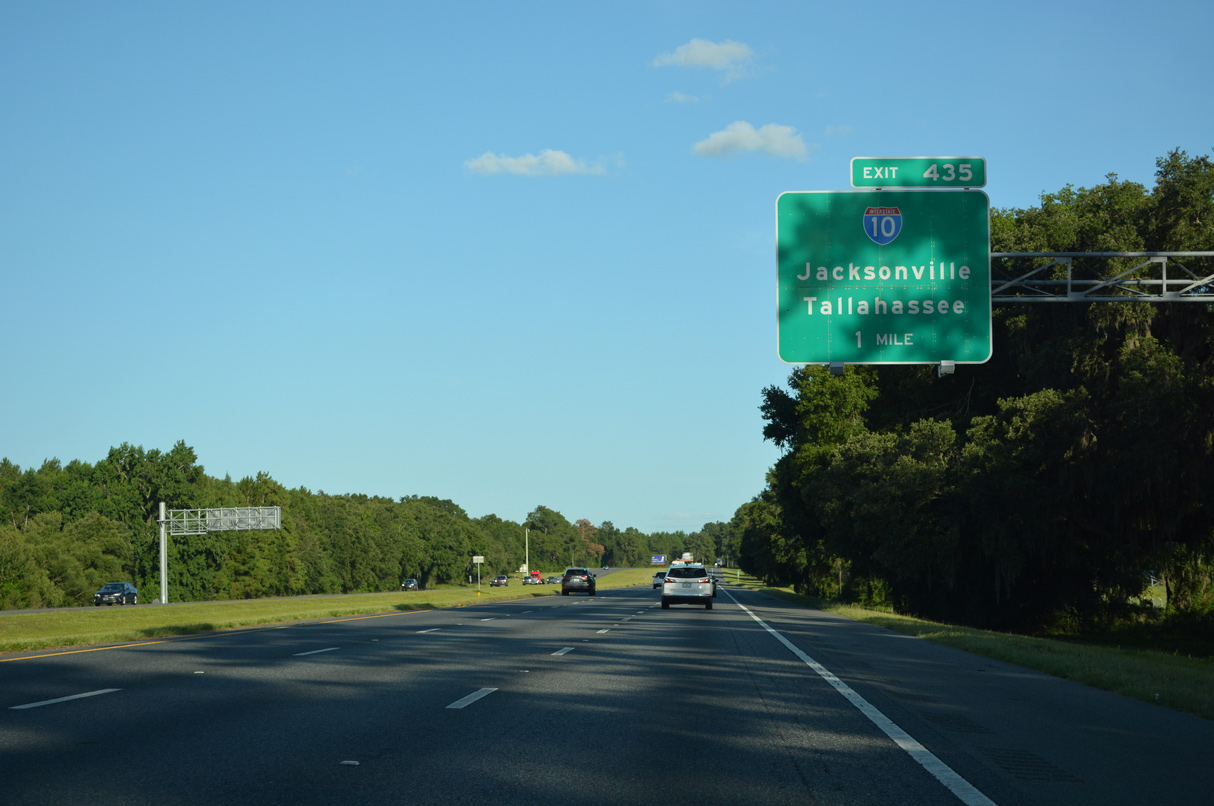
Southbound I-75 advances three miles to the rural junction with Interstate 10 at Exit 435. Traffic counts increase southward on the 165 mile drive to I-275.
06/26/22
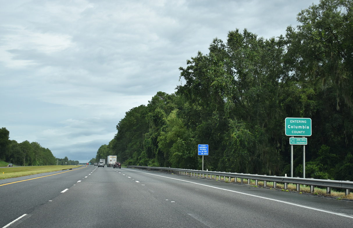
Motorists along I-75 south cross the Columbia County line within one mile of Exit 439.
07/22/20
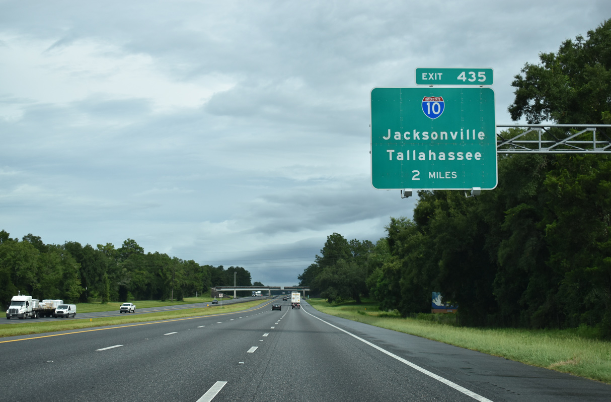
Located ten miles to the northwest of Lake City, the directional cloverleaf interchange (Exit 435) with Interstate 10 lies two miles ahead.
07/22/20
Interstate 10 is a transcontinental route stretching 2,460 miles from I-95 in Jacksonville to California State Route 1 in Santa Monica.
06/26/22
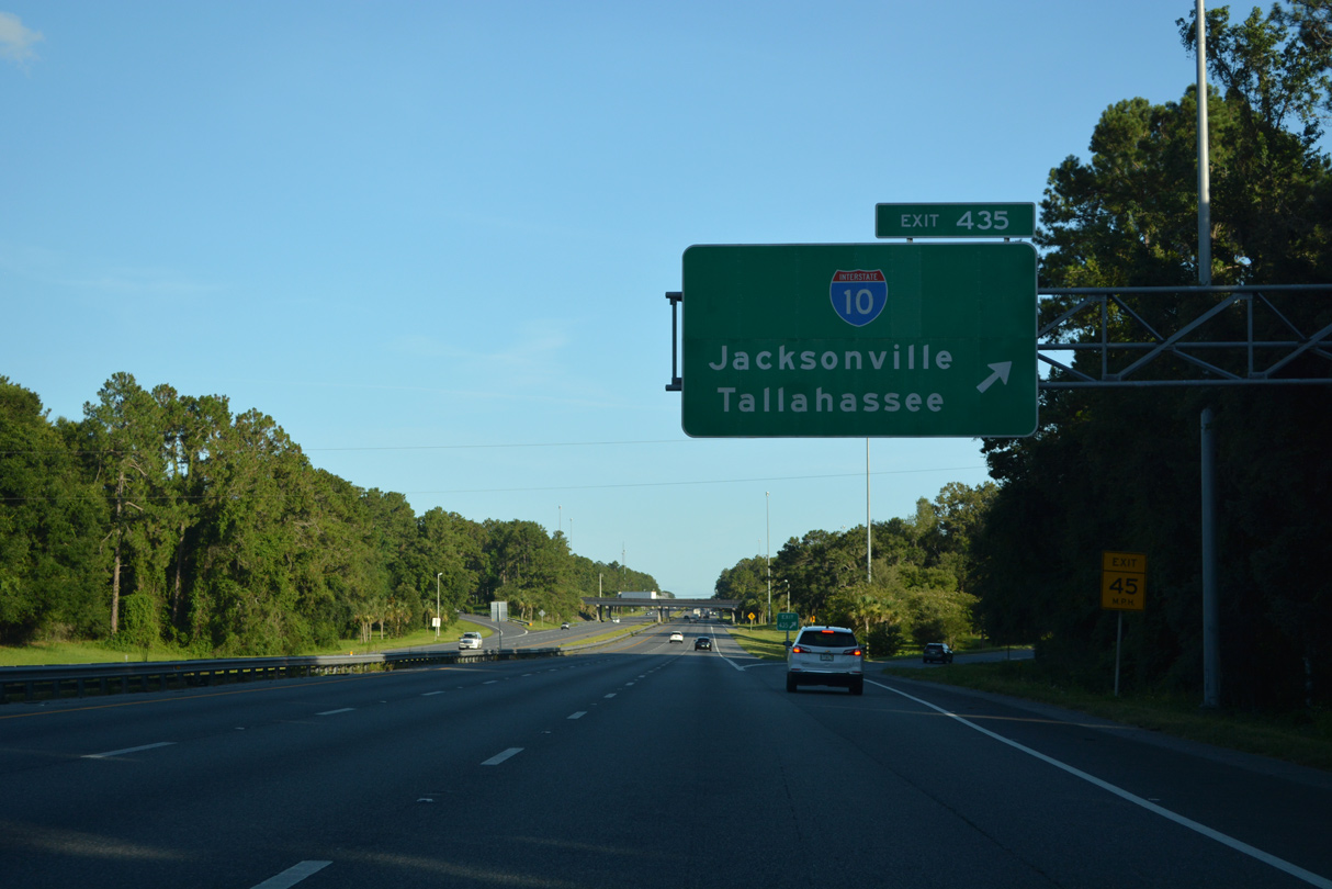
Exit 435 departs Interstate 75 south for I-10 east to Jacksonville and I-10 west 80 miles to Tallahassee.
06/26/22
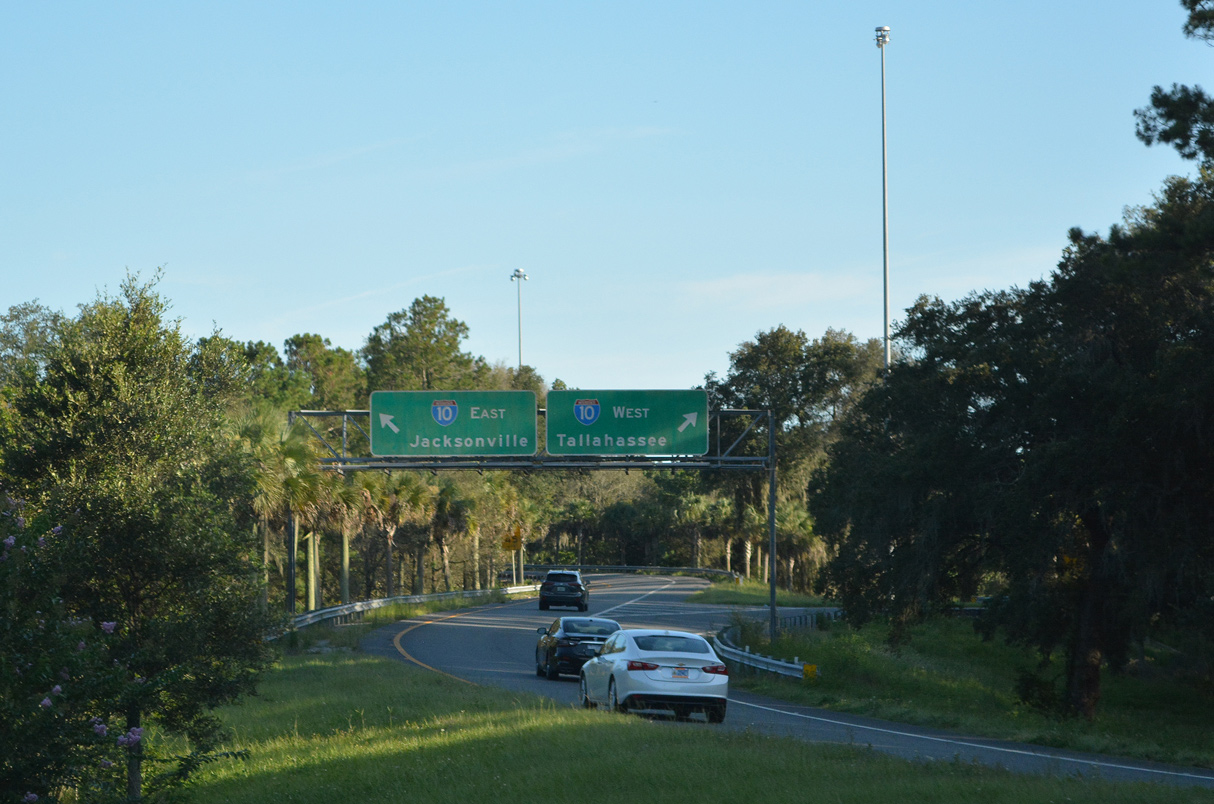
Within Florida, I-10 joins Pensacola and the Emerald Coast, Eglin AFB, the state capital of Tallahassee and Lake City with the First Coast along a 362.82 mile course.
06/26/22
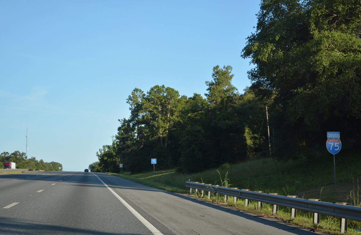
I-75 advances south from Interstate 10 and the CR 250 (W Lake Jefferey Road) overpass by Orange Pond.
06/26/22
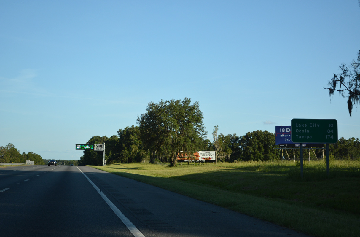
Downtown Lake City lies ten miles away via forthcoming U.S. 90 east. Ocala appears for the first time on I-75 distance signs at 84 miles out.
06/26/22
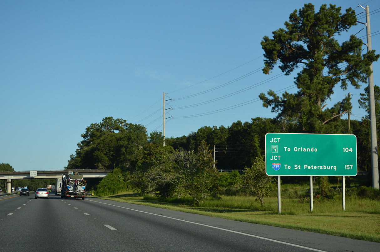
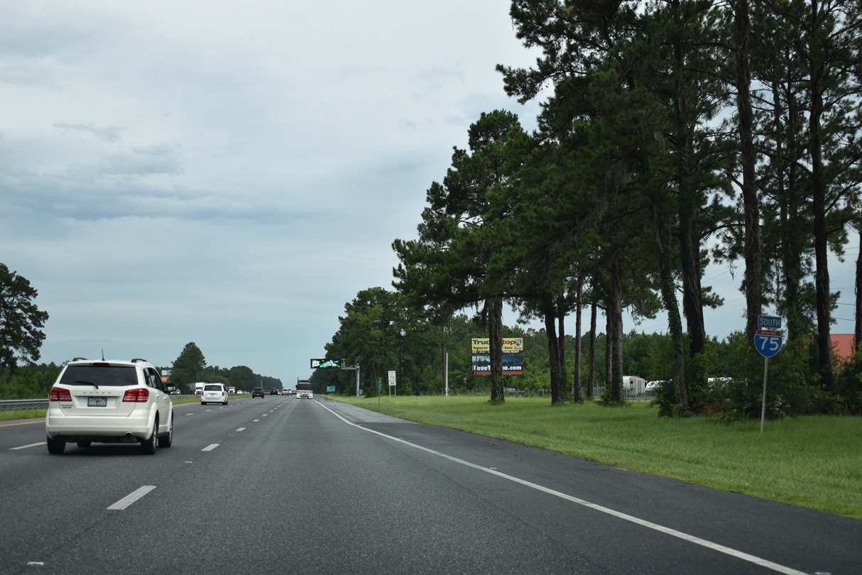
Interstate 75 travels 157 miles south from I-10 to the split with I-275 to Tampa and St. Petersburg.
06/26/22
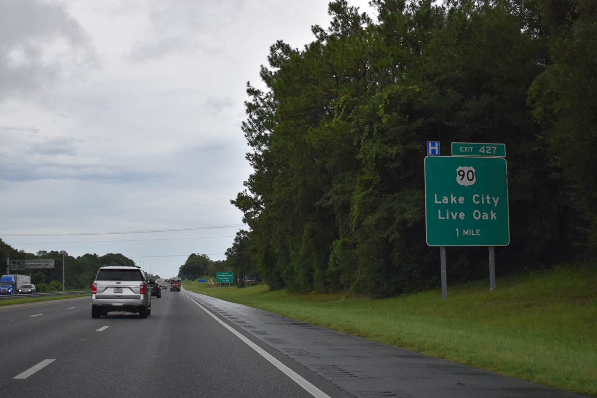
Exit 427 with U.S. 90 is the first of two interchanges along Interstate 75 for Lake City.
07/22/20
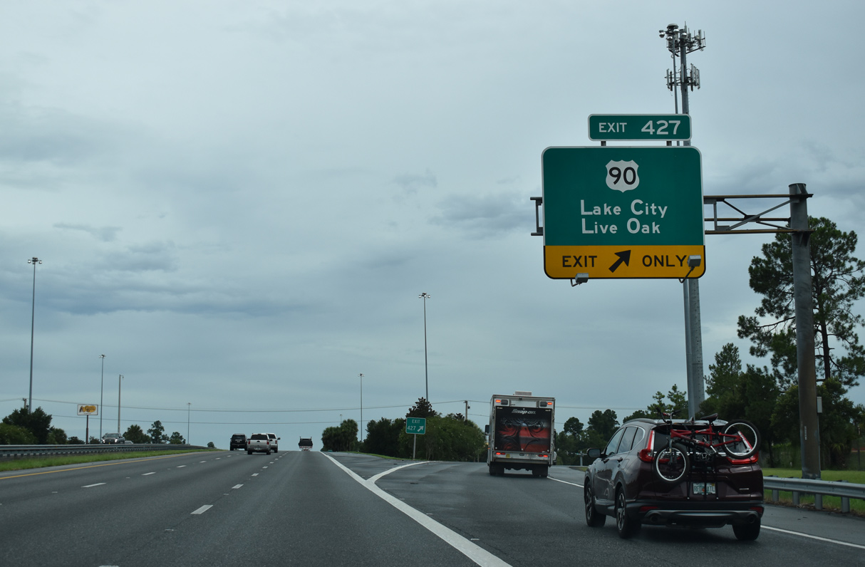
Entering the diamond interchange (Exit 427) with U.S. 90 on I-75 south. U.S. 90 travels 20 miles west to Live Oak.
07/22/20
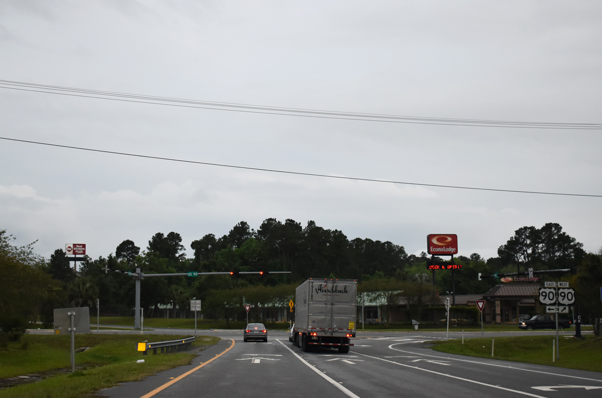
A commercial arterial east to Downtown, U.S. 90 primarily serves local traffic throughout Florida as it parallels Interstate 10.
04/18/20
South from U.S. 90, I-75 passes below SR 247, a 22.05 mile route southwest from Lake City to Branford.
07/22/20
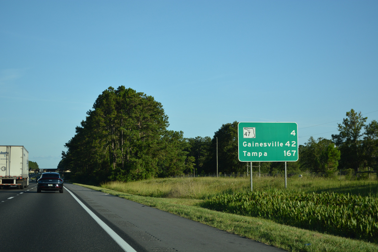
SR 47 converges with I-75 south of Lake City in four miles. Gainesville, located 38 miles further, replaces Ocala on this distance sign.
06/26/22
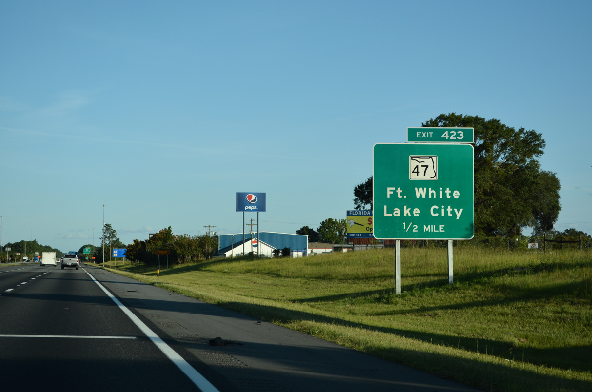
SR 47 narrows to a two lane rural route immediately south of I-75 en route to Fort White and Trenton.
06/26/22
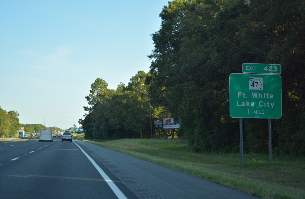
Heading north from Exit 423, SR 47 constitutes a four lane arterial into Lake City. SR 47 is the unmarked counterpart of U.S. 441 north from Lake City to the Georgia state line.
06/26/22
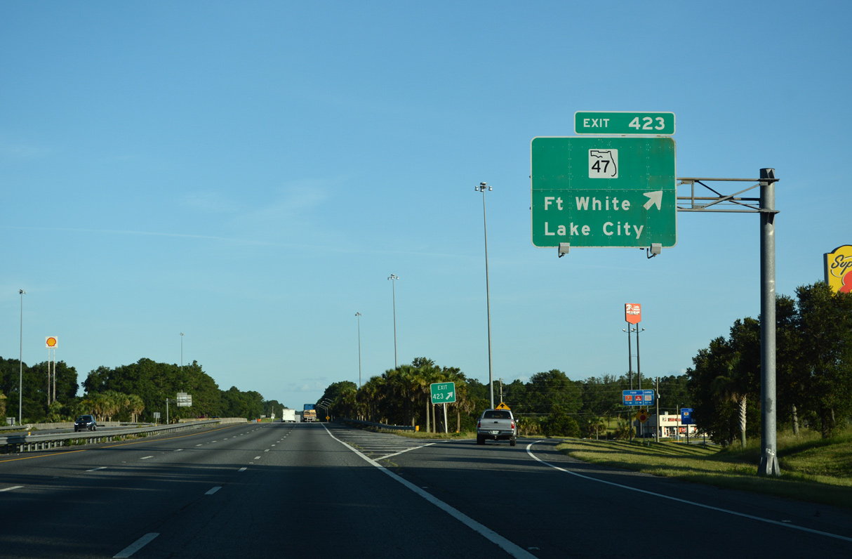
SR 47 travels 15 miles southwest from Exit 423 to Fort White. Ichetucknee Springs State Park, one of the many natural springs in the area, lies west of Fort White. The park is accessible via U.S. 27 from SR 47, or via CR 238 west.
06/26/22

Photo Credits:
- Brent Ivy: 04/18/20
- Alex Nitzman: 06/12/17, 07/22/20, 06/26/22
- AARoads: 08/07/13
Connect with:
Page Updated Thursday September 22, 2022.