
Interstate 75 South - Macon-Bibb County

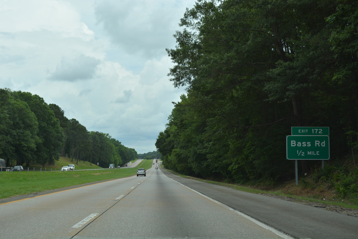
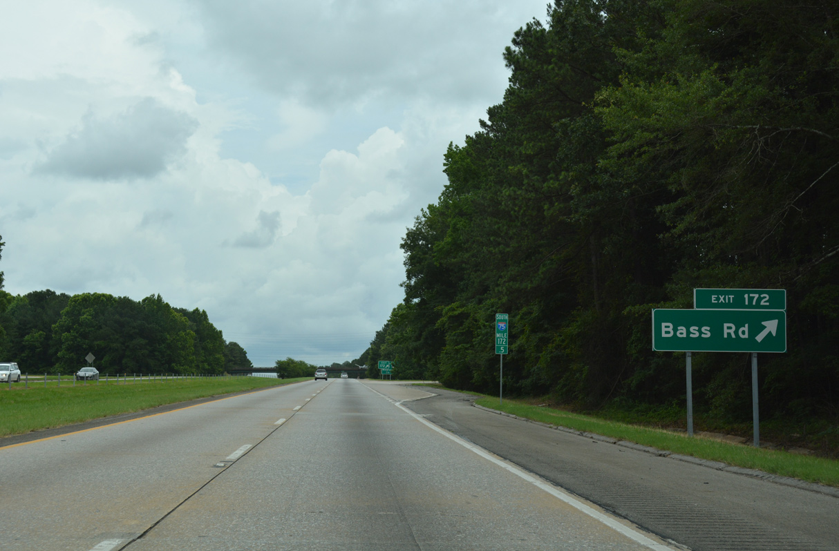
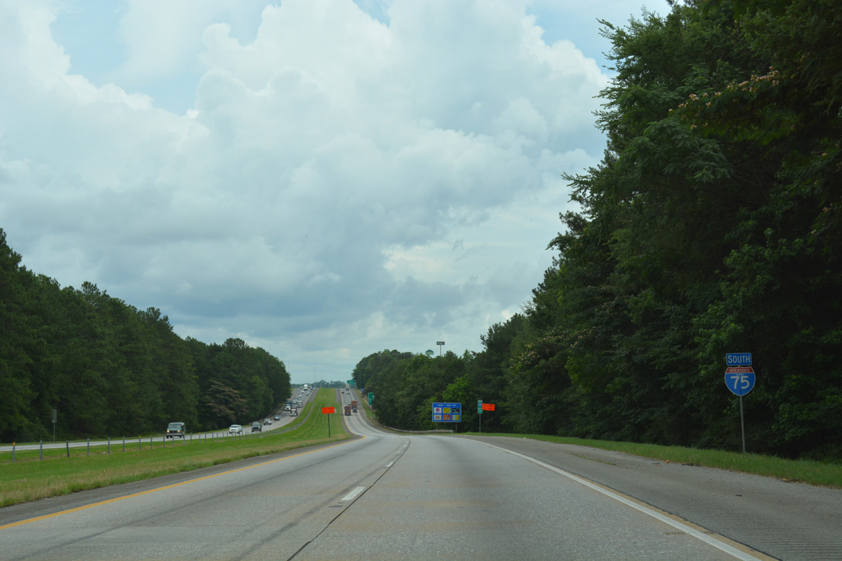
Bass Road arcs east from Exit 172 to U.S. 23/SR 87 (Riverside Drive). The minor arterial was a part of SR 361 until 1982 (AARoads Wiki, 2025).
06/12/17
03/16/26
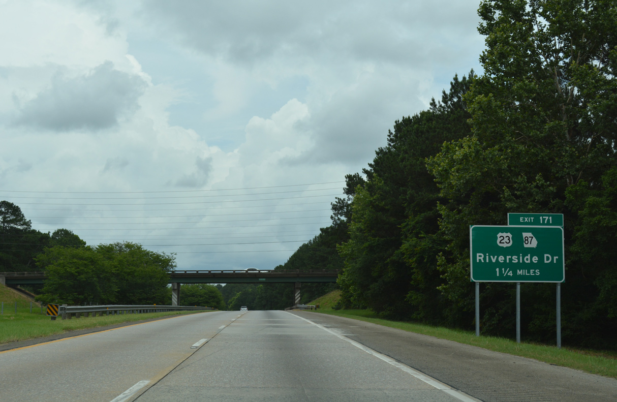
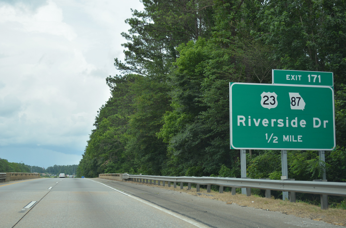
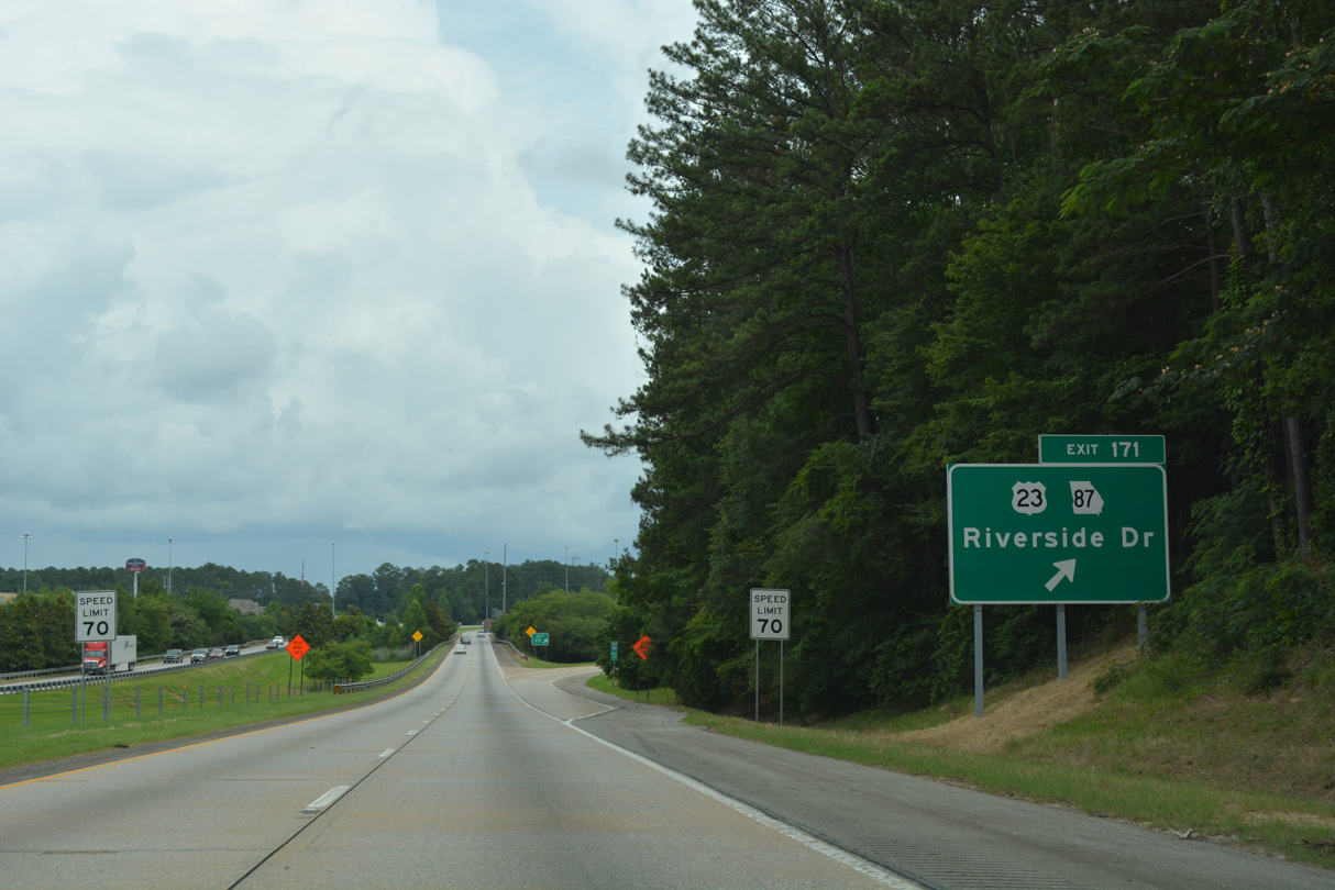
Having looped east from Interstate 75 at Locust Grove to Jackson and Berner, U.S. 23/SR 87 returns at Exit 171 by Arkwright.
03/16/26
I-75 runs between Beaverdam Creek and the Wexford subdivision on the ensuing stretch.
03/16/26
U.S. 23/SR 87 (Riverside Drive) parallel the Ocmulgee River southward into Macon.
03/16/26
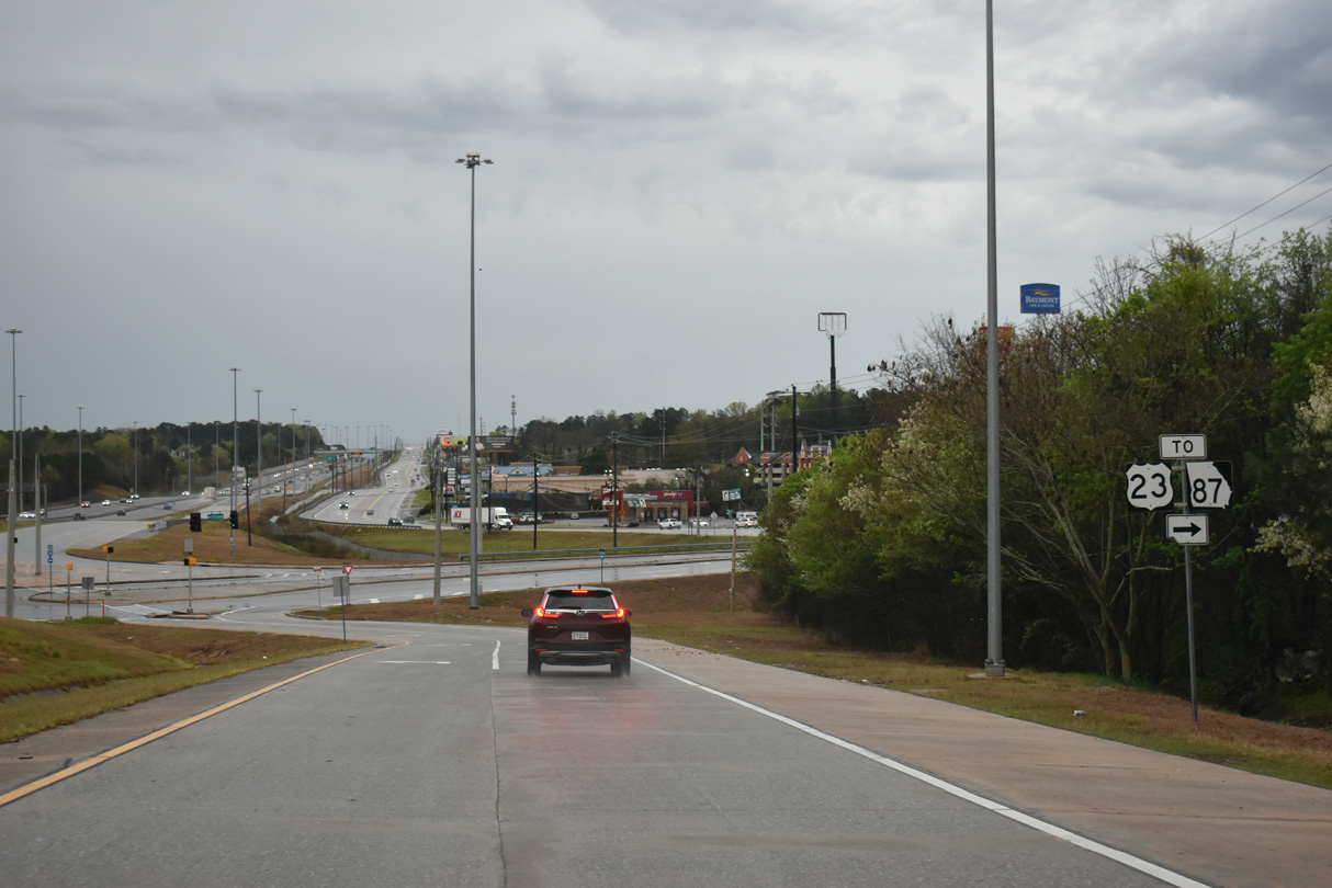
Heavy development surrounds the formerly rural diamond interchange anchored by The Shoppes at River Crossing nearby. U.S. 23/SR 87 (Riverside Drive) act as a west side frontage road to I-75 southward from Exit 171 to the split with I-16 east.
03/16/26

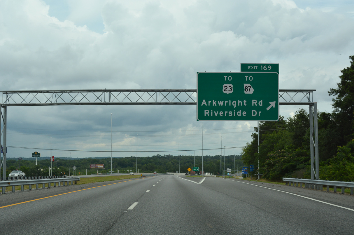
Arkwright Road converges with I-75 and adjacent U.S. 23/SR 87 (Riverside Drive) at a diamond interchange (Exit 169) in one mile.
03/16/26
06/12/17

Tom Hill, Sr. Boulevard extends south from Arkwright Drive and U.S. 23/SR 87 (Riverside Drive) to Northside Drive between the Shops at North Park and Rivergate Shopping Center.
03/16/26
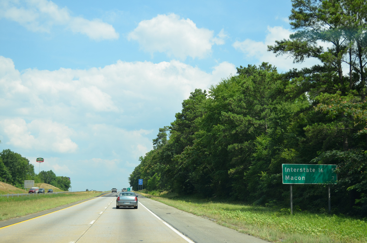
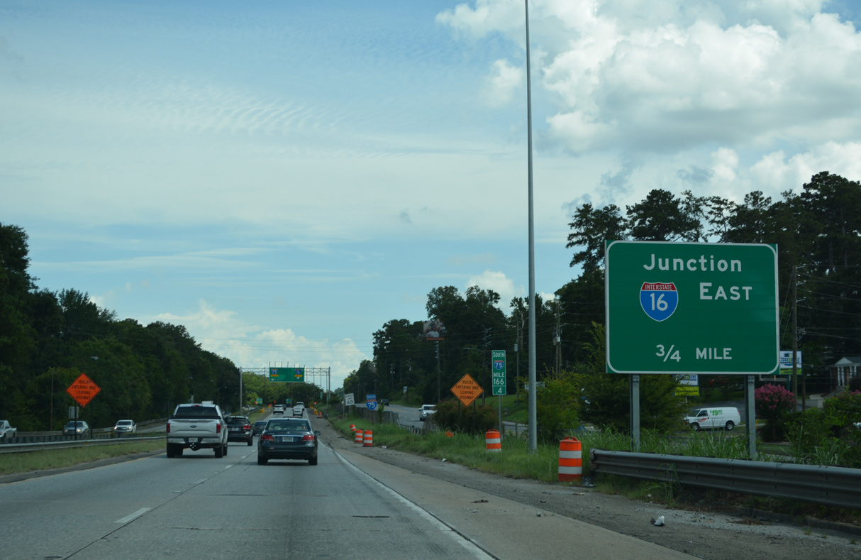
I-16 branches east from Interstate 75 south in five miles by U.S. 23/SR 87 (Riverside Drive).
07/05/14
U.S. 23/SR 87 (Riverside Drive) remain along the west side of Interstate 75 south from Exit 169 for another 3.3 miles.
03/16/26
$68 million in road work from August 2010 to November 2013 expanded 3.3 miles of Interstate 75 south from the exchange with Arkwright Road (Macon Telegraph, 2013).
07/25/22
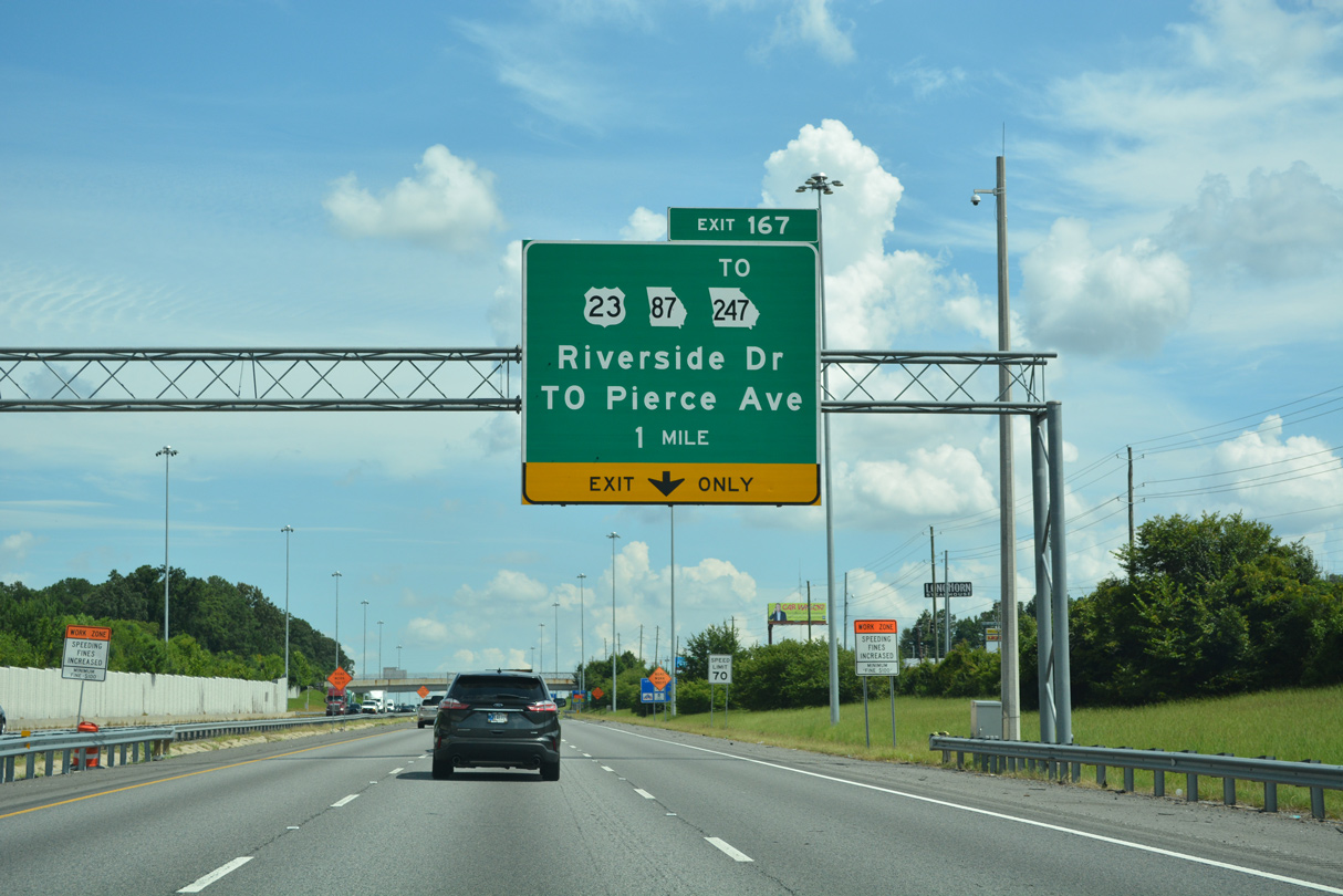
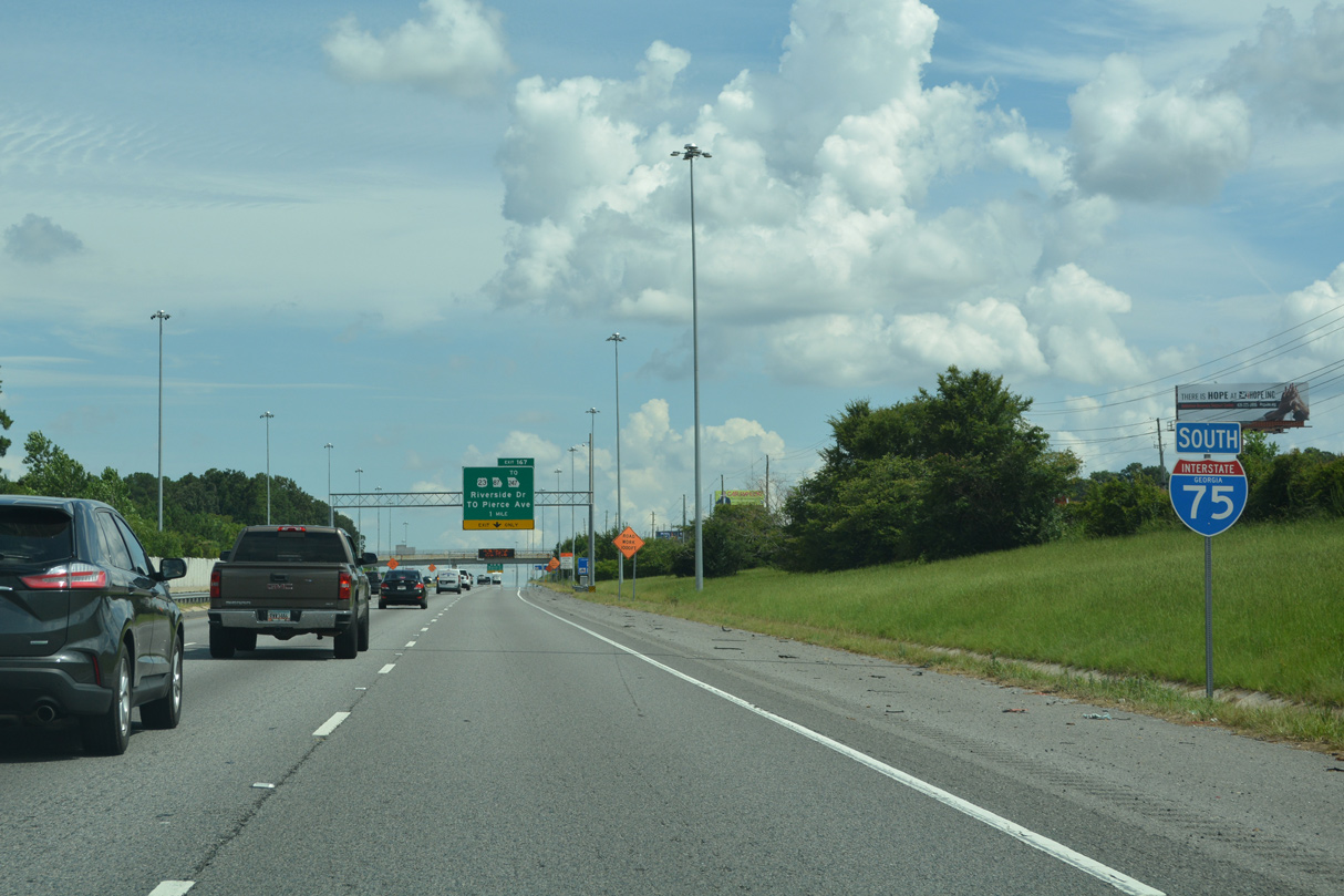
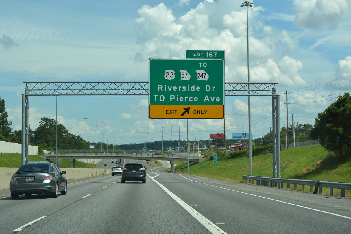
The succeeding exit from I-75 south is with U.S. 23/SR 87 (Riverside Drive) to SR 247 (Pierce Avenue) south. SR 247 constitutes a 43.46 mile long route to the Perry area from I-75 and U.S. 23.
07/25/22
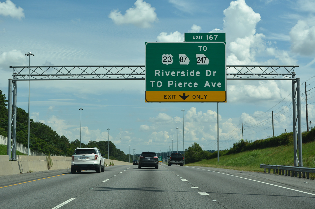
2010-13 widening of I-75 south to Exit 167 redesigned the parclo interchange with SR 247 (Pierce Avenue). Ramps were added southbound with adjacent U.S. 23/SR 87 (Riverside Drive) just ahead of Pierce Avenue in place of the originals further south (Macon Telegraph, 2013).
07/25/22
SR 247 (Pierce Avenue) leads 2.31 miles south from I-75 to become apart of U.S. 41 at U.S. 41BU/SR 19 (Vineville Avenue). SR 247 meets I-75 again at Exit 160A.
07/25/22

Beginning at Exit 165, Interstate 16 runs 165.71 miles southeast from Macon to Montgomery Street outside Downtown Savannah.
03/16/26

Points of interest from Interstate 16 via Exit 2 (U.S. 80/SR 87) include the Georgia Music Hall of Fame, the Georgia Sports Hall of Fame, the Tubman Museum and Ocmulgee National Park.
07/25/22

Scheduled to bid for construction in 2023, Phase 6 of the I-16/I-75 Interchange Improvement project upgrades Interstate 75 south leading into the systems exchange at Exit 165.
03/16/26
Underway by 2018 and split into seven phases, the I-16/I-75 Interchange Improvement project eliminates left exit ramps and adds collector/distributor roadways to eliminate weaving traffic patterns with U.S. 41BU/SR 19 (Hardeman Avenue) and U.S. 23/129-SR 11/19/49 (Spring Street).
03/16/26
U.S. 23/SR 87 (Riverside Drive) reappear beyond the former entrance ramp from SR 247.
03/16/26
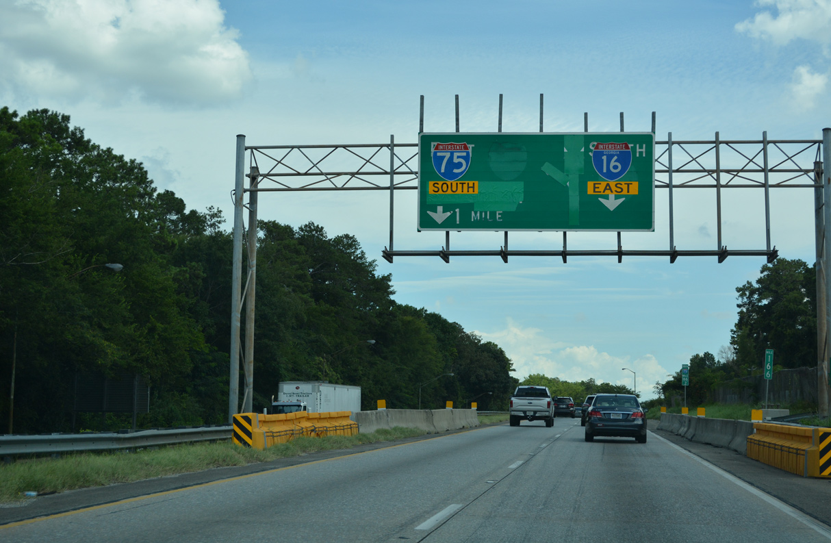
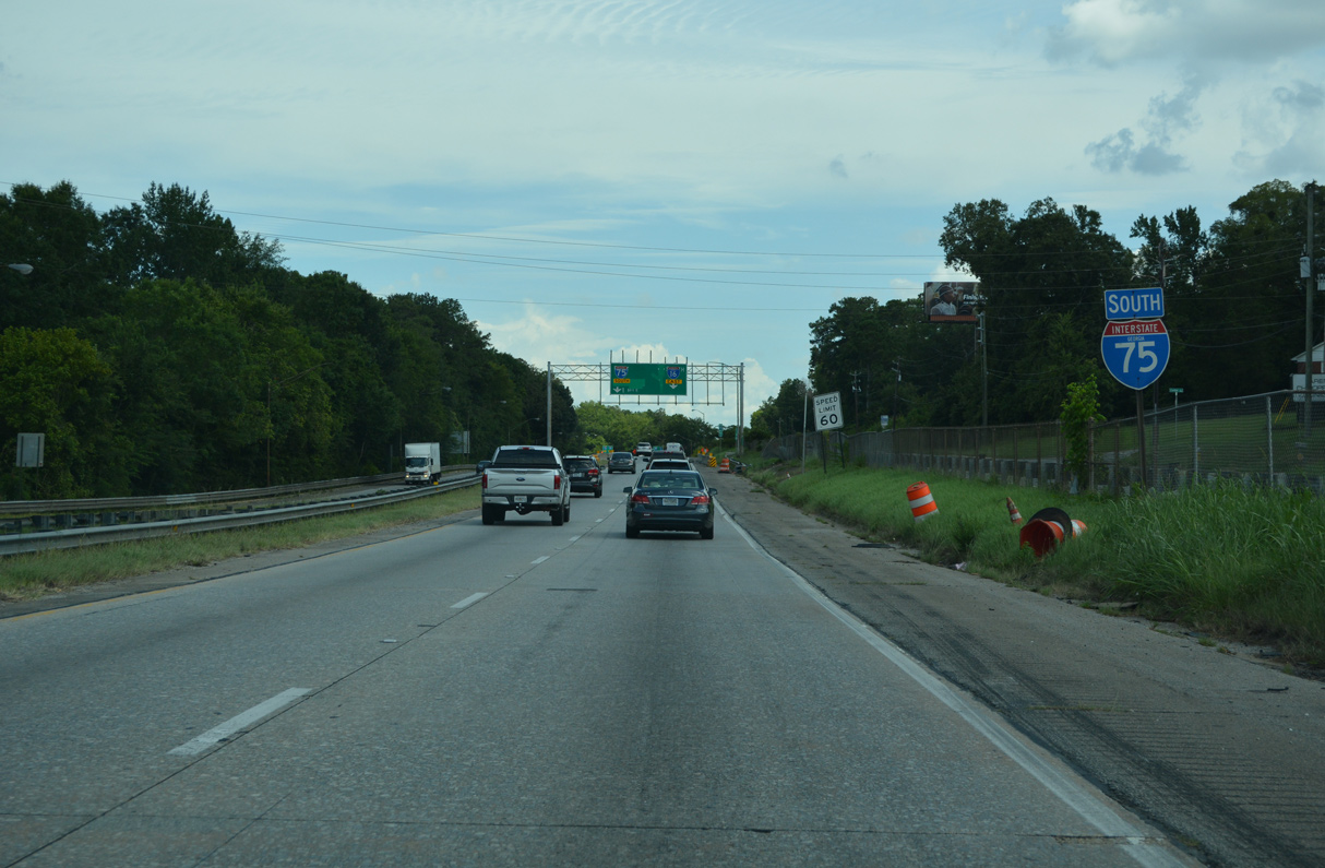
A directional T interchange connects I-75 and I-16 at Exit 165. I-16 comprises a freight corridor joining the Atlanta area with the Port of Savannah.
03/16/26
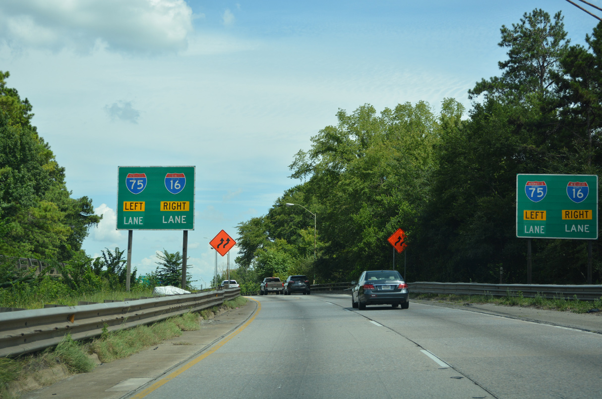
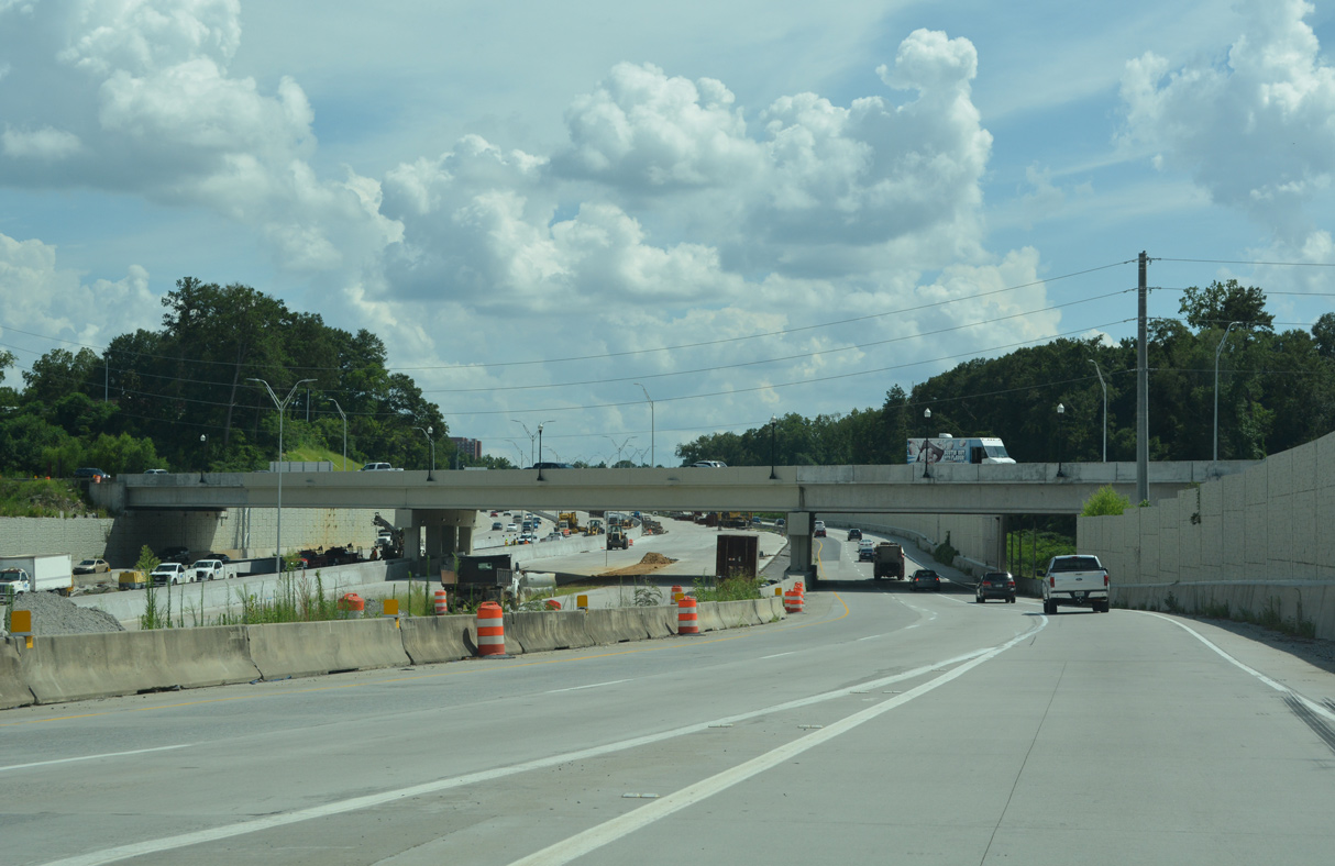
Diverging from parallel U.S. 23/SR 87 (Riverside Drive), I-75 spans a Norfolk Southern Railroad. The separation with I-16 is being relocated to a point just west of a 1,600 foot long railroad tunnel built during Phase 6 construction started in Fall 2025.
03/16/26
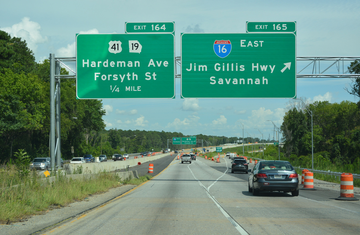
Phase 3 construction expanded Exit 165 for Interstate 16 east to two lanes. Finished by 1978, I-16 (Jim L. Gillis Highway) spans the Ocmulgee River north of Downtown. The intrastate route meets I-95 at Pooler and Savannah in 157 miles.
03/16/26
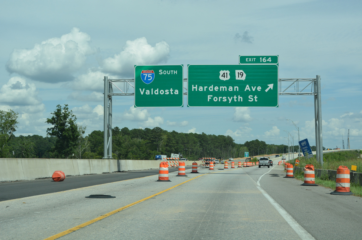
Turning south ahead of U.S. 23/SR 87 (Riverside Drive), I-75 shifts to a below grade freeway west of Downtown Macon. Costing $156 million, Phase 3 construction through 2021 added the c/d roadway south to the split diamond interchange (Exit 164) with U.S. 41 BU/SR 19.
03/16/26
Turning south ahead of U.S. 23/SR 87 (Riverside Drive), I-75 shifts to a below grade freeway west of Downtown Macon. Costing $156 million, Phase 3 construction through 2021 adds the c/d roadway south to the split diamond interchange (Exit 164) with U.S. 41 BU/SR 19.
07/25/22
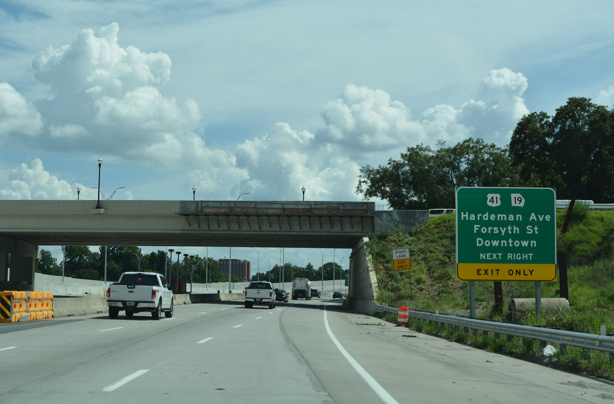
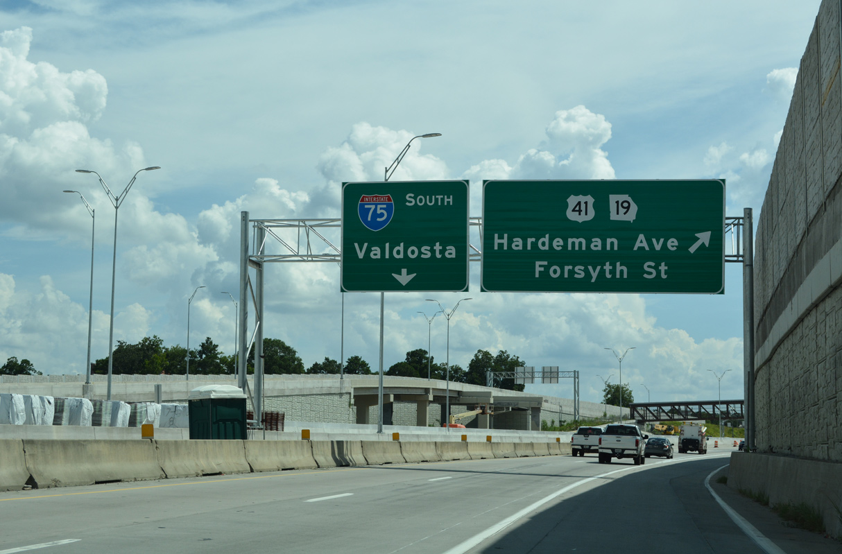
U.S. 41 BU/SR 19 branch eastward from U.S. 41/SR 247 (Pio Nono Avenue) along Vineville Avenue to a one way couplet of Forsyth Street (east) and Hardeman Avenue (west) across I-75.
07/25/22
All guide signs added for Exit 164 in 2022 incorrectly reference U.S. 41 instead of U.S. 41BU.
07/25/22

U.S. 41BU south follows College Street north from Forsyth Street to Georgia Avenue east. U.S. 41BU north follows Georgia Avenue west directly onto Hardeman Avenue. Through Downtown Macon, U.S. 41BU combines with SR 49 along Walnut Street east to U.S. 80/129 (Martin Luther King, Jr. Boulevard) south.
07/25/22
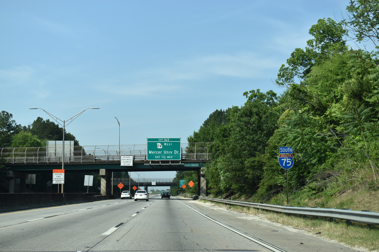
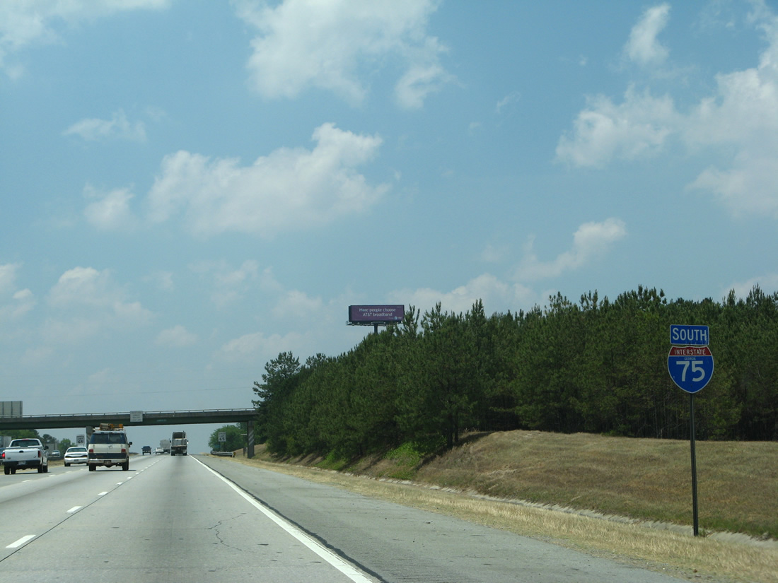
Continuing south, Interstate 75 next meets the east end of SR 74 at Mercer University.
05/25/21
Confirming marker preceding the Napier Avenue over crossing. SR 540 (Fall Line Freeway) accompanies I-75 south from I-16 west to Exit 149 for SR 49 at Byron.
05/25/21
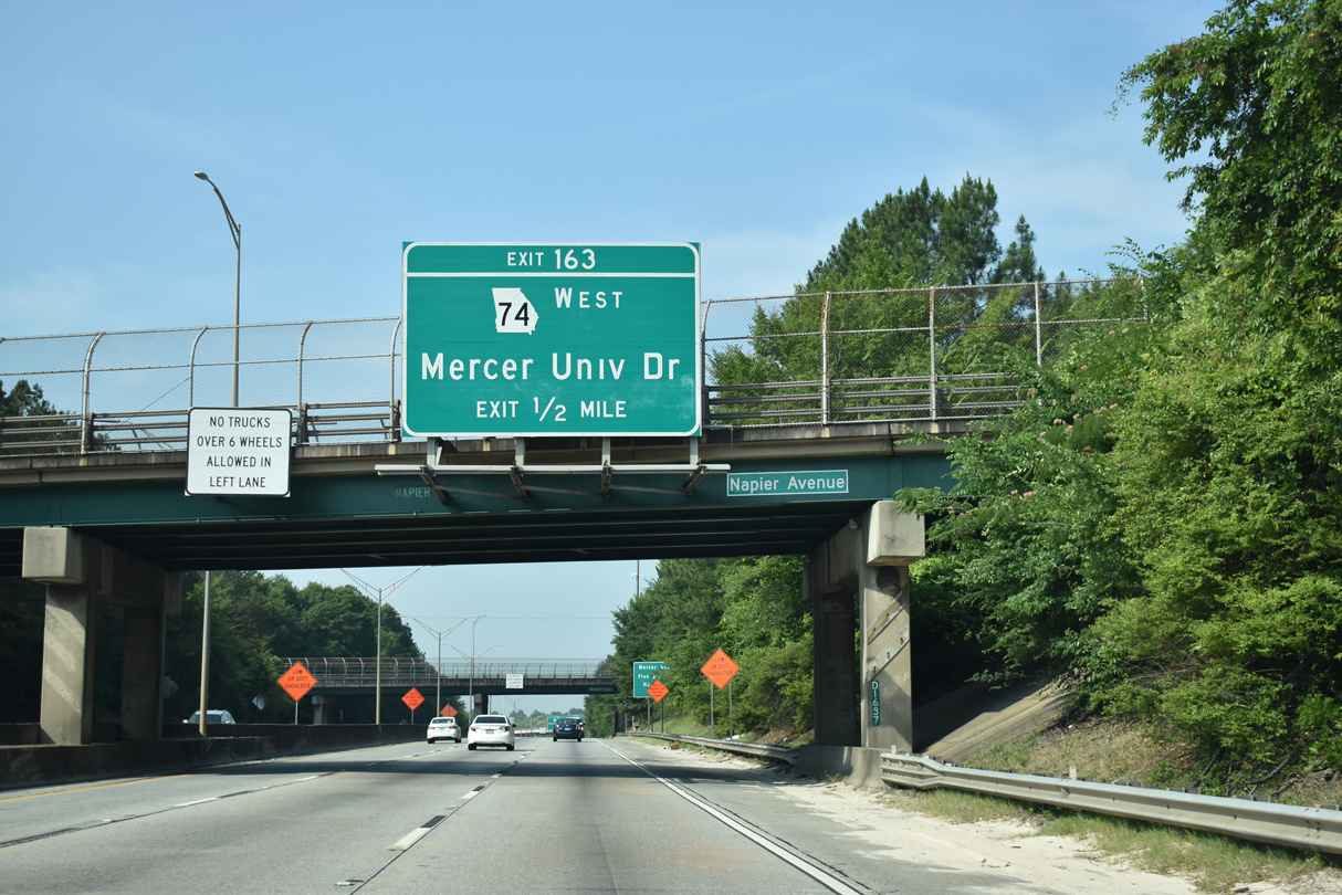
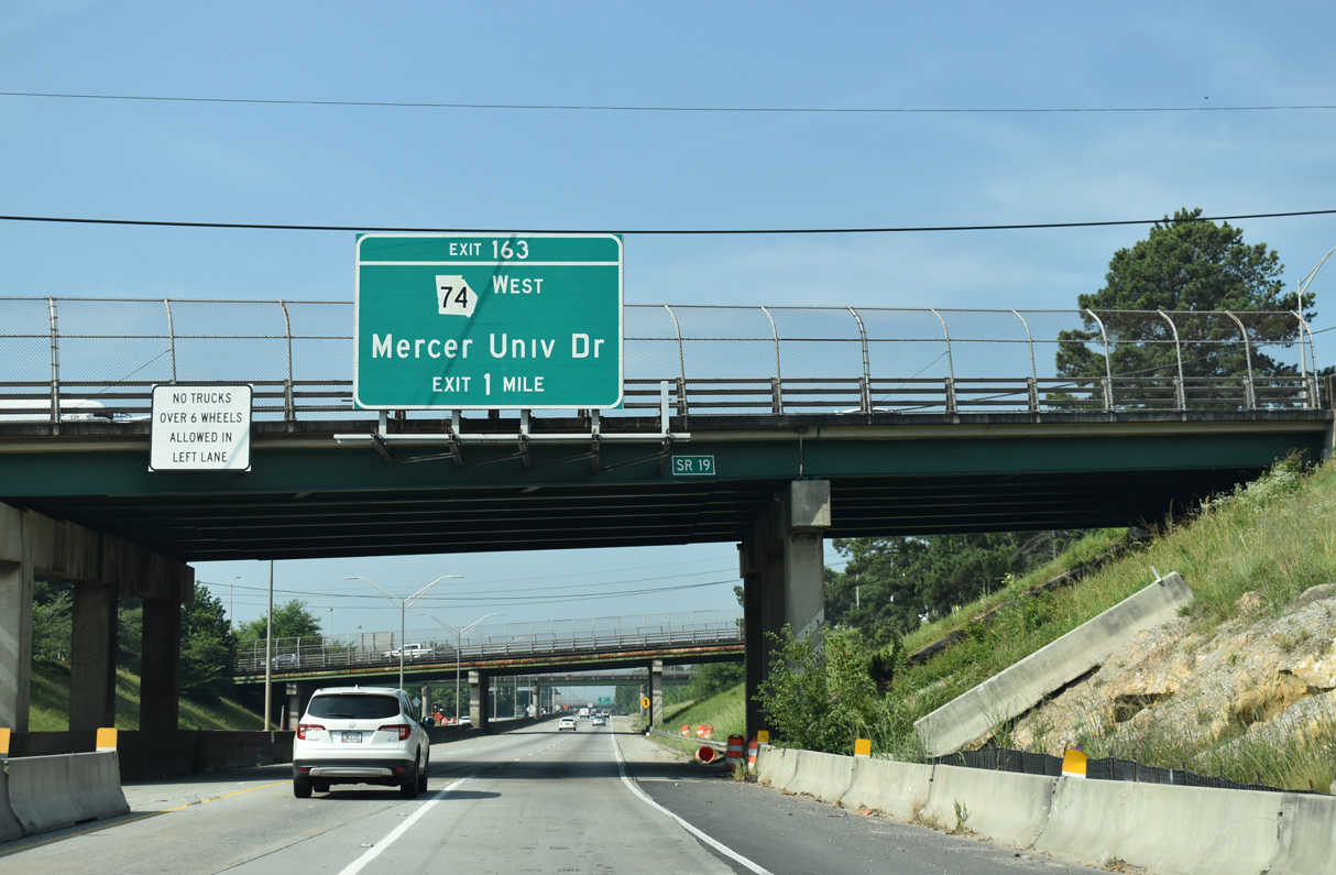
I-75/SR 540 angles southwest between the Unionville community Macon and Mercer University to the six-ramp parclo interchange (Exit 163) with SR 74 west and Mercer University Drive.
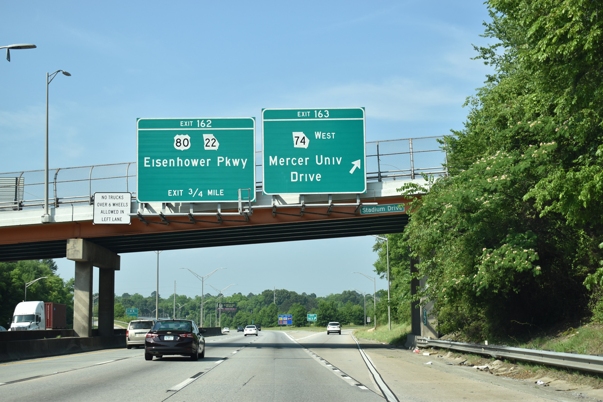
05/25/21
Exit 163 leaves I-75 south for SR 74 (Mercer University Drive) west to Macon Mall. Mercer University Drive becomes Little Richard Penniman Boulevard 0.26 miles east at College Street and Mercer University en route to 2nd Street.
05/25/21

SR 74, a 107.89 mile long route, leads west from Macon to Thomaston and Woodbury before turning north to Peachtree City and Fairburn.
05/25/21
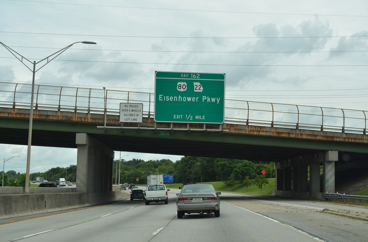
A half mile southward, I-75/SR 540 meet U.S. 80/SR 22 (Eisenhower Parkway) at a parclo interchange (Exit 162). U.S. 80 crosses Georgia for 296 miles from Columbus to Savannah as part of a 1,035 mile long route between Mesquite, Texas and Tybee Island on the Atlantic Ocean.
06/12/17
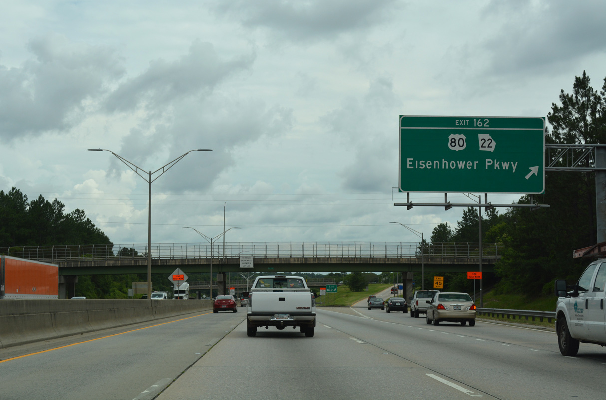
U.S. 80/SR 22 follow Eisenhower Parkway west from U.S. 129/41BU (Broadway) to Macon Mall, Central Georgia Technical College and I-475 by Middle Georgia State University. Part of the original Fall Line Freeway proposal around Macon, Eisenhower Parkway spurs 0.63 miles east from Broadway to Edgewood Avenue.
06/12/17
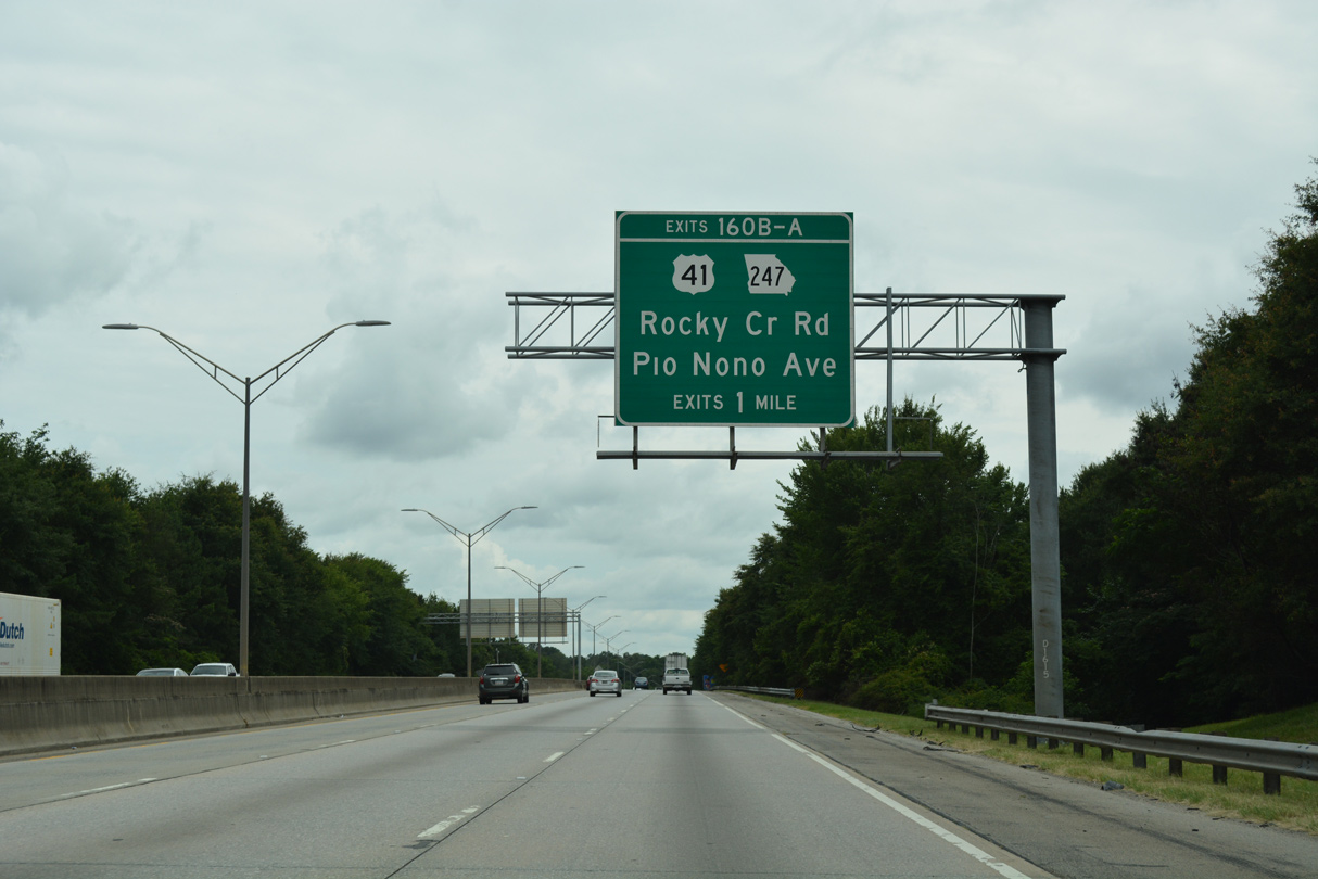
U.S. 41/SR 247 (Pio Nono Avenue) overlap 3.97 miles south from Vineville Avenue to I-75/SR 540 at Exit 160.
06/12/17
A half diamond interchange (Exit 160B) precedes Pio Nono Avenue with Rocky Creek Road. Rocky Creek Road runs 3.21 miles west from Houston Avenue to U.S. 41/SR 247 and Bloomfield Road at the Groveland Park community of Macon.
06/12/17
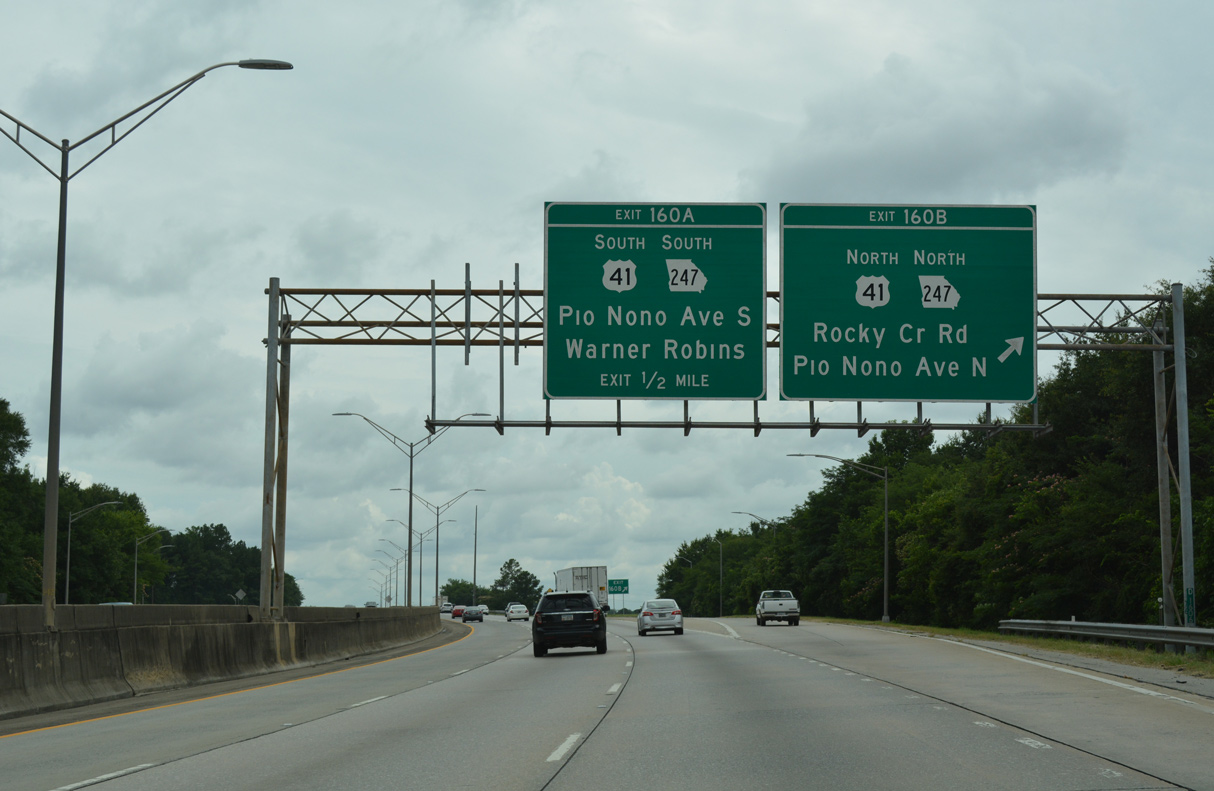
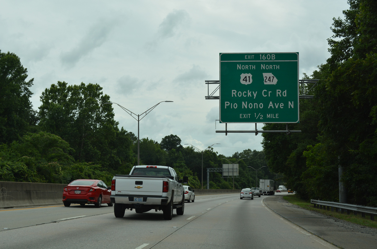
Exit 160B departs for Rocky Creek Road to provide northbound access to Pio Nono Avenue. A parclo interchange (Exit 160A) joins I-75/SR 540 with U.S. 41/SR 247 south directly.
06/12/17
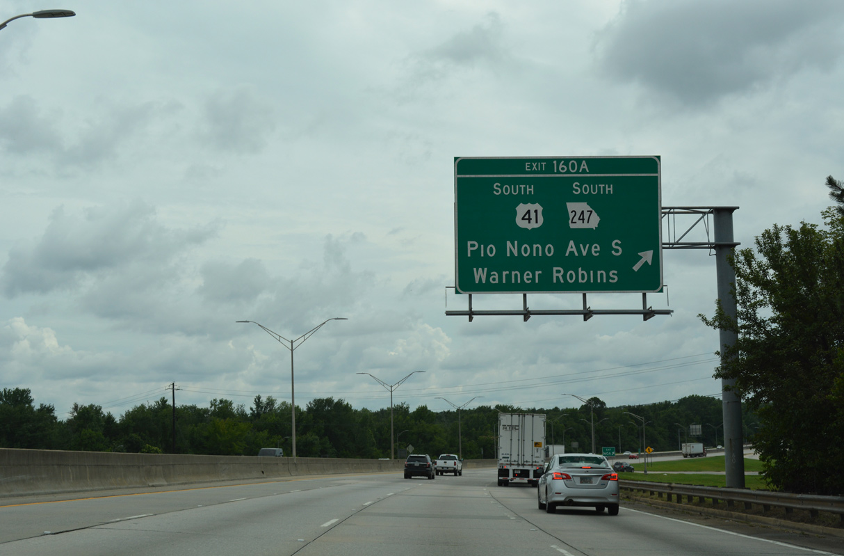
U.S. 41/SR 247 angle 1.28 miles southeast from Exit 160A to combine with U.S. 129/SR 11-49 (Broadway) at the end of U.S. 41BU. The five routes overlap 2.87 miles ahead of Middle Georgia Regional Airport (MCN) and Warner Robins.
06/12/17
Removed by 2014, this confirming marker stood along southbound between Rocky Creek and the Jennifer Drive overpass.
05/29/07
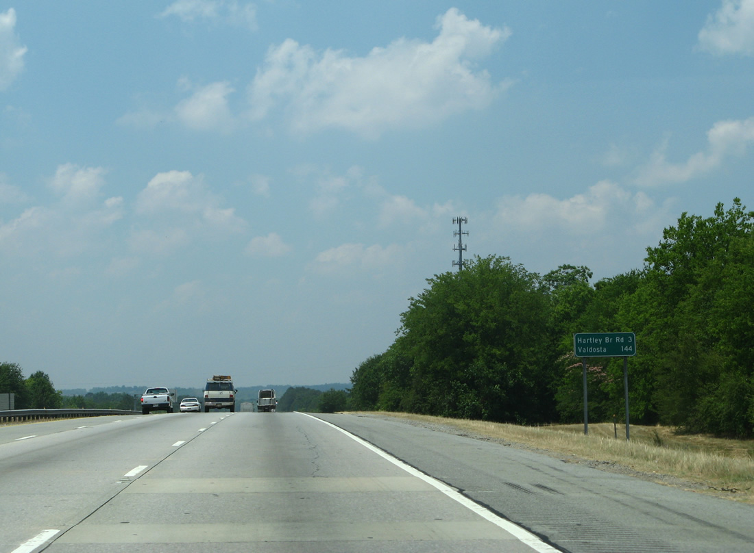
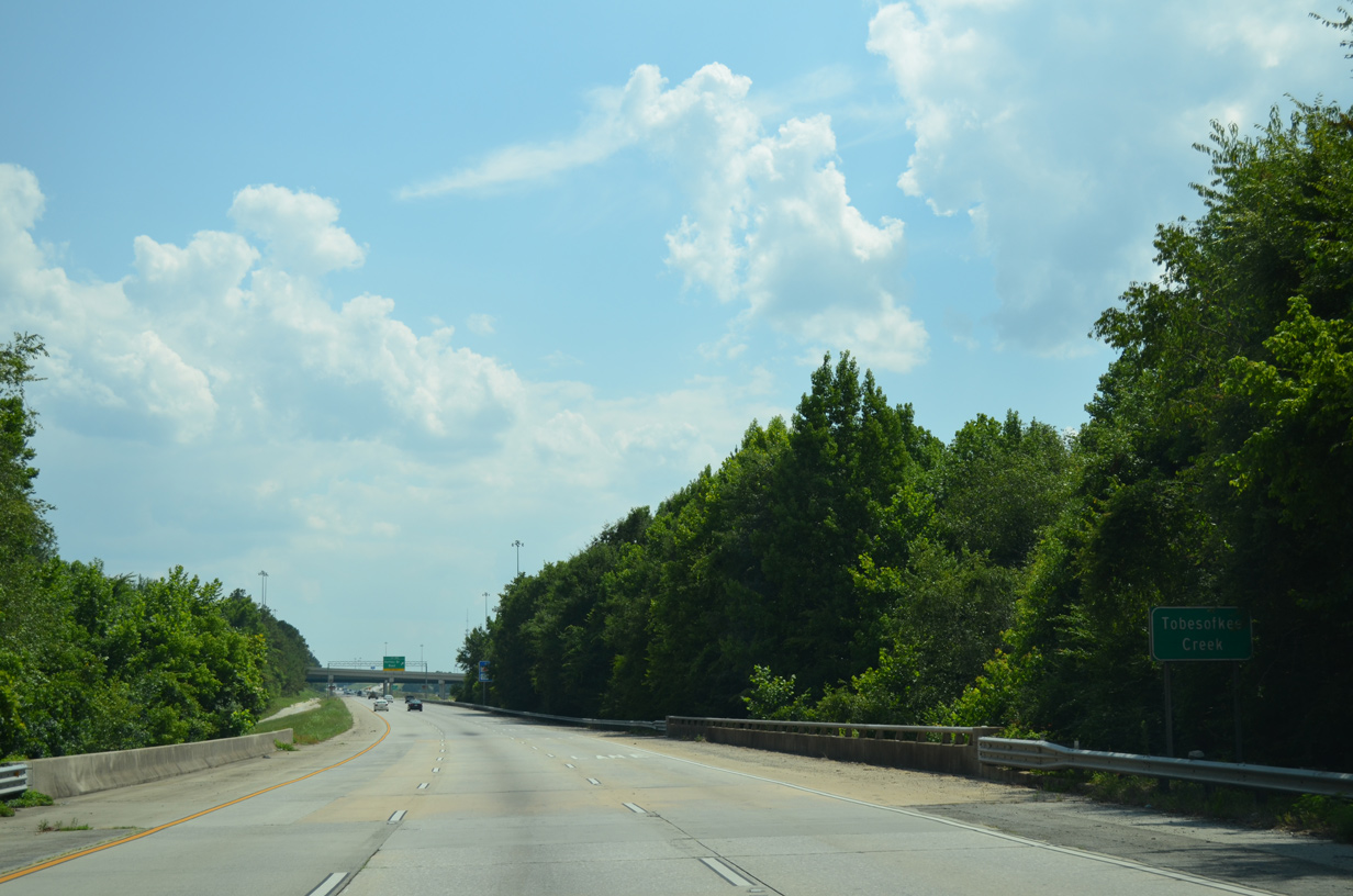
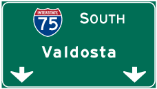
The first distance sign referencing Valdosta preceded the descent into the Tobesofkee Creek swamp area. It was removed by 2013.
05/29/07
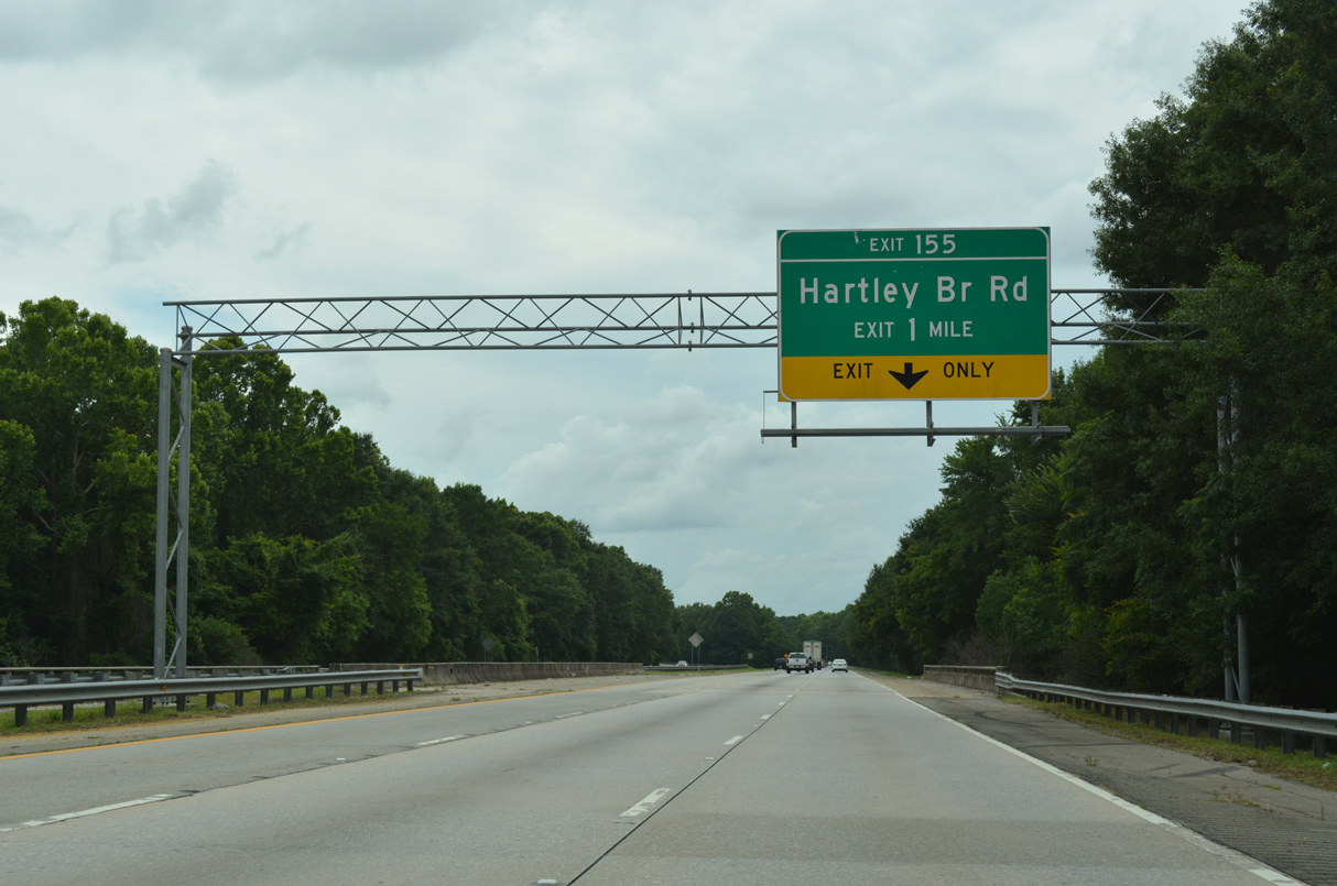
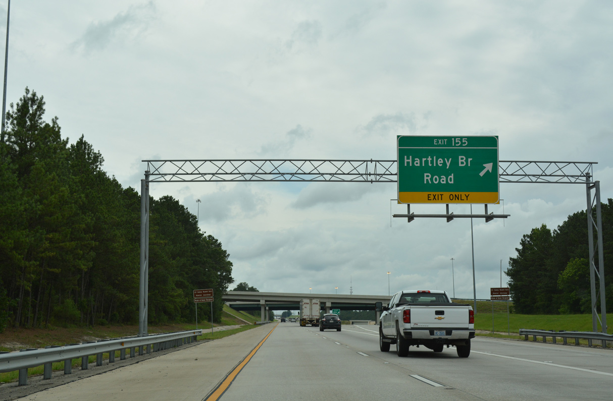
Construction between August 2006 and October 2009 widened Interstate 75 with the addition of distributor roadways between I-475 and rebuilt Exit 155 for Hartley Bridge Road into an expanded parclo interchange.
06/12/17

Hartley Bridge Road leads 2.87 miles east from I-75 to Skipperton and Houston Road (old SR 11) near Rutland. West from Exit 155, Hartley Bridge Road branches southwest from Mount Pleasant Church Road 3.56 miles into Crawford County.
06/12/17
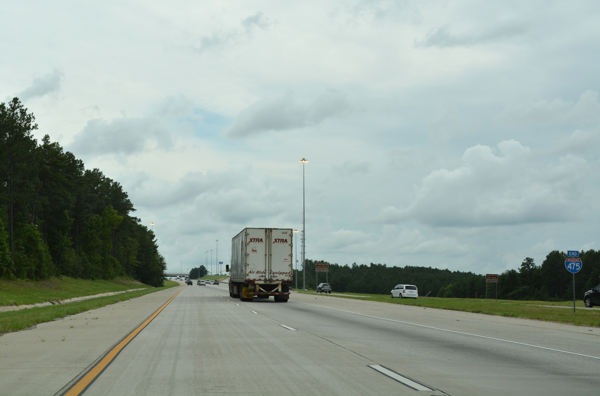
I-75/SR 540 and I-475 converge at a wye interchange south of respective crossings over Tobesofkee Creek.
07/05/14
A distributor roadway separates (Exit 155) from I-75 south 1.3 miles from Hartley Bridge Road by the I-75 Business Park. Decommissioned in 1982,1 SR 361 followed Hartley Bridge Road east to Houston Road (old U.S. 41) and Mount Pleasant Road west to Fulton Mill Road north.
06/12/17
Resulting in a weaving traffic pattern, Exit 155 previously departed one half mile south of the merge with I-475 until 2009.
06/12/17
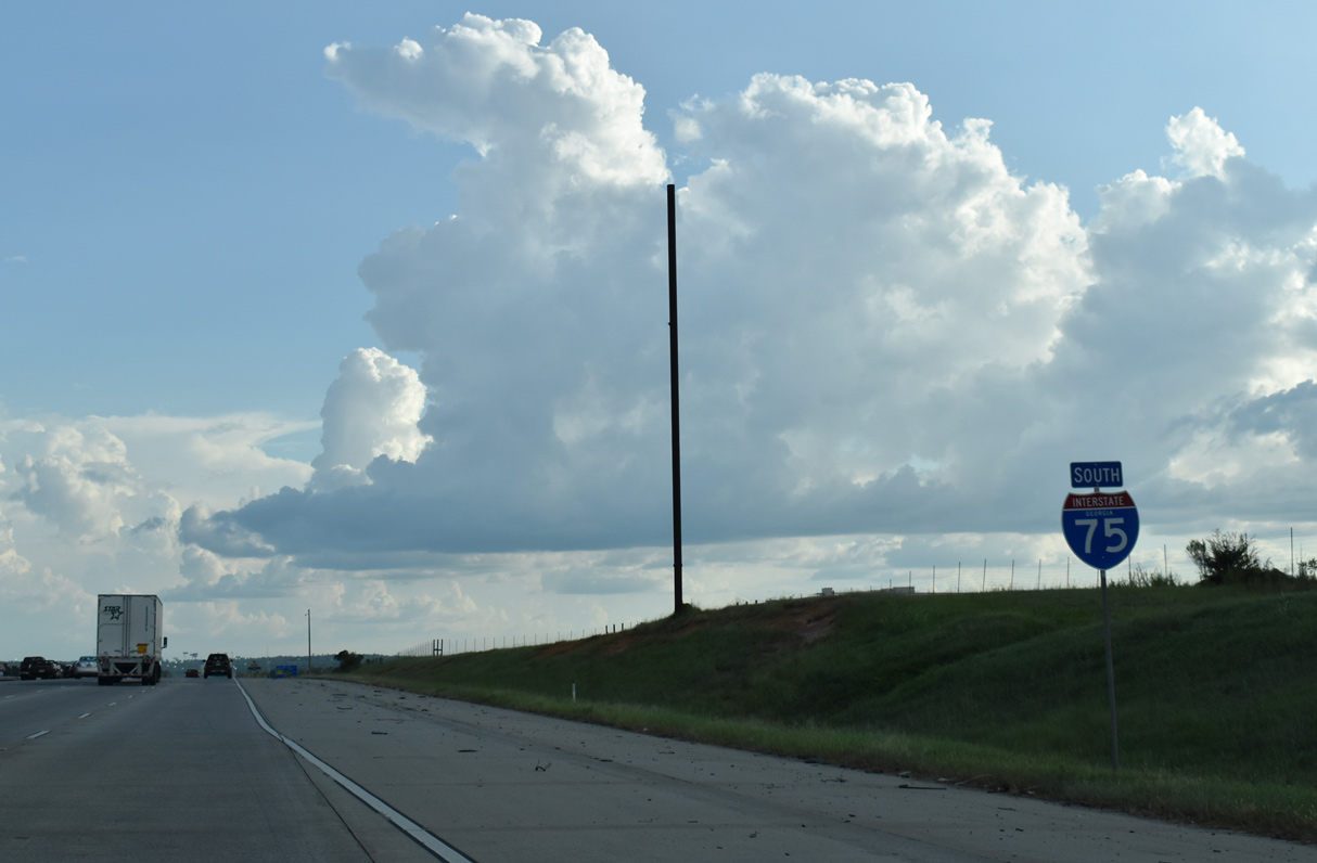
Southbound Interstate 75 advances with five lanes from I-475 to Exit 153.
09/11/20
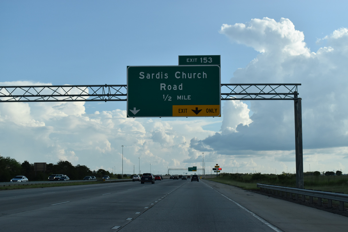
2006-09 road work expanded Interstate 75 southward to a folded diamond interchange (Exit 153) added with Sardis Church Road.
09/11/20
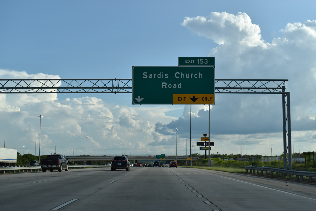
Sardis Church Road branches 1.86 miles southeast from rural Hartley Bridge Road to Frank Amerson Parkway and I-75 at Exit 153. Frank Amerson Parkway, a frontage road north 2.12 miles to Hartley Bridge Road, was built to support economic development.
09/11/20
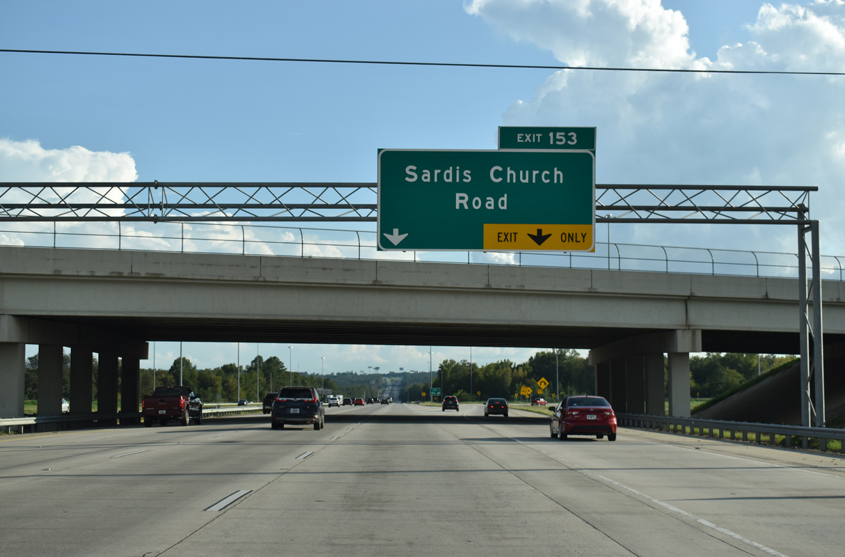
A lane drop occurs at the two lane loop ramp (Exit 153) for Sardis Church Road. East from I-75/SR 540, Sardis Church Road widens to a suburban arterial to Houston Road and Sardis Church Road Extension southeast.
09/11/20
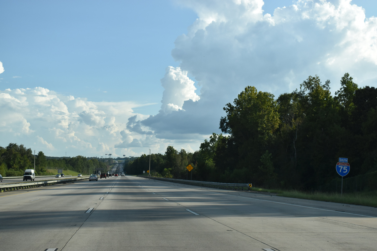
Reducing to six overall lanes, Interstate 75 south lowers from Coppas Branch toward Echeconnee Creek.
09/11/20
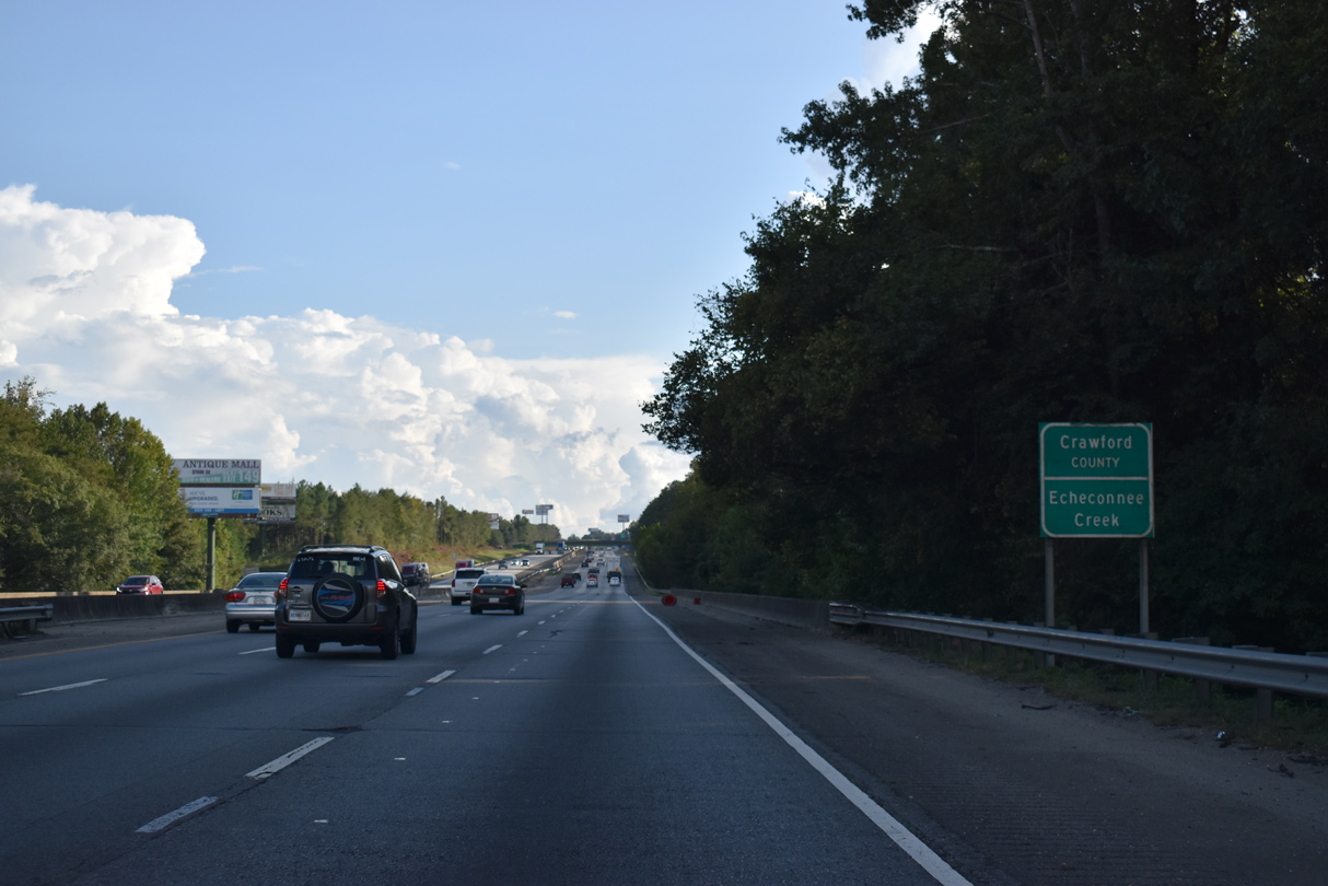
The eastern tip of Crawford County extends across 0.12 miles of Interstate 75 at Echeconnee Creek.
09/11/20

References:
AARoads Wiki. (2025, February 9). List of former state routes in Georgia (200–699). AARoads Wiki. Retrieved March 24, 2026 from https://wiki.aaroads.com/wiki/List_of_former_state_routes_in_Georgia_(200%E2%80%93699)#State_Route_361
Interstate widening project wraps up in Macon. (2013, November 4). Macon Telegraph (GA).
Photo Credits:
- Alex Nitzman: 06/12/17
- Brent Ivy: 07/05/14, 05/25/21, 03/16/26
- Alex Nitzman, JP Nasiatka: 07/25/22
- Andy Field: 05/29/07
- ABRoads: 09/11/20
Connect with:
Page Updated Tuesday March 24, 2026.