
Interstate 80 East - Parsippany to Teaneck

 East
East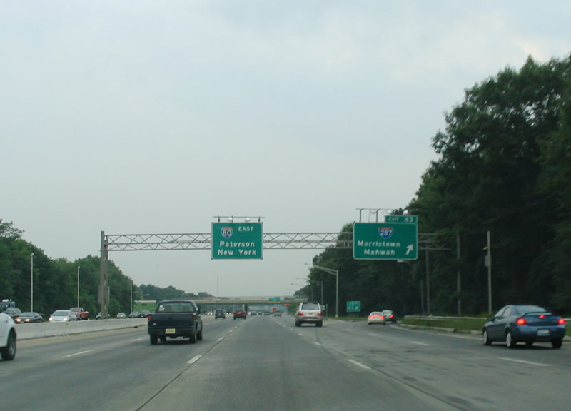
Interstate 80 eastbound at the off-ramp for Interstate 287 at Parsippany in Morris County (Exit 43). I-287 travels 67.54 miles around the North Jersey metropolitan area between Mahwah and Edison. The freeway travels north from Interstate 80 to Boonton through Pompton Lakes and Oakland to the New York Thruway (I-87). Southward, I-287 travels to Morristown, Somerville, and Piscataway.
08/11/04
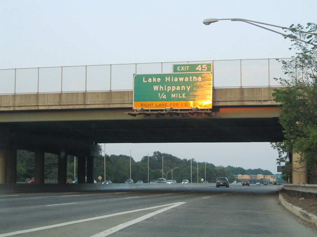
Passing under Interstate 287, Interstate 80 next meets a half diamond interchange (Exit 45) with Beverwyck Road (CR 637). Beverwyck Road leads north to Lake Hiawatha. CR 637 leads south to Troy Hills and Whippany as Troy Hills Road.
06/13/05
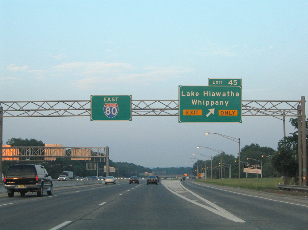
Exit 45 departs the Interstate 80 eastbound mainline for the collector distributor roadway that runs between Interstates 287 and 280. The c/d roadway carries all travelers bound for I-80 east from both I-287 north and Smith Road.
06/13/05
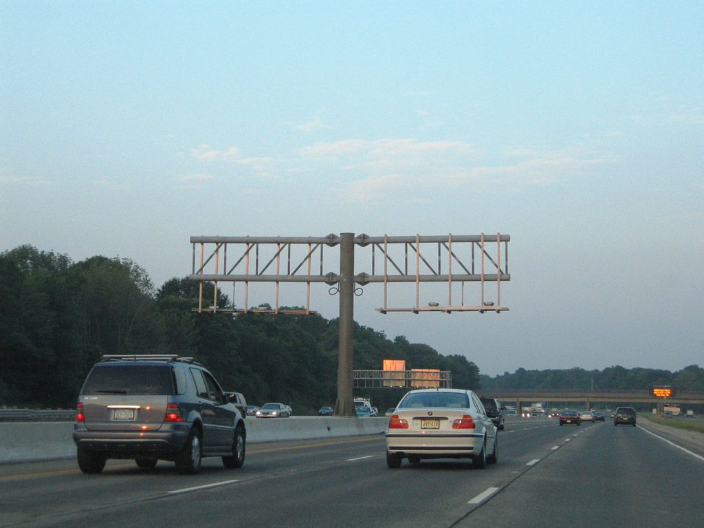
These overhead assemblies were left-over from the aborted HOV-lane project on Interstate 80 in 1998. The HOV lan ran 10.5 miles between Exits 34 and 43.1
06/13/05
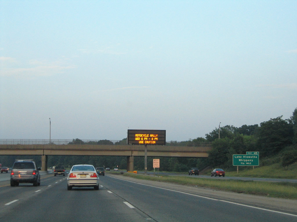
Baldwin Road passes over Interstate 80 east and its c/d roadway, 0.75 miles west of Beverwyck Road (Exit 45). I-80 totals ten overall lanes along this stretch.
06/13/05
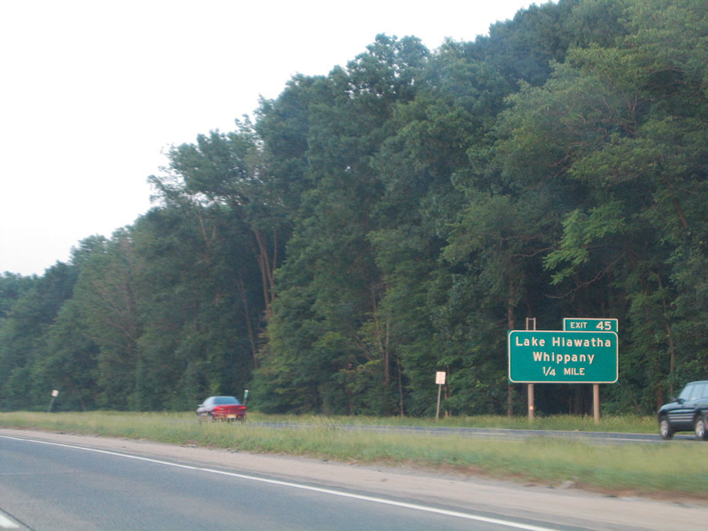
One-quarter mile out from Exit 45. Lake Hiawatha lies north of U.S. 46 and east of Jersey City Reservoir. Whippany lies at the cross roads of Morris County 511 (Parsippany Road) and Route 10.
06/13/05
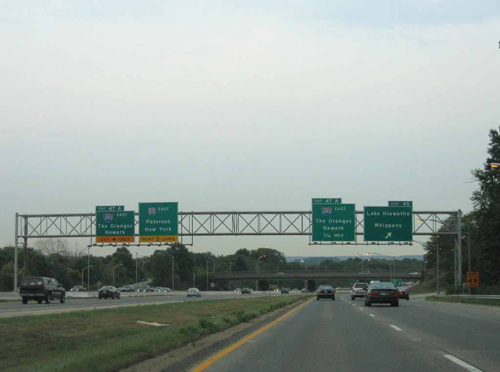
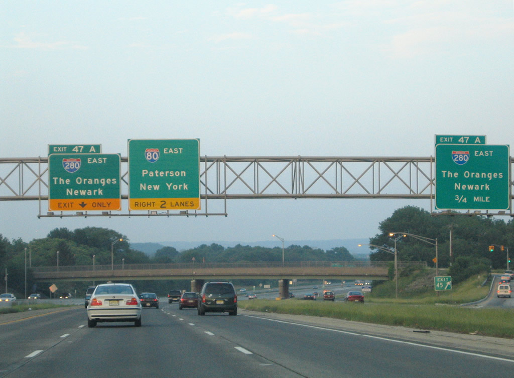
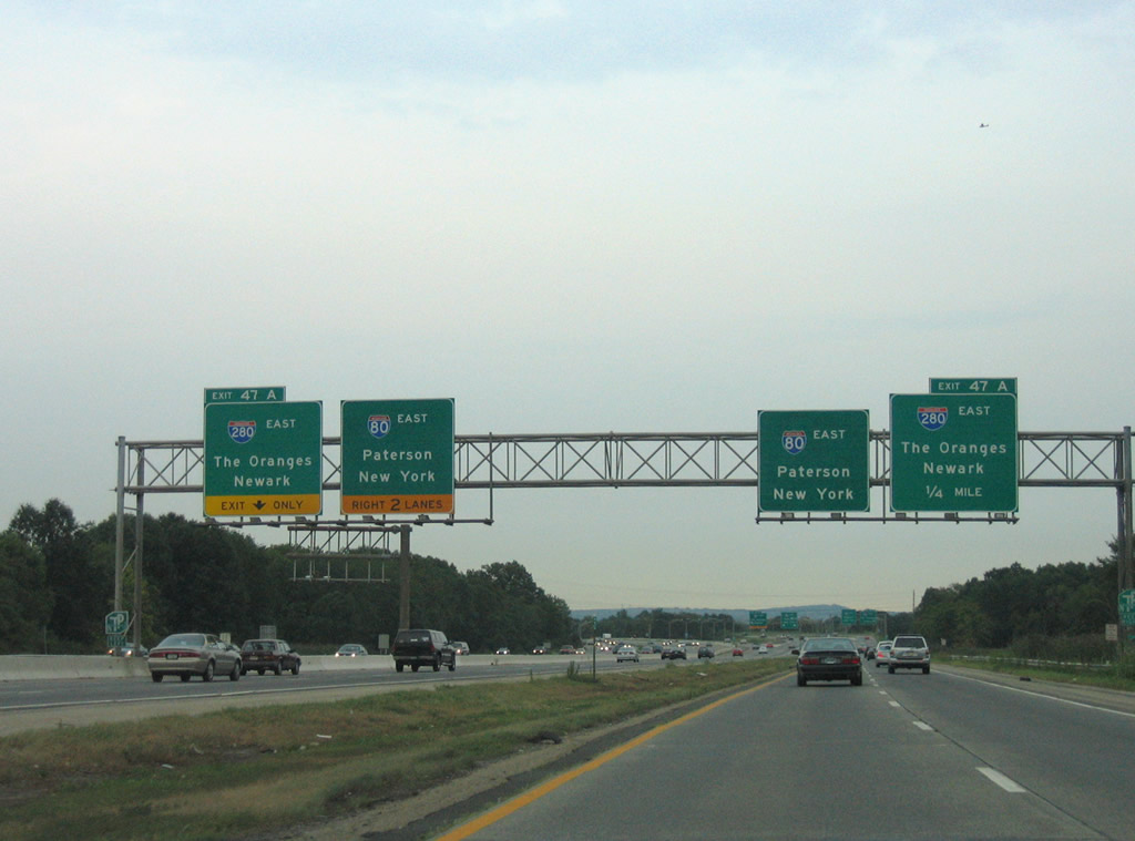
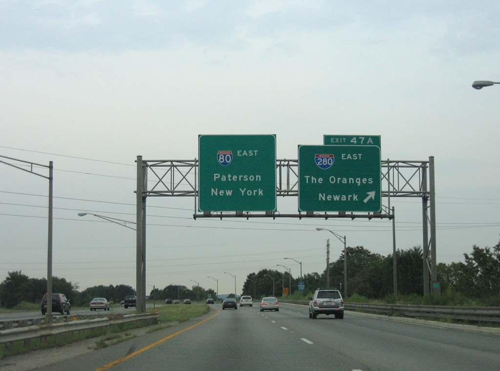
Interstate 80 continues east from Beverwyck Road (CR 637) to split with I-280 east at a wye interchange (Exit 47A). I-280 angles southeast to the New Jersey Turnpike by way of Roseland, the Oranges, Newark and Harrison.
08/29/05
06/13/05
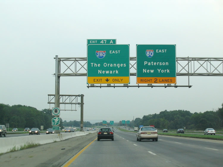
Ramps to Interstate 280 depart both the Interstate 80 eastbound mainline and c/d roadway emanating from I-287. I-280 leads 12 miles southeast to Newark.
08/11/04
08/29/05
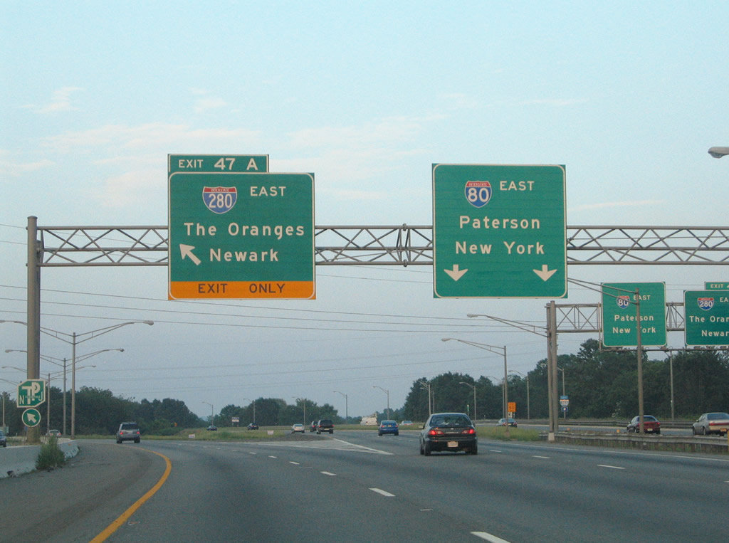
Exit 47A branches southward onto I-280 east by Troy Meadows. The urban loop totals 17.85 miles from I-80 to the New Jersey Turnpike at Kearny.
06/13/05
08/29/05
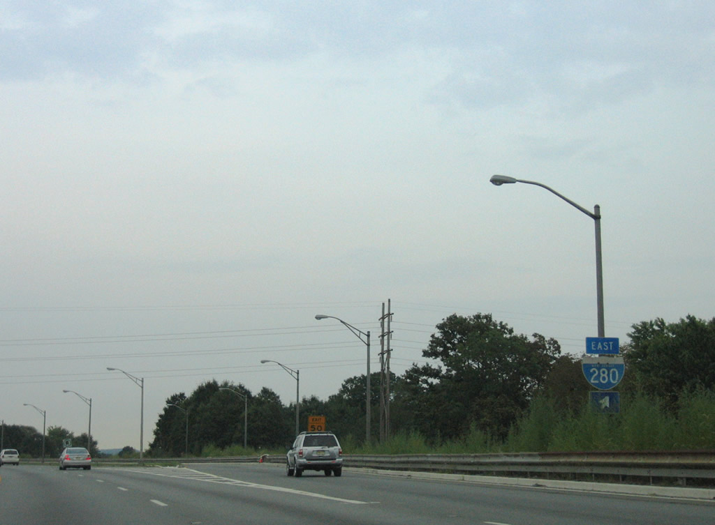
Interstate 280 shield posted at the eastbound beginning of the freeway.
08/29/05
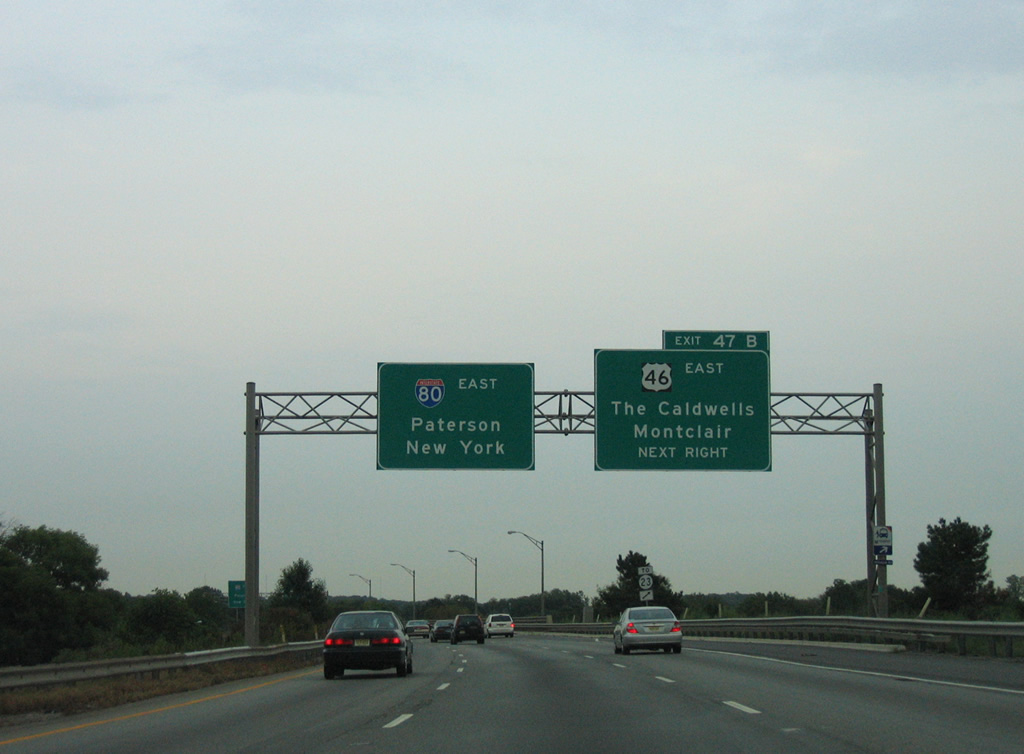
The c/d roadway combines with the I-80 eastbound mainline just ahead of Exit 47B onto U.S. 46 east to Pine Brook and Montville Township. U.S. 46 parallels the south side of I-80 to Route 159.
08/29/05
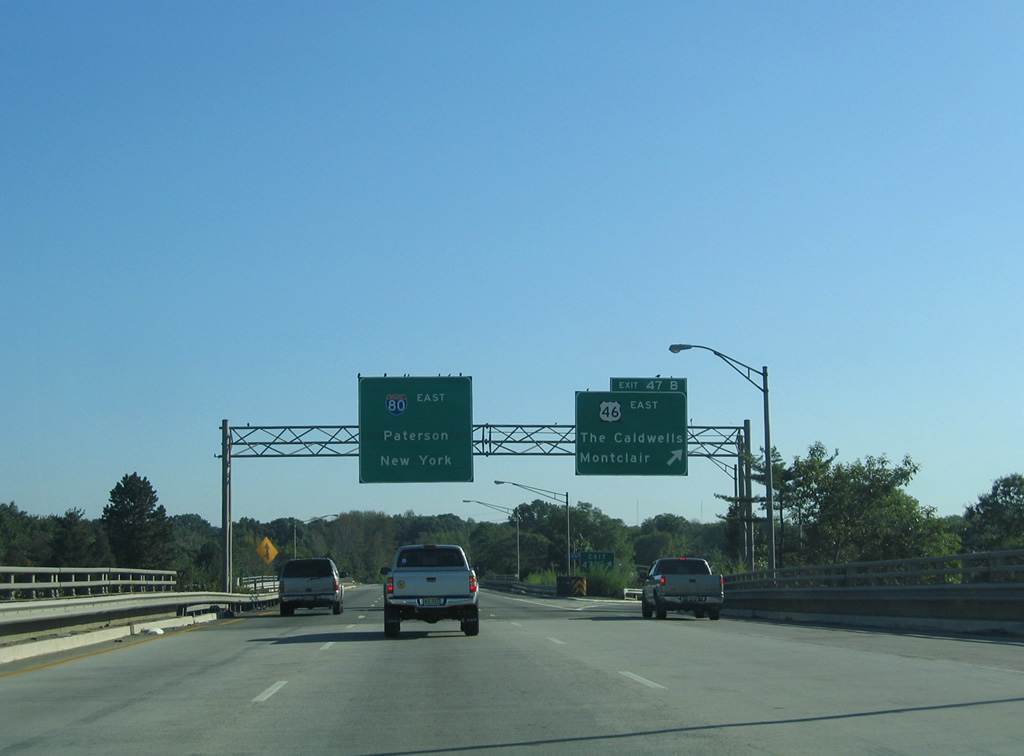
U.S. 46 and Route 159 split two miles to the east of Exit 47B at a wye interchange. Route 159 connects U.S. 46 with County Route 506 east through the Caldwells and Montclair Township while U.S. 46 turns northeast to Fairfield Township.
09/30/05
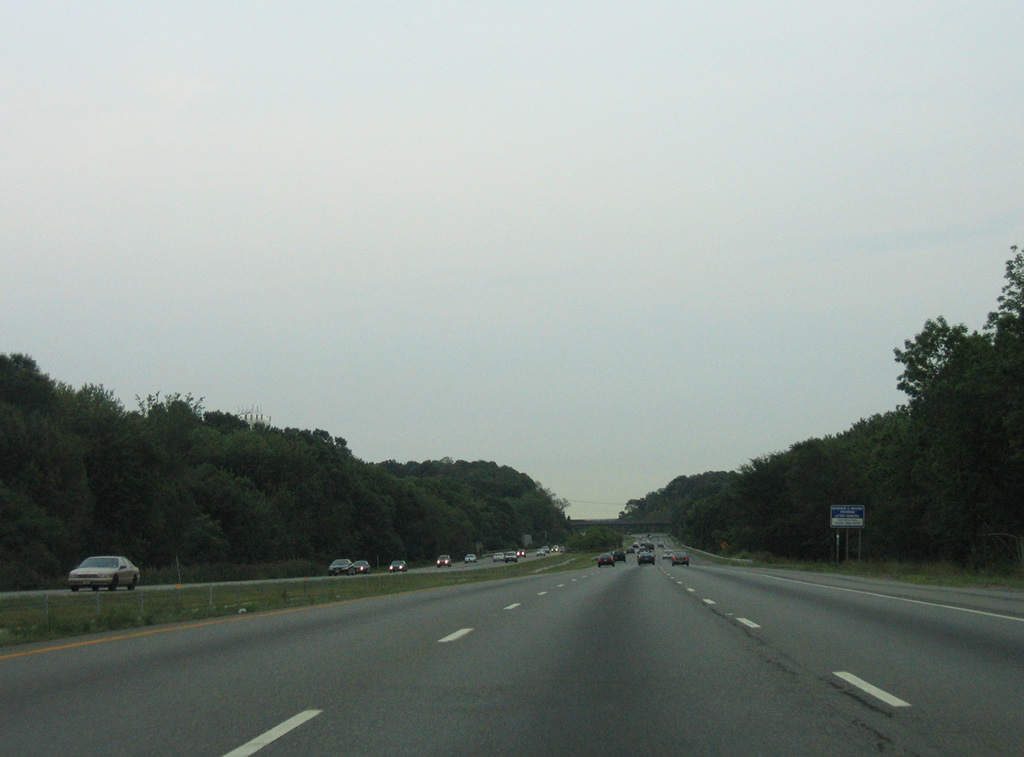
Interstate 80 winds northeast from Montville Township to Great Piece Meadows through Fairfield Township. A seven mile exit less stretch ensues.
08/29/05
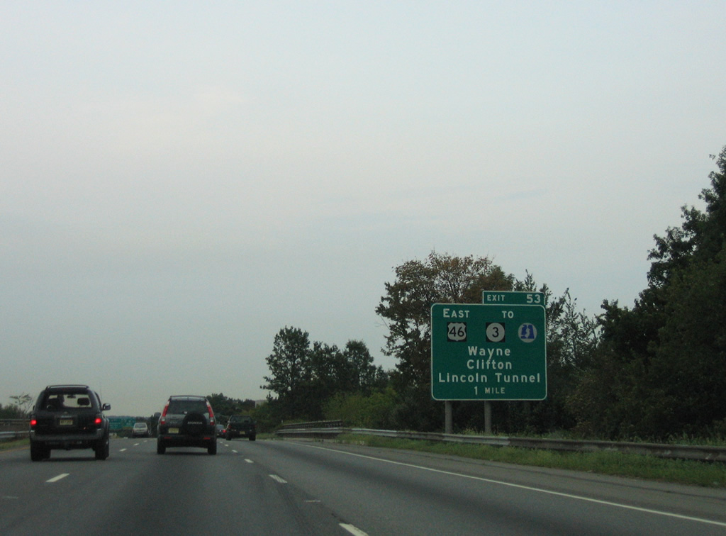
An on-ramp joins I-80 east from CR 613 (Two Bridges Road) ahead of the Passaic River into both Passaic County and Wayne Township. Meeting I-80 next is New Jersey 23 south to U.S. 46 east by Willowbrook Mall.
08/29/05

U.S. 46 veers away from Interstate 80 at Exit 53, looping southeast to Totowa, Woodland Park and Clifton.
08/29/05
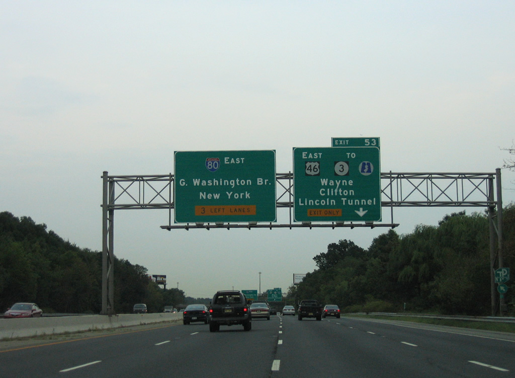
Route 3 splits with U.S. 46 in Clifton for a 10.84 mile route to East Rutherford (home of the Meadowlands sports complex), Secaucus and Route 495 east to the Lincoln Tunnel.
08/29/05
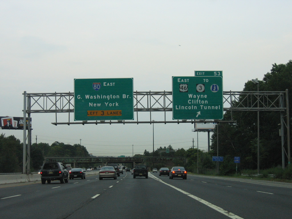
New Jersey 23 crosses Interstate 80 at the directional interchange (Exit 53) with adjacent U.S. 46. The state route runs 6.82 miles between U.S. 202 at Mountain View and CR 506 in Verona Township. There is no access to Route 23 from I-80 east.
08/29/05
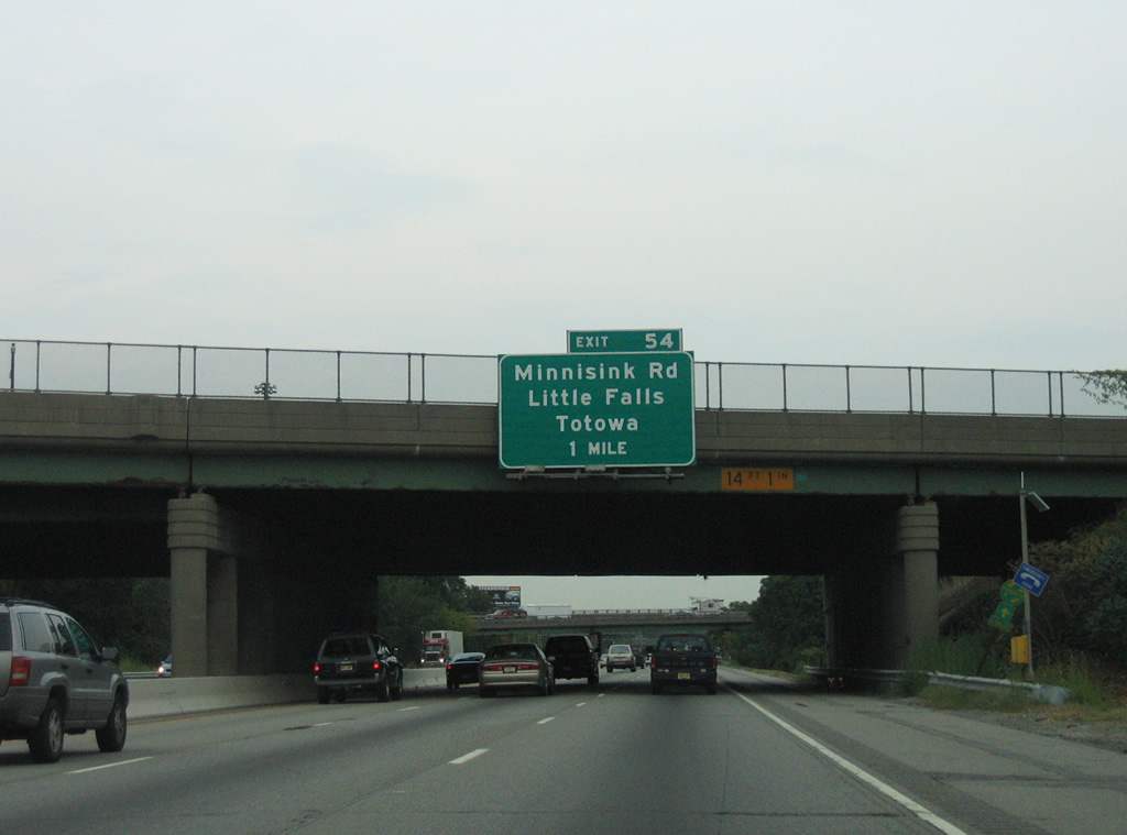
Passing under Route 23, one mile ahead of the half diamond interchange (Exit 54) with Minnisink Road (CR 642) on I-80 east.
08/29/05
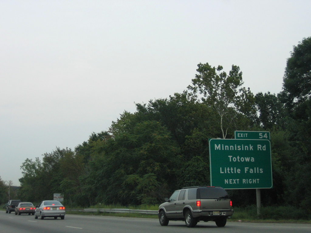
Minnisink Road angles northeast from CR 640 (Riverview Drive) and U.S. 46 to CR 644 (Totowa Road) within the borough of Totowa.
08/29/05
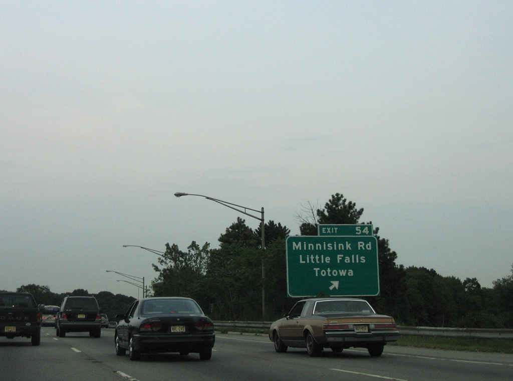
Exit 54 leaves I-80 east for Minnisink Road (CR 642). CR 640 (Riverview Drive) south from the end of CR 642 leads motorists to Little Falls Township.
08/29/05
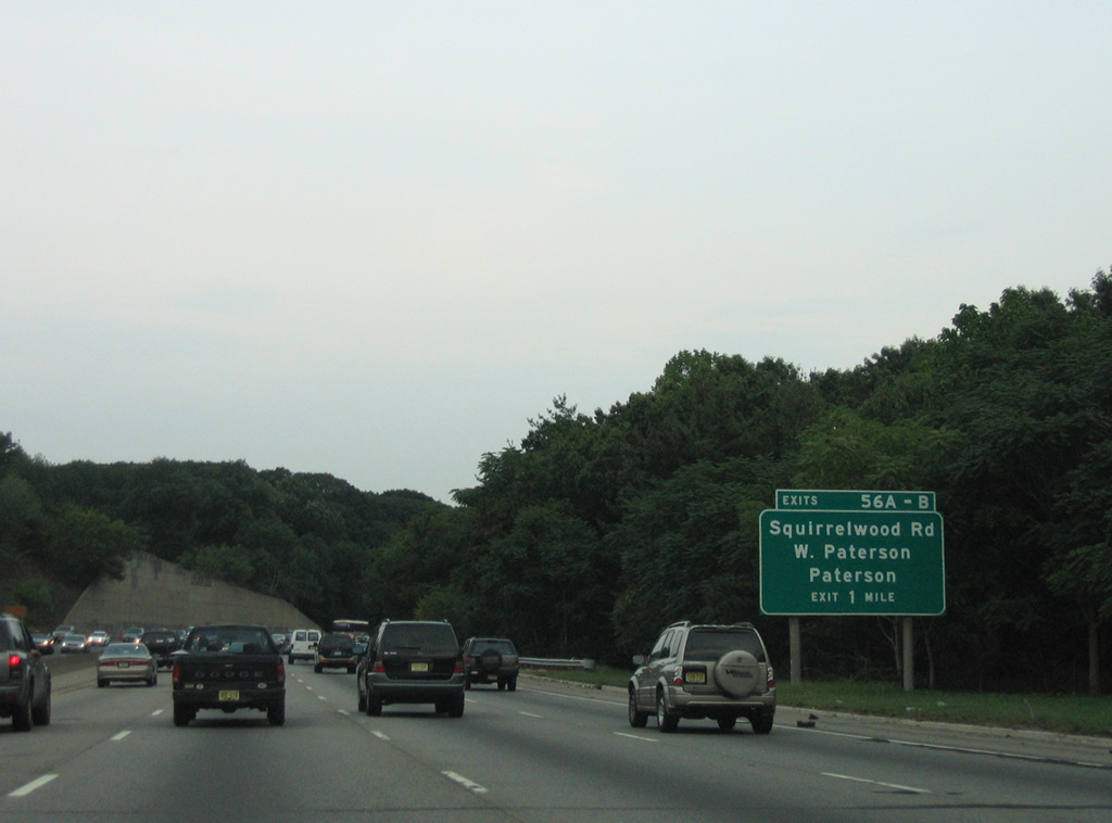
A pair of ramps add traffic from CR 646 (Union Boulevard) in Totowa. I-80 winds along the hill side abutting the Passaic River toward West Paterson in the borough Woodland Park.
08/29/05
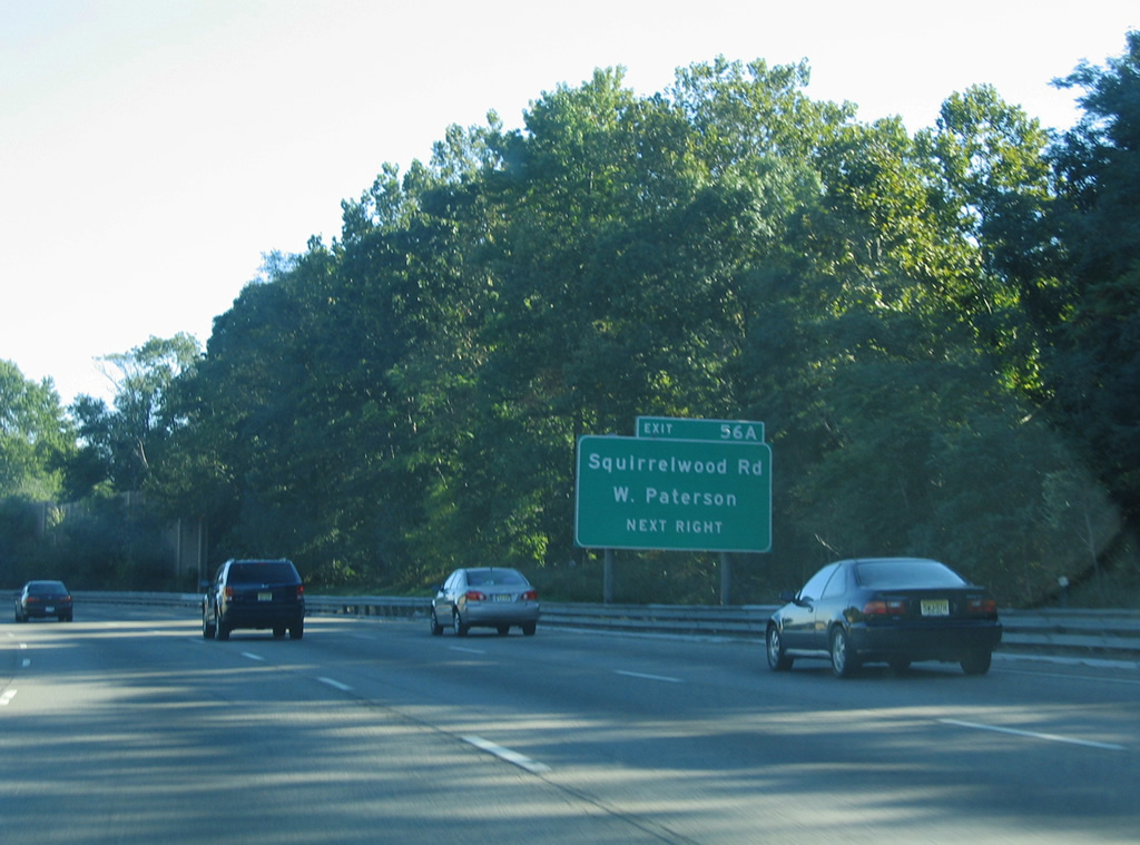
A six-ramp parclo interchange joins Interstate 80 with Squirrelwood Road (CR 636) at West Paterson.
09/30/05
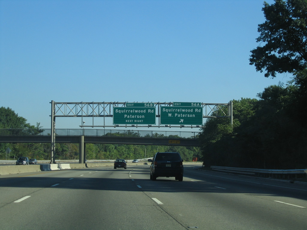
Exit 56A departs Interstate 80 east for Squirrelwood Road (CR 636) south. CR 636 south ends at CR 633 (Rifle Camp Road) ahead of Garrett Mountain Reservation.
09/30/05
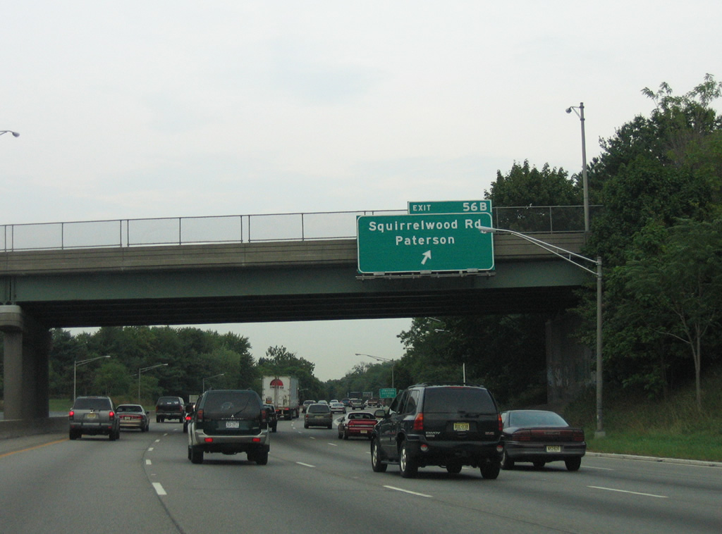
Squirrelwood Road becomes Nagle Street through a residential area of Paterson to the north of Exit 56B.
08/29/05
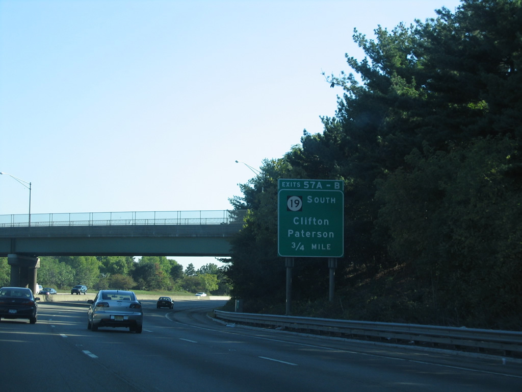
Turning more easterly, Interstate 80 enters the city of Paterson ahead of the directional cloverleaf interchange (Exits 57A/B) with Route 19.
09/30/05
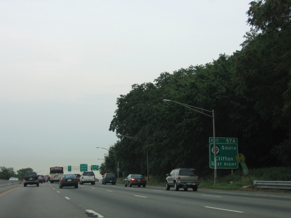
Route 19 follows a freeway south to both County Route 509 (Broad Street) and the Garden State Parkway in Clifton.
08/29/05
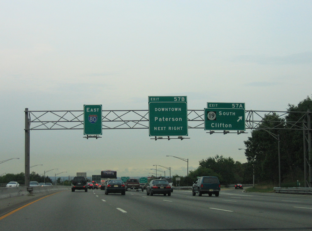
Exit 57A parts ways with I-80 east for Route 19 south to Clifton. The state route concludes a 2.93 mile route at U.S. 46 and CR 509.
08/29/05
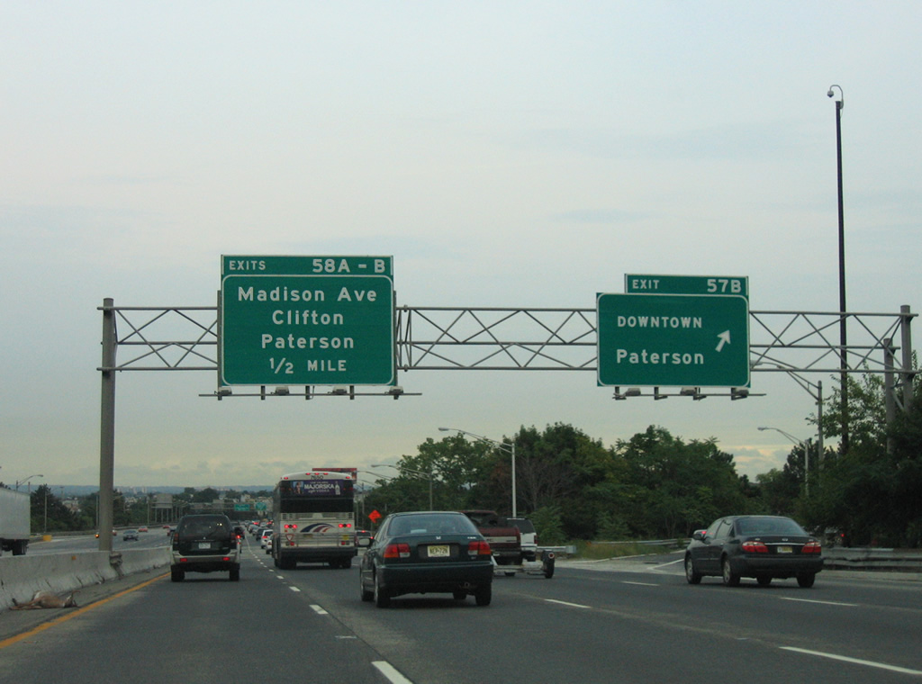
Exit 57B loops onto Route 19 north ahead of the freeway end at Oliver Street. The state route follows Oliver Street east onto Ward Street to end at Main Street (CR 509) in Downtown Paterson.
08/29/05
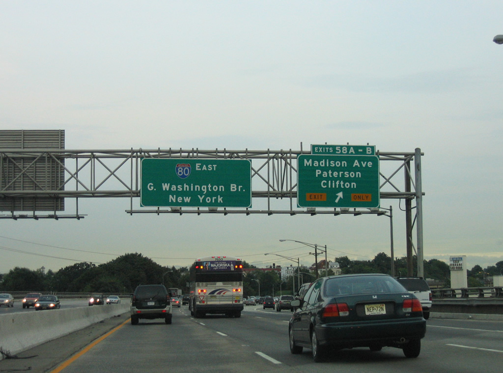
Interstate 80 elevates onto a viaduct from 21st Avenue to a collector distributor roadway (Exits 58A/B) for Madison Avenue (CR 649).
08/29/05
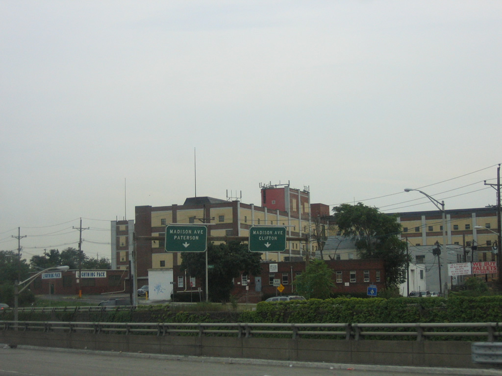
Madison Avenue ends at Main Street (CR 601) to the southwest, with Main Street providing a route south to Clifton.
08/29/05
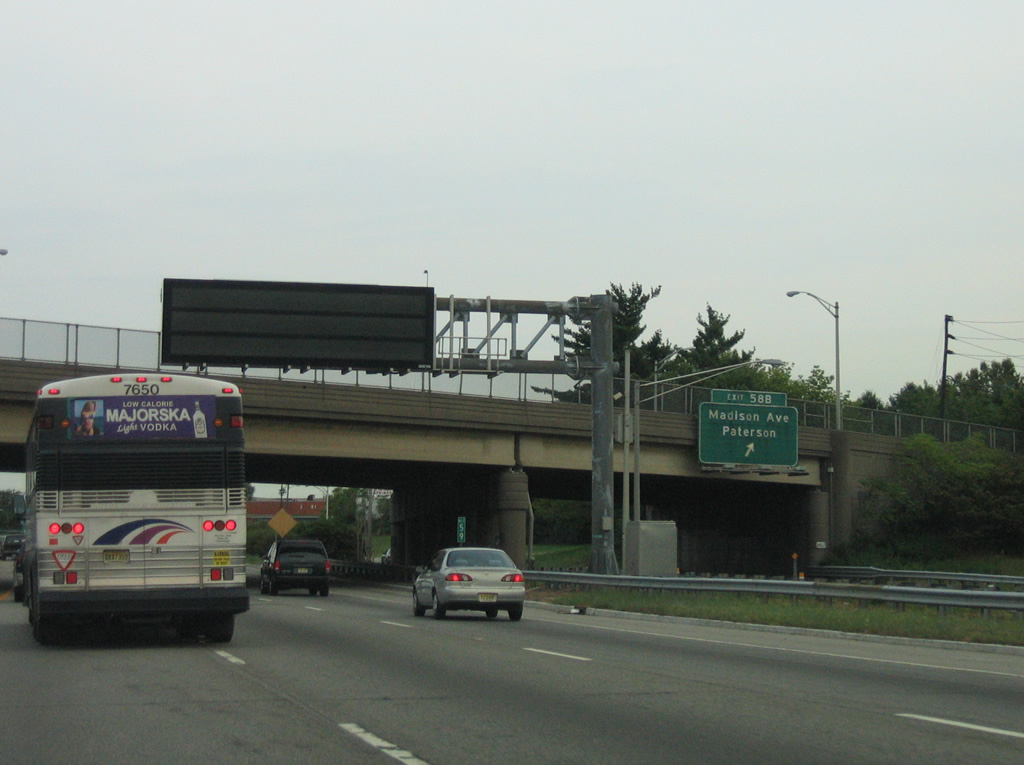
Northward from Exit 58B, Madison Avenue (CR 649) traverses the Paterson street grid to Riverside and New Jersey 20 (1st Avenue).
08/29/05
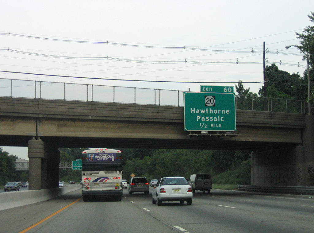
New Jersey 20 meanders southward alongside the Passaic River from CR 504 (River Street / Lincoln Avenue) across from Hawthorne to meet Interstate 80 directly at Exit 60.
08/29/05
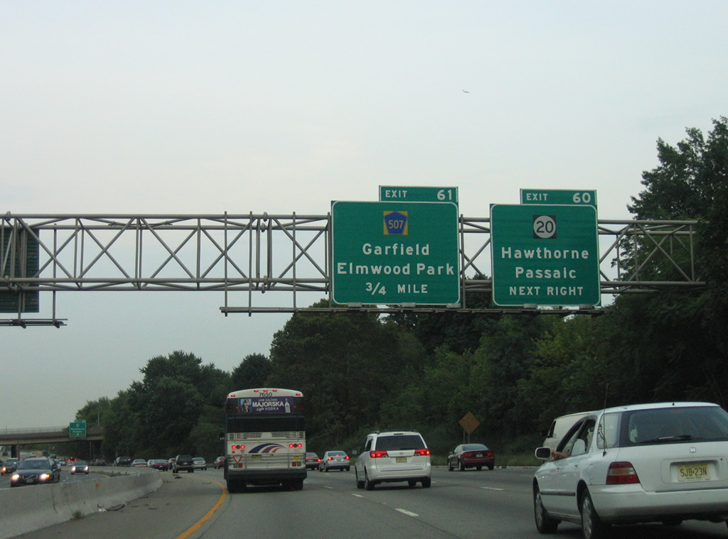
New Jersey 20 ends just south of Exit 60 at U.S. 46 on the Clifton city line. U.S. 46 west to New Jersey 21 south leads motorists into the city of Passaic. County Route 507 mirrors the Passaic River to the east from Exit 61 south to Garfield.
08/29/05
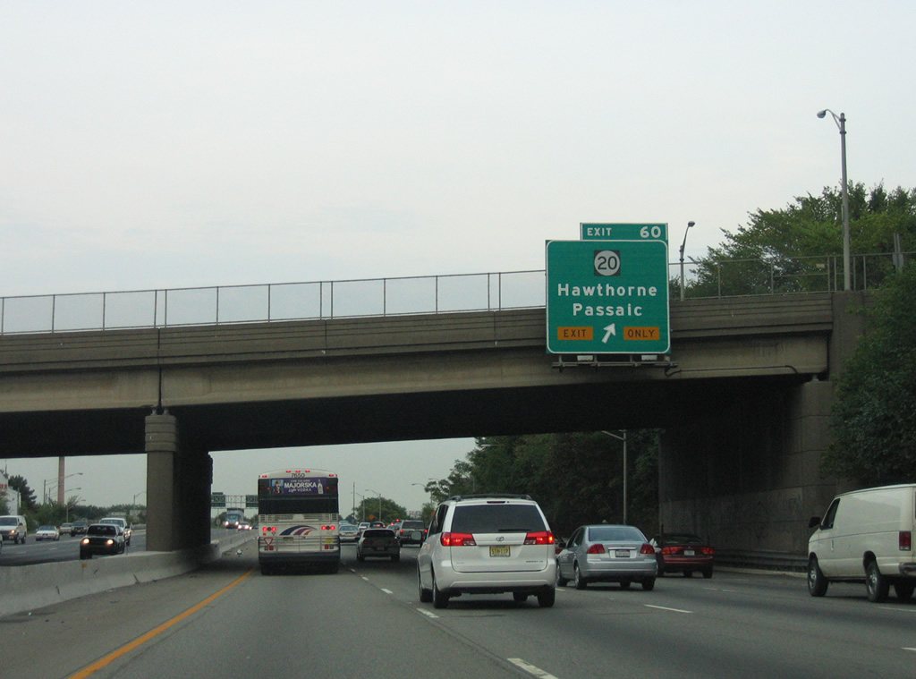
Traffic to Route 20 north to Hawthorne and south to Passaic departs I-80 east in unison at Exit 60. A directional interchange (Exit 60) along the Passaic River shuttles motorists to the 4.15 mile state route.
08/29/05
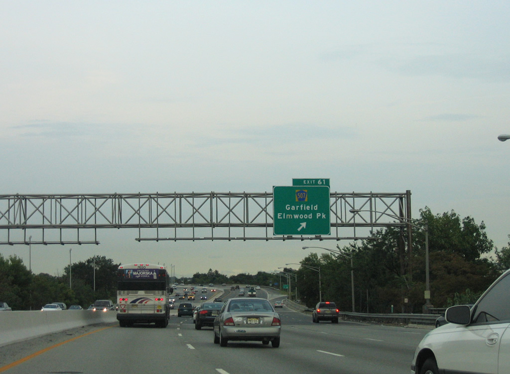
Interstate 80 spans the Passaic River into the borough of Elmwood Park. A parclo interchange (Exit 61) with County Route 507 (River Drive) follows.
08/29/05
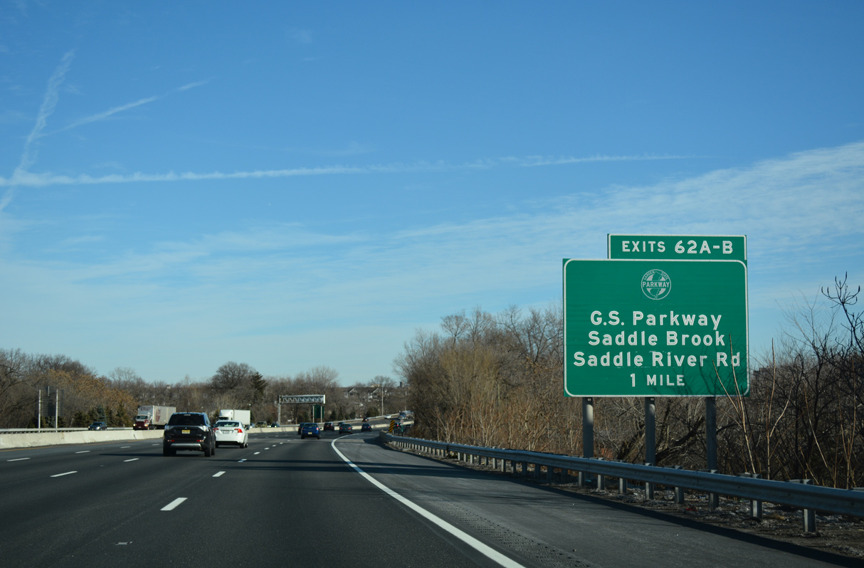
The Garden State Parkway (GSP) angles northeast from Clifton to converge with Interstate 80 at Elmwood Park. A trumpet interchange (Exit 62 A) and access road connect the two routes in one mile.
12/19/16
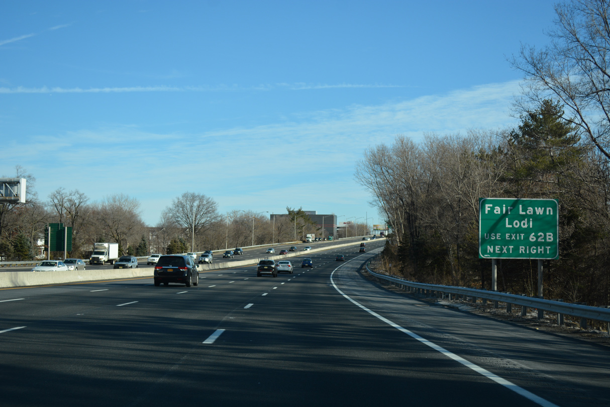
A collector distributor roadway separates from I-80 east at Exit 62 for both the GSP and Saddle River Road (CR 79). Saddle River Road parallels the river northward to the borough of Fair Lawn.
12/19/16
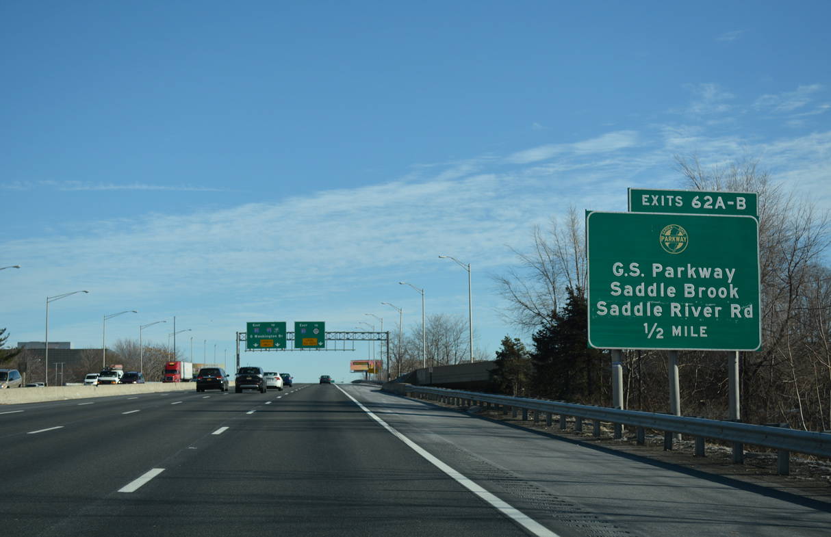
Interstate 80 crosses over the GSP within a half mile of Exit 62. 172 miles in length, the toll road travels the height of the state between Cape May and Chestnut Ridge, New York.
12/19/16

I-80 partitions into a dual freeway with Express and Local lanes east beyond Exit 62. The Express lanes provides an uninterrupted drive to Interstate 95 for the George Washington Bridge at Teaneck Township.
12/19/16
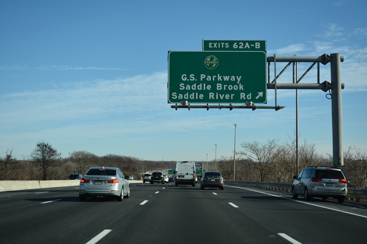
The Garden State Parkway leads north to Paramus and the NYS Thruway and south to East Orange, Newark and Woodbridge.
12/19/16
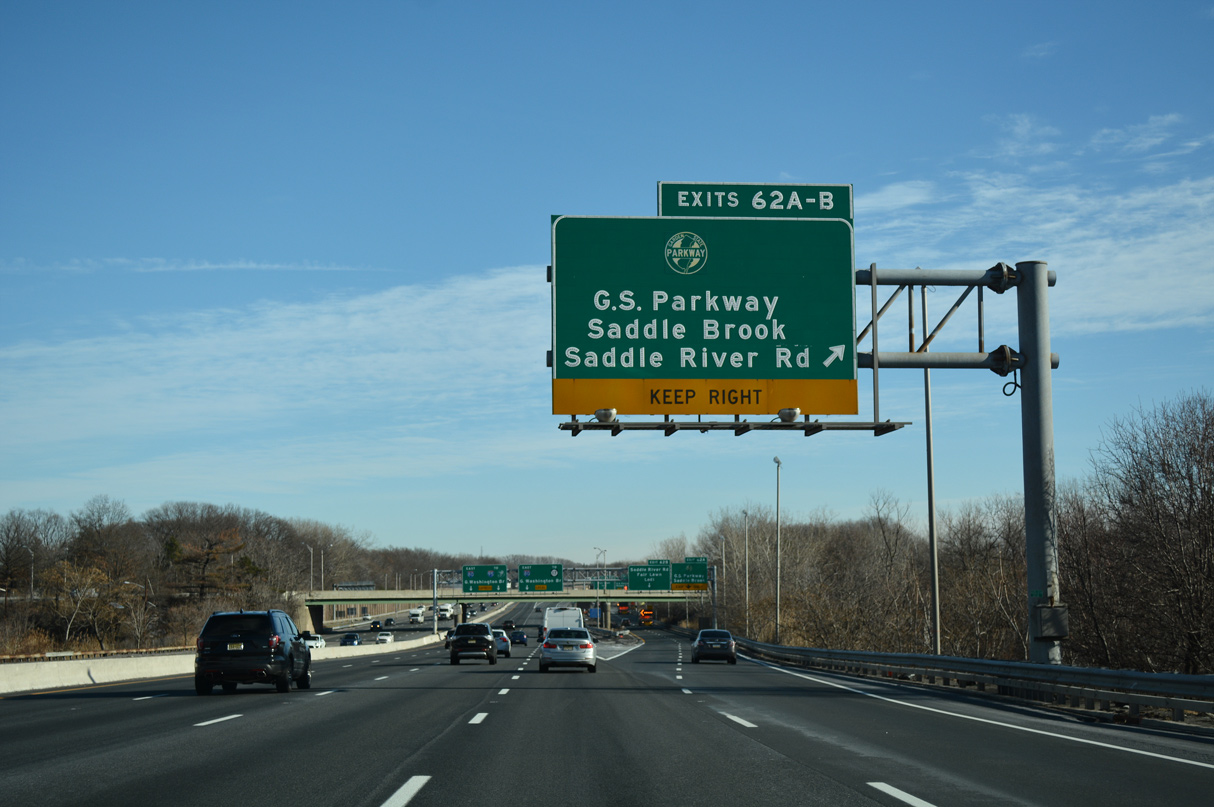
Two lanes depart from I-80 east at Exit 62 in Saddle Brook Township for the access road to the GSP.
12/19/16
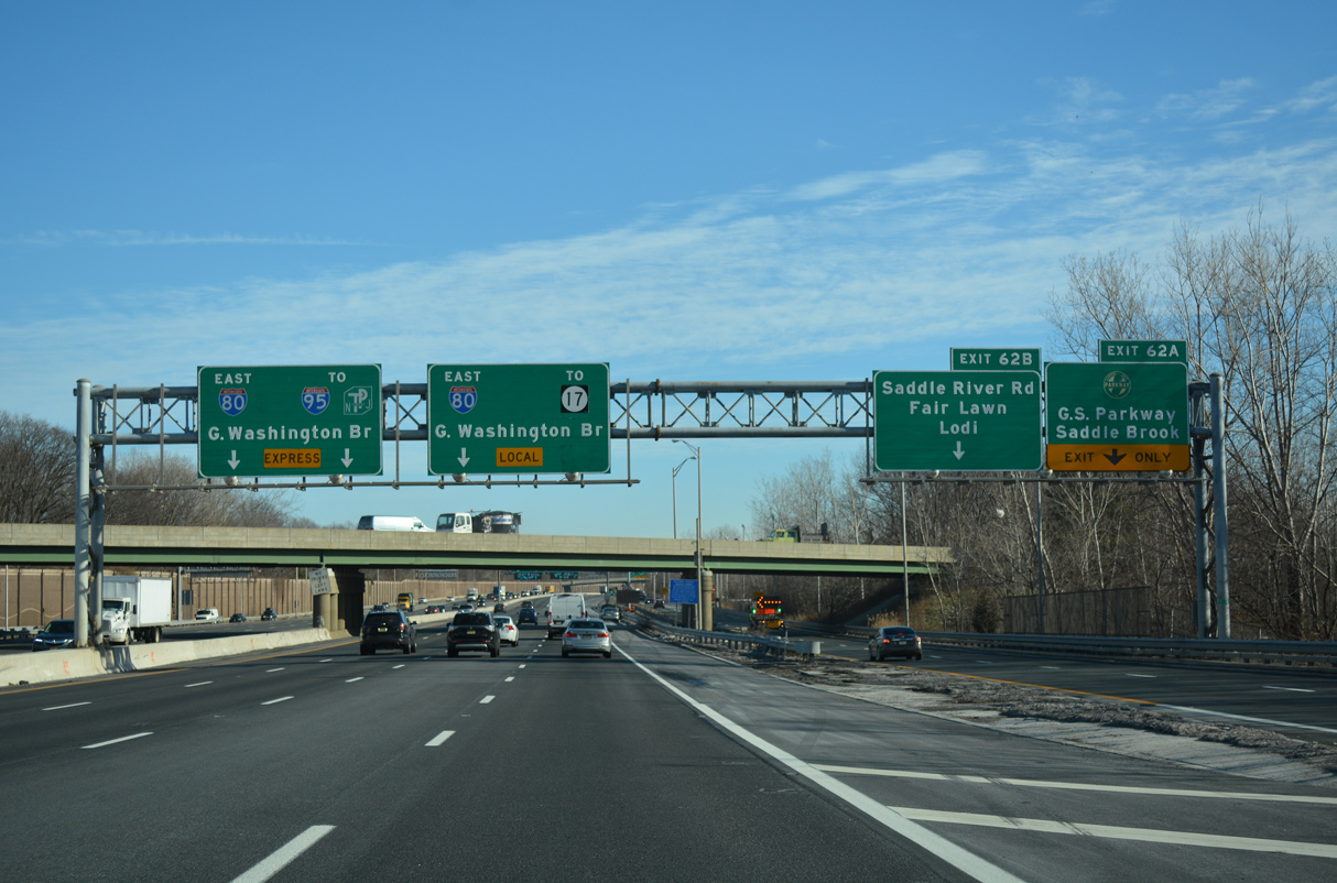
Exit 62 A loops away from the c/d roadway for the Garden State Parkway and a local ramp to Pehle Avenue (CR 105) in Saddle Brook Township.
12/19/16
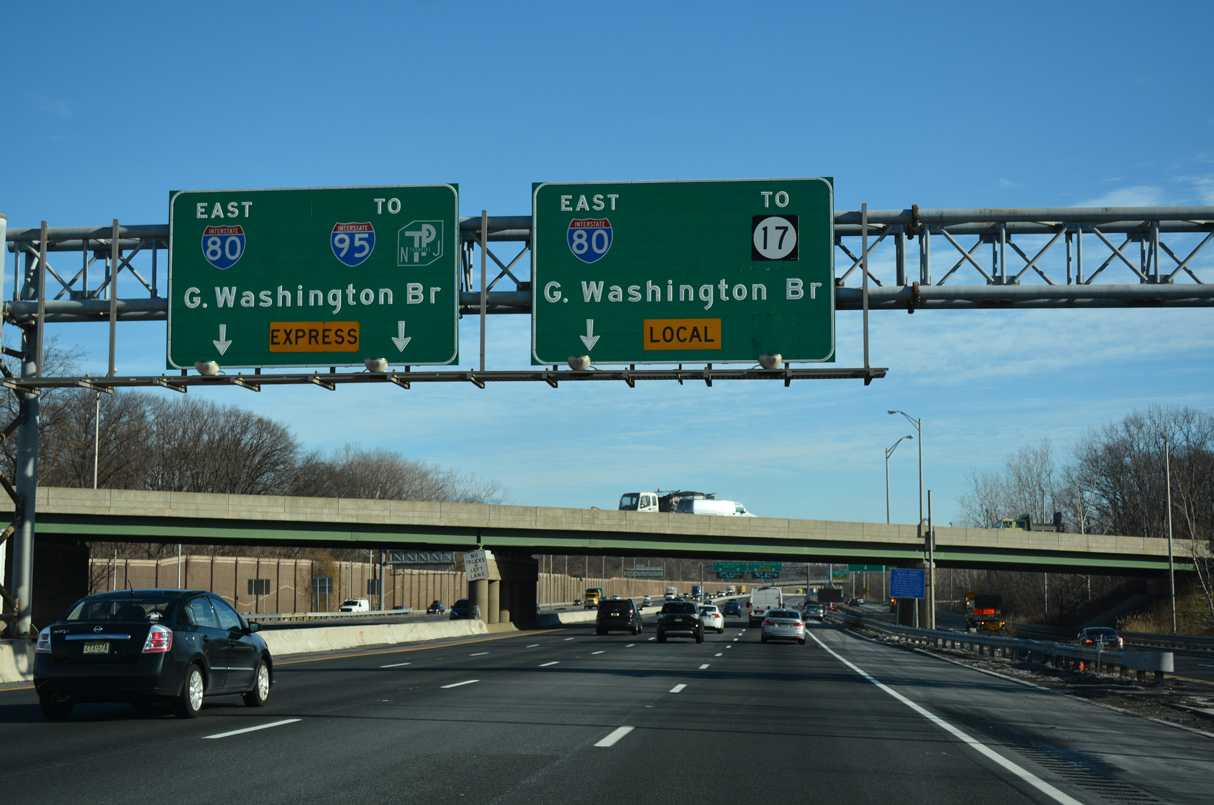
Interstate 80 curves southward from Saddle Brook Township to the borough of Lodi. The succeeding exit from the Local Lanes is for Route 17.
12/19/16
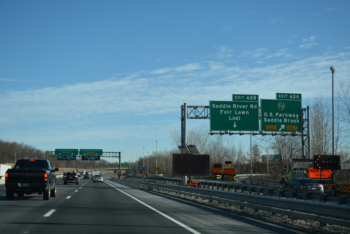
Exit 62 B follows in a half mile to Saddle River Road (CR 79) at Railroad Avenue east into Rochelle Park Township. A small distance sign references New York City at ten miles away.
12/19/16
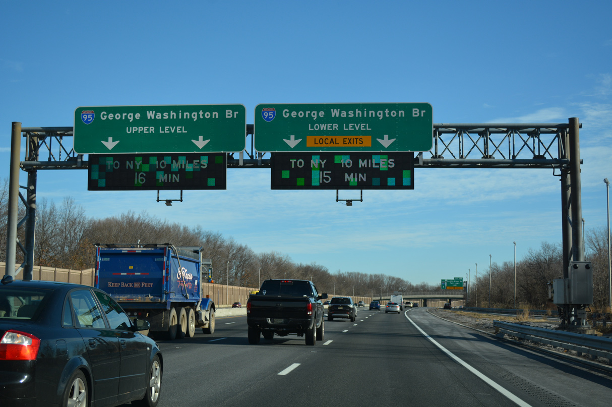
The Express lanes default onto the inner roadway of I-95 north to the Upper Level of the George Washington Bridge (GWB) while the Local Lanes join the outer roadway, with exits to Englewood and Fort Lee, before forming the Lower Level of the GWB.
12/19/16
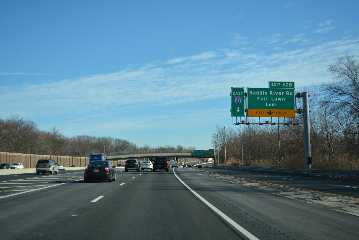
The entrance ramp from the GSP joins the c/d roadway along I-80 ahead of Exit 62 B for Saddle River Road (CR 79) and Railroad Street (CR S61).
12/19/16
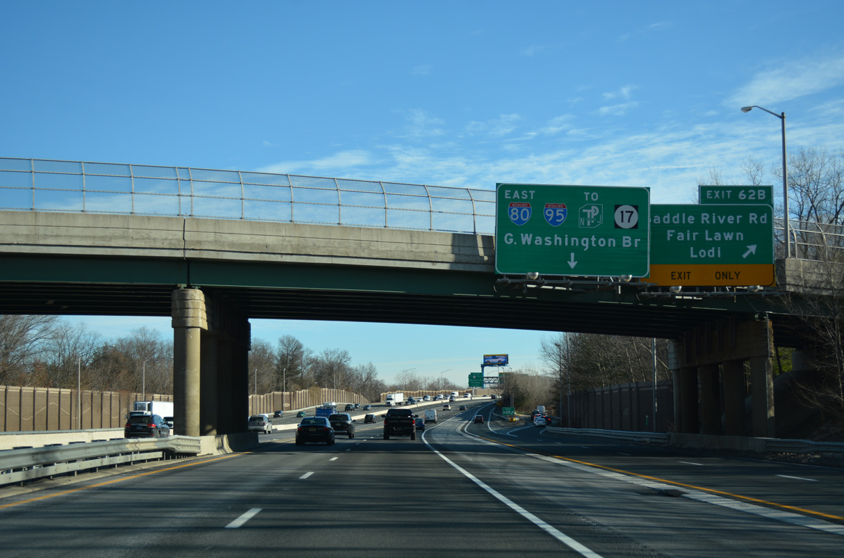
Saddle River Road (CR 79) runs 2.48 miles south from Route 4 in Fair Lawn to Market Street (CR 561), just across the Saddle River from Main Street (CR 61) south into Lodi.
12/19/16
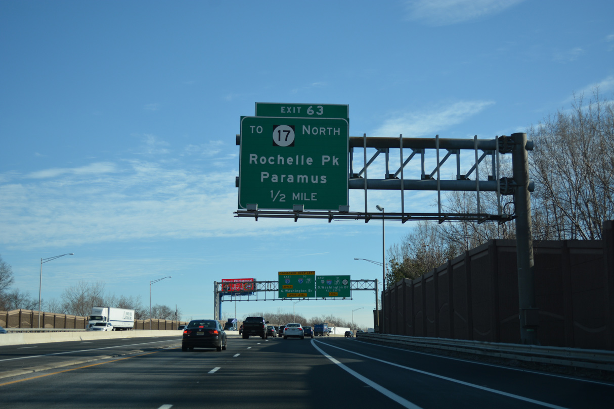
Interstate 80 crosses the Saddle River into Lodi ahead of the diamond interchange (Exit 63) with Riverview Avenue.
12/19/16
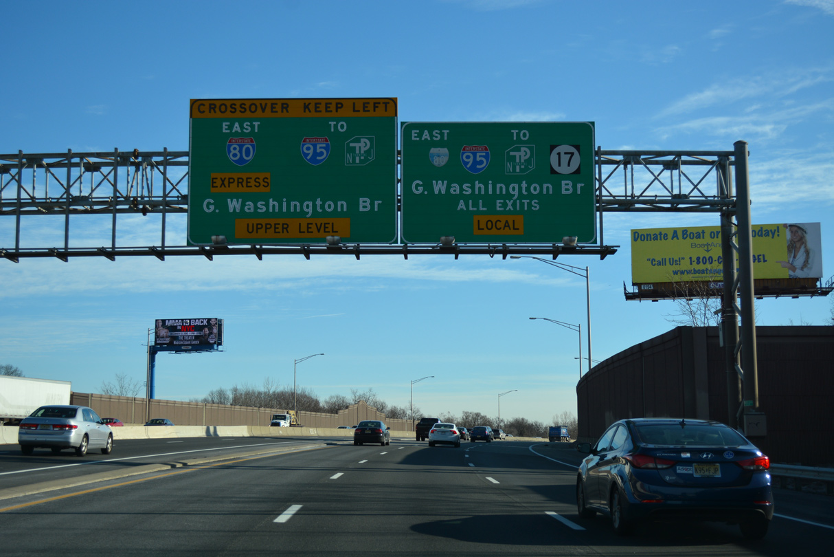
A crossover provides access to the Interstate 80 Express lanes east from the GSP in Lodi.
12/19/16
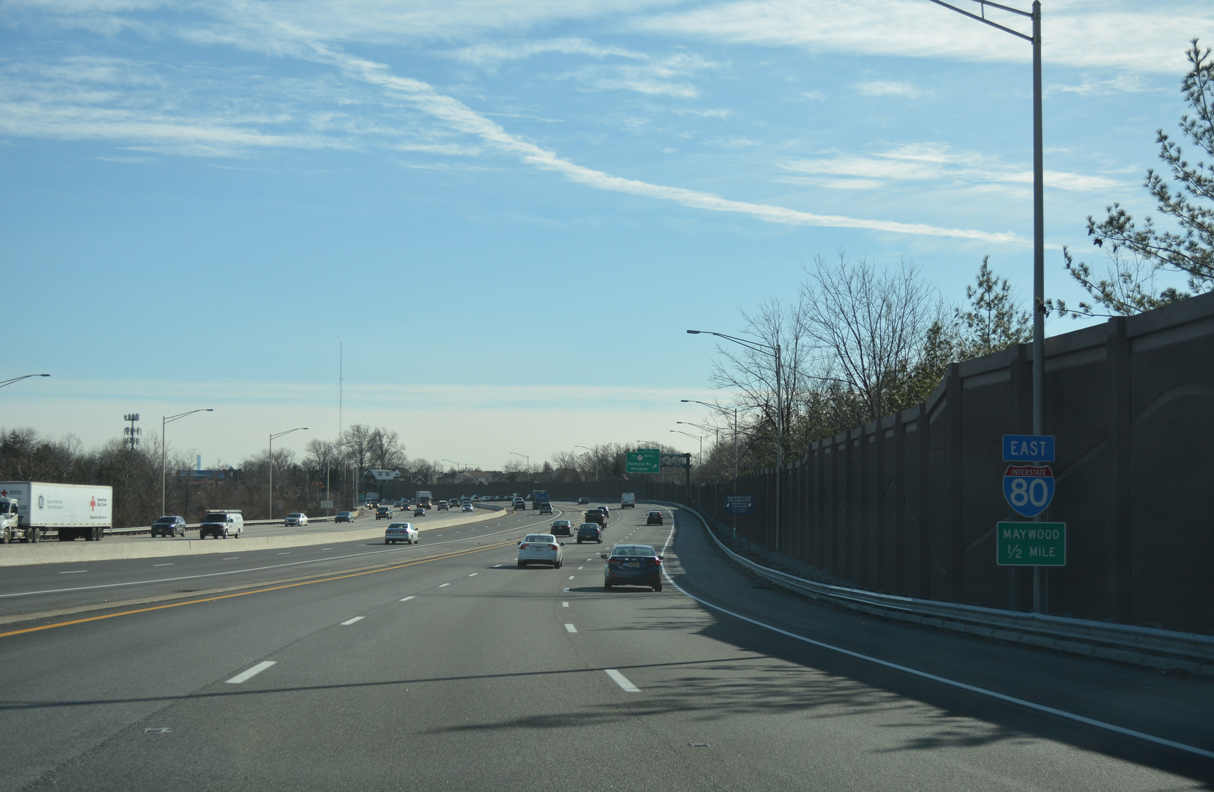
The borough of Maywood lies just east of Exit 63 via parallel Essex Street (CR 561) and Maywood Avenue (CR 59).
12/19/16
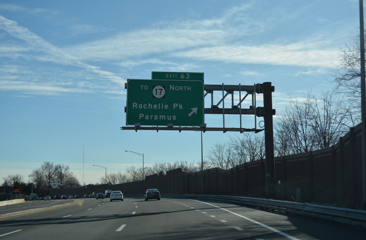
Riverview Avenue ties into adjacent Essex Street (CR 56) for Route 17 north to Rochelle Park and Paramus.
12/19/16
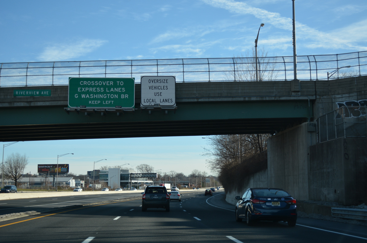
Passing under Riverview Drive, the forthcoming crossover to the Express Lanes departs next from the Local lanes.
12/19/16
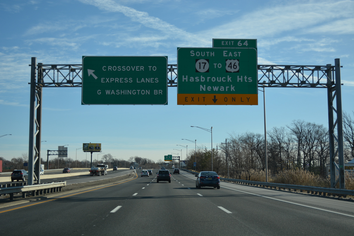
The roadways of Route 17 separate ahead of Exit 64 to run along the outside of I-80. Exit 64 follows the Express lane crossover for Route 17 south to U.S. 46 at Hasbrouck Heights.
12/19/16
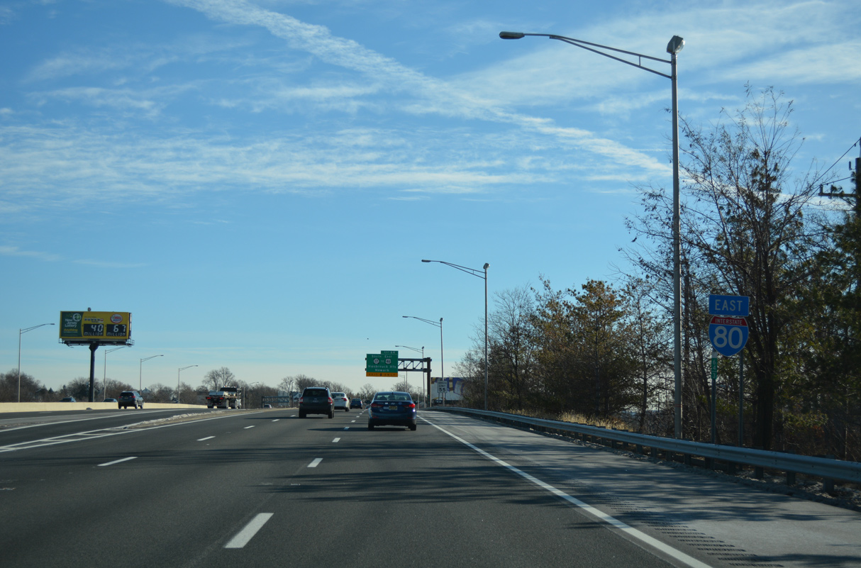
Interstate 80 enters southwest Hackensack at Exit 64 for Route 17 south.
12/19/16
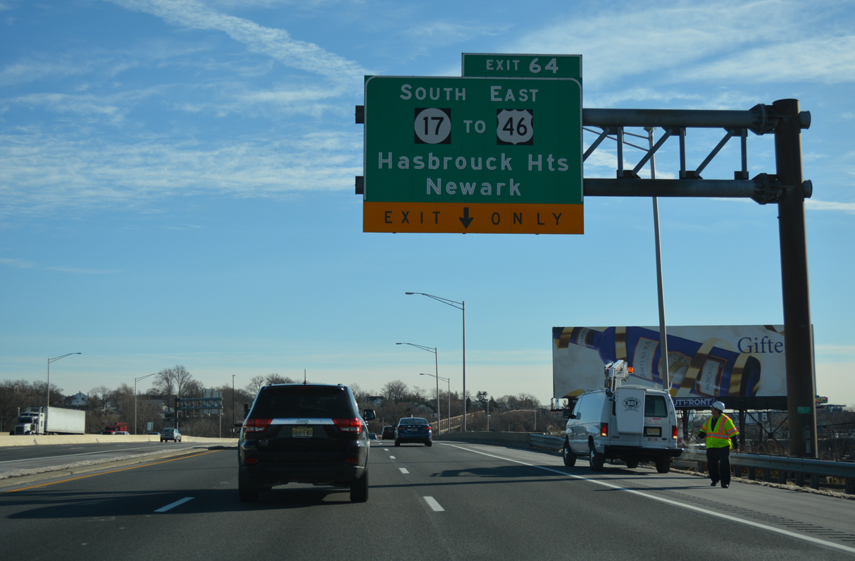
Route 17 south ends at Route 7 on the Kearny and North Arlington borough line, just east of Newark. The multi state route travels 26.81 miles in New Jersey and 397 miles in New York.
12/19/16
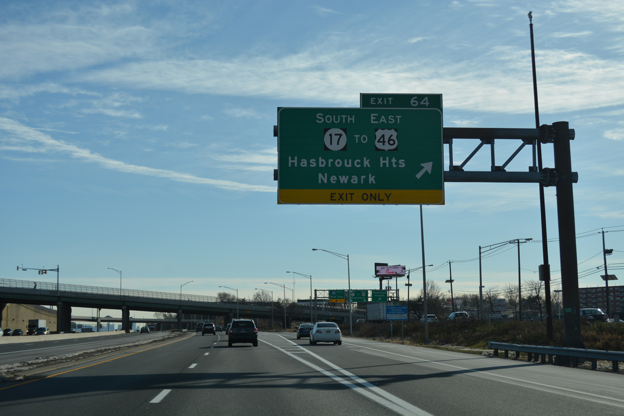
Route 17 turns away from I-80 south into the borough of Hasbrouck Heights from Exit 64 and Summit Avenue (CR 57) in Hackensack. U.S. 46 travels nearby from Lodi east to Teterboro and Little Ferry.
12/19/16
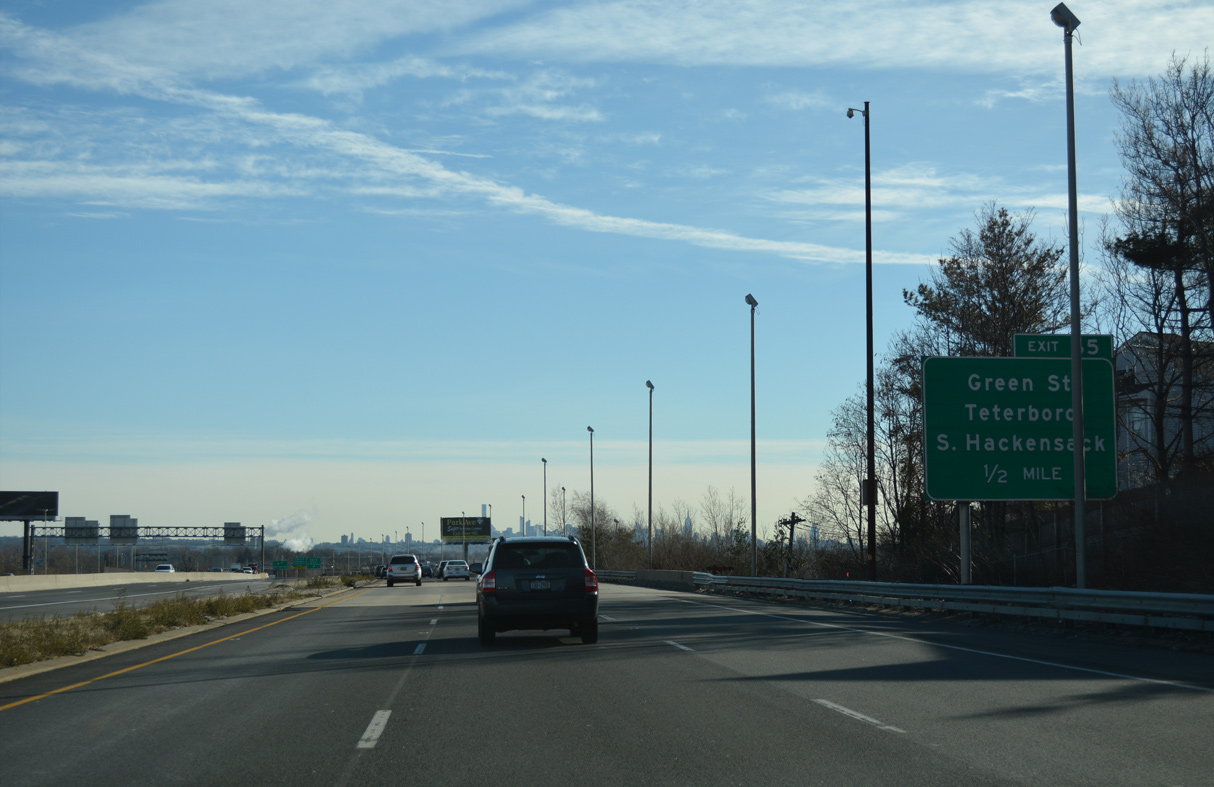
A half diamond interchange adds traffic from Polifly Road (CR 55) ahead of Exit 65 onto North Street in Teterboro.
12/19/16
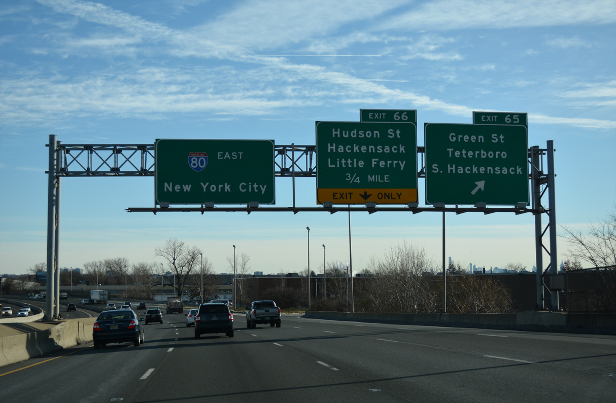
Adjacent North Street parallels I-80 between Green Street and Huyler Street (CR S40) at South Hackensack Township.
12/19/16
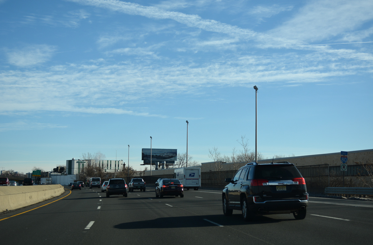
Confirming marker posted east of the RIRO ramps (Exit 65) with North Street in Teterboro.
12/19/16
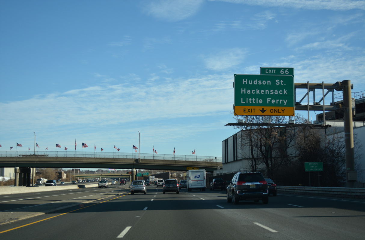
Interstate 80 reenters the city of Hackensack at Exit 66.
12/19/16
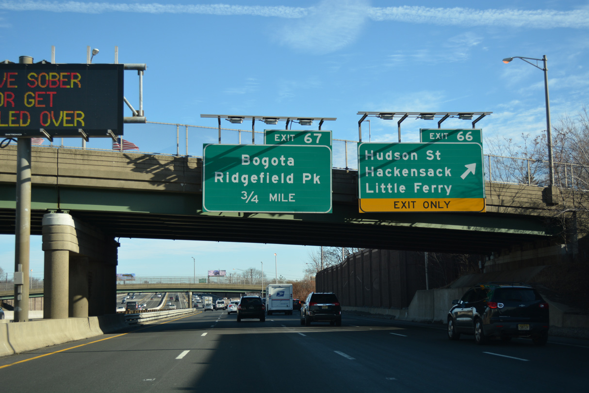
Exit 66 leaves the Local lanes for Vreeland Avenue at Williams Avenue. Vreeland Avenue ties into Hudson Street (CR 124) three blocks to the east. Hudson Street leads north to Downtown Hackensack and south to Little Ferry Borough.
12/19/16
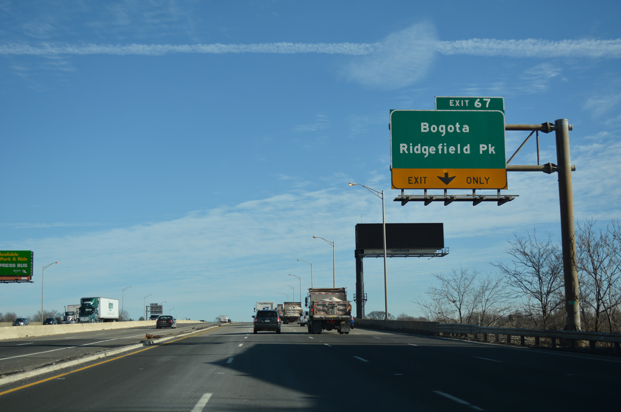
Interstate 80 rises to cross the Hackensack River east into the village of Ridgefield Park. Exit 67 follows at a half diamond interchange with North Avenue at 2nd Street.
12/19/16
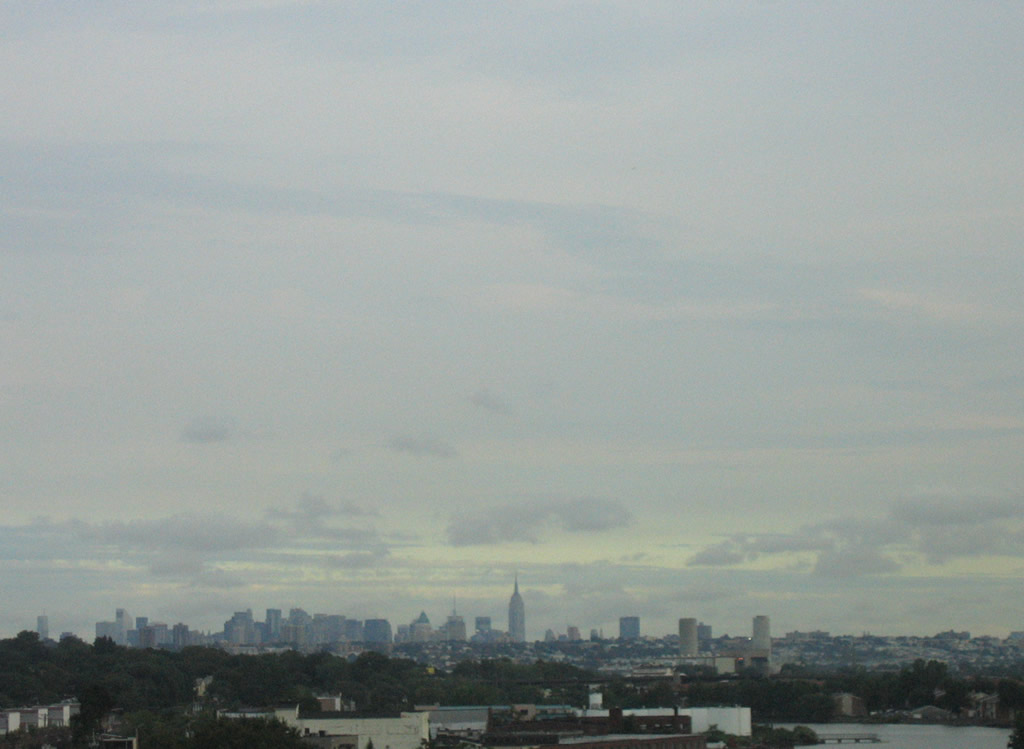
A glimpse of the New York City skyline from the Hackensack River bridge along I-80.
08/29/05
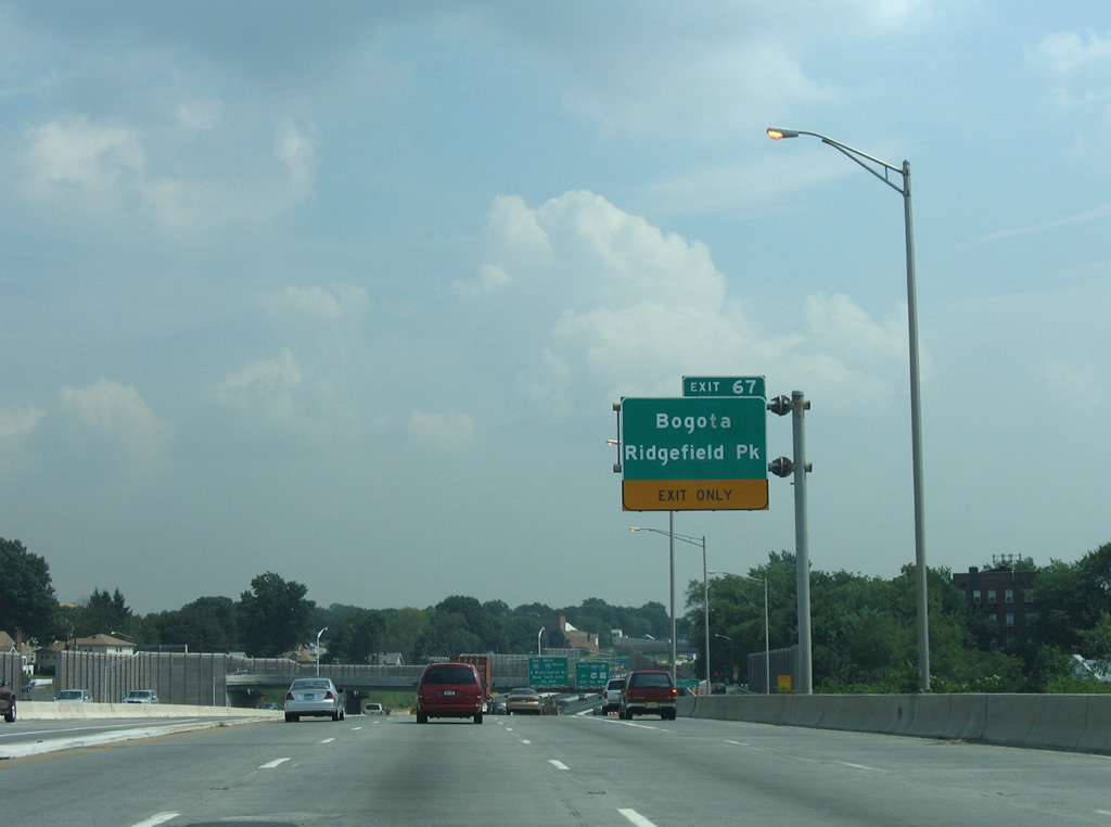
Exit 67 leaves from the Hackensack River bridge for North Avenue, a south side frontage road east to Main Street in Ridgefield Park. 2nd Street north from I-80 becomes Palisade Avenue into the adjacent borough of Bogota.
This overhead was removed by 2008.
08/29/05
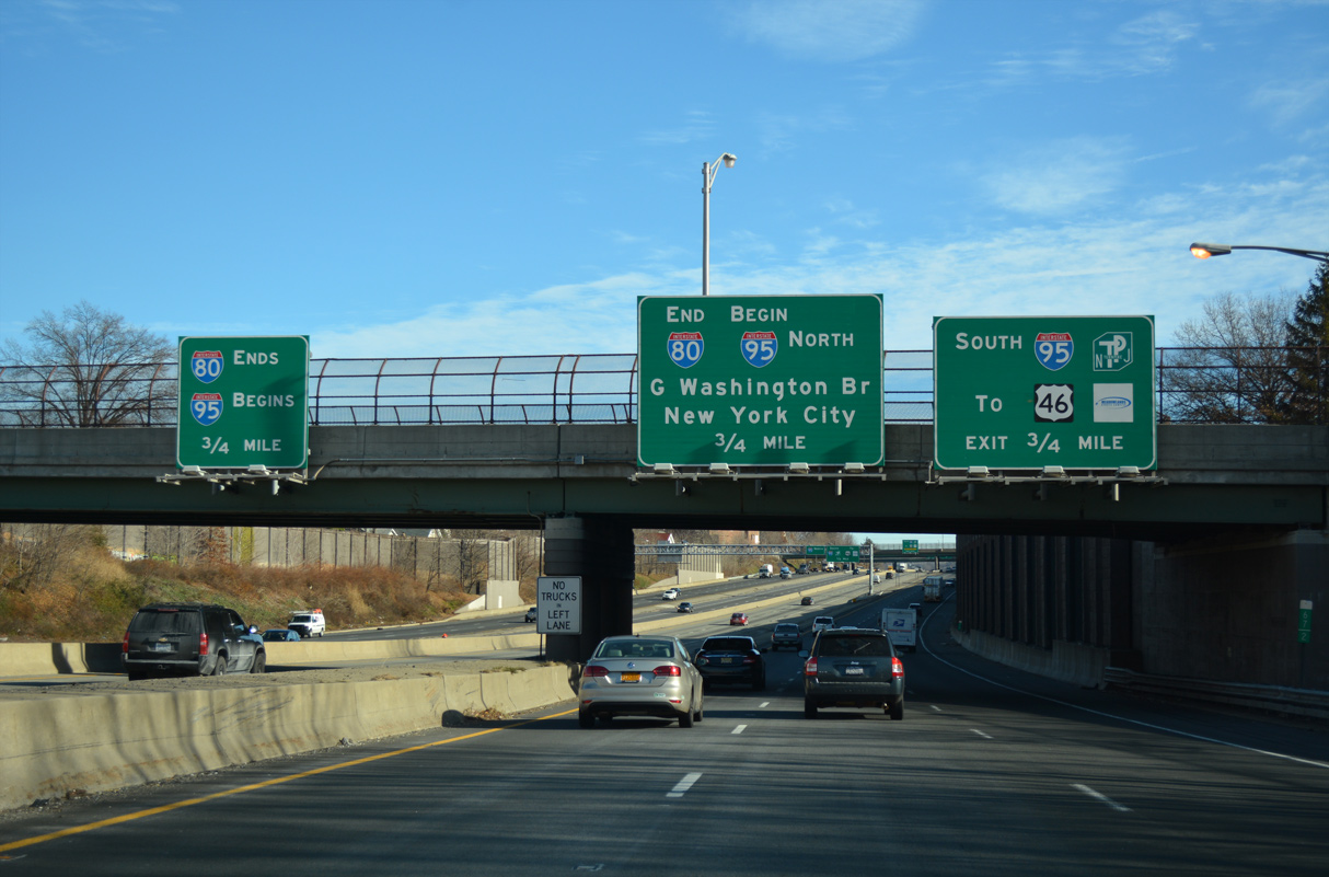
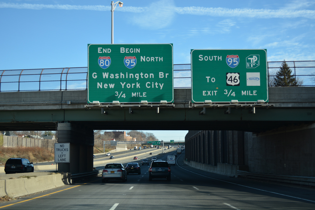
The 2,900 mile long transcontinental route of Interstate 80 concludes 0.75 miles east of the 2nd Street overpass in Ridgefield Park.
12/19/16
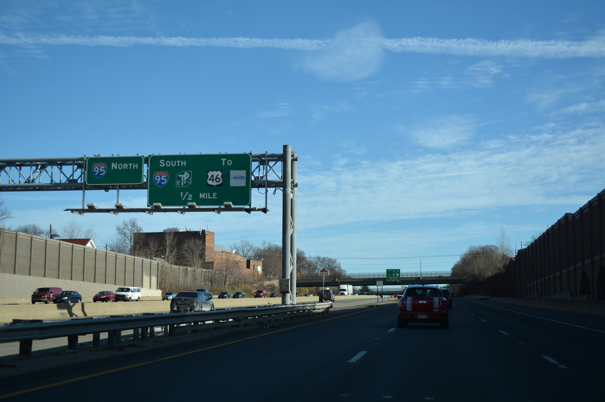
The Express lanes default onto the inner roadway of Interstate 95 north to the GWB. I-95 south to the New Jersey Turnpike and U.S. 46 at Ridgefield Park is also accessible from the Express lanes.
12/19/16
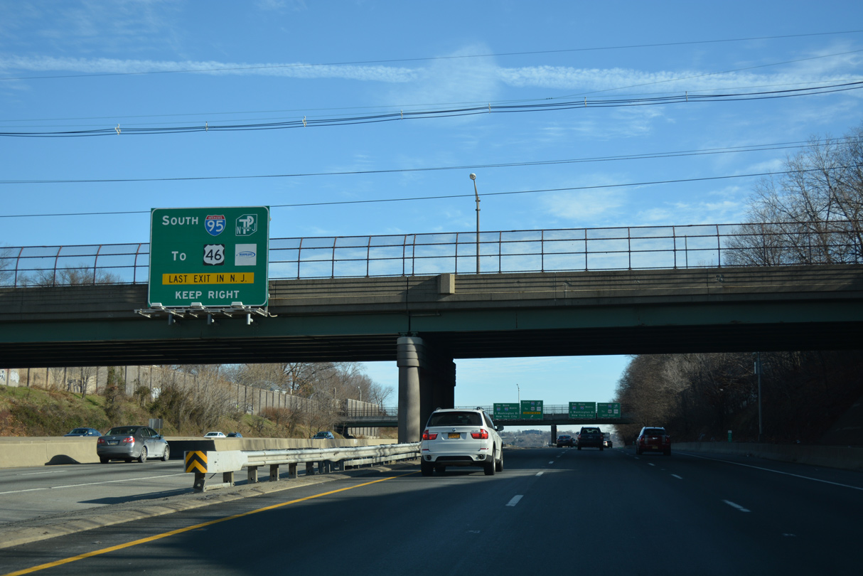
Overheads reference the southbound ramp for I-95 to Ridgefield Park as the last exit in New Jersey for the I-80 Express lanes east. However, Exit 73 for Route 67 at Fort Lee is the final in the state for motorists continuing onto I-95 north.
12/19/16
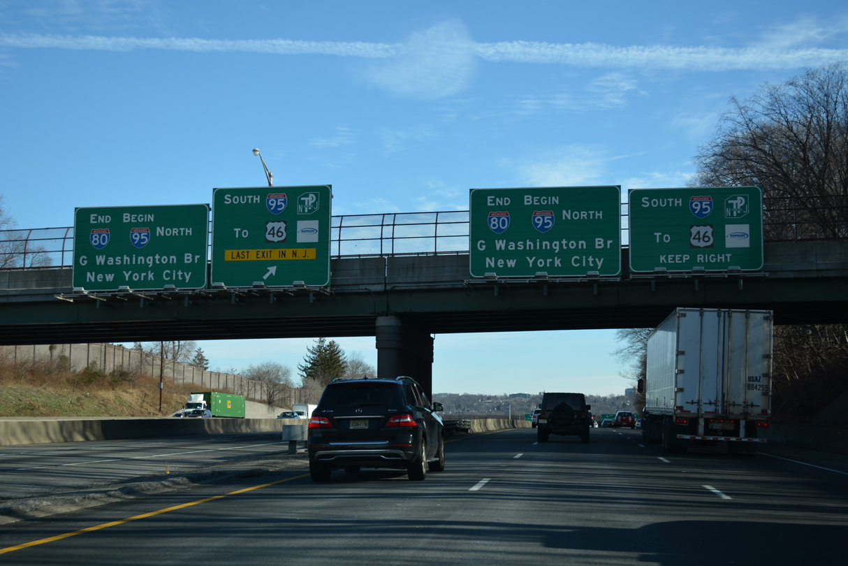
A second set of end signs for I-80 east appear on the Park Avenue overpass in Teaneck Township. I-95 follows the New Jersey Turnpike south to Newark, Elizabeth, Woodbridge, New Brunswick and Mansfield Township. The toll road splits into separate branches through East Rutherford (unsigned I-95W) and Secaucus (the I-95 mainline) at Ridgefield.
12/19/16
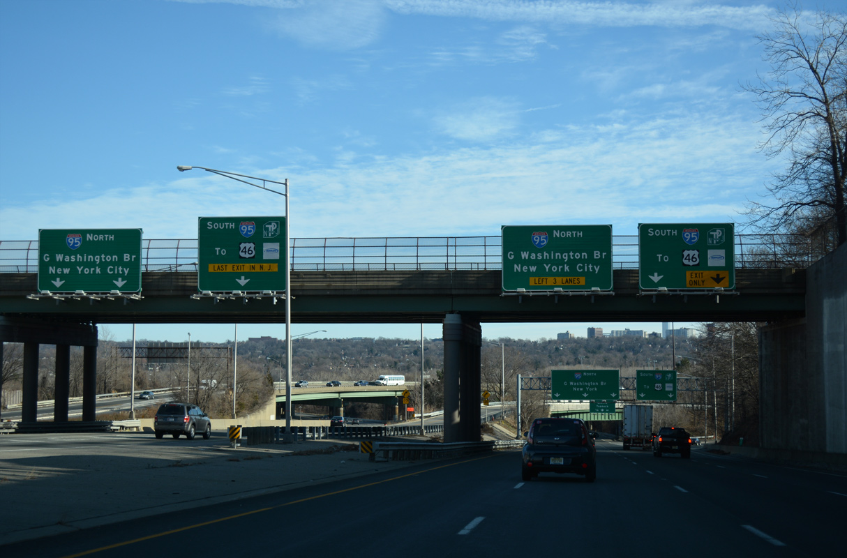
Ramps depart simultaneously from both the I-80 Express and Local lanes for I-95 south. Interstate 95 meets U.S. 46 before joining the NJ Turnpike.
12/19/16
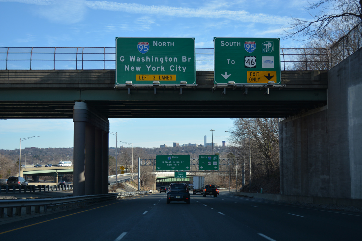
Overall in the Northeast U.S., I-95 joins New York with Philadelphia, Baltimore and Washington to the southwest and New Haven, Providence and Boston in New England.
12/19/16
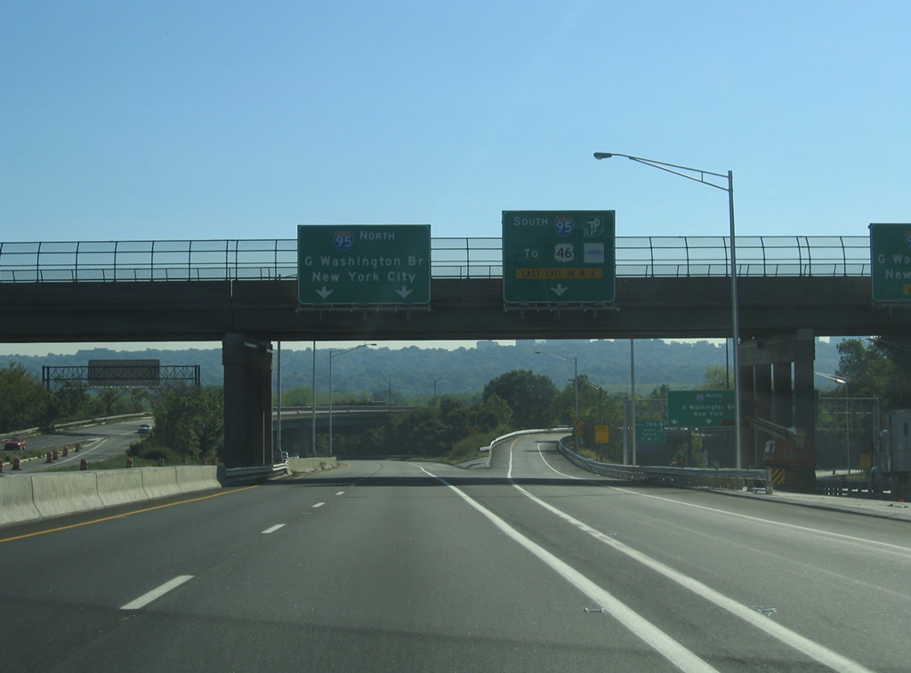
The Express lanes continue with two lanes from the end of I-80 onto the inner roadway of I-95 to the Upper Level of the GWB.
09/30/05
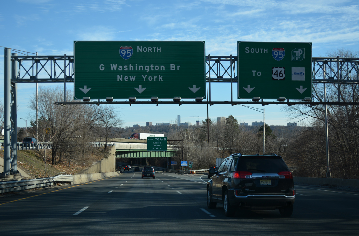
Three lanes join the outer roadway of Interstate 95 north for the Lower Level of the GWB.
12/19/16
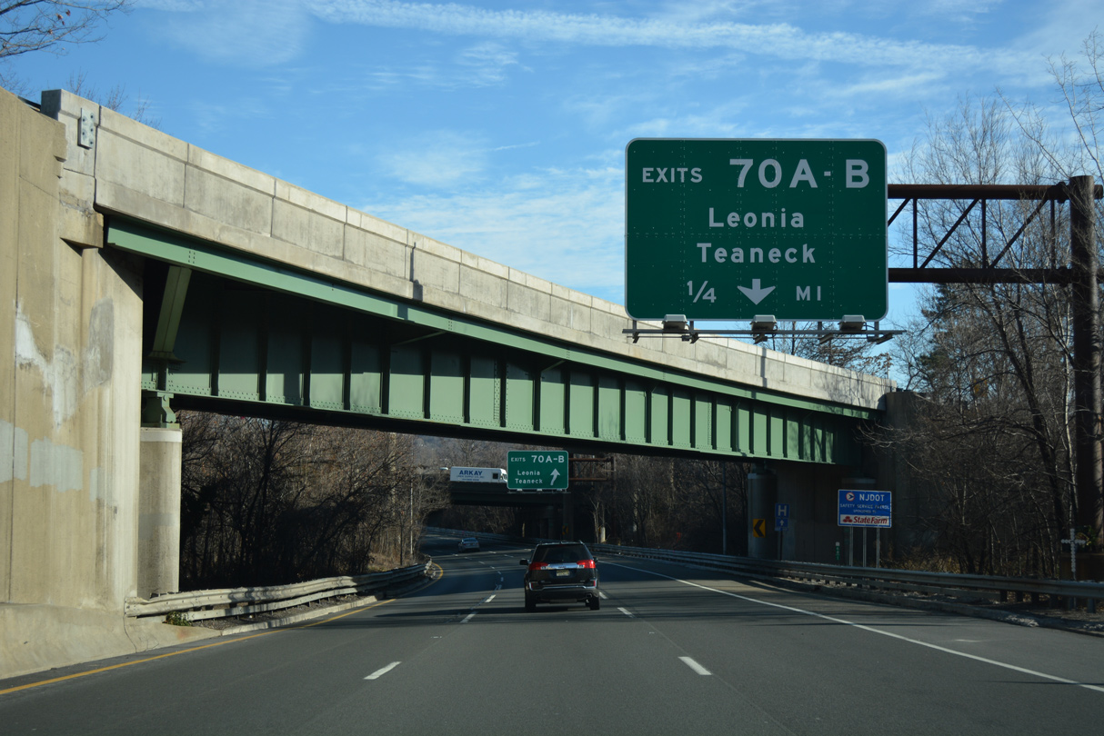
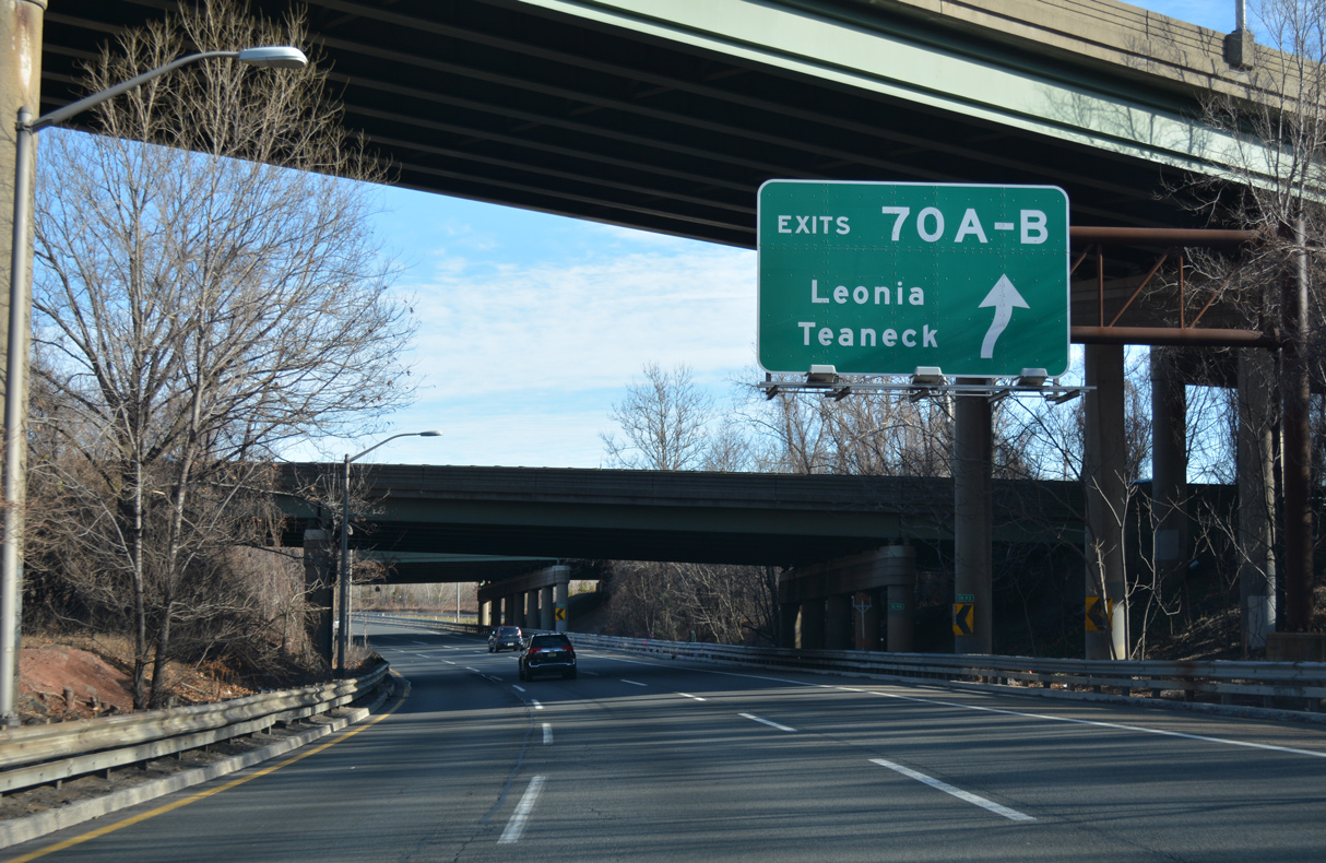
Passing through the three-wye interchange with Interstate 95, the I-80 Local lanes partition with a slip ramp (Exit 70) onto an adjacent c/d roadway for Degraw Avenue (CR 56) in Teaneck Township.
12/19/16
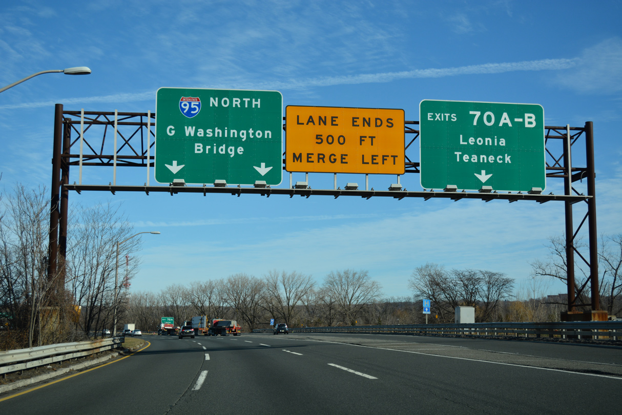
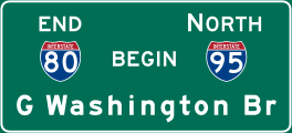
Interstate 80 east concludes where I-95 overtakes the freeway beyond Exit 70. Together with the c/d roadway, 12 overall lanes pass under Degraw Avenue between Teaneck and Leonia.
12/19/16
References:
- Interstate 80 (New Jersey). NYCRoads.com.
Photo Credits:
- Carter Buchanan: 08/11/04
- Alex Nitzman, Justin Cozart: 06/13/05
- AARoads: 08/29/05
- Justin Cozart: 09/30/05
- Alex Nitzman: 12/19/16
Connect with:


Page Updated Wednesday July 05, 2023.