
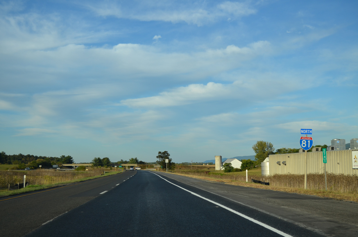
Interstate 81 North - New Market to Winchester
 North
North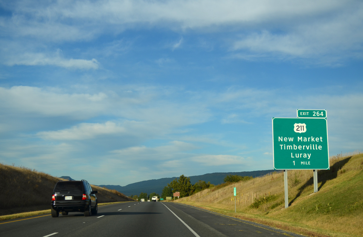
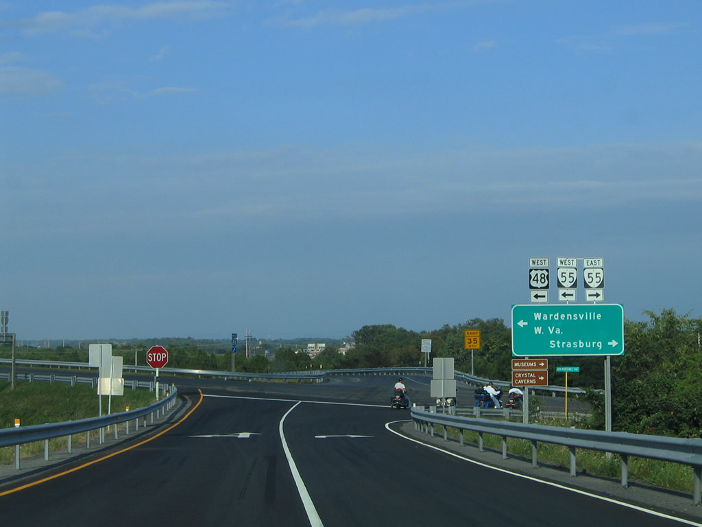
Interstate 81 meets U.S. 211 east and SR 211 (W Old Cross Road) west at a diamond interchange (Exit 264) in one mile.
07/24/04
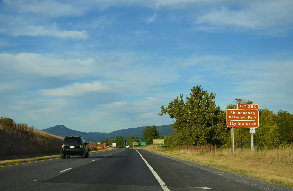
U.S. 211 (Lee Highway) traverses the Blue Ridge Mountains east of Page Valley. U.S. 211 connects with Skyline Drive at Thornton Gap with Shenandoah National Park.
09/23/14
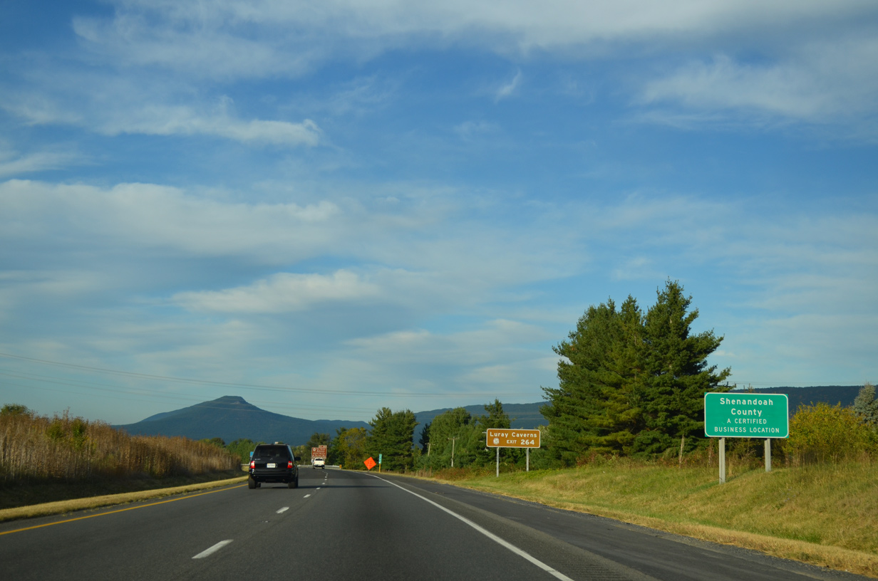
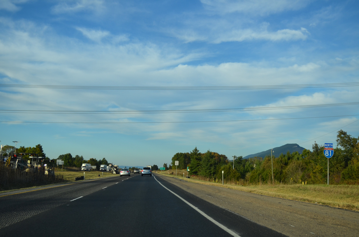
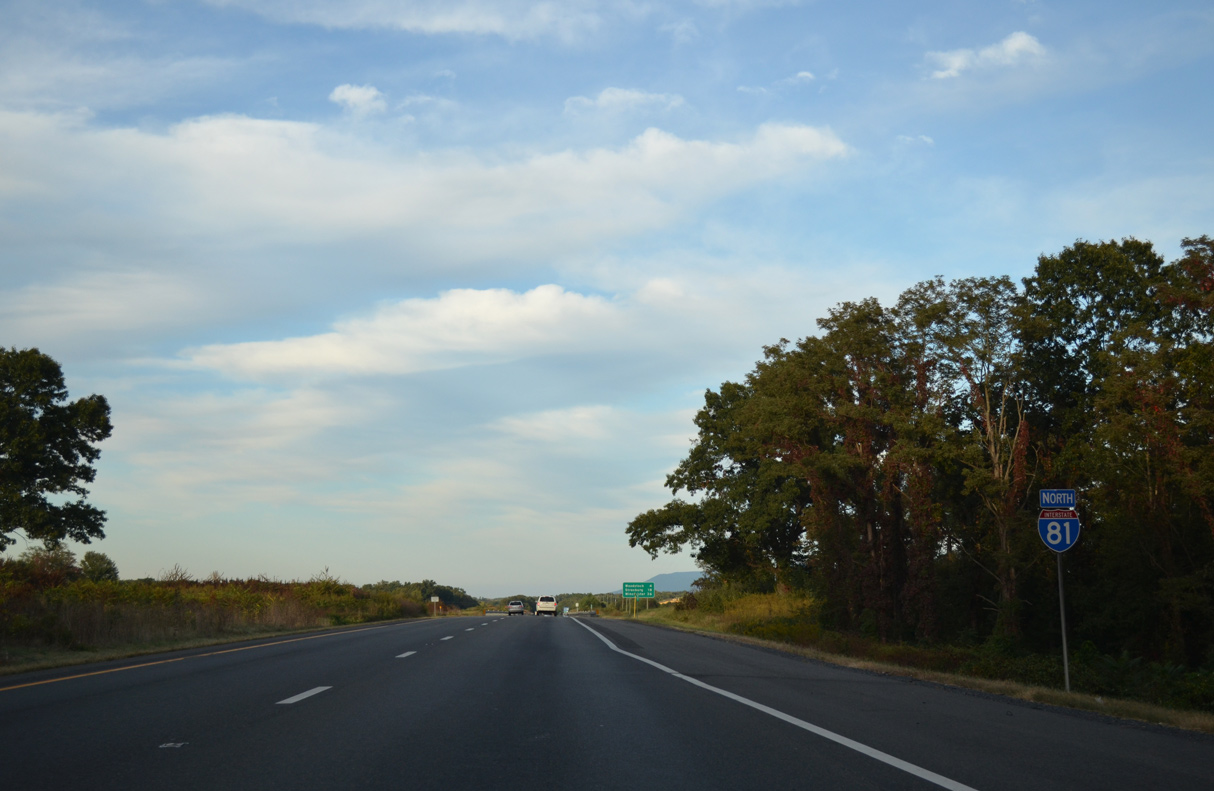
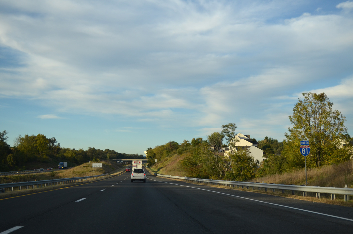
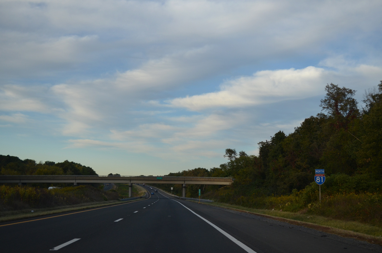
Interstate 81 crosses into Shenandoah County adjacent to the New Market town line.
09/23/14

An intrastate route, U.S. 211 travels just 59.15 miles from Exit 264 east across Massanuetten Mountain to Luray, Washington and Warrenton. SR 211 extends west from I-81/U.S. 211 to SR 42 (S Main Street) in the town of Timberville.
09/23/14
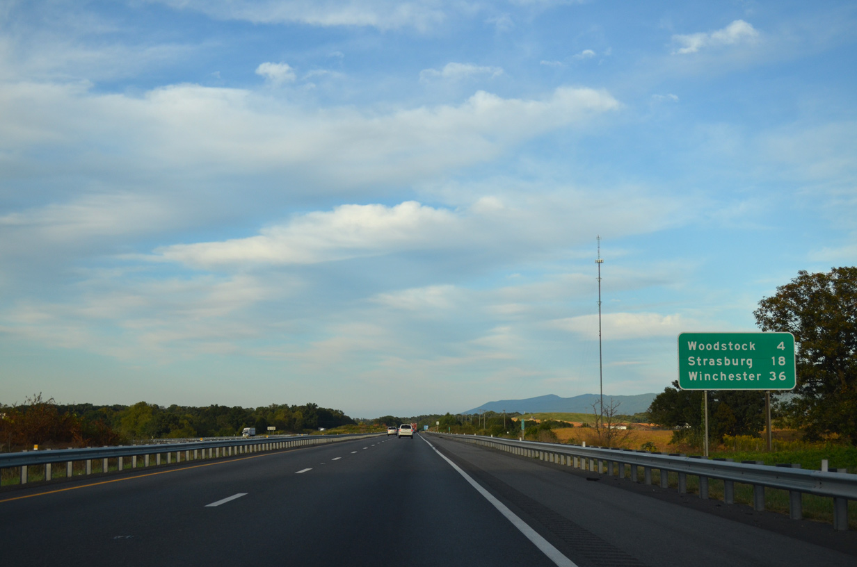
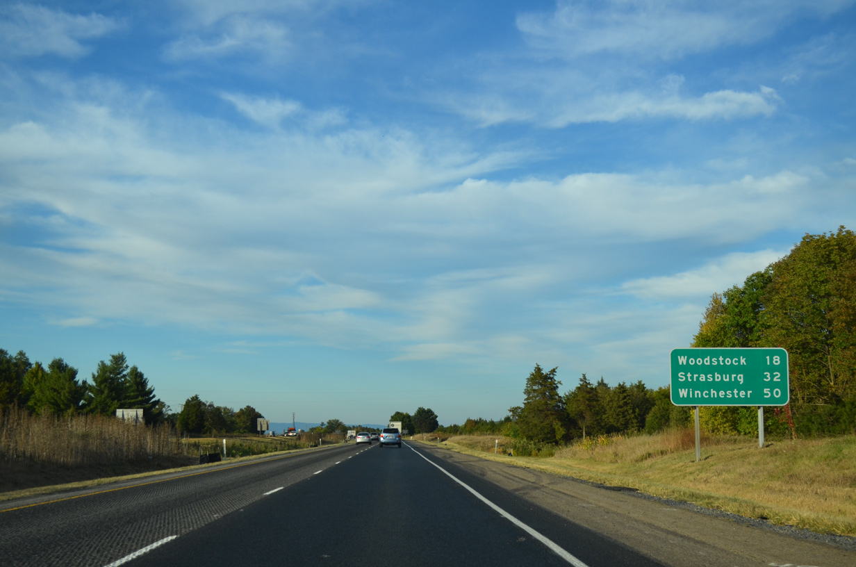
Interstate 81 advances northeast 18 miles from U.S. 211/SR 211 at New Market to Woodstock, seat of Shenandoah County.
09/23/14
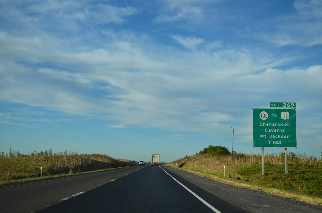
SR 730 (Caverns Road) leads east from the diamond interchange with I-81 at Exit 269 to U.S. 11 (Old Valley Pike) at Rudes Hill and northwest to Shenandoah Caverns and Williamsville.
09/23/14
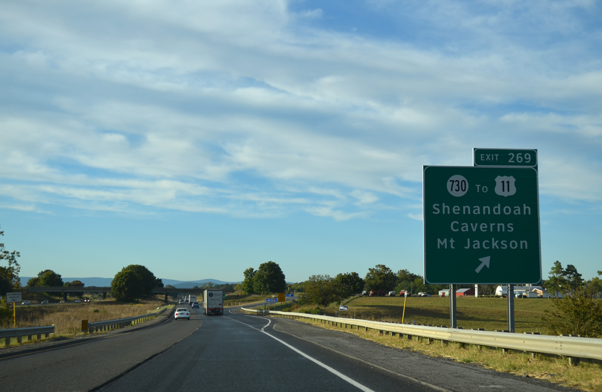
Exit 269 departs from I-81 north after the Shenandoah River North Fork. U.S. 11 continues north from SR 730 (Caverns Road) into Mt. Jackson, where SR 263 (Bryce Boulevard) branches west to Basye and Orkney Springs.
09/23/14
Interstate 81 north parallels the Shenandoah River North Fork along the ensuing stretch to South Jackson.
09/23/14
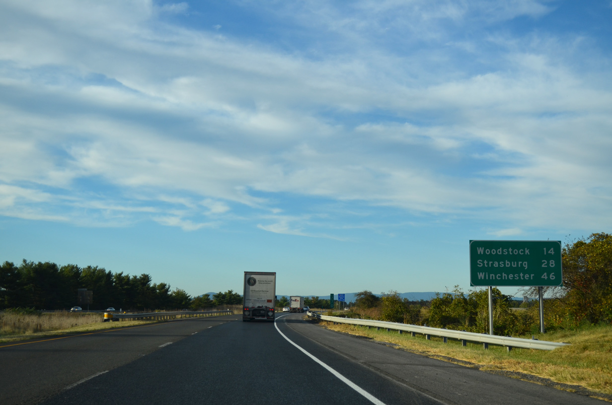
Woodstock and Strasburg lie within the northern half of Shenandoah County over the next 28 miles.
09/23/14
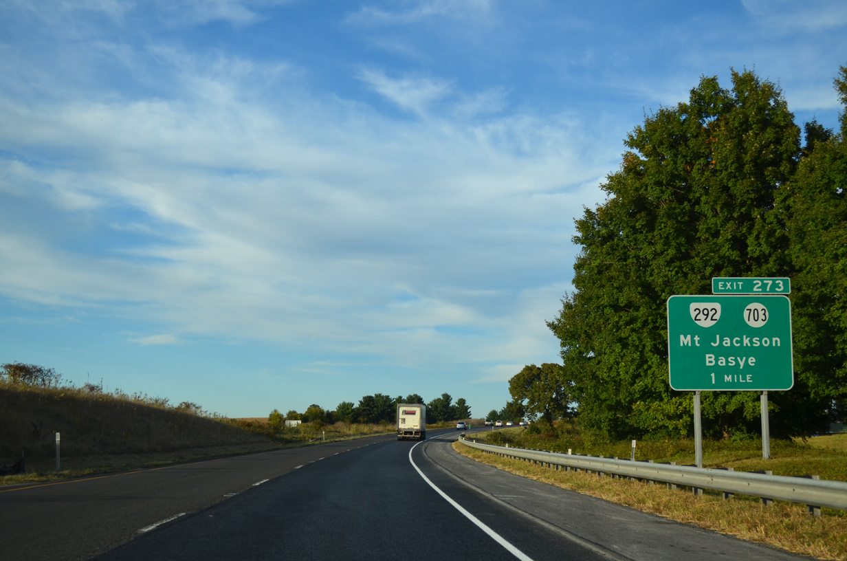
Running along western reaches of Mount Jackson, I-81 advances north to Exit 273 with SR 292 (Conicville Road) east and SR 703 (Mt. Jackson Road) west.
09/23/14
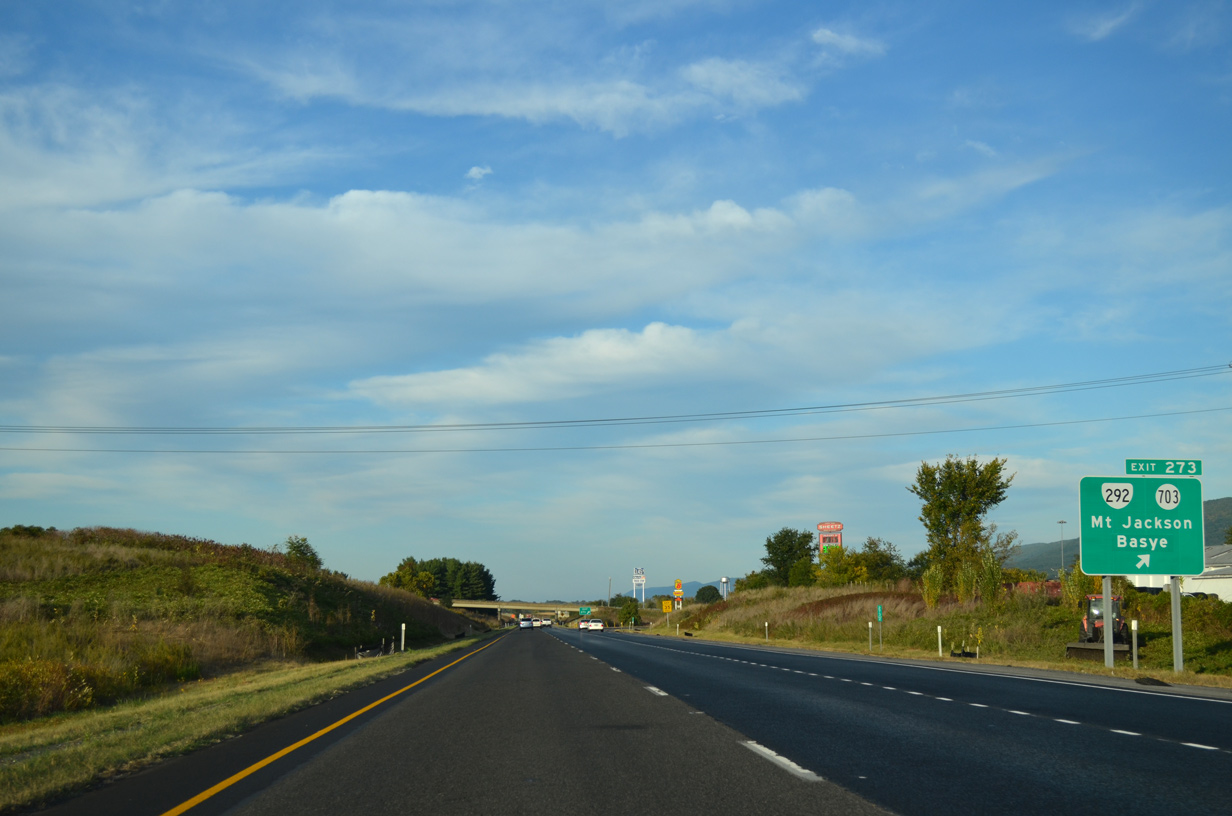
SR 292 is a 0.39 mile route along Conicville Road between the exchange with I-81 and U.S. 11 (Main Street) in the town of Mount Jackson. SR 703 extends 1.28 miles west to SR 614 (S Middle Road).
09/23/14
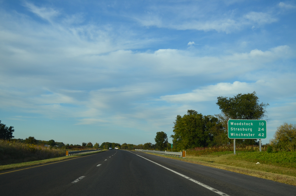
10 miles separate New Jackson from Woodstock along Interstate 81 north.
09/23/14
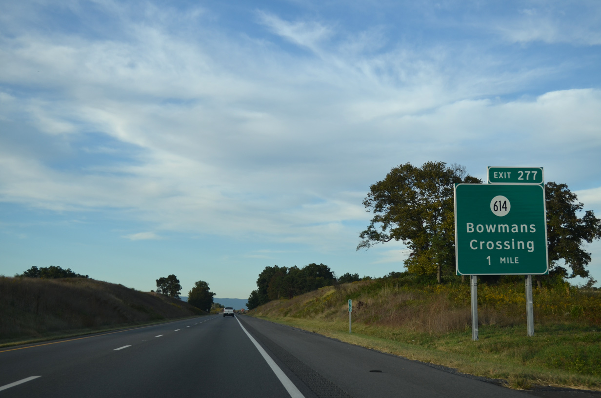
SR 614 (S Middle Road) converges with Interstate 81 at a half diamond interchange (Exit 277), 4.45 miles north of SR 730 (Mount Jackson Road).
09/23/14
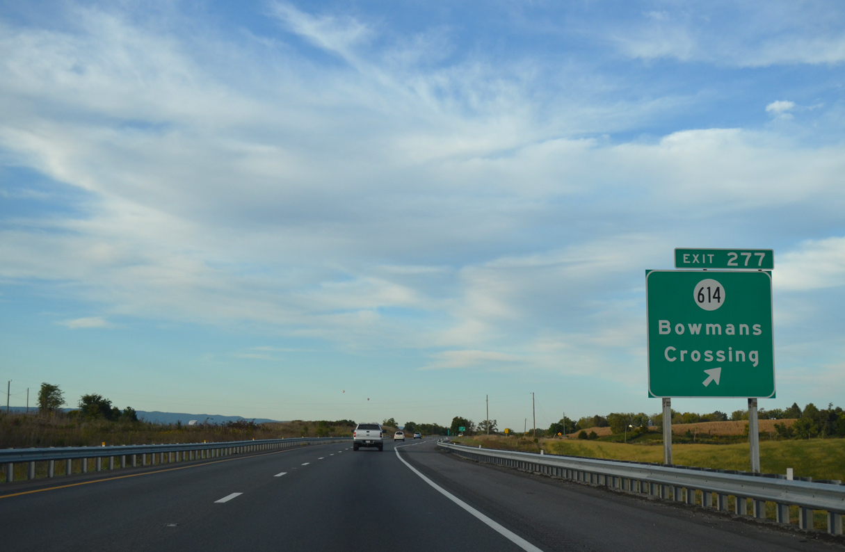
Bowmans Crossing lies a third of a mile east of Exit 277 where SR 614 (S Middle Road) ties into U.S. 11 (Old Valley Pike).
09/23/14
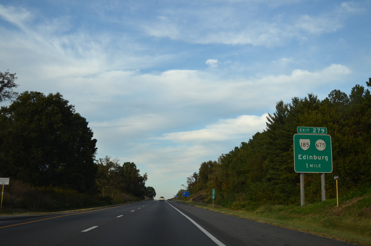
SR 185 (Stoney Creek Road) comprises a 1.00 mile long major collector joining Interstate 81 with U.S. 11 (Main Street) in the town of Edinburg.
09/23/14
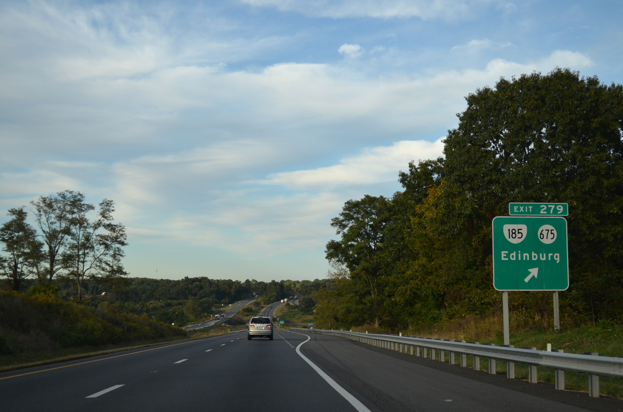
The diamond interchange (Exit 279) with SR 185 east and SR 675 west spreads across Stony Creek. SR 675 extends Stony Creek Road north 4.63 miles to Lantz Mills and SR 42 (Sendo Road) at Columbia Furnace.
09/23/14
Meneka Peak and Signal Knob, part of the Green Mountain range, come into view along northbound I-81 four miles ahead of Woodstock. Strasburg lies 14 miles further, north of the range.
09/23/14
Meneka Peak and Signal Knob, part of the Green Mountain range, come into view along northbound I-81 four miles ahead of Woodstock. Strasburg lies 14 miles further, north of the Green Mountain range.
09/23/14
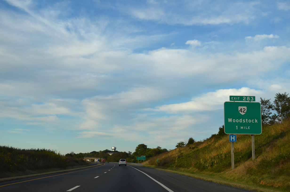
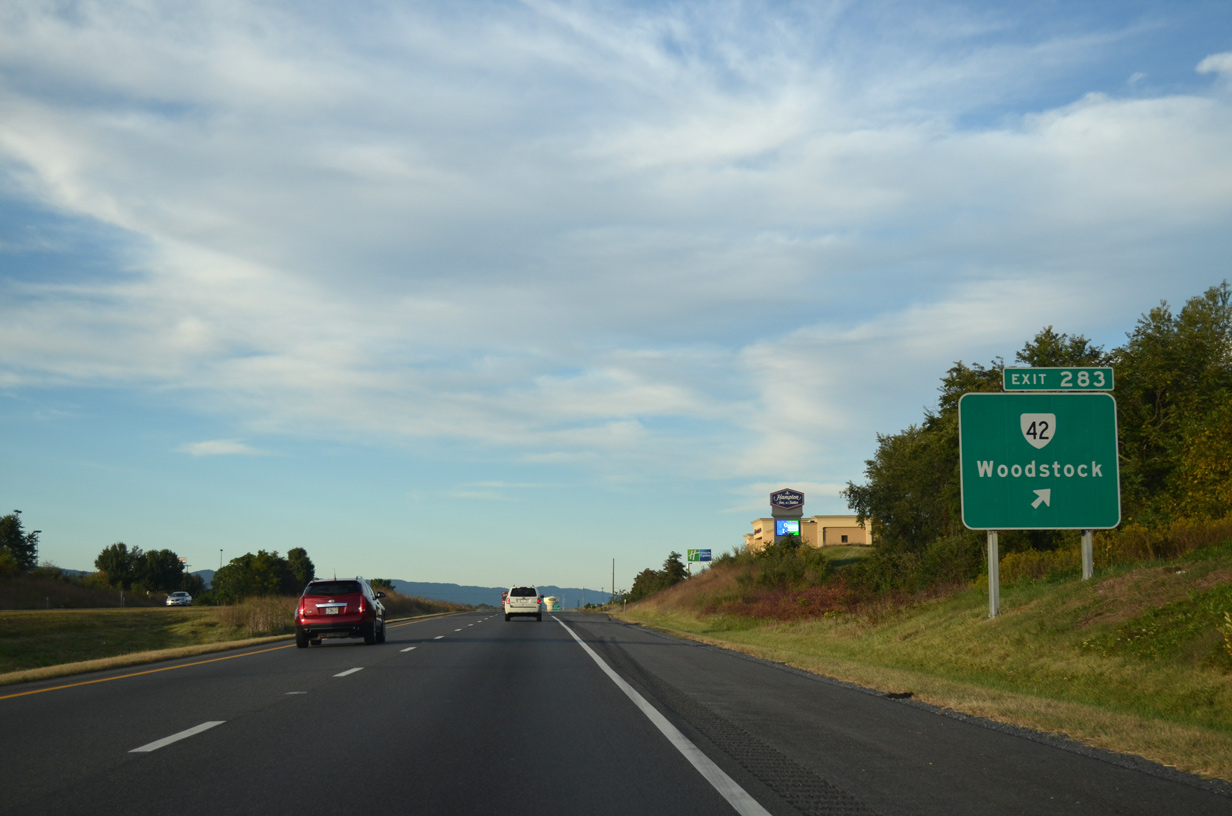
SR 42 (W Reservoir Road) runs east from Columbia Furnace and Harmony to meet Interstate 81 at a diamond interchange (Exit 283) in the town of Woodstock.
09/23/14
The northern segment of SR 42 angles southwest from U.S. 11 (Main Street) in Woodstock to Harrisonburg and I-64 near Clifton Forge. Partitioned into three sections, SR 42 measures 271.63 miles overall north from SR 91 in Broadford.
09/23/14
Interstate 81 passes between a subdivision in Woodstock and Spring Hollow ahead of the W Spring Street (SR 816) overpass.
09/23/14
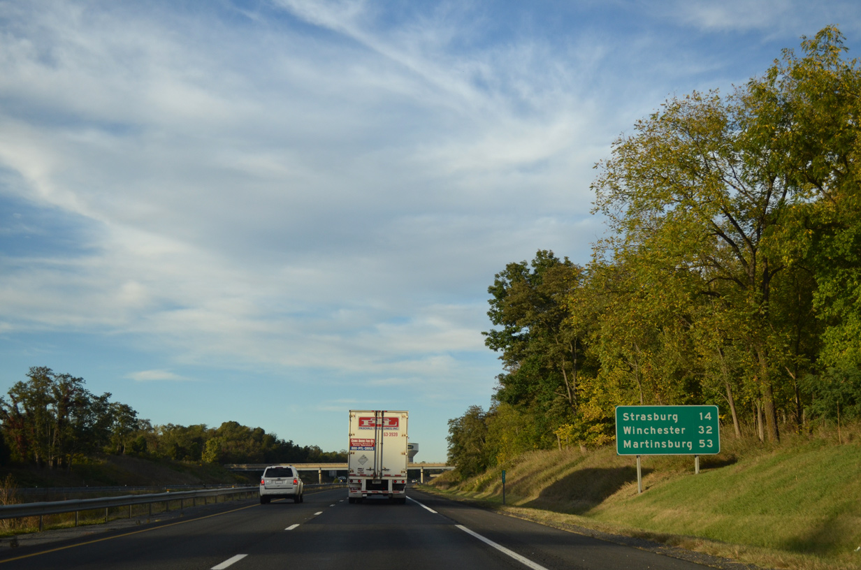
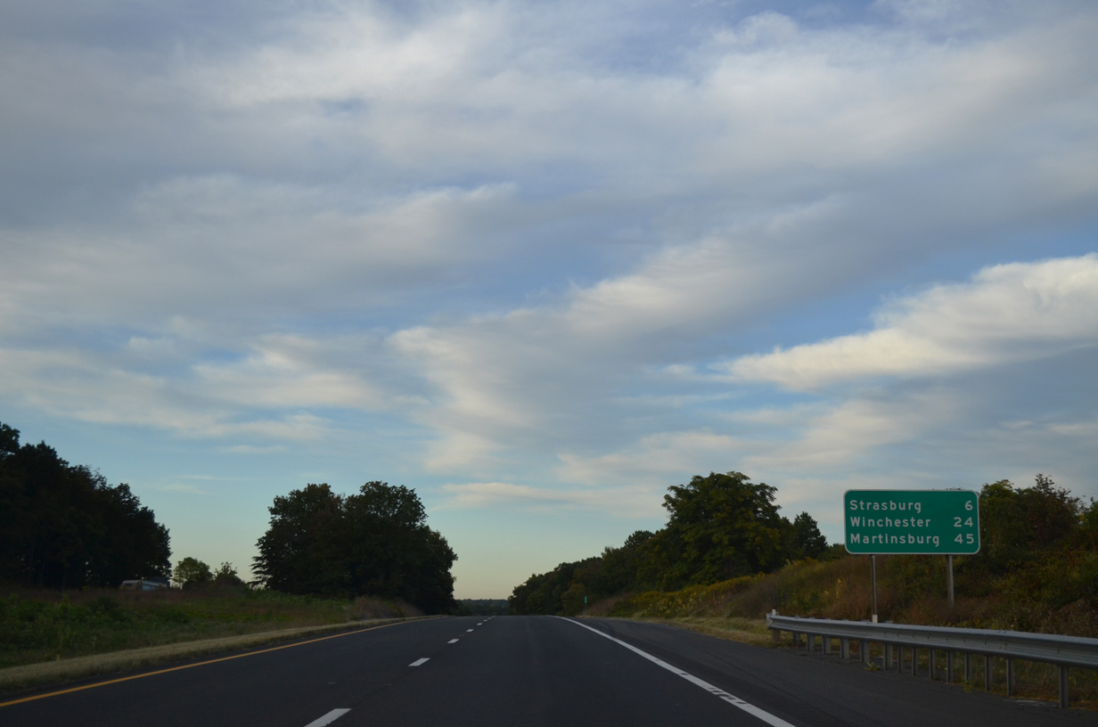
Interstate 81 continues 14 miles north from Woodstock to Strasburg. Martinsburg, West Virginia lies 39 miles further along I-81.
09/23/14
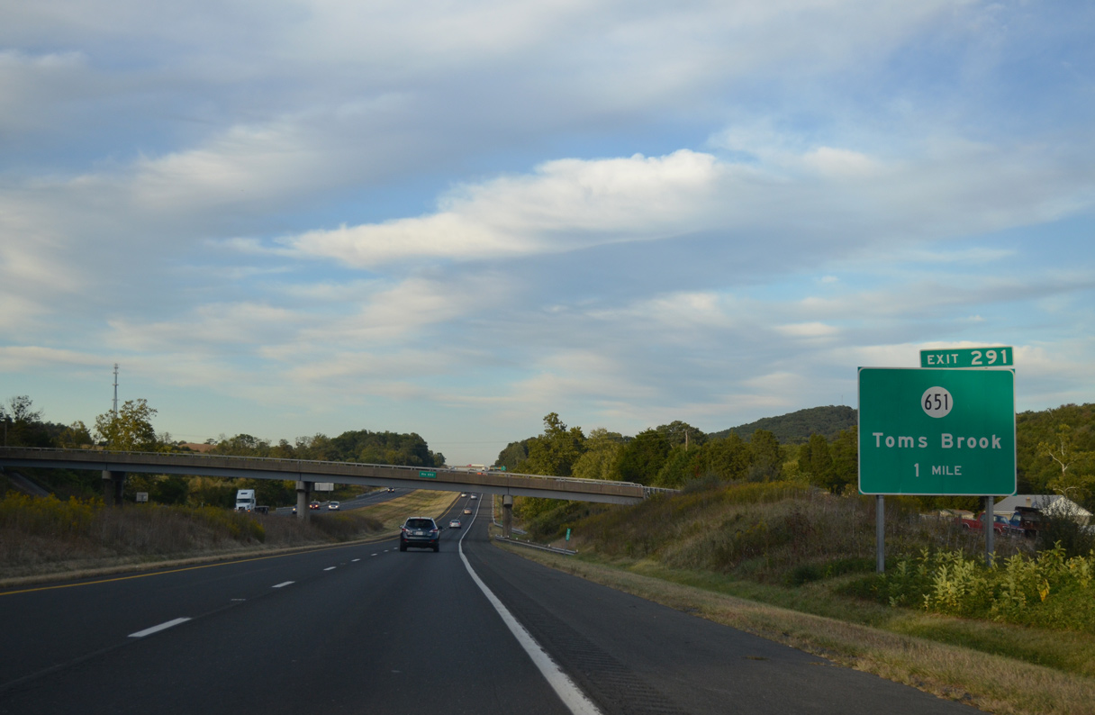
Interstate 81 proceeds north past Maurertown and the town of Toms Brook, both located along U.S. 11, to a diamond interchange (Exit 291) with SR 651 (Mount Olive Road).
09/23/14
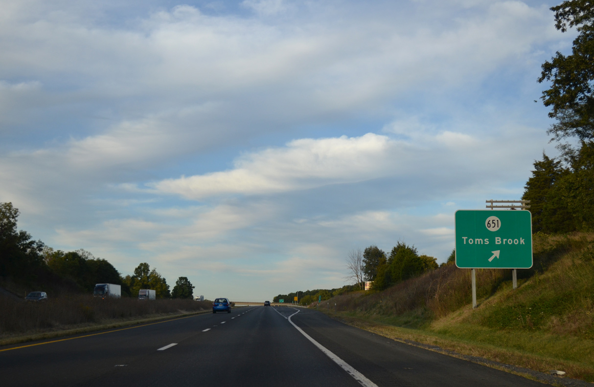
SR 651 (Mount Olive Road) is a major collector linking I-81 with U.S. 11 (Old Valley Pike), 0.97 miles to the south near Toms Brook, and SR 623 (Back Road), 1.35 miles to the north at Mt. Olive.
09/23/14
Confirming marker posted north of Round Hill and ahead of the SR 646 (Mt. Hebron Road) overpass.
09/23/14
The succeeding two exits from Interstate 81 north serve the town of Strasburg.
09/23/14
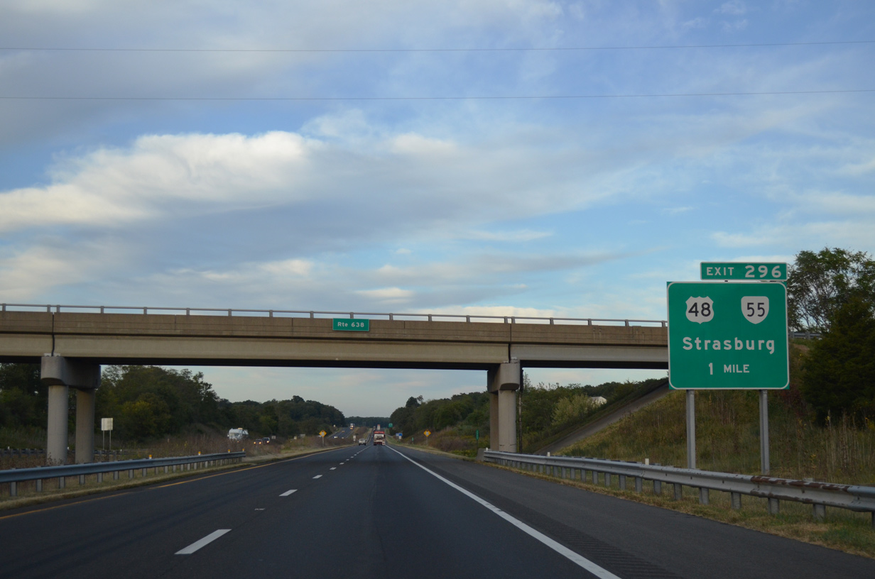
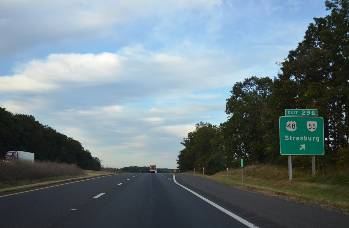
SR 55 (John Marshall Highway) branches 1.47 miles northwest from U.S. 11 (Massanuetten Street) in Strasburg to become U.S. 48 at the diamond interchange (Exit 296) with I-81.
09/23/14
U.S. 48 was signed alongside SR 55 (John Marshall Highway) northwest 14.42 miles to Lebanon Church and the West Virginia border on Great North Mountain in 2003. SR 55 is part of a multi state route east to Gainesville and west to U.S. 19 at Muddlety, West Virginia.
09/23/14
U.S. 48 is Appalachian Regional Development Corridor H, an expressway corridor stretching west to Elkins, West Virginia.
07/24/04
Confirming marker posted beyond the entrance ramp from U.S. 48/SR 55 to north of Strasburg. Exit 296 originally consisted of a half diamond interchange with no return access northbound.
09/23/14
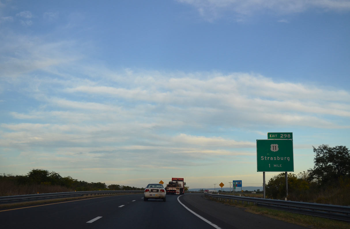
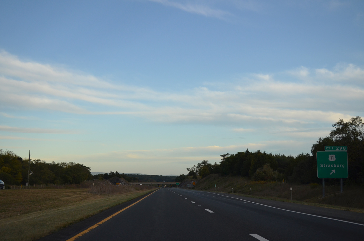
U.S. 11 combines with SR 55 along Massanutten Street outside Downtown Strasburg, 1.61 miles southwest of the diamond interchange at Exit 298.
09/23/14
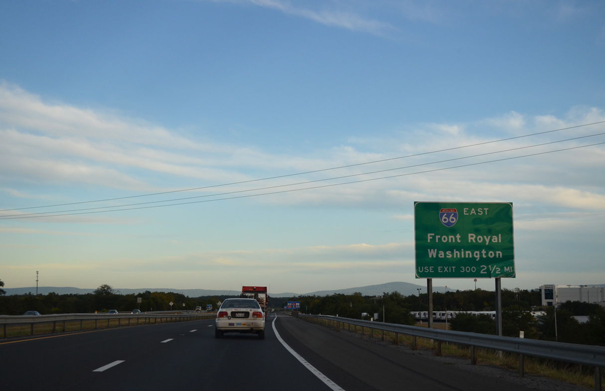
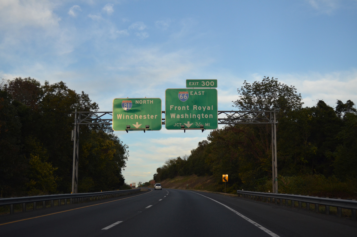
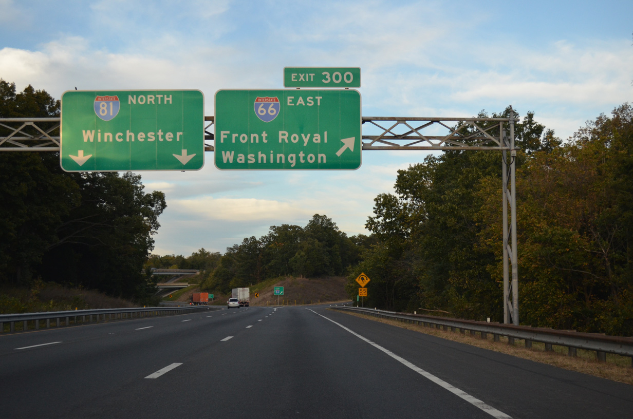
Interstate 66 begins at Exit 300 in 2.5 miles.
09/23/14
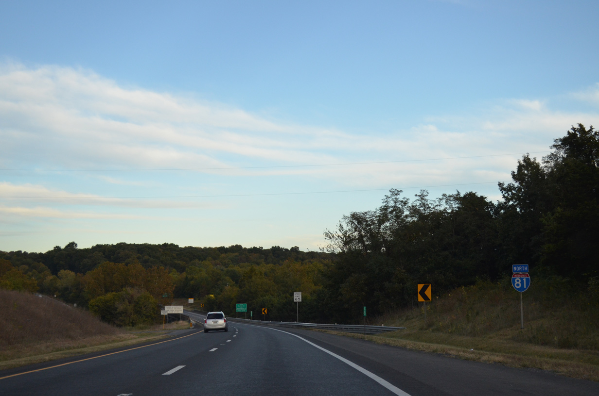
U.S. 11 shifts to the north side of I-81 beyond Hupp Hill and Exit 298 to Middletown. Points of interest for Exit 298 include Belle Grove Plantation and Cedar Creek Battlefield.
09/23/14
I-81 runs across Cedar Creek and Belle Grove National Historical Park between the exchanges with U.S. 11 (Old Valley Pike) and I-66.
09/23/14
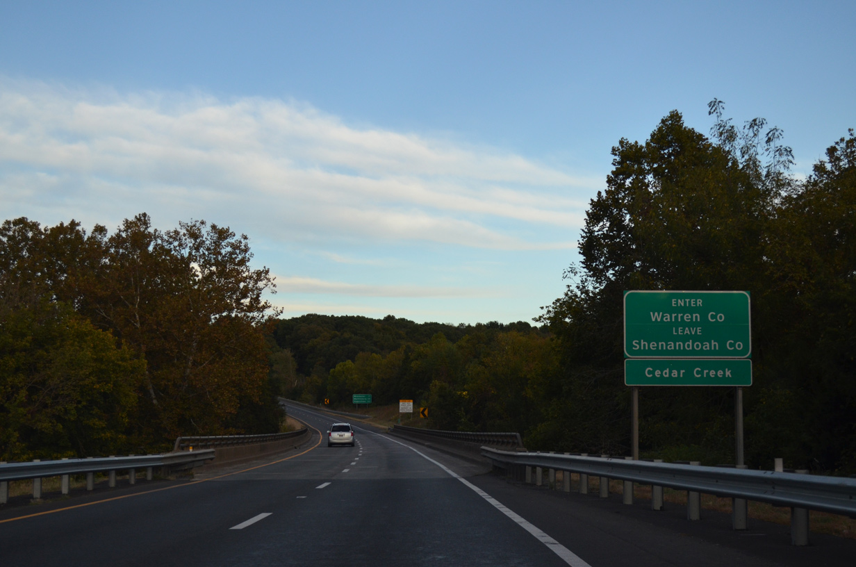
I-81 arcs east across Cedar Creek into the northwestern corner of Warren County over the succeeding 1.29 miles.
09/23/14
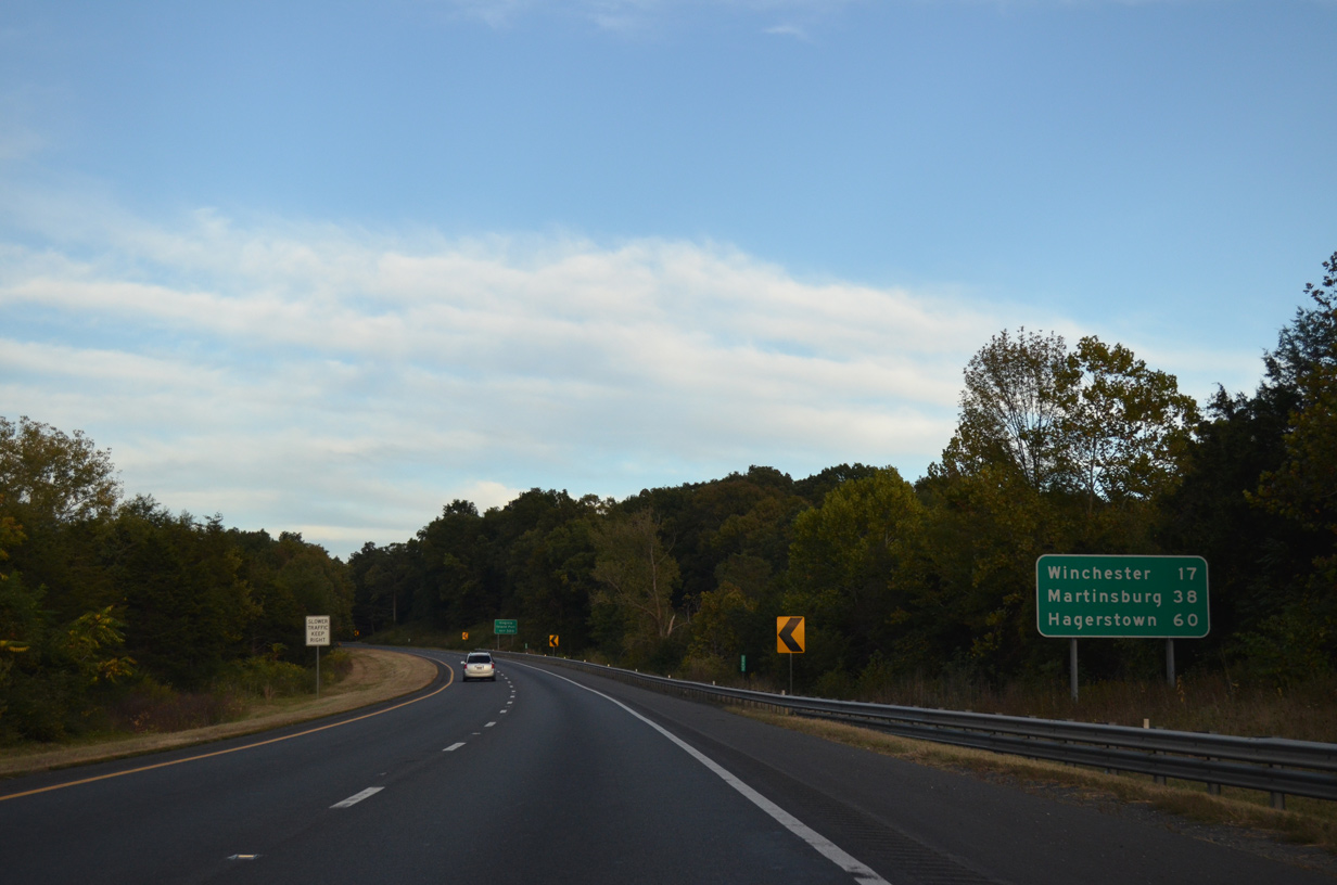
Located at the cross roads of I-70/81, Hagerstown, Maryland lies 61 miles beyond the west end of I-66.
09/23/14
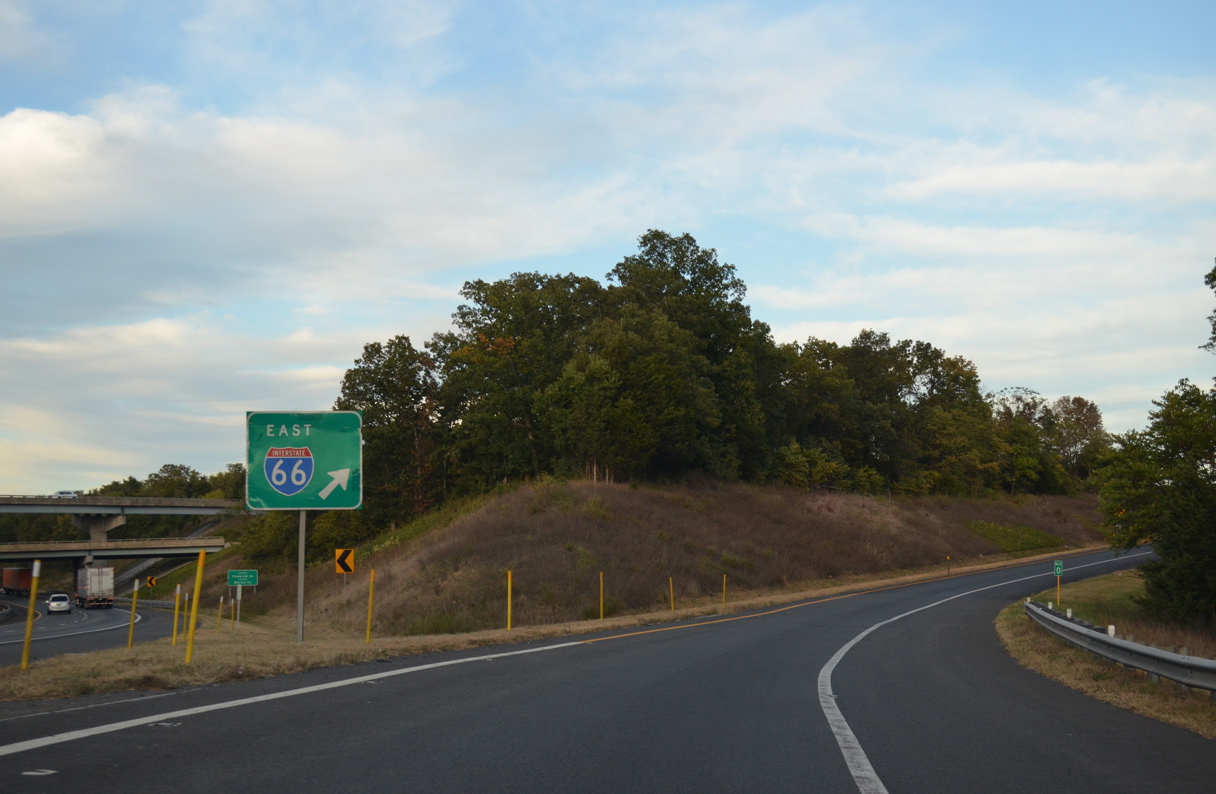
Interstate 66 branches east from I-81 at the Frederick County line eight miles to Front Royal and 42 miles to Gainesville.
09/23/14
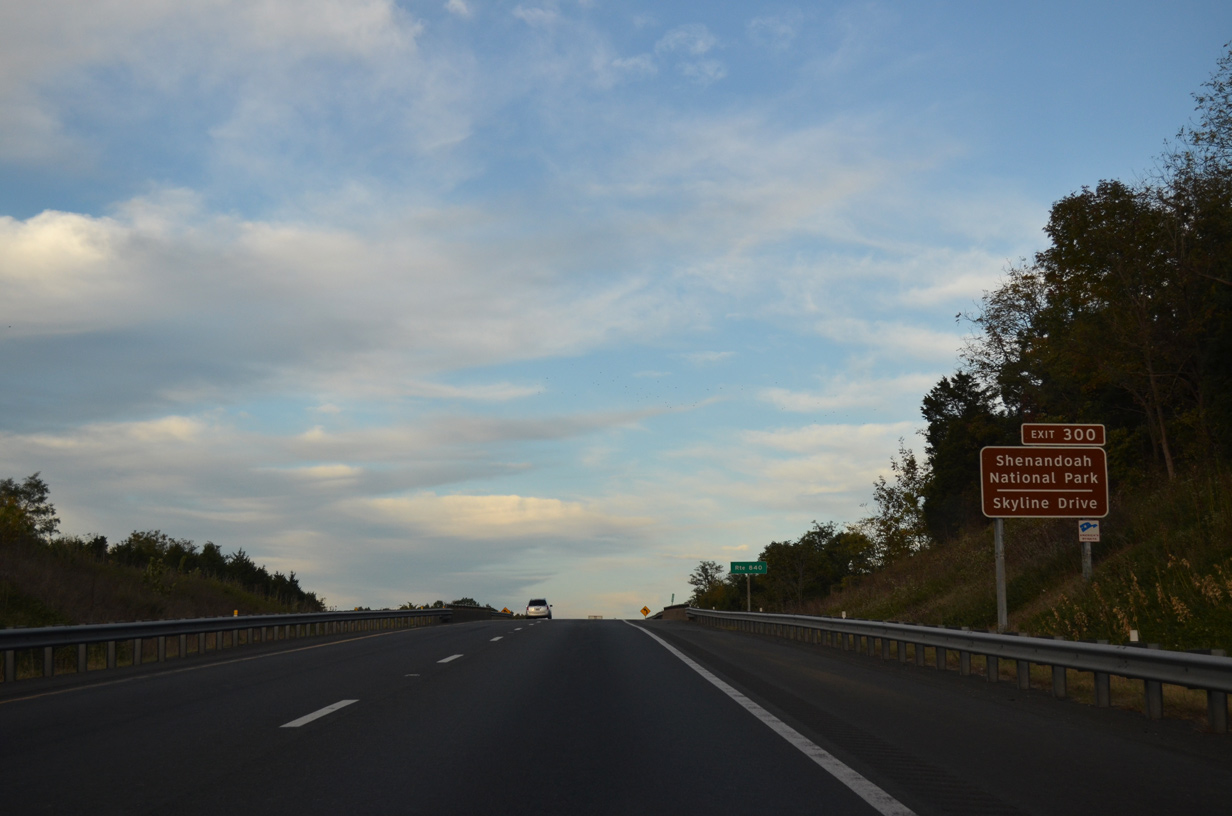
Interstate 66 provides the last connection from I-81 to Skyline Drive south through Shenandoah National Park. The north end of Skyline Drive ties into U.S. 340 between Dickey Ridge and the town of Front Royal. I-66 meets U.S. 340/522 at Exit 6.
09/23/14
I-66 runs across Warren County to Manassas Gap across the Blue Ridge mountains en route to Washington, DC, located 74 miles to the east.
09/23/14
A three-wye interchange joins I-81 with the west end of Interstate 66 at Exit 300.
09/23/14
07/24/04
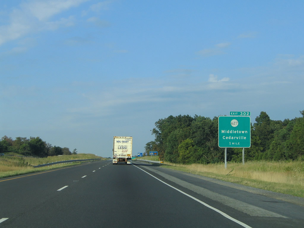
Interstate 81 continues 1.96 miles from Exit 300 to a diamond interchange (Exit 302) with SR 627 (Reliance Road) at Middletown. SR 627 winds 6.43 miles northwest from U.S. 340/522 at Cedarville to Reliance and U.S. 11 (Main Street).
07/24/04
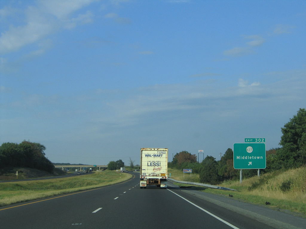
Exit 302 leaves I-81 north for SR 627 (Reliance Road). Parallel U.S. 11 (Main Street / Valley Pike) heads north from the town of Middletown to Vaucluse. SR 627 continues northwest from Main Street toward Marlboro.
07/24/04
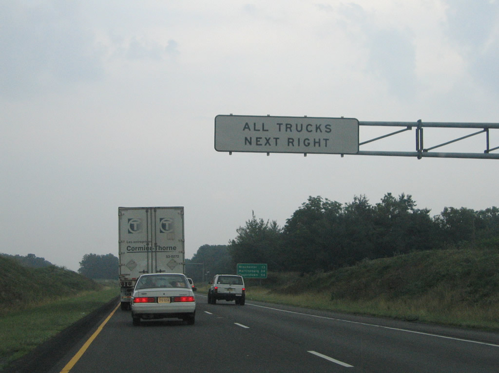
Truck weigh stations line both sides of Interstate 81 ahead of West Run and west of Klines Mill.
07/16/05
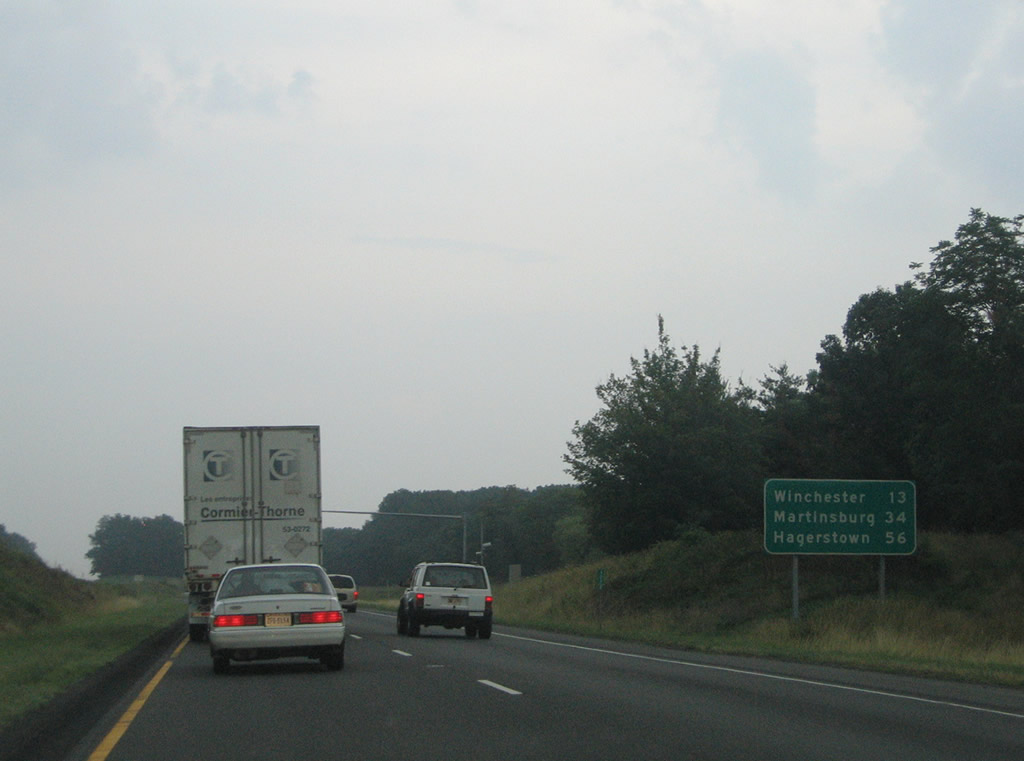
Winchester, the final city along Interstate 81 north in Virginia, is 13 miles away. Martinsburg follows in Berkeley County, West Virginia.
07/16/05
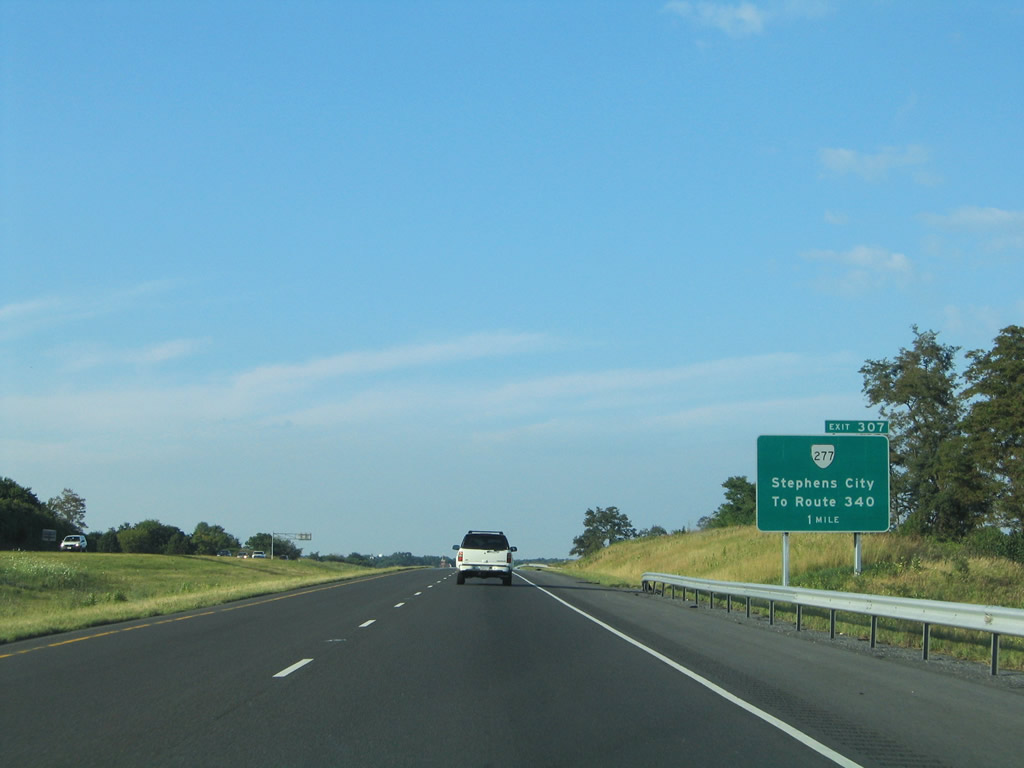
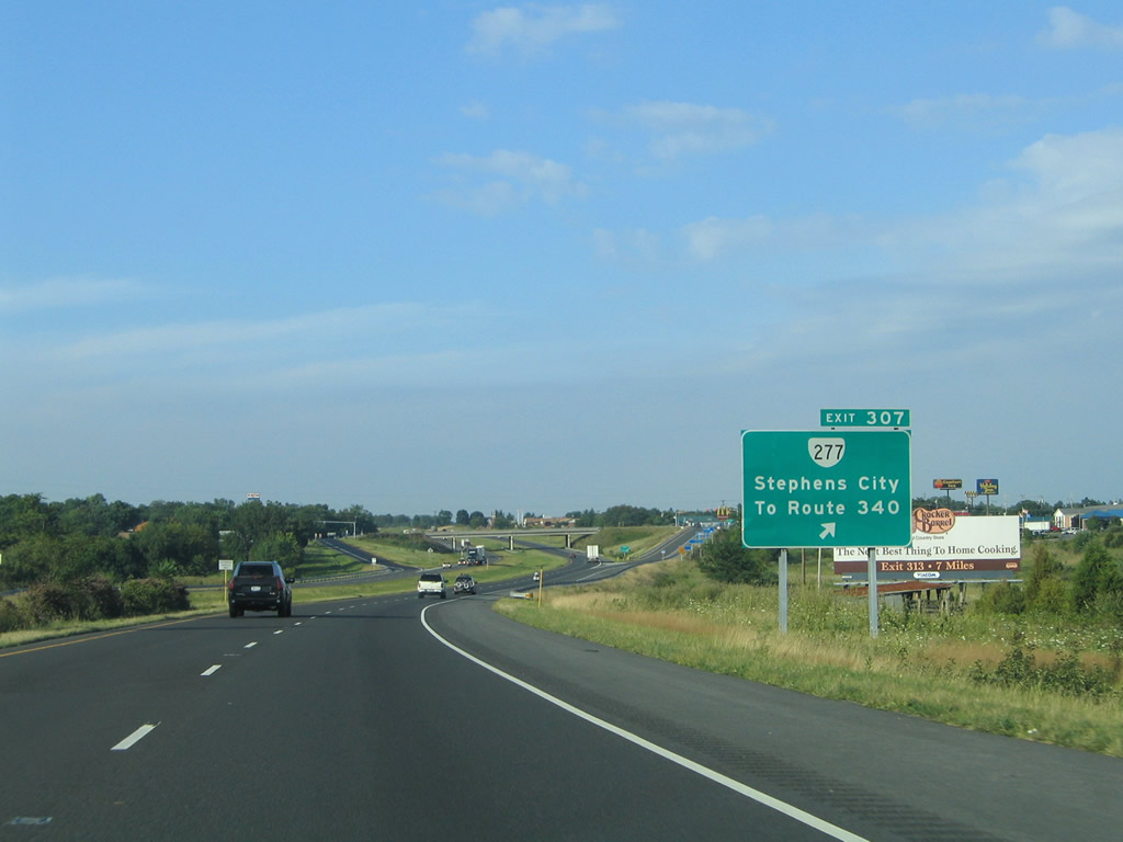
SR 277 (Fairfax Pike), a 4.72 mile long route between U.S. 11 (Main Street) in Stephens City and the north split of U.S. 340/522, meets I-81 at a diamond interchange (Exit 307) in one mile.
07/24/04
SR 277 (Fairfax Pike) meets U.S. 522 (Winchester Road) at U.S. 340 (Lord Fairfax Highway) east at Double Tollgate in Clarke County. U.S. 340 leads east from there to White Post, Berryville, Charles Town, West Virginia and Frederick, Maryland.
07/24/04

SR 37 encircles Winchester to the west from I-81 at Exit 310 northward to U.S. 11 (Martinsburg Pike) by Exit 317. The 9.10 mile loop is a limited access highway.
07/24/04
U.S. 11 (Valley Pike) proceeds north from Bartonville to a folded diamond interchange with SR 37 just west of I-81 and south of Kernstown. SR 642 (Tasker Road) ties into the south end of SR 37 from suburban areas to the southeast.
07/24/04
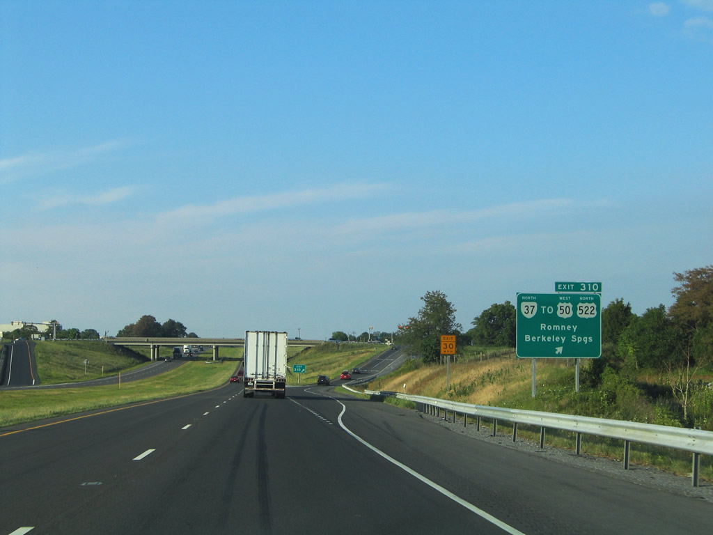
Exit 310 departs I-81 north for SR 37 north to U.S. 50 (Northwestern Pike) west to Gore and Romney, West Virginia and U.S. 522 north to Gainesboro and Berkeley Springs, West Virginia.
07/24/04
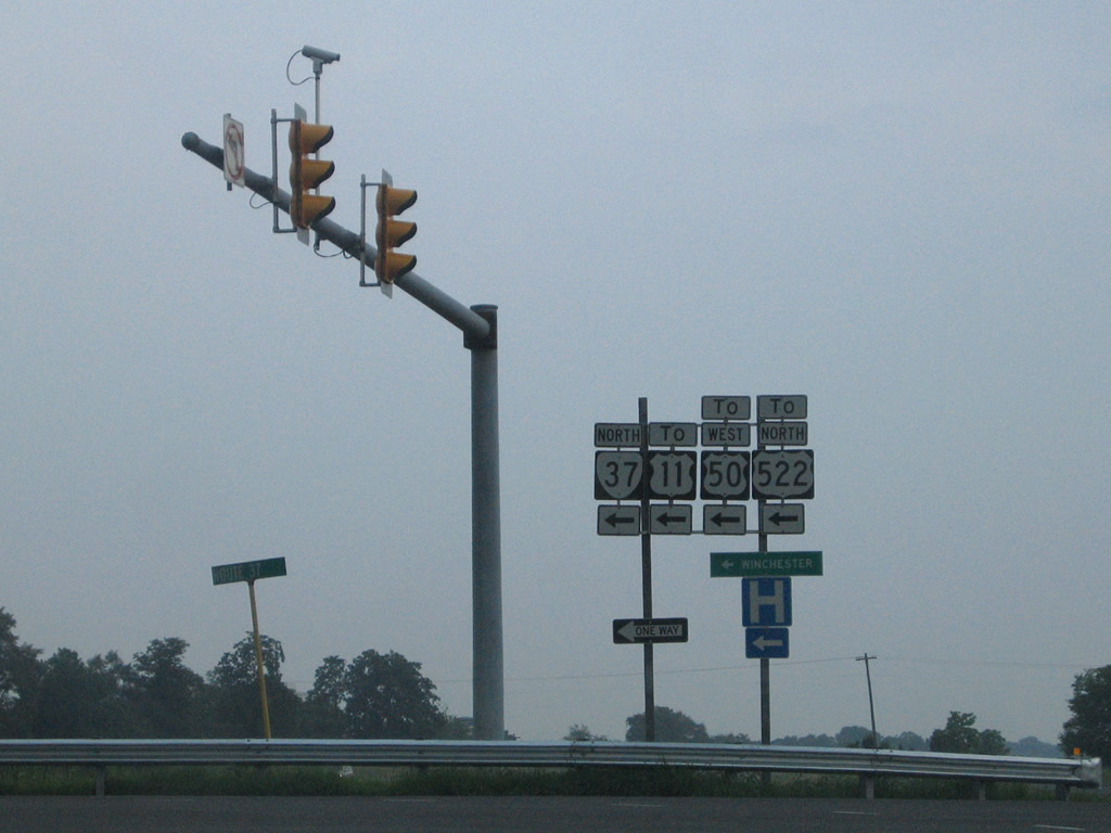
The foot print of the diamond interchange (Exit 310) joining I-81 with SR 37 was expanded outward during construction in 2015-16. Previous plans for SR 37 extended the loop eastward.
07/16/05
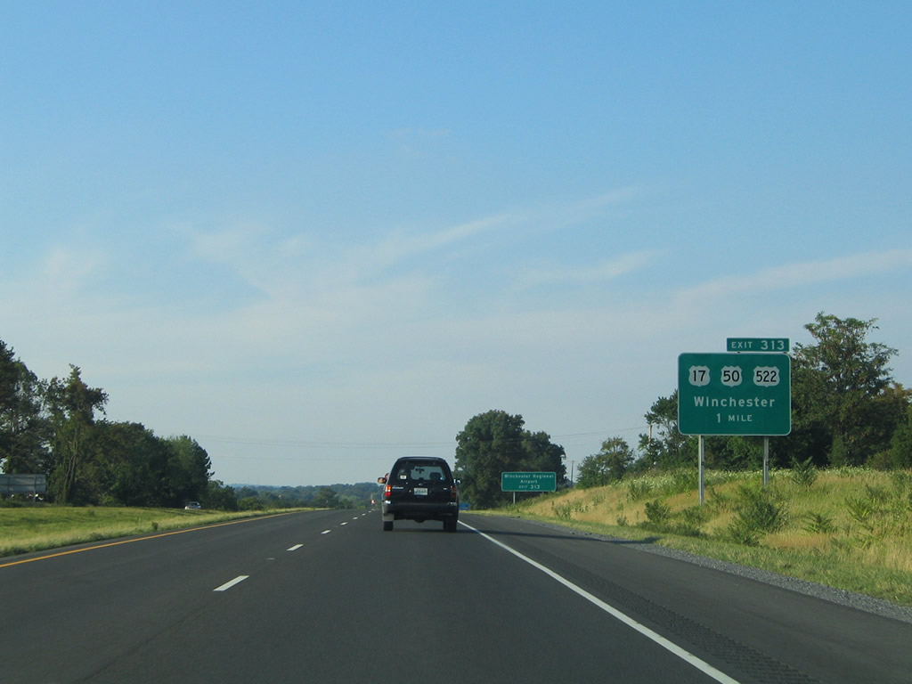
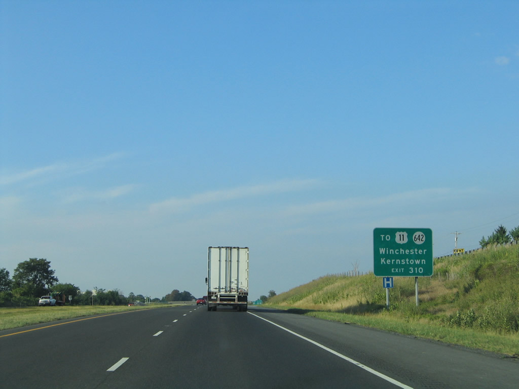
U.S. 522 (Front Royal Pike) runs 7.25 miles north from U.S. 340 at Double Tollgate to SR 645 (Airport Road) for Winchester Regional Airport (OKV) and U.S. 17/50 (Millwood Pike) at the cloverleaf interchange (Exit 313) with I-81.
07/24/04
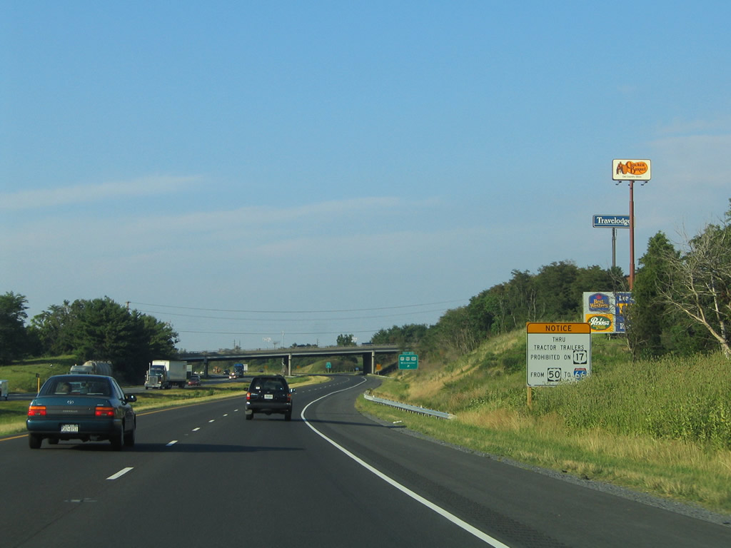
U.S. 17/50 overlap southeast from Winchester across the Blue Ridge Mountains to Paris in Fauquier County. Truck traffic is restricted along the route leading U.S. 17 south to Interstate 66.
07/24/04
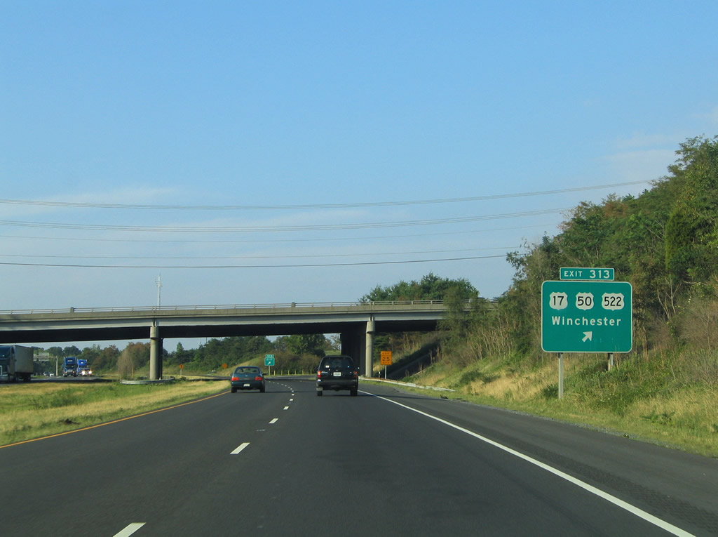
Exit 313 joins Millwood Pike where U.S. 522 combines with U.S. 17/50 west ahead of Shenandoah University and Apple Blossom Mall. U.S. 17/50/522 overlap northwest to the intersection of Cameron and Cork Streets in Downtown Winchester, where U.S. 17 ends.
07/24/04
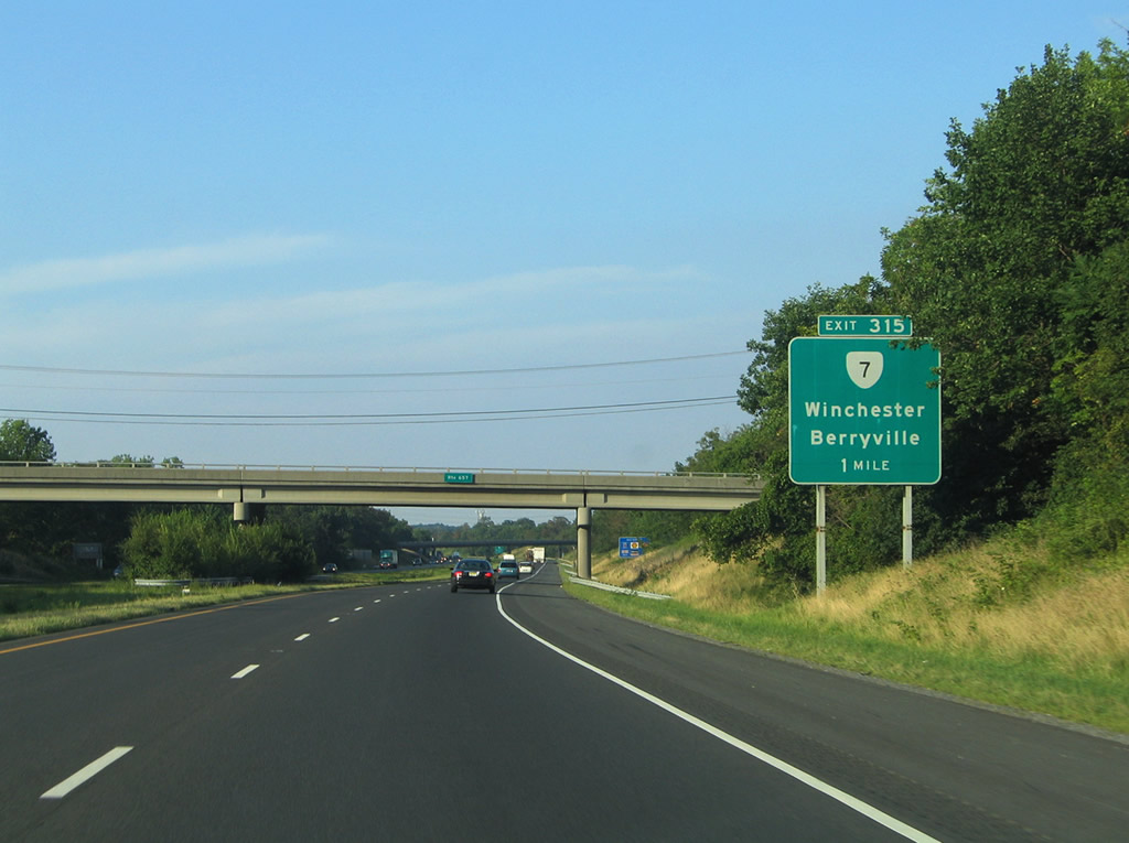
SR 7 originates in Downtown Winchester, 1.47 miles to the west at Piccadilly Street and U.S. 11/522 (N Cameron Street). Heading east along National Avenue and Berryville Avenue, SR 7 converges with I-81 at a folded diamond interchange (Exit 315) along the city line.
07/24/04
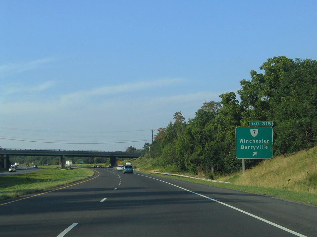
SR 7 (Berryville Pike) continues east from Winchester to the Clarke County seat of Berryville. The 72.40 mile long route ultimately leads to SR 400 (Washington Street) in the city of Alexandria.
07/24/04
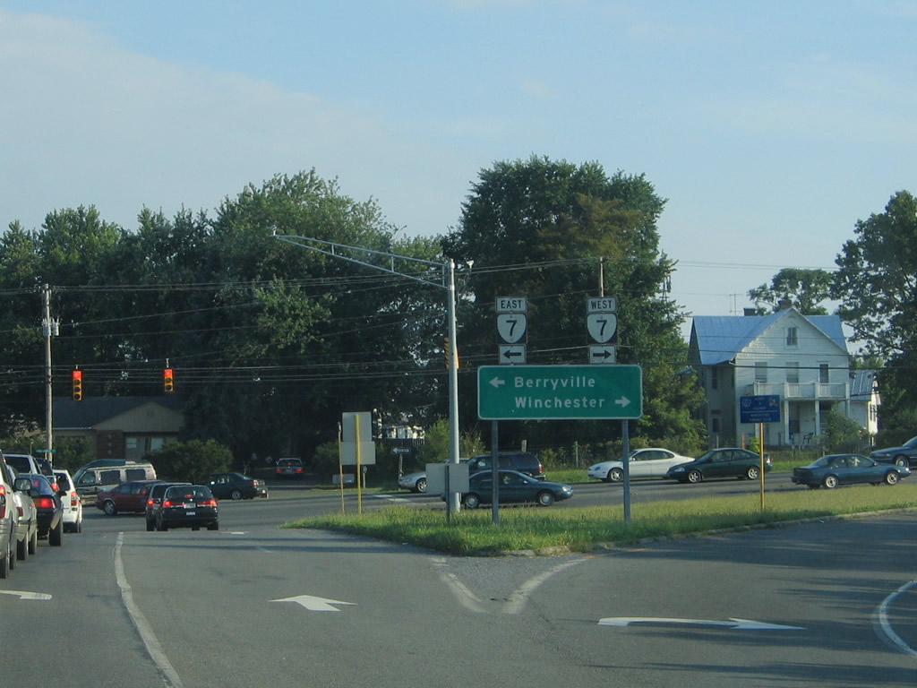
The off-ramp at Exit 315 ties into SR 7 (Berryville Avenue) across from SR 659 (Valley Mill Road). SR 7 varies between an arterial, expressway and freeway east to Leesburg and Herndon.
07/24/04
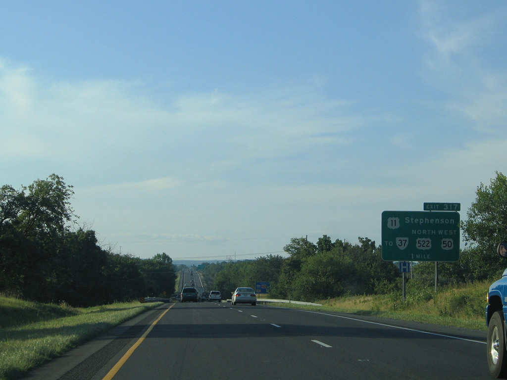
U.S. 11 crosses paths for the final time in Virginia at a diamond interchange (Exit 317) adjacent to the north end of SR 37. U.S. 11 follows Martinsburg Pike northeast from the couplet of Cameron and Loudon Streets in Winchester to a wye interchange with SR 37.
07/24/04
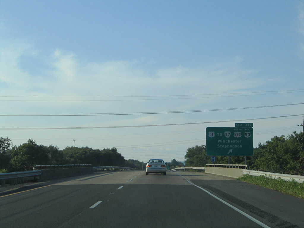
SR 37 travels west 1.9 miles to U.S. 522 and 3.6 miles to U.S. 50 from U.S. 11 (Martinsburg Pike) on the industrial north side of Winchester. U.S. 11 continues parallel to Interstate 81 through Stephenson and Clearbrook.
07/24/04
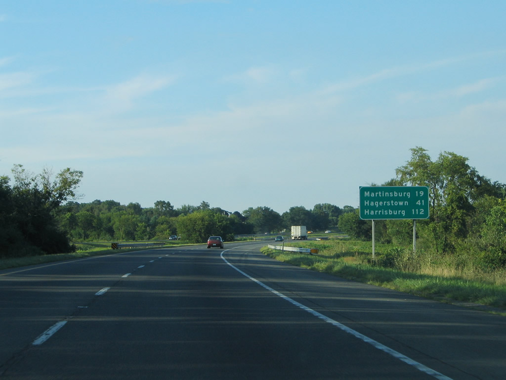
Harrisburg joins Hagerstown and Martinsburg as destinations for Interstate 81 north beyond the state line.
07/24/04
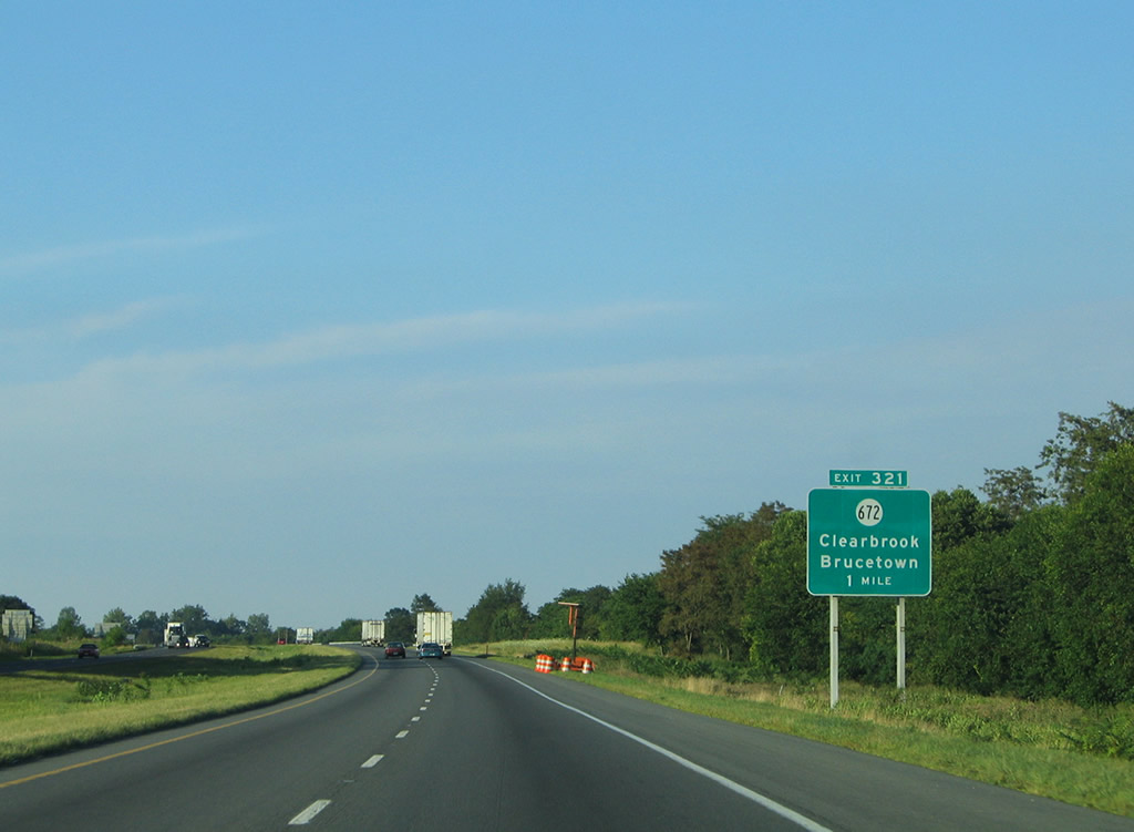
SR 672 (Hopewell Road) converges with Interstate 81 at Exit 321 and the unincorporated community of Clear Brook.
07/24/04
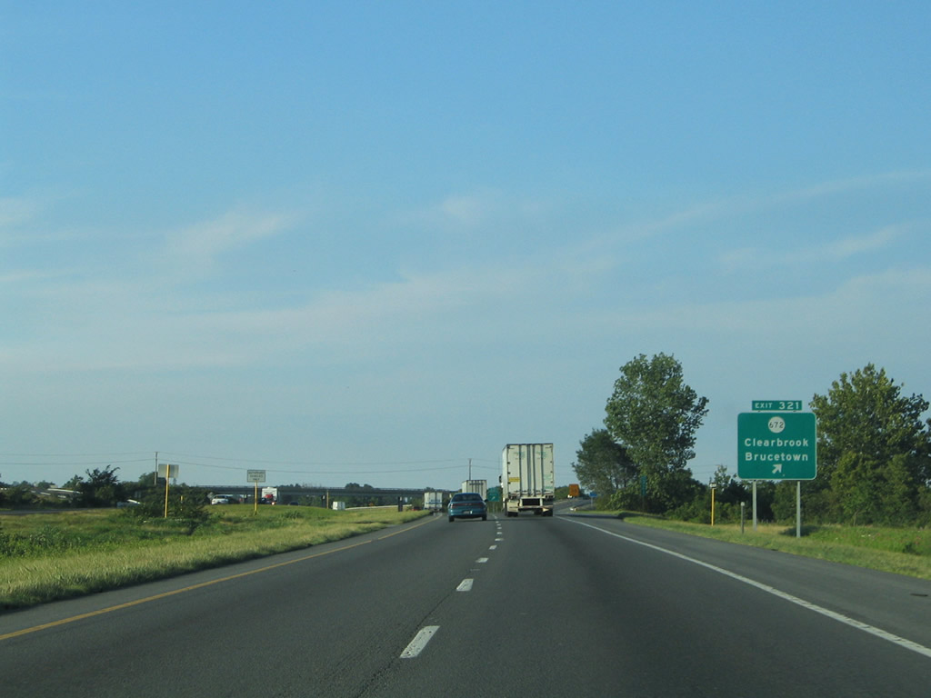
SR 672 heads 4.86 miles west to SR 654 (Apple Pie Ridge Road) at Cedar Grove and 6.31 miles east from U.S. 11 (Martinsburg Pike) and Clearbrook to Brucetown, Wadesville, and SR 761 (Old Charles Town Road) near Jamestown, West Virginia.
07/24/04
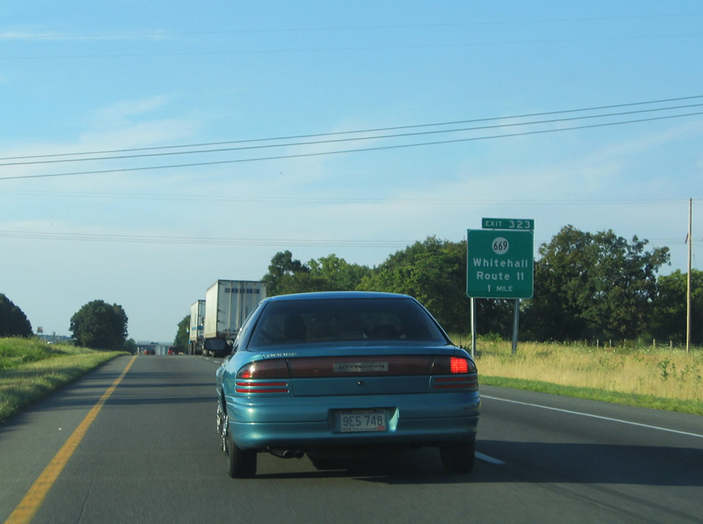
SR 669 (Rest Church Road) arcs east from SR 671 (White Hall Road) east of White Hall on Apple Pie Ridge, to meet Interstate 81 at Exit 321 near Rest.
07/24/04
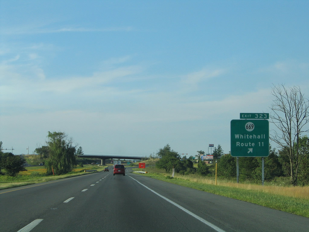
The diamond interchange (Exit 323) with SR 669 (Rest Church Road) lies adjacent to U.S. 11 (Martinsburg Pike) and an Amazon Fulfillment Center. U.S. 11 north enters Ridgeway, West Virginia nearby.
07/24/04

Photo Credits:
- Alex Nitzman: 07/24/04, 07/16/05
- ABRoads: 09/23/14
Connect with:
Page Updated Thursday April 29, 2021.