
Interstate 81 South - Christiansburg to Fort Chiswell
Confirming marker posted after the Texas Hollow Road (SR 641) underpass.
05/27/21
Traveling to the south of Fort Lewis Mountain, Interstate 81 progresses 22 miles to Christiansburg.
05/27/21
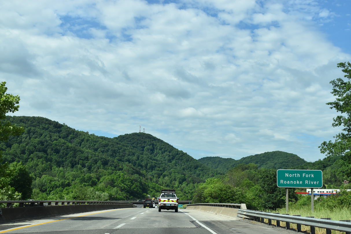
SR 647 (Dow Hollow Road) comprises a 0.20 mile long link between I-81 and parallel U.S. 11/460 (W Main Street).
05/27/21
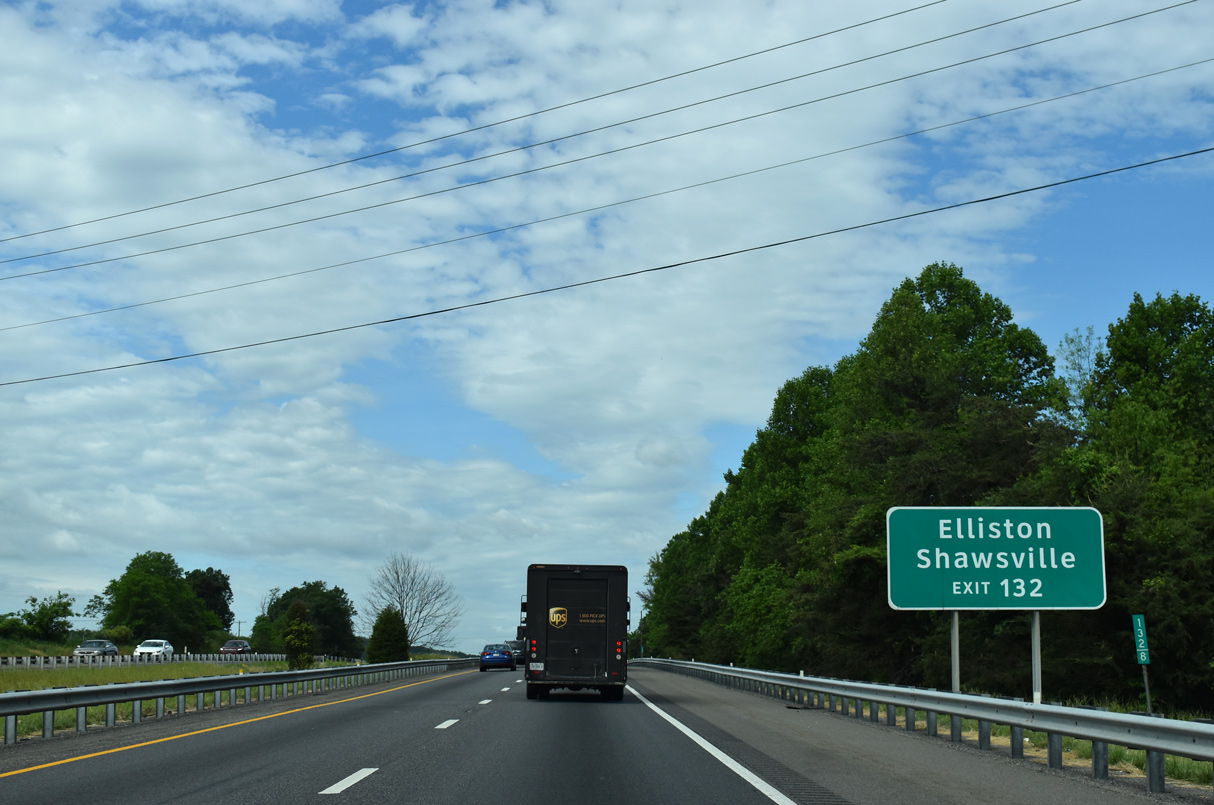
U.S. 11/460 follow the South Fork of the Roanoke River to Elliston south of the Pedlar Hills and Shawsville southeast of Middle Piece Mountain.
05/27/21
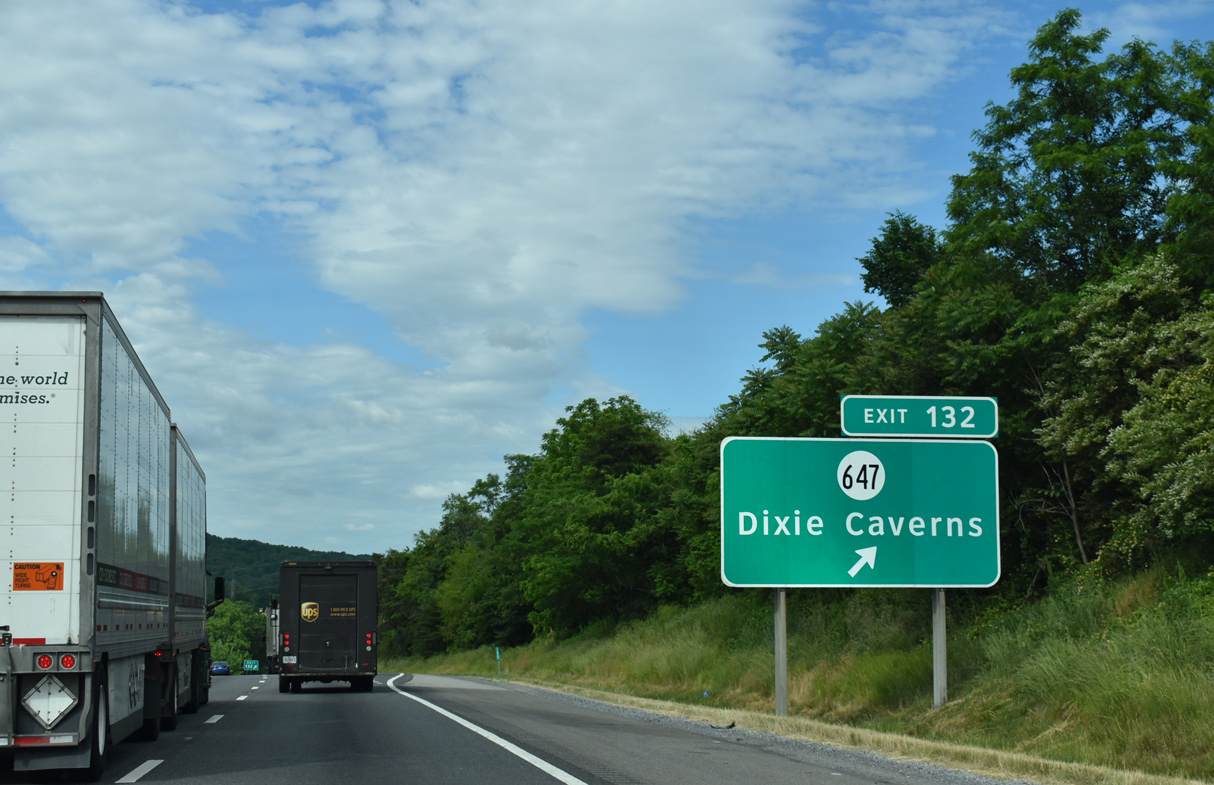
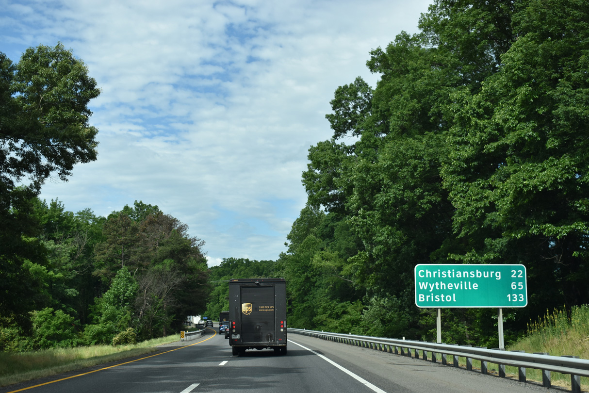
Entering the diamond interchange (Exit 132) with SR 647 (Dow Hollow Road) by Dixie Caverns.
05/27/21
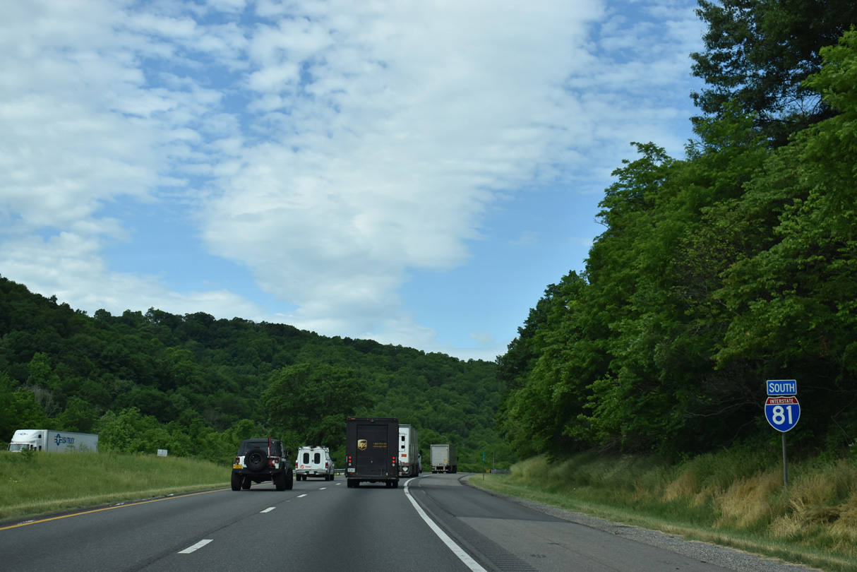
Interstate 81 continues through an S-curve ahead of Sawmill Hollow.
05/27/21
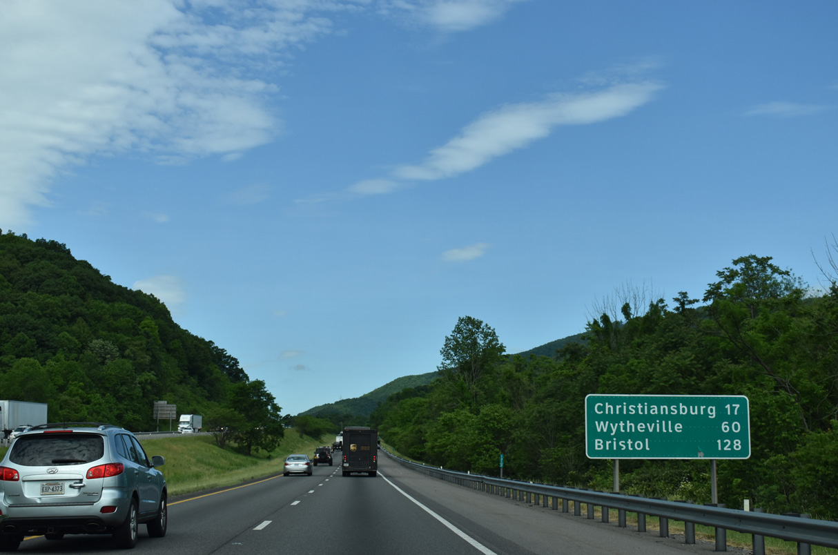
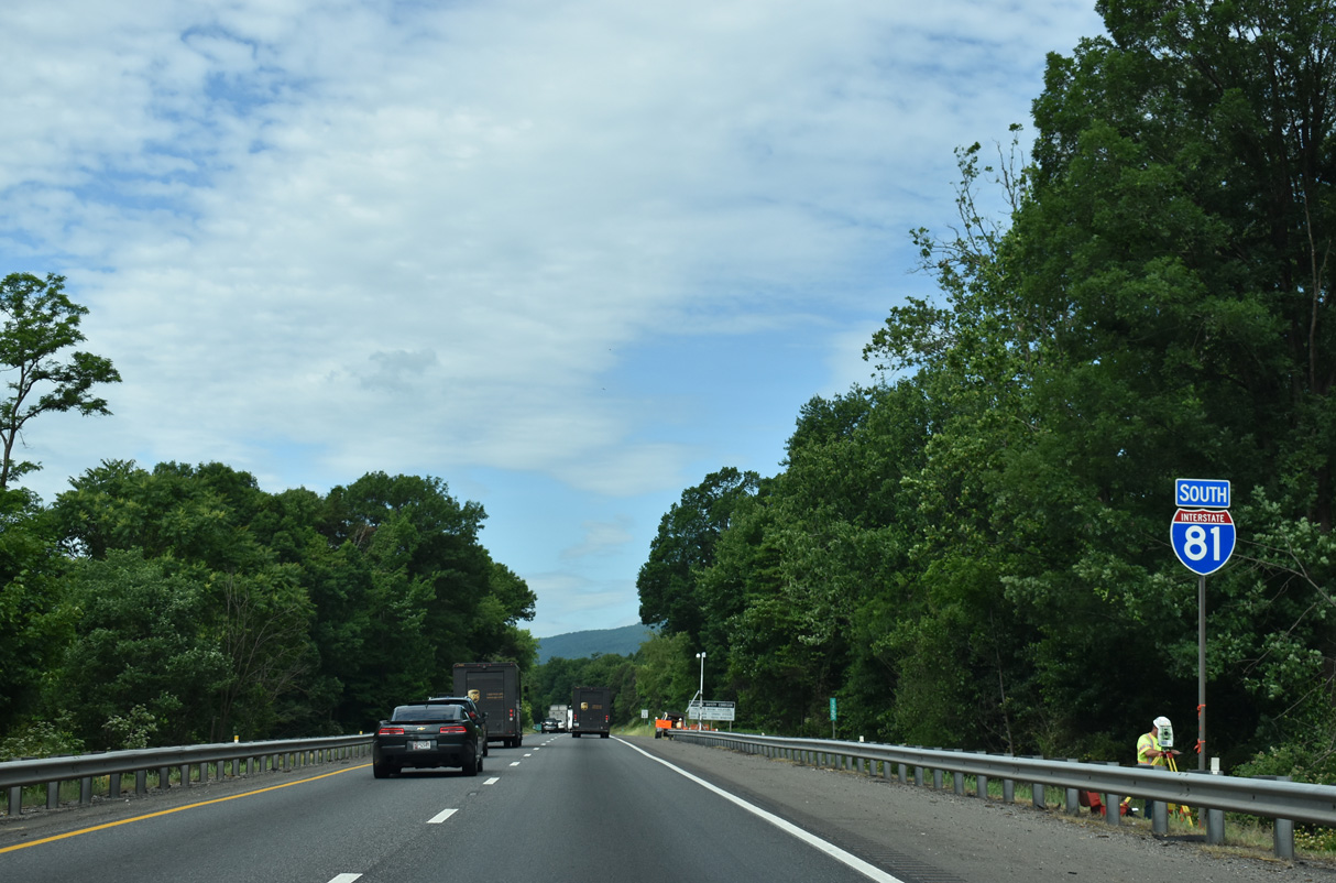
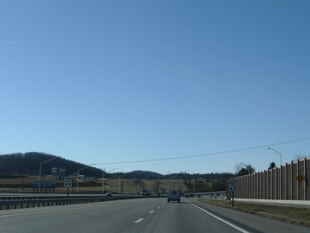
Continuing southwest from Riverside and Fort Lewis Mountain, Interstate 81 reaches Christiansburg in 17 miles and Wytheville in 60 miles.
05/27/21
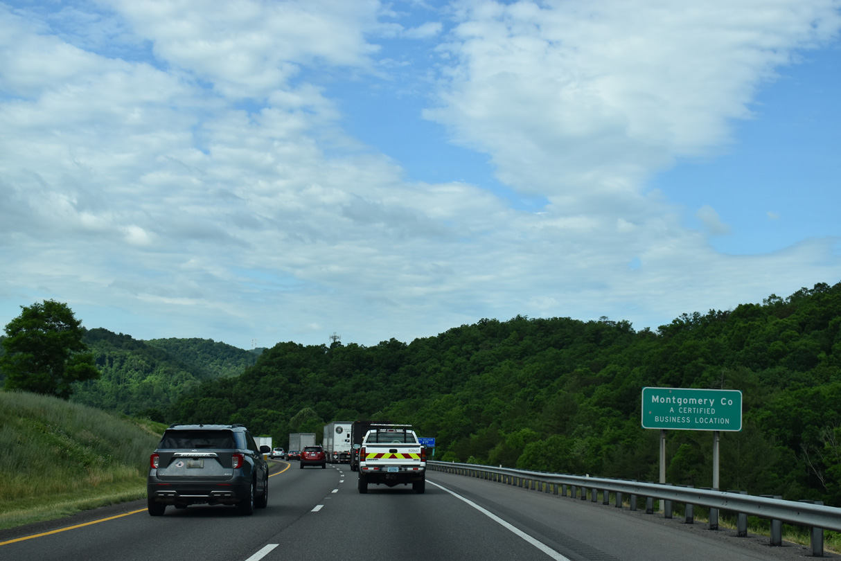
Interstate 81 crosses the Montgomery County line north of Lafayette and adjacent to Sawmill Hollow.
05/27/21
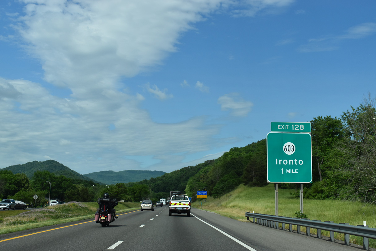
Forthcoming Exit 128 joins Interstate 81 south with SR 603 (N Fork Road) to U.S. 11/460 (Roanoke Road).
05/27/21
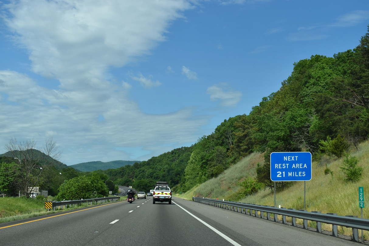
The Ironto Safety Rest Area lines the northbound roadway of Interstate 81, 21 miles from the succeeding facility on southbound.
05/27/21
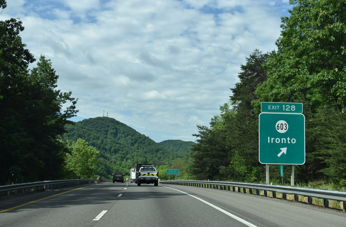
SR 603 follows N Fork Road east around Pedlar Hills to U.S. 11/460 (Roanoke Road) between Elliston and Lafayette. West of Exit 128, SR 603 parallels the North Fork Roanoke River to Ironto and Ellett west of Hightop Mountain.
05/27/21
The diamond interchange at Exit 128 lies just south of the bridges spanning the North Fork Roanoke River and a Norfolk Southern Railroad line.
05/27/21
Ascending through Pedlar Hollow west from the North Fork Roanoke River, southbound I-81 expands to three lanes.
05/27/21

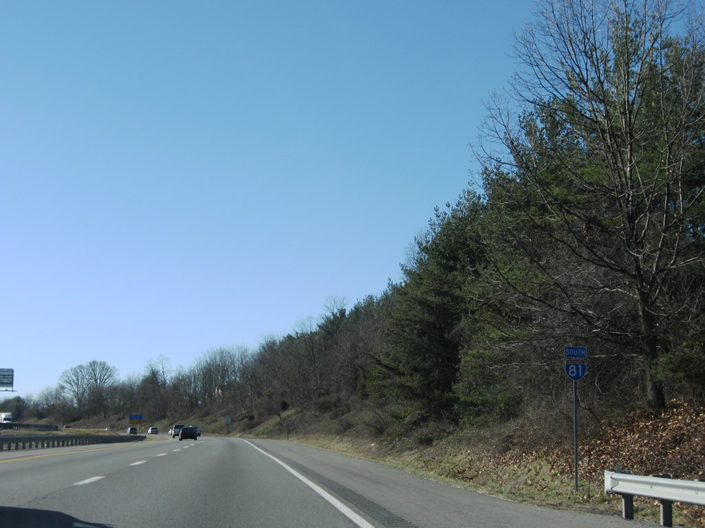
Traversing the Pedlar Hills, Interstate 81 continues 13 miles to Christiansburg.
05/27/21
A planned interchange will link I-81 with a 5.7 mile long limited access highway west to U.S. 460 at Blacksburg. A portion of this road is the 05/27/21
Interstate 81 at Dee Cee Hill.
05/27/21
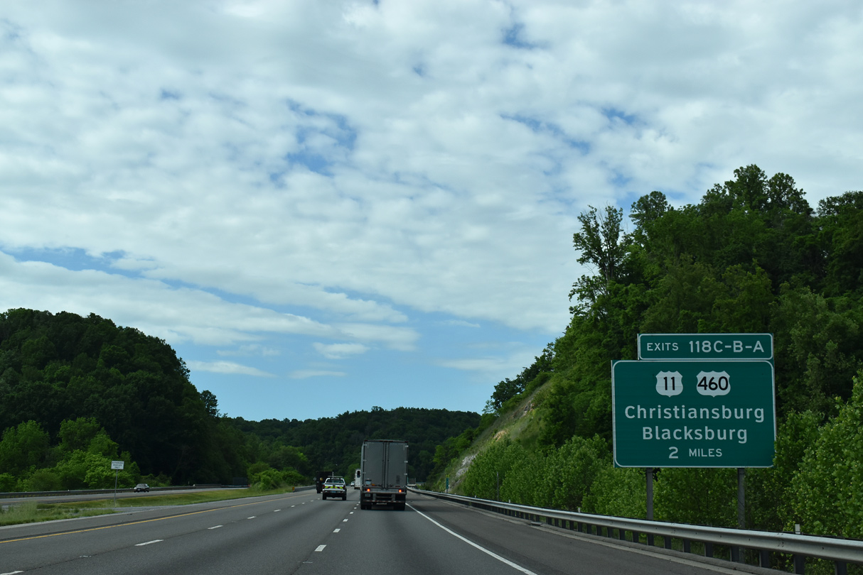
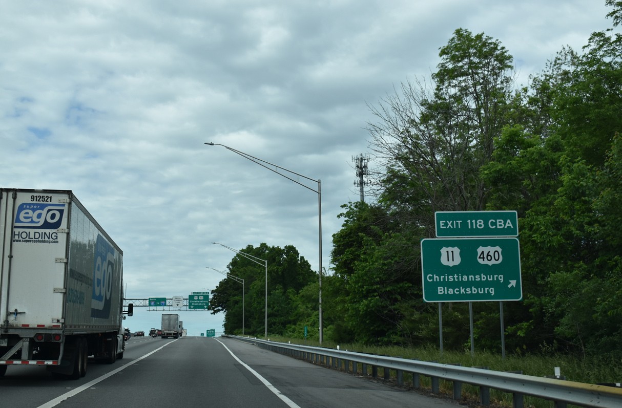
U.S. 11/460 (Roanoke Street) lead west from Shawville to eastern Christiansburg, where they converge with I-81 at Exit 118C.
05/27/21
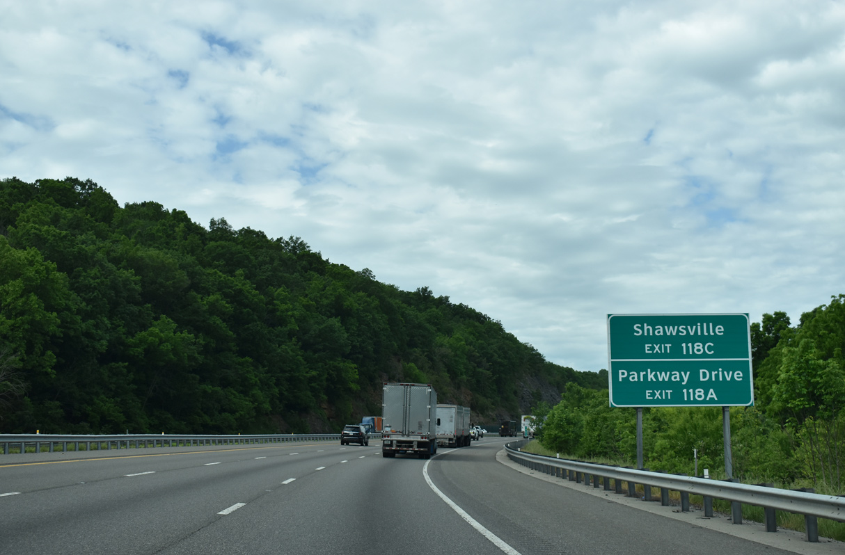
Parkway Drive spurs southwest from the end of the Christiansburg Bypass (U.S. 460) at I-81 to a business and technology park.
05/27/21
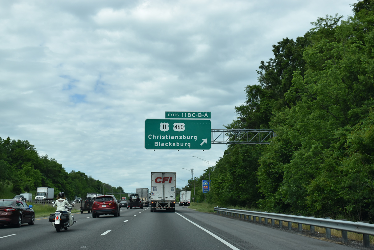
U.S. 11/460 partition at the forthcoming six-ramp parclo interchange (Exit 118C) with Roanoke Street.
05/27/21
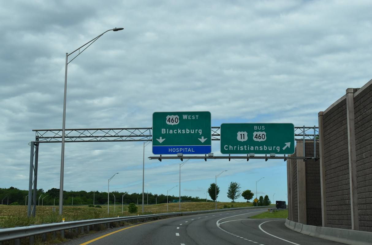
U.S. 460 west utilizes the c/d roadway along I-81 west to Exit 118B, where it turns north toward Blacksburg and Pearisburg.
05/27/21
U.S. 460 extends north from I-81 along a freeway to the Virginia Tech campus in Blacksburg.
05/27/21
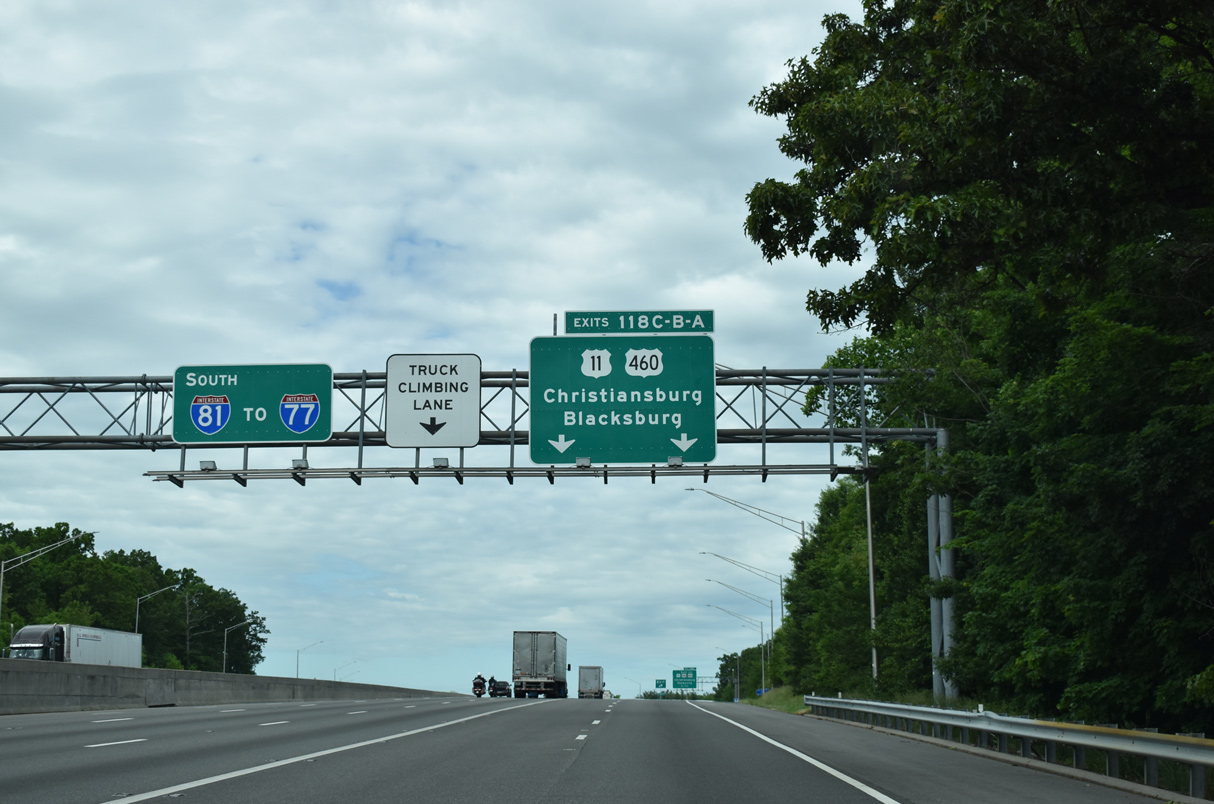
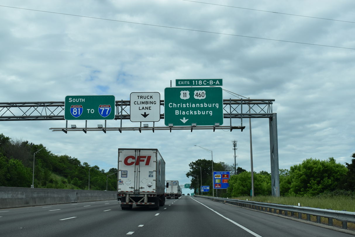
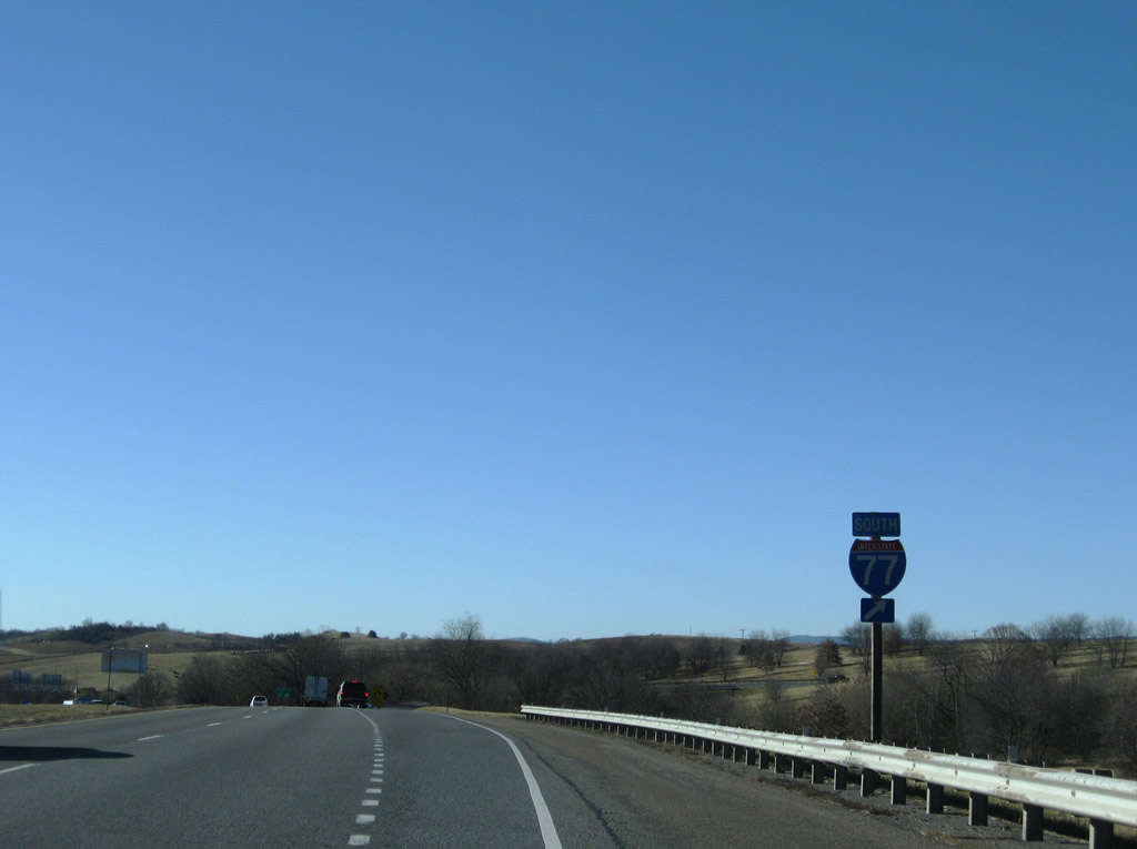
Interstate 77 appears for the first time along I-81 south at the separation with the c/d roadway for Exit 118.
05/27/21
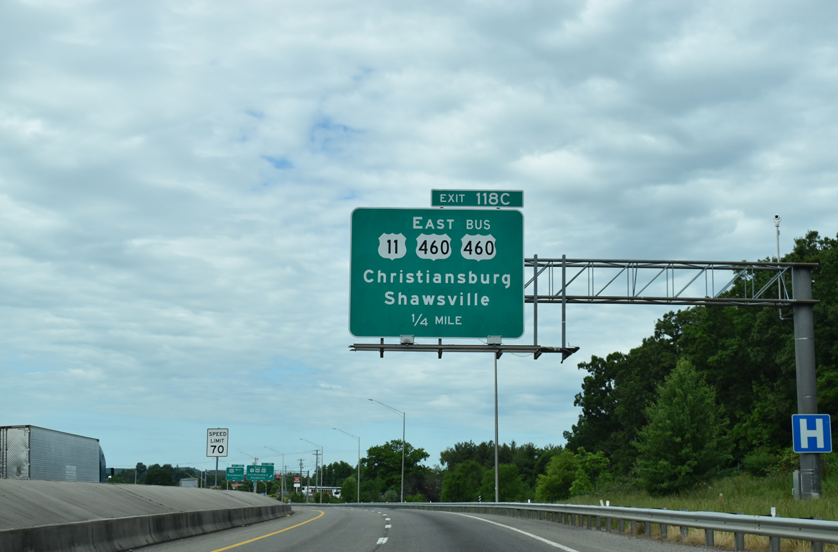
U.S. 11/460 overlap 22.25 miles east to Downtown Salem. U.S. 11 (Roanoke Street) continues west alongside U.S. 460 Business from Exit 118C to the intersection of Main and Franklin Streets in Downtown Christiansburg.
05/27/21
Auto dealerships, big box hotels and fast food chains line U.S. 11/460 Business (Roanoke Street) west from Interstate 81 to U.S. 460 (Christiansburg Bypass).
05/27/21
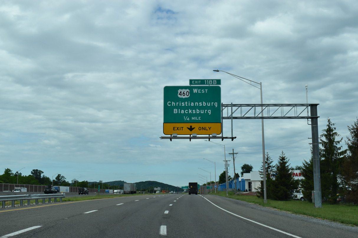
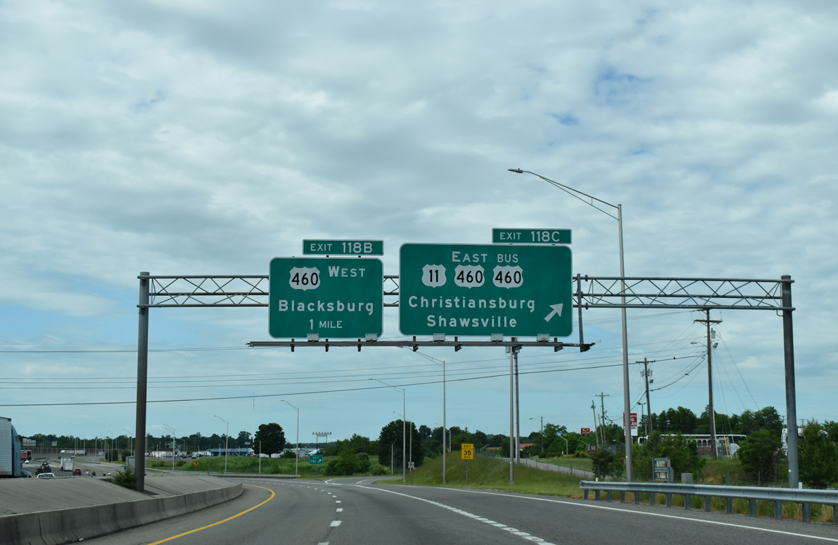
Interstate 81 continues with six overall lanes between the c/d roadway system to the cloverleaf interchange (Exit 118B/A) with U.S. 460 in south Christiansburg.
05/27/21
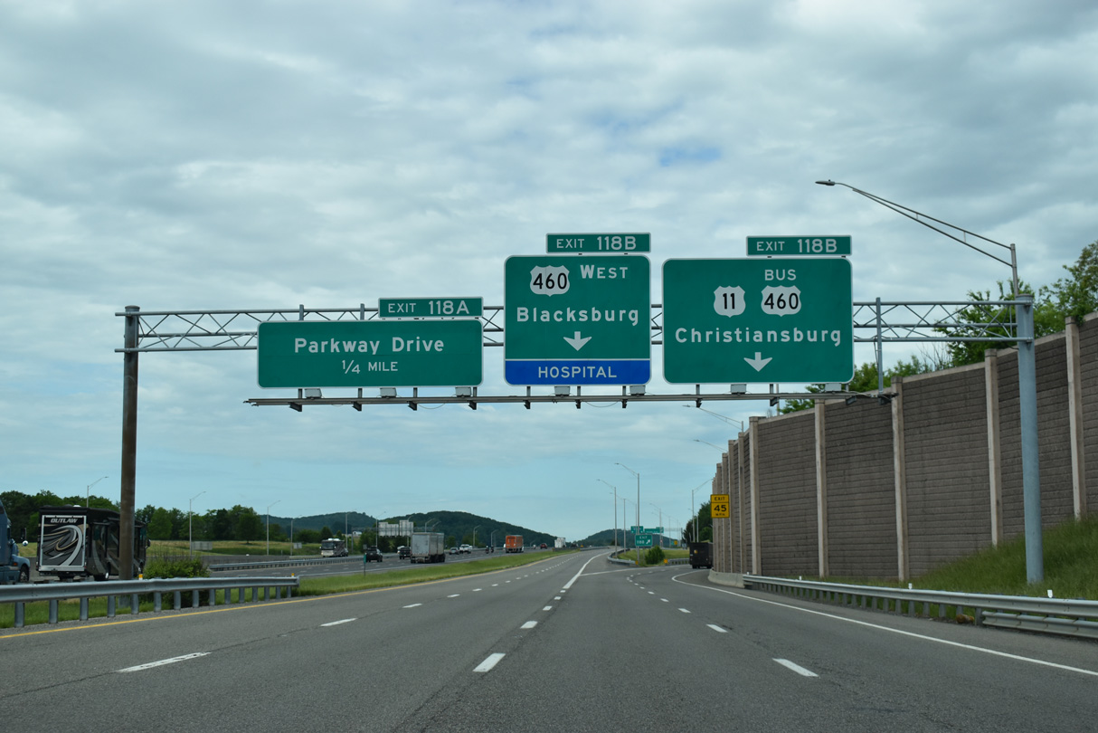
Exit 118B splits into separate ramps for U.S. 460 (Christiansburg Bypass) leading north to Blacksburg and U.S. 11/U.S. 460 Business (Roanoke Street) east of the city center.
05/27/21
U.S. 460 originally followed Franklin Street north from Christiansburg to Main Street in Blacksburg. U.S. 460 shifted to a bypass of north Christiansburg in 1969, and south Christiansburg by 2001. The Christiansburg Bypass was connected to the Blacksburg Bypass by 2003.1
05/27/21
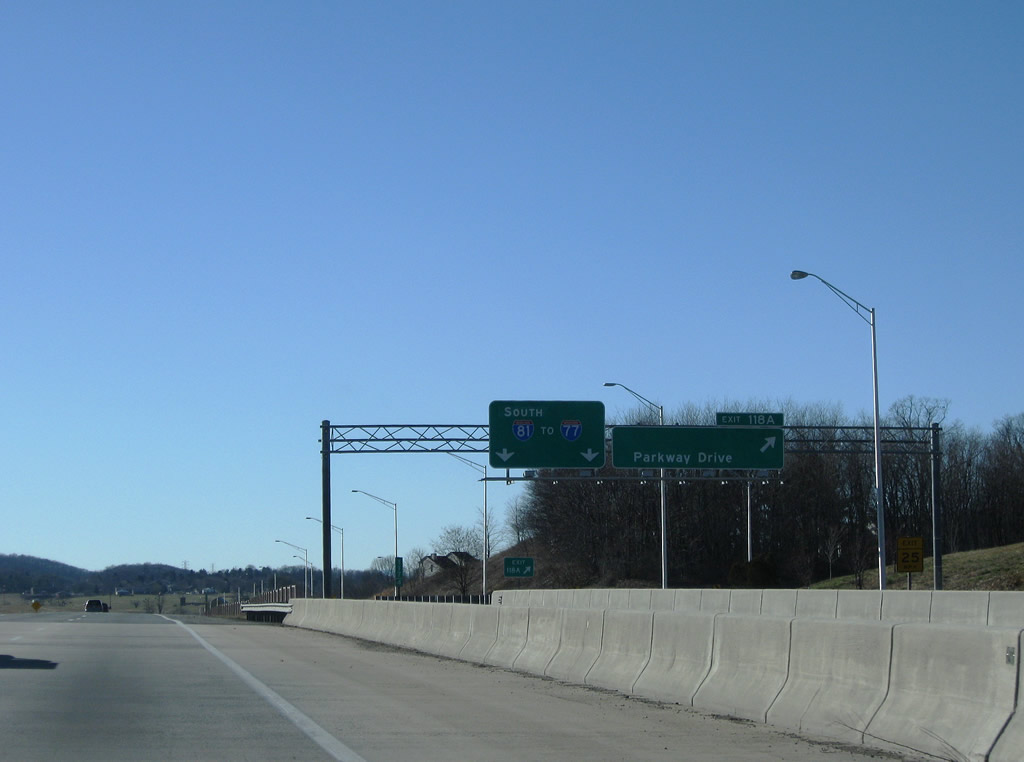
Exit 118A loops from the c/d roadway onto Parkway Drive south ahead of Falling Branch Road (SR 640).
12/30/08
Interstate 81 was expanded with c/d roadways at Exit 118 during construction to extend the Christiansburg Bypass south in 2001.
12/30/08
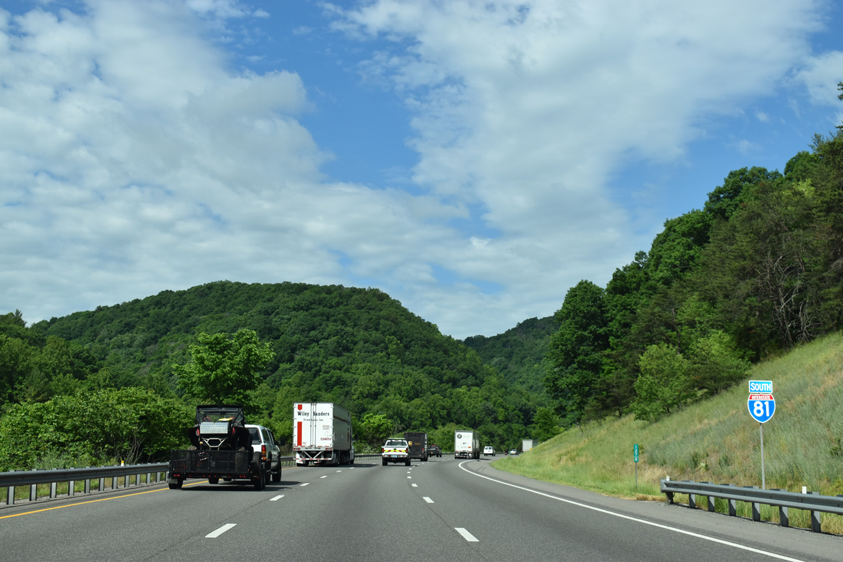
Interstate 81 advances 12 miles west to Radford and southwest to I-77 ahead of Wytheville.
12/30/08
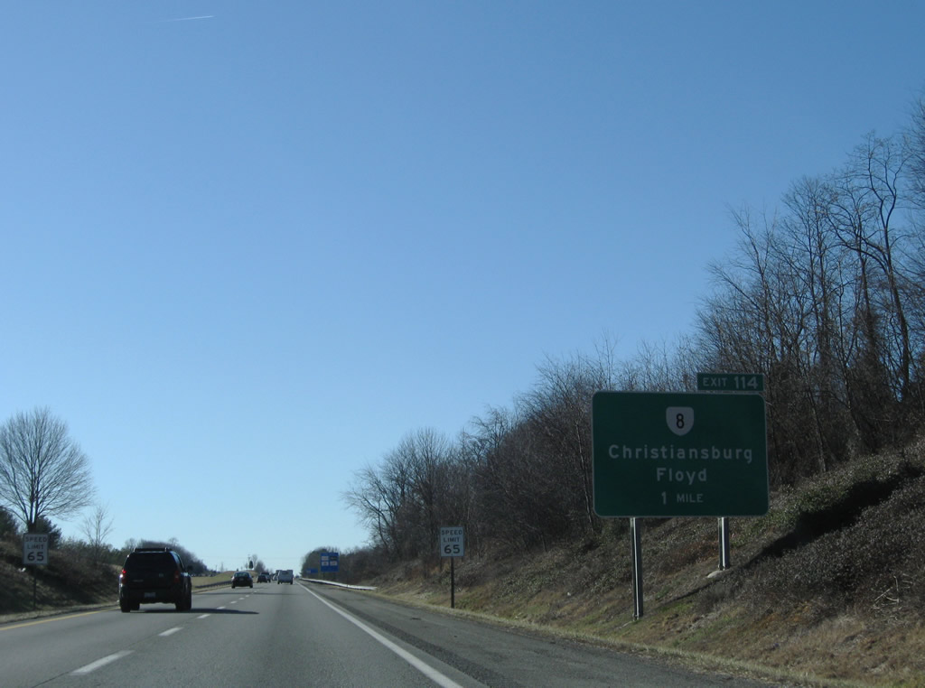
SR 8 (W Main Street) branches 0.99 miles southwest from U.S. 11 (Radford Street) outside Downtown Christiansburg to the diamond interchange at Exit 114.
12/30/08

Measuring 55.88 miles southeast to Riner, Floyd and Stuart, SR 8 is part of a multi state highway with NC 8 to New London.
12/30/08
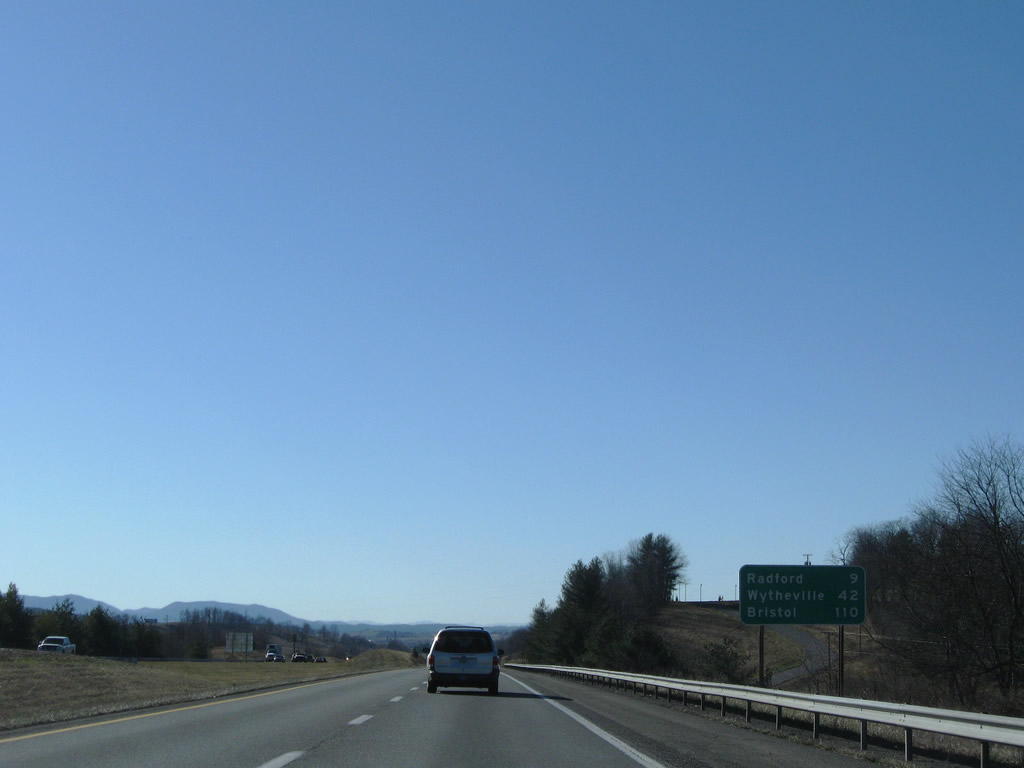
Leaving Christiansburg, Interstate 81 travels nine miles west to Radford and 110 miles southwest to Bristol.
12/30/08
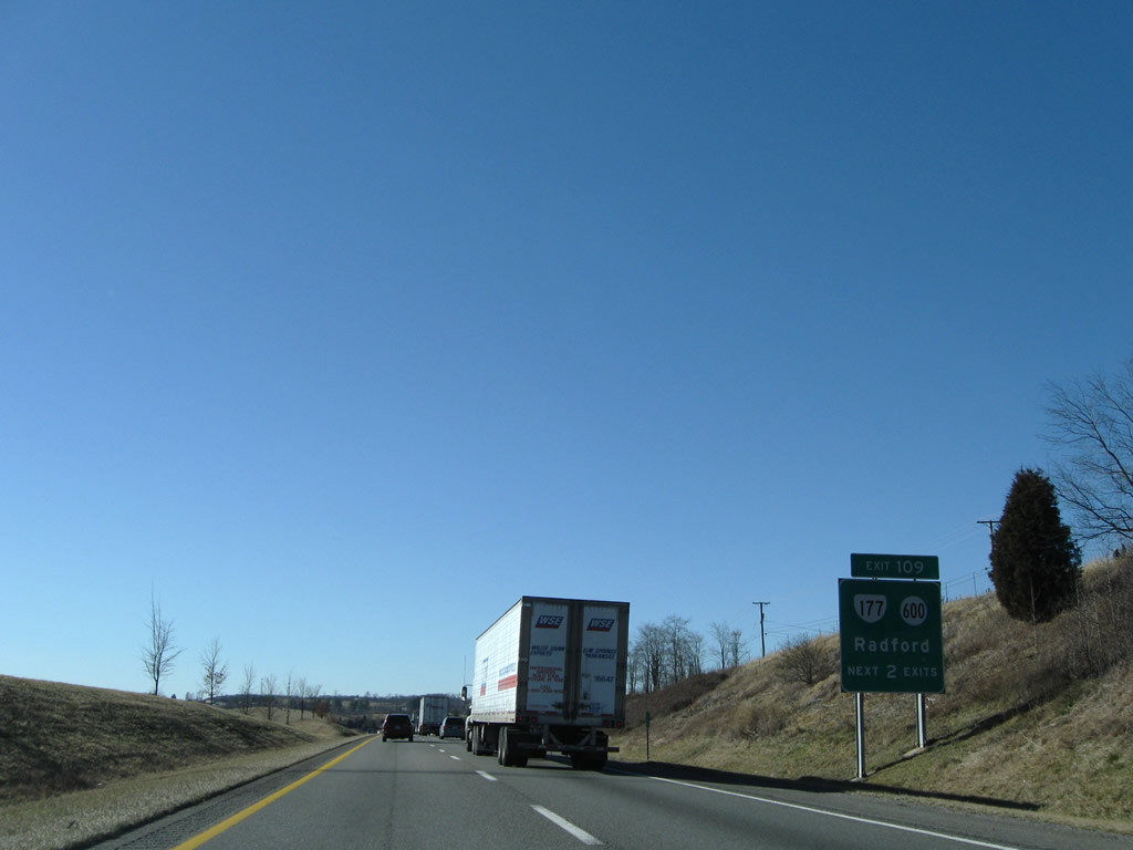
A 4.41 mile long route northwest to U.S. 11 in Radford, SR 117 begins at a diamond interchange (Exit 109) with SR 600 (Tyler Road) south to Childress.
12/30/08
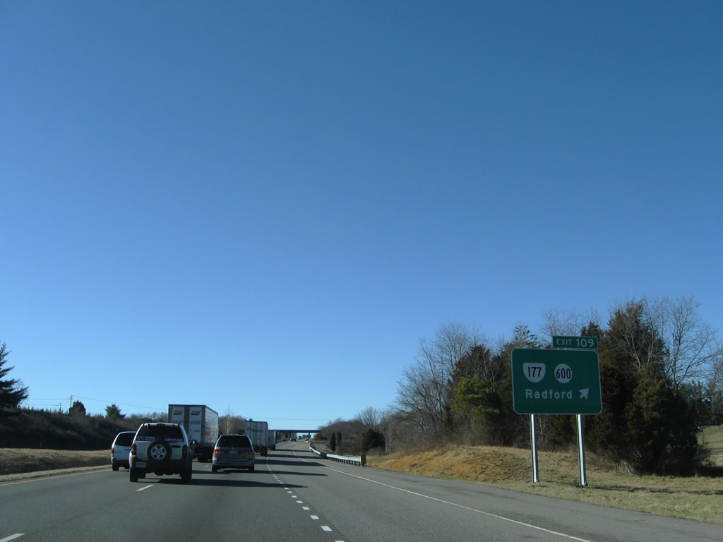
Following Tyler Road/Avenue, SR 177 constitutes a four lane arterial north into the independent city of Radford. SR 117 meets U.S. 11 at Radford University, east of the bridge taking U.S. 11 over the New River.
12/30/08
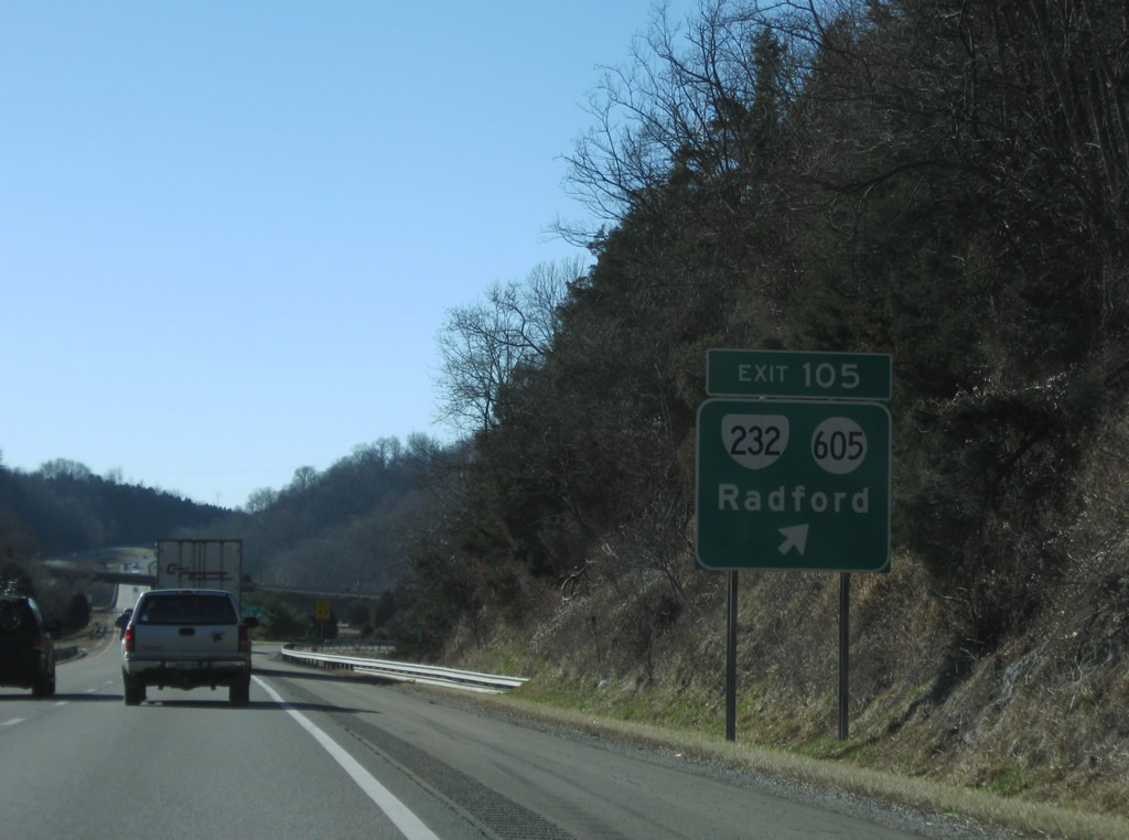
Interstate 81 stays just south of the Radford city line, meeting SR 232 (1st Street) north at SR 605 (Little River Road) ahead of the New River. SR 232 arcs northeast from Exit 105 through Downtown Radford to U.S. 11 by Fairlawn.
12/30/08
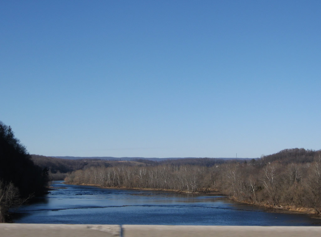
Looking north at the New River from Interstate 81 south of Radford.
12/30/08
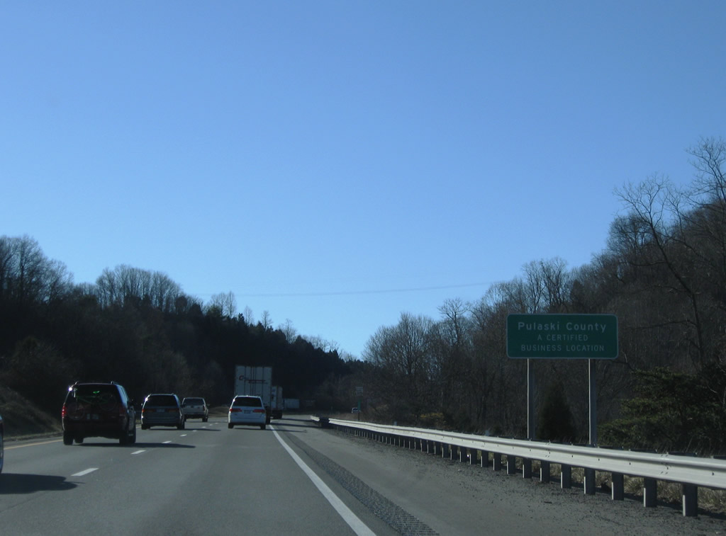
Southbound travelers enter Pulaski County midway across the New River.
12/30/08
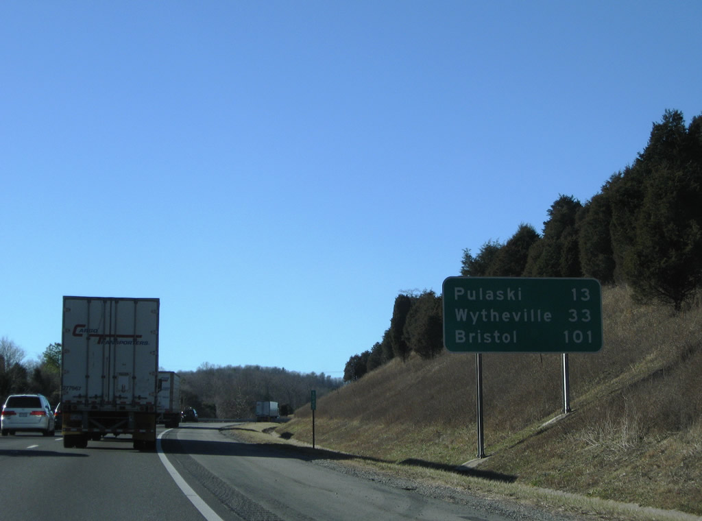
Interstate 81 remains fairly rural and passes Pulaski to the south en route to Wytheville. Bristol is 101 miles to the southwest.
12/30/08

SR 660 (State Park Road) meets Interstate 81 at the first Pulaski County interchange (Exit 101). SR 660 connects the freeway with Claytor Lake Park along the New River to the south.
12/30/08
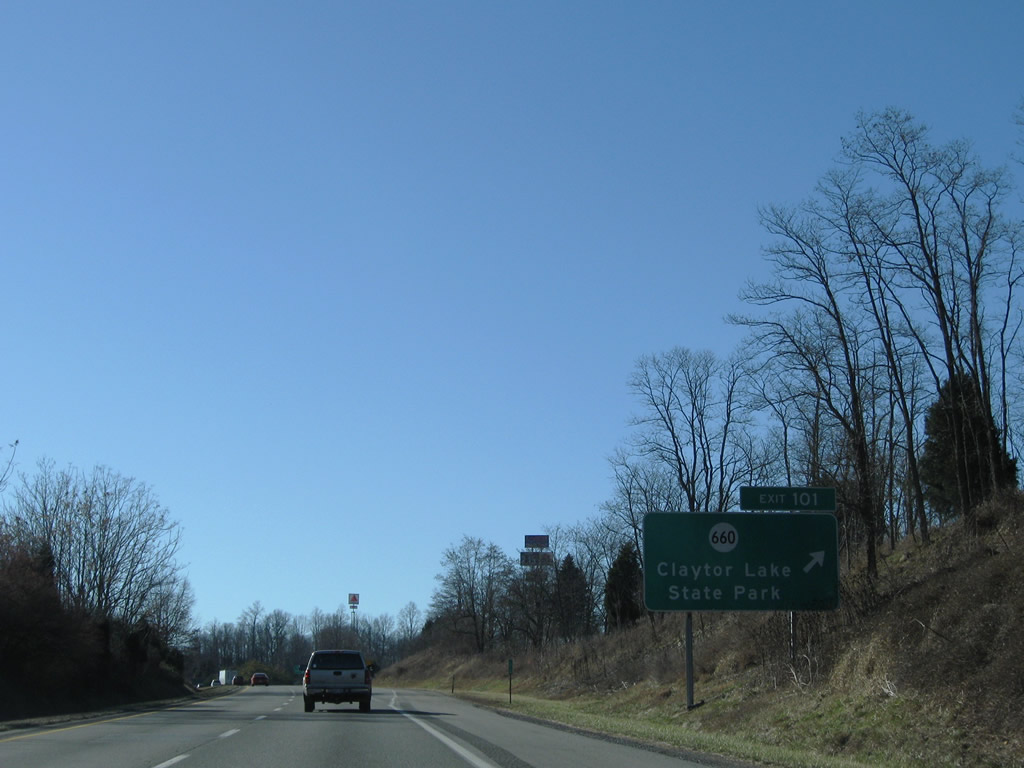
Exit 101 departs Interstate 81 south for SR 660 (State Park Road). SR 660 ties into SR 661 (Wilderness Road) nearby; SR 661 parallels Interstate 81 west from Mountain View to Burlington Mills.
12/30/08
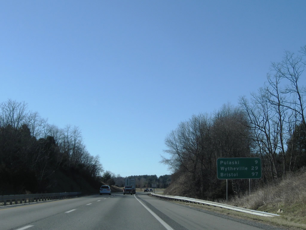
Nine miles east of Pulaski on Interstate 81 south.
12/30/08
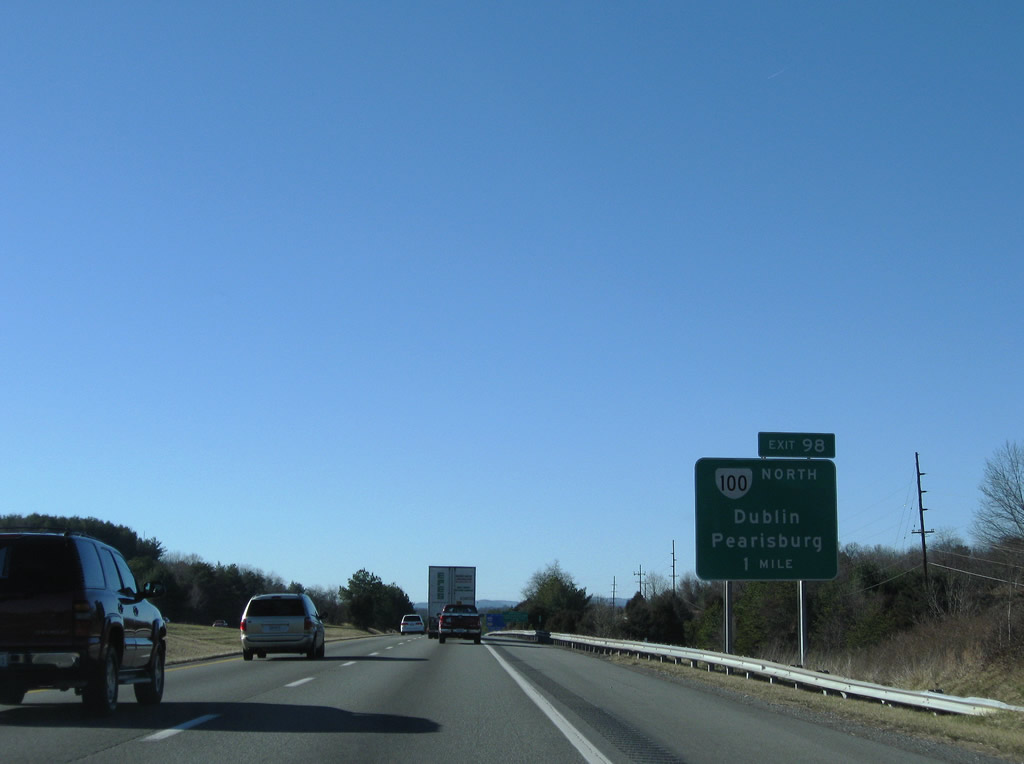
SR 100 joins Interstate 81 with Dublin and New River Community College north from a diamond interchange (Exit 98) near Newburn.
12/30/08
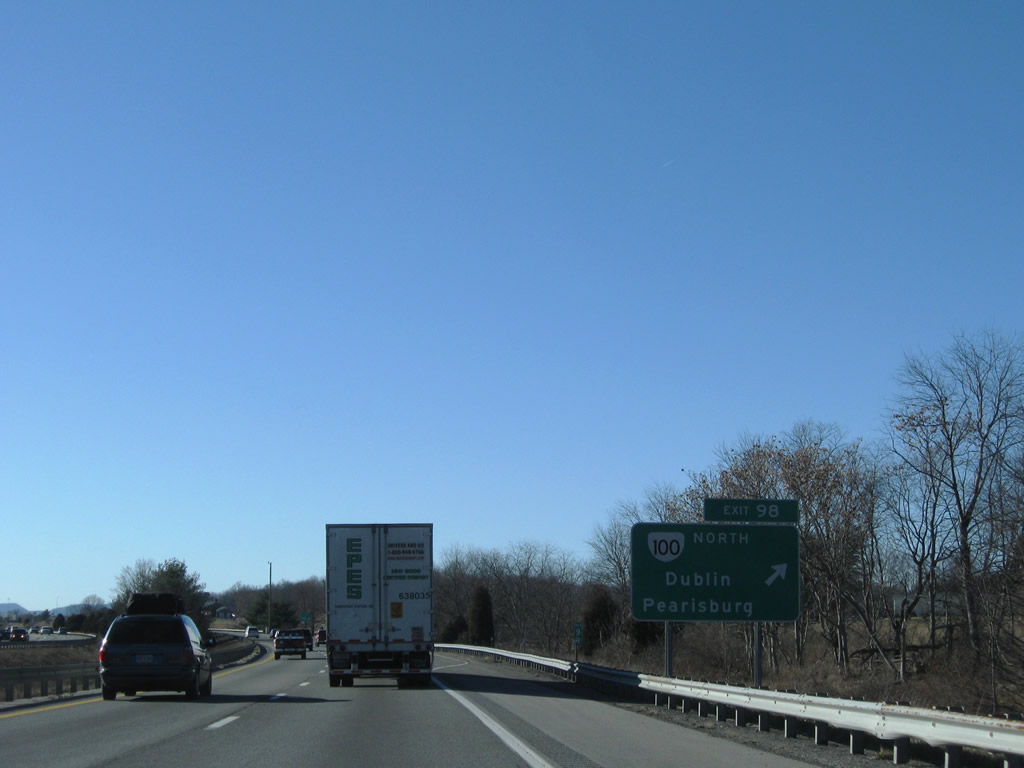
Exit 98 leaves I-81 south for SR 100 (Cleburne Boulevard) north to Burlington Mills, Dublin and New River Valley Airport (PSK). SR 100 concludes at U.S. 460 Business at Pearlsburg.
12/30/08
SR 100 was relocated onto Interstate 81 by 1965.2 Old Route 100 Road was the pre-freeway alignment of SR 100 east through Newburn and McAdam.
12/30/08
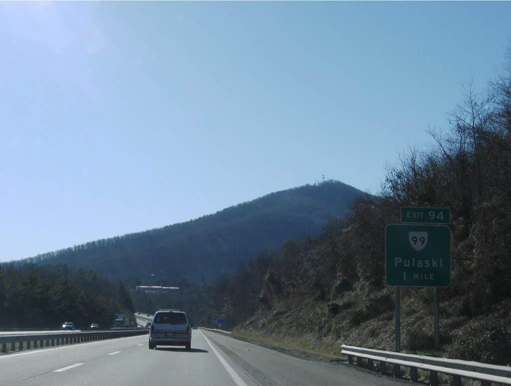
Exit 94 joins I-81/SR 100 with the south end of SR 99 (Count Pulaski Drive). SR 99 runs 5.20 miles north to Randolph Avenue and the Pulaski town line.
12/30/08
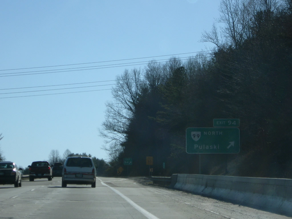
The parclo interchange at Exit 94 provides access to SR 99 (Count Pulaski Drive) northbound only from I-81/SR 100 south. Count Pulaski Drive ends at Old Route 100 Road just east of the exchange.
12/30/08
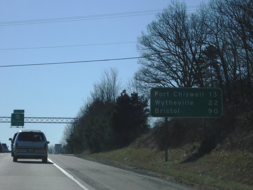
13 miles to the southwest, Fort Chiswell marks the point where Interstate 77 and U.S. 52 join I-81/U.S. 11.
12/30/08
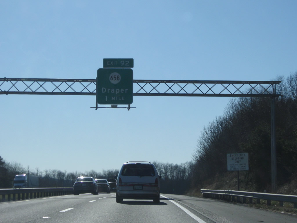
Straddling the east side of Draper Mountain, I-81/SR 100 continue south to Exit 92 with SR 658 (Greenbriar Road).
12/30/08

SR 658 (Greenbriar Road) heads south from the diamond interchange at Exit 92 and parallel Draper Valley Road to Draper and Claytor Lake. Connections with SR 654 (Old Baltimore Road) lead south of Barrett Ridge to SR 100 south of Exit 89.
12/30/08
I-81/SR 100 and the companion frontage roads (Draper Valley Road / Kirby Road) line the north side of Barrett Ridge.
12/30/08
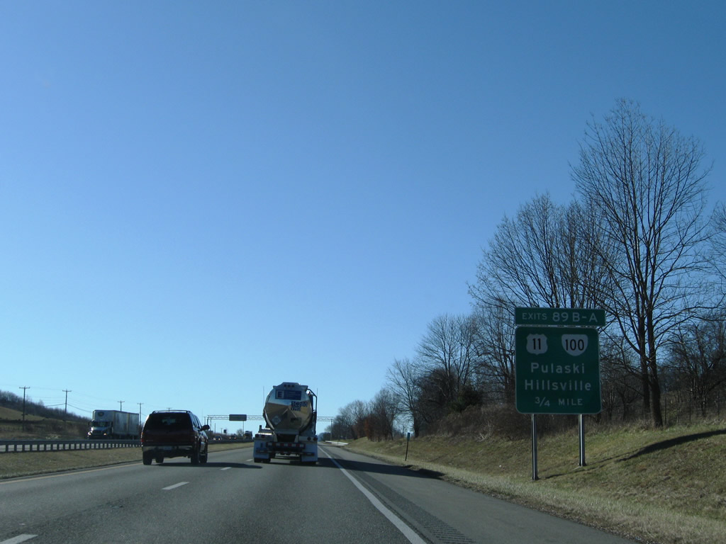
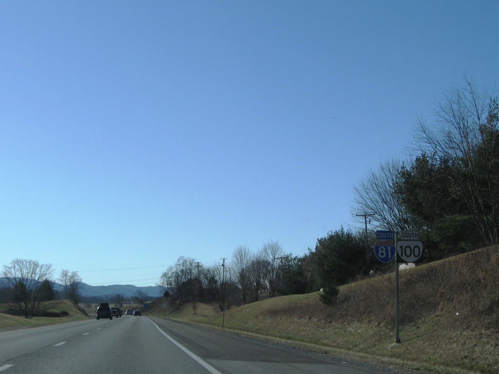
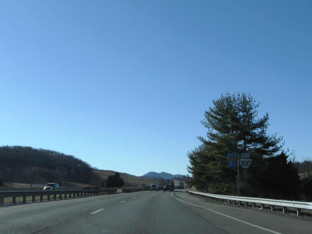
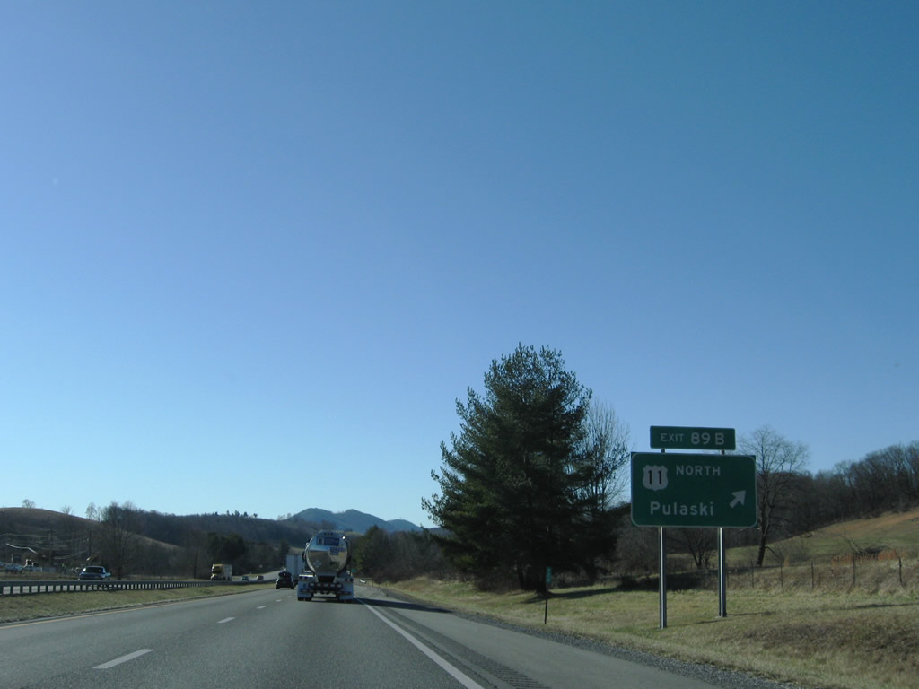
SR 100 separates with I-81 south at the cloverleaf interchange (Exit 89) with U.S. 11 south from Draper Valley and Pulaski.
12/30/08
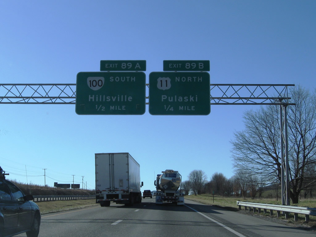
North from Exit 89B, U.S. 11 (Lee Highway) meanders across Draper Mountain to Washington Avenue south of Downtown Pulaski. SR 100 follows Wysor Road south from Exit 89A to Barren Springs.
12/30/08
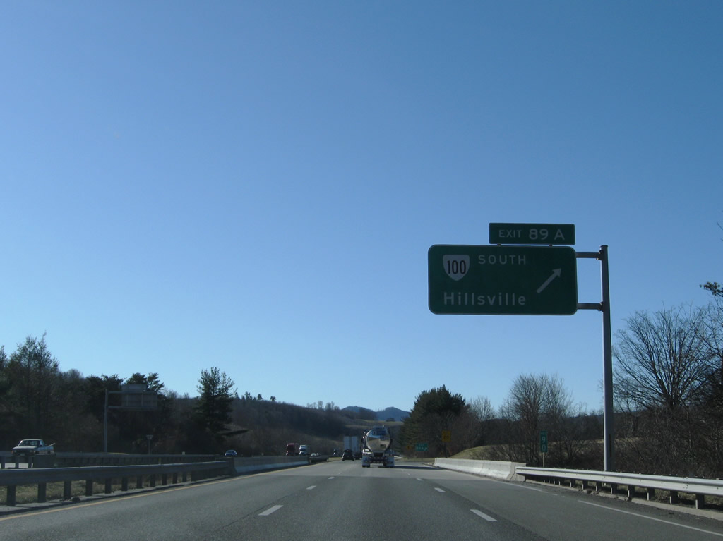
SR 100 leads away from Interstate 81 south to Sylvatus and the Carroll County seat of Hillsville.
12/30/08
 South
South
Continuing west through Draper Valley, Interstate 81 and U.S. 11 south enter Wythe County.
12/30/08
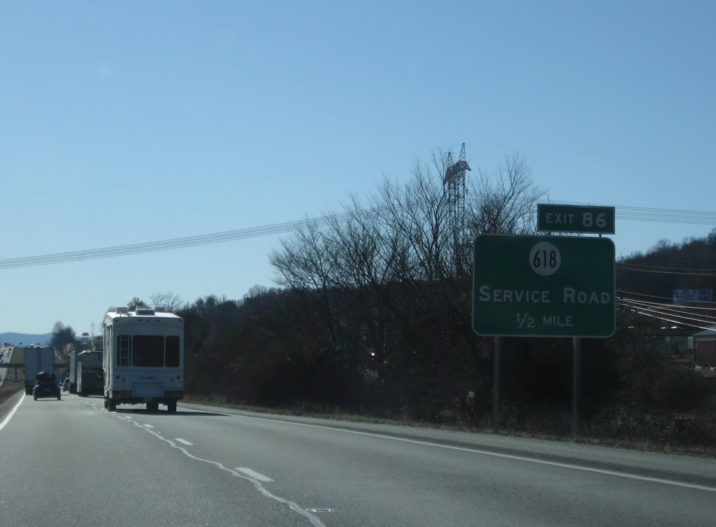
Honaker Road (former U.S. 11) becomes E Lee Highway paralleling Interstate 81 south into Wythe County. SR 618 links I-81/U.S. 11 with E Lee Highway at Exit 86.
12/30/08
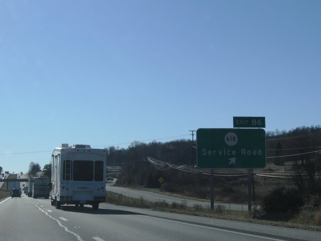
SR 618 follows Topaz Drive east from Exit 86 to Reed Creek Drive south. Topaz Drive constitutes a frontage road for I-81 west to Exit 84 while Old U.S. 11 (E Lee Highway) diverges from the freeway.
12/30/08
Southbound reassurance shields posted for I-81/U.S. 11 between Exits 86 and 84.
12/30/08
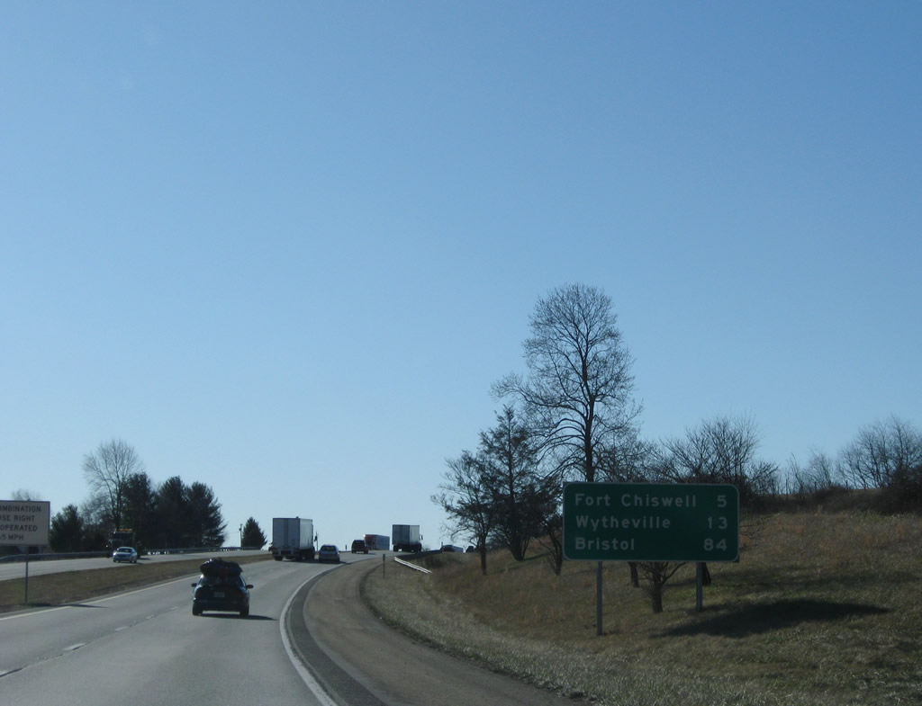
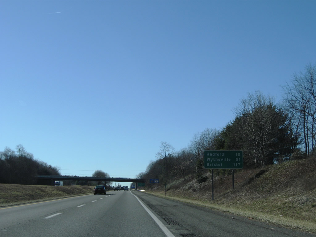
Five miles east of Fort Chiswell along I-81/U.S. 11 south. U.S. 11 remains on the freeway to Wytheville (13 miles).
12/30/08
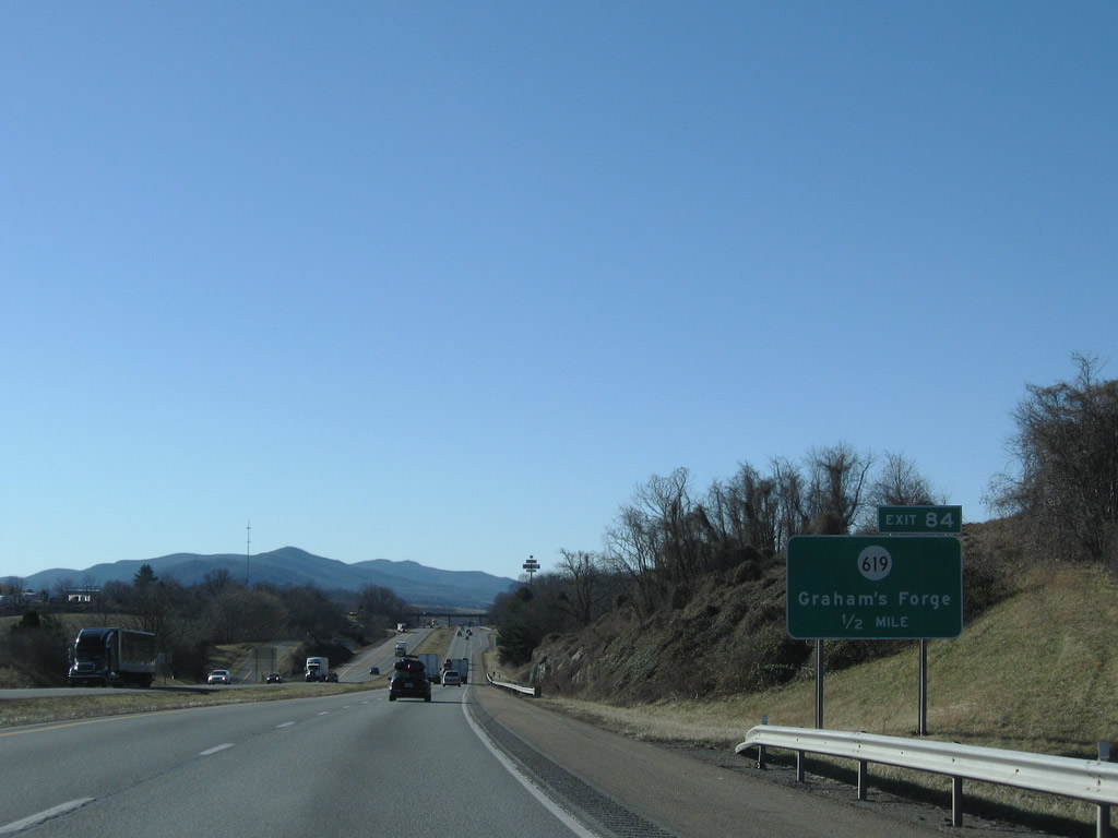
SR 619 (Major Grahams Road) stems south from E Lee Highway (old U.S. 11) near Exit 84 to Grahams Forge.
12/30/08
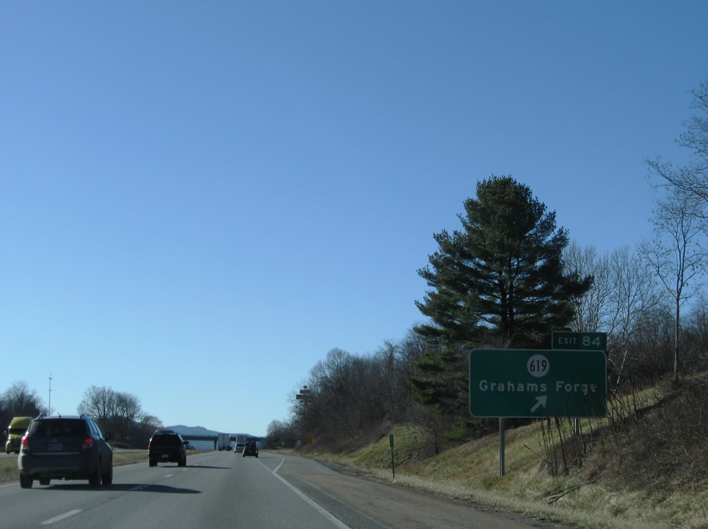
Entering the diamond interchange (Exit 84) with SR 619 (Major Grahams Road) on I-81/U.S. 11 south. SR 619 traverses Chestnut Ridge southward to U.S. 52 at Galena.
12/30/08

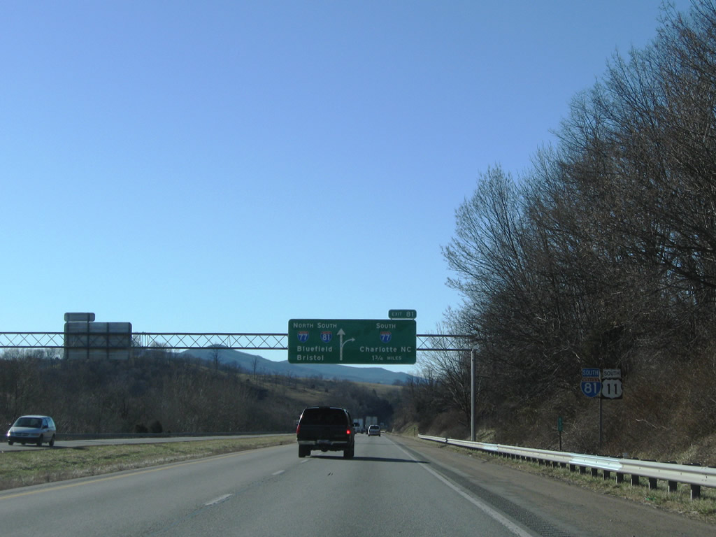
The unincorporated community of Fort Chiswell is three miles ahead where U.S. 52 north and SR 121 south converge with I-77/81 and U.S. 11.
12/30/08
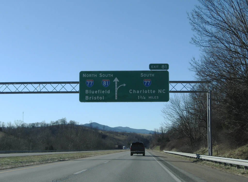
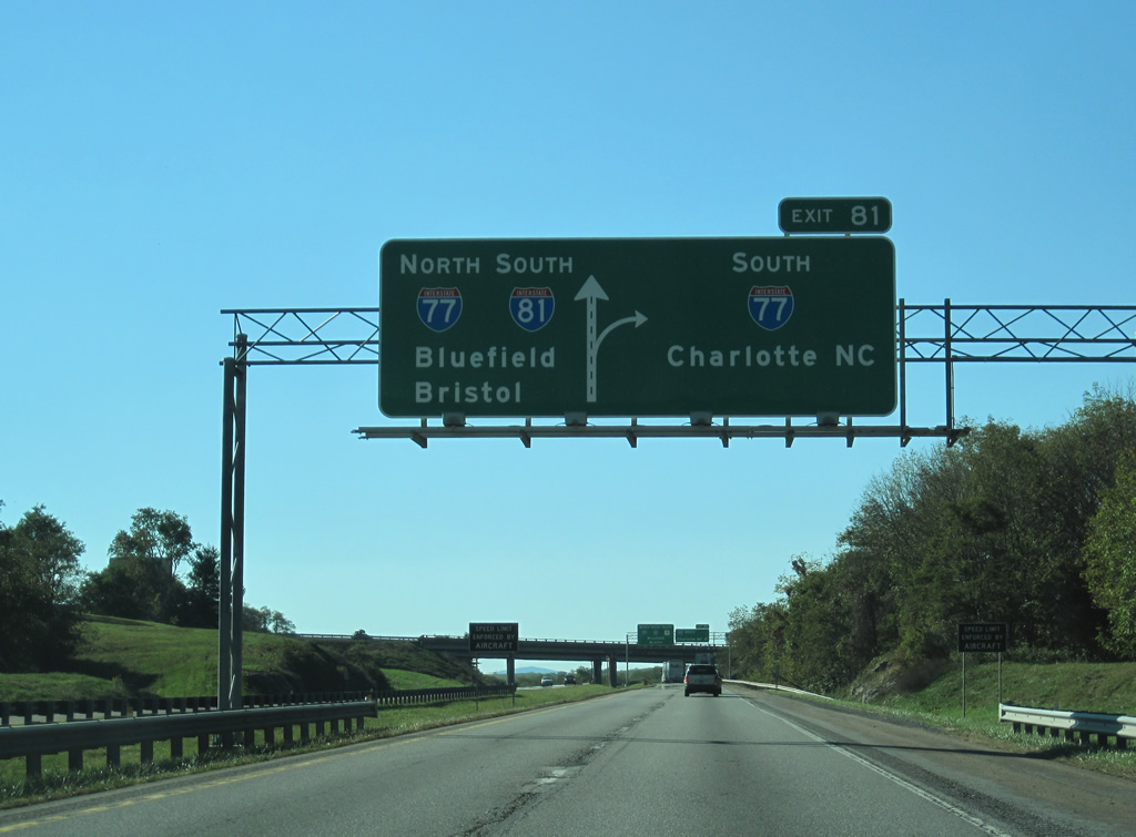
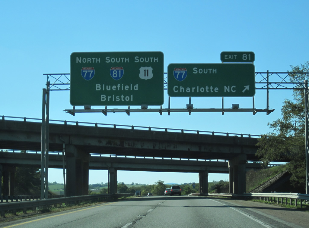
Interstate 77 travels north from Fancy Gap and Hillsville, 18 miles to the south, to meet I-81/U.S. 11 at Exit 81 and Fort Chiswell.
12/30/08
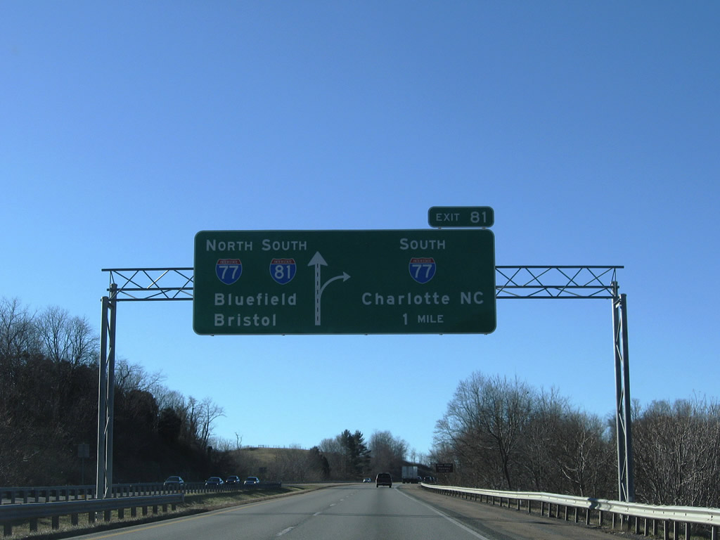
Charlotte, North Carolina is 135 miles to the south along Interstate 77 from the trumpet interchange at Exit 81.
12/30/08
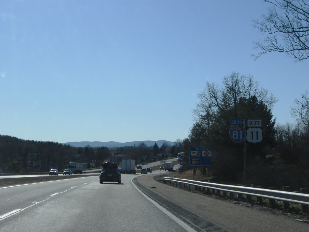
Interstate 77 heads south from Exit 81 to Statesville, North Carolina, where it meets I-40. I-77 also connects with U.S. 52/221 west to Galax and I-74 east to Mt. Airy.
10/02/10
I-77 north overlaps for I-81 south nine miles to Wytheville before resuming a northward course to Bluefield, West Virginia. Overall I-77 runs 610 miles from Columbia, South Carolina to Cleveland, Ohio.
10/02/10
A sweeping loop ramp joins I-81/U.S. 11 south with Interstate 77 south eight miles ahead of Poplar Camp.
12/30/08

References:
- US 460. Virginia Highways Page.
- VA 81 to VA 100. Virginia Highways Page.
Photo Credits:
- Brent Ivy: 05/27/21
- ABRoads: 12/30/08
- ABRoads, Carter Buchanan: 10/02/10
Connect with:
Page Updated Monday August 09, 2021.