
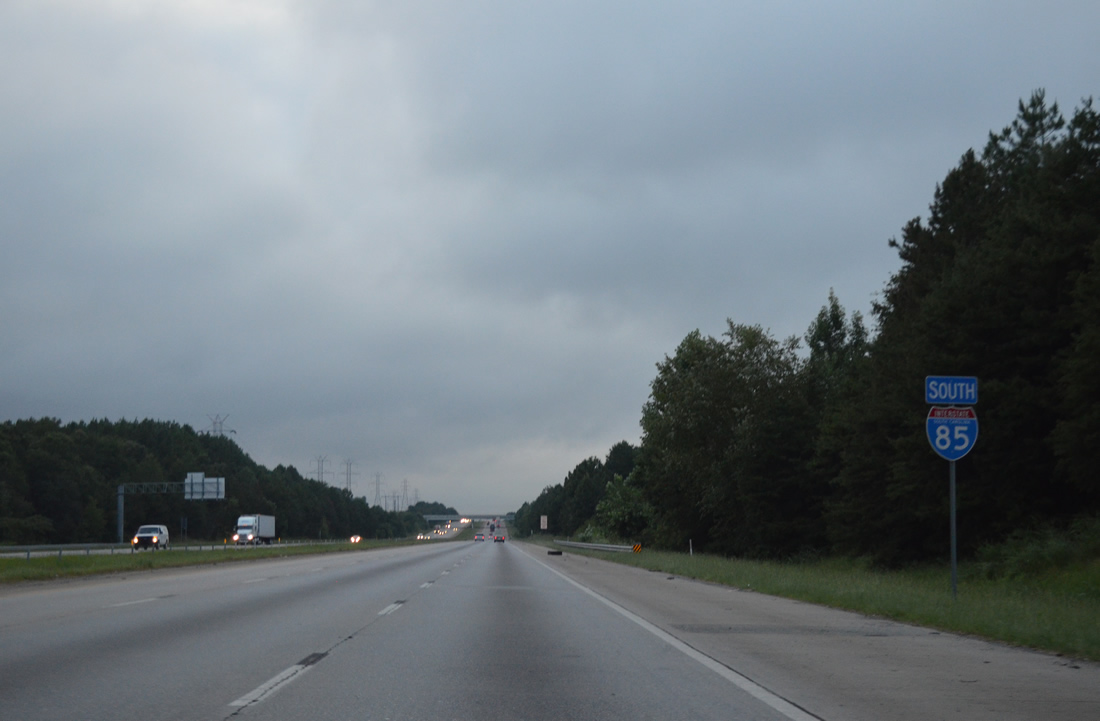
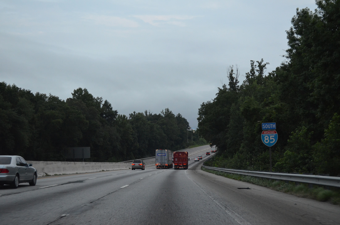
Interstate 85 South - Spartanburg County
S.C. 110 continues another 1.73 miles south from Bud Arthur Bridge Road, the south service road, to U.S. 29 (Main Street) in the town of Cowpens. U.S. 29 curves west from there through Converse and Zion Hill and into the city of Spartanburg.
08/06/13

Six interchanges serve the Spartanburg area from Interstate 85 south over the next ten miles while Greenville is 37 miles away.
08/06/13
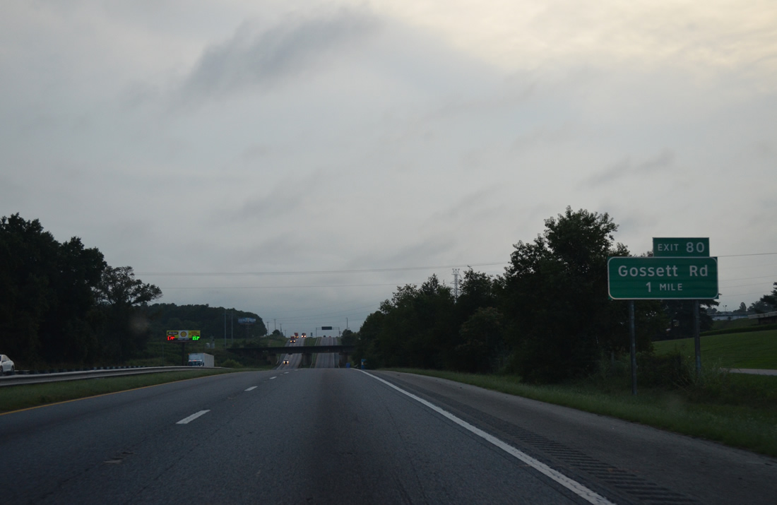
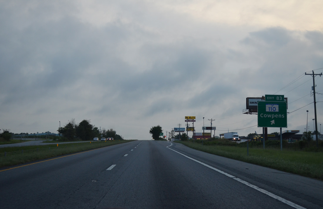
Meeting Interstate 85 south next is Gossett Road (Road 57) at a parclo interchange (Exit 80).
08/06/13
I-85 expands to six lanes with a barrier median just ahead of Exit 80. Gossett Road (Road 57) forms a 3.32 mile long arc from U.S. 221 at Cherokee Springs southward to Cannons Campground Road at Enola.
08/06/13
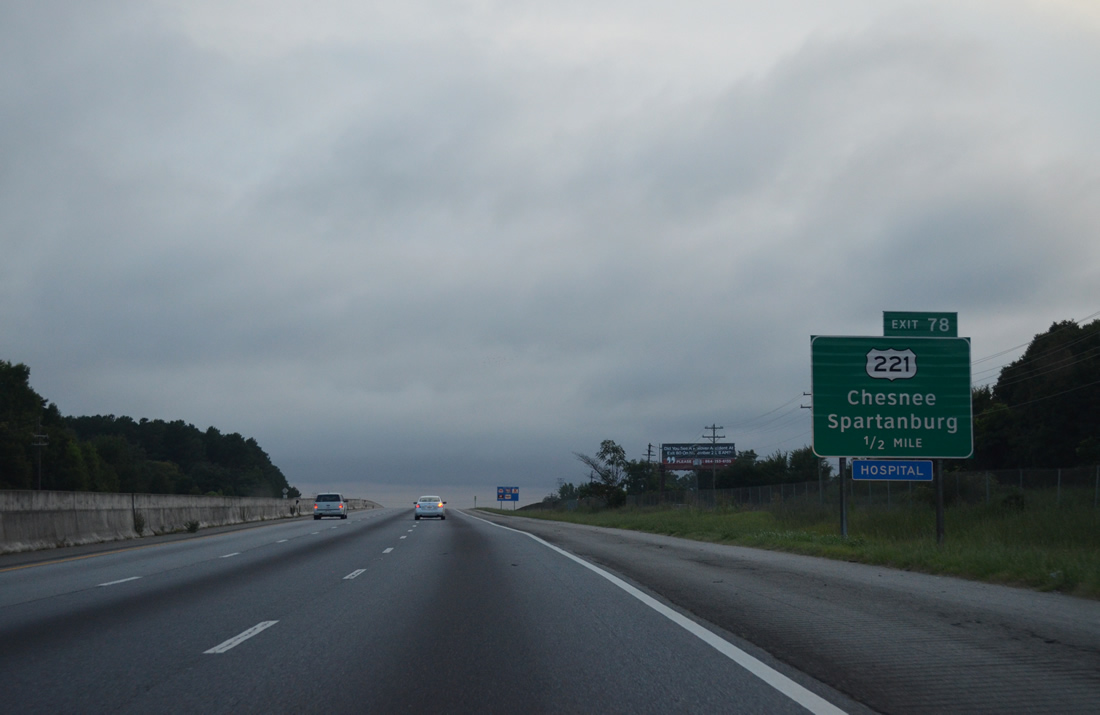
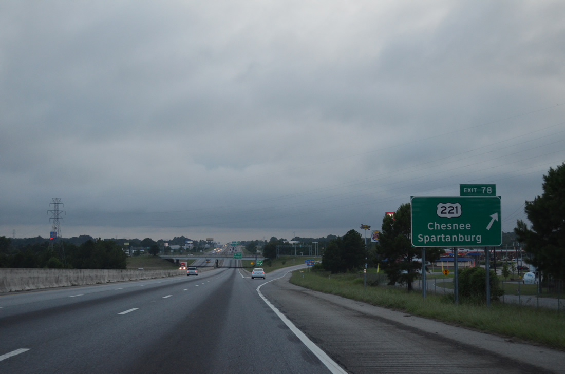
U.S. 221 (Chesnee Highway) heads south from Cherokee Springs to cross I-85 at a diamond interchange (Exit 78). U.S. 221 continues southwest from Exit 78 to Whitney and along Church Street in the city of Spartanburg.
08/06/13
Exit 80 leaves I-85 south for U.S. 221 (Chesnee Highway). U.S. 221 heads 9.96 miles to the city of Chesnee, where U.S. 221 ALT branches northward to Rutherfordton, North Carolina. Overall the 734 mile long highway extends north to Lynchburg, Virginia and south to Perry, Florida.
08/06/13
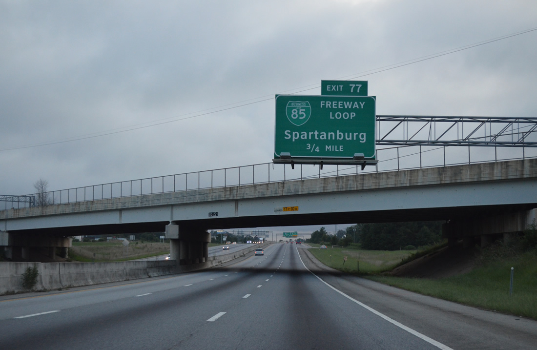
A trumpet interchange (Exit 80) joins I-85 with Business Loop I-85 in 0.75 miles. Business Loop I-85 follows the original route of I-85 by Lone Oak, Johnson City and Fairforest while I-85 shifts northward along a six lane bypass.
08/06/13
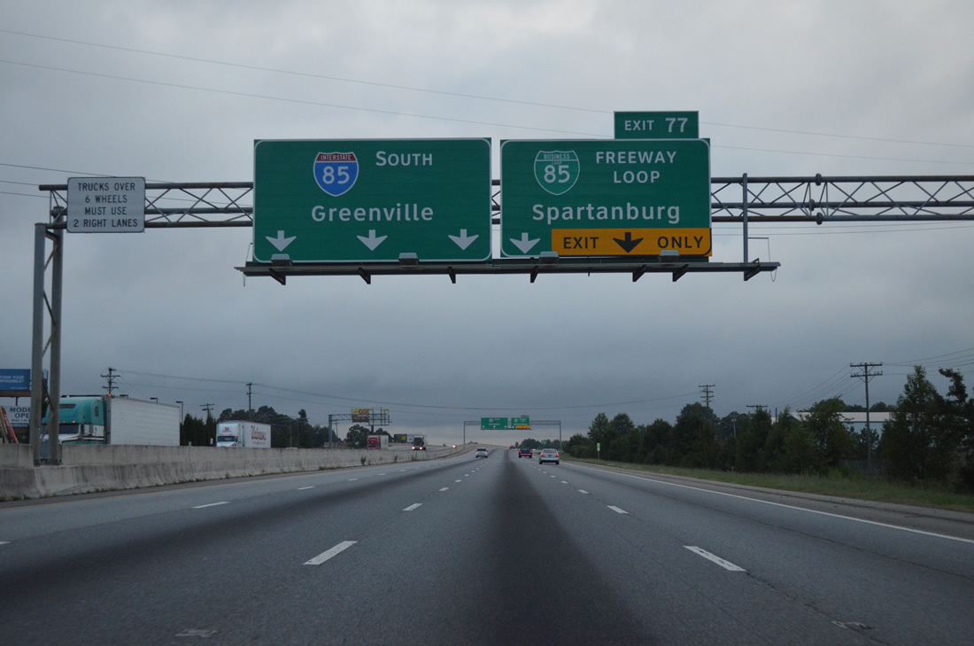
Two lanes separate from I-85 south for Business Loop I-85 toward Spartanburg. The 8.89 mile long bypass for I-85 was constructed between 1988 and September 1995 at a cost of $122 million. It provided traffic relief to the narrow and congested 1950s freeway that became the business loop.
08/06/13
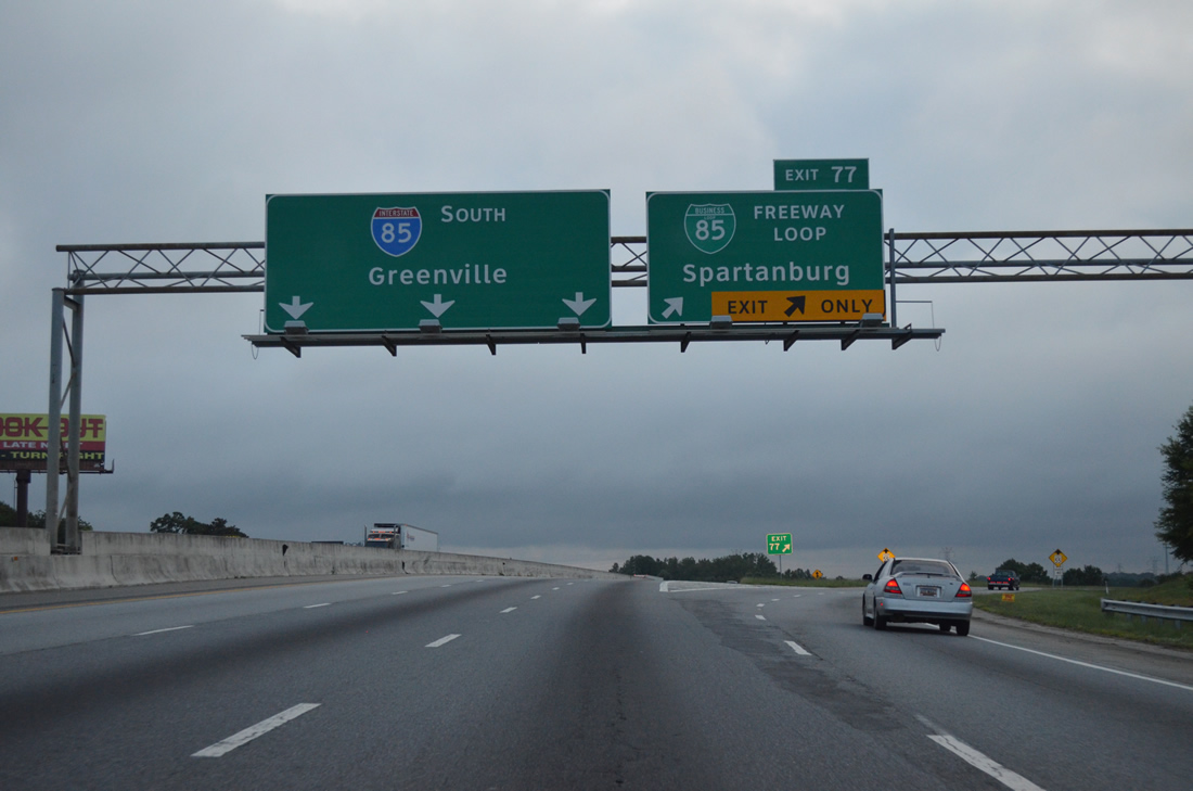
The freeway along Business Loop I-85 has nine interchanges for the Spartanburg area while just three are located along Interstate 85 before the two routes reconvene.
08/06/13
Continuing west along Interstate 85 south, the freeway passes under Bryant Road over the ensuing mile. Bryant Road meets the Business Loop near Whitney.
08/06/13
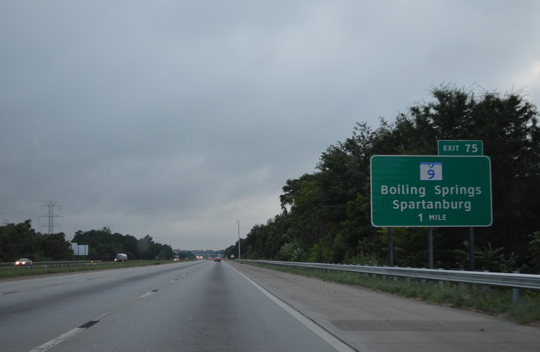
S.C. 9 follows U.S. 176 through Spartanburg along Pine Street to I-585. S.C. 9 (Boiling Springs Road) continues 2.79 miles north to Business Loop I-85 and I-85 at Exit 75 near Boiling Springs.
08/06/13
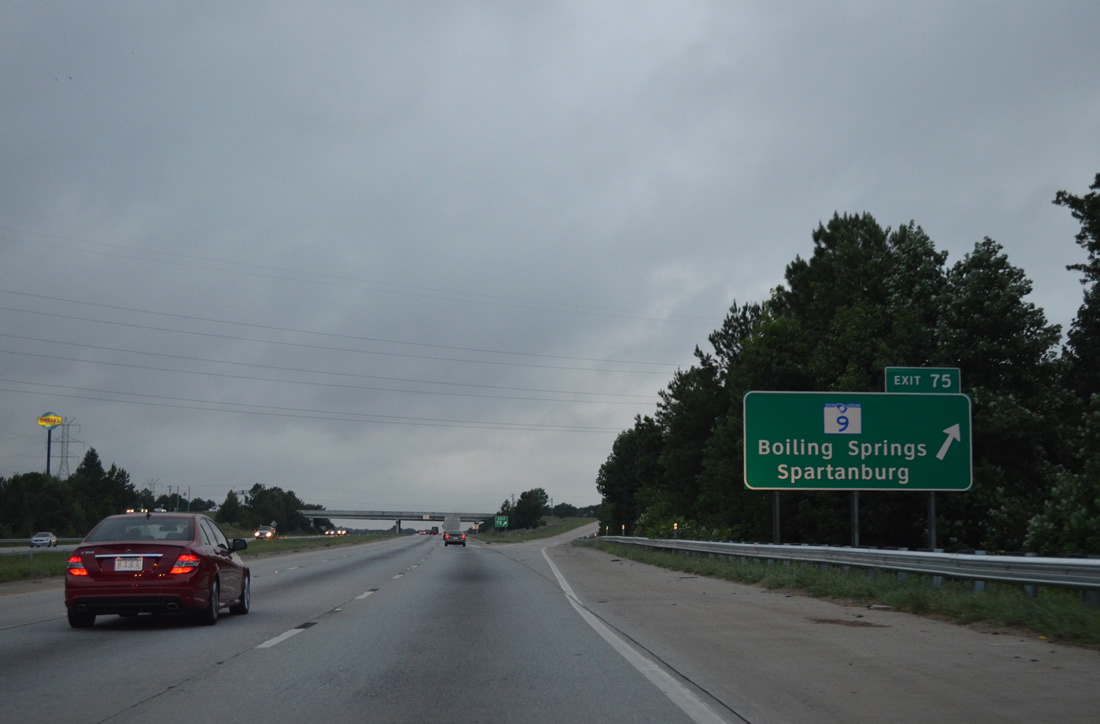
I-85 south at the diamond interchange (Exit 75) with S.C. 9 (Boiling Springs Road). S.C. 9 travels 259.6 miles from Cherry Grove Beach on the Grand Strand to the state line north of New Prospect. NC 9 continues the route another 46.5 miles to Montreat.
08/06/13
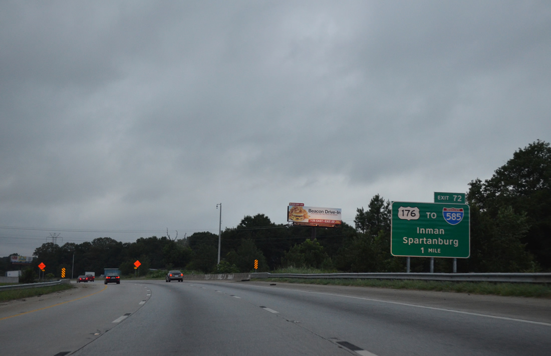
I-85 arcs southwest through Valley Falls toward a diamond interchange (Exit 72) with U.S. 176. Per SCDOT GIS Data, I-585 commences alongside U.S. 176, 1.7 miles southeast at the exchange with Business Loop I-85. Road work in 2003-06 upgraded U.S. 176 south from Fairforest Road to limited access standards.
08/06/13
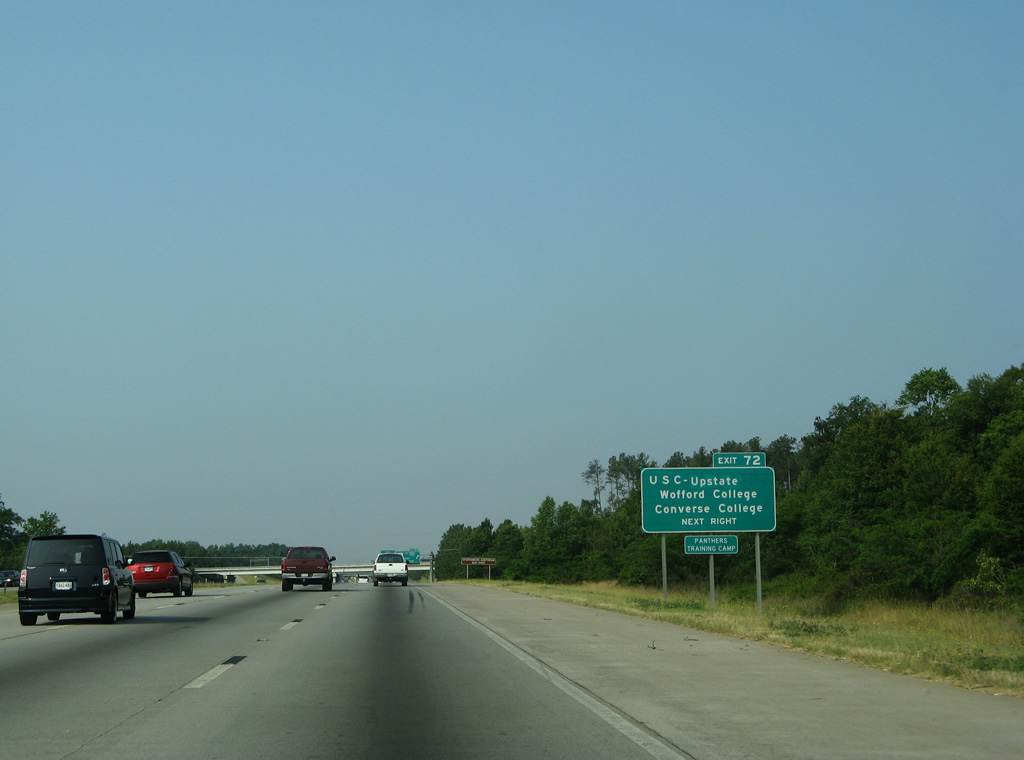
Exit 72 with U.S. 176 serves a bevy of colleges including USC Upstate, Wofford College, Converse College and Sherman College of Chiropractic. USC Update lies just north of U.S. 176 and east of Valley Falls Road. The $63 million project upgrading U.S. 176 in 2003-06 included access improvements to the university.
06/01/07
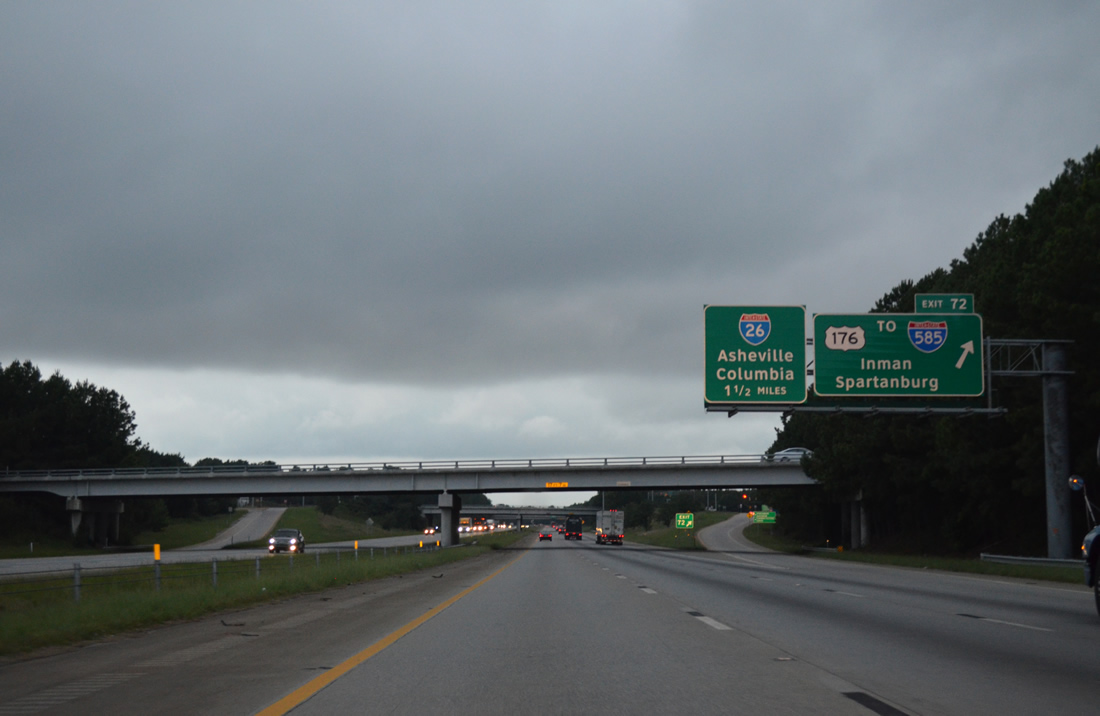
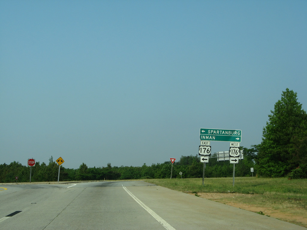
Exit 72 departs I-85 south below Upper Valley Falls Road. U.S. 176 overtakes Asheville Highway from S.C. 56 nearby en route to Inman and Campobello. I-585 overlays U.S. 176 for 2.25 miles between Business Loop I-85 and U.S. 221 (Chesnee Highway) at the Spartanburg city line.
08/06/13
Replaced shield assembly along Exit 72. Changes made here included installation of a traffic light and a trailblazer for I-585. A 238 mile long route, U.S. 176 travels mostly in South Carolina from Goose Creek to Hendersonville, North Carolina.
06/01/07
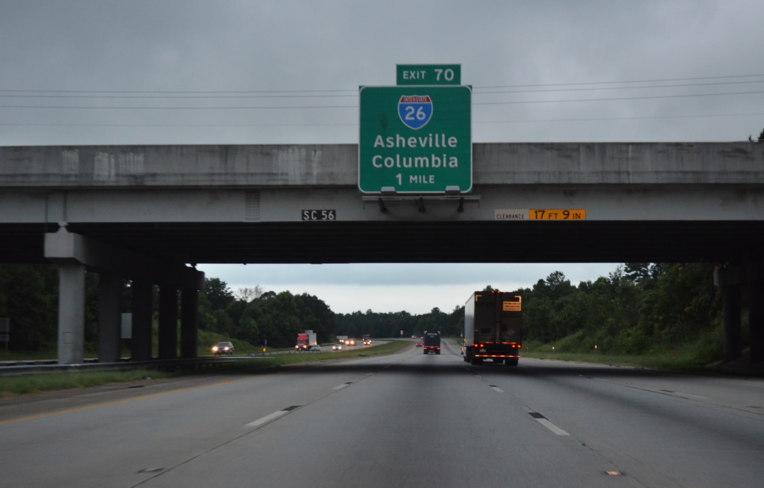
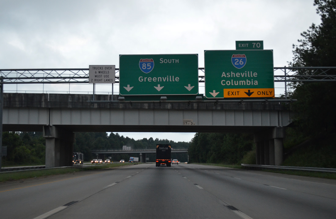
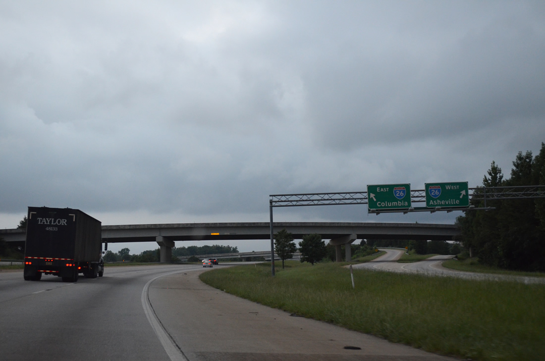
I-26 and I-85 converge at a cloverstack interchange (Exit 70) in one mile.
08/06/13
I-85 south expands to four lanes from the New Cut Road (Road 65) overpass to I-26 at Exit 70. Interstate 26 travels 220.95 miles southeast through South Carolina, joining the Upstate with Columbia and Charleston in the Low Country.
08/06/13
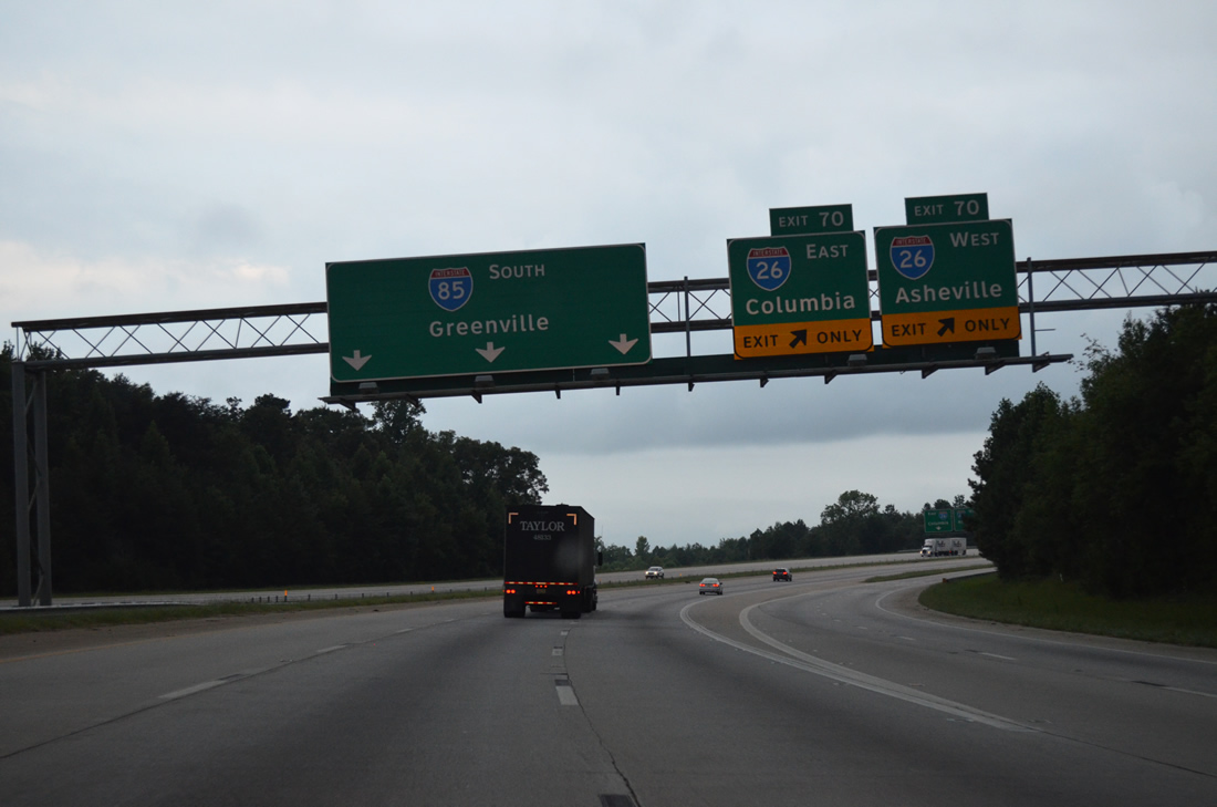
All traffic for I-26 departs in unison at Exit 70. I-26 east straddles the commercialized west side of Spartanburg en route to Clinton while the freeway northward mirrors the course of U.S. 176 to Landrum and Hendersonville, North Carolina.
08/06/13
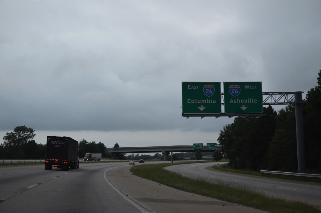
Interstate 26 extends northwest to Asheville, North Carolina and southeast to the capital city of Columbia. I-26 ended in Asheville until August 5, 2003, when the route was extended northward to the Tri-Cities in Tennessee.
08/06/13
Interstate 26 stretches 349 miles from just south of the Virginia state line at Kingsport, Tennessee to just northeast of Downtown Charleston.
08/06/13
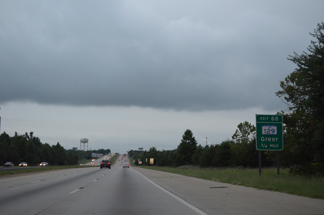
Exit 68 departs from I-85 just ahead of the merge with Business Loop I-85 south. S.C. 129 (Fort Prince Boulevard) runs 4.97 miles west from Falling Creek Road and Exit 68 through the city of Wellford to U.S. 29 (Greenville Highway) in Lyman.
08/06/13
Interstate 85 south passes by an industrial park off of Blackstock Road (Road 41).
08/06/13
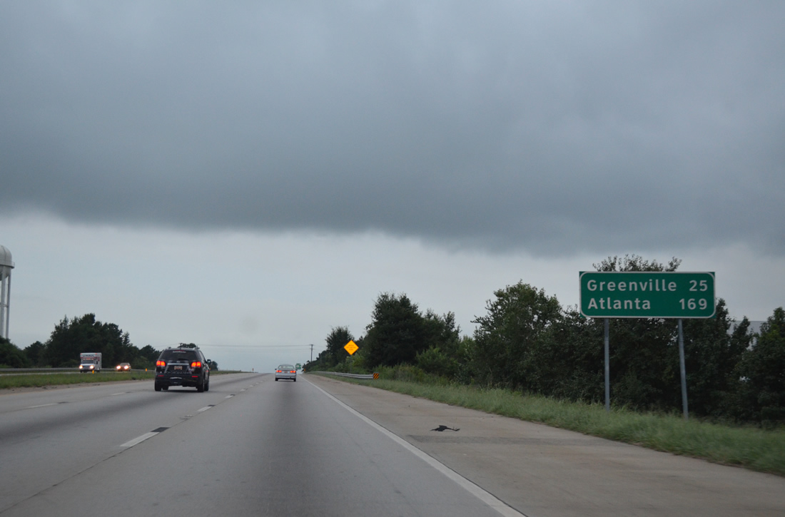
Atlanta appears for the first time on Interstate 85 distance signs at 169 miles out. Greenville is 25 miles to the west via I-385.
08/06/13
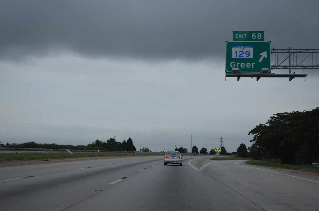
A 1.36 mile long ramp, Exit 68 to S.C. 129 circumnavigates the wye interchange with Business Loop I-85 west to Fort Prince Boulevard. S.C. 129 provides a bypass route of Wellford for U.S. 29 south through Greer.
08/06/13
Leaving the parclo interchange (Exit 68) with S.C. 129, Interstate 85 curves southwest between the city of Wellford and Tyger Lake.
08/06/13
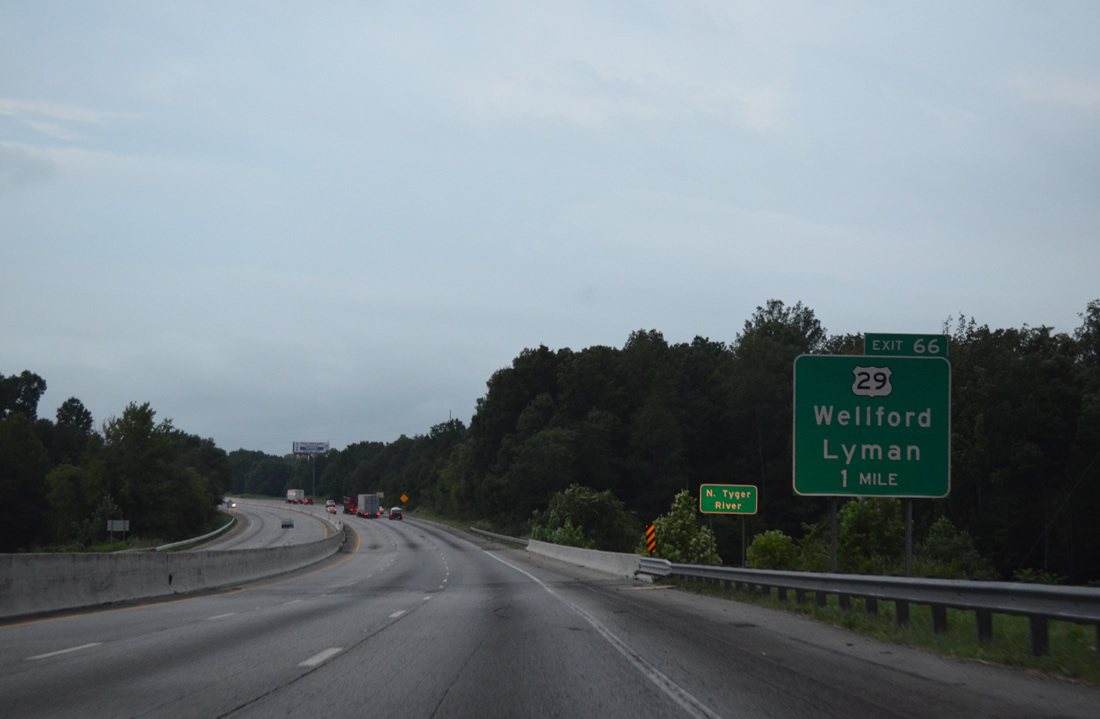
Interstate 85 spans the North Tyger River one mile from Exit 66 to U.S. 29. U.S. 29 (Warren H. Abernathy Highway) leaves Spartanburg by way of Hadden Crossroads and Clevedale to meet I-85 at a parclo interchange.
08/06/13
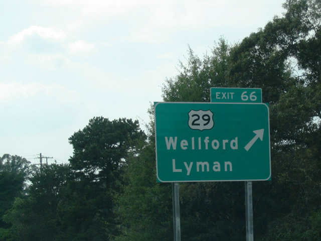
U.S. 29 leads 5.6 miles west from Exit 66 through Wellford and the town of Lyman to the city limits of Greer. U.S. 29 reconvenes with Interstate 85 at Exit 42, southwest of Greenville.
09/24/04
Passing by the community of Startex, Interstate 85 dips in a valley over Jimmies Creek.
08/06/13
The first in a series of interchange sequence signs posted for the Greenville metropolitan area references Exit 60 with S.C. 101. The succeeding exit however is the diamond interchange with S.C. 290 at Duncan.
08/06/13
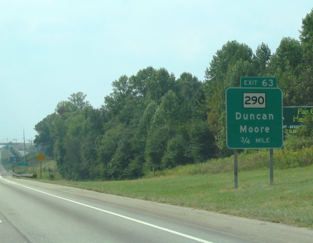
I-85 south passes by a former weigh station facility and spans the Middle Tyger River ahead of Exit 63 for S.C. 290 (Main Street) and the town of Duncan.
09/24/04
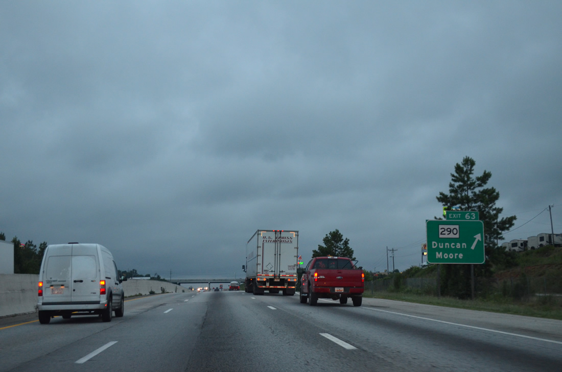
Exit 60 leaves Interstate 85 south for S.C. 290 (Main Street). S.C. 290 heads southeast 9.14 miles to U.S. 221 at Moore and west from Duncan to Downtown Greer.
08/06/13
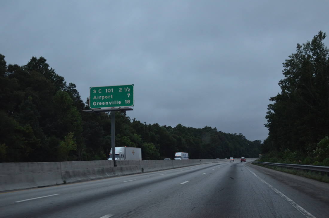
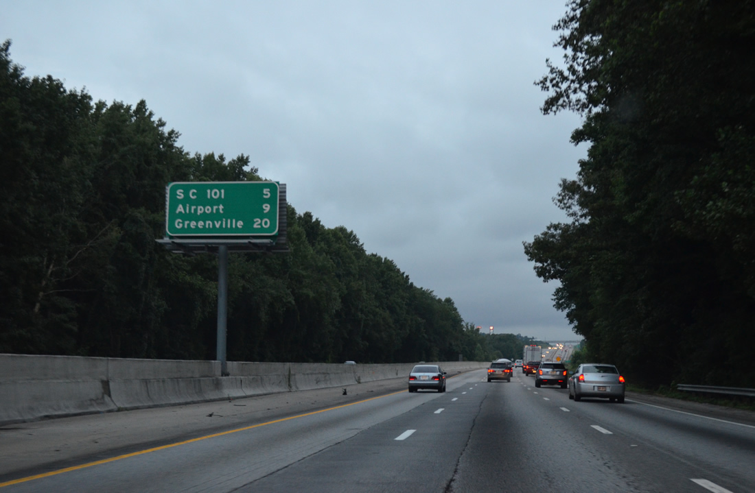
Proceeding westward seven miles to Greenville-Spartanburg International Airport (GSP), Interstate 85 next connects with S.C. 101 on the southeast outskirts of Greer.
08/06/13
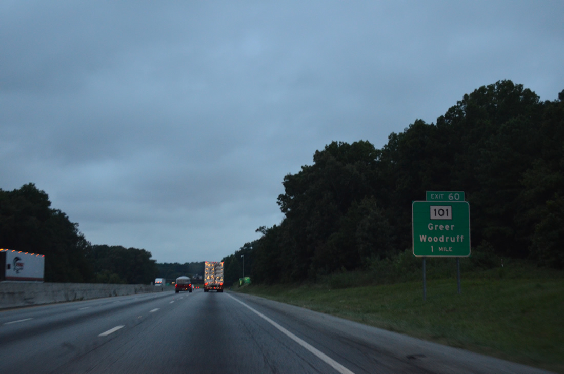
S.C. 101 runs between the I-26 and I-385 corridors between Woodruff and Greer. S.C. 101 follows New Woodruff Road and Line Street northwest 5.14 miles to combine with S.C. 290 (Poinsett Street) outside Downtown Greer.
08/06/13

S.C. 101 expands into a four lane, divided arterial west from I-85 by the BMW Spartanburg plant. Measuring 56.52 miles in length, overall S.C. 101 runs north from U.S. 76 in Hickory Tavern to S.C. 11 in northern Greenville County.
08/06/13

Built as part of the 2004-06 "I-85 Access Project", a two-wye directional interchange (Exit 58) connects Interstate 85 with Brockman-McClimon Road just west of the BMW Spartanburg plant.
08/06/13
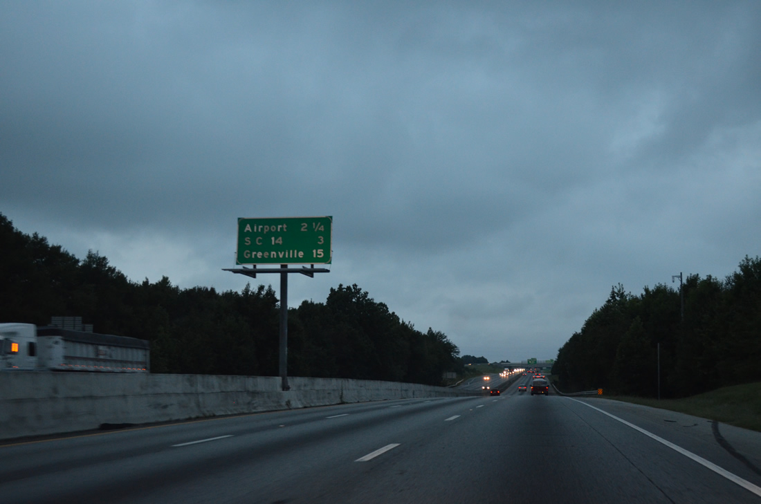
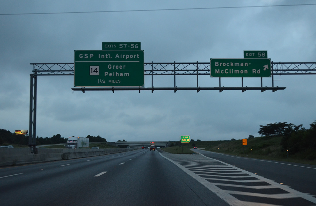
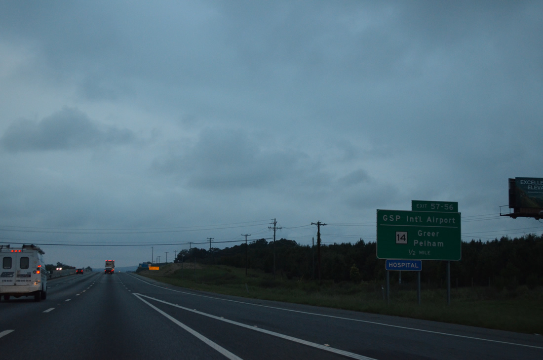
Continuing 15 miles to Greenville, a distributor roadway separates next from I-85 south for Exits 57-56 to Greenville-Spartanburg International Airport (GSP) and S.C. 14.
08/06/13
Brockman-McClimon Road (Road 12) is a four lane arterial extending 0.99 miles north from the ramps with I-85 to S.C. 101. The exchange at Exit 58 was built to improve access to the adjacent Spartanburg BMW Plant.
08/06/13
Aviation Parkway spurs north from the trumpet interchange at Exit 57 to the passenger terminal at Greenville-Spartanburg International Airport (GSP).
08/06/13

The distributor roadway linking I-85 southbound with Aviation Parkway north and S.C. 14 west of GSP Airport opened to traffic in November 2005.
08/06/13
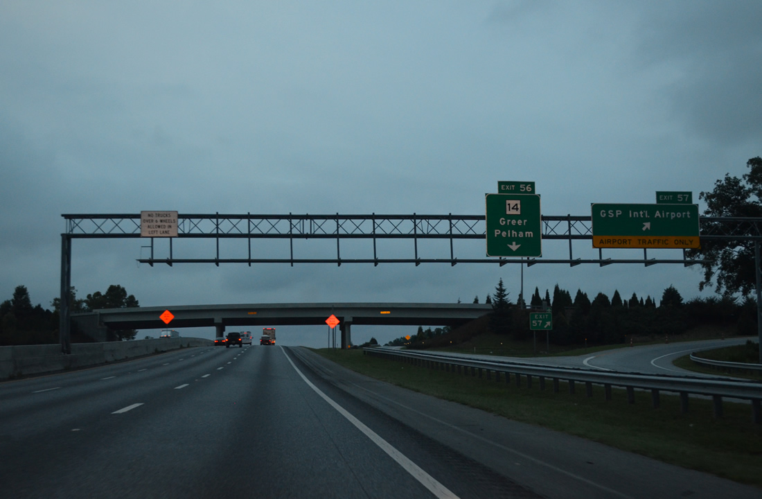
Exit 57 leaves for GSP Airport as the distributor roadway (Exit 56) continues west to S.C. 14. S.C. 14 runs 59.24 miles north from Laurens to Fountain Inn, Simpsonville, Greer and Landrum.
08/06/13
A single point urban interchange joins Interstate 85 with S.C. 14 at Exit 56.
08/06/13
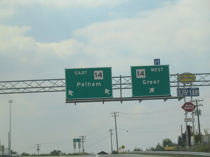
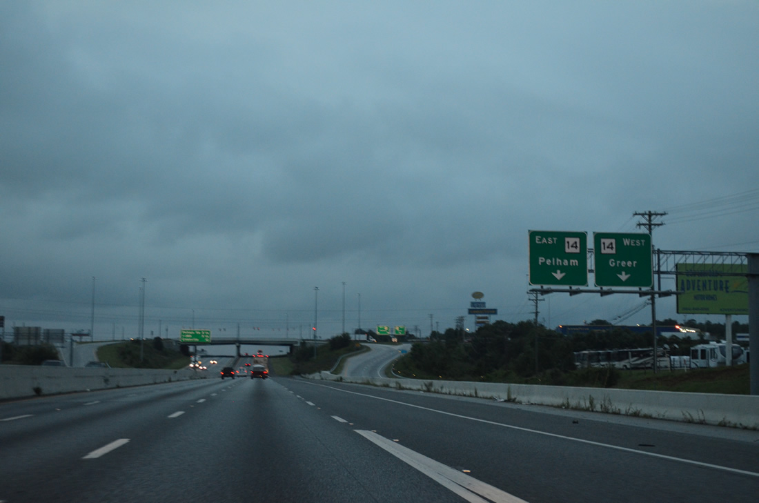
S.C. 14 curves around the western perimeter of GSP Airport north onto Main Street in the city of Greer. S.C. 14 enters the unincorporated community of Pelham south from I-85.
09/24/04
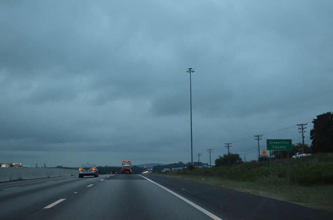
Interstate 85 crosses into Greenville County within the SPUI at Exit 56.
08/06/13
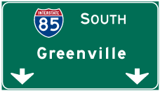

Photo Credits:
- AARoads: 08/06/13
- Andy Field: 06/01/07
- Carter Buchanan: 09/24/04
Connect with:
Page Updated Friday June 18, 2021.