
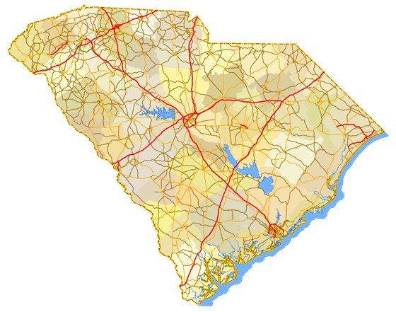
Sitemap to all pages covering the state of South Carolina. Photography contributions by Alex Nitzman, Andy Field, Brent Ivy, Carter Buchanan and Robb Ellis. The author of the original South Carolina Highways and route log is Paul Chris Martin.
Photo Guides
 Interstates
 Interstates
 Interstate 20
 Interstate 26
 Interstate 77
 Interstate 85
 Interstate 95
 Interstate 126
 Interstate 185
 Interstate 385
 Interstate 520
 Interstate 526
 Interstate 585
 Business Spur I-20
 Business Loop I-85
 Business Spur I-526
 U.S. Highways
 U.S. Highways
 U.S. 1
 U.S. 15
 U.S. 17
 U.S. 21
 U.S. 25
 U.S. 29
 U.S. 76
 U.S. 78
 U.S. 123
 U.S. 176
 U.S. 178
 U.S. 221
 U.S. 276
 U.S. 278
 U.S. 301
 U.S. 321
 U.S. 378
 U.S. 601
 U.S. 701
 U.S. 17 Alternate
 U.S. 21 Business – Fort Mill
 State Highways
 State Highways
 S.C. 2
- S.C. 6
- S.C. 9
- S.C. 11
- S.C. 12
- S.C. 14
- S.C. 18
- S.C. 30
- S.C. 33
- S.C. 34
- S.C. 35
 S.C. 38
- S.C. 48
- S.C. 51
- S.C. 53
- S.C. 61
- S.C. 63
- S.C. 64
- S.C. 122
- S.C. 160
- S.C. 170
- S.C. 183
- S.C. 217
- S.C. 253
- S.C. 277
- S.C. 288
- S.C. 291
- S.C. 296
- S.C. 302
 S.C. 315
- S.C. 336
- S.C. 341
- S.C. 403
- S.C. 460
- S.C. 462
- S.C. 703
 S.C. 2
 S.C. 6
 S.C. 9
 S.C. 11
 S.C. 12
 S.C. 14
 S.C. 18
 S.C. 30
 S.C. 33
 S.C. 34
 S.C. 35
 S.C. 38
 S.C. 48
 S.C. 51
 S.C. 53
 S.C. 61
 S.C. 63
 S.C. 64
 S.C. 122
 S.C. 160
 S.C. 170
 S.C. 183
 S.C. 217
 S.C. 253
 S.C. 277
 S.C. 288
 S.C. 291
 S.C. 296
 S.C. 302
 S.C. 315
 S.C. 336
 S.C. 341
 S.C. 403
 S.C. 460
 S.C. 462
 S.C. 703
General Information
About the South Carolina State Highway System
Many South Carolina 3-digit state highways derive their numbers from a parent route (U.S. Route or State Highway). The branch route numbering begins with the parent number followed by a suffix ranging between 0-9, or in the case of a one-digit route, 00-99. Examples include S.C. 291 (29-1), which leads both north and south of U.S. 29 and S.C. 760 (76-0), which spurs east from U.S. 76/378 to Fort Jackson in Columbia.
South Carolina utilizes spur and connector routes for both U.S. and State Highways. These routes are generally unsigned and short in length. For instance U.S. 52 Spur, which appears on maps dating back to the 1960s in Charleston, is an unsigned spur connecting U.S. 52 with the Battery. Other examples include U.S. 25/276 Connector in Travelers Rest, which lines the former U.S. 25 between its bypass and U.S. 276 through downtown and S.C. 16 Connector, which extends along Rosewood Drive to U.S. 76/376 (Garners Ferry Road) and S.C. 760 (Fort Jackson Boulevard) in Columbia.

The South Carolina Department of Transportation (SCDOT) unveiled a new base for state highway markers in June 2007. The new design incorporated a silhouette of the state outline superimposed with the heritage symbols of the state, the sabal palmetto and crescent moon. New shields were grandfathered in during regularly scheduled replacement of existing signs.
Population Statistics
| State Population | |||||
|---|---|---|---|---|---|
| 5,118,425 | |||||
| Metropolitan Populations | |||||
| Greenville-Anderson | 928,195 | Columbia | 829,470 | Charleston- North Charleston |
799,636 |
| Myrtle Beach-Conway- North Myrtle Beach |
487,722 | Spartanburg | 327,997 | Hilton Head Island- Bluffton |
205,566 |
| Top County Populations | |||||
| Greenville | 525,534 | Richland | 416,147 | Charleston | 408,235 |
| Horry | 351,029 | Spartanburg | 327,997 | Lexington | 293,991 |
| Top City Populations | |||||
| Charleston | 139,714 | Columbia | 132,130 | North Charleston | 118,752 |
| Mount Pleasant* | 92,799 | Rock Hill | 76,318 | Greenville | 72,227 |
| Summerville* | 53,301 | Goose Creek | 44,972 | Hilton Head Island* | 39,619 |
| * – Town Sources: 2020 U.S. Census Data (metro populations and counties), 2020 U.S. Census Estimate (cities) |
|||||
About South Carolina
- Capital:
 Columbia
 - Nickname: Palmetto State
- Total Interstate Mileage: 850.80
- Highest Point: Sassafras Mountain 3,560 feet
 Columbia
Major League Sports Franchises
None
Updated December 7, 2022.