
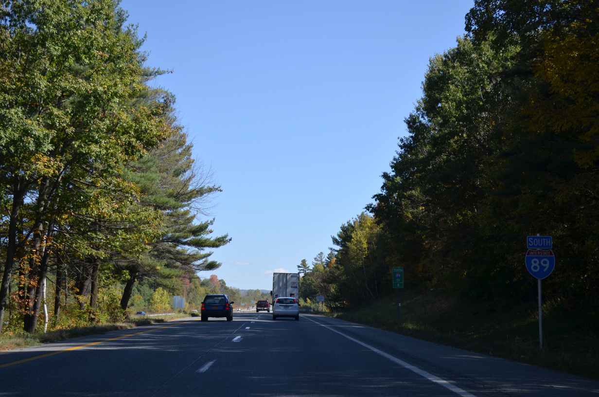
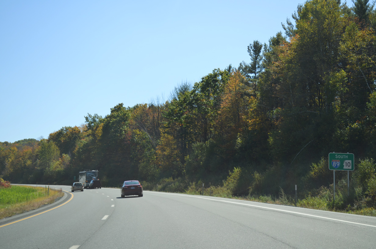
Interstate 89 South - Vermont to Sunapee

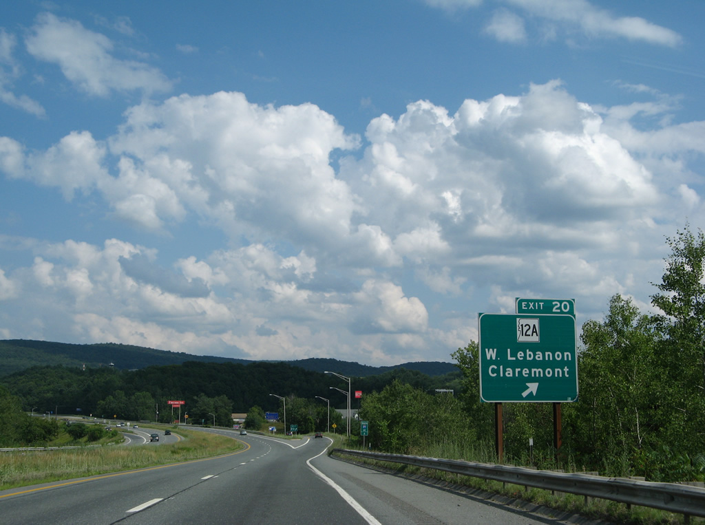
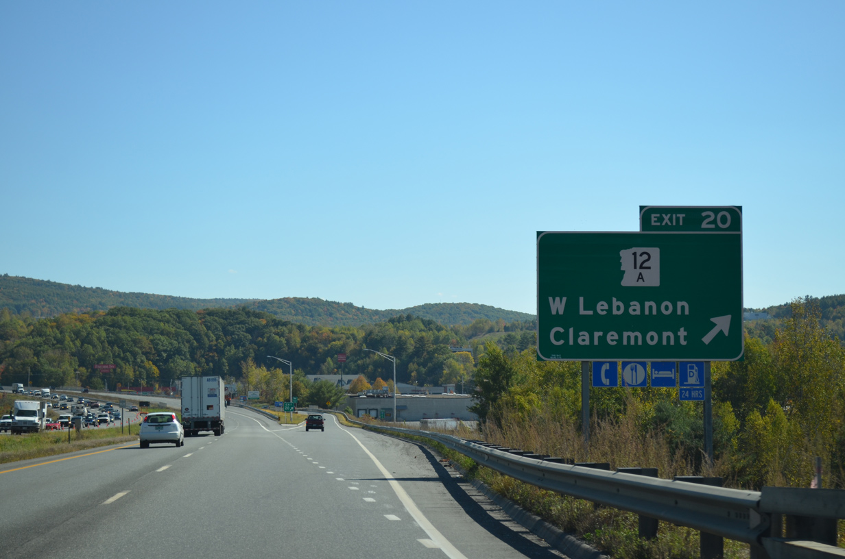
Just east of the Vietnam Veterans Memorial Bridge is the diamond interchange (Exit 20) with NH 12A (South Main Street).
07/30/07
10/06/14
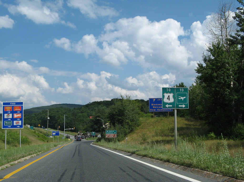
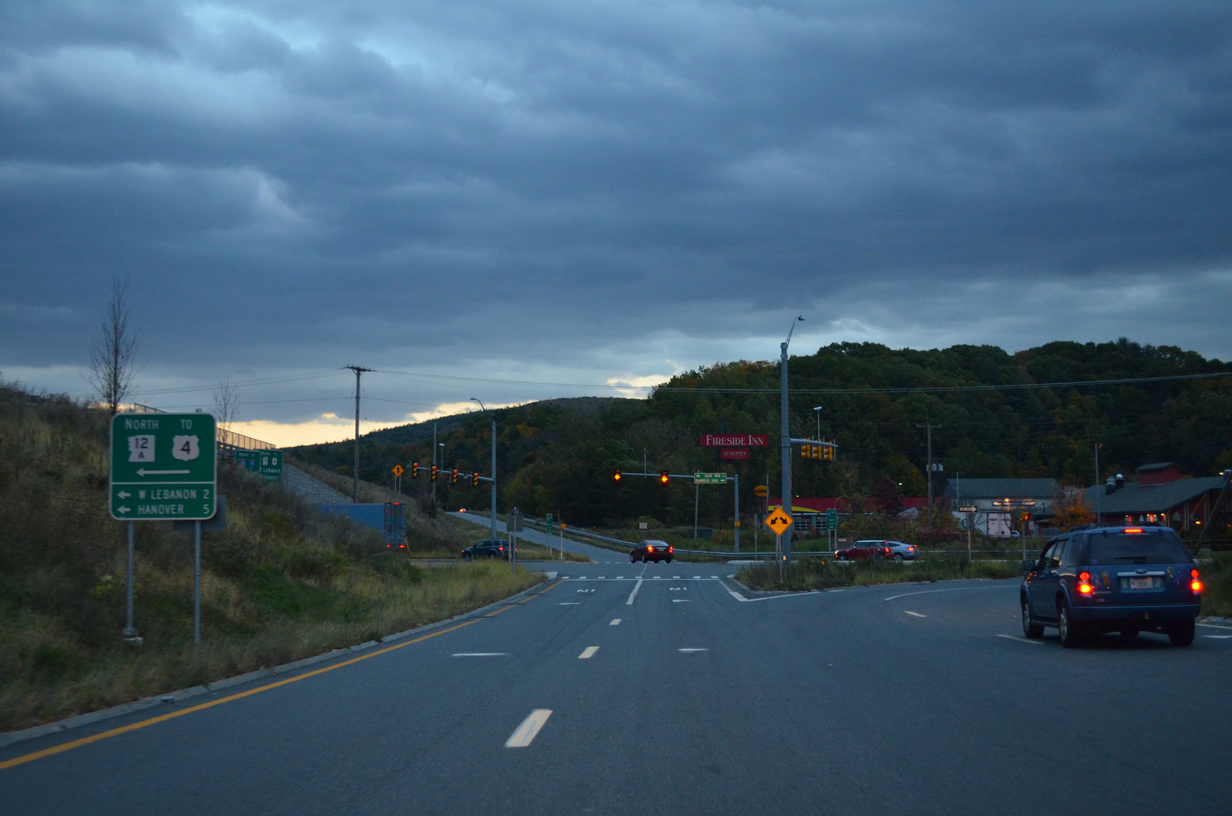
An older style sign for U.S. 4 directed traffic onto the final 1.1 miles of NH 12 (South Main Street) north to U.S. 4/NH 10 in West Lebanon. This sign was replaced by 2013 and references to U.S. 4 are made at the subsequent sign.
07/30/07
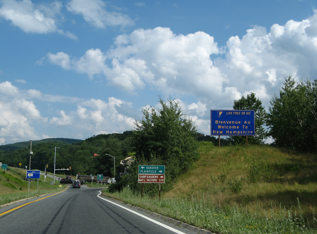
A welcome to New Hampshire sign, replaced with a new design by 2013, stands just above the Exit 20 ramp. This sign is not apparent to mainline motorists on I-89 south.
07/30/07
A NH 12A shield was posted by a rock outcrop ahead of the ramp end with South Main Street. Big box retail and an assortment of shopping centers line both directions of the state route within the vicinity of Interstate 89.
07/30/07
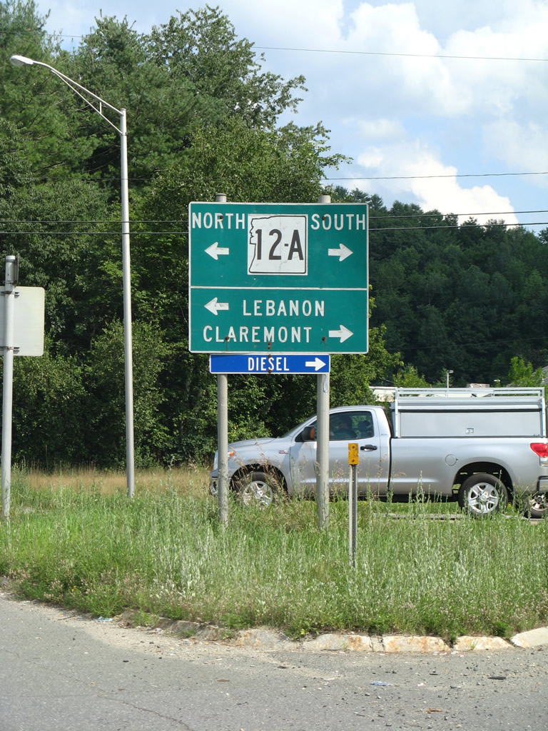
NH 12A provides a direct route to Hanover via NH 10 north from West Lebanon. Southward the 26.9 mile route parallels the Connecticut River to Plainfield, Claremont and Charlestown.
07/30/07
10/06/14
Interstate 89 traverses a valley along the Mascoma River to the north of Lebanon Municipal Airport (LEB).
10/06/14
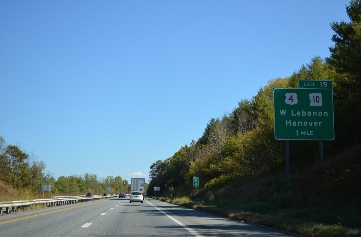
U.S. 4 and NH 10 angle southeast from West Lebanon to cross the Mascoma River ahead of a parclo interchange (Exit 19) with Interstate 89.
10/06/14
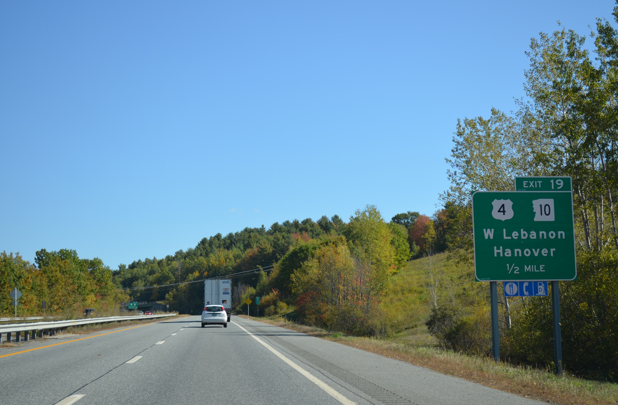
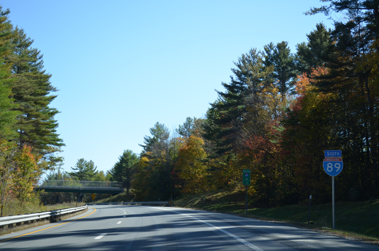
U.S. 4 follows Mechanic Street east from Exit 19 to Downtown Lebanon while NH 10 commences a 24.3 mile overlap with Interstate 89 south to Exit 13. The routing of U.S. 4 through Lebanon was historically also Business Loop I-89.
10/06/14
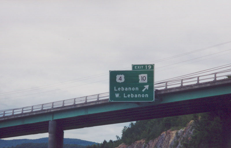
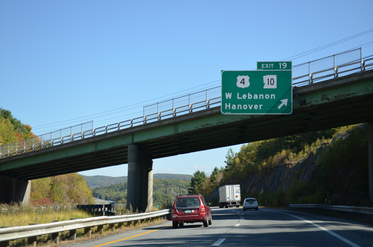
Exit 19 departs Interstate 89 south for U.S. 4 east into Lebanon and U.S. 4 west / NH 10 north to West Lebanon. NH 10 parallels the Connecticut River north from U.S. 4 to Hanover, Lyme, Orford, Piermont and Haverhill.
The control city changed from Lebanon to Hanover.
07/24/00
10/06/14
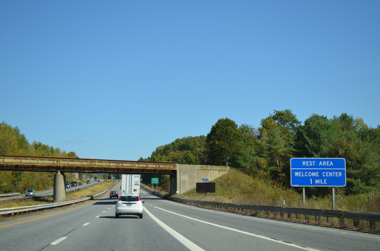
A Boston and Maine Railroad line spans Interstate 89 at the on-ramp of NH 10 south. The first of two rest areas for I-89 in the Granite State lies one mile ahead.
10/06/14
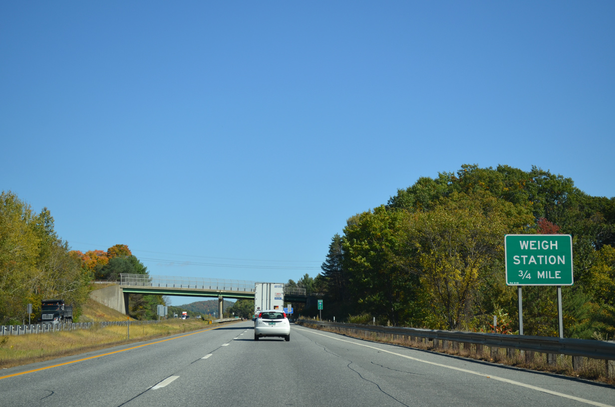
The Lebanon rest area doubles as a weigh station for commercial trucks.
10/06/14
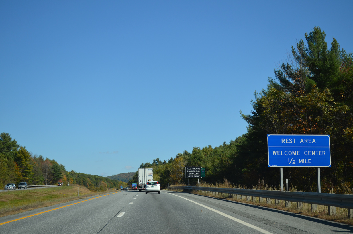
One half mile west of the New Hampshire state welcome center on I-89/NH 10 south by Quarry Hill.
10/06/14
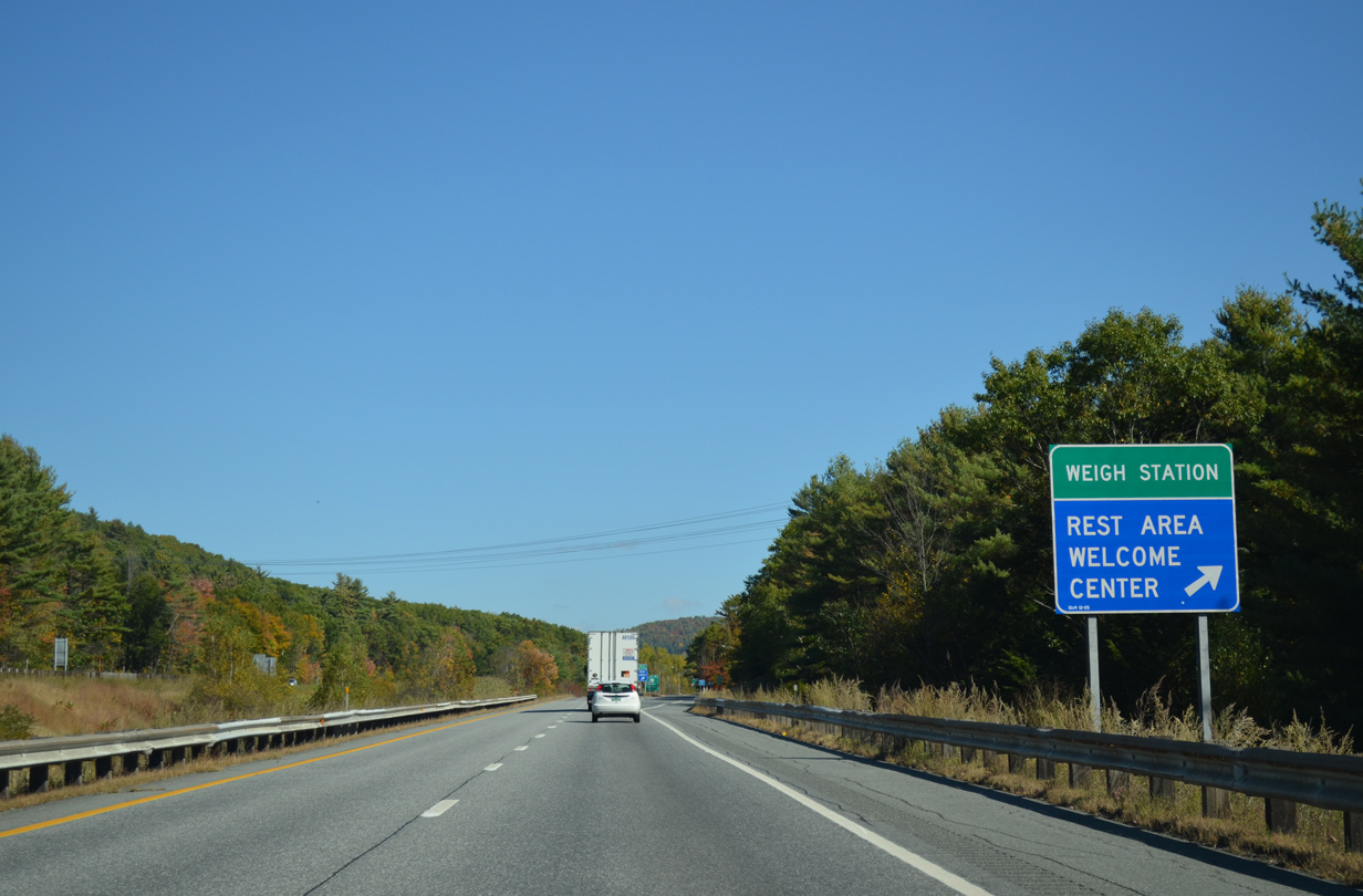
Motorists bound for the Lebanon rest area depart I-89/NH 10 south as the freeway curves southward across northern reaches of the city.
10/06/14
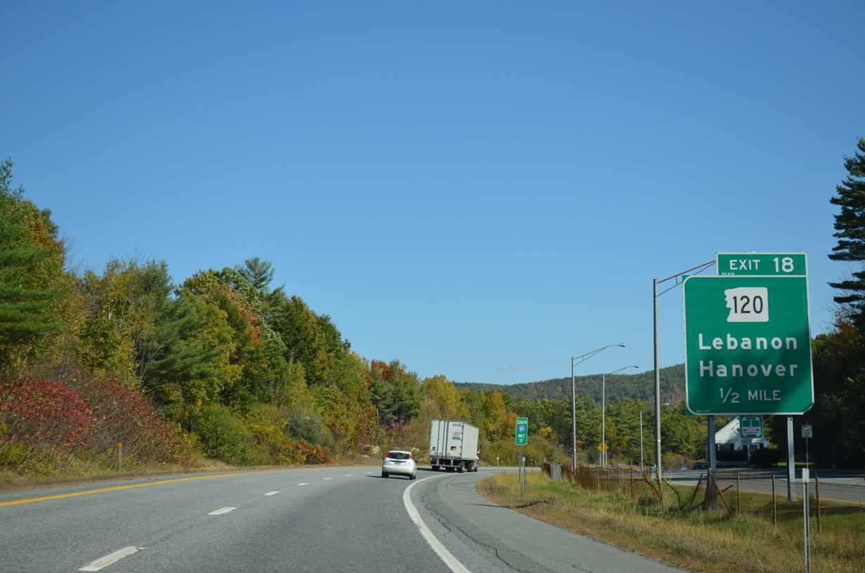
NH 120, a 26.9 mile route from Hanover south to Claremont, crosses paths with I-89/NH 10 in a half mile.
10/06/14

Exit 18 parts ways with I-89/NH 10 under a pedestrian bridge at Hanover Street. NH 120 takes Hanover Street south to Downtown Lebanon and a brief overlap with U.S. 4 on Park Street. Northwest, the state route is partly a multi lane arterial to Dartmouth-Hitchcock Medical Center and Dartmouth College in Hanover.
10/06/14
Advancing eastward, I-89/NH 10 south mirror the course of the Mascoma River south of Signal Hill to a parclo interchange with U.S. 4.
10/06/14
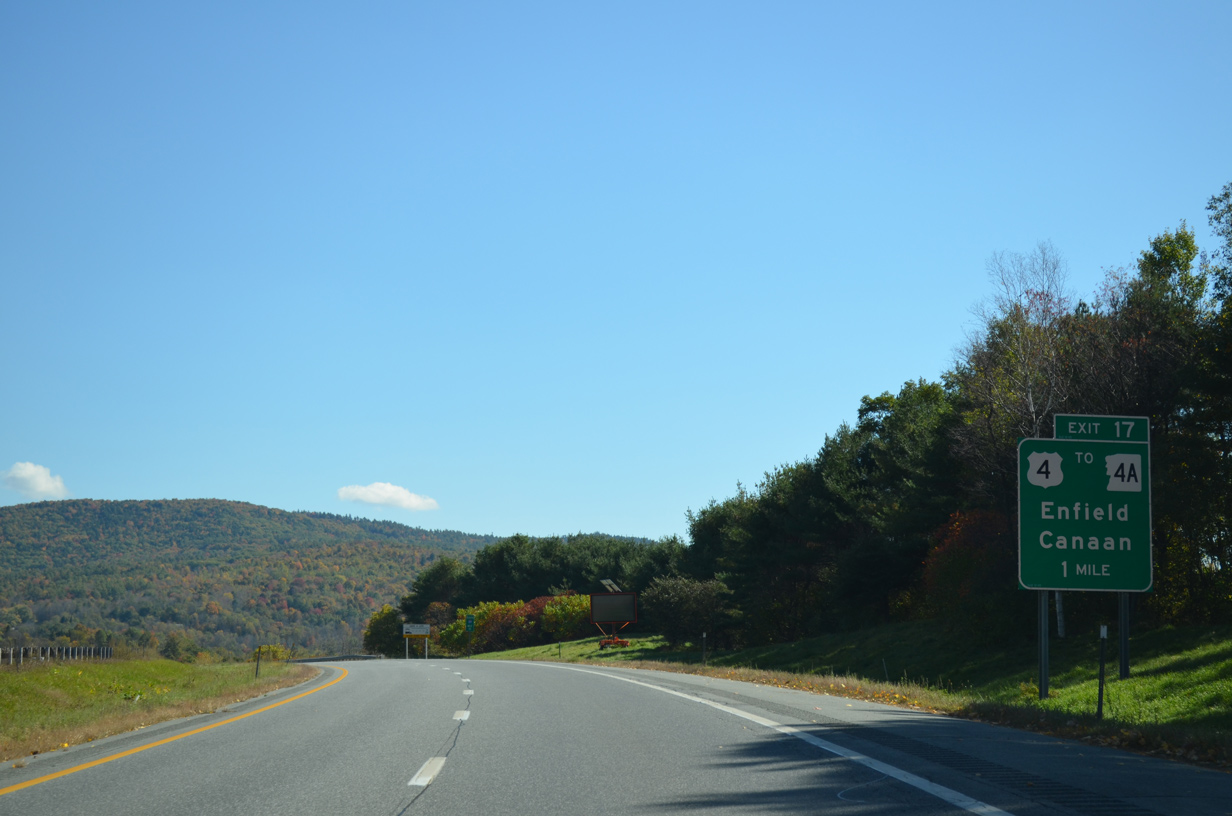
U.S. 4 follows Bank Street east from Downtown Lebanon to Dartmouth College Highway and Exit 17. The US route joins Lebanon with Enfield and Canaan to the east of Mascoma Lake.
10/06/14
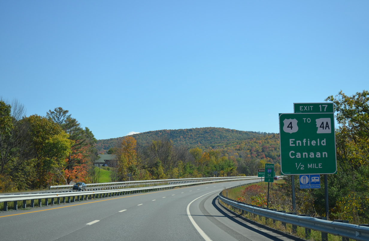
NH 4A partitions from U.S. 4 (Dartmouth College Highway) east ahead of Mascoma. The state route runs along the east side of Shaker Mountain south to Lower and Upper Shaker Village on Mascoma Lake.
NH 4A travels 24 miles overall southeast to Enfield Center, East Springfield and Andover.
10/06/14

I-89/NH 10 south reach Exit 17 for U.S. 4 (Dartmouth College Highway). U.S. 4 runs 106.8 miles across the state from West Lebanon to I-95 at Portsmouth.
10/06/14
The freeway turns southward toward the Enfield town line between Shaker Mountain and Methodist Hill.
10/06/14
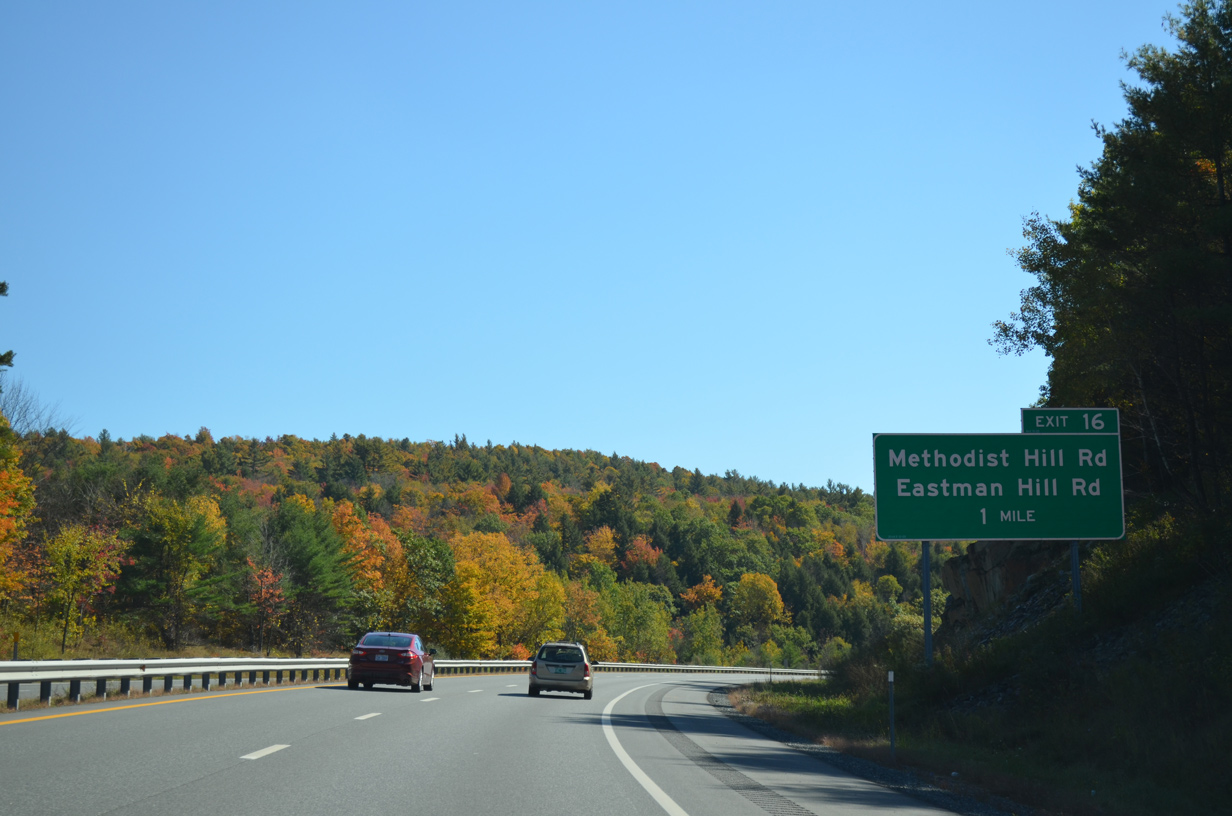
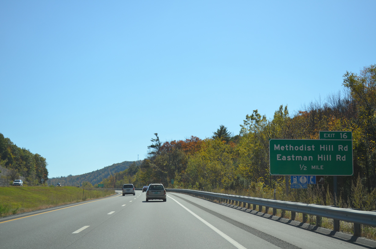
A diamond interchange (Exit 16) lies one mile ahead with Methodist Hill Road south and Eastman Hill Road north.
10/06/14
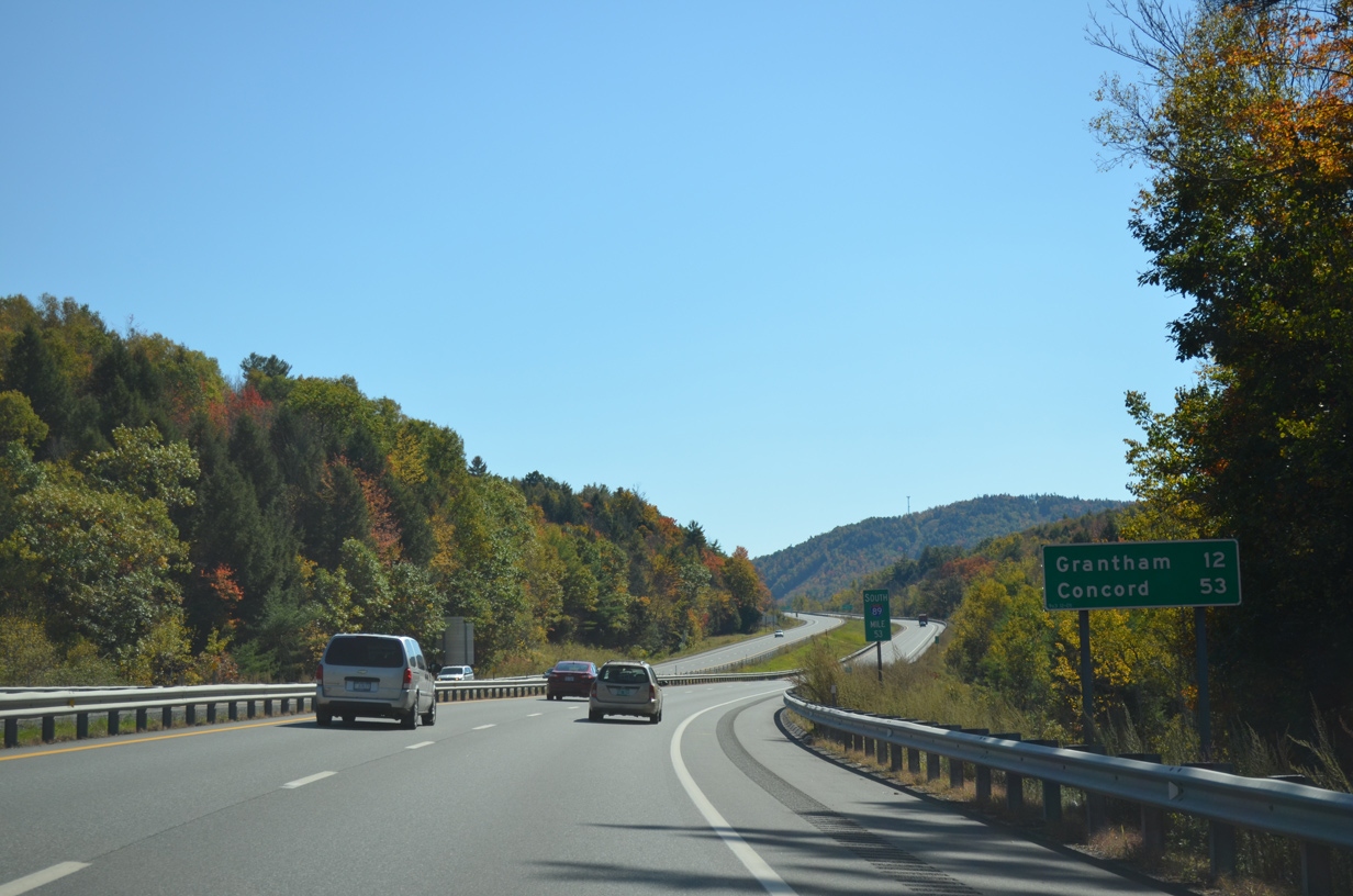
I-89 ventures south 12 miles to Grantham in Sullivan County and 53 miles to the capital city of Concord.
10/06/14
Methodist Hill Road forms an L-shape route south from Exit 16 across Methodist Hill to NH 120 near East Enfield.
10/06/14
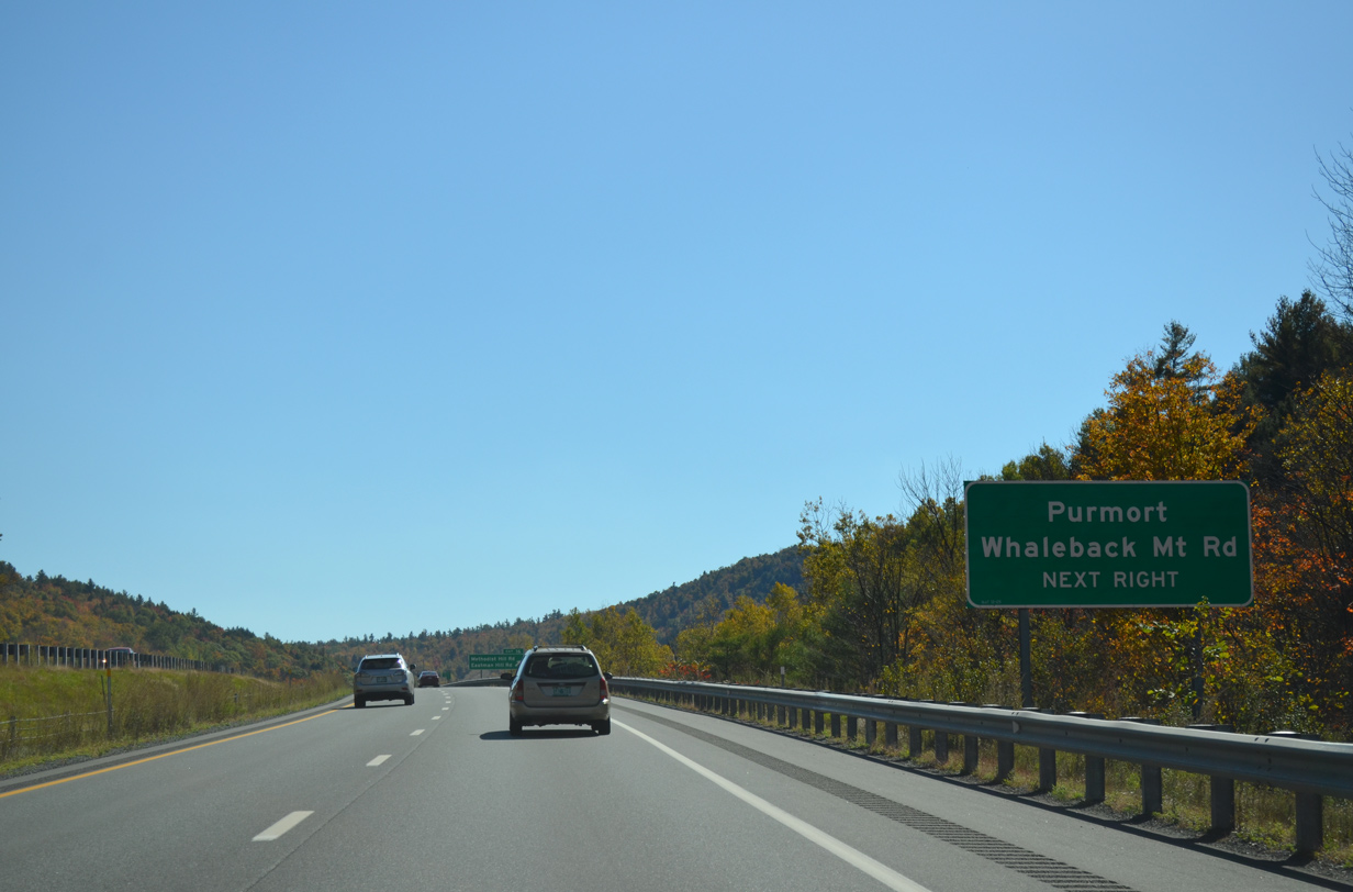
Whaleback Mount Road stems east Exit 16 and Purmort to run alongside I-89/NH 10 south to Whaleback Mountain ski resort on Methodist Hill.
10/06/14
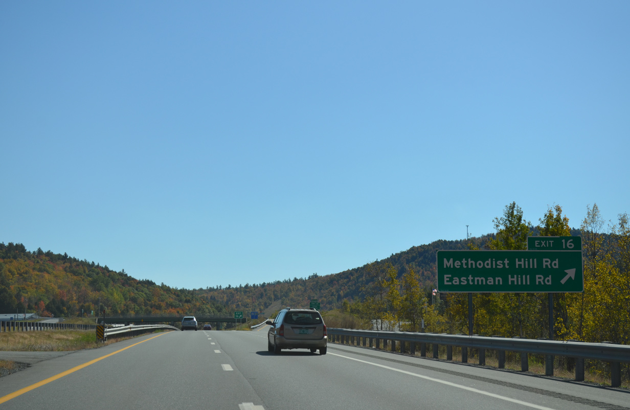
Exit 16 leaves I-89/NH 10 north. Eastman Hill Road ascends over western reaches of Shaker Mountain to U.S. 4 near the intersection with NH 4A.
10/06/14
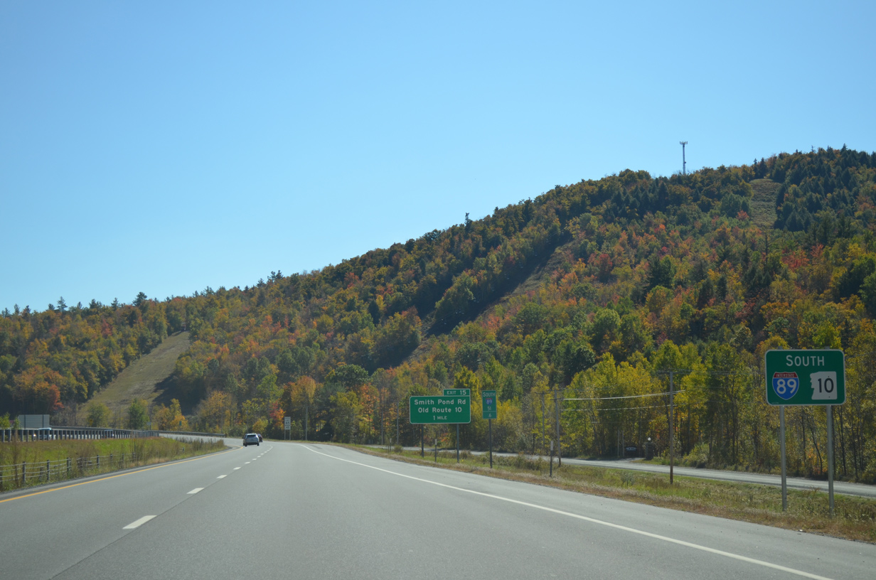
An S-curve takes Interstate 89 southeast from Purmort to Montcalm and Exit 15.
10/06/14
Interstate 89 directly overlaid NH 10 southeast from Lebanon to the Grantham town line. A portion of the old route remains in service at Montcalm on the west side of upcoming Exit 15.
10/06/14
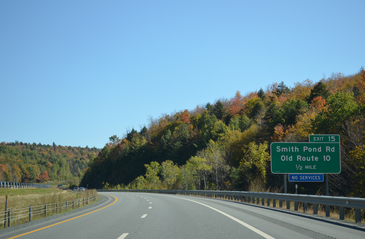
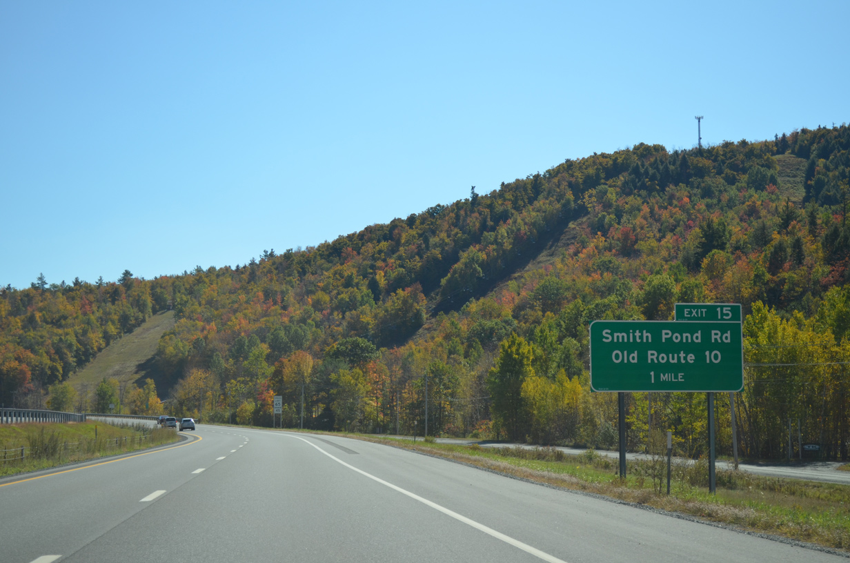
Smith Pond Road spurs east from Old Route 10 to Smith Pond. Montcalm Golf Club lies just to the north of Exit 15.
10/06/14
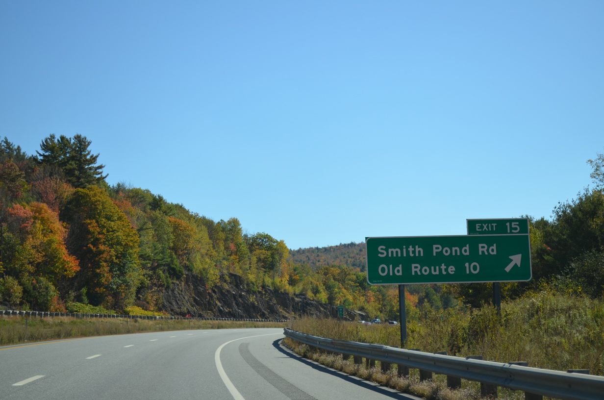
Entering the diamond interchange (Exit 15) with Smith Pond Road on I-89/NH 10 south.
10/06/14
I-89/NH 10 weave southeast through a valley between Snow Mountain and Prospect Hill in southern Enfield.
10/06/14
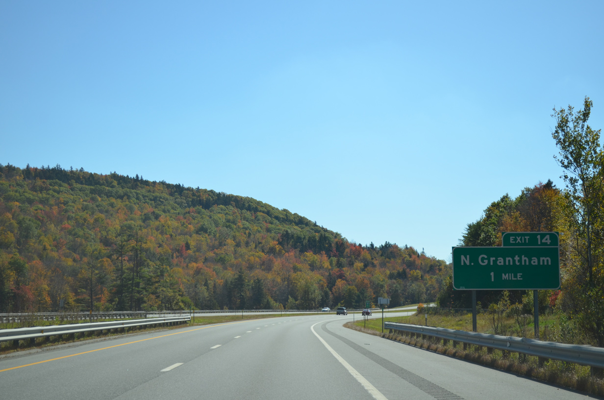
A half diamond interchange (Exit 14) connects I-89/NH 10 south with Old Route 10 and Dart College Highway in one mile.
10/06/14
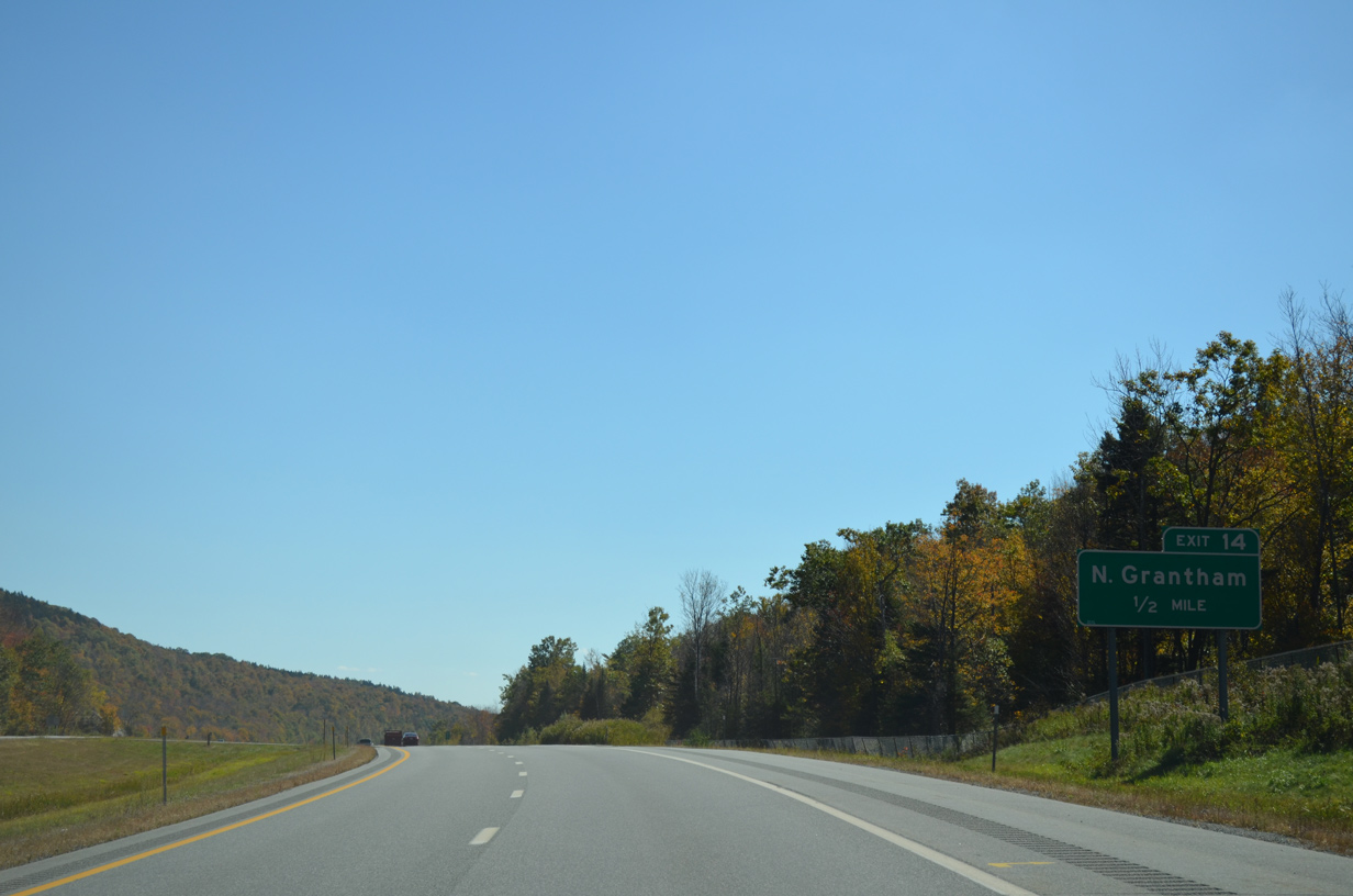
Dart College Highway (old NH 10) runs alongside Interstate 89 south from Exit 14 to North Grantham and the Eastman area.
10/06/14
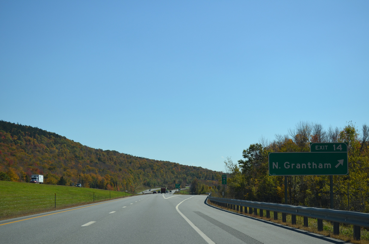
Exit 14 parts ways with I-89/NH 10 south to Old Route 10 as the freeway crosses the Sullivan County and Grantham town lines. Old Route 10 north dead ends nearby.
10/06/14
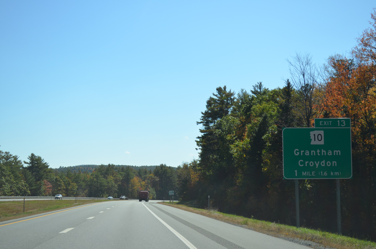
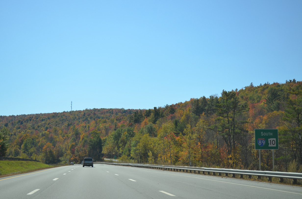
Progressing southward through Grantham, I-89/NH 10 separate at a diamond interchange (Exit 10) with Dart College Highway.
10/06/14
NH 10 diverges southward ten miles to Newport and a short overlap with NH 103.
10/06/14
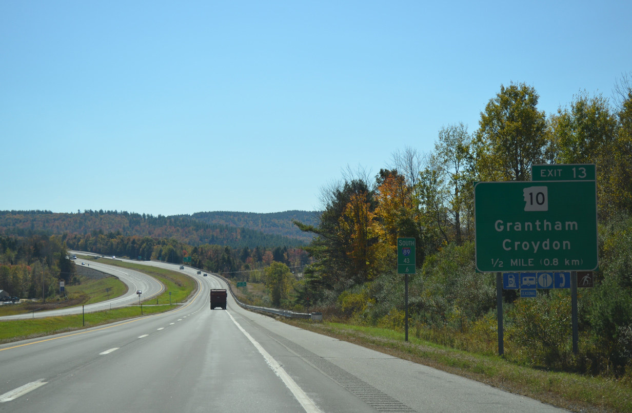
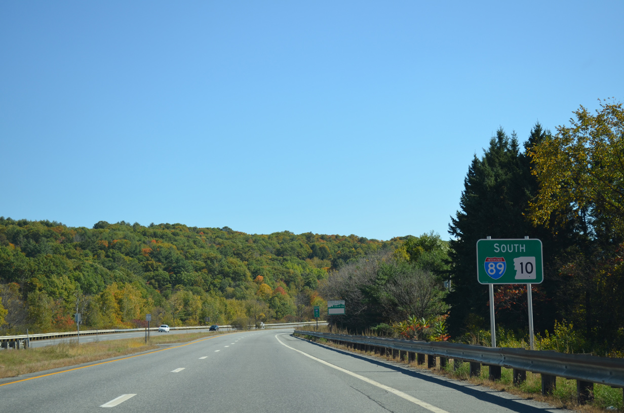
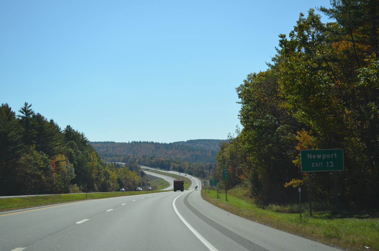
One half mile ahead of the split with NH 10 (Dart College Highway) south to Croydon on I-89. NH 10 forms a lengthy multi-state route leading south from Haverhill to Keene, Greenfield, Massachusetts and New Haven, Connecticut.
10/06/14
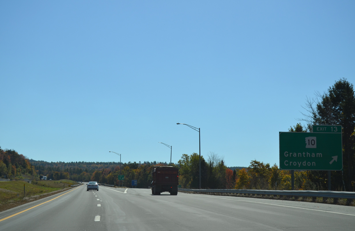
Dart College Highway extends north from Exit 13 to Eastman while NH 10 runs south along the road to the Grantham town center nearby. NH 10 is one of the original New England Interstate Routes originally designated in 1922.
10/06/14
Interstate 89 curves east between Howe Hill and East Grantham.
10/06/14

The next southbound exit joins I-89 with Georges Mills in six miles. Concord is 44 miles to the southeast.
10/06/14
North of Prospect Hill, Interstate 89 traverses an area of wetlands by Baptist Pond.
10/06/14
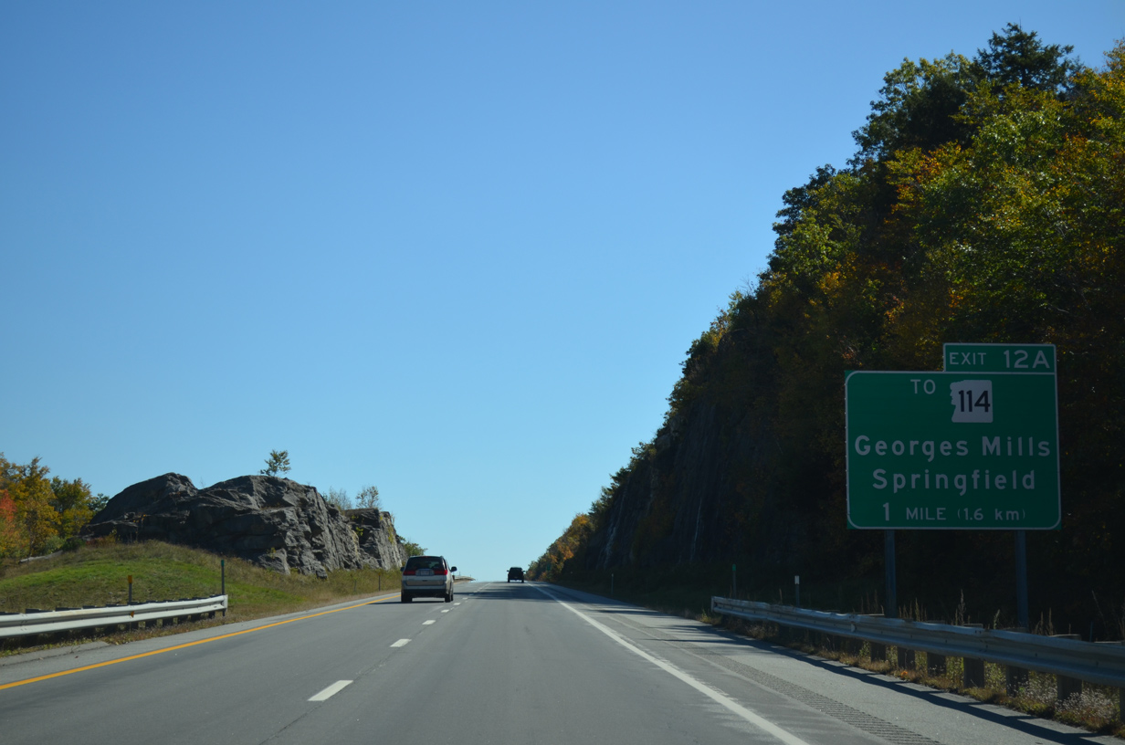
Turning more east again, I-89 advances to the diamond interchange (Exit 12 A) with Springfield Road.
10/06/14
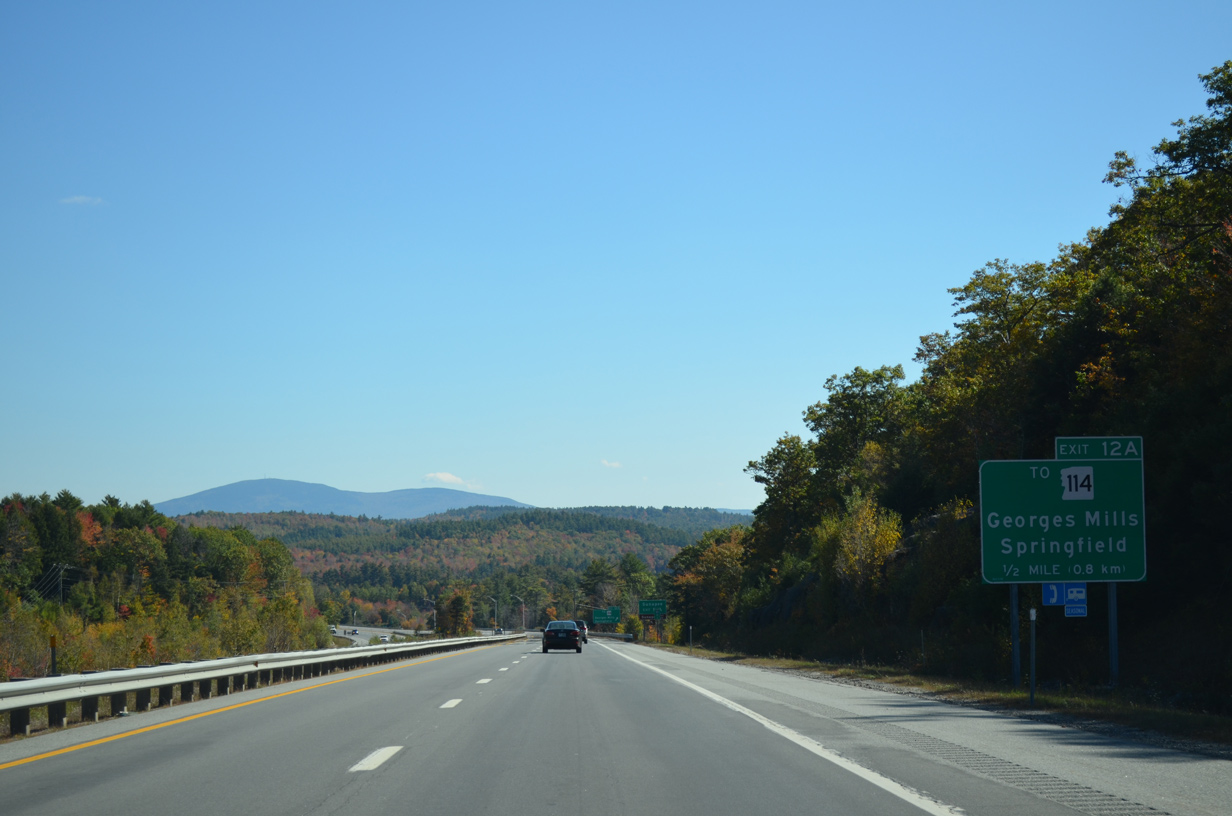
Springfield Road links I-89 with NH 11 (Sunapee Lake Road) at Georges Mills to the south. Georges Mill Road extends the road northeast to NH 114 (Main Street) north toward the Springfield town center.
10/06/14
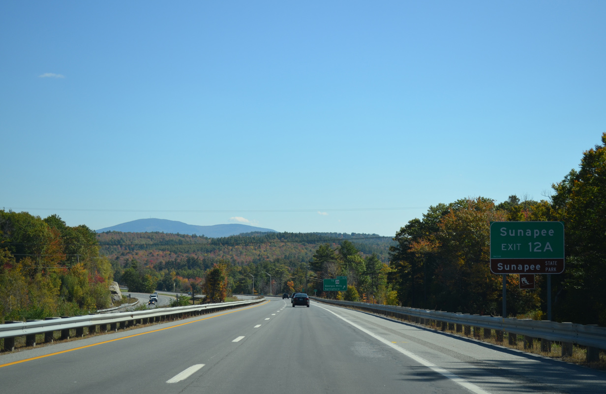
Mount Kearsarge (elevation 2,927 feet) rises prominently to the east as I-89 crosses the Sunapee town line at Exit 12 A. Sunapee encompasses the western half of Sunapee Lake along NH 11 south.
NH 103B south from the Sunapee town center to NH 103 at Edgemont leads to Mt. Sunapee State Park.
10/06/14
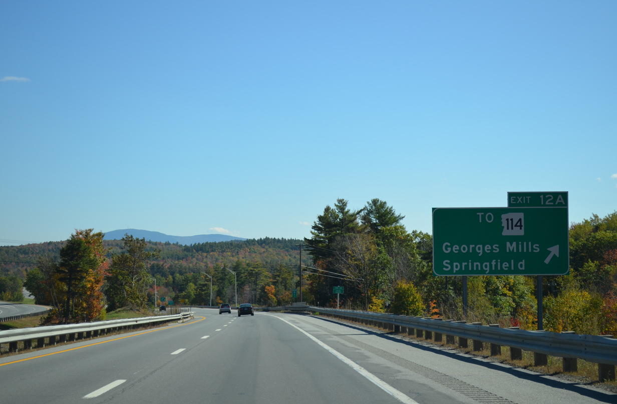
Exit 12A leaves I-89 south to Springfield and Georges Mill Roads. NH 114 loops east from NH 10 at Grantham to West Springfield, Kolelemook Lake, Twin Lakes Village and Little Sunapee Lake in the town of New London.
10/06/14


Photo Credits:
- AARoads: 07/24/00, 07/30/07
- ABRoads: 10/06/14
Page Updated Thursday February 12, 2015.