
Interstate 90 East - Coeur d'Alene

 East
East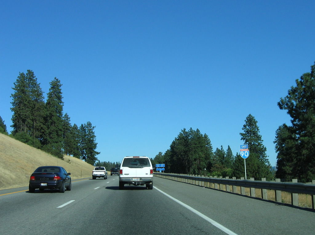
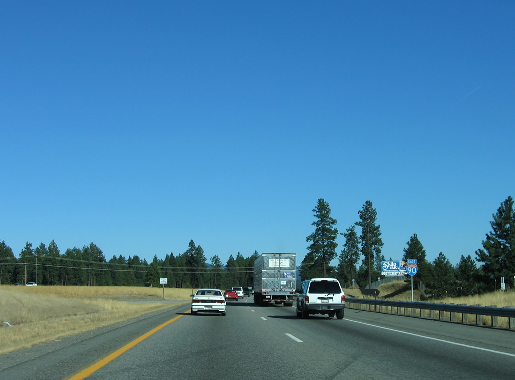
Interstate 90 leaves the city limits of Post Falls along a bluff above the Spokane River and parallel Seltice Way (old U.S. 10).
09/01/06

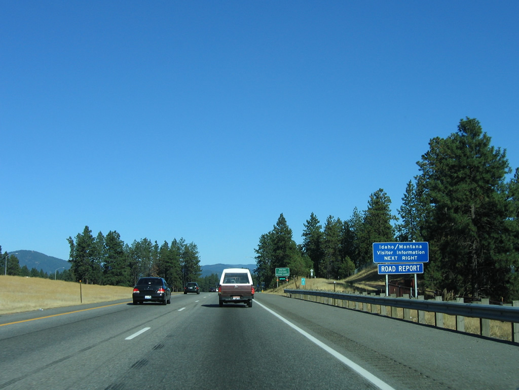
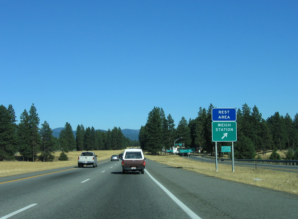
The lone rest area in Idaho along Interstate 90 follows and includes a tourist information center.
09/01/06
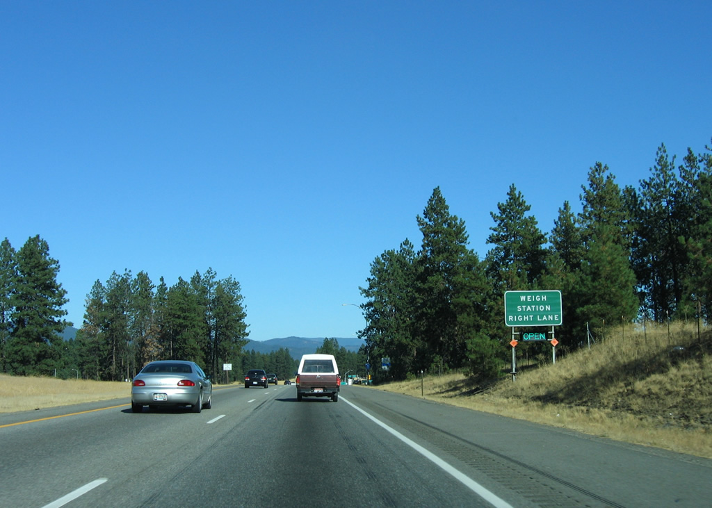
The eastbound Huetter Rest Area doubles as a weigh station for commercial trucks. Car parking for the rest area lies along the south side of the facility while RV parking follows the scales for tractor trailers.
09/01/06
Leaving the rest area and weigh station, Interstate 90 passes by the unincorporated community of Huetter before entering the city limits of Coeur d'Alene by Atlas.
09/01/06
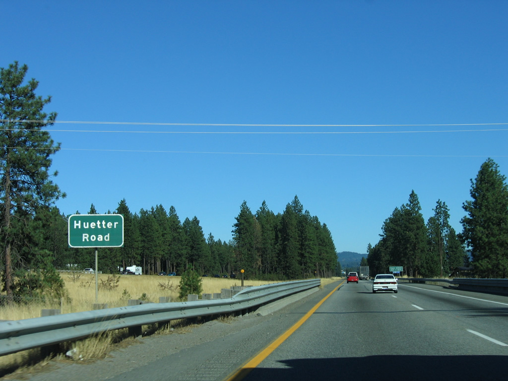
A button copy sign identifies Huetter Road as it passes under Interstate 90.
09/01/06
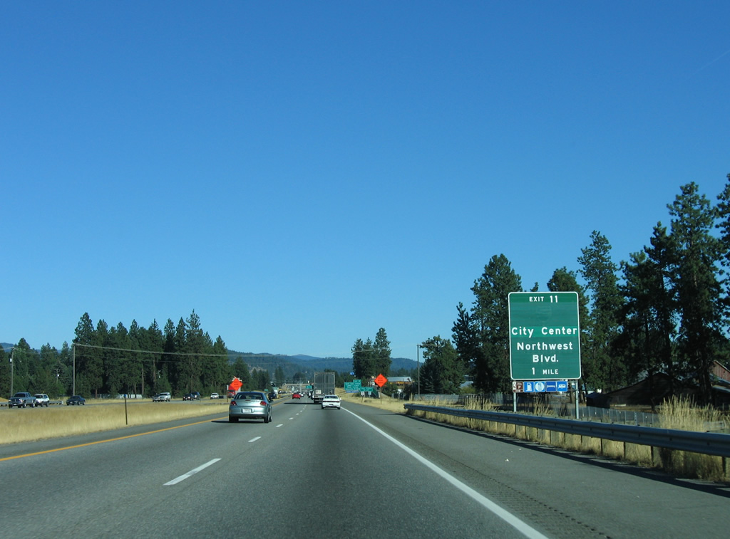
The first of five Coeur d'&apos&lene exits along Interstate 90 east joins the freeway with Northwest Boulevard south and Ramsey Road north at Exit 11. Northwest Boulevard represents both a former Business Loop for I-90 and the historic alignment of U.S. 10 southeast from Seltice Way.
09/01/06
Interstate 90 enters the Coeur d'Alene city limits ahead of the Atlas Road underpass and mostly remains within CdA to Exit 17. Forthcoming Northwest Boulevard angles southeast toward the city center, serving interests to North Idaho College, Lewis - Clark State College, the University of Idaho and Lake Coeur d'Alene Recreation Area.
09/01/06
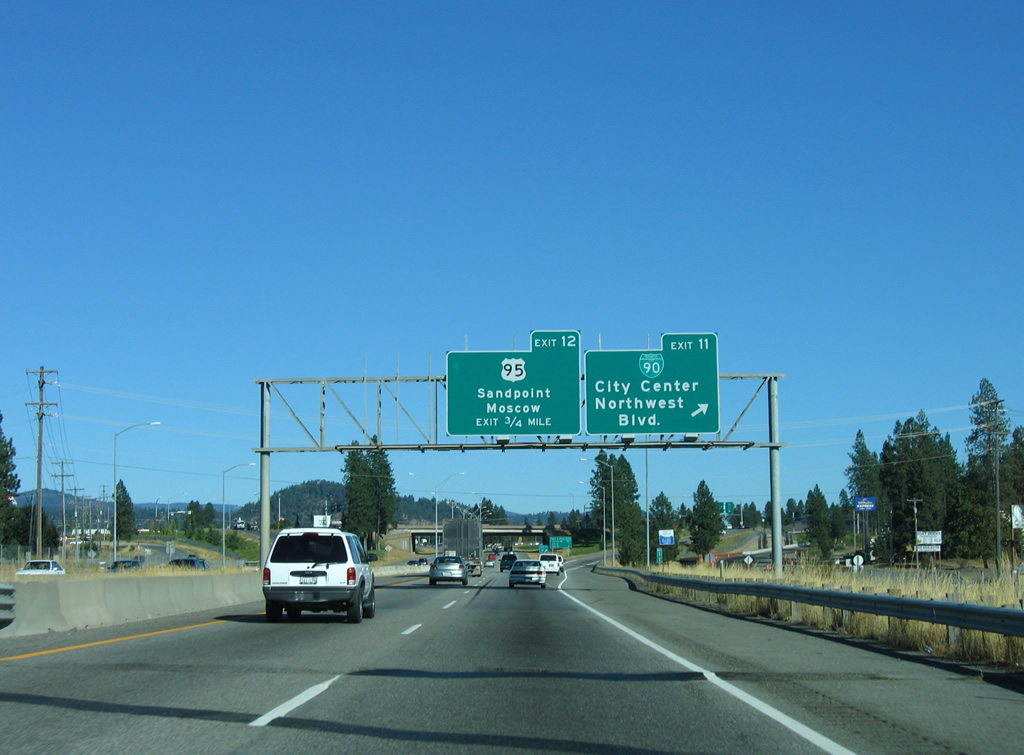
A diamond interchange joins Interstate 90 east with Northwest Boulevard (former Business Loop I-90) east and Ramsey Road north to Coeur d'Alene Airport (COE). The interchange replaced the original split of U.S. 10 (Northwest Boulevard) and U.S. 10 Alternate, which followed Appleway Avenue east to U.S. 95 north. Business Loop I-90 followed Northwest Boulevard southeast to Sherman Avenue, returning to the freeway at Exit 15.
09/01/06
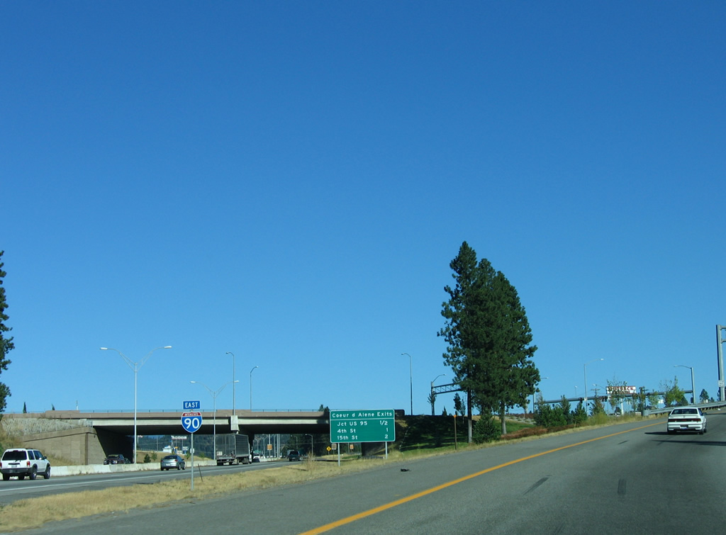
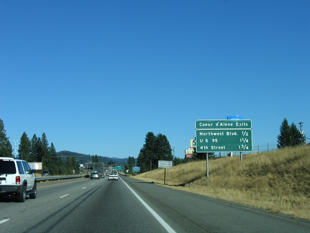
Interstate 90 continues just a half mile to the diamond interchange (Exit 12) with U.S. 95 (Lincoln Way). The freeway turns southward from 4th Street (Exit 13) to 15th Street (Exit 14) by Best Hill.
09/01/06
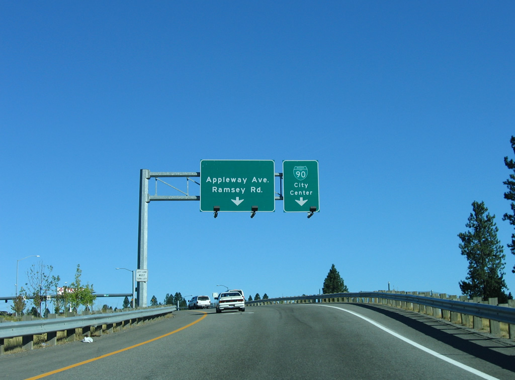
Taking the Exit 11 off-ramp, traffic splits for Northwest Boulevard south to the city center and Ramsey Road north to adjacent Appleway Avenue. Appleway Avenue was relocated to intersect Ramsay Road away from Exit 11 as part of a $9.8 million project to reconstruct the interchange from a parclo to a diamond. The 2001 work included construction of a new seven-lane overpass for Northwest Boulevard above I-90.1
09/01/06
U.S. 95 leads 107 miles north from Coeur D'alene to end at the Canadian border between Eastport and Kingsgate, British Columbia. The US highway follows a busy commercial arterial north through Dalton Gardens and Hayden before turning eastward from Garwood to Sagle along a 31.5 mile stretch being upgraded to limited access standards.
09/01/06
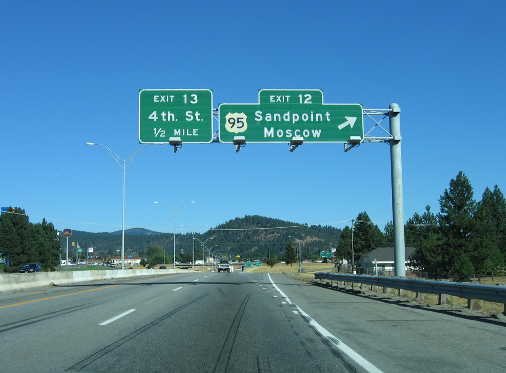
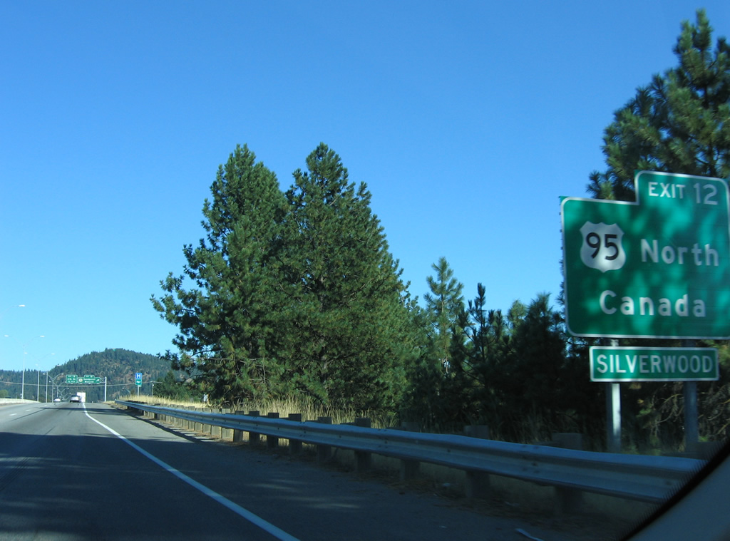
Exit 12 leaves Interstate 90 for U.S. 95. U.S. 95 provides the main route from Interstate 90 to the northern suburbs of Dalton Gardens and Hayward. Regionally the route connects Coeur d'Alene with Sandpoint, Moscow and Lewiston while overall in Idaho, U.S. 95 travels 538.6 miles from the Oregon state line, 33 miles south of Homedale, to British Columbia.
09/01/06
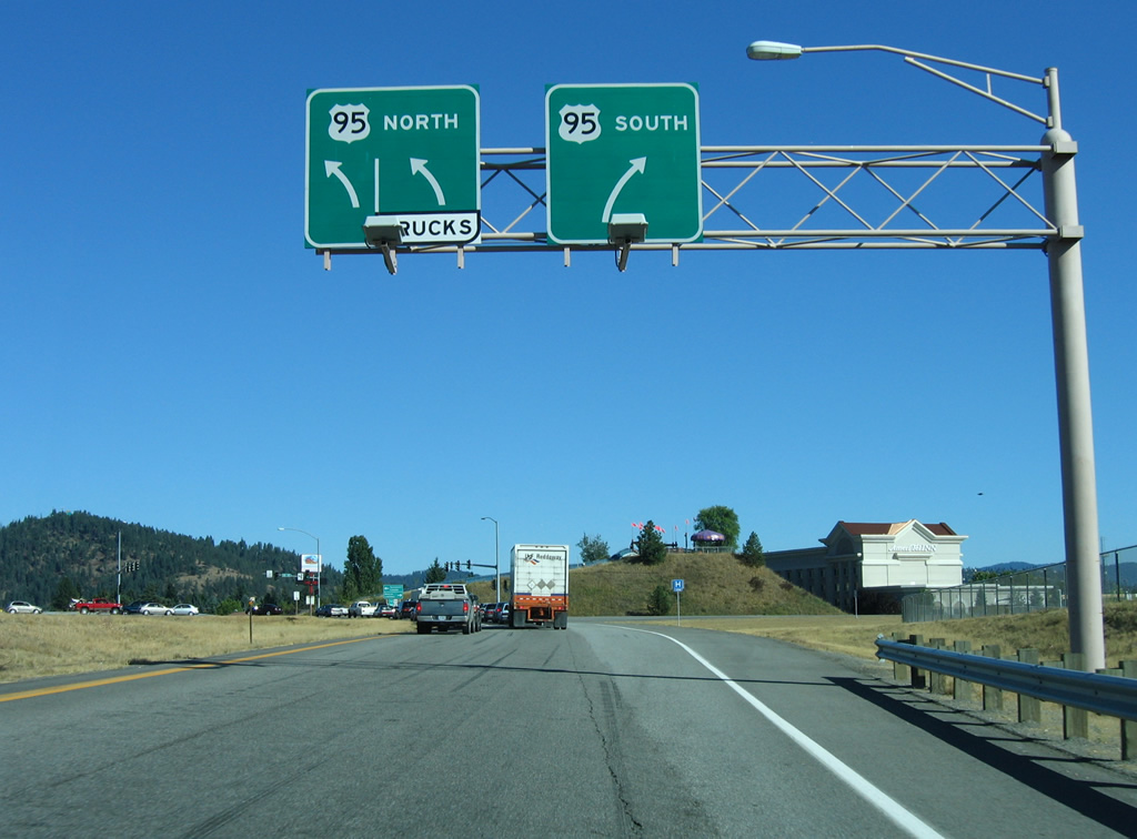
Two lanes turn onto U.S. 95 north, which reaches Hayden in five miles. Southward U.S. 95 follows Lincoln Way to Walnut Avenue, where the route turns west to Blackwell Island. Use Exit 12 for adjacent Kootenai Medical Center and U.S. 95 north for Silverwood Theme Park and Kathleen Avenue east for the Kootenai County Fairgrounds.
09/01/06
References:
- "I-90 Interchange Work To Alter Traffic < Ramsey Road - Appleway Avenue Intersection To Close For A Month." Idaho Spokesman-Review, July 29, 2000.
Photo Credits:
- AARoads: 09/01/06
Page Updated Friday July 05, 2013.