
I-94/U.S. 52 West - Fargo


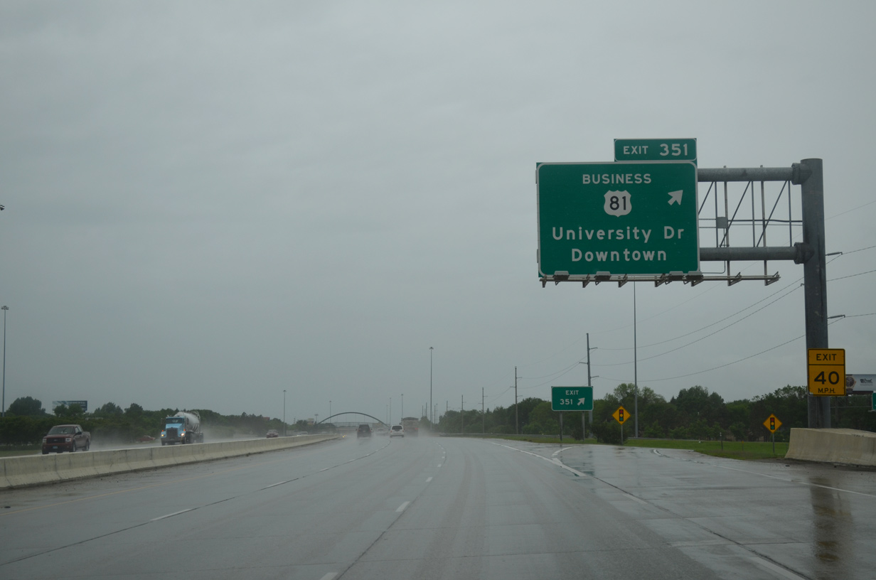
The North Dakota welcome sign appears a half mile ahead of Exit 351 to U.S. 81 Business (University Drive). U.S. 81 Business comprises a 10.84 mile long loop east through Fargo from I-29/U.S. 81 to the west.
06/16/15

Interchange sequence signs are typically placed between every exit within the Fargo area on I-29 and I-94. This panel precedes the six-ramp parclo interchange at Exit 351. U.S. 81 Business follows University Drive northward from 52nd Avenue S at Maple Valley to 13th Avenue S at the Roosevelt/NDSU neighborhood. Most of the route is a commercialized arterial.
06/16/15
U.S. 81 Business (University Drive) heads north from Exit 351 by the Clara Barton neighborhood toward Downtown Fargo. The route separates along the couplet of University Drive south and 10th Street north from Hawthorne to the North Dakota State University (NDSU) campus.
06/16/15
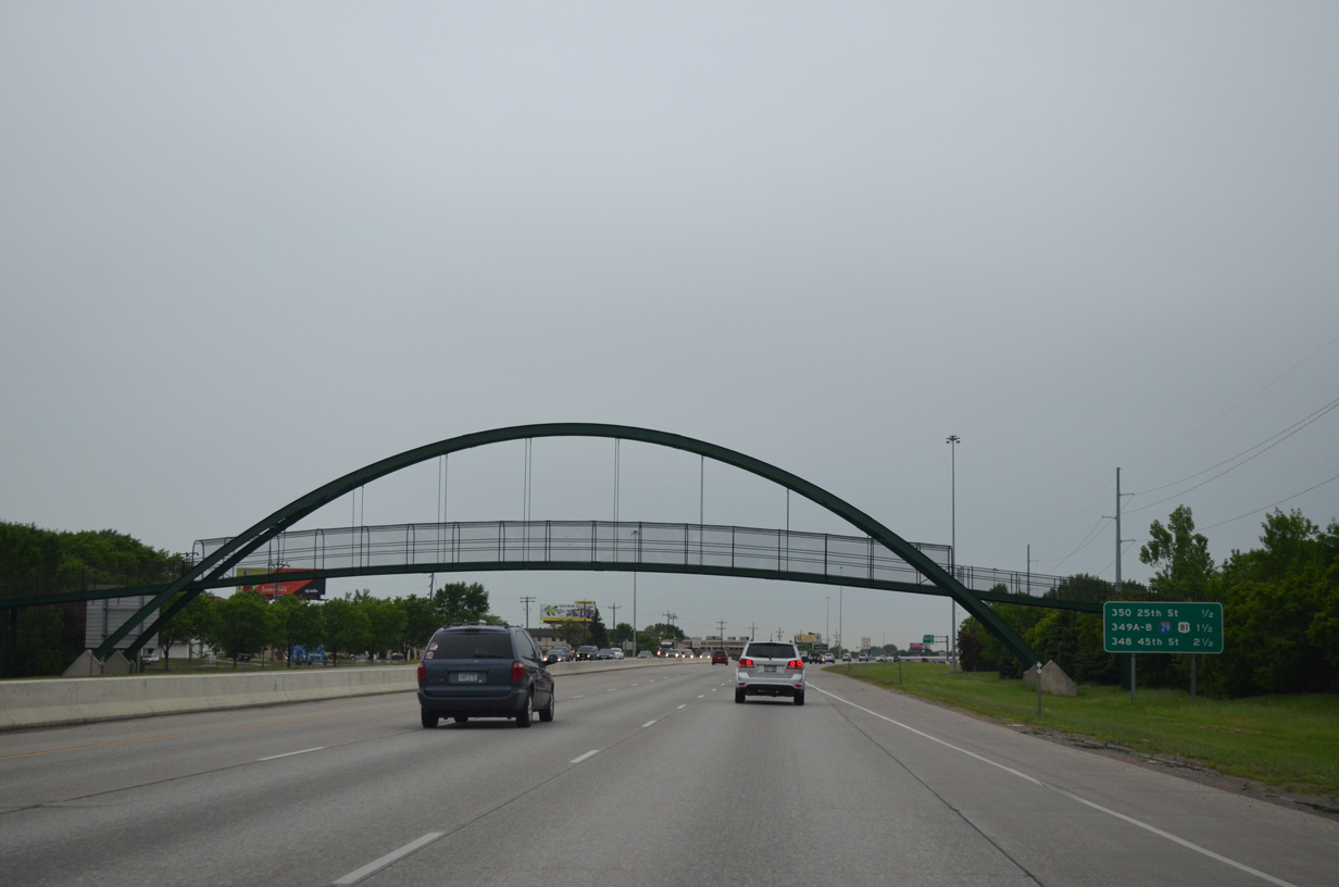
A steel arch pedestrian bridge spans I-94/U.S. 52 between the adjacent Brunsdale and Lewis & Clark neighborhoods west of University Drive.
06/17/15
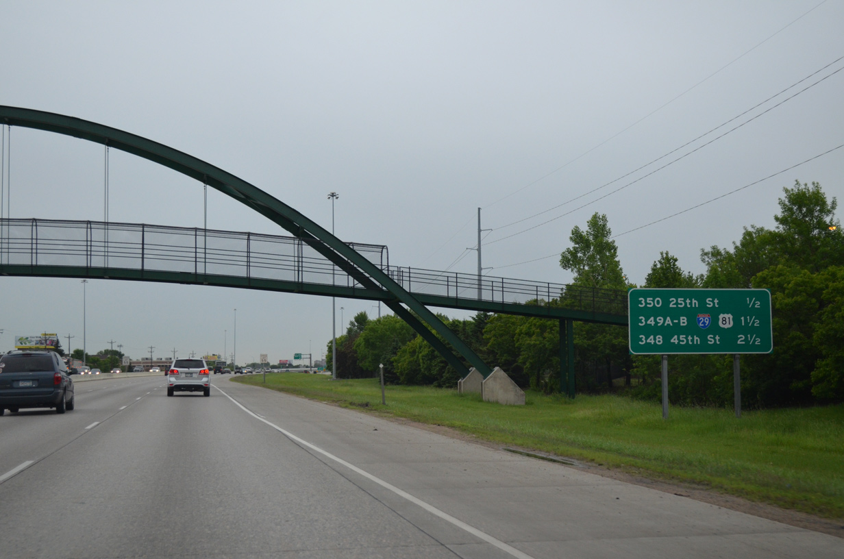
The next westbound exit joins I-94/U.S. 52 with 25th Street. 25th Street runs north to 12th Avenue N between the South High and Westgate neighborhoods.
06/17/15
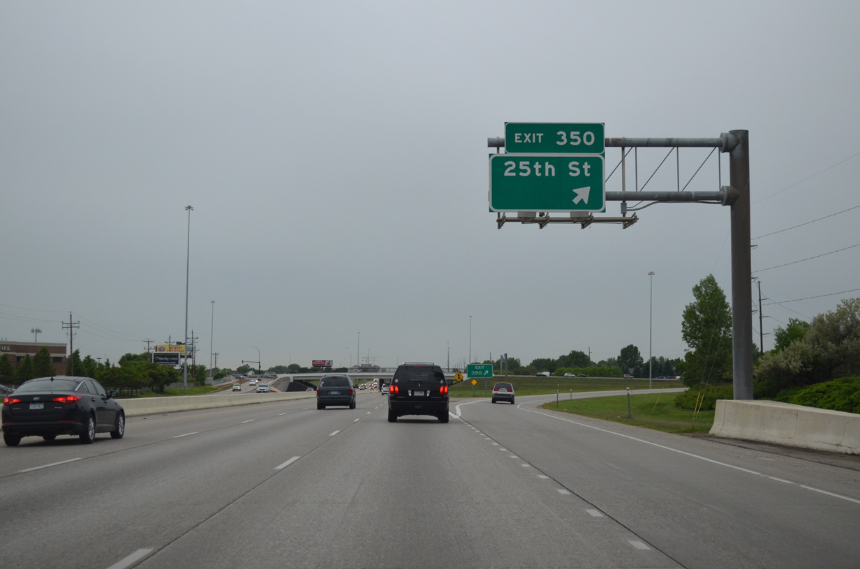
I-94/U.S. 52 west at the six-ramp parclo interchange (Exit 350) with 25th Street S. 25th Street heads south by the Bluemont Lakes and Southpointe communities to the city line at 76th Avenue S.
06/17/15
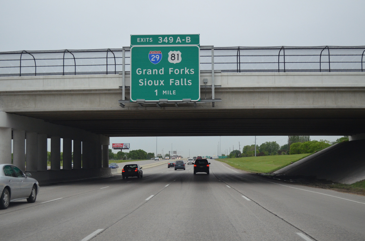
I-94/U.S. 52 advance one mile west from 25th Street S to Exits 349 A/B for I-29/U.S. 81. I-29/U.S. 81 pass through Fargo between Frontier and Reiles Acres.
06/17/15
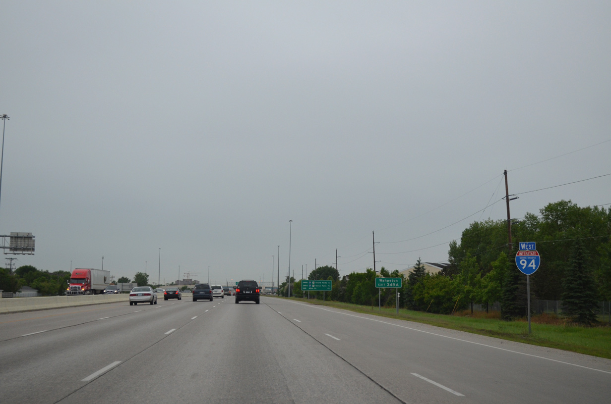
Confirming marker for I-94 west posted after 25th Street S. The 25th Street S interchange was not an original I-94 exit.
06/17/15
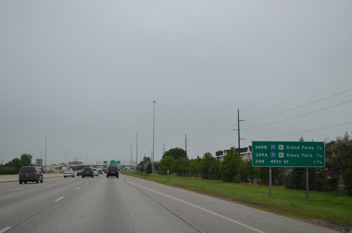
A cloverstack interchange connects I-94/U.S. 52 west with I-29/U.S. 81 at Exit 349. I-29/U.S. 81 south to Exit 23 leads motorists to Wahpeton.
06/17/15
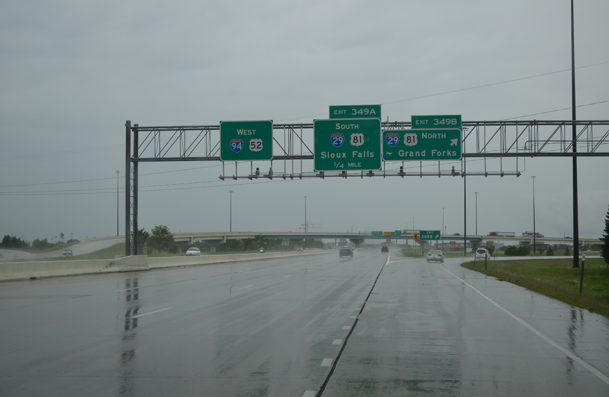
I-29/U.S. 81 head two miles north from Exit 349 B to Main Avenue (U.S. 10) and five miles to Hector International Airport (FAR). Beyond Fargo, I-29/U.S. 81 continue 77 miles to U.S. 2 at Grand Forks.
06/16/15
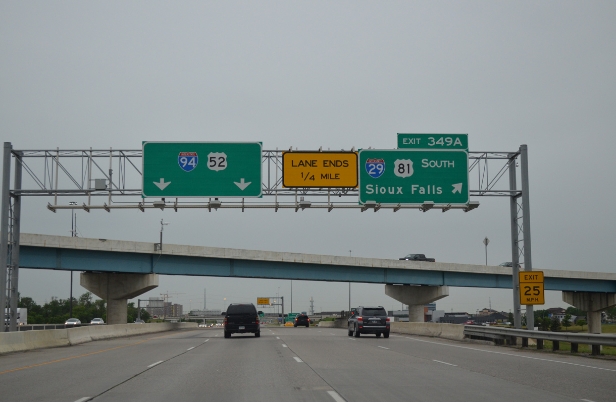
Exit 349 A loops onto I-29/U.S. 81 south toward Sioux Falls, South Dakota and Omaha, Nebraska. A high flyover travels above between I-29/U.S. 81 south to I-94/U.S. 52 east. Interstate 29 leaves Fargo at 52nd Avenue S and Frontier and reaches I-90 at Sioux Falls in 232 miles.
06/17/15
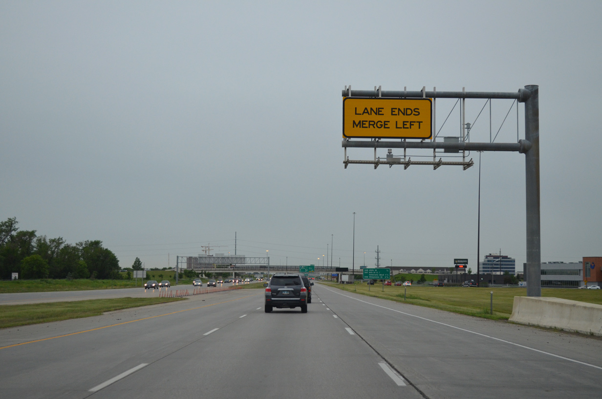
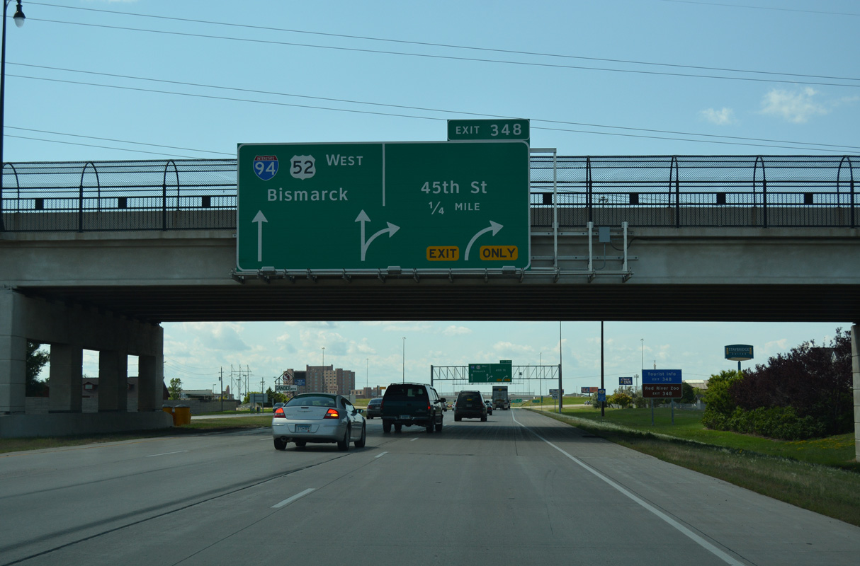
A lane drop occurs along I-94/U.S. 52 west ahead of the entrance ramp from southbound I-29/U.S. 81. Merging traffic forms a third westbound lane to Exit 348 with 45th Street.
06/17/15
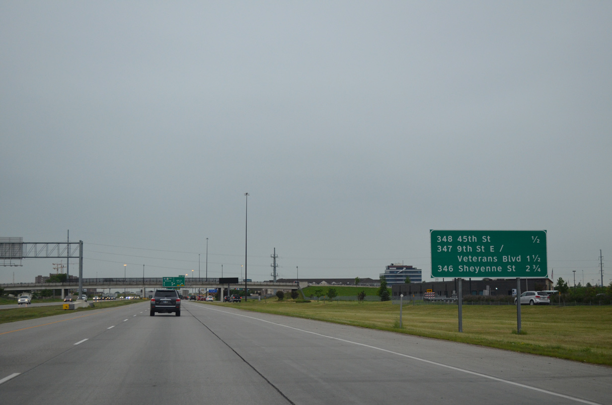
I-94/U.S. 52 next meet 45th Street S at a six ramp parclo interchange (Exit 348). The corridor north of the freeway is well developed to Exit 346. Southward, suburban expansion in the mid-2000s converted open fields to house new apartment complexes and other development.
06/17/15
Two lanes depart from I-94/U.S. 52 west at Exit 348 for 42nd Street S. Points of interest served by Exit 348 include a tourist information center and the Red River Zoo.
08/06/16

Exit 348 provides an array of lodging opportunities on the north side of I-94/U.S. 52. 45th Street extends 0.9 miles north to 13th Avenue S, a commercial arterial leading to West Acres Shopping Center and West Fargo.
08/06/16
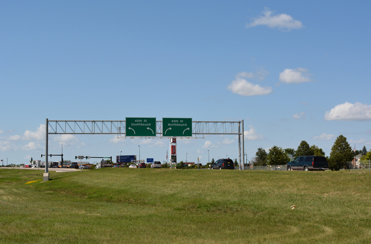
Entering the six-ramp parclo interchange with 45th Street. 45th Street comprises a commuter route south into newly developed areas, including the Urban Plains, Osgood, Woodhaven and The District neighborhoods, to 52nd Avenue South.
08/06/16
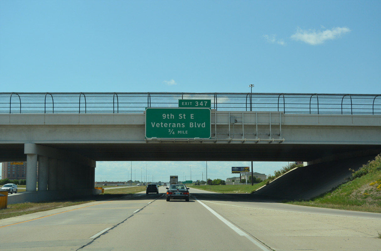
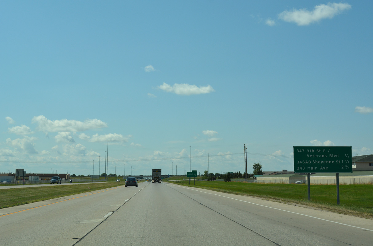
The first of three exits for the city of West Fargo on I-94/U.S. 52 west is with 9th Street E and Veterans Boulevard south. The parclo interchange at Exit 347 opened following a ribbon cutting ceremony held on October 1, 2009.
08/06/16
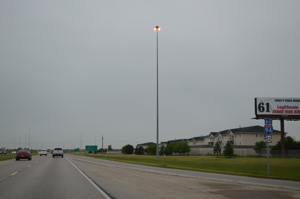
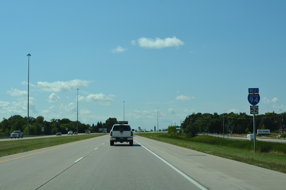
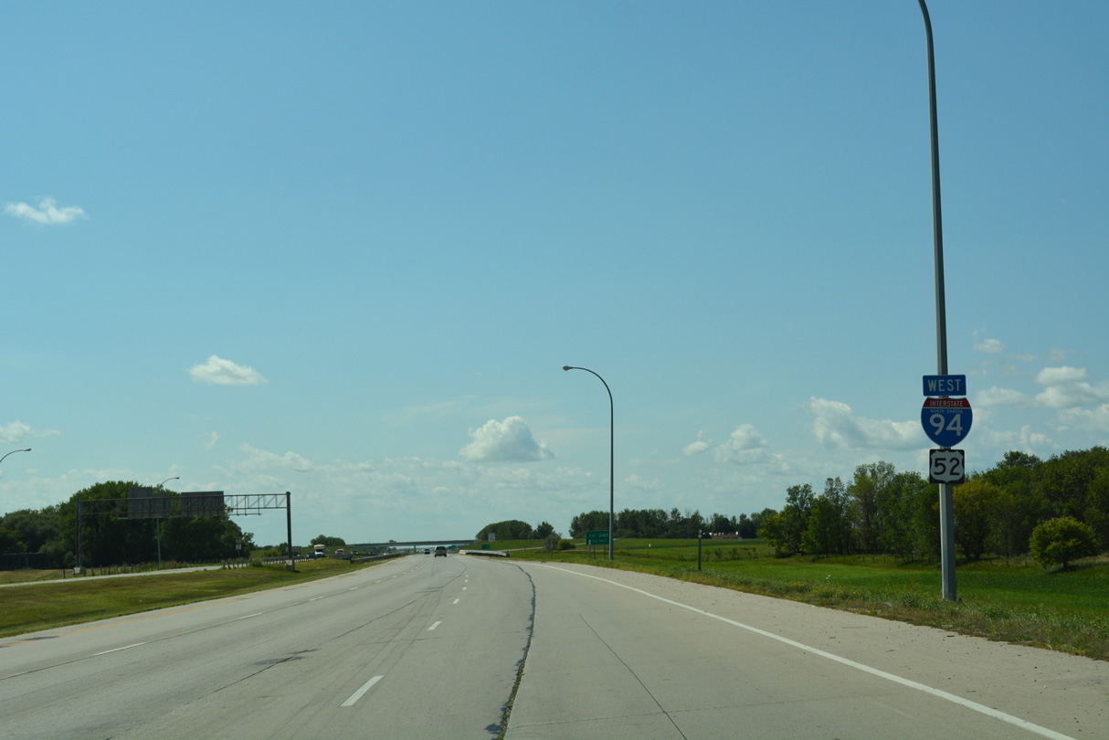
The first U.S. 52 confirming marker posted since the US highway joined Interstate 94 in St. Paul, Minnesota appears by the 45th Street entrance ramp.
06/17/15
Suburban expansion of West Fargo spreads south of Interstate 94 from the succeeding two exits. 9th Street E was extended south of the freeway as newly built Veterans Boulevard in 2009.
08/06/16
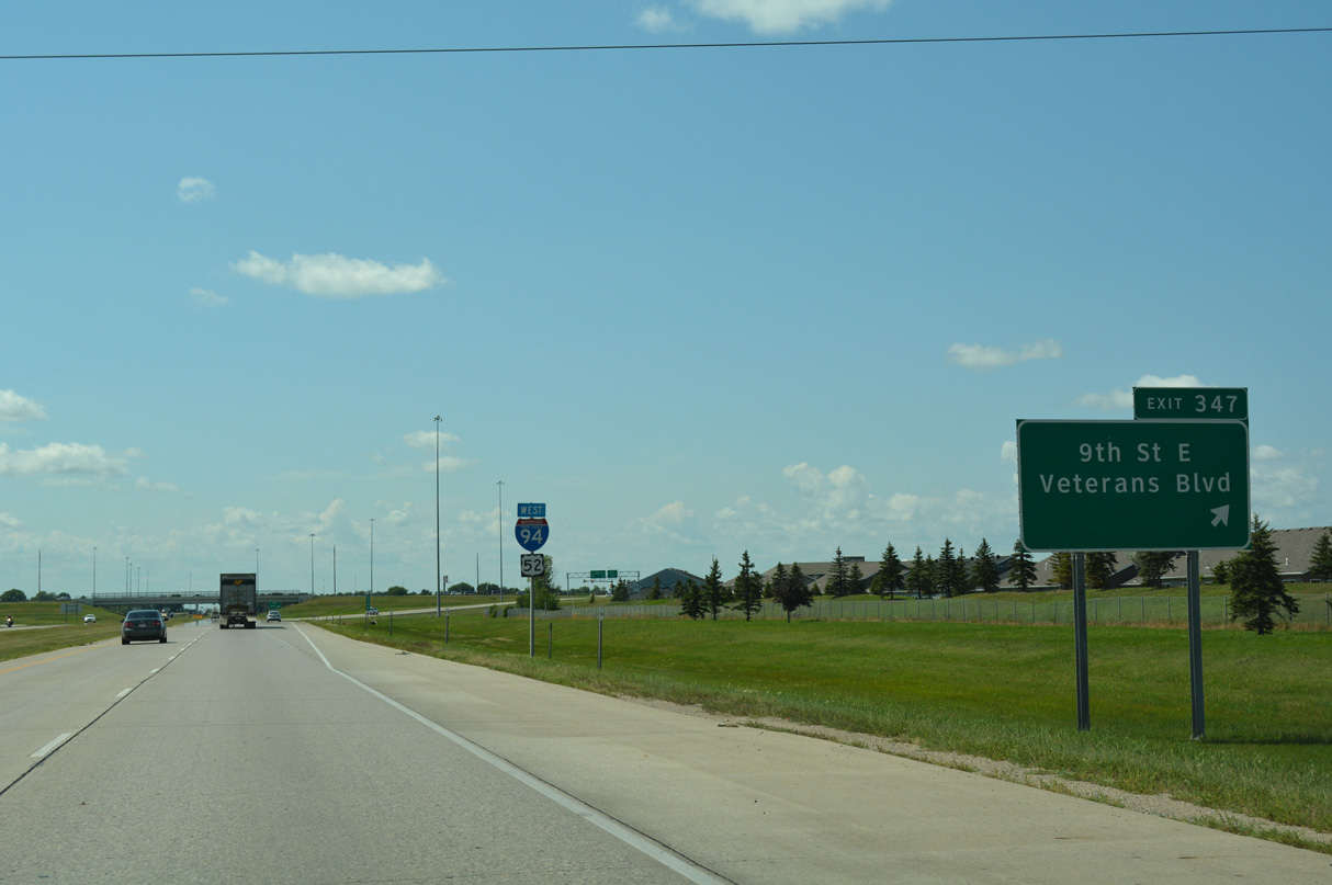
Exit 347 departs I-94/U.S. 52 west for 9th Street E north into older portions of West Fargo and south along the Fargo city line to the Osgood neighborhood at 40th Avenue S.
08/06/16

A second set of shields for I-94/U.S. 52 west posted between Exits 348 and 347. Apartments and duplexes abut the north side of the freeway here.
08/06/16
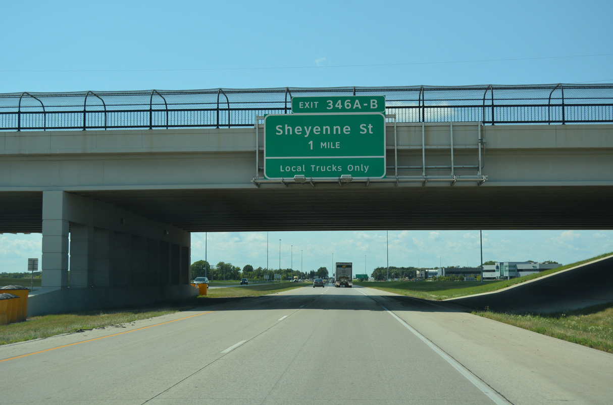
I-94/U.S. 52 advance one mile west through West Fargo to a parclo interchange (Exit 346) with Sheyenne Street (Cass County Route 17). Sheyenne Street and CR 17 serve suburban areas of West Fargo southward through the expanded city limits.
08/06/16
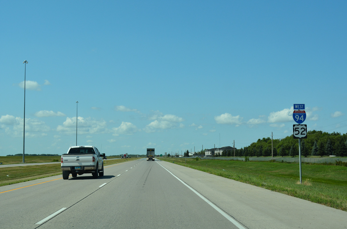
The final two Fargo metro area interchanges join the freeway with Sheyenne Street and the west end of U.S. 10.
06/17/15
Beaton Drive parallels the north side of I-94 from 9th Street E to Sheyenne Street by this set of shields.
08/06/16
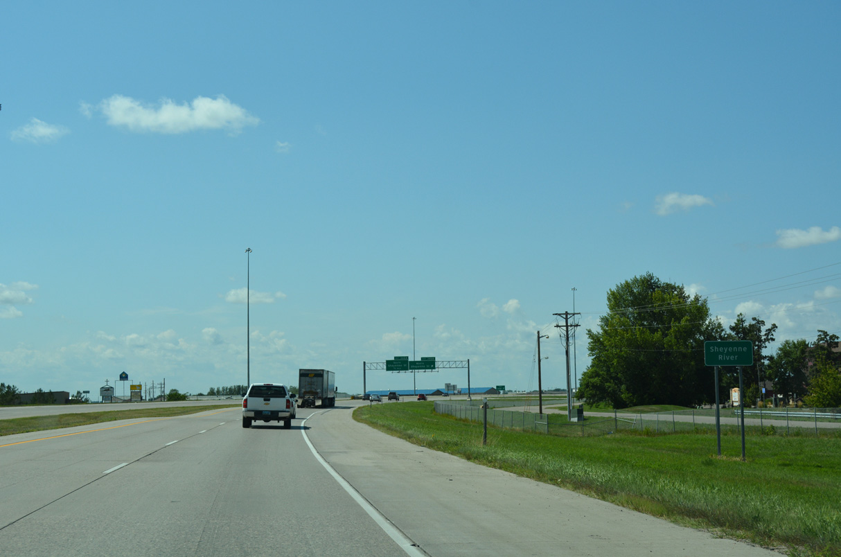
The Sheyenne River flows below I-94/U.S. 52 through a culvert just ahead of Exit 346 B.
08/06/16

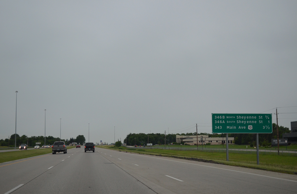
Sheyenne Street leads two miles north from Exit 346 B to the West Fargo city center at Business Loop I-94/U.S. 10 (Main Avenue).
08/06/16

Sheyenne Street / County Route 17 runs south from Exit 346 A through suburban West Fargo to the city of Horace.
08/06/16
I-94/U.S. 52 turns northwest and and leave the city of West Fargo ahead of 13th Avenue W.
08/06/16
U.S. 10/Business Loop I-94 follow Main Avenue west from Downtown Fargo and West Fargo to a trumpet interchange at Exit 343.
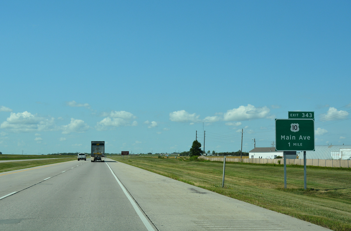
08/06/16
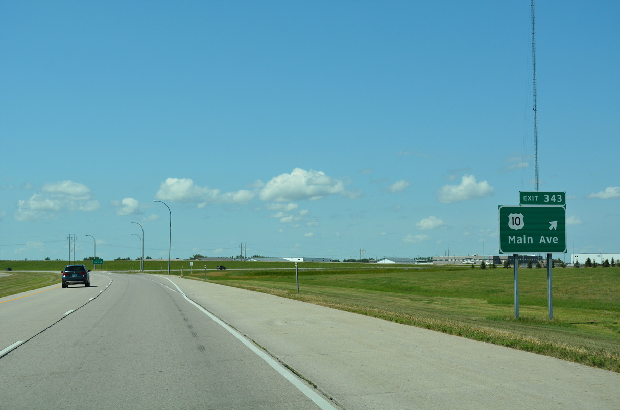
Exit 343 departs I-94/U.S. 52 west for the eastbound beginning of Business Loop I-94/U.S. 10 (Main Avenue). The two routes overlap east east to Moorhead, Minnesota.
08/06/16
I-94/U.S. 52 west of the end of U.S. 10. U.S. 10 historically extended west to Seattle, Washington. The route was replaced by the construction of I-94 and I-90 and subsequently truncated east to West Fargo by 1987.
08/06/16
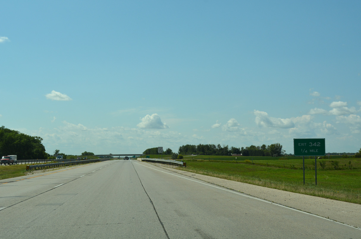
38th Street SW meets I-94/U.S. 52 at Exit 342 beyond the West Fargo city limits. Portions of former U.S. 10 and U.S. 52 follow the adjacent frontage road (37th Street SE) along this stretch.
08/06/16
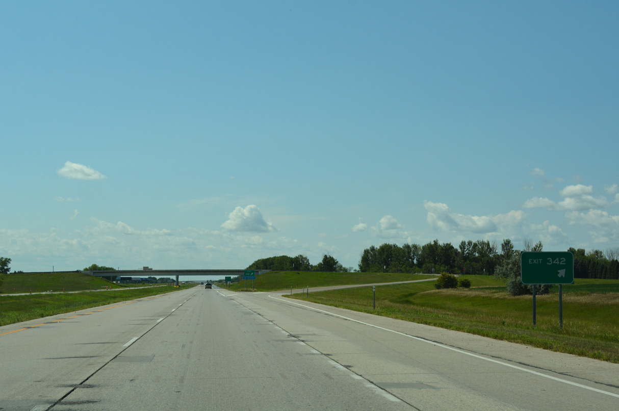
Westbound at the ranch exit with 38th Street on I-94/U.S. 52. 38th Street travels north from Exit 342 to Cass County Route 10 and south to 52nd Avenue S across open farm land.
08/06/16

A truck weigh station operates along Interstate 94 westbound 0.75 miles beyond the 38th Street NW over crossing.
08/06/16
Interstate 94 crosses the Fargo-Moorhead Metropolitan Area Stormwater Diversion Channel Project west of 38th Street NW. The 30 mile long stormwater diversion channel will redirect surplus stormwater from the Red River around the Fargo metropolitan area (FHWA, n.d.).
08/06/16
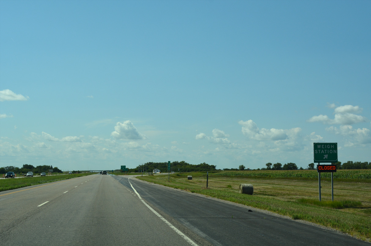
All commercial trucks must enter the weigh station west of Exit 342 during operating hours.
08/06/16
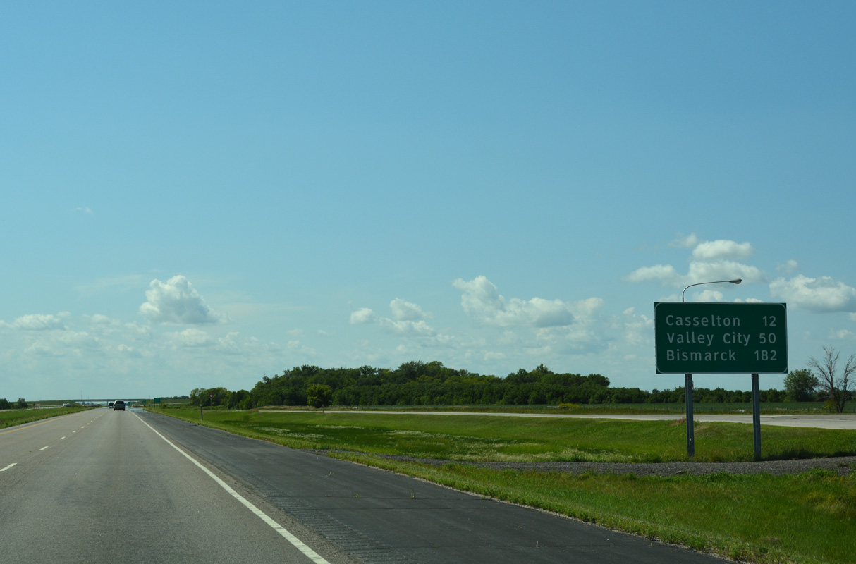
The first distance sign posted along I-94/U.S. 52 west in North Dakota is 12 miles ahead of the city of Casselton. Valley City follows in 50 miles while the capital city is 182 miles away.
08/06/16
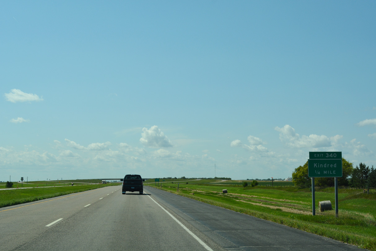
Next along I-94/U.S. 52 west is the diamond interchange (Exit 340) with Cass County Route 15 (185th Avenue SE).
08/06/16
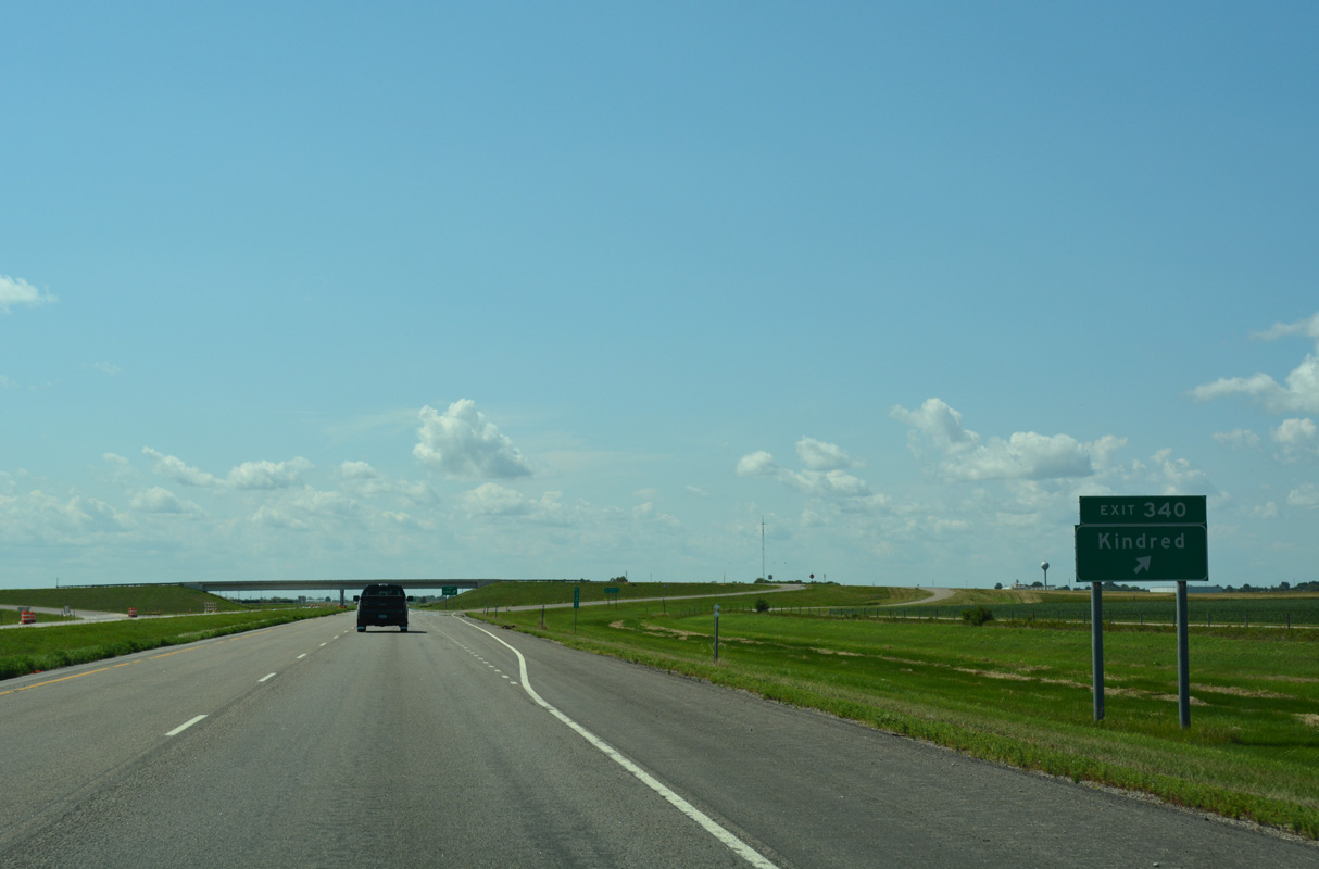
Exit 340 parts ways with I-94/U.S. 52 west for Cass County Route 15 (185th Avenue SE) south 16 miles to the community of Kindred.
08/06/16
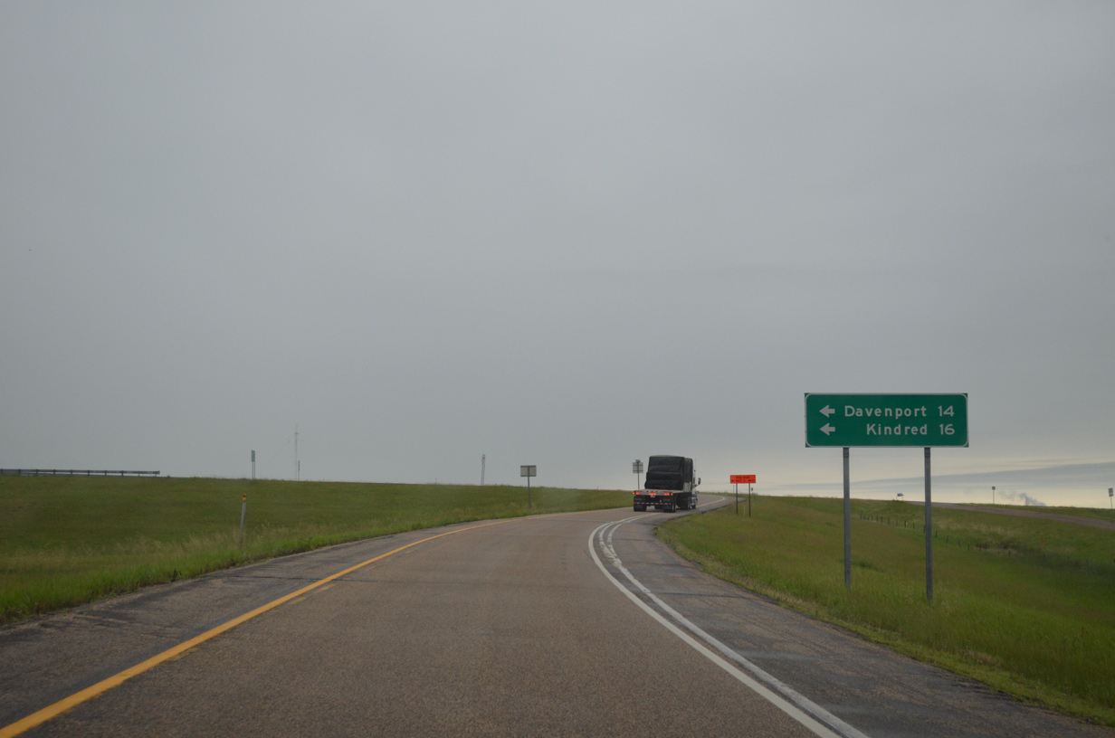
185th Avenue heads north from Exit 340, 0.9 miles to Cass County Route 10 east of Mapleton. CR 15 south to CR 15 west leads to the city of Davenport.
06/17/15
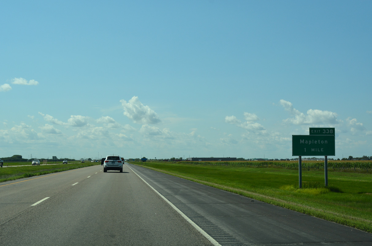
I-94/U.S. 52 continue one mile west to Exit 338 for 163rd Avenue SE at the city of Mapleton.
08/06/16

163rd Avenue SE heads north from I-94/U.S. 52 into Mapleton and south from the diamond interchange at Exit 338 to agricultural areas.
08/06/16
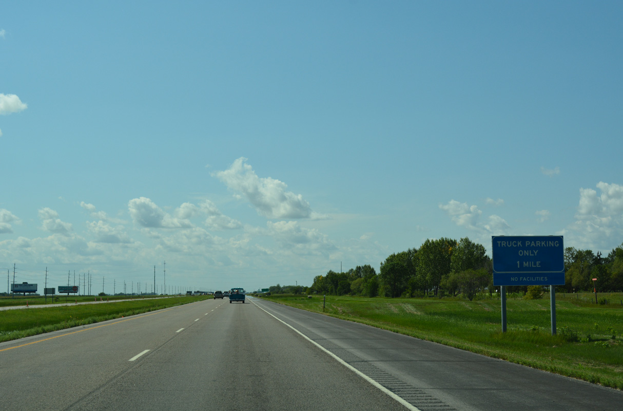
I-94/U.S. 52 run along the south side of Maple River Golf Club west to a truck parking area.
08/06/16
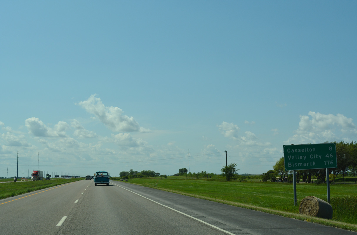
Castleton represents the next exit along Interstate 94 west. The Barnes County seat of Valley City follows in 46 miles.
08/06/16
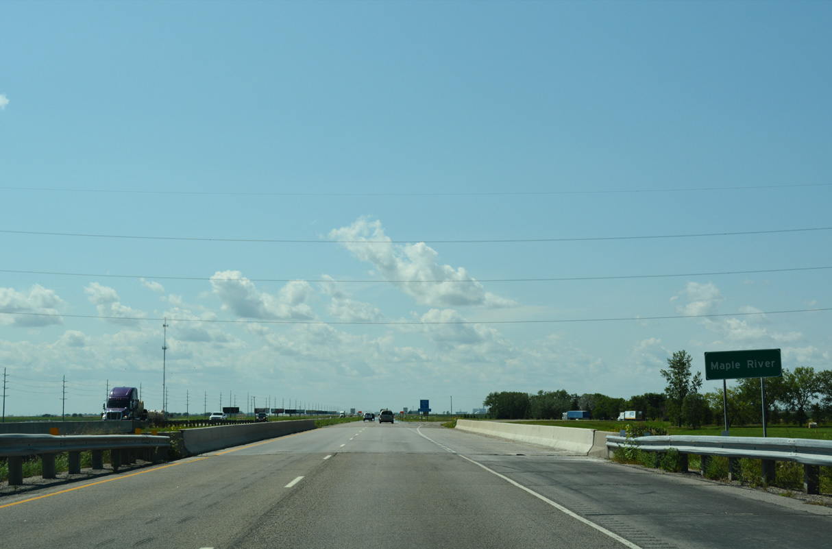
The first of two crossings along I-94/U.S. 52 west with the Maple River. The second precedes mile post 313 southeast of Tower City.
08/06/16
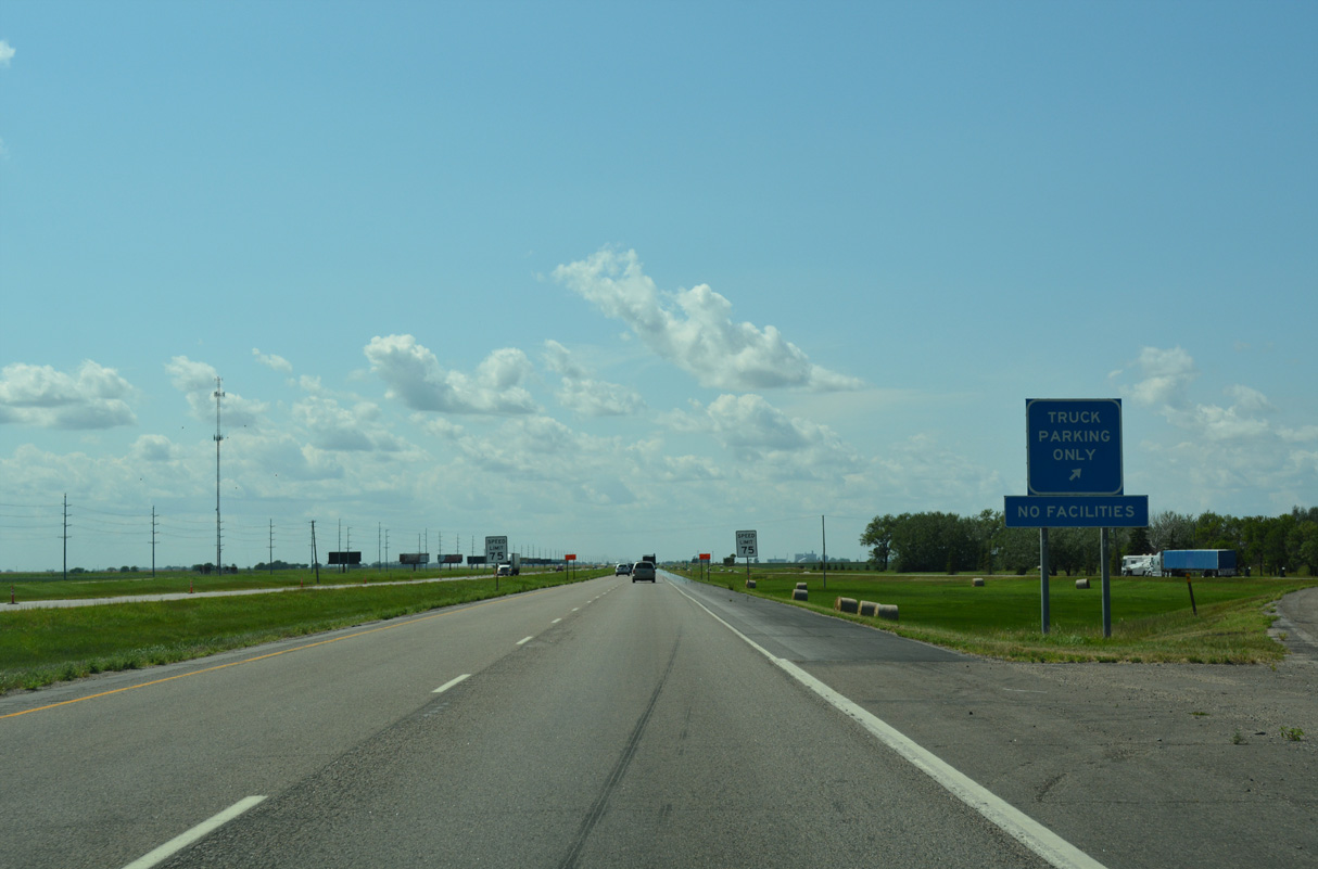
The truck parking area follows the Maple River at mile marker 337.
08/06/16
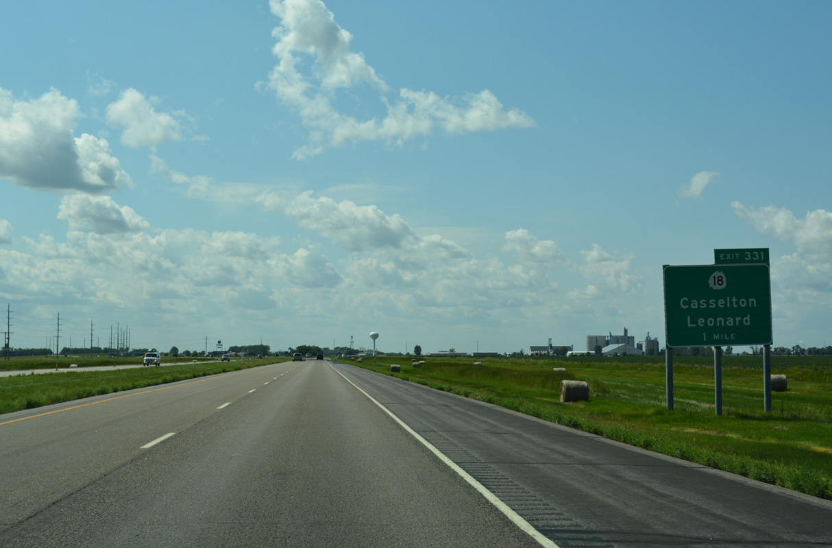
ND 18 (Governor's Drive) meets Interstate 94 just south of the Casselton city limits at Exit 331.
08/06/16
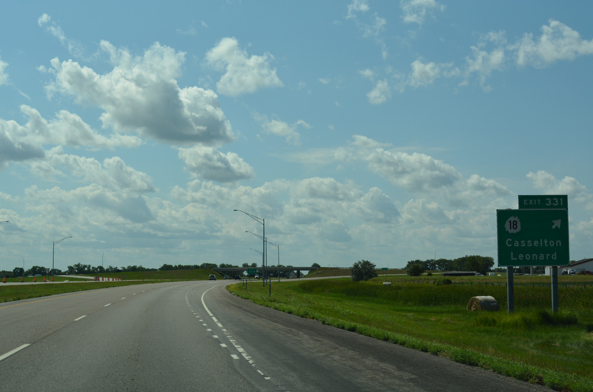
ND 18 travels the height of the state between South Dakota Highway 25 and the Canadian border near Neche. The city of Leonard is 16 miles to the south along the rural highway.
08/06/16

Old U.S. 10 parallels I-94/U.S. 52 along 37th Street SE just to the north.
08/06/16
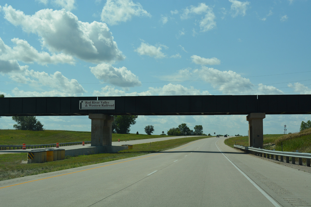
The Red River Valley & Western Railroad spans Interstate 94 a half mile west of ND 18.
08/06/16
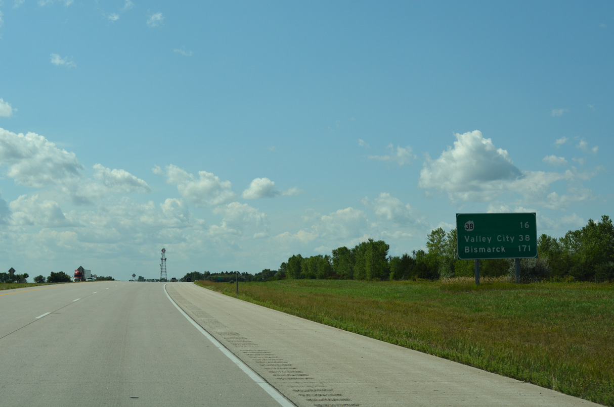
ND 38 meets I-94/U.S. 52 south of Buffalo in 16 miles.
08/06/16
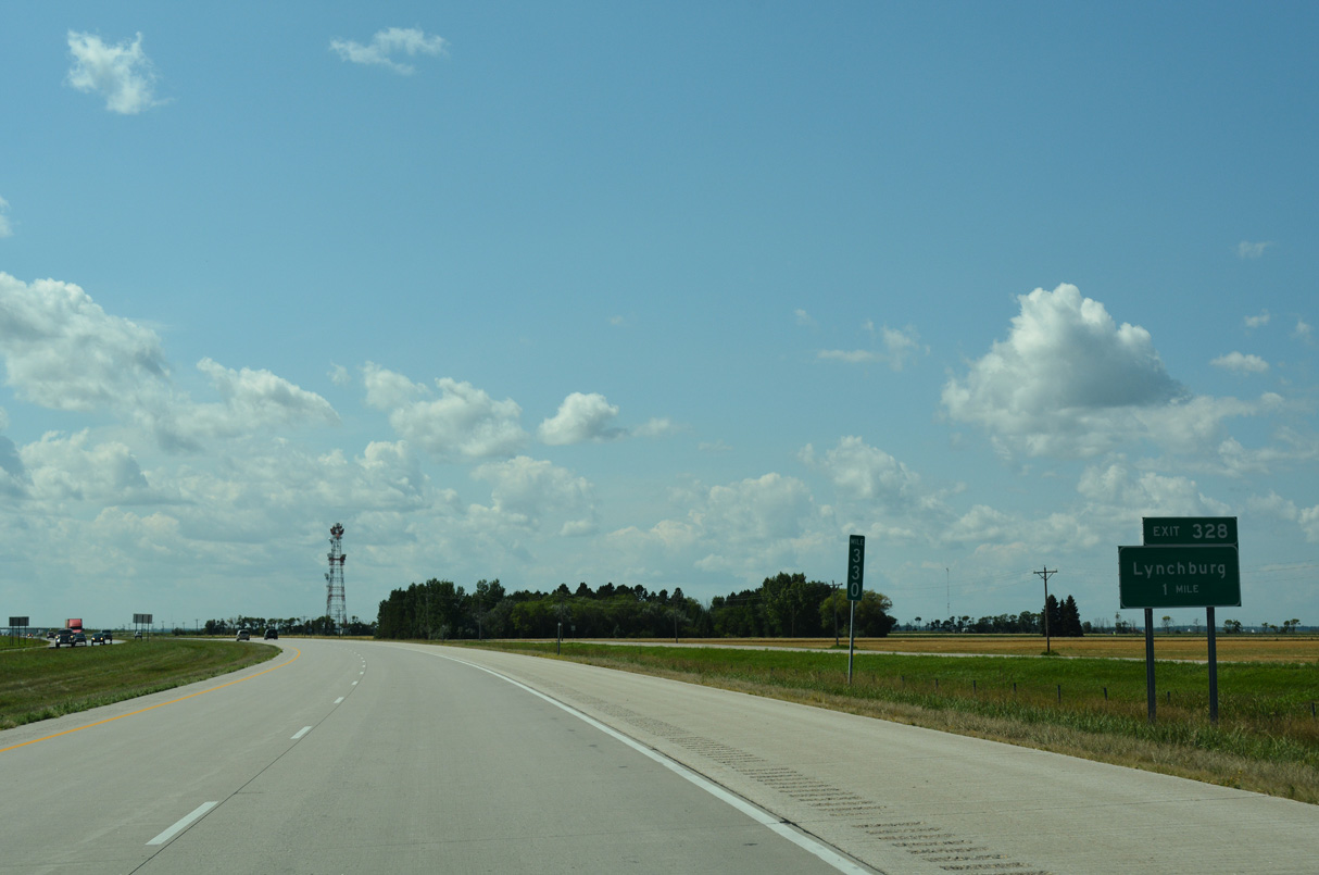
The diamond interchange at Exit 328 joins Interstate 94 with 153rd Avenue SE.
08/06/16
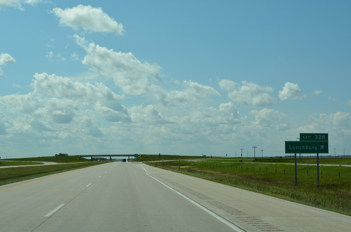
The unincorporated community of Lynchburg is seven miles to the south of Exit 328 along 153rd Avenue SE at Cass County Route 6.
08/06/16
Interstate 94 crosses the path of an abandoned Red River Valley & Western Railroad line west just ahead of mile marker 328.
08/06/16
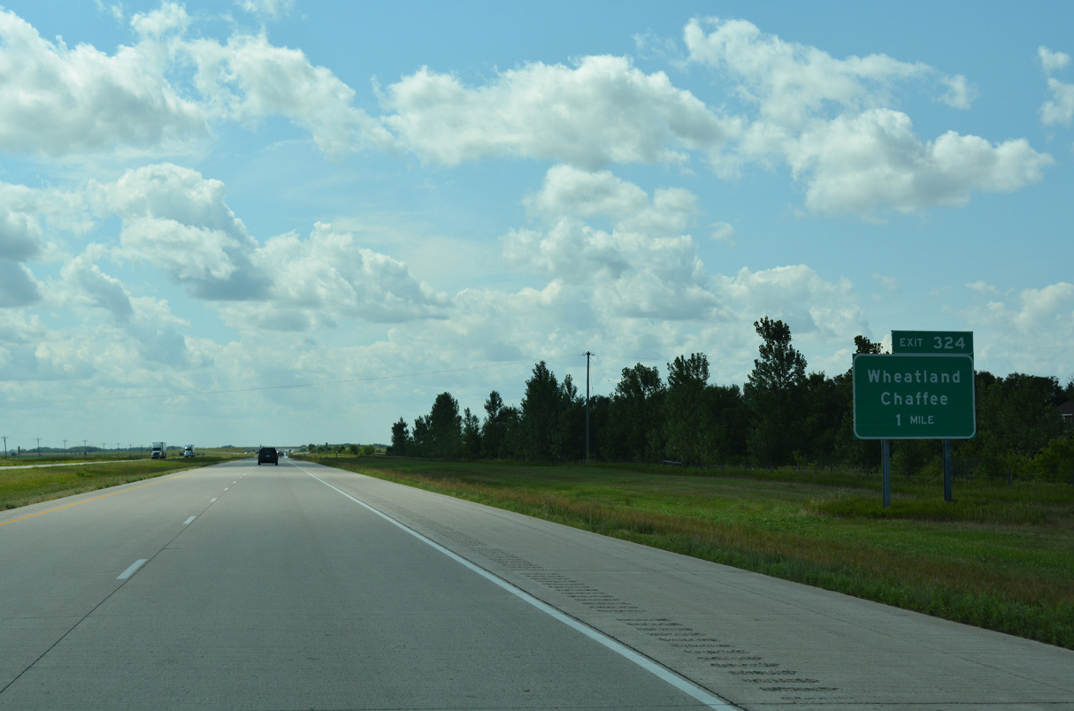
Cass County Route 5 (149th Avenue SE) connects with I-94/U.S. 52 at Exit 324, two miles south of Wheatland.
08/06/16
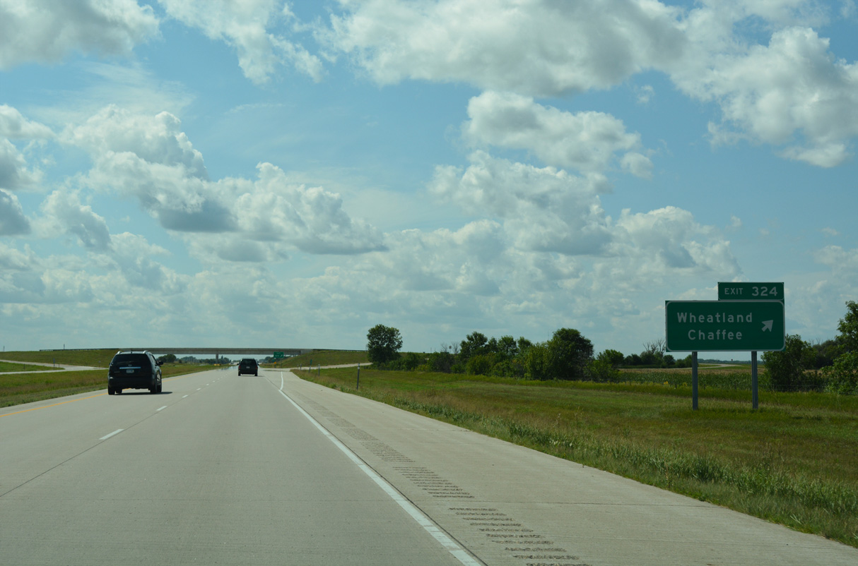
CR 15 (149th Avenue SE) continues seven miles south from I-94/U.S 52 to the unincorporated community of Chaffee and 17 miles to ND 46.
08/06/16
Interstate 94 rises to over 1,000 feet above sea level on the ensuing stretch west to Exit 322.
08/06/16
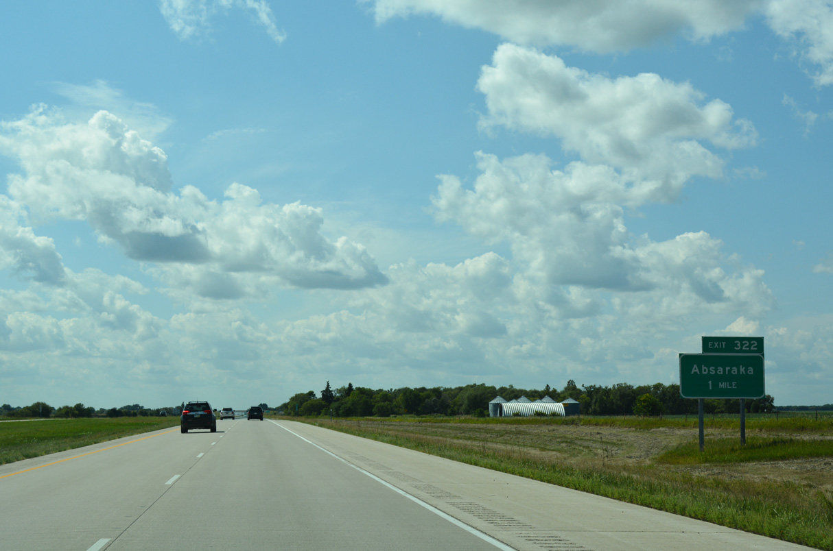
Exit 322 links I-94/U.S. 52 west with 147th Avenue SE in one mile.
08/06/16
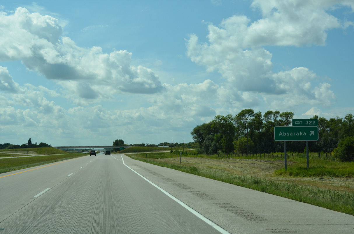
The unincorporated community of Absaraka lies 8.6 miles to the north of Exit 322 via 147th Avenue SE and connecting roads.
08/06/16
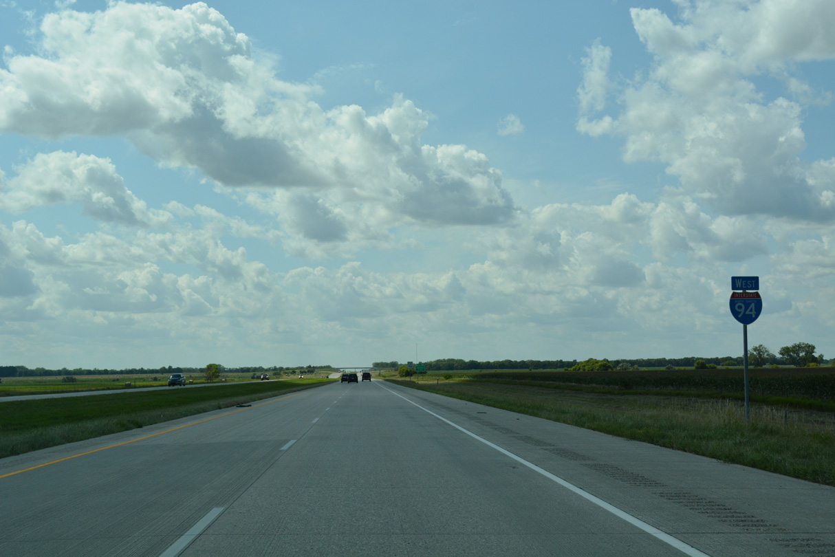
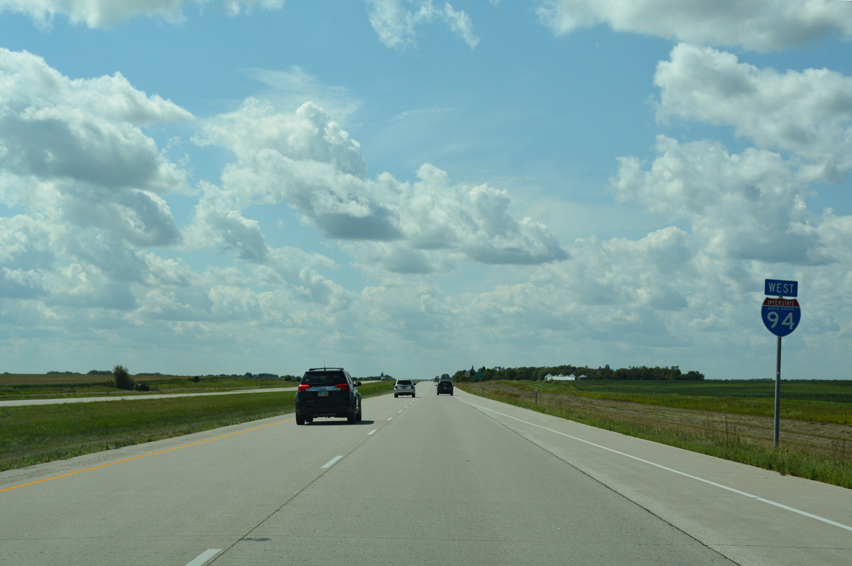
U.S. 52 remains unposted with Interstate 94 reassurance markers in western Cass County.
08/06/16

Cass County Route 7 lines 145th Avenue SE south from Exit 320 five miles to the community of Embden.
08/06/16
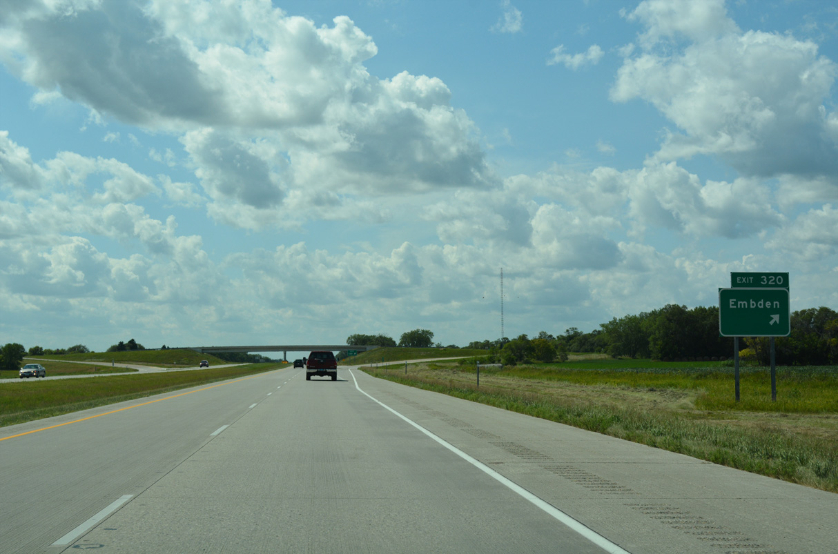
CR 7 extends 16.73 miles south from the diamond interchange at Exit 320 to ND 46 along the Ransom County line.
08/06/16
References:
Federal Highway Administration (FHWA). (n.d.). Project Profile: Fargo-Moorhead River Flood Diversion P3 Project, North Dakota. Retrieved March 26, 2026 from https://www.fhwa.dot.gov/ipd/project_profiles/fargo_moorhead_flood_diversion.aspx
Photo Credits:
- ABRoads: 06/16/15, 06/17/15, 08/06/16
Connect with:
Page Updated Thursday March 26, 2026.