
Interstate 95 / New Jersey Turnpike North - Trenton to Edison

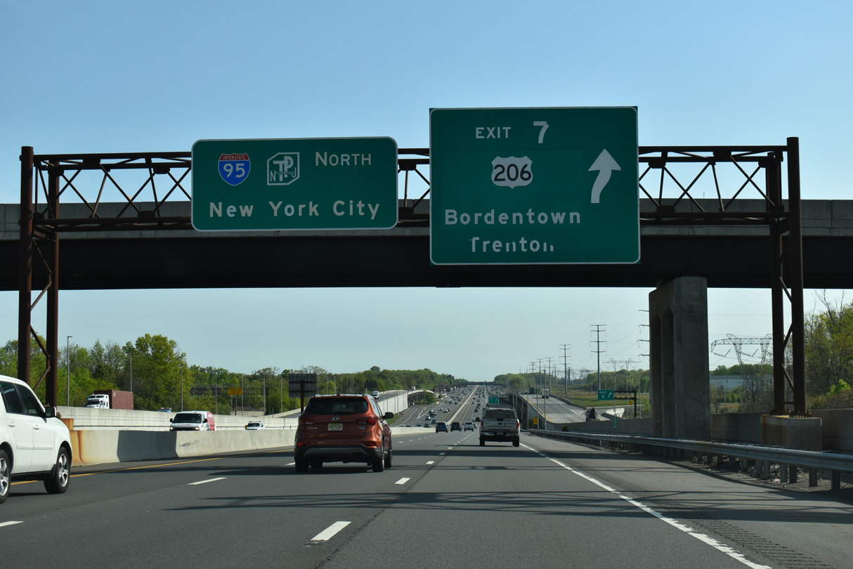
Interstate 95 joins the New Jersey Turnpike north from the Pearl Harbor Memorial Turnpike Extension eastbound near Mansfield. The succeeding exit follows in 1.7 miles to U.S. 206 in Bordentown Township.
04/24/26

Originating in Hammonton, U.S. 206 travels 35.61 miles north from U.S. 30/Route 54 to an overlap with U.S. 130 at Bordentown.
08/19/21
04/24/26
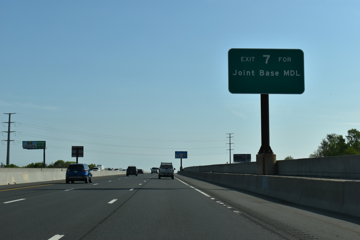
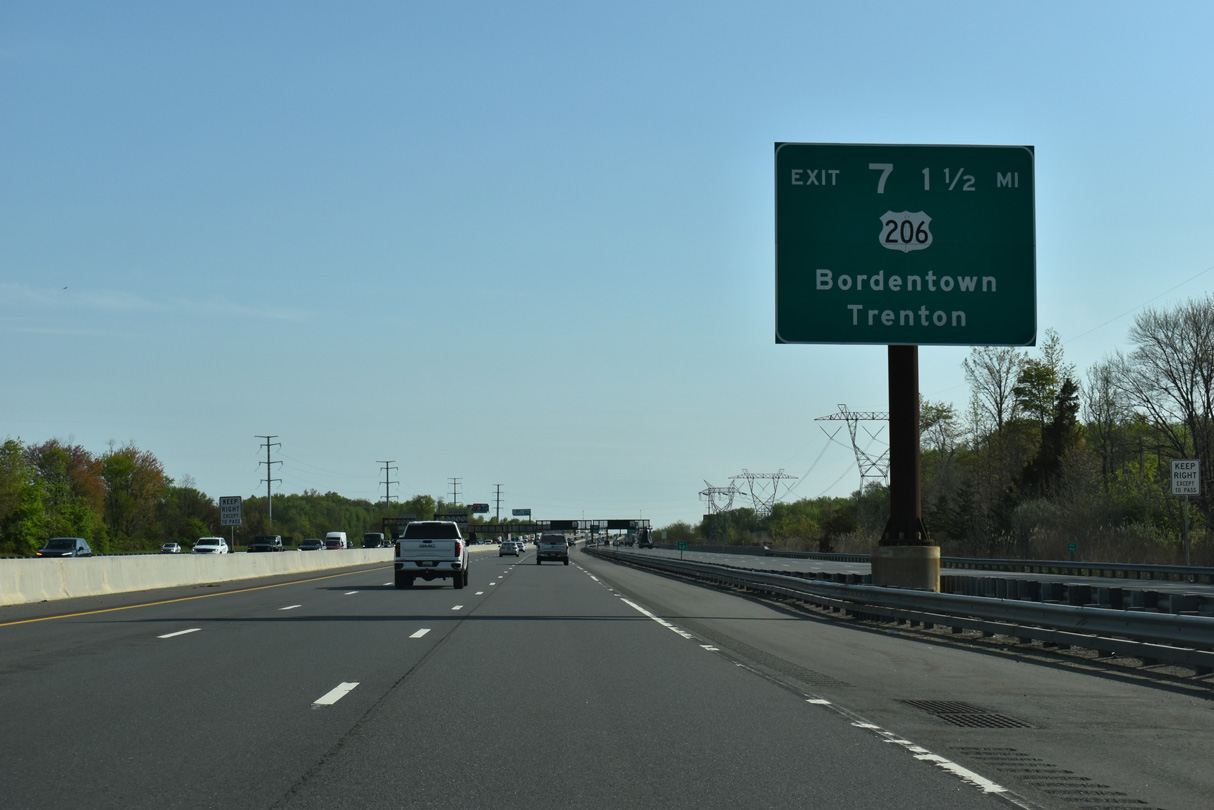
Route 68 stems 7.80 miles southeast from U.S. 206 at nearby Mansfield Square Connections to Joint Base McGuire-Dix-Lakehurst.
04/24/26
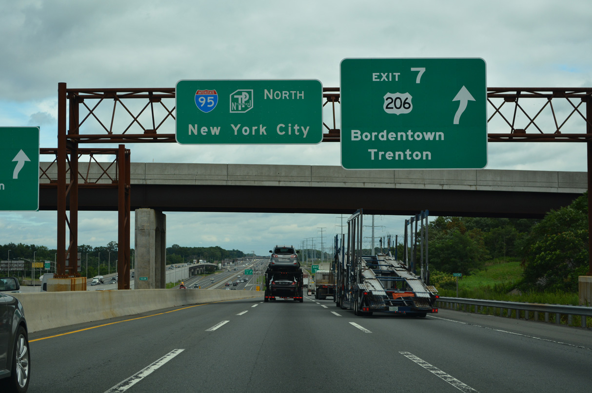
Interstate 95 crosses over U.S. 206 and Blacks Creek ahead of the trumpet interchange (Exit 7) and access roadway between the Turnpike and US route. Beyond a short overlap with U.S. 130, U.S. 206 continues to White Horse and into the capital city of Trenton in 4.7 miles.
08/19/21
04/24/26

The historic standard signing practice on the New Jersey Turnpike is to post exit signs on overhead assemblies at the interchange gore points.
04/24/26
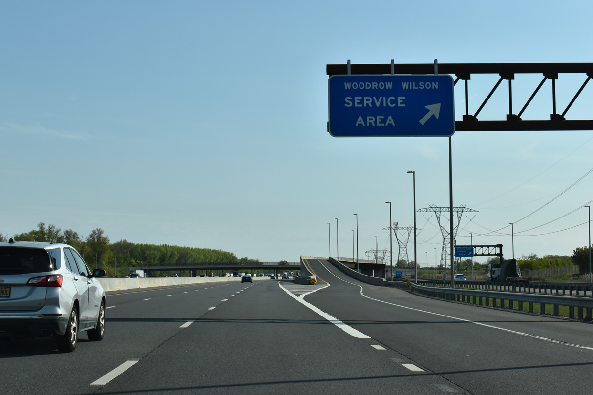
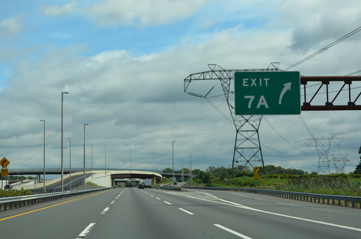
6.7 miles separate Exit 7 from Exit 7 A with Interstate 195 at Robbinsville Township. Service areas line both sides of the Turnpike between the two interchanges.
04/24/26

Interstate 95 (NJ Turnpike) crosses Crosswicks Creek and the Mercer County line ahead of the S Broad Street (CR 672) overpass near North Crosswicks. The Woodrow Wilson Service Area follows in Hamilton Township.
08/19/21
04/24/26

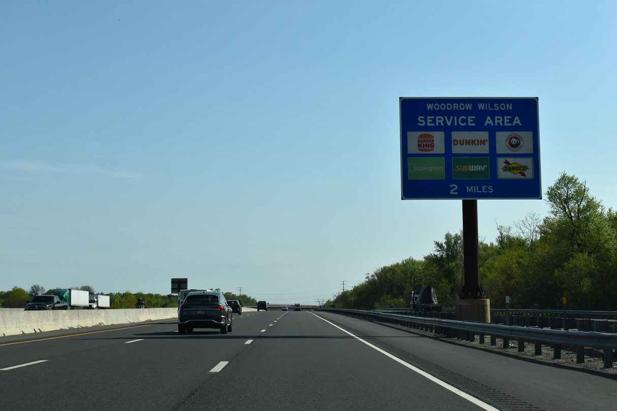
The Woodrow Wilson Service Area lines northbound Interstate 95 between Mercer County Route 524 (Yardville Allentown Road) and Merrick Road. It is accessible from both the Inner and Outer Roadways.
04/24/26

The New Jersey Turnpike continues two miles north from the Woodrow Wilson Service Area to Exit 7 A for Interstate 195.
08/19/21
Services at the Woodrow Wilson Service Area include a gas station, food court and truck parking.
04/24/26
08/19/21
Interstate 195 travels east from the New Jersey Turnpike to Six Flags Great Adventure, Jackson, Asbury Park, Neptune and Point Pleasant.
04/24/26

Interstate 195 extends 34.16 miles east from I-295/Route 29 outside Trenton to Belmar by the New Jersey shore.
04/24/26

I-195 west ends at the junction of Interstate 295 and New Jersey Route 29 at White Horse. Route 29 extends northwest along an expressway into the capital city.
08/19/21
Construction on Interstate 195 commenced in 1968, with most the route complete between White Horse and Belmar by 1981. The western section to the Trenton Belt Line fully opened by 1990.
04/24/26
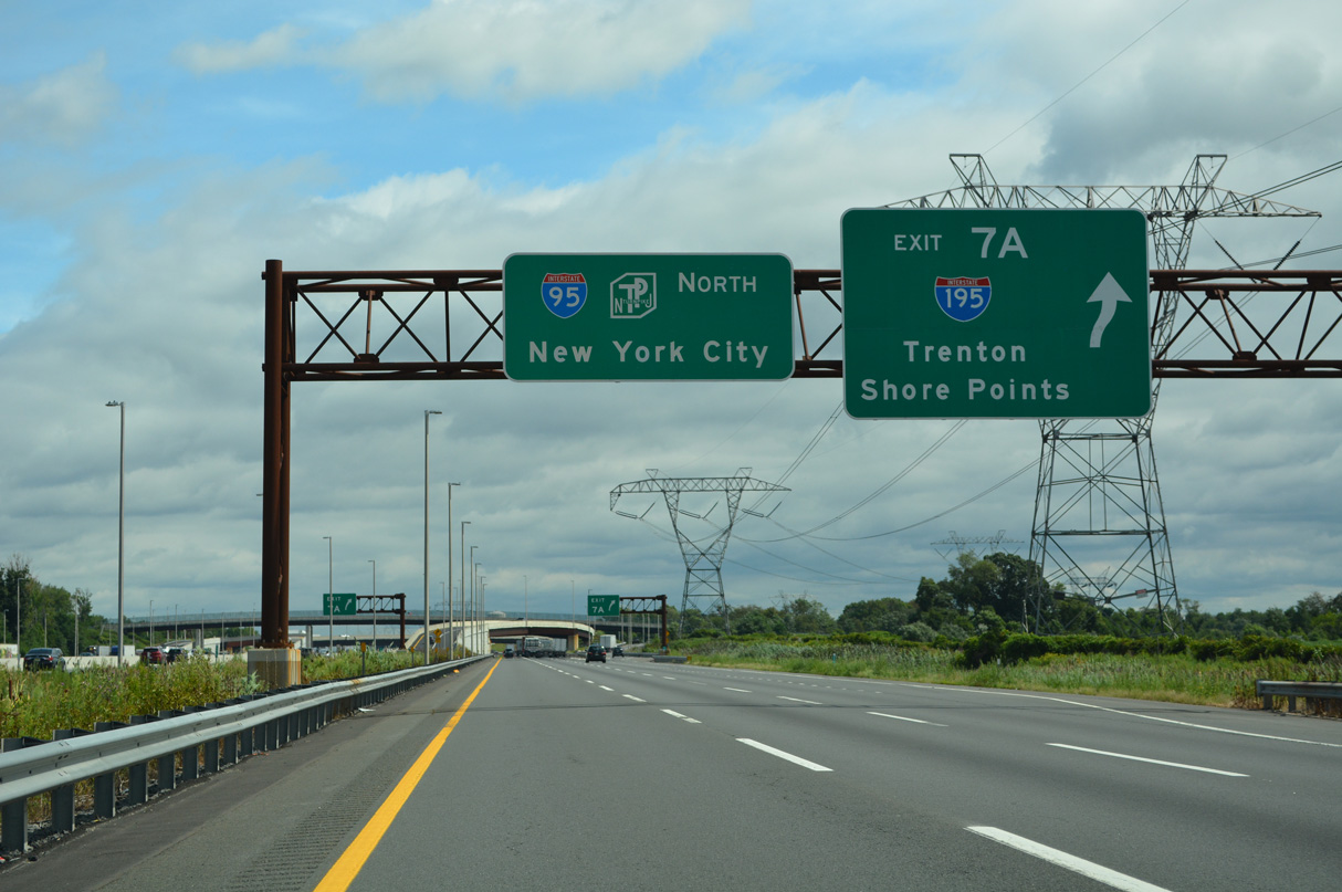
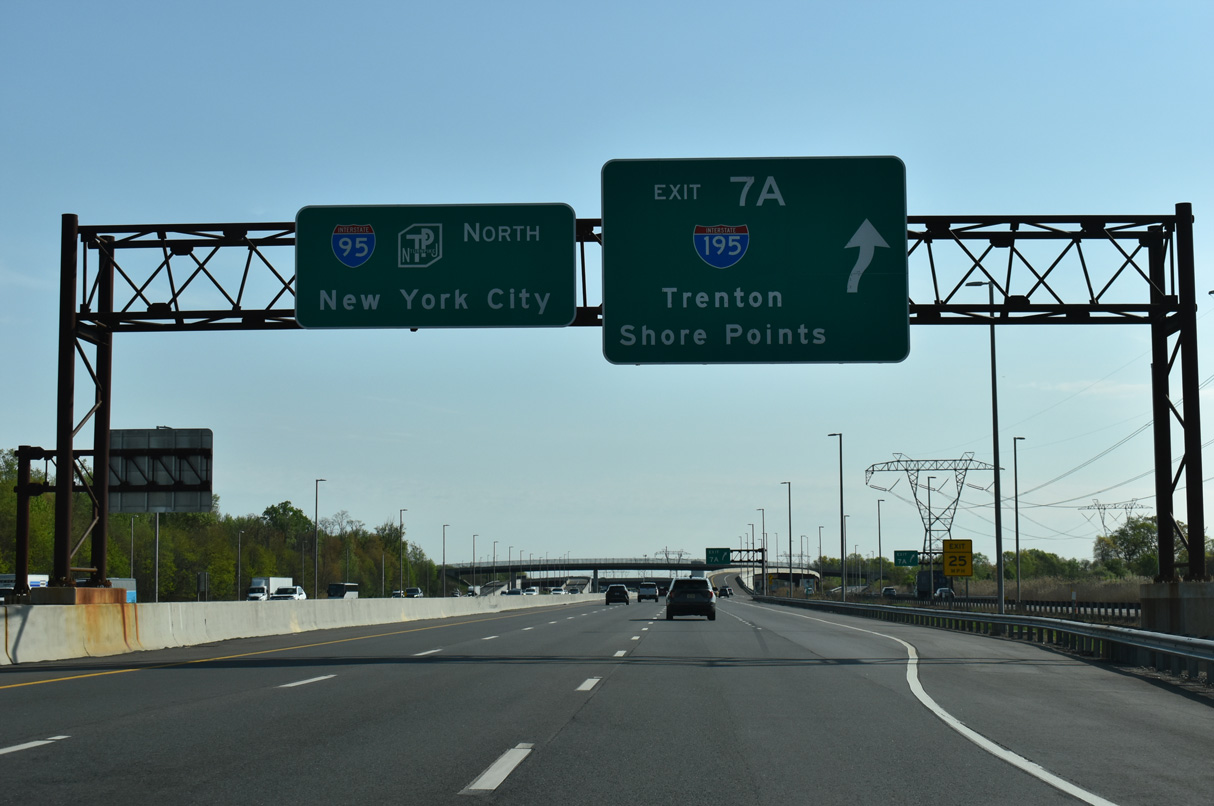
Exit 7 A leaves the Outer Roadway of the New Jersey Turnpike northbound for Interstate 195. Downtown Trenton lies ten miles to the west while West Belmar and South Belmar are 31 miles to the east.
08/19/21

The trumpet interchange (Exit 7 A) for I-195 was redesigned during the 2009-14 widening project. This included building a new sweeping ramp from the Exit 7A toll plaza onto the northbound Turnpike.
04/24/26
08/19/21
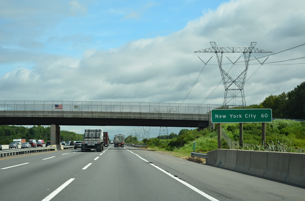
The distance sign posted just beyond Assunpink Creek references New York City at 60 miles. More specifically, this is the distance to the George Washington Bridge.
04/24/26
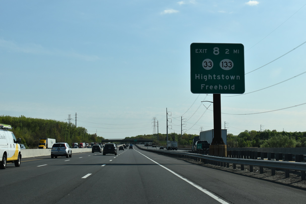
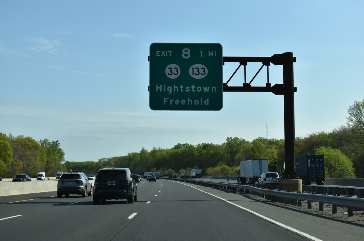
Continuing northward toward the borough of Hightstown, Interstate 95 meets the east end of Route 133 (Hightstown Bypass) in two miles.
04/24/26

Reassurance markers for Interstate 95 and the New Jersey Turnpike posted along the Outer Roadway by milepost 65.1
08/19/21
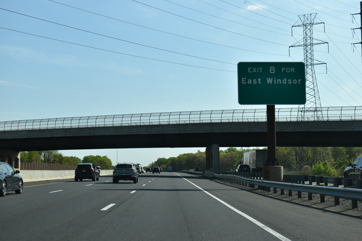
Forthcoming Exit 8 consists of a rebuilt trumpet interchange with the Hightstown Bypass in East Windsor Township. Route 133 was extended south from Route 33 to the NJ Turnpike in January 2013, replacing the original access road to Route 33 in the process.
04/24/26
A single point urban interchange (SPUI) joins Route 133 with Route 33 just northeast of Exit 8. Route 33 (Franklin Street) travels 42.03 miles between Downtown Trenton and Ocean Grove in Neptune Township.
04/24/26
08/19/21
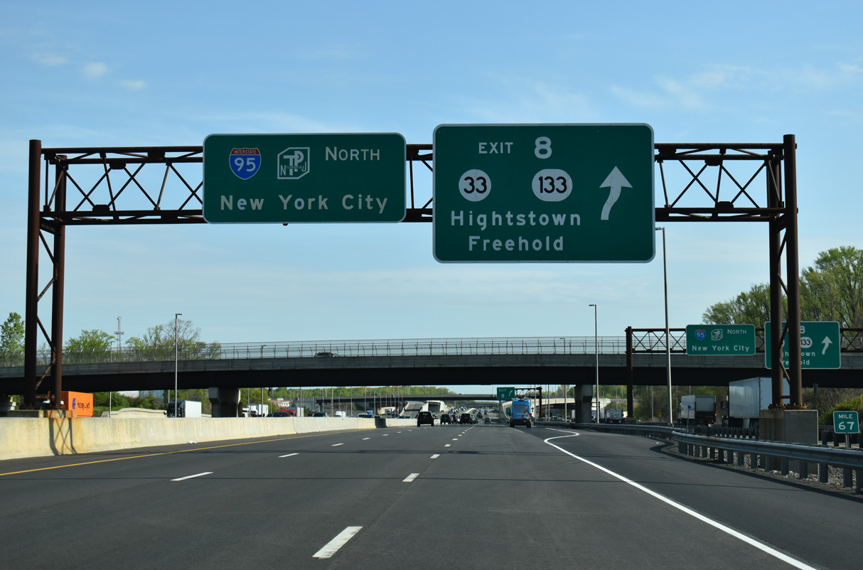
Exit 8 leaves the Inner Roadway at the CR 571 (Etra Perrineville Road) overpass for Route 133 to Route 33. Route 33 follows Franklin Street, Main Street and Mercer Street west through Hightstown to an overlap with U.S. 130 southwest to Robbinsville.
04/24/26

Route 33 runs east from Hightstown to Twin Rivers, Freehold, Neptune and Asbury Park.
08/19/21

Route 133 encircles Hightstown along a 4.4 mile long freeway from I-95 west to Mercer County Route 571 (Princeton Hightstown Road) at Windsor Center Drive near Locust Corner.
04/24/26
08/19/21

The succeeding service area along Interstate 95 (New Jersey Turnpike) north lies eight miles north of Cranbury Station in East Brunswick Township.
04/24/26

Two miles south of the trumpet interchange at Exit 8 A with the access road to with Route 32 and CR 535 at South Brunswick.
04/24/26

CR 612 (Forsgate Drive) extends 2.31 miles east from Route 32 and the New Jersey Turnpike across Monroe Township to CR 522 (Buckelew Avenue) in the borough of Jamesburg.
04/24/26

Route 32 (Forsgate Drive) leads 1.18 miles west from CR 612 (Forsgate Drive) and the New Jersey Turnpike to U.S. 130 at Friendship Road in South Brunswick Township.
04/24/26
08/19/21
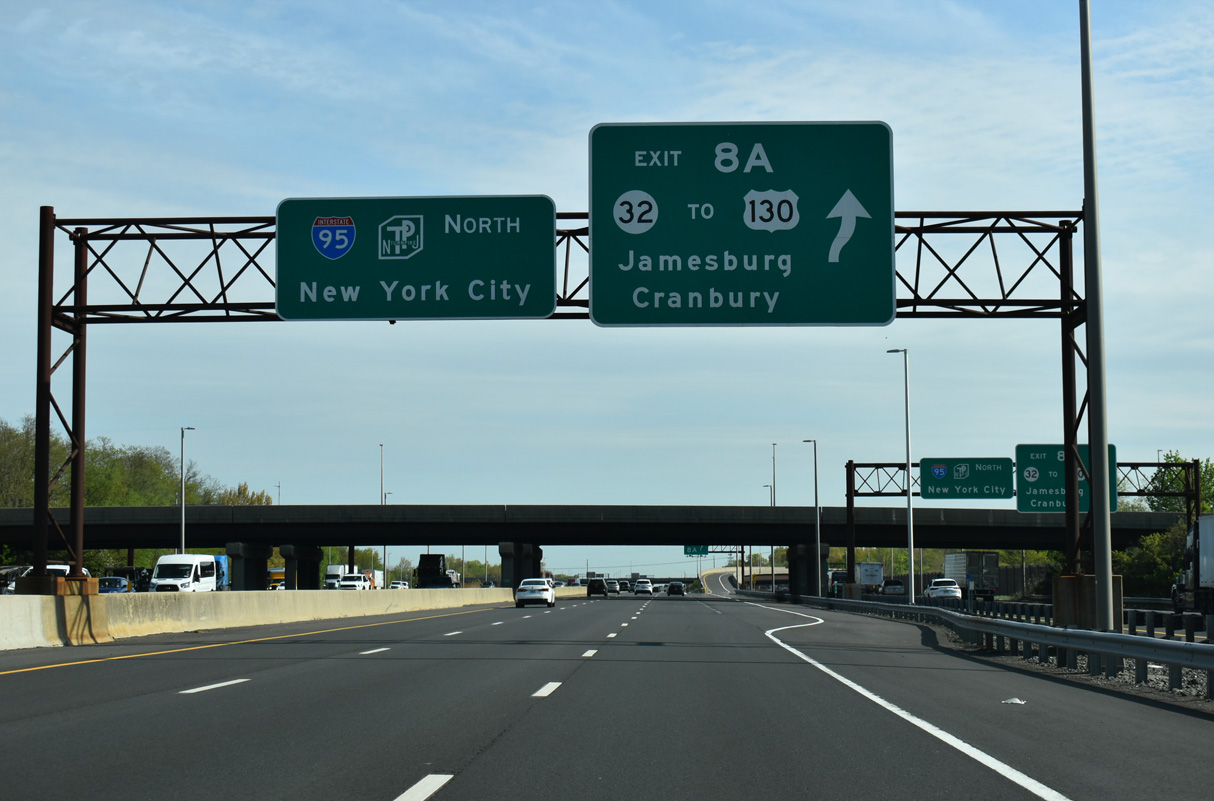
Exit 8 A leaves Interstate 95 north for Route 32 west to U.S. 130 and CR 612 east to Jamesburg. U.S. 130 heads south from Forsgate Drive to Cranbury Township and north to North Brunswick Township.
04/24/26
08/19/21

The access road at Exit 8 A leads south from a toll plaza to ramps for both Route 32 (Forsgate Drive) and parallel CR 535 (Cranbury - South River Road).
04/24/26
08/19/21
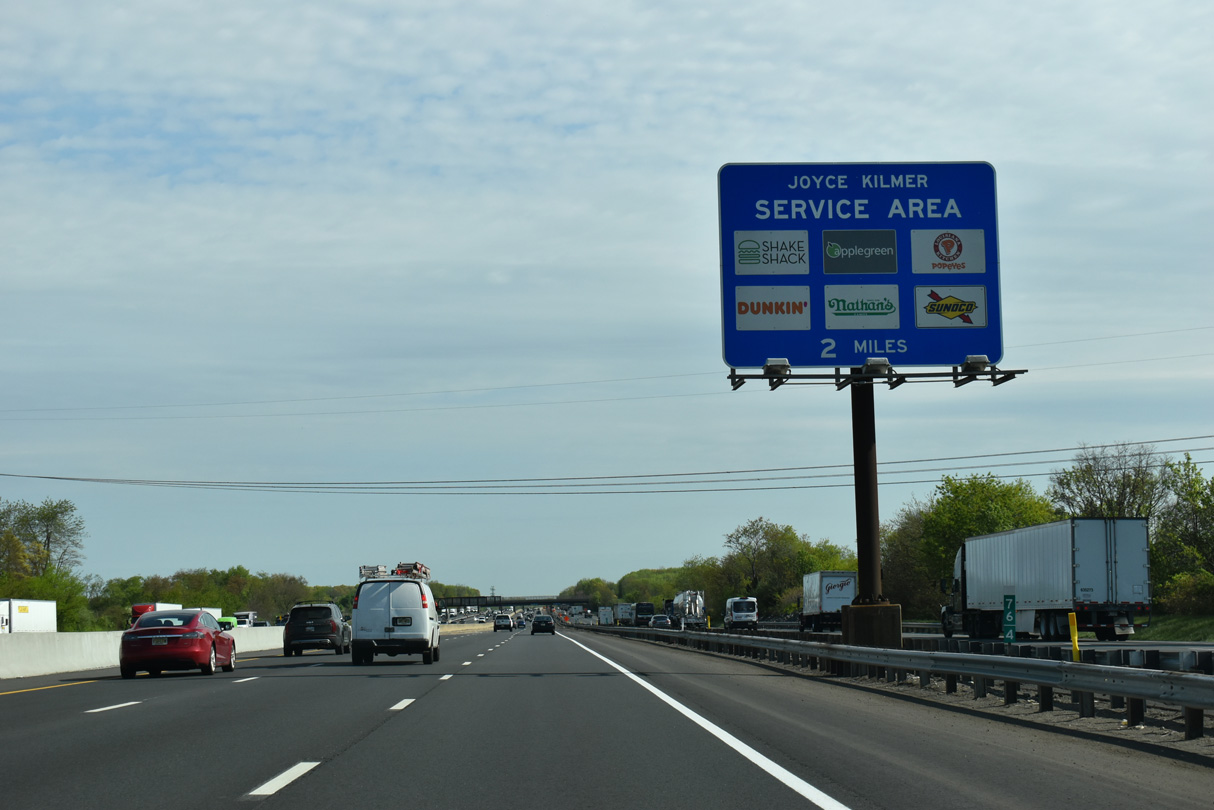
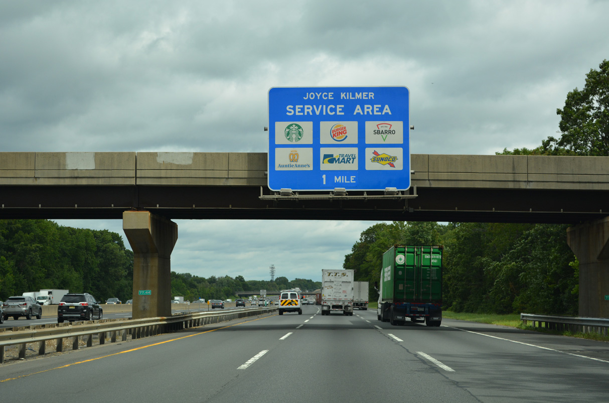
Continuing north beyond the original Inner and Outer Roadway split, Interstate 95 advances through an industrial park area through South Brunswick Township. The Joyce Kilmer Service Area is two miles ahead.
04/24/26

Ramps from the Inner and Outer Roadways connect I-95 north with the Joyce Kilmer Service Area one mile north of the Davidson Mill Road overpass.
04/24/26
08/19/21

Church Lane passes over the New Jersey Turnpike at the ramp linking the Inner Roadway with the Joyce Kilmer Service Plaza in East Brunswick Township.
04/24/26

The ramp to the Joyce Kilmer Service Plaza from the Turnpike Outer Roadway separates from I-95 northbound at milepost 78.5.
08/19/21

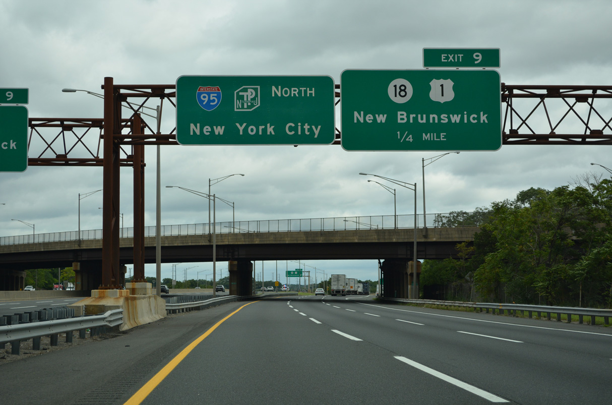
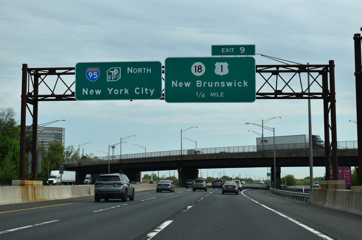
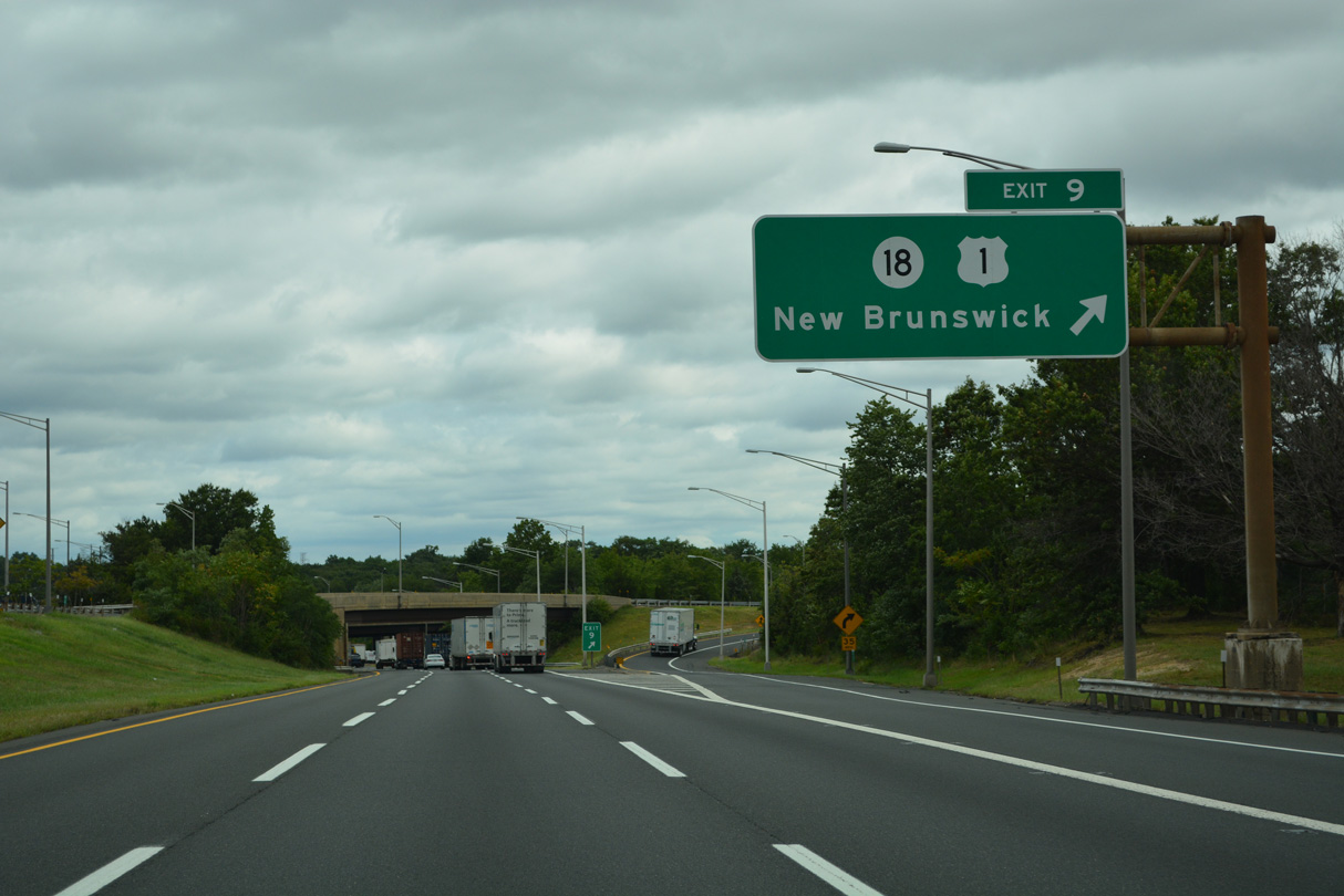
Route 18 links the Turnpike at Exit 9 with nearby U.S. 1 along an expressway spanning Westons Mill Pond.
04/24/26

Route 18 travels southeast from New Brunswick to South River, East Brunswick, Old Bridge and U.S. 9 before upgrading to a freeway onward to the Atlantic coast.
08/19/21
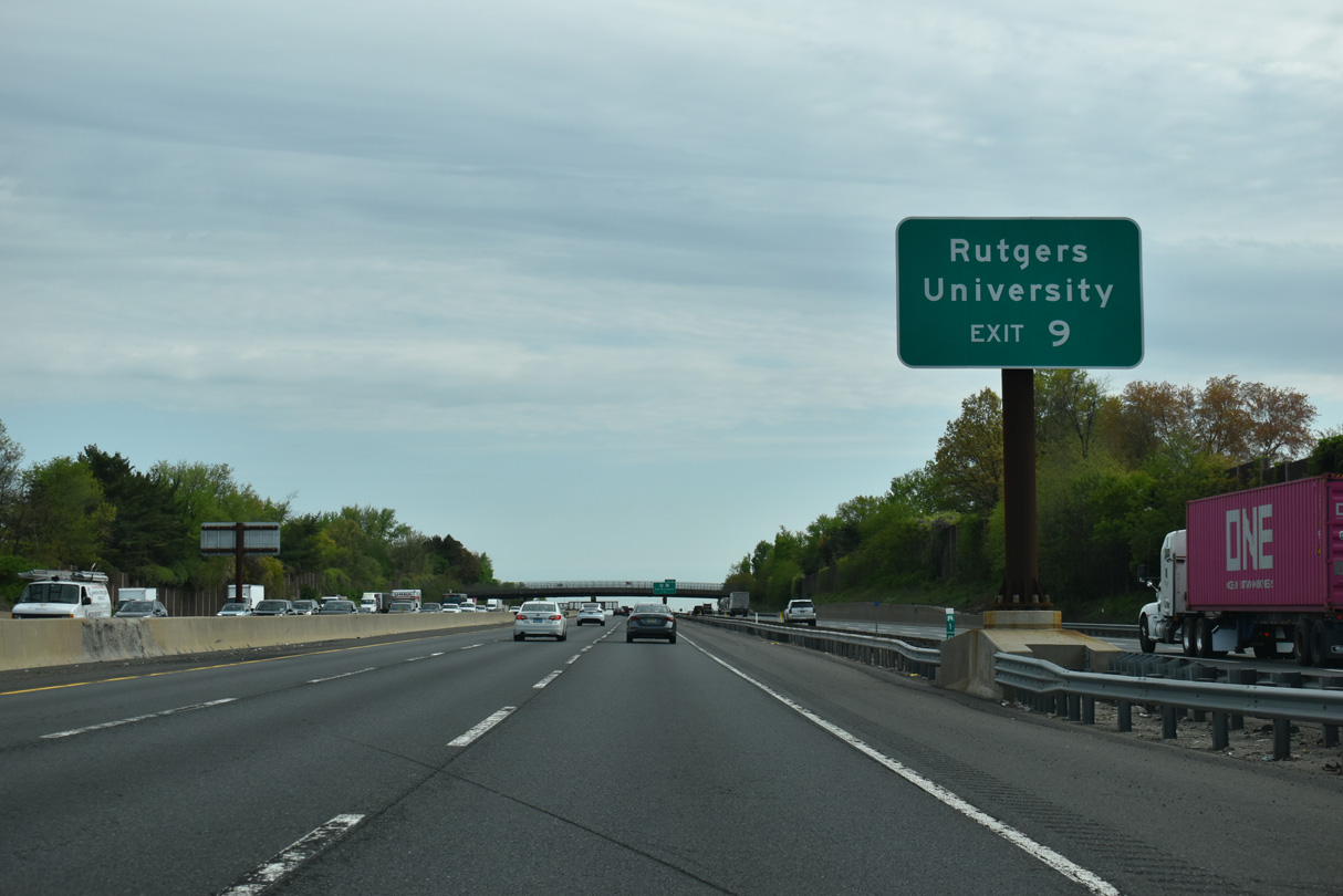
Forthcoming Route 18 winds northwest from Exit 9 through the city of New Brunswick to span the Raritan River ahead of Rutgers University. The state route ends at Hoes Lane and Buckingham Drive.
04/24/26

Interstate 95 northbound at the Sullivan Way overpass, one mile south of the trumpet interchange (Exit 9) with Route 18. Route 18 meets U.S. 1 just west of I-95 at a cloverleaf interchange before transitioning onto Memorial Parkway along the Raritan River.
04/24/26
Exit 9 departs from both the Inner and Outer Roadways of the New Jersey Turnpike beyond the Route 18 overpass.
08/19/21
04/24/26

South River, East Brunswick and Old Bridge are within four miles of I-95 via Route 18 south. Three miles separate Downtown New Brunswick from the New Jersey Turnpike to the northwest.
04/24/26
08/19/21
The New Jersey Turnpike span the Raritan River between New Brunswick and Edison Township with 12 overall lanes.
10/05/14

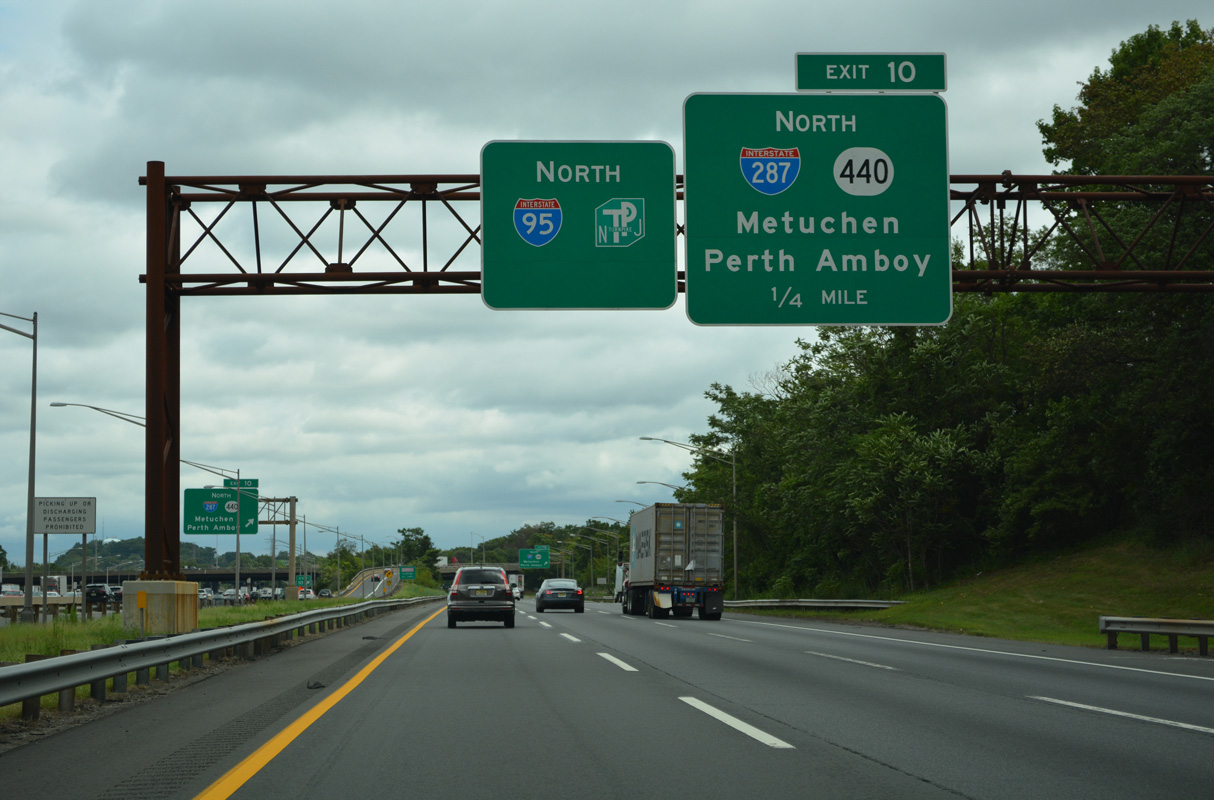
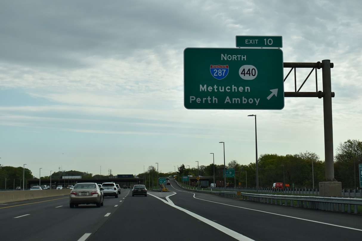
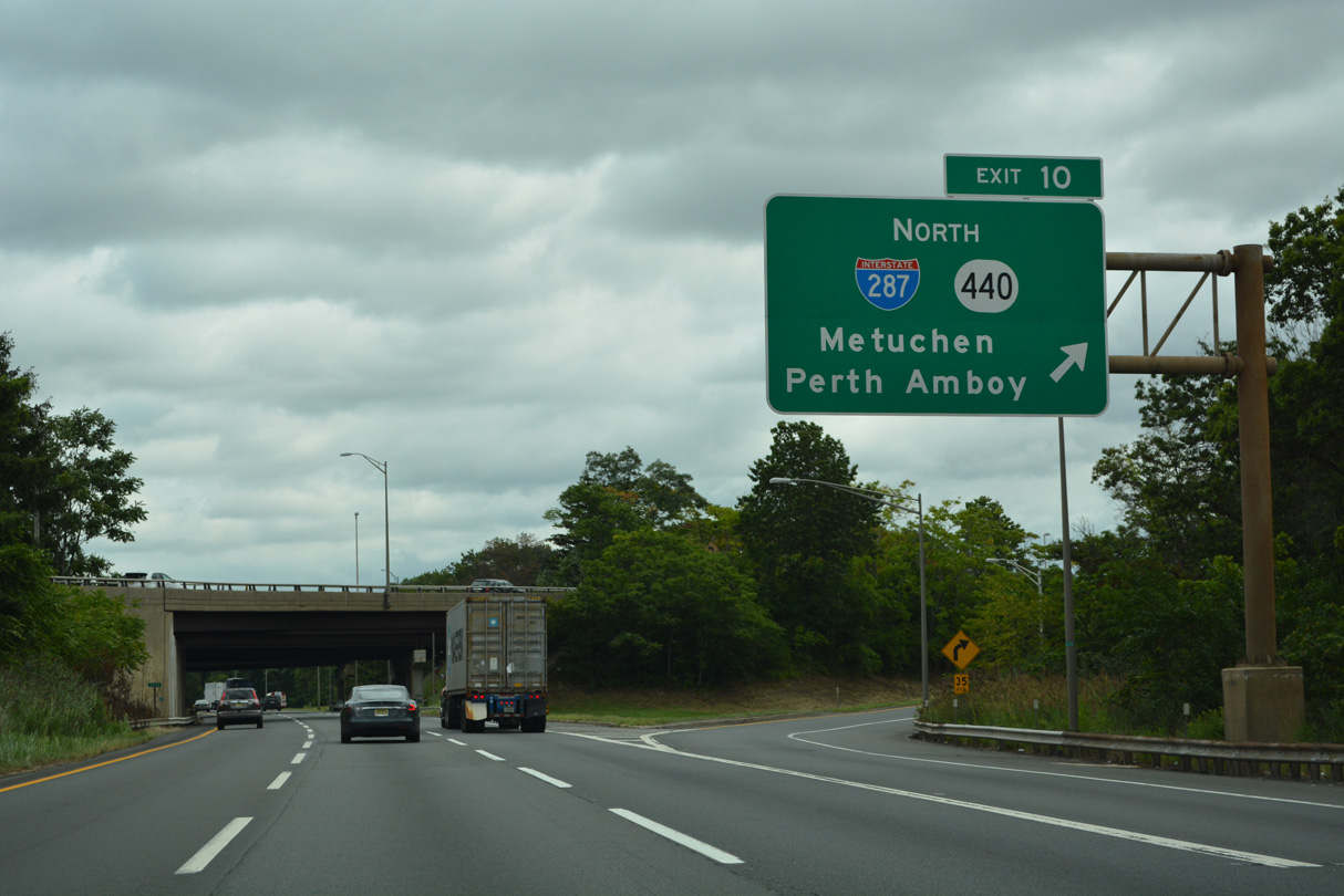
Advancing northeast through Edison Township, the New Jersey Turnpike next meets Interstate 287 and Route 440 at Exit 10.
04/24/26
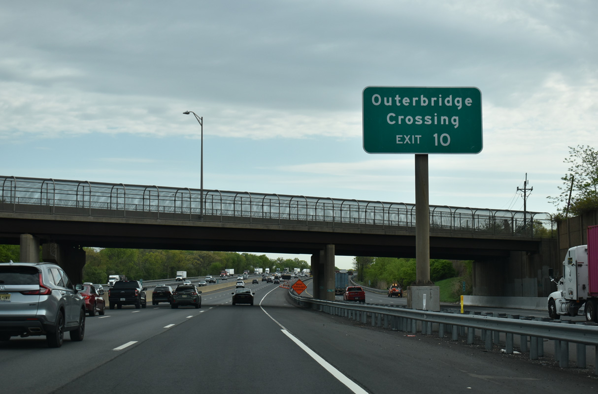
Route 440 extends 5.20 miles east along a freeway from I-287 to the Outerbridge Crossing toll bridge spanning Arthur Kill onto Staten Island, New York.
04/24/26

Interstate 287 travels west from Route 440 and I-95 to Metuchen, Piscataway and Somerville.
04/24/26
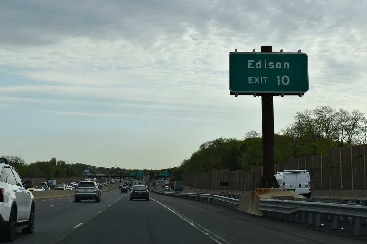
The trumpet interchange at Exit 10 connects with ramps to parallel CR 514 (Woodbridge Avenue) in Edison Township in addition to Route 440 east and I-287 north.
04/24/26

Interstate 287 encircles urban areas of North Jersey between Perth Amboy and Mahwah at the New York state line. Within New York State, I-287 combines with I-87 across the Governor Mario M. Cuomo Bridge before following the Cross Westchester Expressway back to I-95 at Rye.
04/24/26
08/19/21
Following the West Shore Expressway, New York Route 440 continues northeast from the Outerbridge Crossing to I-278 (Staten Island Expressway). The multi state route returns to New Jersey via the Bayonne Bridge at Bayonne.
04/24/26
CR 514 (Woodbridge Avenue) leads southwest from near Exit 10 to U.S. 1 near Highland Park. North from the directional cloverleaf interchange with Route 440, CR 541 continues into Woodbridge Township.
08/19/21
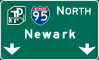
Photo Credits:
- Alex Nitzman: 08/19/21, 04/24/26
- Andy Field: 08/19/21
- ABRoads: 10/05/14
Connect with:
Page Updated Thursday April 30, 2026.