
Interstate 287

Interstate 287 encircles the greater New York City area along a 67.54 mile route in New Jersey and 31.18 mile alignment through New York state. Joining the north end of the Garden State Parkway with the Cross West Chester Expressway east of the Mario M. Cuomo Bridge, I-287 combines with I-87 along the New York Thruway for 19.20 miles.
Interstate 287 Guides
North
North - Edison to Somerville - 56 photos

North - Somerville to Parsippany - 42 photos
Boonton to Mahwah - 53 photos
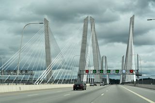
I-87 South / I-287 East - Suffern to Tarrytown - 51 photos

Cross-West Chester Expressway - 40 photos
South
Cross-Westchester Expressway - 42 photos
I-87 North / I-287 West - Tarrytown to Suffern - 52 photos
South - Parsippany to Somerville - 42 photos
Parsippany to Somerville - 44 photos
Somerville to Edison - 46 photos
Beginning at the transition of Route 440 south over the New Jersey Turnpike (I-95) at Edison Township, I-287 leads west to Metuchen, South Plainfield and Piscataway Township. A portion of this stretch was originally slated as Interstate 95, meant to link the route between the NJ Turnpike mainline and the proposed Somerset Freeway alignment southwest to Trenton. I-95 was formally dropped from this alignment in 1982 when the Somerset Freeway was cancelled (Anderson, n.d.).
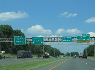
Beginning its northern turn, Interstate 287 winds around Bound Brook to Somerville, commingling with both U.S. 202 and 206 north to Pluckemin and Bedminster Township. A dual roadway configuration on this stretch separates through traffic from movements with Interstate 78. I-287 was completed north from Edison to U.S. 202/206 (Exit 22) in 1964 (Anderson, n.d.).
Climbing onto Second Watchung Mountain at Far Hills, Interstate 287 starts an eastern movement toward New York. I-287 winds through Bernards Township to Morristown, Hanover Township and Parsippany, where it meets Interstate 80. From 1973 to November 1993 (Anderson, n.d.), the freeway ended just north of I-80 in Boonton (Exit 44 / U.S. 202).
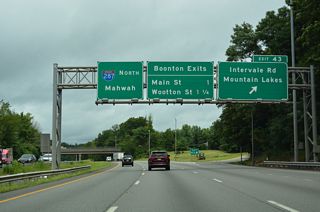
The final stretch takes I-287 through Montville Township along Waughaw Mountain to Riverdale, Wanaque and another climb through the southern Ramapo Mountains. There the route turns eastward again, straddling the hillside of Campgraw Mountain through Franklin Lakes to Mahwah Township and an exit from New Jersey at Houvenkopf Mountain. Completion of I-287 took place in August 1994, when the interchange with the New York Thruway (I-87) was upgraded to incorporate high-speed ramps (Anderson, n.d.).

CR 514 (Woodbridge Avenue) south at the entrance ramp for Interstate 287 north in Edison township. I-287 commences west from New Jersey Route 440 across I-95 (New Jersey Turnpike).
05/31/22
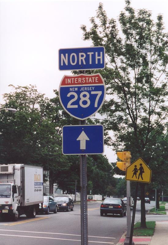
Interstate 287 trailblazer, since replaced, posted on South Street (CR 601) beyond the split with Madison Avenue (Route 124) in Morristown. Ramps connect both South Street south and Route 124 east with adjacent I-287 north.
07/28/00
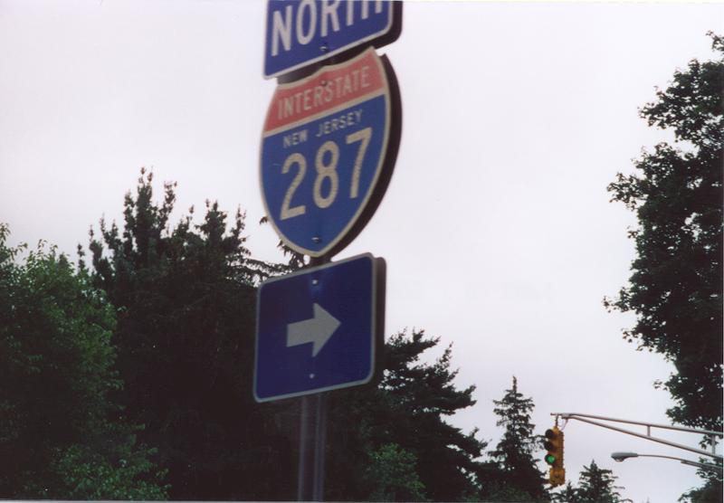
South Street (CR 601) parallels I-287 just to the east to a loop ramp onto the freeway north. This vintage shield posted at the entrance ramp was replaced.
07/28/00
References:
Anderson, S. (n.d.). Interstate 287 (New Jersey). NYCRoads.com. http://www.nycroads.com/roads/I-287_NJ/
Photo Credits:
- Brent Ivy: 05/31/22
- Alex Nitzman: 07/28/00
Connect with:
Page Updated Wednesday May 13, 2026.