
Interstate 95 South - New England Thruway
 South
South
I-95 (New England Thruway) south meets the east end of I-287 (Cross Westchester Expressway) at Exit 21. The Cross Westchester Expressway serves the Westchester County suburbs of Harrison, White Plains and Tarrytown.
05/31/22

Interstate 95 crosses the Byram River into the village of Port Chester, New York from Greenwich, Connecticut. The New England Thruway section of I-95 stretches 14.8 miles southwest to Pelham Parkway in New York City.
05/31/22

I-287 follows the Cross Westchester Expressway between I-95 and the New York State Thruway (I-87) beyond Elmsford. I-87/287 west combine across the Governor Mario. M. Cuomo Bridge between Tarrytown and Nyack. South from I-87, I-287 and Route 440 encircle the North Jersey urban area between Suffern, New York and Perth Amboy, New Jersey.
05/31/22

Exit 21 includes a folded diamond interchange with adjacent Midland Avenue. Midland Avenue leads south from Grace Church Street near U.S. 1 to Playland Parkway in Rye.
05/31/22

Interstate 95 continues southwest from I-287 and U.S. 1 (Boston Post Road) through the city of Rye to Exit 19 for Playland Parkway. Playland Parkway spurs 1.34 miles southeast from the New England Thruway to Rye Beach and Playland Park along Long Island Sound.
08/29/05

Playland Parkway connects with U.S. 1 (Boston Post Road) 0.41 miles from I-95. U.S. 1 parallels I-95 to the east, southward from Rye to Harrison, Mamaroneck, Larchmont and New Rochelle between Exits 20 and 15.
08/29/05

North Street spans Interstate 95 at the trumpet interchange (Exit 19) with Playland Parkway.
08/29/05

A three quarter cloverleaf interchange (Exit) connects I-95 with Mamaroneck Avenue at the village of Mamaroneck in one mile. Mamaroneck Avenue runs north from U.S. 1 (Boston Post Road) and Harbor Island Park to NY 125 at White Plains.
08/29/05

The Mamaroneck Metro Station at Mamaroneck is 0.7 miles south of Exit 18 A off Mamaroneck Avenue. U.S. 1 (Boston Post Road) south from Mamaroneck leads to the village of Marchmont.
08/29/05

A collector distributor roadway departs Interstate 95 south for Exit 18 to Mamaroneck Avenue. Mamaroneck Avenue runs 1.2 miles south to U.S. 1 and 5.4 miles north to Main Street (NY 119) in White Plains.
08/29/05

Exit 18 B leaves Interstate 95 south for Mamaroneck Avenue northbound. The arterial connects with Hutchinson River Parkway in 1.5 miles adjacent to Saxon Woods Park.
08/29/05

Exit 18 A loops onto Mamaroneck Avenue south to Downtown Mamaroneck.
08/29/05

A southbound reassurance shield for Interstate 95 stands next to the Old White Plains Road over crossing in Mamaroneck.
08/29/05

Advancing south into the city of New Rochelle, Interstate 95 southbound passes under Potter Avenue a half mile from the succeeding exit to North Avenue and Cedar Street at Downtown New Rochelle.
08/29/05

Exit 16 leaves Interstate 95 southbound for Cedar Street south and Memorial Highway west to North Avenue in New Rochelle. Cedar Street heads south to U.S. 1 Hugenot Street). North Avenue heads 3.76 miles north through New Rochelle from Pelham Road to Mill and Wilmot Roads.
08/29/05

U.S. 1 (Boston Post Road) and Interstate 95 south converge for a second time in New York at Exit 15 in New Rochelle. U.S. 1 turns southwest from central New Rochelle to Pelham Manor and into the Bronx south of Mount Vernon.
08/29/05
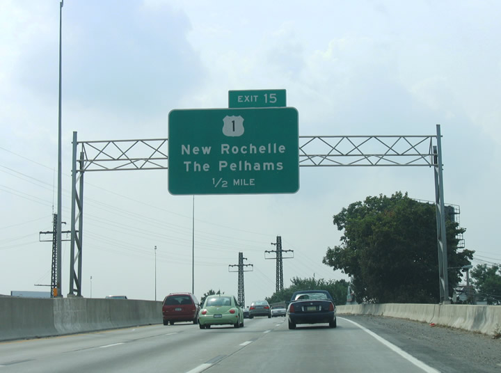
Interstate 95 passes over Webster Avenue and a railroad corridor a half mile east of Exit 15 to U.S. 1. The village of Pelham abuts Pelham Manor to the north of Colonial Avenue and U.S. 1 (Boston Post Road).
08/29/05

Southwest from the parclo A2 interchange (Exit 15) with I-95, U.S. 1 (Boston Post Road) runs through the village of Pelham Manor into the Eastchester neighborhood of the Bronx in New York City.
08/29/05

Hutchinson River Parkway meets I-95 south for the first time at Exit 14 in Pelham Bay Park. The limited access highway links Merritt Parkway in Connecticut with I-678 and the Whitestone Bridge. Like all New York state parkways, the roadway is only open to passenger vehicles.
08/29/05

Interstate 95 enters the City of New York and Bronx County. Pictured here is a sign referencing the restriction of truck traffic from the parkway system. This is due to the low clearances of bridge heights along the parkways.
04/21/11
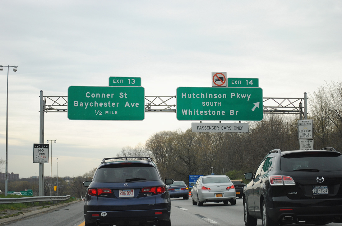
Hutchinson River Parkway enters New York City from Mount Vernon to the north. The parkway shifts east of I-95 by Pelham Bay Park in the north Bronx between Exit 14 and Exit 9. A loop ramp joins the parkway southbound for I-678 to the Whitestone Bridge and Van Wyck Expressway.
04/21/11

Hutchinson River Parkway travels 4.5 miles south to the Bruckner Interchange with I-95, I-278, I-295 and I-678. Interstate 678 continues the parkway south as an expressway to the Whitestone Bridge, Queens, and John F. Kennedy International Airport (JFK).
04/21/11

Interstate 95 crosses the Hutchinson River beyond Hutchinson River Parkway. Next along southbound is Exit 13 to Conner Street and the Co-Op City section of the Bronx.
08/29/05

Exit 13 departs I-95 south onto Hollers Avenue ahead of Conner Street. Conner Street connects the freeway with Co-Op City Boulevard via Peartree Avenue to the south. Conner Street meets U.S. 1 (Boston Road) and Provost Avenue (NY 22) north of I-95.
08/29/05

I-95 curves southward toward Exit 11 with Bartow Avenue west of Co-Op City. Co-Op City represents a middle income housing project spread throughout 35 high rise buildings built upon former wetlands. The community lies east of I-95 between Baychester Avenue and Co-Op City Boulevard.
08/29/05

Exit 11 departs I-95 ahead onto adjacent Edson Avenue. Bartow Avenue leads west from Bay Plaza Shopping Center and Co-Op City to Gun Hill Road. Co-Op City Boulevard parallels the Hutchinson River northward from Bartow Avenue nearby.
08/29/05

Exit 11 leaves I-95 south for Edson Avenue, Bartow Avenue and the Baychester community of the Bronx.
08/29/05

Hutchinson River Parkway converges with I-95 again at Exit 9. A loop ramp links with the parkway northbound for Pelham Bay Park and Mount Vernon. Gun Hill Road ties into the exchange from the northwest.
04/21/11
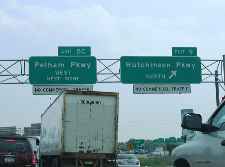
Hutchinson River Parkway travels northeast to Co-Op City and Pelham Bay Park. Exit 8 C to Pelham Parkway west links I-95 with Hutchinson River Parkway south.
08/29/05

I-95 transitions from the New England Thruway into the Bruckner Expressway at Exit 8. Pelham Parkway is a controlled access route between Bronx Park and Pelham Bay Park in northeast Bronx. Exit 8 B loops onto the parkway eastbound for Pelham Bay Park, Orchard Beach and City Island. Westbound meets Bronx River Parkway in 2.4 miles.
08/29/05
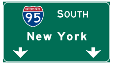
Photo Credits:
- Brent Ivy: 05/31/22
- AARoads: 08/29/05
- I.C. Ligget: 04/21/11
Connect with:

Page Updated Thursday May 14, 2026.