
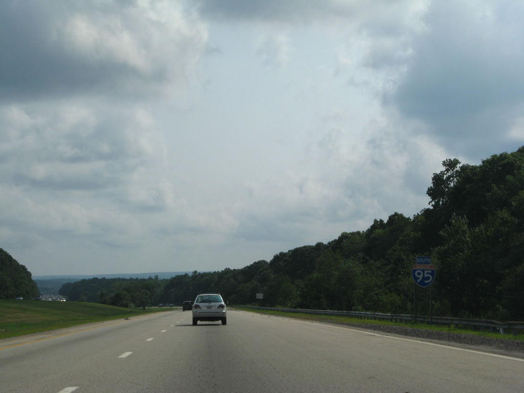
Interstate 95 South - Warwick to Connecticut
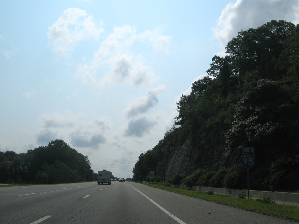
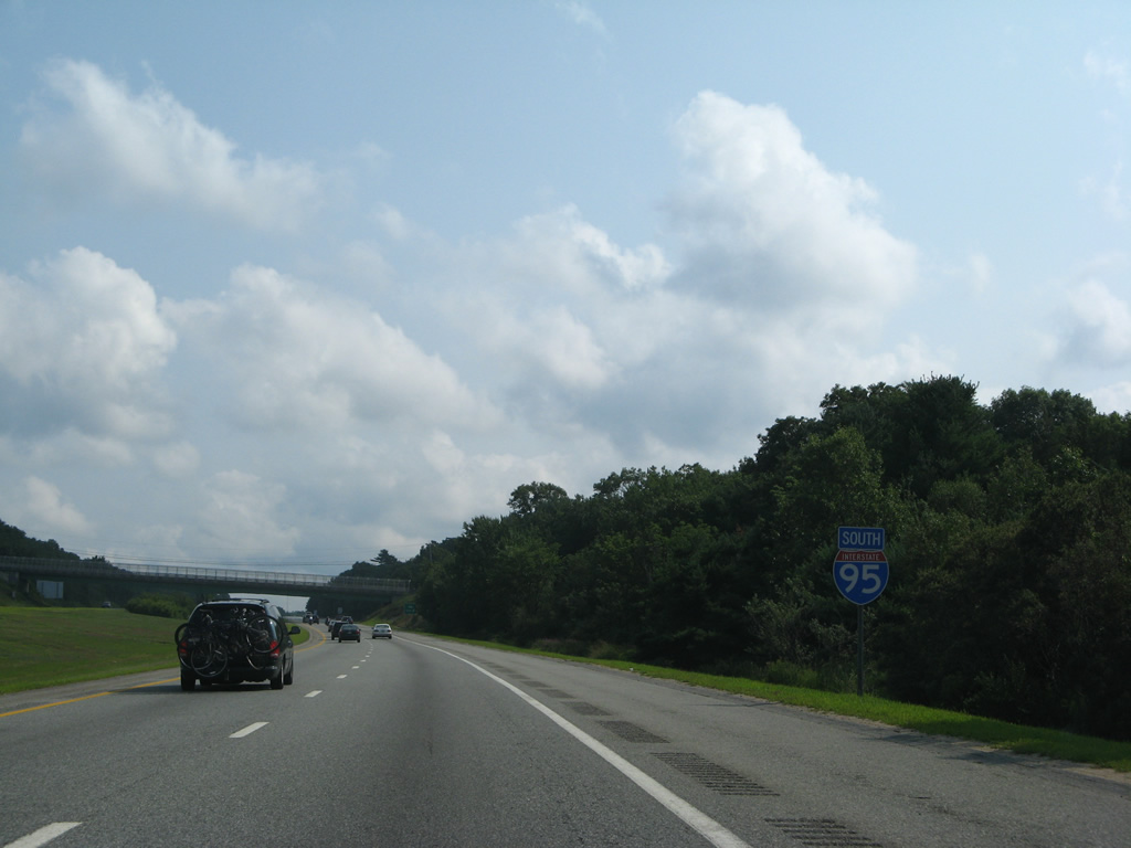
 South
South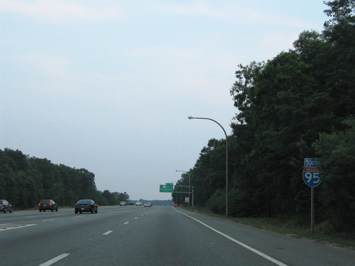
Interstate 95 reassurance marker posted at the wye interchange merge with Interstate 295 south at Warwick.
06/25/05
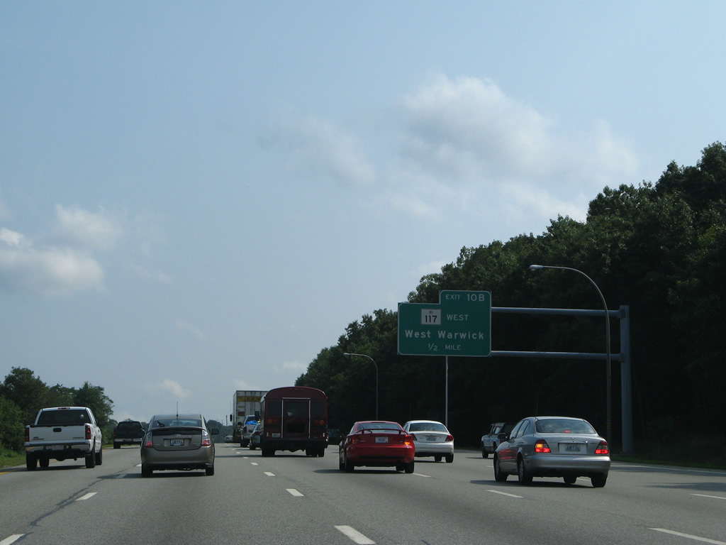
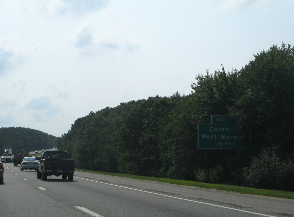
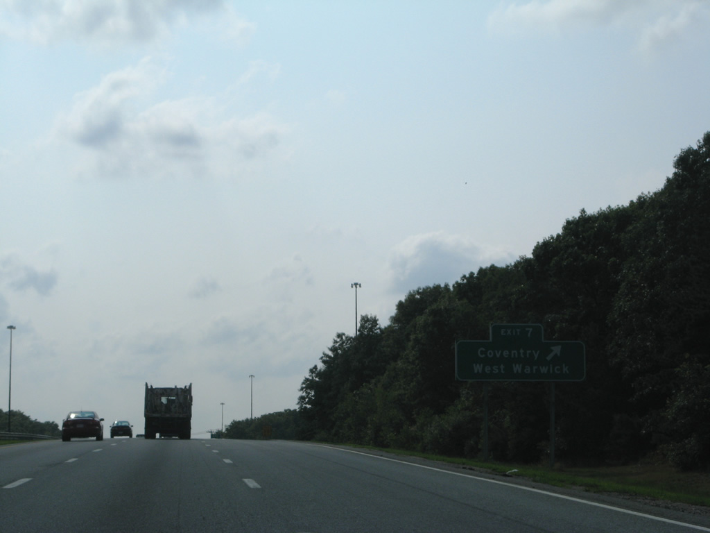
Route 117 travels locally east-west between Centerville in West Warwick and Apponaug in Warwick.
07/28/07
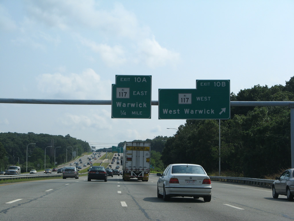
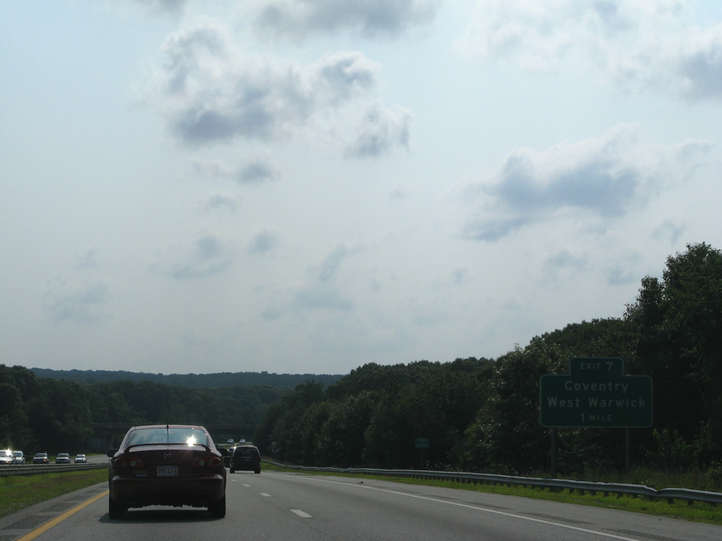
Exit 10B departs Interstate 95 southbound onto Route 117 (Centerville Road) west to West Warwick. Route 117 continues through Centerville to Quidnick, Anthony, and Washington through the town of Coventry. Route 117 east serves the Warwick town center at U.S. 1 and the coastal communities along the Providence River via West Shore Road.
07/28/07
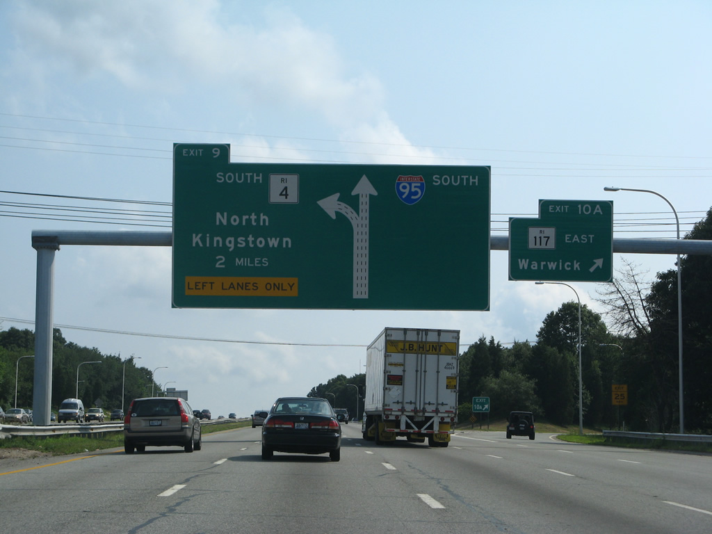
Southbound at the Exit 10A loop ramp to Route 117 (Centerville Road) east. A large diagrammatic sign advises motorists of the impending split of Interstate 95 with the Route 4 freeway at Exit 9.
07/28/07
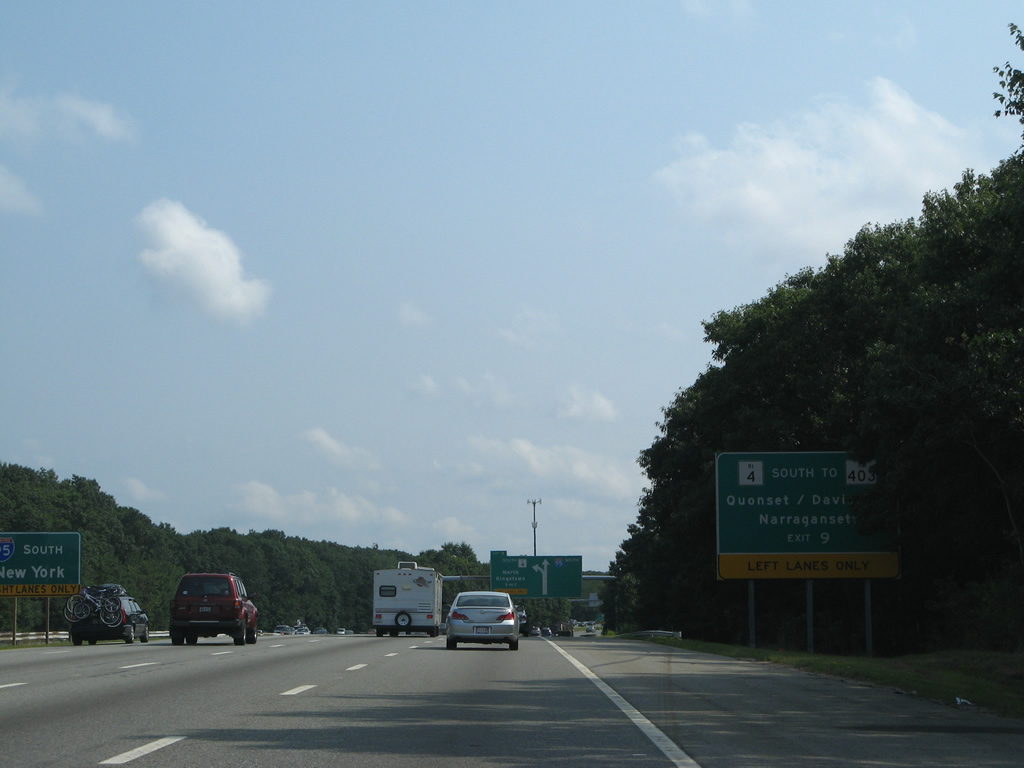
Completed in 2008, the Quonset Freeway (Route 403) links Route 4 (Exit 7B) with Davisville, Quonset Point and Quonset Davisville Business Park.
07/28/07

Route 4 constitutes a southward freeway spur to East Greenwich, North Kingstown, and U.S. 1 and Route 138 for Narragansett and Newport respectively.
07/28/07
Presently a wye interchange provides southbound access to Route 4 only from Interstate 95. Northbound travelers must use Exit 7 and a combination of Route 2 south and 401 east. Future plans call for the addition of the missing ramps.
07/28/07
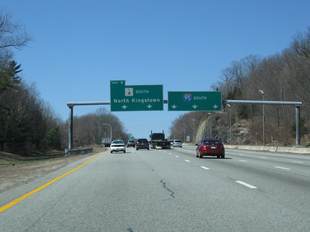
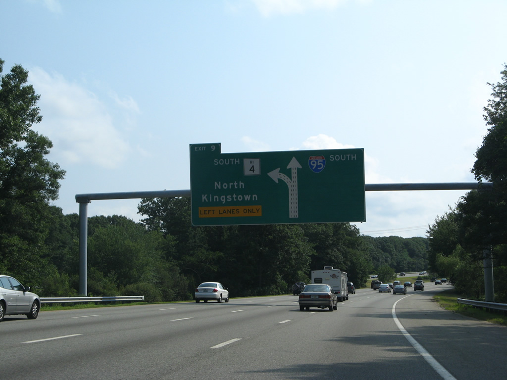
Interstate 95 continues south with three overall lanes as Exit 9 claims the left two lanes for Route 4. Route 4 was completed as a freeway in 1988 and travels 10.37 miles.
04/13/09
Interstate 95 reassurance marker posted as the freeway splits with Route 4 and climbs toward West Warwick.
07/28/07
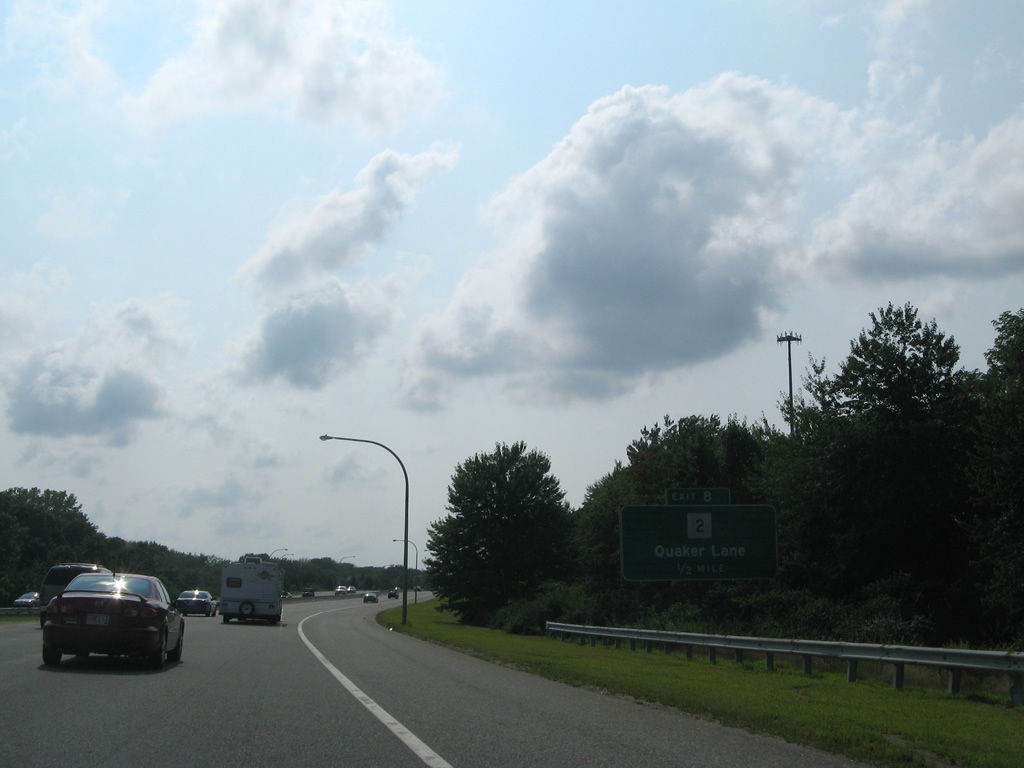
Southbound travelers quickly meet Route 2 (Quaker Lane) at a three-quarter cloverleaf interchange at the West Warwick town line. R.I. 2 parallels the Route 4 freeway south into East Greenwich.
07/28/07
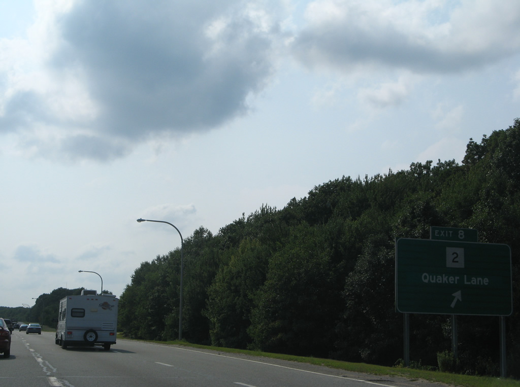
Exit 8 loops away from Interstate 95 south to Route 2 (Quaker Lane). Areas south and north of the interchange are developed with retail, apartments and an industrial park. Route 2 comprises a 33.6 mile route otherwise between Charlestown and Providence.
07/28/07
Heading west now, Interstate 95 travels through West Warwick to the northwest corner of East Greenwich. The aforementioned industrial park lines the north side of the freeway with Division Road paralleling to the south.
07/28/07
The next exit joins Interstate 95 with New London Turnpike at the West Greenwich and East Greenwich town line.
07/28/07
New London Turnpike angles southwest from Crompton through suburban West Warwick and Coventry to meet Interstate 95 by the Centre of New England retail development.
07/28/07
Entering the Exit 7 diamond interchange with New London Turnpike along Interstate 95 south. New London Turnpike intersects Division Road near Phelps Pond south of I-95. The road becomes unpaved there to Exeter.
07/28/07
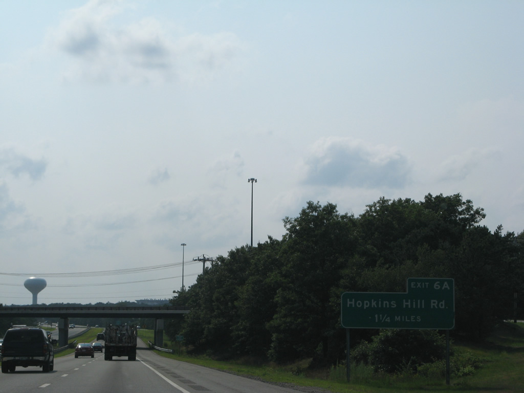
Suburban development continues along the north side of Interstate 95 to the parclo interchange (Exit 6A) with Hopkins Hill Road.
07/28/07
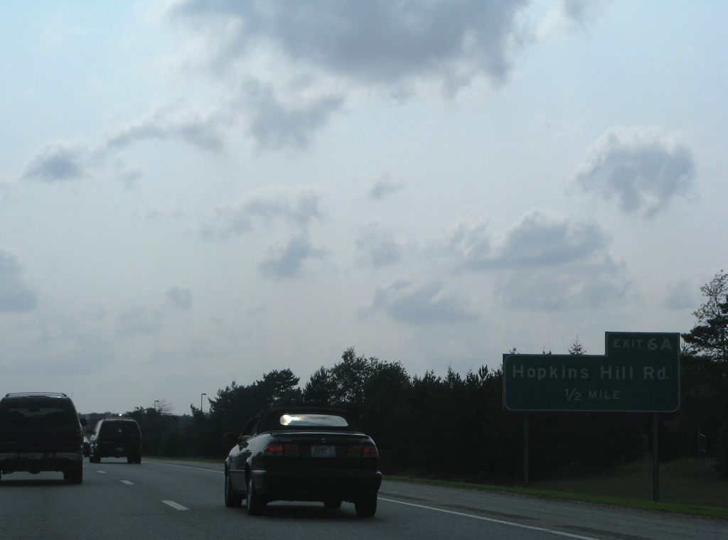
Hopkins Hill Road meets Division Road just south of Interstate 95 in West Greenwich and Route 3 (Tiogue Avenue) 2.2 miles to the north in east Coventry.
07/28/07
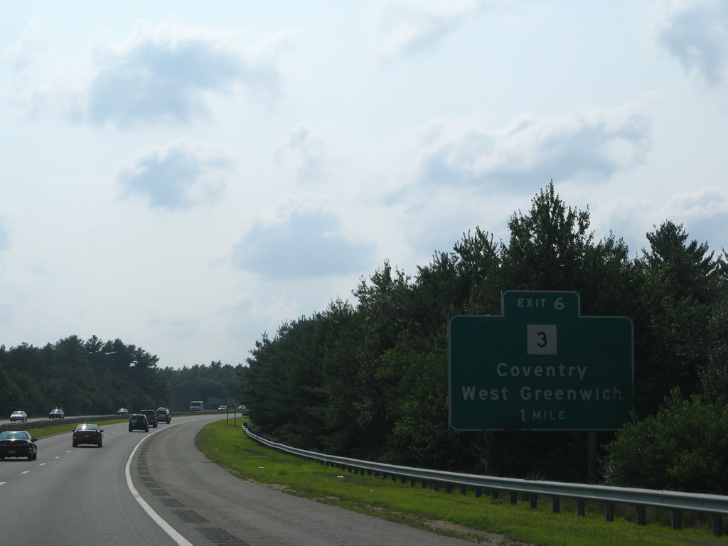
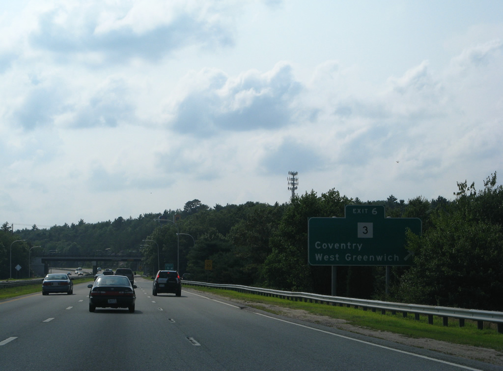
Route 3 (Nooseneck Hill Road) bends southwest from near Washington in Coventry to cross paths with Interstate 95 at the Exit 6 diamond interchange in one mile.
07/28/07
South of Exit 6, Route 3 (Nooseneck Hill Road) parallels Interstate 95 through Nooseneck in West Greenwich before meeting the freeway again at Exit 4.
07/28/07
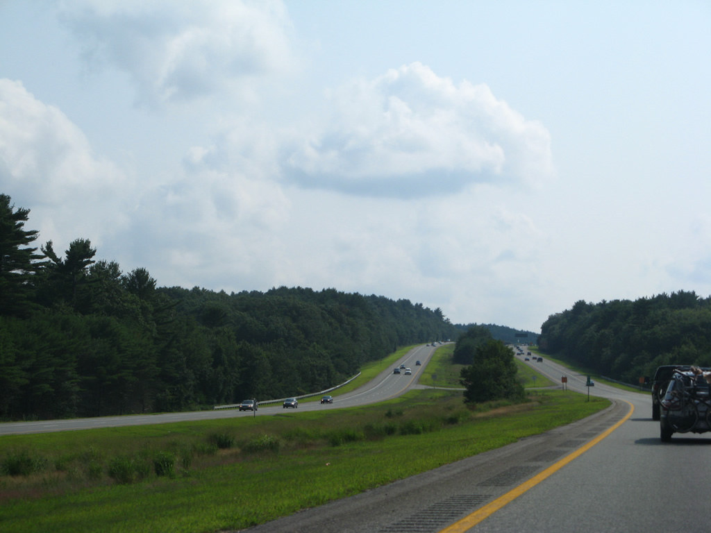
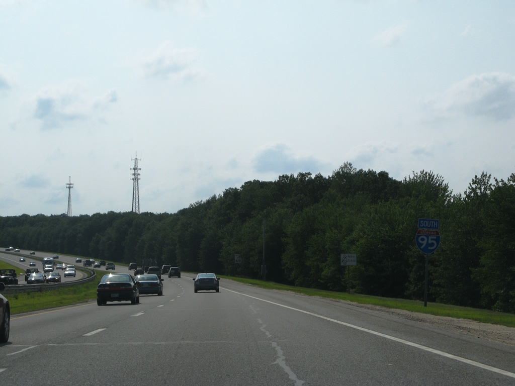
Turning southward again, Interstate 95 becomes vastly more rural to the Connecticut state line.
07/28/07
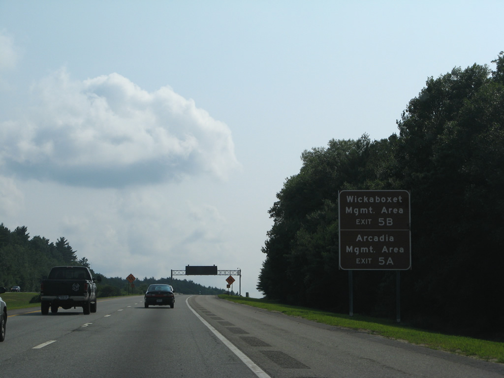
Forthcoming Route 102 meets Interstate 95 to the southeast of Wickaboxet Management Area and to the northeast of Arcadia Management Area.
07/28/07

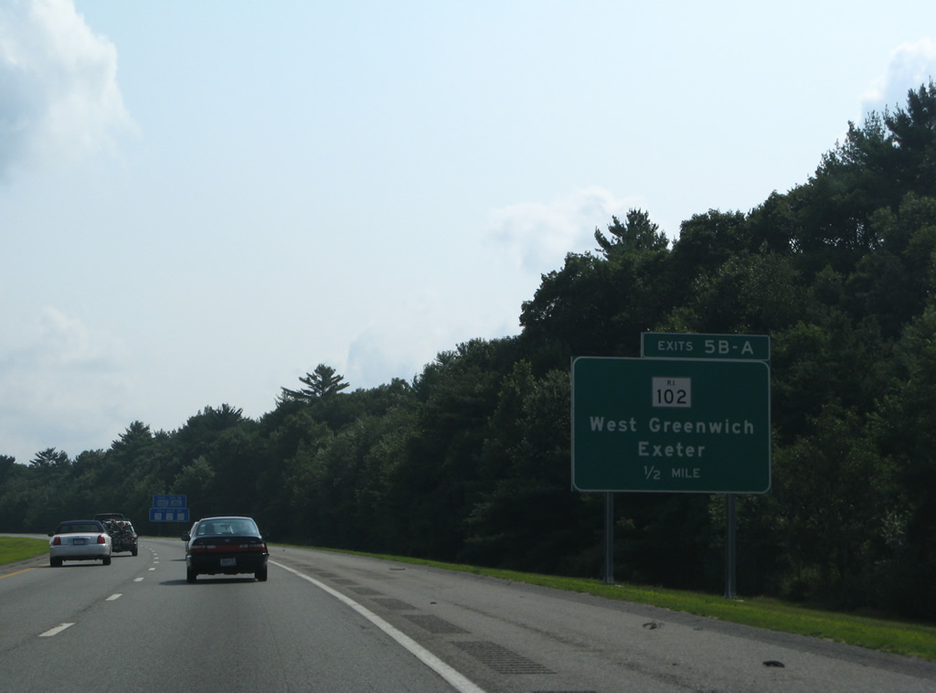
The final Kent County exit joins Interstate 95 with Route 102 (Victory Highway) at a cloverleaf interchange (Exits 5B/A) in one mile.
07/28/07
Route 102 follows the Victory Highway north from Ten Rod Road in Exeter to Slatersville near the Massachusetts state line.
07/28/07
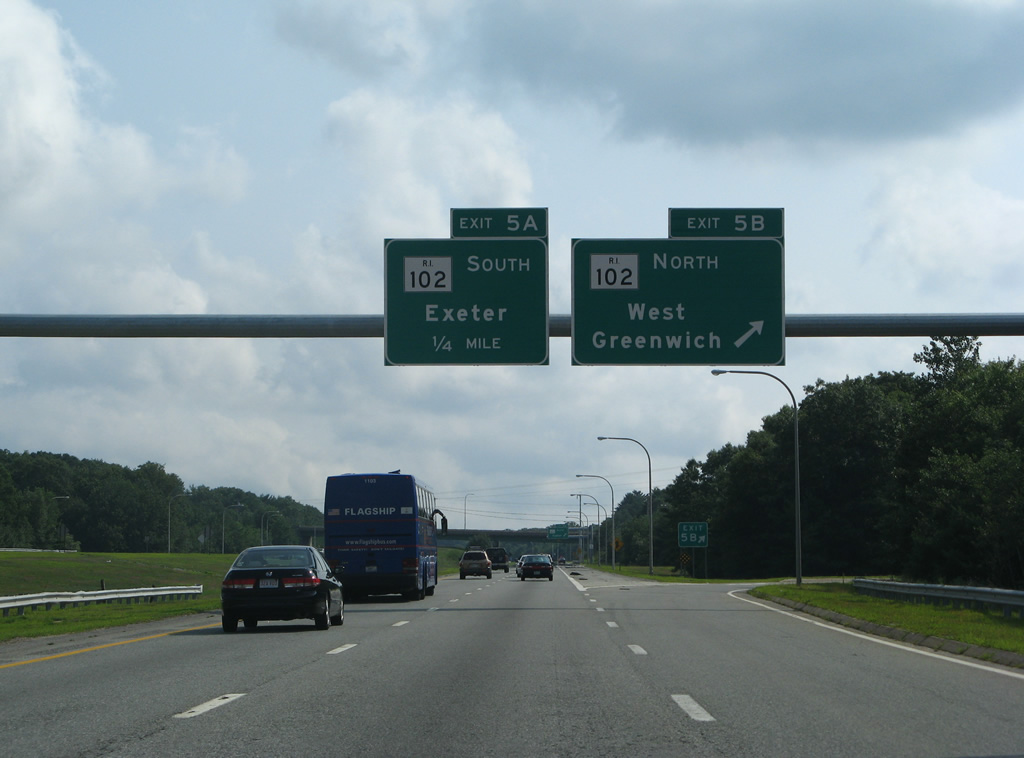
Exit 5B departs Interstate 95 south for Route 102 (Victory Highway) north through West Greenwich to Coventry and Foster.
07/28/07
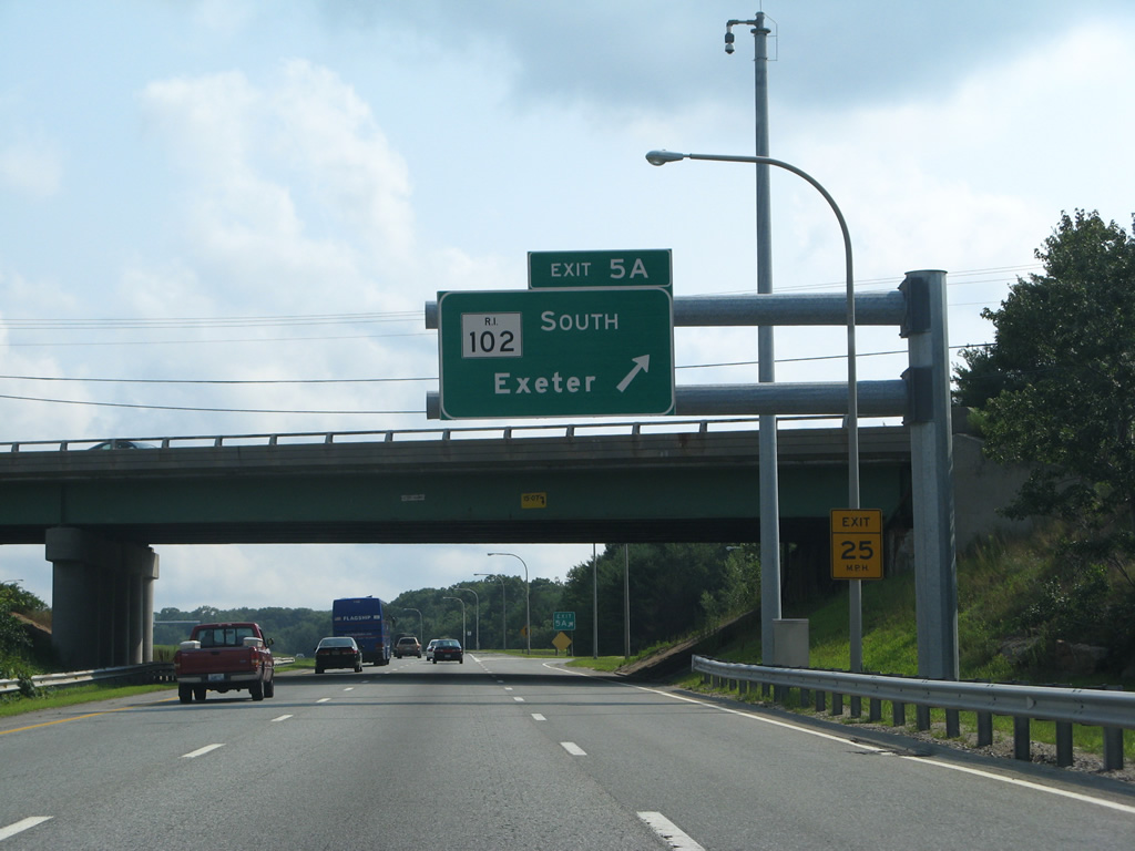
Route 102 south turns easterly after a brief overlap with Route 3 near Austin to Exeter and North Kingstown. The state route concludes at Route 1A in Wickford.
07/28/07

State-named shield that was posted at the on-ramp from Route 102 south before the Washington County line.
07/28/07
A second shield follows the Kent County line along Interstate 95 south.
07/28/07
Exit 4 constitutes a half diamond interchange with Route 3 (Nooseneck Hill Road) for northbound travelers. Southbound continues to Wyoming and Hope Valley.
07/28/07
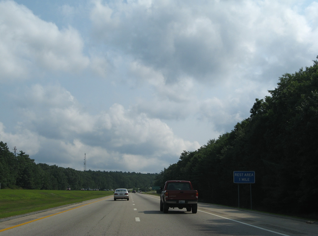
A pair of rest areas line the sides of Interstate 95 west of Tefft Hill in one mile.
07/28/07
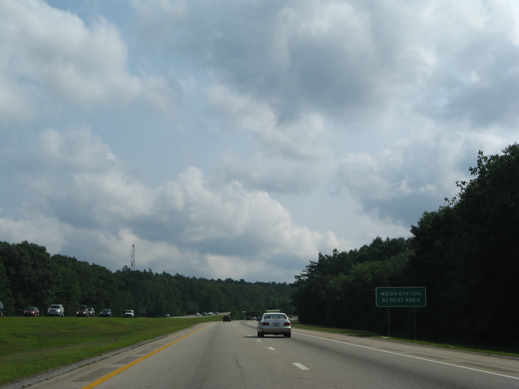
The rest area doubles as a weigh station for all commercial trucks.
07/28/07
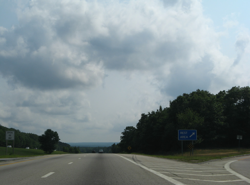
The hills of southwest Rhode Island rise along the southern horizon as Interstate 95 splits with the rest area off-ramp. This forested stretch of freeway resides within Arcadia Management Area.
07/28/07
Another Interstate 95 shield follows the rest area in northern Richmond.
07/28/07
Lowering into the Wood River valley north of Kenyon Hill. An on-ramp joins the southbound freeway from Route 3 (Exit 4).
07/28/07
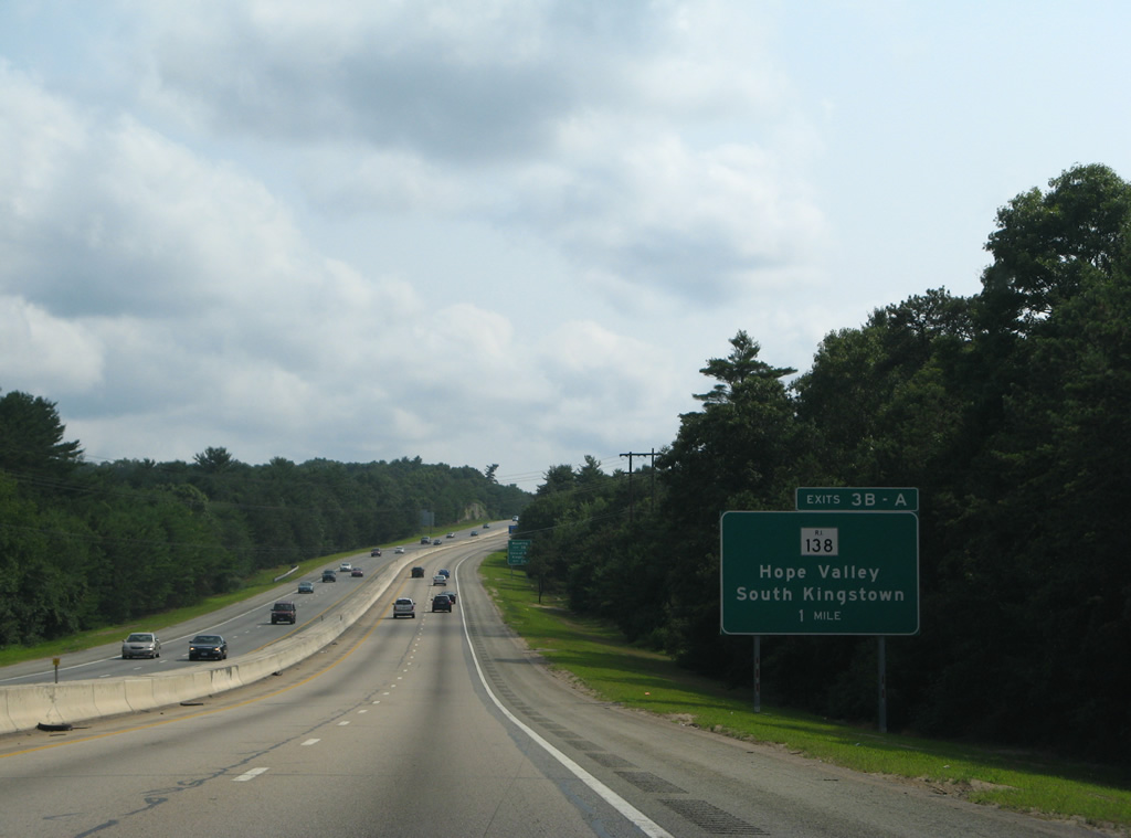
Route 138, a major east-west route in the southern part of the state, intersects Interstate 95 near Hope Valley at Exit 3 in one mile.
07/28/07
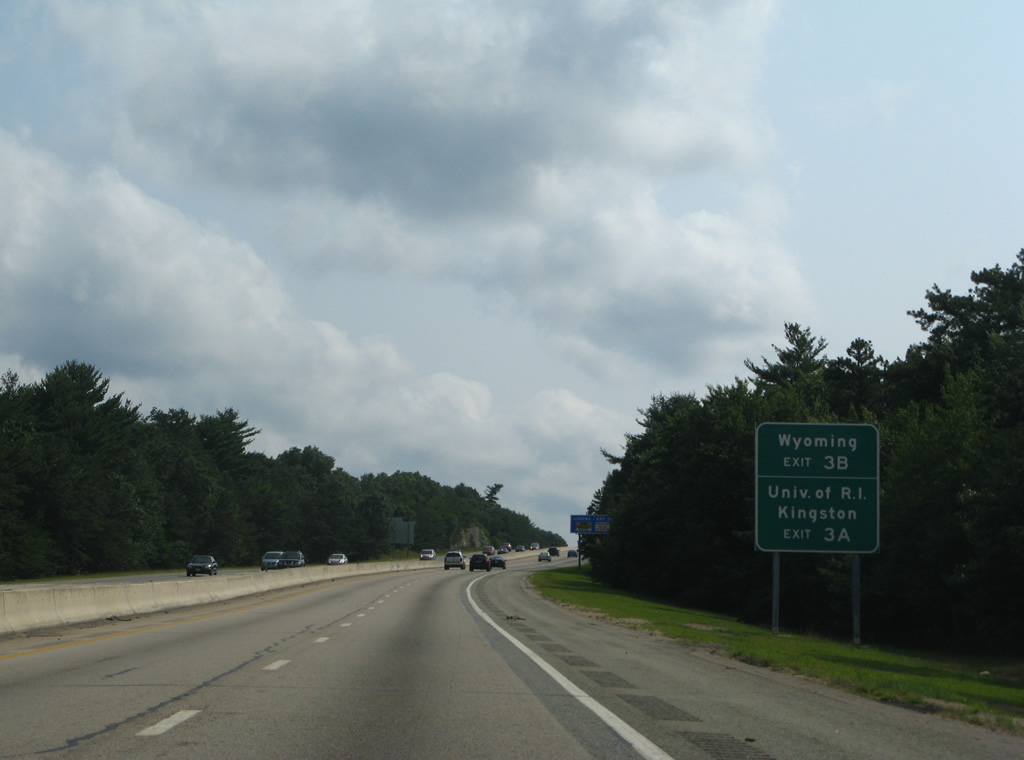
Route 138 ventures east from Wyoming and Interstate 95 to the University of Rhode Island and Kingston.
07/28/07

A 45.2 mile route, R.I. 138 travels between Connecticut and Massachusetts, utilizing the Jamestown and Newport Bridges to span Narragansett Bay.
07/28/07

A cloverleaf interchange facilitates the movements between Interstate 95 and Route 138. Exit 3B leaves first for Main Street west to Wyoming and Route 3. R.I. 3 & 138 combine there into Hope Valley.
07/28/07
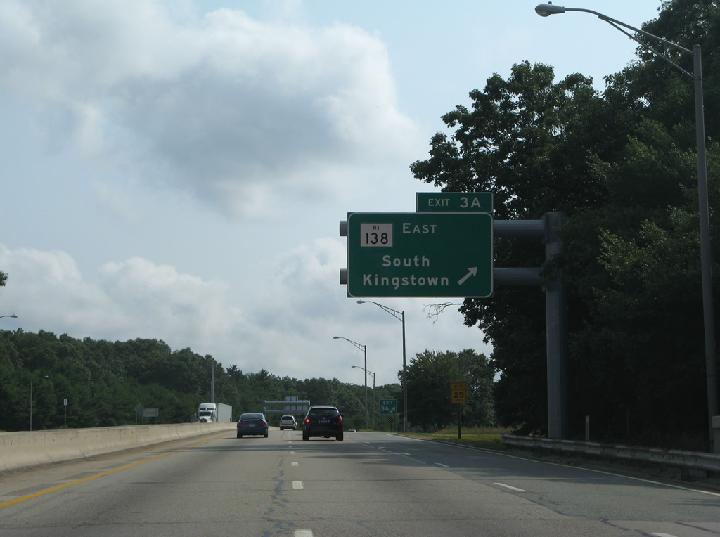
Following Kingstown Road from Exit 3A, Route 138 meanders through Richmond to the Town of South Kingston at Usquepaug. Overall the multi-state route concludes at Fall River, Massachusetts to the east and Voluntown, Connecticut to the west.
07/28/07
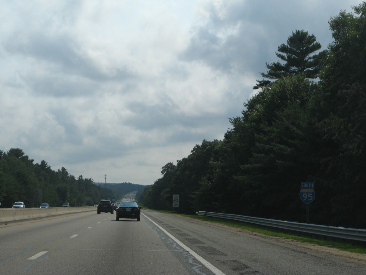
Interstate 95 bypasses Hope Valley in a swampy area east of the Wood River beyond this reassurance marker.
07/28/07
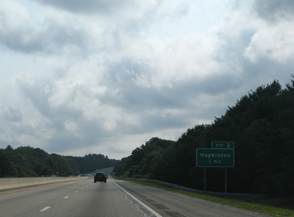
The final two exits of Interstate 95 south in the Ocean State lie within the Town of Hopkinton.
07/28/07
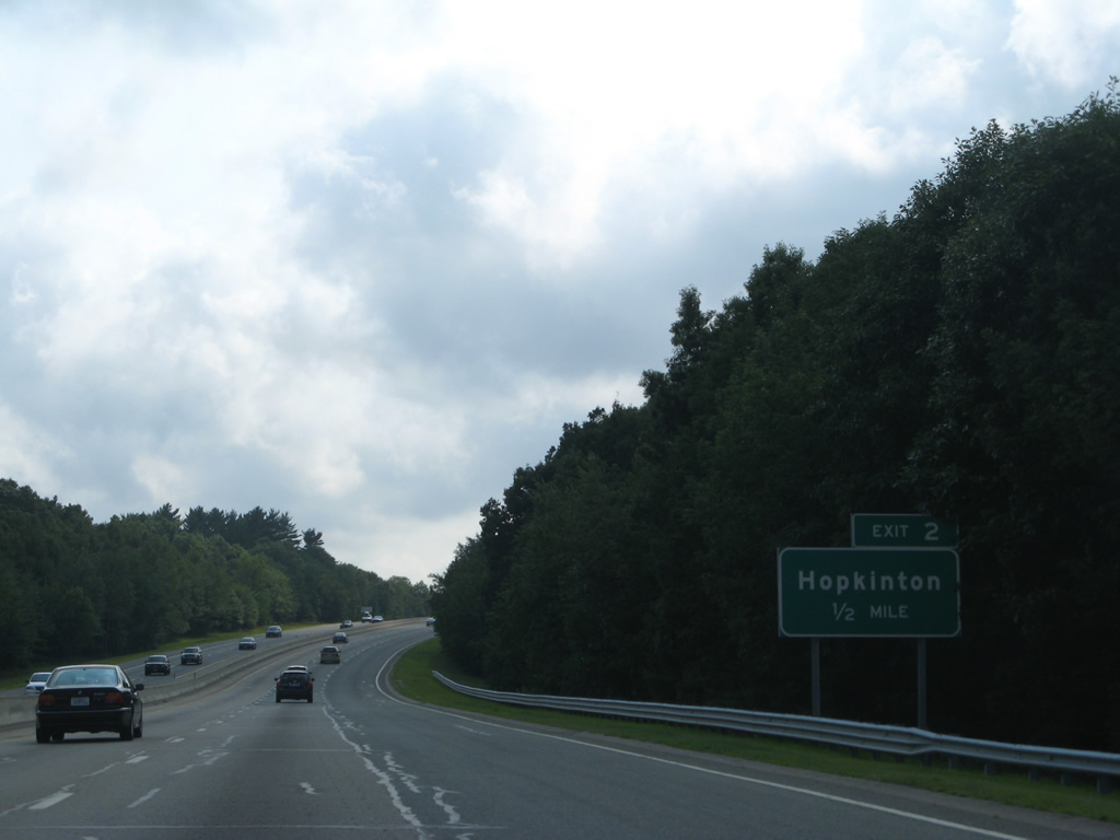
Woodville Alton Road connects Interstate 95 (Exit 2) with parallel Route 3 (Main Street) south of Hope Valley in one half mile.
07/28/07
Southbound Interstate 95 at the Exit 2 diamond interchange. Woodville Alton Road heads south to Alton and Route 91.
07/28/07
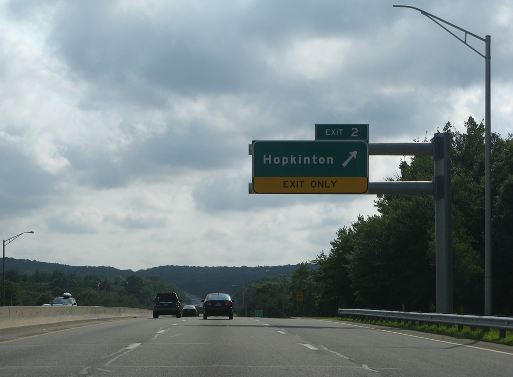
Interstate 95 continues through the hills of Hopkinton with a jersey barrier median. Route 3 shadows the freeway to the north through the town center.
07/28/07
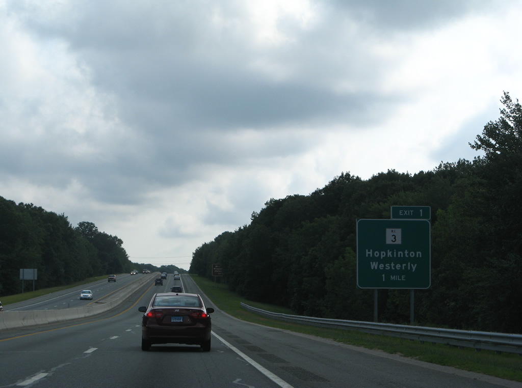
One mile north of the Exit 1 folded-cloverleaf interchange with Route 3 (Main Street).
07/28/07

Route 3 (Main Street) turns south from Hopkinton to Ashaway and the Town of Westerly. Points of interest served by Exit 1 include Burlingame Management Area and Ninigret Park.
07/28/07
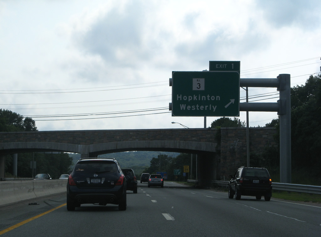
Exit 3 departs Interstate 95 south. Route 3 meets the Westerly Bypass (Route 78) south in 4.5 miles for interests south to Watch Hill State Beach and Misquamicut State Beach. The state route ends at U.S. 1 in Westerly otherwise.
07/28/07
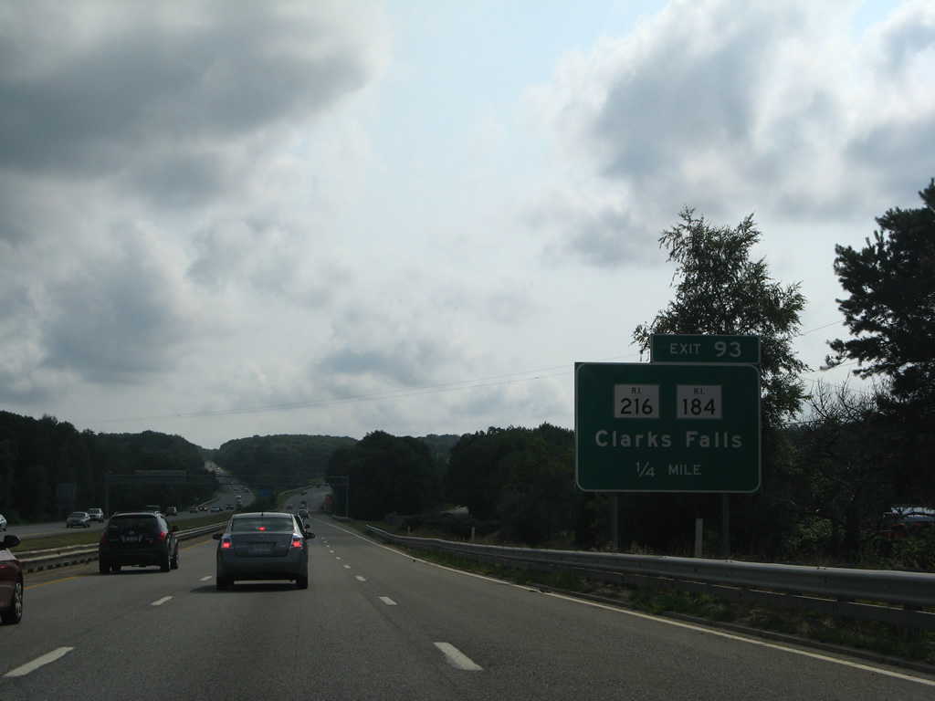
A short distance west of Exit 1 is the Exit 93 diamond interchange with Route 216 (Clarks Falls Road) to Route 184 (Providence New London Turnpike) west.
07/28/07
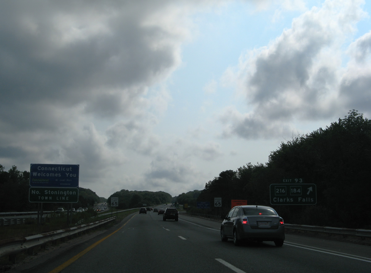
Travelers cross Parmenter Brook and enter the Town of North Stonington at the Constitution State line. Exit 93 immediately follows for Route 216 south to High Street in Bethel, RI and north to Clarks Falls and CT-49. CT 184 follows a 15.66 mile course west to I-95 in Groton.
07/28/07
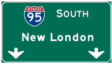
Photo Credits:
- Alex Nitzman, Carter Buchanan: 06/25/05
- AARoads: 07/28/07
- I.C. Ligget: 04/13/09
Connect with:
Page Updated Thursday August 16, 2012.