
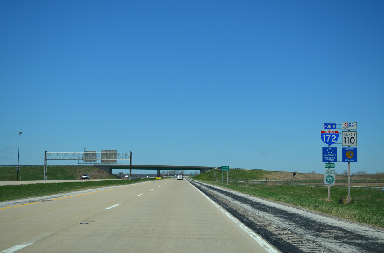
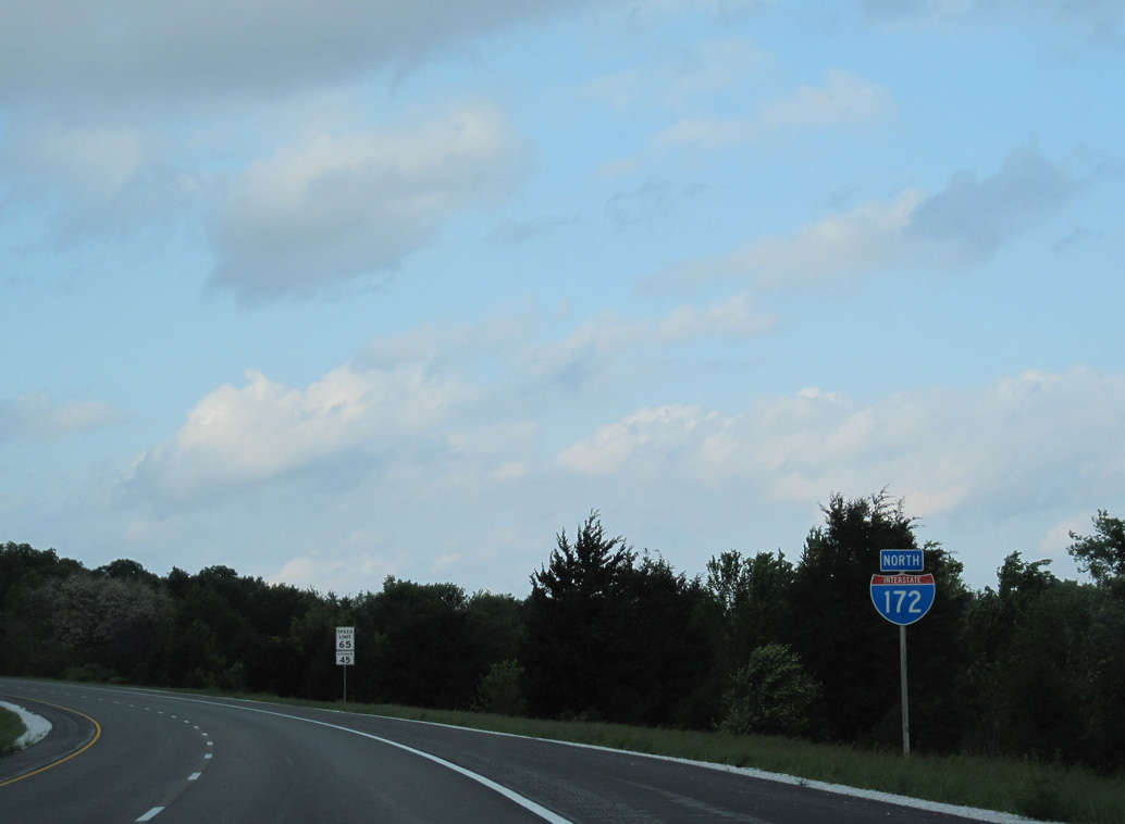
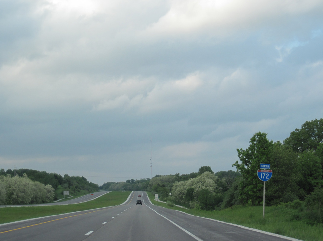
Interstate 172 North

 North
North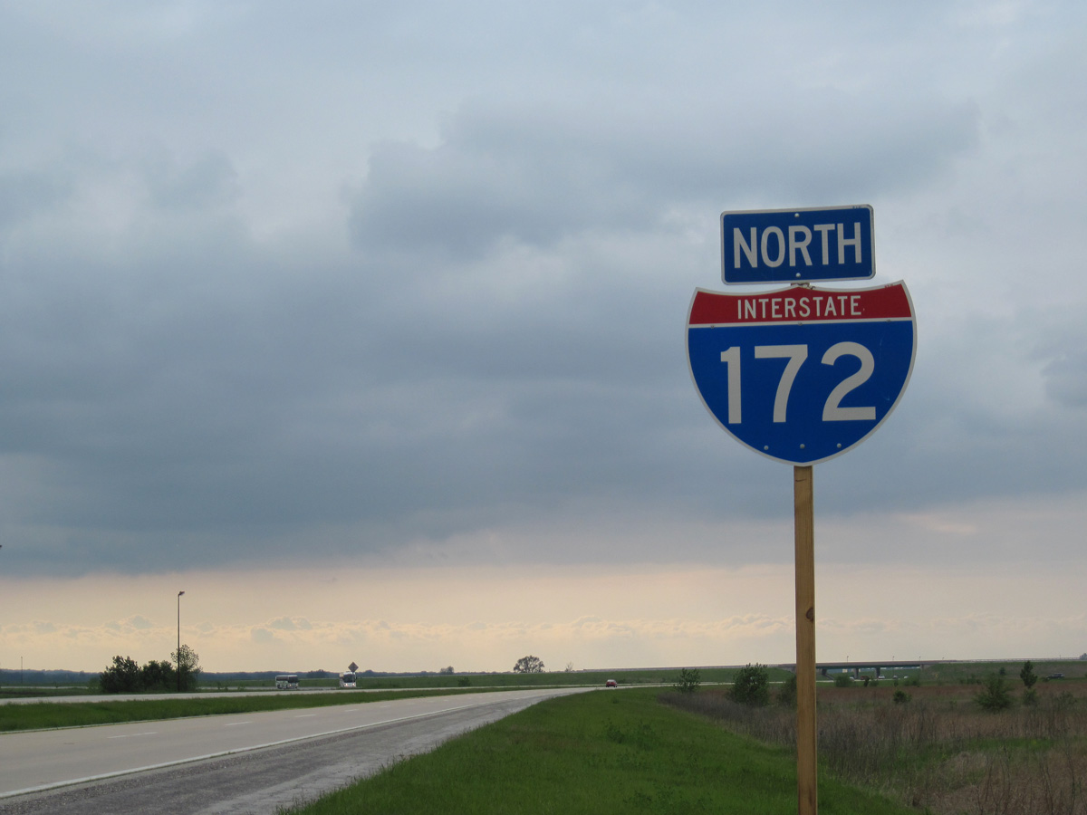
Since replaced, the first shield for Interstate 172 posted northbound precedes the loop ramp joining I-72/U.S. 36 east with the freeway spur to Quincy.
05/07/10
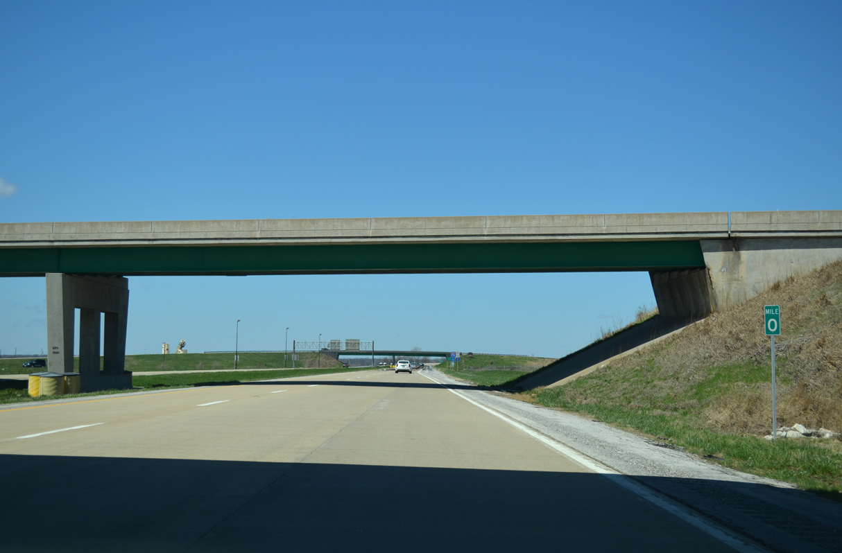
Mile post zero for Interstate 172 is located within the trumpet interchange at Exit 0.
04/13/13
The second shield for Interstate 172 north stands precedes the Fall Creek Road (Old IL 79) overpass.
04/13/13
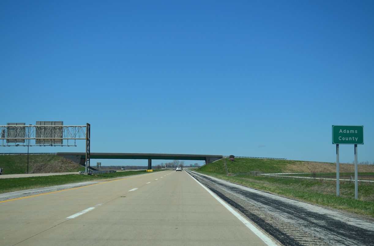
I-172 angles 0.80 miles northwest from westbound I-72 across the Adams County line.
04/13/13
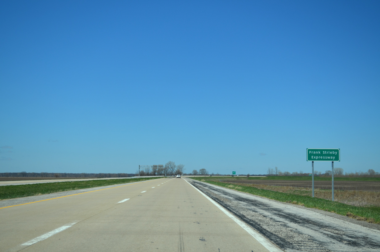
Interstate 172 is the Frank Strieby Expressway.
04/13/13

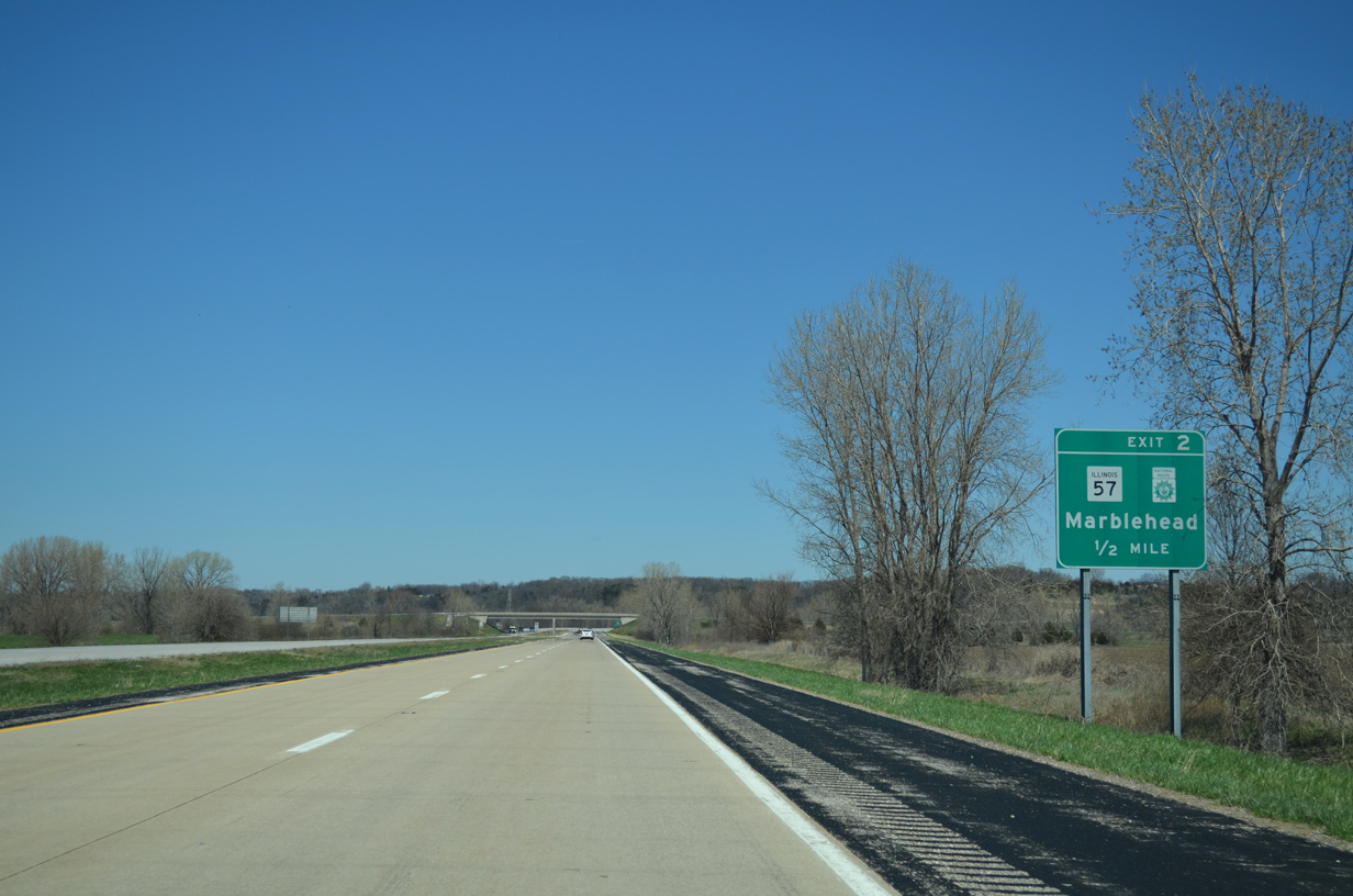
Turning north by the unincorporated community of Fall Creek, I-172/IL 110 (CKC) advance one mile to a folded diamond interchange (Exit 2) with IL 57 north and 1083rd Lane south.
04/13/13

IL 57 travels 11.61 miles northwest from I-172/IL 110 (CKC) to York Street in Downtown Quincy.
04/13/13
1083rd Lane southeast to Fall Creek was formerly part of IL 57. IL 57 previously extended 7.57 miles southeast from I-172 to IL 96 en route to Hull.
04/13/13
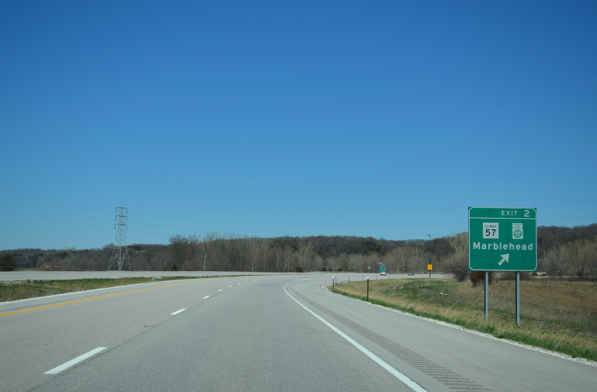
I-172/IL 110 (CKC) shift northeast across IL 57 at Exit 2. The unincorporated community of Marblehead is five miles to the northwest.
04/13/13

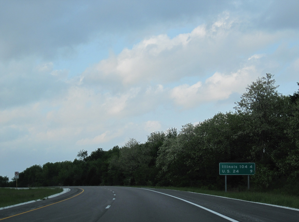
IL 57 travels 12.32 miles overall from I-172/IL 110 (CKC) to U.S. 24 (Maine Street) in Downtown Quincy.
04/13/13
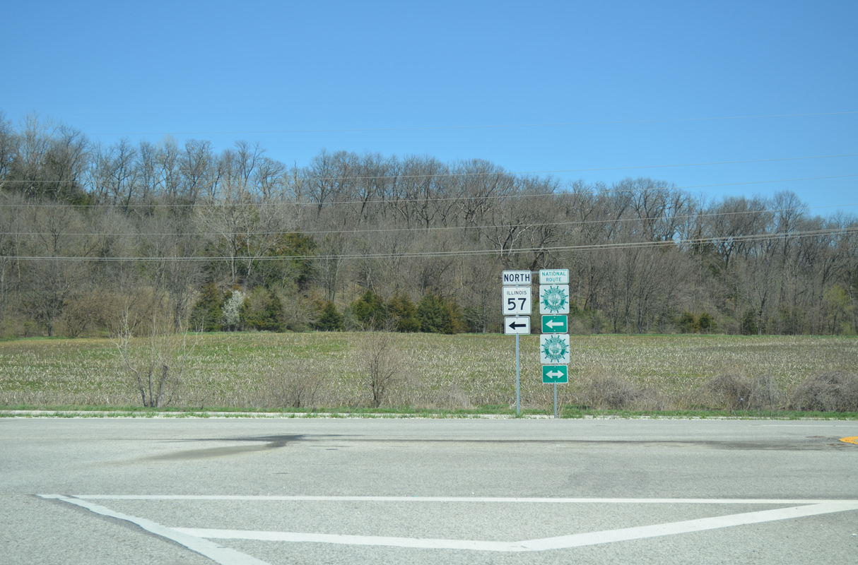
The Great River Road system overlays IL 57 north to U.S. 24 in Quincy and Old IL 57 southeast to IL 96 near Hull.
04/13/13
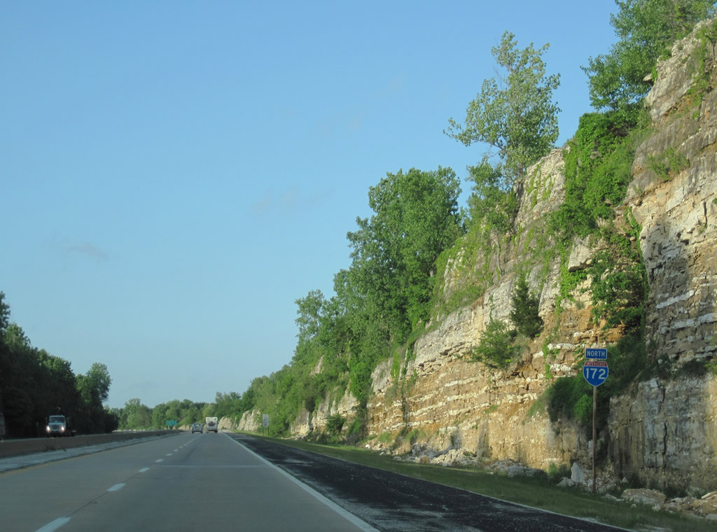
Interstate 172 gains 160 feet in elevation through rock cuts northeast from IL 57.
05/07/10
Three exits remain along Interstate 172 north over the 17 miles to U.S. 24.
05/07/10
Bee lining northwest, I-172/IL 110 (CKC) gradually descend from around 700 feet above sea level to cross Burton and Mill Creeks around 510 feet in elevation.
05/07/10
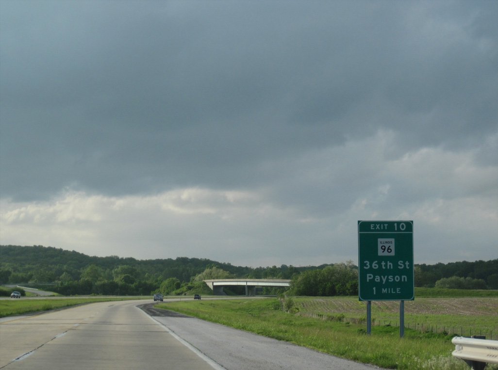
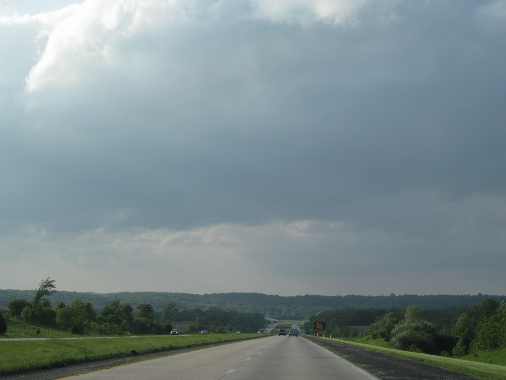
Interstate 172 makes a sweeping curve east across Mill Creek into the diamond interchange (Exit 10) with IL 96 on the suburban outskirts of Quincy.
05/07/10
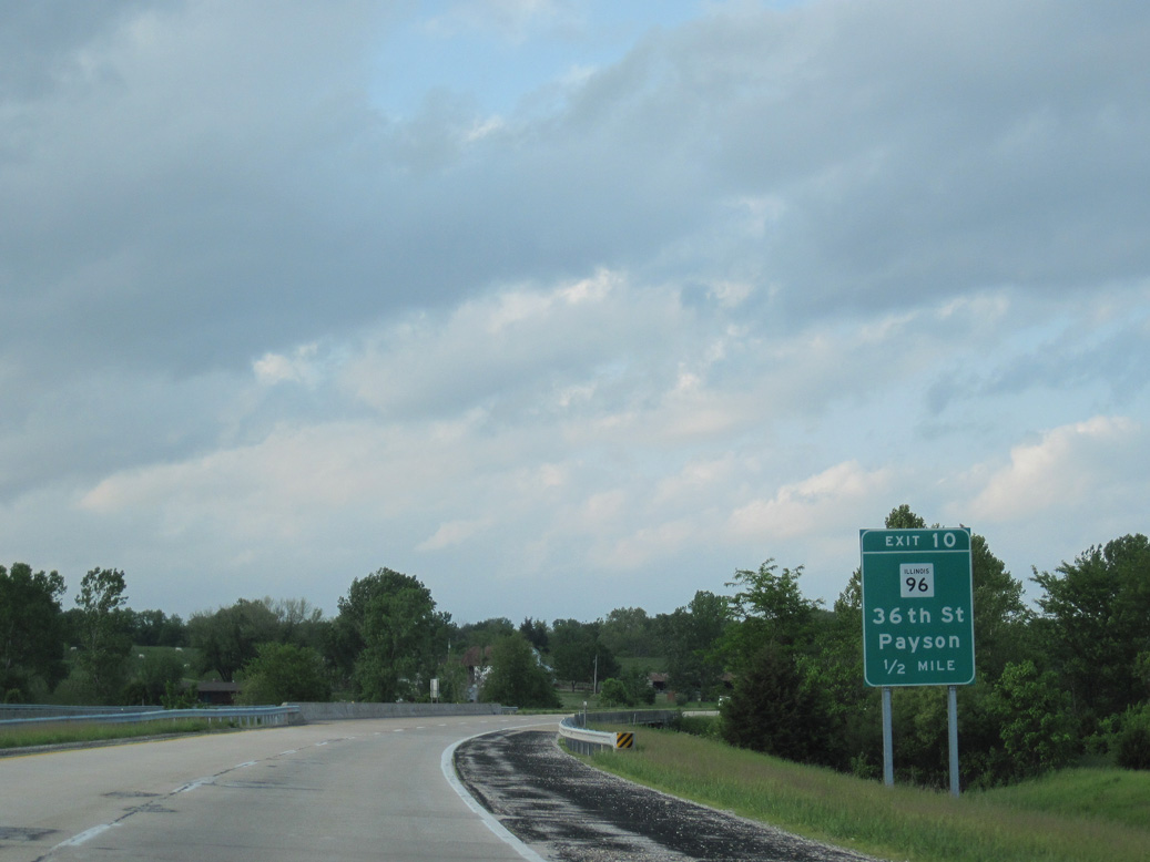
IL 96 angles southeast from Exit 10 to the villages of Payson and Plainville.
05/07/10
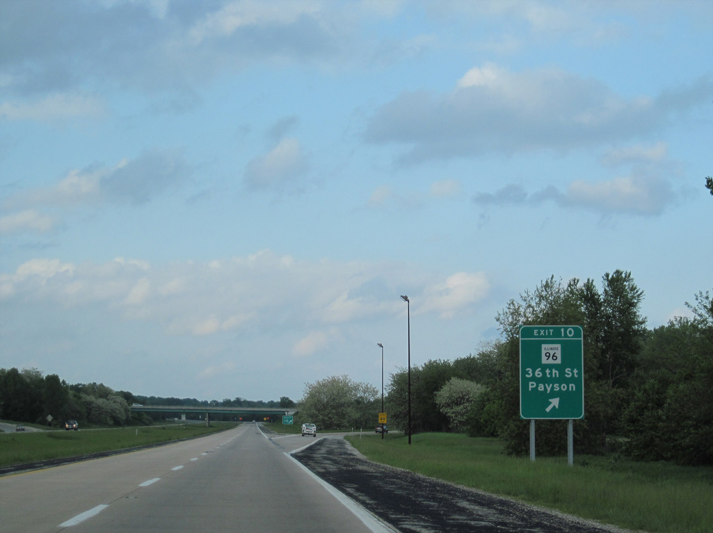
Northwest from I-172/IL 110 (CKC), IL 96 turns west onto Payson Road and then north along 36th Street into the Quincy city limits.
05/07/10
IDOT recorded 7,250 vehicles per day along Interstate 172 between Exits 10 and 14 in 2017.
05/07/10
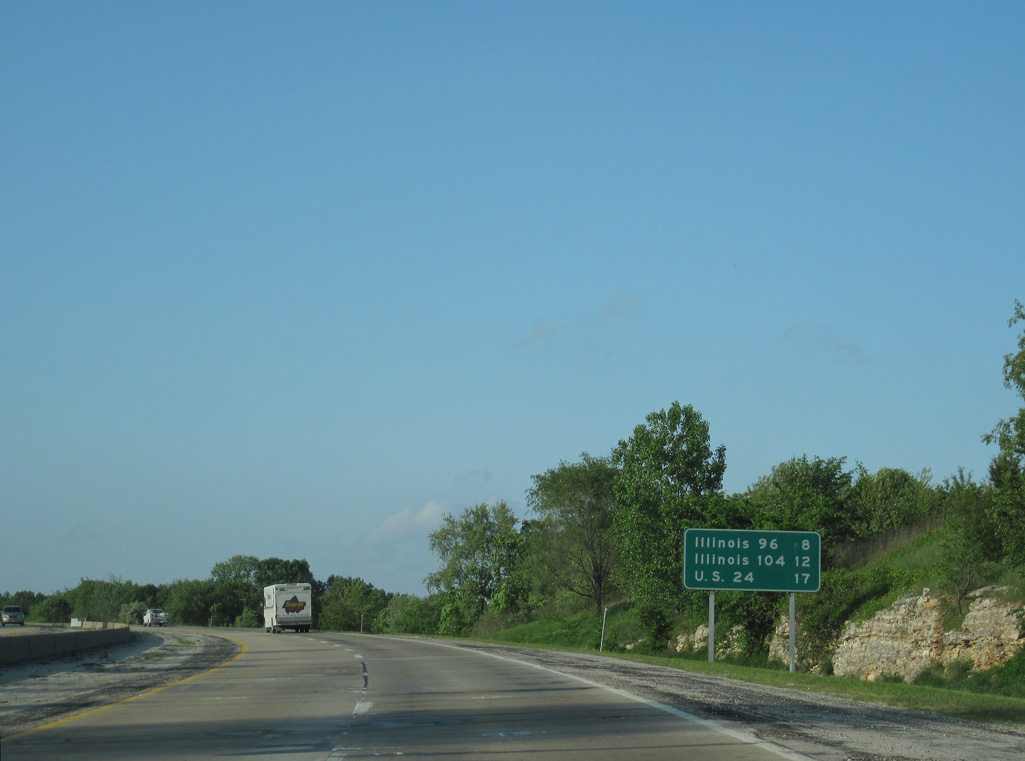
I-172/IL 110 (CKC) stays just east of the Quincy city line until reaching IL 104 in four miles.
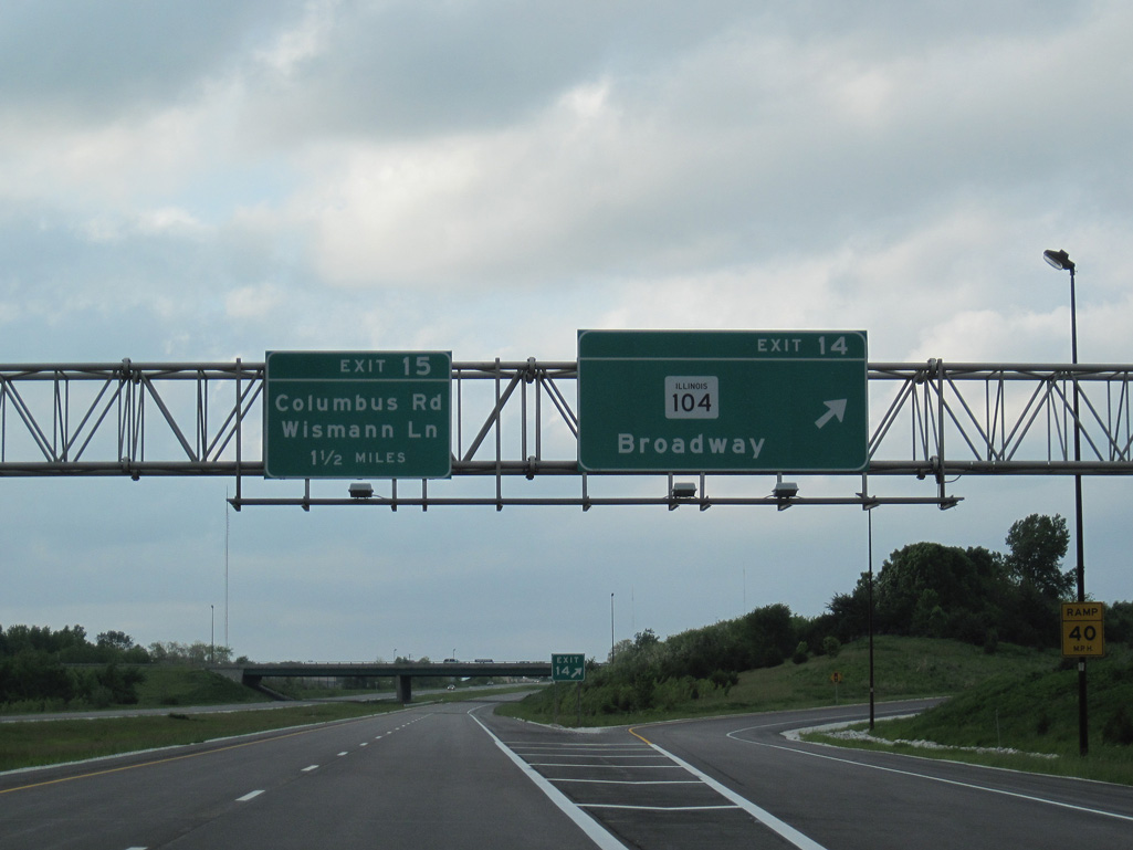
05/07/10

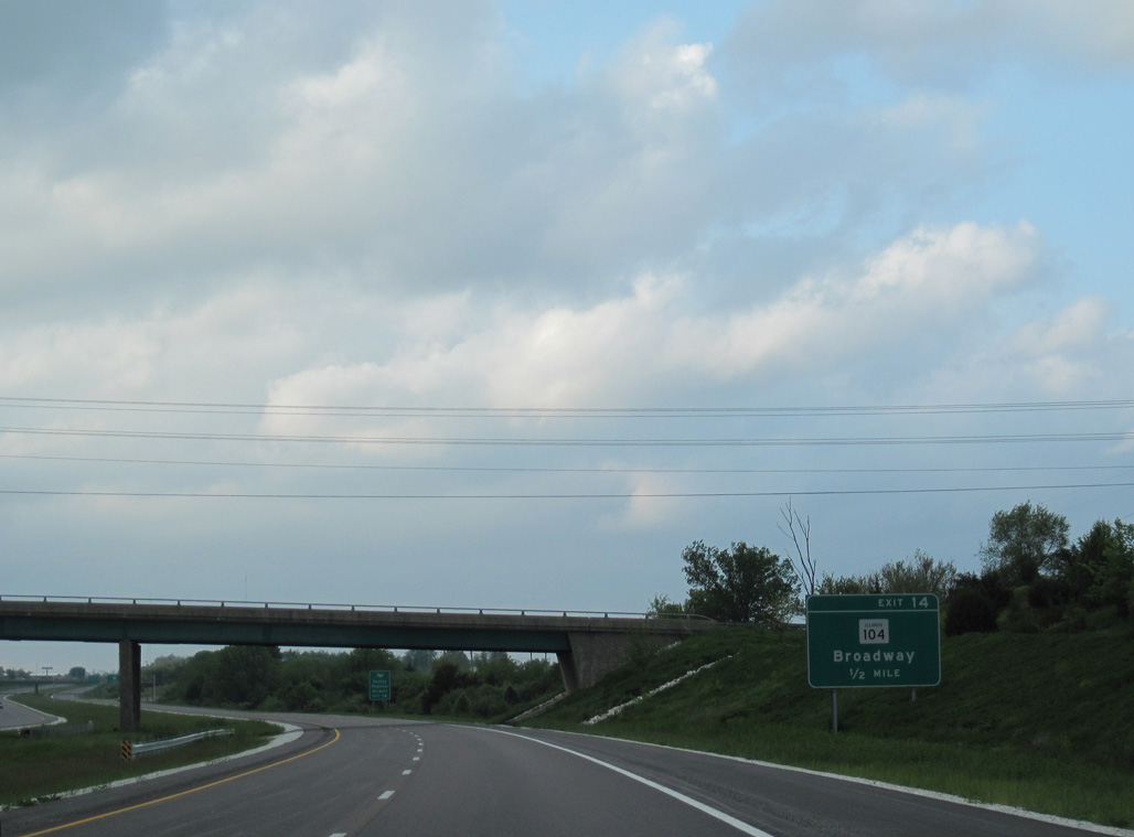
IL 104 (Broadway Street) constitutes a five lane commercial boulevard leading east from Downtown Quincy to big box retail adjacent to the diamond interchange (Exit 14) with I-172/IL 110.
05/07/10
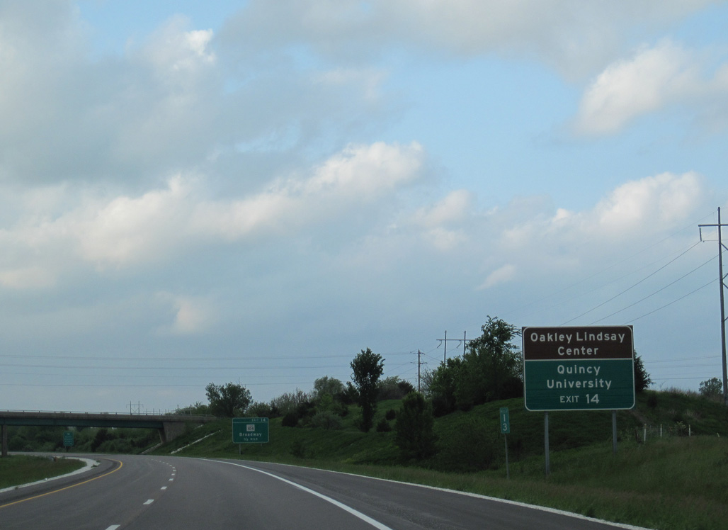
The Oakley Lindsay Center is an entertainment venue and convention center located along IL 57 (3rd Street) south of Downtown Quincy. Quincy University lies four blocks north of Broadway Street within the city street grid.
05/07/10
Originating in Downtown Quincy, IL 104 runs 53.32 miles east to U.S. 67/IL 100 beyond the village of Meredosia. IL 104 combines with U.S. 67 south to Jacksonville and concludes at IL 29 in Taylorville.
05/07/10
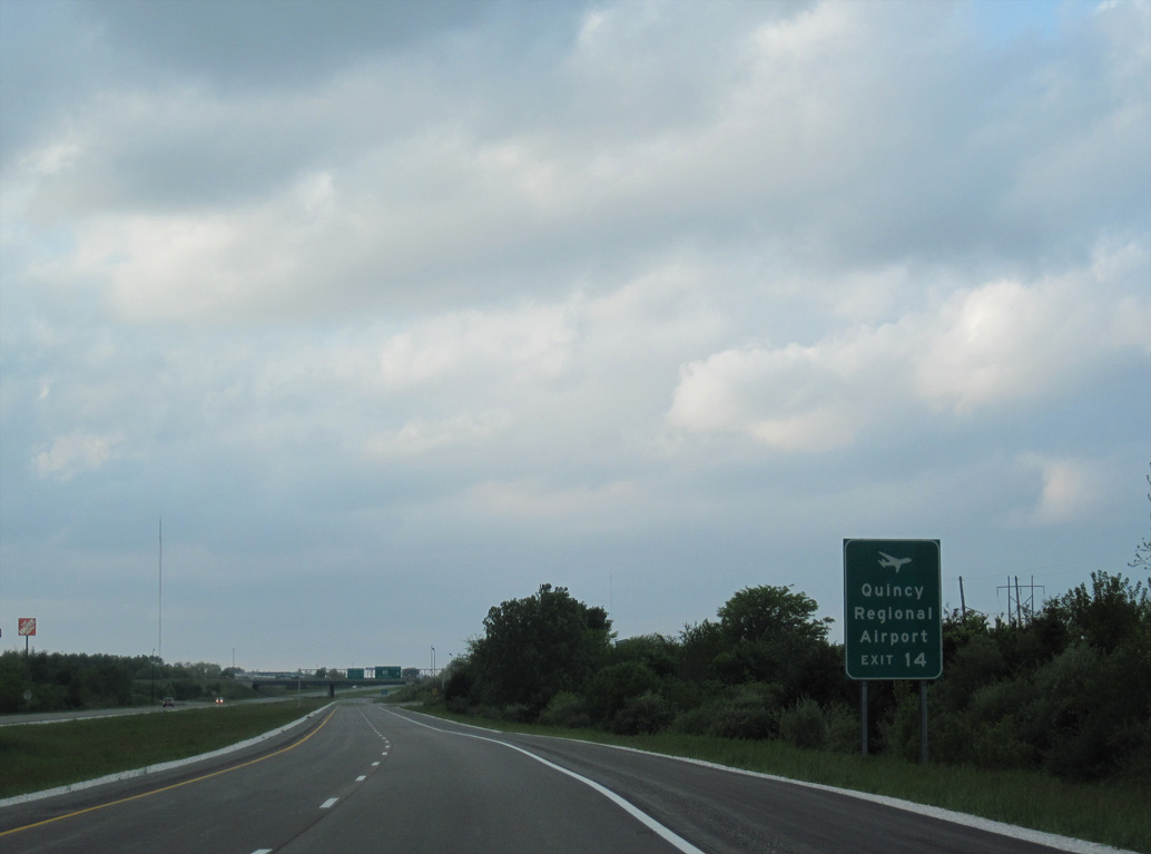
Quincy Regional Airport (UIN) lies 6.97 miles east of Interstate 172 along IL 104.
05/07/10
IL 104 extends east as a four lane, divided highway to beyond Quincy Regional Airport. Leading west, IL 104 connects with U.S. 24 across the Bayview Bridge to West Quincy, Missouri.
05/07/10
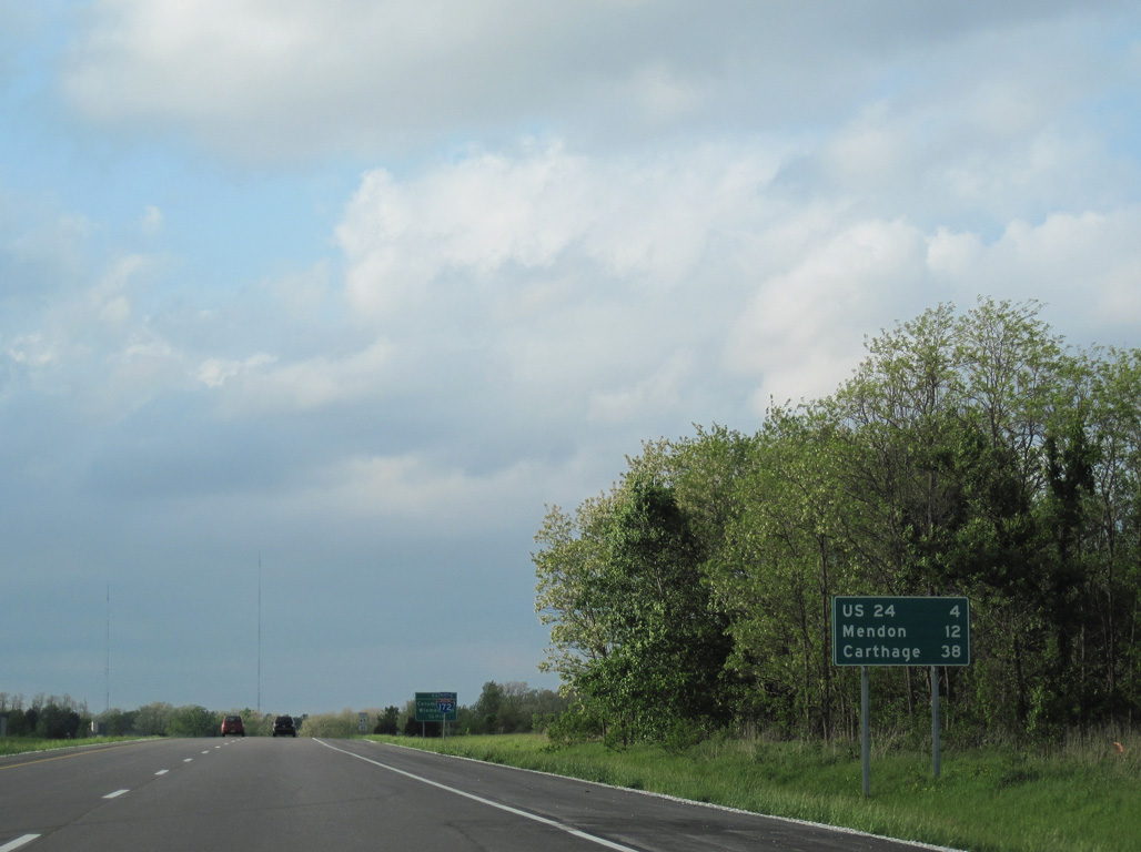
The village of Mendon is eight miles beyond the end of I-172 along the Chicago Kansas City Expressway (IL 110/336). Carthage is where IL 110/336 combine with U.S. 136 east toward Macomb.
05/07/10
Interstate 172 straddles the Quincy city line north adjacent to the commercial strip along parallel 54th Street.
05/07/10
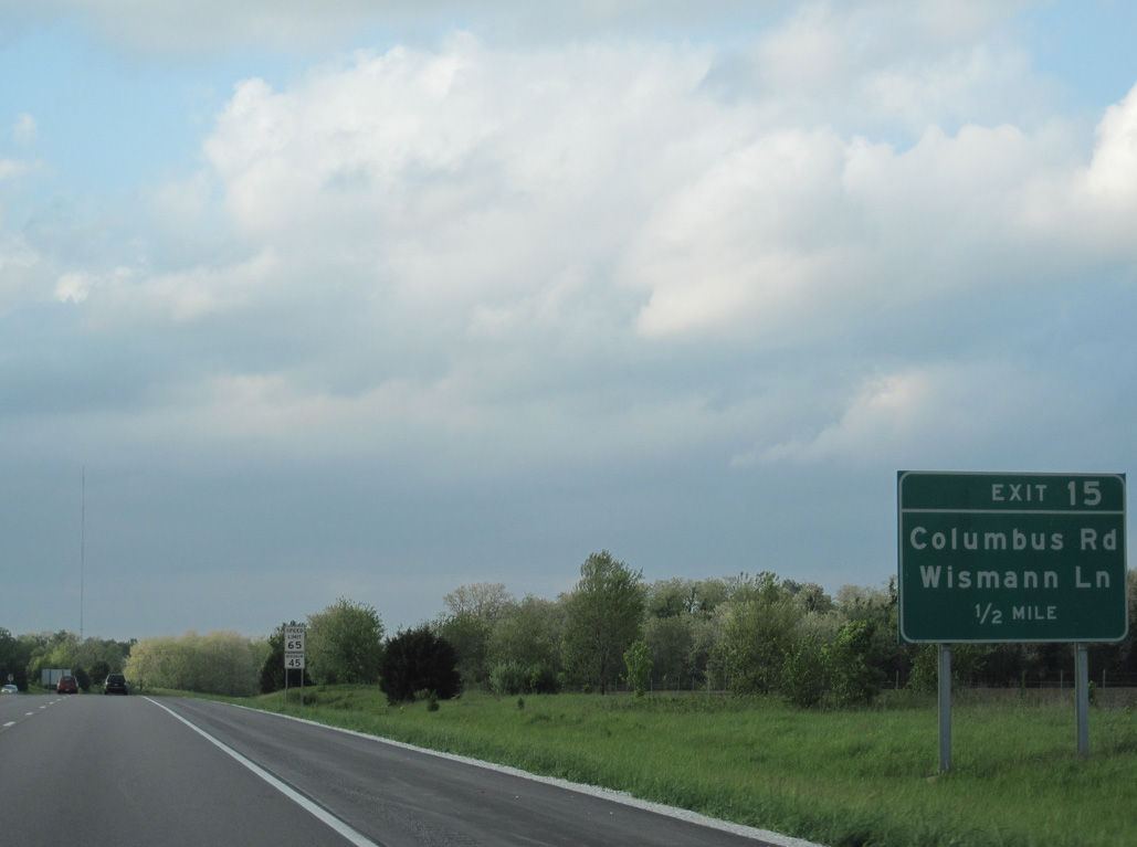
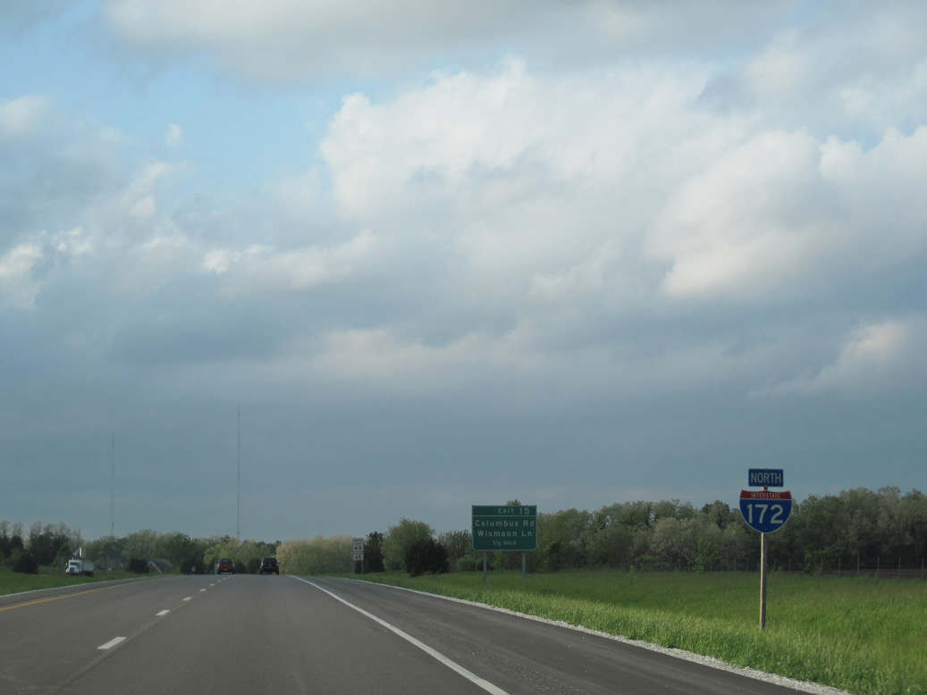
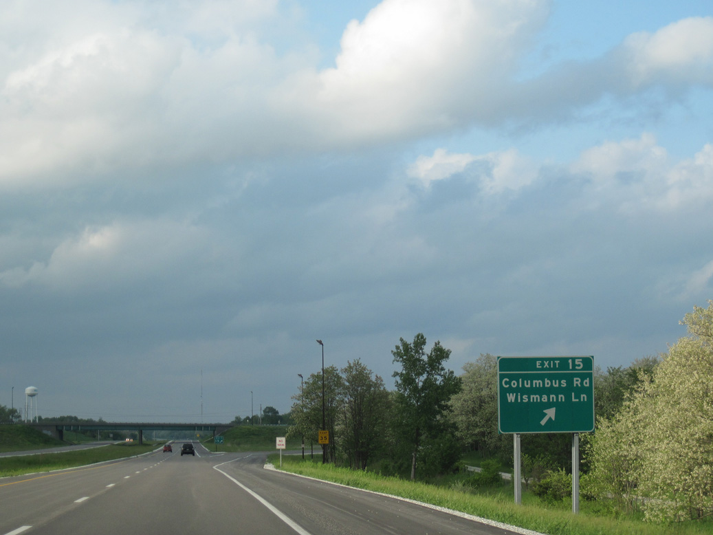
Columbus Road arcs northeast from N 36th Street in Quincy to Wismann Lane, where it turns east to the diamond interchange at Exit 15.
05/07/10
Wismann Lane extends 2.52 miles west from Columbus Road and Cannonball Road across an industrial park area to IL 96 (N 24th Street) in north Quincy.
05/07/10
I-172/IL 110 (CKC) continue north by a mix of timberland and agricultural areas and the unincorporated community of Ewbanks over the final stretch to U.S. 24.
05/07/10
Heading north out of Quincy, U.S. 24 combines with IL 96 for 0.63 miles before turning east at Boy Scout Road 3.18 miles to I-172/IL 110.
05/07/10
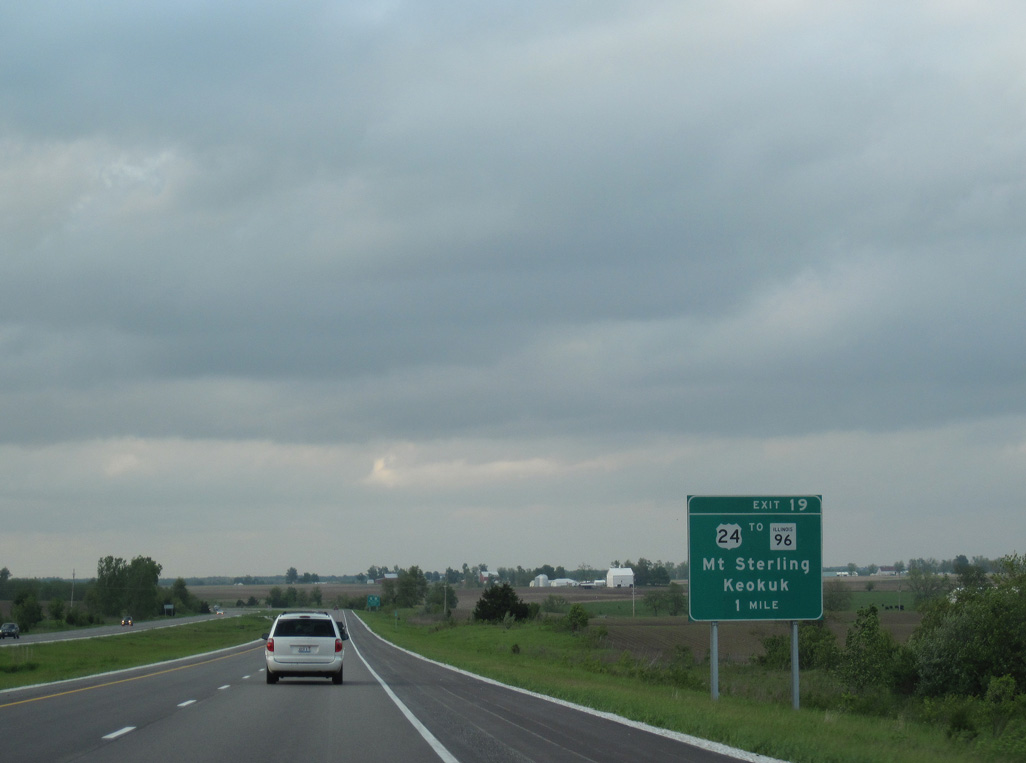
U.S. 24 continues 30 miles east from Exit 19 to the Brown County seat of Mt. Sterling.
05/07/10
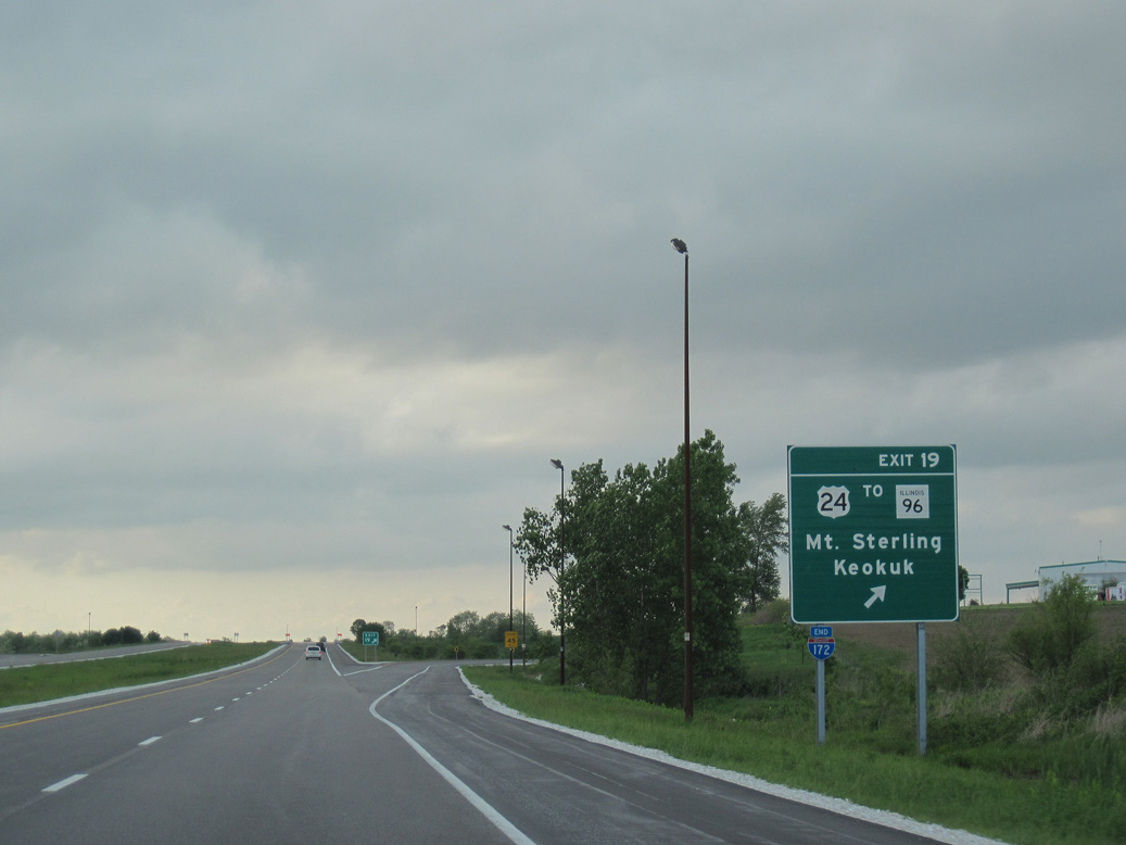
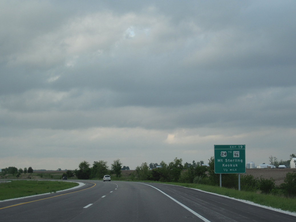
IL 96 parallels the Mississippi River north from U.S. 24 to U.S. 136 across from Keokuk, Iowa. IL 336, the former designation for I-172 south to Fall Creek, commences north from Exit 19.
05/07/10
Photo Credits:
- ABRoads: 05/07/10
- AARoads: 04/13/13
Connect with:
Page Updated Monday November 13, 2023.