
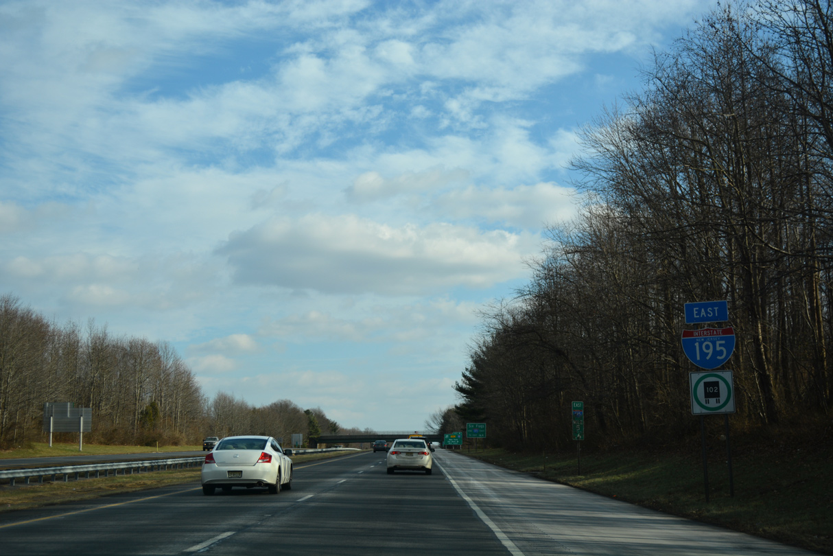
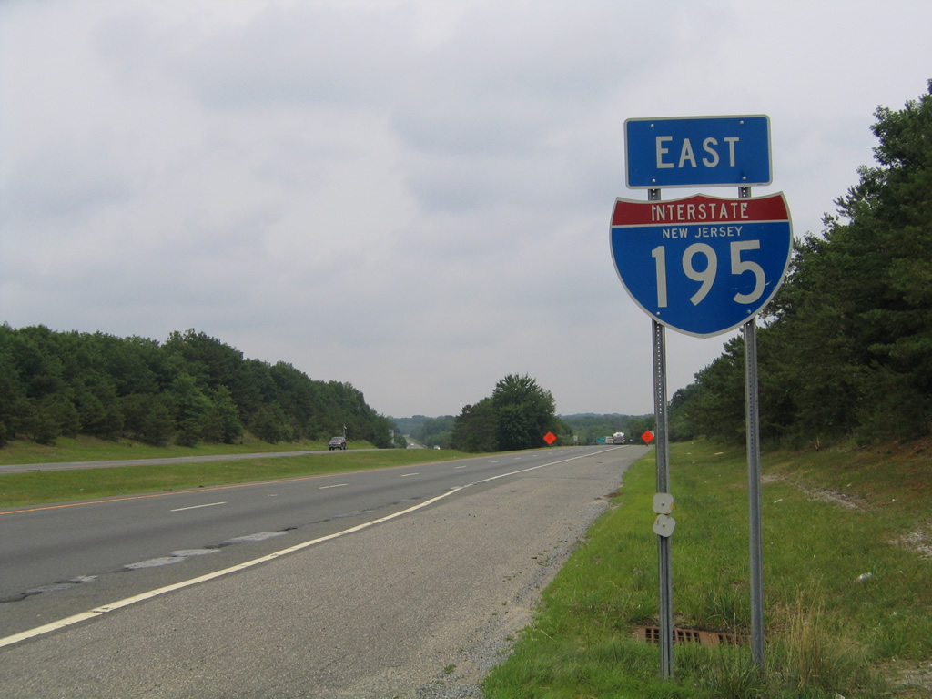
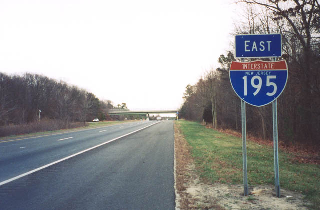
Interstate 195 East
 East
East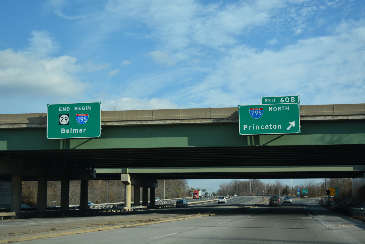
Interstate 195 begins eastbound at the Trenton Complex interchange (Exit 1) joining Route 29 south with I-295 in Hamilton Township.
12/19/17
Exit numbers for I-295 along I-195 were renumbered in 2018 from 60 to 1.
12/19/17
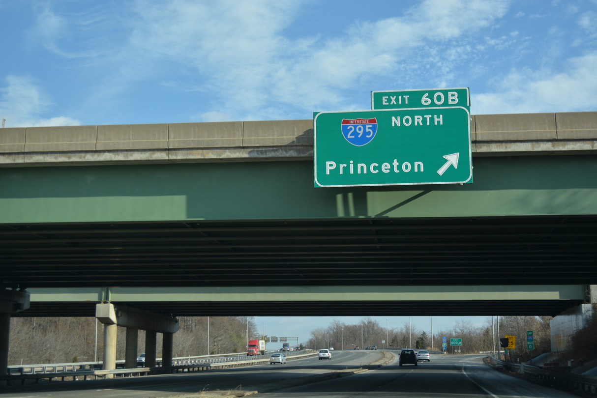
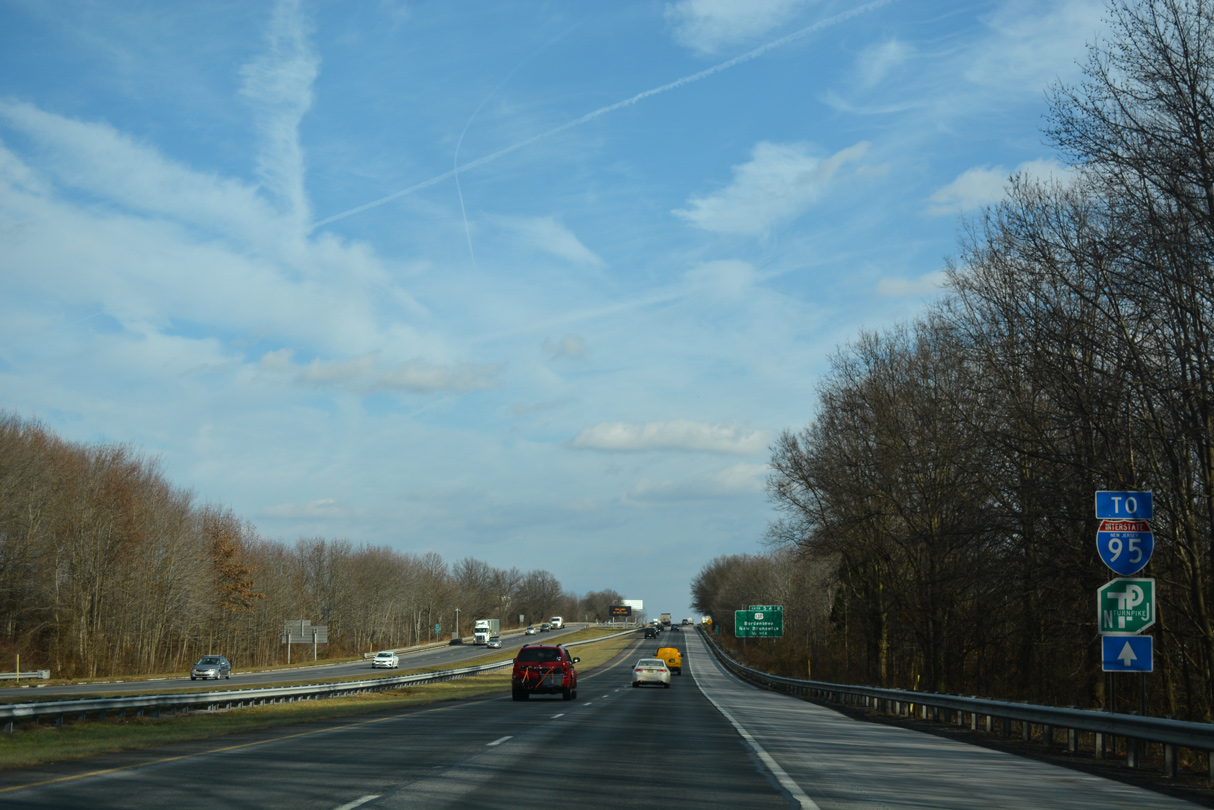
The collector distributor roadway linking the south end of Route 29 with I-295 concludes along I-195 east beyond trailblazers for I-95/New Jersey Turnpike.
12/19/17
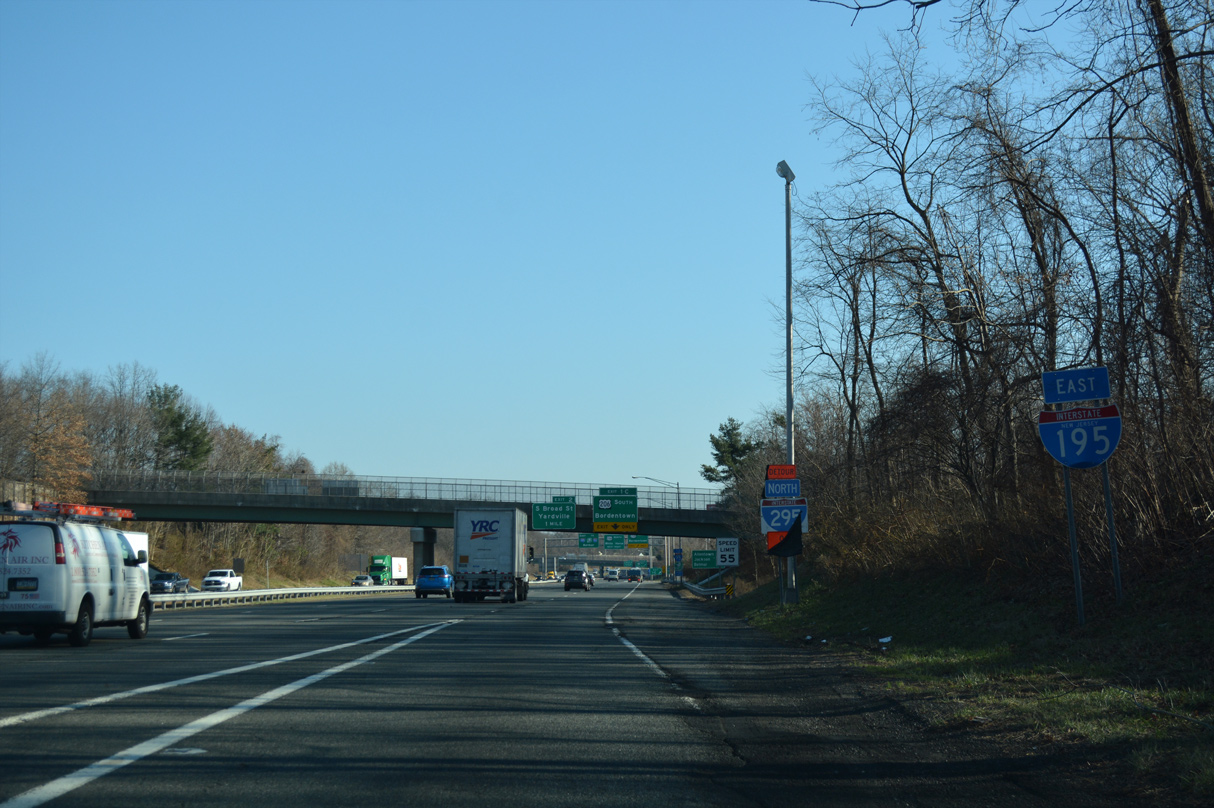
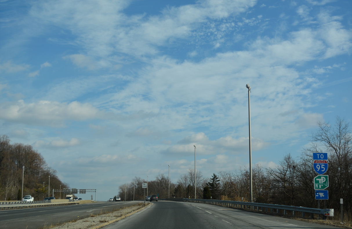
The first confirming marker for Interstate 195 east stands between the directional cloverleaf interchange with I-295 and Route 29 and Hobson Avenue overpass.
12/27/18
The borough of Allentown lies eight miles east beyond the New Jersey Turnpike via Interstate 195.
12/27/18

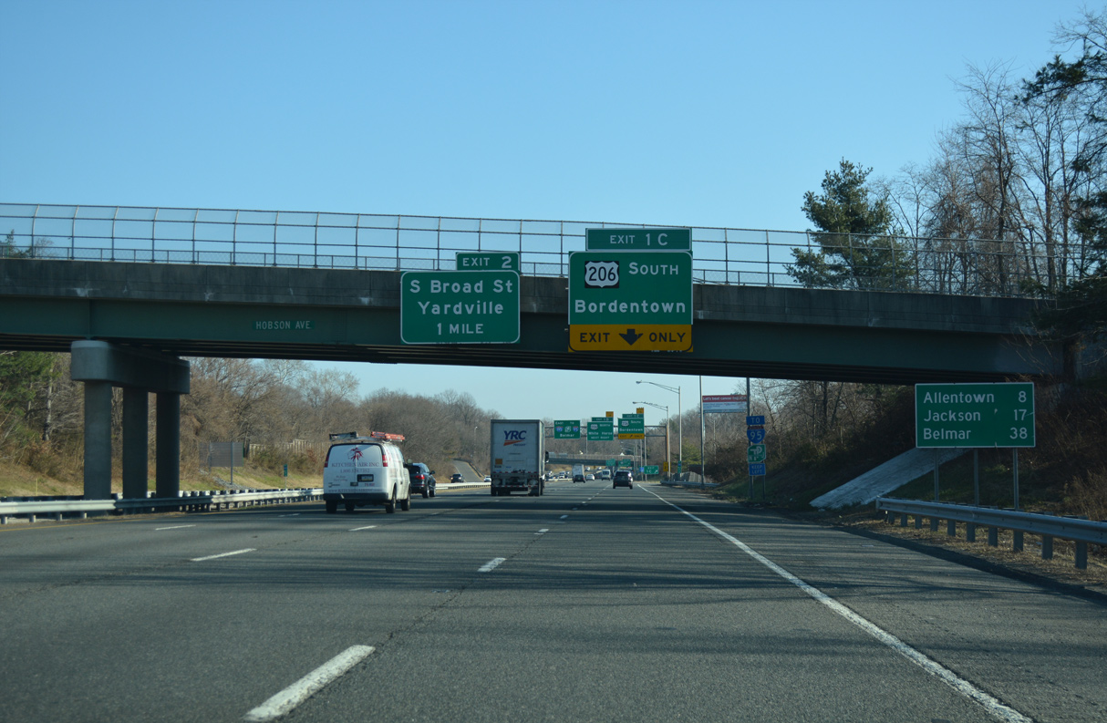
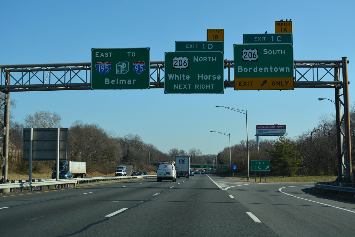
U.S. 206 meets I-195 at a half cloverleaf interchange (Exits 1 C/D) in Hamilton Township. Exit 1 C joins U.S. 206 south across Crosswicks Creek into Bordentown Township.
12/27/18
U.S. 206 (Bordentown Road) heads 2.4 miles south from Interstate 195 to an overlap with U.S. 130 at city of Bordentown.
12/27/18
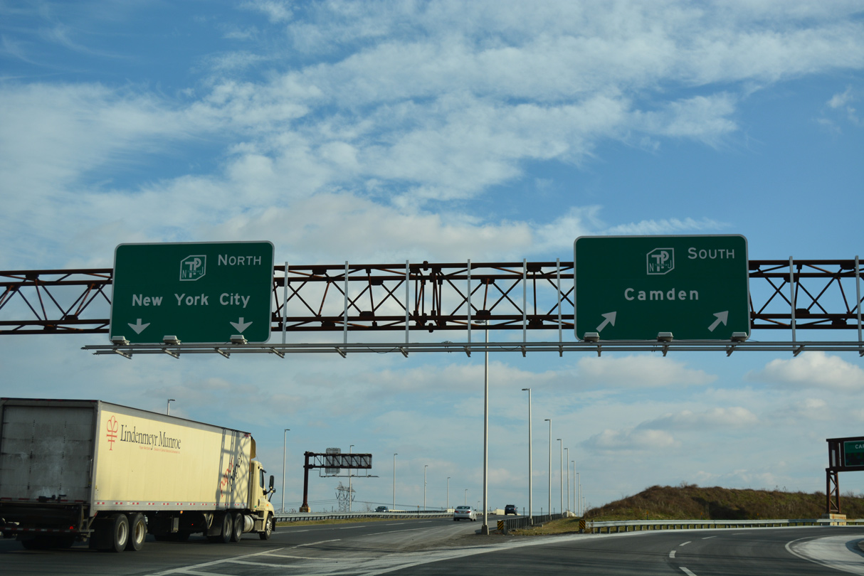
Signs directing motorists from I-295 to I-95 and the NJ Turnpike via I-195 east were installed in the Trenton area by April 2004. These were added after reassurance markers for I-95 appeared along the Turnpike mainline.
12/27/18

Exit 1 D loops onto U.S. 206 north ahead of the westerly turn onto Broad Street through White Horse. CR 533 (White Horse Avenue) south and CR 524 (S Broad Street) west tie into U.S. 206 at a roundabout nearby from Mercerville and Yardville respectively.
12/27/18
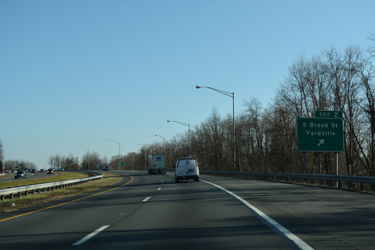
Interstate 195 progresses east through an S-curve by wetlands areas associated with Crosswicks Creek ahead of a modified diamond interchange (Exit 2) with CR 524 (S Broad Street).
12/27/18
Connecting White Horse with Yardville in east Hamilton Township, CR 524 commences a 39.90 mile long route east at U.S. 206.
12/27/18
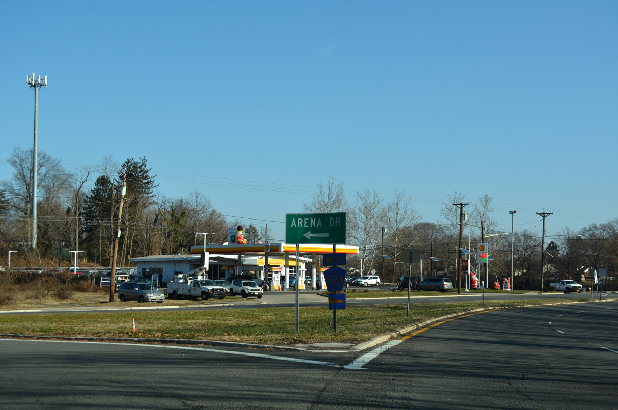
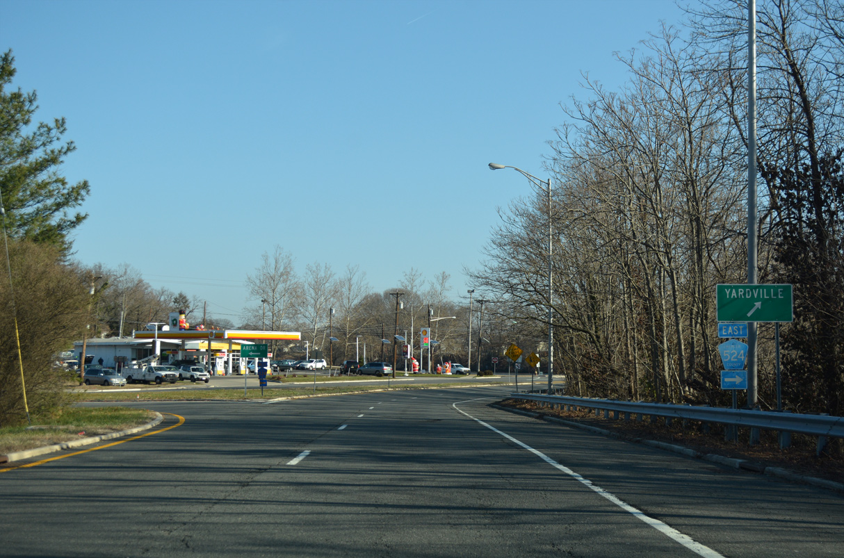
Arena Drive (CR 620) angles northwest from CR 524 (S Broad Street) within the exchange at I-195. Located just west of I-195, Hempstead Road north links CR 524 with Arena Drive north.
12/27/18
A set of trailblazers for I-95 and the New Jersey Turnpike appear along I-195 east within the exchange for CR 524 (Broad Street) and CR 620 (Arena Drive) at White Horse.
08/29/05
Interstate 195 shifts northward by Gropp Lake over the ensuing mile.
12/19/17
Another set of trailblazers for I-95 and the New Jersey Turnpike posted along I-195 east. I-95 was relocated southward onto the Pearl Harbor Memorial Extension east from I-276/PA Turnpike to the NJ Turnpike mainline at Exit 6 in 2018.
04/25/04
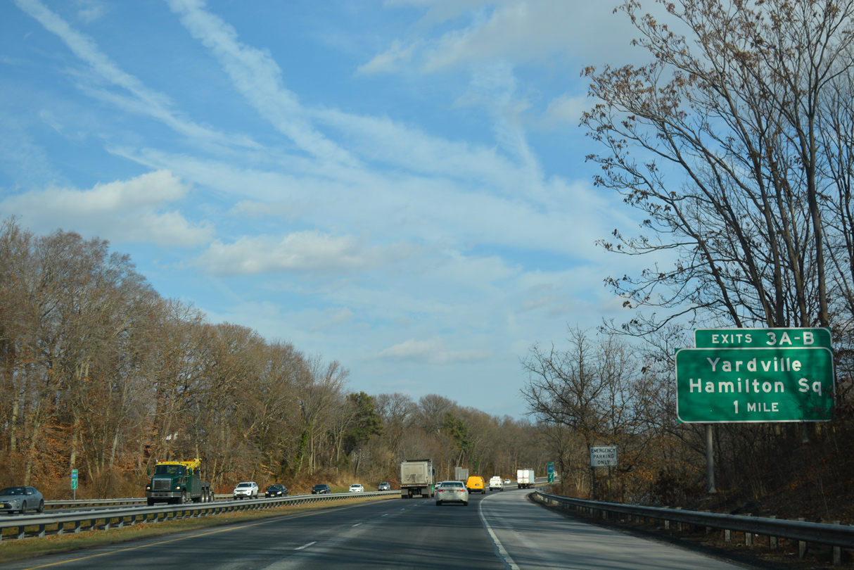
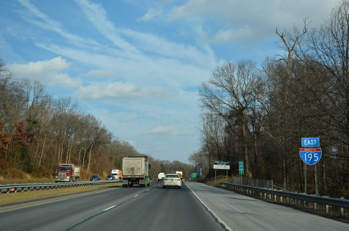
A cloverleaf interchange (Exits 3 A/B) joins Interstate 195 with Yardville Hamilton Square Road in one mile.
12/19/17

Yardville Hamilton Square Road winds southwest from Exit 3 A by a number of residential subdivisions 1.5 miles to County Route 524 (Broad Street) in Yardville.
12/19/17

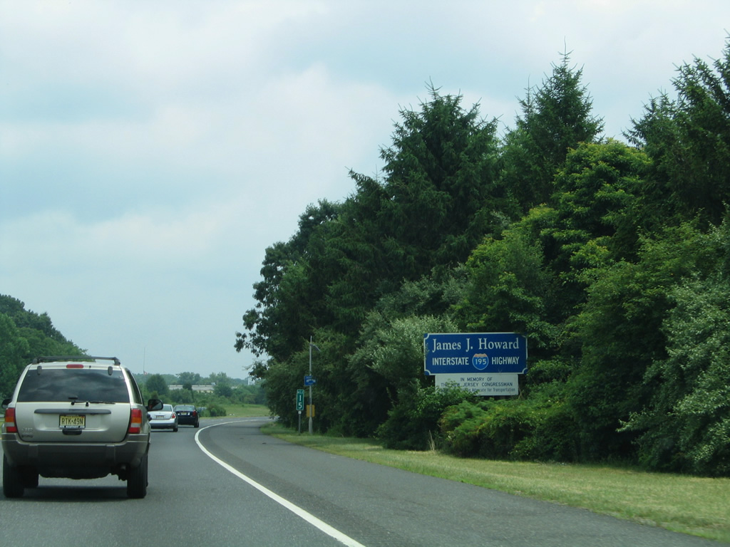
I-195 is the James J. Howard Interstate Highway. Serving in the U.S. Congress from 1965 to his death in 1988, Howard worked on transportation issues such as the 1974 national 55 mile per hour speed limit initiative and the Motor Carrier Act of 1980. I-195 was named to honor him on April 6, 1988 in a bill signed by President Ronald Reagan.1
12/19/17
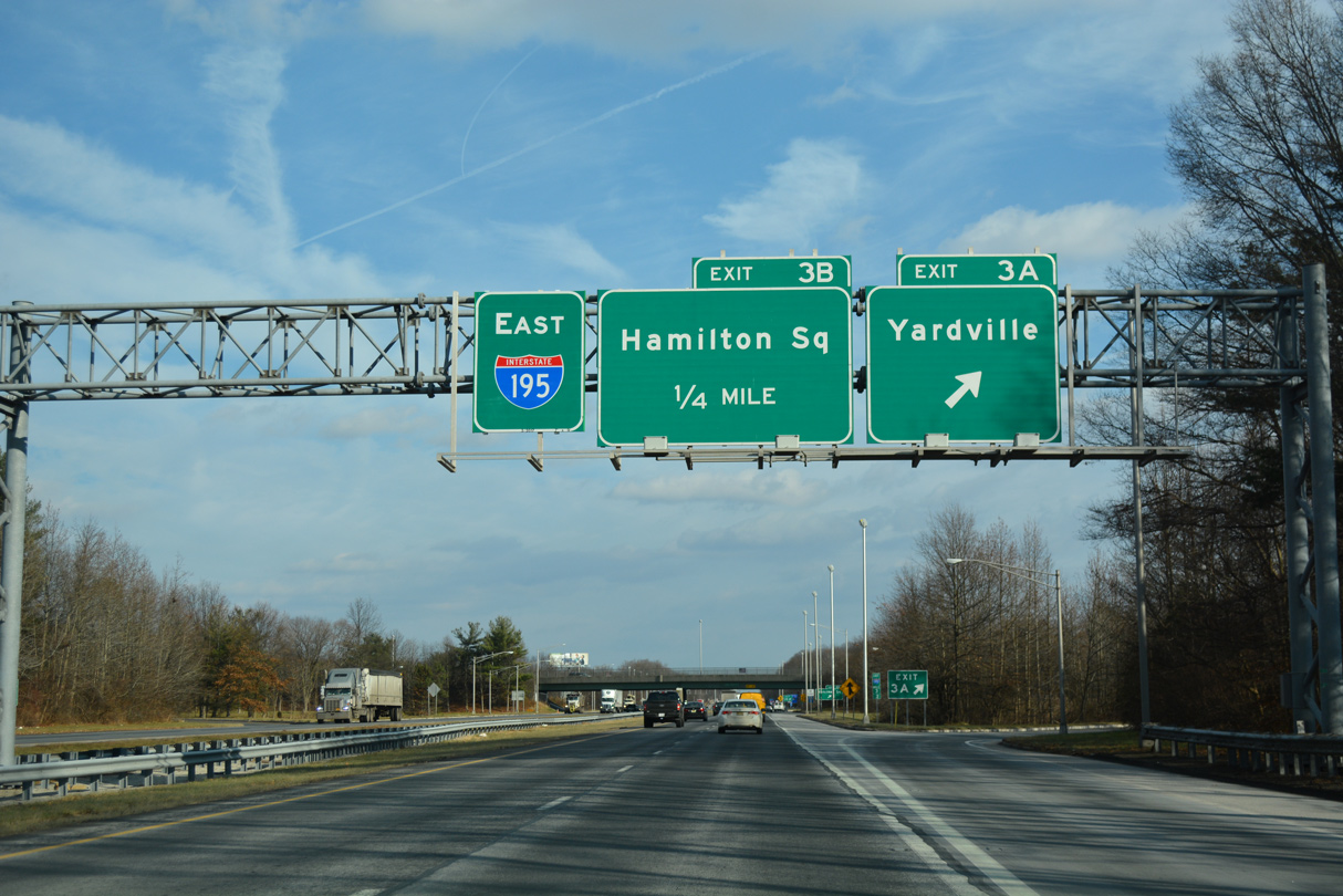
Exit 3 A departs I-195 east for Yardville Hamilton Square Road south to CR 524 (S Broad Street) and CR 609 (Church Street) in Yardville.
12/19/17

Traffic to Hamilton Square loops away from Interstate 195 east at Exit 3 B. Yardville Hamilton Square Road remains suburban north by Veterans Park to Route 33.
12/19/17
Interstate 195 continues through east Hamilton Township.
12/19/17
U.S. 130 converges with I-195 at a cloverleaf interchange (Exits 6 A/B) in 0.75 miles.
12/19/17
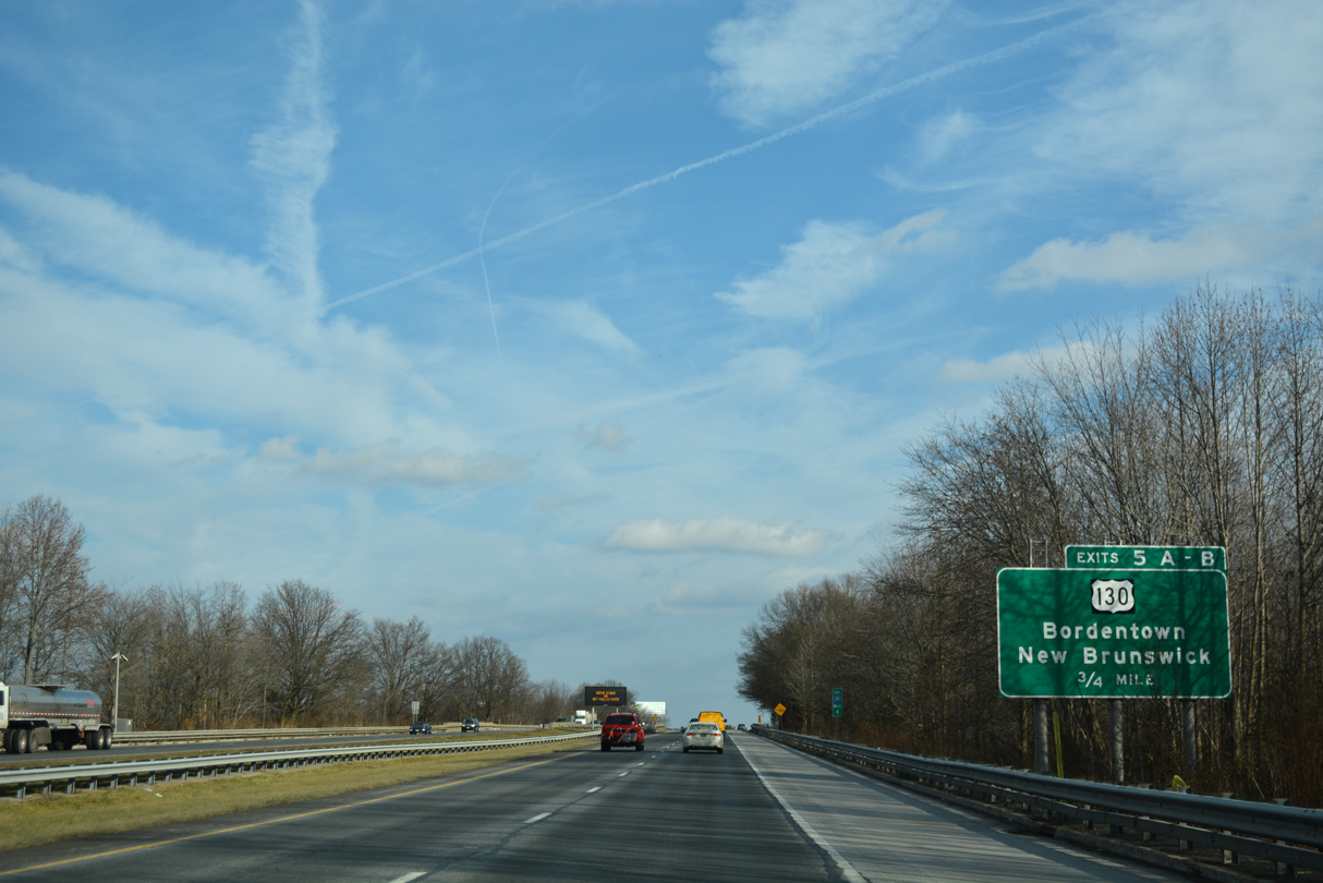
Interstate 195 spans both Klockner Road and an abandoned Conrail line just ahead of Exit 5 A. U.S. 130 leads southwest 2.5 miles back to Yardville and 6.5 miles to Bordentown and U.S. 206.
12/19/17
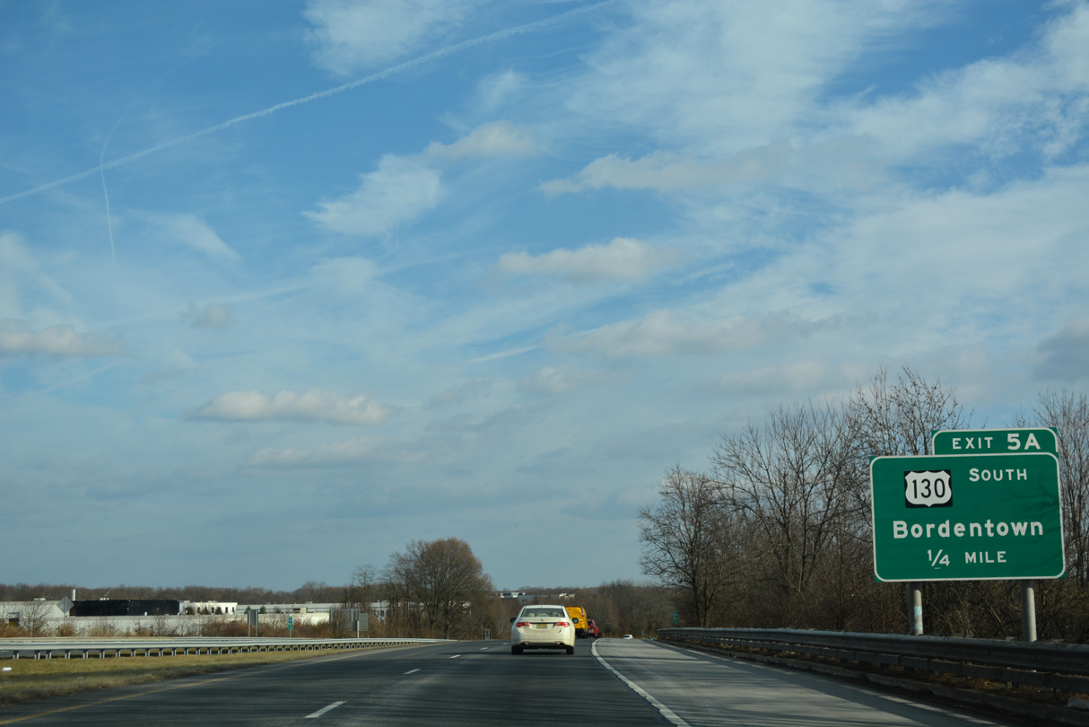
Exit 5 A leaves I-195 east for U.S. 130 south. U.S. 130 travels just 83.46 miles overall between I-295 at Deepwater and U.S. 1 at North Brunswick.
12/19/17
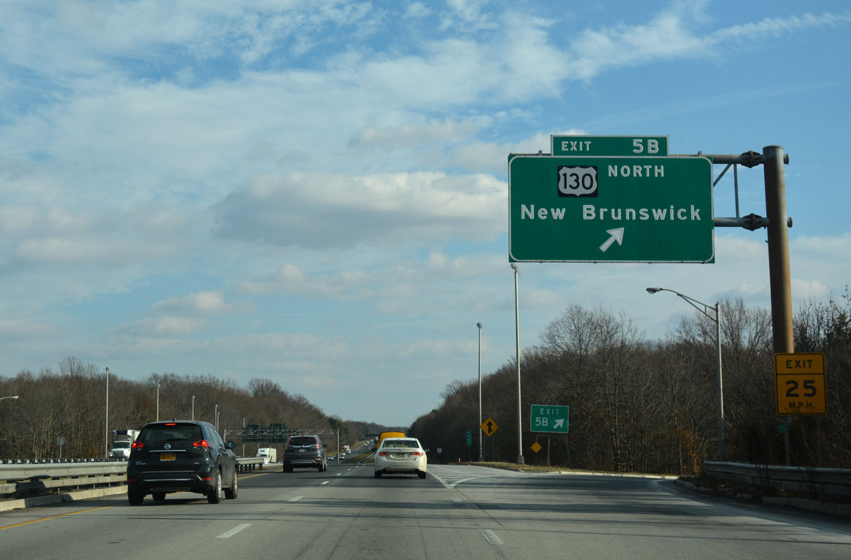
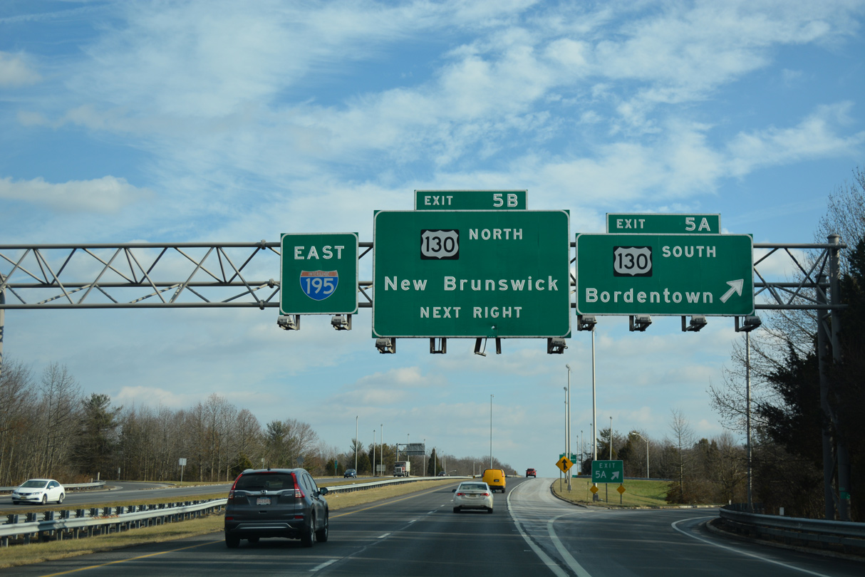
U.S. 130 north from Exit 5 B provides a slower alternate route to U.S. 1 and the New Jersey Turnpike between the Trenton area and New Brunswick in North Jersey. U.S. 130 concludes in 22 miles at a interchange with U.S. 1 and Route 171 in North Brunswick Township.
12/19/17
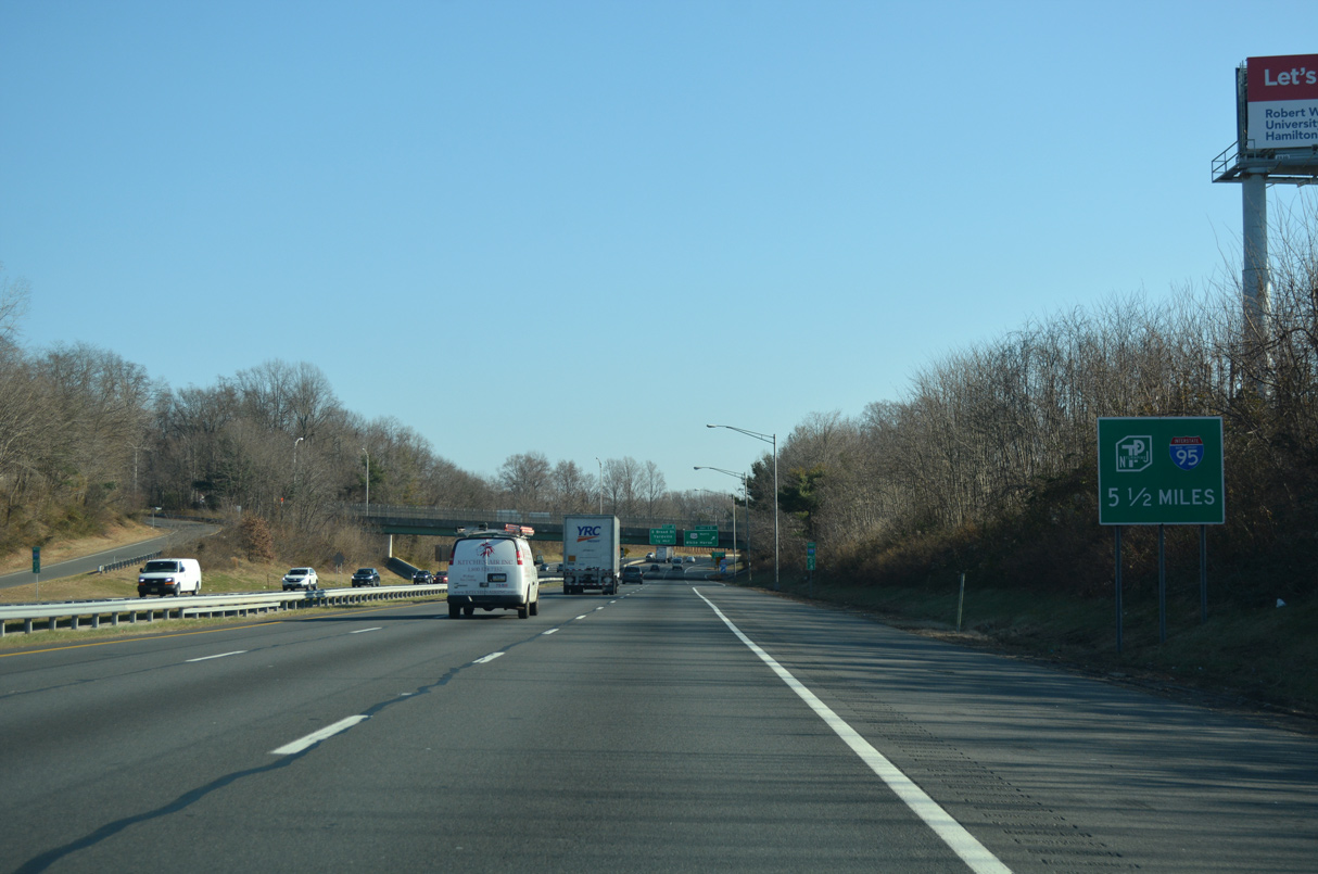
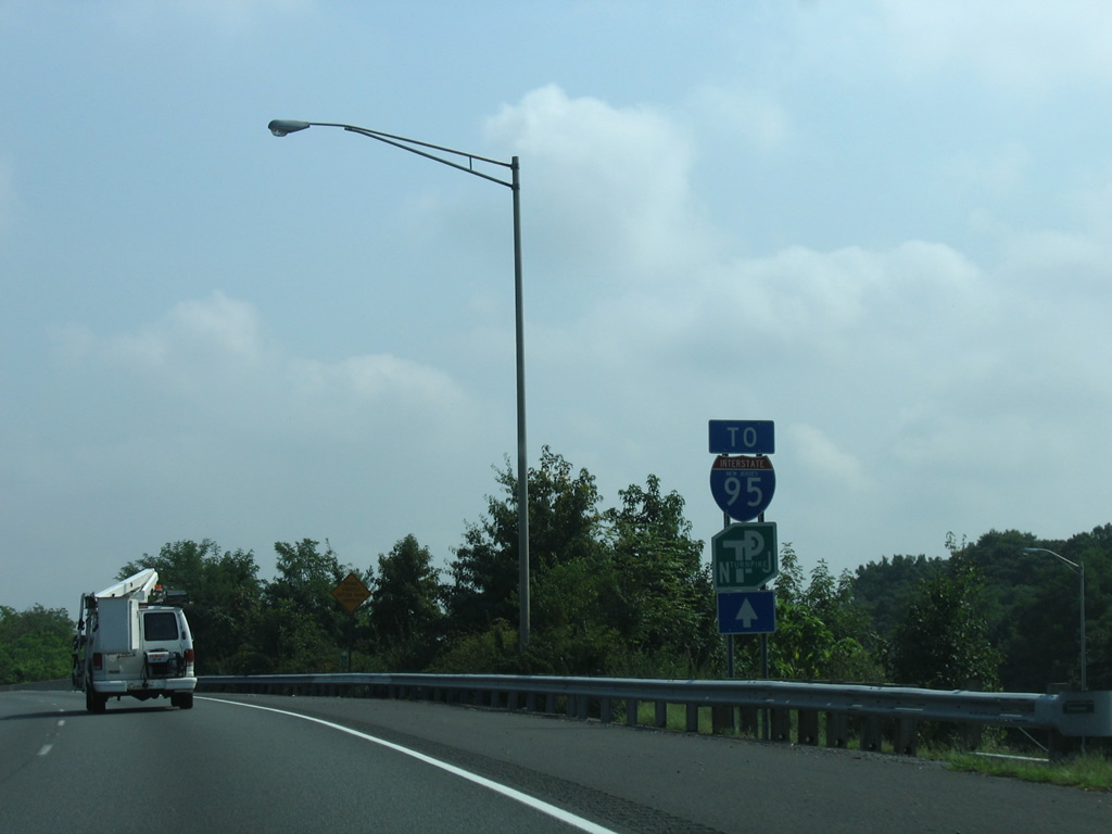
Advancing 0.75 miles east, the succeeding exit from Interstate 195 links with I-95/New Jersey Turnpike. Guide signs posted by April 2004 along I-195 referenced I-95 for the Turnpike.
12/19/17
Interstate 195 crosses into Robbinsville Township along the stretch preceding the NJ Turnpike.
12/19/17
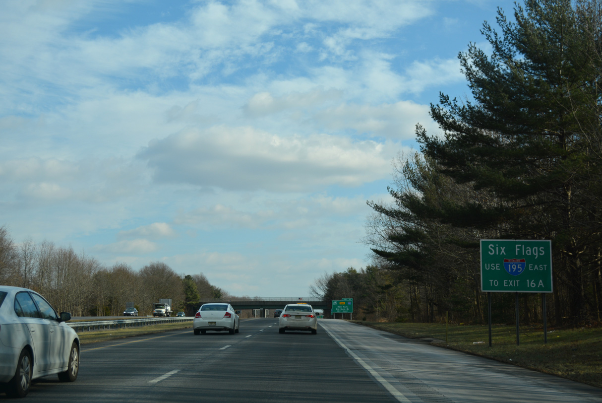
Six Flags Great Adventure theme park lies further east along I-195 east off Exit 16 A.
12/19/17
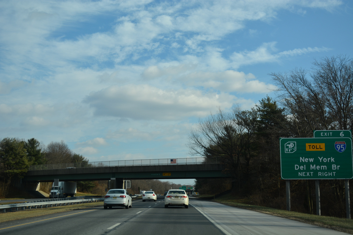
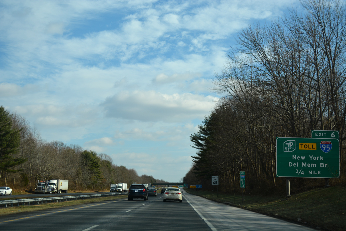
Richardson Road spans I-195, one quarter mile ahead of Exit 6 for I-95 (New Jersey Turnpike). The New Jersey Turnpike extends 60 miles south to I-295/U.S. 40 near the Delaware Memorial Bridge.
12/19/17
A trumpet interchange at Exit 6 connects with an access road and toll plaza for the New Jersey Turnpike. I-95 follows the Turnpike north 57 miles to U.S. 46 at Ridgefield Park.
12/19/17
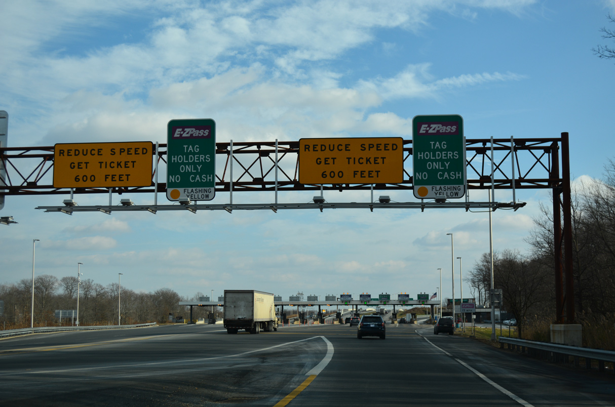
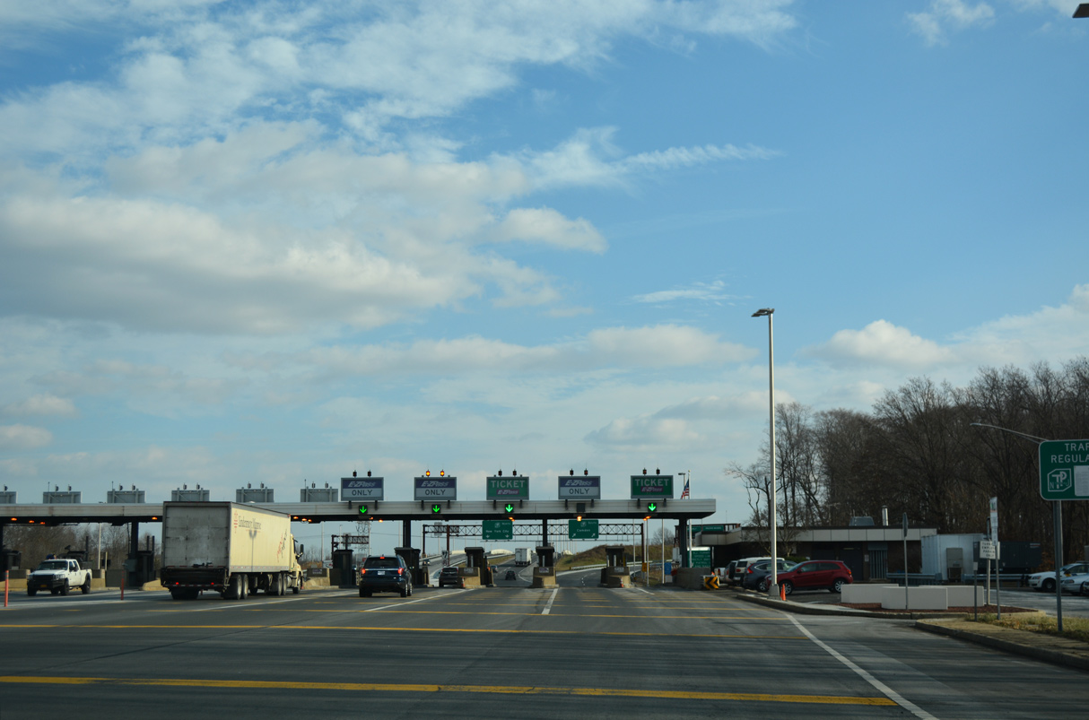
A toll plaza precedes the trumpet interchange joining I-195 with I-95 (New Jersey Turnpike).
12/19/17
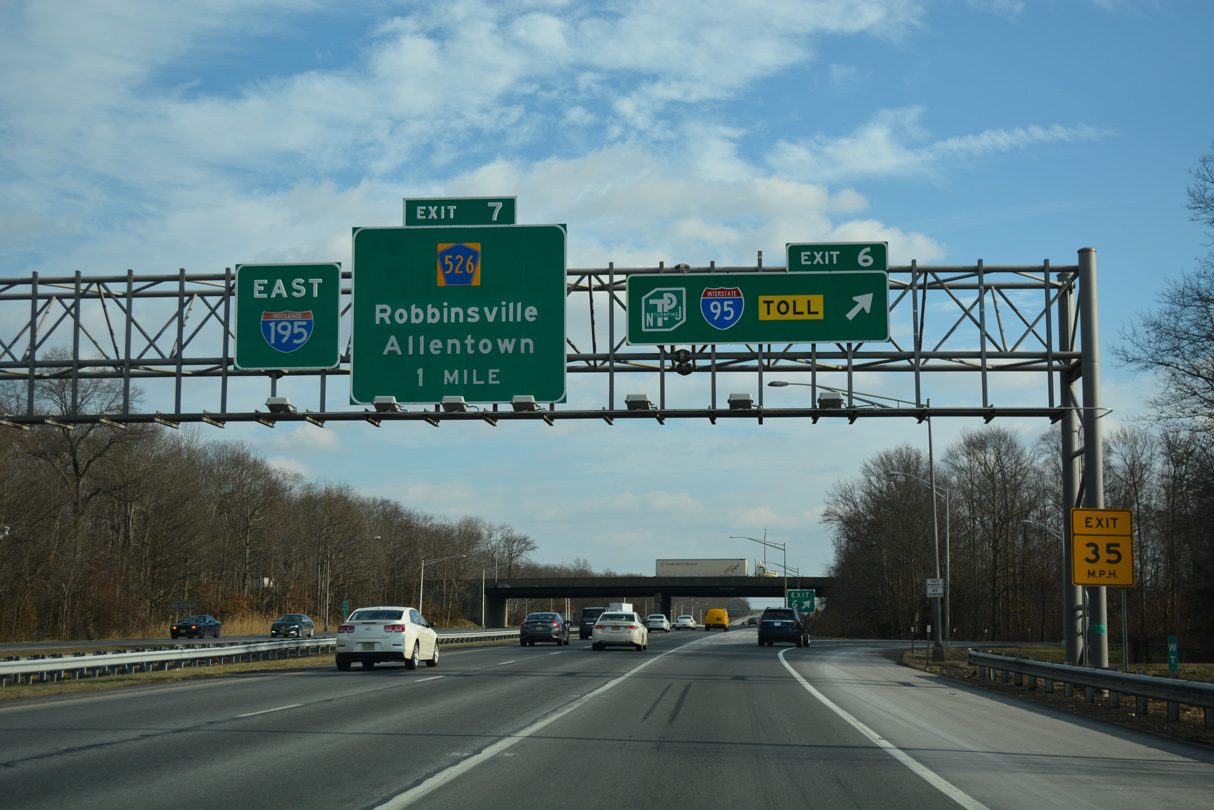
Turnpike widening between 2009-14 included redesigning the exchange at Exit 7 A to include a high speed ramp for Interstate 95 north to New York.
12/19/17
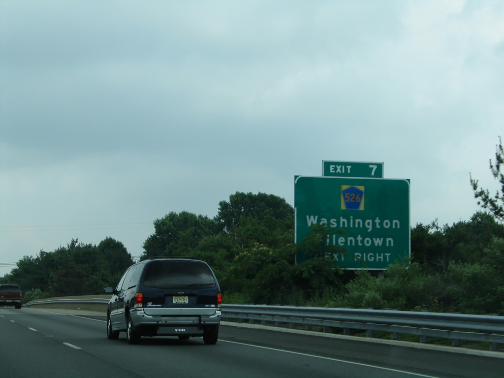
Exit 7 with County Route 526 (Robbinsville Allentown Road) follows just east of I-95 by Northeast Business Park and the borough of Allentown. Signs for Exit 7 referenced Washington Township, which was the name of Robbinsville Township until November 6, 2007. The area was renamed to distinguish it from five other Washington Townships in the state.2
06/30/05
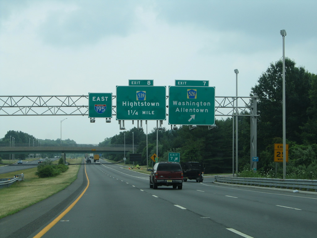
Entering the parclo interchange (Exit 7) with CR 526 (Robbinsville Allentown Road). County Route 526 travels 35.56 miles overall from CR 571 in West Windsor Township to CR 549 in Lakewood Township. The majority of the route east from Robbinsville parallels I-195.
06/30/05
CR 524/539 (Old York Road) combine in the borough of Allentown at Main Street east to a six-ramp parclo interchange (Exit 8) with Interstate 195.
06/30/05
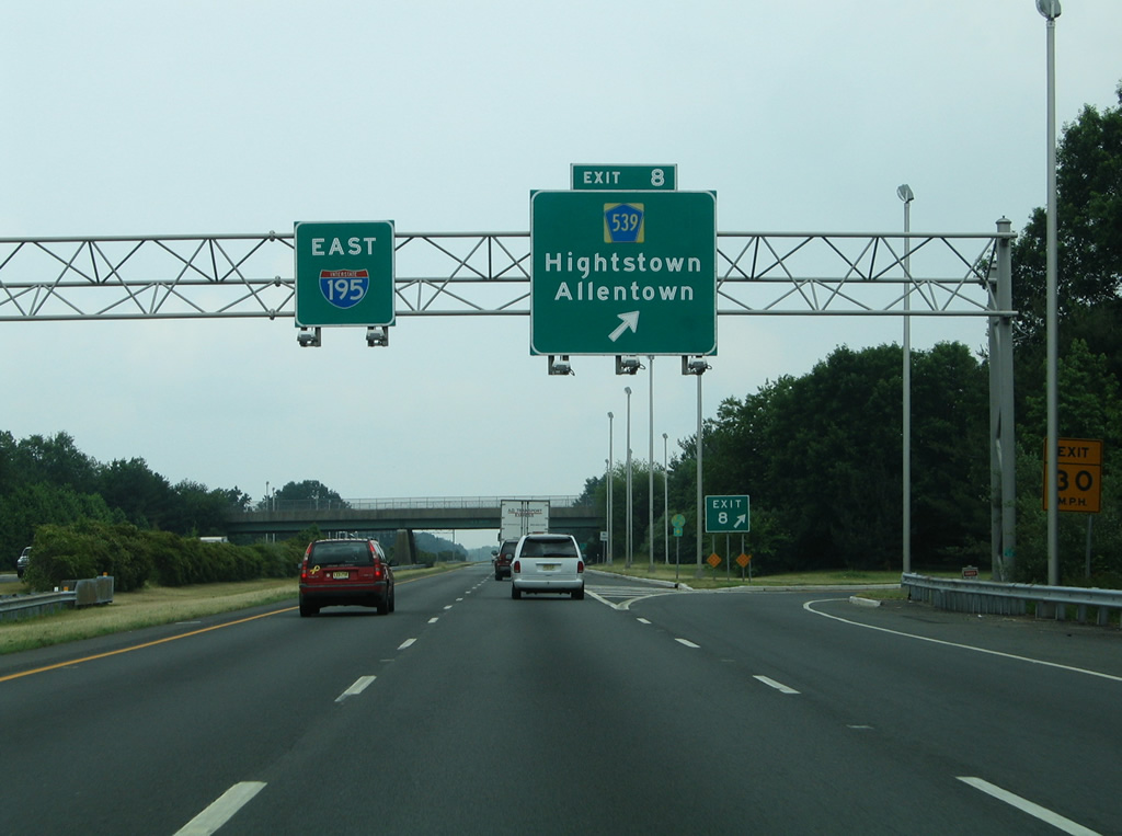
I-195 enters both Monmouth County and Upper Freehold Township at the CR 524/539 (Old York Road) overpass. CR 524 resumes an easterly course from New Canton to Wrightsville while CR 539 heads north to New Sharon, East Windsor Township and Hightstown.
06/30/05

A distance sign appears east of Exit 8 for Jackson (eight miles) and Belmar (29 miles). I-195 traverses agricultural areas and forest land to Jackson Mills.
08/29/05
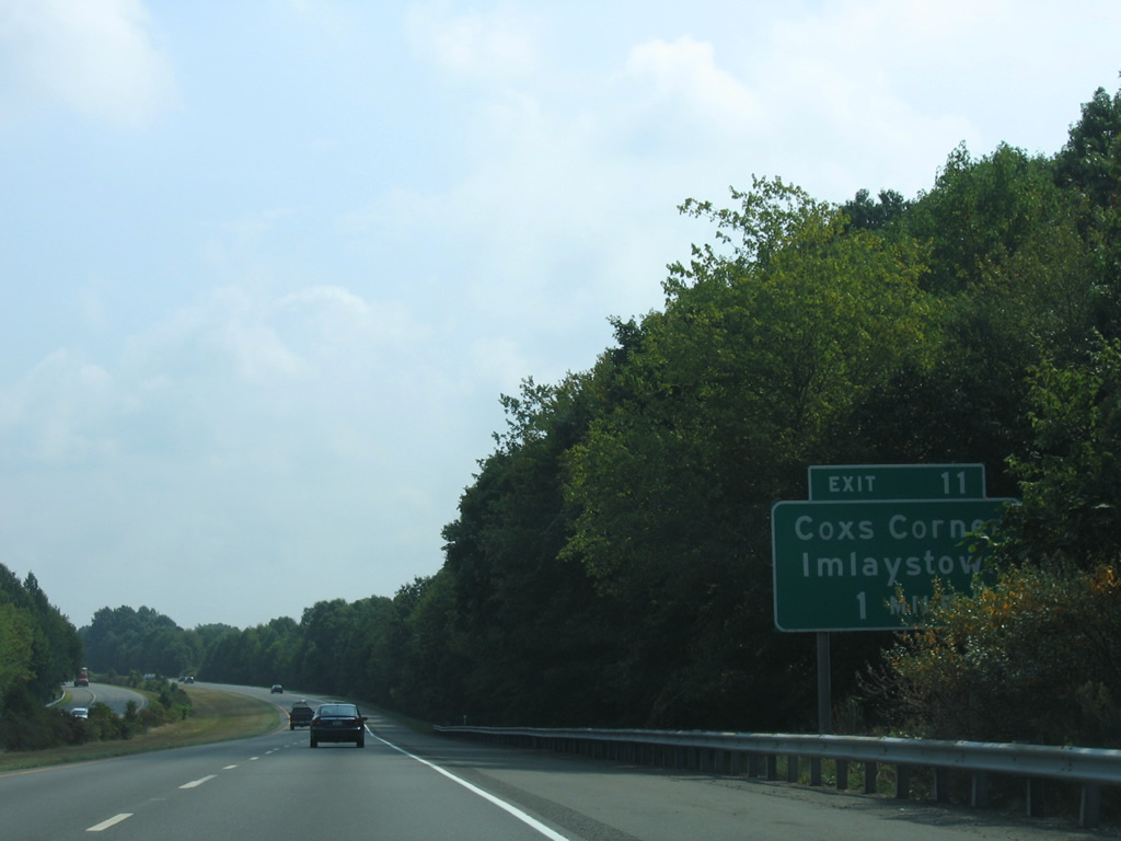
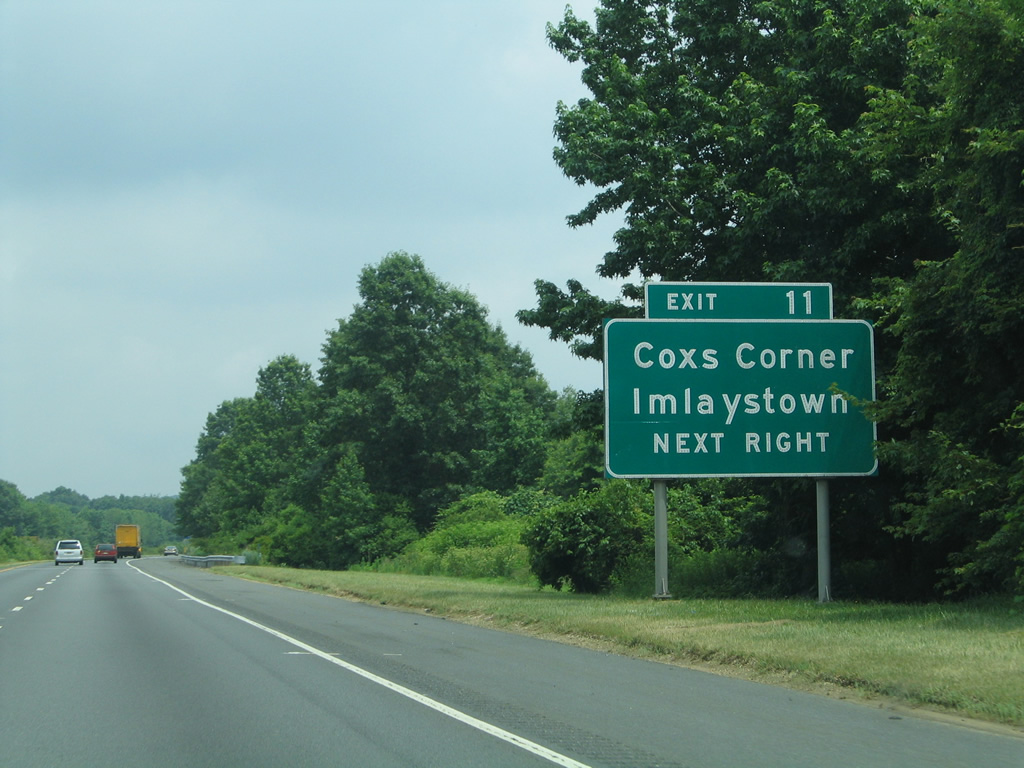
County Route 43 (Imlaystown Hightstown Road) meets Interstate 195 at Exit 11 in one mile. The rural route links I-195 with parallel CR 524 and CR 526.
08/29/05
Imlaystown Hightstown Road travels north from Exit 11 to Wrightsville and Coolers Corner along Assunpink Lake.
06/30/05
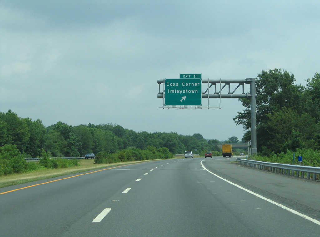
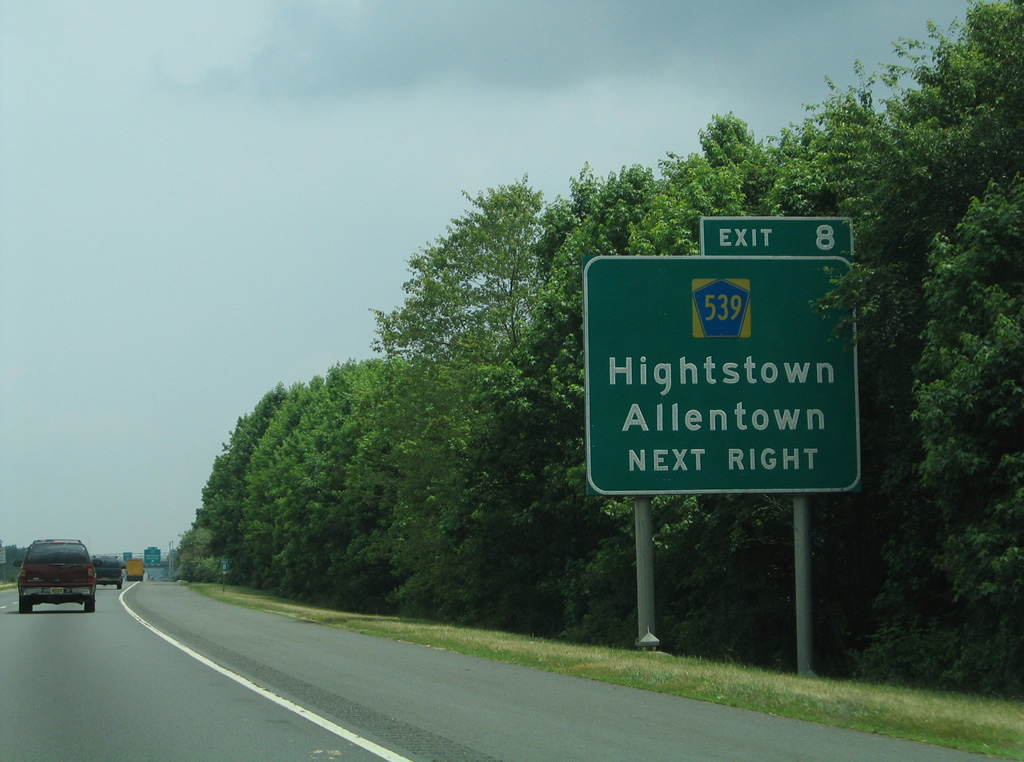
Exit 11 parts ways with I-195 east at the six-ramp parclo interchange with CR 43. Imlaystown lies 0.7 miles to the south along CR 526 (Allentown Lakewood Road).
06/30/05
A second sign along I-195 east honors James J. Howard at milepost 15.
06/30/05
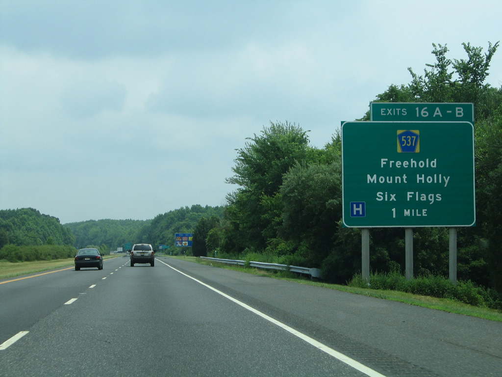
Interstate 195 reaches Millstone Township ahead of CR 537 (Monmouth Road) at Burkesville. CR 537 heads southwest to Six Flags Great Adventure, Prospertown and Hornerstown along the Ocean County line.
06/30/05
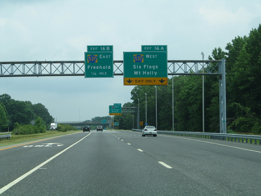
Exit 16A connects with CR 537 (Monmouth Road) west from a three quarter cloverleaf interchange with I-195. County Route 537 stretches all the way to Mount Holley and Camden as part of a 67.91 mile route.
06/30/05
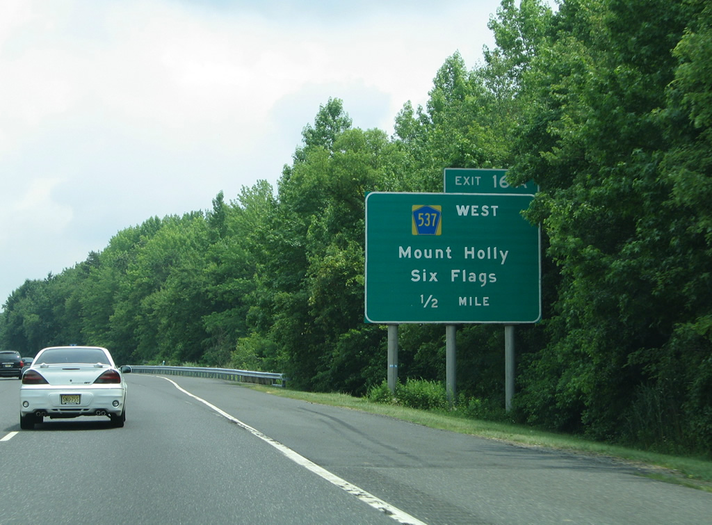
Solid striping restricts movements to the left lane of Interstate 195 to separate through traffic from potential backups for CR 537 west to Six Flags Great Adventure.
06/30/05
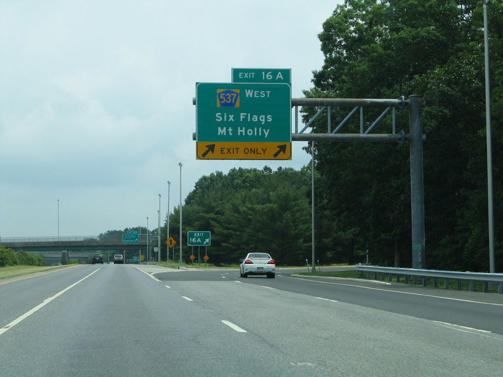
Two lanes separate from I-195 east to CR 537 (Monmouth Road) west. Home to 12 roller coasters, Six Flags Great Adventure spreads across 510 acres, representing the largest theme park in the world.
06/30/05

County Route 537 heads northeast to Freehold Township, Freehold boro and ultimately Long Branch.
06/30/05
Interstate 195 winds east through northern Ocean County by the community of Maryland. The second Jackson Township exit follows with County Route 527 (Cedar Swamp Road).
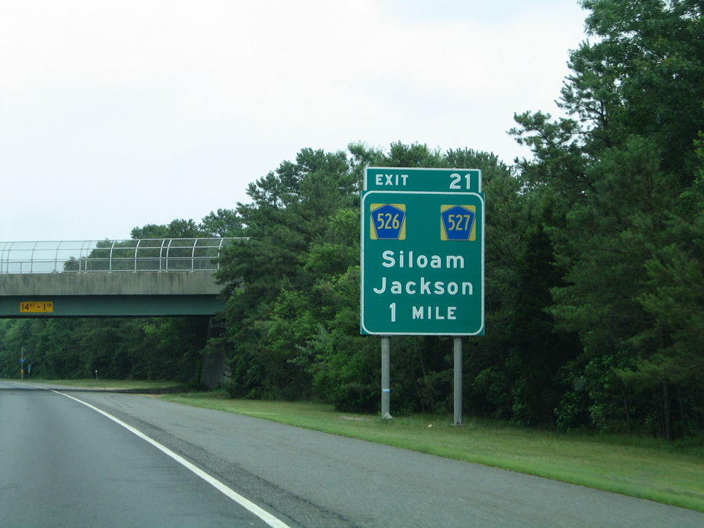
06/30/05
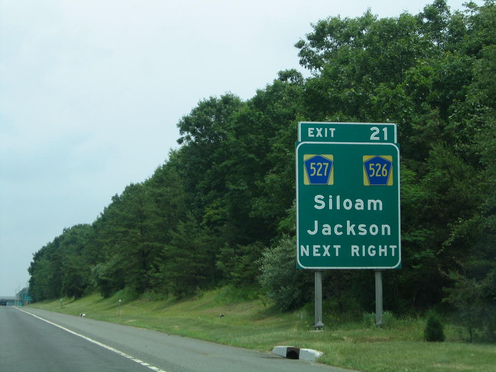
CR 527 intersects CR 526 (Commodore Boulevard) just south of the six-ramp parclo interchange (Exit 21) with Interstate 195. CR 526 travels east to Jackson Mills before turning more southward to Lakewood.
06/30/05
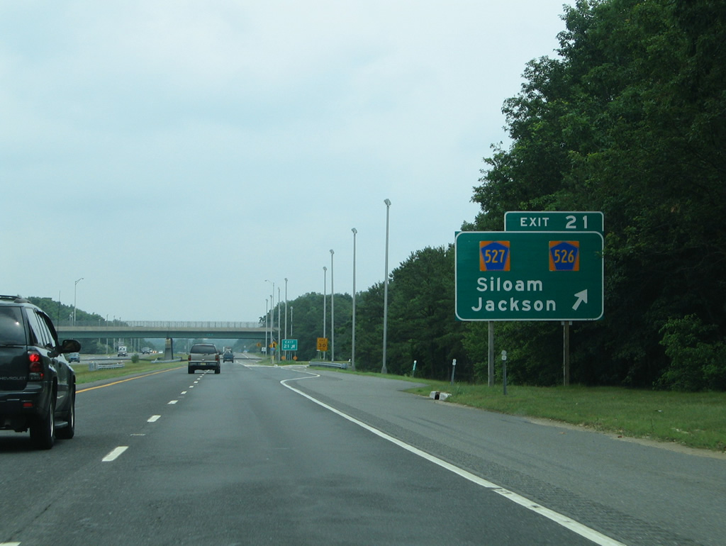
North from Exit 21, County Route 527 (Cedar Swamp Road) traverses the Pine Barrens to Siloam and Smithburg in Monmouth County.
06/30/05
A forested median appears along I-195 to the north of Jackson Mills Lake.
06/30/05
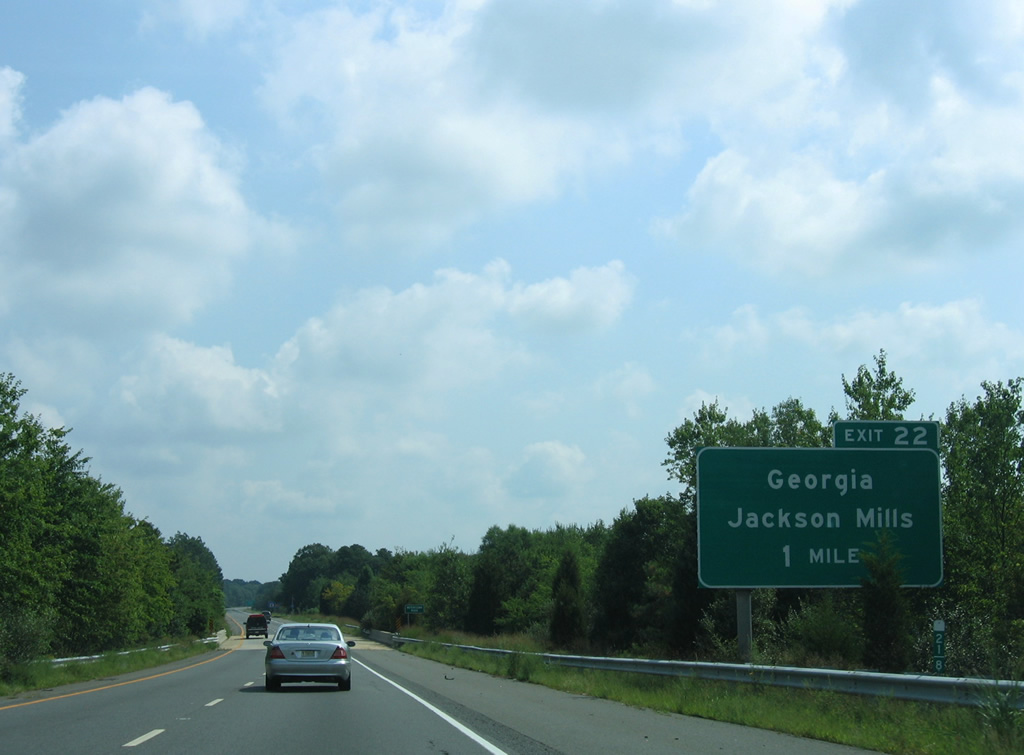
Crossing the Metedeconk River, one mile ahead of a six-ramp parclo interchange (Exit 22) with Jackson Mills Road (CR 638).
08/29/05
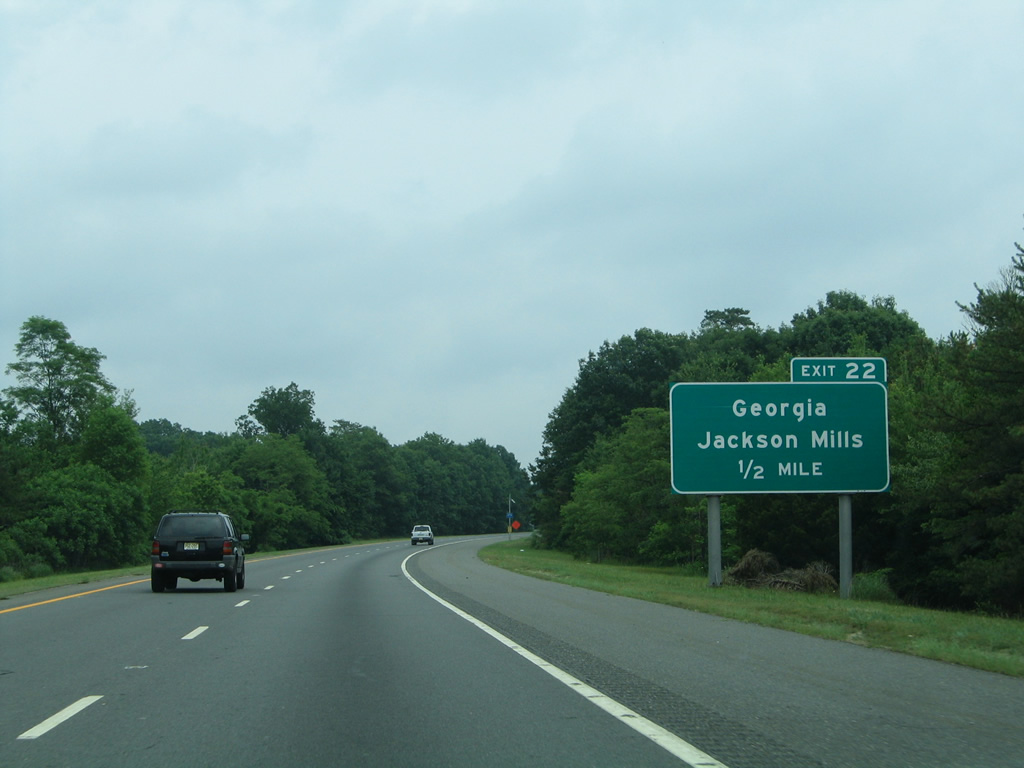
Jackson Mills Road (CR 638) extends northeast from CR 526 (County Line Road) at Jackson Mills to Interstate 195 by the Four Seasons at Metedeconk Lakes suburban community.
06/30/05
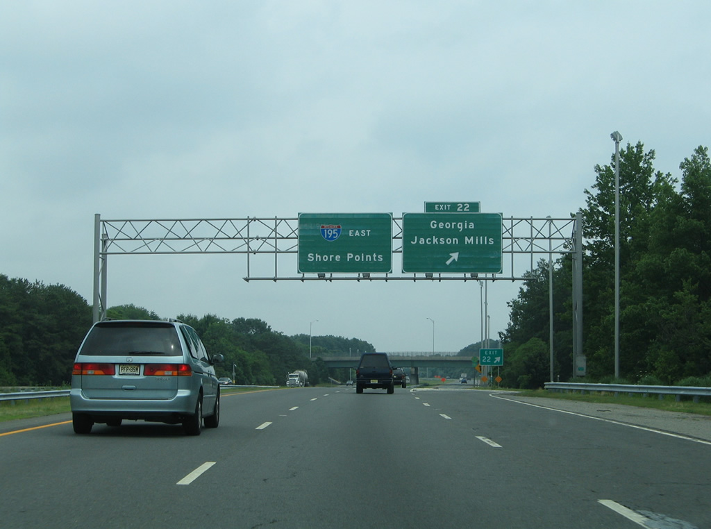
North from Exit 22, Jackson Mills Road (CR 638) becomes Monmouth County 23 into Freehold Township. The rural highway heads to Georgia midway between I-195 and U.S. 9 near Adelphia.
06/30/05
Suburban development increases along the Interstate 195 corridor as the freeway pushes east toward Howell Township. Pictured here is a former reassurance marker posted ahead of the CR 641 overpass.
12/23/01
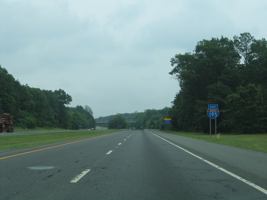
The relocated shield for I-195 east precedes the bridge over the North Branch Metedeconk River. The waterway represents the Monmouth County line across the freeway.
06/30/05
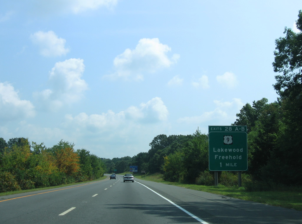
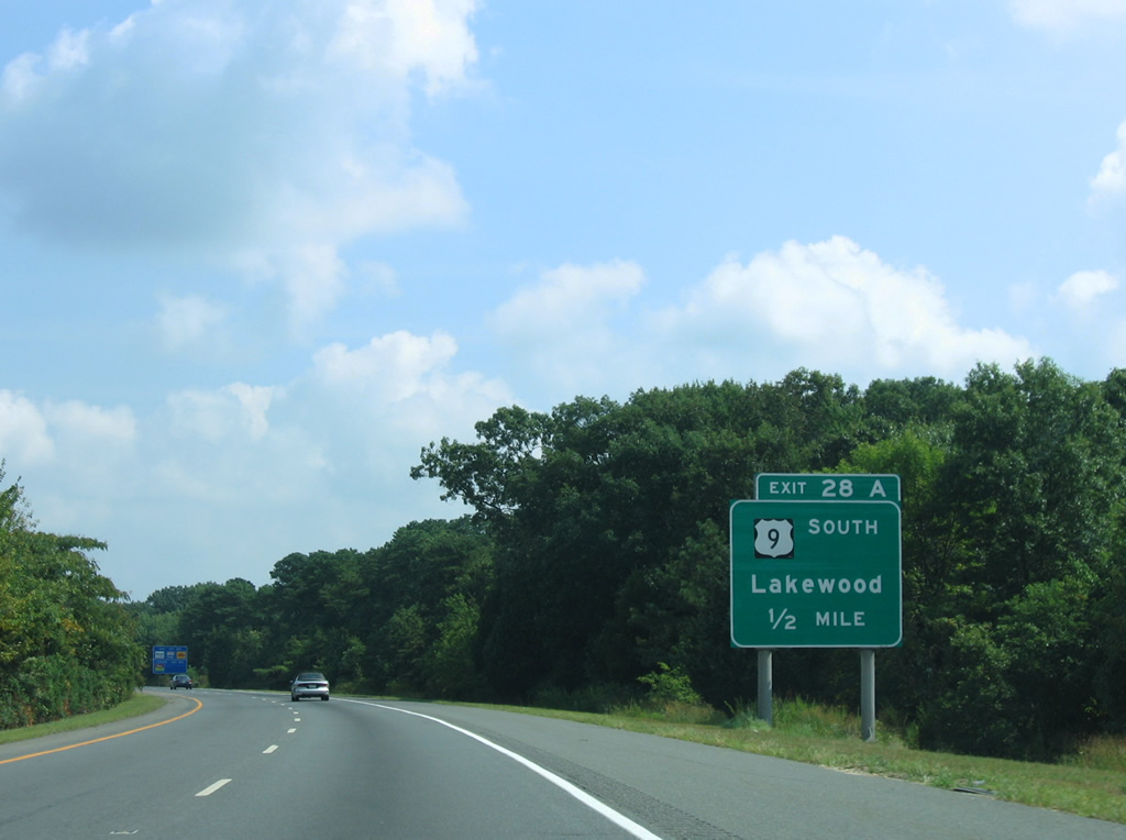
Interstate 195 curves northeast from Matthews to Freewood Acres and a cloverleaf interchange (Exits 28A/B) with U.S. 9.
08/29/05
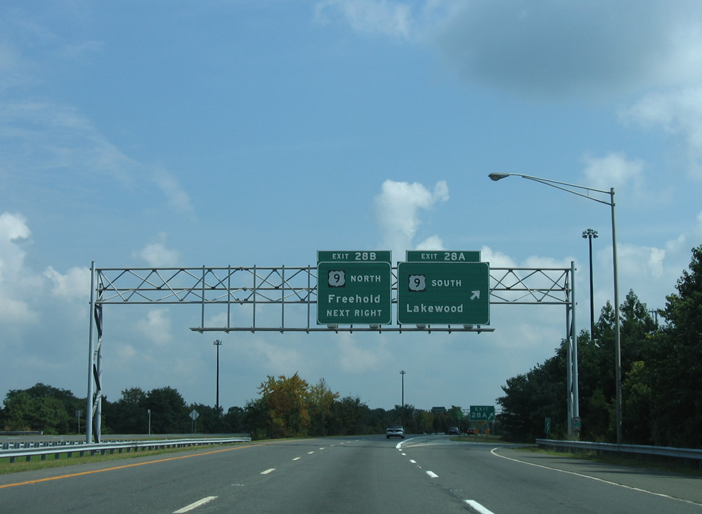
One half mile ahead of Exit 28 A to U.S. 9 south for Candlewood, Lakewood and Georgian Court University.
08/29/05
U.S. 9 constitutes an arterial route between Lakewood and Freehold through eastern Monmouth County. The highway runs 522 miles overall from Laurel, Delaware to Champlain, New York.
08/29/05
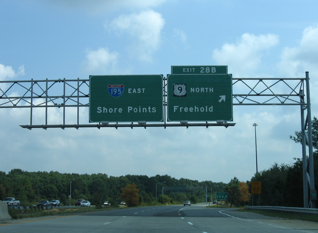
Exit 28B loops onto U.S. 9 north to Fort Plains and Freehold.
08/29/05
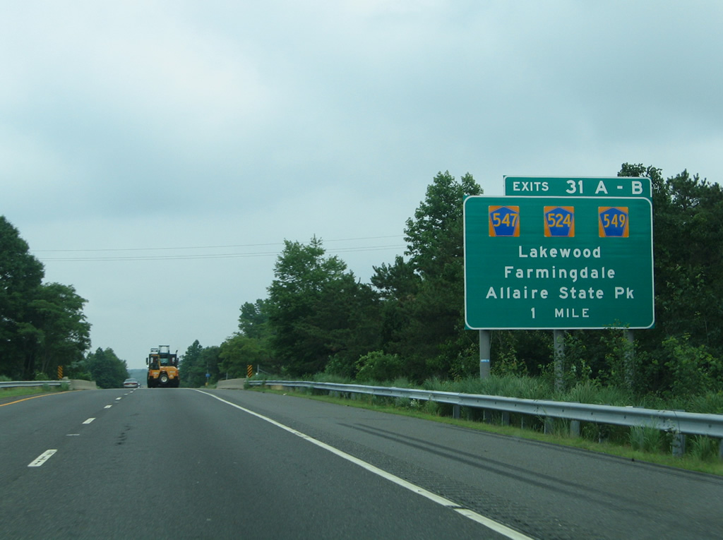
Another forested stretch along Interstate 195 east culminates at the cloverleaf interchange (Exits 31 A/B) with County Route 547 (Lakewood Farmingdale Road) at Squankum.
06/30/05
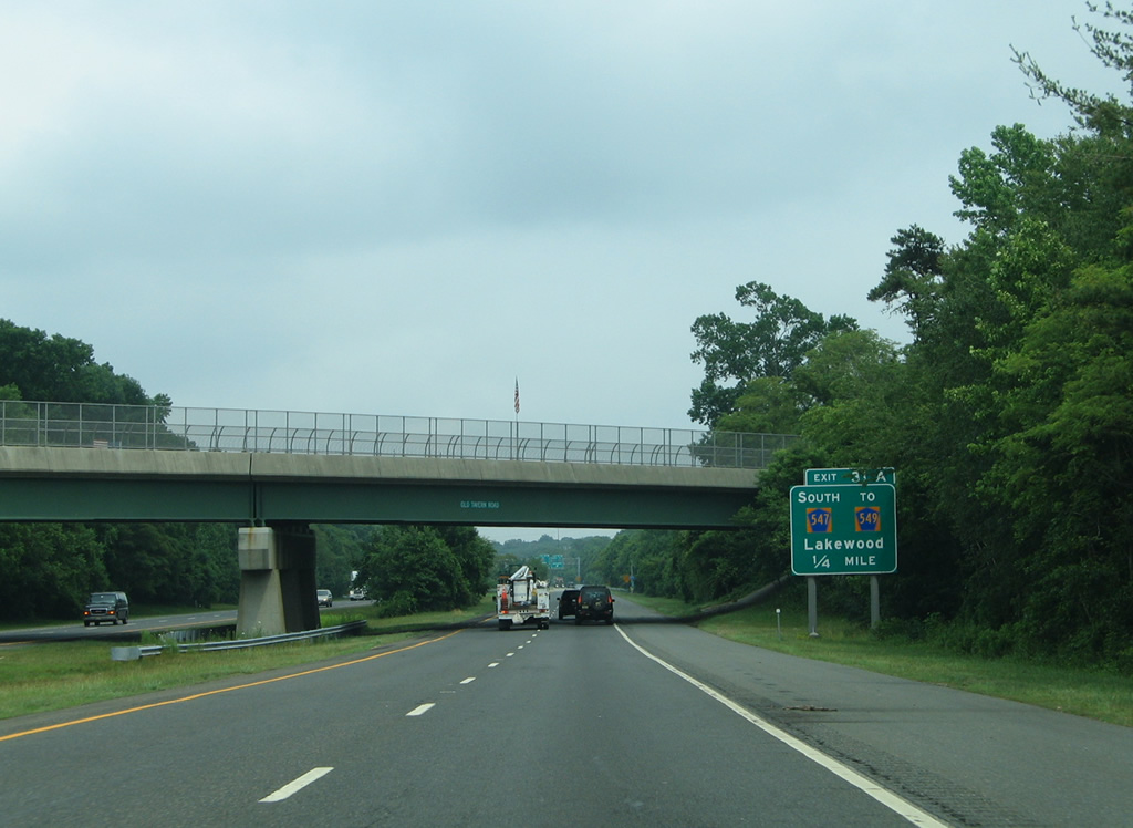
Old Tavern Road (CR 21) passes over I-195 east, one quarter mile ahead of Exit 31 A for CR 547 south to CR 549 at Lower Squankum and Allaire State Park.
06/30/05
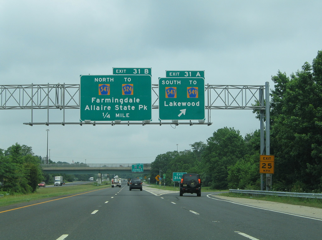
CR 549 (Herbertsville Road) angles southeast to Brick Township from CR 547 (Lakewood Farmingdale Road) just south of Exit 31 A and the Manasquan River. CR 547 bee lines southwest to Lakewood.
06/30/05
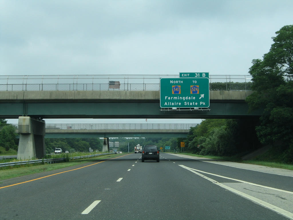
CR 524 (Lakewood Farmingdale Road) heads north from Exit 31 B to Main Street through the borough of Farmingdale while CR 524A (Squankum Yellowbrook Road) branches northwest as a bypass route.
06/30/05
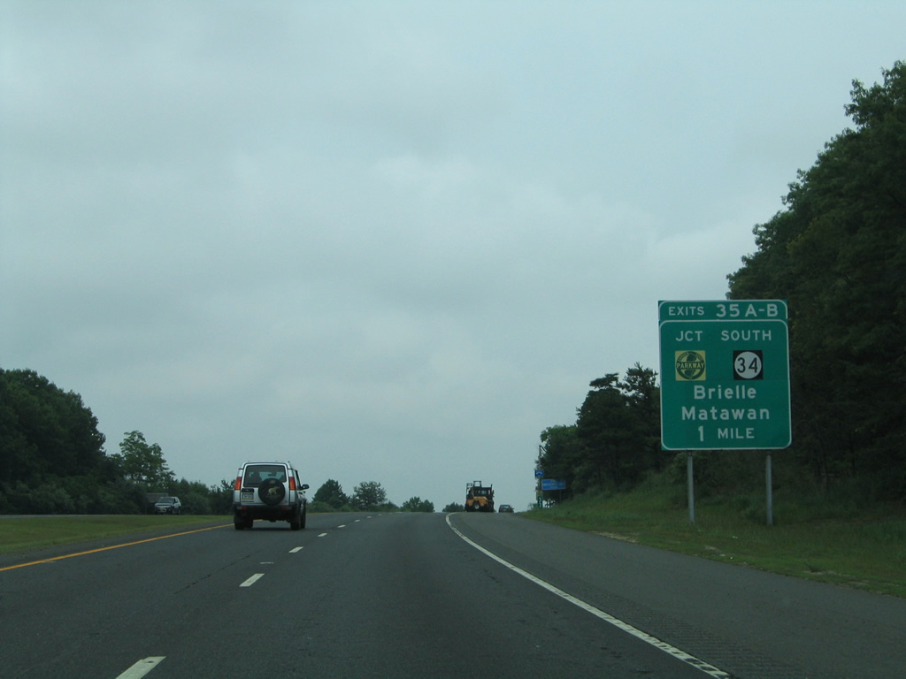
Interstate 195 plies across the Manasquan River and Allaire State Park into Wall Township. The final mainline exit joins the freeway with Route 34 at Exits 35A/B.
06/30/05
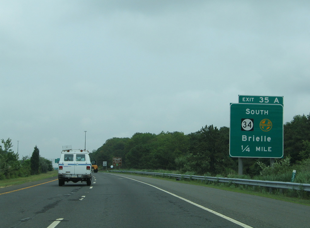
Forthcoming Exit 35A onto Route 34 south doubles as the movement between I-195 east and the Garden State Parkway south. Route 34 leads south through Wall Township to end at Route 35 and Route 70 just outside the Brielle borough limits.
06/30/05
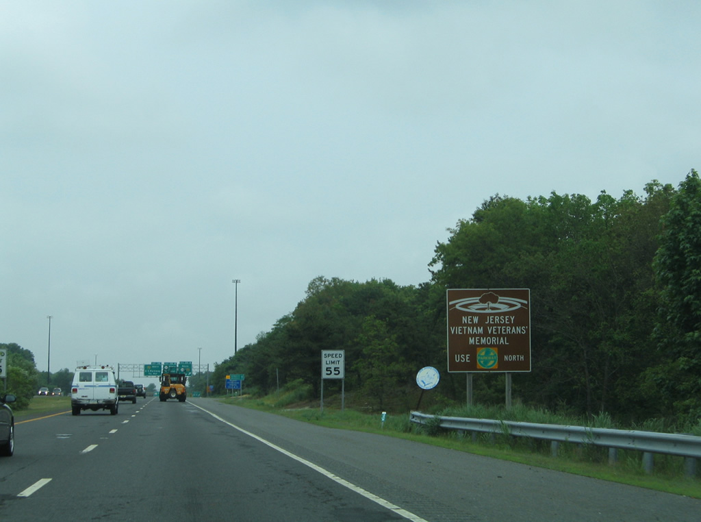
A loop ramp joins the Garden State Parkway northbound directly from Route 138 east, just after the transition from I-195. The parkway is home to the New Jersey Vietnam Veterans' Memorial, located off Exit 116 in Holmdel Township.
06/30/05
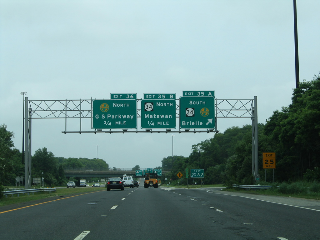
Entering the cloverleaf interchange (Exit 35) with Route 34 on I-195 east. Route 34 south connects with the Garden State Parkway (GSP) in 0.3 miles. The GSP leads south another 60 miles to the exchange with the Atlantic City Expressway.
06/30/05
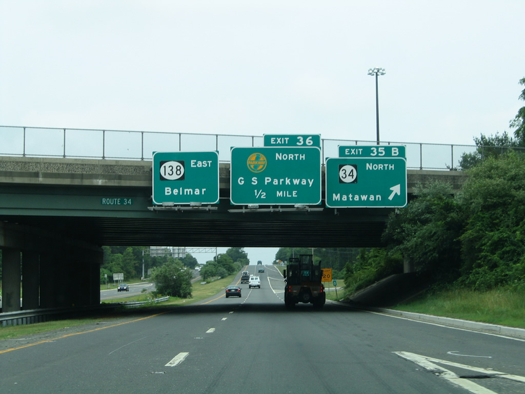
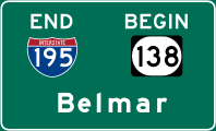
Exit 35B loops away from the east end of Interstate 195 for Monmouth Executive Airport (BLM), Colts Neck Township, and Matawan. Route 138 begins here and extends east from I-195, 3.52 miles to Route 35 just outside Belmar. Exit 36 for the GSP north to Woodbridge departs in a half mile.
06/30/05
References:
- James J. Howard. Wikipedia.org.
- Robbinsville Township, New Jersey. Wikipedia.org.
Photo Credits:
- ABRoads: 12/19/17
- Alex Nitzman: 12/23/01, 04/25/04, 12/27/18
- AARoads: 08/29/05
- Carter Buchanan: 06/30/05
Connect with:
Page Updated Tuesday December 13, 2022.