
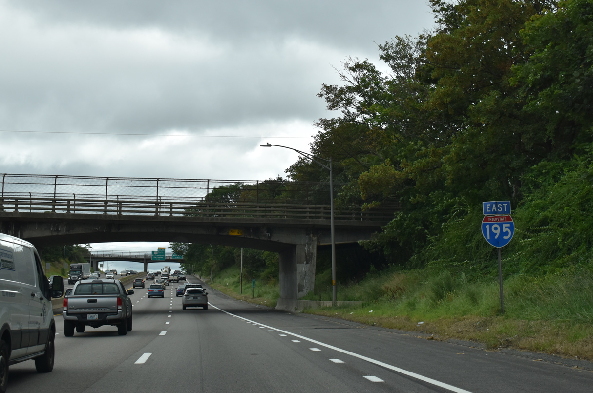
Interstate 195 East


 East
East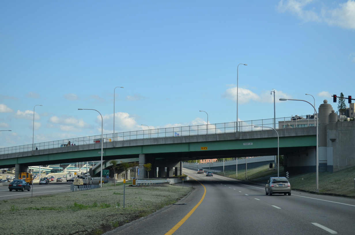
A sweeping ramp takes U.S. 6 east from I-95 south onto Interstate 195 east ahead of the Iway Bridge across the Providence River. The ramp passes under Point Street here as Exit 36 B departs from the adjacent I-95 to Eddy Street.
10/06/14
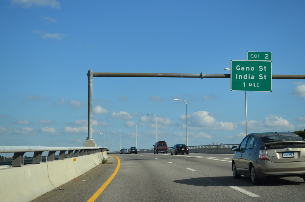
An entrance ramp from Franklin and Plain Streets joins the I-195/U.S. 6 flyover from southbound I-95 one mile ahead of India Point Park and Exit 1 A.
10/06/14
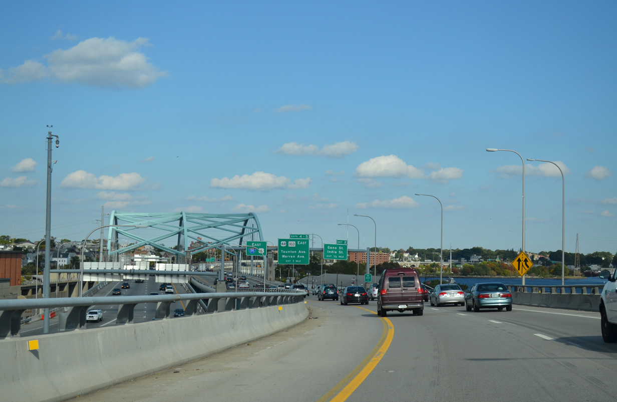
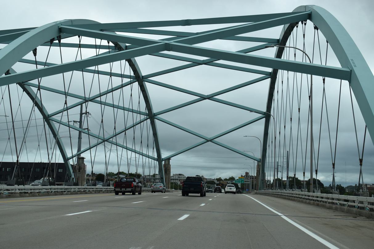
The Iway Bridge comes into view as both ramps from I-95 converge. The signature span travels 1,200 feet across the Providence River with eight overall lanes. It was opened to eastbound traffic in November 2007.
10/06/14
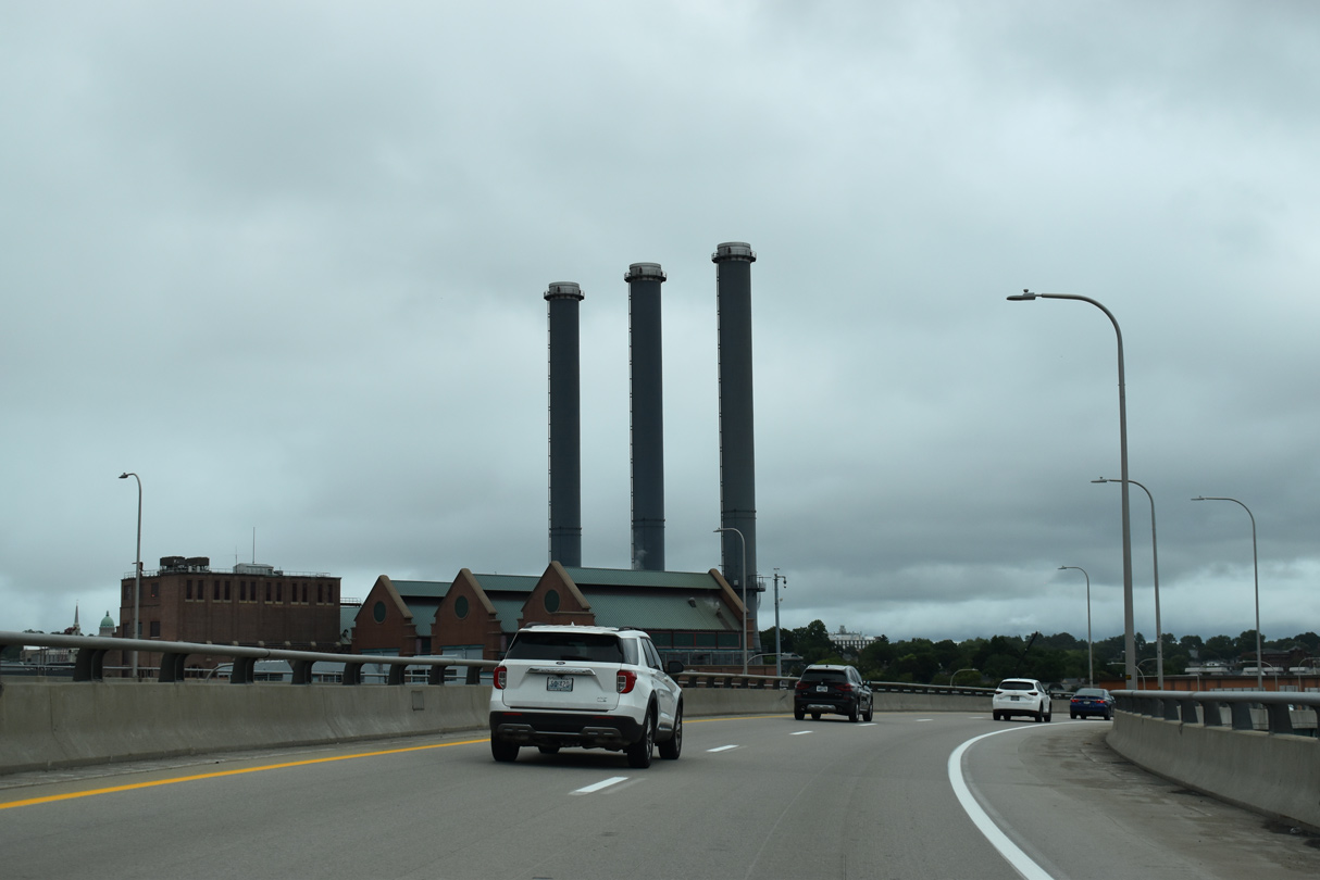
The Manchester Street Generating Station appears along the north side of the three-wye interchange joining I-95, I-195 and U.S. 6.
08/20/21
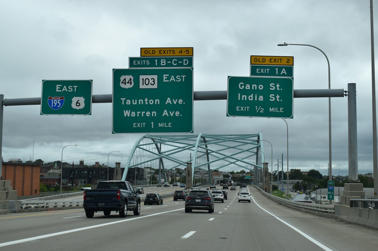
I-195/U.S. 6 span the Providence River east to Fox Point. Exit 1 A departs in a half mile onto parallel India Street west to S Main Street (U.S. 1A/44) and east to Gano Street north. U.S. 44 east joins I-195/U.S. 6 east from S Water Street to Exit 1 B.
08/20/21
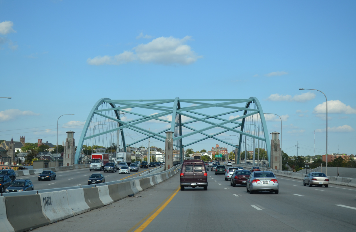
The arch and steel cables of the Iway bridge support a 400 foot long section of the bridge. The unique design of the crisscrossing cables is the first such design used in the United States.1
10/06/14
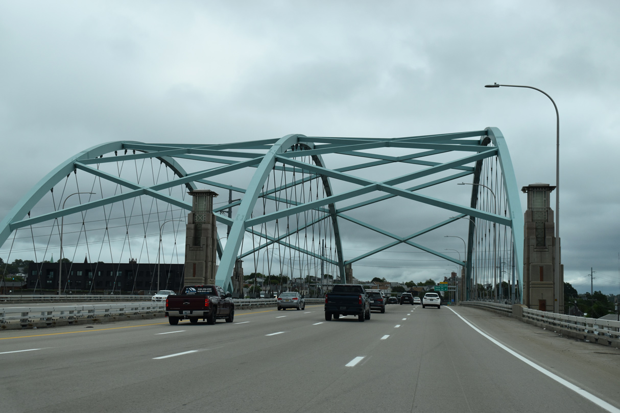
The arch component of the overall Iway Bridge was built off-site at Quonset Business Park in North Kingstown and floated into place via two barges in August 2006.1,3
08/20/21
Improperly installed railing along the Iway bridge resulted in the installation of concrete barriers in Summer 2014. The measure was taken after a 10 foot section of eastbound side railing was damaged in May 2014. Inspections revealed that the base of the rail was incorrectly installed, leading to the addition of barriers as a safety measure.4
08/20/21
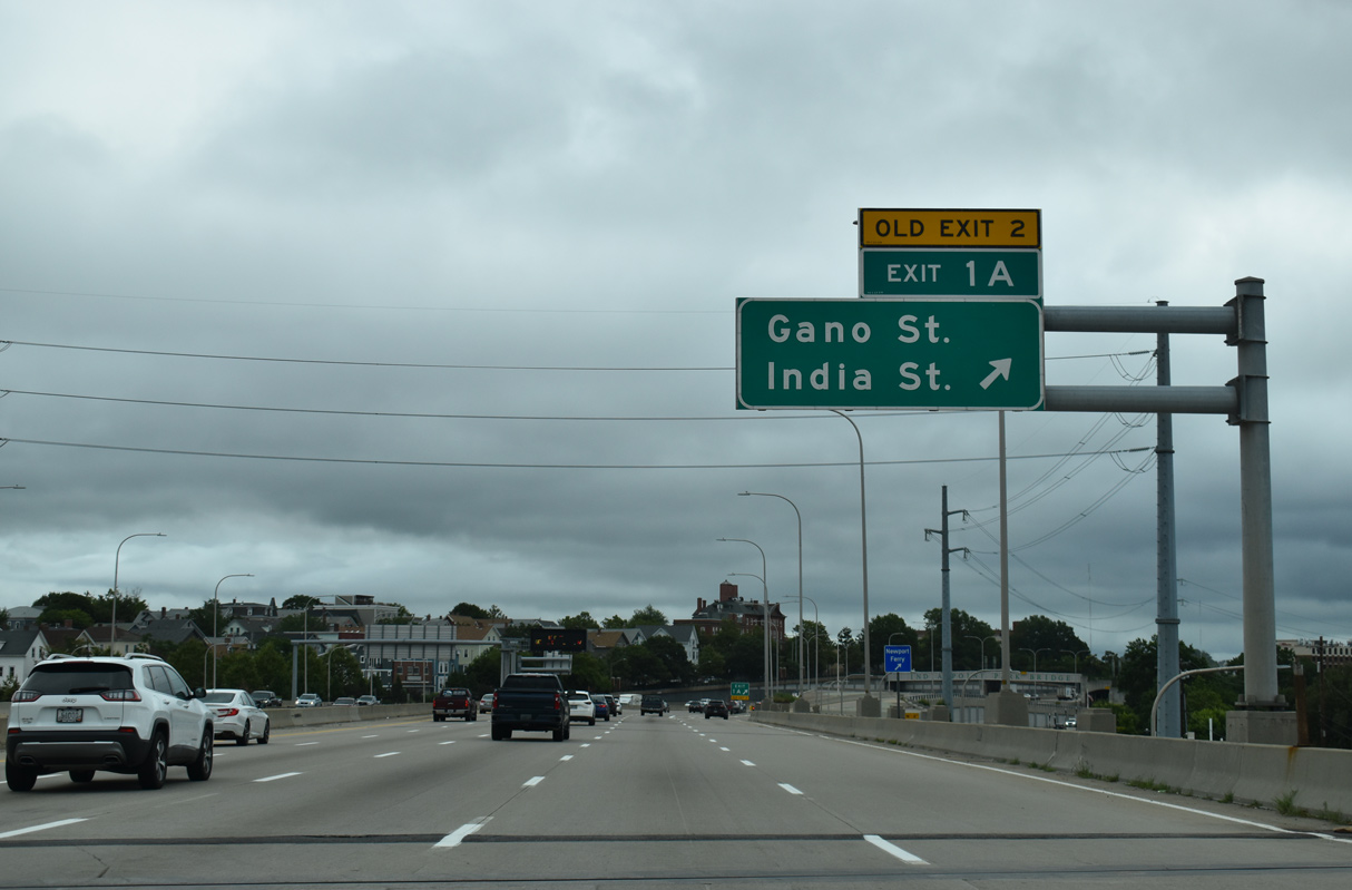
Exit 1 A leaves I-195/U.S. 6 east to India Street at India Point Park above a tunnel bringing U.S. 1A/44 onto the freeway. U.S. 1A/44 tie into India Street nearby from alongside the Providence River between Downtown and Brown University.
08/20/21
 East
East  North
North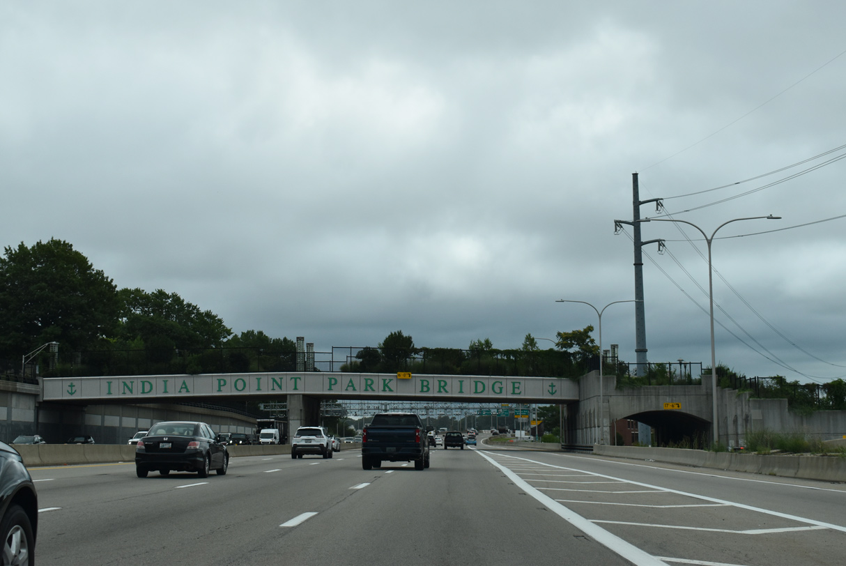
Built as part of the Iway project, the Indian Point Park Bridge spans I-195 at a width of 48 feet. The $9.5 million structure replaced an eight foot wide span built at the location in 1971. The old bridge was demolished in 2005 to make way for freeway expansion. Its replacement features concrete benches, decorative lighting and landscaping. Dedication of the new bridge took place on October 15, 2008.2
08/20/21

A toll collection point for tractor trailers was erected just ahead of the Washington Bridge by 2021.
08/20/21
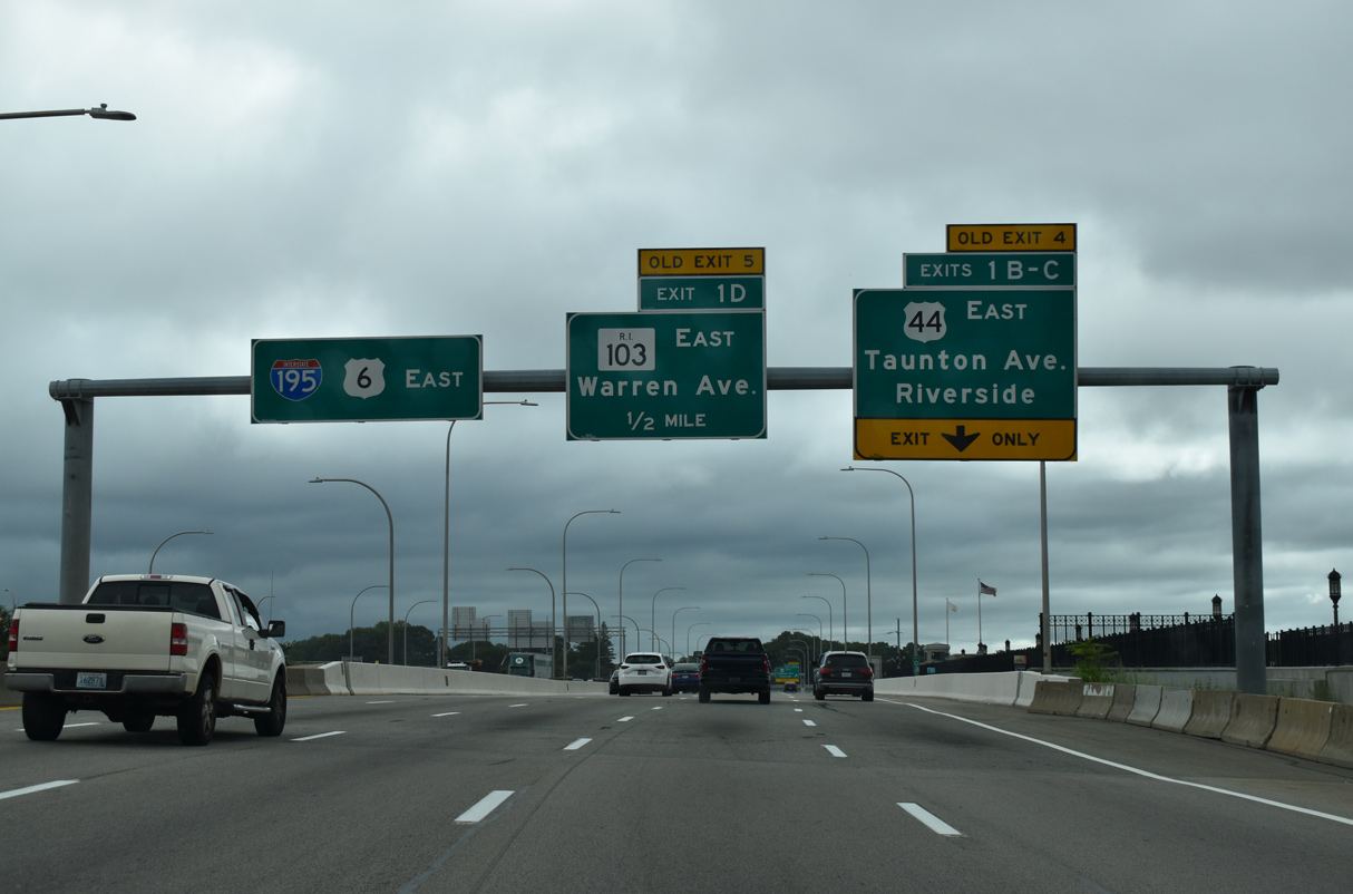
U.S. 44 branches northeast from I-195/U.S. 6 at the end of the Washington Bridge across the Seekonk River onto Taunton Avenue through central East Providence. The Washington Bridge eastbound was replaced from July 2001 to December 2008.
08/20/21
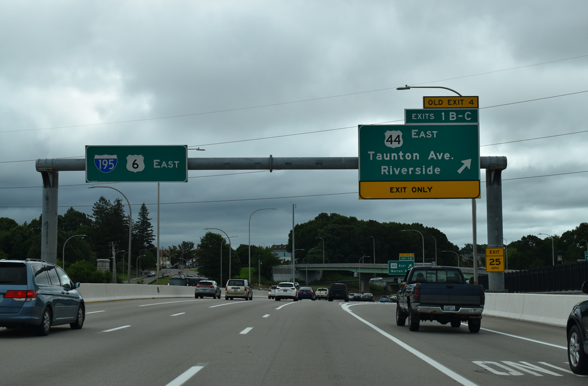
Exit 1 B/C partition into separate ramps for U.S. 44 (Taunton Avenue) east and Veterans Memorial Parkway south to Route 103 (Pawtucket Avenue. Route 103 extends south to Riverside in East Providence.
08/20/21
East North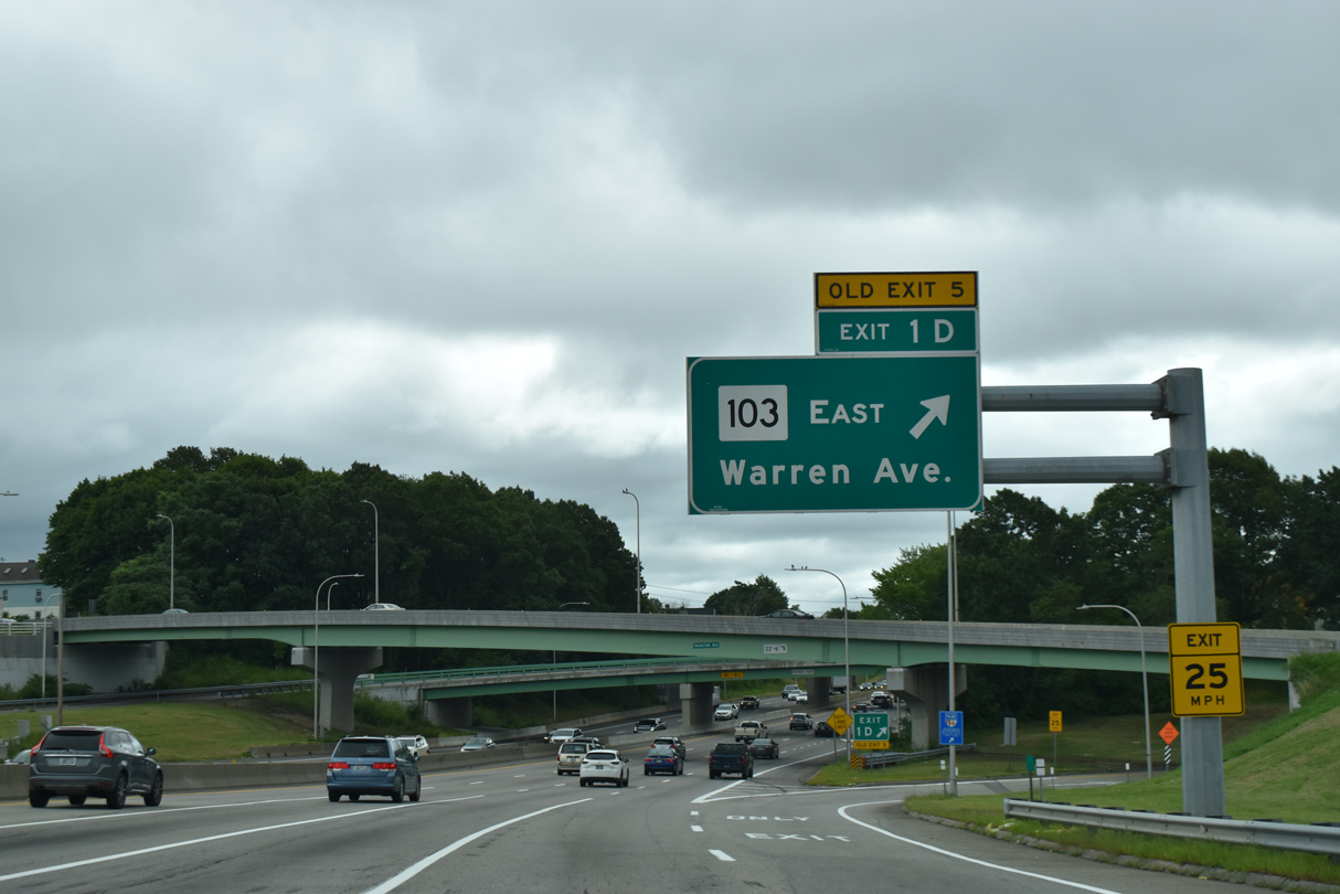
Route 103 commences east along Warren Avenue from Exit 1 D. The state route parallels I-195/U.S. 1A-6 one block south to Broadway. Route 103 is part of a 16.7 mile long multi state highway east to Somerset, Massachusetts.
08/20/21
Passing under a series of overpasses to Broadway, Interstate 195 travels below grade through East Providence.
08/20/21
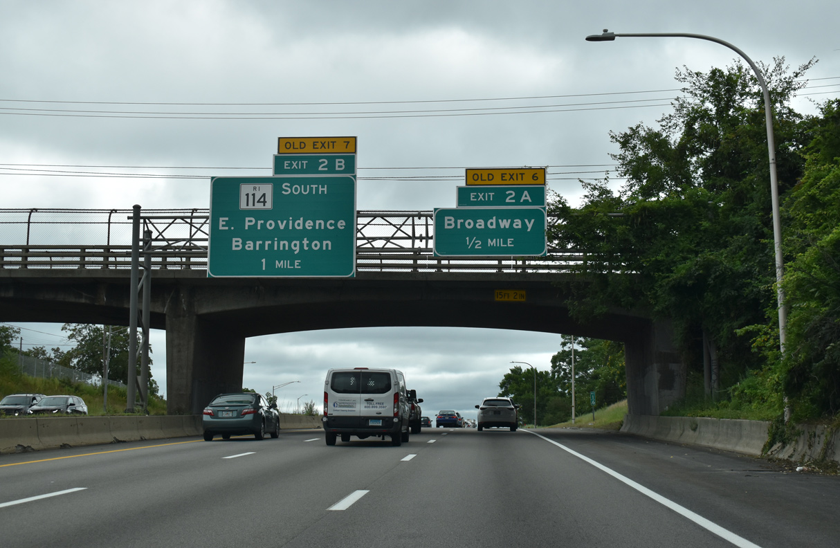
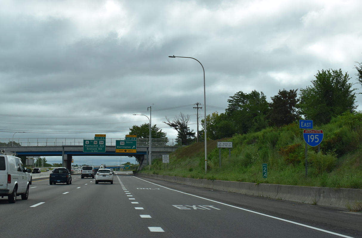
Exit 2 A leaves I-195/U.S. 1A-6 a half mile beyond the Lyons Avenue overpass onto adjacent Warren Avenue (Route 103) between Broadway and Route 114 (Pawtucket Avenue). Exit 2 B follows for the East Shore Expressway south to Route 114 (Wampanoag Trail).
08/20/21
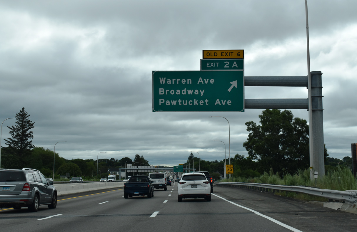
Broadway travels north through central East Providence from Veterans Memorial Parkway to Newman Avenue (Route 114/152). Pawtucket Avenue leads U.S. 1A/Route 114 northward from Warren Avenue to Rumford.
08/20/21
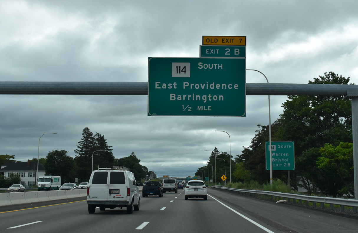
The East Shore Expressway stems south from the wye interchange at Exit 2 B to Route 114 (Wampanoag Trail). Route 114 constitutes a divided four lane boulevard southward to the town of Barrington.
08/20/21
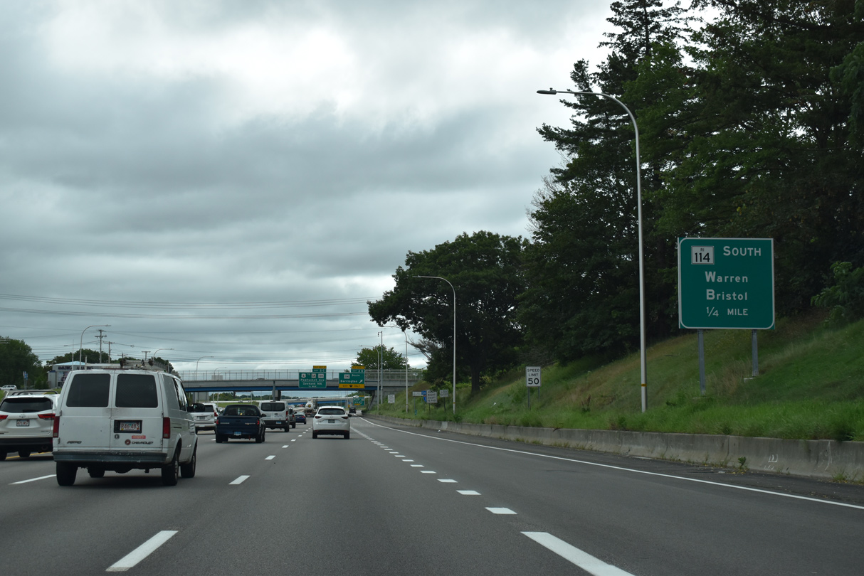
Route 114 follows Wampanoag Trail south from the East Shore Expressway 5.5 miles to Massasoit Avenue in Barrington. Route 114 extends south from there through the towns of Bristol and Warren en route to Portsmouth and Route 138 in Newport.
08/20/21

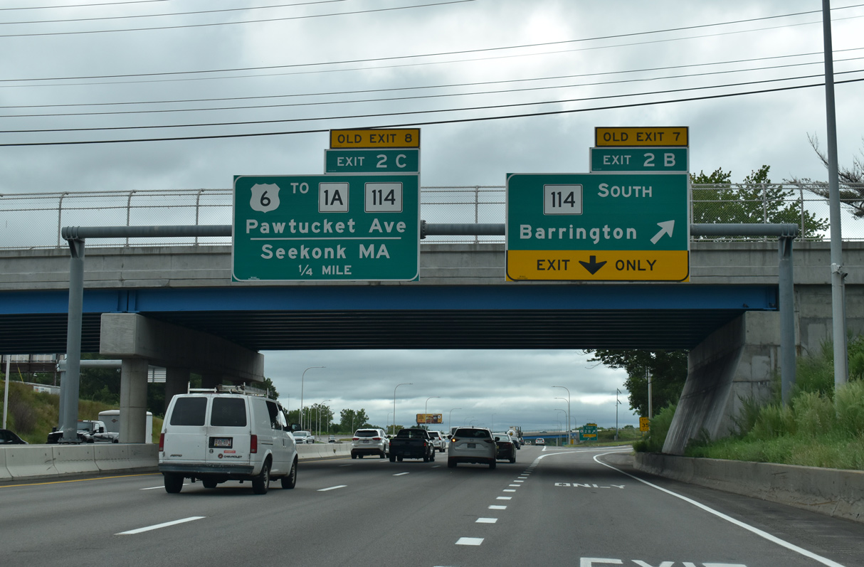
U.S. 1A north leaves I-195 for Warren Avenue west to Pawtucket Avenue (Route 114) north via Exit 2 C. Route 114 follows Wampanoag Trail west from the East Shore Expressway to Pawtucket Avenue north through Kent Heights. Paralleling I-195, U.S. 6 follows Warren Avenue east to Highland Avenue and South Seekonk, Massachusetts.
10/06/14
Confirming marker posted ahead of the U.S. 1A/Route 114 (Pawtucket Avenue) overpass by Leonard Corner.
08/20/21
Originally U.S. 6 utilized a ramp from the East Shore Expressway directly onto Warren Avenue east. That ramp was removed in 2006 after old Exit 8 was realigned to serve both directions of Warren Avenue. An RIDOT maintenance facility was built where the former ramp was.
08/20/21
East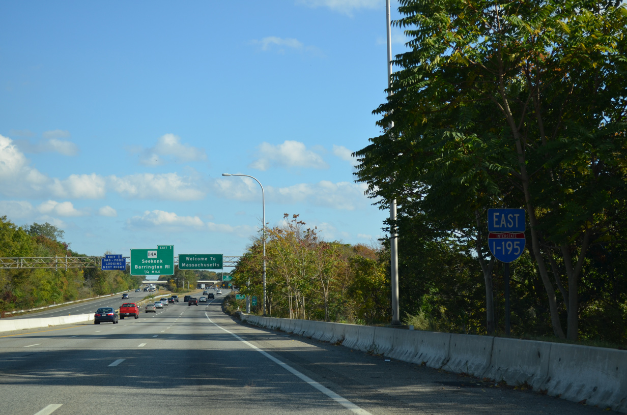
Warren Avenue branches east from U.S. 6 (Highland Avenue) to pass underneath Interstate 195 by this erroneous reassurance marker.
10/06/14
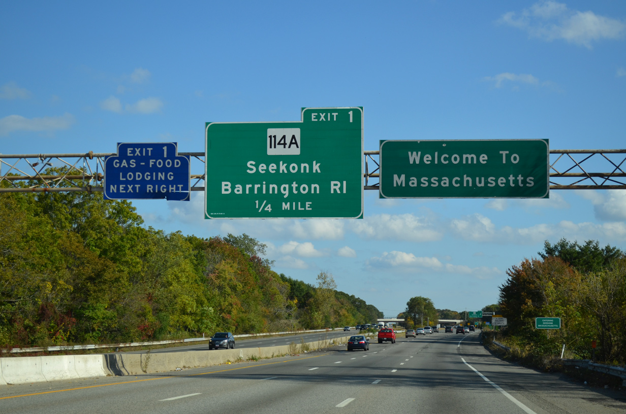
Interstate 195 bends southeast and crosses the Massachusetts state line at Runnins River. The first Bay State exit serves Route 114A (Fall River Avenue), a bypass route of East Providence for Route 114 through Seekonk.
10/06/14
References:
- "I-195 bridge takes top honors." Providence Business News (RI), April 16, 2010.
- "RIDOT opens India Point Park Pedestrian Bridge, new bridge is six times wider than the original bridge." The State of Rhode Island, press release, October 15, 2008.
- "Taking a swing at the last hurdle in path of new Iway." Providence Journal (RI), November 15, 2010.
- "Cost to deal with Iway rail problem nears $500,000." Associated Press State Wire: Rhode Island (RI), August 19, 2014.
Photo Credits:
- ABRoads: 10/06/14
- Alex Nitzman: 08/20/21
Page Updated Tuesday March 21, 2023.