
Interstate 205 North - Portland
 North
North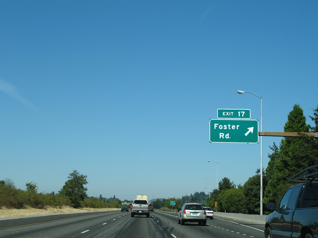
Foster Road west splits into a couplet with Woodstock Boulevard east at Exit 17. The boulevard angles northwest to U.S. 26 (Powell Boulevard) at Creston - Kenilworth while running east to Pleasant Valley and Damascus. Exit 17 provides access to Willamette National Cemetery and the Oregon Korean War Veterans Memorial.
08/27/06
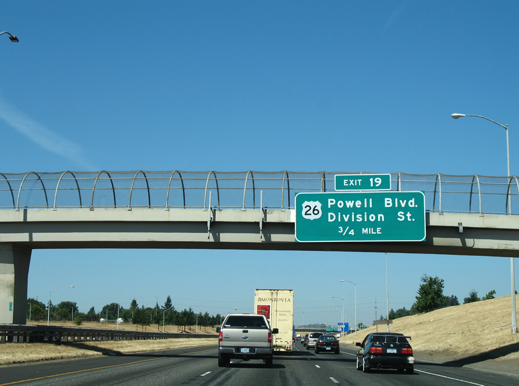
Continuing north, Interstate 205 meets U.S. 26 (Powell Boulevard) and parallel Division Street at a split diamond interchange (Exit 19).
08/27/06
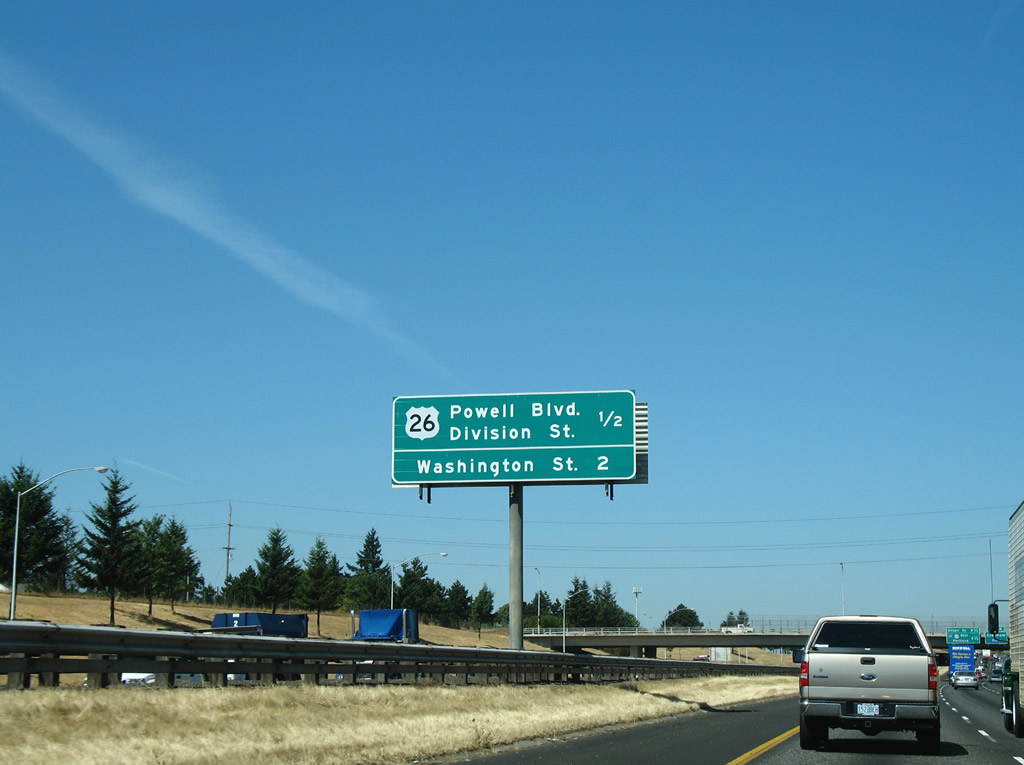
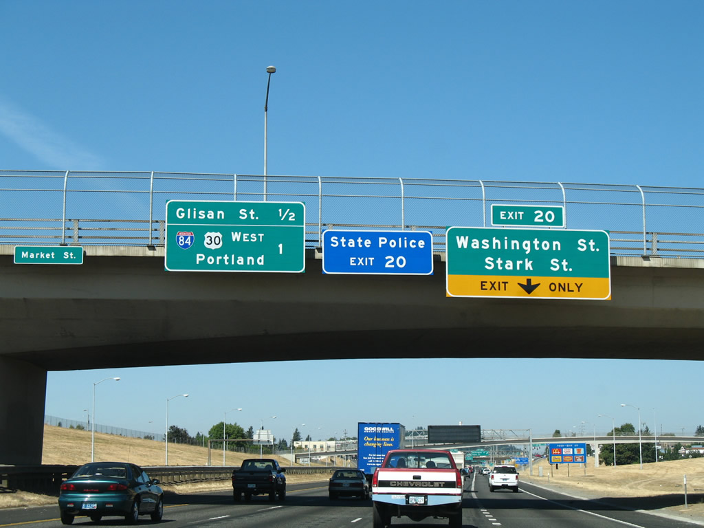
U.S. 26 (Powell Boulevard) and Division Street lead west to South Tabor and east to Powellhurst-Gilbert. Washington and Stark Streets follow in 1.50 miles between Montavilla and Mill Park.
08/27/06
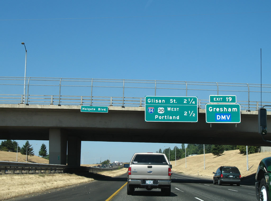
U.S. 26 leads east from Portland along Powell Boulevard into the city of Gresham. Westward U.S. 26 continues to Brooklyn and the Ross Island Bridge. I-84/U.S. 30 (Banfield Expressway) ties into I-205 east from Downtown in 2.5 miles.
08/27/06
Exit 19 leaves I-205 north for U.S. 26 (Powell Boulevard) and Division Street. The exchange between the four lane boulevard and I-205 alludes to the unconstructed Mount Hood Freeway, a proposed alignment for I-84 west to the Marquam Bridge.
08/27/06
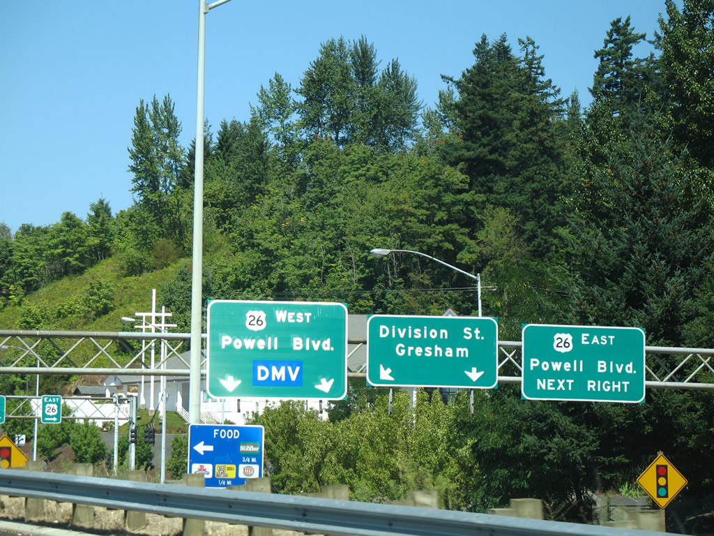
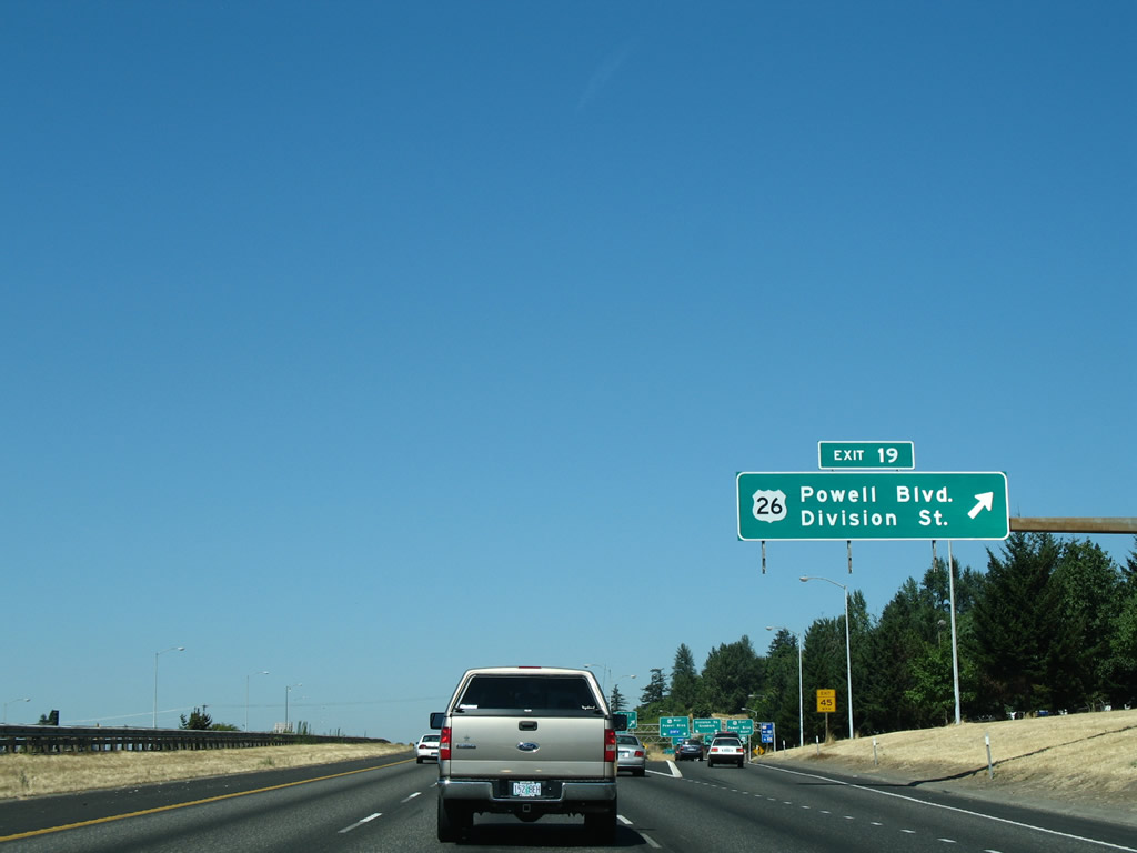
Exit 19 intersects U.S. 26 (Powell Boulevard) in Southeast Portland before continuing north to Division Street for the South Tabor and Mill Park neighborhoods.
08/27/06
The grassy right of way between U.S. 26 (Powell Boulevard) and Division Street would have accommodated ramps bringing I-84 from the Mount Hood Freeway east onto an overlap with I-205 north to Maywood Park.
08/27/06

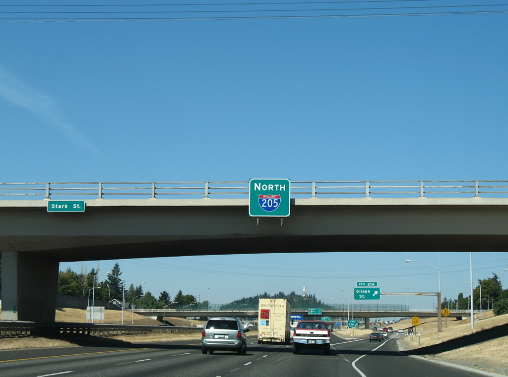
Another split diamond interchange follows at Exit 20 between Interstate 205 (East Portland Freeway) and the couplet of Washington Street east and Stark Street west.
08/27/06
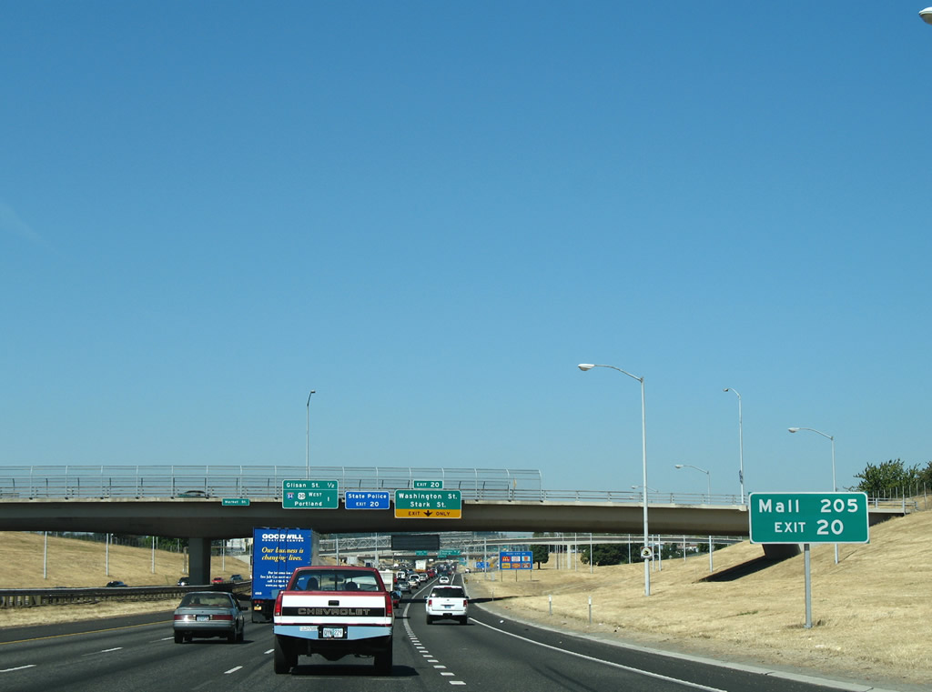
The former Mall 205 lies southeast of I-205 and Washington Street. Excluding two big box stores, the enclosed mall closed in 2022 for redevelopment.1
08/27/06
Exit 20 parts ways with I-205 north for Washington and Stark Streets one mile from I-84/U.S. 30. Stark Street leads west to through the Montavilla neighborhood to Thorburn Street at Mt. Tabor. Stark Street continues east to the Hazelwood and Mill Park neighborhoods.
08/27/06
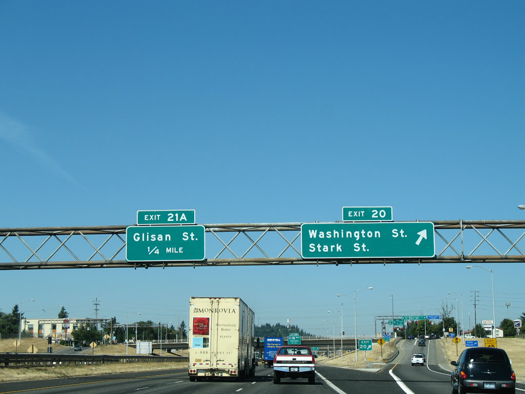
Exit 21 A quickly follows beyond Stark Street to a distributor roadway linking with Glisan Street.
08/27/06
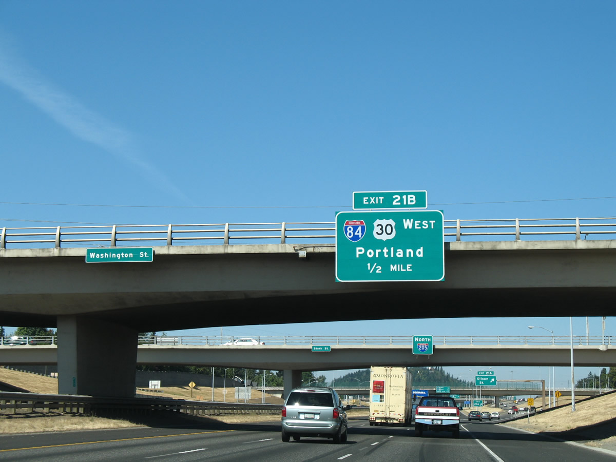
I-84/U.S. 30 turn north alongside I-205 (East Portland Freeway) between the directional T interchanges at Exit 21 B and 22. I-84/U.S. 30 overlap west to I-5 near Downtown Portland.
08/27/06
The pull through panel for I-205 north at the Stark Street overpass was removed by 2021.
08/27/06
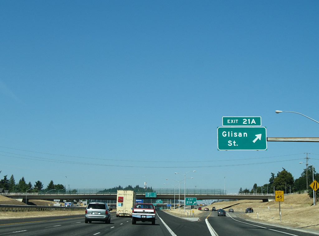
Glisan Street runs east into Hazelwood and west to the Montavilla and North Tabor neighborhoods.
08/27/06
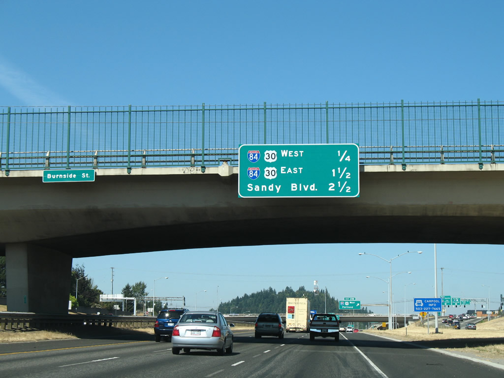
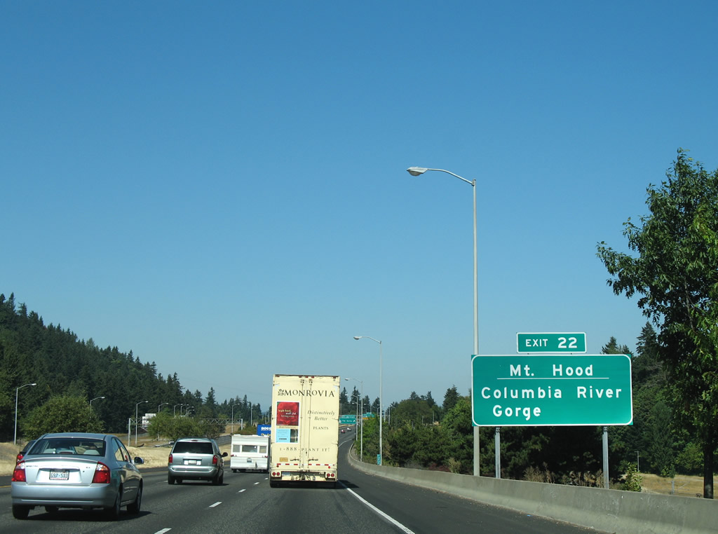
I-84 and I-205 parallel each other for nearly a mile. Exit 21 B provides access to the Banfield Expressway west for Rose City Park, Irvington, and the Lloyd District. Exit 22 follows for Gresham, Hood River and The Dalles.
08/27/06
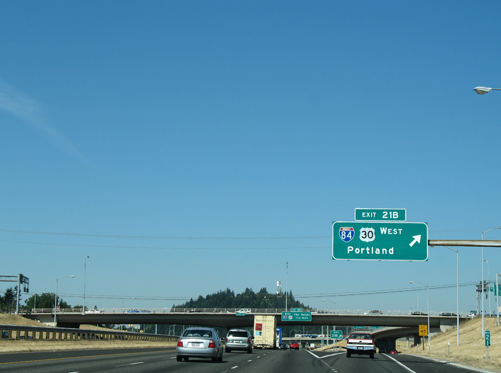
Exit 21 B departs below Glisan Street for I-84/U.S. 30 (Banfield Expressway) west. The Banfield Expressway was built as a temporary alignment for I-80N as the ultimate and cancelled plan was to reroute the Interstate southward onto the Mount Hood Freeway.
08/27/06
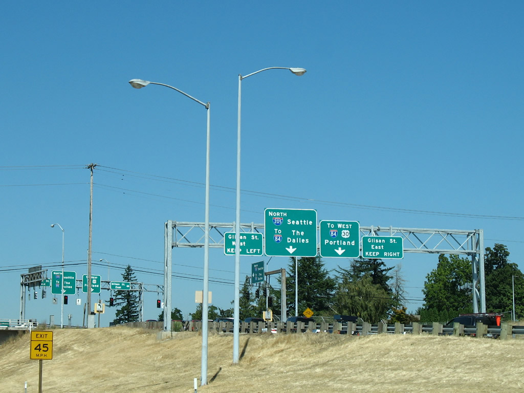
The distributor roadway from Exit 20 combines with Exit 21 A ahead of Glisan Street. Beyond Glisan, the roadway provides access to both Interstate 205 north and I-84/U.S. 30 west.
08/27/06
I-84/U.S. 30 turn eastward from Rocky Butte and Interstate 205 to Gresham, Fairview, Wood Village and Troutdale. Beyond the eastern suburbs, the freeway travels through the scenic Columbia River Valley to Cascade Locks and Hood River.
08/27/06
The Glisan/Stark/Washington Street entrance ramp partitions for Interstate 205 north and I-84/U.S. 30 west. A MAX light rail line joins the freeway right of way nearby.
08/27/06
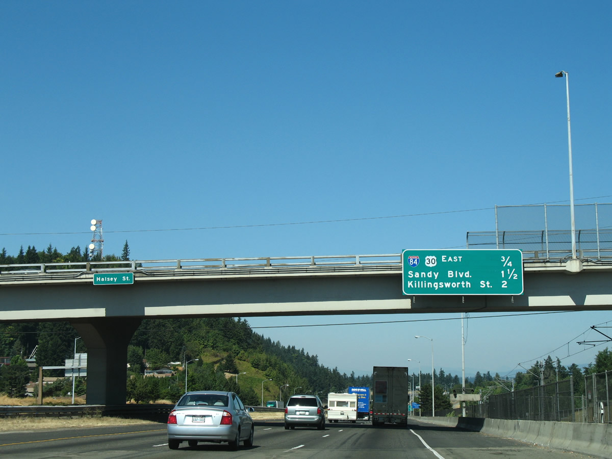
I-84/U.S. 30 (Banfield Expressway) travels below I-205 adjacent to the Halsey Street overpass. Another remnant design from the Mount Hood Freeway plan where I-84/205 were to split, forthcoming Exit 22 forms a short freeway overtaking I-84/U.S. 30 east of NE 102nd Avenue.
08/27/06
I-84/U.S. 30 enter the Columbia River Gorge east of Troutdale at Corbett. OR 35 south from Interstate 84 at Hood River leads toward Mount Hood, Oregon's highest peak.
08/27/06
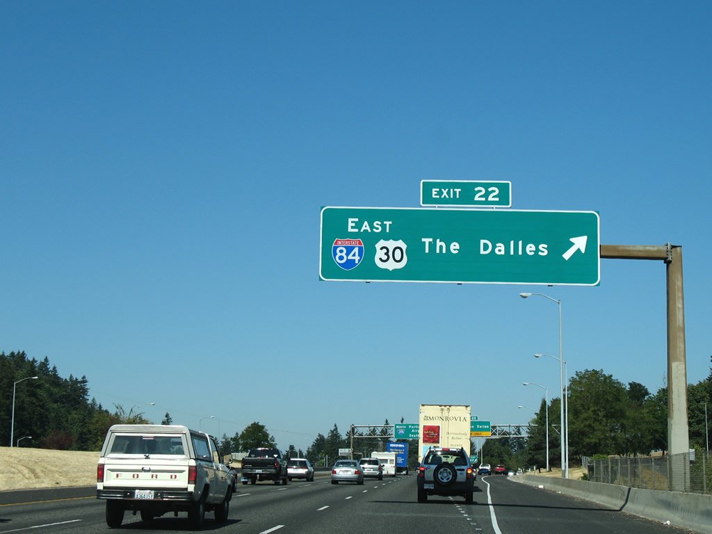
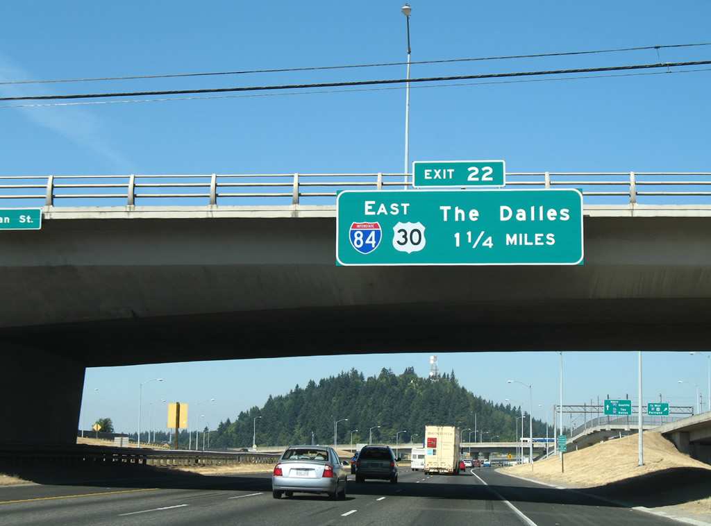
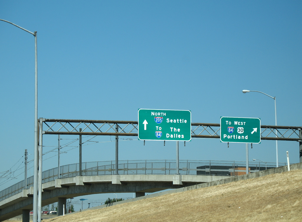
Exit 22 separates from Interstate 205 north for I-84/U.S. 30 east to Gresham, The Dalles, Pendleton and Boise, Idaho.
08/27/06
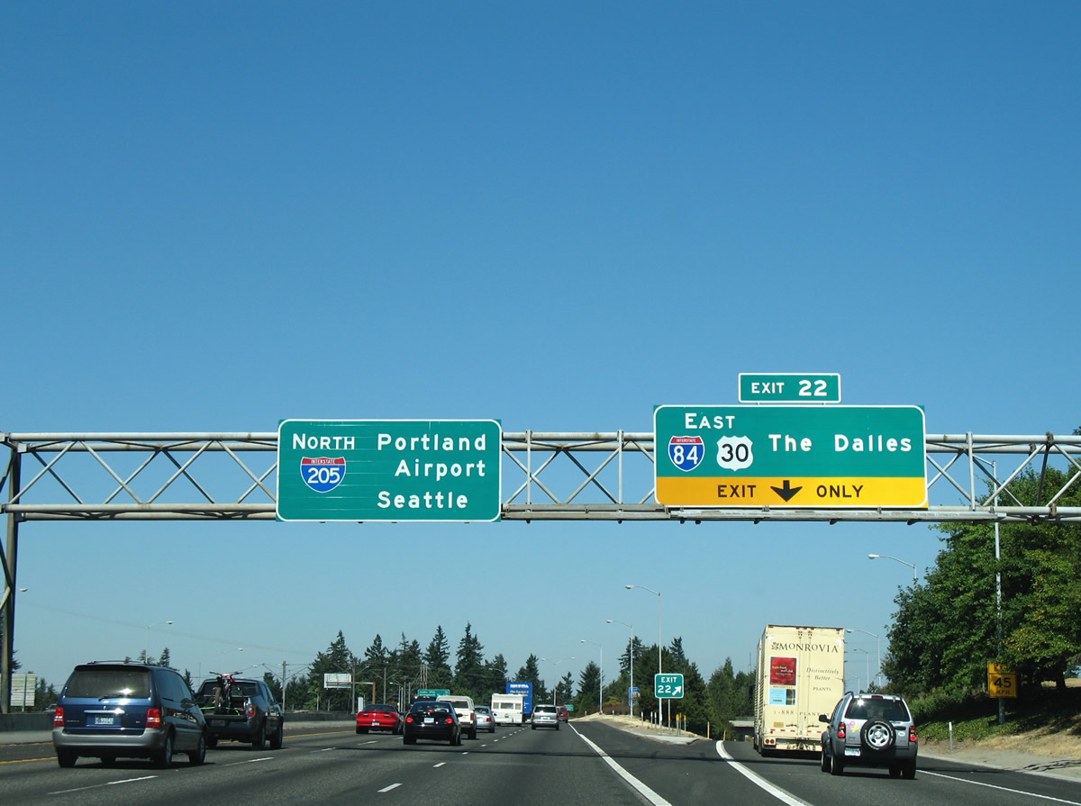
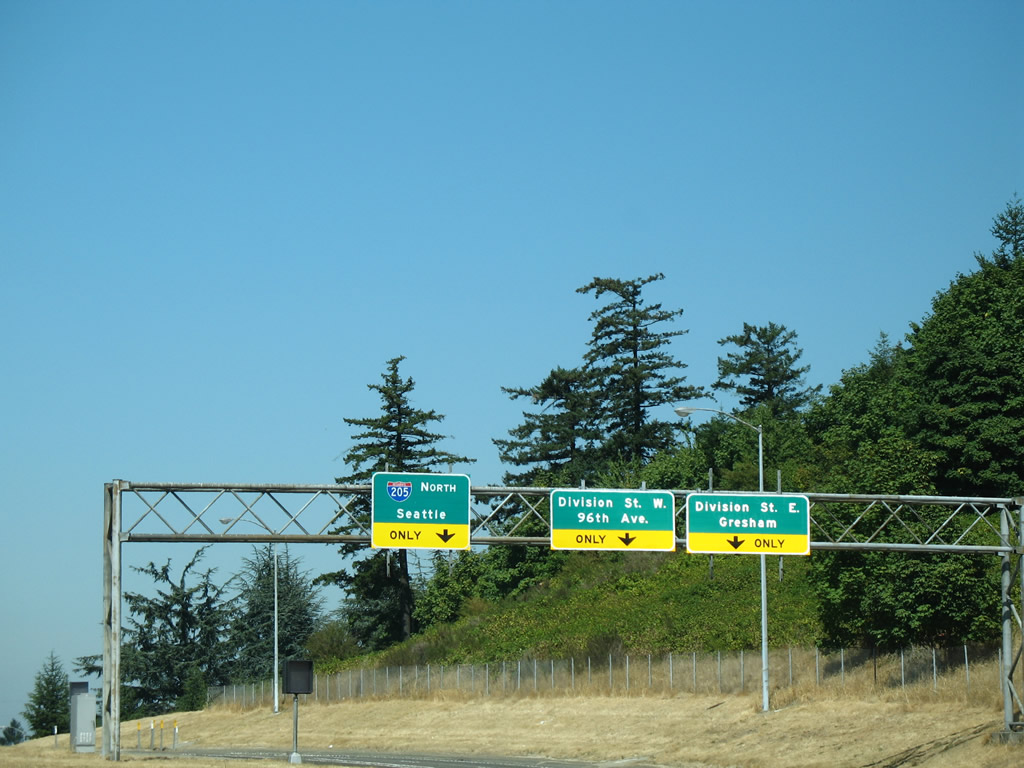
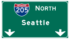
Interstate 205 gains Seattle as a control city for the connection with I-5 north at Vancouver, Washington. I-84/U.S. 30 travel east to the Argay, Russell, and Wilkes neighborhood of Northeast Portland.
08/27/06
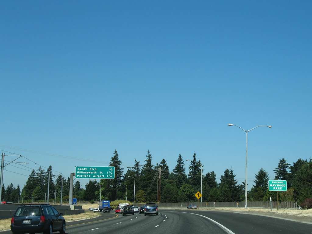
An enclave of Portland, Maywood Park occupies land along the east side of I-205 between I-84 and Prescott Street.
08/27/06
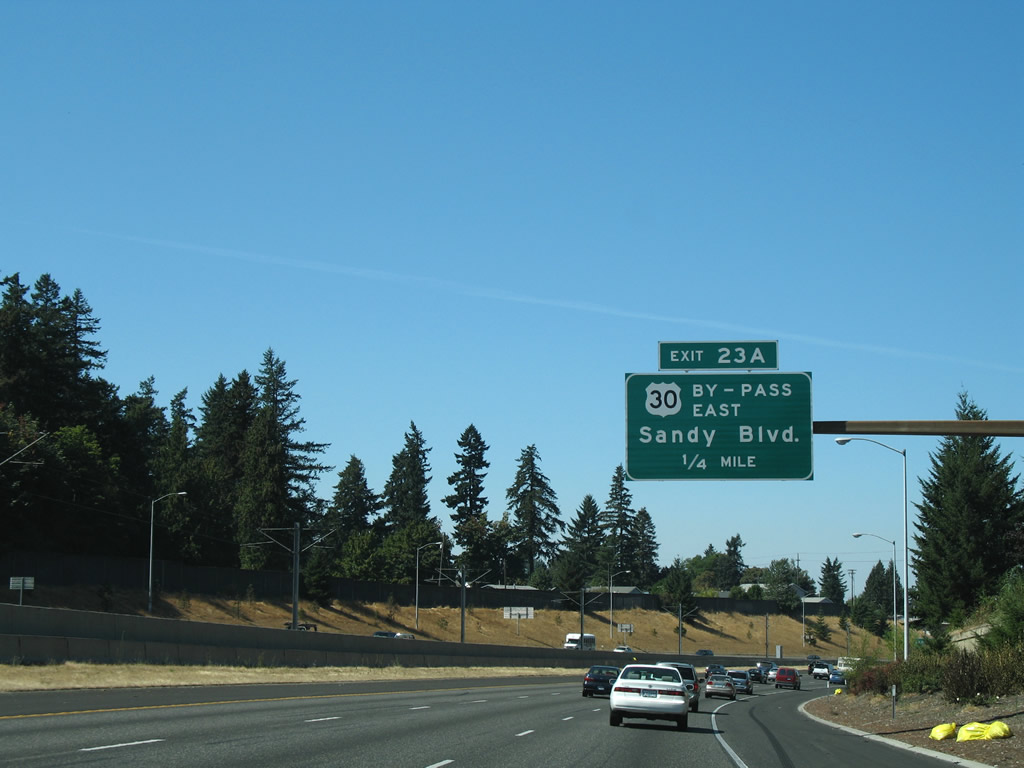
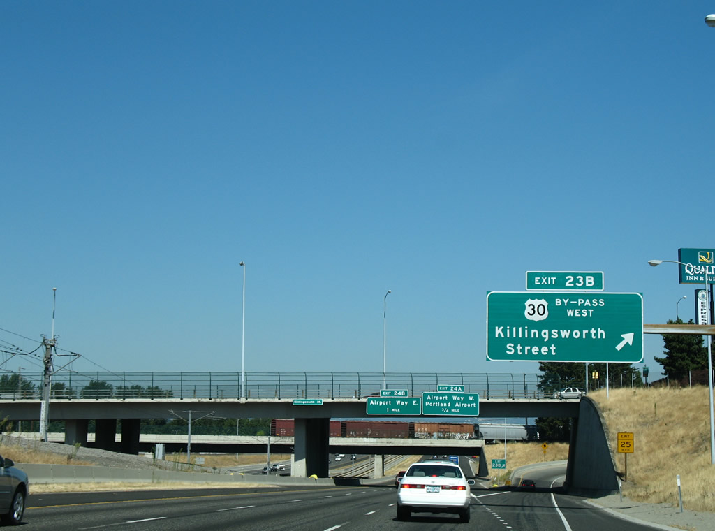
Interstate 205 rounds Rocky Butte north to Exit 23 A for Sandy Boulevard east to U.S. 30 Bypass. Prior to being decommissioned in 2007, Sandy Boulevard carried U.S. 30 Business southwest to OR 99E (Martin Luther King, Jr. Boulevard) and east to adjacent U.S. 30 Bypass at Killingsworth Street.
08/27/06
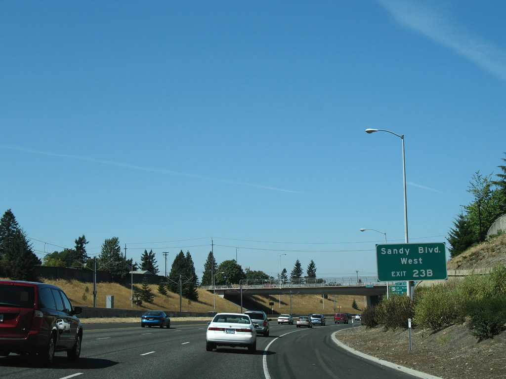
There is no direct access to Sandy Boulevard (old U.S. 30 Business) west from I-205 north at Exit 23 A. Instead motorists are directed to the loop ramp at Exit 23B to Sandy Boulevard at U.S. 30 Bypass.
08/27/06
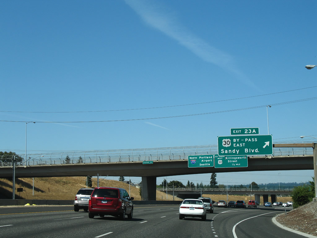
U.S. 30 Bypass follows Sandy Boulevard from Killingsworth Street through the Parkrose, Argay and Wilkes neighborhoods of Northeast Portland. Sandy Boulevard takes the route east to NE 238th Drive in Wood Village.
08/27/06
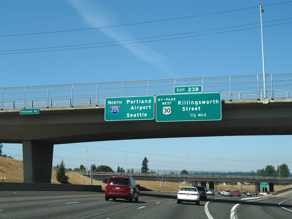
U.S. 30 Bypass branches north from Sandy Boulevard at Interstate 205 for Killingsworth Street west into the Sumner neighborhood.
08/27/06
Heading west, U.S. 30 Bypass follows Portland Highway from Killingsworth Street to Lombard Street and Interstate 5 at Kenton in north Portland. U.S. 30 Bypass provides more of a direct route for U.S. 30 west to Saint Helens, but at a much slower pace than the U.S. 30 overlaps with I-84, I-5 and I-405.
08/27/06
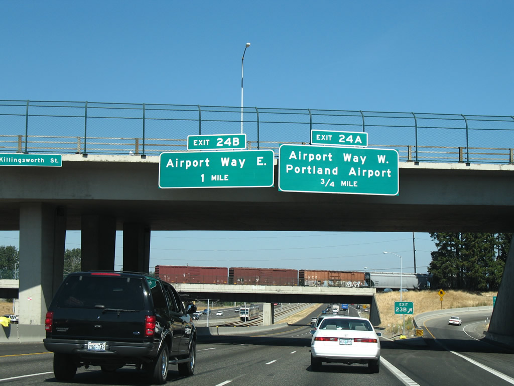
Angling northeast, Interstate 205 crosses Columbia Slough ahead of Exit 24 to Airport Way. As the name suggests, Airport Way provides the main route to Portland International Airport (PDX).
08/27/06
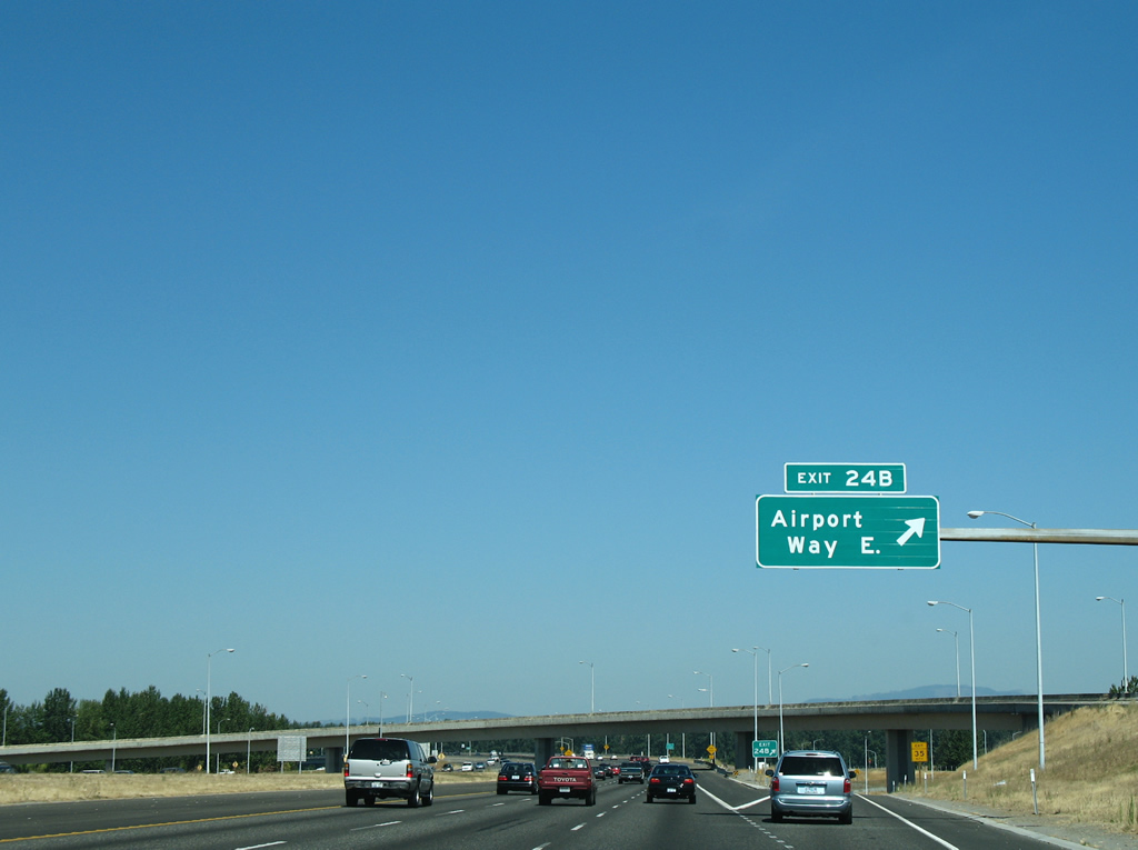
The MAX red line elevates to turn west to the airport just ahead of the flyover ramp linking I-205 with Airport Way West at Exit 24.
08/27/06
Airport Way constitutes an expressway westward first to a retail area outside PDX Airport and then to the passenger terminal.
08/27/06
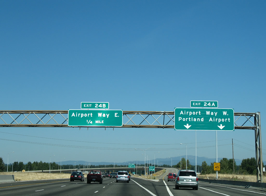
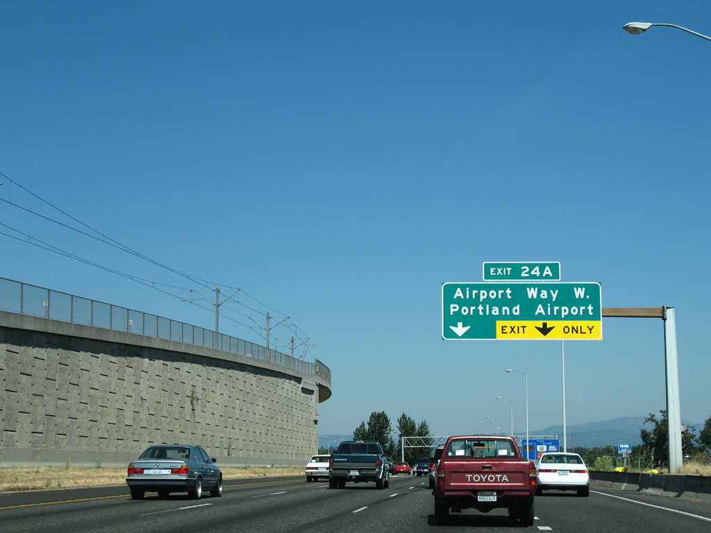
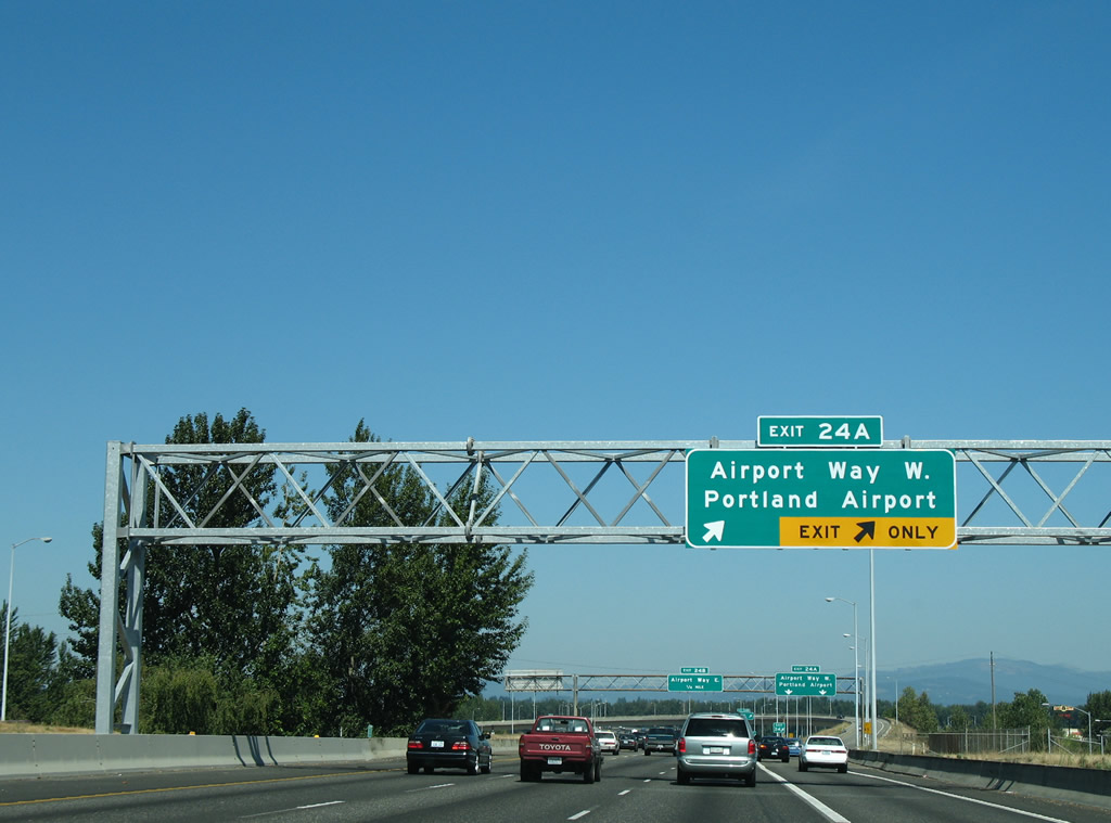
Exit 24 A departs Interstate 205 north for Portland International Airport (PDX). Airport Way East extends east as a commercial arterial into north Parkrose.
08/27/06
Airport Way continues from Exit 24 B to Wilkes in far Northeast Portland where it turns south to become NE 181st Avenue at U.S. 30 Bypass (Sandy Boulevard) near Interstate 84 at Exit 13.
08/27/06
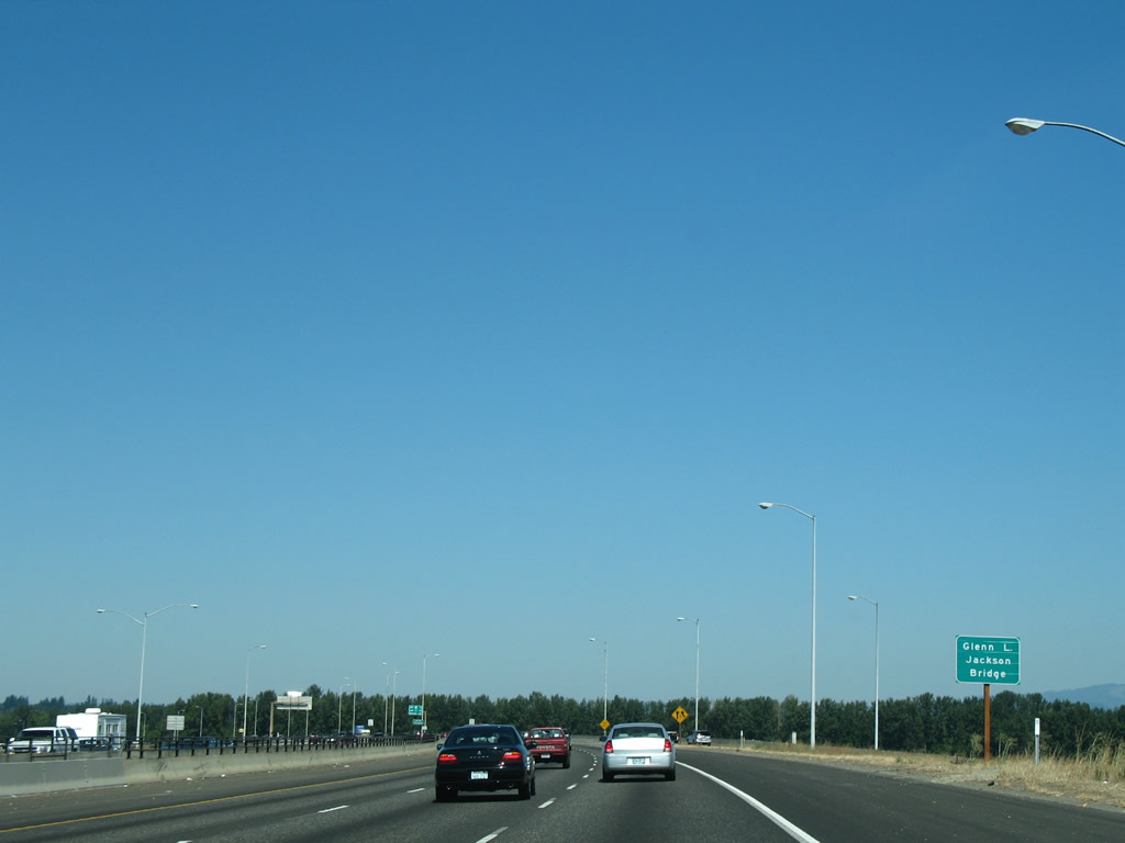
Interstate 205 advances north from the cloverstack interchange at Airport Way and city of Portland onto the Glenn Jackson Bridge over the split Columbia River.
08/27/06
The Glenn L. Jackson Bridge across the Columbia River is named after a former chairman of the Oregon Transportation Commission.
08/27/06
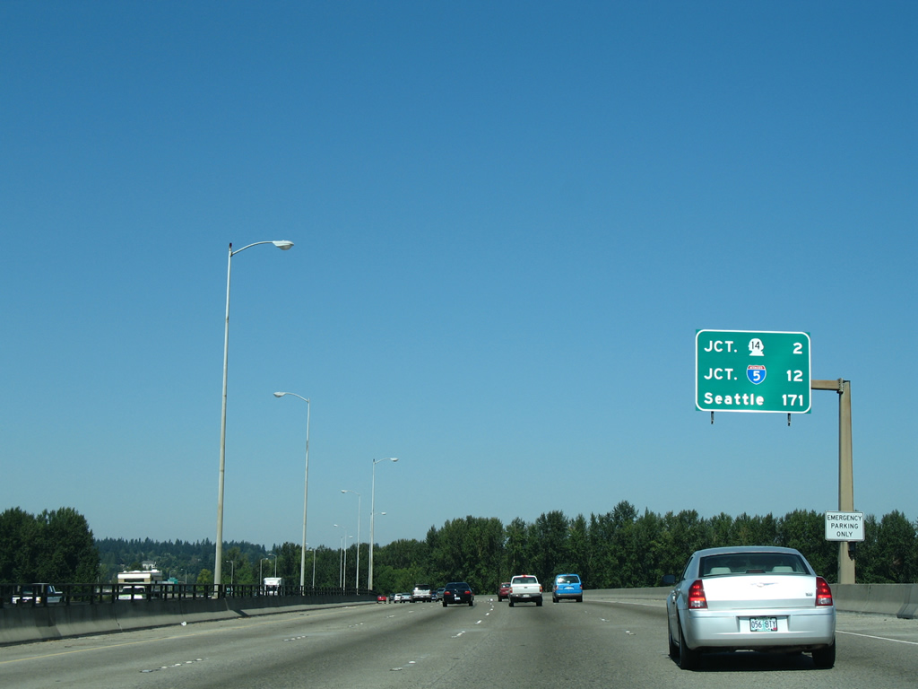
12 miles of Interstate 205 remain north from the Glenn Jackson Bridge to I-5. Seattle, Washington is 170 miles away.
08/27/06
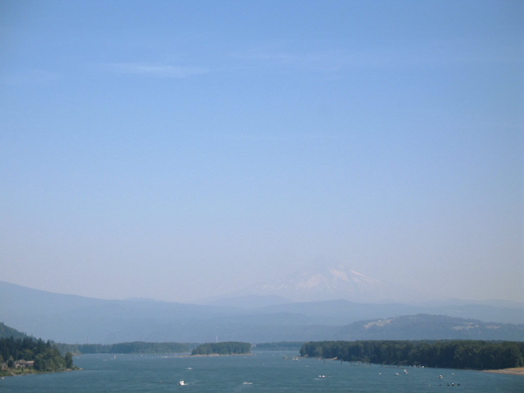
Trees on Government Island line both sides of Interstate 205 (Glenn Jackson Bridge) briefly as the freeway turns northwest.
08/27/06
Opened in 1982, the Glenn L. Jackson Bridge continues northward over the main channel of the Columbia River.
08/27/06
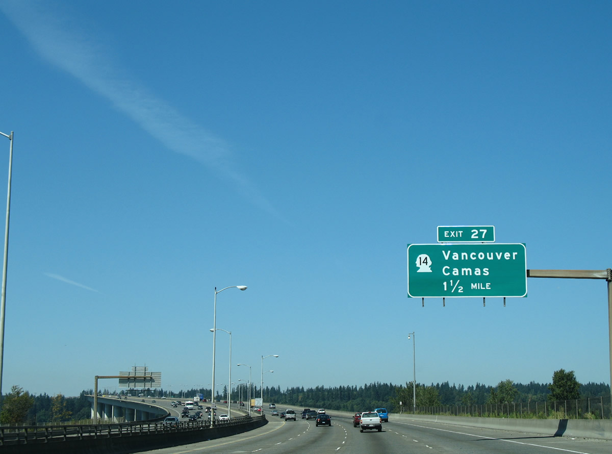
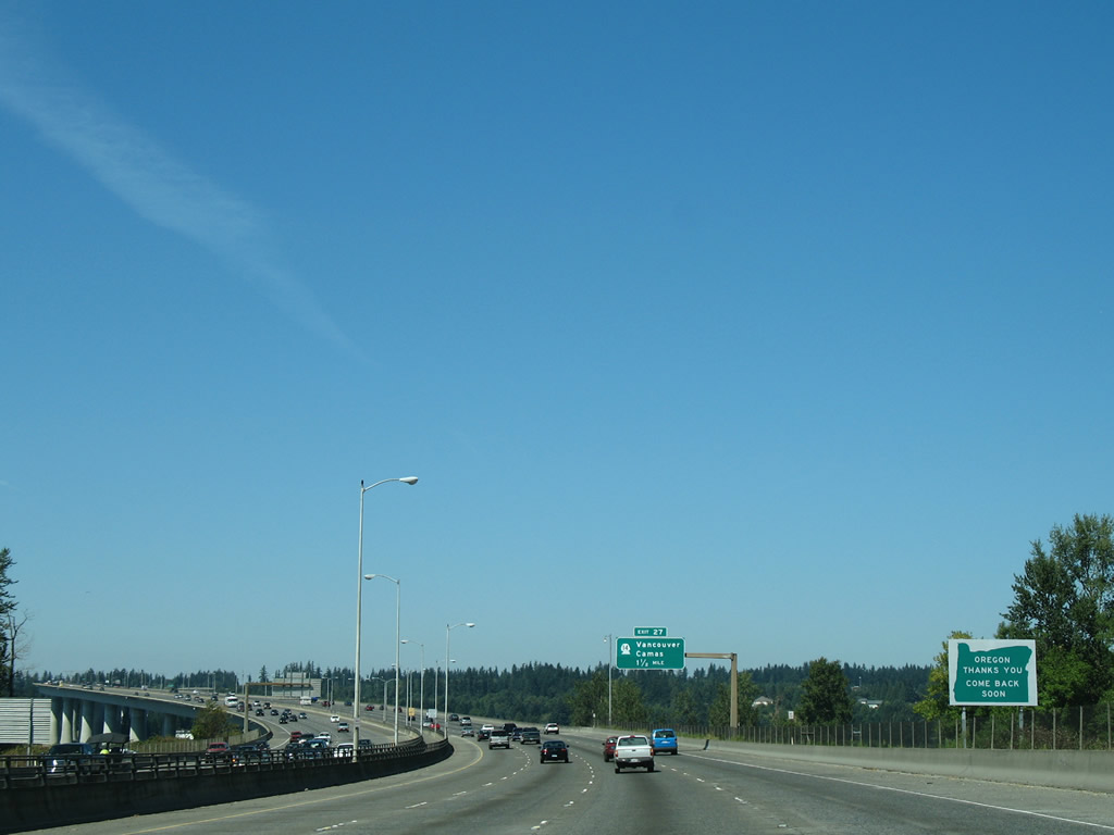
Exit 27 departs from the north end of the Glenn Jackson Bridge to Washington State Route 14, the former U.S. 830. A version of a cloverstack interchange joins the two freeways.
08/27/06
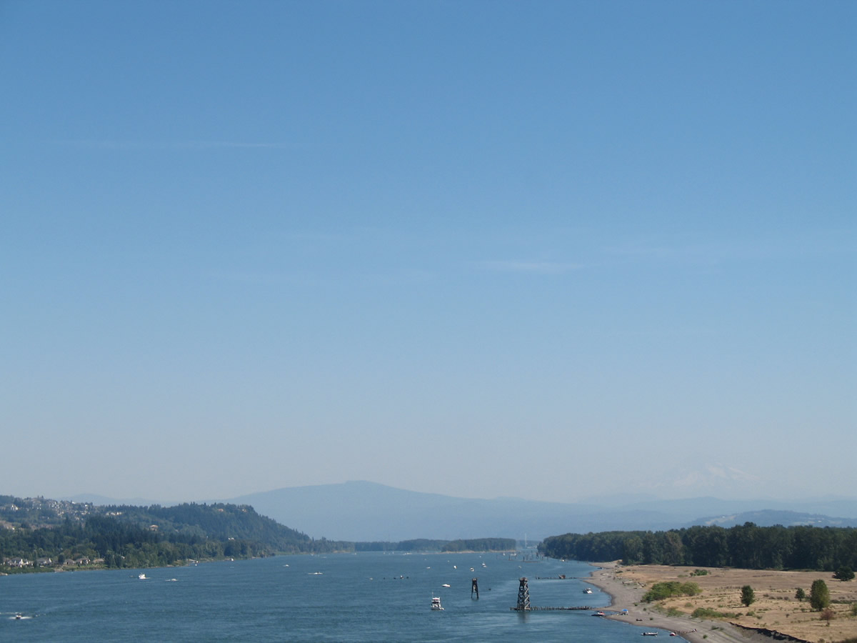
Looking east at Government Island and Mount Hood from Interstate 205. There is no road access to the pastoral island, instead visitors must travel by boat.
08/27/06
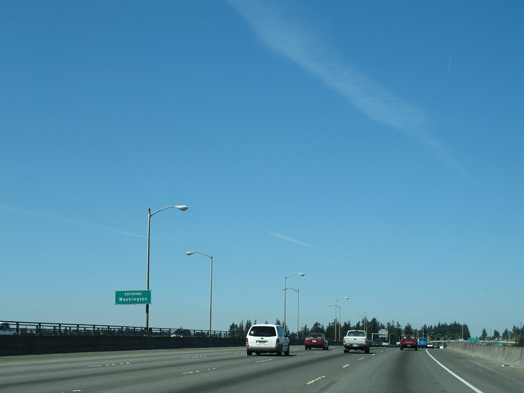
I-205 north enters Clark County, Washington ahead of the northern banks of the main Columbia River channel.
08/27/06
References:
- Mall 205. Wikipedia.
Photo Credits:
- AARoads: 08/27/06
Connect with:
Page Updated Wednesday December 15, 2010.