
Interstate 278 Triborough Bridge / Bruckner Expressway East
 East
East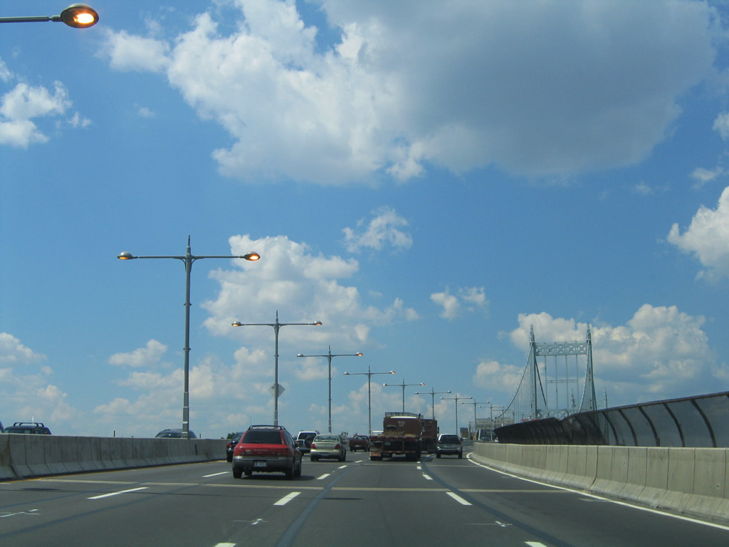
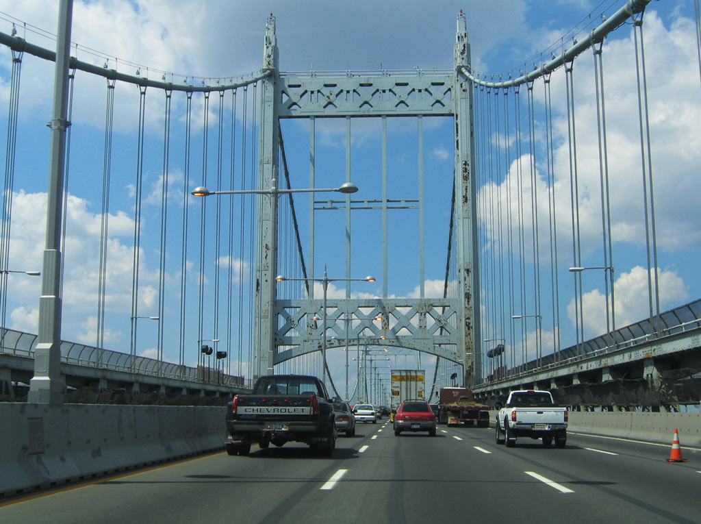
Interstate 278 eastbound transitions from the Grand Central Parkway in Queens onto the Triborough (Robert F. Kennedy) Bridge at Wards Island. The Triborough Bridge system consists of three spans linking the boroughs of Bronx, Manhattan, and Queens. Interstate 278 utilizes a suspension bridge to cross Hell Gate of the East River and a fixed truss span over the Bronx Kill between Randalls Island and the Bronx. The western branch of the Triborough Bridge consists of the Harlem River lift span between Randalls Island and Manhattan Island.
08/09/04
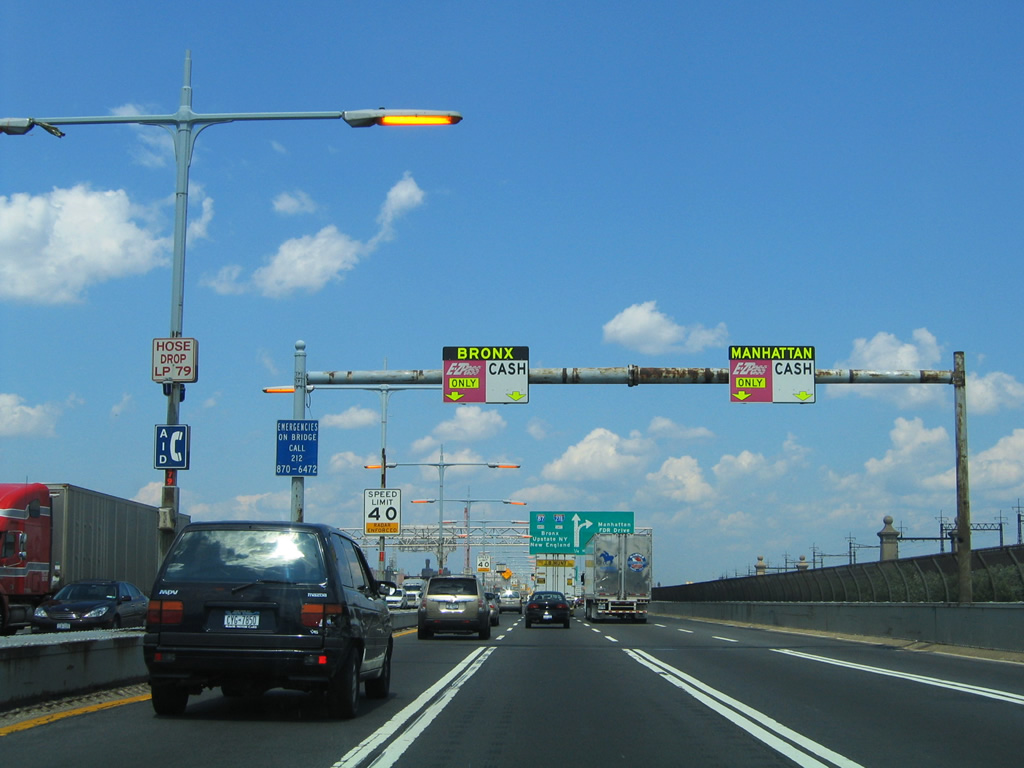
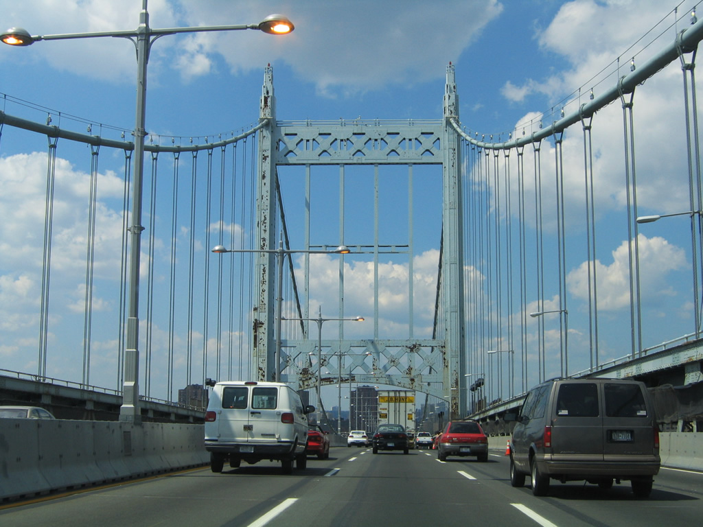
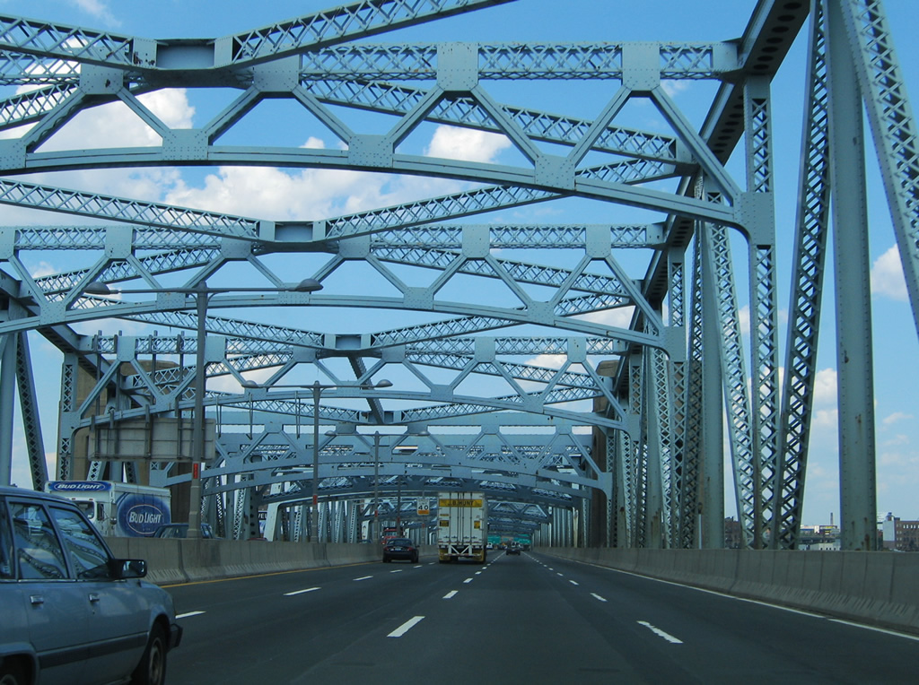
Traveling northbound on the suspension bridge over the East River on Interstate 278 east. Traffic is advised to stay to the left for the fixed truss bridge to the Bronx and Interstate 87 (Major Deegan Expressway). Manhattan bound drivers are to move right for the Harlem River lift bridge to East 125th Street and Franklin D. Roosevelt (FDR) Drive.
08/09/04
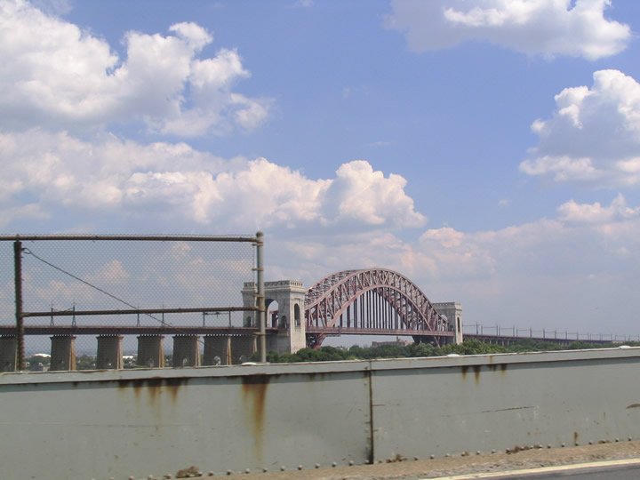
Opened on July 11, 1936 at a cost of $37 million, the Triborough Bridge was the vision of legendary New York City Parks Commissioner Robert Moses. Moses wanted a way for residents to reach the park systems of Long Island without having to traverse the city streets of Manhattan. It was his idea to build a system of bridges to link the three boroughs at the confluence of the Harlem and East Rivers at Randalls Island.
The Hell Gate Bridge carries Interstate 278 over Hell Gate (East River) between Queens and Wards Island. The towers were originally designed to mimic the dual-arched Gothic design of the Brooklyn Bridge, with four suspension cables carrying dual decks and 16 overall lanes of travel. However in an effort to save money, one of the decks was eliminated and two cables instead of four carry a single truss-stiffened deck carrying eight lanes. The towers reflected newer designs and construction techniques at the time with a more simplistic architecture over what was originally envisioned. The 1,380-foot span travels 135 feet above the East River.1
08/09/04
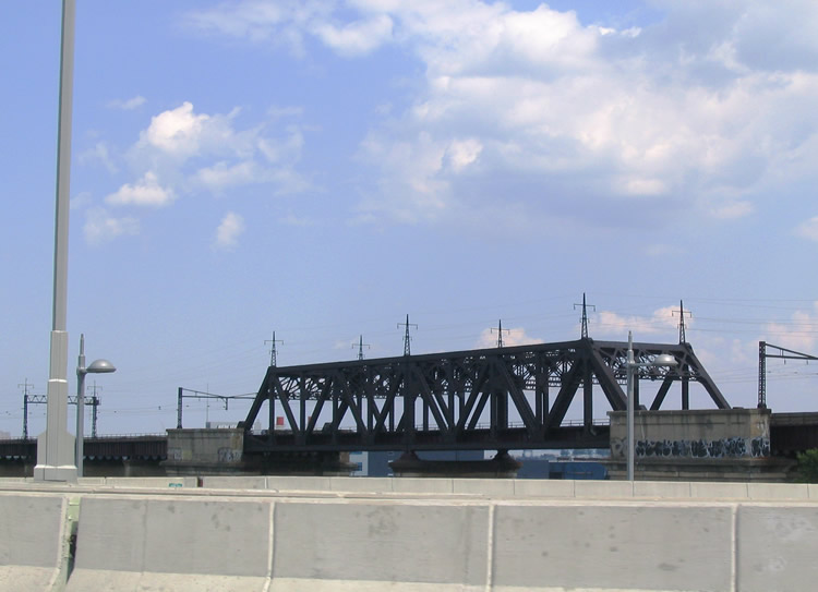
Peering to the southeast at the Hell Gate Railroad Bridge parallel to Interstate 278. There was once a proposal in the 1920s to build a second deck on the railroad bridge to accommodate five lanes of vehicular traffic in lieu of building the Triborough Bridge system.1
08/09/04
The Hell Gate Bridge joins Randalls Island with the Astoria section of Queens. A toll plaza operates along I-278 on the island preceding the split between the Harlem River lift span and the Bronx Kills fixed truss bridge.
08/09/04
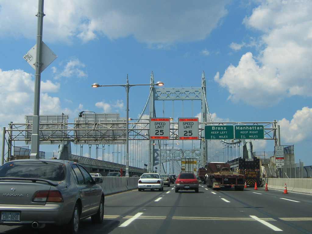
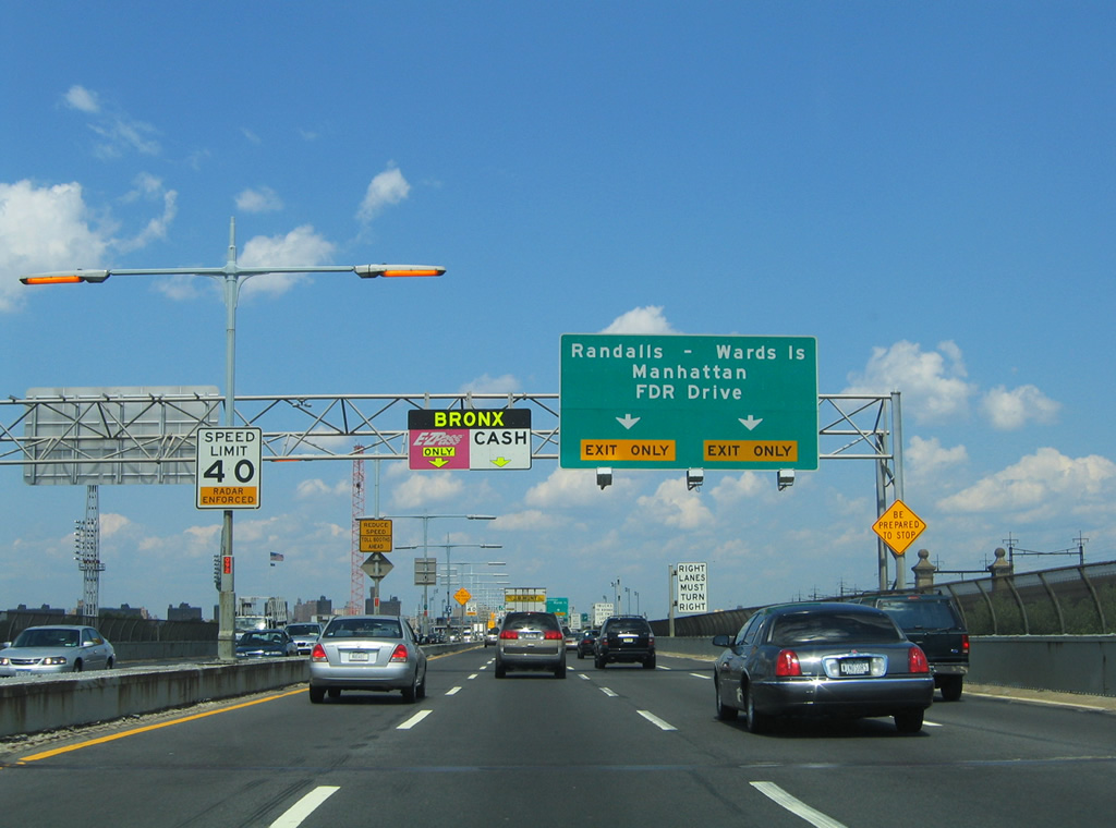
A directional interchange connects the Harlem River lift bridge and I-278 over Randalls Island. Two lanes default onto the western spoke of the Triboro Bridge system for FDR Drive, E 125th Street, and the rest of Manhattan Island. Additionally traffic bound for Randalls Island Park or Wards Island Park is directed onto the westbound off-ramp as well.
The sign bridge was replaced when this stretch of the Robert F. Kennedy Bridge was expanded to nine lanes.
08/09/04
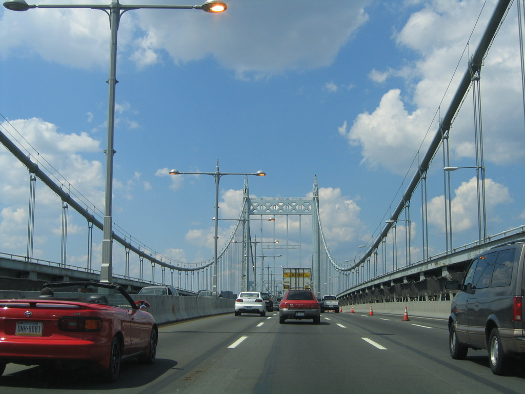
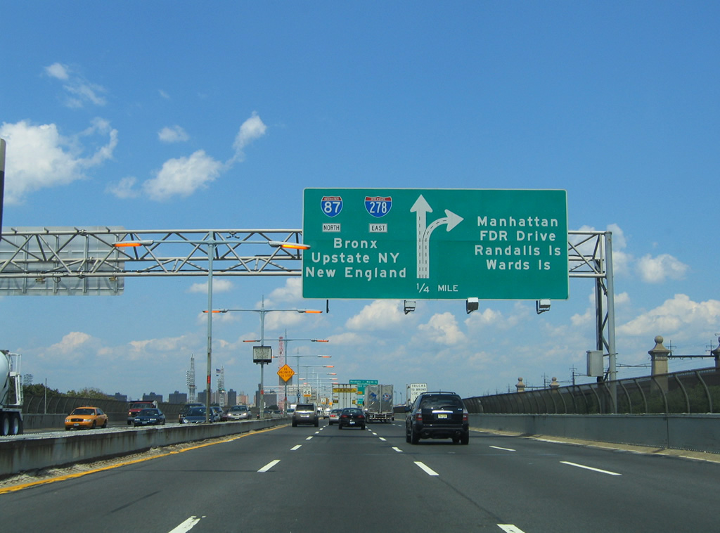
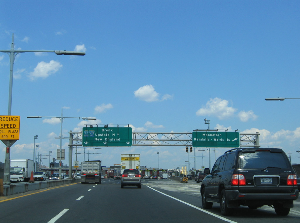
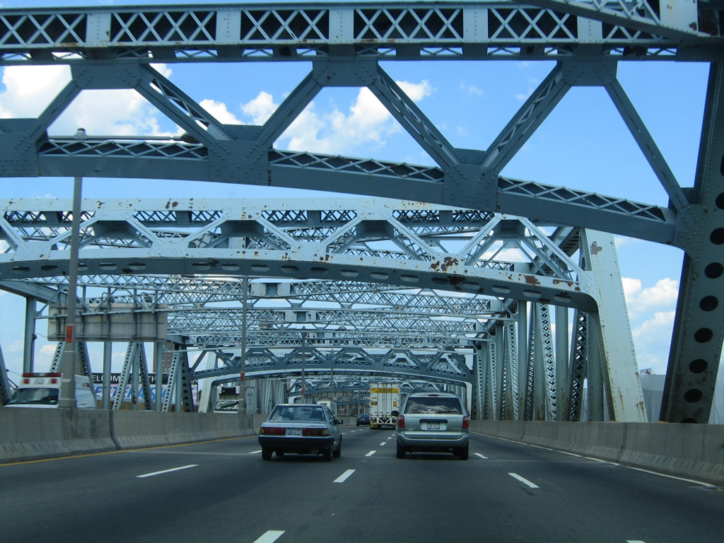
Interstate 278 eastbound continues closer to the Triborough (Robert F. Kennedy) Bridge toll plaza and split with the Harlem River lift bridge. The western spoke of the bridge system ties directly into the FDR Drive freeway along the eastern reaches of Manhattan Island. FDR Drive straddles the East River between Harlem River Drive and the Brooklyn Battery Tunnel. The north-south freeway, in conjunction with Harlem River Drive, ties into Interstate 95 (Cross-Bronx Expressway).
08/09/04
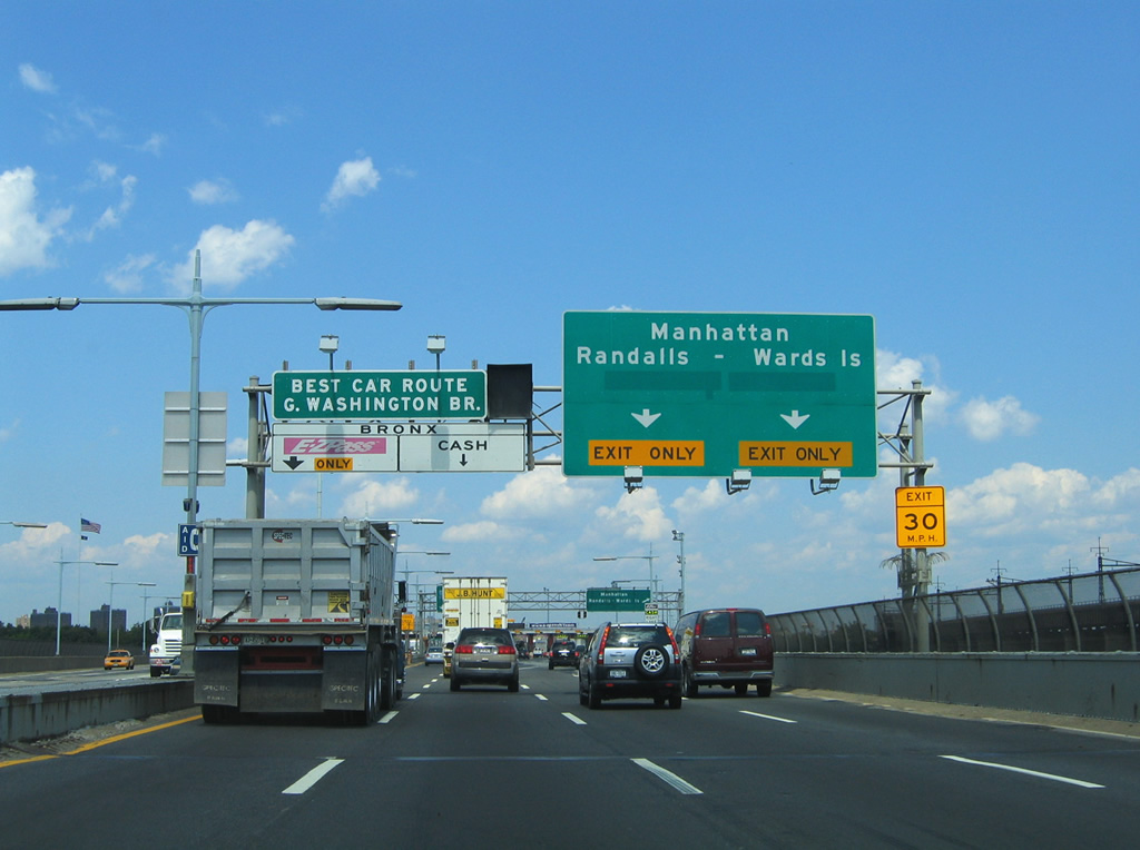
Two lanes prepare to leave Interstate 278 eastbound for FDR Drive and East 125th Street. The westbound ramp provides access to the surface roadways of Randalls and Wards Island beyond its toll plaza. Traffic bound for the George Washington Bridge (Interstate 95) is advocated to continue east on Interstate 278 to Interstate 87 (Major Deegan Expressway) northbound.
08/09/04
Button copy overheads that were posted at the split of Interstate 278 east from the Harlem River bridge approach on Randalls Island. The westbound ramp curves underneath the Bronx Kills bridge approach to join the Harlem River branch of the Triborough Bridge at its main line toll plaza. Continue west across the river onto East 125th Street and Martin Luther King Boulevard for the East Harlem and Harlem neighborhoods of Upper Manhattan.
08/09/04
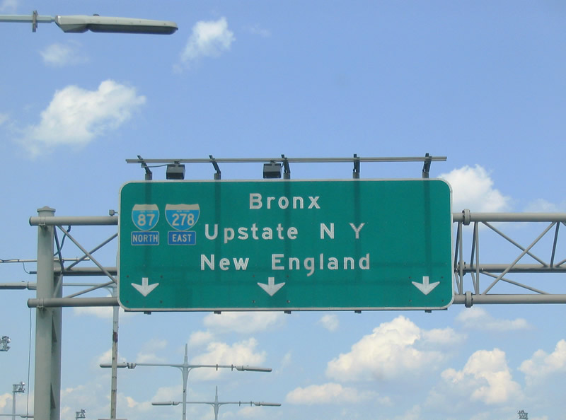
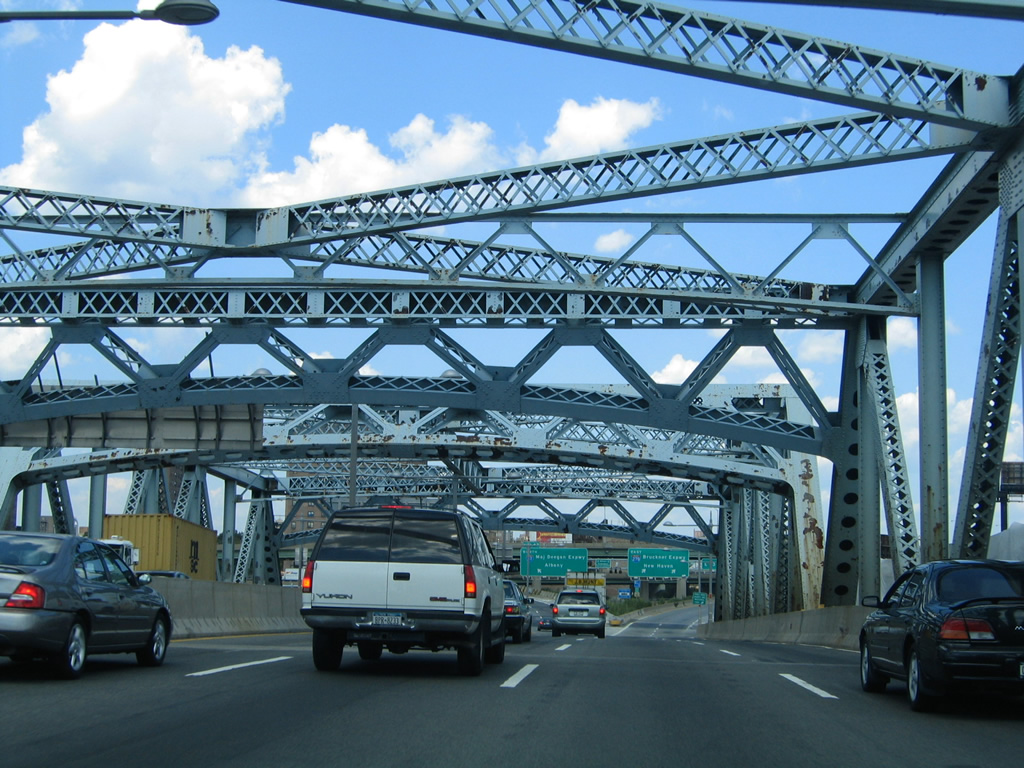
A close-up of the Interstate 278 pull-through panel revealed state name shields for both Interstate 87 and 278. Control cities included Upstate New York for the Interstate 87 (Major Deegan Expressway) connection to the New York Thruway System and New England for the Bruckner Expressway merge with Interstate 95 north. Modern signs replace Upstate NY with Albany and New England with New Haven.
08/09/04
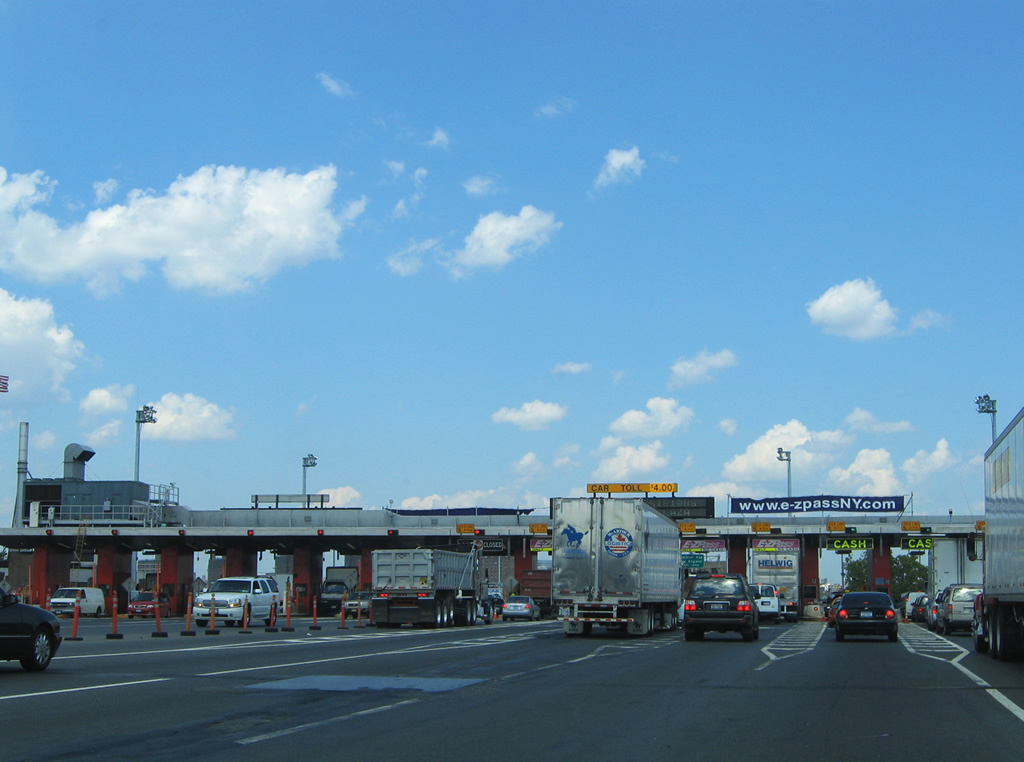
Entering the Triborough Bridge system toll plaza along Interstate 278 eastbound. All cars are charged tolls regardless of direction traveled along Interstate 278.
08/09/04
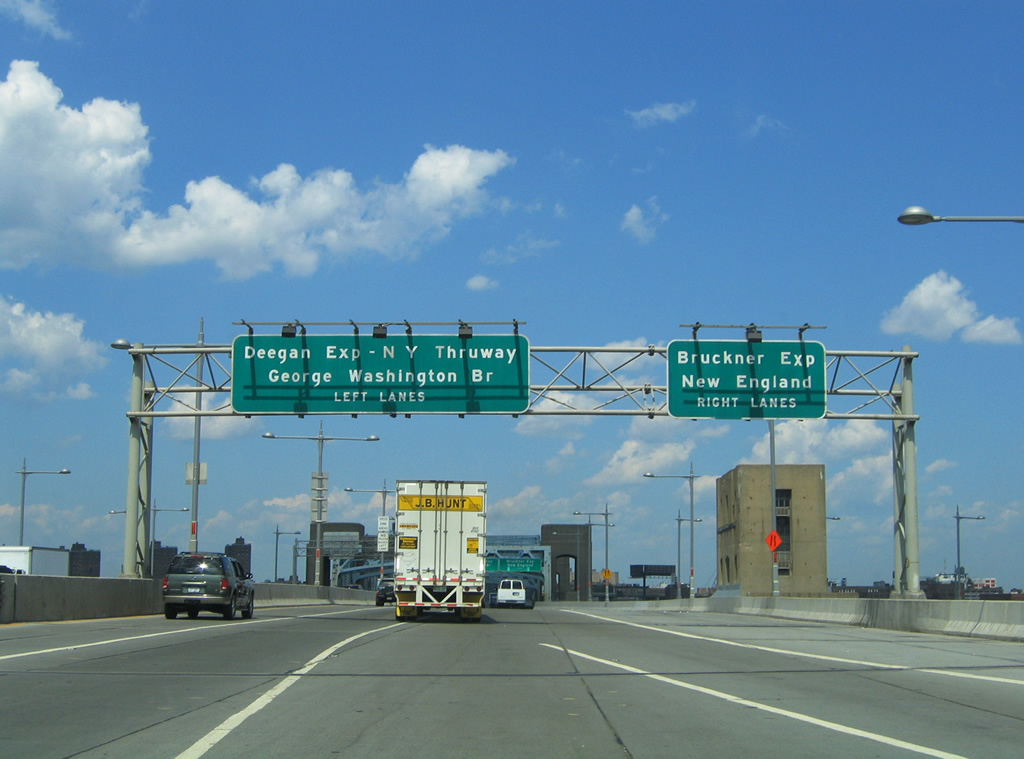
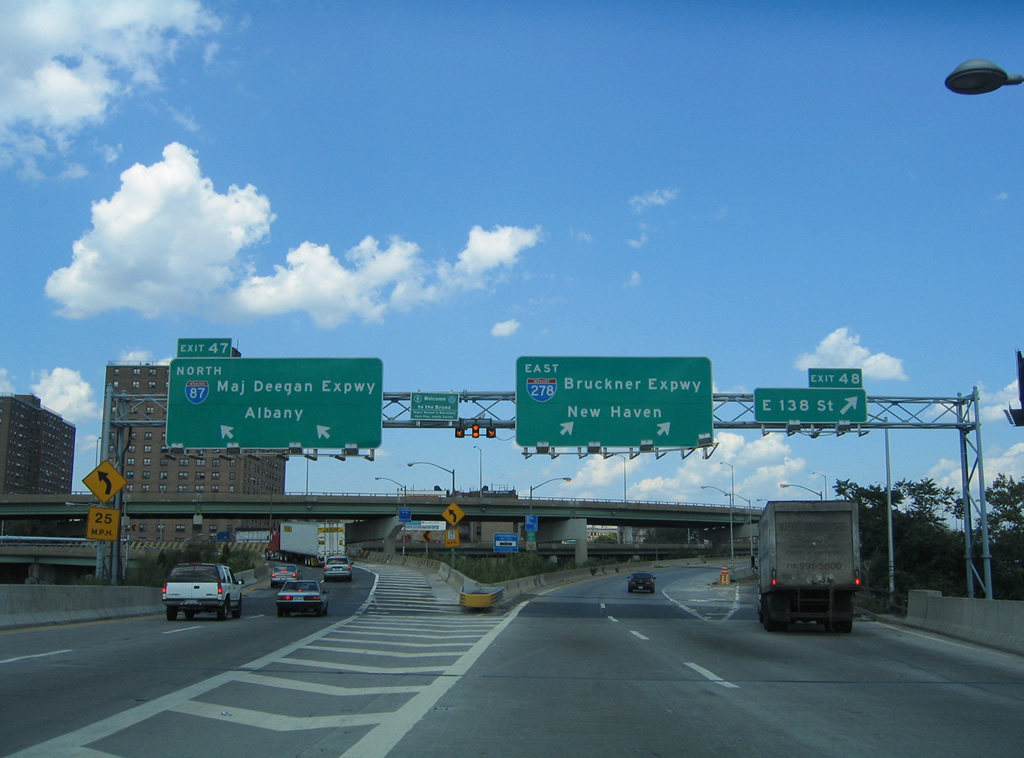
This sign bridge proclaims the formal names of both Interstate 87 (Major Deegan Expressway) and Interstate 278 (Bruckner Expressway) in the Borough of Bronx. Interstate 278 meets the southern terminus of Interstate 87 at the north end of the Bronx Kills bridge at Exit 47. Traffic bound for Interstate 95 and the George Washington Bridge follows I-87 north 3.5 miles to Exit 7.
08/09/04
Looking east at the parallel Bronx Kills Railroad Bridge from the eastbound lanes of Interstate 278. Bridges over the Bronx Kill are low in height and not required to accommodate shipping traffic as the waterway is unnavigable.1
08/09/04

Views of the Bronx Kills fixed truss bridge along Interstate 278 eastbound. The bridge travels 55 feet above the surface and carries eight lanes of travel.1
Interstate 278 (Bruckner Expressway) splits with Interstate 87 (Deegan Expressway) immediately beyond the span at the Port Morris section of the Bronx. Additionally, Exit 48 leaves the Bruckner Expressway for 138th Street via Bruckner Boulevard eastbound at Interstate 87 (Exit 47).
08/09/04
The four eastbound lanes of Interstate 278 split between Interstate 87 north (Exit 47), the Bruckner Expressway east, and Exit 48 onto Bruckner Boulevard to Port Morris. Interstate 87 comprises the Major Deegan Expressway between the Bruckner Expressway and New York Thruway in Yonkers. The New York Thruway in turn carries Interstate 87 northward to the northern suburbs and the state capital of Albany. Bruckner Boulevard meanwhile parallels Interstate 278 between here and the Bruckner Interchange (Interstates 95, 295, and 678). 138th Street parallels Interstate 87 between Port Morris and the Madison Avenue Bridge over the Harlem River.
08/09/04
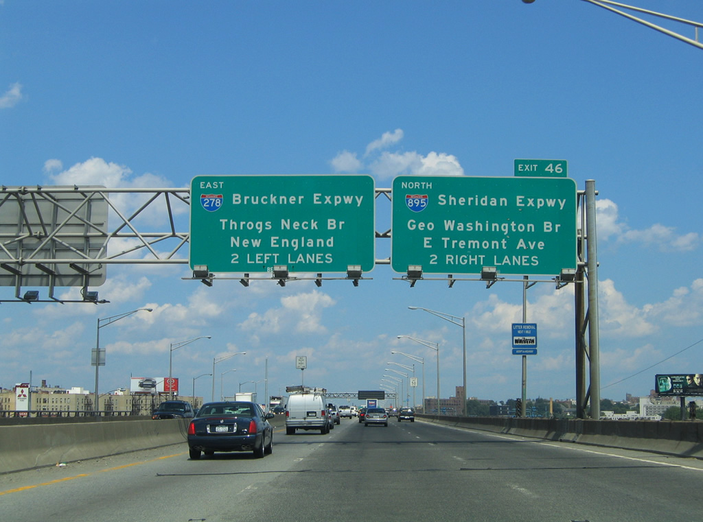
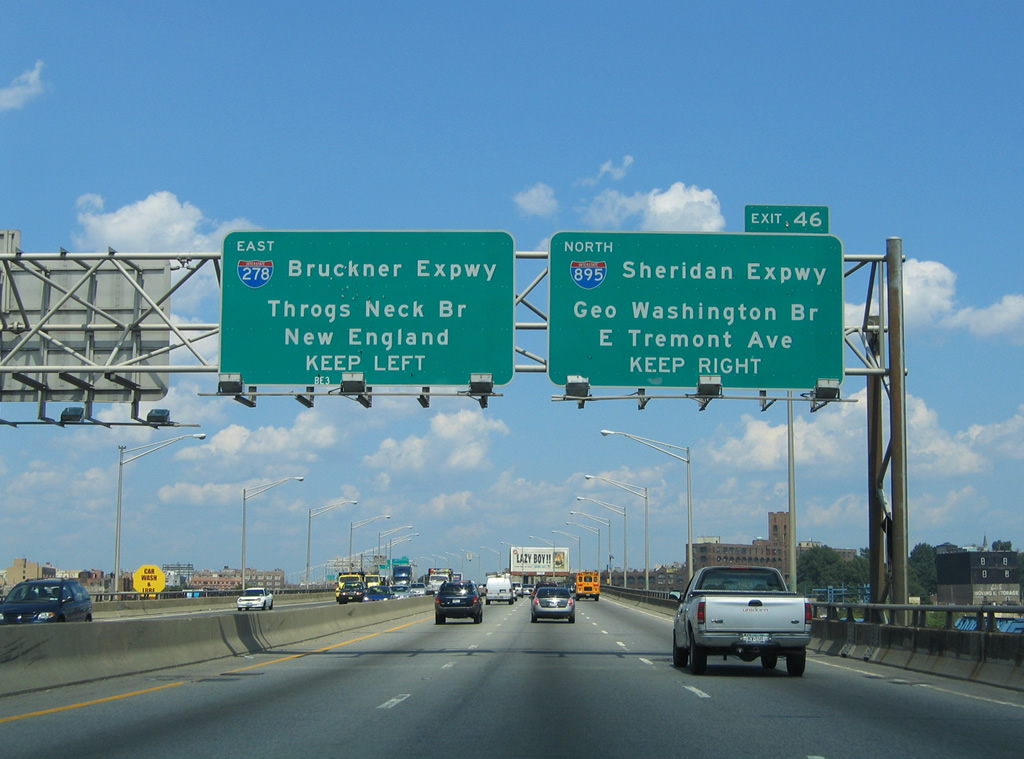
The Bruckner Expressway travels northeast from the Triborough (Robert F. Kennedy) Bridge to Interstate 895 (Sheridan Expressway). Travelers bound for the George Washington Bridge are provided with a second connection to Interstate 95 southbound (Cross Bronx Expressway) via Interstate 895 north. The Sheridan Expressway comprises a short connector between Interstates 278 and 95 with a ramp at Westchester Avenue.
08/09/04
In addition to its connection with Interstate 95, Interstate 895 (Sheridan Expressway) northbound includes exits to Tremont Avenue and East 177th Street at West Farms.
08/09/04
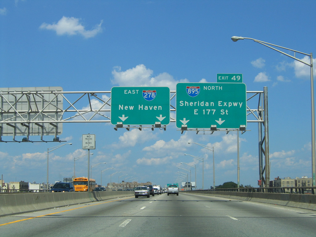
Nearing the Exit 49 split of Interstate 895 north from Interstate 278 (Bruckner Expressway) eastbound. The Sheridan Expressway was part of Interstate 278 originally as the designation continued northeast to Interstate 95 (Cross-Bronx Expressway). During the same time Interstate 878 encompassed Bruckner Boulevard / Bruckner Expressway between the Sheridan Expressway and Bruckner Interchange. Beyond the Cross-Bronx Expressway, the Sheridan Expressway and Interstate 278 were to continue northeast through Bronxdale, Westchester, Morris Park, and Baychester to the New England Thruway portion of Interstate 95 near Baychester Avenue. Plans for the Sheridan Expressway north extension were killed in 19712 and the Interstate 878 designation was replaced with Interstate 278 in 1972.3
08/09/04
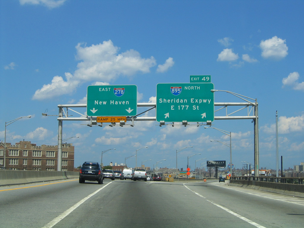
The northbound beginning of Interstate 895 departs Interstate 278 (Bruckner Expressway) eastbound via Exit 49. Interstate 895 features ramps onto Interstate 95 (Cross-Bronx Expressway) southbound and East 177th Street at Devoe Avenue. Devoe Avenue northbound carries motorists to East Tremont Avenue for the East Tremont and West Farms sections of the Bronx.
08/09/04
The Bruckner Expressway descends below the wye interchange with the Sheridan Expressway as it turns easterly toward the Bronx River and the Soundview neighborhood. The narrow four lane freeway navigates through a sharp turn ahead of the Bruckner Drawbridge.
08/09/04
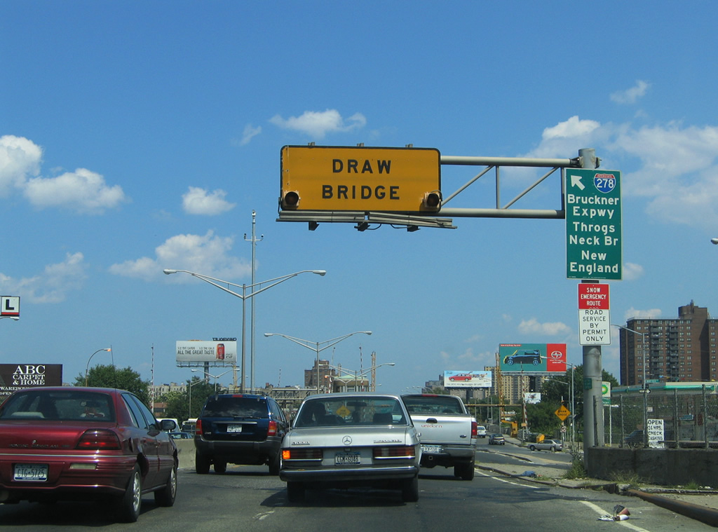
One of the few drawbridges found along the Interstate system, the Bruckner Drawbridge carries Interstate 278 over the Bronx River. A slip ramp brings additional drivers onto the eastbound Bruckner Expressway ahead of the span from adjacent Bruckner Boulevard eastbound. The drawbridge system consists of two four lane spans. The older westbound span opened in 1930.3
08/09/04
Both the Bruckner Expressway and Bruckner Boulevard share the Bruckner Drawbridge over the Bronx River. The eastbound span cost $2.8 million and opened on October 27, 1953 to carry four lanes. A second drawbridge carried Bruckner Expressway traffic over the Westchester Creek nearby. Known as the Unionport Drawbridge, the span carried eight lanes of traffic over two crossings (one built in 1930, the other in 1953). Late 1960s construction of the Bruckner Interchange with the Cross-Bronx Expressway eliminated the 1930 Unionport Drawbridge. However the 1953 span remains in place to carry Bruckner Boulevard as Interstate 278 passes overhead.3
08/09/04

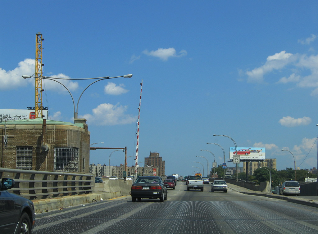
Eastbound reassurance shield posted on the Bruckner Expressway as it enters the Soundview neighborhood of the Bronx.
08/09/04
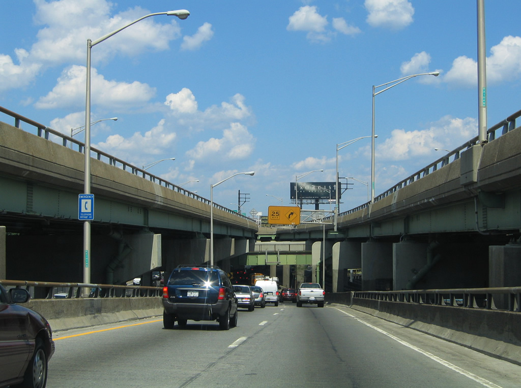
Next in line for Interstate 278 eastbound motorists is the interchange with the Bronx River Parkway at Morrison and Metcalf Avenues. The Bronx River Parkway constitutes a north-south freeway between Interstate 278 & Story Avenue northward to the Cross County Parkway and Sprain Brook Parkway at Yonkers and Mt. Vernon. Like all New York City Parkways, truck traffic is not permitted on the Bronx River Parkway.
08/09/04
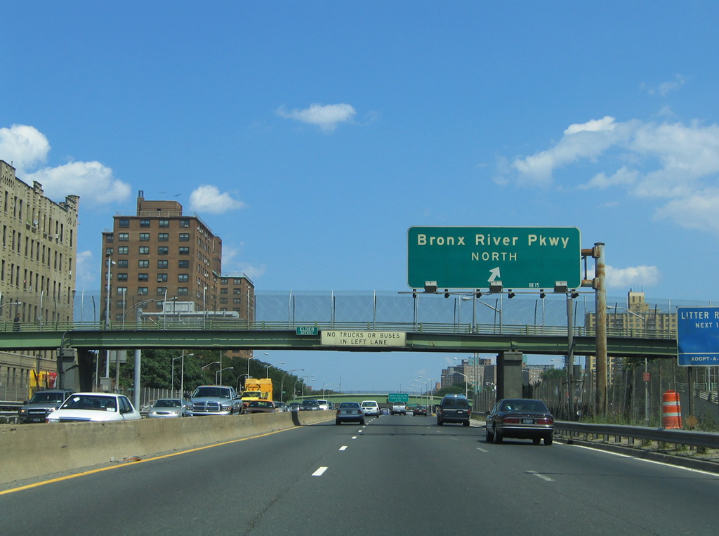
Bronx River Parkway bound traffic utilizes a slip ramp onto adjacent Bruckner Boulevard eastbound at the Elder Avenue pedestrian overpass. Bruckner Boulevard in turn sees a cloverleaf interchange with the Bronx River Parkway between Morrison and Metcalf Avenues. There is no access to Bronx River Parkway south as the highway ends in one block at Story Avenue and Soundview Park.
08/09/04
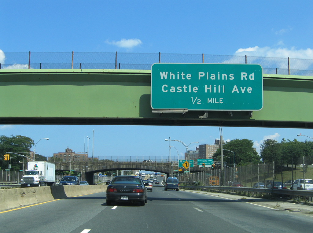
Interstate 278 continues underneath the Bronx River Parkway independent of the exit ramps with Bruckner Boulevard. The Bruckner Expressway in turn continues east toward the White Plains Road & Castle Hill Avenue off-ramp one half mile ahead. White Plains Road travels north from Soundview to West Farms and Van Nest.
08/09/04
The Bronx River Parkway travels over Interstate 278 and Bruckner Boulevard via stone arch bridges. Visible to the right is the northbound loop ramp onto the parkway. White Plains represents the northbound control city for the Sprain Brook Parkway connection to Interstate 287 (Cross West-Chester Expressway).
08/09/04
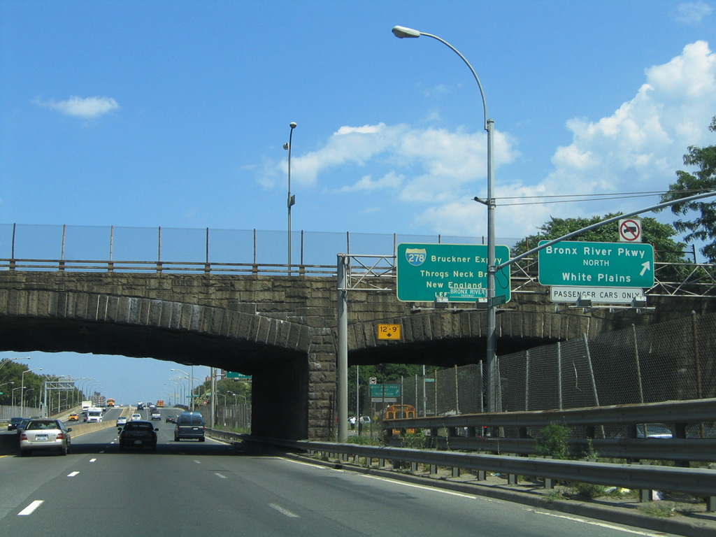
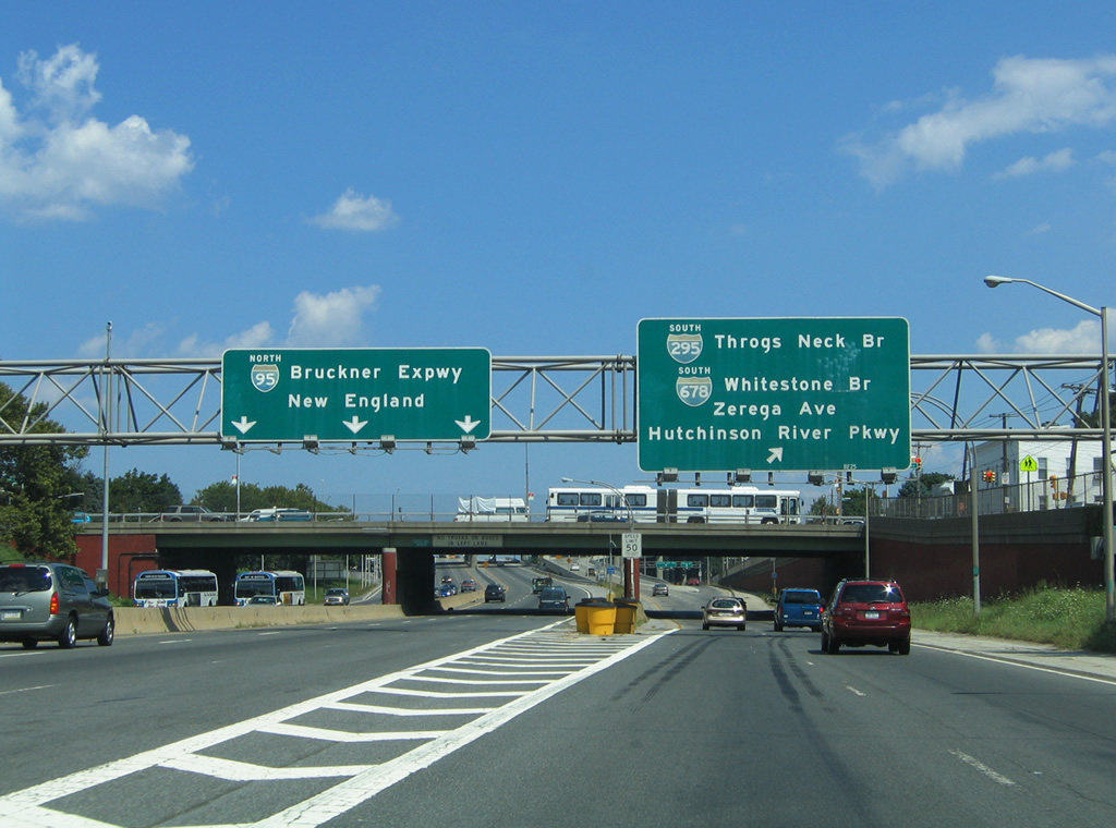
A slip ramp immediately joins Interstate 278 (Bruckner Expressway) eastbound after the Bronx River Parkway over crossing from Bruckner Boulevard. New England and the Throgs Neck Bridge were signed as the destinations for the Interstate 278 connections with Interstate 95 north and Interstate 295 south at the Bruckner Interchange. New signs reflect New Haven, CT only.
08/09/04
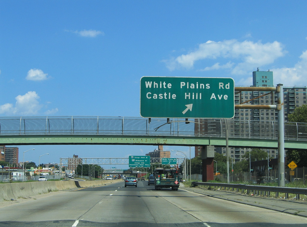
Three lanes of Interstate 278 eastbound travel underneath a pedestrian overpass ahead of the slip ramp onto Bruckner Boulevard east for White Plains Road and Castle Hill Avenue. Bruckner Boulevard intersects White Plains Road two blocks east of the exit ramp and Castle Hill Avenue three blocks from there. Use Castle Hill Avenue north for Parkchester.
08/09/04
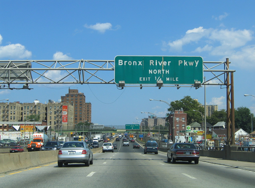
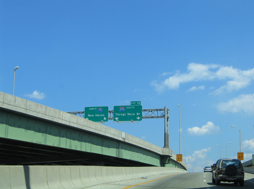
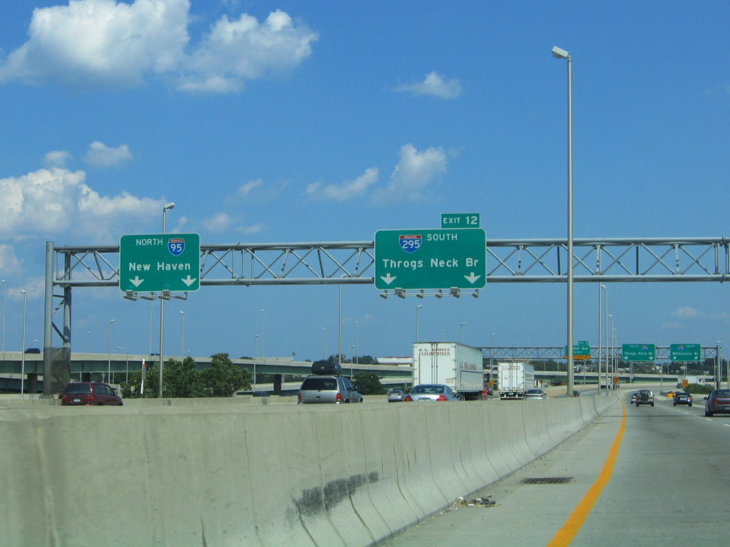
Traffic to Bruckner Boulevard east for White Plains Road and Castle Hill Avenue leaves Interstate 278 (Bruckner Expressway) eastbound near the Unionport section of the Bronx. White Plains Road continues north all the way to the city line at Mount Vernon. Meanwhile for Interstate 278 eastbound travelers, the first guide sign for the upcoming Bruckner Interchange was posted here.
New sign bridges have replaced all button copy overheads for the Bruckner Interchange.
08/09/04
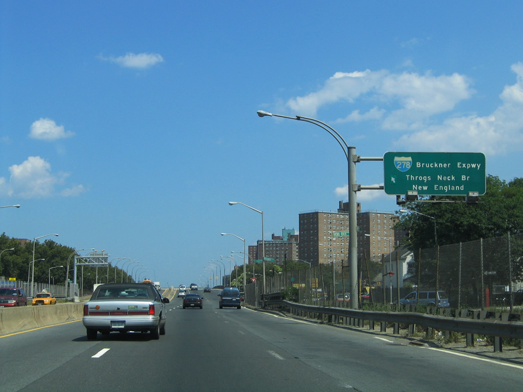
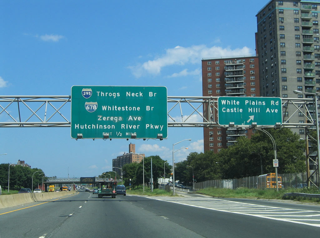
The Bruckner Expressway mainline defaults onto Interstate 95 northbound for the northeast Bronx, New Rochelle, and New Haven, Connecticut. The right lanes continue eastward for connections onto Zerega Avenue & Unionport, Interstate 678 (Whitestone Bridge) south, Hutchinson River Parkway north, and Interstate 295 (Throgs Neck Bridge) south. Note a reflectorized Interstate 678 shield installed to replace the button copy shield that fell off in the early 2000s.
08/09/04
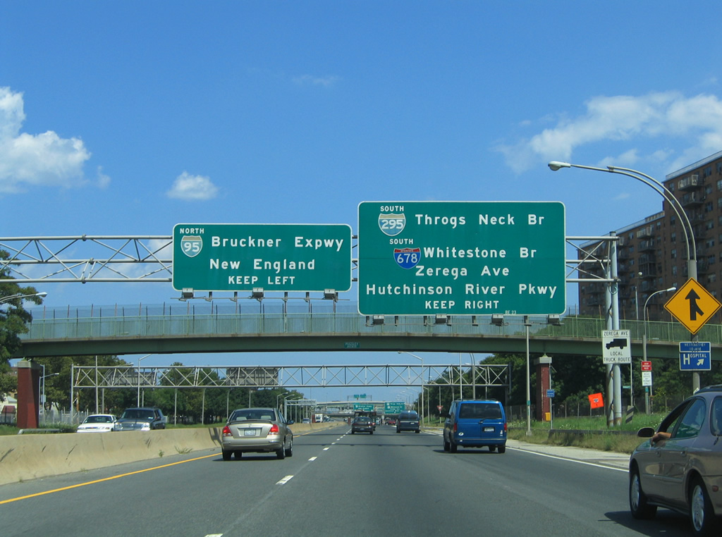
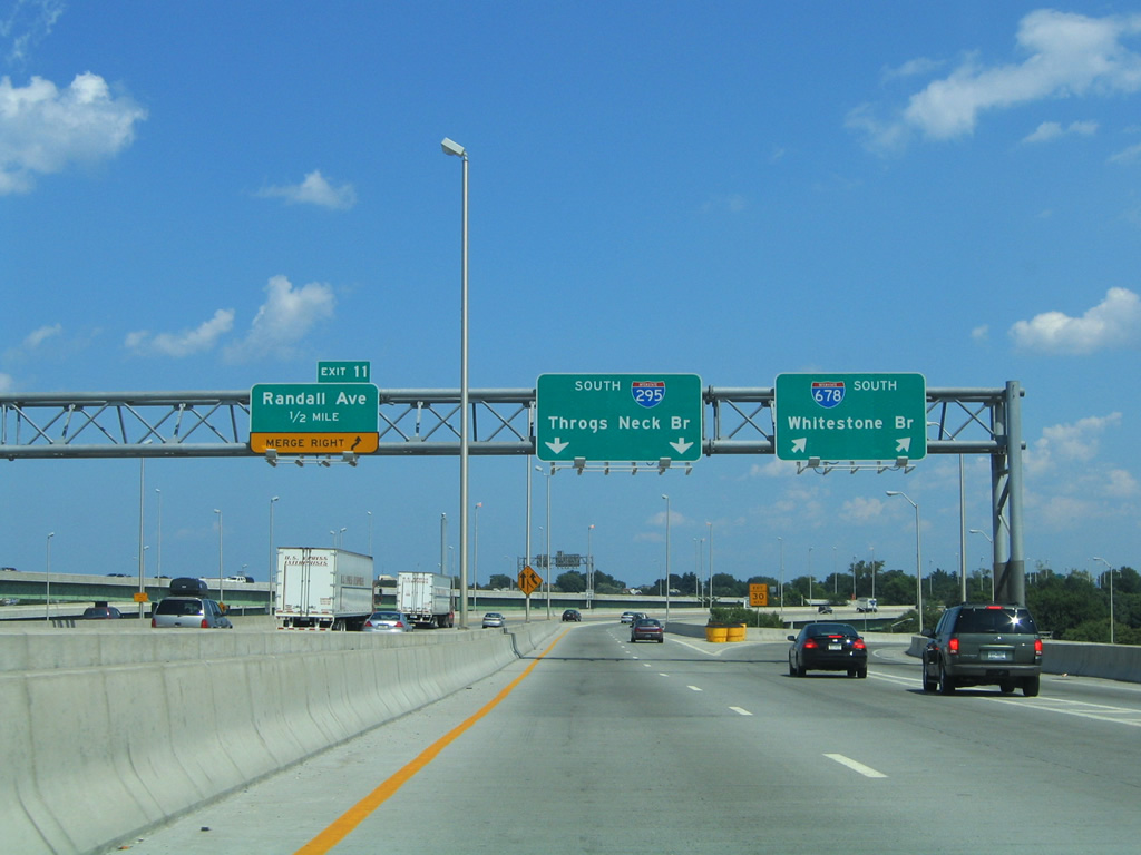
Interstate 278 eastbound partitions into three lanes for the Bruckner Expressway continuation onto Interstate 95 north and two lanes for the Cross-Bronx Expressway continuation onto Interstate 295 south. Castle Hill Avenue passes over the split. Traffic utilizing the northbound connection to Interstate 95 defaults onto the freeway with no access to Interstates 678, 295, or Hutchinson River Parkway. The next departure point is the Country Club Drive off-ramp north of Interstate 695 (Throgs Neck Expressway).
08/09/04
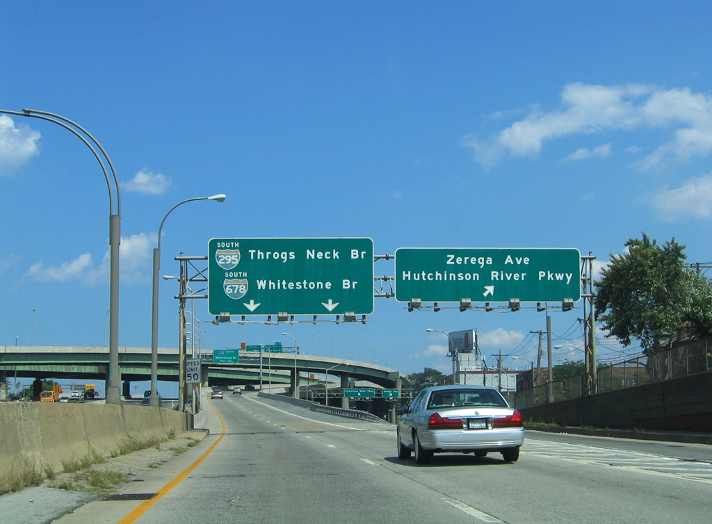
Taking the Interstate 278 eastbound ramp onto the Cross-Bronx Expressway Extension leads drivers to a second split with the Bruckner Boulevard, Zerega Avenue, and Hutchinson River Parkway off-ramp. Drivers using the right side ramp again split between Bruckner Boulevard ramps to Zerega Avenue and Unionport or for the Unionport Drawbridge to the ramps onto the Hutchinson River Parkway. Zerega Avenue parallels the Westchester Creek between Unionport and Parkchester. The Hutchinson River Parkway, called 'The Hutch' by locals, continues the Interstate 678 freeway northward to New Rochelle, White Plains, Interstate 684, and the Merritt Parkway (Route 15).
08/09/04

The Bruckner Interchange saw a major redesign in the early 2000s to improve traffic flow. The reconfigured interchange features smoother high speed ramps onto Interstate 678 (Whitestone Expressway) southbound and Interstate 295 (Cross-Bronx Expressway Extension) southbound. Interstate 678 begins its southward journey at the Bruckner Interchange en route to the tolled Whitestone Bridge into Queens. The freeway continues south from there to Flushing and John F. Kennedy International Airport as the Van Wyck Expressway.
08/09/04
Visible above the Interstate 278 eastbound ramps to Interstates 678 and 295 southbound is the Exit 12 sign bridge for the Interstate 95 (Cross-Bronx Expressway) split with Interstate 295. Interstate 95 turns northward from here via the Bruckner Expressway to the New England Thruway and New Rochelle. Interstate 295 travels the Cross-Bronx Expressway Extension eastward between Interstates 278 and 695 (Throgs Neck Expressway).
08/09/04
Interstate 278 drivers ascend to the same level as the Cross-Bronx Expressway in preparation for the transition onto Interstate 295 south. Interstate 95 northbound veers northeast to Baychester, Co-Op City, and the Westchester County line. Interstate 295 meanwhile begins and travels southeast to the Throgs Neck Expressway and Throgs Neck Bridge at Locust Point.
08/09/04
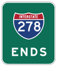
End Interstate 278 at the partitioning of traffic onto Interstates 295 and 678 southbound. The Whitestone and Throgs Neck Bridges traverse the East River between the Bronx and Queens as the easternmost crossings onto Long Island. Interstate 295 follows the Clearview Expressway southeast from the Throgs Neck Bridge to Interstate 495 (Long Island Expressway) and the Grand Central Parkway in eastern Queens. The Clearview Expressway was designated the easternmost segment of Interstate 78 until 1971.
08/09/04

References:
Photo Credits:
- Alex Nitzman, Carter Buchanan: 08/09/04
Connect with:
Page Updated Tuesday February 07, 2012.