
Interstate 278 Goethals Bridge / Staten Island Expressway East
A brief history of Staten Island: The first permanent European settlement on Staten Island was established in 1661 by nineteen Dutch and French Huguenot colonists. By 1683 Staten Island was renamed Richmond County by King Charles II of England after James the Duke of Richmond. On January 21, 1898 Staten Island joined the Bronx, Brooklyn, Queens, and Manhattan to form a single city. And in 1975 the Borough of Richmond was renamed officially to the Borough of Staten Island.2
 East
East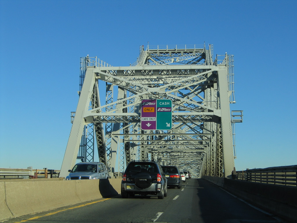
Constructed between 1925 and 1928, the narrow Goethals Bridge spans the Arthur Kill River between Linden, New Jersey and Staten Island, New York.1
10/03/04
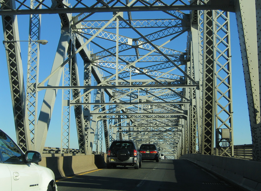
Measuring 8,600 feet in length, the steel-truss cantilever bridge travels 135 feet above the river below at mid-span. The bridge is named after Major General George W. Goethals, designer of the Panama Canal.1
10/03/04
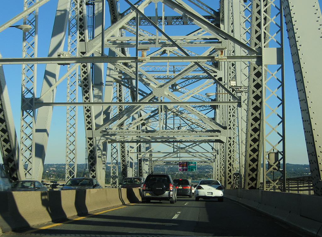
The Goethals Bridge and Outerbridge Crossing (New Jersey Route 440 / NY 440) both opened on June 20, 1928.1
10/03/04
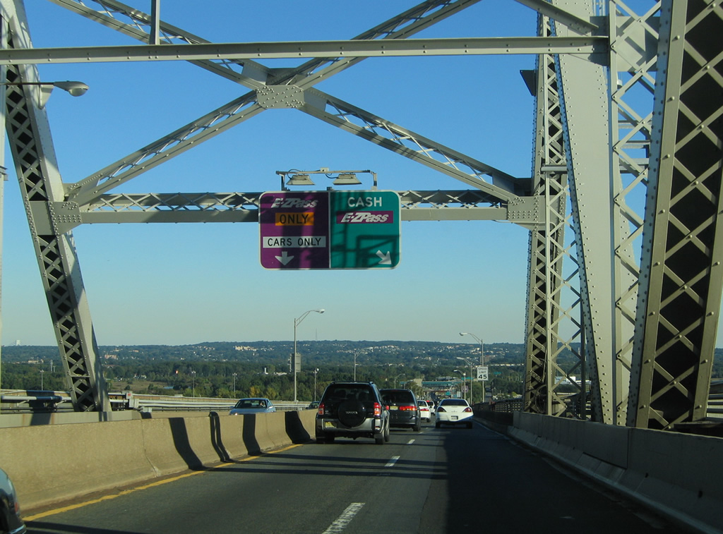
The original Goethals Bridge accommodate just four ten-foot wide lanes with no shoulders in either direction.
10/03/04
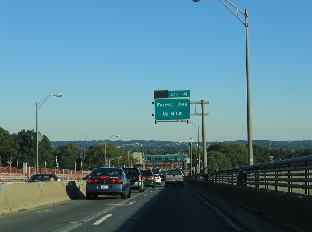
Descending toward Staten Island (Richmond County) on I-278 (Goethals Bridge) eastbound. Exit 4 to Forest and Gulf Avenues departed beyond the forthcoming Goethals Bridge toll plaza ahead. Forest Avenue stems east from parallel Gulf Avenue through the Graniteville and Westerleigh neighborhoods of Staten Island.
10/03/04
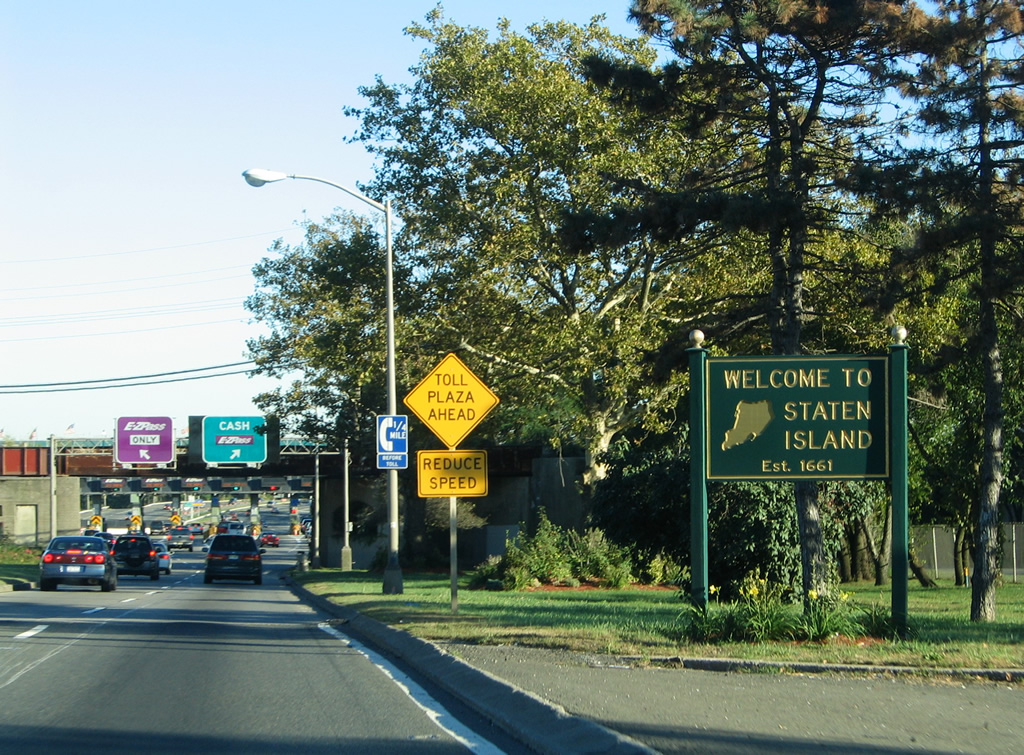
A Staten Island welcome sign appeared where Interstate 278 (Staten Island Expressway) eastbound lowered to grade level from the Goethals Bridge.
10/03/04
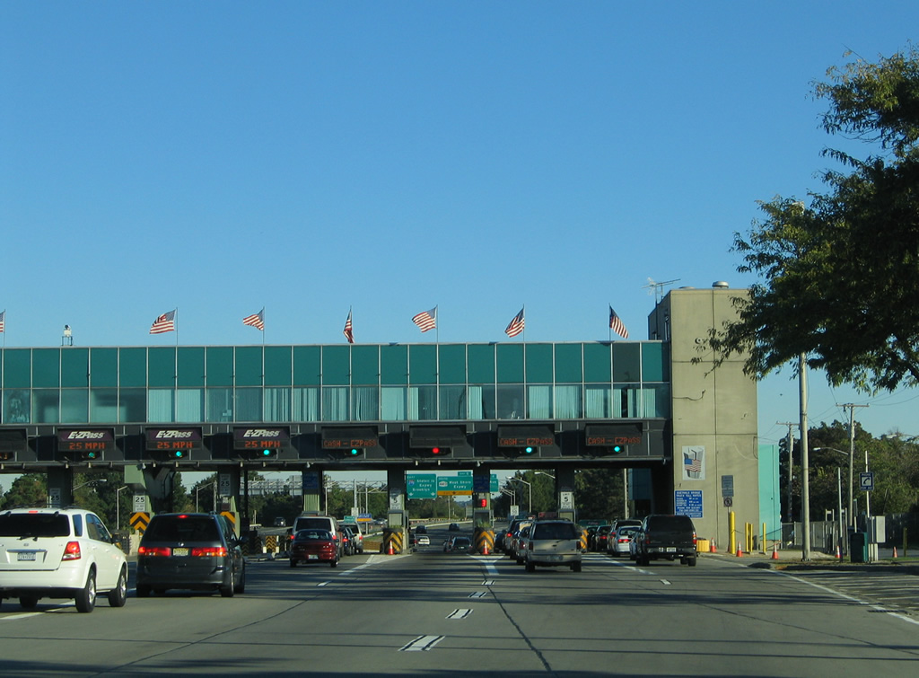
The Port Authority toll plaza lies just east of the Goethals Bridge levying a fare to eastbound vehicles. Lanes are partitioned between cash paying and E-ZPass only lanes. Tolls for NY-bound traffic are set by the Port Authority of New York & New Jersey. Different rates are charged for E-ZPass account holders versus cash-paying drivers. The E-ZPass rates vary increase during peak hours.
10/03/04
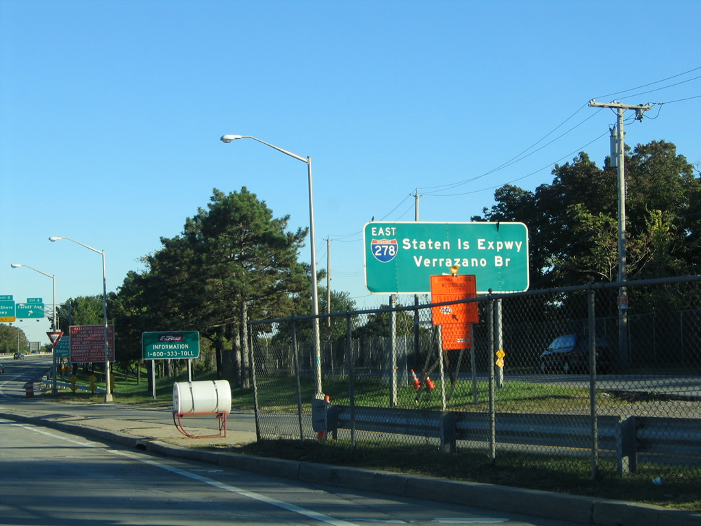
A slip ramp brings traffic from adjacent Gulf Avenue onto Interstate 278 (Staten Island Expressway) eastbound after the toll plaza. Gulf Avenue and Goethals Road North join Forest Avenue with 6th Avenue and Western Avenue for Old Place, Gulfport, and Port Ivory to the west.
10/03/04

Exit 4 departs Interstate 278 (Staten Island Expressway) for Forest Avenue east and Gulf Avenue south to Edward Curry Avenue at Bloomfield. Ahead is the directional interchange with NY 440 (West Shore Expressway) at Exit 5.
10/03/04
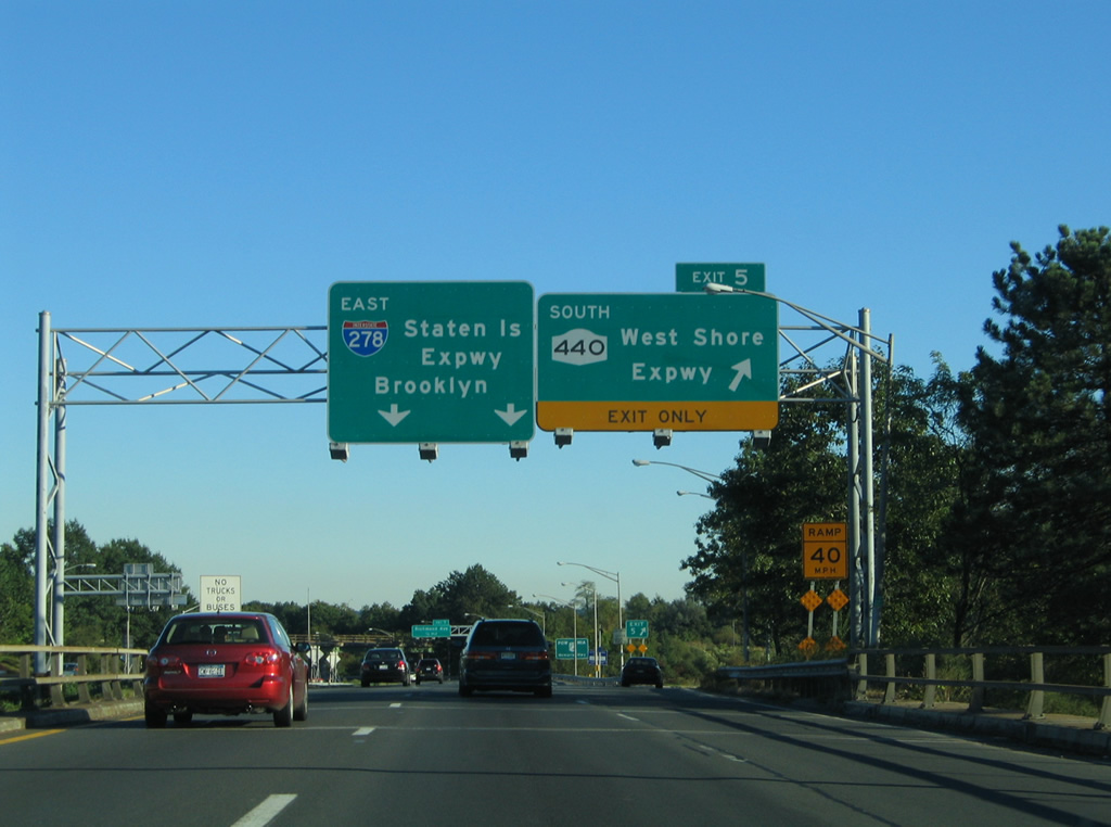
Interstate 278 passes over Forest Avenue at Exit 5 to NY 440 (West Shore Expressway) southbound. The West Shore Expressway straddles western Staten Island between the Outerbridge Crossing / Richmond Parkway and I-278, a distance of eight miles.
10/03/04
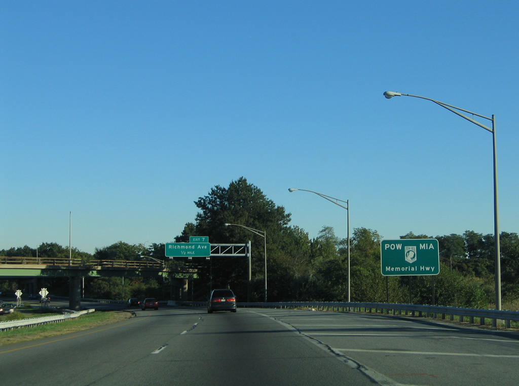
In addition to Staten Island Expressway, Interstate 278 is also designated the POW MIA Memorial Highway in honor of those who have served in the armed forces and never returned.
10/03/04
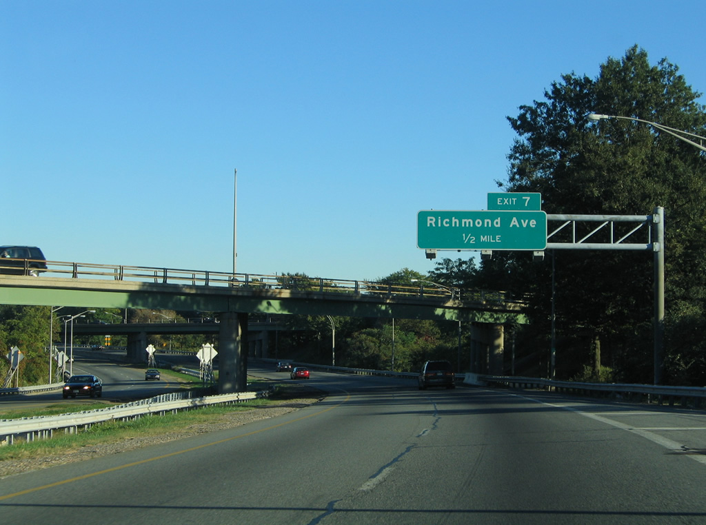
Exit 7 departs from the Staten Island Expressway eastbound next to Richmond Avenue. Spanning I-278 here is the ramp linking NY 440 north with the Goethals Bridge. NY 440 joins the Staten Island Expressway between Exits 7 and 9.
10/03/04
East  North
North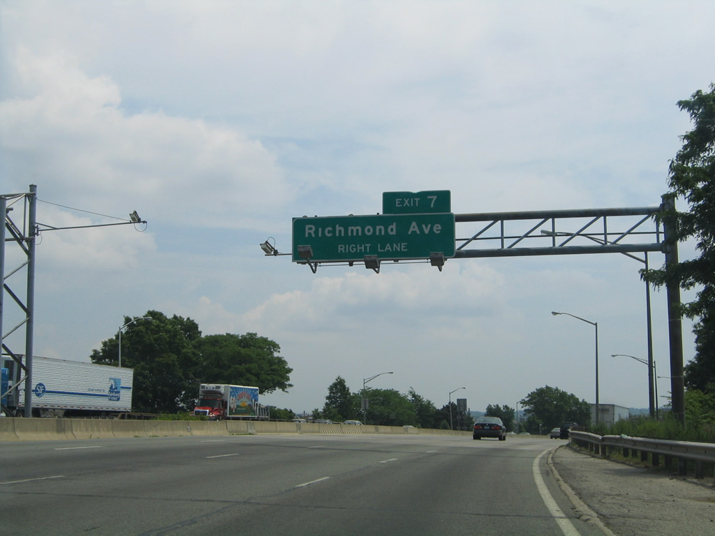
Traffic from NY 440 north joins I-278 east just ahead of the slip ramp to Fahy Avenue at Exit 7. Fahy Avenue runs along the south side of the Staten Island Expressway from South Avenue to Exit 7 before turning south to the intersection of Lamberts Lane and Arlene Street.
06/13/05
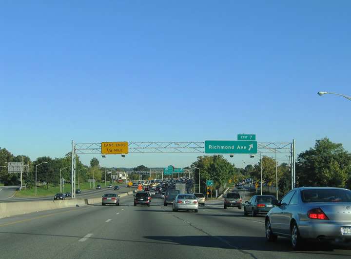
A lane drop occurs along I-278/NY 440 east beyond Exit 7. Traffic bound for Richmond Avenue utilizes Lamberts Lane east from Fahy Avenue. Richmond Avenue is a multi-lane boulevard extending north from Korean War Veterans Parkway at Greenridge through New Springville and Bulls Head.
06/13/05
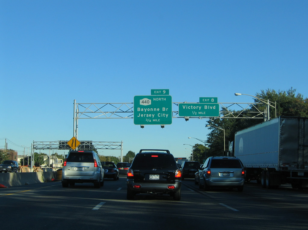
The succeeding exit connects I-278/NY 440 with Dr. Martin Luther King, Jr. Expressway southbound to Victory Boulevard. The expressway ends beyond ramp stubs for an unbuilt extension.
10/03/04
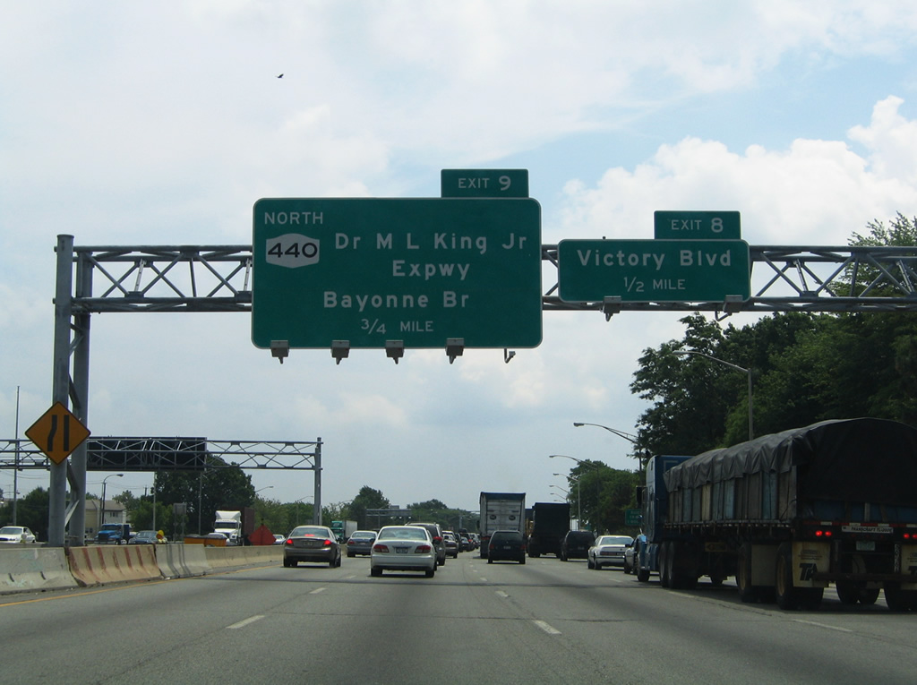
A sign bridge replacement included a new panel for Exit 9 acknowledging the name change of Willowbrook Expressway to honor Dr. Martin Luther King in 1990.
06/13/05
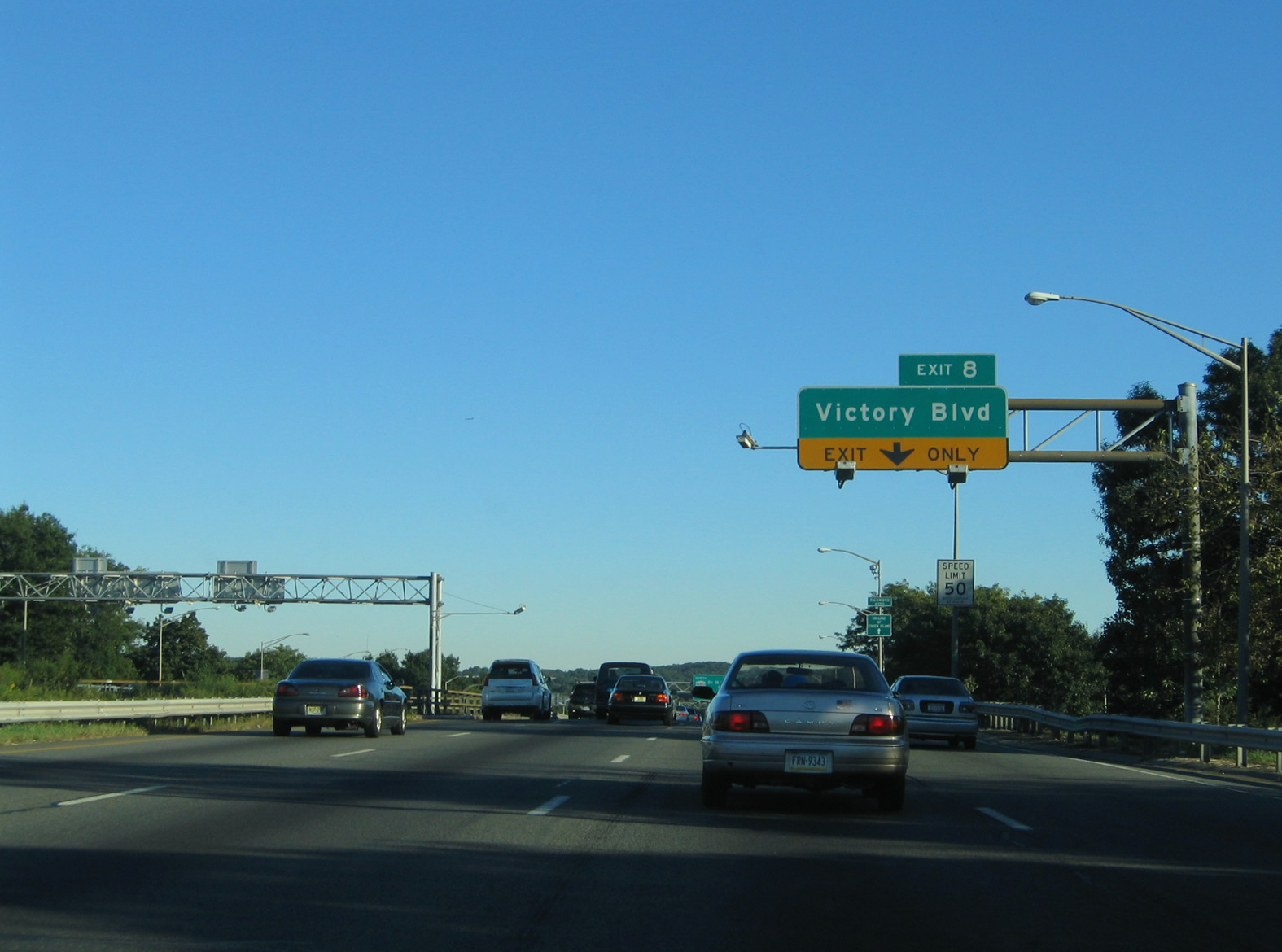
The Staten Island Expressway passes over Richmond Avenue ahead of Exit 8 to Victory Boulevard. Victory Boulevard leads east from the Travis and Bulls Head sections of Staten Island to Sunnyside and Tompkinsville northeast of I-278. Points of interest for Exit 8 include Willow Brook Park, The College of Staten Island, and the William T Davis Wildlife Refuge.
10/03/04
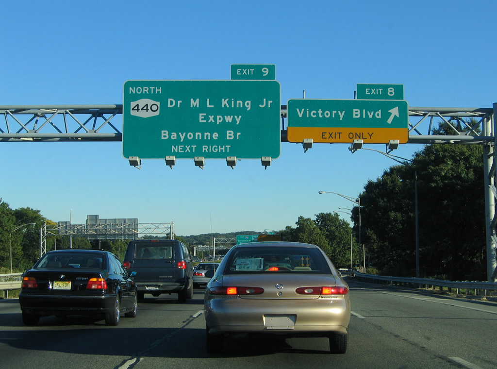
Willowbrook Parkway was planned to continue southeast from Victory Boulevard to Richmondton, where it would converge with the planned Richmond Parkway, and from there to Oakwood Beach and the proposed Shore Front Drive freeway. Plans for these highways were scuttled due to community opposition.
10/03/04
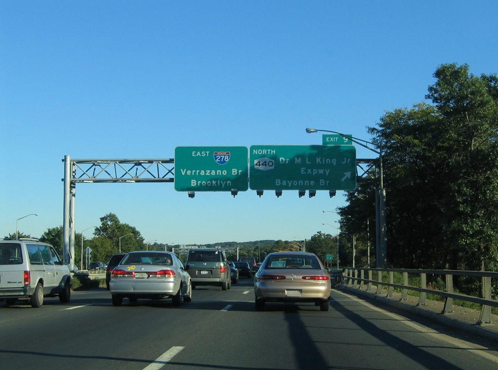
NY 440 turns northward along Dr. Martin Luther King Junior Expressway to connect Interstate 278 with the Bayonne Bridge over the Kill Van Kull River. NY 440 transitions into New Jersey Route 440 (former Route 169) upon entering Bayonne.
10/03/04
East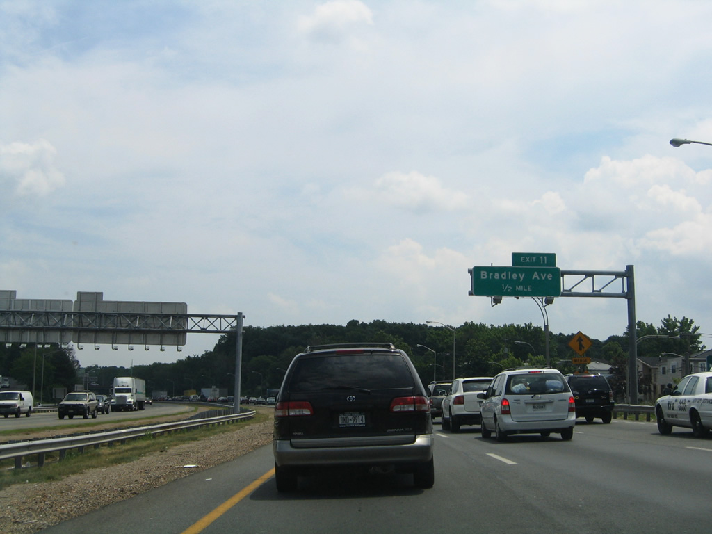
Continuing eastbound on Interstate 278 over Victory Boulevard toward the Willowbrook section of Staten Island. The ensuing exit is a slip ramp to South Gannon Avenue for Bradley Avenue.
06/13/05
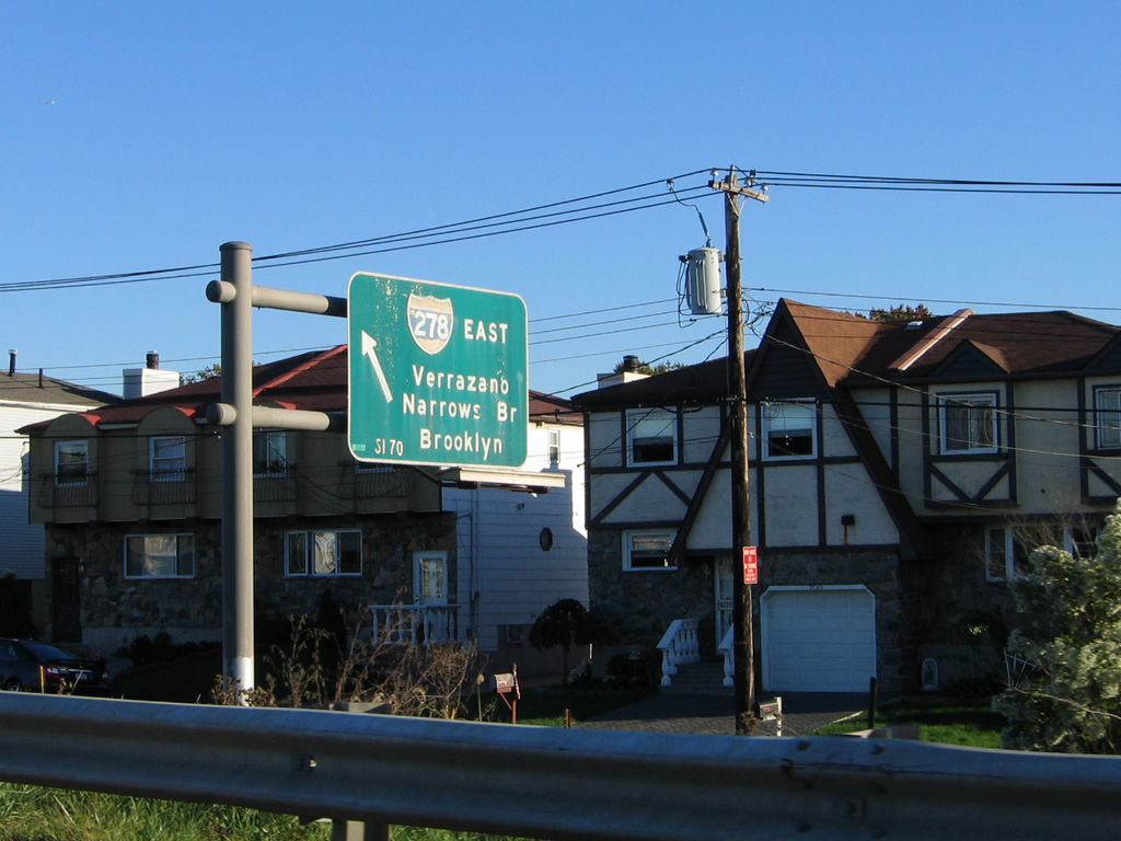
Button copy overhead for the S Gannon Avenue entrance ramp to Interstate 278 eastbound. S Gannon Avenue links Victory Boulevard with the Staten Island Expressway for the Verrazzano-Narrows Bridge.
10/03/04
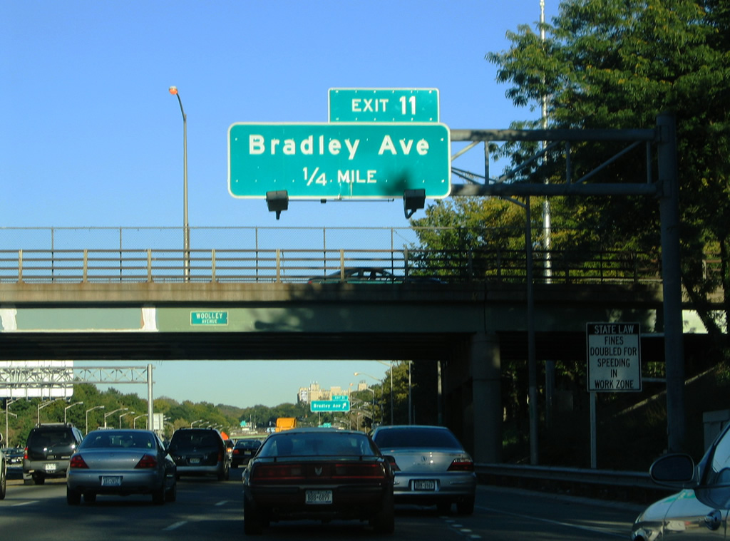
Woolley Avenue spans I-278 a quarter mile from Exit 11 to Bradley Avenue. Bradley Avenue heads south from Victory Boulevard to Brielle Avenue through the Willowbrook neighborhood of the city.
10/03/04
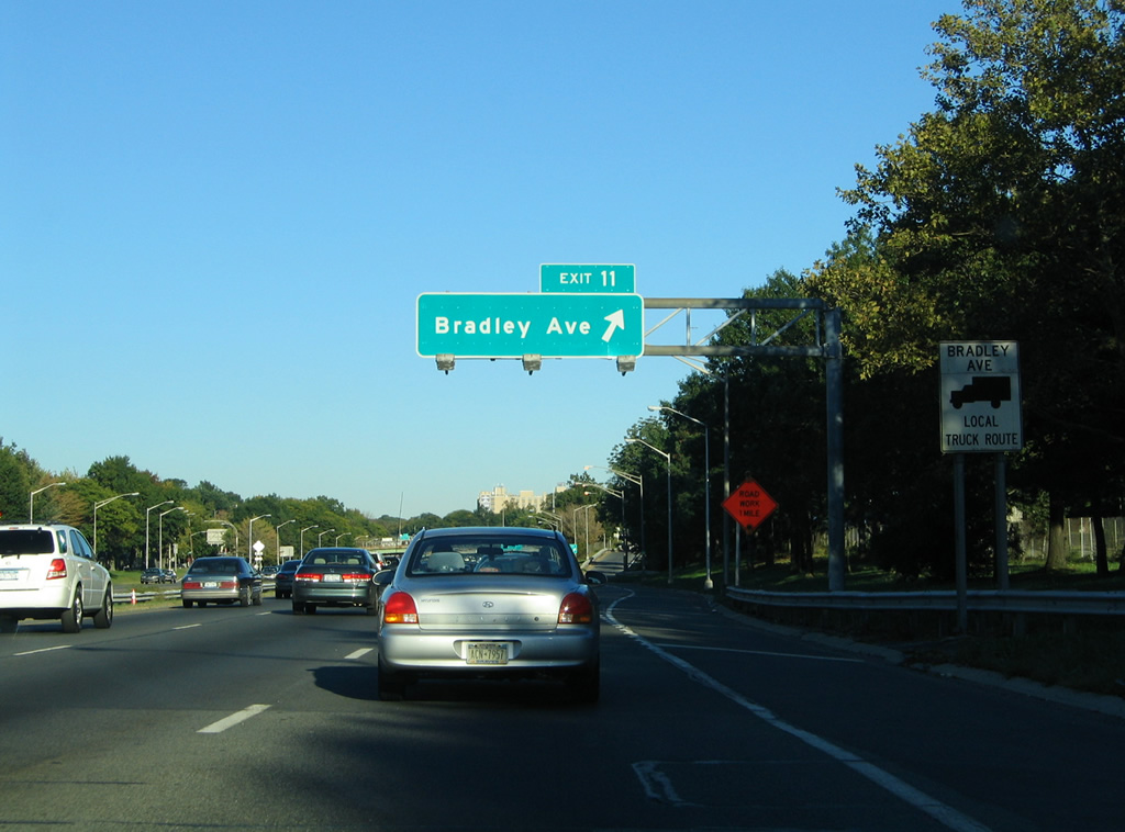
Exit 11 leaves I-278 east for S Gannon Avenue and Bradley Avenue. Gannon Avenue comprises frontage streets in both directions of the Staten Island Expressway between Victory Boulevard and Manor Road.
10/03/04
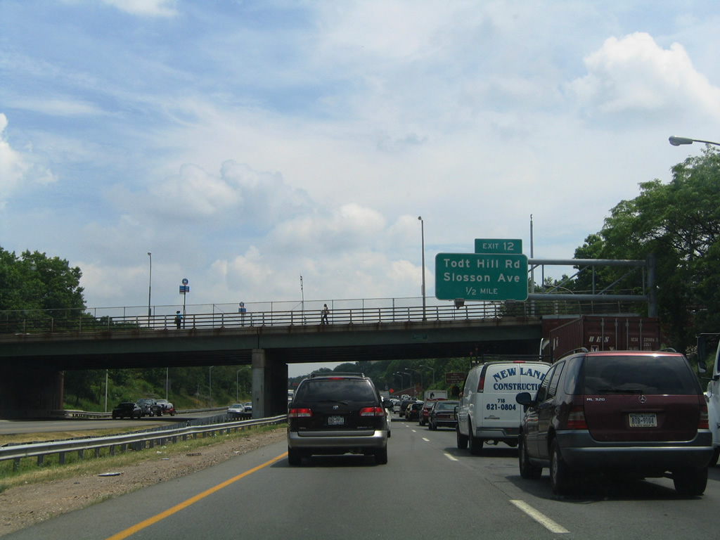
Exit 12 to Slosson Avenue and Todt Hill Road follows the Bradley Avenue overpass in a half mile. Slosson Avenue stems north from Interstate 278 to Clove Lakes Park and Martling Avenue. Todt Hill Road continues Slosson Avenue southward to Four Corners and Richmond Roads.
06/13/05
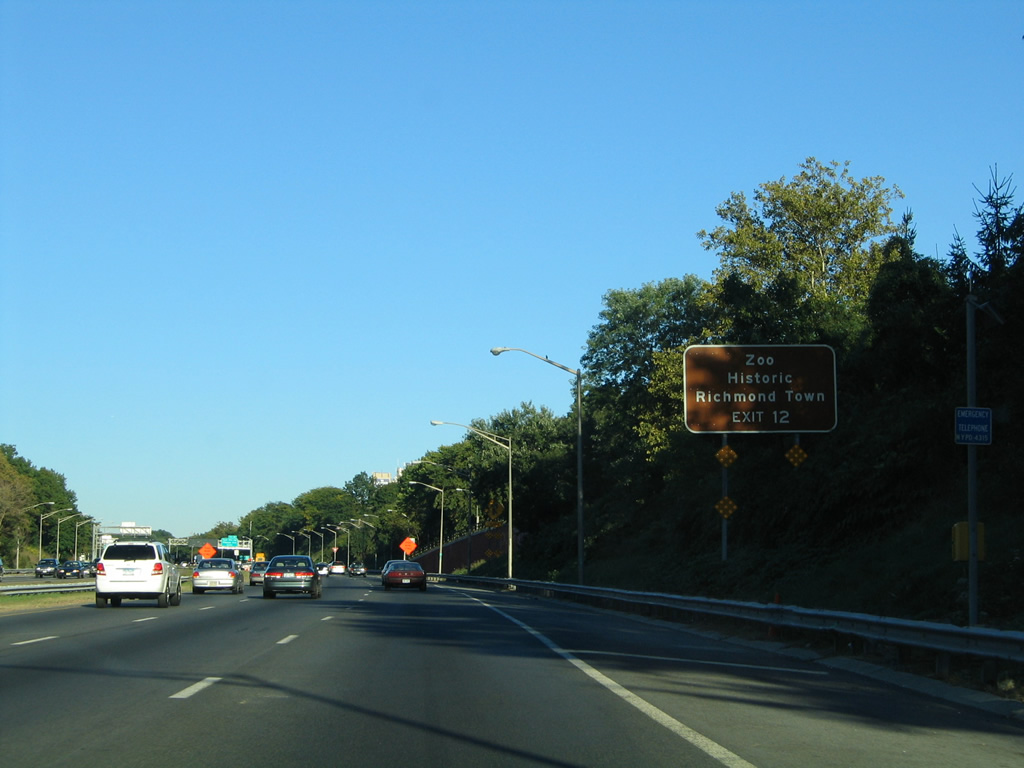
Points of Interest for Exit 12 include Staten Island Zoo at Clarence T. Barrett Park and Historic Richmond Town. Richmond Town represents the first county seat of the original Richmond County. That area of Staten Island is located along Richmond Road southwest of Grant City and New Dorp from the south end of Todt Hill Road.
10/03/04
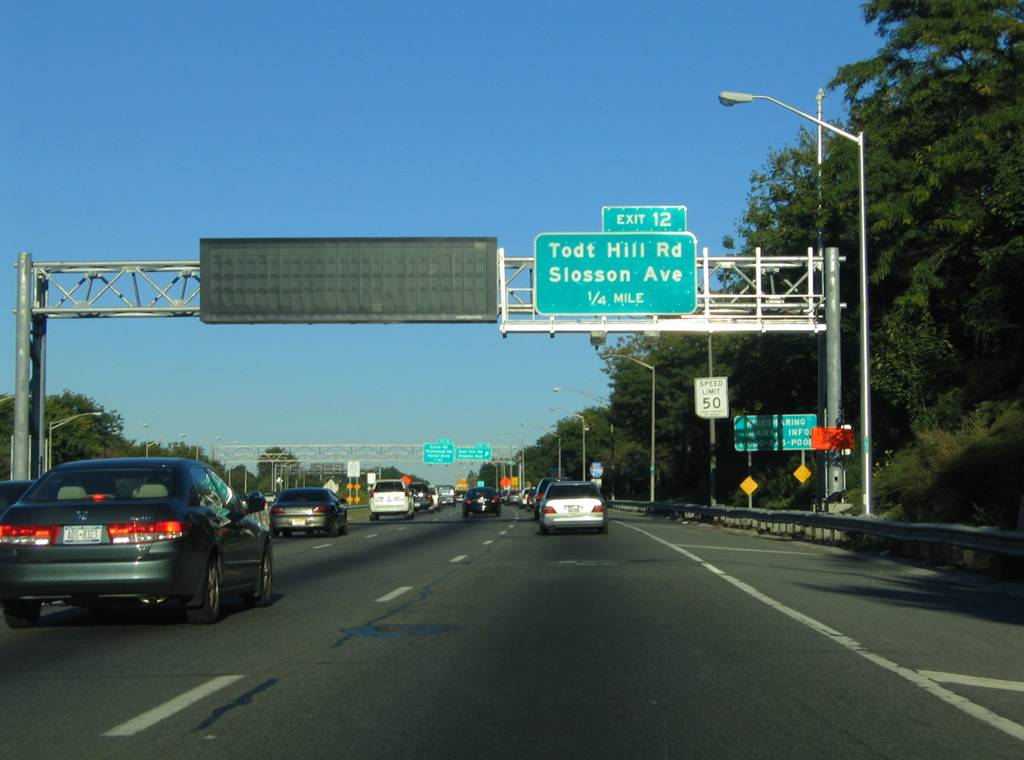
The Staten Island Expressway maintains six overall lanes through the parclo interchange at Exit 12. Slosson Avenue north leads toward the Castleton Corners neighborhood of the city.
10/03/04
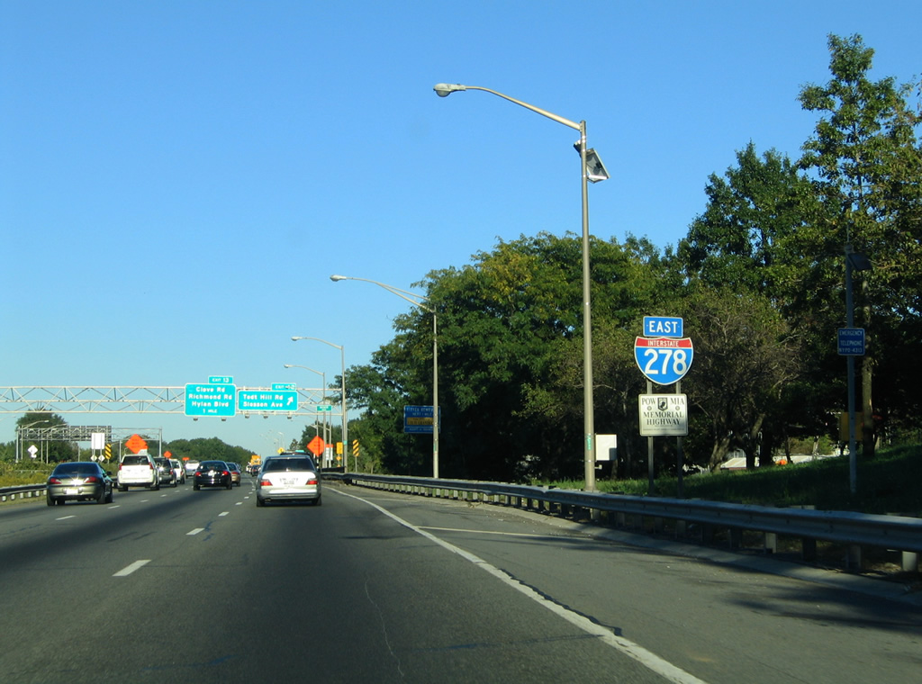
Interstate 278 eastbound reassurance shield posted along with a POW MIA Memorial Highway trailblazer near the Manor Road under crossing.
10/03/04
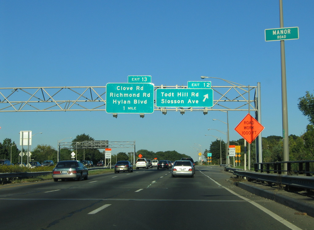
Slosson Avenue becomes Todt Hill Road four blocks to the south of Exit 12 near Westwood Avenue. Todt Hill Rill south to Four Corners Road east leads to the Dongan Hills neighborhood.
10/03/04
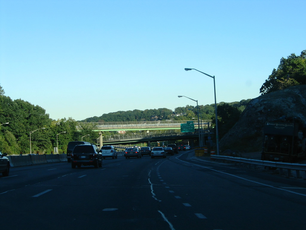
The unused ramps built to link I-278 (Staten Island Expressway) with Richmond Parkway were located east of Slosson Avenue. Korean War Veterans (Richmond) Parkway constitutes a limited access route from NY 440 and the Outerbridge Crossing northward to Arthur Kill Road. The Parkway from Arthur Kill Road to I-278 was cancelled.
10/03/04
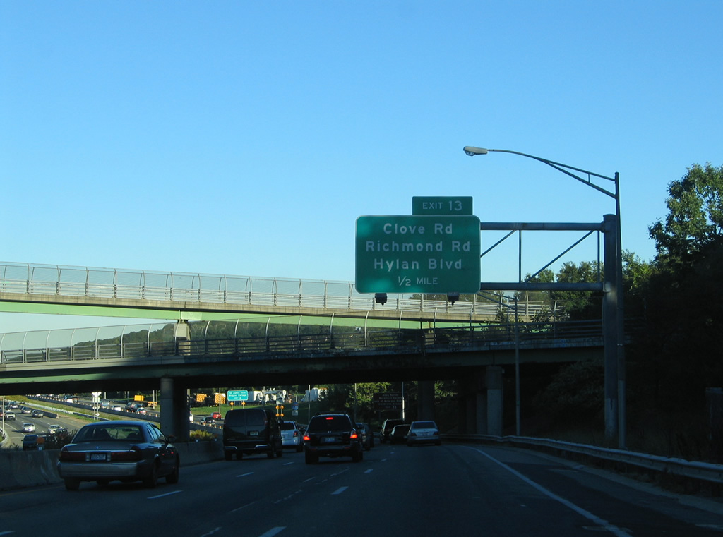
I-278 advances a half mile from the former Richmond Parkway exchange to a split diamond interchange for Clove Road, Richmond Road and Targee Street.
10/03/04
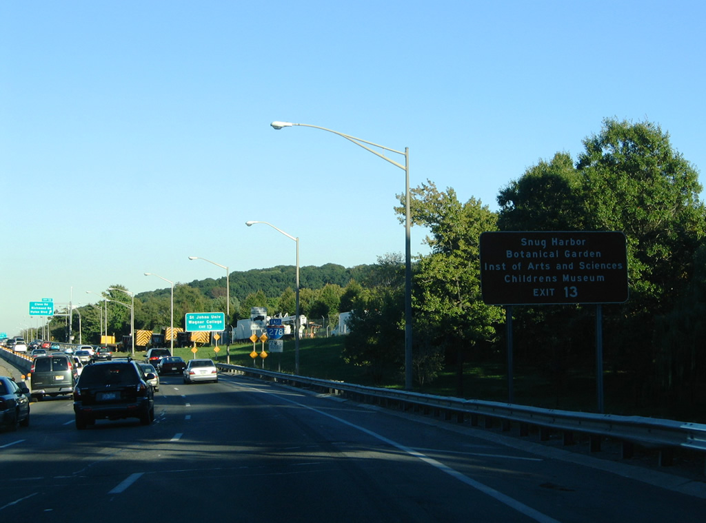
Exit 13 serves the following attractions: Snug Harbor Cultural Center and Botanical Garden, Staten Island Institute of Arts and Sciences, and the Staten Island Children's Museum.
This stretch of Interstate 278 was widened by 2007.
10/03/04
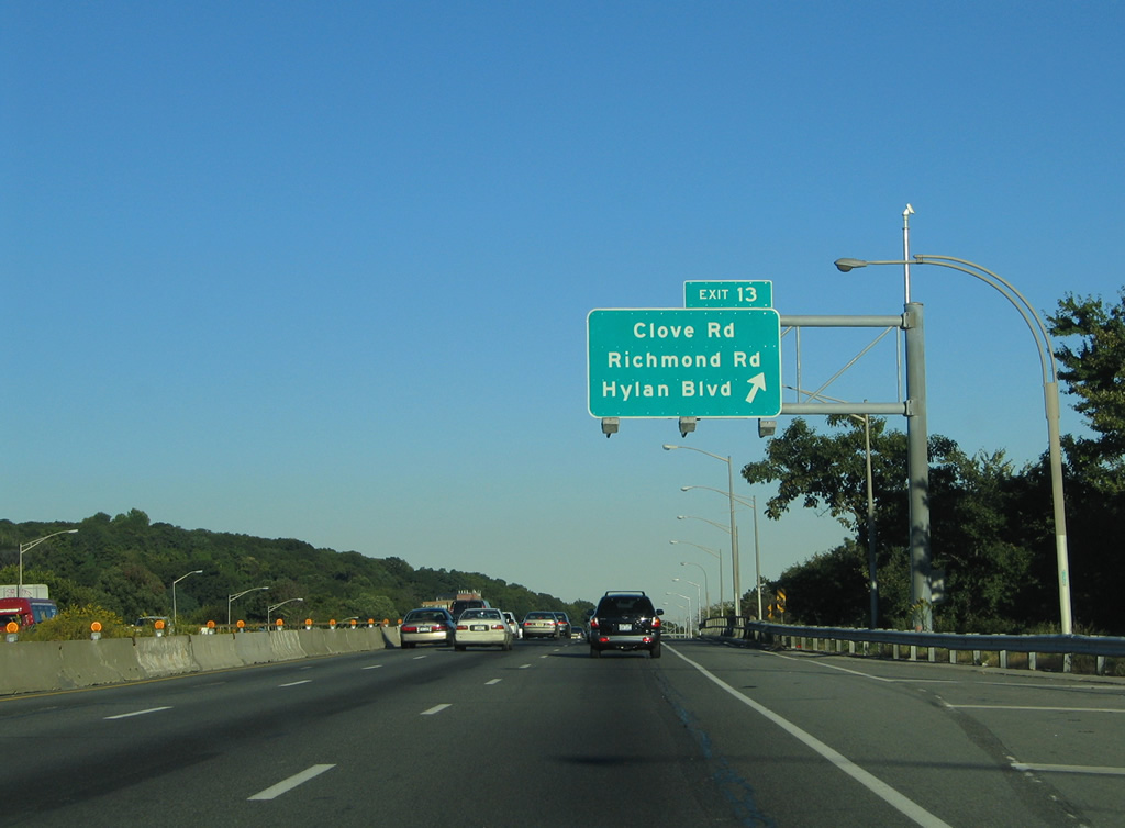
Exit 13 departs beyond the Renwick Avenue under crossing onto adjacent Milford Drive / Clove Road. Clove Road enters the vicinity from the northwest and then parallels I-278 east between Milford Drive and Richmond Road / Felt Avenue.
A bus lane was added to the left here by 2007.
10/03/04
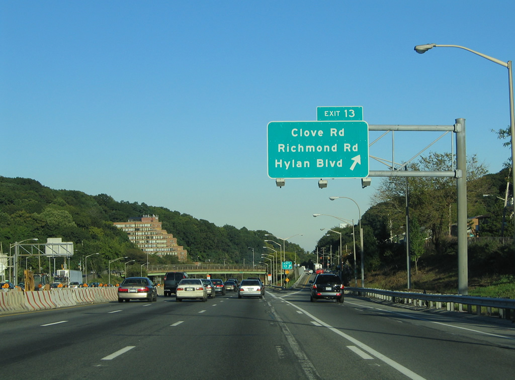
Traffic to Clove Road leaves I-278 eastbound for Fox Hills, Clifton, Stapleton and Rosebank. The Staten Island Expressway frontage road system (Cove Road, Felt Avenue, Narrows Road) leads to a traffic circle with Hylan Boulevard near Grasmere Lake.
10/03/04
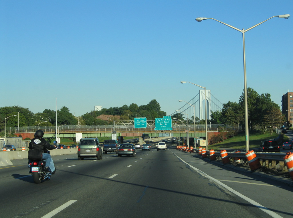
The Verrazzano-Narrows Bridge comes into view from Interstate 278 at Mosel Avenue. The Narrows Road frontage street system diverges ahead of the Hylan Boulevard over crossing.
10/03/04
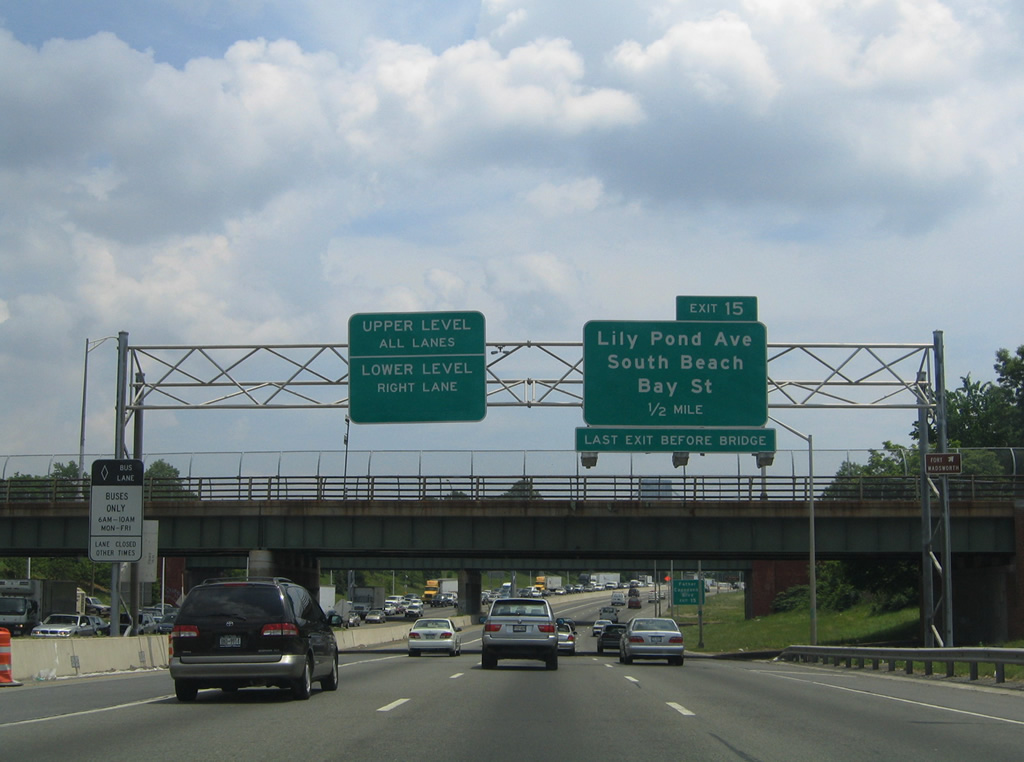
Exit 15 to Lily Pond Avenue at Fort Wadsworth is the final exit from the Staten Island Expressway east before I-278 ascends over the Verrazzano-Narrows Bridge across The Narrows into Brooklyn. Like the George Washington Bridge, the Verrazzano-Narrows Bridge partitions into an upper and lower deck.
06/13/05
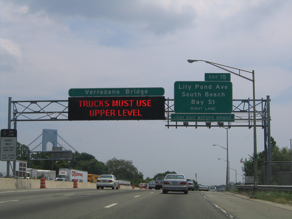
Exit 15 is a six-ramp parclo interchange with Lily Pond Avenue between Father Capodanno Boulevard and Bay Street in northeastern Staten Island. Bay Street stems north from Lily Pond Road and Fort Wadsworth to Rosebank, Stapleton, and Tompkinsville.
06/13/05
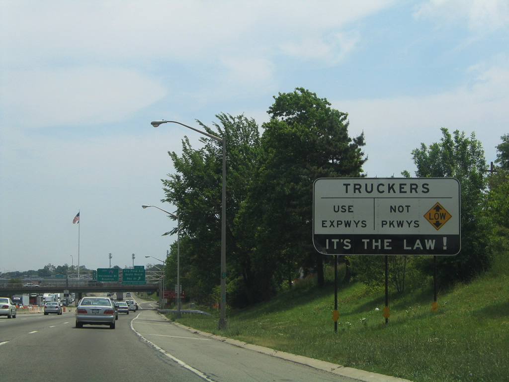
A typical advisory sign advising truckers to use only Expressways in New York City, posted ahead of the Fingerboard Road overpass.
06/13/05
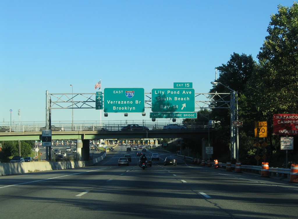
Exit 15 leaves Interstate 278 eastbound for Lily Pond Avenue. Lily Pond Avenue and Father Capodanno Boulevard southbound serve the South Beach section of Staten Island and the Gateway National Recreation Area. Bay Street and McClean Avenue lead to Fort Wadsworth Park and Fort Wadsworth Light.
10/03/04
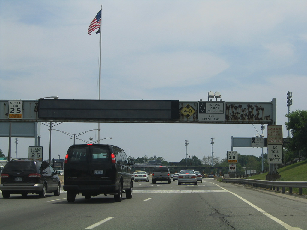
The original Verrazzano-Narrows Bridge toll plaza was located just east of Lily Pond Avenue. Tolls for eastbound traffic along the bridge were dropped in 1986 to alleviate growing air pollution in Staten Island from idling cars at the toll plaza.3
06/13/05
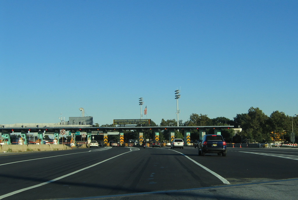
Unused since 1986, the toll booths requiring traffic to reduce speed to 25 MPH along I-278 remained in place until February 1, 2012. Discussion for reimplenting tolling for eastbound arose in 2001 and in 2003 studies were undertaken in the feasibility in removing the booths.3
10/03/04
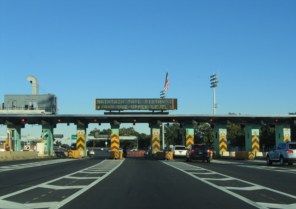
Fares continued to be collected for the Verrazzano-Narrows Bridge westbound in 1986, with passenger vehicle cash rates of $6.00 in 2004 and $13.00 in 2011. The switch to all-electronic tolling (AET) restored tolling in both directions.
10/03/04

References:
- Goethals Bridge (I-278). NYCRoads.com.
Photo Credits:
- Alex Nitzman, Carter Buchanan: 10/03/04
- Alex Nitzman, Justin Cozart: 06/13/05
Connect with:
Page Updated Tuesday February 07, 2012.