
Interstate 285 Outer Loop - Smyrna to East Point

 South
South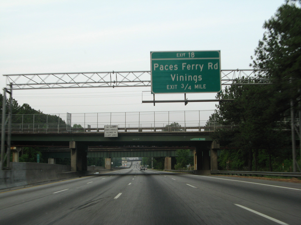
Interstate 285 turns southward and passes under Cumberland Boulevard and a CSX Railroad line ahead of the diamond interchange (Exit 18) with Paces Ferry Road. Paces Ferry Road leads east through Vinings to Paces and Pleasant Hill in Atlanta.
06/03/07

A distance sign posted by the Mountain to River Trail overpass lists the distances to the Perimeter Highway interchanges with Interstates 20, 85, and the south junction with I-75.
08/07/13

Exit 18 leaves Interstate 285 southbound for Paces Ferry Road. Paces Ferry Road ends at Atlanta Road, just outside the Smyrna city limits 0.75 miles to the west.
08/07/13
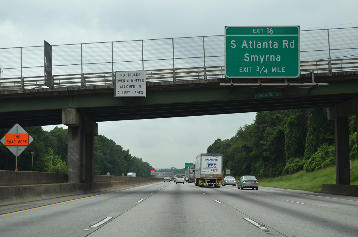
Atlanta Road arcs south from Smyrna and Paces Ferry Road to cross paths with Interstate 285 at Exit 16 in three quarters of a mile.
08/07/13
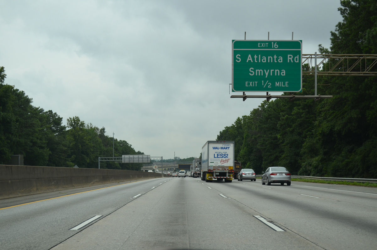
A diamond interchange (Exit 16) joins the Perimeter Highway with Atlanta Road amid several apartment complexes and business parks.
08/07/13
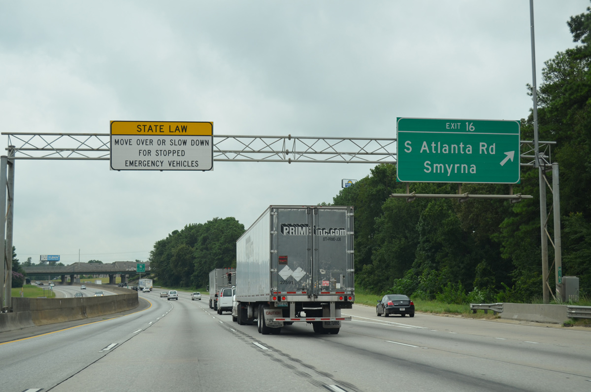
I-285 south reaches the off-ramp (Exit 16) for Atlanta Road. Atlanta Road east crosses the Chattahoochee River and enters Atlanta in 2.3 miles. Marietta Boulevard continues the arterial into the Bolton community.
08/07/13
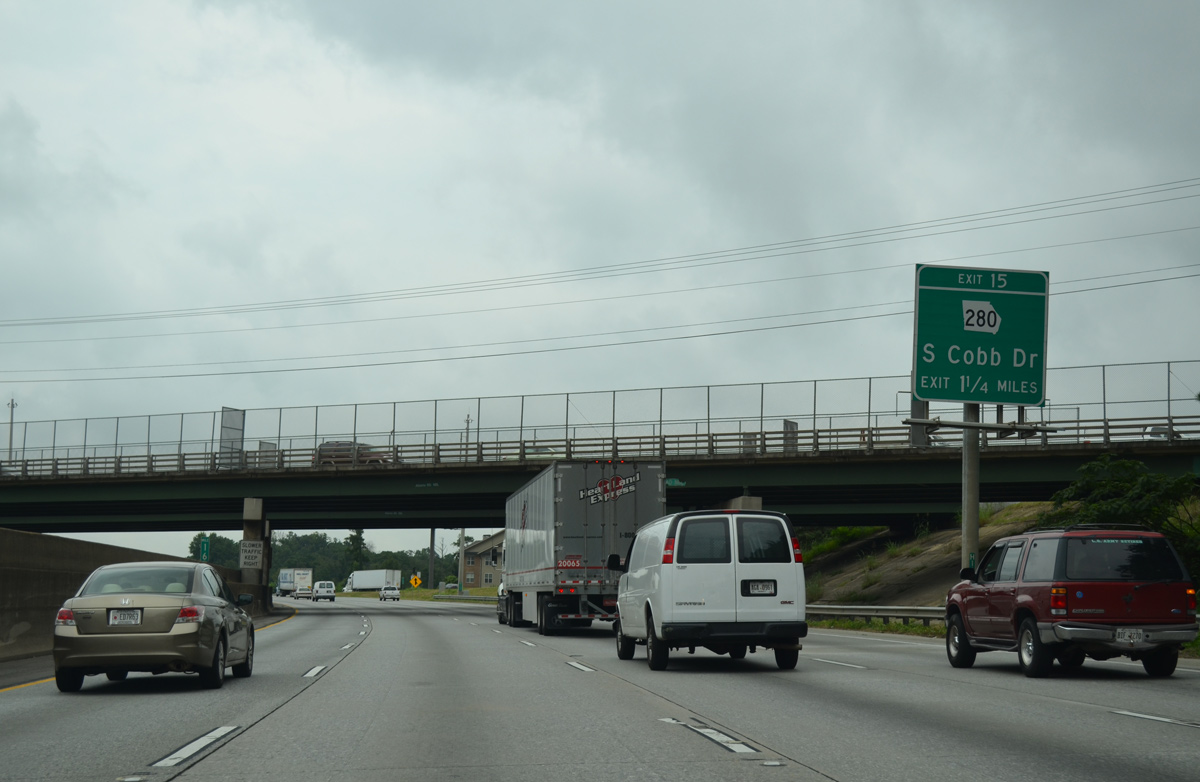
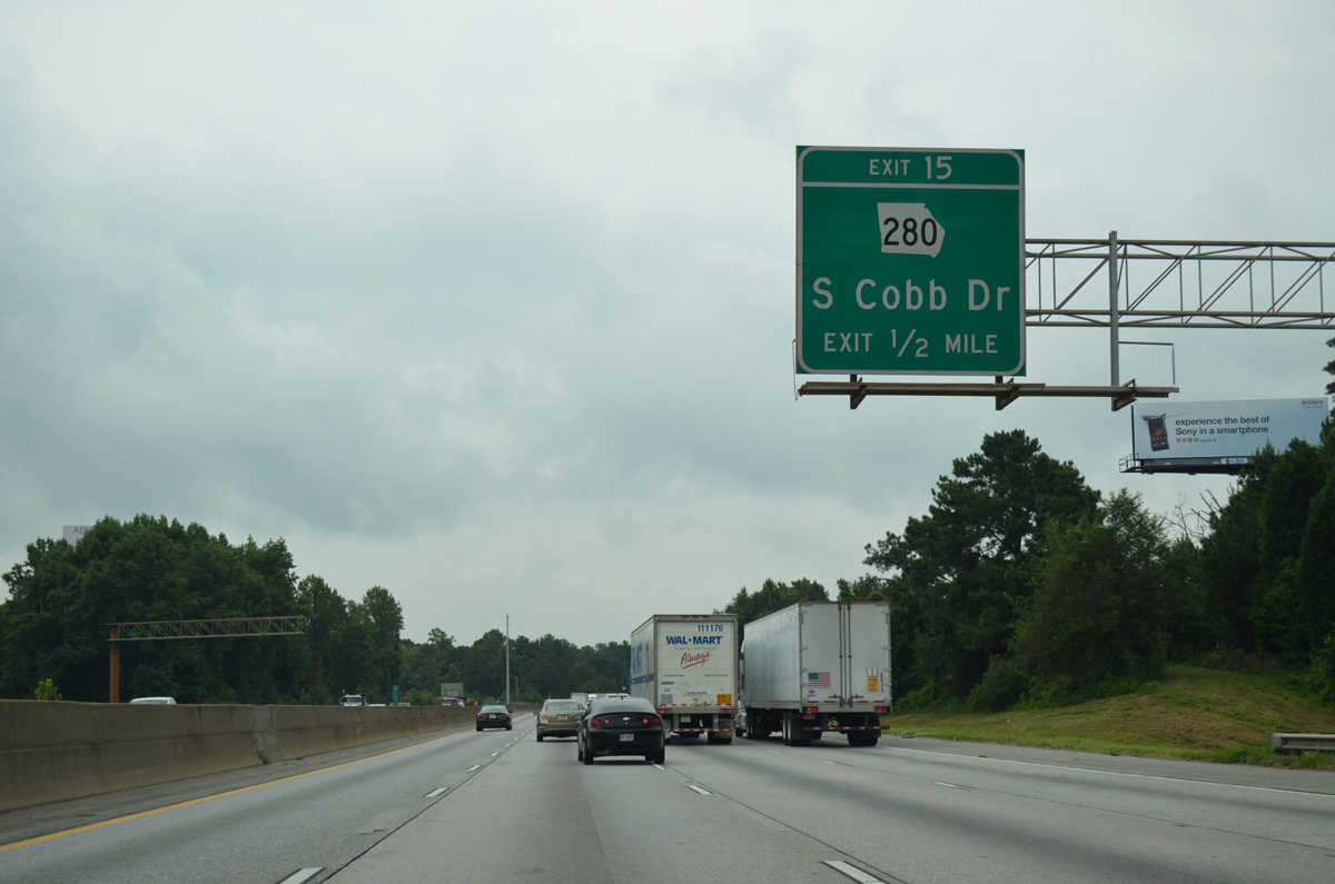
SR 280 (South Cobb Drive) meets Interstate 285 at a diamond interchange (Exit 15) in 1.25 miles.
08/07/13
SR 280 follows South Cobb Drive northward through Smyrna to Fair Oaks, Marietta, and Dobbins ARB. The Silver Comet Trail, a rails to trails facility leading from Atlanta to the Alabama state line, parallels the East-West Connector west from SR 280.
08/07/13
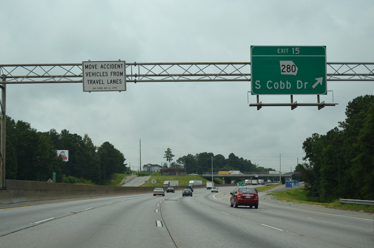
Exit 15 leaves I-285 south for SR 280 (South Cobb Drive). SR 280 becomes James Jackson Parkway south through the Riverside, Scotts Crossing and Carey Park neighborhoods of Atlanta. The state route ends at SR 139 (Martin Luther King, Jr. Drive) at Harland Terrace, Atlanta.
08/07/13
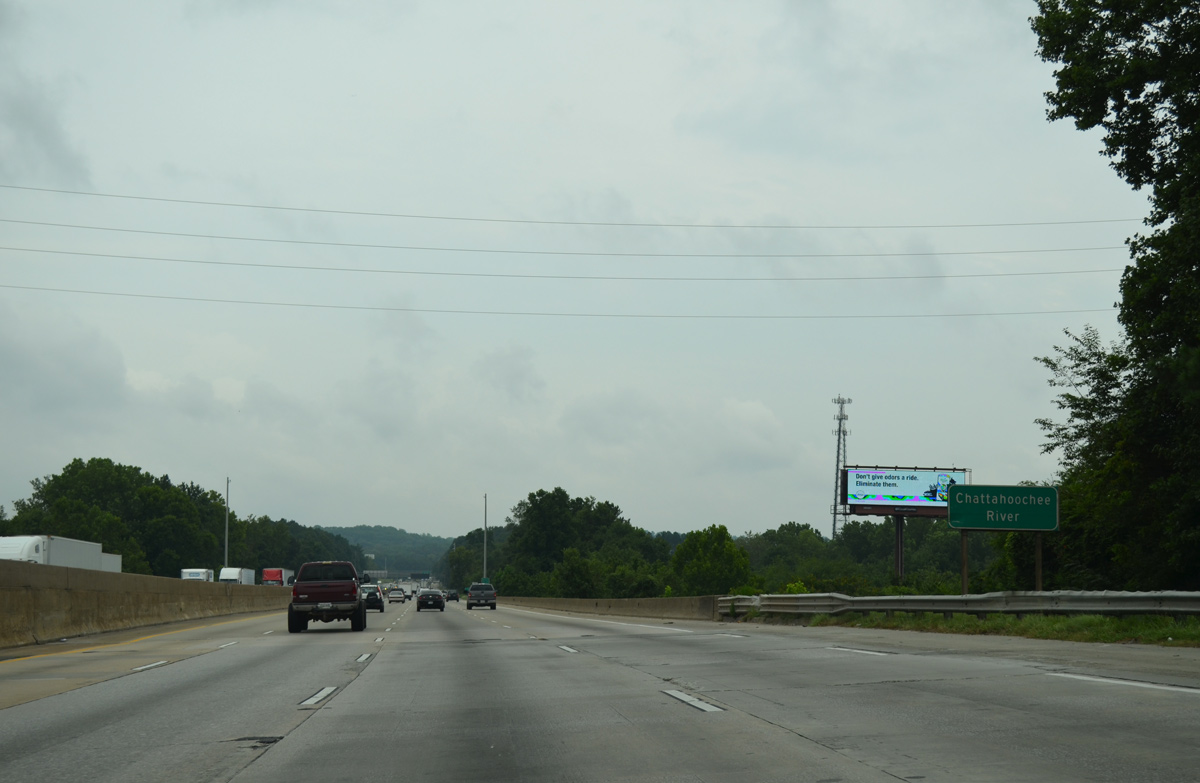
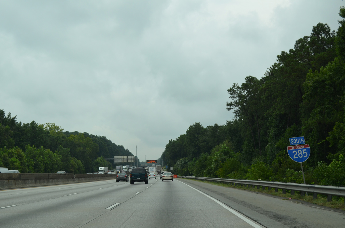
Interstate 285 makes a gradual turn to the southeast to cross the Chattahoochee River.
08/07/13
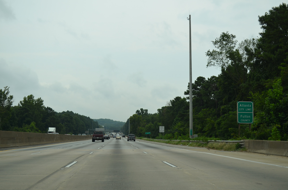
Crossing the Chattahoochee River, drivers along I-285 enters the city of Atlanta and Fulton County by Atlanta Industrial Park.
08/07/13
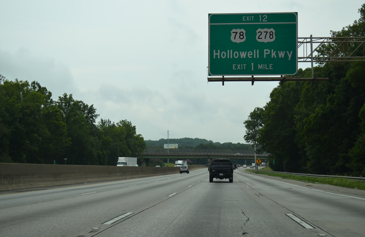
A loop ramp adds traffic from Bolton Road south on the one mile approach to Exit 12 with U.S. 78/278 (Hollowell Parkway). U.S. 78/278 run concurrently across the city of Atlanta to Druid Hills.
08/07/13

Hollowell Parkway winds east from Exit 12 through the Brookview Heights, Center Hill, Grove Park and Bankhead communities. The four lane boulevard was renamed in 1998 from Bankhead Highway to honor Donald Lee Hollowell Parkway, a civil rights attorney that represented Martin Luther King, Jr. in 1960.1
08/07/13
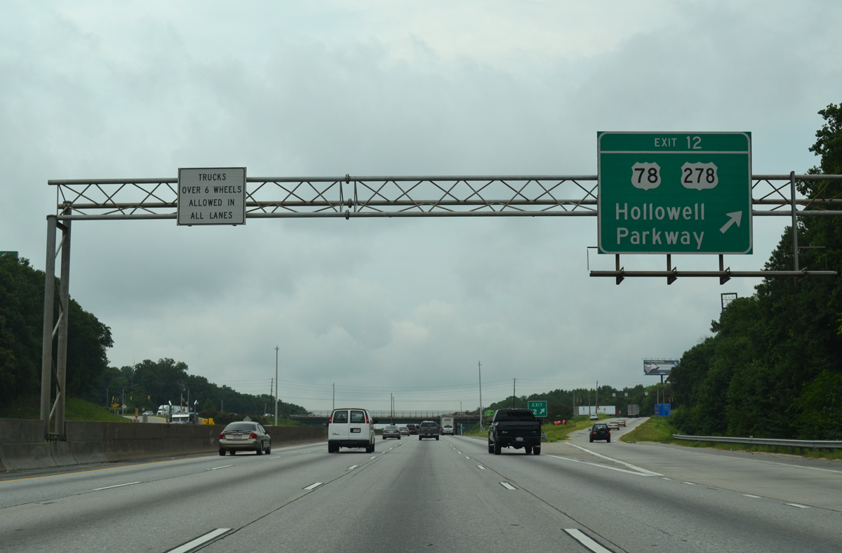
I-285 south reaches the diamond interchange (Exit 12) with U.S. 78/278 (Hollowell Parkway) at the Bankhead/Bolton and English Park communities. The north end of SR 70 ties into U.S. 78/278 nearby. The state route angles southwest to Fulton County Airport-Brown Field (FTY).
08/07/13
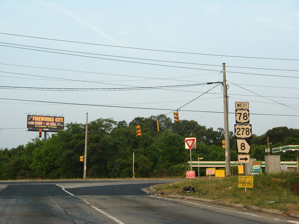
U.S. 78/278 overlap west 10.6 miles from Exit 12 west ten miles to Mableton and the city of Austell. The two part ways on respective paths toward Alabama from there. U.S. 78 follows the Interstate 20 corridor west to Douglasville, Bremen and Anniston, Alabama. U.S. 278 turns northwest to Dallas, Cedartown and Piedmont, Alabama.
06/03/07
Advancing south between the Collier Heights and Fairburn Heights communities, I-285 approaches Exits 10B/A with Interstate 20.
Arrow per lane (APL) signs went up along this stretch to replace all overheads for I-20 by 2016.
08/07/13

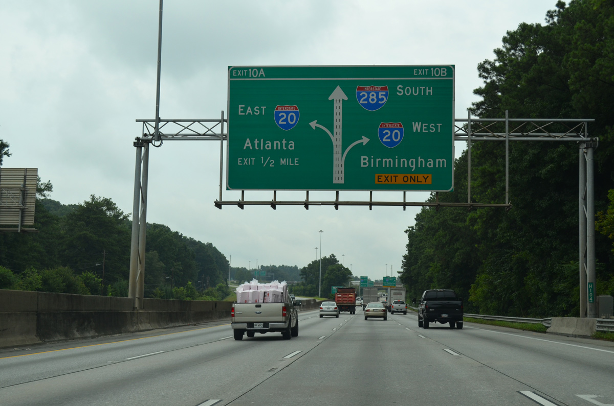
The exchange joining Interstates 20 and 285 at Adamsville in Atlanta remains with left side ramps. A pair of wye interchanges facilitate movements from I-20 west to I-285 south and from I-285 north to I-20 east.
08/07/13
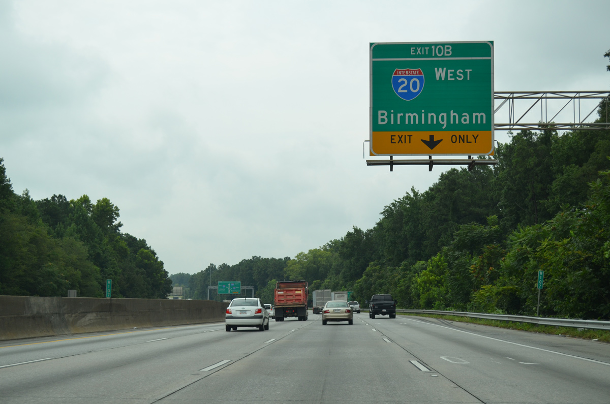
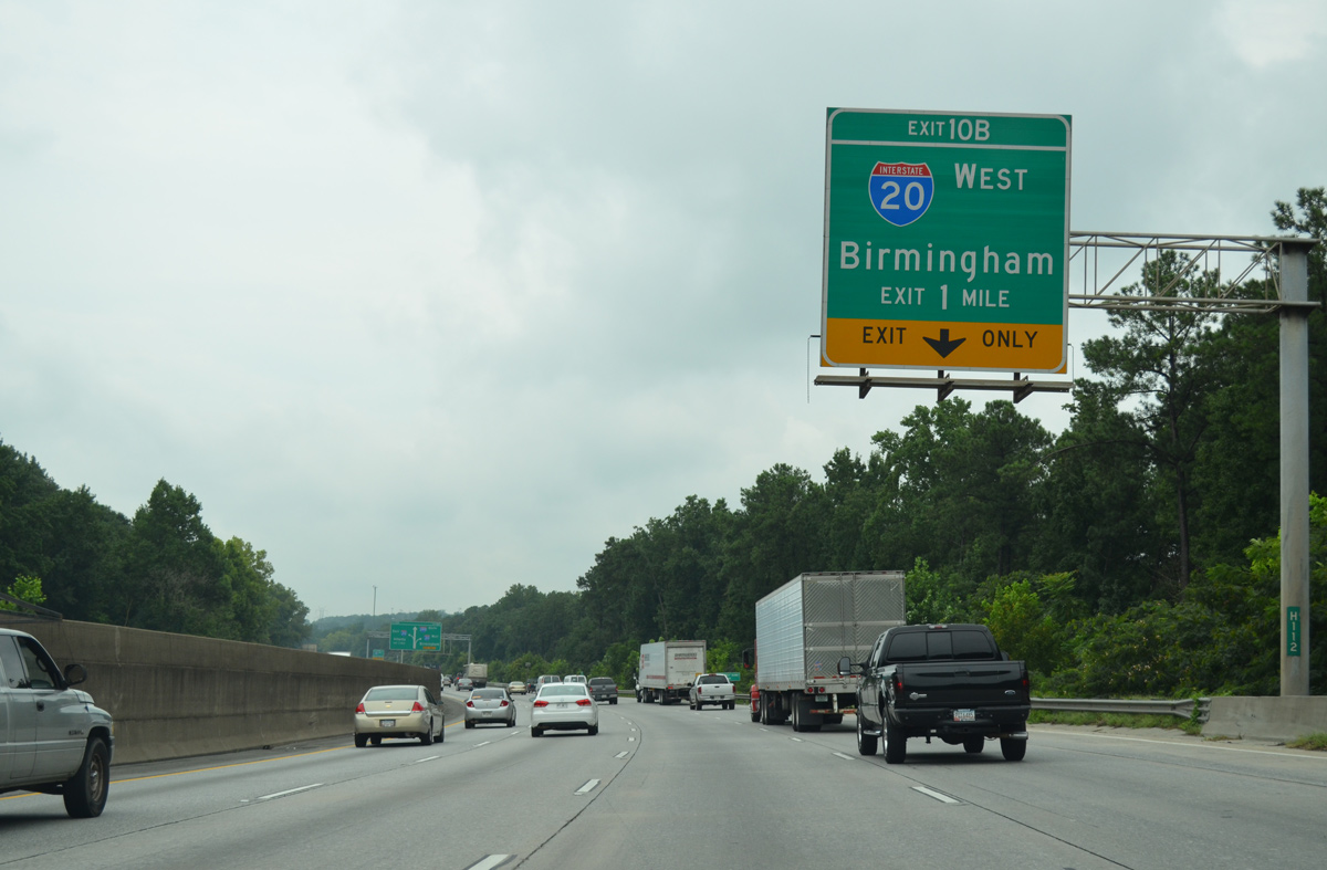
A lane drop occurs at the eastbound ramp (Exit 10B) for Interstate 20 (Tom Murphy Freeway) west. I-20 travels 135 miles to Birmingham, Alabama.
08/07/13
Interstate 20 remains within the Atlanta metro area to Exit 11 at Breman. Beyond there, I-20 transitions into a rural freeway across the southern Appalachian Mountains to Anniston and Talladega.
08/07/13
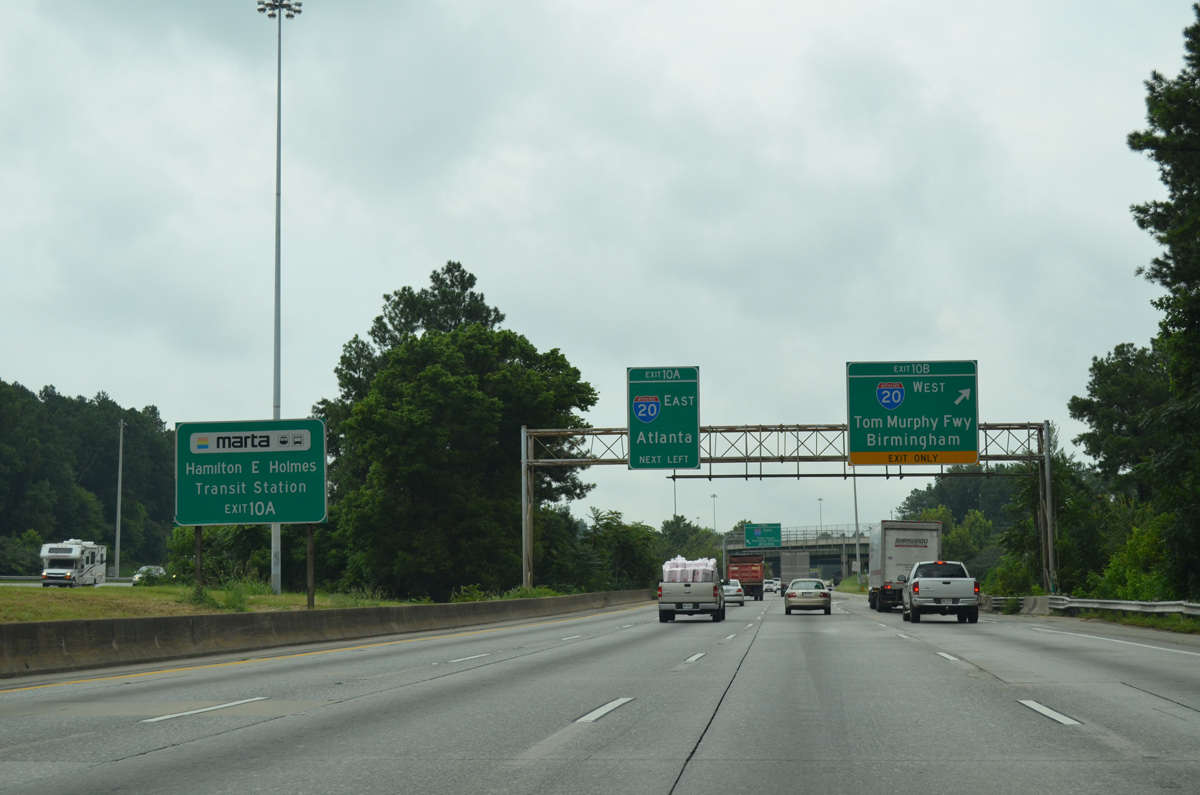
The Hamilton E. Holmes Transit Station (MARTA) lies east of Interstate 285 and south of I-20 by the junction of SR 139 (Martin Luther King. Jr. Drive) and SR 260.
08/07/13
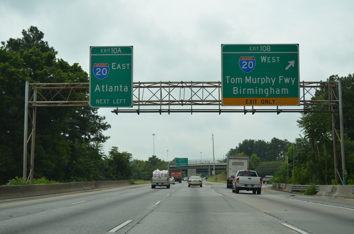
Exit 10B departs from I-285 south for I-20 west to Six Flags Over Georgia, Lithia Springs and Douglasville. Exit 10A follows from the left for I-20 east through Atlanta to Mozely Park, West End and Mechanicsville.
08/07/13
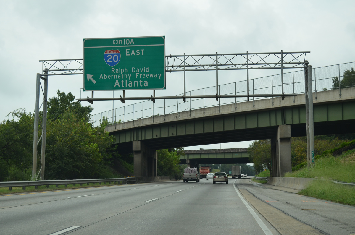
Interstate 20 (Ralph David Abernathy Freeway) widens to 14 lanes as it crosses Atlanta. The freeway meets the Downtown Connector (I-75/85) in six miles.
08/07/13
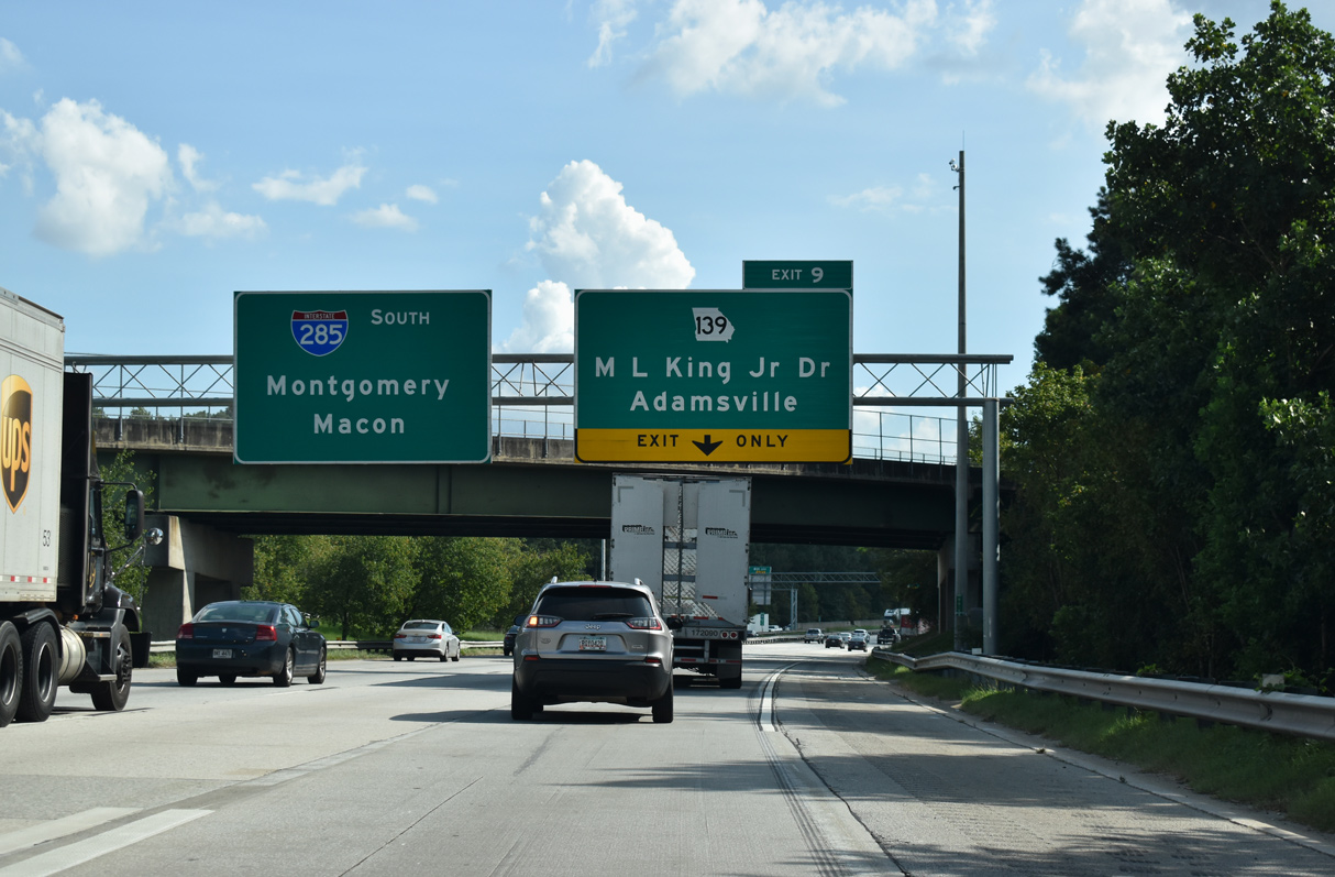
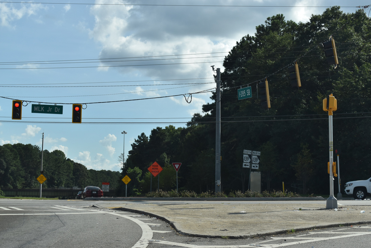
Located just south of I-20, the parclo interchange at Exit 9 links I-285 with SR 139 (Martin Luther King, Jr. Drive). I-285 is designated the Bob A. Holmes Freeway on this stretch.
09/11/20
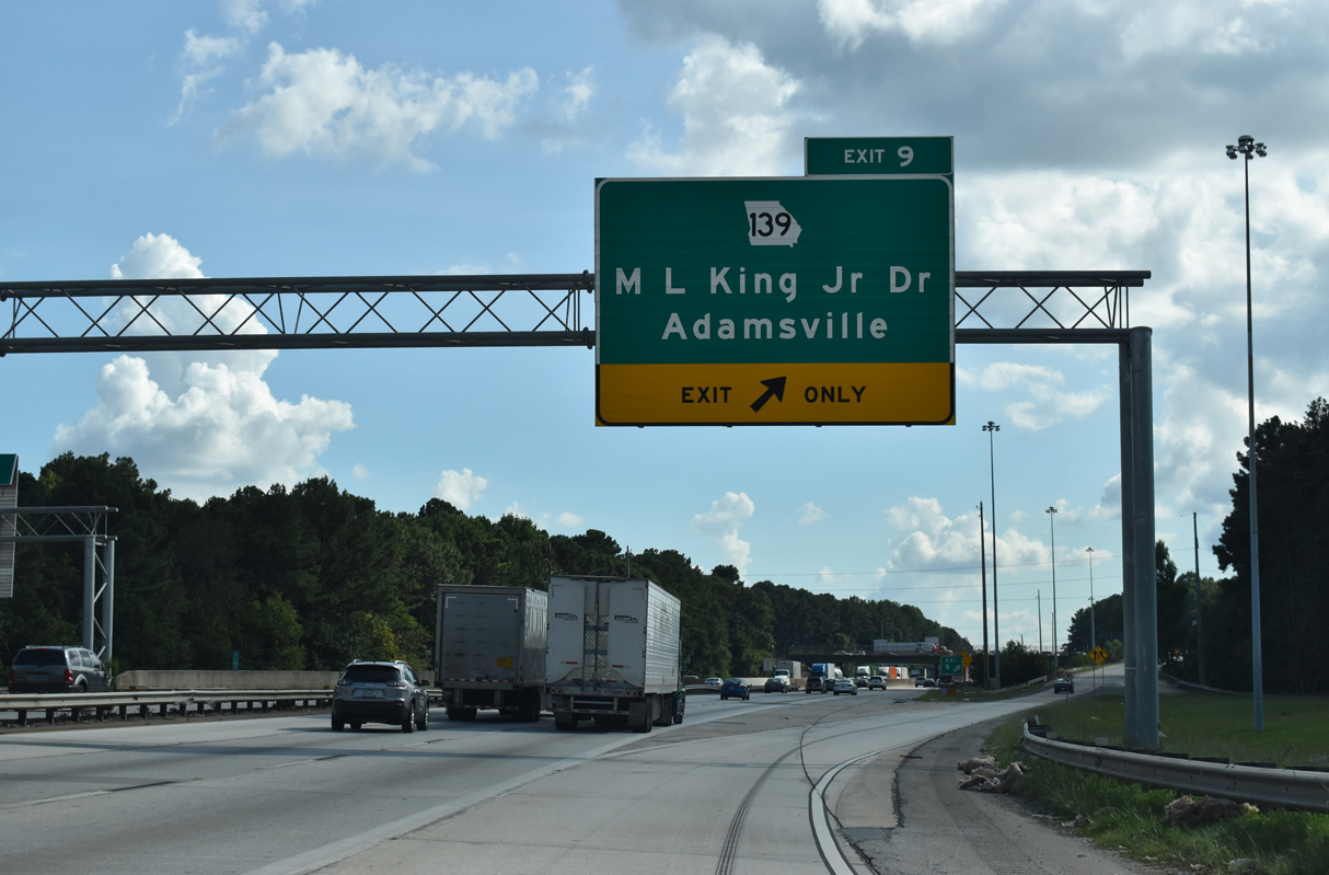
SR 139 (Martin Luther King, Jr. Drive) meets I-285 at the Adamsville neighborhood of west Atlanta. Measuring 27.64 miles in length, SR 139 heads northwest to U.S. 78/278-SR 8 and south from Atlanta to SR 85 at Riverdale.
09/11/20
SR 139 travels northwest to Mableton and east alongside Interstate 20 to Harland Terrace, Florida Heights and Westview.
09/11/20
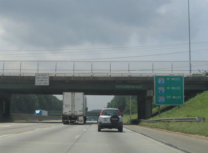
South from SR 139, Interstate 285 travels ten miles to I-85 and 14 miles to I-75.
07/13/05
Interstate 285 with eight overall lanes near North Utoy Creek. This confirming marker was knocked over by November 2018 and never replaced.
08/07/13
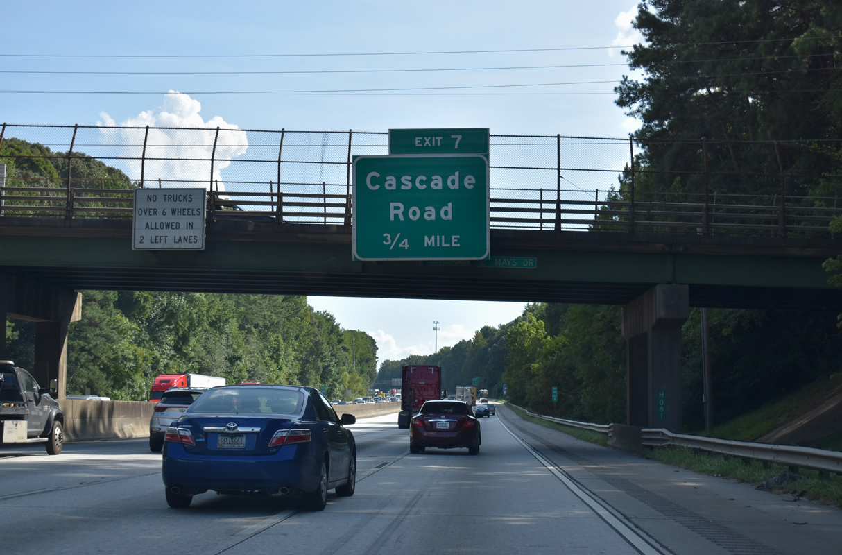
Benjamin E. Mays Drive spans the Perimeter Highway one mile north of the diamond interchange (Exit 7) with Cascade Drive.
09/11/20
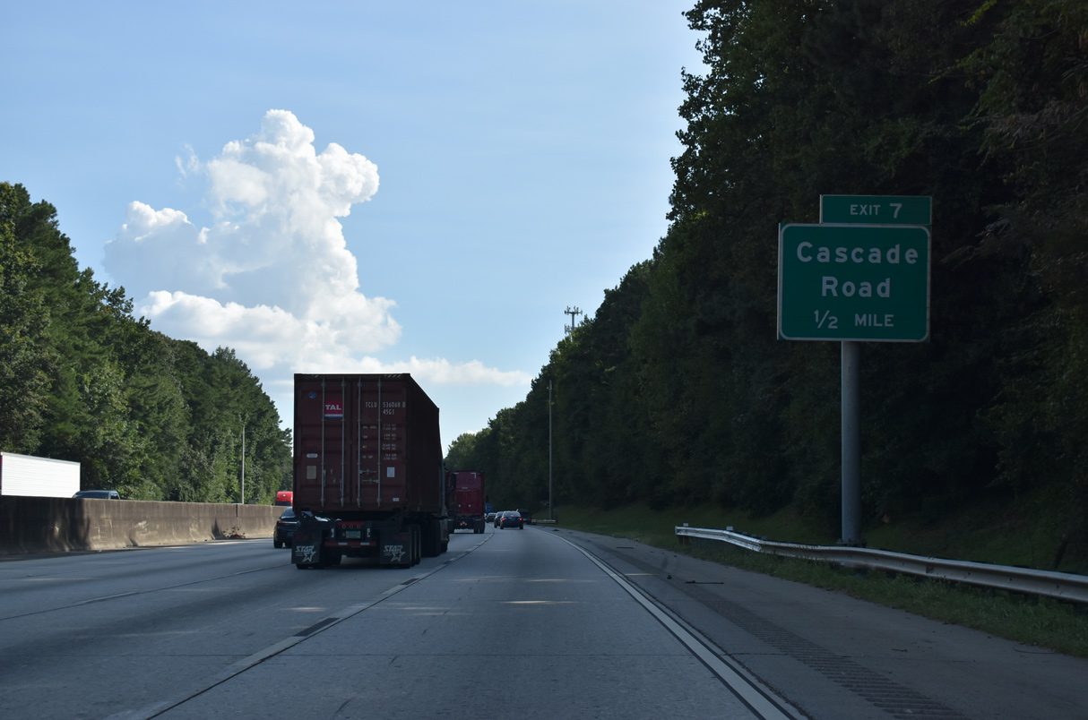
Advancing to Exit 7, I-285 briefly exits the Atlanta city limits. Cascade Road east connects the beltway with the Horseshow Community, Cascade Heights and Magnum Manor.
09/11/20
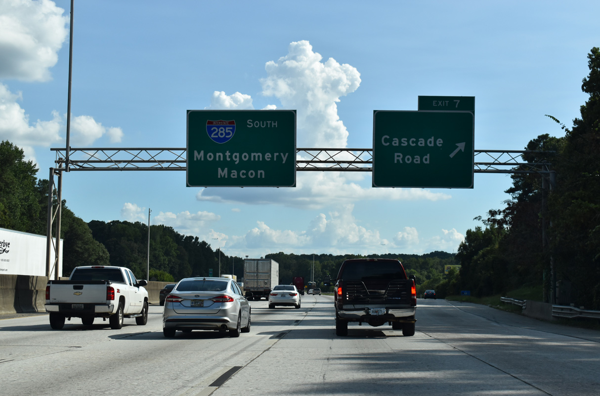
Exit 7 parts ways with Interstate 285 south for Cascade Road west to SR 70 and Fulton County Industrial Park and east to Adams Park and Venetian Hills.
09/11/20

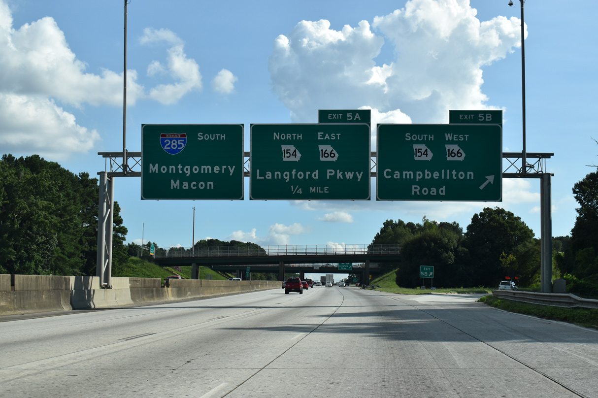
Reentering Atlanta between the Cascade Green and Southwest neighborhoods, Interstate 285 winds southward to a directional cloverleaf interchange (Exits 5 B/A) with SR 154/166 (Langford Parkway).
09/11/20
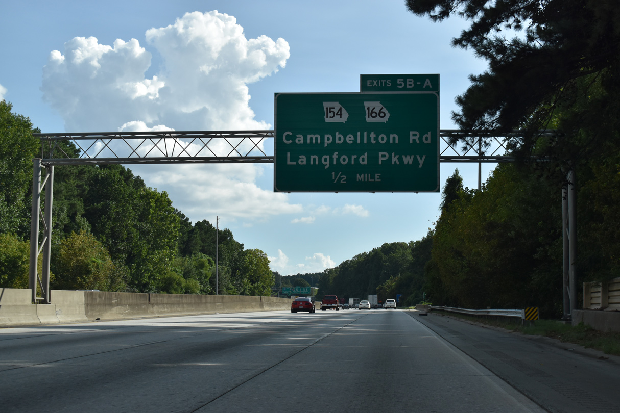
Langford Parkway constitutes a freeway east from I-285 to the Downtown Connector and the Polar Rock neighborhood. Named Lakewood Freeway prior to 1995, the urban expressway was previously part of the planned Interstate 420 corridor between Douglasville and Gresham Park.
09/11/20
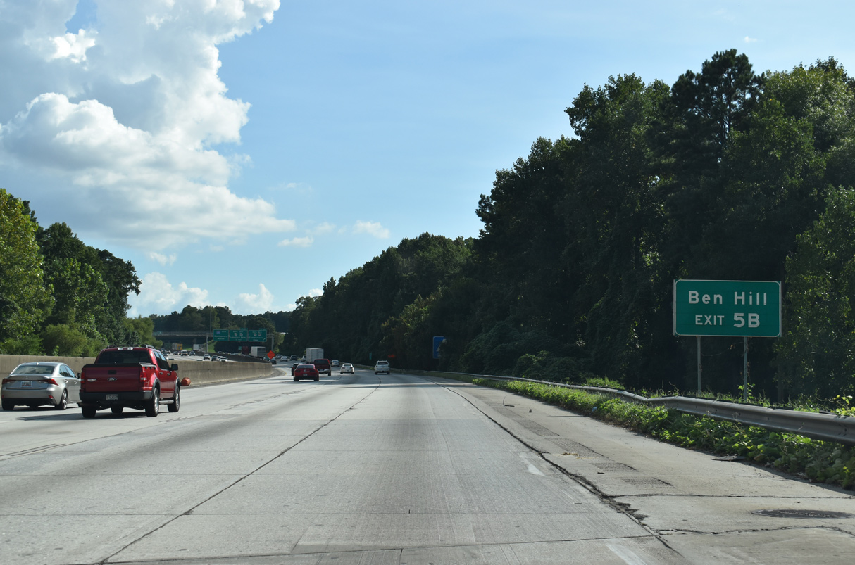
SR 154/166 follow Campbellton Road west from Langford Parkway through the Ben Hill community of southwest Atlanta to Douglas County.
09/11/20
SR 154/166 continue 7.43 miles west to combine with SR 70 at Cascade Palmetto Highway. Beyond their overlap, SR 154 turns south with SR 70 back into Fulton County while SR 166 heads west to Carrollton and the Alabama state line beyond Bowdon.
09/11/20
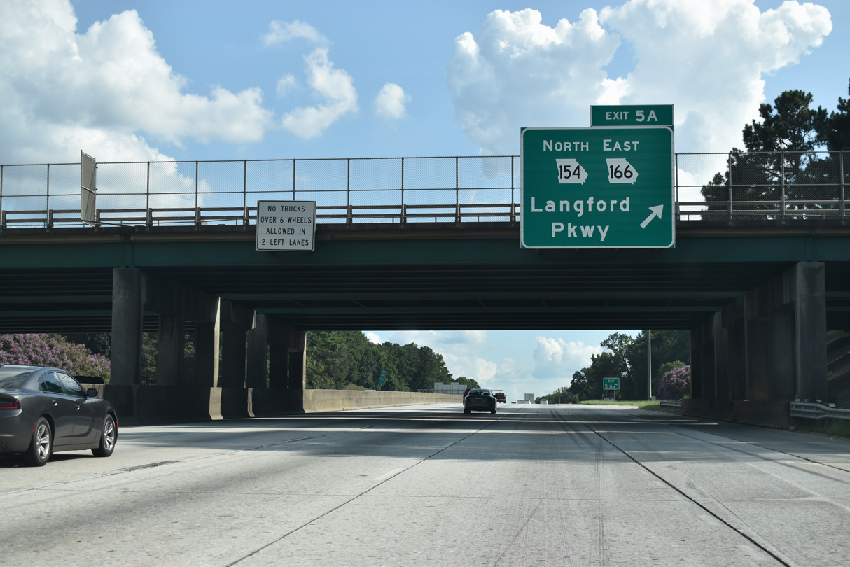
Exit 5A loops onto SR 154/166 (Langford Parkway) east to East Point and Fort McPherson. SR 166 follows the freeway east to end at Lakewood Avenue.
09/11/20
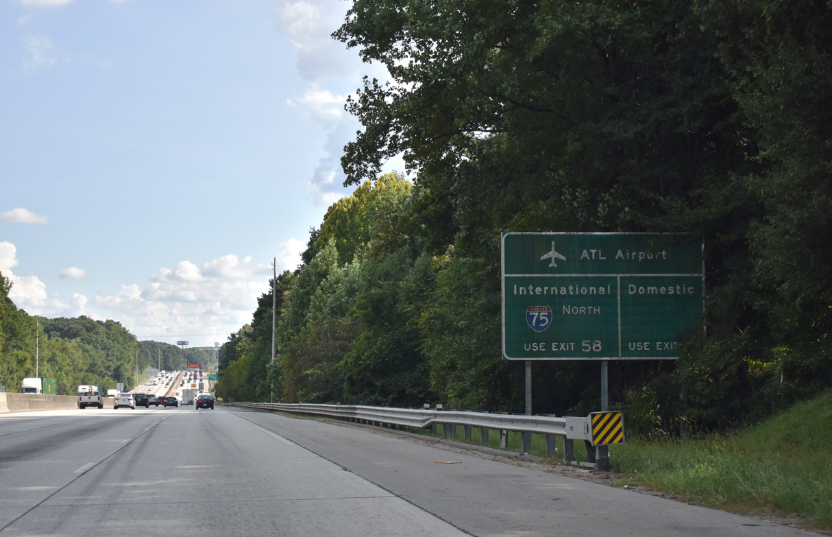
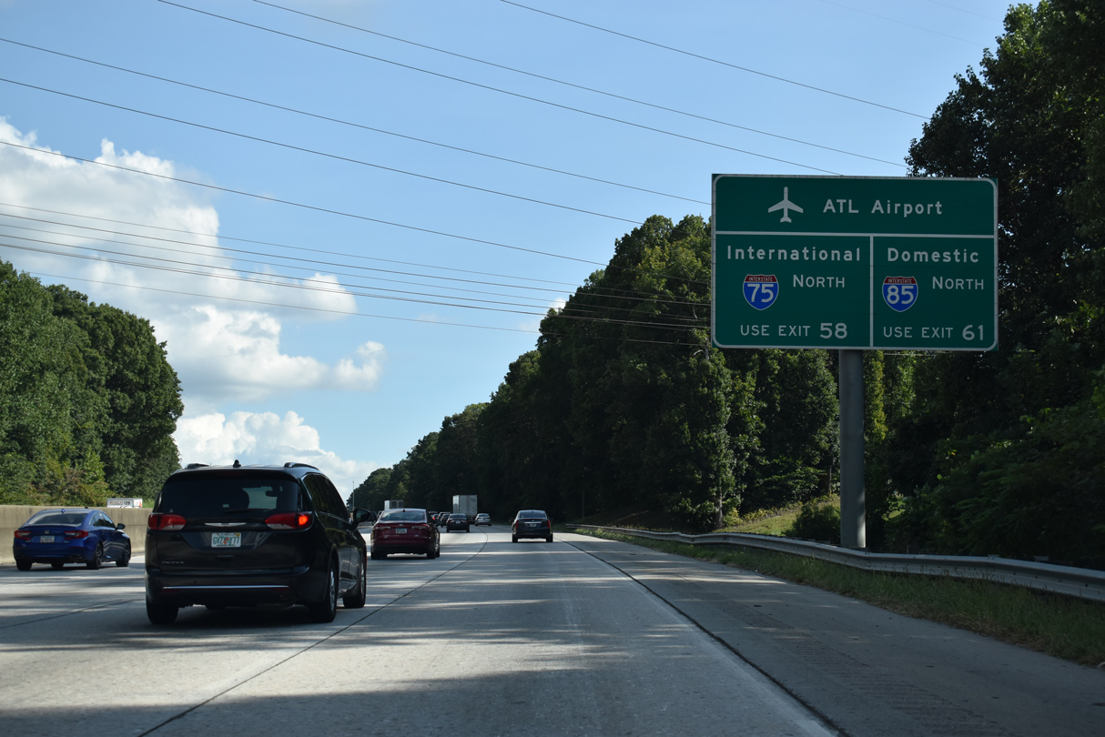
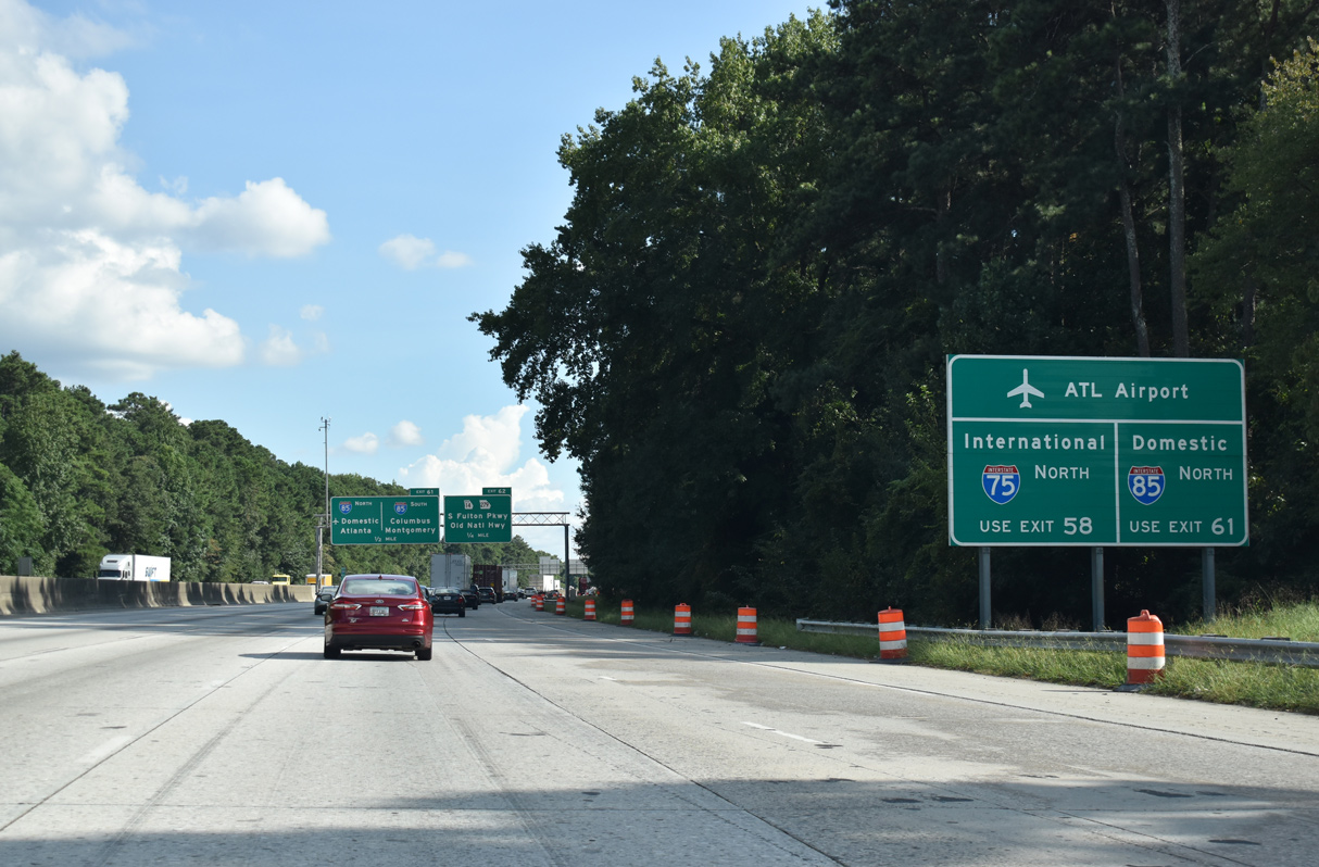
Travelers headed to Hartsfield-Jackson Atlanta International Airport (ATL) are advised to use upcoming Exit 2 with SR 6 (Camp Creek Parkway) for the Domestic Terminal and to remain along the I-285 outer loop to I-75 north for the International Terminal.
09/11/20
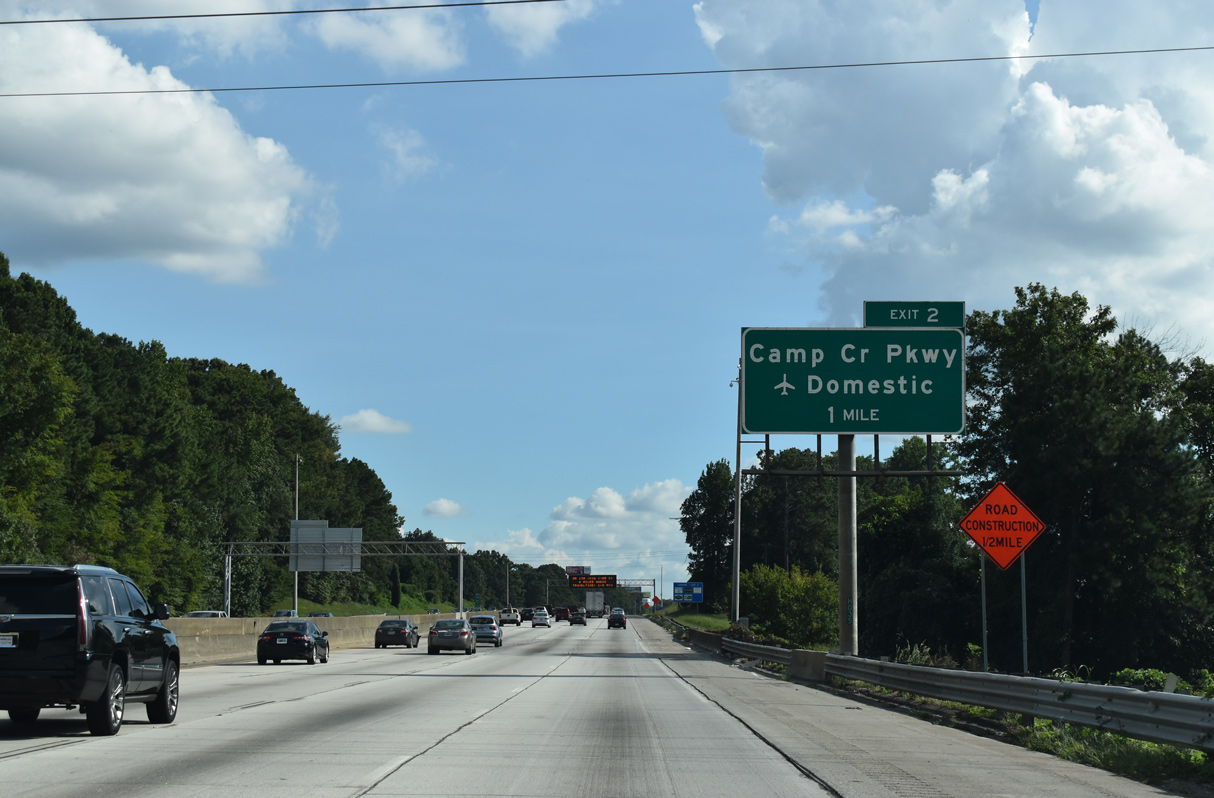
I-285 leaves the city of Atlanta again beyond the Greenbrier neighborhood to enter western reaches of East Point. Meeting the beltway at Exit 2 is Camp Creek Parkway (SR 6), an arterial serving ATL Airport.
East Point was named because it fell at the eastern terminus of the Atlanta & West Point Railroad.
09/11/20
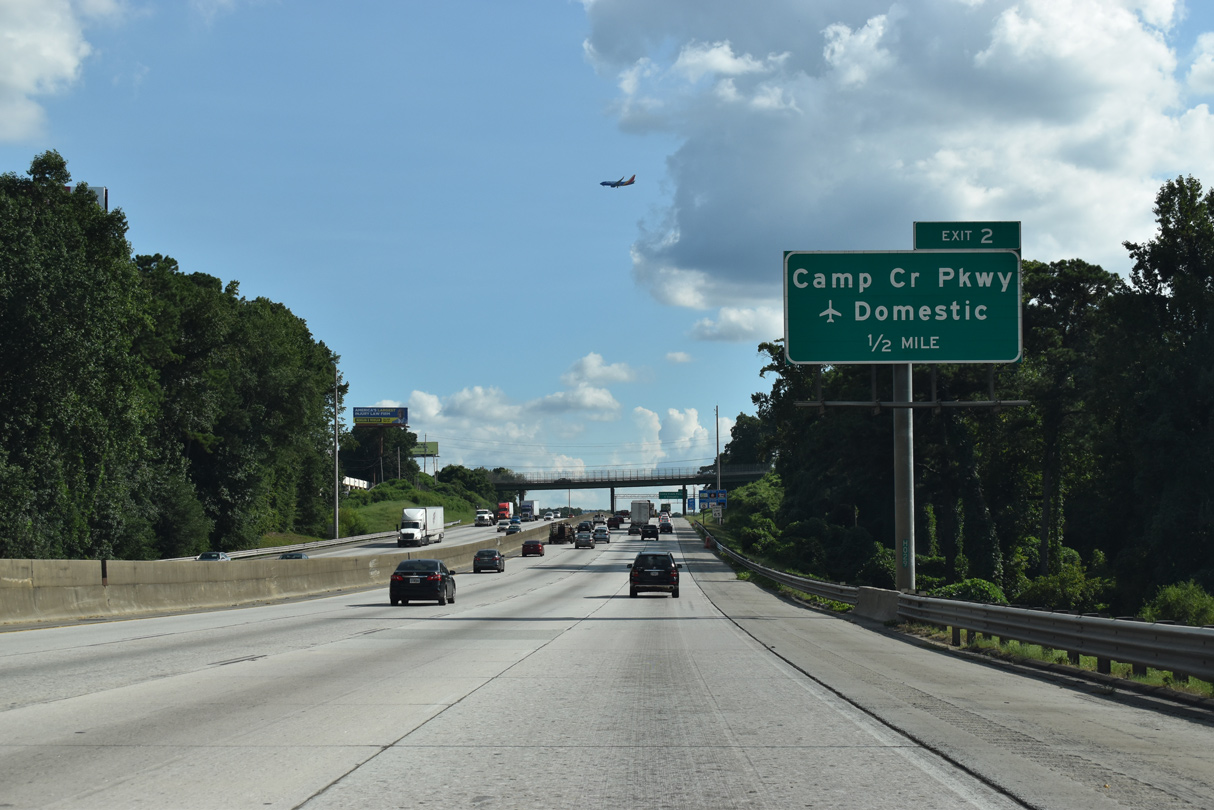
Camp Creek Parkway arcs northwest from Exit 2 and East Point to Austell west of Atlanta. SR 6 lines the highway west from Interstate 85 to Douglas County, where it eventually combines with U.S. 278 to the Alabama state line.
09/11/20

Camp Creek Parkway (SR 6) enters the city of College Park midway between the diamond interchange at Exit 2 and the Georgia International Convention Center. College Park began in 1890 as Manchester and was named so as it was the former home of Cox College and Georgia Military Academy.2
09/11/20
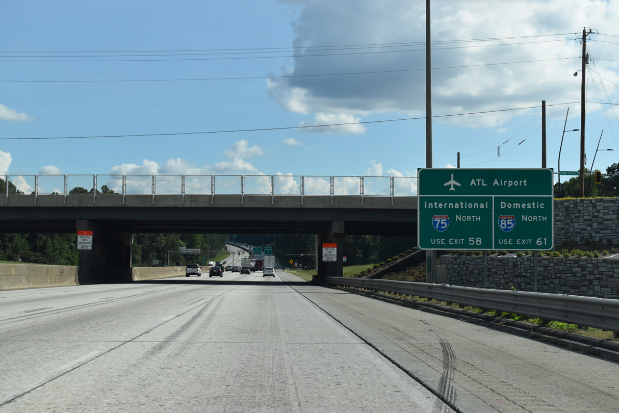
Continuing south, motorists bound for Hartsfield-Jackson Atlanta International Airport (ATL) can use Interstate 85 north back to the Domestic Terminal via Exit 61.
09/11/20
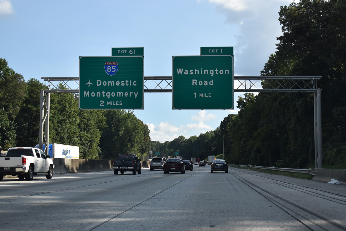
The second exit for East Point from I-285 south lies one mile ahead at Washington Road. The Perimeter Highway turns east in another mile at Interstate 85 and SR 14CO (South Fulton Parkway).
09/11/20
120,000 vehicles per day (vpd) were recorded by GDOT in 2016 on the eight lane section of I-285 through East Point.
09/11/20
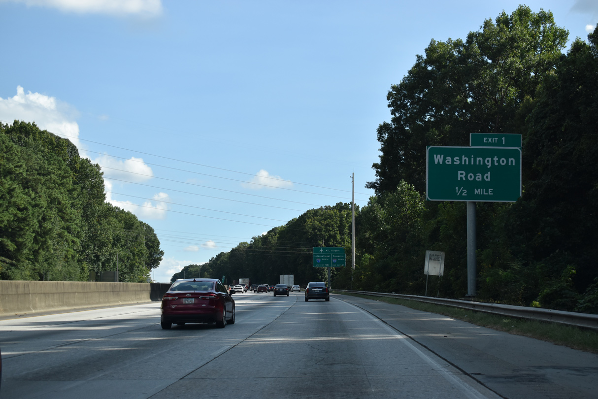
Washington Avenue / Road arcs 4.36 miles southwest from U.S. 29/SR 14-139 (Main Street) through East Point to meet I-285 in one half mile.
09/11/20
Located on the east side of the ATL Airport, the Maynard H. Jackson International Terminal commenced operations on May 16, 2012.
09/11/20
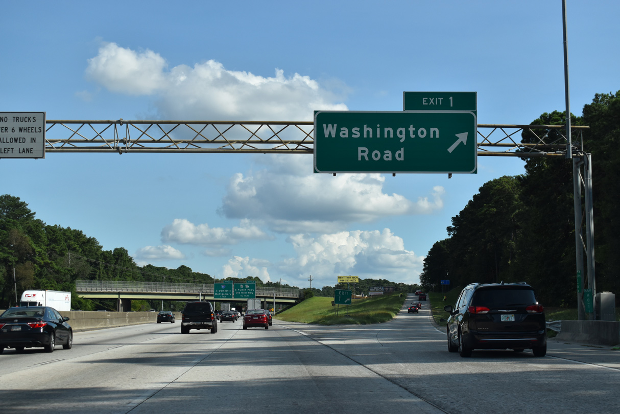
Washington Road extends 1.10 miles south alongside I-285 from the parclo interchange at Exit 1 to U.S. 29/SR 14 (Roosevelt Highway) near Red Oak in College Park.
09/11/20
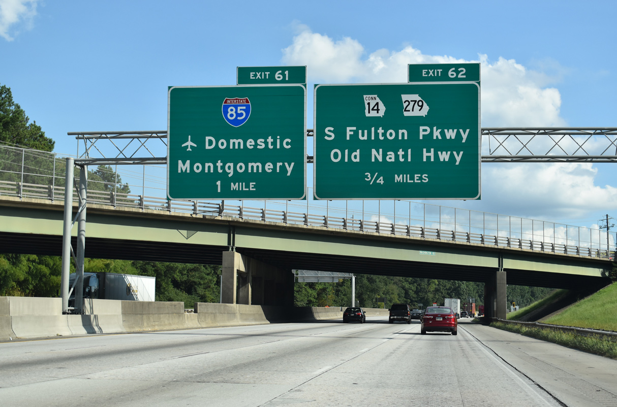
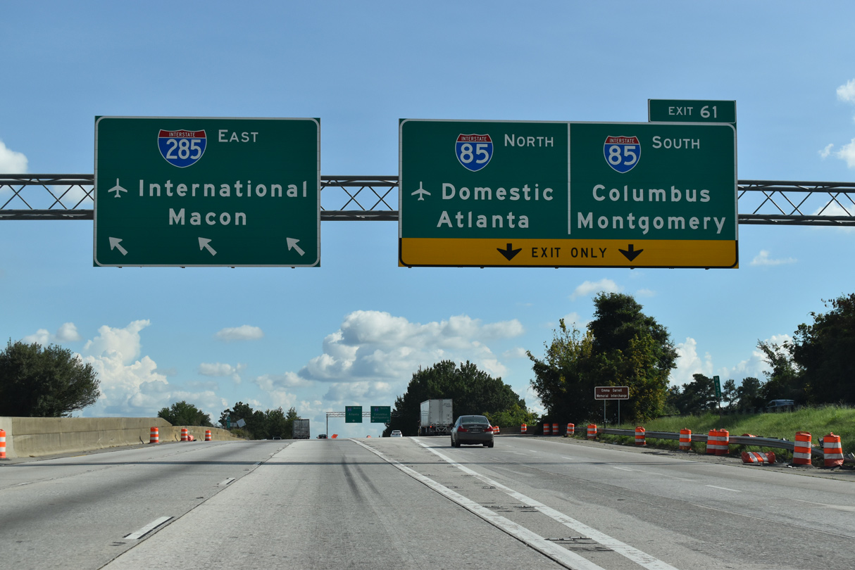
I-285 proceeds south to the systems interchange (Exits 62/61) with Interstate 85 and SR 14CO (South Fulton Parkway).
09/11/20
A lane drop occurs for Exit 61 to Interstate 85 north. I-85 angles northeast through College Park and along the west side of Hartsfield-Jackson Atlanta International Airport (ATL).
09/11/20
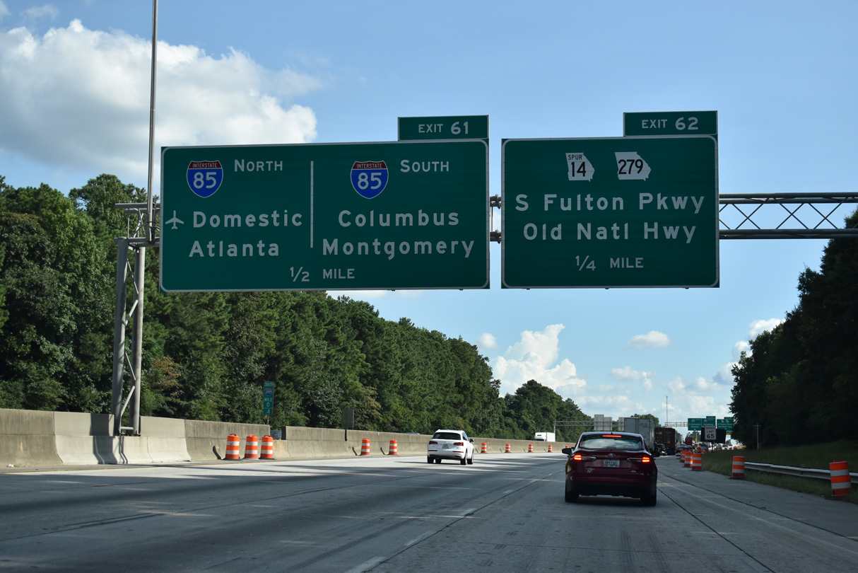
Columbus accompanies Montgomery for I-85 south from Exit 61 for the connection with Interstate 185 south at LaGrange.
09/11/20
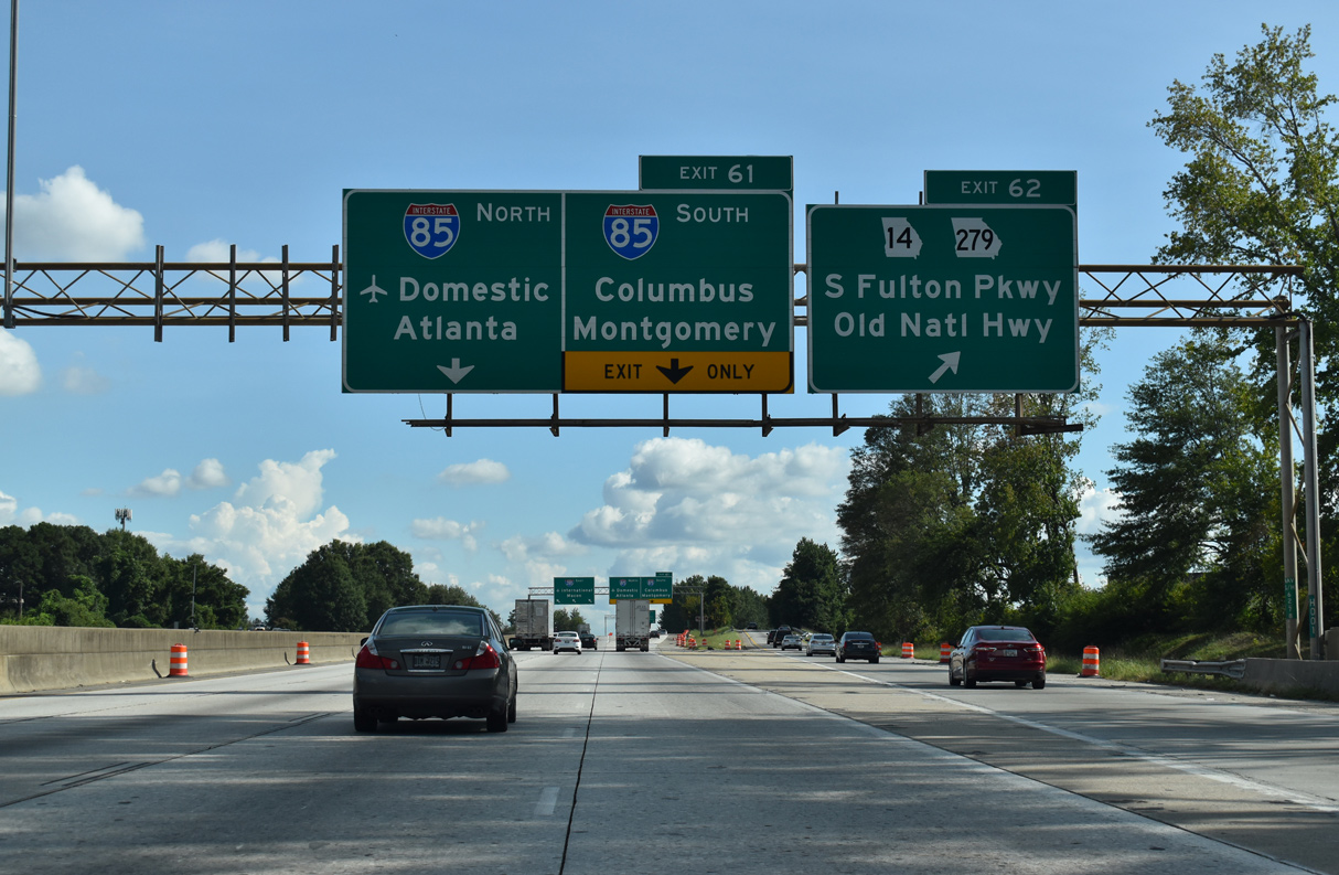
SR 14CO (South Fulton Parkway) stems 1.92 miles west from I-85/285 as a freeway to U.S. 29/SR 14 (Roosevelt Highway), and a controlled access highway (U.S. 29AL/SR 14AL) from there 9.64 miles to SR 70 at Chattahoochee Hills. A c/d roadway extends east from Exit 62 to SR 279 (Old National Highway).
09/11/20
Interstate 285 curves east with three through lanes as Exit 61 partitions for I-85 south to Montgomery and north into Atlanta.
09/11/20
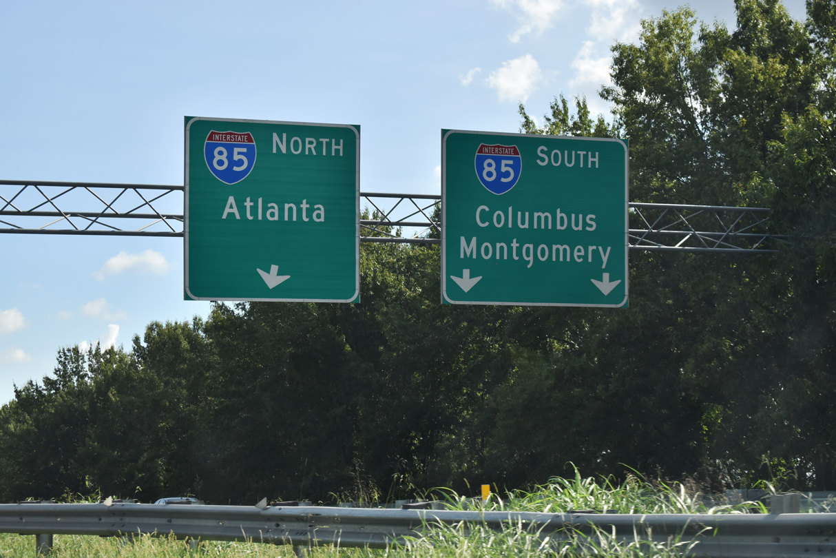
Interstate 85 continues southwest through the Atlanta metropolitan to Newnan and Grantville. Montgomery, Alabama is 148 miles away.
09/11/20

References:
- "Atlanta street fight: Who was Donald Lee Hollowell?" Atlanta-Journal Constitution (GA), October 3, 2016.
- College Park, Georgia. Wikipedia.
Photo Credits:
- Andy Field: 06/03/07
- AARoads: 08/07/13
- ABRoads: 09/11/20
- Alex Nitzman: 07/13/05
Connect with:
Page Updated Thursday March 24, 2022.