
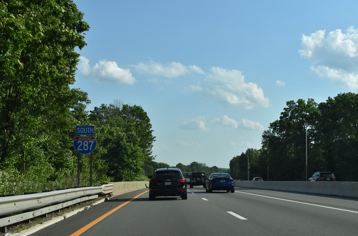
Interstate 287 South - Parsippany to Somerville

05/31/22
07/26/24
07/26/24
07/26/24
07/26/24
07/26/24
07/26/24
07/26/24
07/26/24

07/26/24
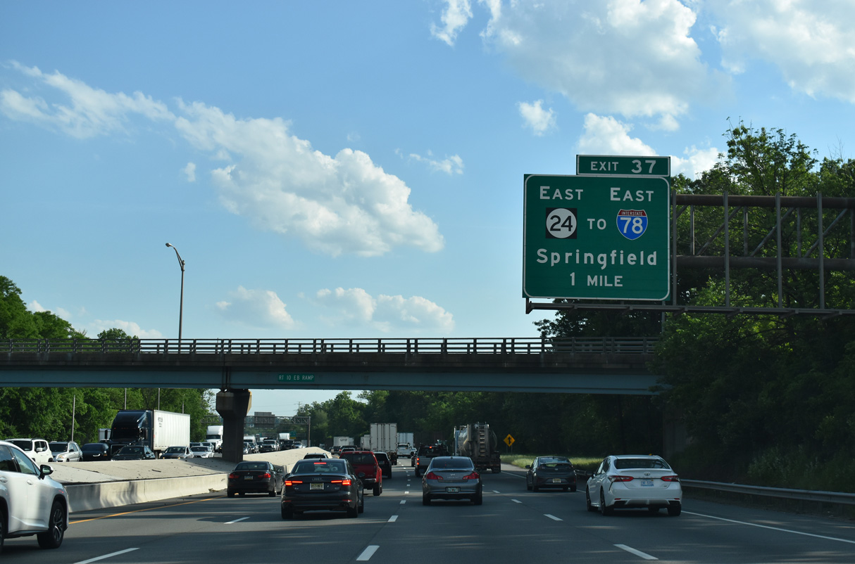
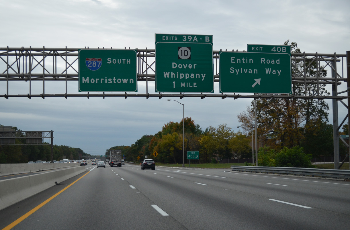
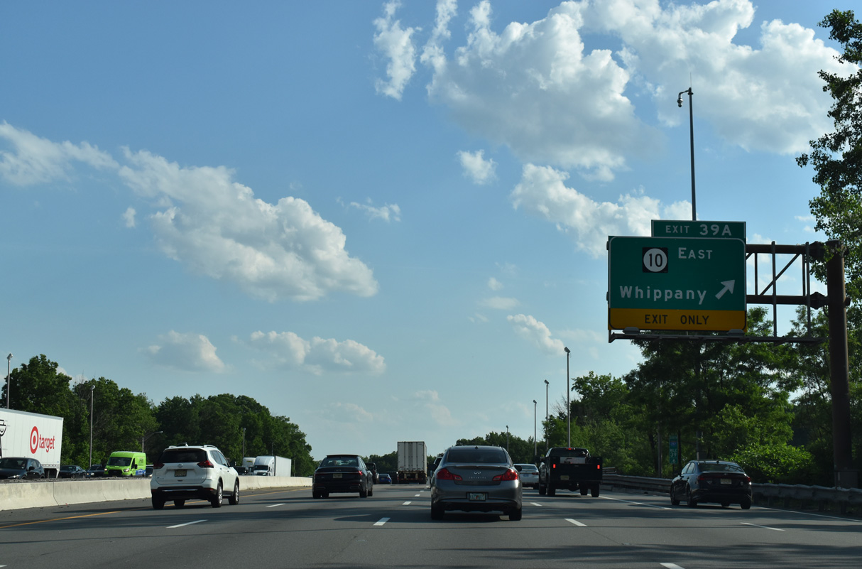
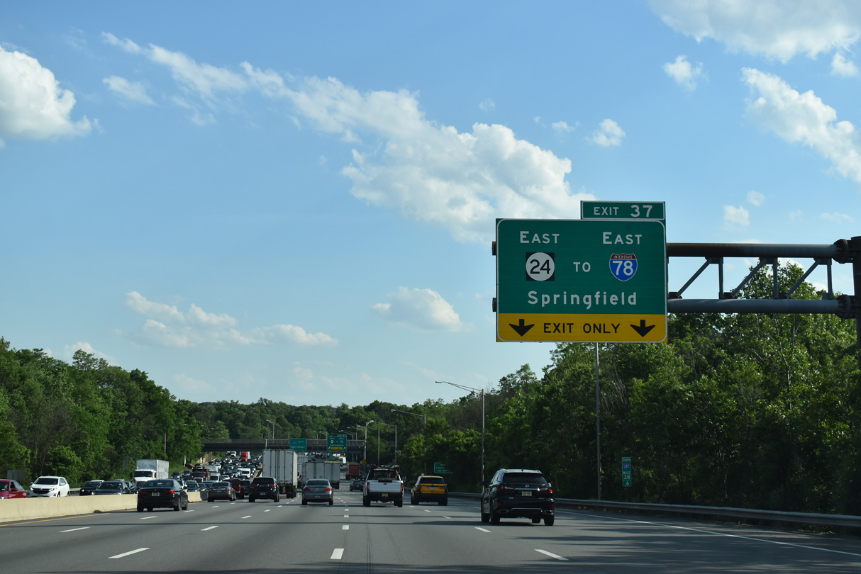
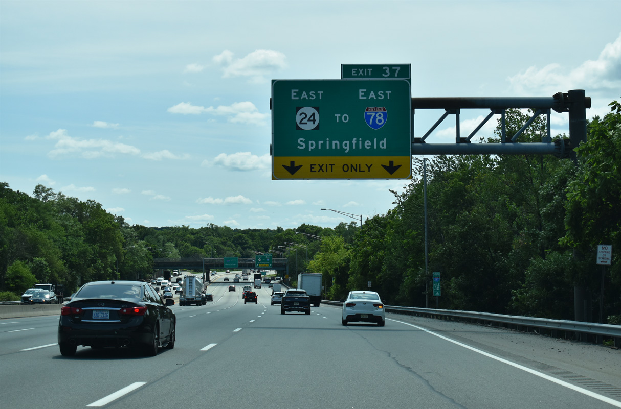
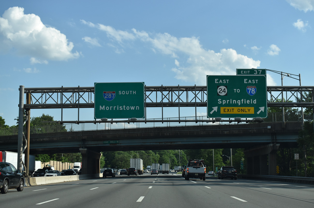
Heading south from Route 10 in Hanover Township, Interstate 287 advances to a trumpet interchange (Exit 37) with New Jersey Route 24 east.
07/26/24
07/26/24
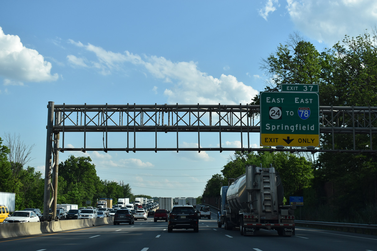
New Jersey Route 24 constitutes a 10.42 mile long freeway southeast from I-287 to Interstate 78 at Springfield Township.
07/26/24
07/26/24
07/26/24
The freeway along New Jersey Route 24 east to I-78 was completed in 1992.
07/26/24
07/26/24
05/31/22

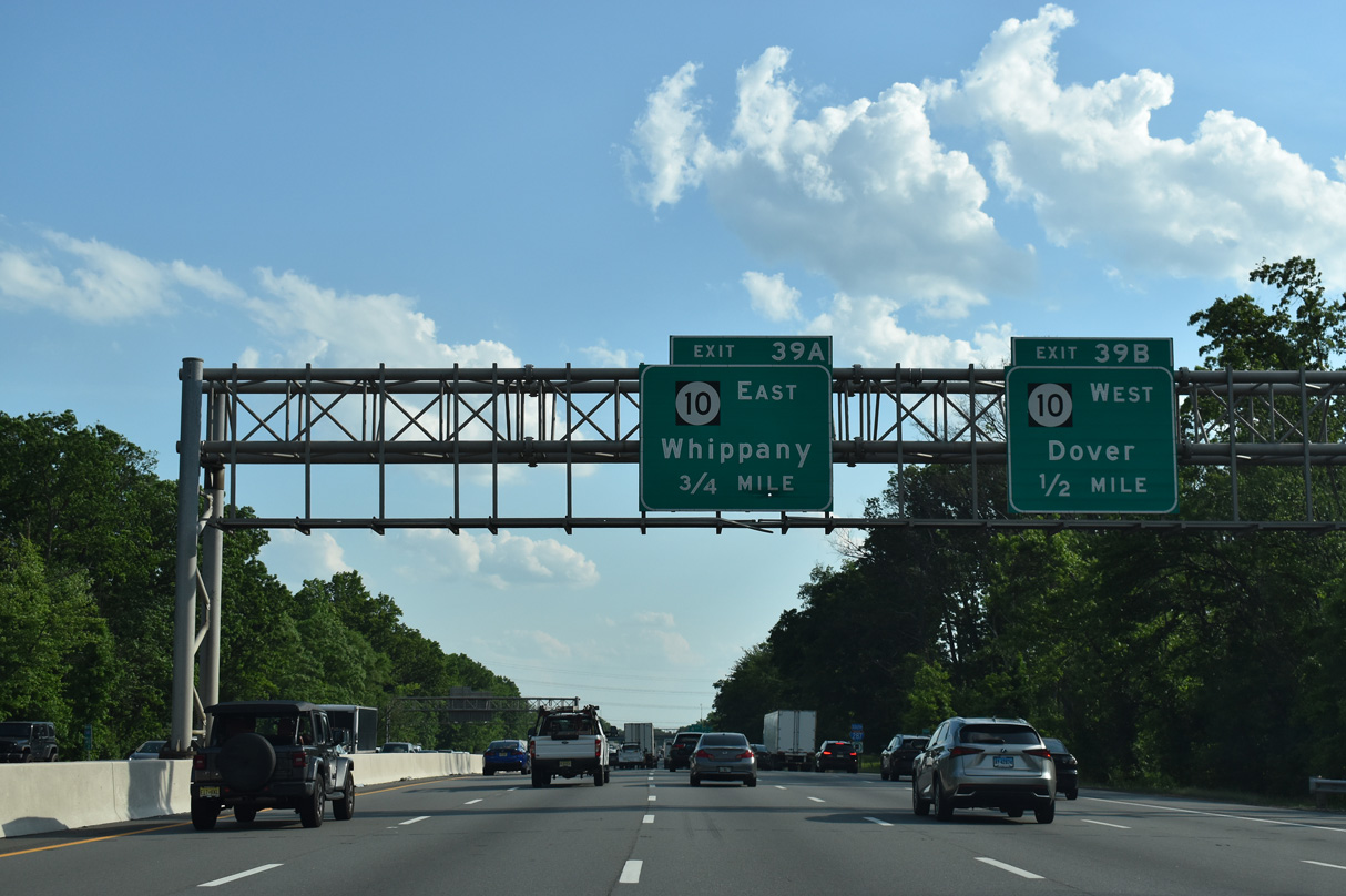
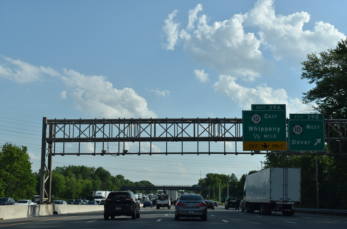
Two lanes leave I-287 south at Exit 37 for Route 24 east to Florham Park, Madison, Chatham and the city of Summit.
07/26/24
07/26/24
10/10/14
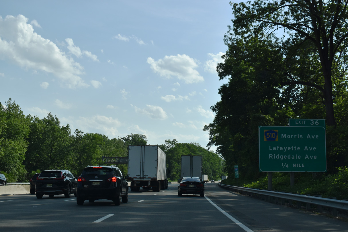
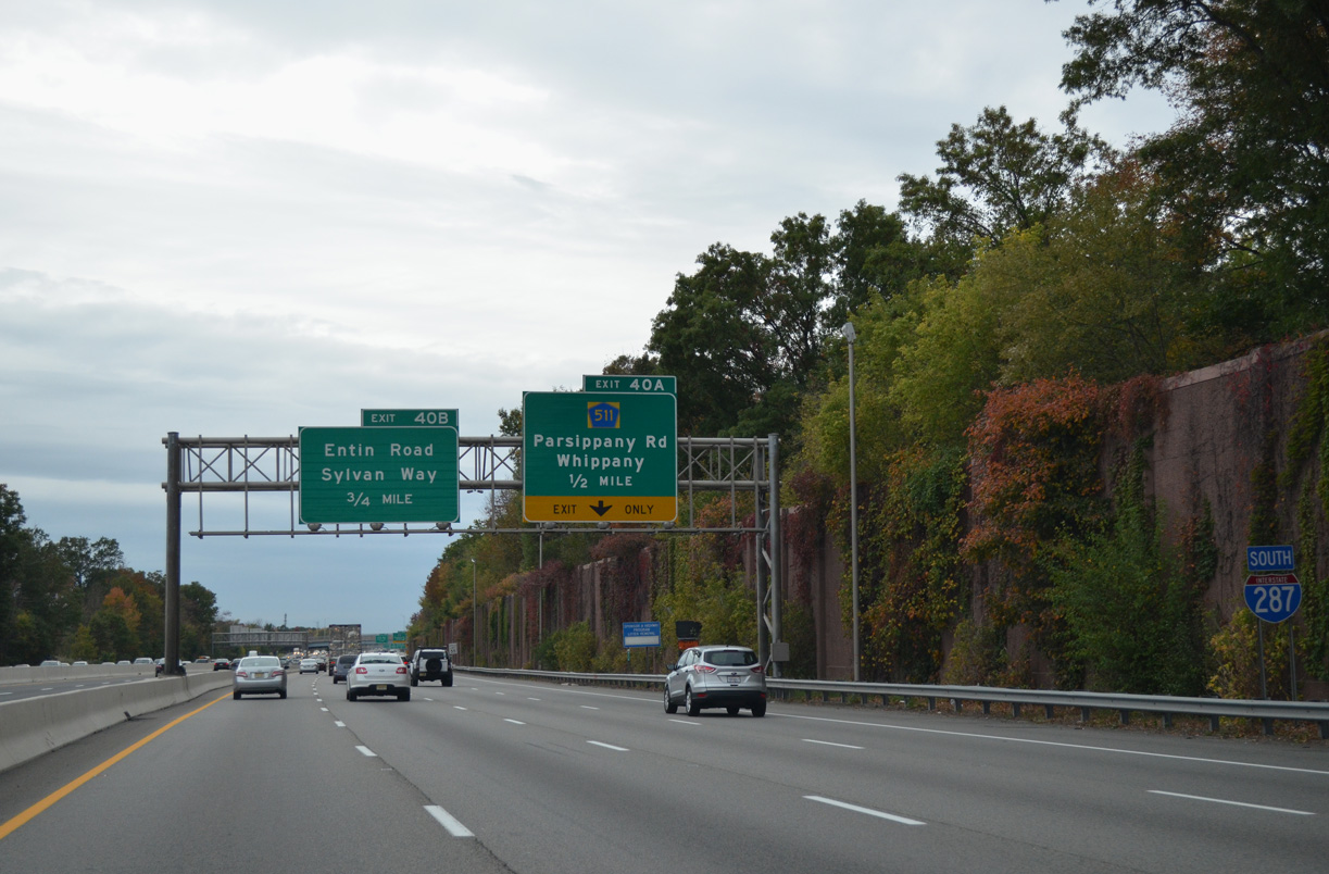
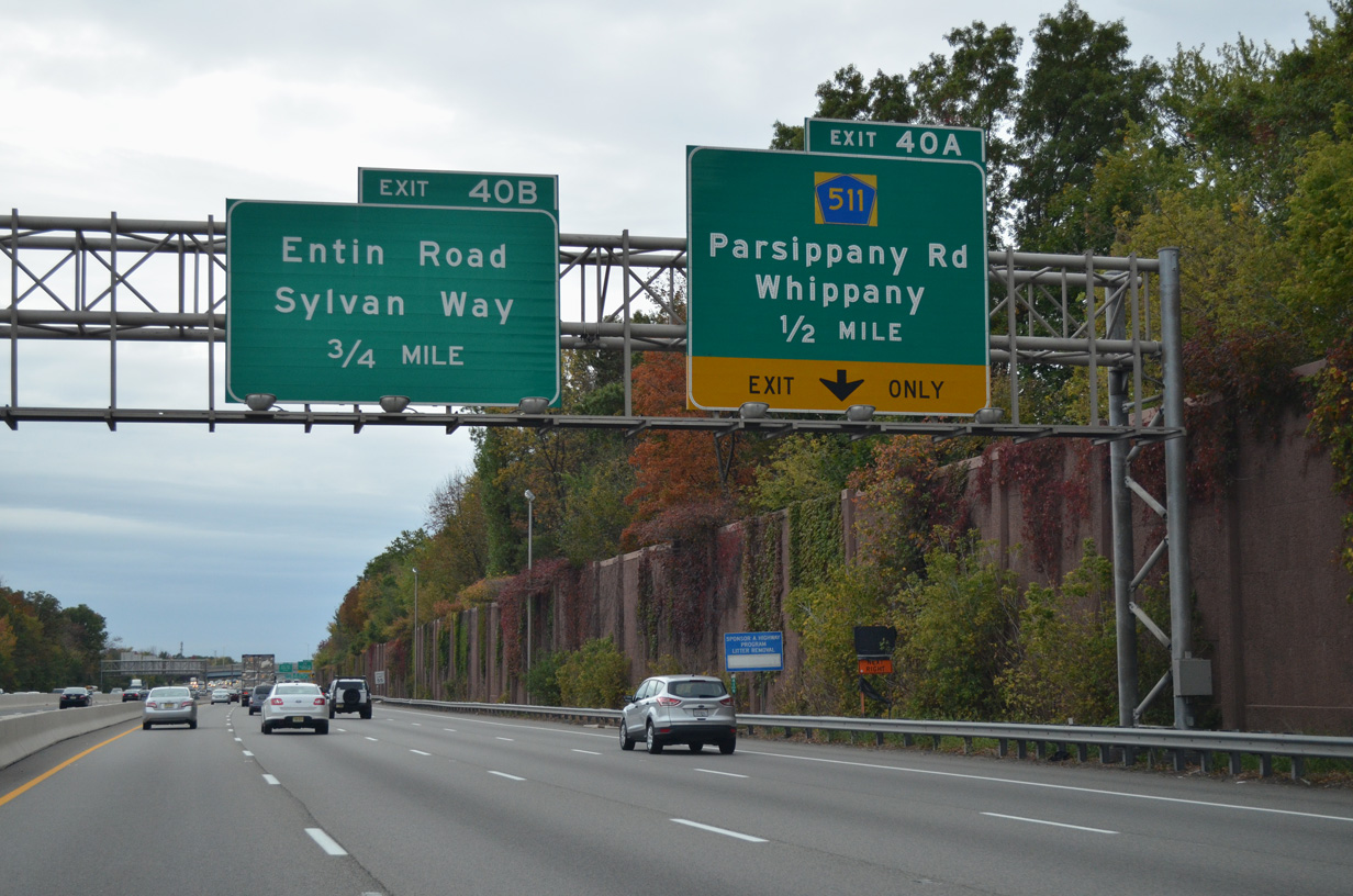
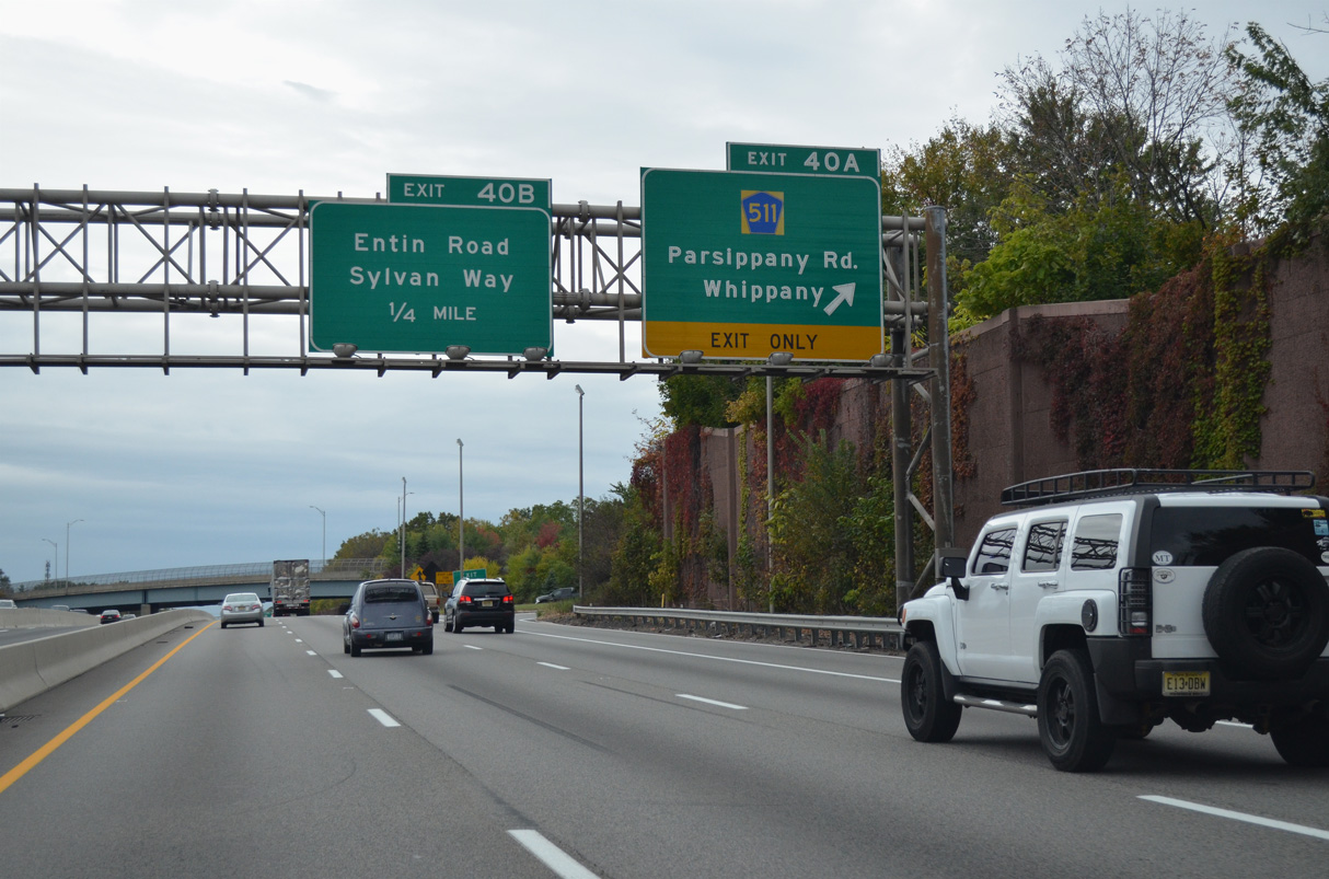
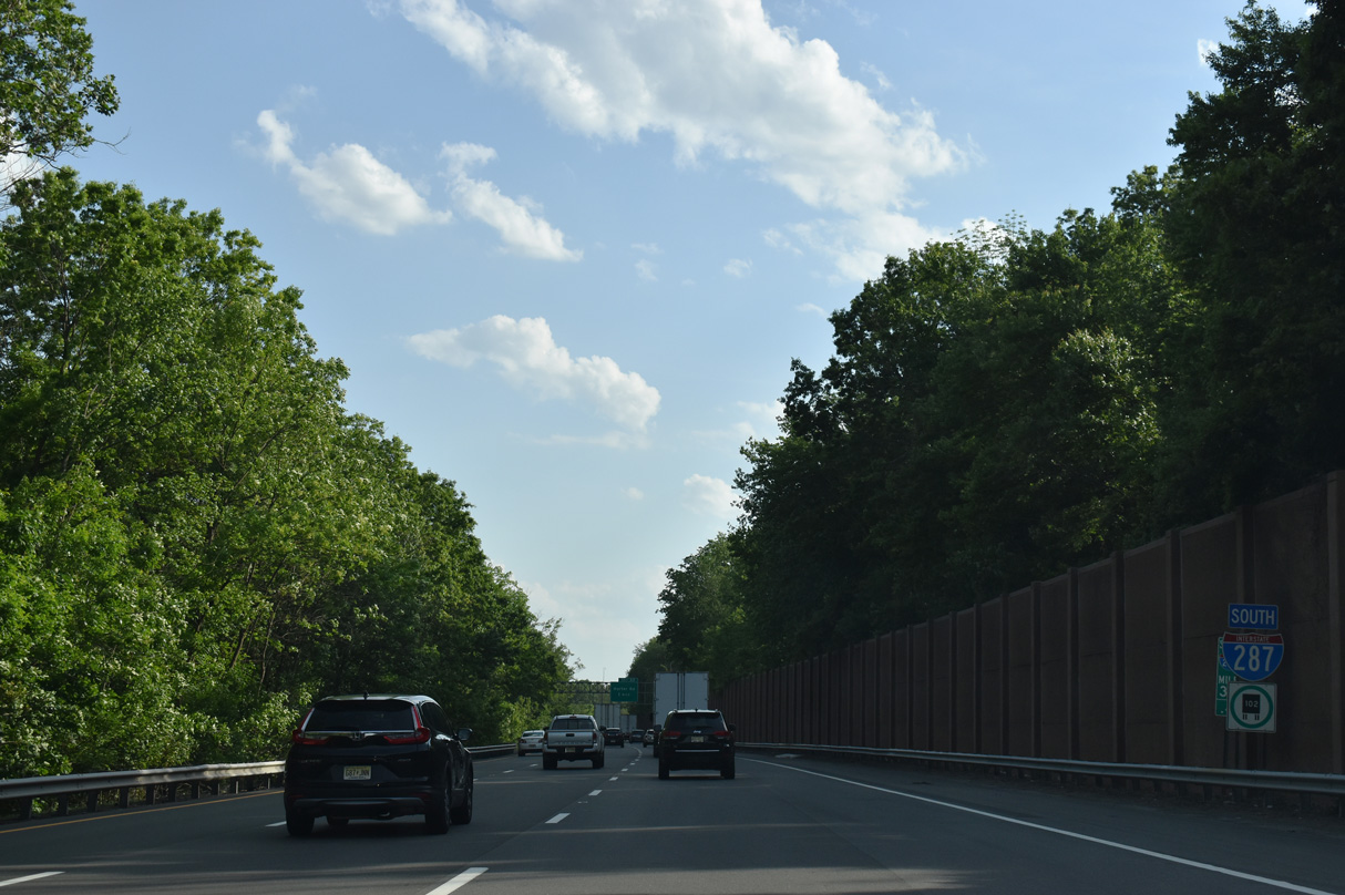
The next two exits from Interstate 287 south serve the town of Morristown. Departing in one quarter mile is Exit 37 to both adjacent Ridgedale Avenue and County Route 510Z (Lafayette Avenue).
05/31/22
05/31/22
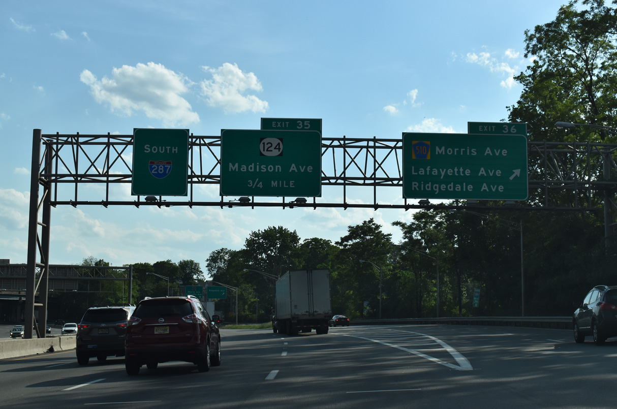
West from Exit 36, CR 501 follows Morris Avenue into Downtown Morristown. Lafayette Avenue (CR 501Z) loops 1.21 miles north of Morris Avenue to the ramps with I-287 and the south end of CR 511 (Whippany Road).
05/31/22
05/31/22
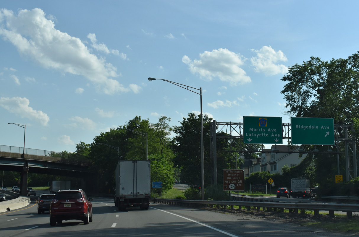
Exit 36 partitions with a ramp onto parallel Ridgedale Avenue at Abbett Avenue.
05/31/22
05/31/22
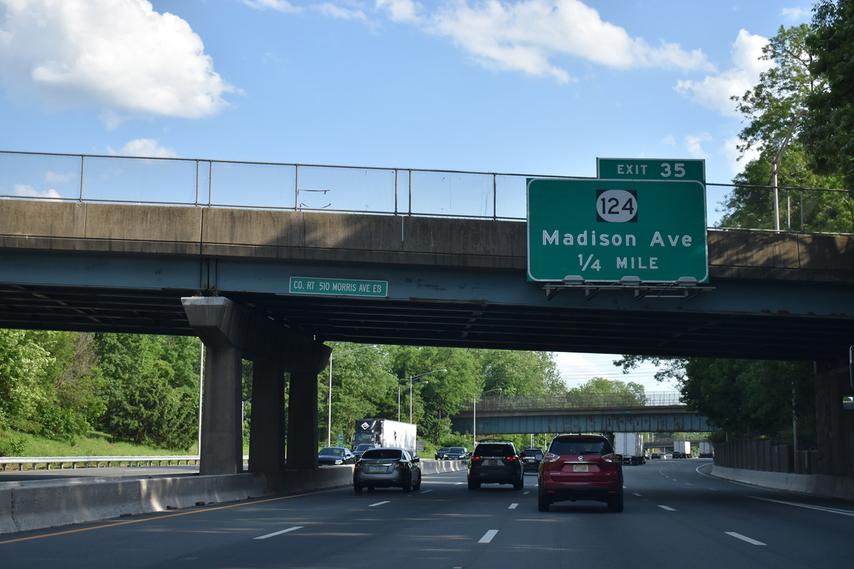
Route 124, the former alignment of Route 24, follows Madison Avenue southeast to Madison and South Street north to U.S. 202 in Downtown Morristown.
05/31/22
05/31/22
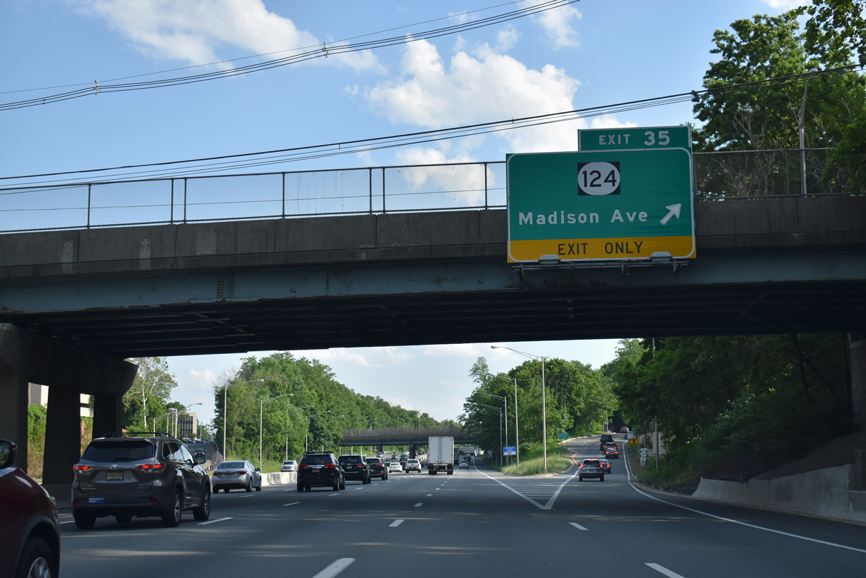
Route 124 (Madison Avenue) travels 14.74 miles from Morristown southeast to Summit and Maplewood Township. The old alignment of Route 24 once extended west from Morristown to Chester, which was later planned as a freeway.
05/31/22
05/31/22
05/31/22
05/31/22
05/31/22
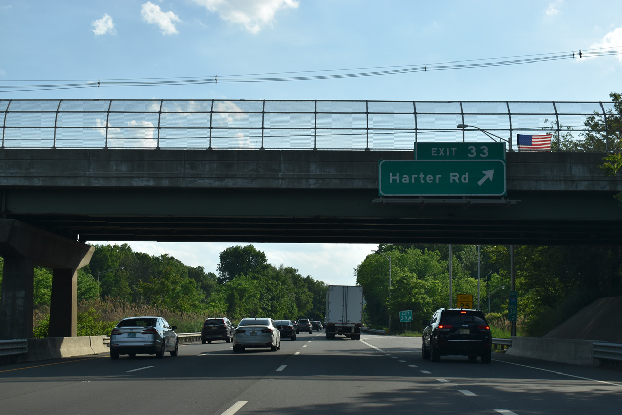
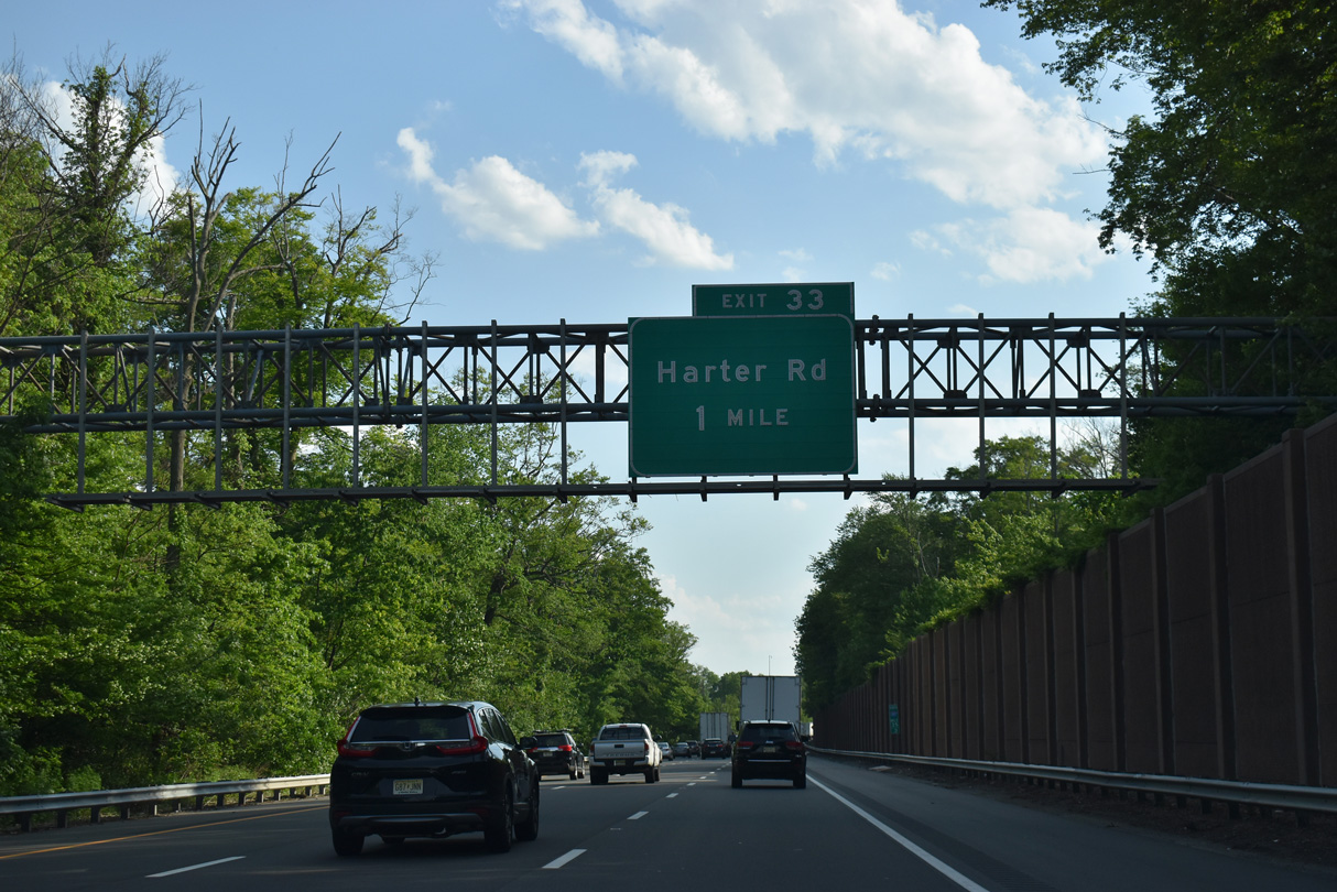
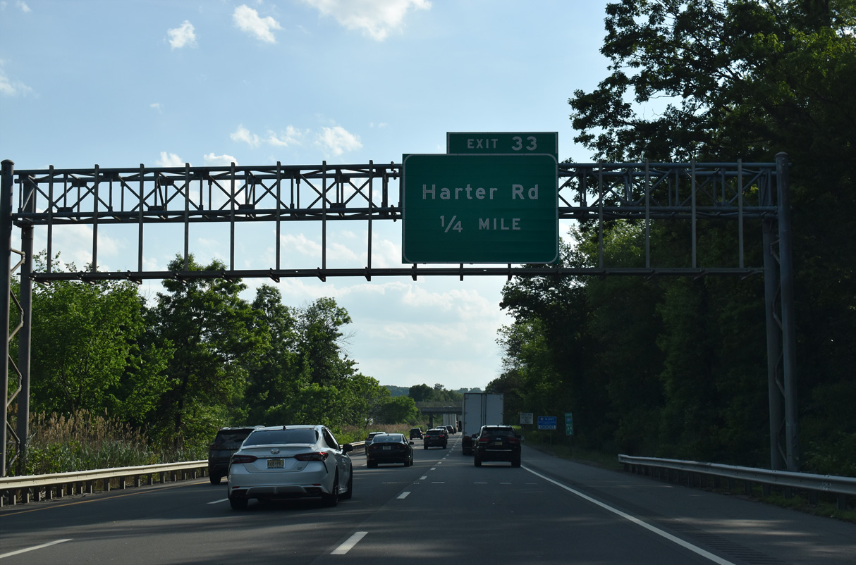
Exit 33 loops onto Harter Road ahead of the Morris / Harding Township line.
05/31/22
05/31/22
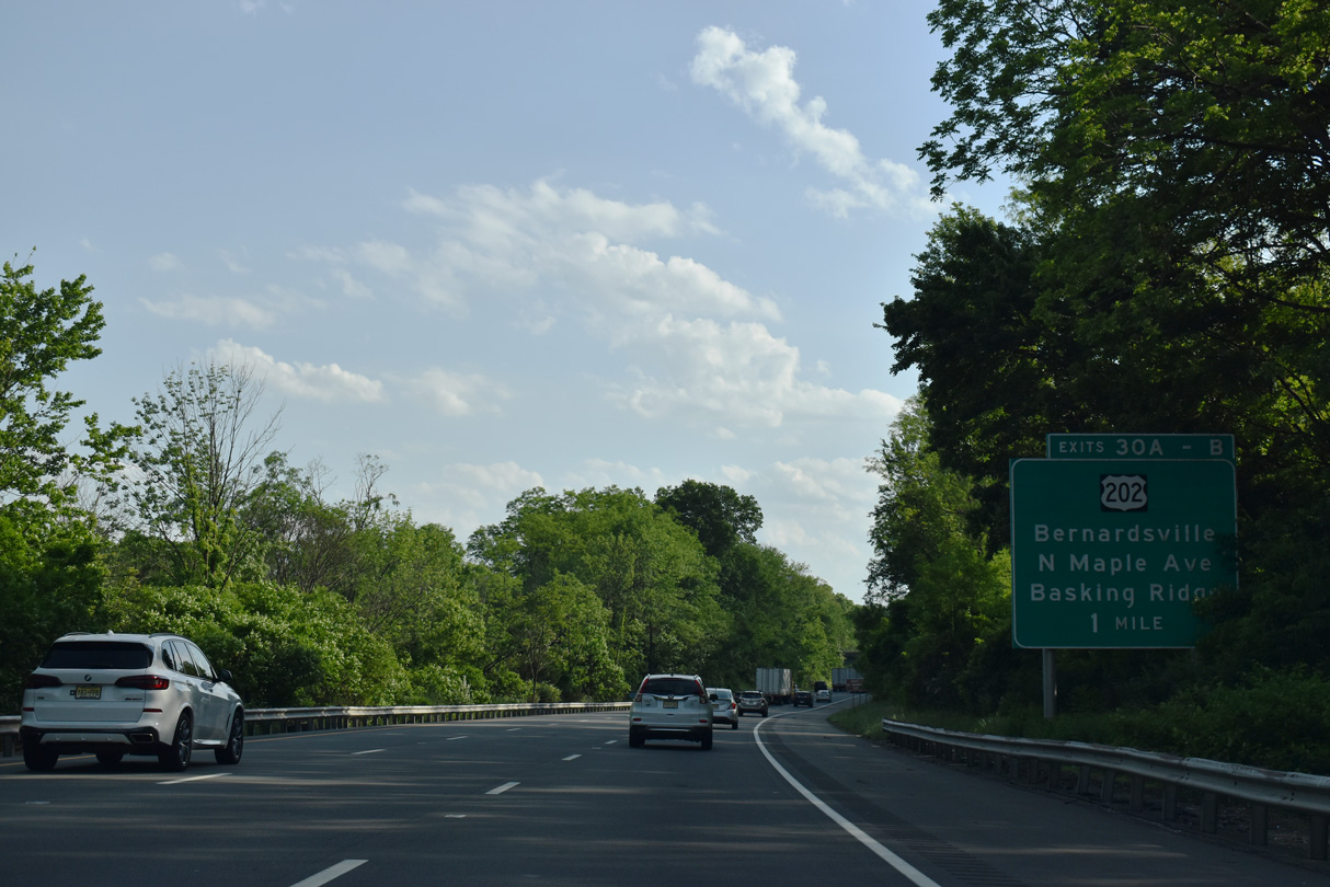
Shifting westward toward Mount Kemble in Harding Township, Interstate 287 again parallels U.S. 202 south to Exit 30 in Bernards Township.
05/31/22
05/31/22
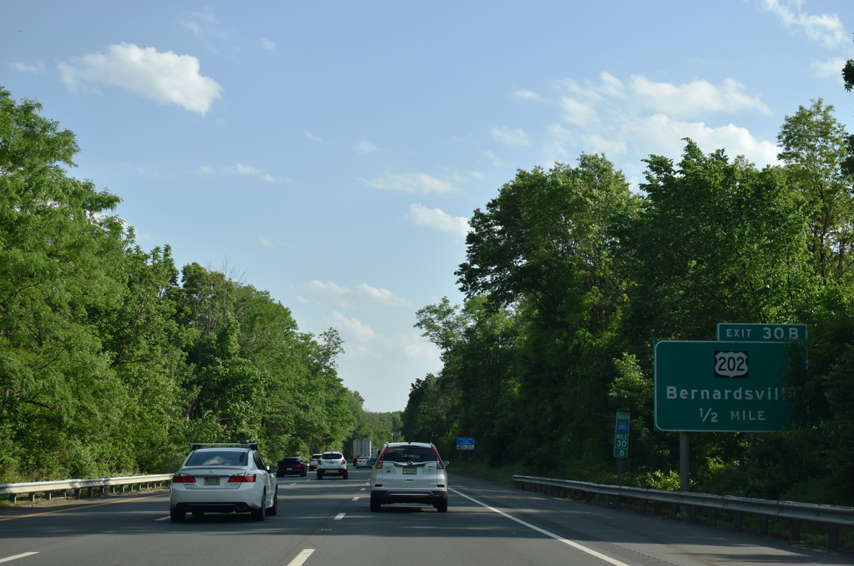
The three quarter cloverleaf interchange at Exit 30 joins Interstate 287 with Maple Avenue, south of the intersection with U.S. 202 (Morristown Road) and Childs Road (CR 613) at Van Dorans Mill.
05/31/22
05/31/22
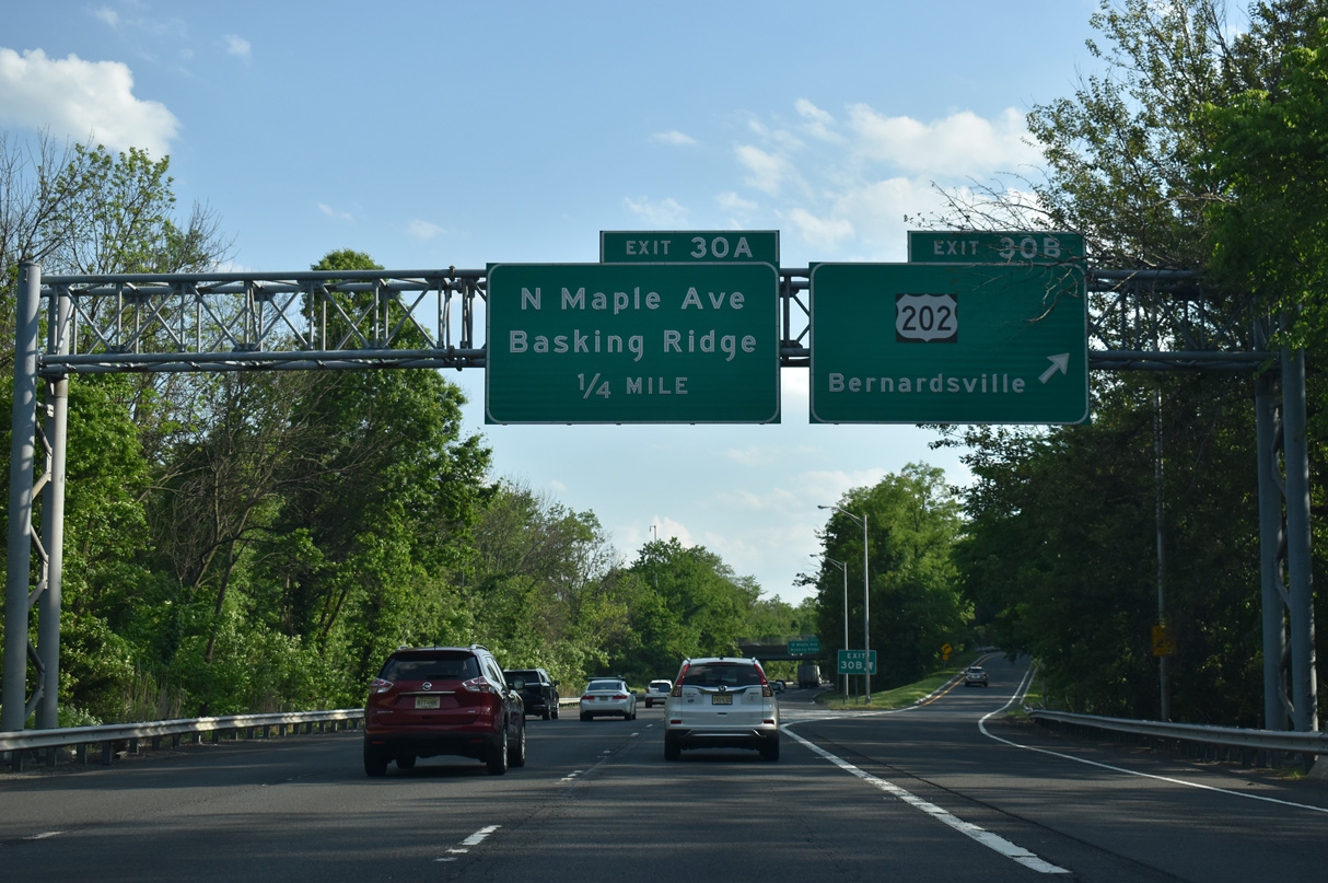
U.S. 202 diverges from I-287 southwest from Maple Avenue into the borough of Bernardsville.
05/31/22
05/31/22
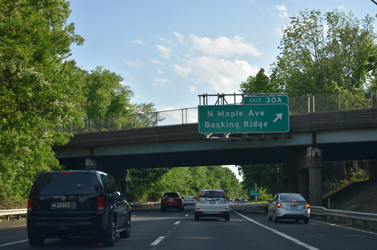
Maple Avenue heads south from Exit 30 A to Madisonville and Basking Ridge in Bernards Township.
05/31/22
05/31/22
Maple Road heads south from U.S. 202 and Exit 30A to Madisonville and Basking Ridge.
05/31/22
05/31/22
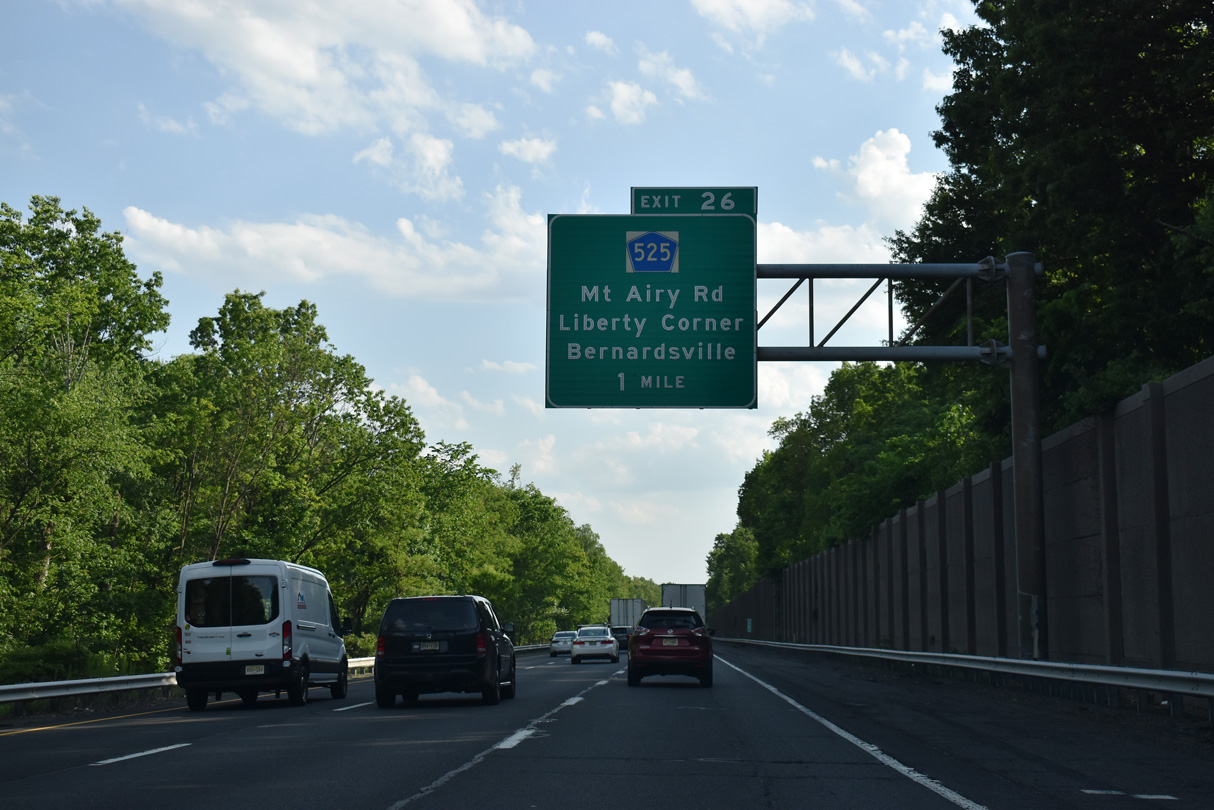
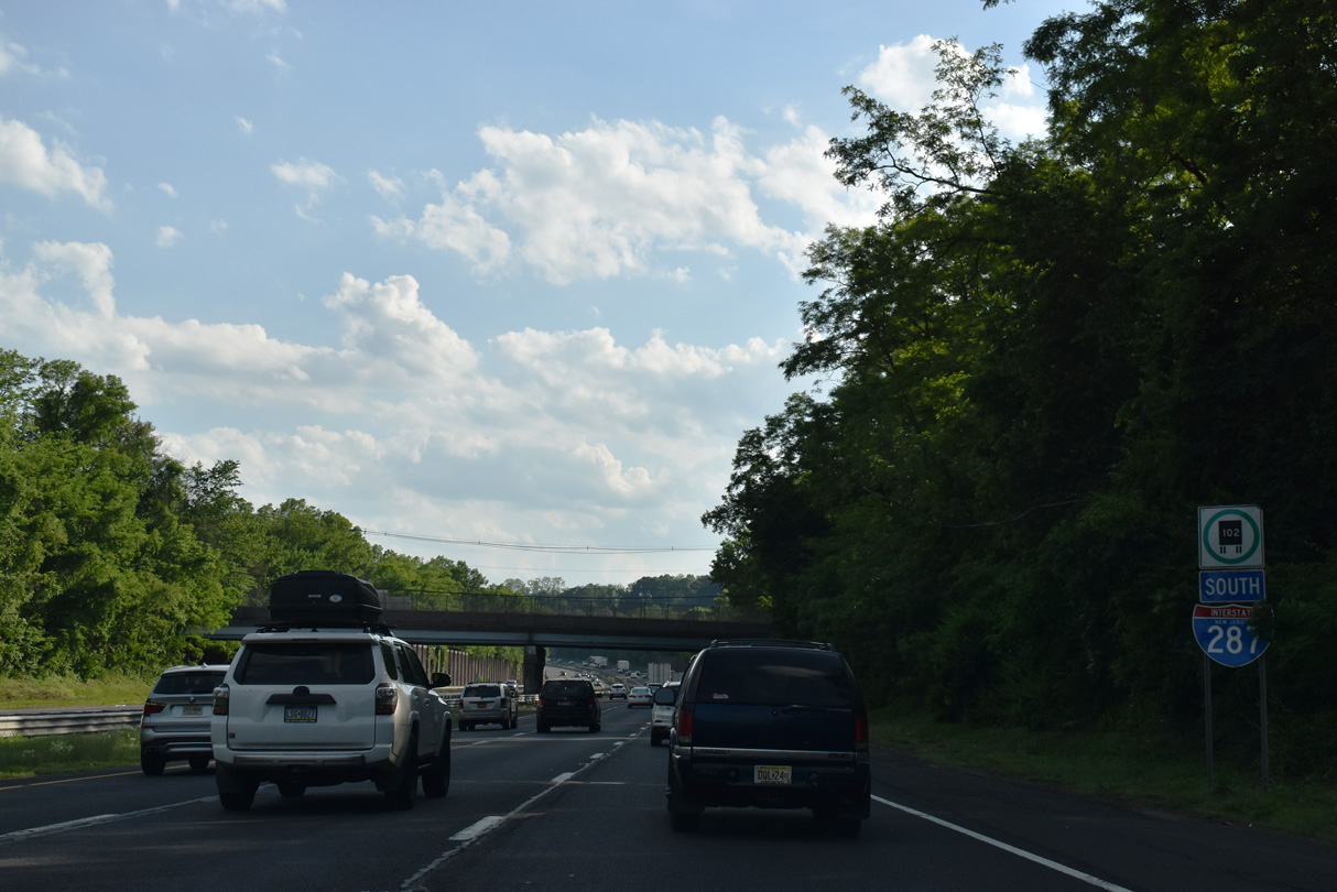
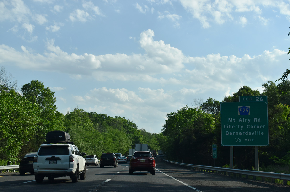
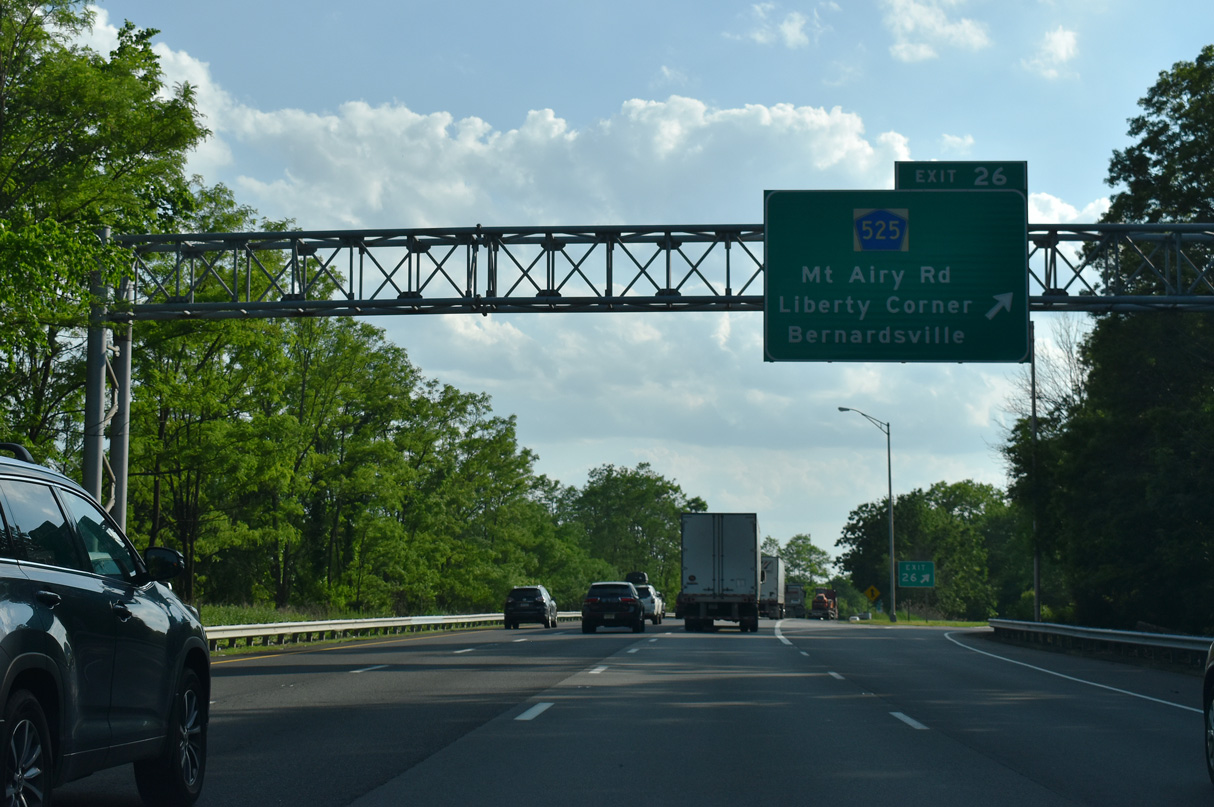
Interstate 287 passes Bernardsville to the east ahead of Exit 26 to County Route 525 (Mount Airy Road).
05/31/22
05/31/22
CR 525 runs 16.88 miles from New Jersey Route 28 at Bound Brook to CR 510 in the borough of Mendham.
05/31/22
05/31/22
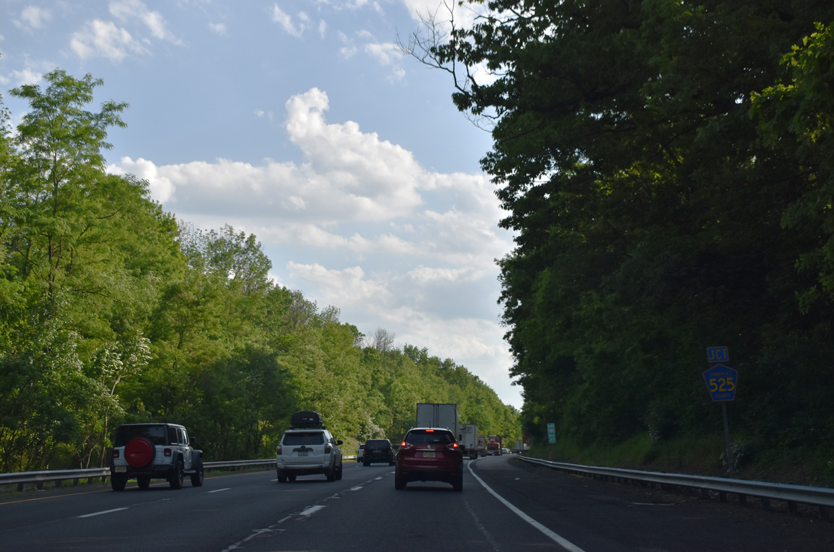
A six-ramp parclo interchange (Exit 26) joins the CR 525 with I-287 north of Liberty Corner.
05/31/22
05/31/22
05/31/22
05/31/22
05/31/22
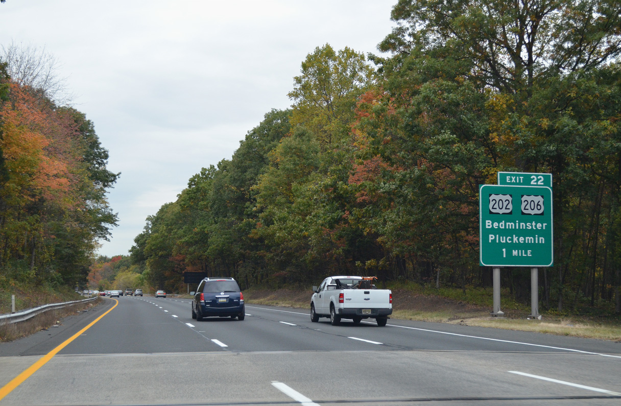
Interstate 287 curves westward and lowers from Second Watchung Mountain into a parclo interchange (Exit 22) with U.S. 202/206 near Pluckemin.
10/10/14
10/10/14
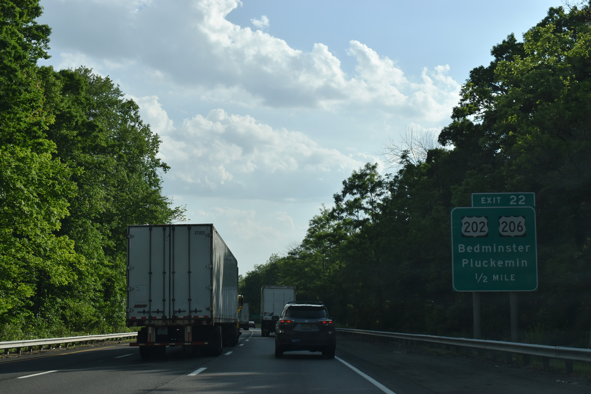
Exit 22 from I-287 south defaults onto U.S. 202/206 north in Bedminster Township. A U-turn at River Road is required to access southbound to Pluckemin.
05/31/22
05/31/22
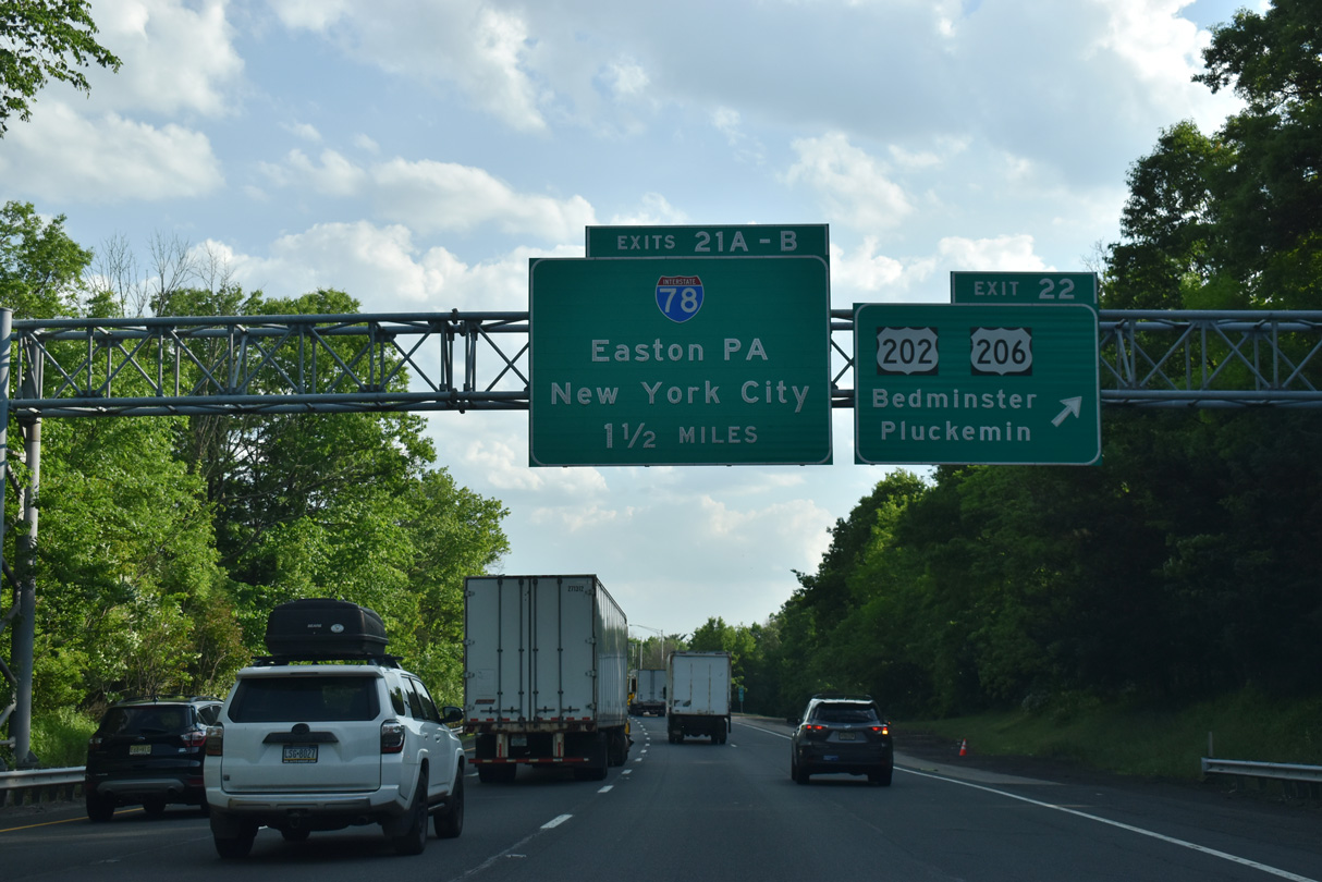
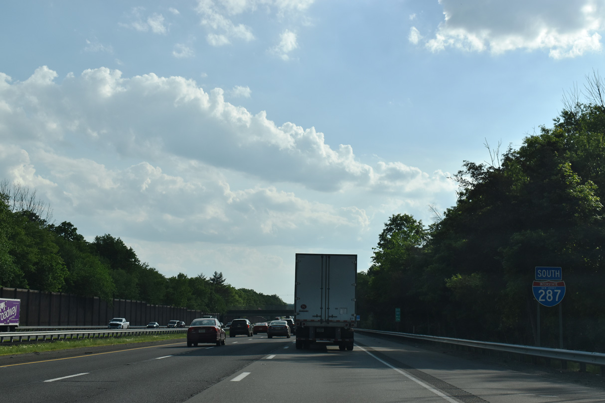
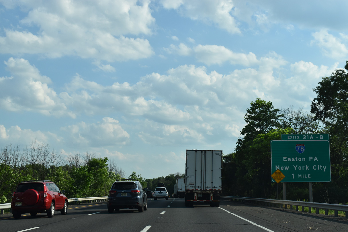
U.S. 202/206 combine west of Far Hills along a seven mile overlap south to Raritan. The two routes parallel I-287 east of the forthcoming interchange (Exits 21 B/A) with Interstate 78.
05/31/22
05/31/22
A 144 mile long route, Interstate 78 travels east to New York City and west to the Lehigh Valley and I-81 near Harrisburg, Pennsylvania.
05/31/22
05/31/22
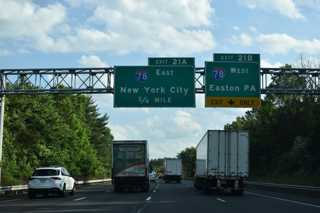
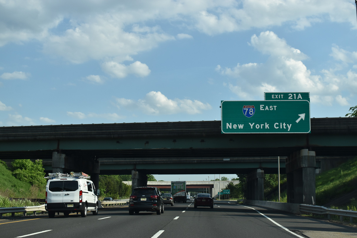
The entrance ramp from U.S. 202/206 south adds an auxiliary lane to the directional cloverleaf interchange (Exits 21 B/A) with Interstate 78.
05/31/22
05/31/22
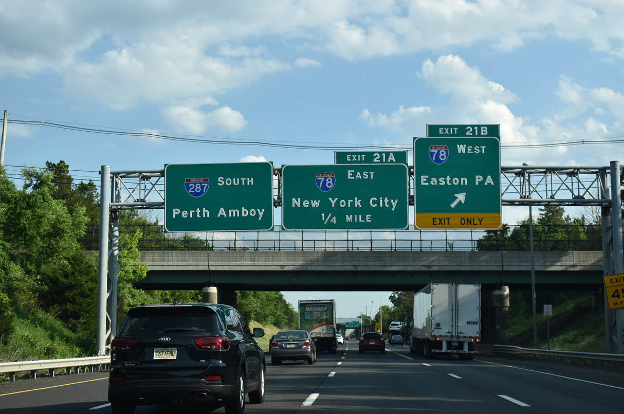
The control city for I-78 west was changed from Clinton to Easton, Pennsylvania in the mid 1990s. The freeway leaves the Garden State over a toll bridge spanning the Delaware River near Alpha.
05/31/22
05/31/22
Interstate 78 travels a rural route west to Lebanon, Clinton and Phillipsburg and an increasingly urban route east to Springfield, Newark and Jersey City.
05/31/22
05/31/22


Photo Credits:
- Brent Ivy: 05/31/22, 07/26/24
- Alex Nitzman: 10/10/14, 05/31/22
Connect with:
Page Updated Wednesday May 13, 2026.