
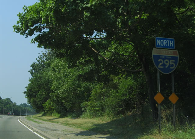
Interstate 295 North
 North
North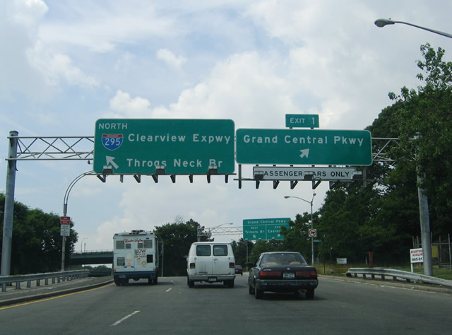
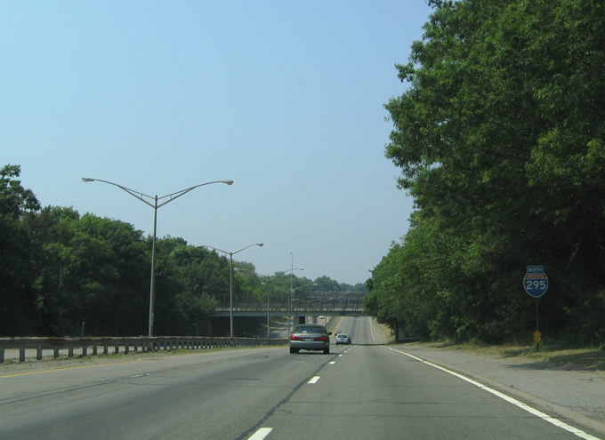
Interstate 295 begins north from the intersection with NY 25 (Hillside Avenue) and 212th Street at Queens Village. The Clearview Expressway immediately separates with ramps (Exit 1) for Grand Central Parkway west to I-278 and Long Island.
06/13/05
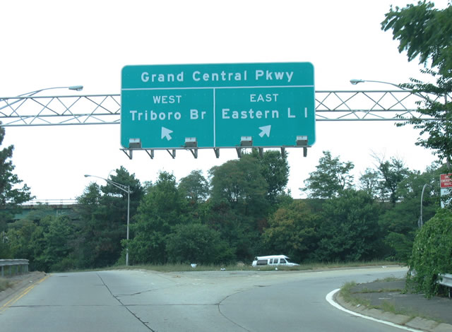
Grand Central Parkway travels 3.5 miles west across Queens to the Kew Gardens Interchange with I-678 (Van Wyck Expressway) and Jackie Robinson Parkway. East from I-295, the parkway continues 3.3 miles into Nassau County as Northern State Parkway .
08/29/05
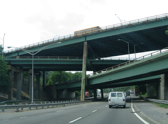
A four level interchange joins I-295 with Grand Central Parkway. The systems exchange was constructed to serve traffic from the cancelled alignment of I-78 south to Nassau Expressway.
06/13/05
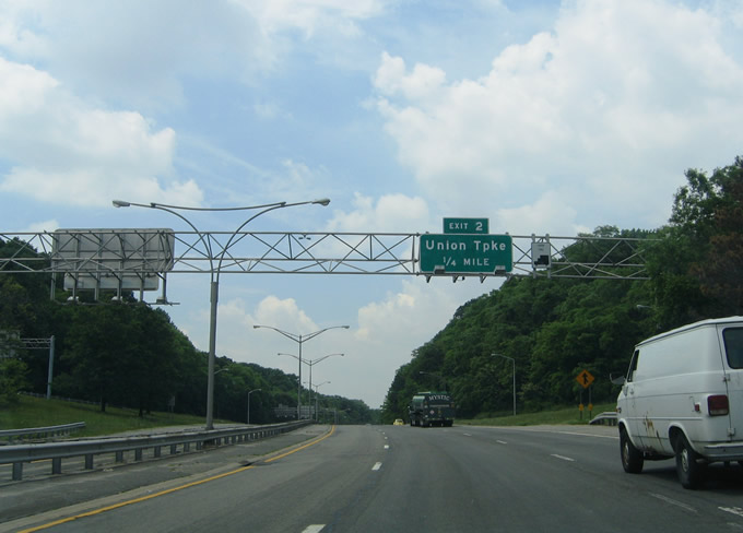
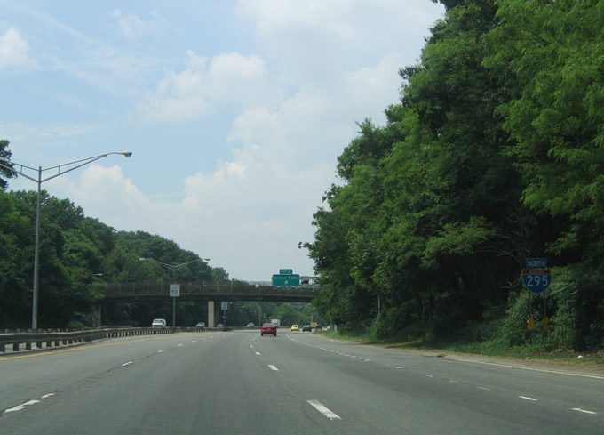
I-295 advances north to a diamond interchange (Exit 2) with Union Turnpike.
06/13/05
The first I-295 confirming marker stands along the Clearview Expressway northbound ahead of the 82nd Avenue pedestrian bridge in Cunningham Park.
06/13/05
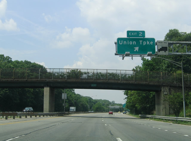
Union Turnpike connects Interstate 295 with the Hollis Hills neighborhood to the east and with Francis Lewis Boulevard in Cunningham Park, and the Fresh Meadows and Utopia communities to the west.
06/13/05
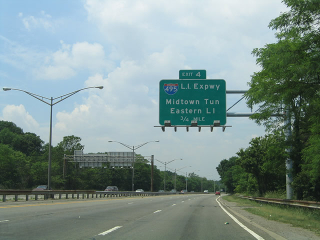
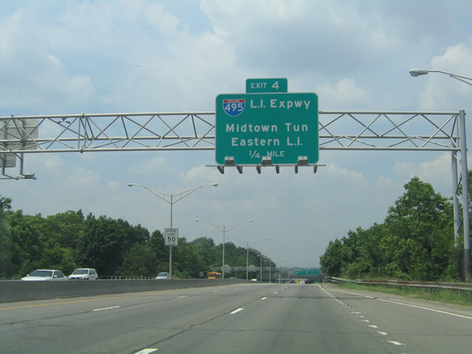
Interstate 295 continues through Cunningham Park to a directional interchange (Exit 4) with the Long Island Expressway.
06/13/05
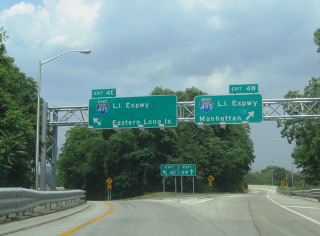
A half diamond interchange joins 73rd Avenue with I-295 north a quarter mile ahead of the ramps (Exit 4E/W) for Interstate 495 (Long Island Expressway).
06/13/05
Traffic to I-495 departs I-295 north beyond a pedestrian overpass in Cunningham Park. The Long Island Expressway comprises the main route joining New York City with Nassau and Suffolk Counties on Long Island.
06/13/05

Interstate 495 travels 11 miles west to the Queens Mid-Town Tunnel crossing the Harlem River into Manhattan. I-495 east connects with Cross Island Parkway at Little Neck in 1.25 miles.
06/13/05
Interstate 495 heads 3.5 miles east from I-295 at Oakland Gardens to North New Hyde Park in Nassau County and 19 miles to Melville in Suffolk County. Flushing Meadows Corona Park lies 3.6 miles to the west along the LIE.
06/13/05
A reassurance marker for Interstate 295 north stands within the exchange for the Long Island Expressway.
06/26/05

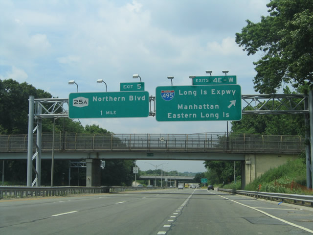
The succeeding exit joins I-295 with NY 25A (Northern Boulevard) at the Auburndale and Bayside neighborhoods of Queens.
06/26/05
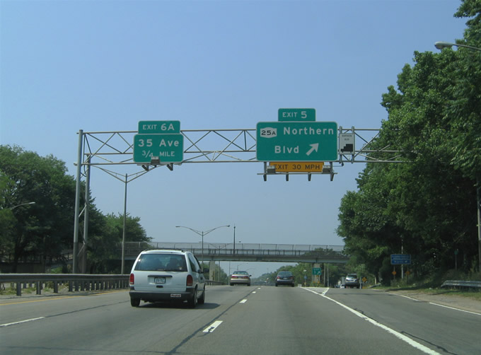
Exit 3 separates from I-295 north ahead of the 46th Avenue pedestrian overpass. NY 25A follows Northern Boulevard east across Queens from Flushing Meadows-Corona Park to Russell Gardens in Nassau County.
06/26/05
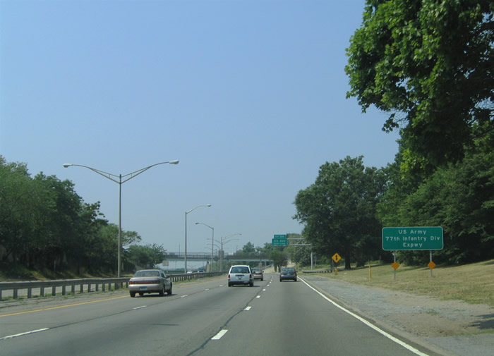
Interstate 295 is the U.S. Army 77th Division Expressway through Queens. Nicknamed the 'Statue of LibertyDivision ', the 77th Infantry Division played a pivotal role in the invasion of Guam during World War II.
06/26/05
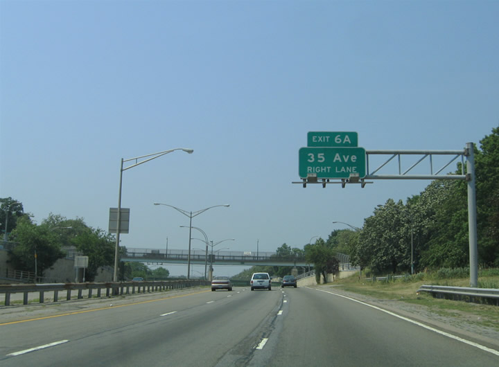
Progressing north between the Auburndale and Bayside communities, the Clearview Expressway next meets 35th Avenue at Exit 6A.
06/26/05
Exit 6A leaves Interstate 295 northbound for the Clearview Expressway Service Road ahead of 35th Avenue. 35th Avenue heads east to Crocheron Park and west to Crocheron Avenue and Murray Hill.
06/26/05
A reassurance marker for I-295 north stands within the diamond interchange (Exit 6A) at 35th Avenue.
06/26/05
Former state named shield posted along the Clearview Expressway between the 32nd Avenue and 26th Avenue overpasses. This assembly was removed by 2009.
06/26/05
A half diamond interchange (Exit 6B) ties into I-295 north from 26th Avenue ahead of this confirming marker that was replaced by 2009.
06/26/05
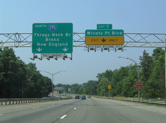
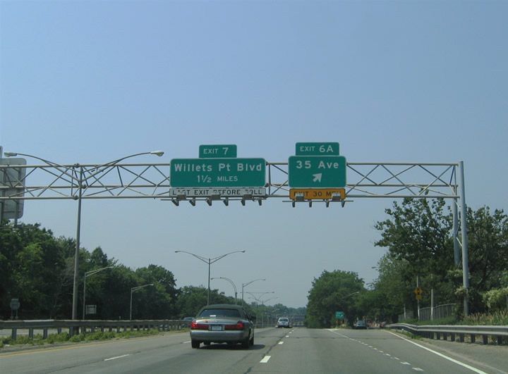
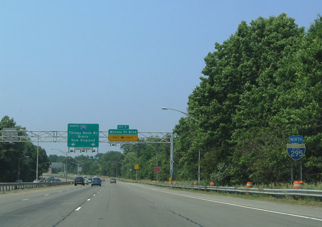
Running alongside Clearview Park, I-295 advances north to Exit 7 with the Cross Island Parkway frontage roads to Willets Point Boulevard.
06/26/05
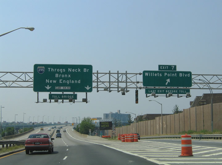
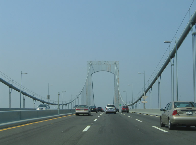
Interstate 295 reduces to two northbound lanes through the half diamond interchange (Exit 7) for Willets Point Boulevard and the wye connecting Cross Island Parkway west with the tolled Throgs Neck Bridge north.
06/26/05
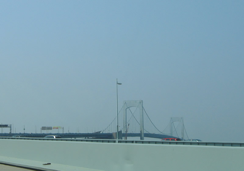
The Throgs Neck Bridge spans the East River north from Cross Island Parkway in Queens to the Throgs Neck peninsula and Locust Point in Bronx.
06/26/05
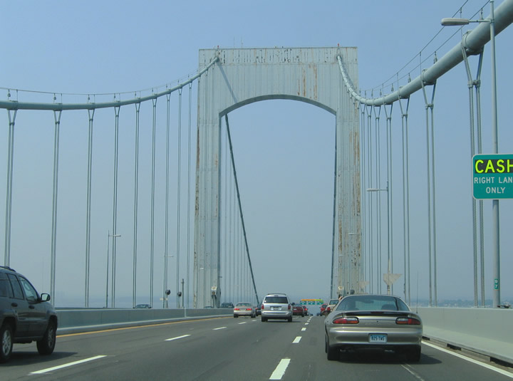
Constructed between December 1958 and January 1961, the suspension bridge along Interstate 295 opened to traffic on January 11, 1961 at a cost of $92 million.1
06/26/05
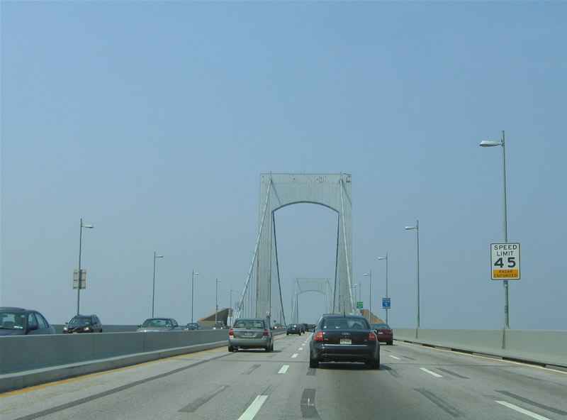
The Throgs Neck Bridge spans 2,910 feet from anchorage to anchorage at a height of 142 feet above the shipping channel.1
06/26/05
Two 360 foot high towers support the six lane deck on the Throgs Neck Bridge.1
06/26/05
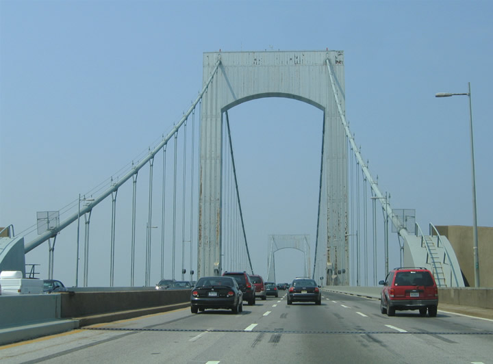
The Throgs Neck Bridge was initially planned as Interstate 495 and later signed as part of I-78 between 1959 and 1971.1
06/26/05
The Throgs Neck Bridge gradually descends from Throgs Point to Fort Schuyler and Exit 9 to Pennyfield Avenue.
06/26/05
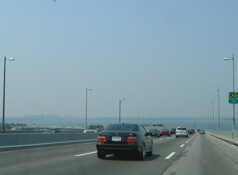
Curving west toward Locust Point, Eastchester Bay and high rises at the Co-Op City come into view along the northern horizon.
06/26/05
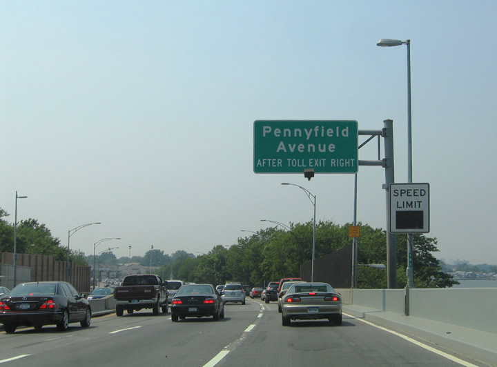
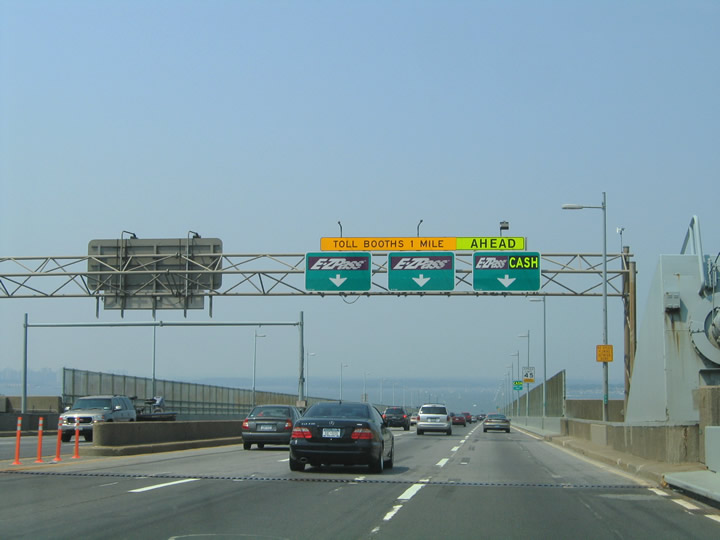
Exit 9 partitions from I-295 (Throgs Neck Expressway) just beyond the toll collection point for Pennyfield Avenue to Fort Schuyler and Edgewater Park.
06/26/05
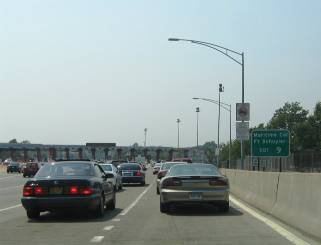
The Throgs Neck toll plaza was demolished in 2017 and replaced with an all electronic toll (AET) gantry. Exit 9 follows for the Throgs Neck Expressway service road.
06/26/05
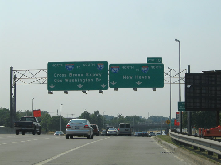
Interstate 295 splits with I-695 and the Throgs Neck Expressway at a wye interchange (Exit 10).
06/26/05
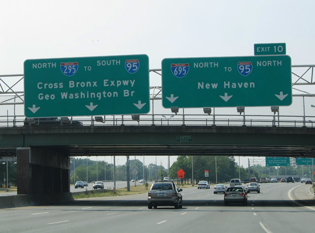
Interstate 695 (Throgs Neck Expressway) connects I-295 with I-95 north along the New England Thruway to New Rochelle, Mamroneck and Port Chester. I-295 leads northwest directly onto I-95 south along the Cross Bronx Expressway.
06/26/05
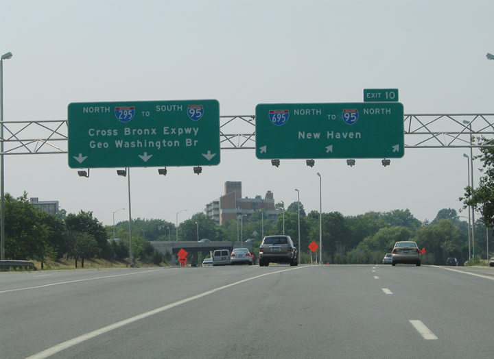
Beyond Exit 10, Interstate 295 shifts onto the Cross Bronx Expressway Extension west to the Bruckner Interchange. I-695 merges with I-95 between the Country Club and Pelham Bay neighborhoods of Bronx, New York.
06/26/05
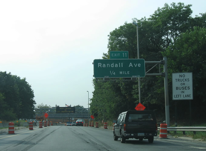
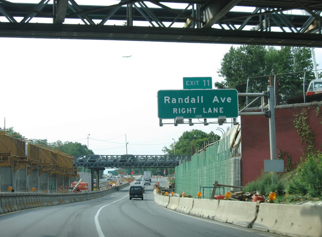
Exit 11 links I-295 (Cross Bronx Expressway Extension) north with Randall Avenue to Schuylerville and St. Raymond's Cemetery.
08/29/05
Dewey Avenue and Tremont Avenue intersect on a bridge spanning I-295 just ahead of Exit 11.
08/29/05
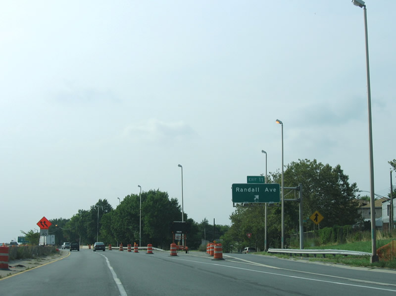
Slip ramps join the Cross Bronx Expressway Extension service roads at the diamond interchange (Exit 11) with Randall Avenue.
08/29/05
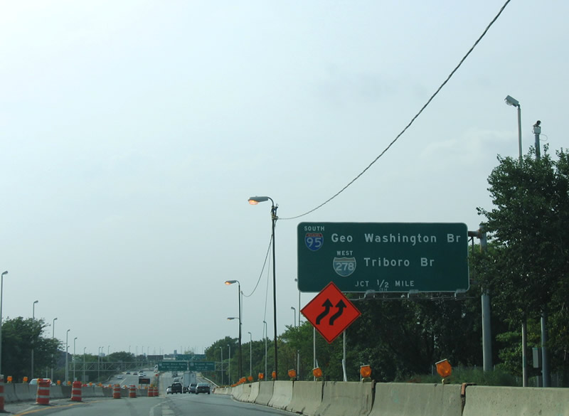
The north end of Interstate 295 splits into ramps for I-95 (Cross Bronx Expressway) south and I-278 (Bruckner Expressway) west to the RFK (Triboro) Bridge.
08/29/05
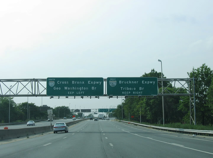
Interstate 95 travels six miles west to the George Washington Bridge connecting Manhattan with Fort Lee, New Jersey. I-278 follows the Bruckner Expressway five miles southwest to I-87 (Major Deegan Expressway) at the RFK Bridge.
08/29/05

Entering the Bruckner Interchange along Interstate 295 northbound. There is no access to I-678 south to the Whitestone Bridge or Hutchinson River Parkway north.
08/29/05
References:
- Throgs Neck Bridge (I-295). NYCRoads.com.
Photo Credits:
- Alex Nitzman, Justin Cozart: 06/13/05
- AARoads: 08/29/05
- Alex Nitzman, Carter Buchanan: 06/26/05
Connect with:
Page Updated Thursday March 12, 2020.