
Interstate 295 North - Portland
 North
North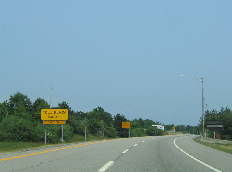
Travelers quickly approach a toll plaza for the exit of the Maine Turnpike system from the wye interchange from I-95 northbound.
06/27/05
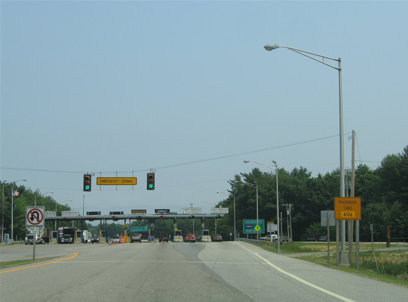
An emergency access road joins Interstate 295 with Spring Street and Payne Road ahead of the toll barrier.
06/27/05
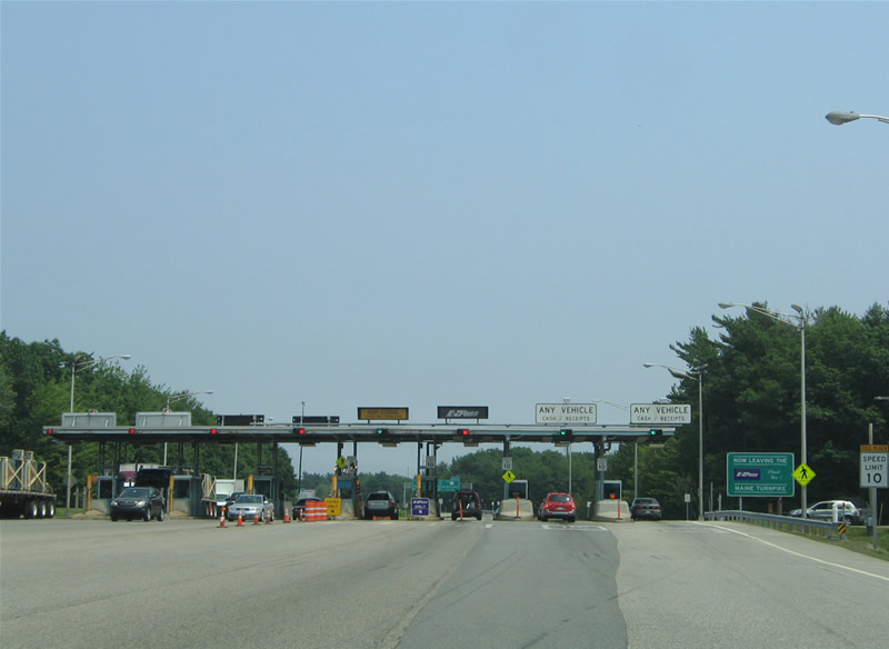
E-ZPass account holders must slow down to 10 MPH through the eight lane toll plaza on Interstate 295.
06/27/05
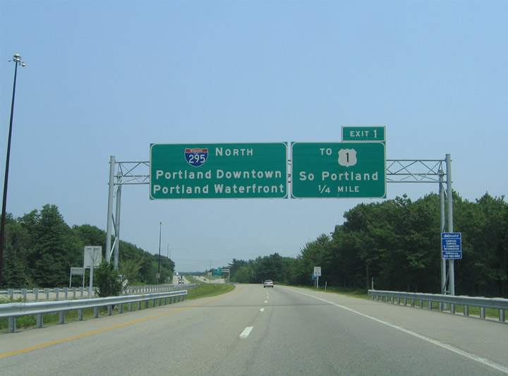
Heading out of the toll plaza, Interstate 295 crosses the South Portland city limits and immediately enters a parclo interchange (Exit 1) with the Maine Turnpike access road. An east-west freeway connector between U.S. 1 (Main Street) and I-95, the access road provides access to West Broadway, the Scarborough Connector south, and Main Street at Thornton Heights for northbound travelers.
06/27/05
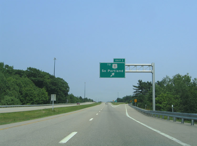
Exit 1 departs I-295 north onto the Maine Turnpike access road eastbound. The road sees interchanges with West Broadway and the Scarborough Connector before ending at U.S. 1 (Main Street) in South Portland.
06/27/05
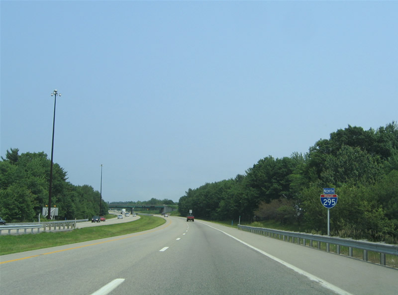
Interstate 295 northbound reassurance marker posted south of Clark Pond and ahead of the wye interchange (Exit 2 on southbound) merge with the Scarborough Connector north. Like the Maine Turnpike access road, the Scarborough Connector constitutes a local freeway spur to U.S. 1.
06/27/05
Interstate 295 next meets the Veterans Memorial Bridge (former U.S. 1) east to the West End neighborhood of Portland. A $65 million two-year project replaced the 1954 Fore River crossing of U.S. 1 between Exit 4 and Fore River Parkway (U.S. 1A). Officially opened on June 28, 2012, the new six lane span includes a 12 foot multi-use walkway. Completion of the new bridge was preceded by a 2007 relocation of U.S. 1 from its surface street alignment around West End and Downtown to an overlap with I-295 north to Exit 9.
06/27/05
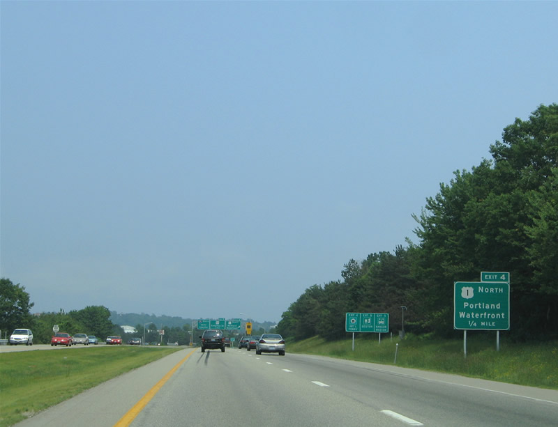
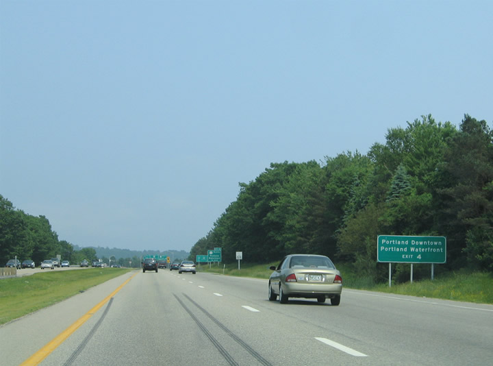
One quarter mile ahead of the parclo interchange (Exit 4) with the Veterans Memorial Bridge (old U.S. 1) east. U.S. 1 follows Main Street north through South Portland to an industrial area north at Ligonia, where the route angles northwest to combine with I-295.
The adjacent Veterans Memorial Bridge ties into U.S. 1A (Fore River Parkway), a circuitous route along the Portland Waterfront to Downtown.
Replacement guide signs for Exit 4 now display TO SR 77 South and Casco Bay Bridge.
06/27/05
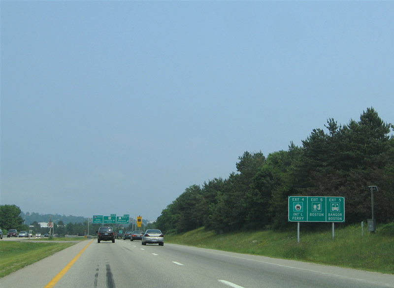
Transportation facilities including the International Ferry to Nova Scotia, Greyhound bus lines to Bangor and Boston, and AMTRAK are accessible at Downtown Portland. Use Exit 4 to the ferry and Exit 5 for other ground transportation modes.
06/27/05
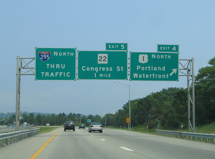
Exit 4 parts ways with Interstate 295 north to the Veterans Memorial Bridge for U.S. 1A (Fore River Parkway). U.S. 1A follows Commercial Street east to Maine 77 (Casco Bay Bridge) south and Downtown. The route was extended north in 2007 along Fore River Parkway to end at I-295 & U.S. 1 at Exit 5.
U.S. 1 formerly turned northward along Valley Street to Park Avenue east.
06/27/05
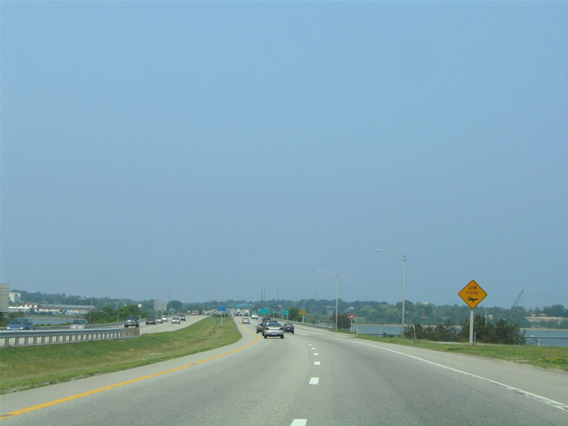
Flights out of adjacent Portland International Jetport (PWM) skim above Interstate 295 within the vicinity of the Fore River. The Fore encircles the Downtown peninsula eastward into Portland Harbor and Casco Bay.
06/27/05
 North
North
I-295 & U.S. 1 formally enter the Portland city limits midway across the Fore River causeway and bridge.
06/27/05
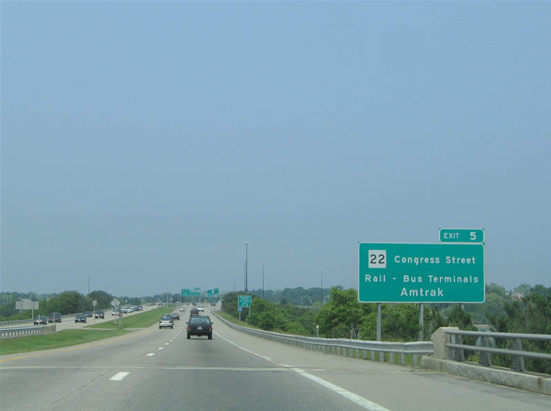
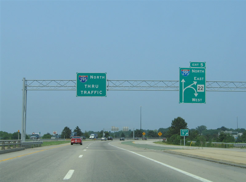
U.S. 1A and SR 22 (Congress Street) meet Interstate 295 & U.S. 1 at back to back parclo interchanges (Exit 5). Congress Street carries the state route west to SR 9 (Stevens Avenue) and South Portland and east a short distance to its end at Park Avenue and State Street (SR 77).
06/27/05
Exit 5 branches away from the freeway mainline for ramps to U.S. 1A (Fore River Parkway) and SR 22 (Congress Street) east. SR 22 separates into a couplet here with westbound using Park Avenue and eastbound taking Congress to St. John Street north near Hadlock Field (home of the Portland Sea Dogs Minor League Baseball team).
06/27/05
Exit 5 forms a collector distributor roadway with on-ramps from both U.S. 1A (Fore River Parkway) and Maine 22 east. Fore River Parkway ends at Congress Street on the west side of I-295 & U.S. 1.
06/27/05
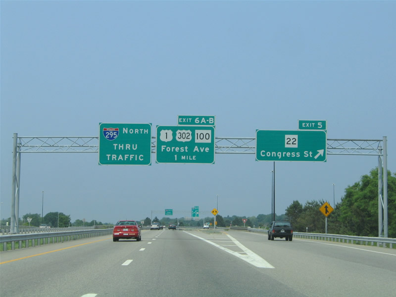
Interchange sequence sign featuring the distances to Exit 6A (Maine 77 south), 6B (U.S. 302 & Maine 100 north), and 7 (U.S. 1A south). U.S. 302 & Maine 100 follow Forest Avenue south from their merge at Allen Avenue to end at Interstate 295 & U.S. 1. The routes previously ended just south of Exit 6A at U.S. 1 until the 2007 relocation onto the freeway.
06/27/05
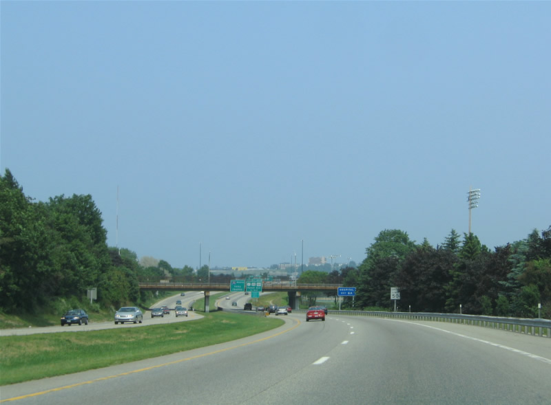
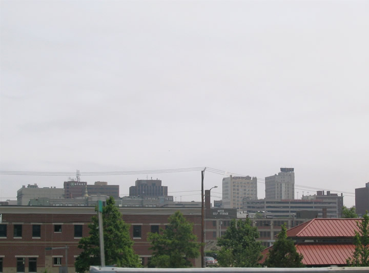
Northern reaches of the Downtown Portland skyline appears along the horizon as Interstate 295 & U.S. 1 nears the Maine 25 (Deering Avenue) overpass. Deering Oaks Park encompasses the lands adjacent to Interstate 295 between Maine 25 and the Exit 6A off-ramp. Portland is home to the University of Southern Maine, accessible via Exit 6B.
06/27/05
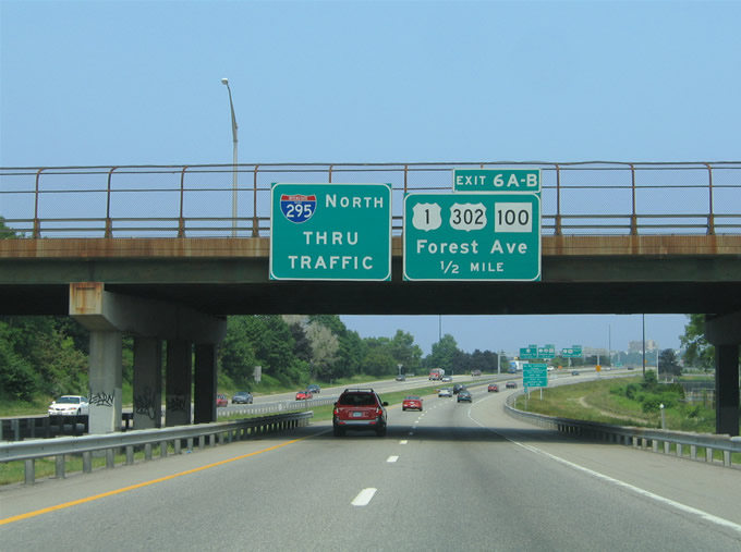
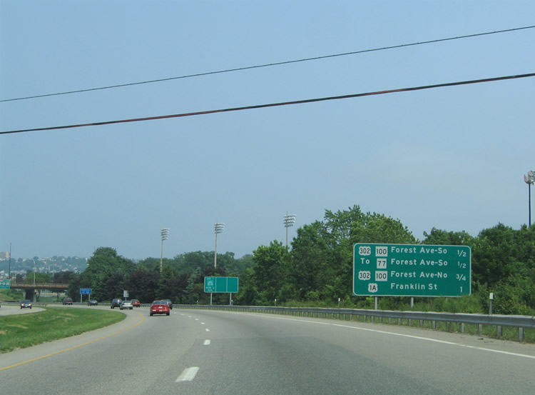
A cloverleaf interchange joins Interstate 295 & U.S. 1 with Forest Avenue in a half mile. U.S. 302 & Maine 100 begin their westward trek at Exit 6 while Maine 77 ties in from State Street and Deering Oaks Park to the south.
Historically U.S. 1 turned north onto Forest Avenue from Park Avenue to encircle Back Cove along Baxter Boulevard.
06/27/05
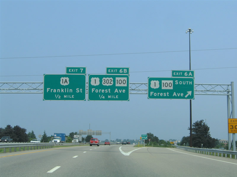
Signs at Exit 6A still reflected Maine 100 for Forest Avenue southbound, despite the route ending at I-295 & U.S. 1. Maine 77 begins here and travels 12.3 miles overall between Portland and Scarborough.
06/27/05
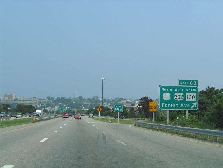
Exit 6B leaves Interstate 295 & U.S. 1 north for U.S. 302 west & SR 100 (Forest Avenue) north. U.S. 302 travels 171 miles overall between Portland and Montpelier, Vermont. The US highway ventures northwest to North Windham and Bridgton. Maine 100 follows U.S. 302 north to Allen Avenue and Allen Avenue to Maine 26 (Auburn Street). The state route shares pavement with other highways for most of its journey to Bangor.
06/27/05
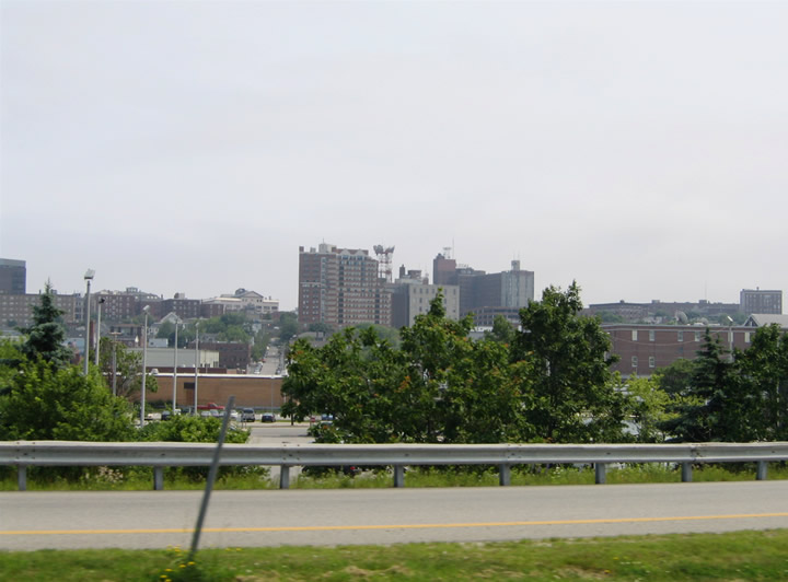
A handful of high rises dot the cityscape of Portland south of Interstate 295 & U.S. 1. Over 66,000 call The Forest City home.
06/27/05
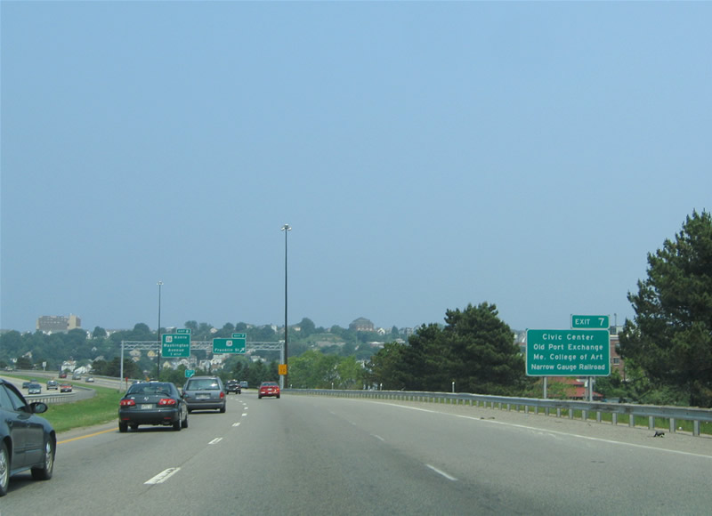
Exit 7 provides a direct route into Downtown Portland from Interstate 295 & U.S. 1. Downtown is home to the Cross Insurance Arena, Old Port Exchange shopping district, the Maine College of Art, and the Narrow Gauge Railroad among other points of interest.
06/27/05
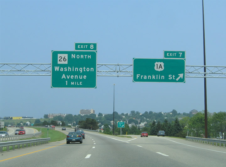
A trumpet interchange joins U.S. 1A (Franklin Street) with Interstate 295 & U.S. 1. Franklin Street constitutes a tree lined boulevard southeast to Commercial Street and the State Pier.
06/27/05
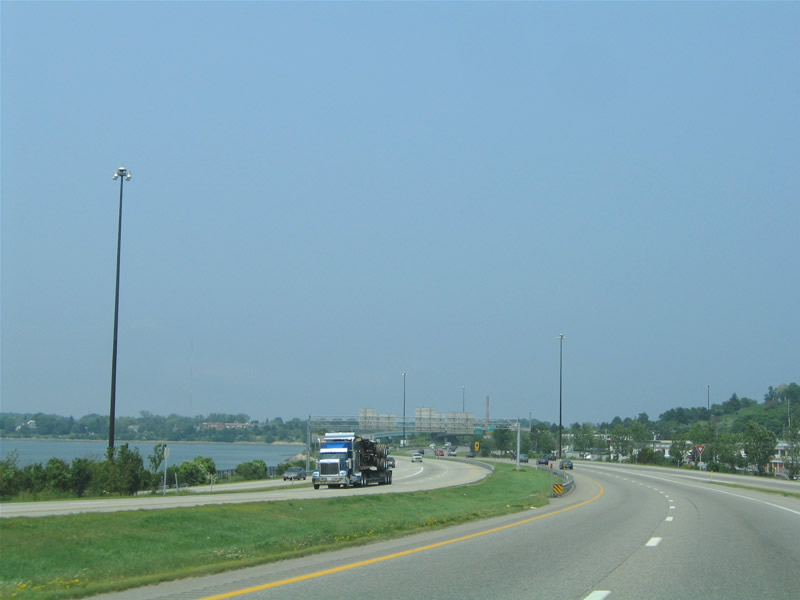
Interstate 295 & U.S. 1 straddle the eastern shore of Back Cove between Exit 7 and the wye interchange merge with Maine 26 (Washington Avenue) north.
06/27/05
Rising onto Tukey's Bridge and the causeway that separates Back Cove from Casco Bay. A flyover passes overhead from I-295 & U.S. 1 south onto Washington Street south. Maine 26 originates in East End, Portland at the intersection of Congress Street and Washington Avenue. The state route combines with I-295 & U.S. 1 across Tukey's Bridge.
06/27/05
06/30/12
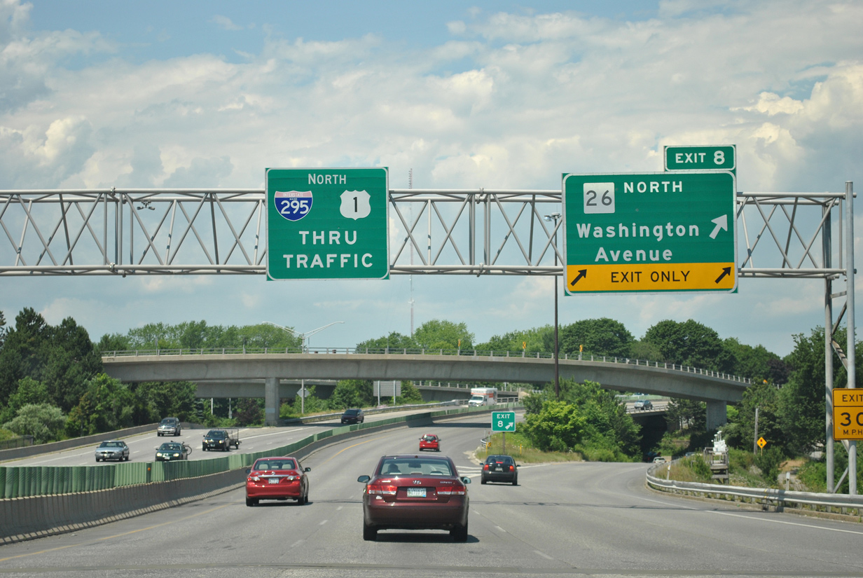
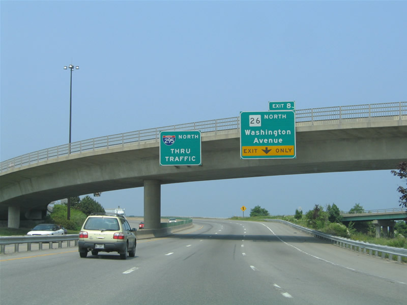
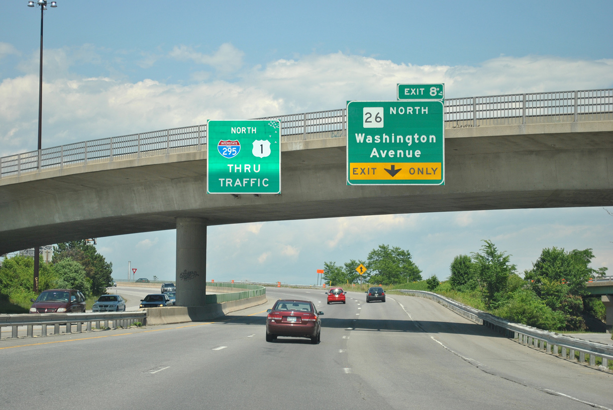
Maine 26 departs Interstate 295 & U.S. 1 northbound at back to back wye interchanges (Exit 8) with Baxter Boulevard and Washington Avenue. Maine 26 resumes along Washington Avenue northward to Andover College and Maine 100 (Allen Avenue) at the North Deering section of Portland. SR 26 & 100 overlap northward 13 miles from Portland to Gray. U.S. 1 northbound briefly merges onto Interstate 295 northbound between Exits 8 and 9; U.S. 1 south follows parallel Veranda Street.
06/30/12
North
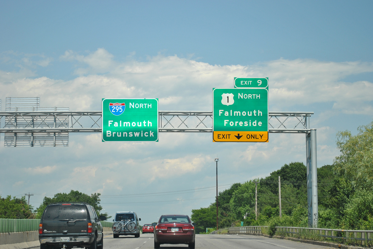
Interstate 295 & U.S. 1 northbound span the CN Railroad ahead of their split at Exit 9. U.S. 1 joins Veranda Street ahead of Martin's Point Bridge over the Presumpscot River. North of the river, U.S. 1 partitions with Maine 88 (Foreside Road), a north-south state route leading to Falmouth Foreside on Casco Bay.
06/27/05
06/30/12
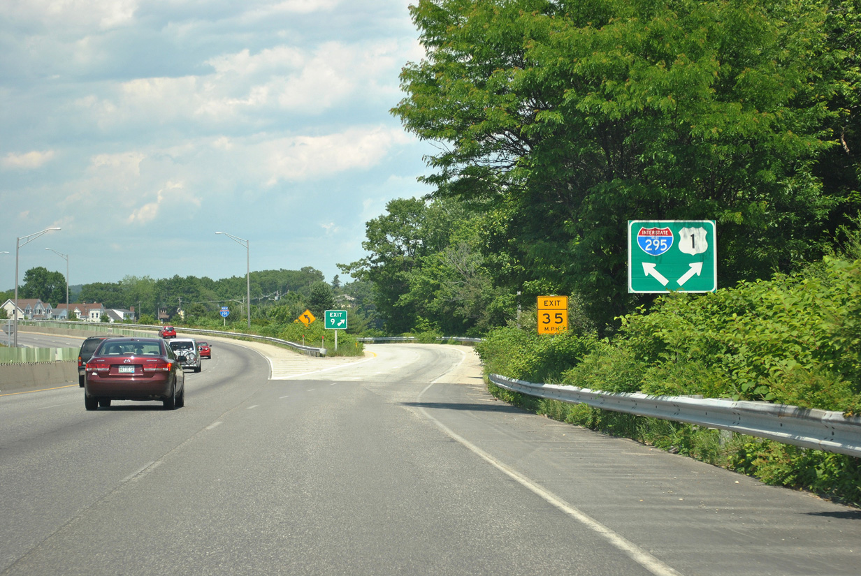
U.S. 1 northbound departs Interstate 295 north at wye interchange (Exit 9) with Verdana Street. U.S. 1 stays east of the freeway through the Falmouth vicinity and next meets Interstate 295 directly at Yarmouth (Exit 15).
06/30/12
North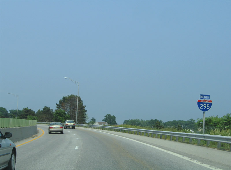
Interstate 295 curves northwest parallel to the Presumpscot River to the east and the CN Railroad to the west.
06/27/05
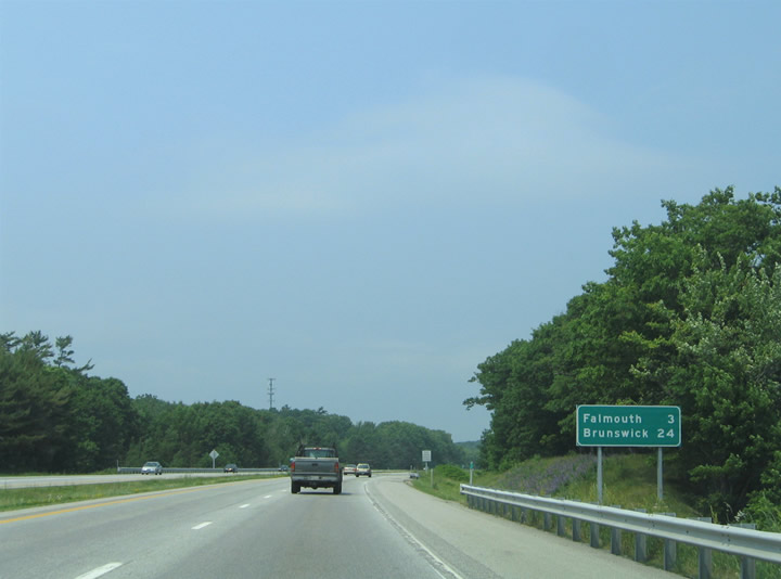
Falmouth lies three miles ahead; Brunswick, where U.S. 1 journeys eastward to Bath, Belfast and Calais lies 24 miles ahead.
06/27/05
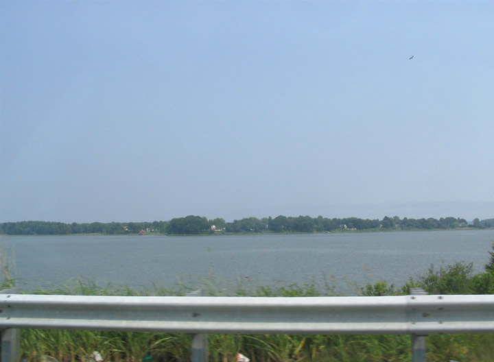
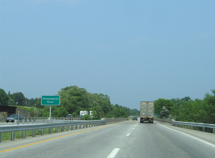
Interstate 295 straddles the Presumpscot River east of Graves Hill. The Presumpscot River flows east from Falmouth into Casco Bay and the Atlantic Ocean. Scitterygusset Creek adds water to the river from Falmouth parallel to Interstate 295 near Exit 10.
06/27/05
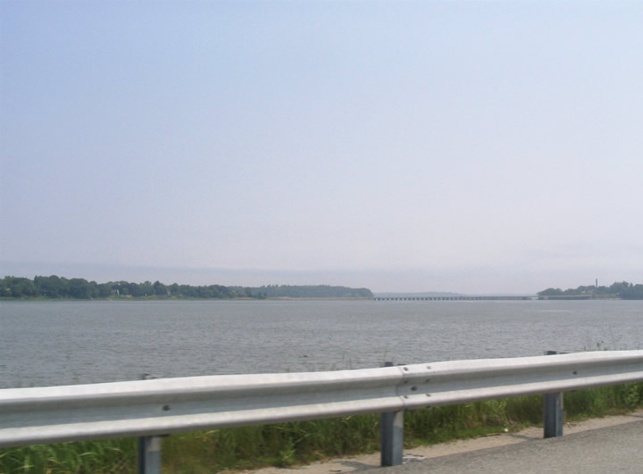
Looking southeast, U.S. 1 (Martin's Point Bridge) spans the river across at its mouth with Casco Bay.
06/27/05
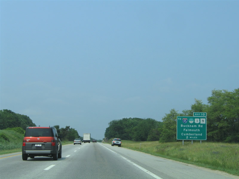
Next in line for northbound travelers is the folded diamond interchange (Exit 10) with Bucknam Road at Falmouth. Bucknam Road provides access to parallel U.S. 1 (Blue Star Memorial Highway) to the east and Maine 9 (Middle Road) to the west. There is no direct access to the Falmouth Spur of the Maine Turnpike (unsigned Interstate 495) from Interstate 295 north.
06/27/05
Spanning the Presumpscot River on Interstate 295 northbound. Maine 9 (Middle Road) and the CN Railroad cross the river beside the freeway.
06/27/05
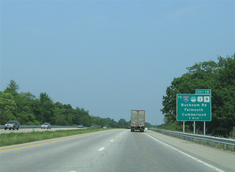
One mile south of the off-ramp (Exit 10) to Bucknam Road on I-295 north. Bucknam Road travels west from U.S. 1 to Maine 9 (Middle Road) at Falmouth Road; Falmouth Road continues the roadway to West Falmouth. Maine 9 splits with Middle Road nearby for Longwoods Road to Cumberland Center.
U.S. 1 meanwhile parallels Interstate 295 nearby between Depot and Johnson Roads, streets leading east to Maine 88 (Foreside Road) and Falmouth Foreside.
06/27/05
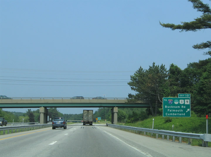
Bucknam Road passes over Interstate 295 ahead of the Exit 10 loop ramp. Motorists destined for Interstate 495 (Falmouth Spur) westbound must use Bucknam Road east to U.S. 1 (Blue Star Memorial Highway) north. A trumpet interchange joins the east end of the Falmouth Spur with U.S. 1 nearby. Unsigned Interstate 495 provides a direct link to the Maine Turnpike mainline (Interstate 95) at West Falmouth.
06/27/05

References:
- "Celebration opens new Veterans Memorial Bridge." Portland Press Herald, June 28, 2012.
Photo Credits:
- Alex Nitzman, Carter Buchanan: 06/27/05
- I.C. Ligget: 06/30/12
Connect with:
Page Updated Thursday February 05, 2015.