
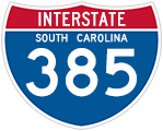
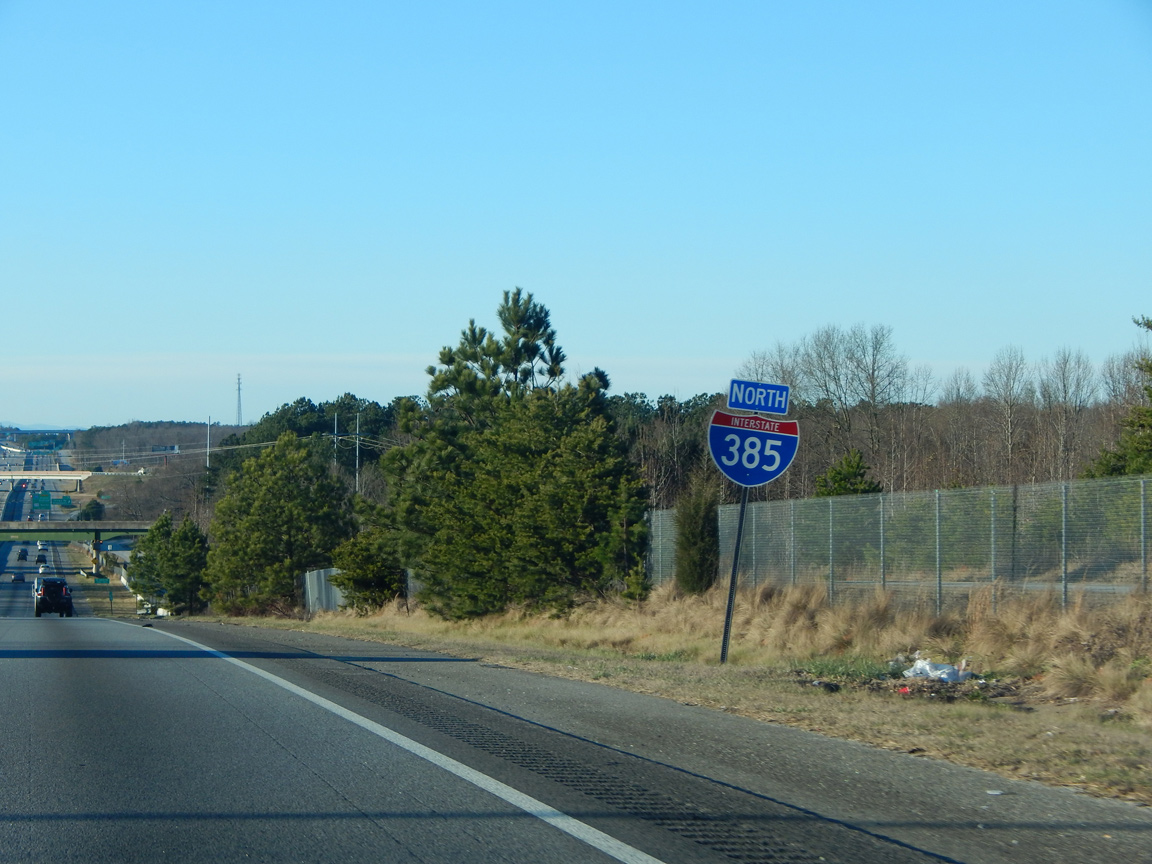
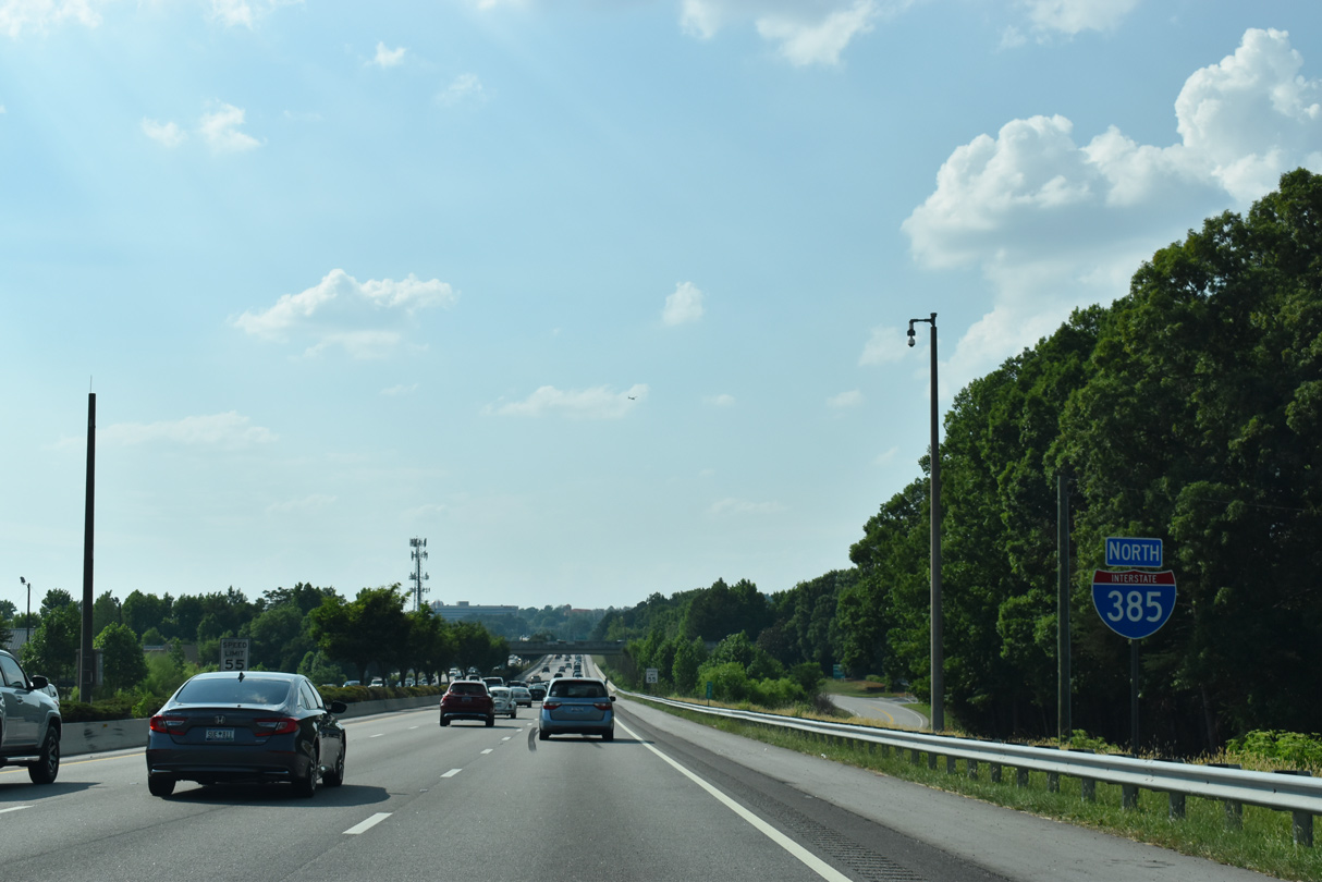
Interstate 385 North - Simpsonville to Greenville
Traffic counts steadily increase as I-385 advances toward Greenville. 45,900 vehicles per day (vpd) were recorded between Exits 24 and 26 in 2014. Counts on I-385 topped out at 96,600 vpd north of I-85 in 2014.
01/13/16
01/13/16
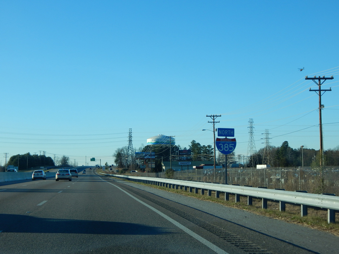
Interstate 385 expands to six overall lanes ahead of the diamond interchange (Exit 26) with Harrison Bridge Road.
01/13/16
01/13/16
The first in a series of interchange sequence signs precedes the city of Simpsonville and the Southern Connector (I-185).
12/31/13
12/31/13
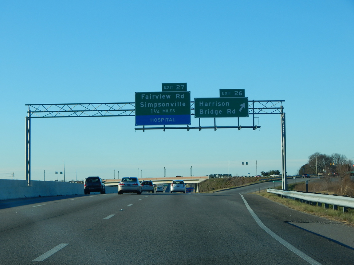
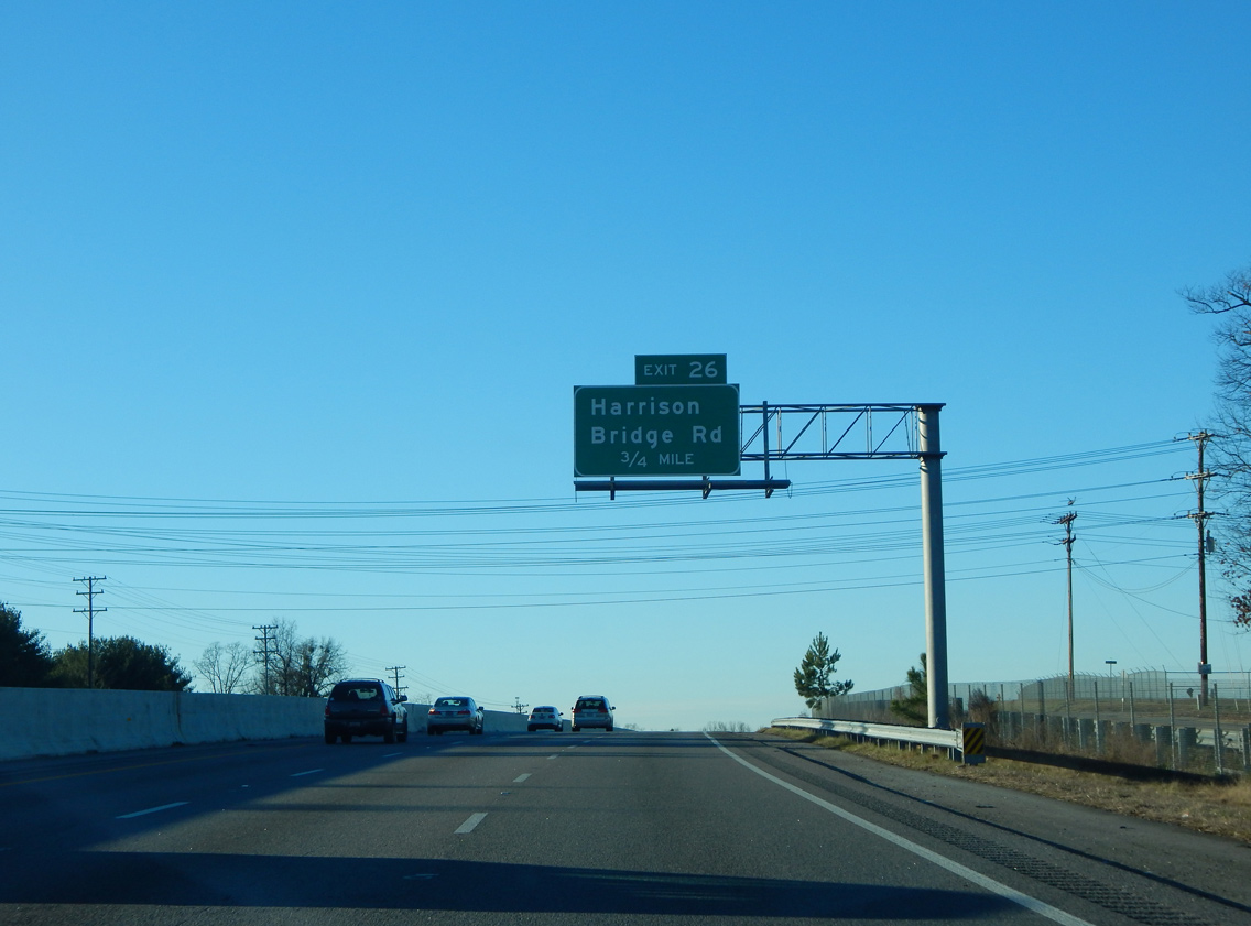
Harrison Bridge Road stems west from S.C. 14 (Main Street) to I-385 and suburban areas at Neely Ferry and Rocky Creek Roads.
01/13/16
01/13/16
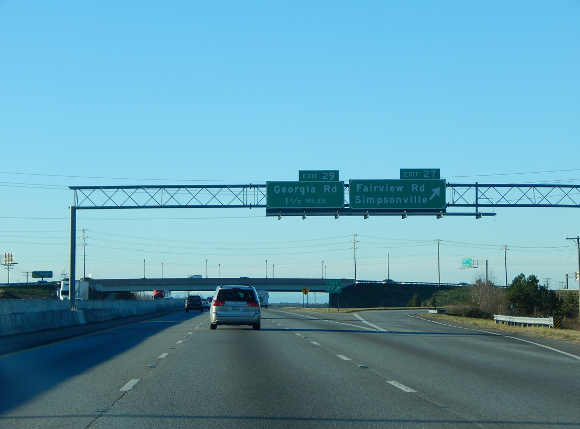
I-385 passes between a pair of schools to the east and big box retail to the west to enter the Simpsonville city limits. A six ramp parclo interchange (Exit 27) follows with Fairview Road.
12/31/13
12/31/13
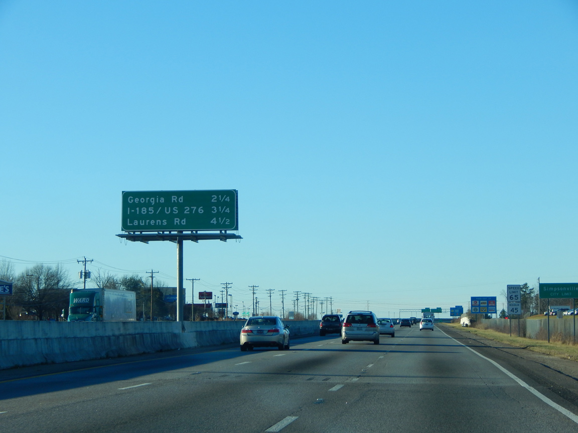
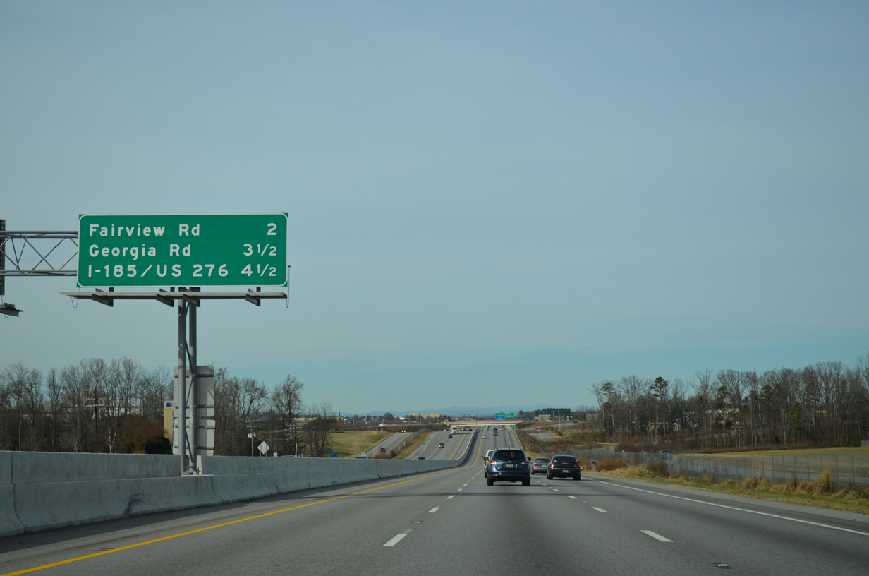
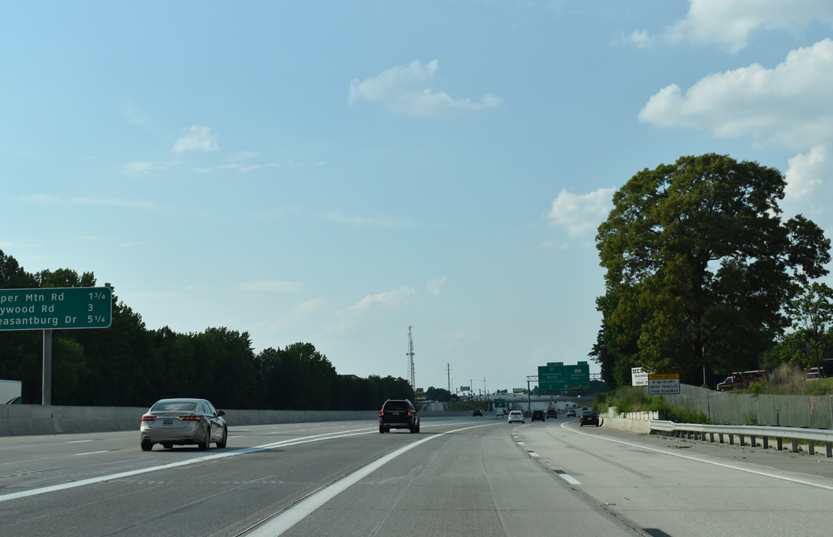
Fairview Road and Georgia Road connect I-385 with Simpsonville over the next 2.25 miles. U.S. 276 begins at southern reaches of the Mauldin city limits.
01/13/16
01/13/16
Fairview Road comprises a commercial arterial leading south from adjacent S.C. 14 (SE Main Street) to Harrison Bridge Road. Further suburban development lines the arterial southward to S.C. 418.
01/13/16
01/13/16
Interstate 385 reassurance marker posted ahead of the Richardson Road overpass in Simpsonville
01/13/16
01/13/16
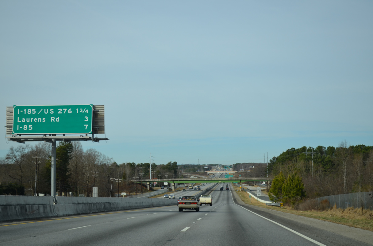
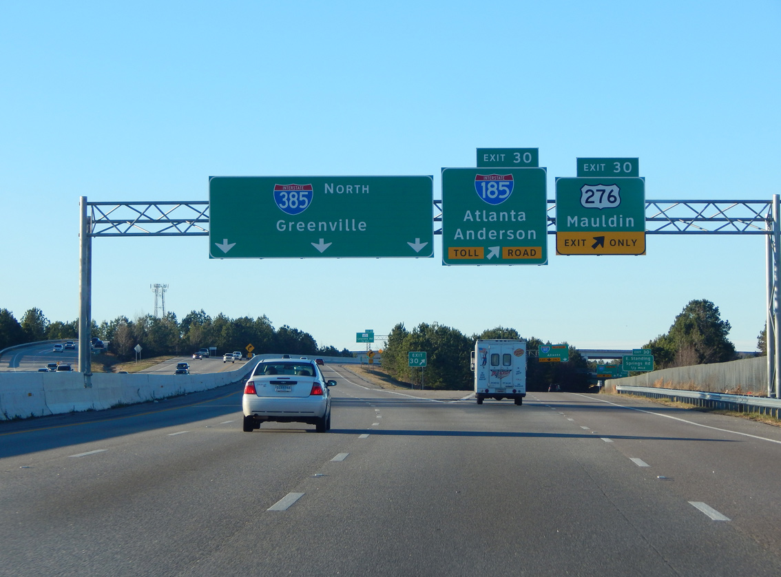
Interchange sequence sign posted 1.75 miles ahead of the split with U.S. 276 west at the Southern Connector (I-185) and seven miles south of Interstate 85.
12/31/13
12/31/13
Exit 29 departs I-385 next for Georgia Road east to Maple Street in Simpsonville and west to the Brashier Campus of Greenville Technical College and Fork Shoals Road. A wye interchange follows in 1.25 miles for U.S. 276 west to I-185.
01/13/16
01/13/16
Interstate 385 climbs north from Rocky Creek to Exit 30.
12/31/13
12/31/13
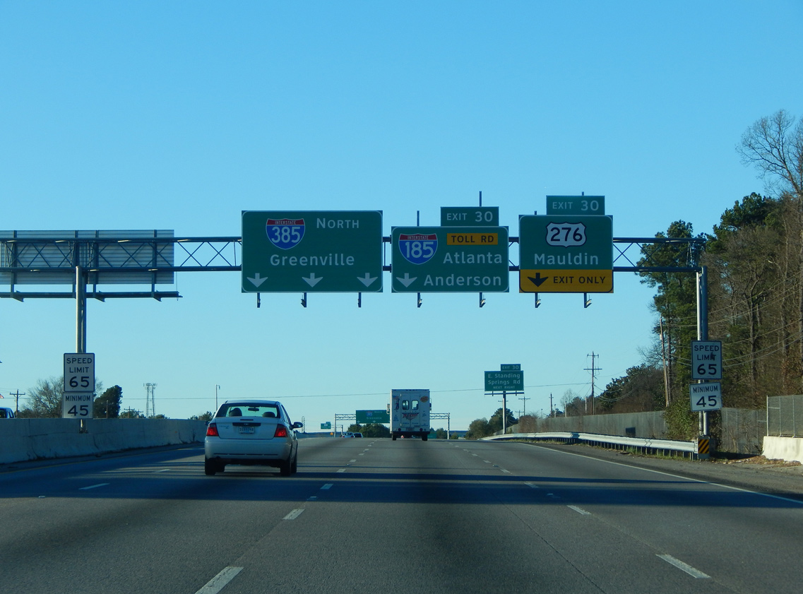
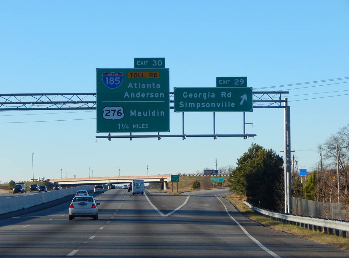
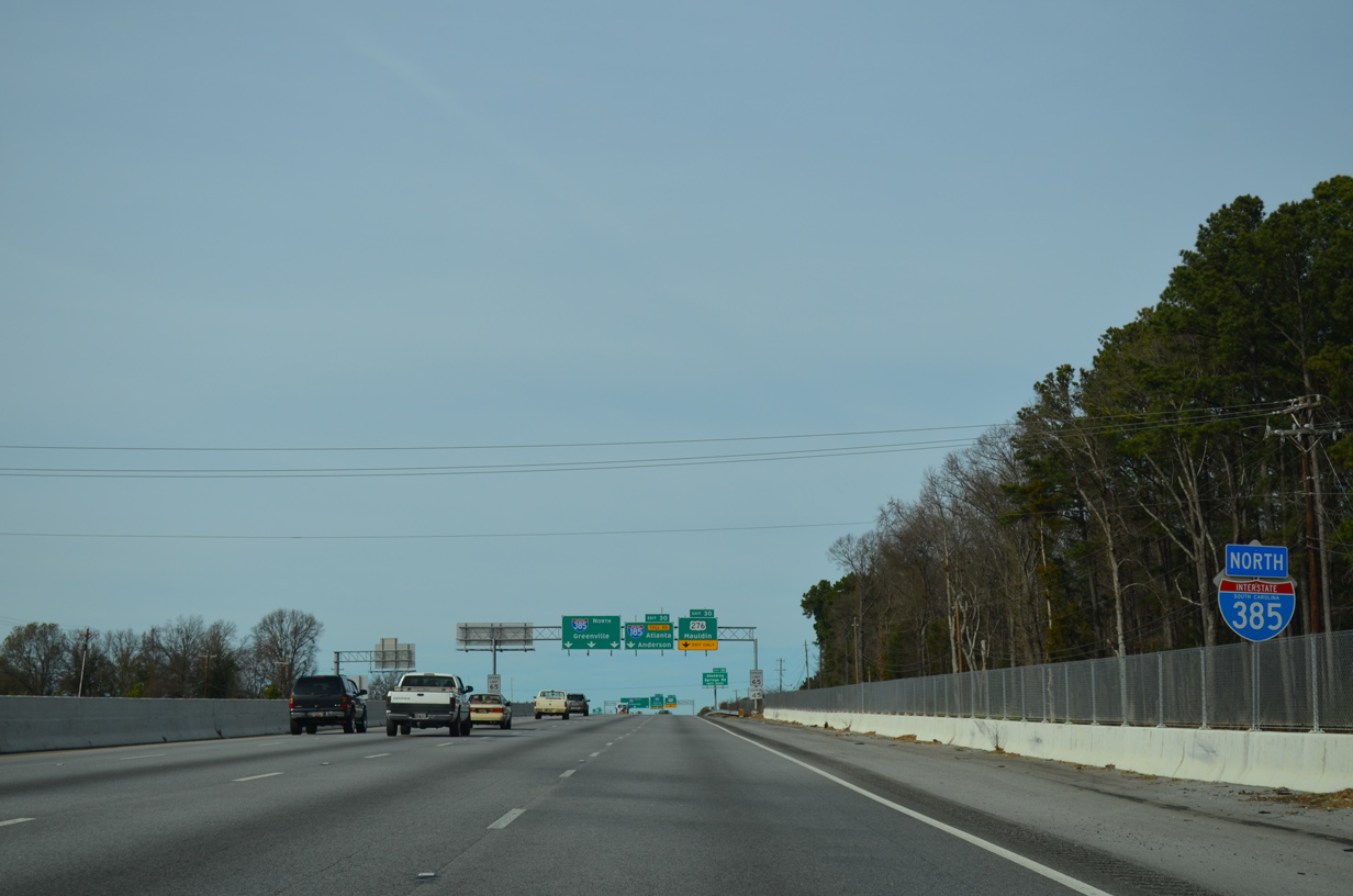
A second set of signs precedes the Exit 30 split with U.S. 276 west into Mauldin. I-385 was expanded through Simpsonville between 2005 and 2007.
01/13/16
01/13/16
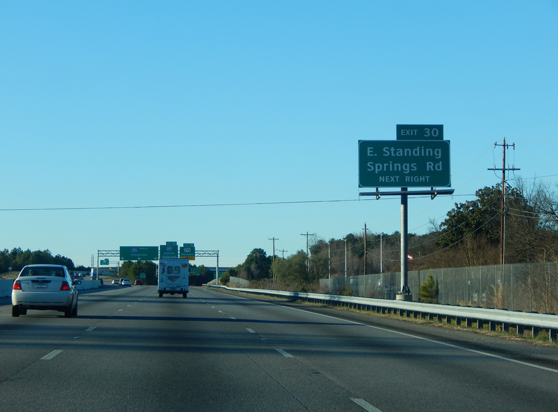
U.S. 276 commences on limited access highway ahead of a loop ramp for Standing Springs Road. Standing Springs Road connects the freeway with Old Stage Road to the east and W Georgia Road to the south.
01/13/16
01/13/16
The Southern Connector, constructed between 1998 and 2001, ties into U.S. 276 at an adjacent wye interchange. The toll road also spurs east alongside I-385 to S.C. 417 (NE Main Street), to provide access north to Greenville.
01/13/16
01/13/16
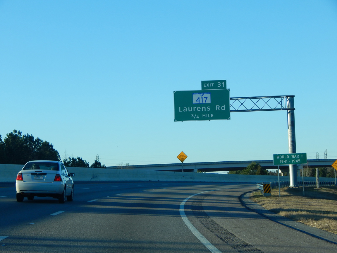
Interstate 385 turns northeast from U.S. 276 to next meet S.C. 417 at Exit 31. S.C. 417 follows old U.S. 276 north from Simpsonville onto S Main Street through Mauldin.
01/13/16
01/13/16
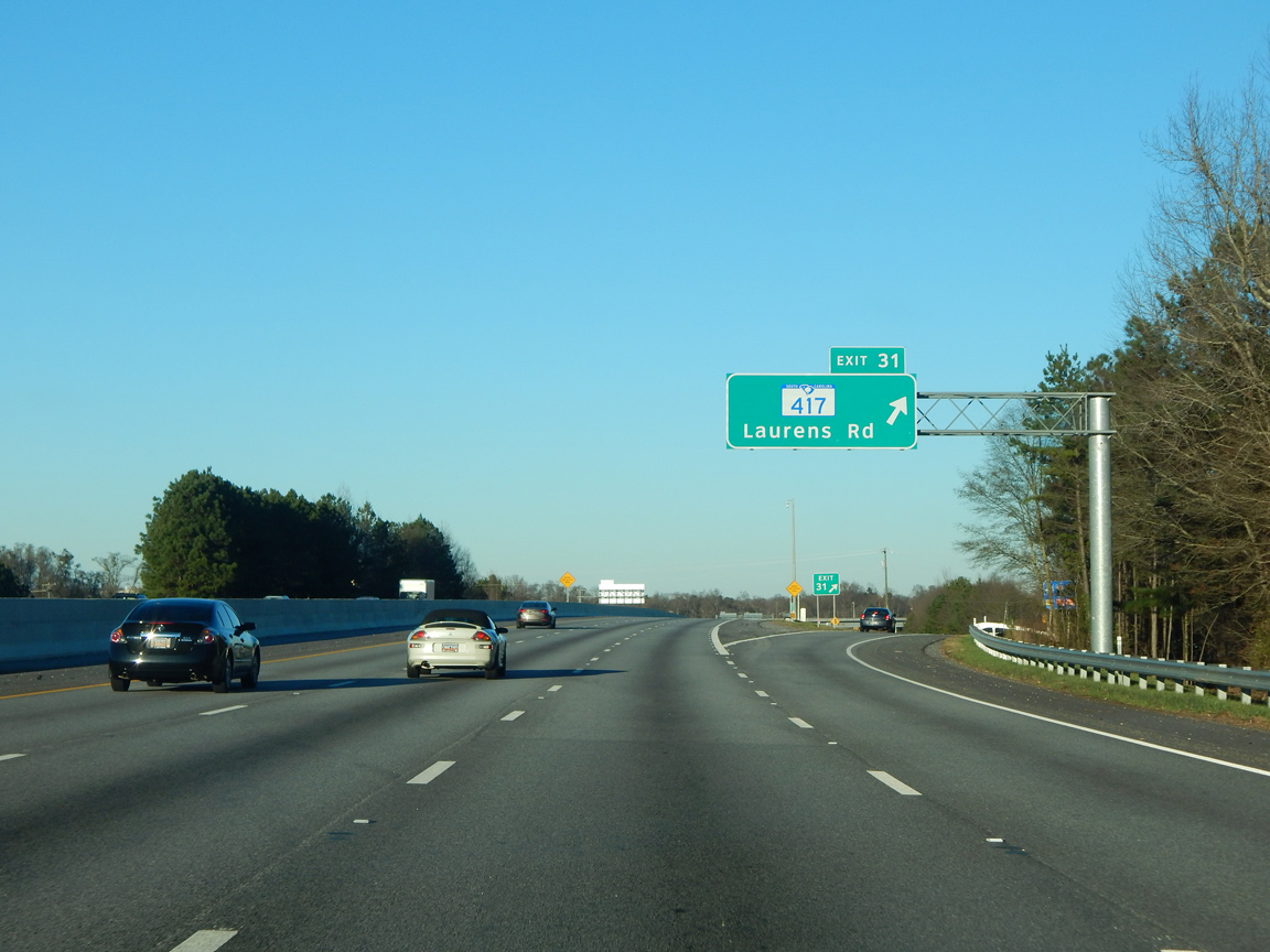
S.C. 417 travels 21.48 miles from U.S. 276 in Mauldin to S.C. 296 south of Spartanburg. S.C. 417 follows NE Main Street south from the diamond interchange at Exit 31 to combine with S.C. 14 into Downtown Simpsonville.
01/13/16
01/13/16
Interstate 385 encircles eastern reaches of Mauldin along the Golden Strip Freeway constructed from 1978 to 1985.
05/25/21
05/25/21
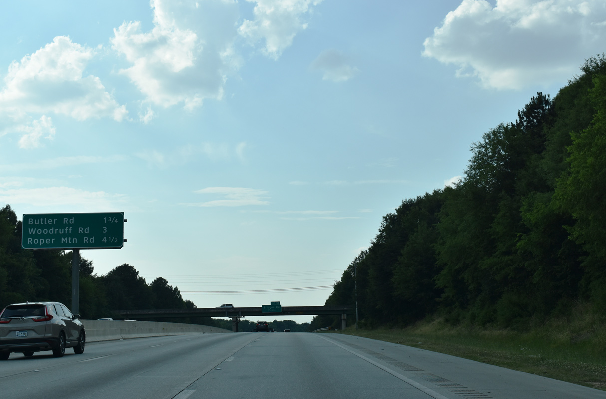
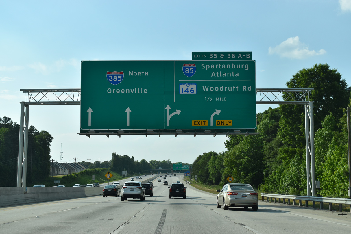
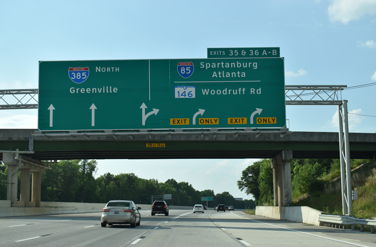
The next two exits lie within the city of Mauldin while the ensuing interchanges with Woodruff Road (S.C. 146) and Roper Mountain Road serve eastern reaches of Greenville.
05/25/21
05/25/21
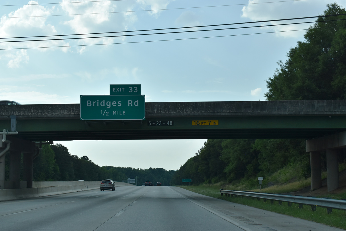
Exit 33 with Bridges Road joins Interstate 385 with the east side of Mauldin and built up suburban areas of Greenville County near Five Forks.
05/25/21
05/25/21
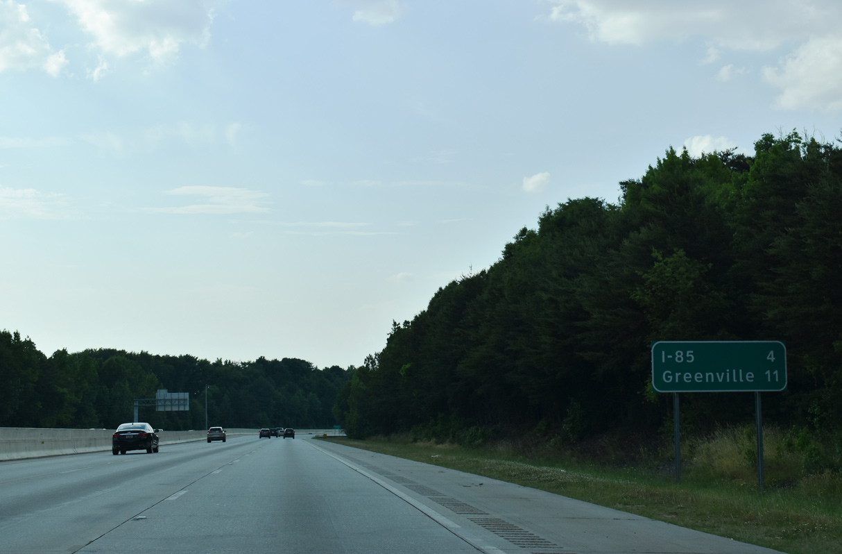
Four miles south of the multilevel interchange (Exit 36) with Interstate 85 and 11 miles southeast of Downtown Greenville. This sign was previously posted ahead of the Bethel Road overpass.
05/25/21
05/25/21
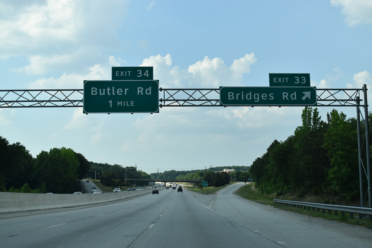
Entering the diamond interchange (Exit 33) with Bridges Road on I-385 north. Bridges Road links the freeway with Corn and Butler Roads at Mauldin High School to the west and Bethel Road to the east.
05/25/21
05/25/21
Butler Road arcs northeast from the Mauldin city center to meet Interstate 385 at a diamond interchange (Exit 34) in 0.75 miles.
05/25/21
05/25/21
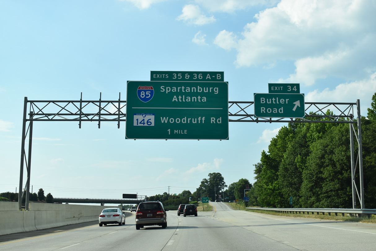
Exit 34 leaves Interstate 385 north for Butler Road (Road 107). Butler Road continues 1.12 miles northeast by the Brookfield Corporate Center to S.C. 146 (Woodruff Road). S.C. 146 travels west from there to both I-385 and I-85.
05/25/21
05/25/21
The <a href="http://www.85385gateway.com/">I-85/I-385 Gateway project</a>, underway from February 2016 to mid 2020, added a distributor roadway along I-385 northbound ahead of S.C. 146 and leading to a flyover ramp for I-85 south.
05/25/21
05/25/21
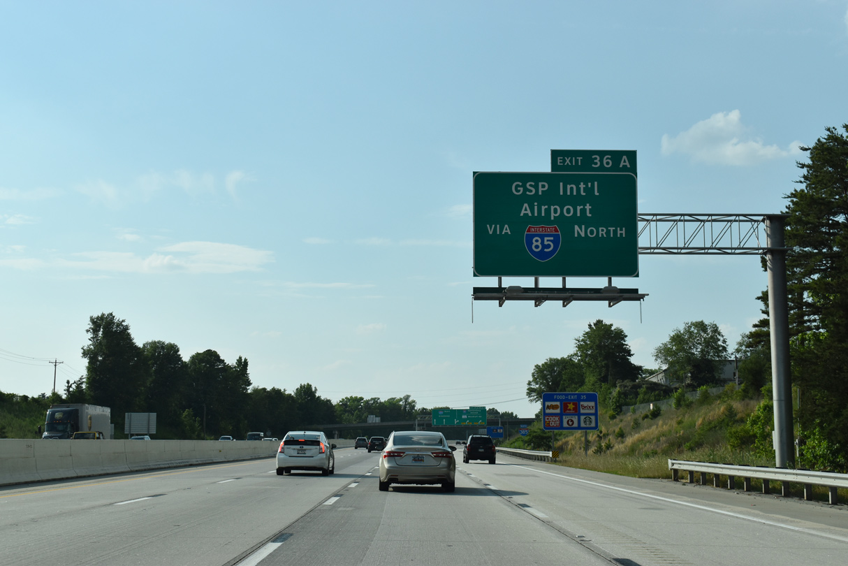
Interstate 85 leads east from Exit 36A to Greenville-Spartanburg International Airport (GSP) nearby at Greer.
05/25/21
05/25/21
The eight lane freeway passes between a town home community and business park south of Smith Hines Road (Road 23).
05/25/21
05/25/21
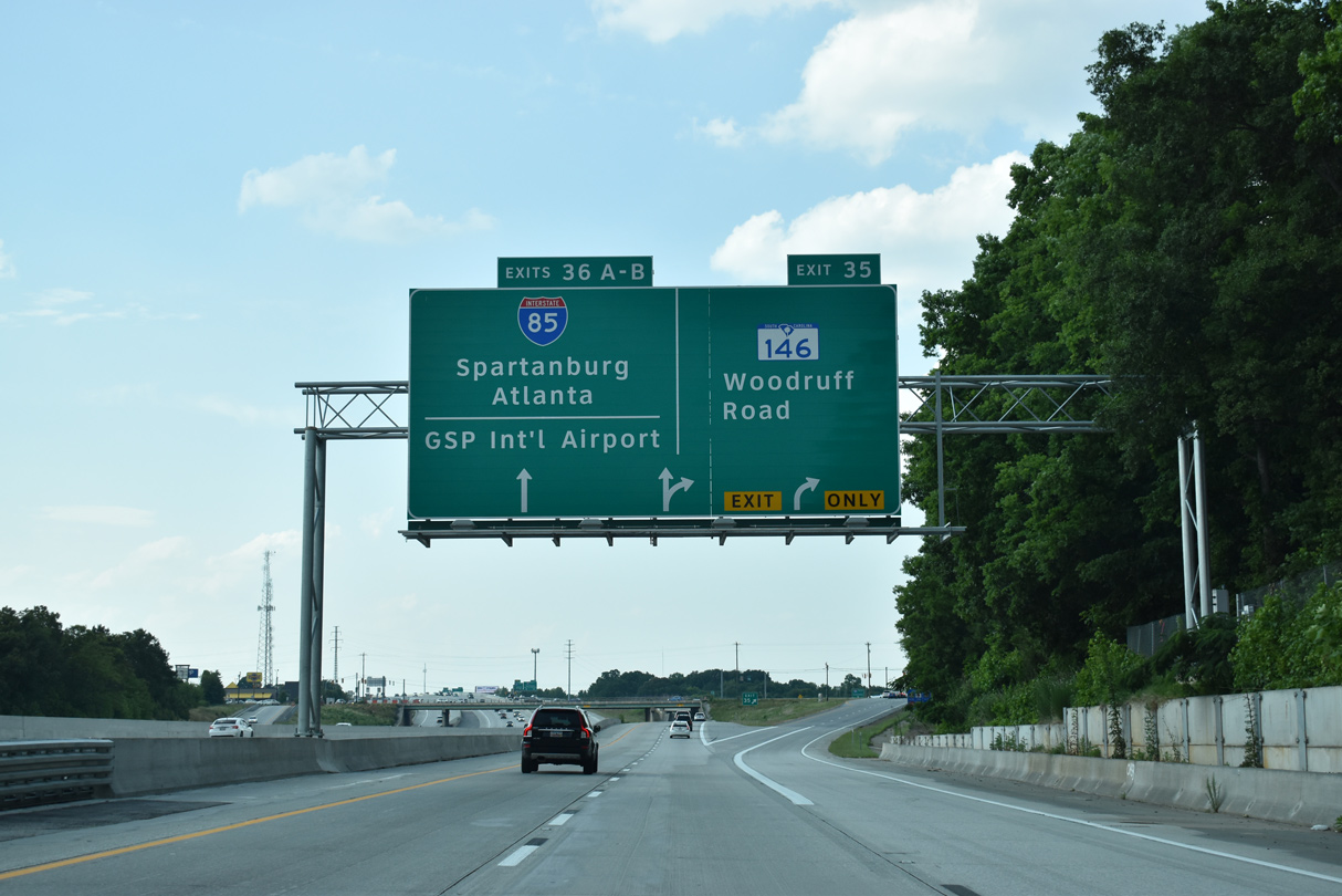
The three lane distributor roadway eliminated weaving traffic between the diamond interchange (Exit 35) with S.C. 146 (Woodruff Road) and exchange (Exit 36) at I-85.
05/25/21
05/25/21
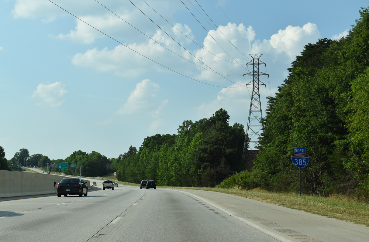
Interstate 385 turns west along its original alignment from I-85 with four interchanges in Greenville. The freeway ends in 7.2 miles.
05/25/21
05/25/21
S.C. 146, a 33.45 mile long route from Cross Anchor west to Woodruff, Five Forks and Greenville, converges with Interstate 385 along a heavily developed commercialized stretch.
05/25/21
05/25/21
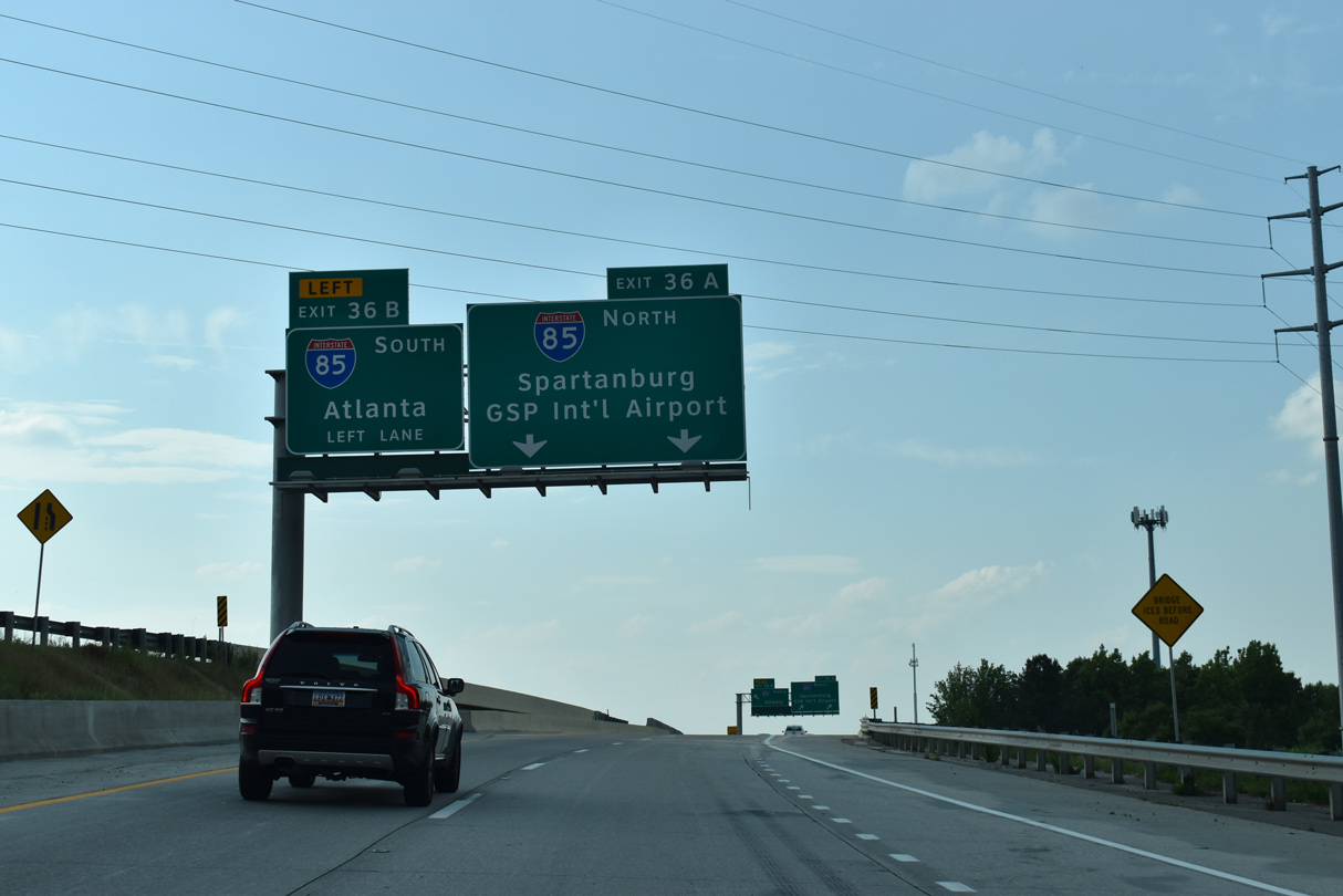
Two lanes separate at Exit 36A for Interstate 85 northeast 25 miles to Spartanburg.
05/25/21
05/25/21
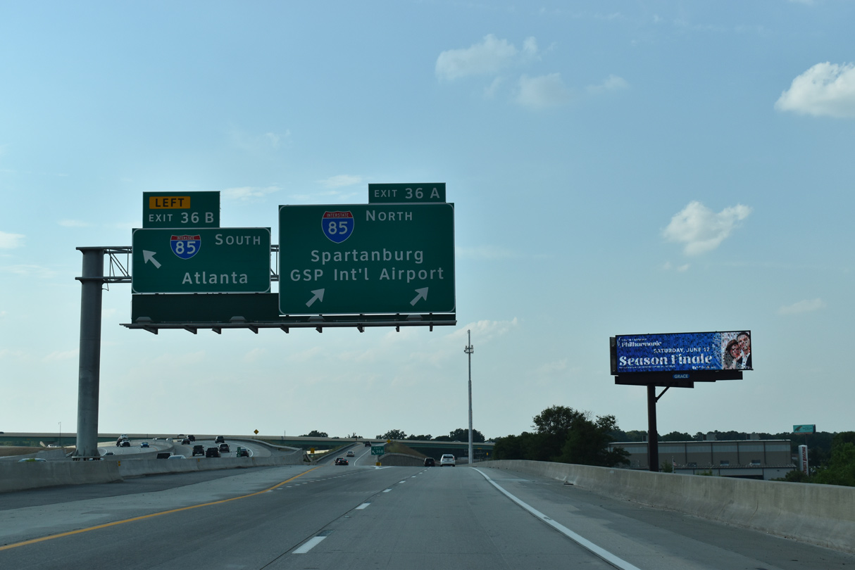
Exit 36B is a high flyover built during the 2016-20 Gateway Project connecting I-385 north with Interstate 85 south to Anderson and Atlanta, Georgia.
05/25/21
05/25/21
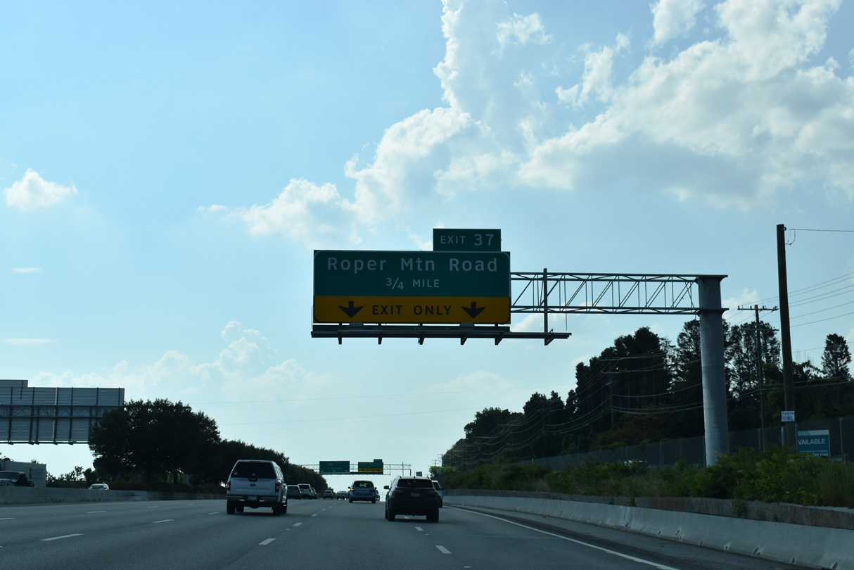
Northbound Interstate 385 continues with five lanes to the diamond interchange (Exit 37) for Roper Mountain Road (Road 183).
05/25/21
05/25/21
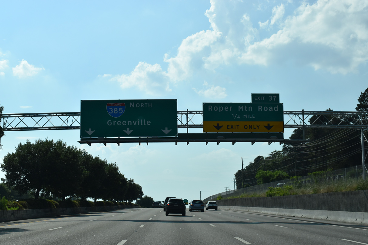
Numerous office buildings and retail surrounds Roper Mountain Road by the exchange with I-385, as S.C. 146 (Woodruff Road) parallels just to the west.
05/25/21
05/25/21
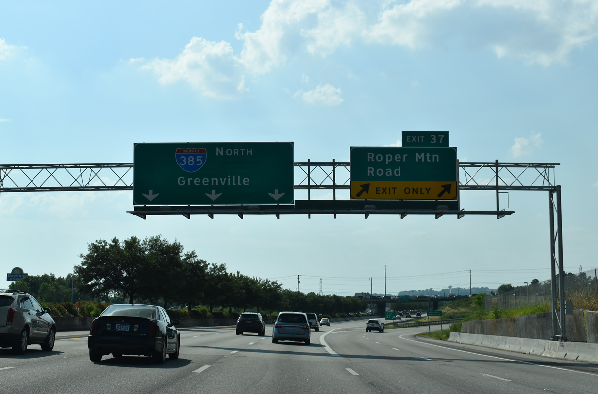
The I-85/385 Gateway Project added a second auxiliary lane north to Exit 37 for Roper Mountain Road. Roper Mountain Road winds around Roper Mountain to the eastern suburbs near Five Forks.
05/25/21
05/25/21
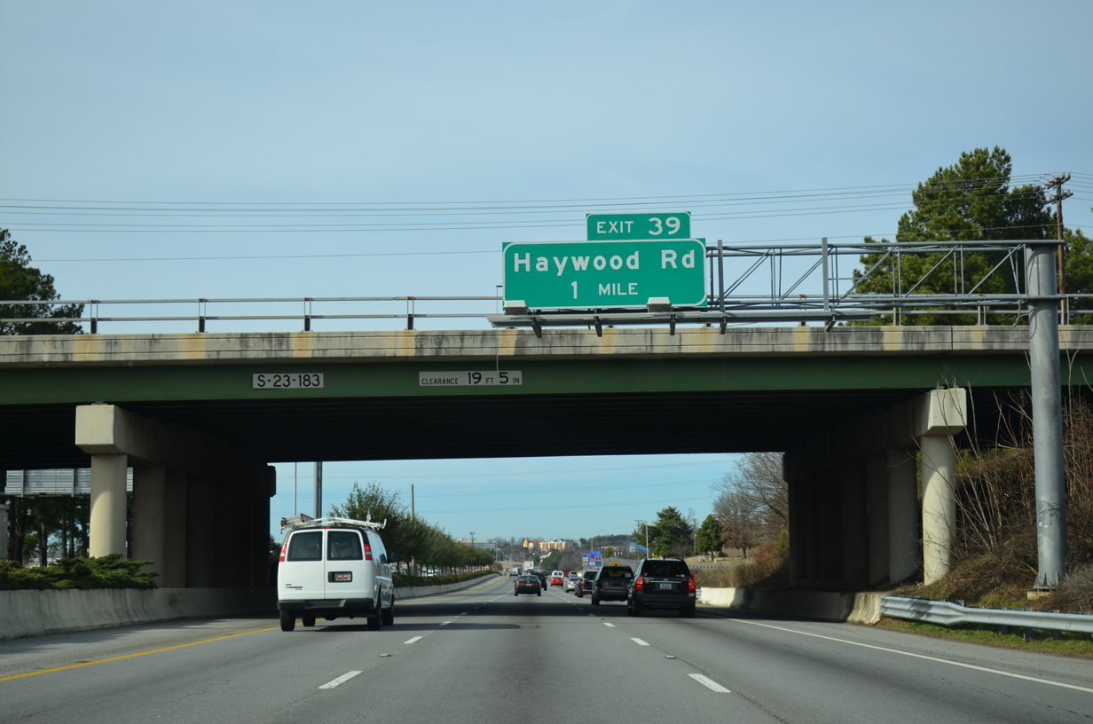
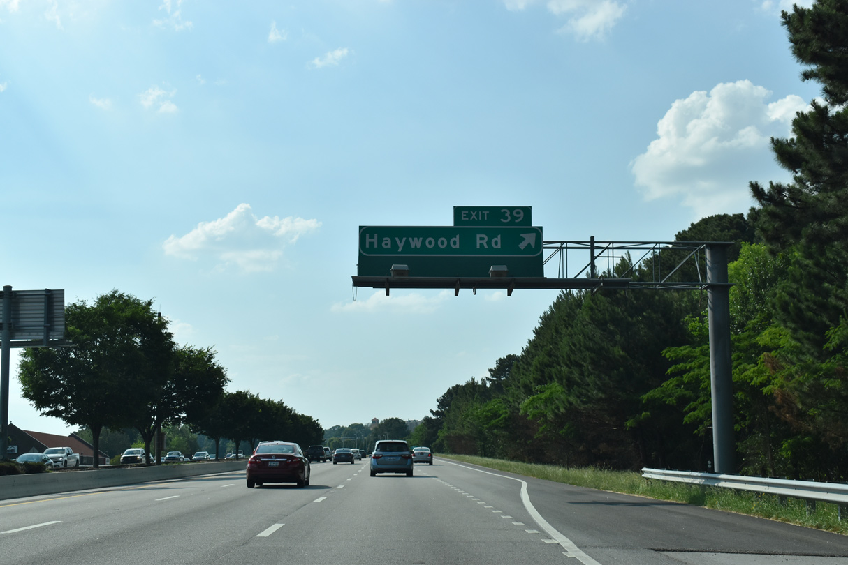
Heavy development continues on both sides of Interstate 385 to the diamond interchange (Exit 39) with Haywood Road.
12/31/13
12/31/13
A confirming marker precedes the Patewood Drive overpass along Interstate 385 north. I-385 was widened westward through Greenville from June 2001 to Fall 2004.
05/25/21
05/25/21
Haywood Road heads 1.69 miles south from Exit 37 to Haywood Mall and U.S. 276 (Laurens Road). Northward the five lane arterial climbs over Butler Hill 1.41 miles to E North Street at Howard Road.
05/25/21
05/25/21
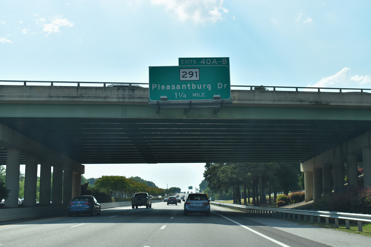
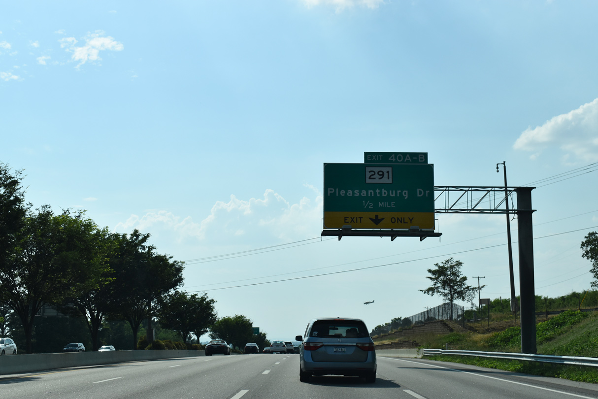
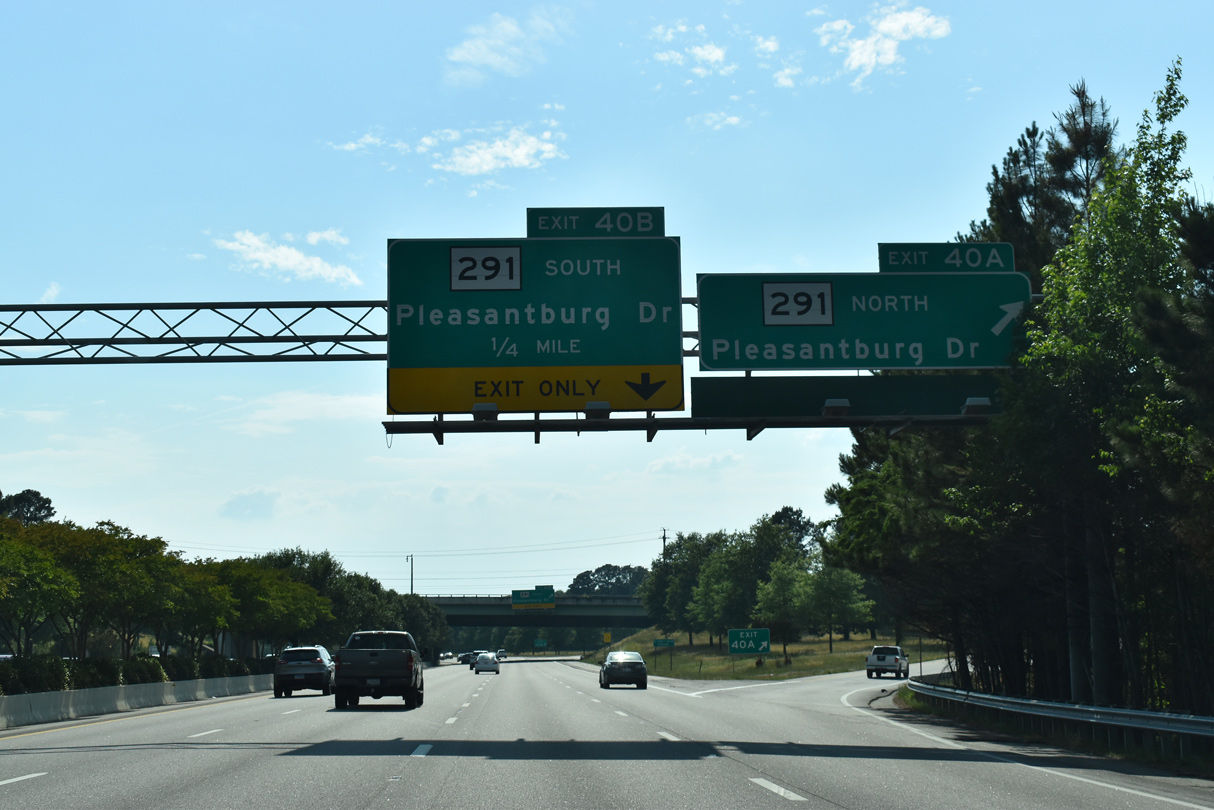
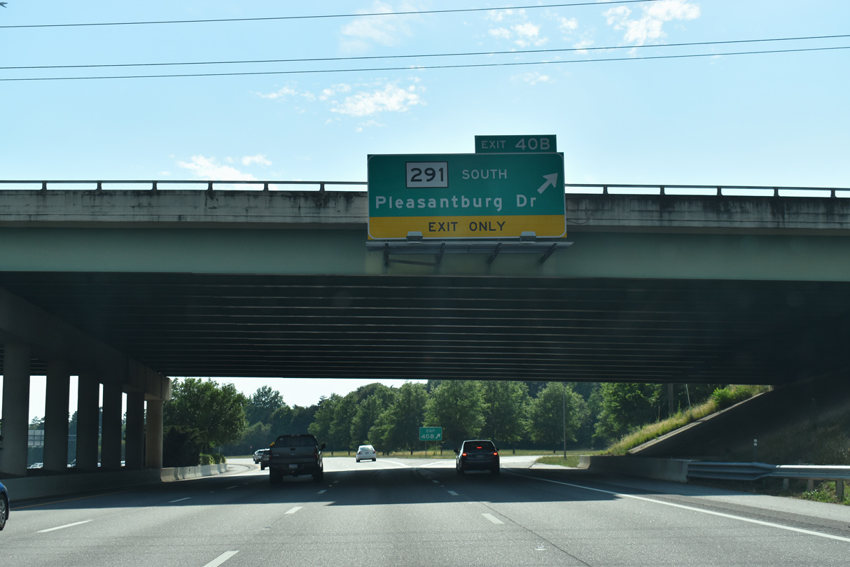
A western turn takes Interstate 385 by northern reaches of Greenville Downtown Airport (GMU) to Exits 40A/B with S.C. 291 (Pleasantburg Drive).
05/25/21
05/25/21
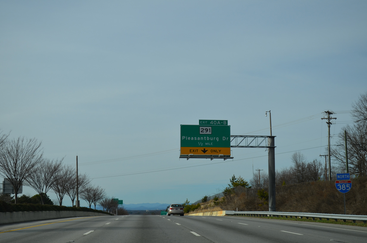
A western turn takes Interstate 385 by northern reaches of Greenville Downtown Airport (GMU) to Exits 40A/B with S.C. 291 (Pleasantburg Drive).
12/31/13
12/31/13
S.C. 291 constitutes an 11.40 mile long arterial loop east from S.C. 253 (State Park Road) near U.S. 276 (Poinsett Highway) and Piney Mountain to U.S. 25 (White Horse Road) near Donaldson Center Airport (GYH).
05/25/21
05/25/21
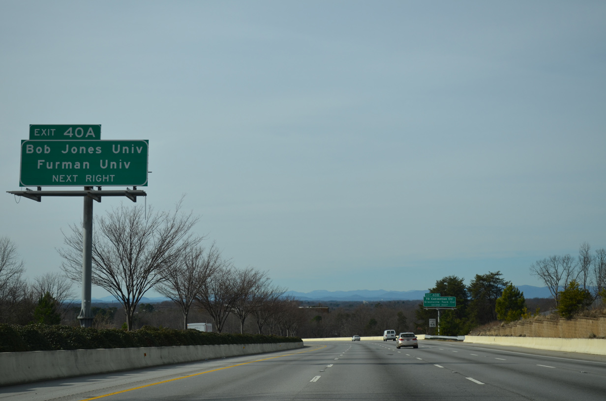
S.C. 291 (Pleasantburg Drive) leads north from Exit 40A to U.S. 29 (Wade Hampton Boulevard) at Bob Jones University. Furman University lies beyond the north end of S.C. 291 along U.S. 276 north toward Travelers Rest.
12/31/13
12/31/13
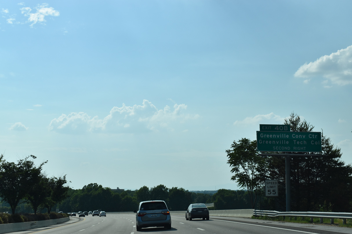
S.C. 291 (Pleasantburg Drive) south leads to Greenville Convention Center at Greenville Downtown Airport (GMU) and Greenville Technical College past Nicholtown.
05/25/21
05/25/21
Loop ramps from Pleasanburg Drive onto I-385 at the cloverleaf interchange with S.C. 291 (Pleasantburg Drive) were removed during 2001-04 expansion of the freeway.
05/25/21
05/25/21
South from Exit 40B, S.C. 291 (Pleasantburg Drive) connects I-385 with the Arcadia Hills and Nicholtown neighborhoods.
05/25/21
05/25/21
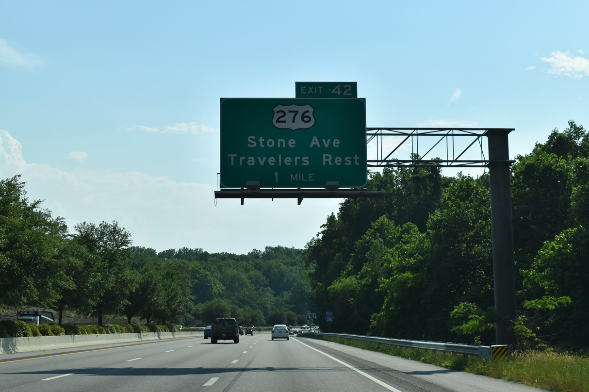
Exit 42 links I-385 with U.S. 276, a commercial arterial (Laurens Road) north from Mauldin to Nicholtown. U.S. 276 continues west along E Stone Avenue around Downtown to the Viola Street neighborhood.
05/25/21
05/25/21
Interstate 385 winds west through a valley north of Arcadia Hills.
05/25/21
05/25/21
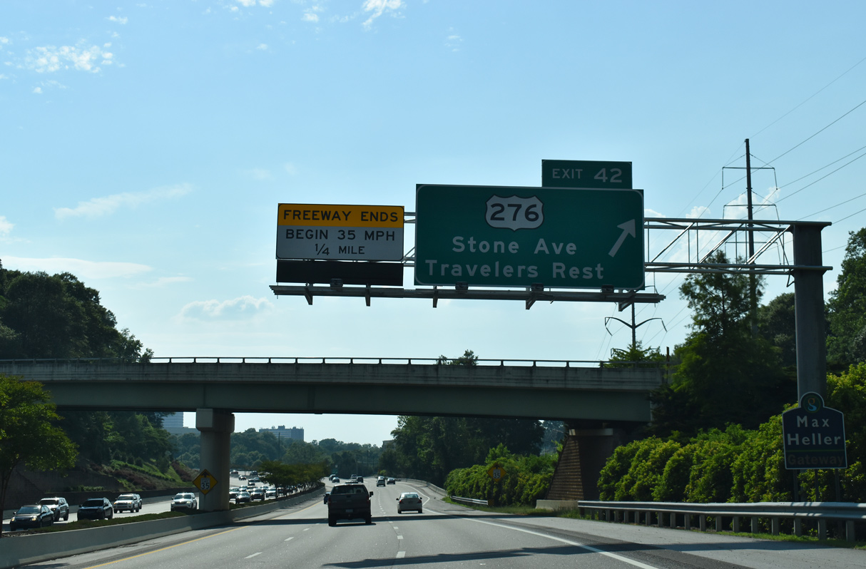
Hillside Drive spans I-385 at the Max Heller Gateway into Downtown ahead of Exit 42 for U.S. 276 (Stone Avenue north / Laurens Road south). U.S. 276 follows Poinsett Highway northward to the Brutontown community en route to Travelers Rest, Marietta and Caesars Head, the highest point in the Palmetto State.
05/25/21
05/25/21
Photo Credits:
- Carter Buchanan: 01/13/16
- Alex Nitzman: 12/31/13
- Brent Ivy: 05/25/21
Page Updated Saturday June 19, 2021.