
Interstate 405 North

 North
North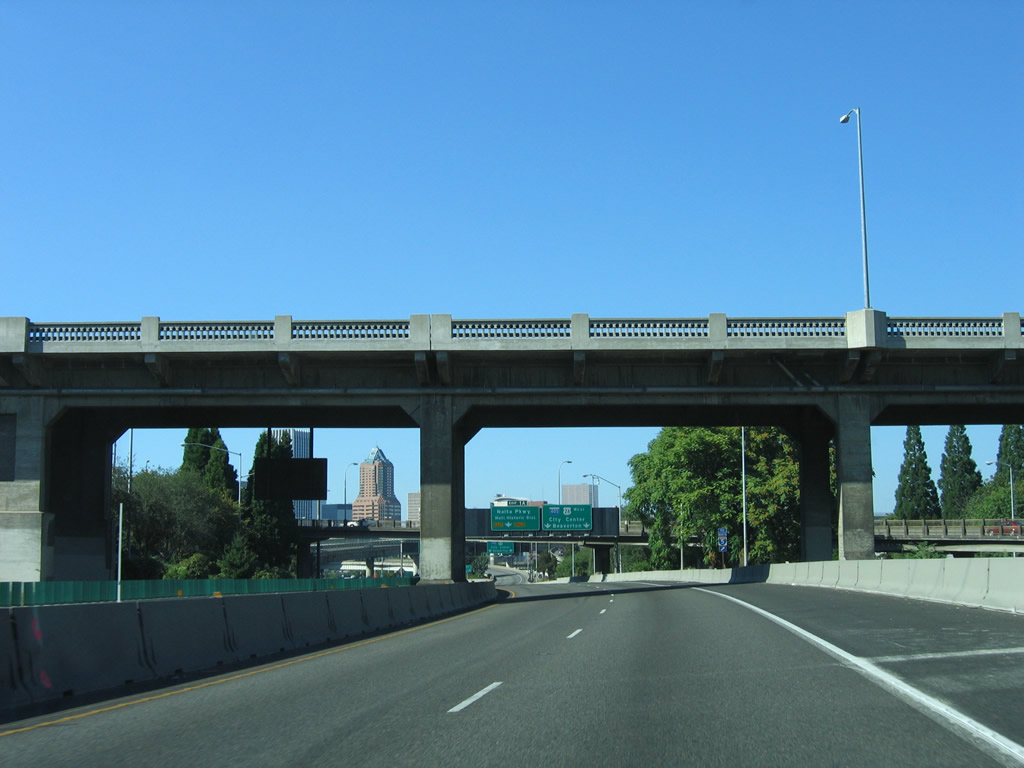
Traveling beneath U.S. 26 and the Ross Island Bridge, I-405 initially follows S Harbor Drive. Harbor Drive connected to the Portland city center until 1974 when the expressway permanently closed north of Market Street (Harbor Drive, 2025).
08/27/06
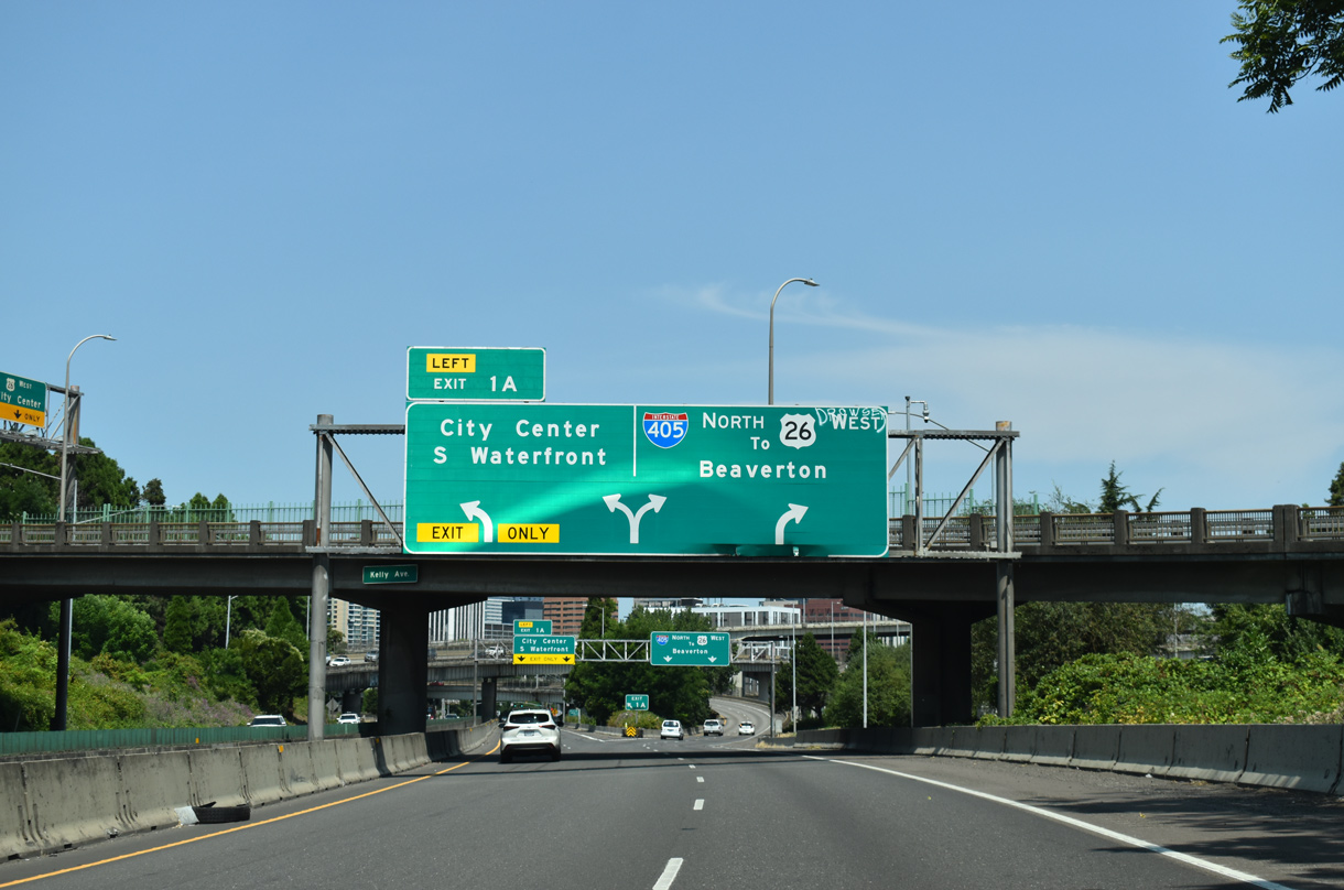
S Harbor Drive continues north from Left Exit 1 A as an at-grade boulevard to SW Naito Parkway and the National Historic District of Portland. I-405 shifts onto the Stadium Freeway around the west side of City Center.
07/20/23
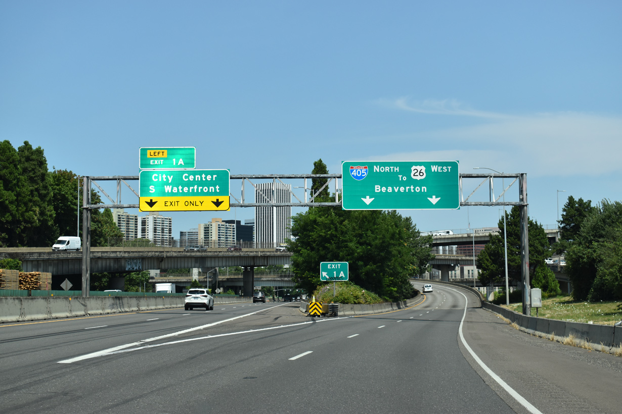
S Harbor Drive ties into SW Naito Parkway across from the couplet of SW Clay Street and SW Market Street in City Center. Originating in the Homestead neighborhood, SW Naito Parkway heads north between Waterfront Park and Downtown. OR 99W previously overlaid a portion of SW Naito Parkway.
07/20/23
I-405 angles northwest along the Stadium Freeway while I-5 curves northeast on the Marquam Bridge across the Willamette River to East Portland.
07/20/23
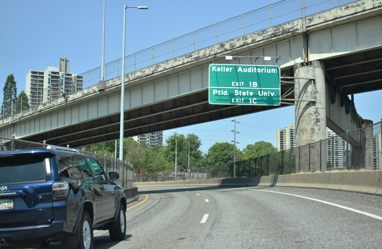
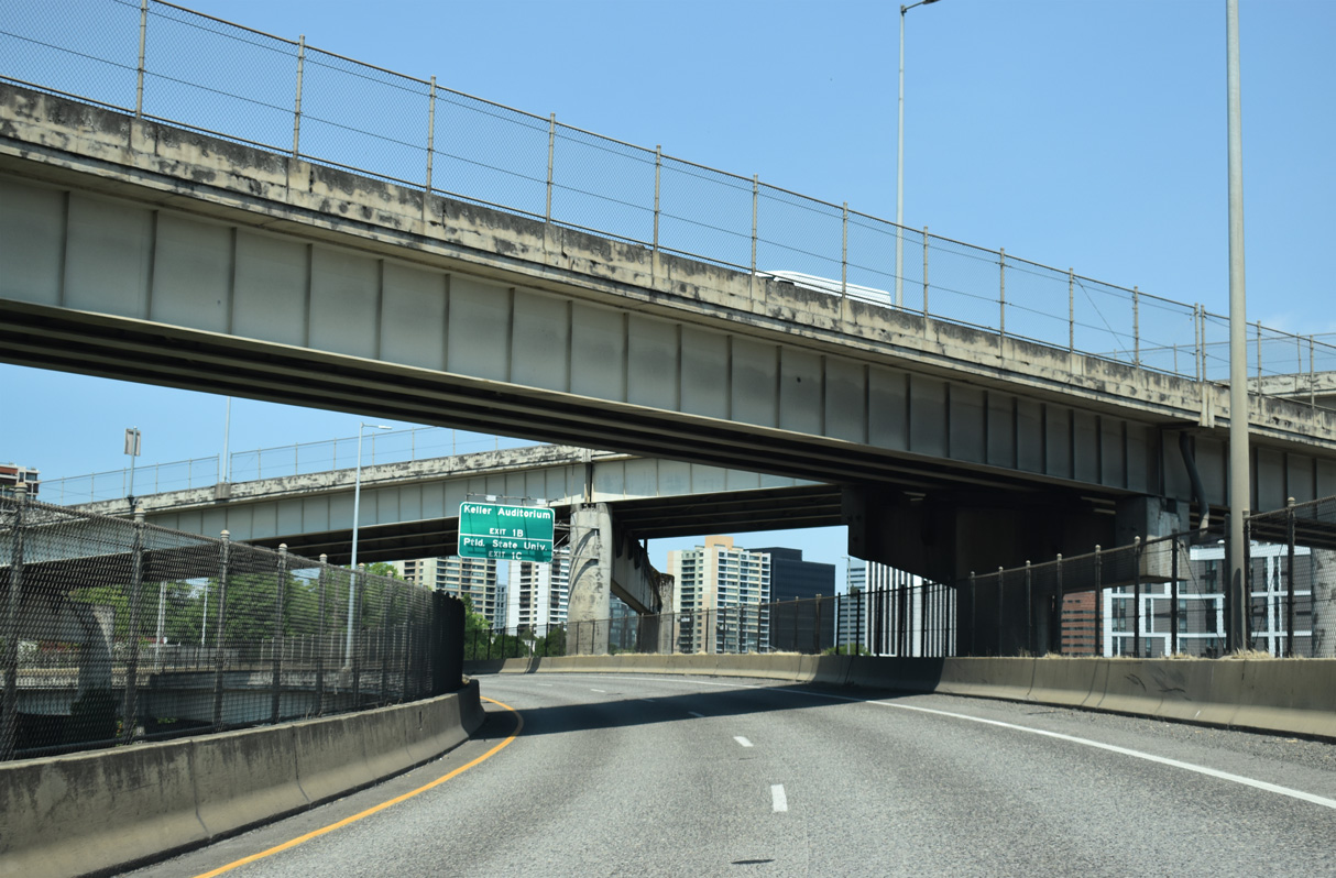
Exit 1 B joins I-405 (Stadium Freeway) north with SW 4th Avenue. Exit 1 C follows onto SW 6th Avenue (Exit 1 C) to Portland State University and Keller Auditorium.
07/20/23
SW 4th Avenue leads northeast from SW Barbur Boulevard and I-405 along the Portland street grid to Pioneer Place shopping mall between SW Taylor Street and SW Alder Street. Historically, U.S. 99W followed a portion of both SW 4th and 6th Avenues in Downtown Portland prior to realignment in 1950 (Oregon Route 99W, 2024).
07/20/23
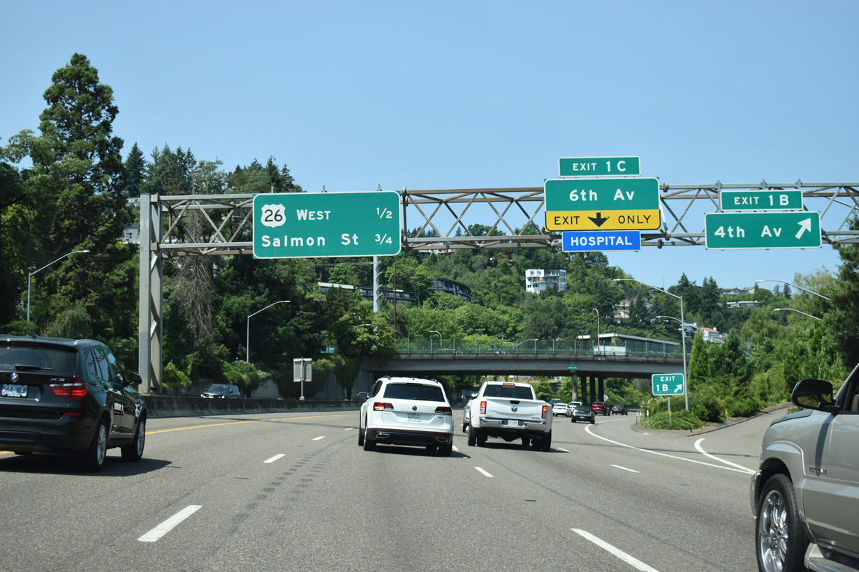
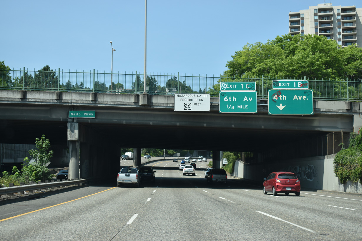
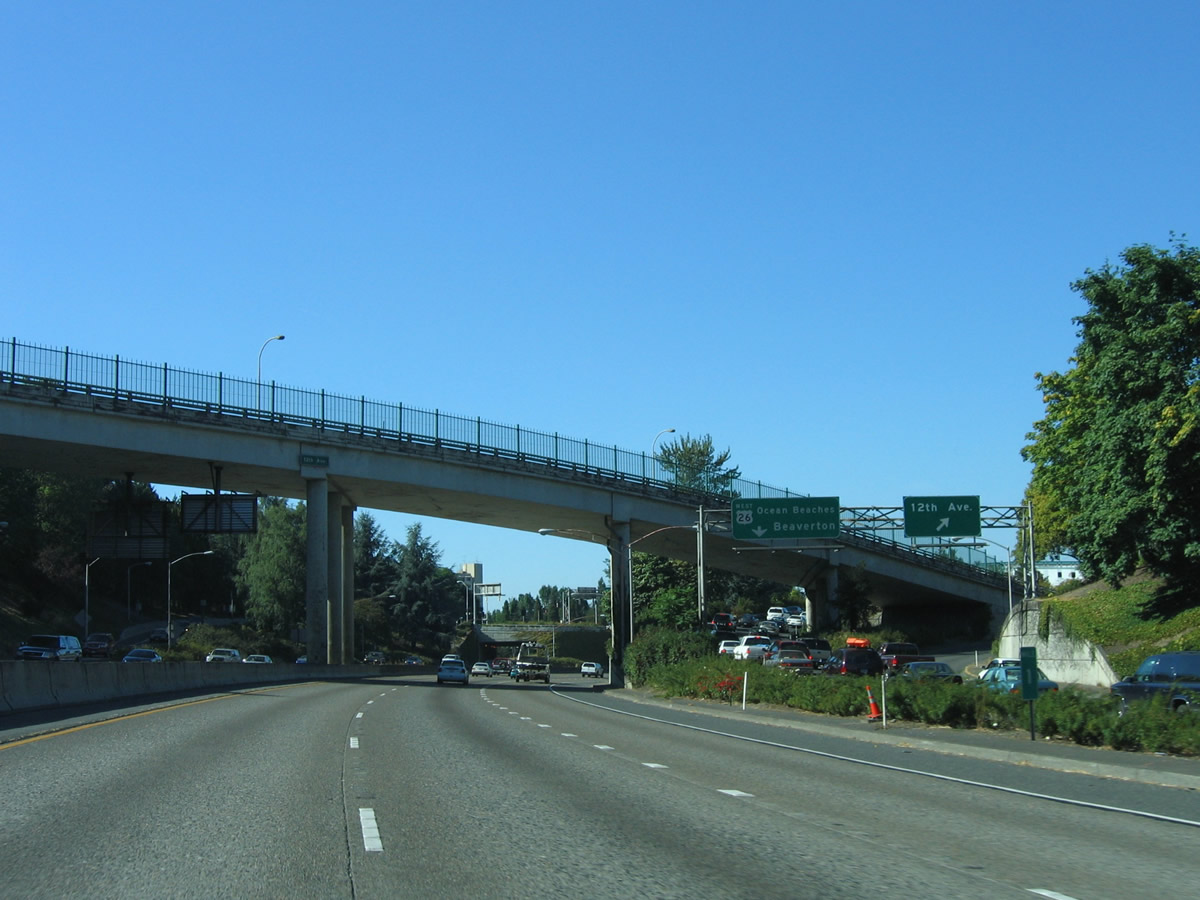
Exit 1 B leaves for SW 4th Avenue ahead of a lane drop at Exit 1 C for SW 6th Street. U.S. 26 west joins the Stadium Freeway from SW 6th Avenue only to leave at Exit 1 D along Sunset Highway to Beaverton in one half mile.
07/20/23
SW 6th Avenue travels northeast from Exit 1 C through the heart of Portland State University. U.S. 26 joins I-405 and Portland with northwest Portland neighborhoods and the city of Beaverton. The U.S. highway was relocated onto the Stadium Freeway in 2005 (U.S. Route 26 in Oregon, 2025).
07/20/23
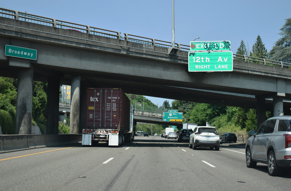
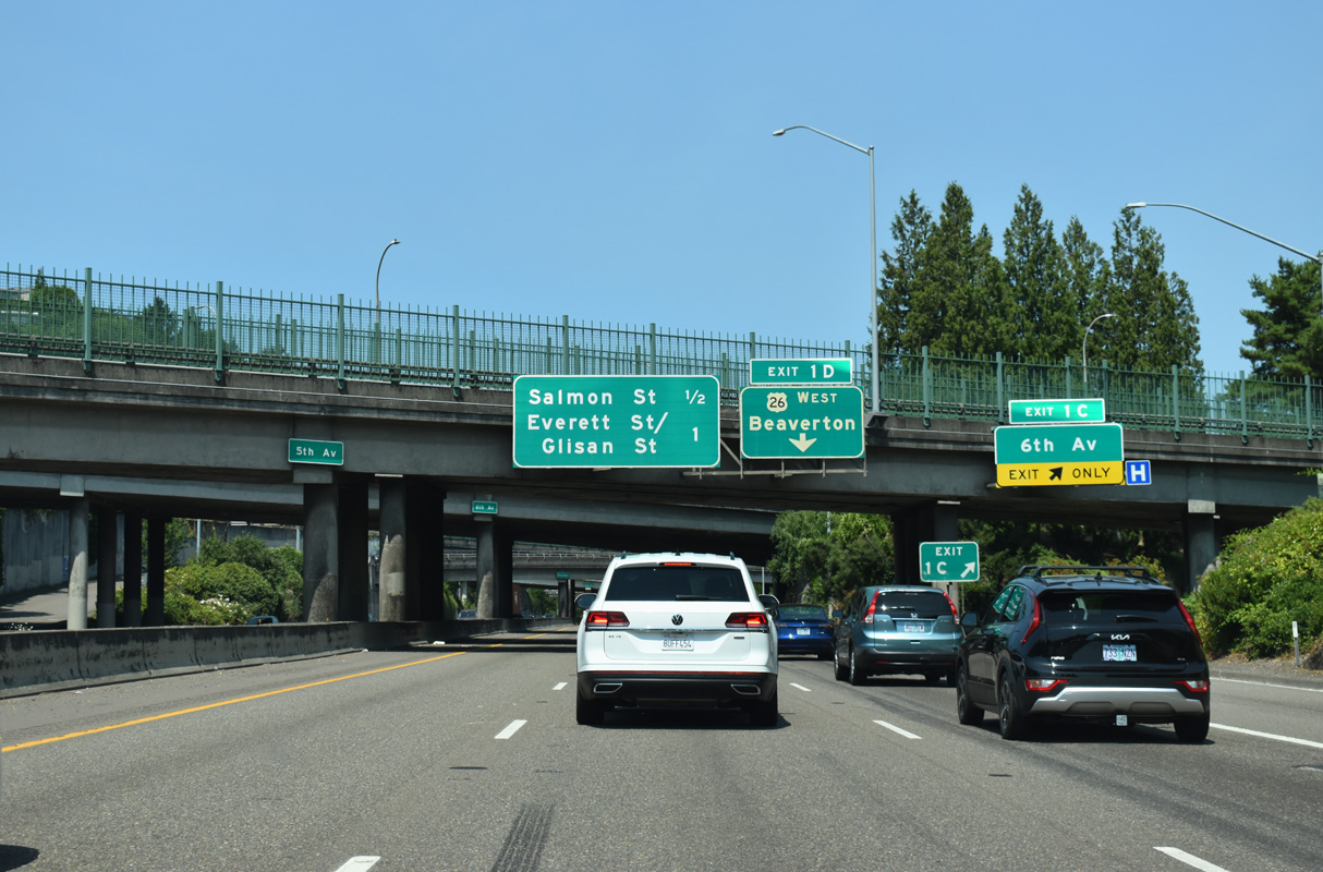
Exit 1 D also connects to SW 12 Avenue north to western reaches of City Center. This overhead was replaced a sign referencing the zoo and forestry center after 2007.
07/20/23
North  West
West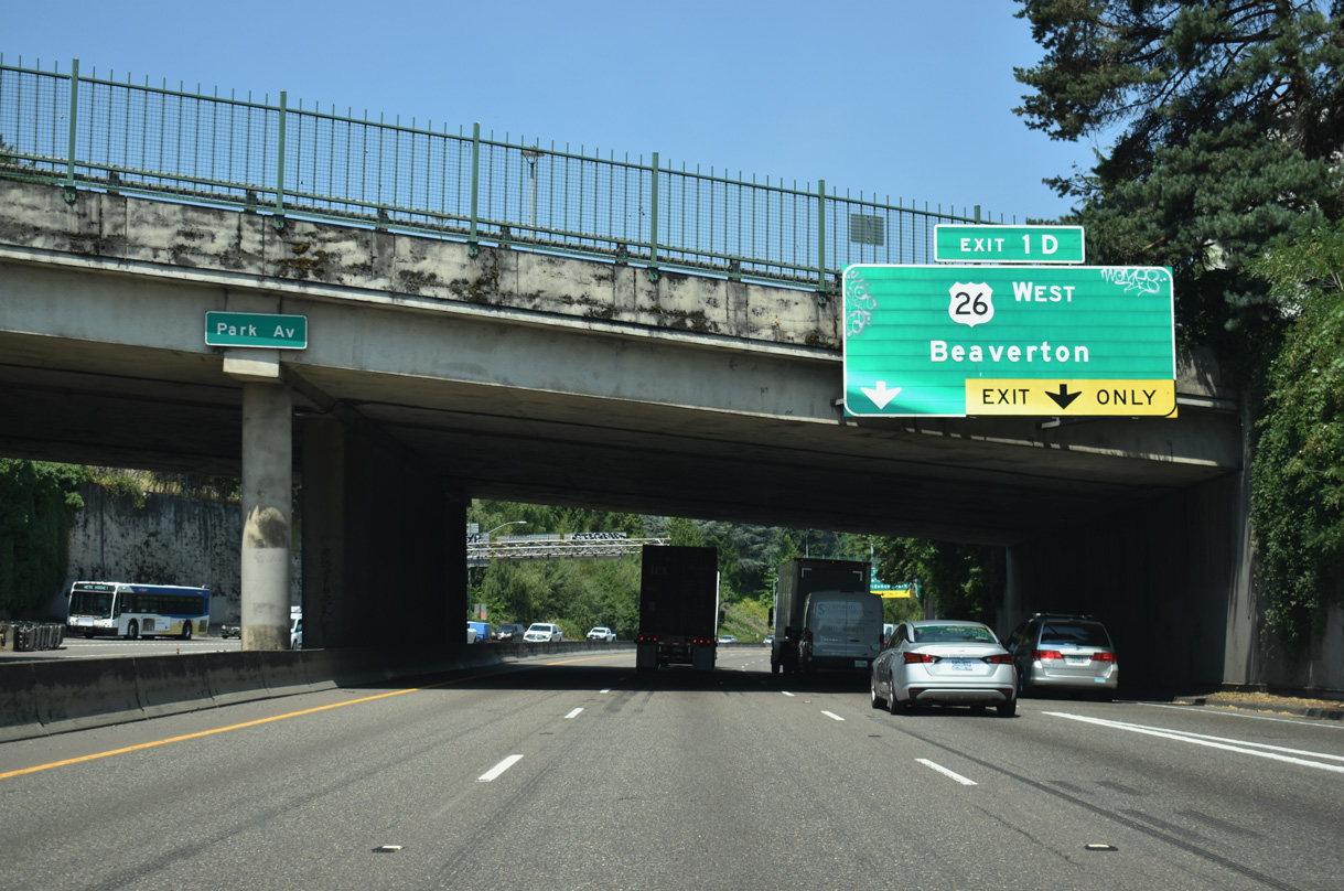
Passing under SW Park Avenue, an auxiliary lane briefly joins I-405 north as U.S. 26 enters from SW 6th Avenue. U.S. 26 west departs next for Sunset Highway, a freeway linking I-405 with the Oregon Zoo and World Forestry Center en route to Beaverton.
07/20/23
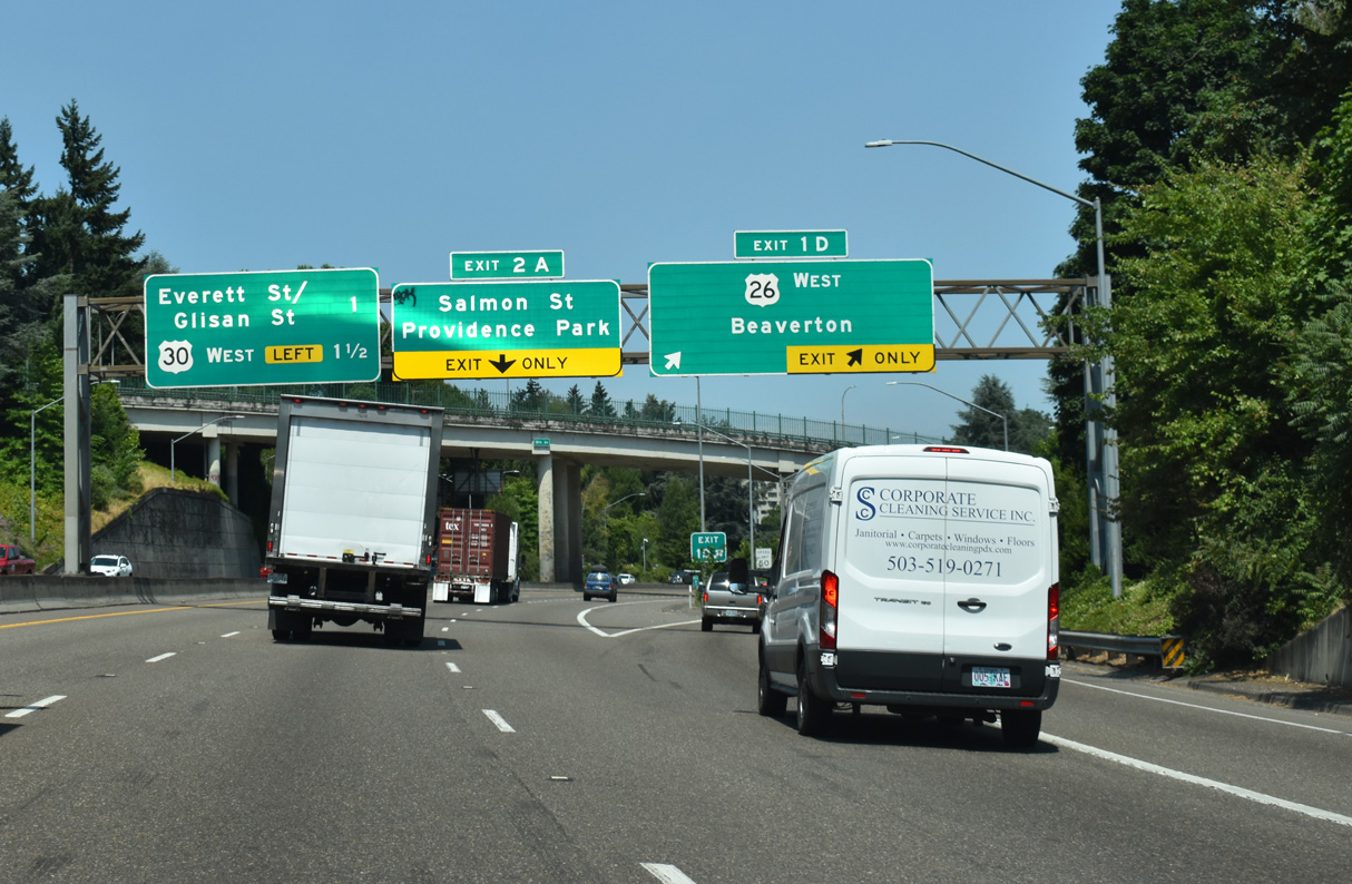
A two lane ramp leaves at Exit 1 D for U.S. 26 west to the Oregon coast and SW 12th Avenue north. Providence Park stadium is located four blocks west of I-405 at Exit 2 A to SW 14 Avenue / SW Salmon Street next.
07/20/23
Leaving I-405 (Stadium Freeway) and Downtown, U.S. 26 advances 73.8 miles west to U.S. 101 south of Seaside. Locally, U.S. 26 travels along the freeway portion of Sunset Highway through the Vista Ridge Tunnel en route to western suburbs of Portland.
08/27/06
North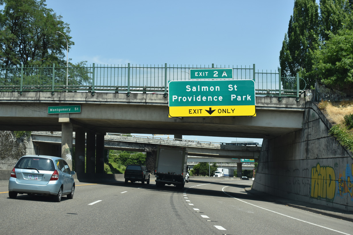
The Stadium Freeway turns northeast at SW Montgomery Street to run between SW 13th and 14th Avenues along the Portland street grid. Upcoming Exit 2 A to SW Salmon Street serves both the Oregon History and Portland Art Museums.
07/20/23
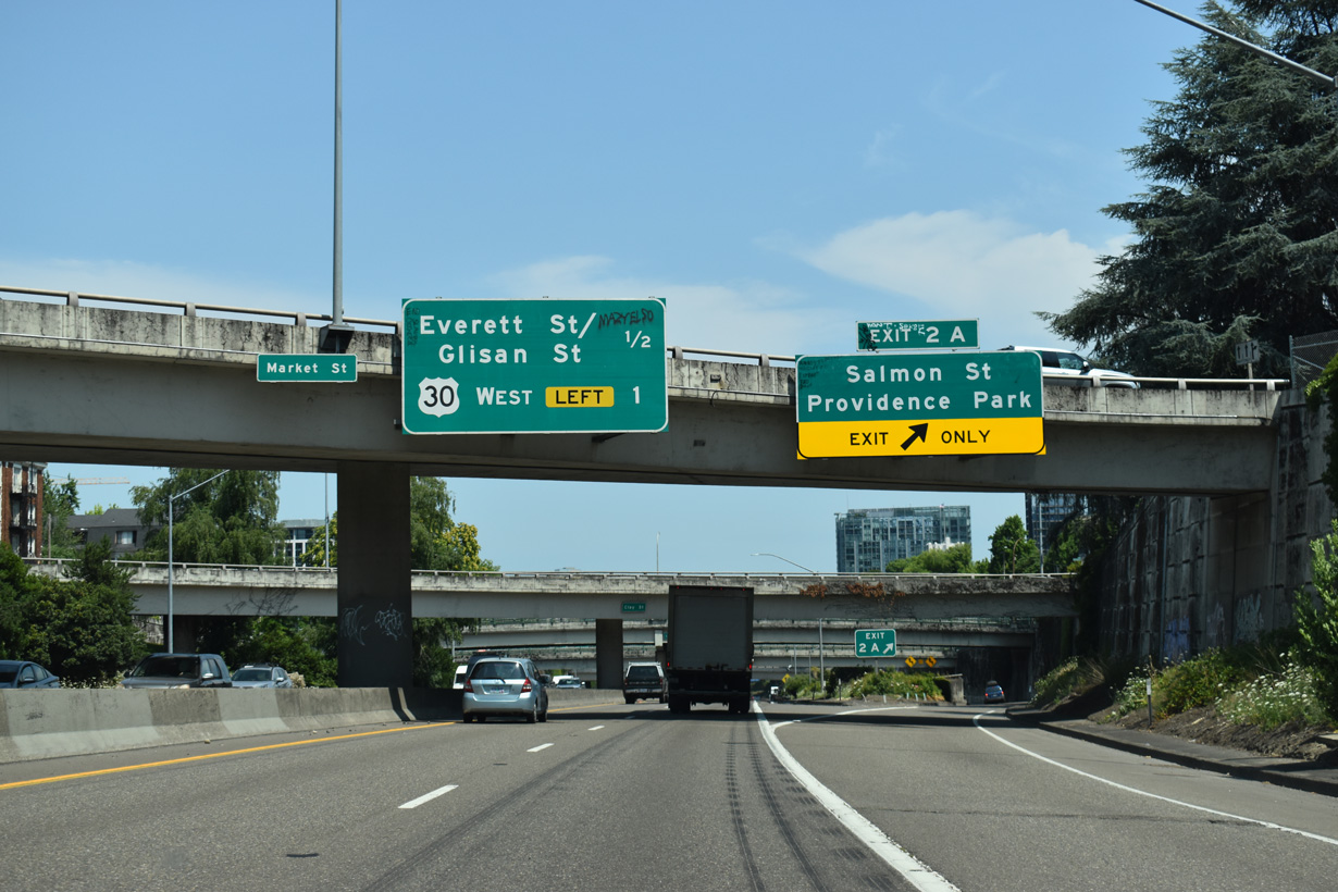
The couplet of SW Market and Clay Streets tie into the exchange between I-405 / U.S. 26 from City Center where Exit 2 A departs for SW 14th Avenue to SW Salmon Street. The couplet was formerly part of U.S. 26 prior to completion of the Vista Ridge Tunnels in 1970.
One mile separates I-405 from U.S. 30 west to Northwest Portland and St. Johns.
07/20/23
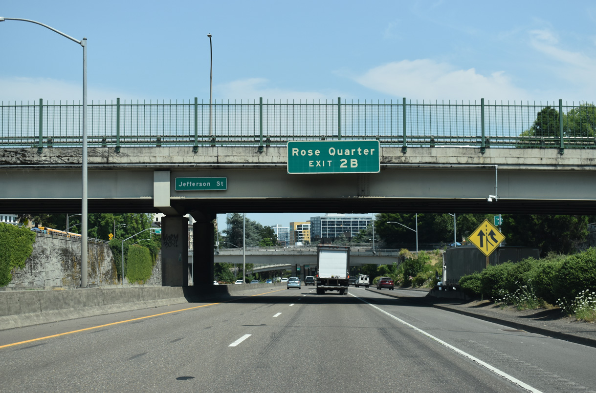
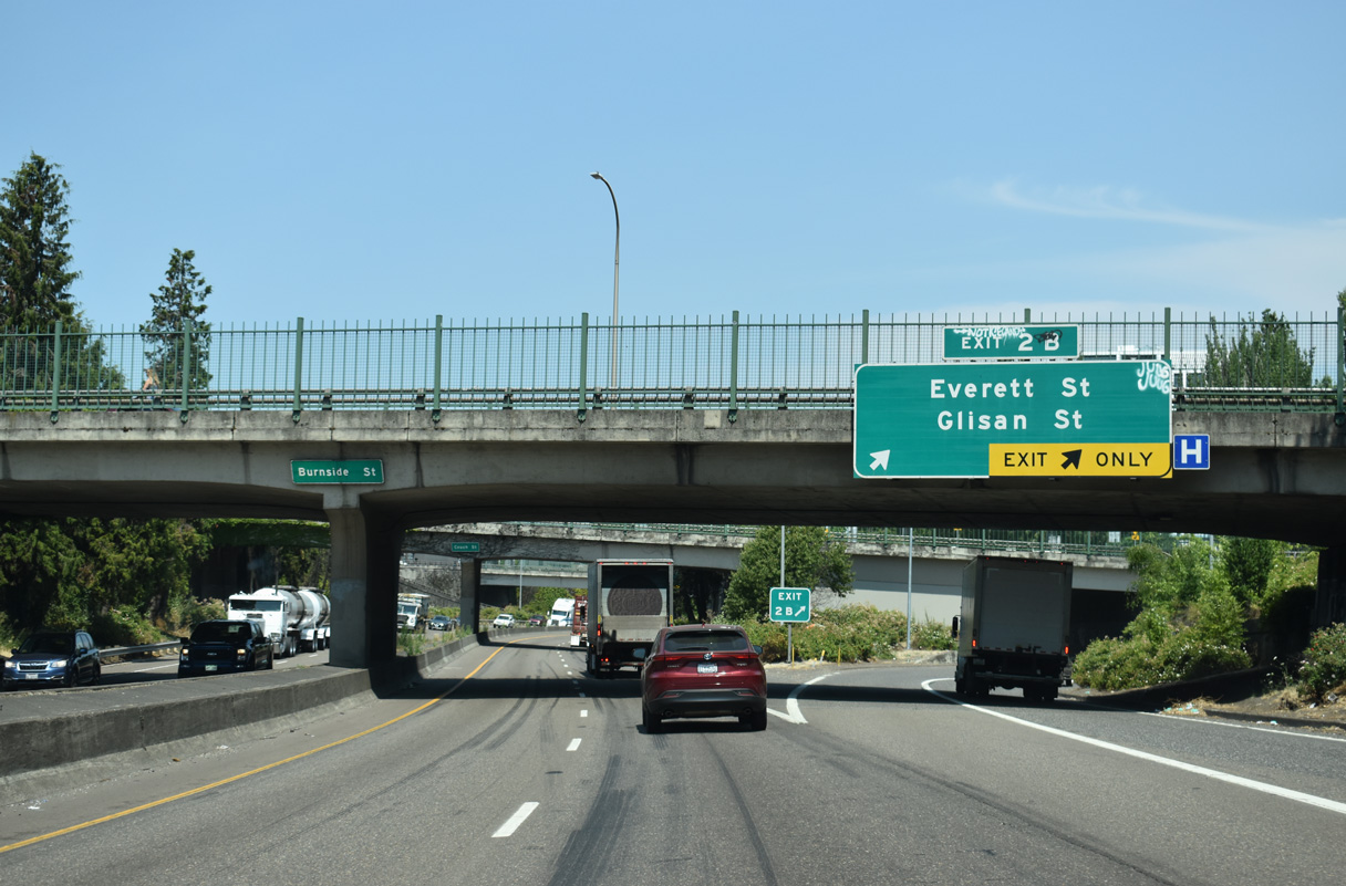
I-405 travels under SW Jefferson Street as the Stadium Freeway advances northeast to Exit 2 B for NW 14th Avenue to NW Everett Street. Located in the Lloyd District across the Willamette River, the Moda Center (Rose Quarter) is home to the Portland Trailblazers NBA team.
07/20/23
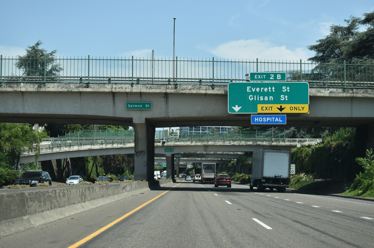
NW Everett Street runs east from the Northwest District / Nob Hill area to the Pearl District east of the Stadium Freeway. NW 14th Avenue connects with NW Glisan Street west two blocks north of NW Everett Street.
07/20/23
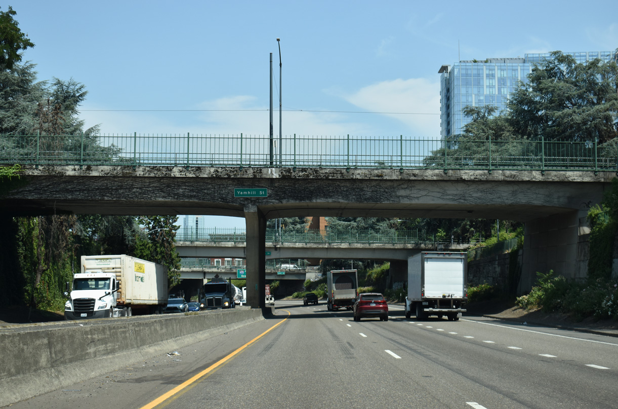
The below grade section of Interstate 405 north passing below Yamhill Street, Morrison Street and Alder Streets.
07/20/23
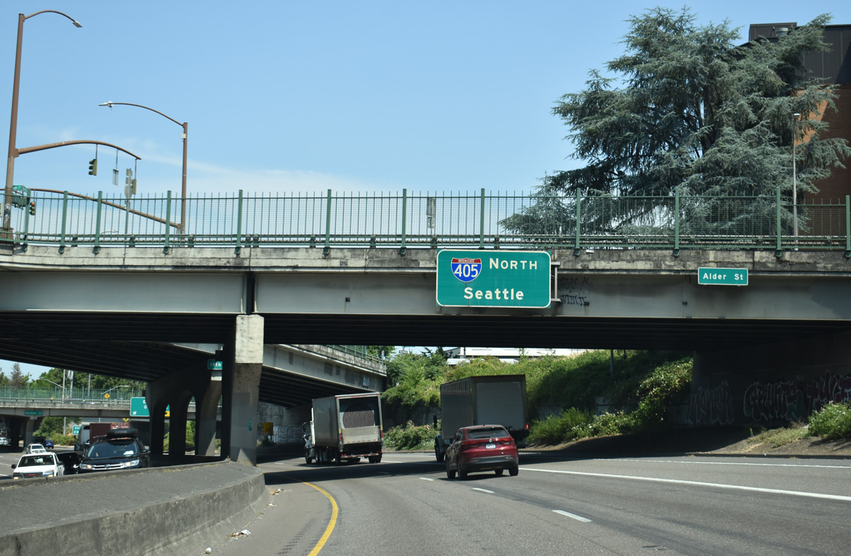
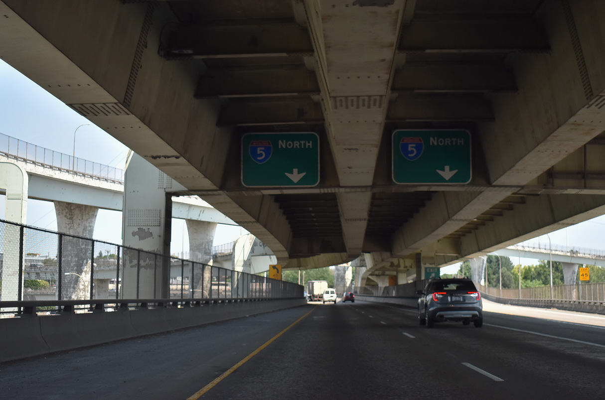
I-405 (Stadium Freeway) meets Interstate 5 north to Vancouver, Washington in two miles. I-5 travels north through the Evergreen State to Tacoma and Seattle.
07/20/23
Interstate 405 (Stadium Freeway) shifts north under W Burnside Street at Exit 2 B to NW 14th Avenue and NW Everett Street. NW 14th Street advances north through the Pearl District to NW 15th Avenue under the Fremont Bridge.
07/20/23
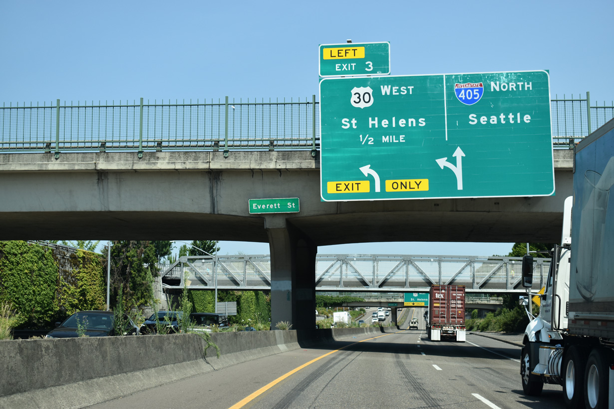
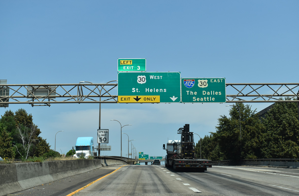
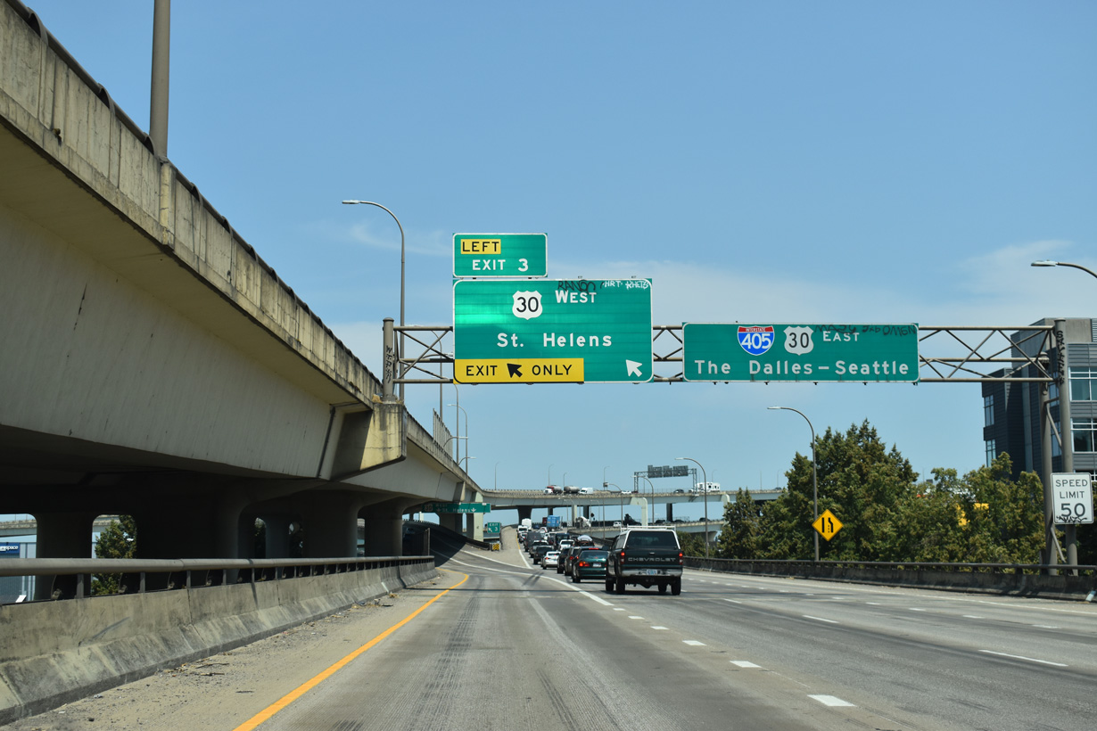
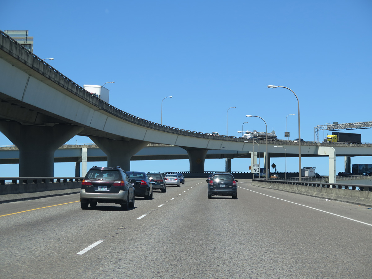
Lining the western limits of the Pearl District, I-405 transitions to an elevated viaduct beyond NW Glisan Street. U.S. 30 east joins the Stadium Freeway in one half mile from St. Helens and Northwest Portland at Left Exit 3.
07/20/23
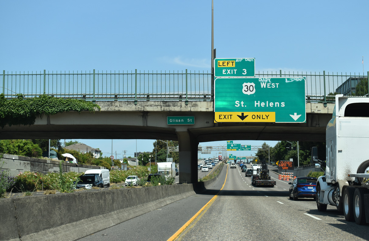
A second entrance ramp joins I-405 (Stadium Freeway) north from 15th Avenue / Glisan Street a quarter mile from Left Exit 3 for U.S. 30 west to St. Helens and Astoria. U.S. 30 initially follows a freeway that was intended for Interstate 505.
07/20/23
Had Interstate 505 been completed as planned, the freeway would have stretched 1.44 miles between the Fremont Bridge and St. Helens Road (old U.S. 30). Cancellation of the route occurred in 1979 and in 1988, U.S. 30 was realigned to Yeon Avenue at Nicolai Street along the part of I-505 that was built (U.S. Route 30 in Oregon, 2024).
07/20/23
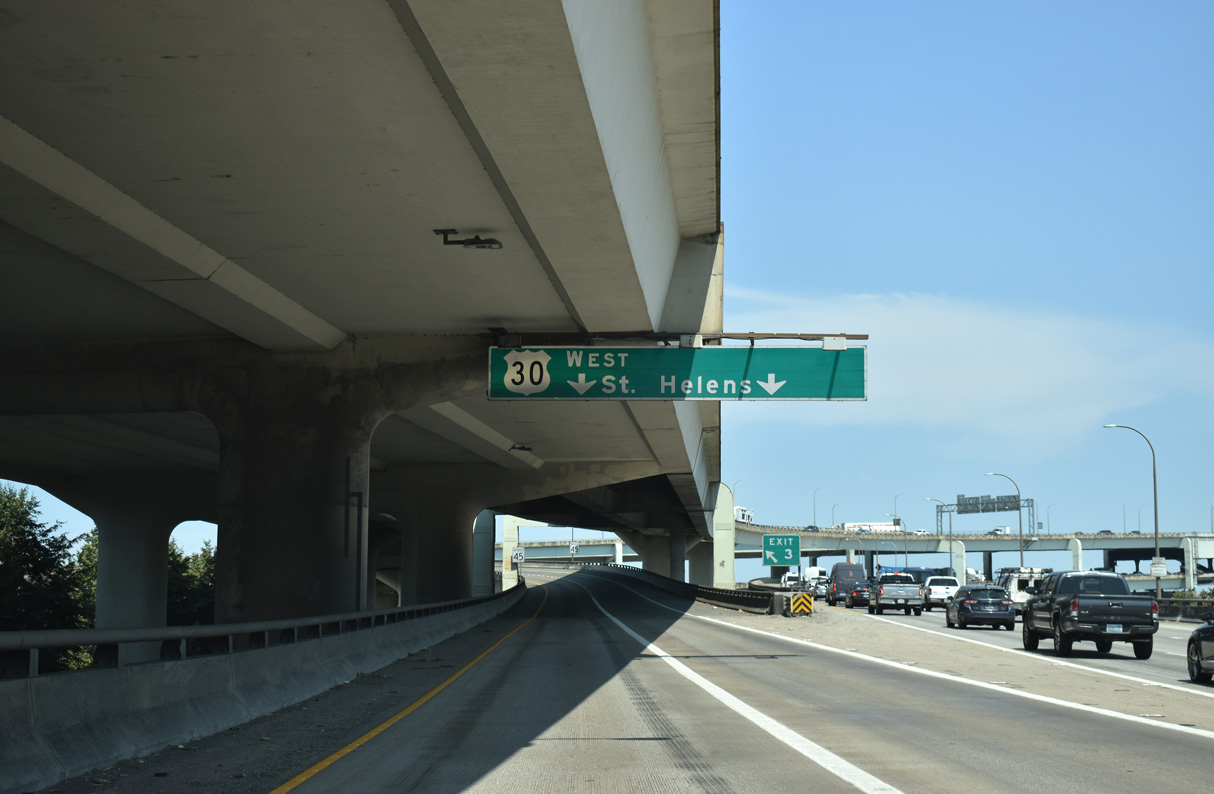
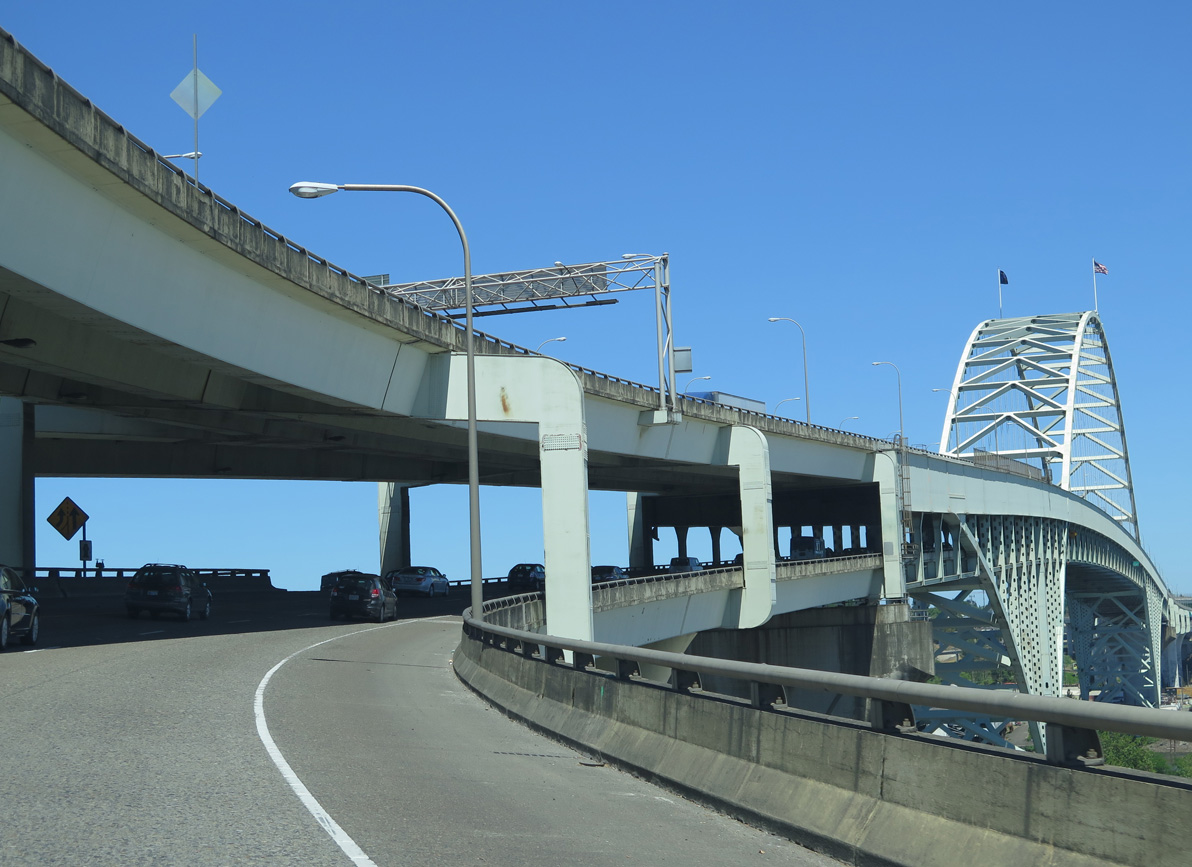
The three-wye interchange (Exit 3) joining I-405 and U.S. 30 (Lower Columbia River Highway) ties into the south end of the Fremont Bridge.
07/20/23
U.S. 30 (Lower Columbia River Highway) follows the Columbia River for the majority of the 98.5 mile course between I-405 and U.S. 101 at Astoria. Yeon Avenue carries the route from the freeway end to St. Helens Road through the Northwest Industrial Area.
07/20/23
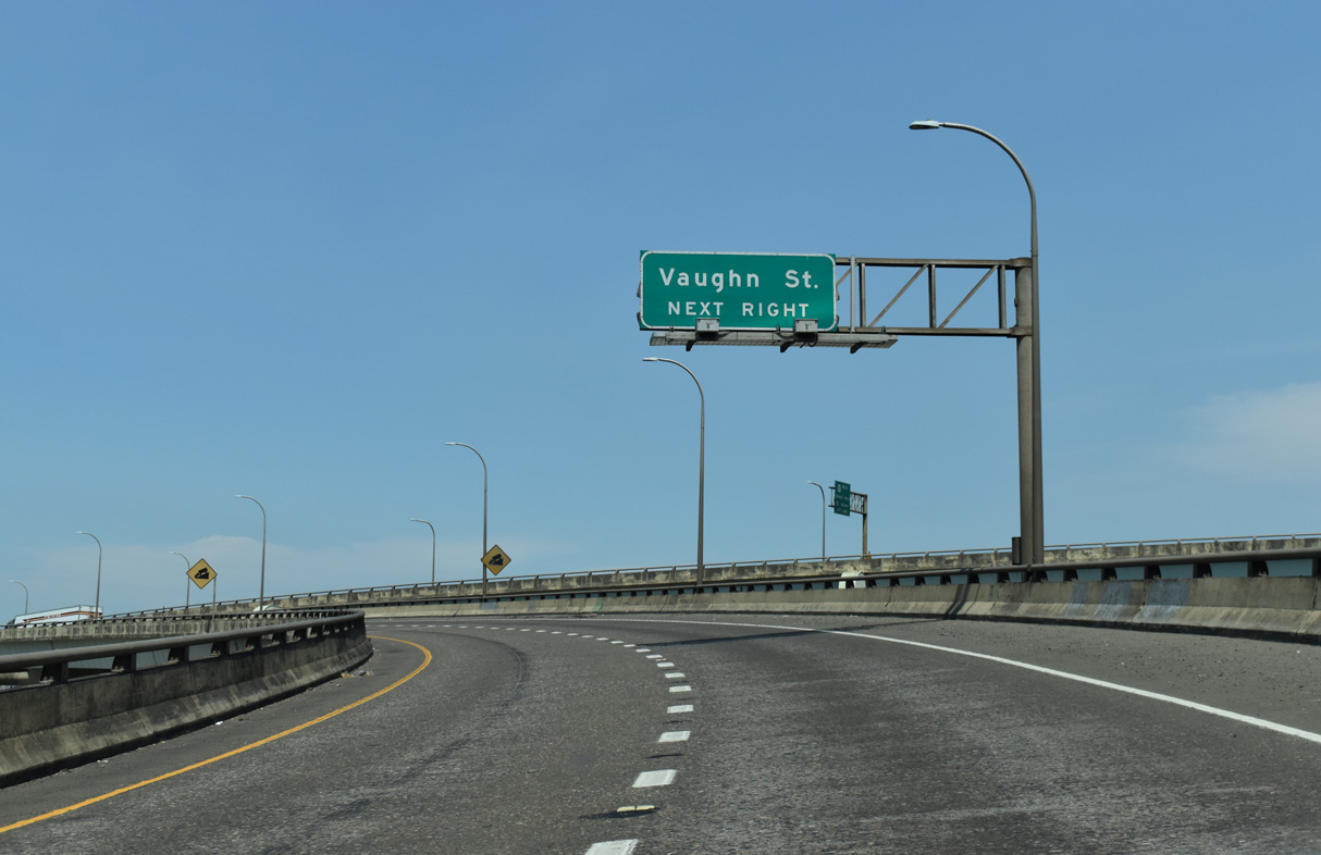
The lone exit from the freeway spur taking U.S. 30 north to Yeon Avenue departs for Vaughn Street at NW 23rd Avenue immediately after the flyovers from I-405 converge.
07/20/23
North  East
East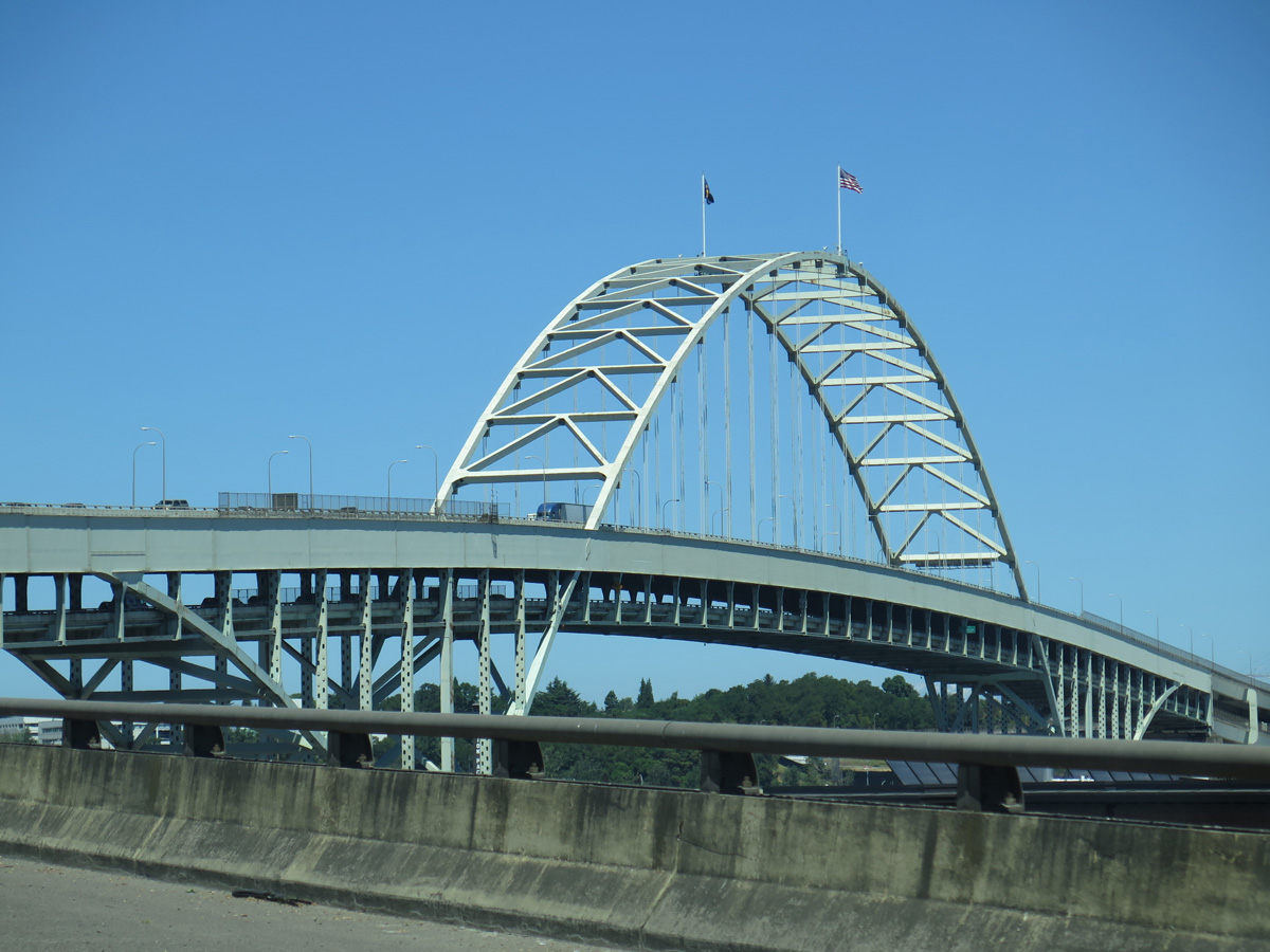
U.S. 30 combines with I-405 northeast across the Fremont Bridge spanning the Willamette River.
06/25/15
I-405 northbound follows the lower deck of the Fremont Bridge. The bridge and the north interchange with I-5 opened to traffic on November 15, 1973, which completed the 4.25 mile long urban loop ("Fremont Bridge (Portland, Oregon)", 2010).
06/25/15
2,154 feet in length, the Fremont Bridge crests at 175 feet above the Willamette River ("Fremont Bridge (Portland, Oregon)", 2010).
06/25/15
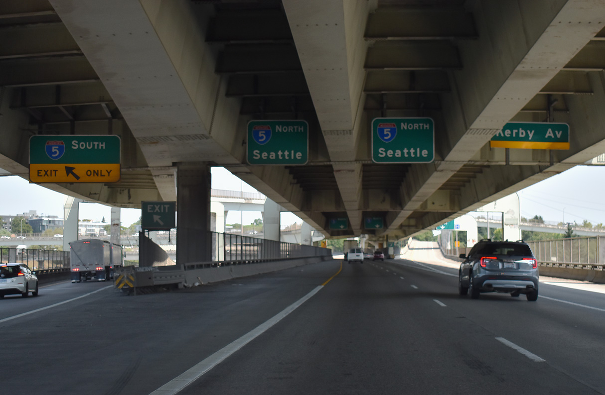
A four level interchange connects the north end of the Fremont Bridge with Interstate 5 and the East Fremont Interchange Connector to Kerby Avenue.
07/20/23
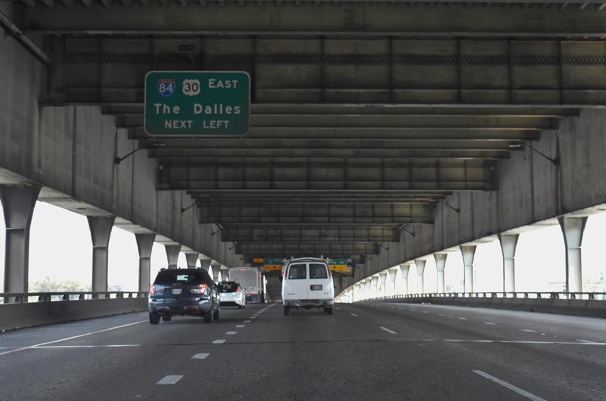
U.S. 30 east continues south along I-5 one mile to Interstate 84 (Banfield Expressway) east. With exceptions at Cascade Locks, Hood River, and from Mosier eastward to The Dalles, I-84/U.S. 30 overlap east from Portland along the Columbia River.
07/20/23
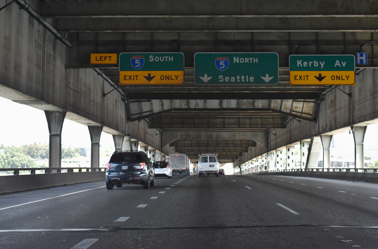
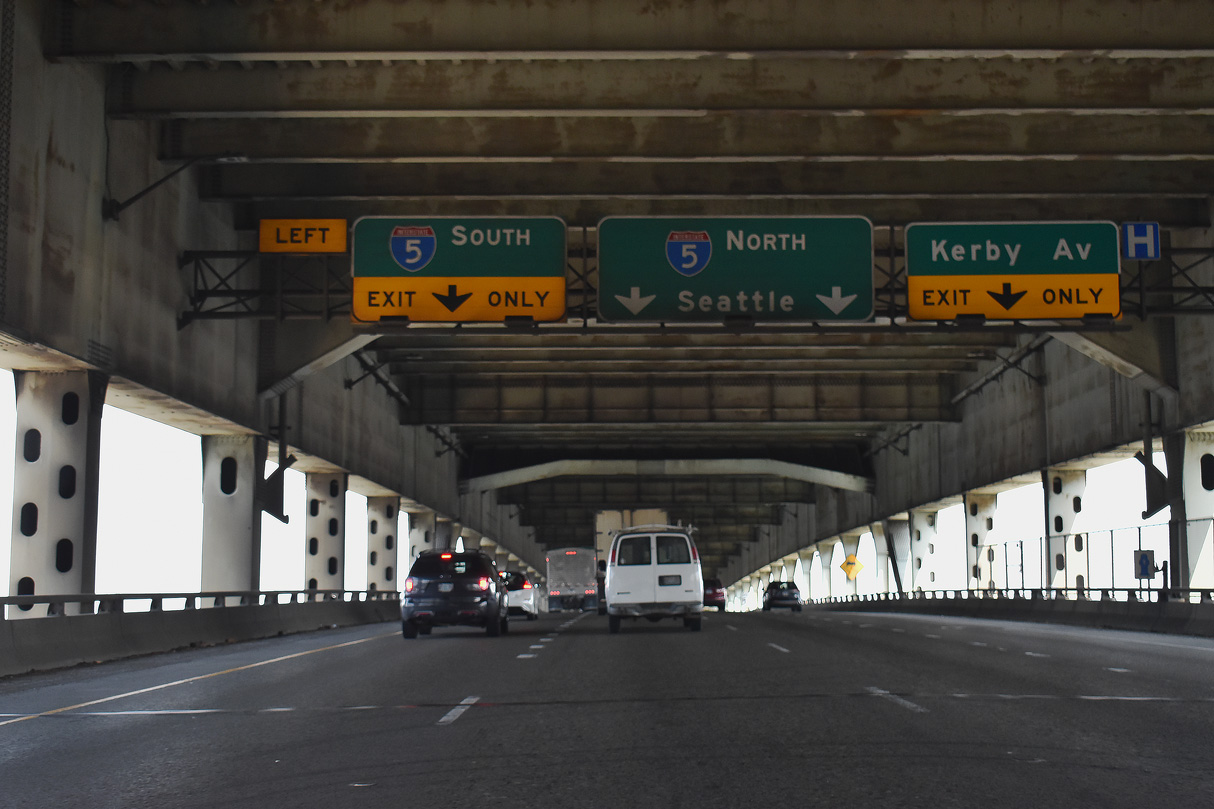
I-405 defaults with two lanes onto Interstate 5 north through the Humbolt and Kenton areas of north Portland beyond the ramp taking U.S. 30 east onto I-5 southbound.
07/20/23
The right lane extends north from the Stadium Freeway along the East Fremont Interchange Connector to Kerby Avenue at Gantenbein Avenue and Boise section of the city. This spur was built as part of the planned Rose City Freeway, a cancelled road proposed northeast to the unconstructed Prescott Freeway.
07/20/23
Interstate 5 north joins Portland with Vancouver, Olympia, and Seattle-Tacoma in Washington.
07/20/23
References:
Harbor Drive. (2025, July 1). In AARoads Wiki. Retrieved August 25, 2025, from https://wiki.aaroads.com/wiki/Harbor_Drive
Oregon Route 99W. (2024, September 27). In AARoads Wiki. Retrieved August 25, 2025, from https://wiki.aaroads.com/wiki/Oregon_Route_99W
U.S. Route 26 in Oregon. (2025, August 16). In AARoads Wiki. Retrieved August 25, 2025, from https://wiki.aaroads.com/wiki/U.S._Route_26_in_Oregon
U.S. Route 30 in Oregon. (2024, January 2). In AARoads Wiki. Retrieved August 25, 2025, from https://wiki.aaroads.com/wiki/U.S._Route_30_in_Oregon#History
Fremont Bridge (Portland, Oregon). (2010, November 28) In https://en.wikipedia.org/w/index.php?title=Fremont_Bridge_(Portland,_Oregon)&oldid=399282974
Photo Credits:
- AARoads: 08/27/06
- Brent Ivy: 07/20/23
- Andy Field: 06/25/15
Connect with:
Page Updated Monday August 25, 2025.