
Interstate 405 South

 South
South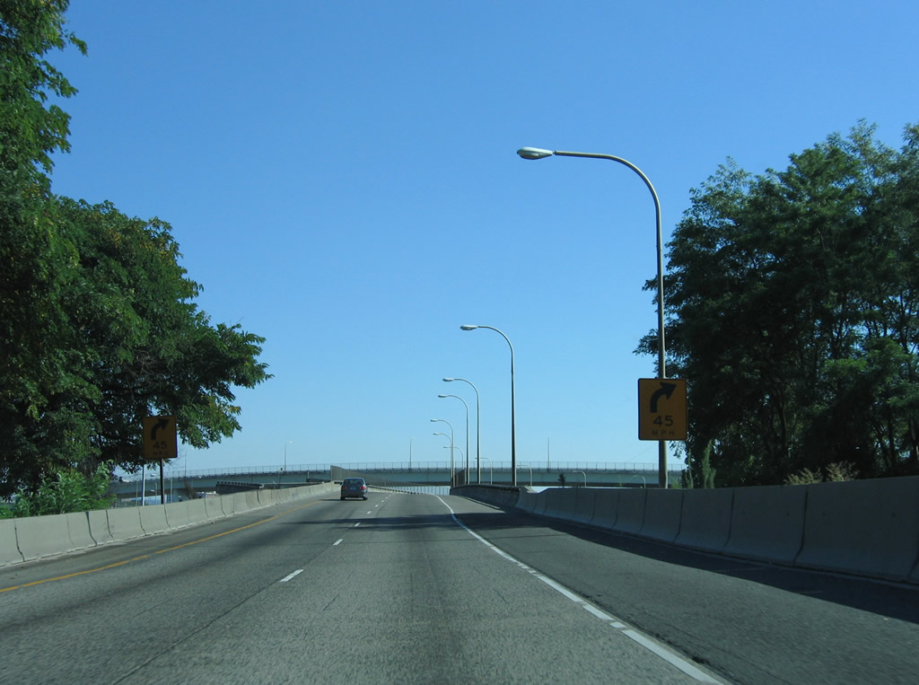
The flyover from I-5 south to I-405/U.S. 30 includes a ramp stub for an unconstructed ramp onto the Stadium Freeway spur to Kerby Avenue. Original plans for the Rose City Freeway took the unbuilt highway northeast to the planned Prescott Freeway.
08/27/06
 South
South  West
West
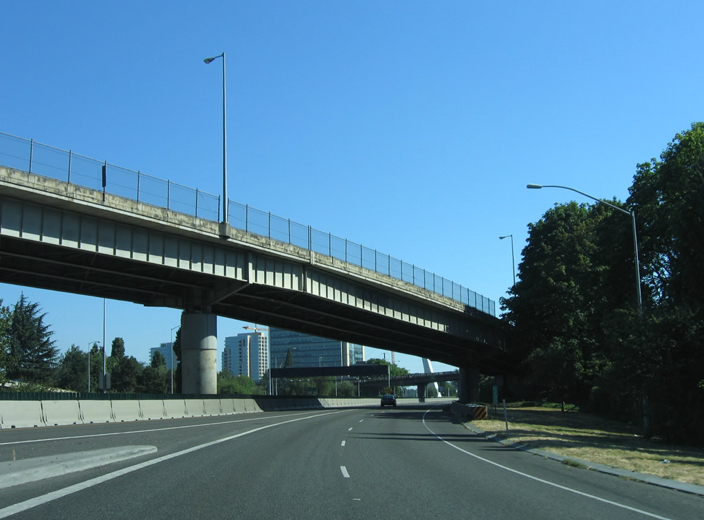
The northbound flyover taking U.S. 30 west from I-5 onto I-405 also includes a ramp stub for the unconstructed Rose City Freeway. Beyond the spur to Kerby Avenue at Cook Street, the Rose City Freeway never progressed beyond the planning stages.
06/02/06
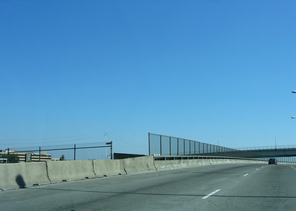
Ramps from I-5 converge with the Stadium Freeway spur angling southwest from the intersection of Gantenbein Avenue and Kerby Avenue.
08/27/06
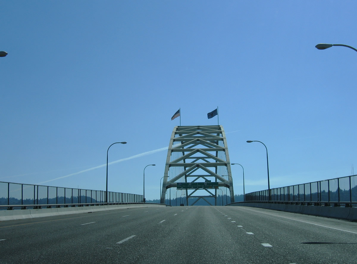
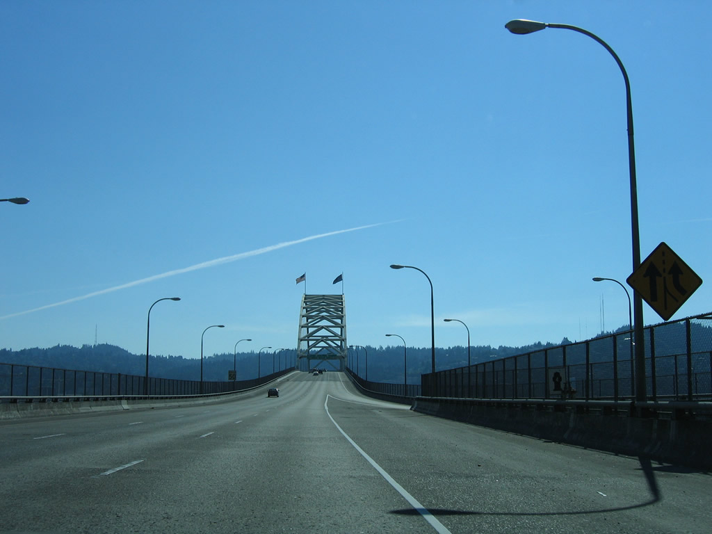
I-405/U.S. 30 ascend across the Fremont Bridge over the Willamette River. The tied-arch bridge measures 2,154 feet in length and provides a vertical clearance of 175 feet above the waterway ("Fremont Bridge (Portland, Oregon)", 2010).
08/27/06
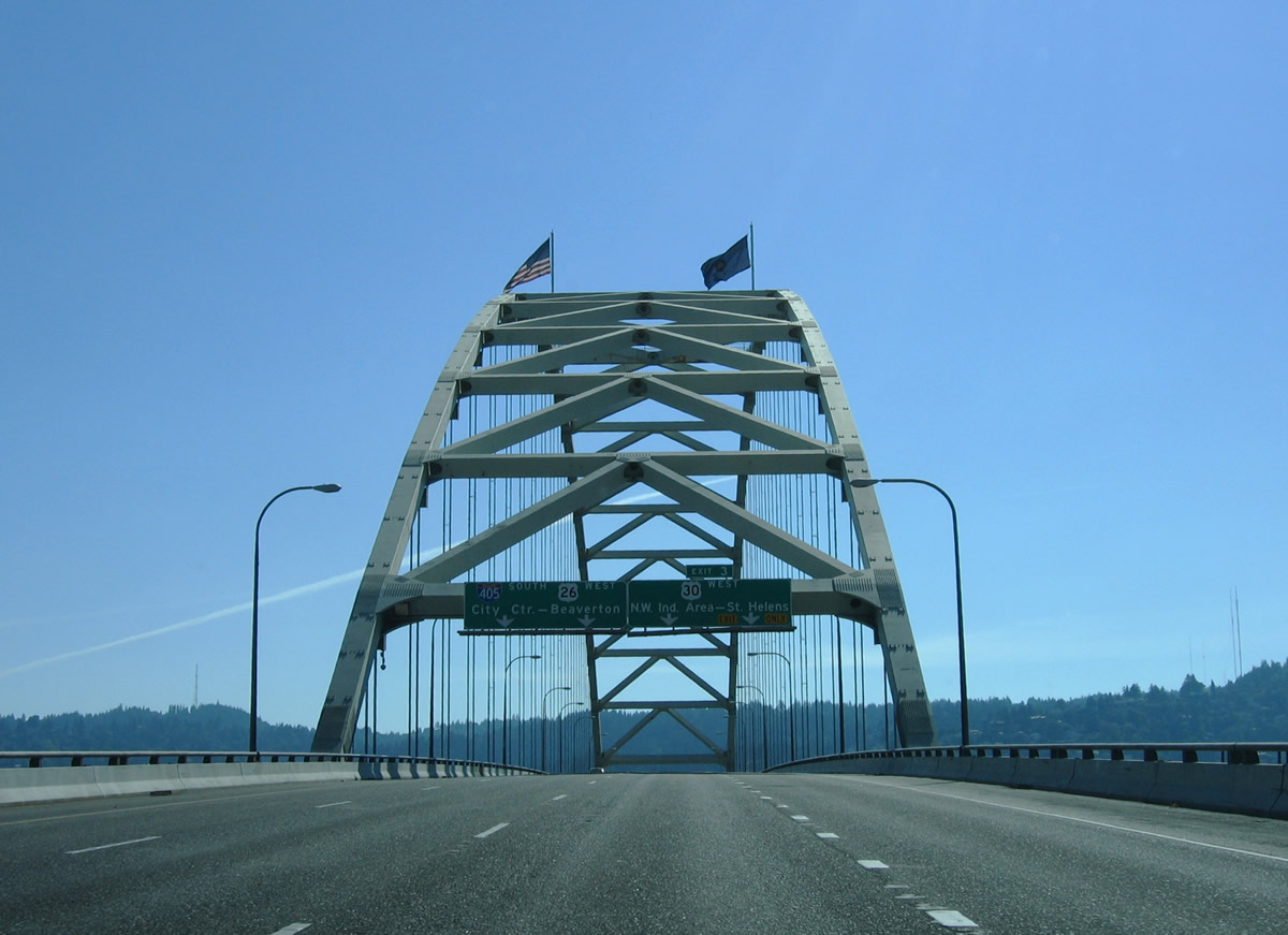
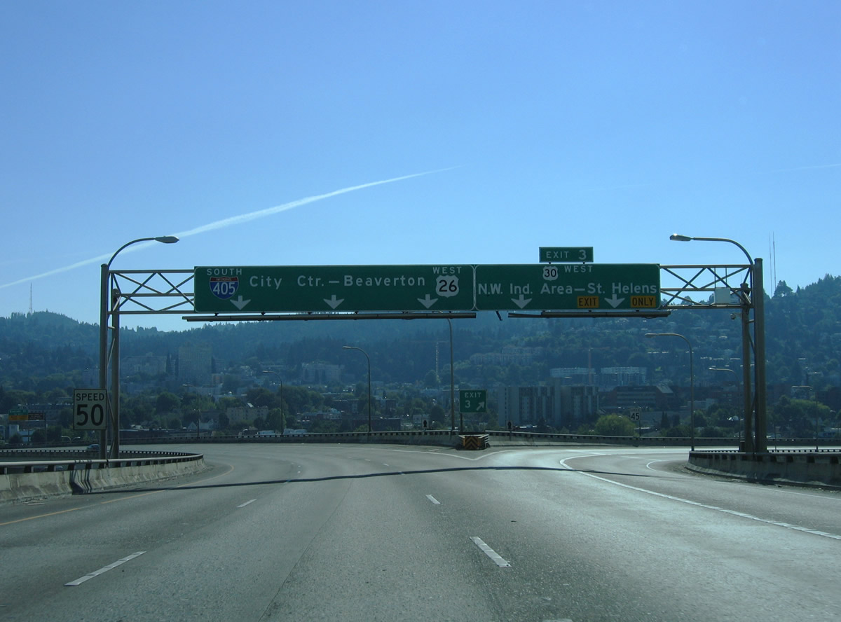
U.S. 30 west separates from I-405 for the Northwest Industrial Area of Portland at a three-wye interchange (Exit 3) at the south end of the Fremont Bridge. U.S. 30 (Lower Columbia River Highway) follows the Columbia River northwest from Portland to St. Helens and Astoria.
08/27/06
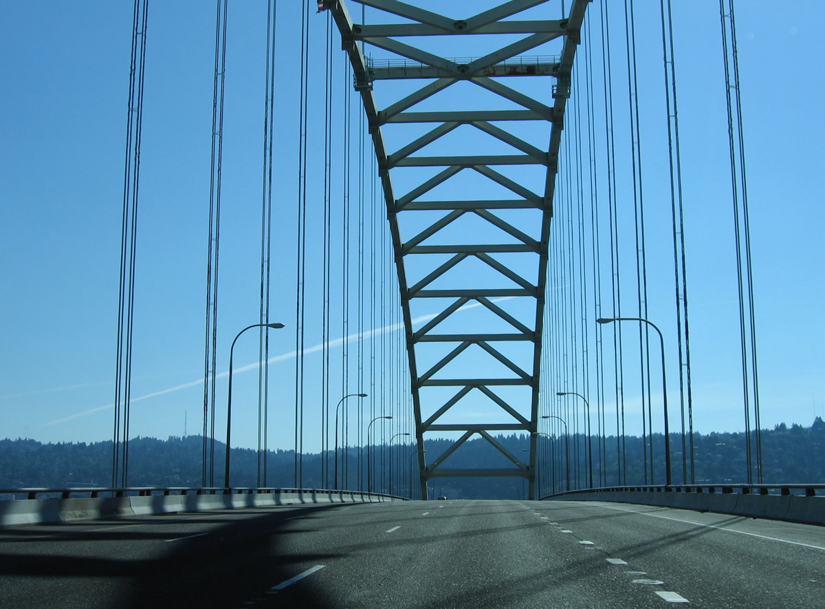
Interstate 405 northbound uses the lower deck of the Fremont Bridge.
08/27/06
Completing the 4.25 mile long loop, the Fremont Bridge, along with the interchange at Interstate 5, opened to traffic on November 15, 1973 (Interstate 405 (Oregon), 2024).
08/27/06
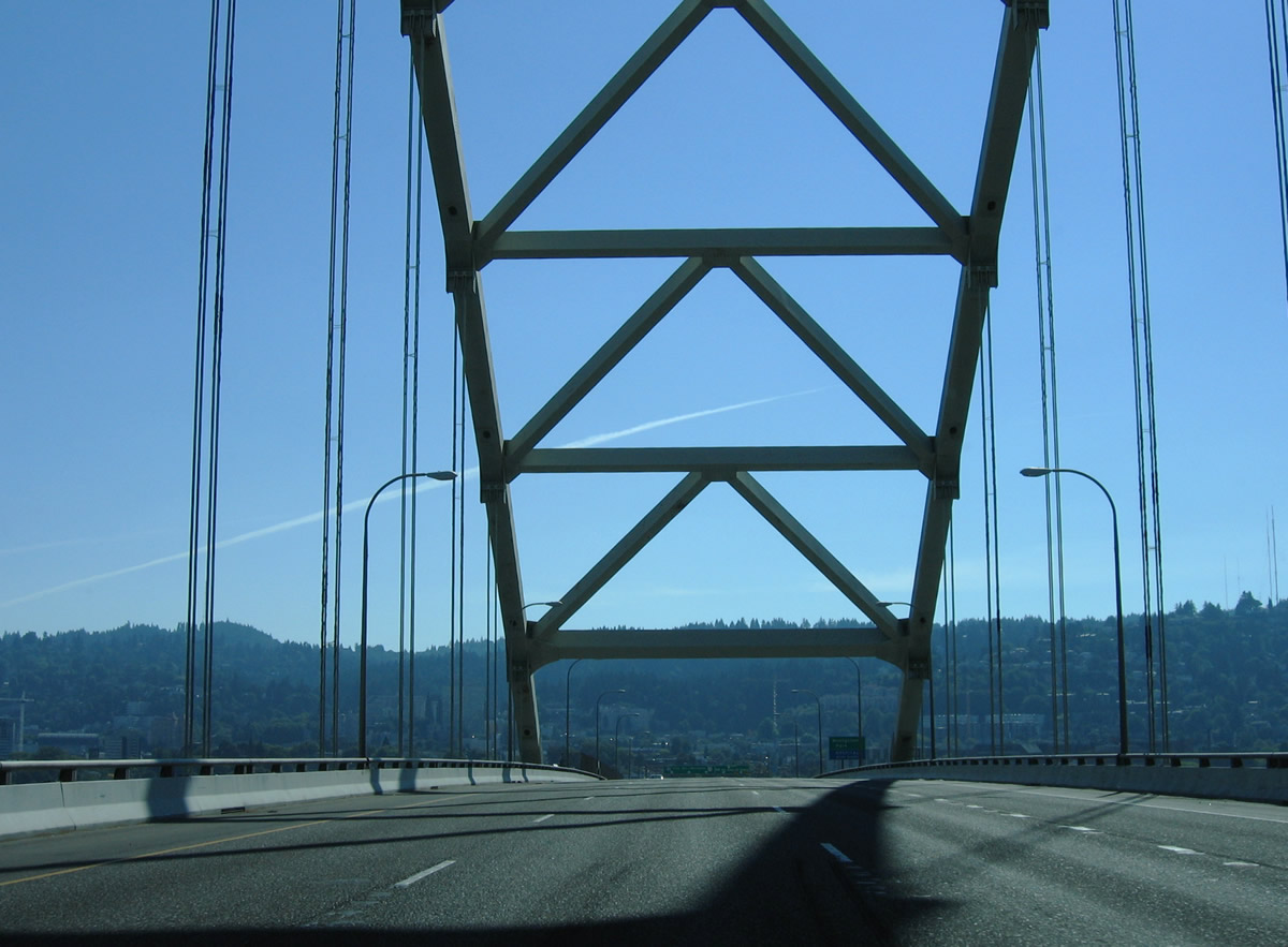
U.S. 30 (Lower Columbia River Highway) initially follows a freeway northwest 0.75 miles to Nicolai Street. The freeway was part of the proposed I-505, a 3.17 mile long spur to St. Helens Road. Cancellation of I-505 was approved by the FHWA in December 1979 (U.S. Route 30 in Oregon, 2024).
08/27/06
South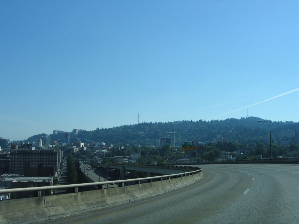
Turning south from the Fremont Bridge, Interstate 405 follows a viaduct from Exit 3 to Exit 2 B for Glisan Street.
08/27/06
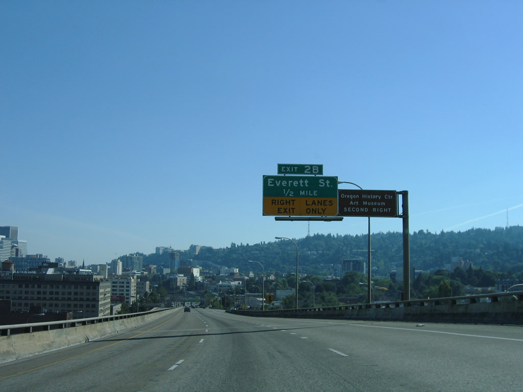
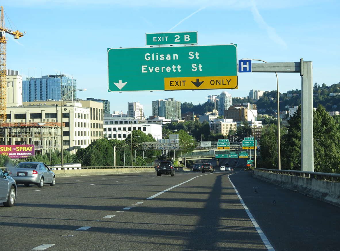
Exit 2 B is a half diamond interchange with parallel NW 16th and 15th Avenues ahead of Glisan and Everett Streets. Exit 2 B serves interests to the Oregon History Center and Portland Art Museum.
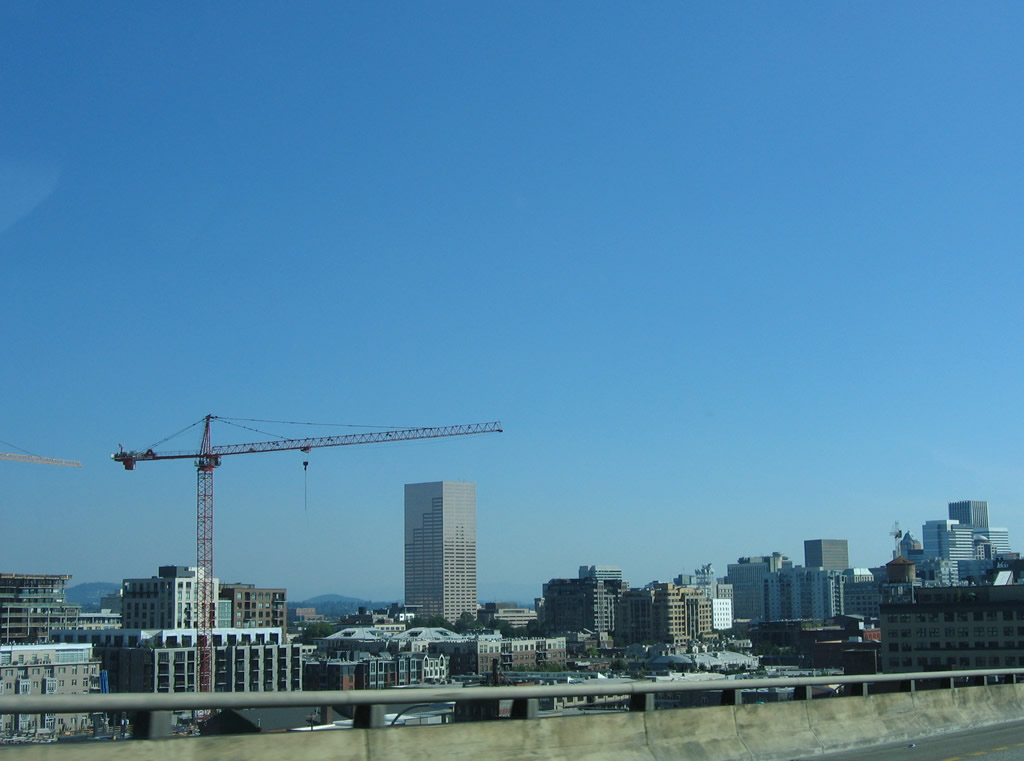
08/27/06
The Downtown Portland skyline to the southeast of I-405.
08/27/06
Everett Street connects the Northwest District and Pearl District. East-west streets in west Portland are named alphabetically from south to north between Ankey and Wilson Streets.
06/24/15
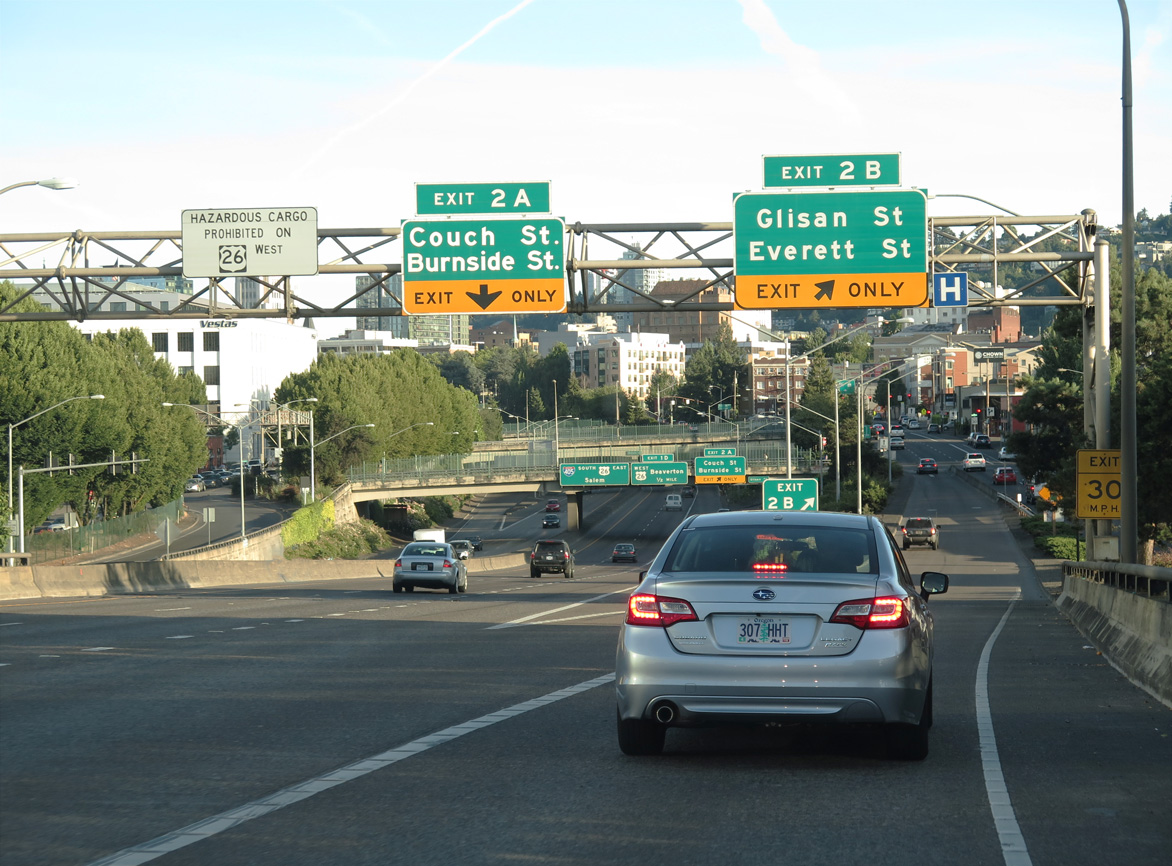
Exit 2 B departs from I-405 (Stadium Freeway) south. Exit 2 A follows to NW 15th Avenue south at Couch and Burnside Streets east of PGE Park (Home of the Portland Timbers MLS franchise).
06/24/15
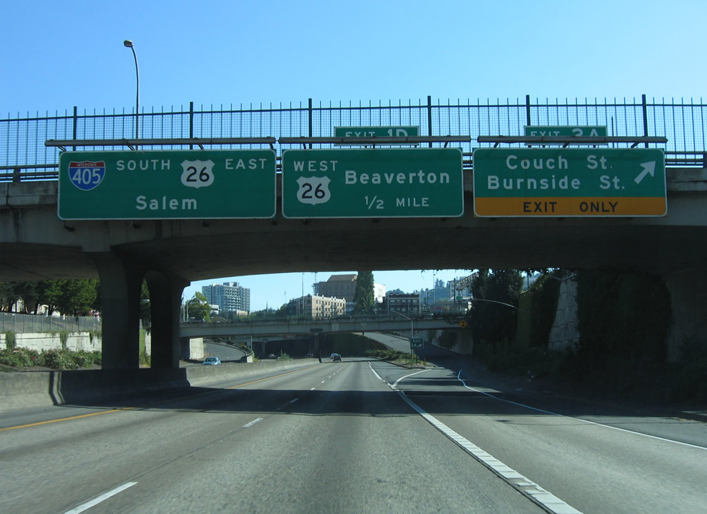
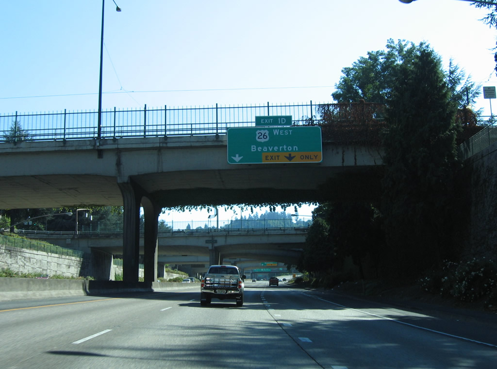
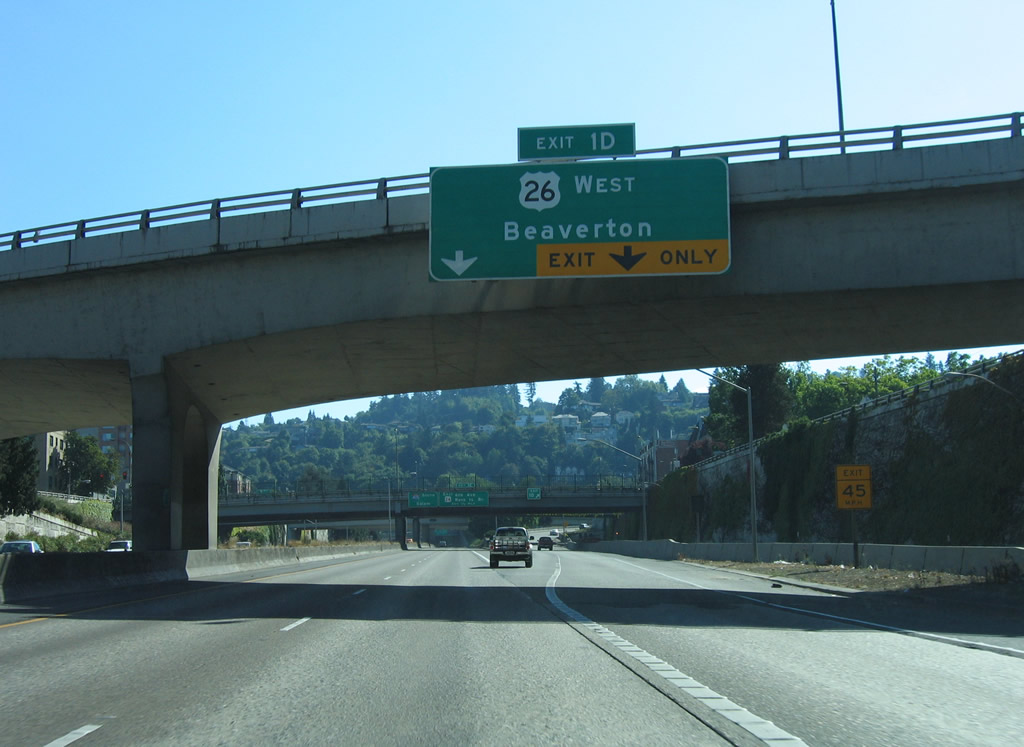
Exit 2 A ties into the intersection of NW 15th Avenue at Couch Street, one block north of Burnside Street. U.S. 26 (Sunset Highway) converges with the Stadium Freeway south next at a directional T interchange (Exit 1 D).
08/27/06
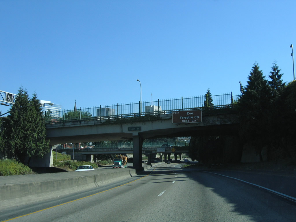
Interstate 405 travels below grade from the Couch Street overpass parallel to SW 14th Avenue east of the Goose Hollow neighborhood. West from Exit 1 D, U.S. 26 passes through the Vista Ridge Tunnels en route to Washington Park and the Oregon Zoo.
08/27/06
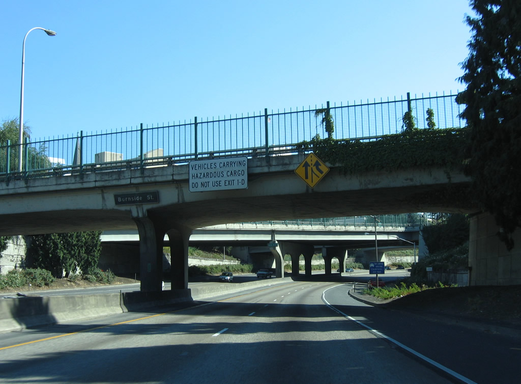
Vehicles carrying hazardous materials are prohibited from using the Vista Ridge Tunnels on U.S. 26. The Hazmat detour follows Interstate 5 to OR 217 north.
08/27/06
U.S. 26 (Sunset Highway) originally followed Naito Parkway north with OR 99W to the couplet of Market Street (east) and Clay Street (west) through the Portland city center. U.S. 26 was realigned onto Interstate 405 in 2005 (U.S. Route 26 in Oregon, 2025).
08/27/06
U.S. 26 (Sunset Highway) constitutes a full freeway west to Beaverton, Hillsboro, and many unincorporated suburbs of Portland. U.S. 26 extends 74 miles from Exit 1 D to U.S. 101, south of Seaside.
08/27/06
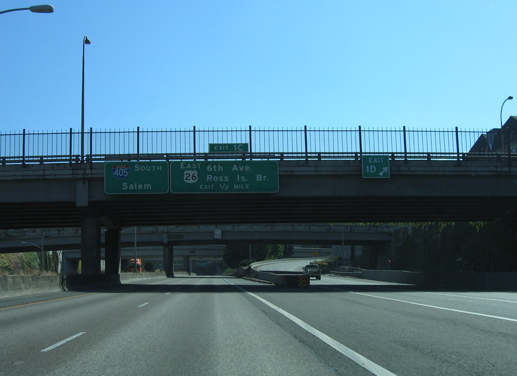
U.S. 26 east joins Interstate 405 south from Sunset Highway to SW Broadway. U.S. 26 continues from Exit 1 C along the locally maintained route of SW Broadway, 5th Avenue, Sheridan Street, 3rd Avenue and Arthur Street to Naito Parkway.
08/27/06
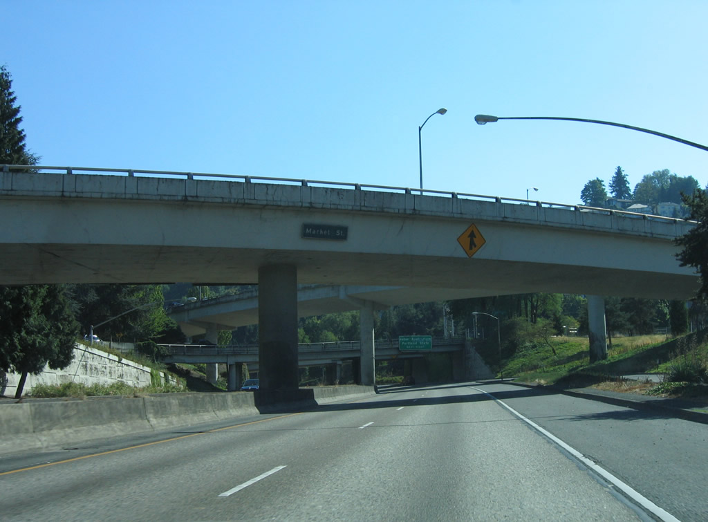
Market Street (old U.S. 26) splits from Sunset Highway east above Interstate 405 at the exchange with U.S. 26 (Sunset Highway).
08/27/06
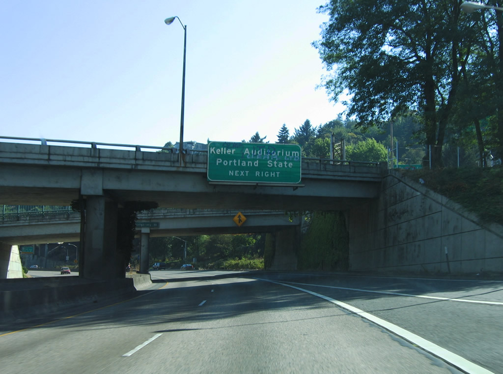
An entrance ramp provides access from Taylor Street and SW 13th Avenue onto Interstate 405 south at Montgomery Street. Forthcoming Exit 1C connects with SW 6th Avenue north to Portland State University and Keller Auditorium via Market Street east.
08/27/06
South  East
East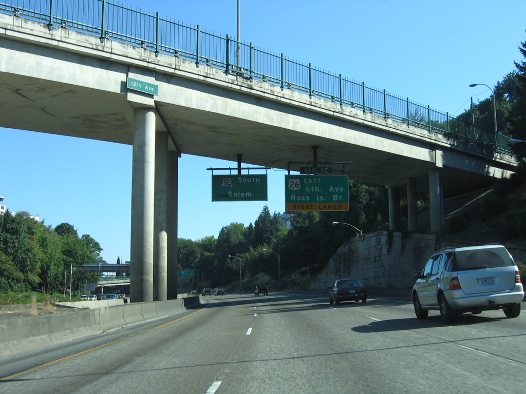
The busiest part of Interstate 405 is where traffic from U.S. 26 eastbound conflicts with entering traffic from Montgomery Street and exiting traffic to SW Broadway. Substantial traffic congestion ensues during peak rush hours. Lake Oswego, Southwest Portland, the Ross Island Bridge and Milwaukie are all accessed through Exit 1 C.
08/27/06
I-405 (Stadium Freeway) curves east from Exit 1 C and U.S. 26 to Interstate 5 at the Marquam Bridge. U.S. 26 spans the Willamette River along the Ross Island Bridge between Naito Parkway (OR 10) and Powell Boulevard.
08/27/06
South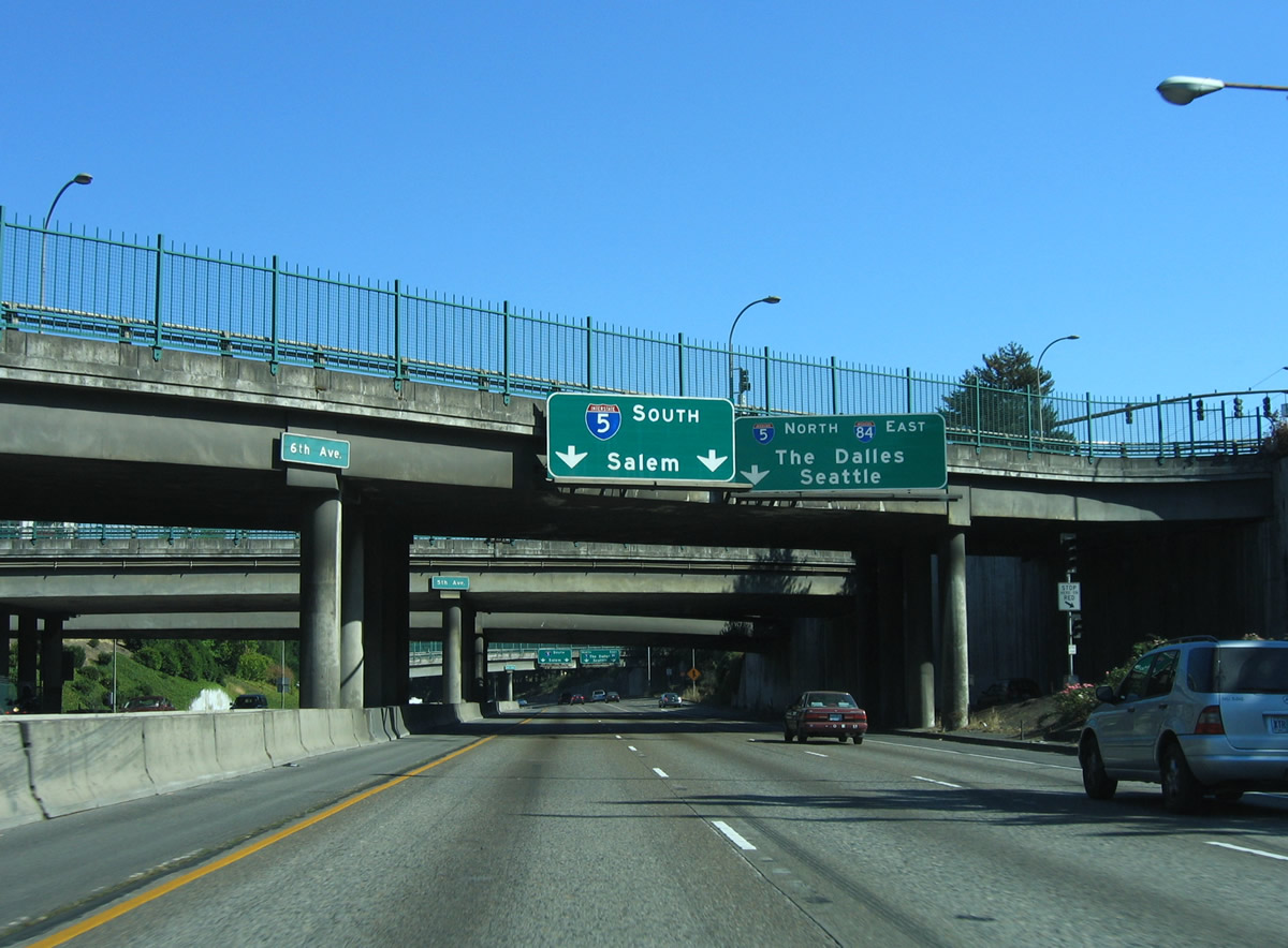
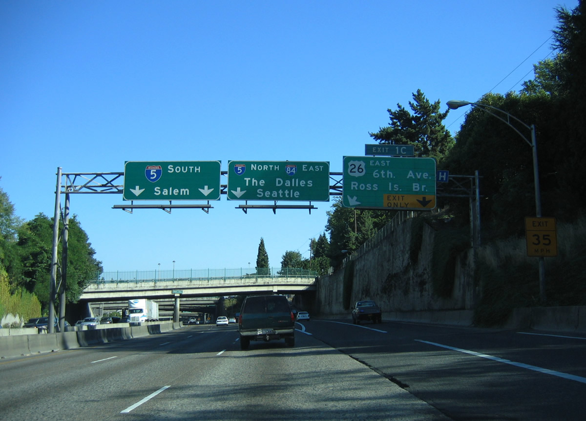
6th and 5th Avenues pass overhead a third of a mile from the unnumbered exit to Interstate 5 north.
08/27/06
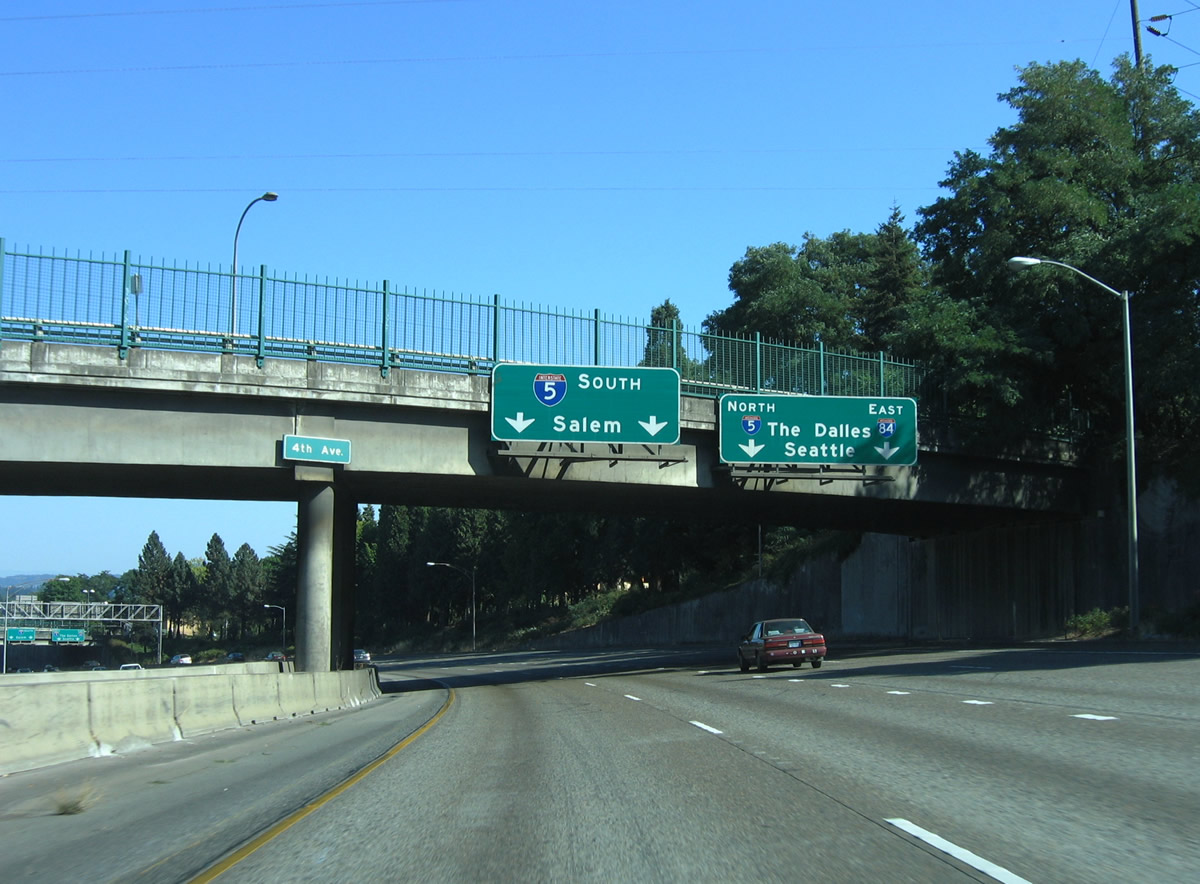
Traffic partitions into two lane ramps at the directional T interchange with Interstate 5. The left lanes of I-405 south default onto I-5 south for the capital city of Salem, Eugene, and eventually California.
08/27/06
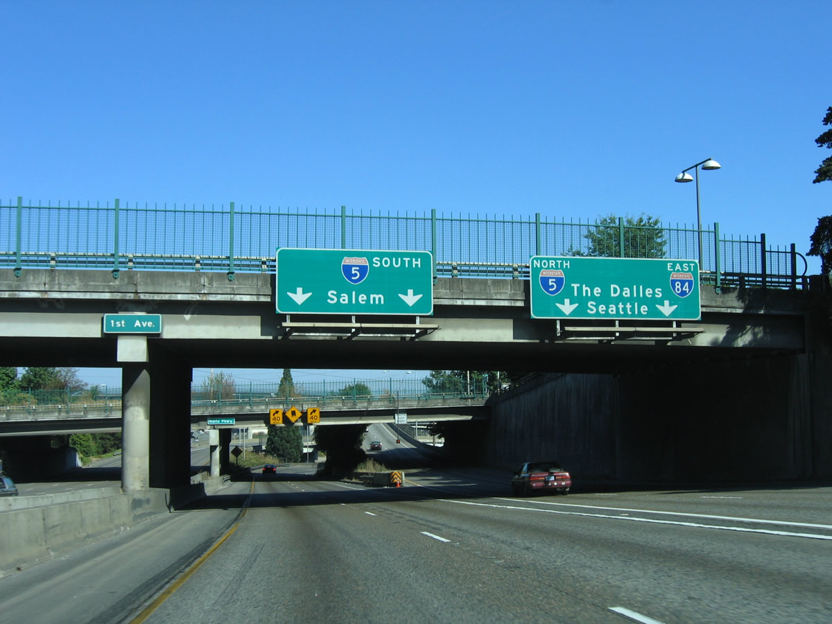
The right lanes of I-405 south access the Marquam Bridge along I-5 north to Seattle and British Columbia as well as I-84 east for the Columbia River Gorge. The southbound ramp to I-5 first joins S Harbor Drive.
08/27/06
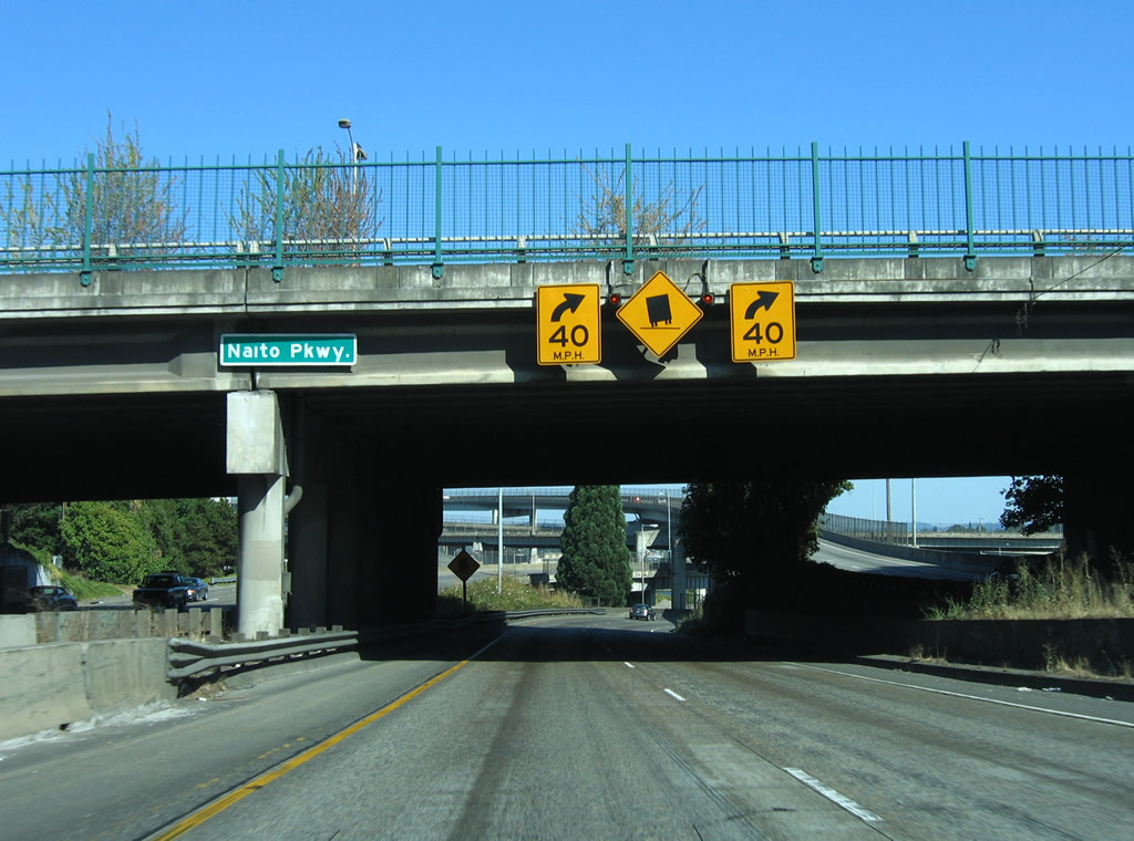
S Harbor Drive was the original expressway leading south from the Portland city center to Interstate 5. Historically OR 99W followed Harbor Drive before shifting to Naito Parkway.
08/27/06
A flyover located at milepost 300 brings Interstate 5 south from the Marquam Bridge alongside S Harbor Drive. Harbor Drive was removed as a river side expressway north of Market Street following a permanent closure in May in 1974 (Harbor Drive, 2025).
08/27/06
References:
Fremont Bridge (Portland, Oregon). (2010, November 28) In https://en.wikipedia.org/w/index.php?title=Fremont_Bridge_(Portland,_Oregon)&oldid=399282974
Interstate 405 (Oregon). (2023, September 9). In AARoads Wiki. Retrieved August 25, 2025, from https://wiki.aaroads.com/wiki/Interstate_405_(Oregon)
U.S. Route 30 in Oregon. (2024, January 2). In AARoads Wiki. Retrieved August 25, 2025, from https://wiki.aaroads.com/wiki/U.S._Route_30_in_Oregon#History
U.S. Route 26 in Oregon. (2025, August 16). In AARoads Wiki. Retrieved August 25, 2025, from https://wiki.aaroads.com/wiki/U.S._Route_26_in_Oregon
Harbor Drive. (2025, July 1). In AARoads Wiki. Retrieved August 25, 2025, from https://wiki.aaroads.com/wiki/Harbor_Drive
Photo Credits:
- AARoads: 08/27/06
- Andrew Fields: 06/02/06
- Andy Field: 06/24/15
Connect with:
Page Updated Monday August 25, 2025.