
Interstate 465 Outer Loop - Five Points to Castleton
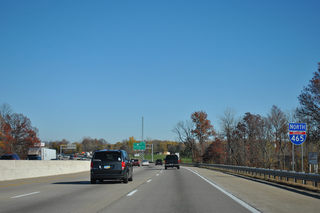
 North
North
The cloverleaf interchange at the east split of I-74/465 was upgraded to include flyovers from Interstate 74 west onto the beltway and from the beltway south onto I-74 east.
10/16/04
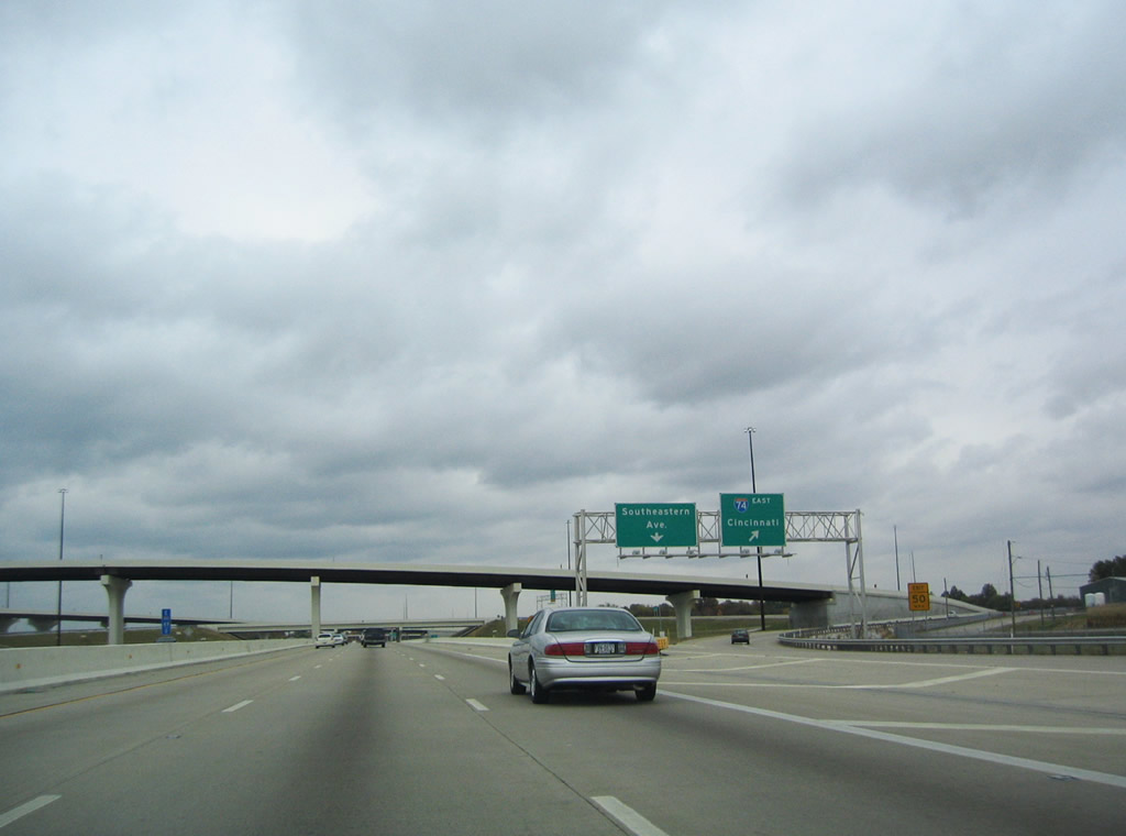
The Interstate 74 mainline reduces to a single lane off-ramp from the c/d roadway at Exit 49. I-74 extends southeast to Cincinnati, Ohio. Separate segments of I-74 are also signed in North Carolina between the Virginia state line and Lumberton. Long range plans called for the two sections to be linked, but it is highly unlikely that Ohio or West Virginia will complete their sections of I-74 freeway.
10/16/04
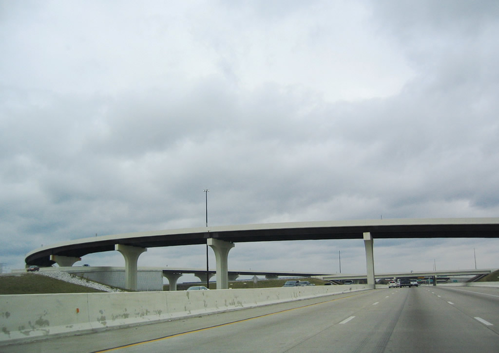
Interstate 465 north beyond the separation with I-74 east at Exit 49.
10/16/04

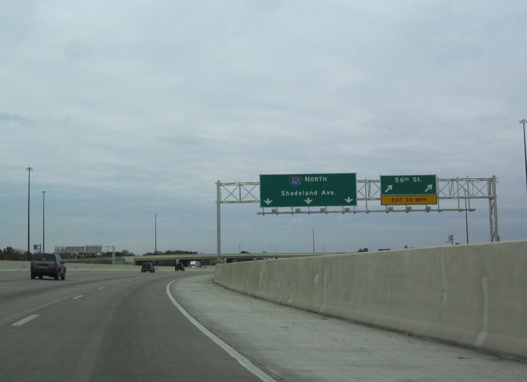
A loop ramp joins the c/d roadway at Exit 49 for the freeway spur linking I-74 with Southeastern Avenue. Southeastern Avenue (former U.S. 421) continues to Washington Street (old U.S. 40) outside Downtown Indianapolis. A wye interchange with Shadeland Avenue (former SR 100) follows from the c/d road.
11/04/11
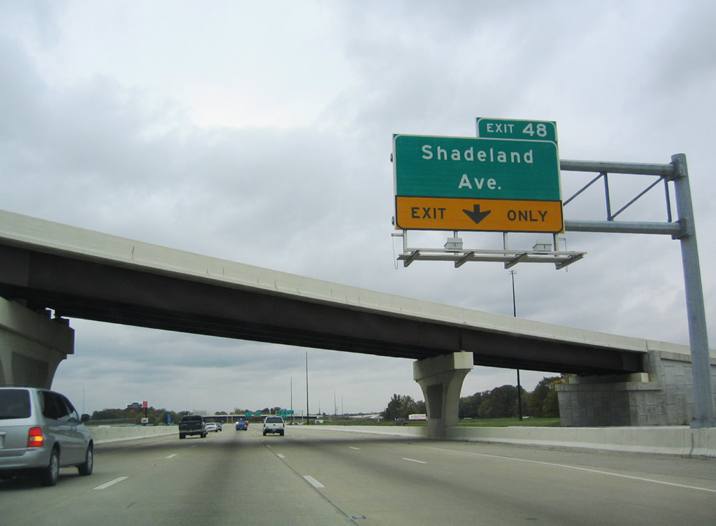
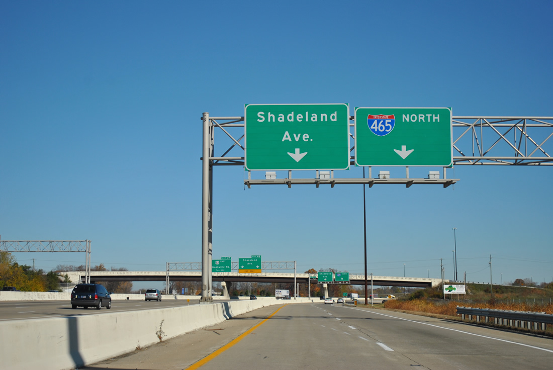
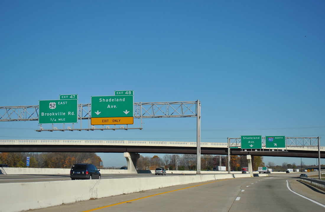
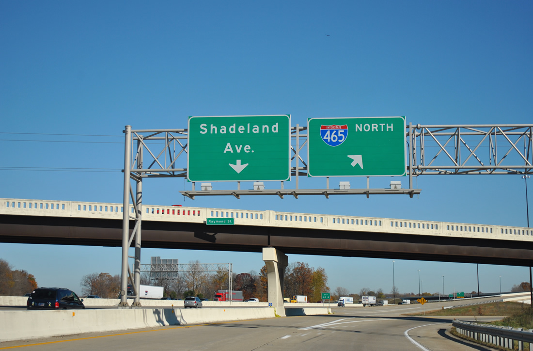
Exit 48 is a slip ramp linking the Interstate 465 northbound mainline onto the adjacent c/d road for Shadeland Avenue north to Warren Park.
10/16/04
Shadeland Avenue is a freeway between Exit 48 and Washington Street (old U.S. 40). It was built as the predecessor to the Indianapolis beltway and signed as SR 100 until 1999.
11/04/11
Two lanes depart Interstate 465 north at Exit 48 for the flyover leading onto Shadeland Avenue.
11/04/11
Shadeland Avenue parallels the beltway north to Lawrence and again from Exit 40 to I-69/SR 37.
11/04/11
U.S. 52 west combines with Interstate 465 north from Brookville Road at Exit 47 to I-865 west at Exit 25. U.S. 52 enters Indianapolis from Rushville and the Julietta area of southeast Indianapolis.
11/04/11
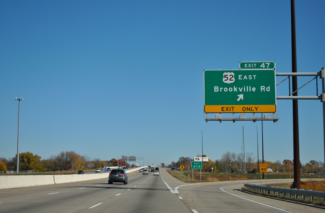
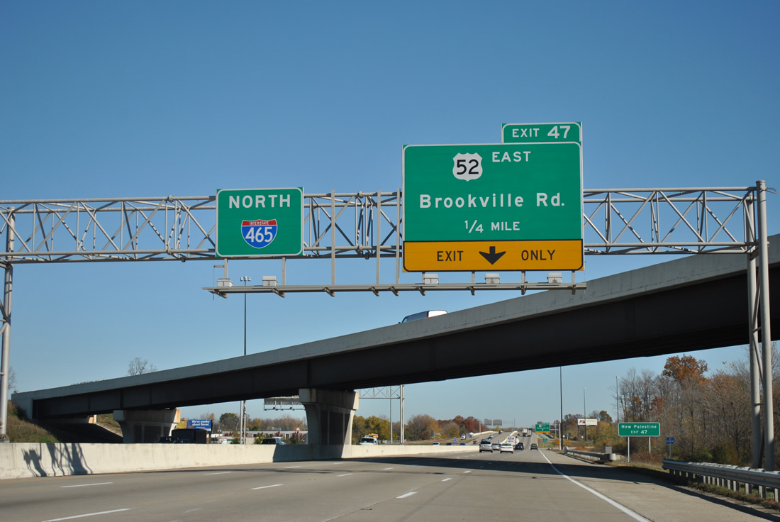
A folded diamond interchange at Exit 47 joins Interstate 465 with U.S. 52 east and Brooksville Road. Brookville Road west carried U.S. 52 to English Avenue, where the route shifted west to Southeastern Avenue (old U.S. 421). Brookville Road east continues U.S. 52 east from Exit 47 to the county line en route to New Palestine.
11/04/11
Reassurance shield for Interstate 465 northbound posted after the Baltimore And Ohio Railroad under crossing
11/04/11
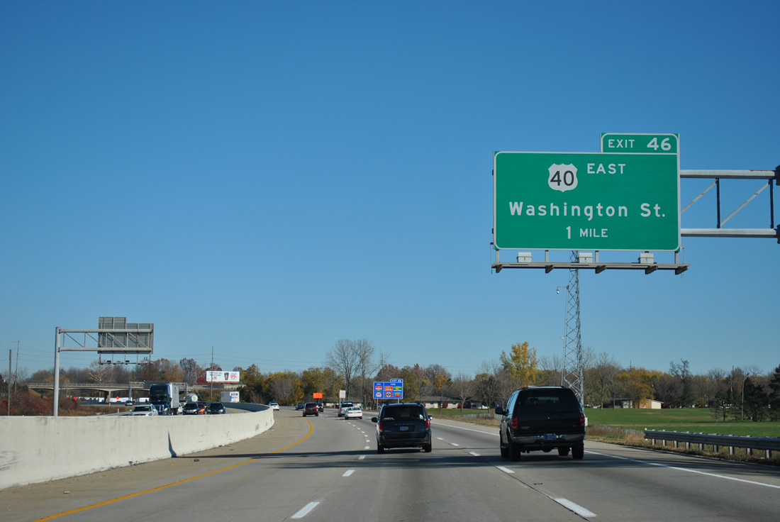
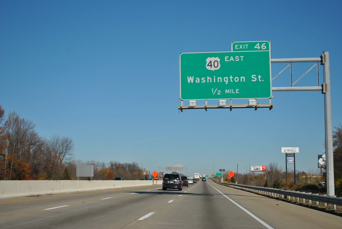
I-465 advances one mile north to a folded diamond interchange (Exit 46) with U.S. 40 (Washington Street) east. U.S. 40 follows Interstate 465 along an unmarked concurrency from Exit 12 at Ben Davis to Exit 46 near Warren Park.
11/04/11
U.S. 40 continues east along Washington Street from Exit 46 to Cumberland and Greenfield. Westward Washington Street travels through the Irvington and Southeast neighborhoods to Downtown Indianapolis.
11/04/11
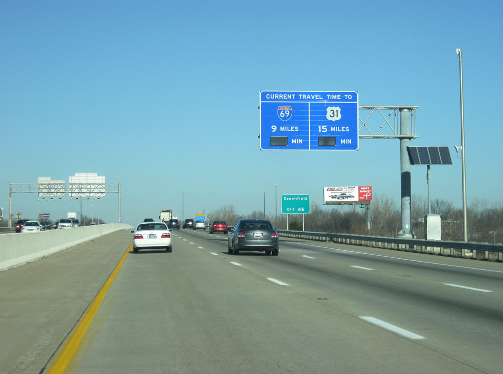
A travel time sign preceding Lick Creek on I-465 north advises motorists of the distance and estimated time to reach Interstate 69 and U.S. 31. As of late 2011, the signs were not yet operational.
12/17/11
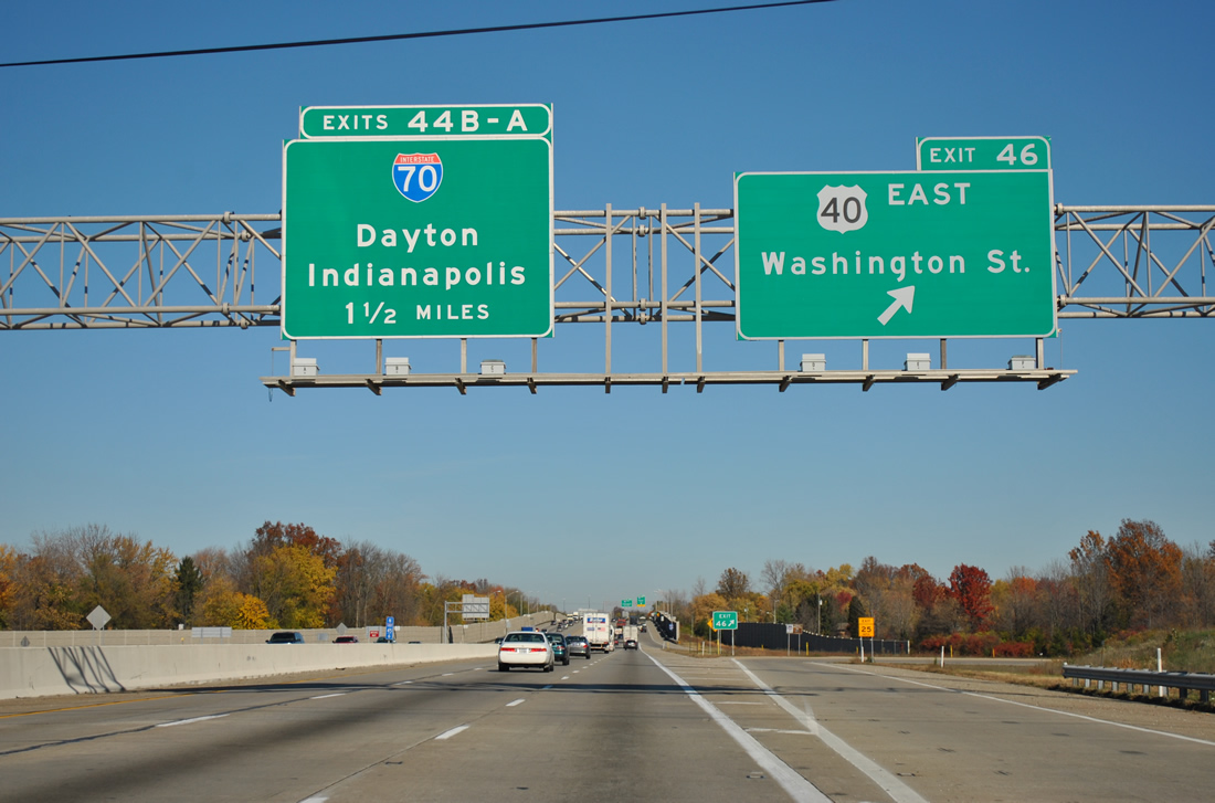
Exit 46 loops away from I-465 north for U.S. 40 east and Washington Street, 1.5 miles south of Exits 44 B/A for Interstate 70. Washington Street west meets the expressway portion of Shadeland Avenue (old SR 100) just to the west at Warren Park. Washington Place is just to the east of the freeway.
11/04/11
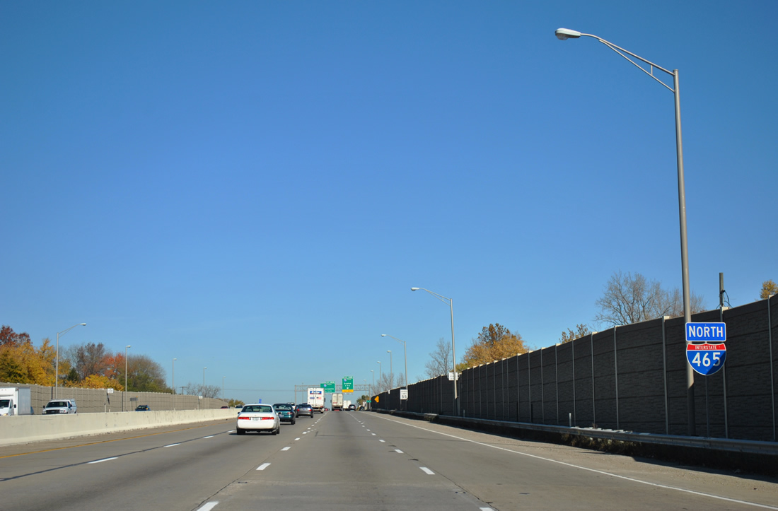
This stretch of Interstate 465 doubles as U.S. 31/36/52/421 and also SR 37/67. It will also be part of Interstate 69 when the extension southward is completed in Fall 2024.
11/04/11
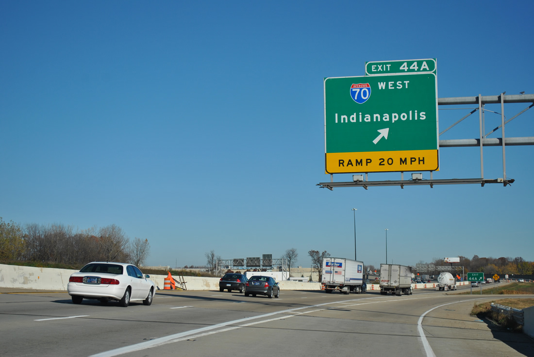
Stretching 156.60 miles across the Hoosier State, forthcoming Interstate 70 joins Downtown Indianapolis with Richmond in eastern Indiana.
11/04/11

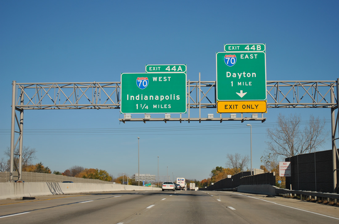
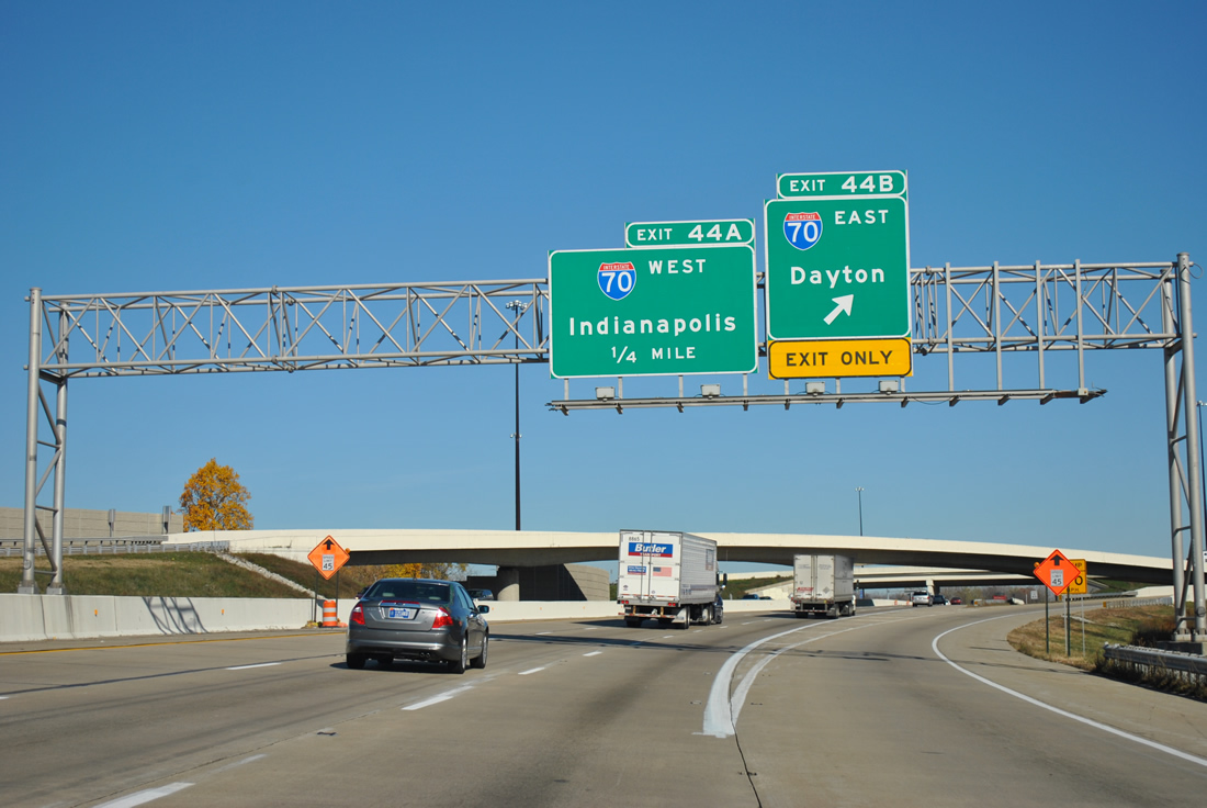
16th Street spans I-465 a half mile from Exit 44 B for Interstate 70 east to Dayton, Ohio. A half turbine interchange joins the two freeways northeast of Warren Park.
11/04/11
Interstate 70 travels east to Richmond, Dayton, and Columbus, Ohio. Paralleling or superseding U.S. 40 for the majority of the route between Cove Fort, Utah and Baltimore, Maryland, Interstate 70 is 2,153 miles in length.
11/04/11
Interstate 70 continues 6.4 miles west to combine with I-65 south near Downtown Indianapolis. The entire length of I-70 within Indiana was completed by 1976.1
11/04/11
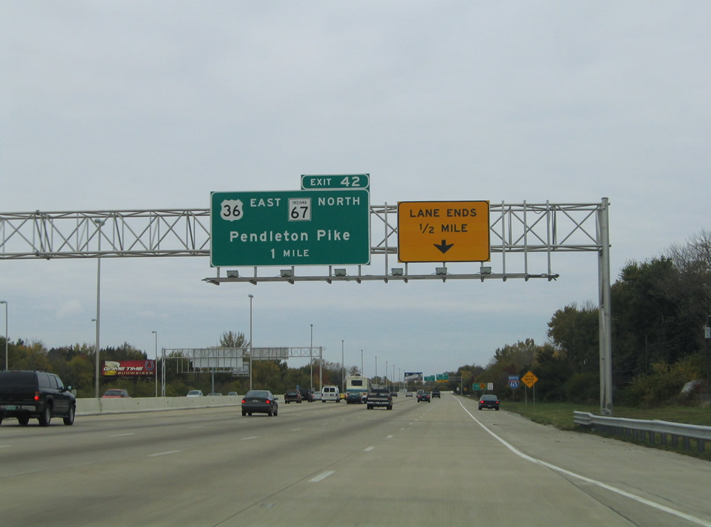
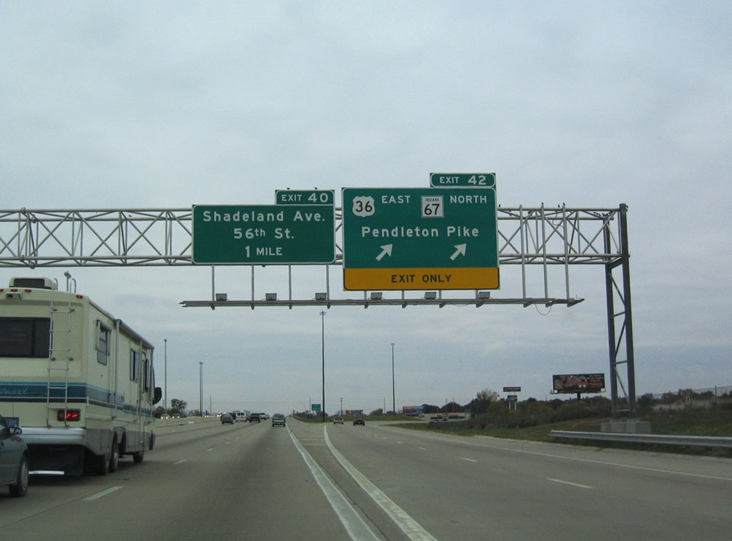
Interstate 465 expands to 13 overall lanes between I-70 and the viaduct over the CSX Railroad and 30th Street. Meeting the beltway next is Pendleton Pike at the city of Lawrence. Pendleton Pike represents the historic alignment of U.S. 36/SR 67 west to E 38th Street and Massachusetts Avenue (former SR 367).
10/16/04
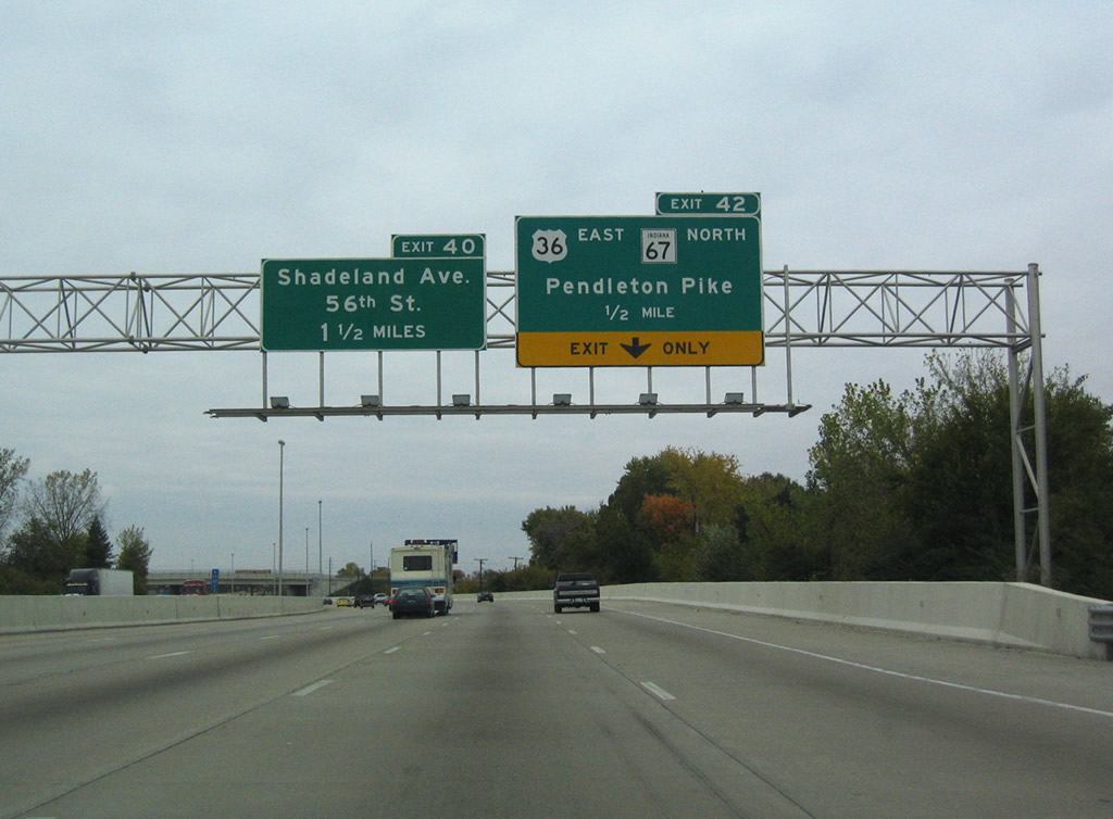
A diamond interchange joins I-465 with Pendleton Pike and the continuation of U.S. 36 east and SR 67 north. U.S. 36 follows the beltway from Exit 13 near Lynhurst to Exit 42. SR 67 joins I-465 at Exit 8 near Valley Mills. Neither overlaps are marked.
10/16/04
U.S. 36/SR 67 (Pendleton Pike) angle northeast through Lawrence to Oaklandon and the county line. The two routes separate at Huntsville near Interstate 69. SR 67 overall travels 199.3 miles between Vincennes and the Ohio state line east of Trinity.
10/16/04
Northbound confirming marker for Interstate 465 posted between a CSX Railroad underpass and 46th Street at Lawrence.
10/16/04
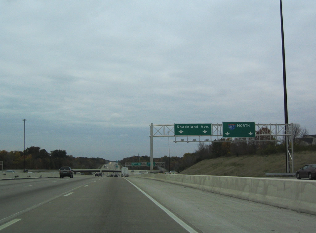
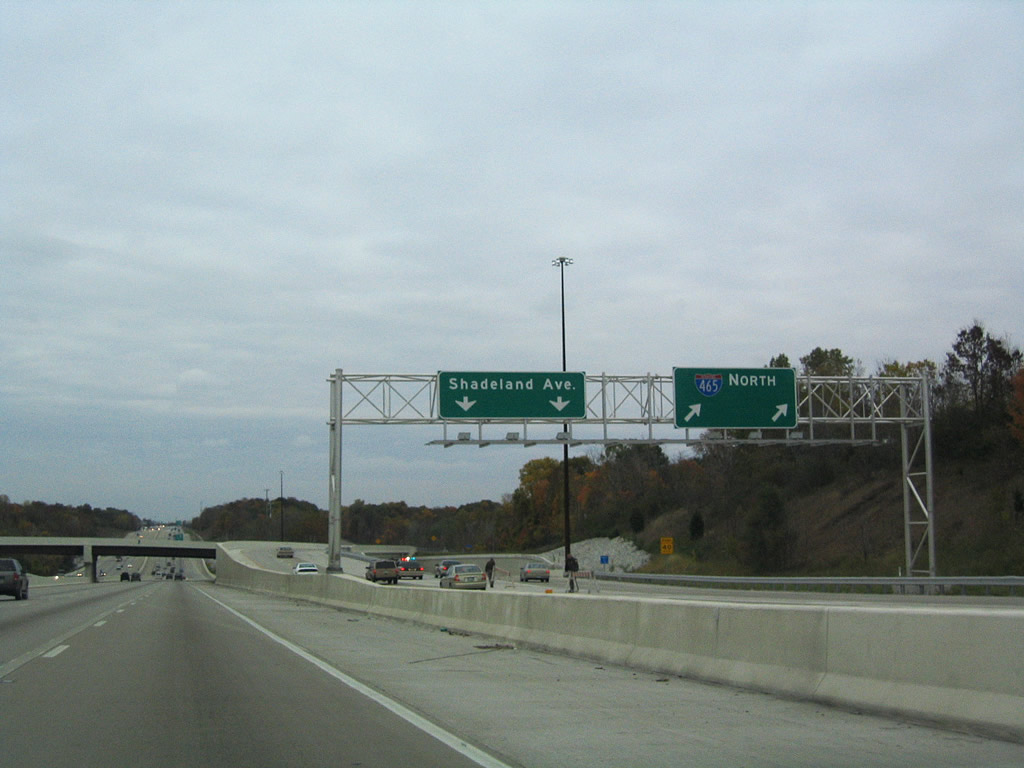
Interstate 465 overtakes Shadeland Avenue north from a wye interchange at 52nd Street in Lawrence.
10/16/04
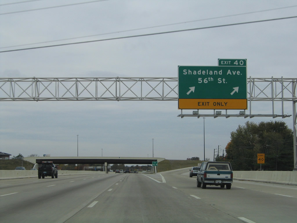
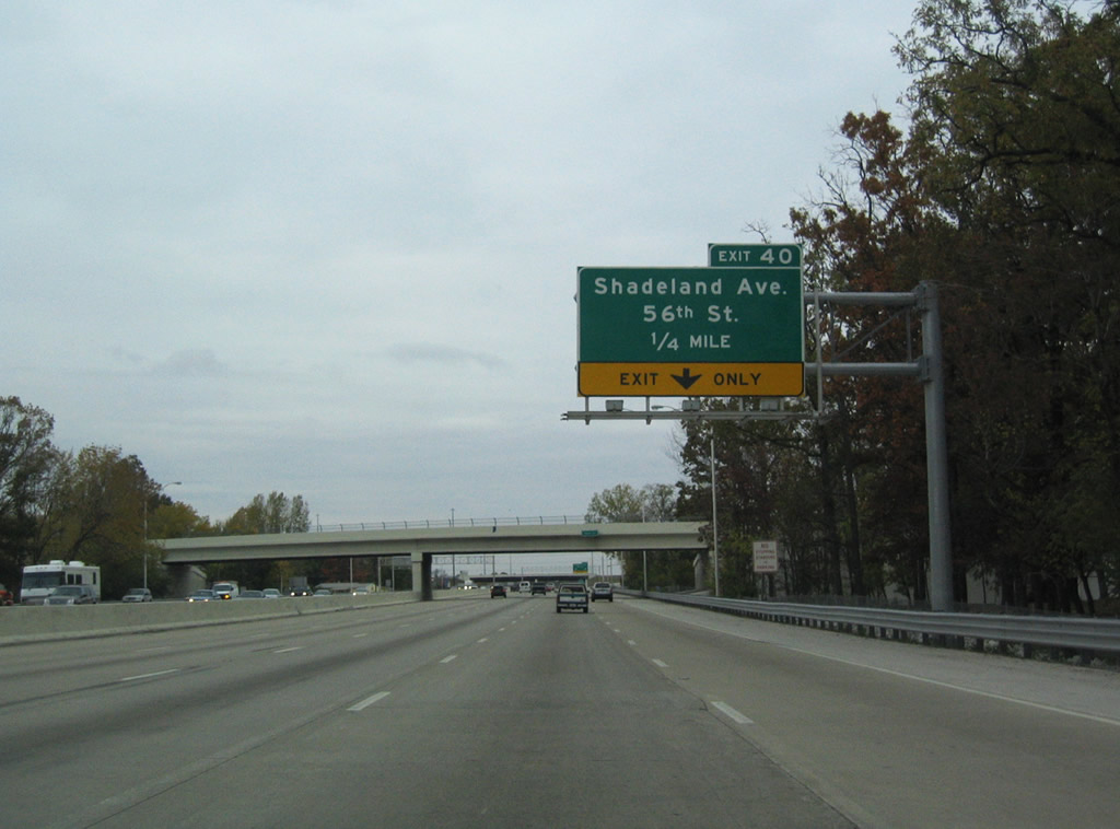
I-465 expands with collector distributor roadways north to the six-ramp parclo interchange (Exit 40) at 56th Street and the continuation of Shadeland Avenue across Fall Creek.
10/16/04
56th Street constitutes an arterial linking Interstate 465 with Fort Benjamin Harrison to the east and the Brendonwood neighborhood to the west.
10/16/04
Shadeland Avenue extends north from Exit 40 to 82nd Street at Interstate 69.
10/16/04
Continuing from a wye interchange with I-465, Shadeland Avenue parallels the beltway by an array of business parks, apartment complexes and Community Hospital North.
10/16/04
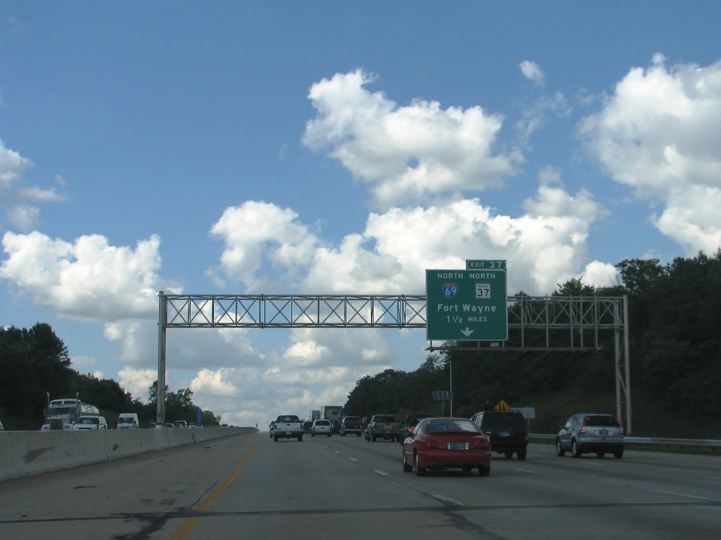
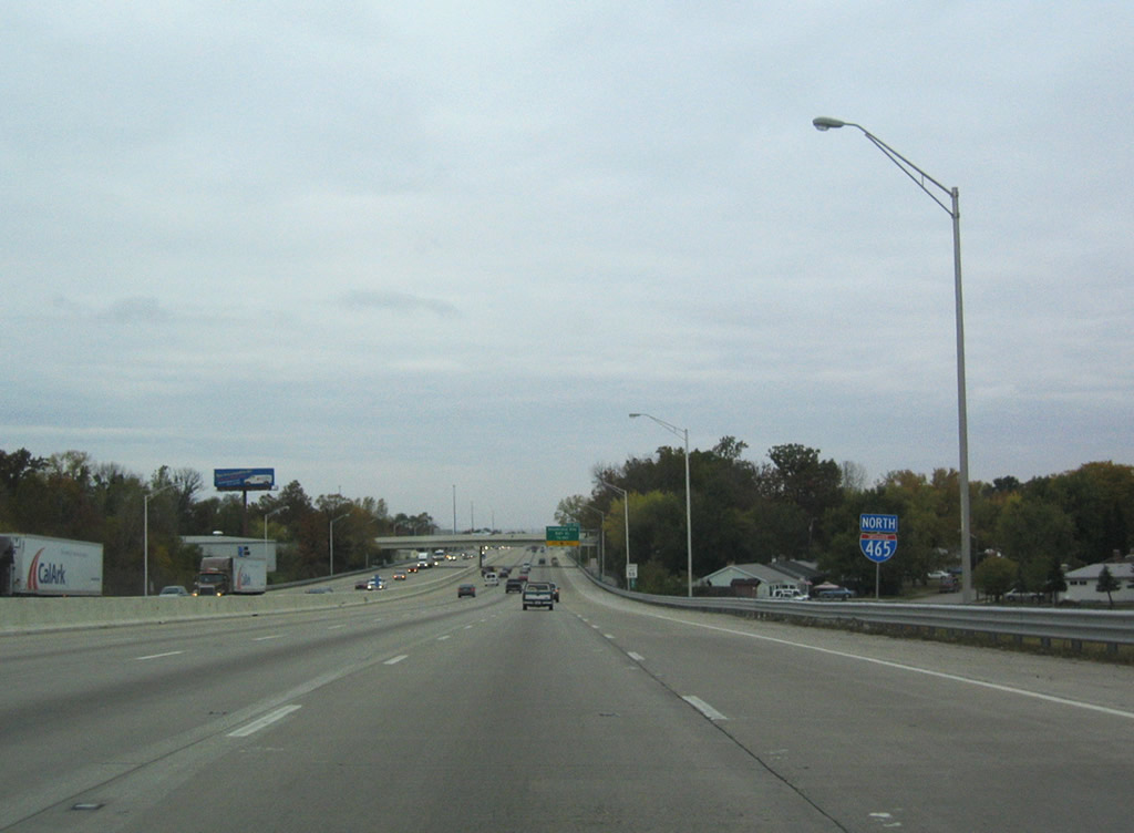
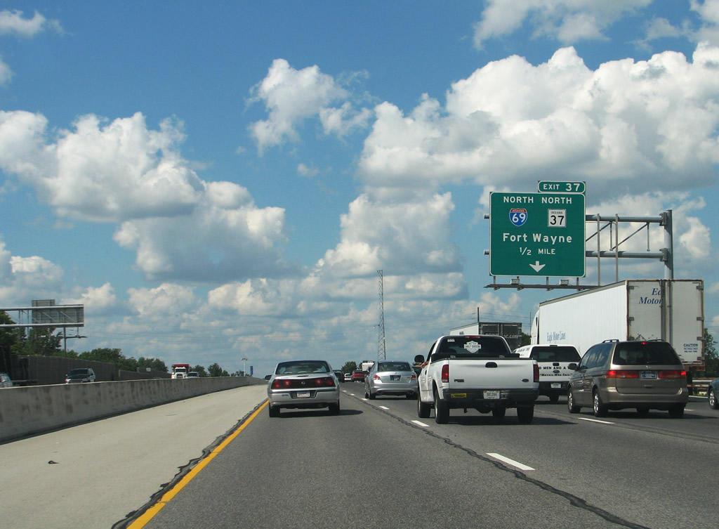
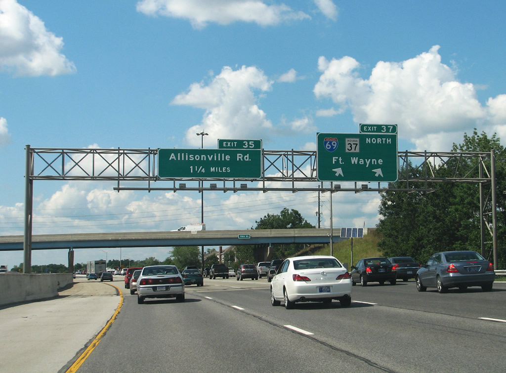
The succeeding exit along I-465 north is with the continuation of Interstate 69 to Fort Wayne and SR 37 to Noblesville.
07/31/09
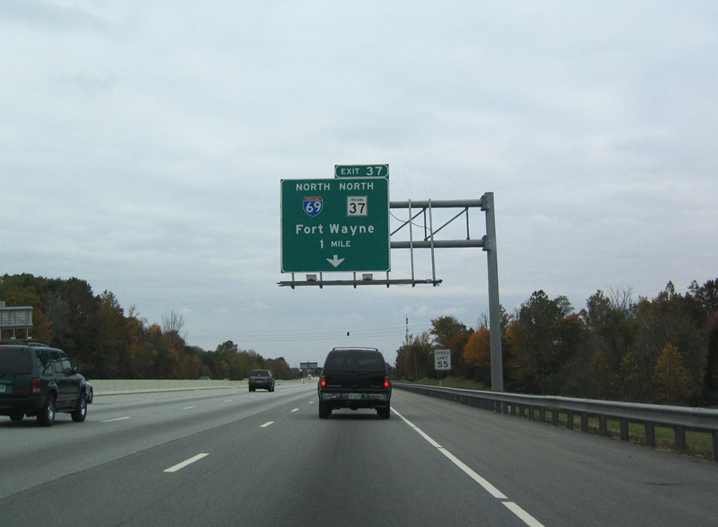
SR 37 follows Interstate 465 north from Exit 4 to Interstate 69 near Castleton and I-69 northeast to Fishers. I-69 travels 22 miles to Anderson en route to Muncie, Huntington and Fort Wayne.
10/16/04
Interstate 69 overtakes Binford Boulevard (former SR 37) north from Exit 37 The freeway spur southwest to E 75th Street is a remnant from the unconstructed alignment of I-69 between I-65/70 at Downtown and the beltway.
07/31/09
The original 157.30 miles of Interstate 69 within Indiana was completed by 1970.2 The route joins Indianapolis with Lansing, Flint and Port Huron, Michigan.
07/31/09

References:
- Indiana Highway Ends - I-70 (HighwayExplorer).
http://www.highwayexplorer.com/EndsPage.php?id=3070 - Indiana Highway Ends - I-69 (HighwayExplorer).
http://www.highwayexplorer.com/EndsPage.php?id=3069
Photo Credits:
- AARoads: 10/16/04
- ABRoads: 11/04/11
- Thomas Decker: 12/17/11
- Andy Field, Carter Buchanan: 07/31/09
- Carter Buchanan: 07/31/09
Connect with:
Page Updated Sunday January 15, 2012.