
Interstate 470 East / North

 East
East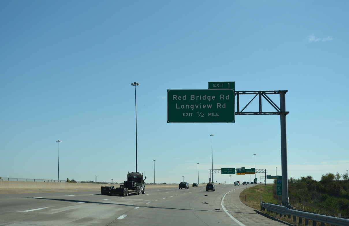
Initially running side by side with U.S. 71, Interstate 470 separates from I-435 east through the Three Trails Crossing Memorial Highway interchange. The ensuing exit is for both I-49/U.S. 71 south and Red Bridge Road.
11/03/16
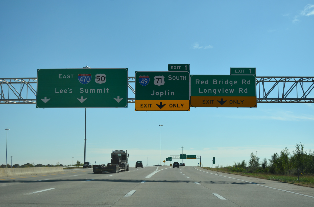
Two lanes split from I-470/U.S. 50 east for I-49/U.S. 71 south to Joplin and the adjacent diamond interchange with Red Bridge Road at Hickman Hills in south Kansas City.
11/03/16
Interstate 49 travels 137 miles south from the Three Trails Crossing Memorial Highway Interchange to I-44 outside Joplin in southwestern Missouri.
11/03/16
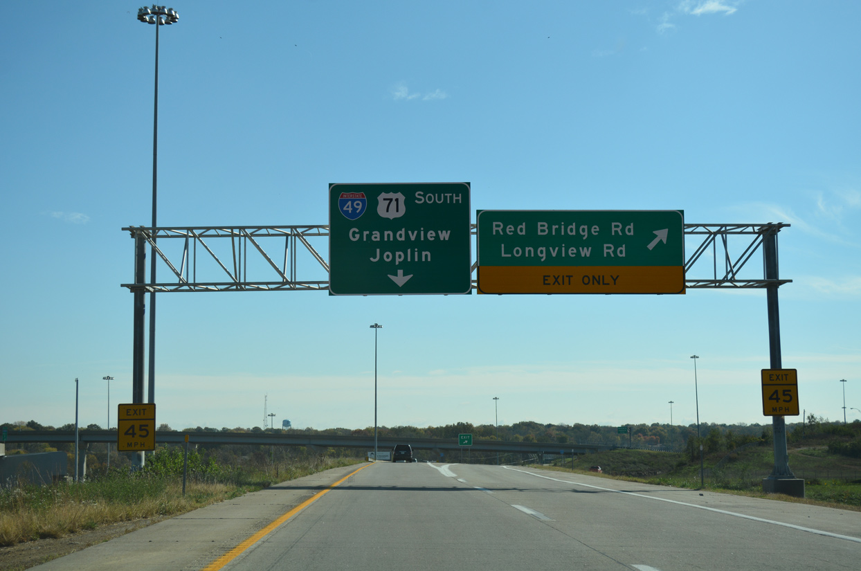
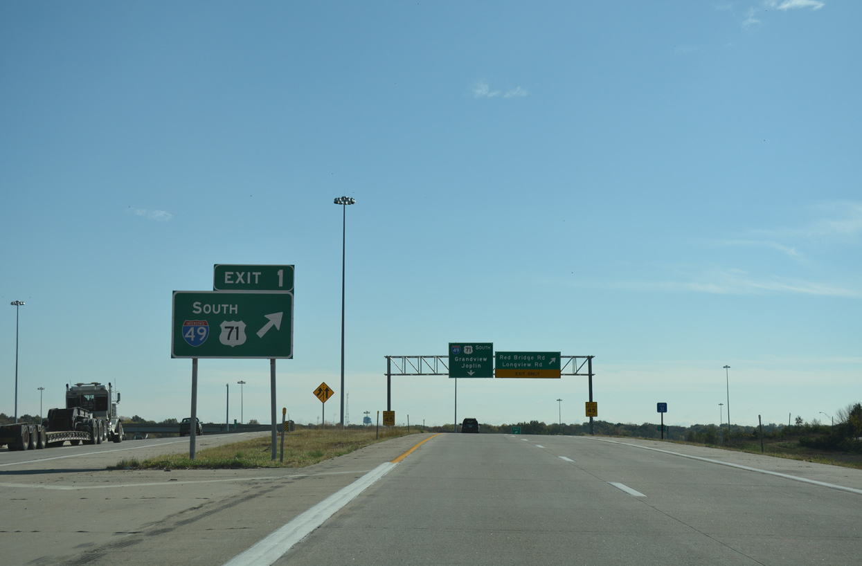
Exit 1 partitions with ramps leading directly onto I-49/U.S. 71 south to Grandview and the adjacent frontage road joining Red Bridge Road with Longview Road.
11/03/16
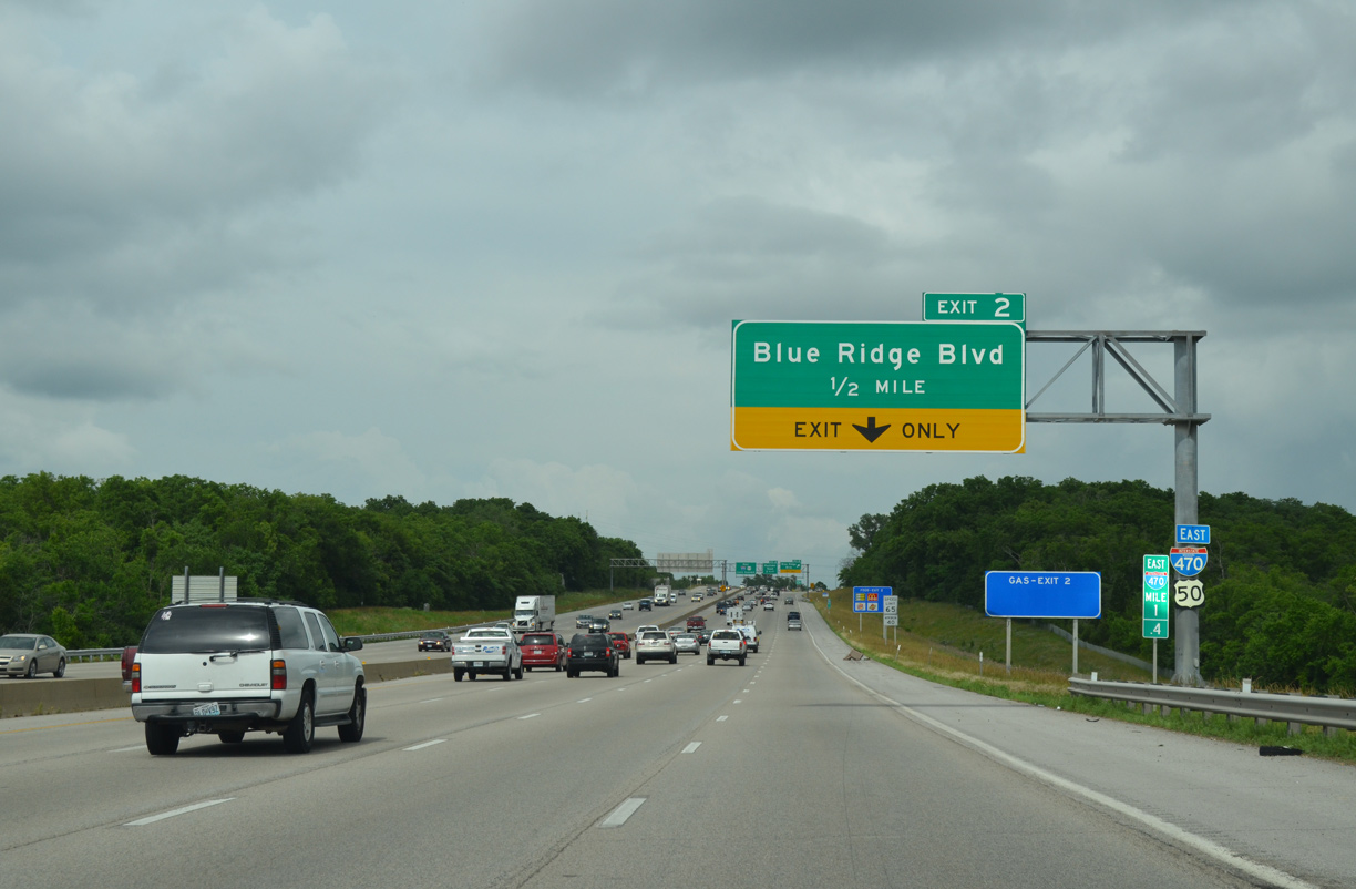
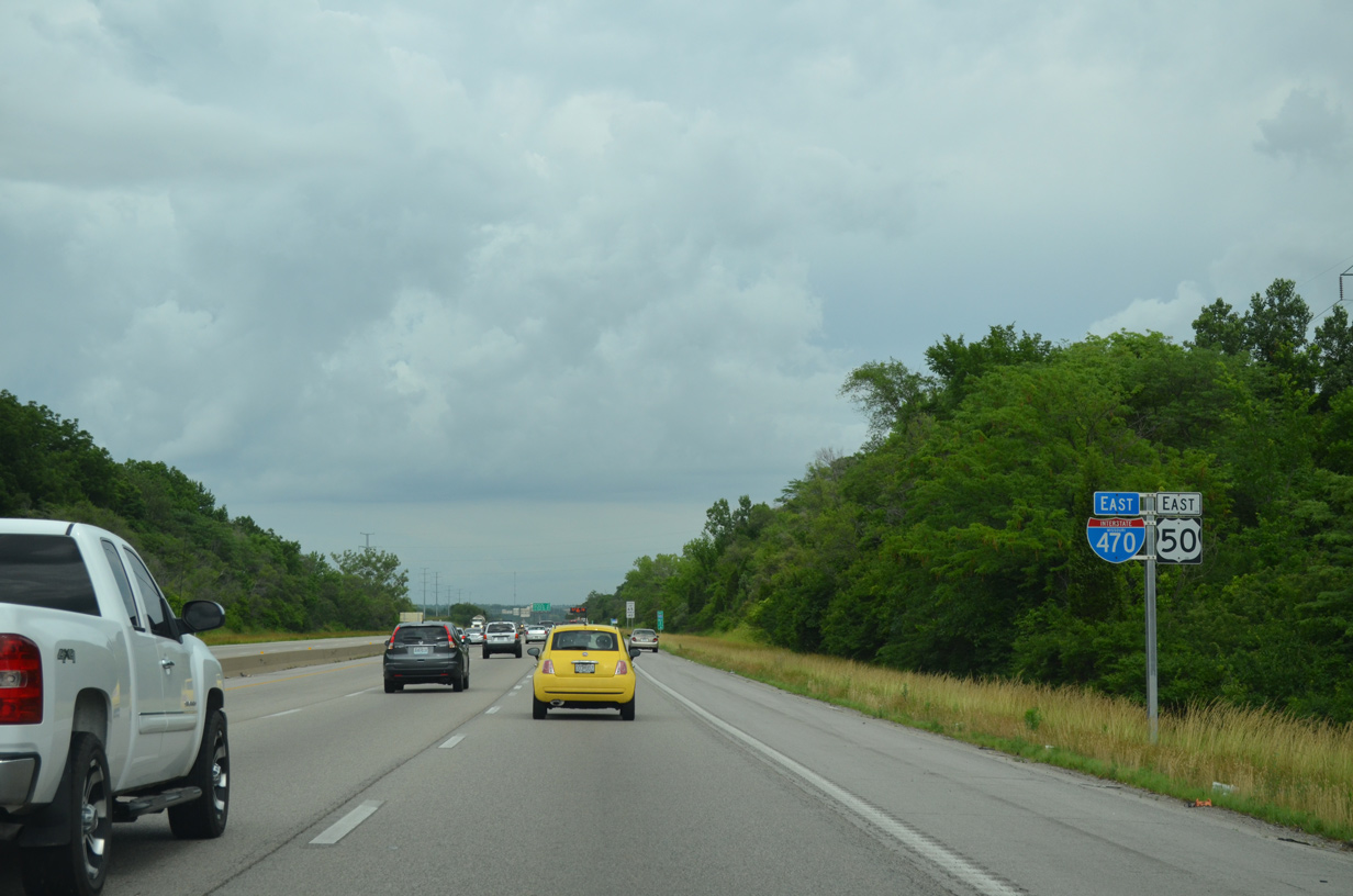
U.S. 50 extends east onto I-470 from I-435 north and the Three Trails Crossing Memorial Highway interchange to Lee's Summit. Four lanes of eastbound traffic lead away from I-49 to a diamond interchange (Exit 2) with Blue Ridge Boulevard.
06/18/15
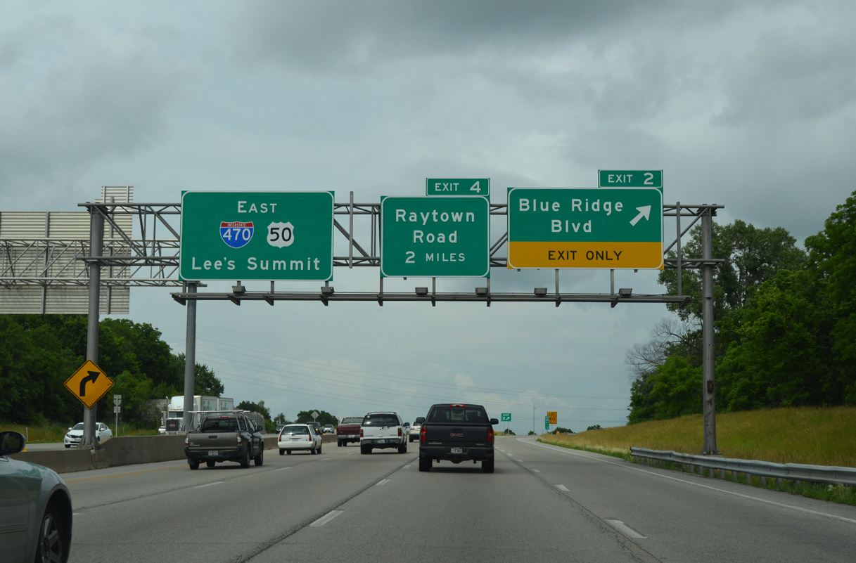
A lane drop occurs at Exit 2 for Blue Ridge Boulevard from I-470/U.S. 50 east. Blue Ridge Boulevard forms a four to five lane commercial boulevard north to the Bannister Acres and south to the Ruskin Heights residential neighborhoods.
06/18/15
Interstate 470/U.S. 50 turn east between the Bannister Acres and Hickman Mills South neighborhoods to a rural area north of Longview Lake.
06/18/15
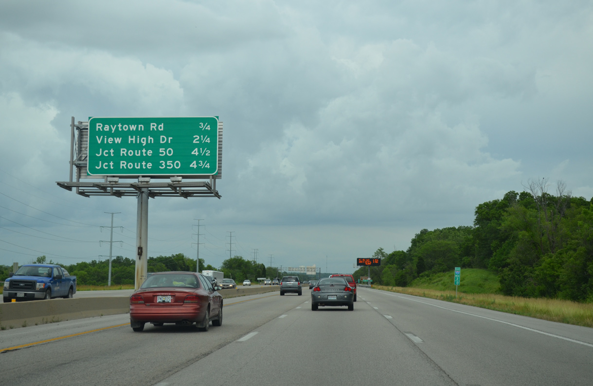
Interchange sequence sign outlining the next two Kansas city exits and first two off-ramps to Lee's Summit. U.S. 50 separates with I-470 in 4.5 miles.
06/18/15
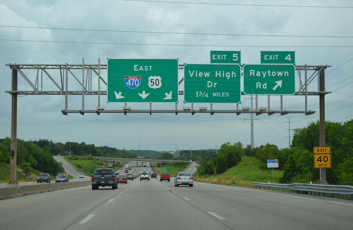
Raytown Road leads north to suburban areas such as Highview Estates and White Oak. South from the diamond interchange (Exit 4) with Interstate 470, Raytown Road continues as a four lane parkway west of Longview Lake to Grandview.
06/18/15
Maintaining six overall lanes, Interstate 470/U.S. 50 cross the Little Blue River along the ensuing stretch east of Raytown Road.
06/18/15

View High Drive straddles the Lee's Summit city line north from Longview Road and the Fred Arbanas Golf Course to meet Interstate 470/U.S. 50 at a diamond interchange (Exit 5).
06/18/15
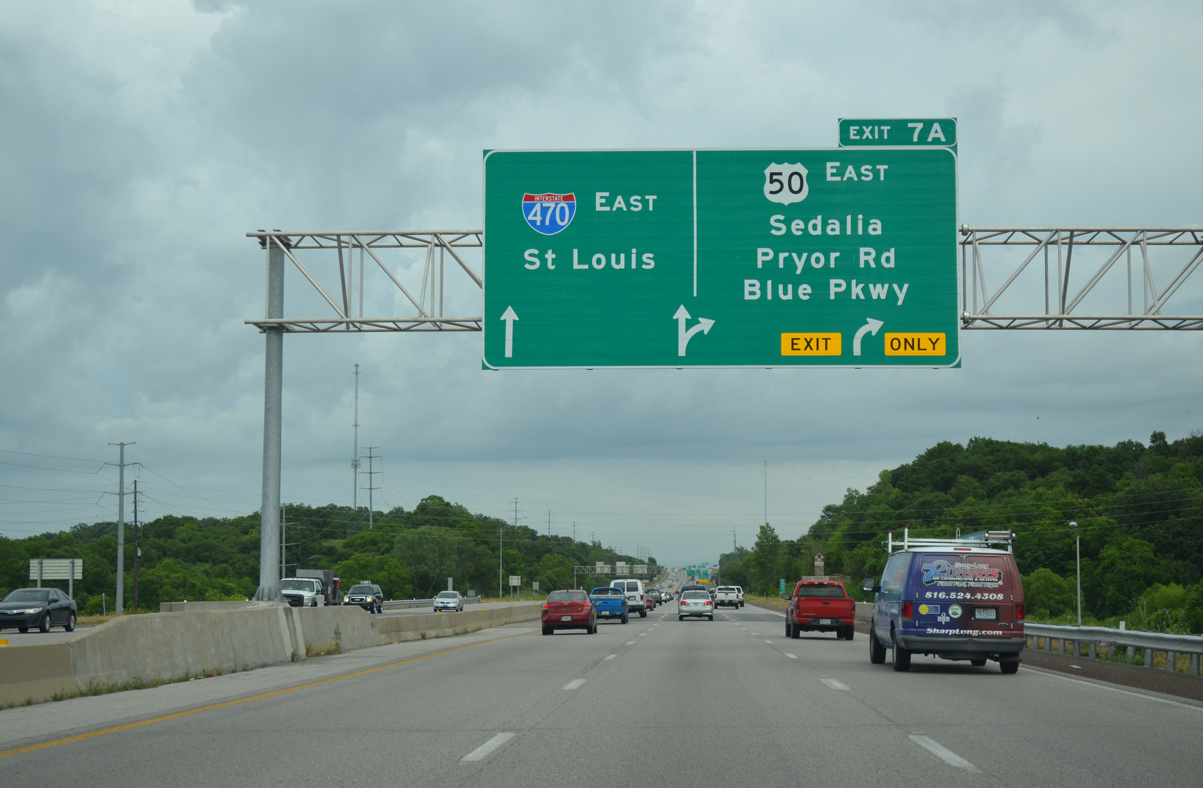
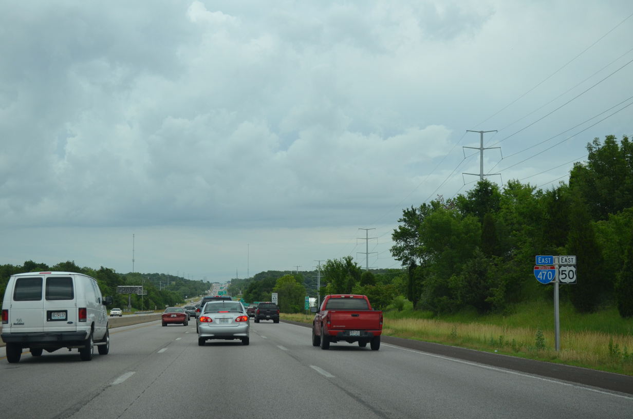
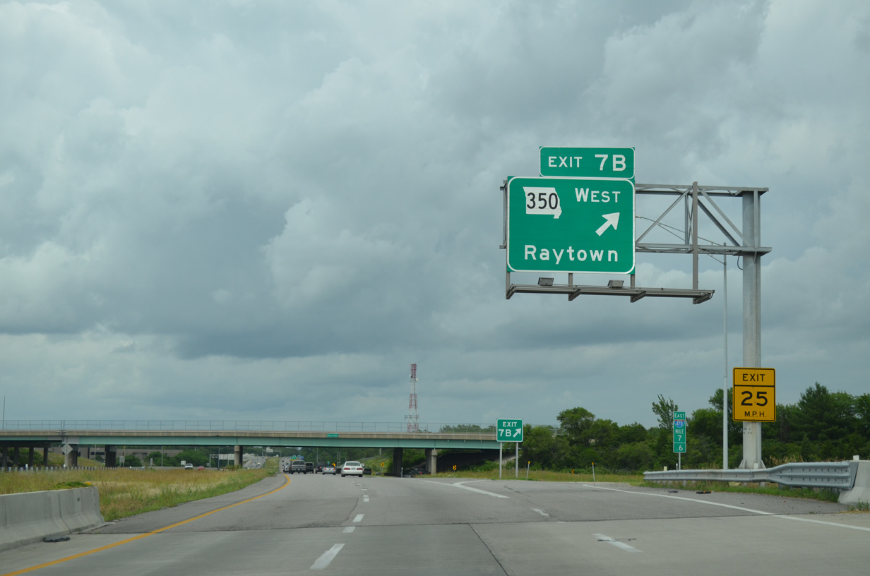
Entering Lee's Summit, I- 470 and U.S. 50 advance east to their partition at the split diamond (Exit 7A) and cloverleaf interchanges (Exit 7B) with Pryor Road and Route 350 (Blue Parkway).
06/18/15
The last set of reassurance markers for Interstate 470/U.S. 50 east stand ahead of Cedar Creek.
06/18/15
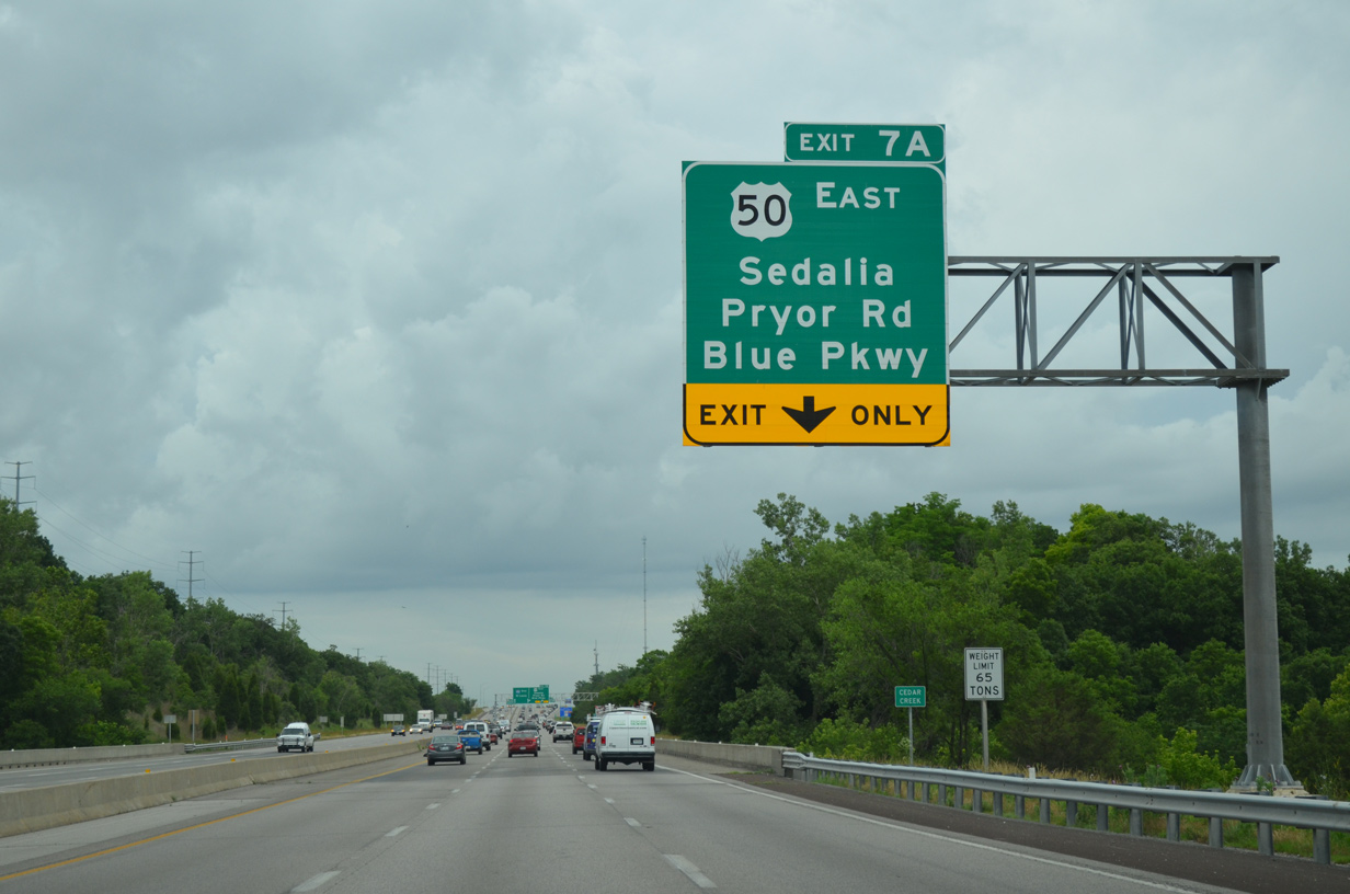
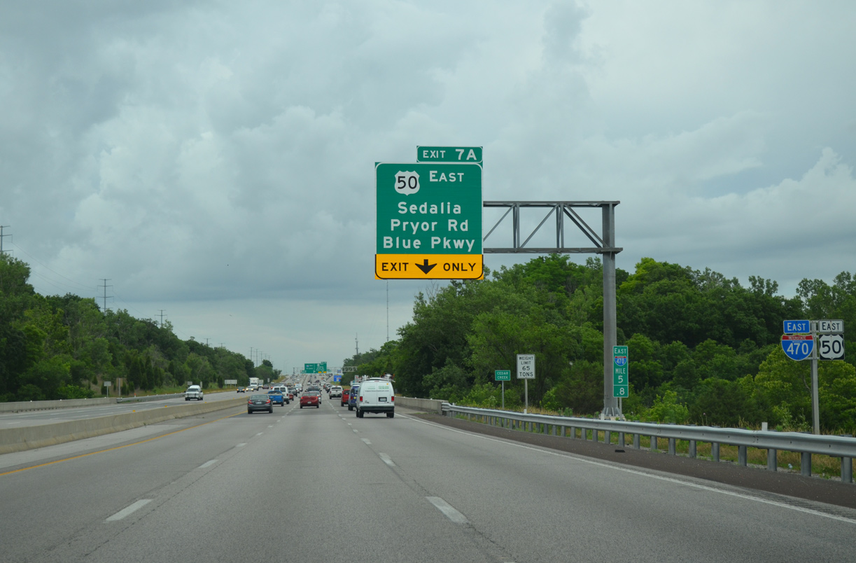
U.S. 50 separates from I-470 for a freeway leading 6.4 miles southeast through Lee's Summit to Lake Lotawana. The US highway reaches the Pettis County seat of Sedalia in 66 miles.
06/18/15

A two lane distributor roadway departs at Exit 7A for both Pryor Road and Blue Parkway to the adjacent Summit Woods Crossing and Summit Fair retail complexes. The Pryor Road off-ramp and access road east to Blue Parkway were added during road work from 2006 and June 2010.
06/18/15
Beyond the split with U.S. 50, Exit 7A departs in 1.25 miles for Route 350 (Blue Parkway) northwest to Unity Village, southeast Kansas City and Raytown.
06/18/15
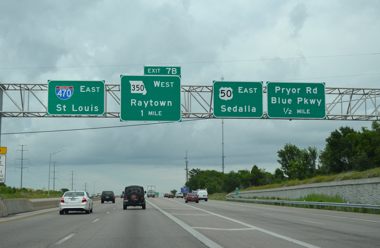
Exit 7A partitions from the Interstate 470 eastbound mainline for U.S. 50 east to Sedalia and the local Pryor Road and Blue Parkway. Route 350 commences a 8.50 mile course from the exchange with I-470 and U.S. 50.
06/18/15
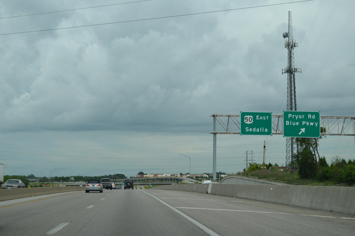
Traffic separates for Pryor Road and Blue Parkway as U.S. 50 turns southeast through Lee's Summit to Lake Lotawana and Lone Jack. Blue Parkway forms a north side frontage road to the U.S. 50 freeway.
06/18/15
East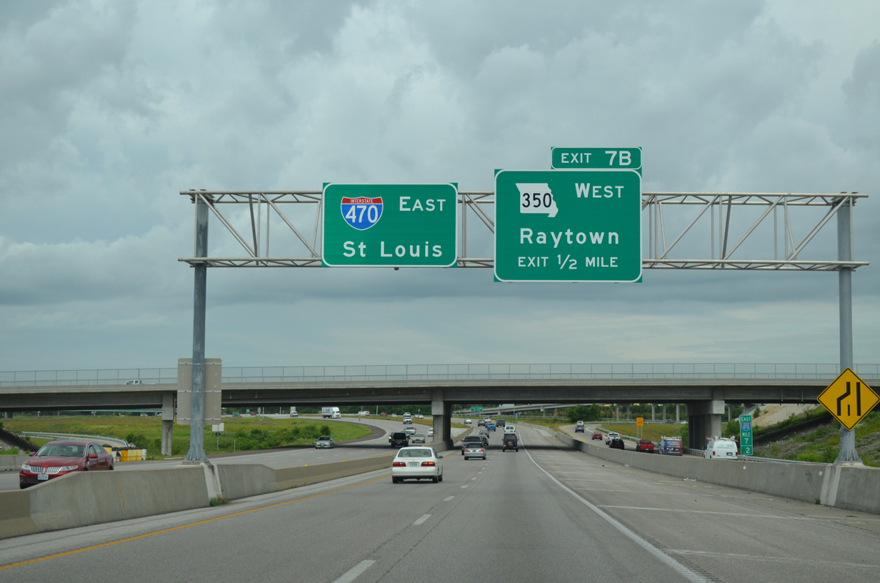
A loop ramp (Exit 7B) follows in a half mile for Route 350 (Blue Parkway) west to Raytown. Route 350 replaced U.S. 50 when it was realigned to bypass Kansas City upon completion of I-470.
06/18/15
Blue Parkway extends northwest to an interchange with Bannister Boulevard before transitioning into an at-grade route through Raytown. Route 350 ends at Interstate 435 by the Lewis Heights neighborhood in Kansas City.
06/18/15
Interstate 470 nips the southeast corner of Unity Village beyond the NW Main Street underpass.
06/18/15
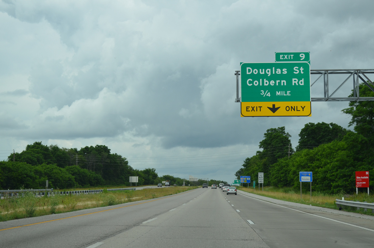
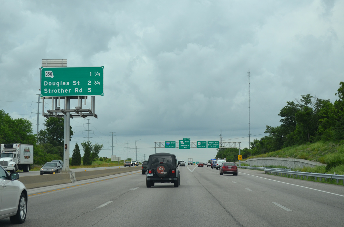
A lane drop occurs at the diamond interchange (Exit 9) with Douglas Street as I-470 reenters Lee's Summit.
06/18/15
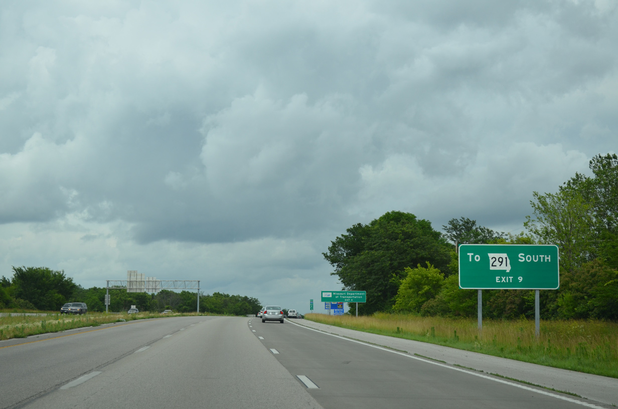
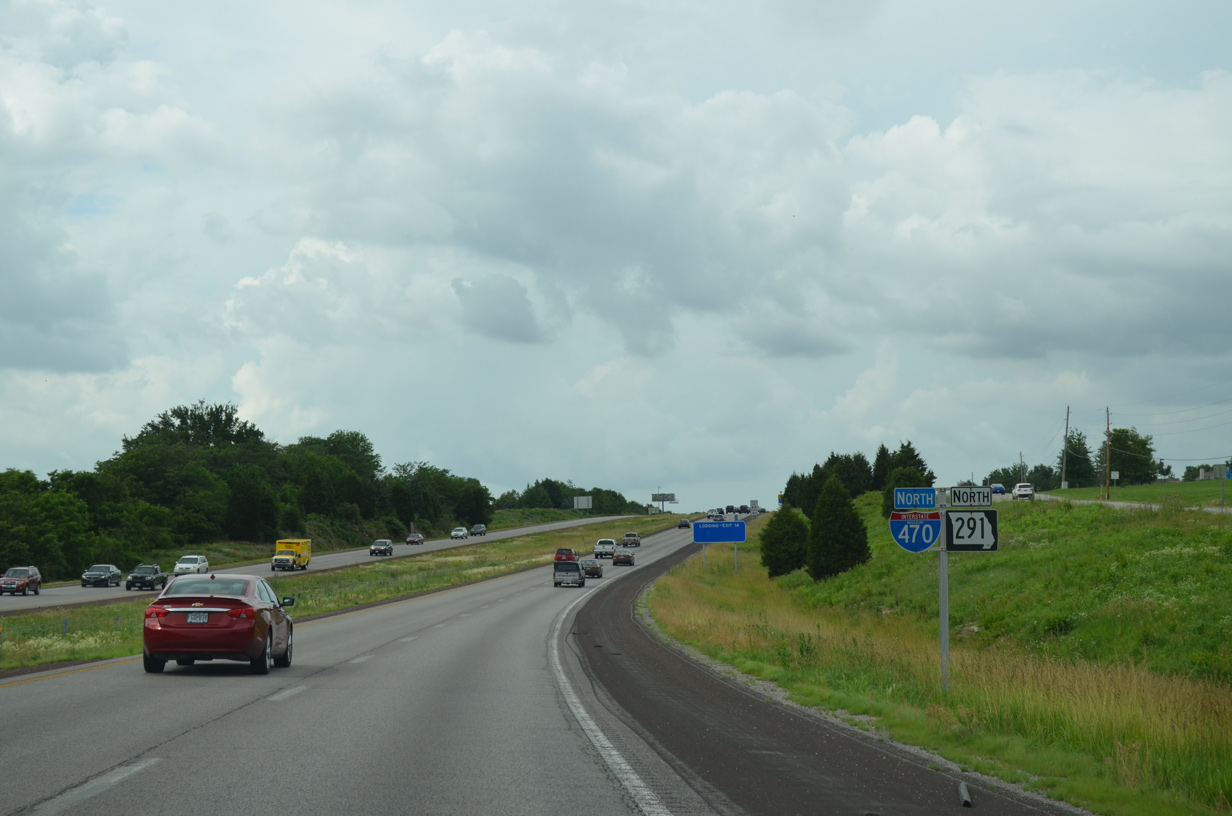
Colbern Road leads east from Douglas Street, just north of Exit 9, to connect with Route 291 south. Route 291 north merges onto I-470 at a wye interchange north of Colbern Road.
06/18/15
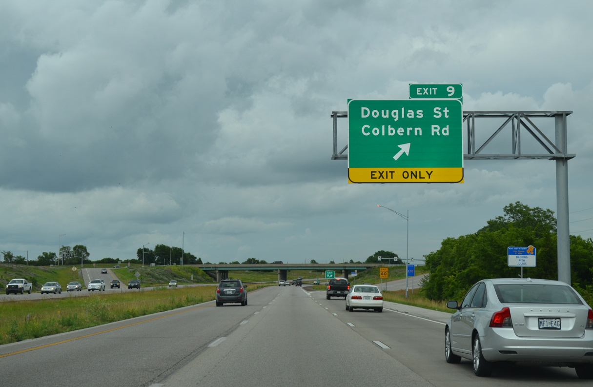
Exit 9 departs from Interstate 470 east for Douglas Street south to Saint Luke's East Hospital and several business and industrial parks and north to Lee's Summit Municipal Airport (LXT).
06/18/15

Eastbound confirming marker posted as I-470 makes its northern turn toward Independence.
06/18/15
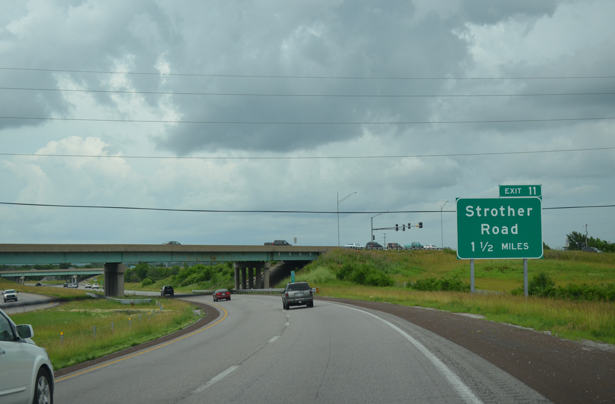
Colbern Road passes over Interstate 470, 1.25 miles south of the diamond interchange (Exit 11) with Strother Road.
06/18/15
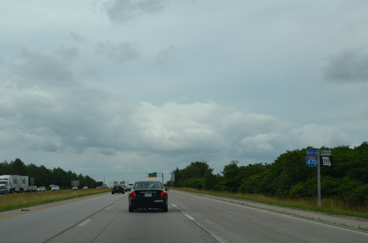
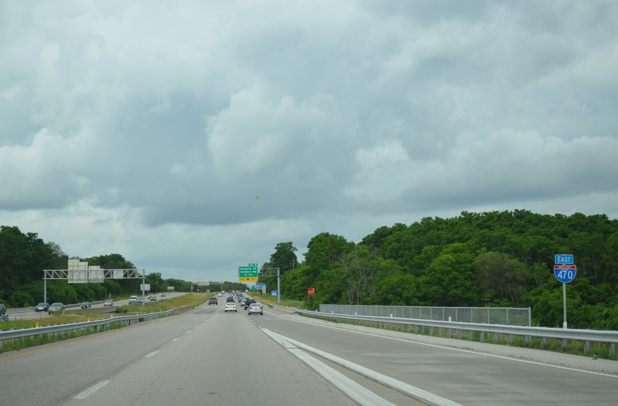
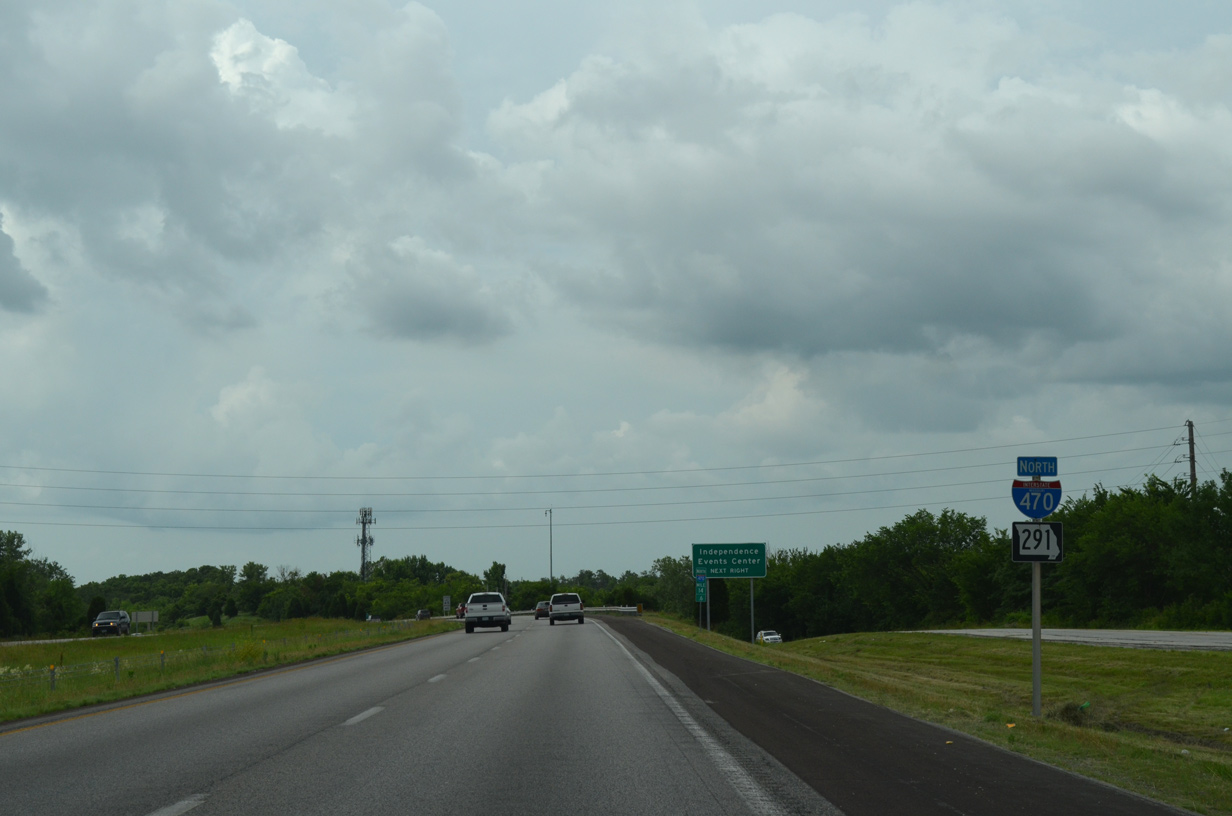
Missouri Route 291 combines with Interstate 470 north for the remainder of the freeway to Independence. Signs for I-470 switch from east-west to north-south as well.
06/18/15

The lane added from Route 291 ends at the off-ramp (Exit 11) to Strother Road. Strother Road serves industrial areas and business parks to the north of Lee's Summit Municipal Airport (LXT).
06/18/15
Strother Road originates just east of Exit 11 at Todd George Parkway in a rural area. The road west becomes 83rd Street beyond the Kansas City line ahead of its end at Lee's Summit Road near Truman Medical Center Lakewood.
06/18/15
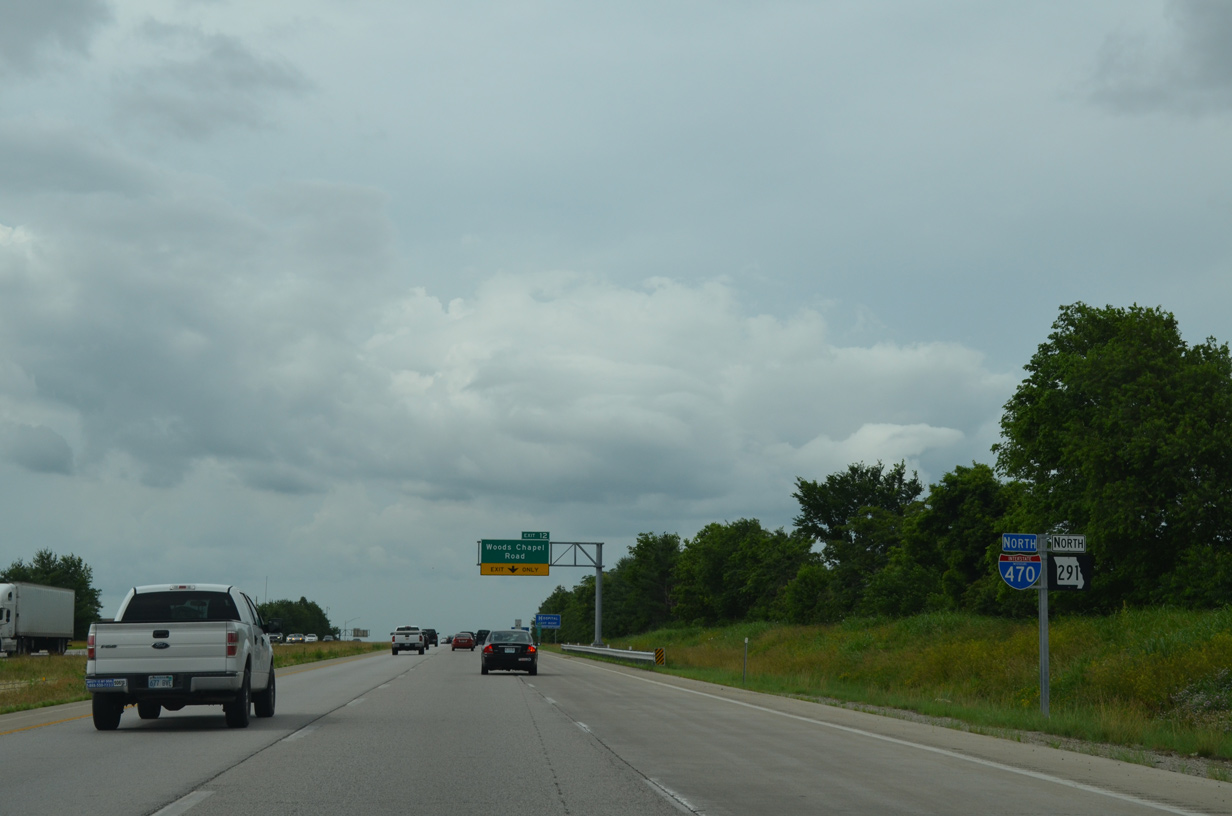
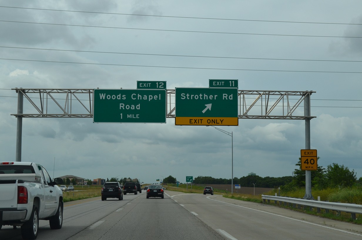
An array of businesses abut the west side of I-470/Route 291 to the diamond interchange (Exit 12) with Woods Chapel Road.
06/18/15
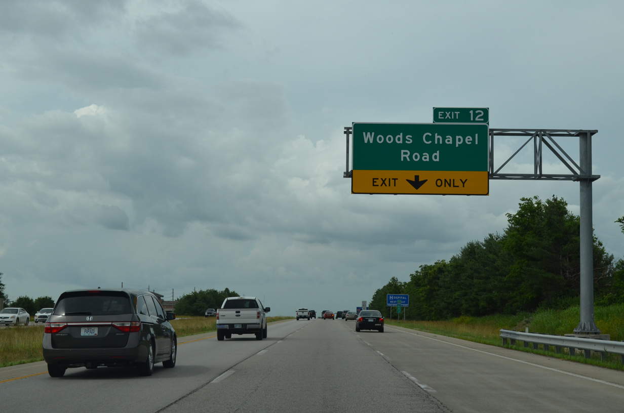
An auxiliary lane accompanies the freeway north to Exit 12. Woods Chapel Road west joins I-470 with a number of subdivisions surrounding Lakewood Lakes.
06/18/15
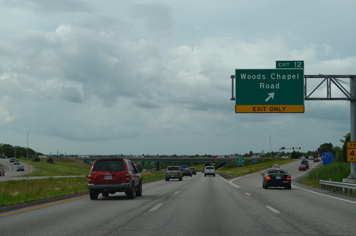
East from Exit 12, Woods Chapel Road leaves suburban areas of Lee's Summit for Lake Jacomo, Blue Springs Lake and U.S. 40 in the city of Blue Springs.
06/18/15
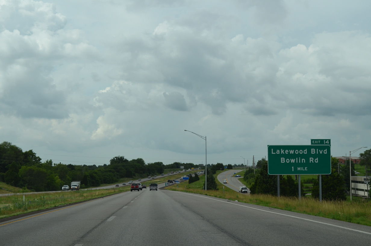
I-470/Route 291 become more suburbanized northward to the diamond interchange (Exit 14) with Lakewood Boulevard west and Bowlin Road east.
06/18/15
Frontage roads serves subdivisions to the west along Lakewood Lakes and to the east near Delta Woods Middle School.
06/18/15
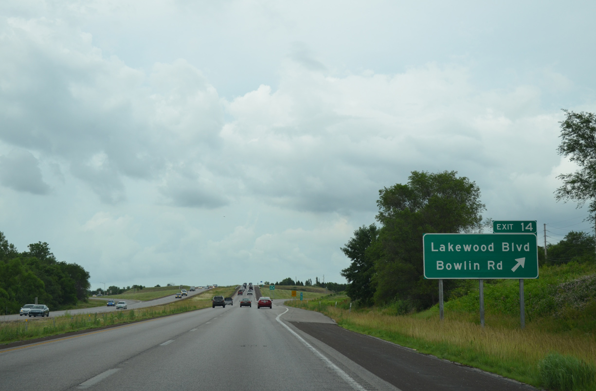
Lakewood Boulevard winds southwest from adjacent Lakewood Oaks Golf Club across an earthen dam of Lakewood Lakes to Lee's Summit Road. Bowlin Road extends the road east from Exit 14 to Fleming (County) Park off Blue Springs Lake.
06/18/15
I-470/Route 291 shifts westward from hills south of the Little Blue River toward the Independence city line.
06/18/15
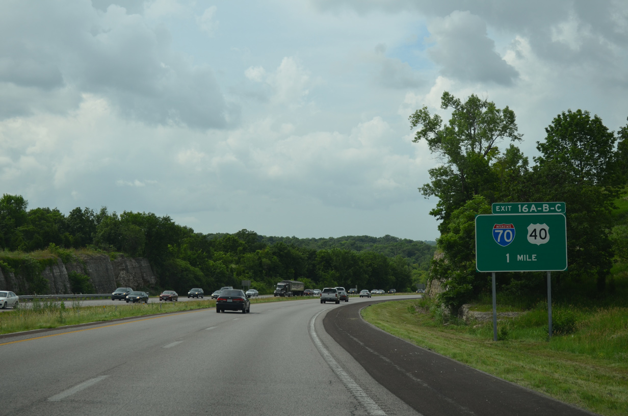
Exits 16A and 16B-C follow for U.S. 40 and parallel Interstate 70 over the next mile.
06/18/15
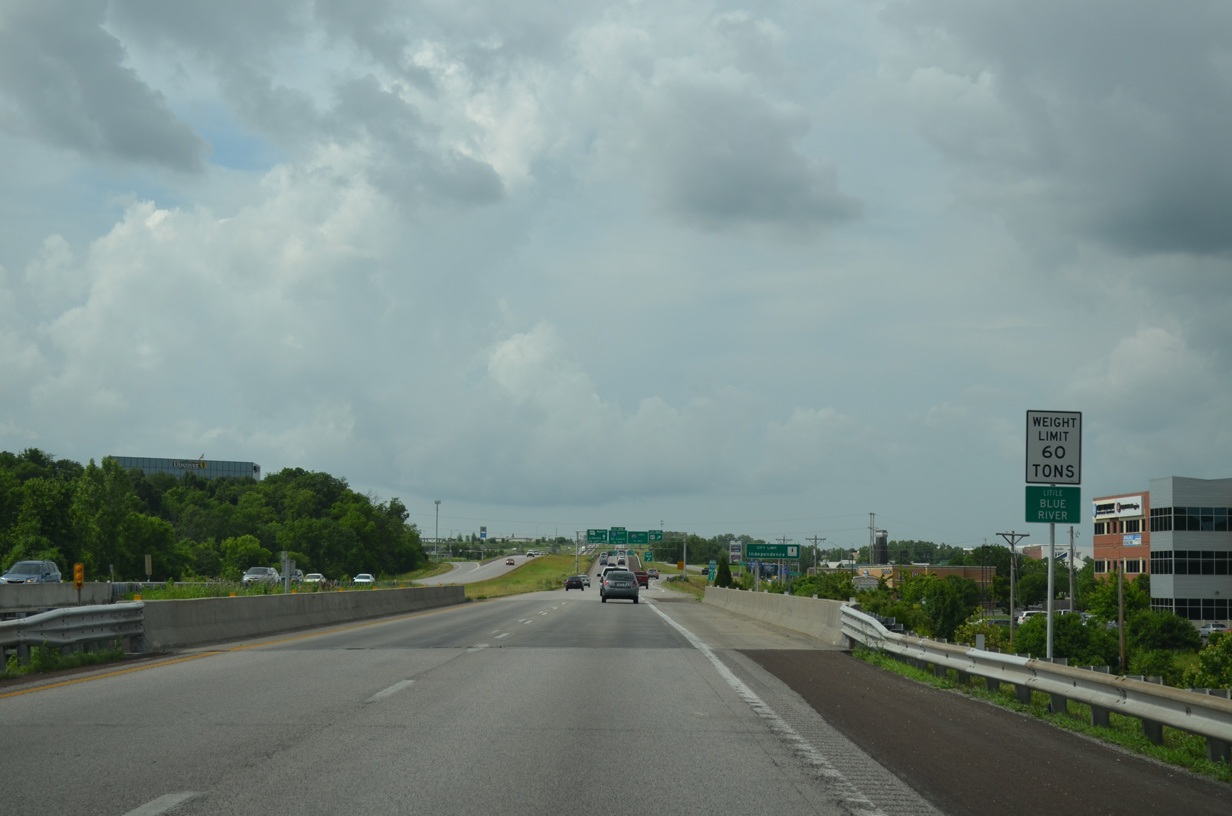
Spanning the Little Blue River along I-470/Route 291 north. The 45 mile long waterway flows north from Grandview into the Missouri River near Sibley.
06/18/15
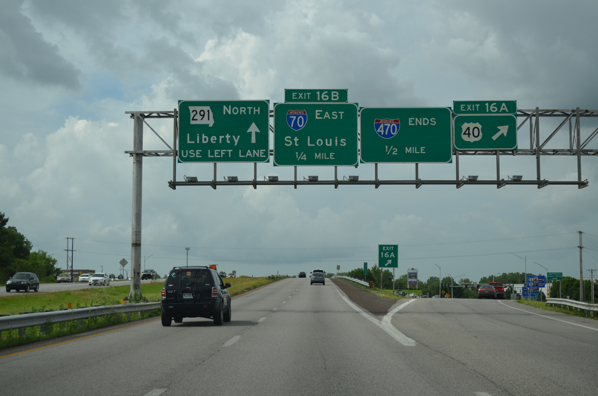
A diamond interchange connects I-470/Route 291 with U.S. 40 just south of the cloverleaf interchange (Exits 16B/C) with I-70. U.S. 40 comprises a arterial route west to Exit 11 of I-70 and east to adjacent big box retail and Little Blue Parkway. The route overlaps with I-70 west through Kansas City and east from Blue Springs.
06/18/15
The succeeding off-ramp takes motorists onto Interstate 70 east to Columbia and St. Louis. I-70 forms a busy trucking corridor between Kansas City and southwest Pennsylvania.
06/18/15
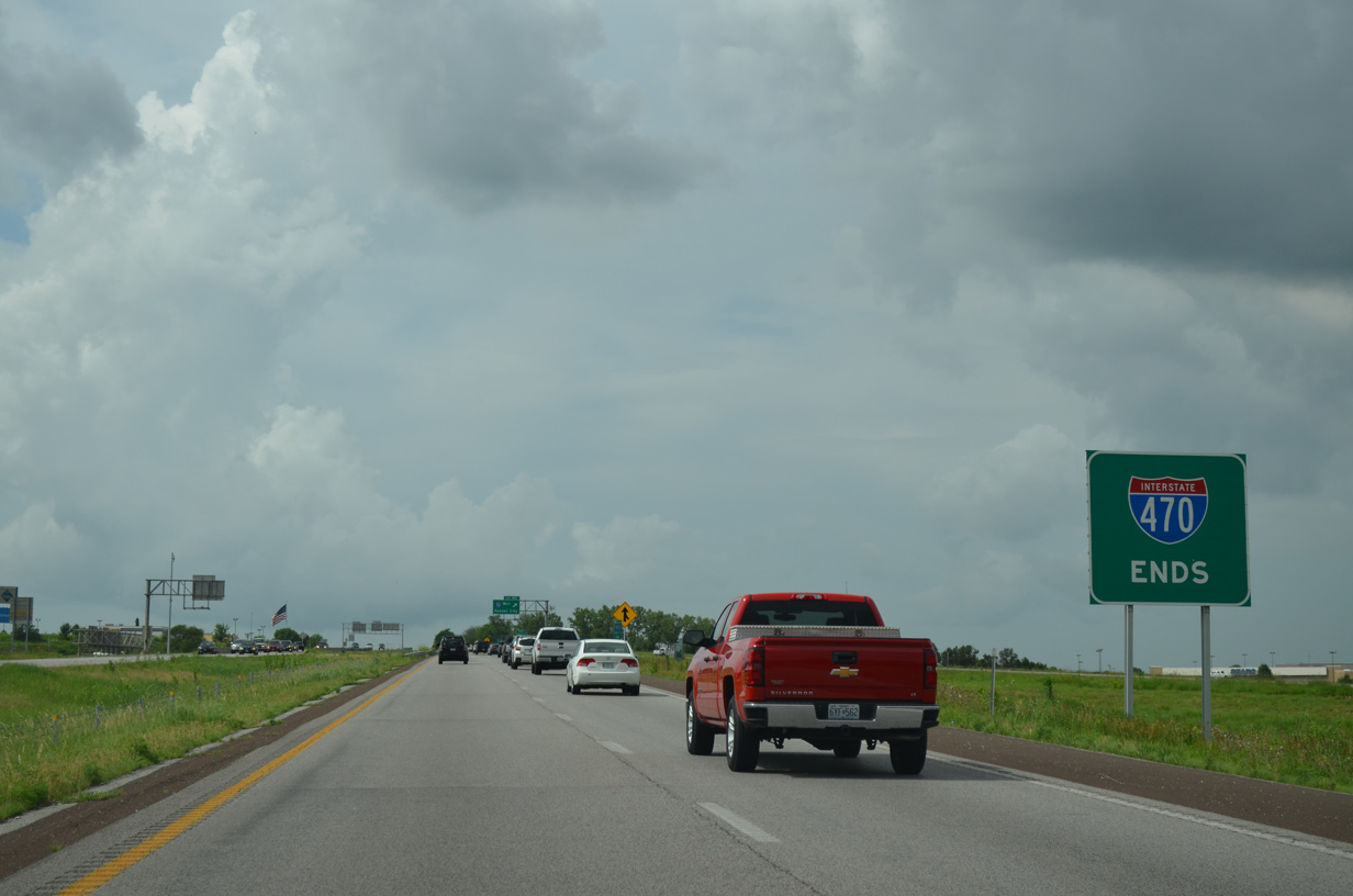
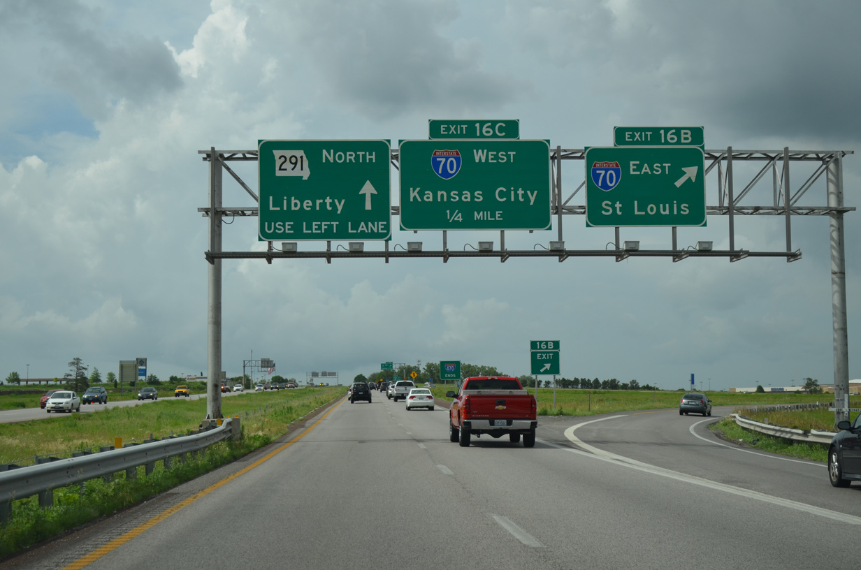
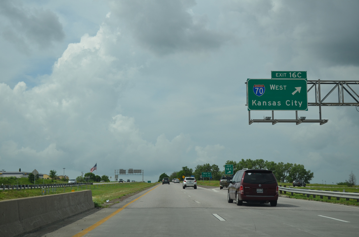
A formal end sign appears for Interstate 470 ahead of the loop ramp (Exit 16C) for I-70 west to Downtown Kansas City.
06/18/15
Interstate 70 straddles the Independence and Kansas City line west to I-435, where it passes by both Kauffman Stadium (home of the KC Royals) and Arrowhead Stadium (home of the KC Chiefs).
06/18/15
Photo Credits:
- Alex Nitzman: 11/03/16
- ABRoads: 06/18/15
Connect with:
Page Updated Monday February 24, 2020.