
Interstate 471 South


 South
South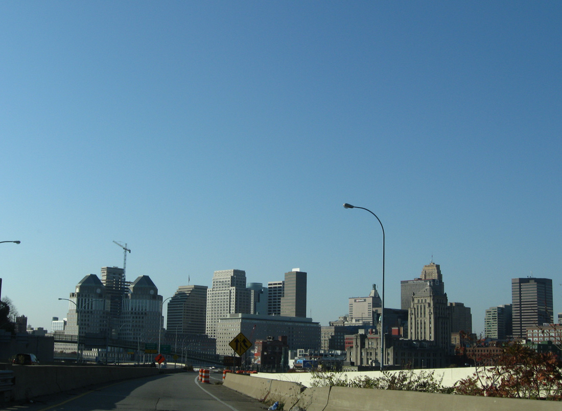
The southbound beginning of Interstate 471 departs from I-71 at the U.S. 22 (Gilbert Avenue) overpass, 0.4 miles ahead of the mainline turn southeast toward the Daniel Beard Bridge. An on-ramp adds traffic from adjacent U.S. 42 (Reading Road) and Liberty Street as well.
11/08/09
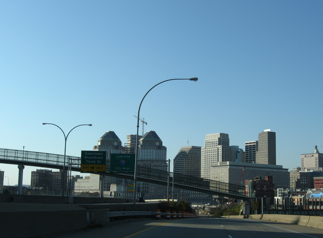
With the Liberty Street on-ramp added, Interstate 471 south expands to two lanes as parallel I-71 elevates onto a viaduct ahead of Downtown and Interstate 75.
11/08/09
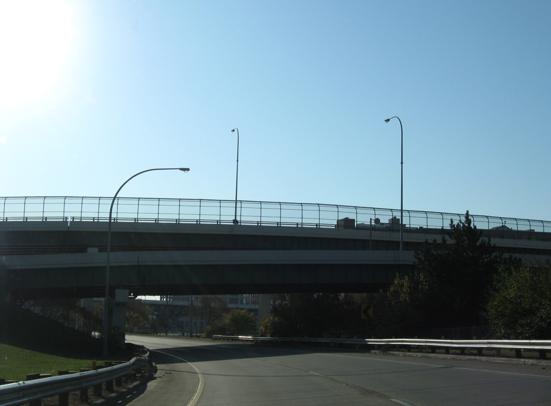
An overpass and flyover pass over Interstate 471 south from Columbia Parkway and to 6th Street.
11/08/09
The left side ramp from 5th Street merges onto I-471 south below the Columbia Parkway viaduct. Interstate 471 continues south 0.75 miles to Exit 5 for Kentucky 8 (Dave Cowens Drive).
11/14/04
The Columbia Parkway viaduct was built in 1938 and reconstructed in 1997. U.S. 50 follows Columbia Parkway east from adjacent Fort Washington Way through Mt. Adams and the East End neighborhood of Cincinnati.
11/14/04

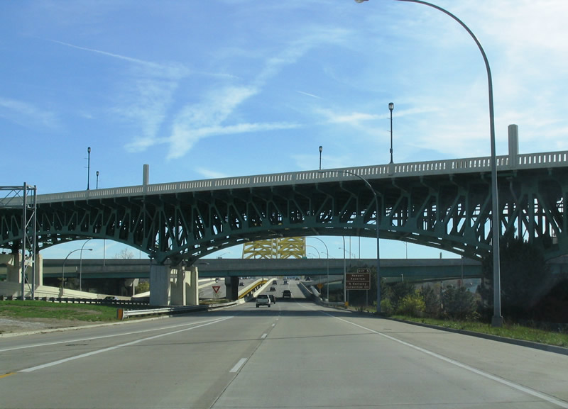
Two lanes join Interstate 471 south from U.S. 50 east to form the overall four lane southbound Dan Beard Bridge. The right lane, which was the shoulder until a restriping project in 2000, defaults onto Exit 5 for Kentucky 8 at the south end of the span.
11/14/04
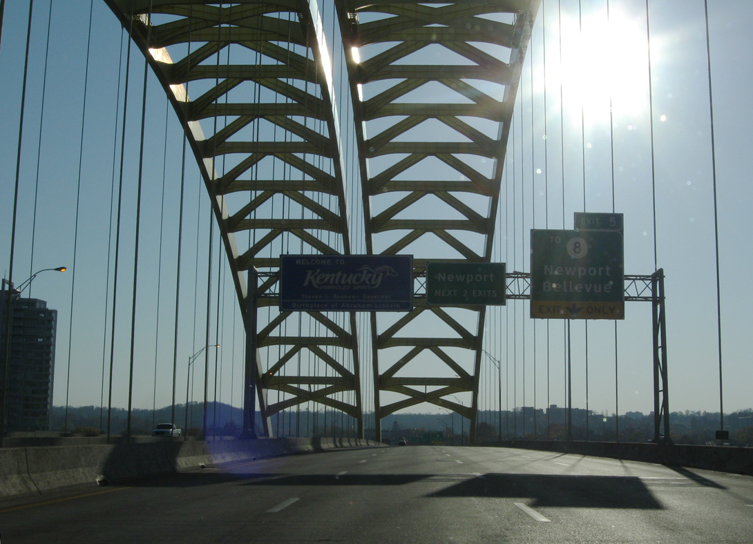
Welcome to Kentucky sign bridge posted mid-span along the Dan Beard Bridge. The bridge opened in 1976 between U.S. 50 and Kentucky 8. Kentucky 8 (Dave Cowens Drive) parallels the Ohio River from U.S. 27 (Taylor Southgate Bridge) and the Newport on the Levee mall eastward into the city of Bellevue.
11/08/09

Replaced guide signs showing the older welcome sign style and a pull through panel for Interstate 471 south.
11/14/04
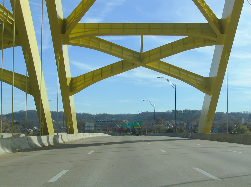
Leaving the superstructure of the Dan Beard Bridge of Interstate 471 south.
11/14/04
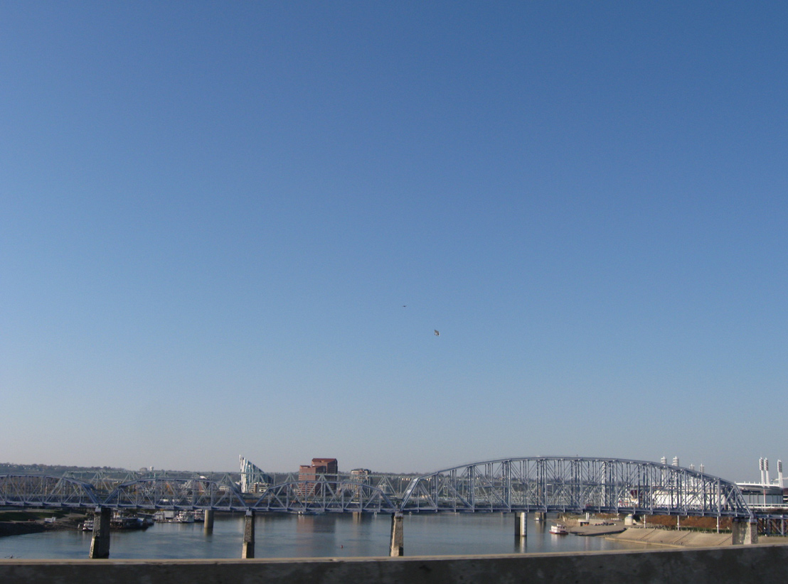
Looking downriver along the Ohio from the Dan Beard Bridge at the parallel L&N Pedestrian (Purple People) and Taylor Southgate (U.S. 27) Bridges.
11/08/09
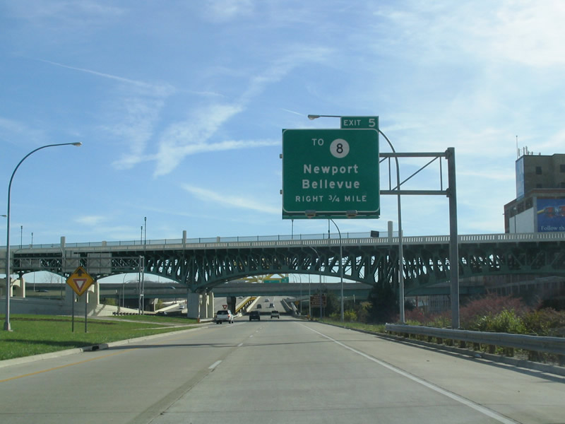
Exit 5 departs Interstate 471 south as a loop ramp to Park Avenue north to KY 8 (Dave Cowens Drive). KY 8 comprises a two-section route along the Ohio River from KY 20 near Idlewild to U.S. 23 at South Portsmouth. Locally the route joins Downtown Newport with central Bellevue.
11/08/09
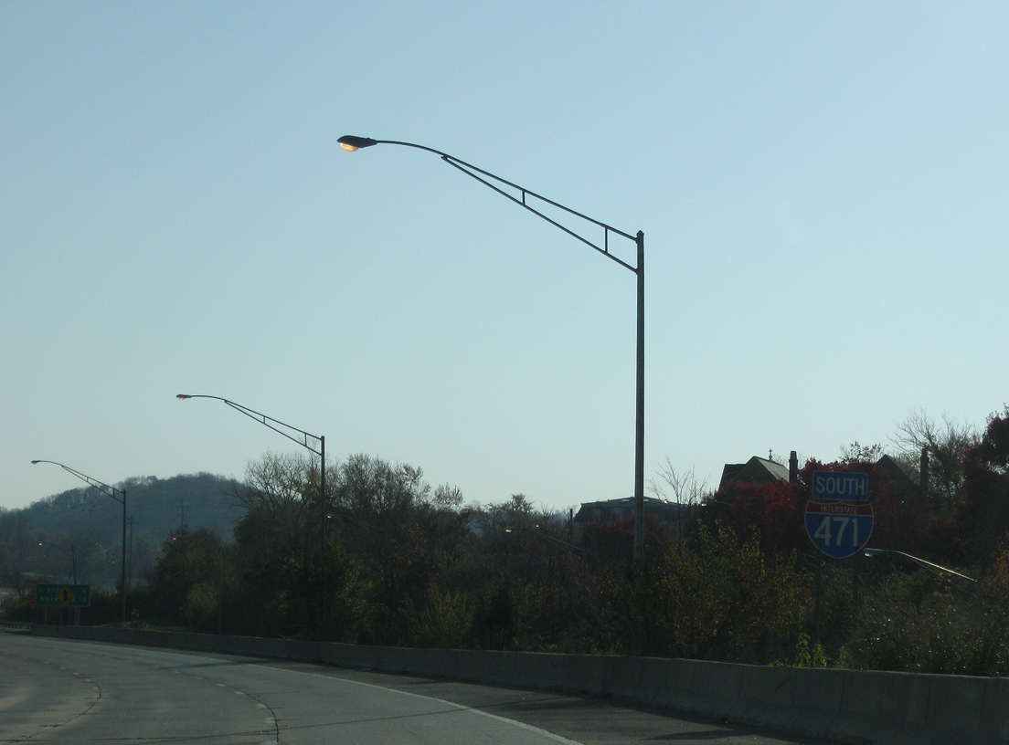
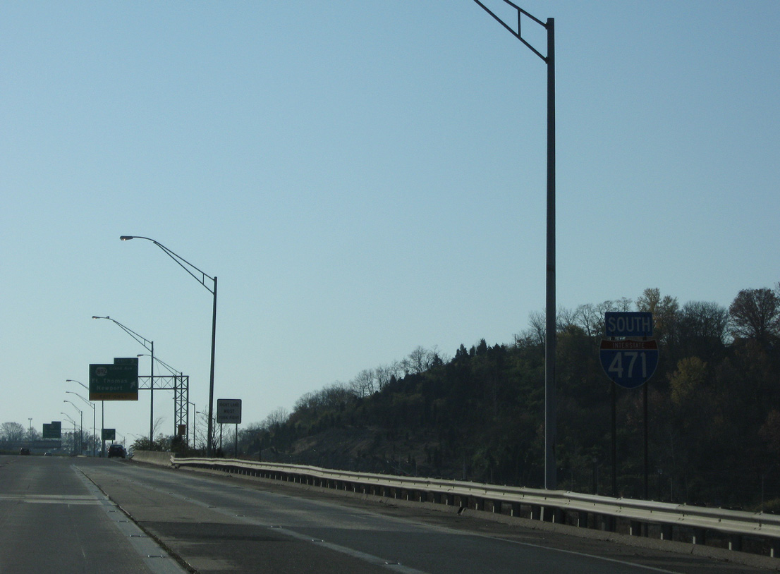
The first confirming marker for I-471 appears as the freeway kinks eastward between the Newport street grid and Bellevue Plaza shopping center.
11/08/09

A distance sign follows, four miles ahead of Interstate 275 and 13 miles from the U.S. 27 destination of Alexandria.
11/08/09
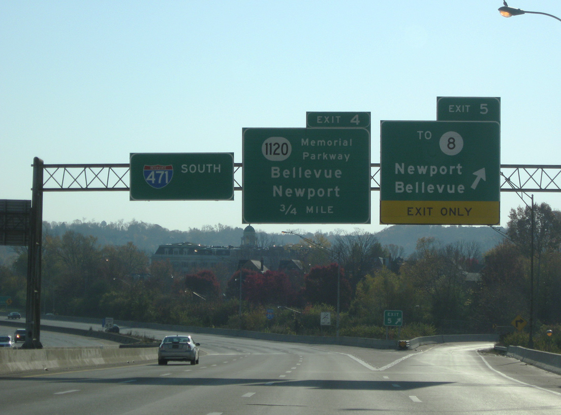
Interstate 471 travels a viaduct by Newport High School and across 6th Street on the approach to the diamond interchange (Exit 4) with KY 1120 (Memorial Parkway).
11/14/04
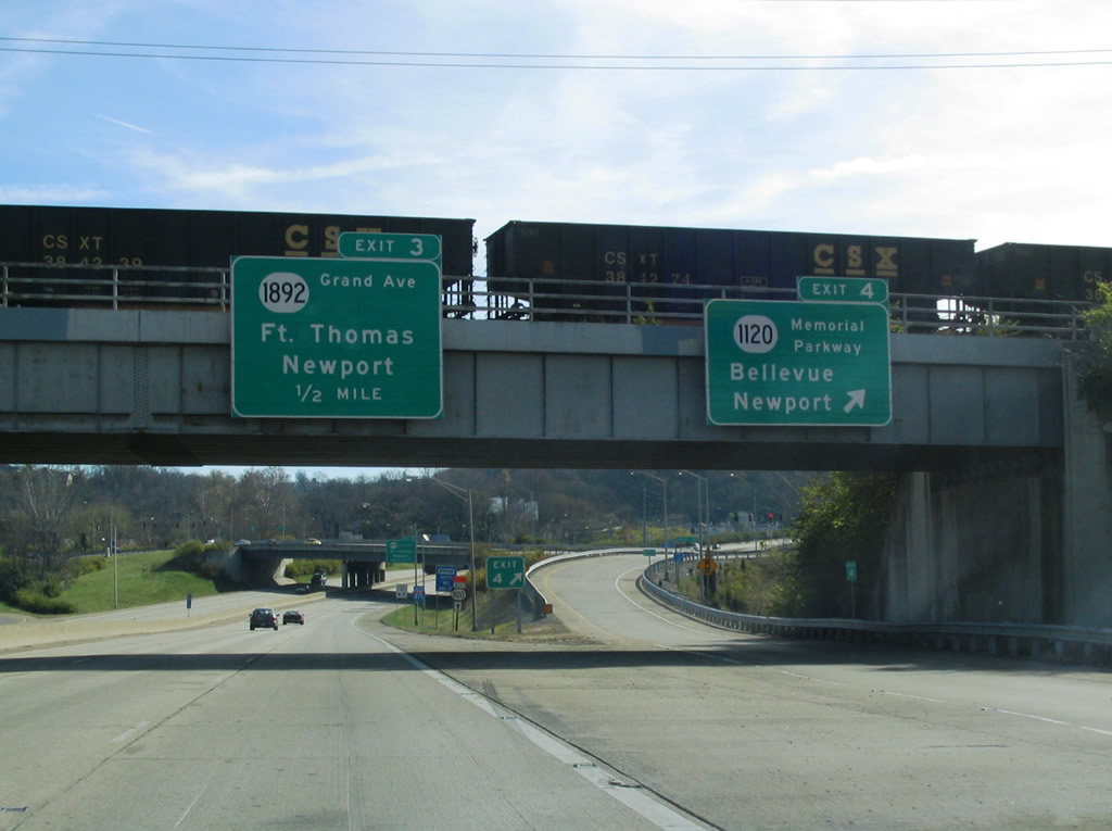
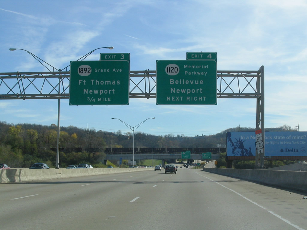
Exit 4 parts ways with Interstate 471 south at a CSX Railroad overpass. KY 1120 follows 10th Street through Newport to a brief merge with U.S. 27 (Monmouth Street). Eastward the state route loops through Bellevue and Fort Thomas.
11/14/04
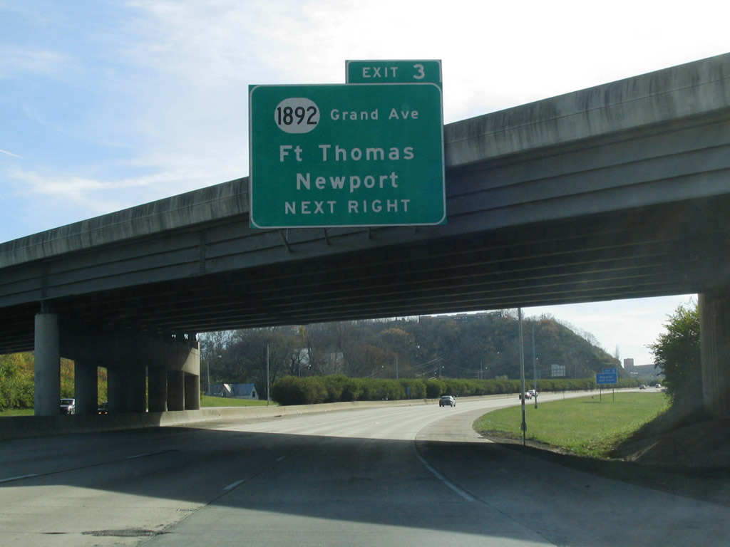
Exit 3 follows quickly with KY 1892 (Grand Avenue) at the Newport Pavilion retail area east of U.S. 27 and Carothers Road.
11/14/04
Construction in 2013 added an auxiliary lane from the Memorial Parkway on-ramp to the nearby off-ramp (Exit 3) for Grand Avenue.
11/08/09
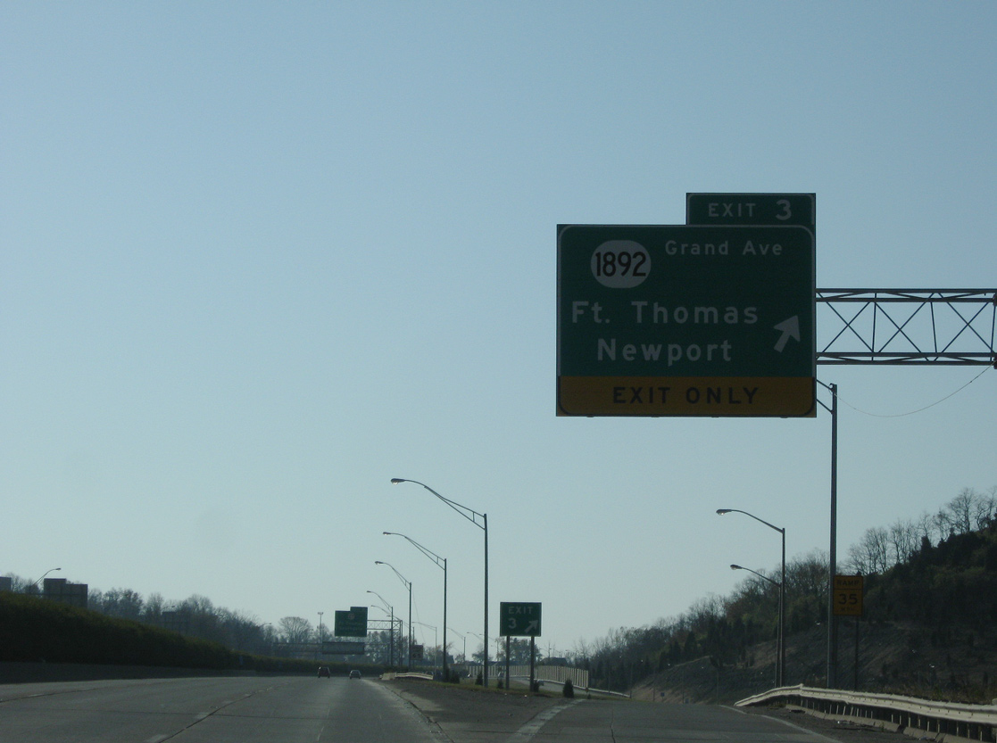
KY 1892 begins at parallel U.S. 27 (Monmouth Street) in south Newport and ventures east along Grand Avenue to KY 1120 (Fort Thomas Avenue) in the city of Fort Thomas.
11/08/09
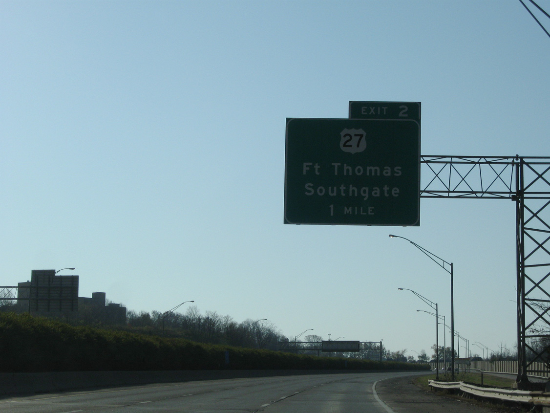
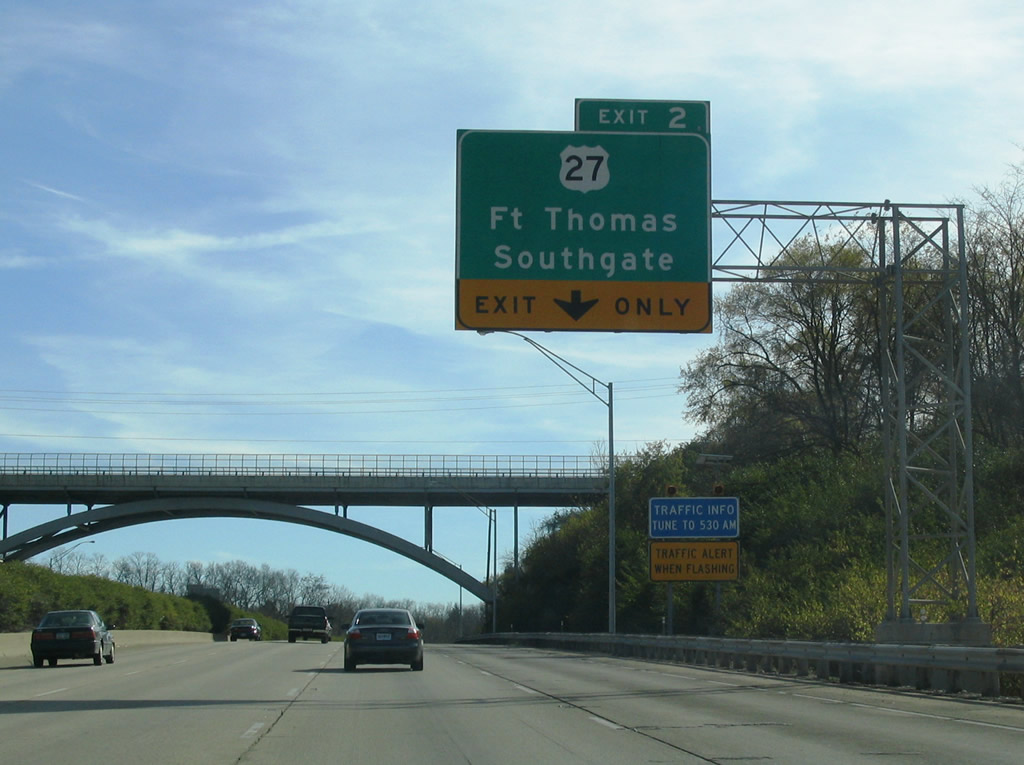
Interstate 471 enters the city of Fort Thomas on the approach to U.S. 27 (Exit 2). U.S. 27 leaves Newport for Southgate before meeting the freeway at a diamond interchange.
11/08/09
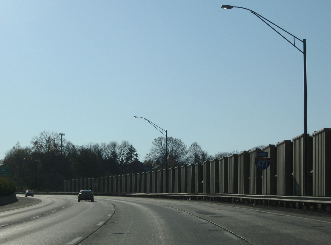
Sound walls were incorporated into the original design of Interstate 471 through Fort Thomas. This stretch was completed in 1980.
11/08/09
The right lane gained from Exit 3 adds a fourth southbound lane for U.S. 27, as Interstate 471 passes under the arched Highland Avenue overpass.
11/14/04
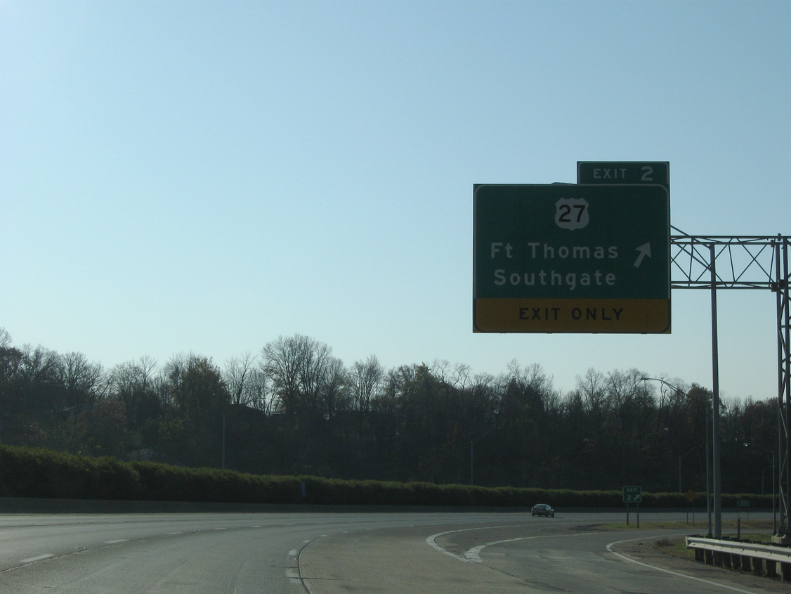
U.S. 27 heads east of the freeway to Fort Thomas and Highland Heights, meeting it again at its end south of Interstate 275.
11/08/09
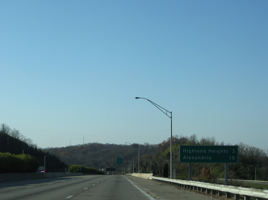
The city of Highland Heights spreads to the south of the forthcoming junction with Interstate 275. Motorists continuing beyond the exchange join U.S. 27 for another seven miles beyond the city to Alexandria.
11/08/09
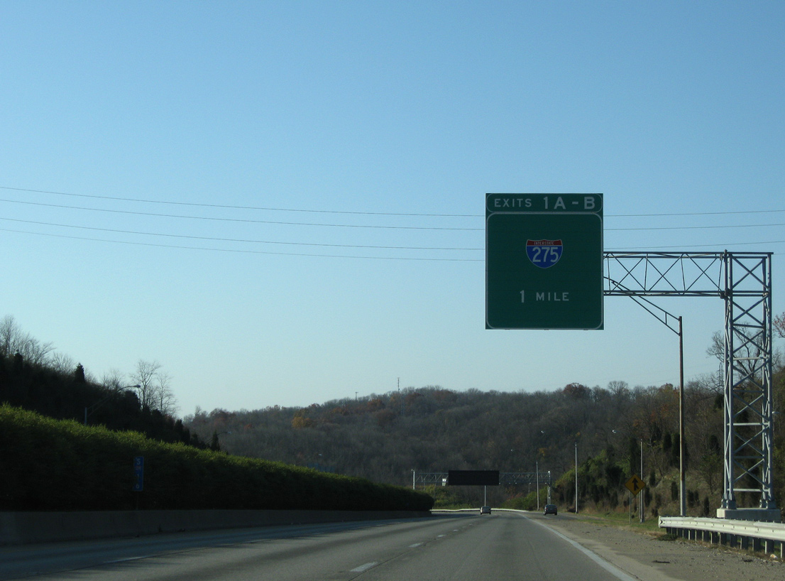
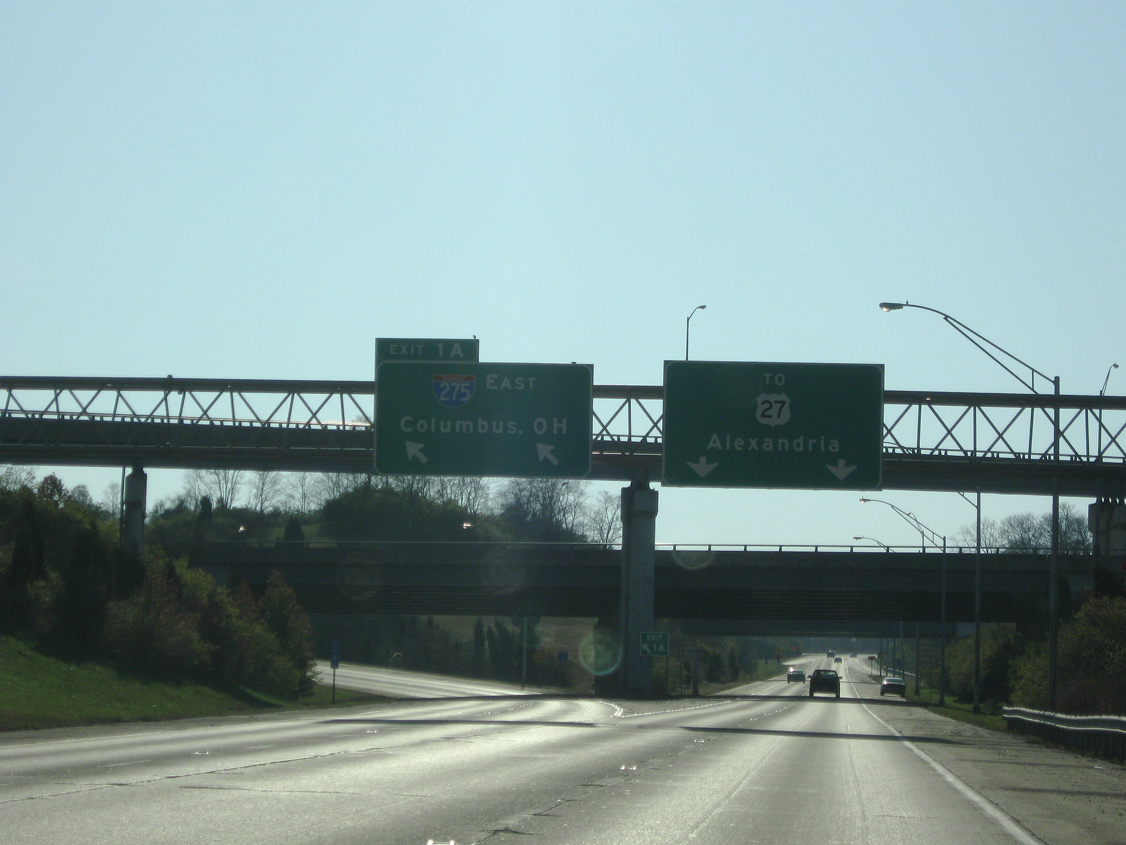
Initial signs in both directions of the I-471 freeway use no control city for Interstate 275 (Exits 1A/B).
11/08/09
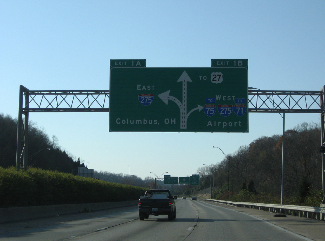
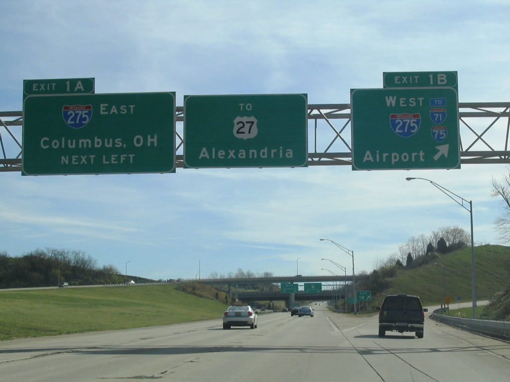
Exit 1A consists of a left side ramp onto Interstate 275 east to Forestville and Milford, Ohio. Exit 1B carries drivers onto I-275 west to Erlanger and Cincinnati / Northern Kentucky International Airport (CVG).
11/08/09
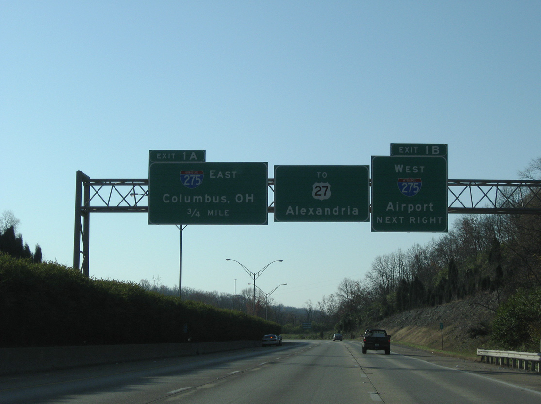
Interstate 275 (Circle Freeway) wraps around the east suburbs of Cincinnati to connect with I-71 north to Columbus. The I-471 freeway extends south another 0.7 miles to U.S. 27 (Alexandria Pike) near Northern Kentucky University.
11/08/09

Interstate 275 west across the Licking River to Erlanger leads motorists to I-71 south to Louisville and I-75 south to Lexington.
11/08/09
West from Exit 1A, I-275 travels 8.5 miles to I-71/75. The beltway east crosses the Combs-Hehl Bridge and reaches U.S. 52 at New Richmond, Ohio in 2.5 miles.
11/14/04
Interstate 471 officially ends at the directional interchange with I-275. The remainder of the freeway south is unsigned KY 471.
11/08/09
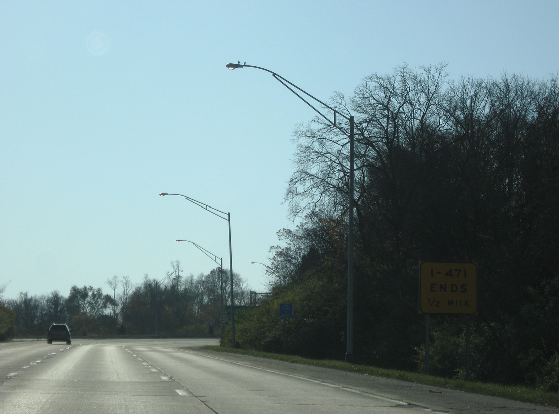
I-471 ends sign posted a half mile ahead of the traffic light with U.S. 27 (Alexandria Pike) north and Sunset Drive west.
11/08/09
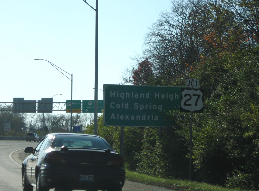
Distance sign posted a half mile out from Highland Heights. U.S. 27 (Alexandria Pike) overtakes the ending freeway two miles to Cold Spring and eight miles to Alexandria.
11/08/09
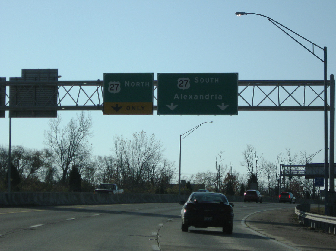
U.S. 27 (Alexandria Pike) north winds east and north back into Fort Thomas.
11/08/09
KY 471 ends as the roadway switches to a surface arterial through Highland Heights. Sunset Drive ties into the roadway from subdivisions and apartments to the west.
11/08/09
Photo Credits:
- ABRoads: 11/08/09
- Carter Buchanan: 11/14/04
Connect with:
Page Updated Thursday September 22, 2016.