
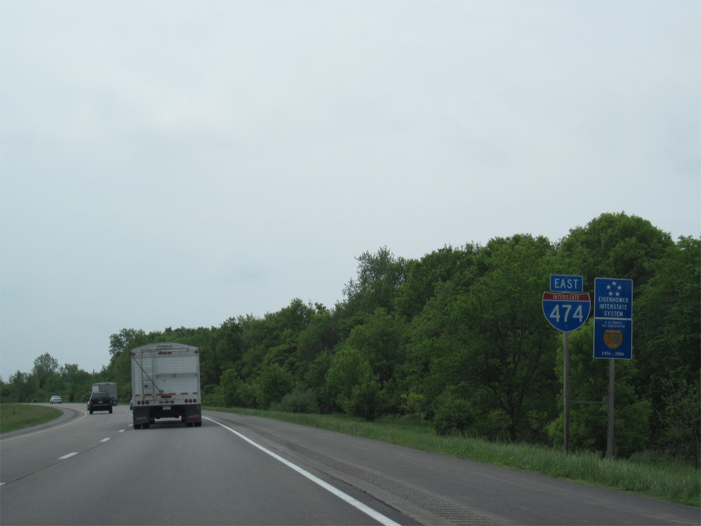
Interstate 474 East

 East
East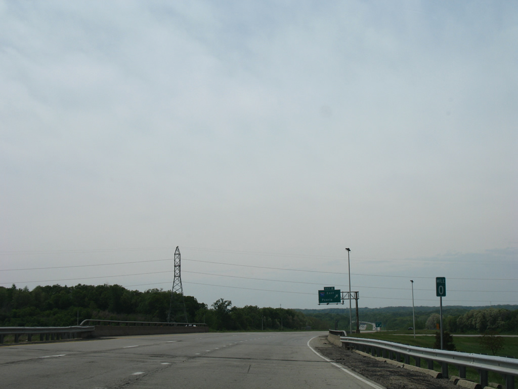
Milepost zero for Interstate 474 and IL 6 stands between the loop ramps from I-74 west and to I-74 east.
05/24/08
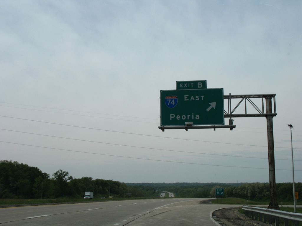
Exit 0 B links IL 6 south with Interstate 74 east to the city of Peoria. Ramps from I-474/IL 6 to I-74 were previously unnumbered.
05/24/08
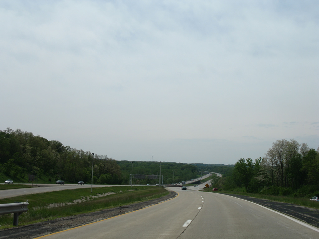
Beyond the entrance ramp from I-74 west, Interstate 474 east proceeds southward toward the first of three crossings over Kickapoo Creek.
05/24/08
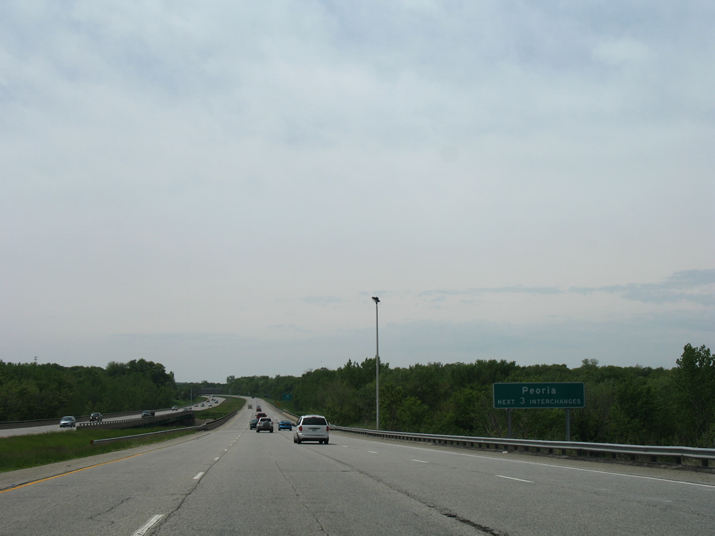
Interstate 474 stays west of the Peoria city limits to Bartonville and Exit 6. Exits 3, 5 and 6 connect with roads that lead into the city.
05/24/08
Meeting Interstate 474 at the village of Bellevue is unsigned Illinois Route 905, an expressway linking the freeway with Maxwell Road (County Route R46) and IL 116 (Plank Road).
05/24/08
The first confirming shield assembly for Interstate 474 east.
05/07/10
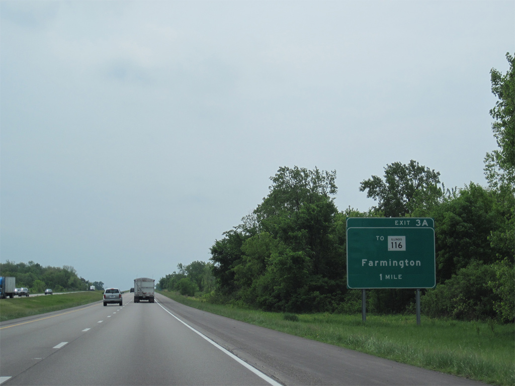
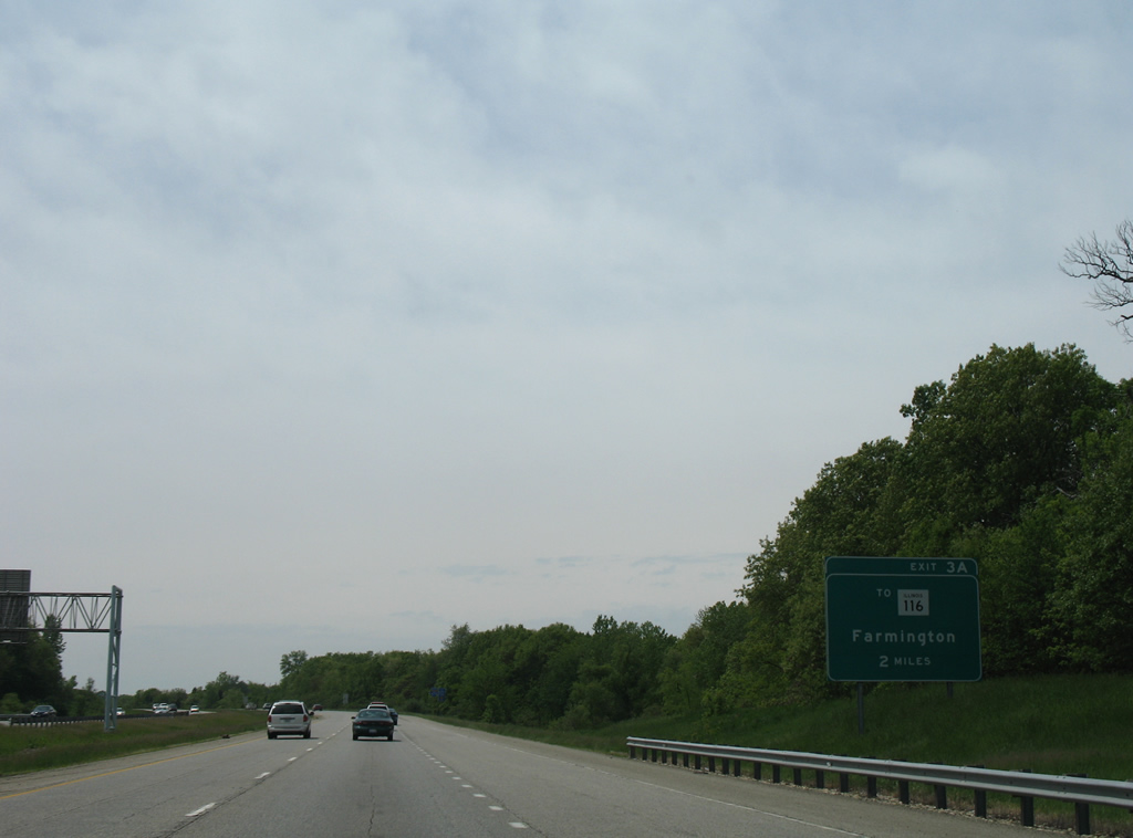
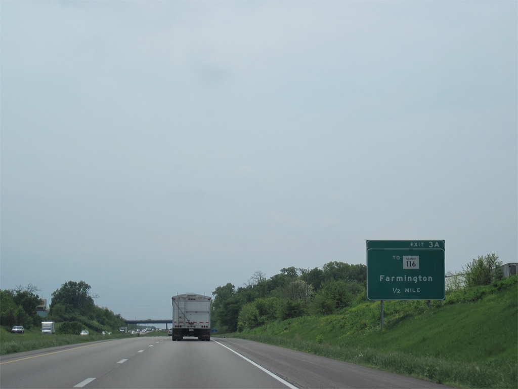
A partially built cloverleaf interchange links I-474 with Illinois Route 905. Exit 3 A connects with Maxwell Connector west to Maxwell Road while Exit 3 B was intended for the unconstructed expressway east of I-474 to either West Peoria or Peoria.
05/07/10
Illinois Route 905 was constructed as the easternmost leg of a planned extension of the expressway leading IL 336 east from Maccomb. Coupled with IL 110 (Chicago Kansas City Expressway), IL 336 travel southwest to Quincy and Interstate 172.
05/07/10
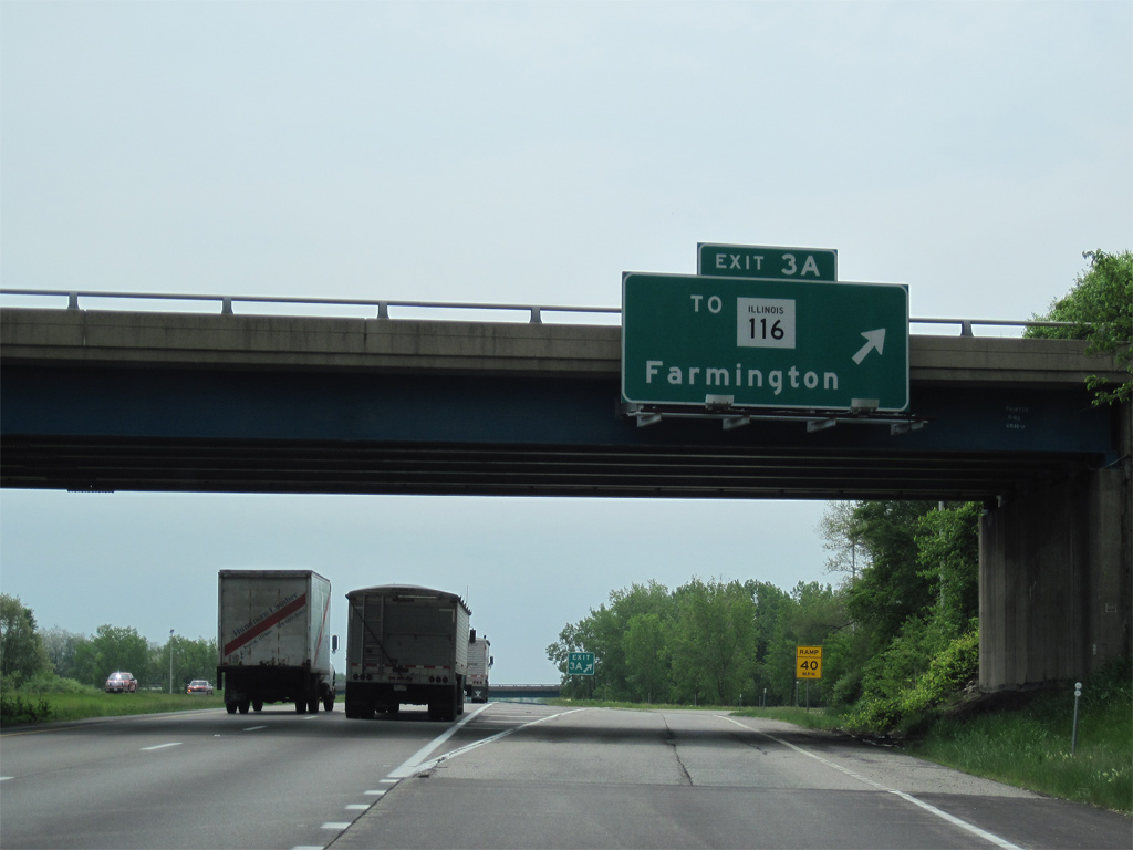
Exit 3 A leaves I-474 east at the Farmington Road overpass for Illinois Route 905 west. 1.03 miles in length, Maxwell Connector ties into CR R46, 0.37 miles north of IL 116 (Plank Road). IL 116 runs 190 miles overall from U.S. 34 near Biggsville to U.S. 45 at Ashkum. IL 116 enters Bellevue from Farmington to the west and continues east through both Peoria and East Peoria.
05/07/10
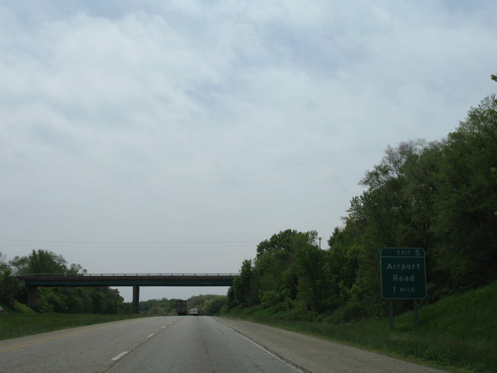
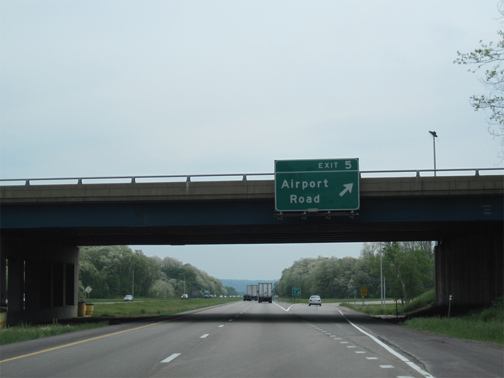
Airport Road angles 1.01 miles southwest from Kickapoo Creek Road (CR R51) and IL 116 at Bellevue to a folded diamond interchange (Exit 5) with Interstate 474.
05/24/08
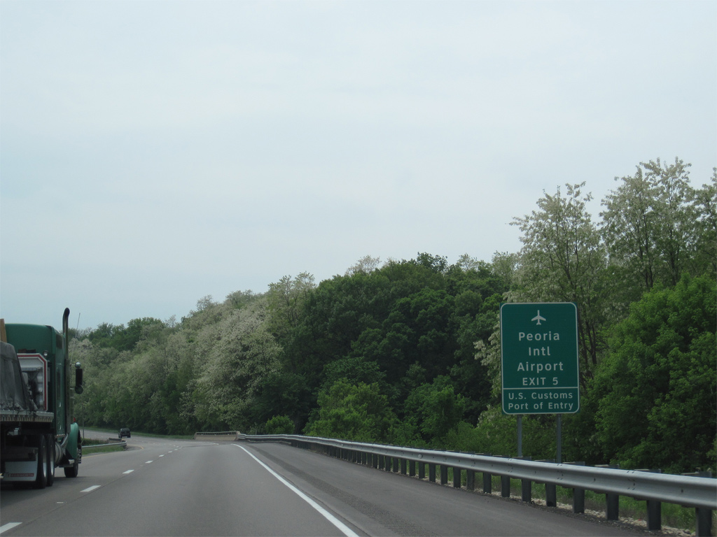
General Wayne A. Downing Peoria International Airport (PIA) lies just southwest of Interstate 474 off S Airport Road. E.M. Dirksen Parkway spurs west from the arterial to the passenger terminal.
05/07/10
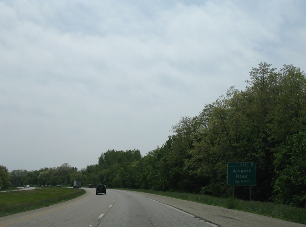
Airport Road doubles as Peoria County Route R49 south from I-474 and forms a west side bypass of Bartonville to Tuscarora Road west of U.S. 24 at Tuscarora.
05/24/08
The loop ramp at Exit 5 ties into S Airport Road across from E.M. Dirksen Parkway (County Route D49) west to Middle Road and PIA Airport.
05/07/10
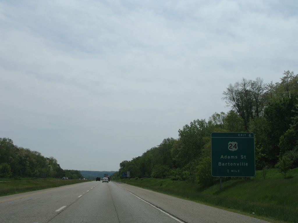
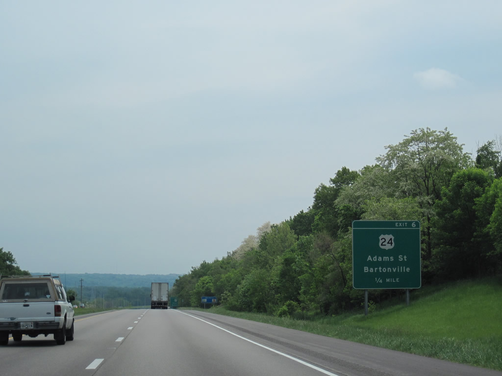
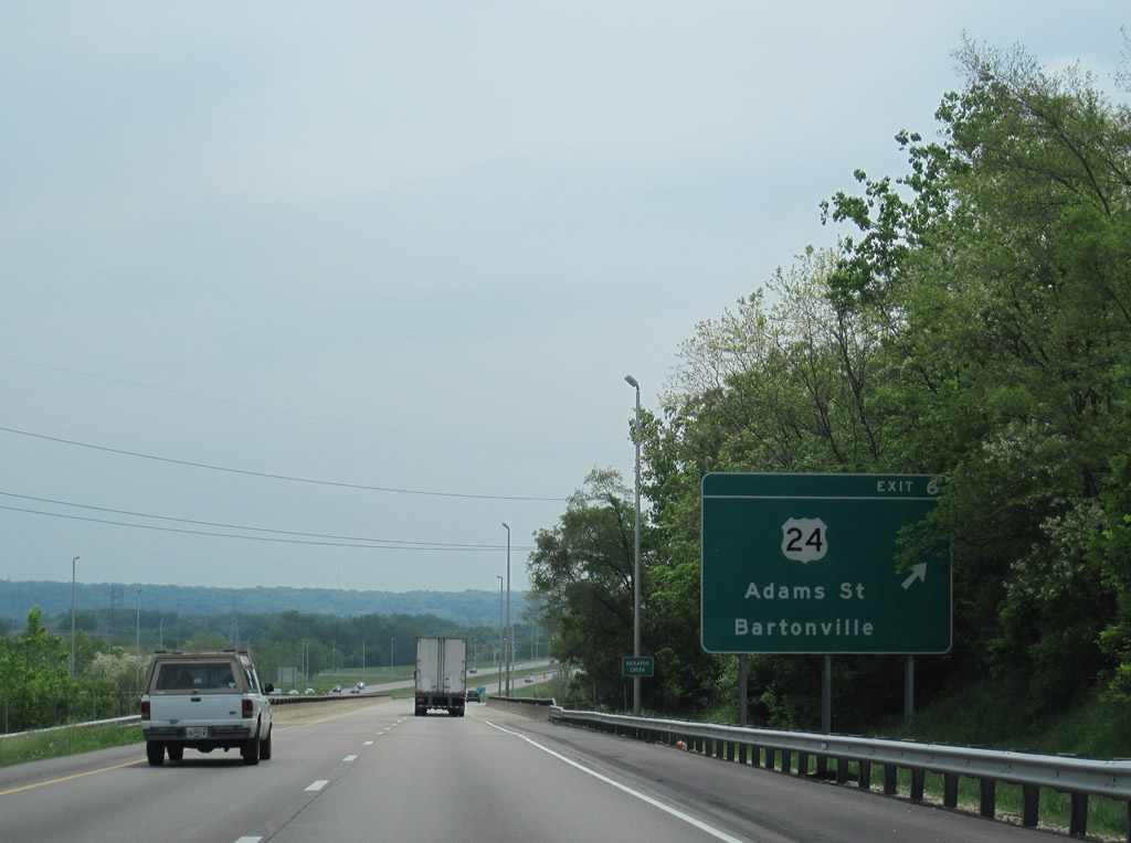
Interstate 474 continues southeast to a six-ramp parclo interchange (Exit 6) with U.S. 24 west in Bartonville and Adams Street north into Peoria.
05/24/08
U.S. 24 was relocated from Adams and Washington Streets northeast through the Warehouse District and Downtown Peoria to bypass the city east via I-474 and IL 29 north through Creve Coeur in 2010. U.S. 24 enters I-474 from Bartonville and Lewistown to the south.
05/07/10
Interstate 474 spans Kickapoo Creek for the second time where Exit 6 departs for U.S. 24 west and Adams Street.
05/07/10
 East
East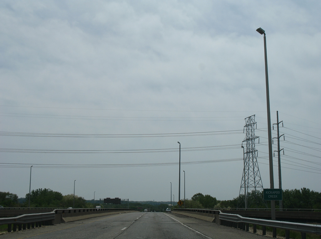
U.S. 24 combines with Interstate 474 east at another crossing of Kickapoo Creek and bridge over a Union Pacific Railroad line.
05/24/08
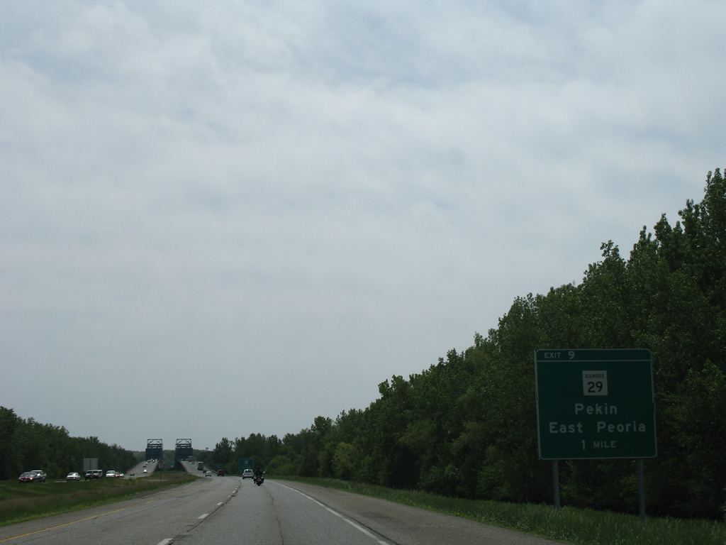
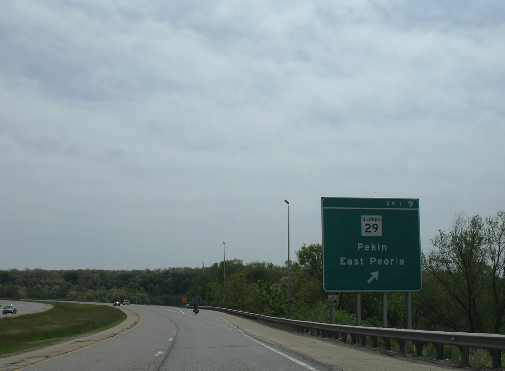
I-474/U.S. 24 overlap 2.48 miles east to the parclo interchange (Exit 9) with IL 29 (S Main Street).
05/24/08
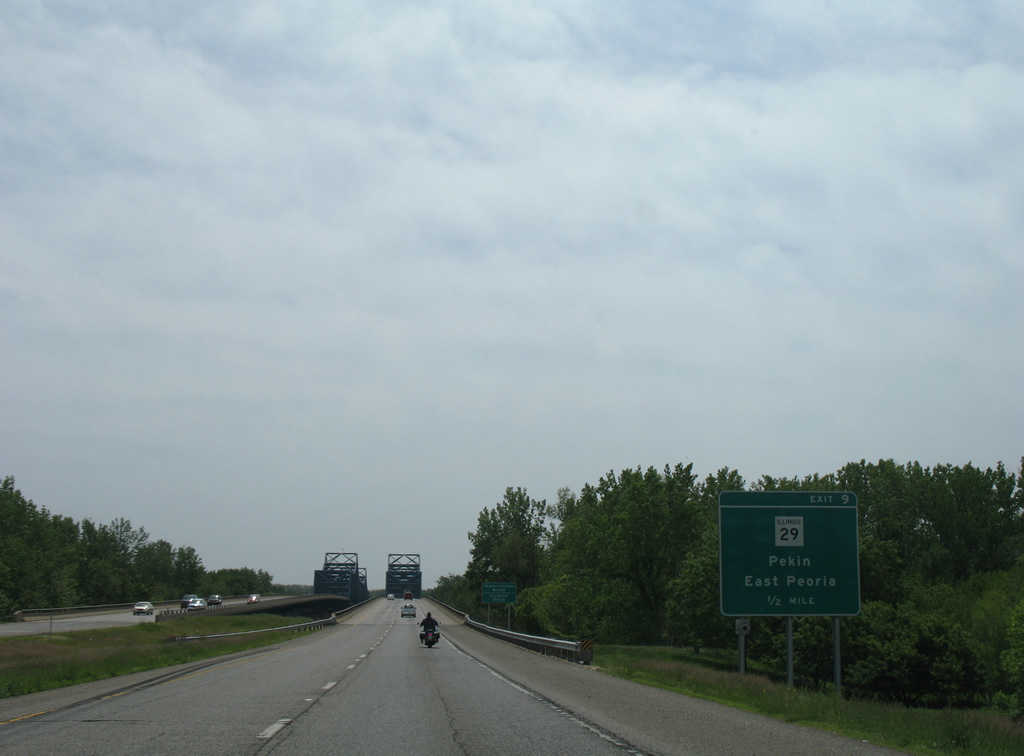
IL 29 constitutes a 180 mile long highway between Pana and Spring Valley through central Illinois. Locally the state route joins Creve Coeur with Pekin to the south and East Peoria to the north.
05/24/08
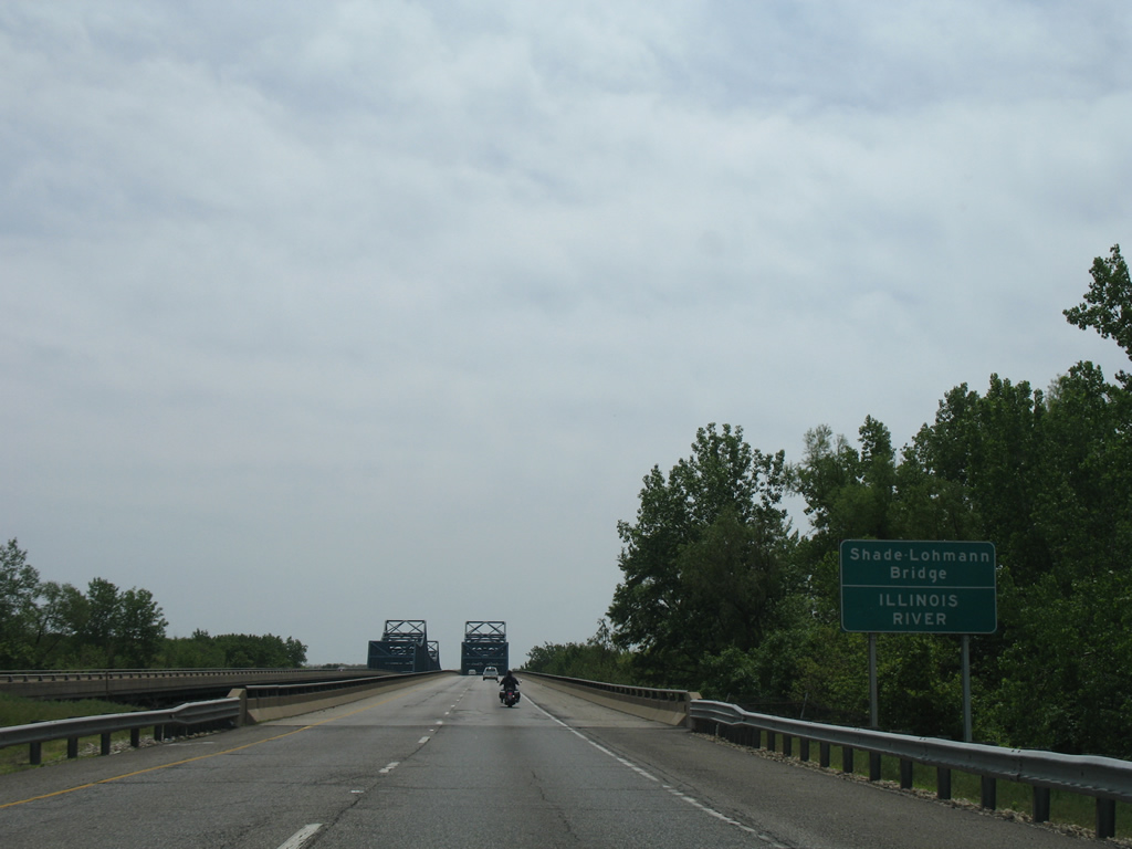
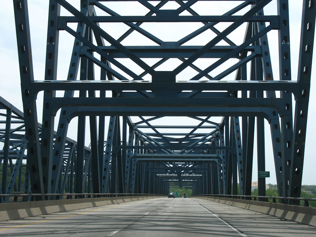
I-474/U.S. 24 span the Illinois River across the Shade-Lohmann Bridge.
05/24/08
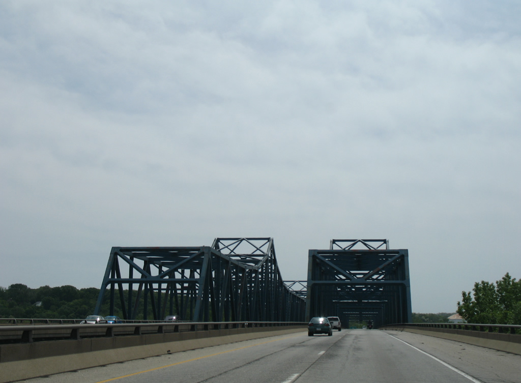
The twin steel truss bridges over the Illinois River are 39 feet wide with two travel lanes per direction. The eastbound span is three feet shorter than the westbound bridge at 3,421 feet in length.1
05/24/08
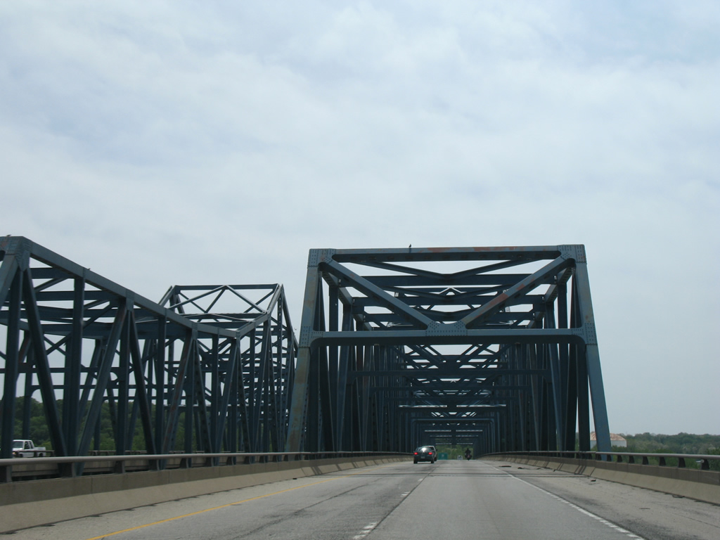
The Shade-Lohmann Bridge crests at 65 feet above the Illinois River navigation channel.1
05/24/08
Entering Tazewell County midway across the Illinois River on I-474/U.S. 24 east.
05/24/08
U.S. 24 east separates from I-474 east for a 3.79 mile long concurrency with IL 29 north through Creve Coeur and East Peoria. IL 29 turns west across the Murray Baker Bridge with I-74 to Peoria. Pekin is 4.6 miles to the south.
05/24/08
east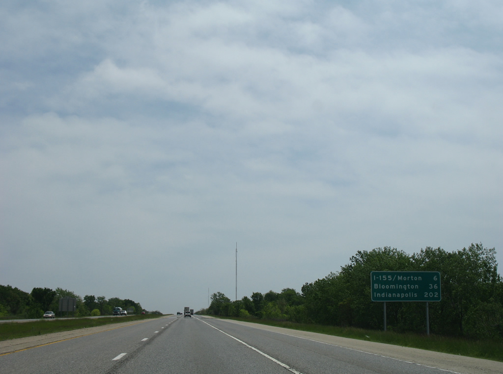
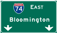
Interstate 474 bee lines 5.31 miles east from U.S. 24/IL 29 to I-74. I-74 enters Morton from there ahead of I-155 south to Lincoln. Bloomington is 36 miles away along I-74 east followed by Indianapolis in 202 miles.
05/24/08
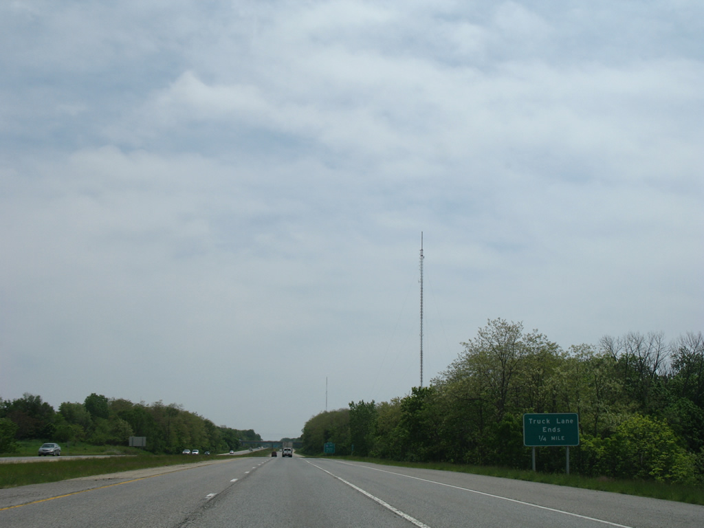
Straddling the Creve Coer village line by Independence Park, a truck climbing lane accompanies I-474 east toward Exit 15 for Interstate 74.
05/24/08
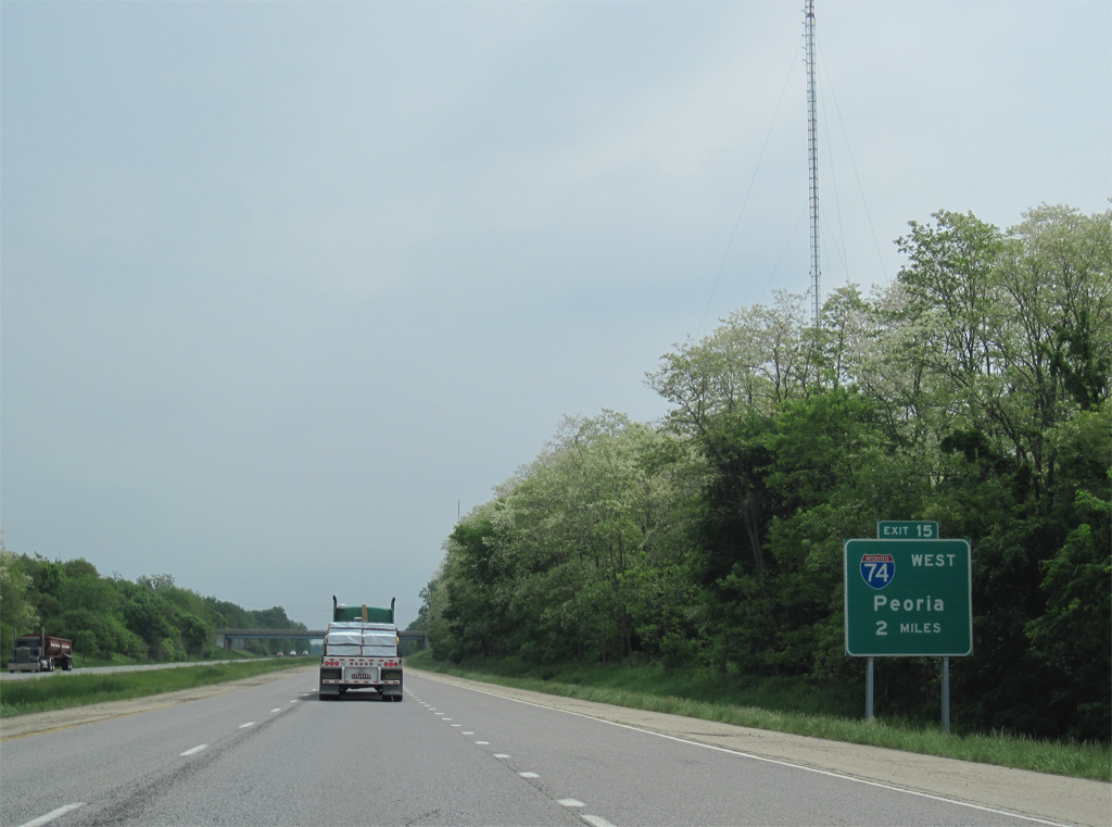
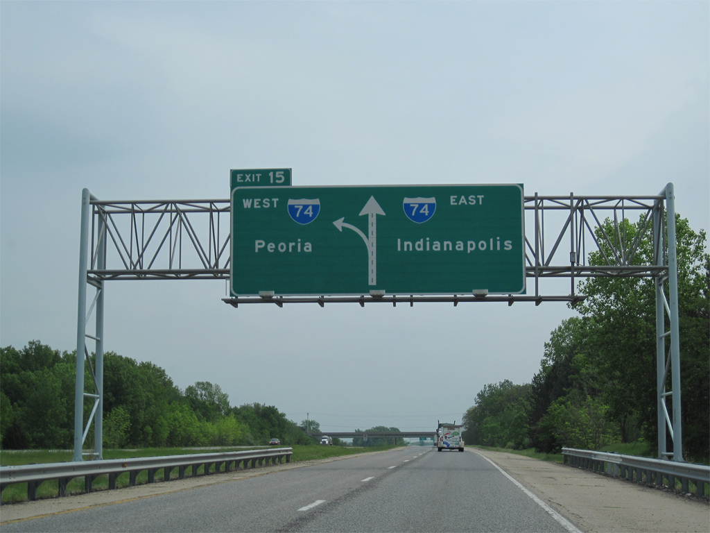
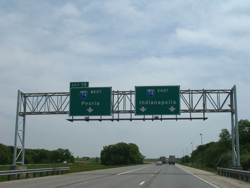
Interstate 474 runs across southern reaches of East Peoria to a wide two-wye interchange (Exit 15) with I-74.
05/07/10
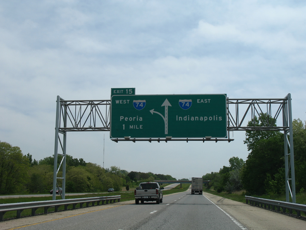
Left Exit 15 provides access to Interstate 74 west back into East Peoria and Peoria from the east end of I-474.
05/24/08
I-74 and I-155 Improvement Project underway between March 2013 and October 2016 reconstructed I-74 from Pleasant Hill Drive, just east of the exchange with I-474, to Morton.
05/07/10
Five exits serve East Peoria along Interstate 74 west to the Murray Baker Bridge, 3.8 miles to the north. Linking I-74 at Morton with I-55 at Lincoln, Interstate 155 begins 2.4 miles to the east.
05/24/08
References:
- Shade-Lohmann Bridge. John A. Weeks III.
Photo Credits:
- Alex Nitzman: 05/24/08
- ABRoads: 05/07/10
Connect with:
Page Updated Thursday March 21, 2013.