
Interstate 495 West - Suffolk County

 West
West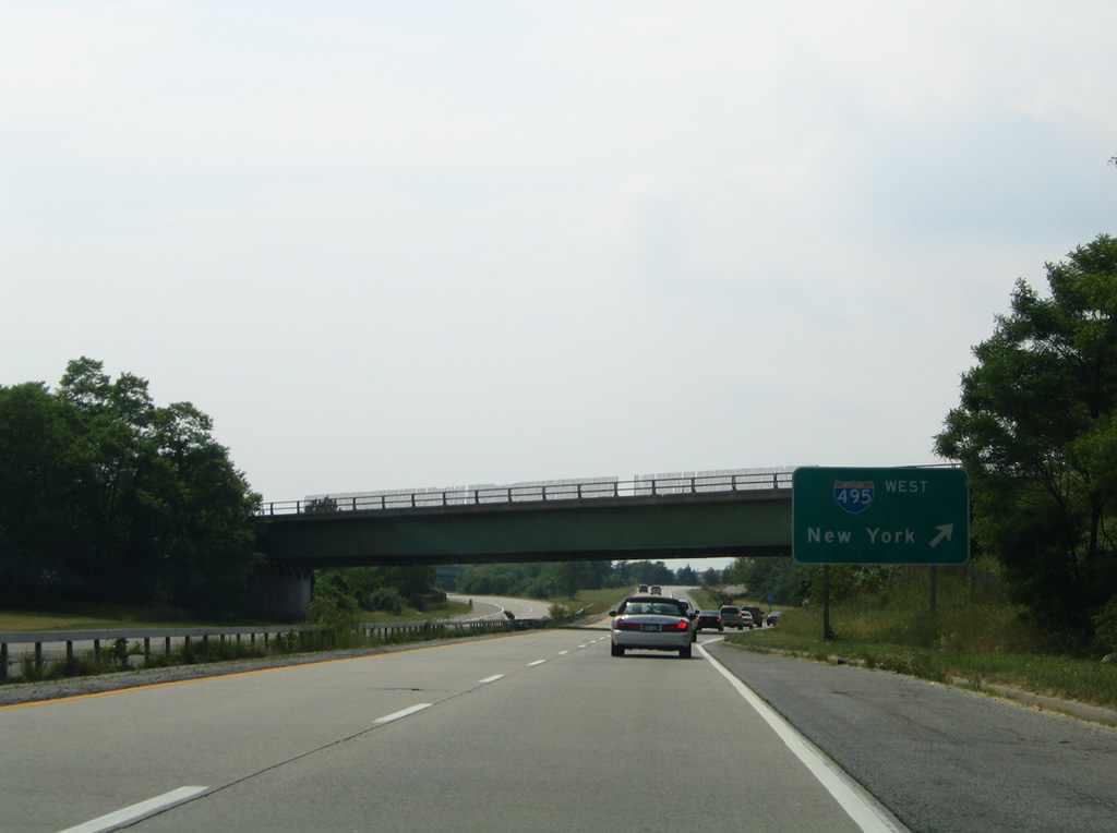
A loop ramp joins Old Country Road west with the beginning of the Long Island Expressway.
06/13/05
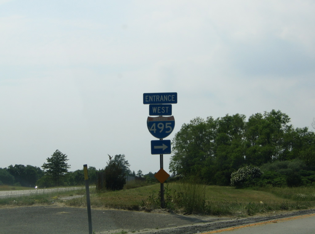
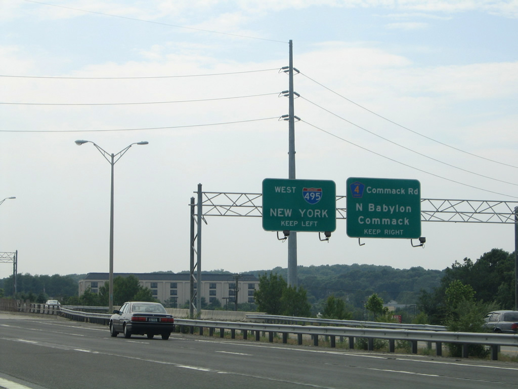
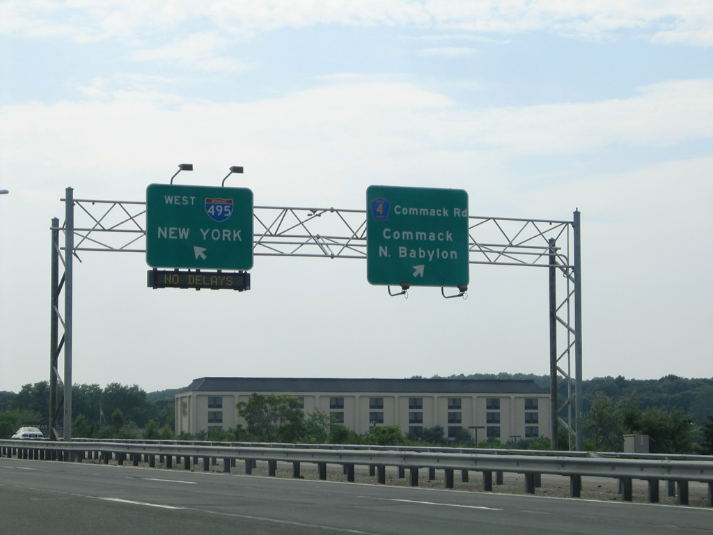
Entrance shield assembly at the westbound ramp for Interstate 495.
06/13/05
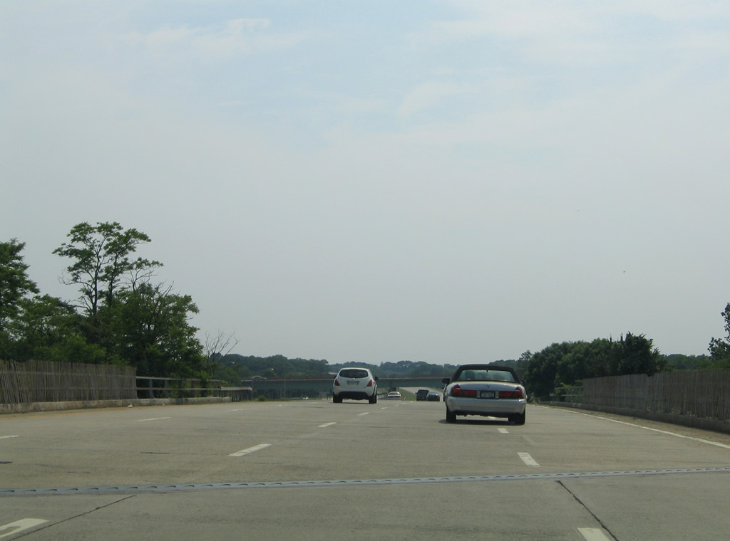
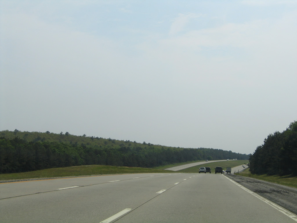
Passing over Old Country Road, Interstate 495 immediately expands to three westbound lanes from a roadway stub.
06/13/05

A metal guard rail and a series of signs shunt motorists from I-495 east to Old Country Road ahead of an eastbound roadway stub.
06/13/05
Ramps add traffic to the Long Island Expressway west from NY 25 (West Main Street) ahead of the first reassurance shield for I-495.
06/13/05

Interstate 495 curves southwest from Riverhead to cross both River Road and the Peconic River.
06/13/05
Curving by the Long Island State Pine Barrens Preserve, beyond a half diamond interchange with NY 24 (Edwards Avenue) at Calverton.
06/13/05

Halsey Manor Road passes over Interstate 495, one mile east of the Exit 70 diamond interchange with Suffolk County 111 (Captain Daniel Roe Highway).
06/13/05
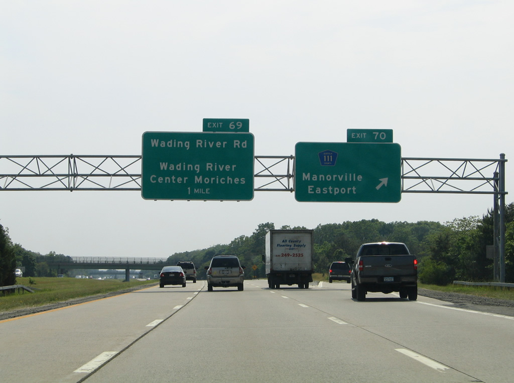
CR-111 leads east from Manorville and Interstate 495 to CR-511 (Moriches-Riverhead Road) and NY 27 (Sunrise Highway) outside Eastport.
06/13/05
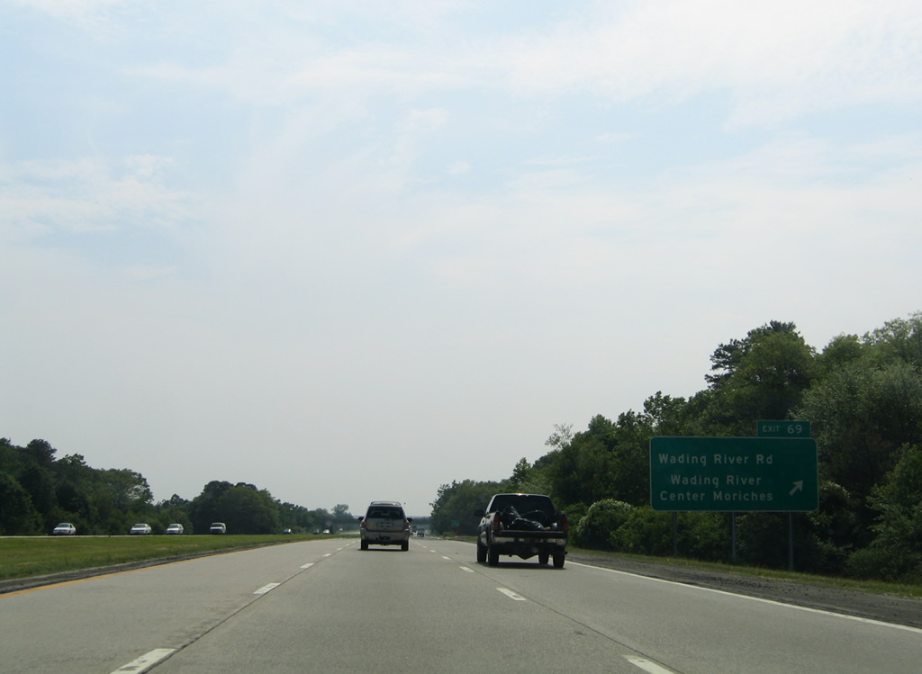
Exit 69 follows less than a mile west of CR-111 with Wading River Road. Wading River Road heads north from Interstate 495 to Wading River via Schultz Road and south to Railroad Avenue at Center Moriches.
06/13/05
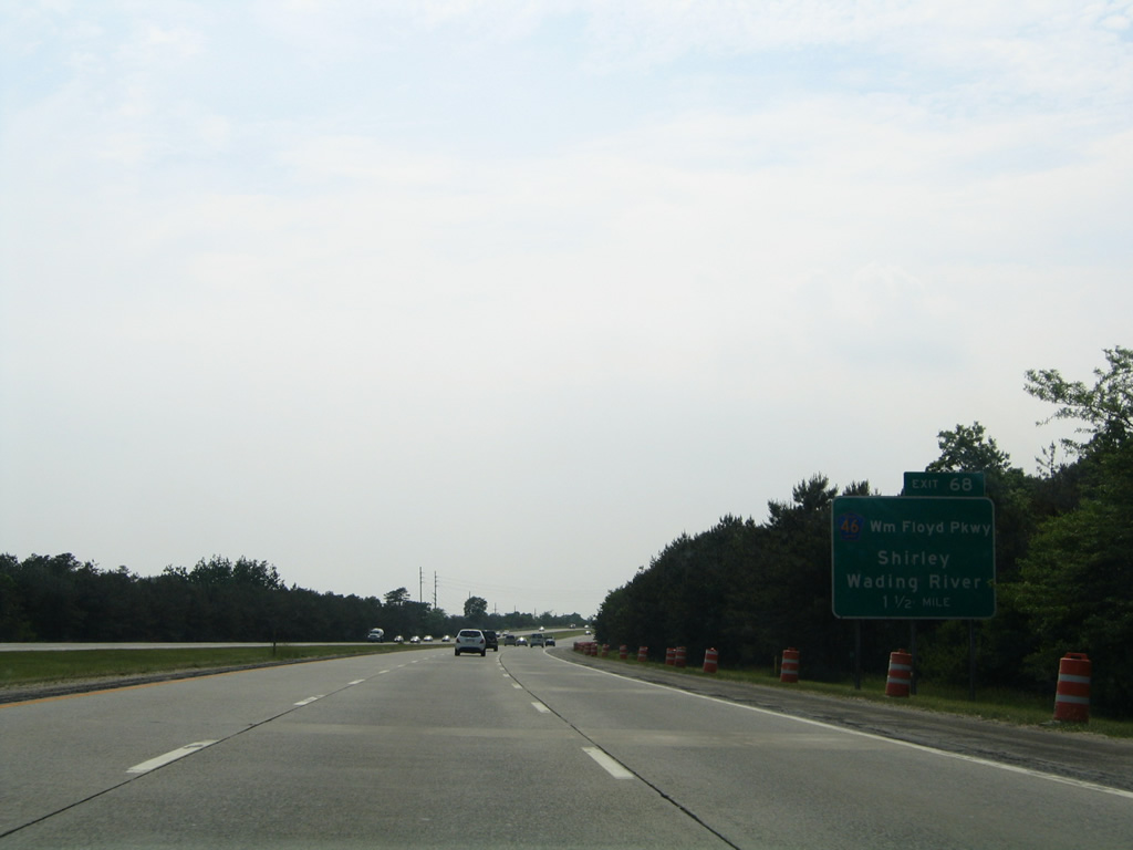
Suffolk County 46 (William Floyd Parkway) sees a cloverleaf interchange (Exit 68) with Interstate 495 next in 1.5 miles.
06/13/05
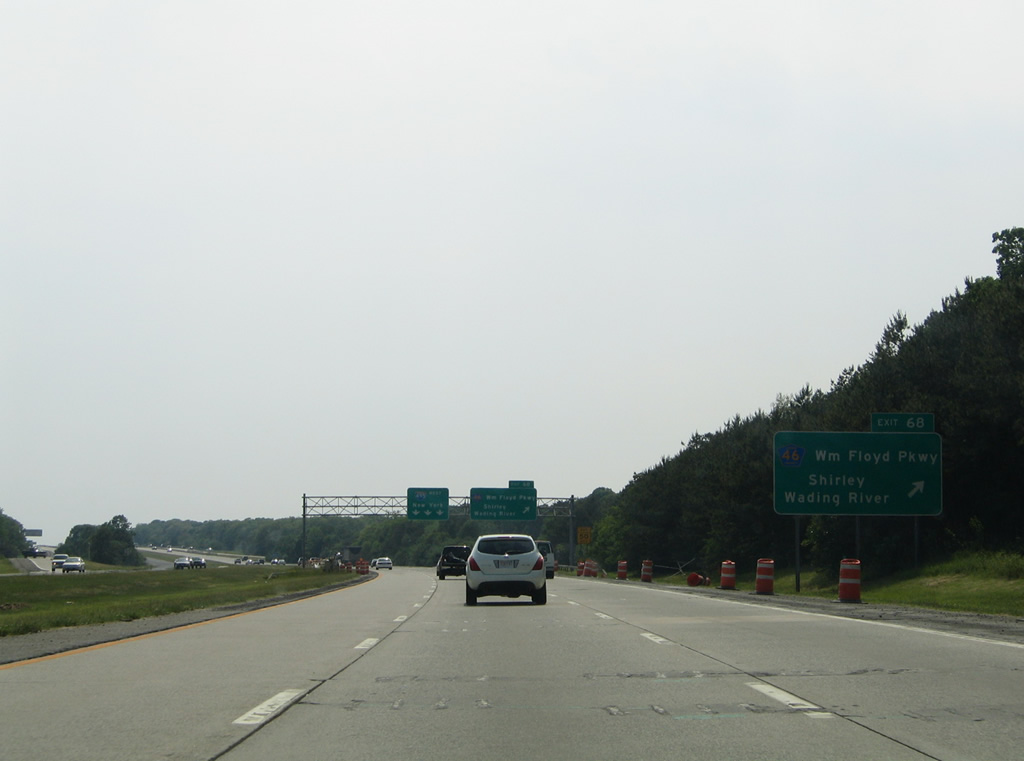
CR-46 connects Interstate 495 with Brookhaven Lab to the north and Smith Point Park on Fire Island to the south.
06/13/05

All traffic to William Floyd Parkway departs I-495 west in unison via a collector distributor roadway to County Road 46. CR-46 constitutes a multi-lane highway north to NY 25A, west of Wading River and south to Shirley and the formerly tolled bridge across Narrow Bay.
06/13/05
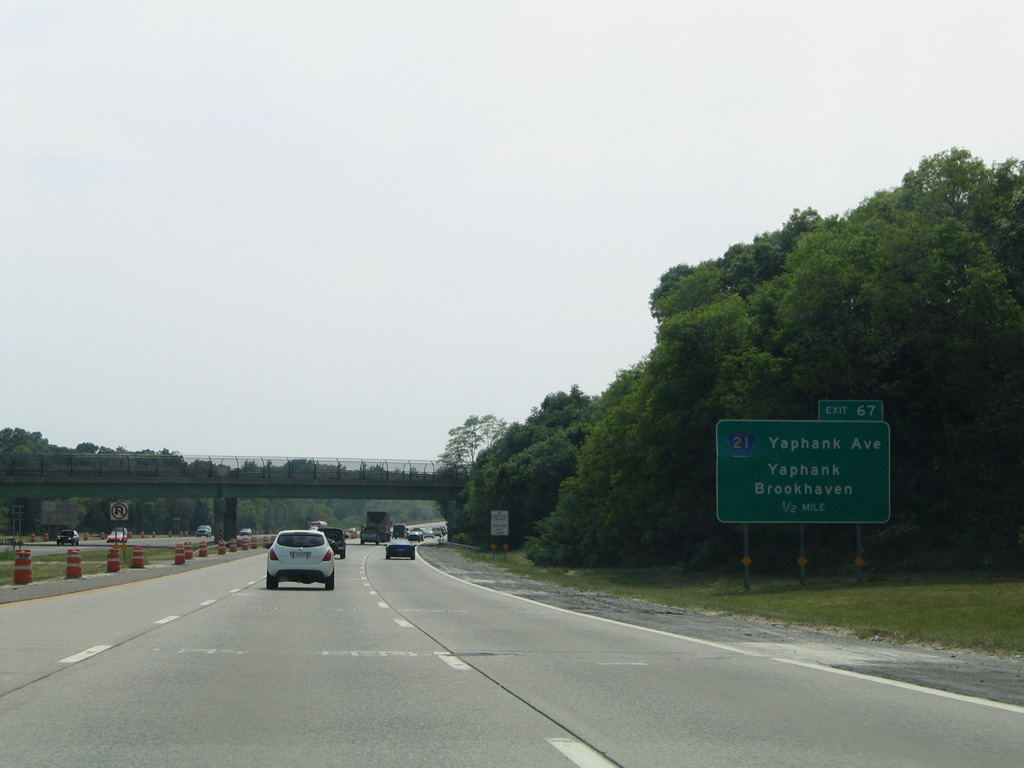
County Road 21 (Yaphank Avenue) and Interstate 495 come together at a diamond interchange (Exit 67) just west of the Carmans River.
06/13/05
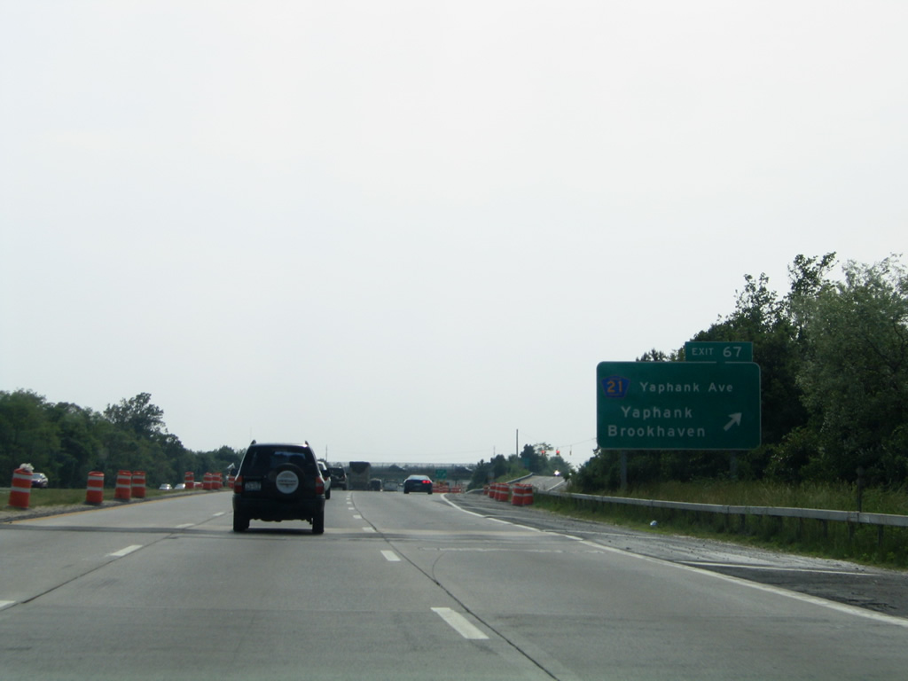
Exit 67 leaves Interstate 495 west for Yaphank Avenue nearby on Main Street through Yaphank to Siegfield Park. South of the LIE, CR-21 serves the Suffolk County offices en route to Brookhaven.
06/13/05
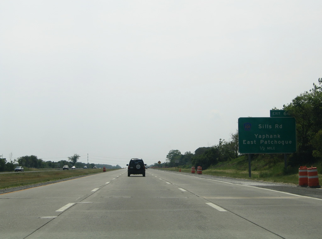
A split diamond interchange originally connected Interstate 495 with both County Road 21 (Yaphank Avenue) and County Road 101 (Sills Road). Separate on and off-ramps were later added, resulting in a full diamond interchange for Exit 66. CR-101 leads north from Exit 66 to Siegfield Park and south to East Patchogue.
06/13/05
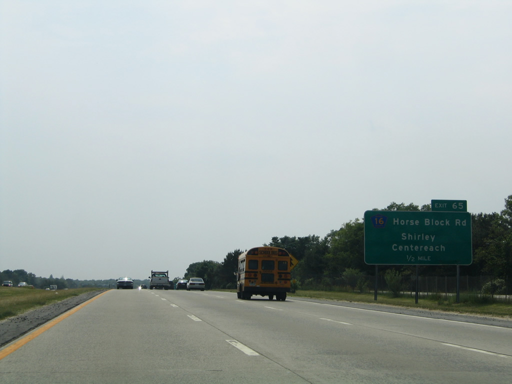
Frontage roads extend west from Exit 66 alongside Interstate 495 all the way to Plainview. Forthcoming Exit 65 utilizes the service roads to make the connections with Suffolk County 16 (Horse Block Road) east to Shirley and west to Farmingville and Centereach.
06/13/05
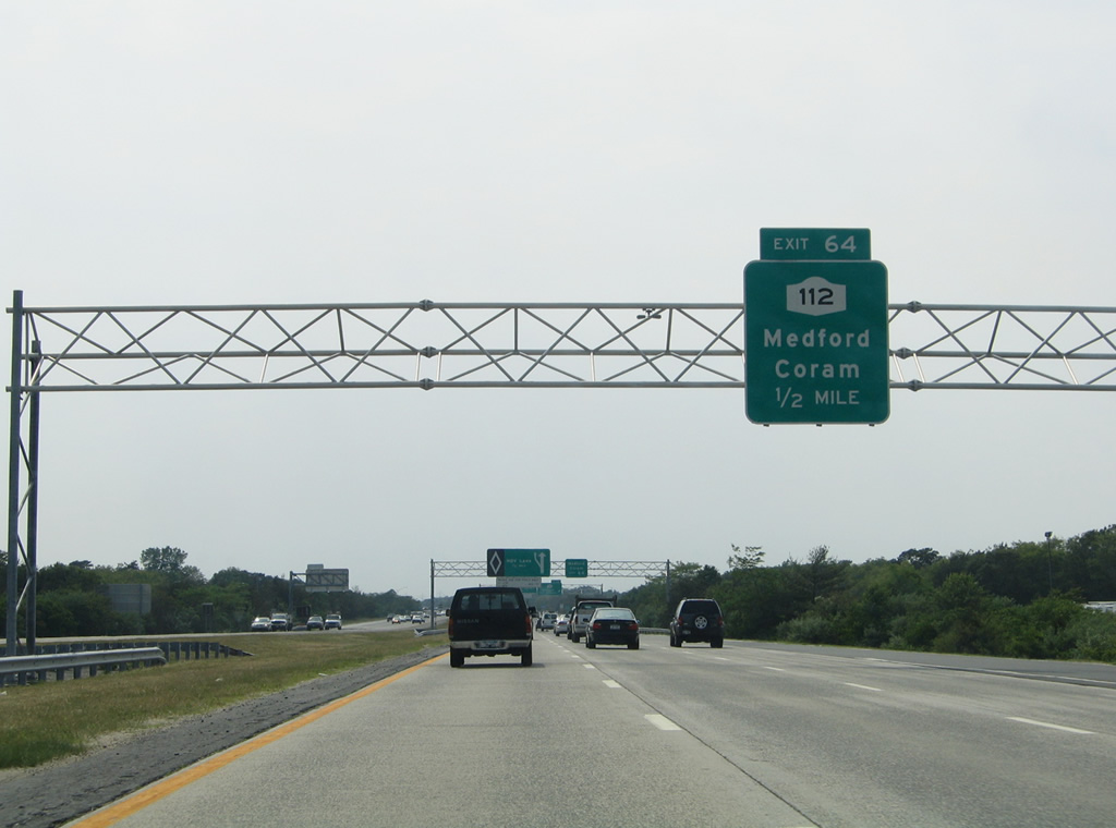
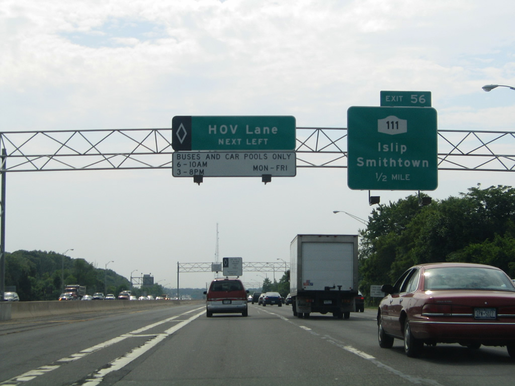
NY 112, a 12.5 mile state route between CR 80 at Patchogue and NY 25A at Port Jefferson Station, meets Interstate 495 at Exit 64 in one half mile.
06/13/05
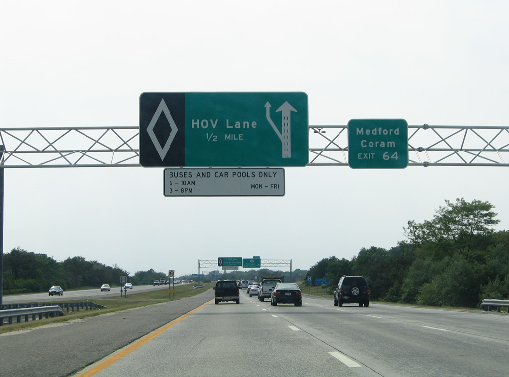
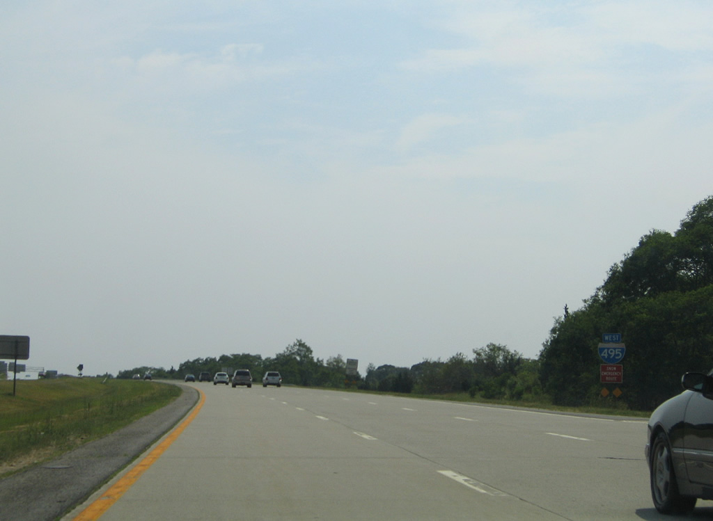
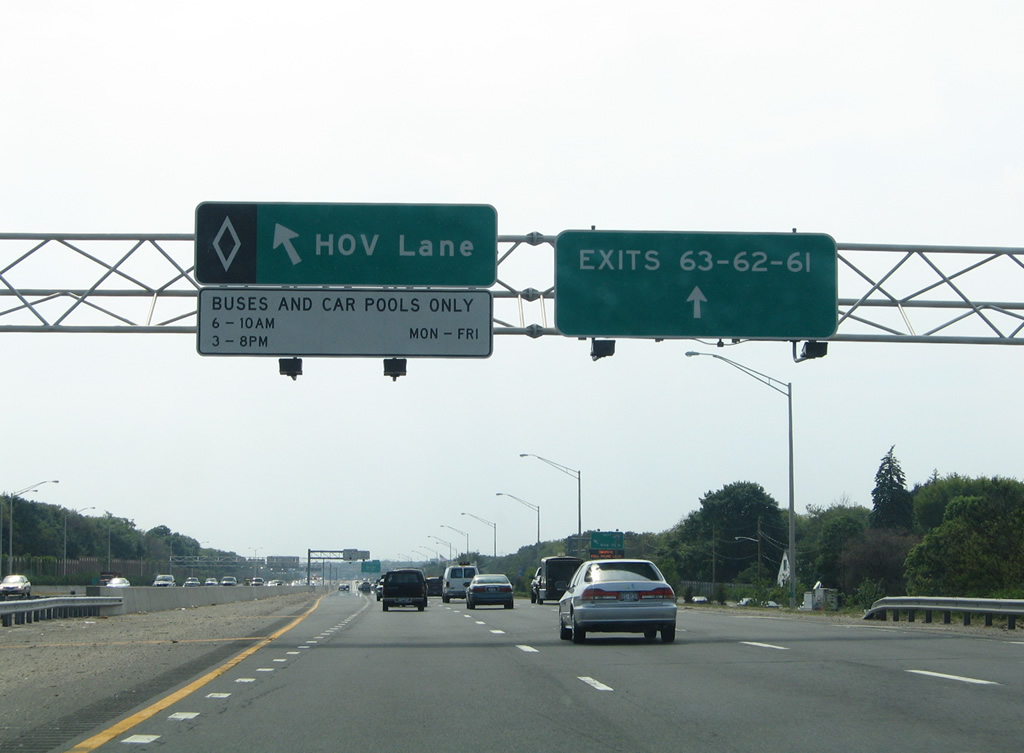
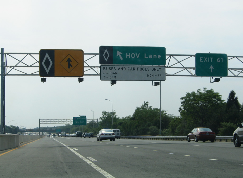
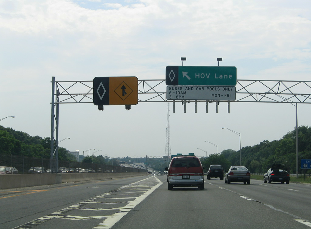
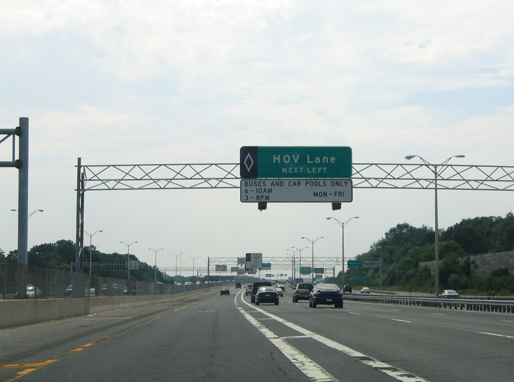
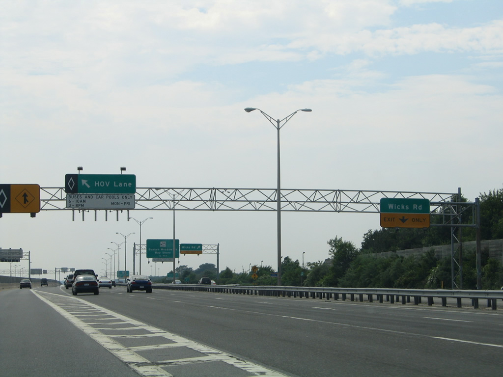
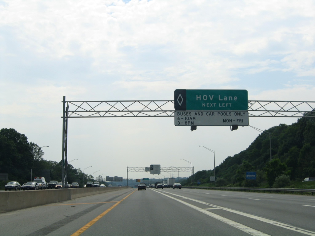
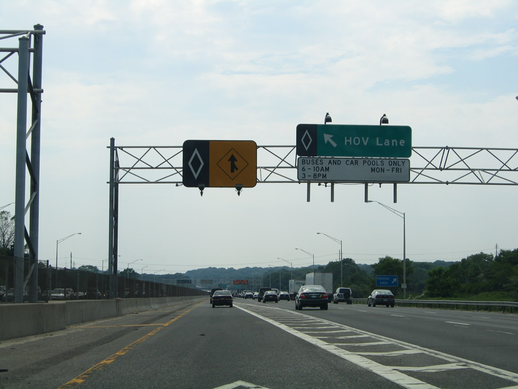
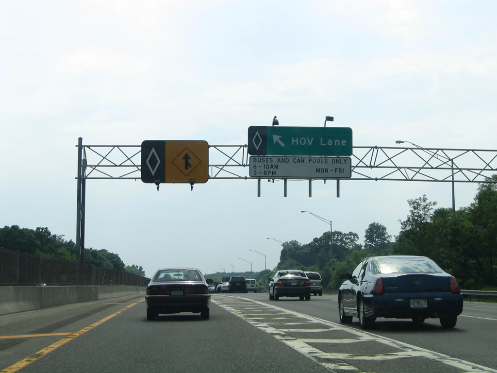
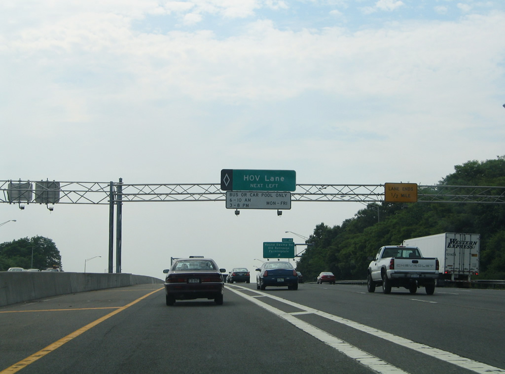
An HOV lane commences just west of Exit 64 along the innermost lane of Interstate 495 to Exit 33 (Lakeville Road). The lanes operate during both morning and peak periods of traffic during weekdays.
06/13/05
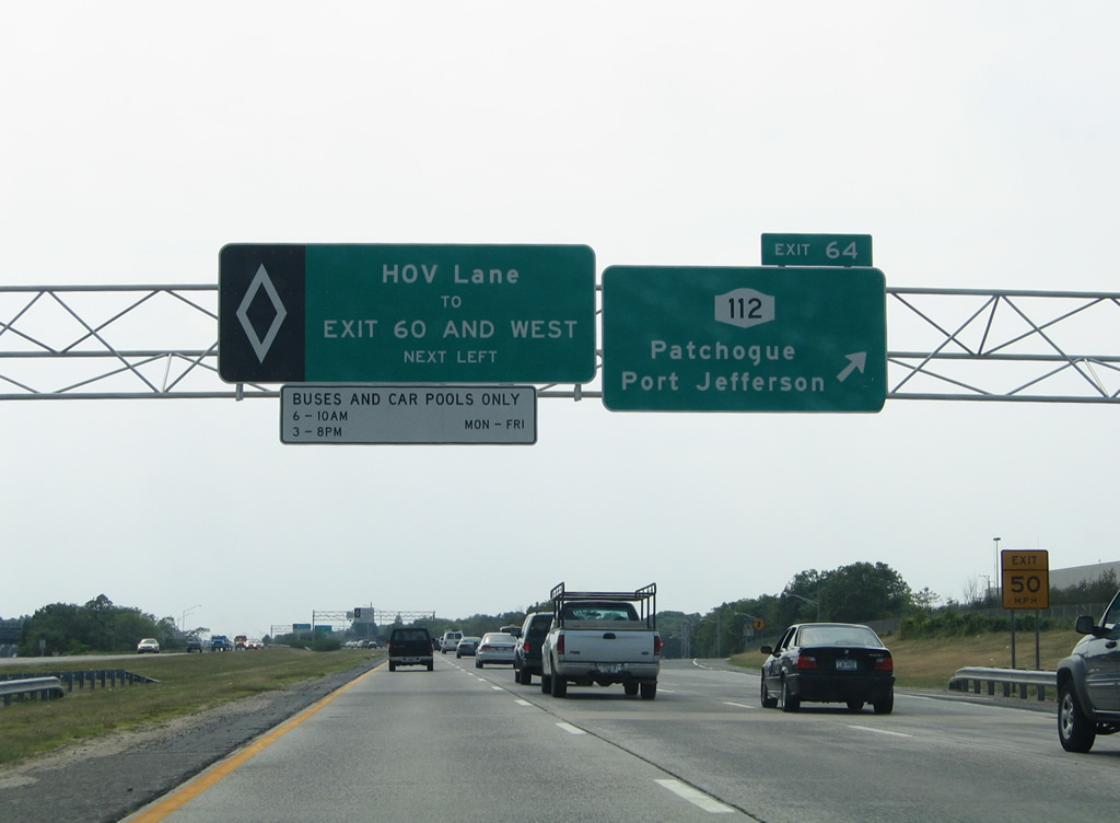
Exit 64 leaves Interstate 495 west for NY 112 (Medford Avenue) north to Coram and south to Medford.
06/13/05
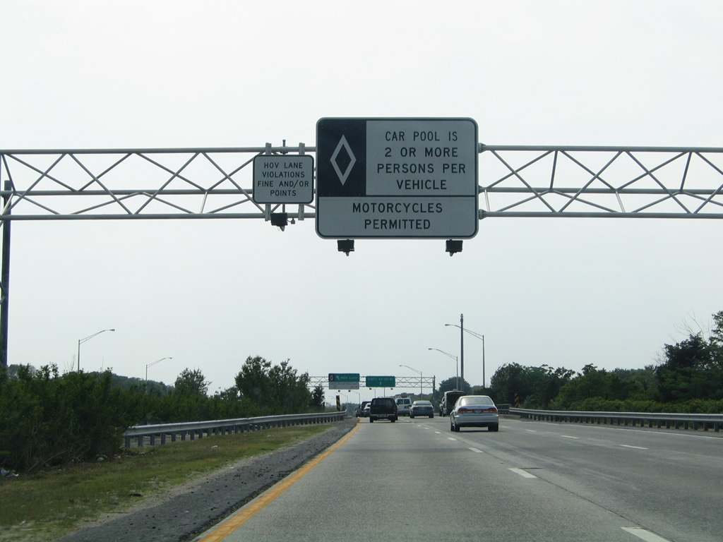
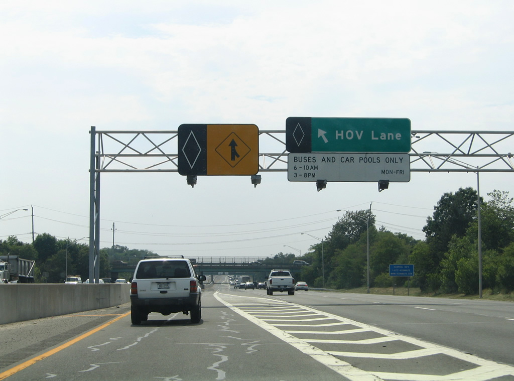
The Long Island Expressway carpool lanes are restricted to HOV-2 traffic and motorcycles.
06/13/05
The HOV lane allows long distance commuters to avoid ingress and egress movements associated with the Interstate 495 mainline. A painted median separates the carpool lane from three general purpose lanes.
06/13/05
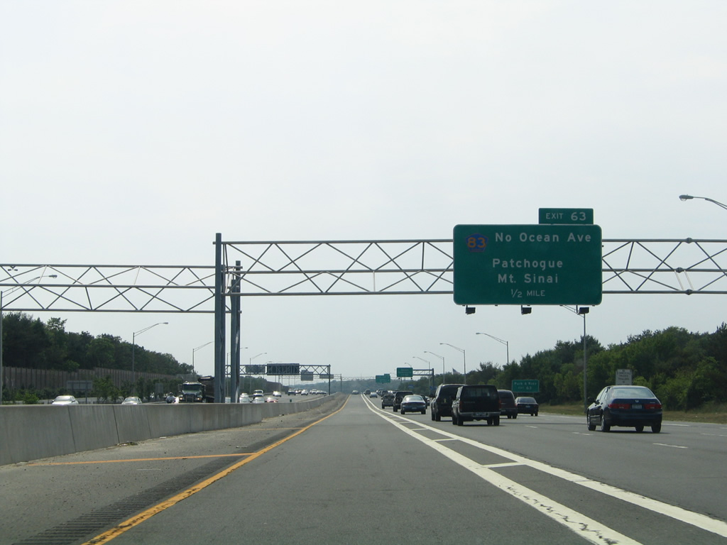
Exit 63 joins Interstate 495 with Suffolk County 83 (North Ocean Avenue) at Farmingville in one half mile. Ocean Avenue leads south to the Patchogue business district.
06/13/05

Entering the Exit 63 diamond interchange with County Road 83 (North Ocean Avenue) on I-495 west of the Old Medford Avenue underpass. County Road 83 encircles Coram along an arterial route northward to Selden and NY 25A at Mt. Sinai.
06/13/05
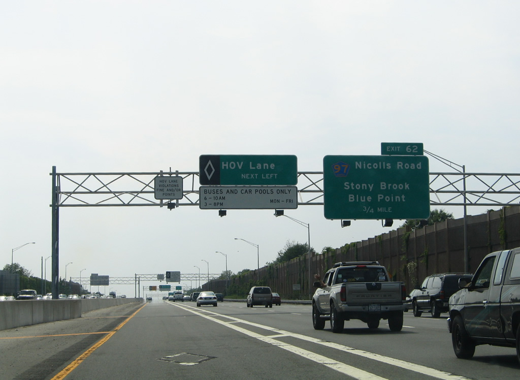
A cloverleaf interchange facilitates the movements between Interstate 495 and Suffolk County 97 (Nicolls Road) in 0.75 miles.
06/13/05
Motorists originating from Patchogue eastward may access the HOV lane between Exits 63 and 62.
06/13/05

Suffolk County 97 follows Nicolls Road, a controlled-access arterial, south from Exit 62 to County Road 85 (former NY 112A / Montauk Highway) at Blue Point.
06/13/05

Exit 62 leaves Interstate 495 west for Expressway Drive North (north side frontage road) to its ramps with Nicolls Road. County Road 97 (Nicolls Road) ventures north to SUNY Stony Brook University and NY 25A.
06/13/05
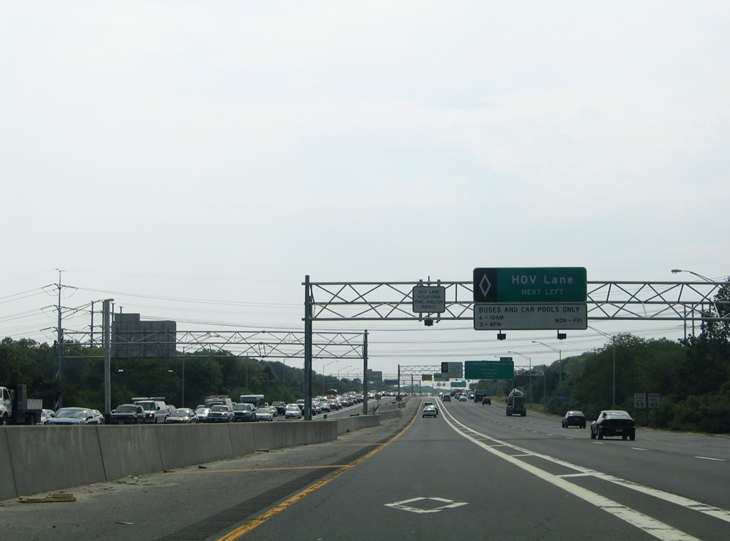
Heavy traffic appears in the eastbound direction of the Long Island Expressway as I-495 westbound approaches the next ingress point to the HOV lane.
06/13/05

Suffolk County 19 (Patchogue-Holbrook Road) angles northwest from County Road 65 (Division Street) in Patchogue to cross paths with Interstate 495 at a diamond interchange (Exit 61) near Holbrook in one half mile.
06/13/05
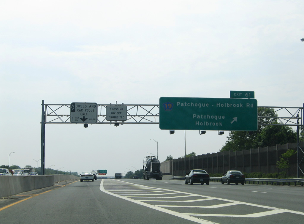
Exit 61 departs the L.I.E. west after the Holbook Road underpass, joining the westbound frontage road ahead of CR 19. Patchogue-Holbrook Road curves west and then northwest to conclude County Road 19 at Portion Road (Suffolk County 16) east of Lake Ponkonkoma.
06/13/05
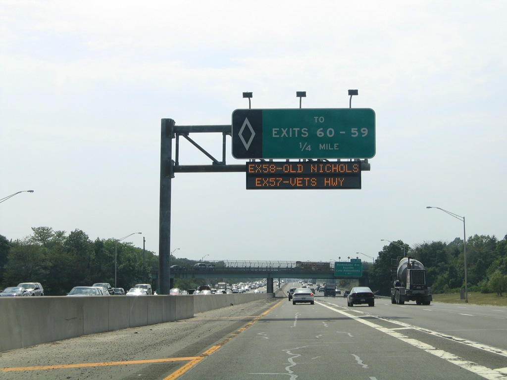
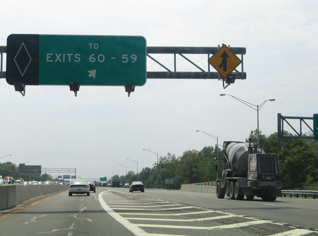
Drivers along the HOV-lane next see an egress after the County Road 19 overpass, providing access to Exits 60 and 59 along the Interstate 495 mainline.
06/13/05

Exit 60 consists of a split diamond interchange with both Hawkins and Ronkonkoma Avenue at Ronkonkoma in one mile.
06/13/05
HOV traffic merges onto Interstate 495 west for Lake Ronkonkoma, Sayville and Oakdale.
06/13/05

Hawkins Avenue and parallel Ronkonkoma Avenue lead north from Interstate 495 to the Lake Ronkonkoma area, combining en route to NY 25 (MIddle Country Road) at Lake Grove.
06/13/05
South from Exit 60, Ronkonkoma Avenue doubles as Suffolk County 29 to become Smithtown Avenue en route to County Road 29 (Lakeland Avenue) along the periphery of Long Island Mac Arthur Airport (ISP).
06/13/05

Westbound at the Exit 60 slip ramp onto Expressway Drive North ahead of both Hawkins and Ronkonkoma Avenues. Sayville is reached via County Road 29 (Ronkonkoma Avenue) south to County Road 93 (Lakeland Avenue).
06/13/05
An ingress point for the HOV roadways lies below the Hawkins Avenue overpass.
06/13/05

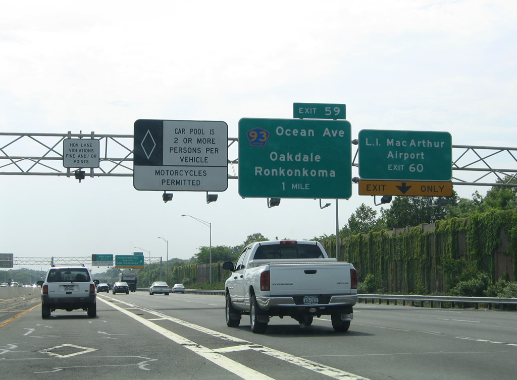
Suffolk County 93 originates at the Lakeland Avenue interchange with NY 27 (Sunrise Highway), east of Oakdale. The county road follows an arterial route northwest from Bohemia to Ocean Avenue through Lakeland and a diamond interchange with I-495 at Exit 59. Rosevale Avenue carries CR 93 northwest around Lake Ronkonkoma to its end at Smithtown Boulevard (CR 16).
06/13/05

Leaving Ronkonkoma, westbound HOV motorists approach the next egress point for access to Exits 58 and 57.
06/13/05
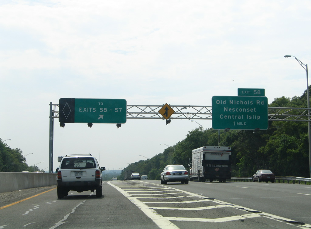
Nichols Road in Nesconset becomes Old Nichols Road at East Hauppage southwest from Suffolk County 67 (Long Island Motor Parkway) to meet Interstate 495 at Exit 58 within the village of Islandia.
06/13/05
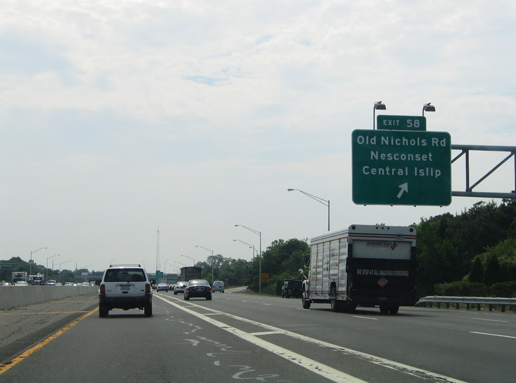
Old Nichols Road continues south from a diamond interchange with Interstate 495 (Exit 58) to become Suffolk County 100 along Suffolk Avenue through Central Islip.
06/13/05
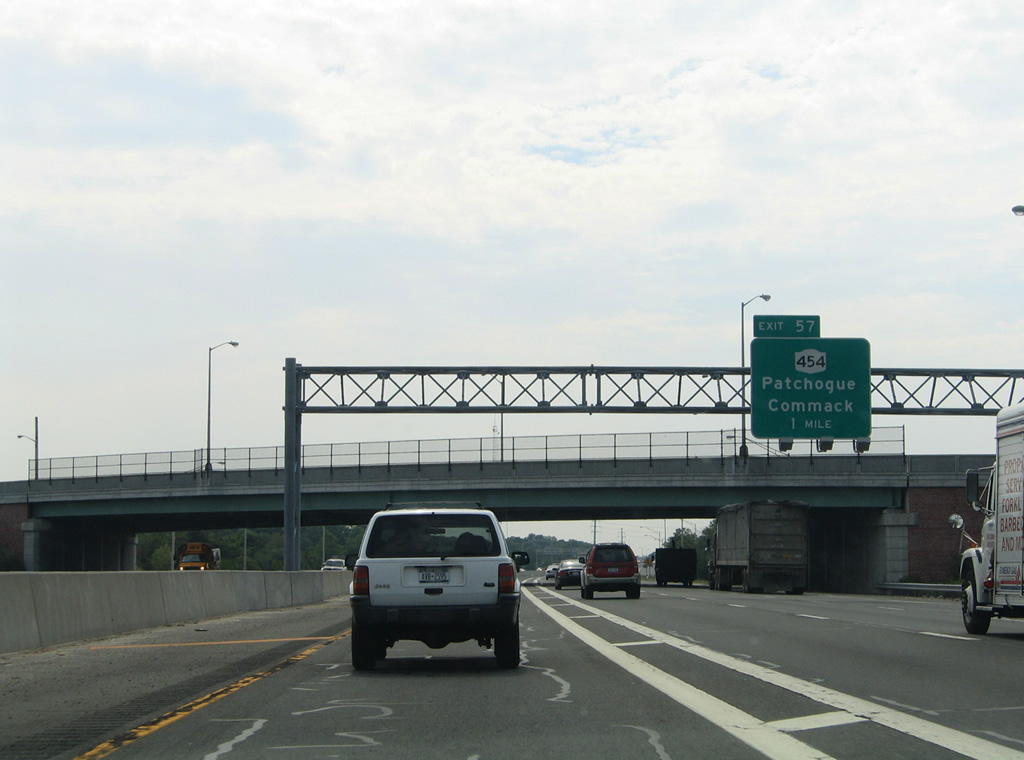
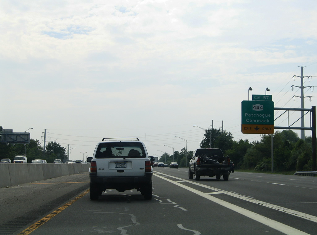
NY 454 (Veterans Memorial Highway) branches northwest from NY 27 at Holbrook and west of Patchogue to meet Interstate 495 by a large business park area of Islandia at Exit 57 in one mile.
06/13/05
The on-ramp from Old Nichols Road adds a fifth westbound lane for Interstate 495 to the split diamond interchange with NY 454 (Veterans Memorial Highway) and Suffolk County 67 (Long Island Motor Parkway).
06/13/05

Heading northwest, NY 454 (Veterans Memorial Highway) combines with parallel NY 347 nearby through Hauppage to the beginning of the Northern State Parkway. The 13.7 mile state route concludes at NY 25 (Jericho Turnpike) in Commack.
06/13/05

The next westbound egress point for HOV traffic lies west of the NY 454 underpass.
06/13/05
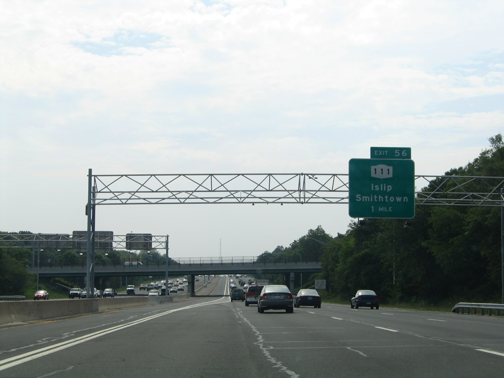
NY 111, a 9.4 mile route between Islip and Smithtown meets Interstate 495 next in one mile.
06/13/05
Exit 56 consists of a diamond interchange with NY 111 (Wheeler Road) in Hauppage. NY 111 splits with Wheeler Road just south of the L.I.E. for Joshuas Path through the East Brentwood community. The state route follows Islip Avenue south from there to Islip and its conclusion at NY 27A (Main Street).
06/13/05
An ingress point to the westbound HOV lane departs the mainline just ahead of the Exit 56 slip ramp onto Expressway Drive North.
06/13/05
North from Exit 57, NY 111 takes Wheeler Road to junction NY 454 (Veterans Memorial Highway), where it becomes Hauppage Road to NY 25 & 25A (Main Street) at Village of the Branch.
06/13/05

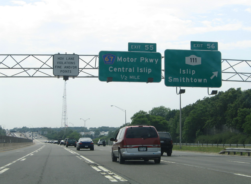
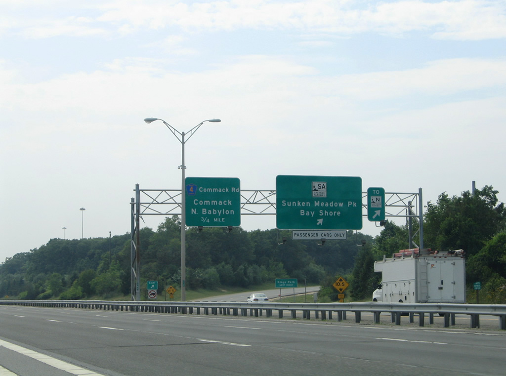
Long Island Motor Parkway (Suffolk County 67) parallels the Long Island Expressway west from Lake Ronkonkoma to Central Islip before finally seeing access with I-495 at Exit 55. County Road 67 shifts from south of the L.I.E. to north of it, serving a sprawling industrial park area to Moreland Road and Exit 53.
06/13/05
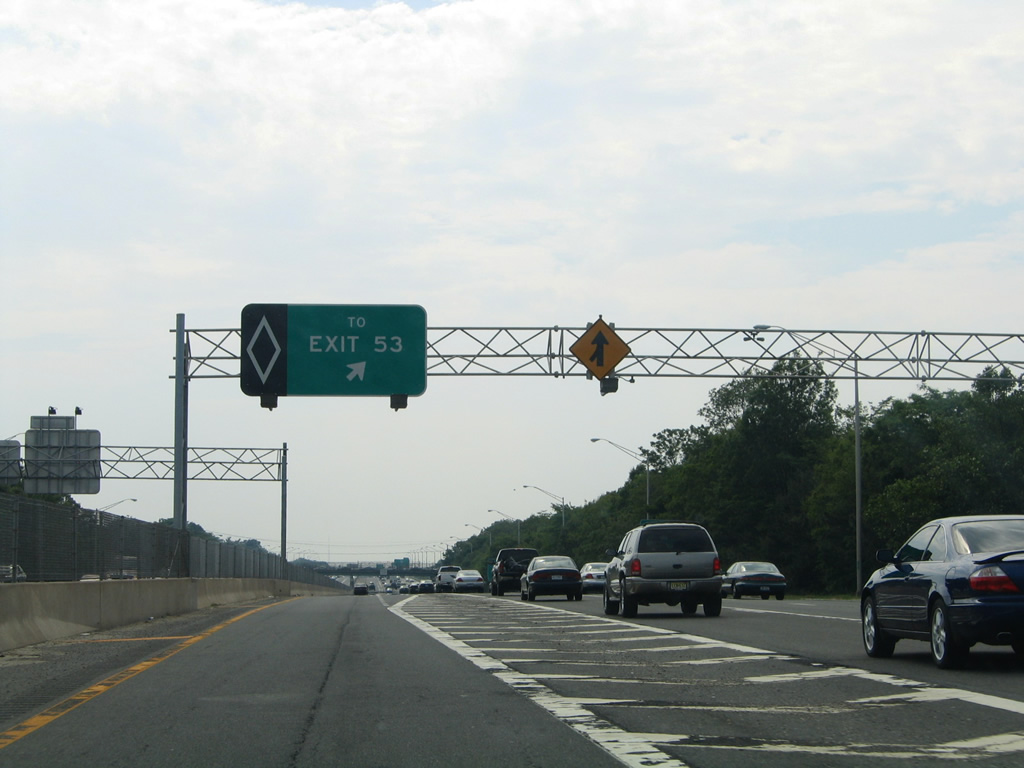
Approaching the Long Island Motor Parkway, HOV motorists are one half mile out from the egress point for Exit 53 to Sagtikos Parkway.
06/13/05
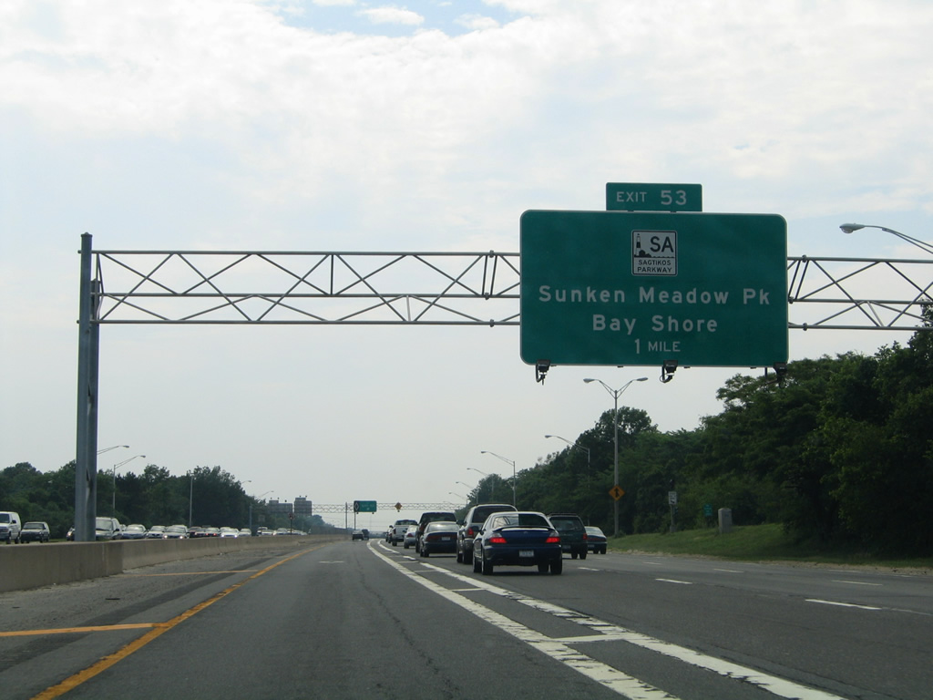
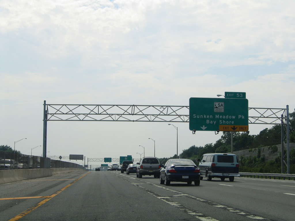
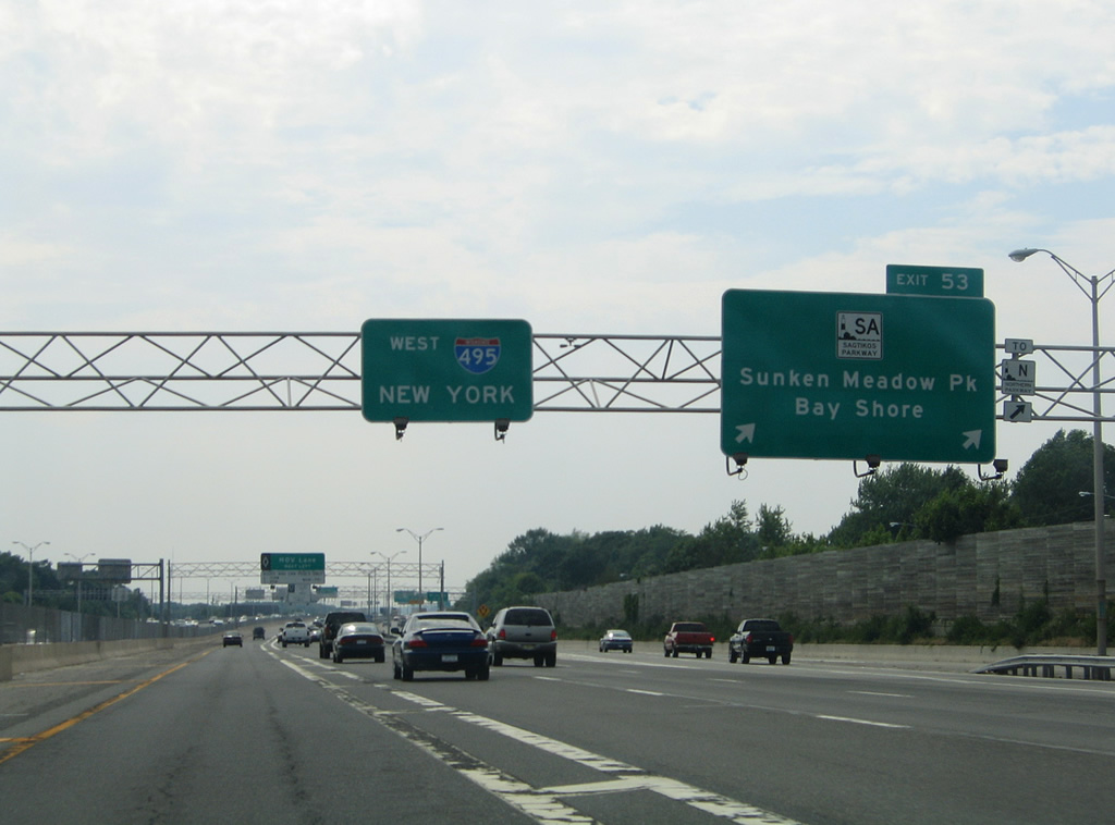
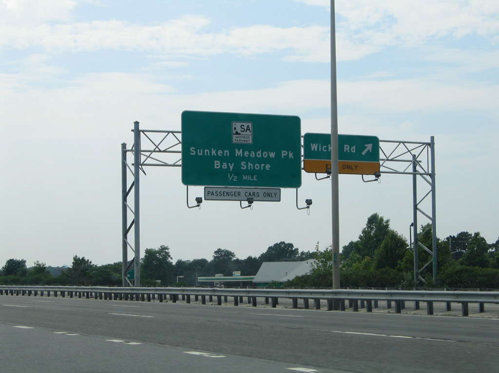
Sagtikos Parkway and Interstate 495 meet at a directional cloverleaf interchange in one mile.
06/13/05
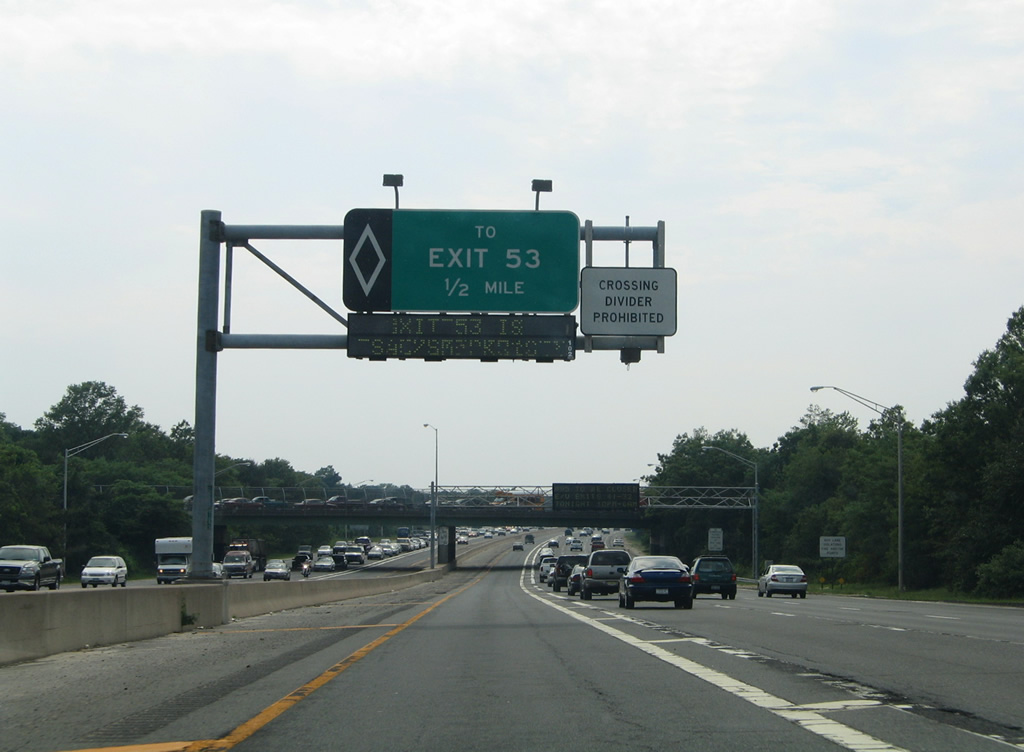
The egress ramp points HOV drivers to the mainline ahead of Exit 53. Exit 53 consists of a collector distributor roadway with four westbound off-ramps.
06/13/05
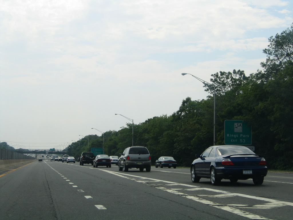
Sagtikos Parkway leads north from Interstate 495 to become Sunken Meadow Parkway to Kings Park and an end at Sunken Meadow State Park.
This sign was replaced by 2013 with a new panel directing motorists to Sunken Meadow State Park in place of Kings Park, which is now the northbound control point of the Sagtikos Parkway.
06/13/05
Suffolk County 4 parallels Sagtikos Parkway northward along Commack Road to Northern State Parkway. A diamond interchange with Commack Road follows just west of the ramps to the parkway.
06/13/05
A two lane ramp prepares to leave Interstate 495 west for the c/d roadway for Sagtikos Parkway. The 5.1 mile parkway connects the L.I.E. with Heckscher State Parkway east and Southern State Parkway west at Bay Shore to the south.
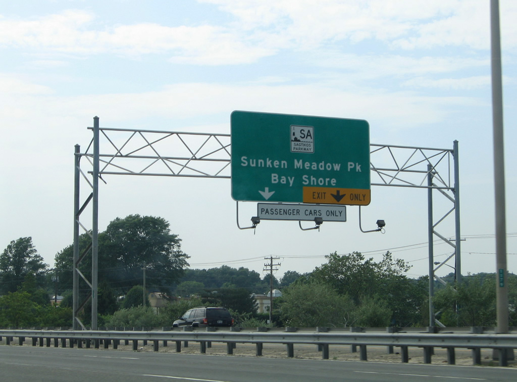
Sign changes made by 2013 change Sunken Meadow State Park to Kings Park.
06/13/05
A Northern Parkway trailblazer appears as Exit 53 parts ways with the Interstate 495 westbound mainline. Sagtikos Parkway meets the parallel parkway at a cloverleaf interchange one half mile to the north. Northern State Parkway leads west from NY 357 & 454 to Melville and Plainview, where it crosses paths with I-495 directly.
06/13/05
Motorists remaining along the Interstate 495 mainline see the next ingress point for the HOV roadway west west of the Exit 53 gore point.
06/13/05
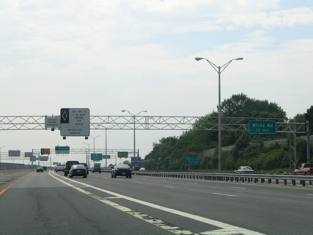
The first ramp of the Exit 53 c/d roadway connects I-495 with adjacent Suffolk County 67 (Motor Parkway) ahead of its intersection with Moreland Road north and Suffolk County 7 (Wicks Road) south.
06/13/05
County Road 7 follows Wicks Road south from County Road 67 through Brentwood to County Road 13 (Crooked Hill Road).
06/13/05
The Wicks Road off-ramp leaves Exit 53 for CR 7 south to Suffolk County Community College while ramps for Sagtikos Parkway prepare to depart for Kings Bay and Bay Shore. Like other parkways on Long Island, the Sagtikos is restricted to passenger cars only.
06/13/05
All traffic bound for the Sagtikos Parkway departs in unison from the Exit 53 c/d roadway. A directional ramp shuttles drivers southward to Bay Shore, with connections to Fire Island and Oak Beach via Robert Moses Causeway south.
06/13/05
Two lanes leave the c/d roadway for Sagtikos Parkway. Originally a loop ramp joined I-495 west with the parkway south. The parkway south ends where Heckscher Parkway transitions into Southern parkway from North Bay Shore to North Babylon.
06/13/05
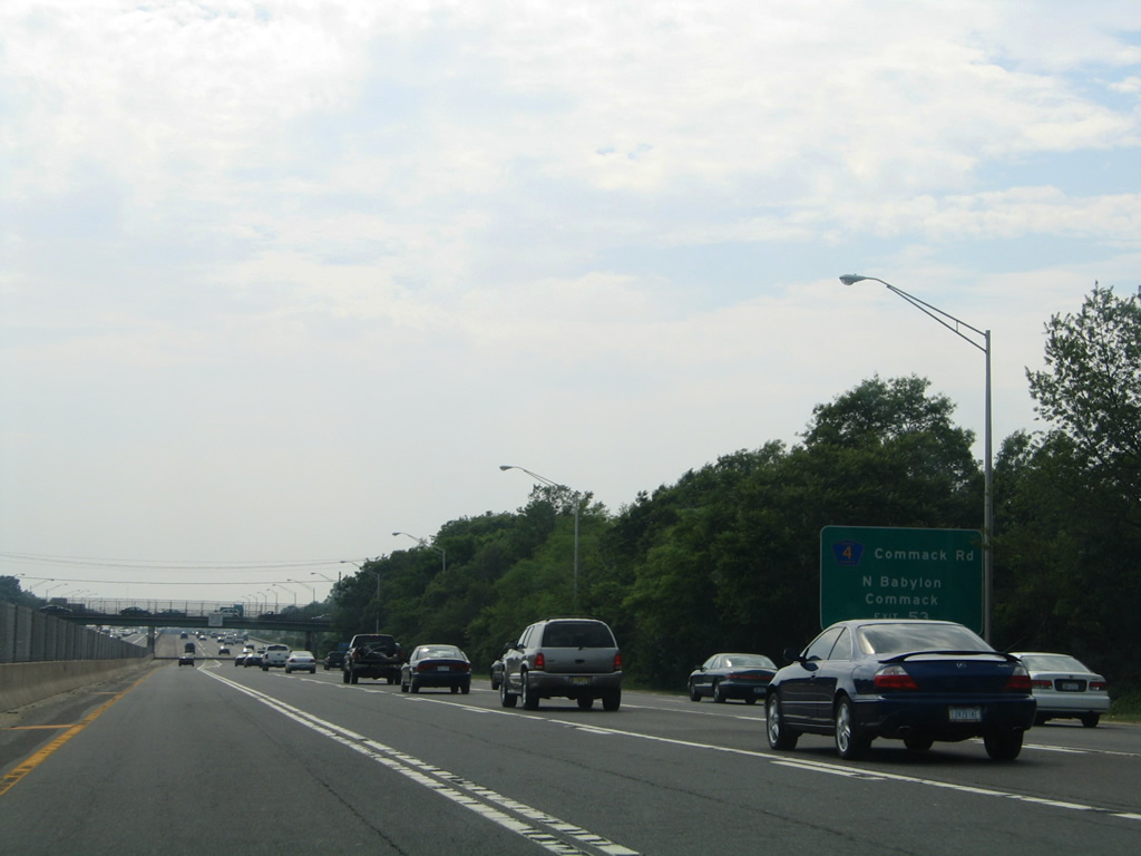
Passing over Suffolk County 13 (Crooked Hill Road), motorists along the Exit 53 c/d roadway near the slip ramp for Commack Road (CR 4) north to Commack and south to North Babylon.
06/13/05
The Commack Road off-ramp serves an adjacent retail area between County Road 4 and Sagtikos Parkway to the north. CR 4 ends in Commack to the north and at NY 231 (Deer Park Avenue) to the south.
06/13/05
Continuing west from County Road 4, Interstate 495 travelers pass by another ingress point for the HOV roadway and a parking area (rest area with no facilities) ahead of the Carls Straight Path overpass.
06/13/05
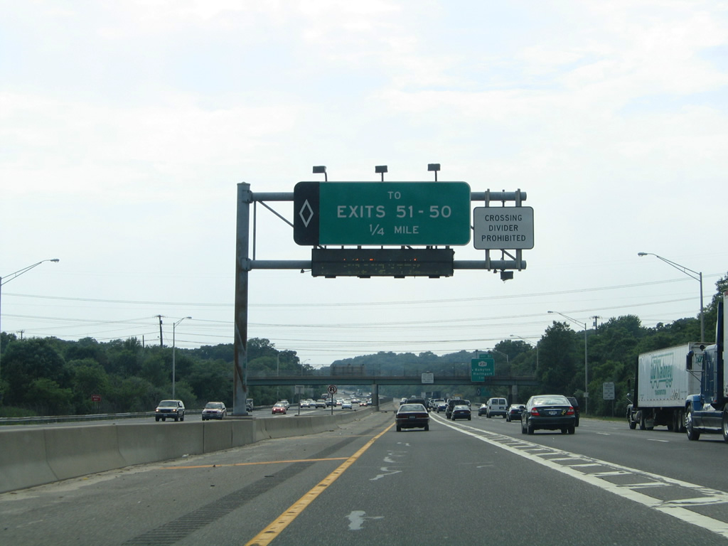
Access from the HOV lane for NY 231 (Exit 51) and Bagatelle Road (Exit 50) follows.
06/13/05

One mile east of the diamond interchange (Exit 51) with NY 231 (Deer Park Avenue) on I-495 west.
06/13/05
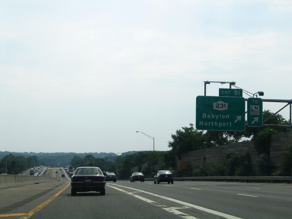
NY 231 travels 9.05 miles from NY 27A in Babylon to Northern State Parkway in Dix Hills. Connections with Deer Park Road (CR 66) north to NY 25 (Jericho Turnpike) and Suffolk County (Elwood Road) lead motorists north to Northport.
06/13/05

The second Dix Hills exit of Interstate 495 west joins the L.I.E. with Bagatelle Road in one mile.
06/13/05
Access to the HOV lane follows the Half Hollow Road overpass.
06/13/05
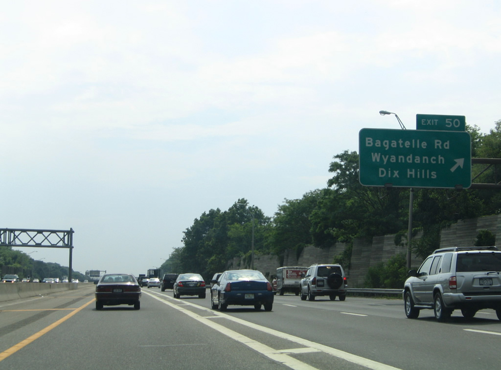
Bagatelle Road stems south from Half Hollow Road to a diamond interchange (Exit 50) with the Long Island Expressway. South from I-495, the road becomes Conklin Avenue to 22nd Avenue at Wyandanch.
06/13/05
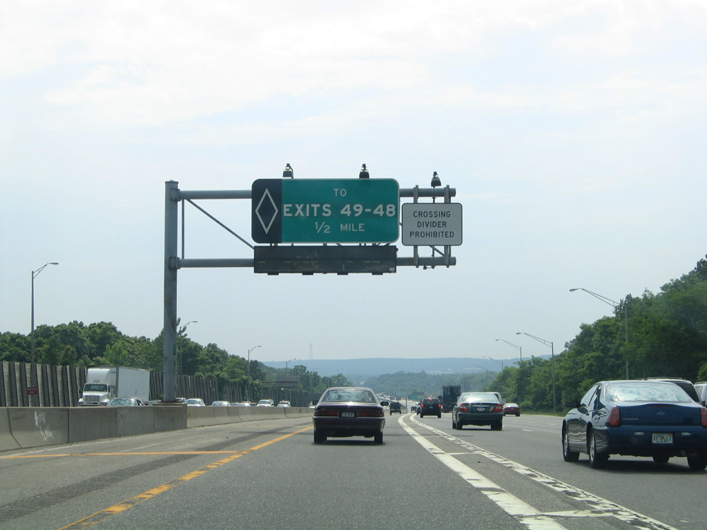
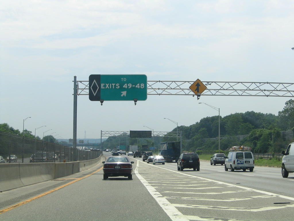
The next egress point from the HOV lane serves Exits 49 and 48 for the business and industrial center of Melville.
06/13/05

NY 110 meets Interstate 495 at a cloverleaf interchange with Broad Hollow Road. Exit 49N provides access to the northbound direction via North Service Road west to Pinelawn Road (Suffolk County 3).
06/13/05
Half Hollow Road circles southward and crosses Interstate 495 again ahead of the HOV egress ramp for NY 110 and Round Swamp Road.
06/13/05
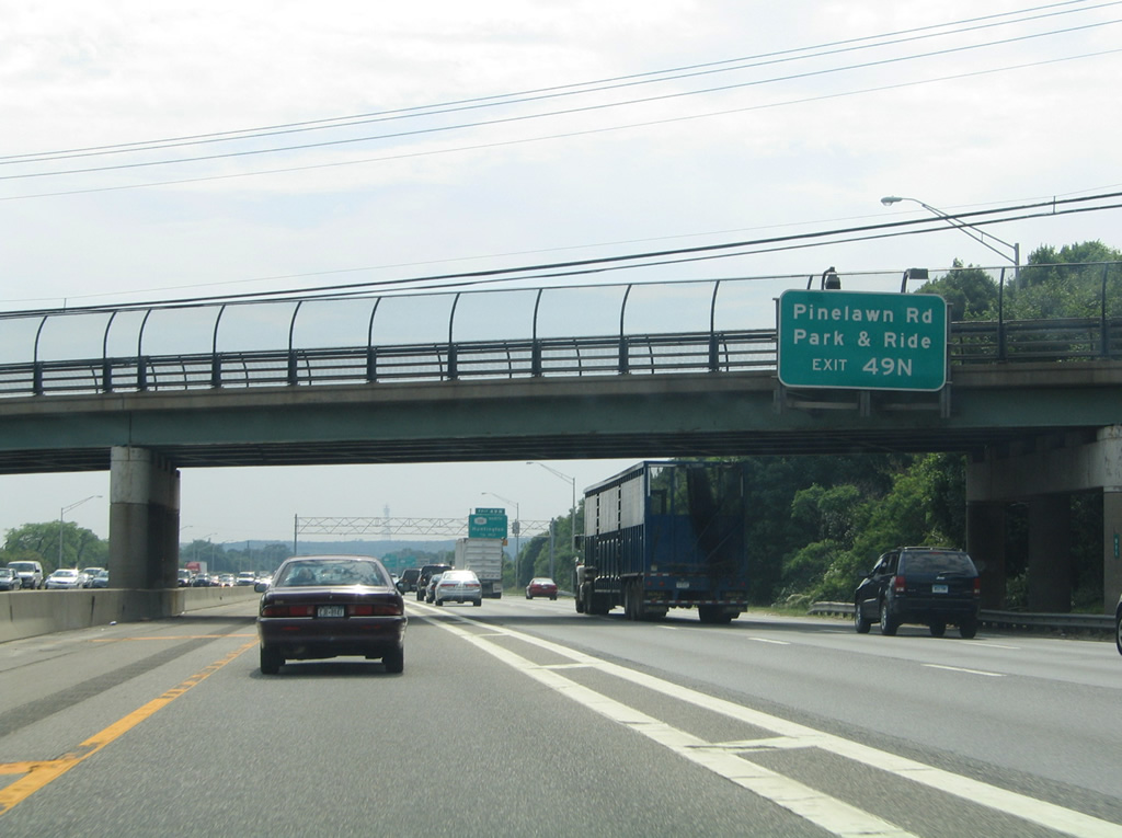
Aforementioned Pinelawn Road (Suffolk County 3) angles southeast from Walt Whitman Road and parallel NY 110 (Broad Hollow Road) to Long Island National Cemetery and North Lindenhurst.
06/13/05
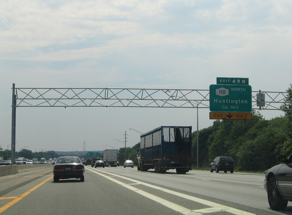
Interstate 495 adds a fifth westbound lane one quarter mile ahead of the Exit 49N half diamond interchange for Pinelawn Road to NY 110 north.
06/13/05
NY 110 totals 15.8 miles from NY 27A at Amityville to Youngs Hill Road in Halesite. Generally a commercial route, NY 110 winds its way northward through South Huntington, Huntington Station and the Huntington town center before ending at Halesite alongside Huntington Harbor.
06/13/05
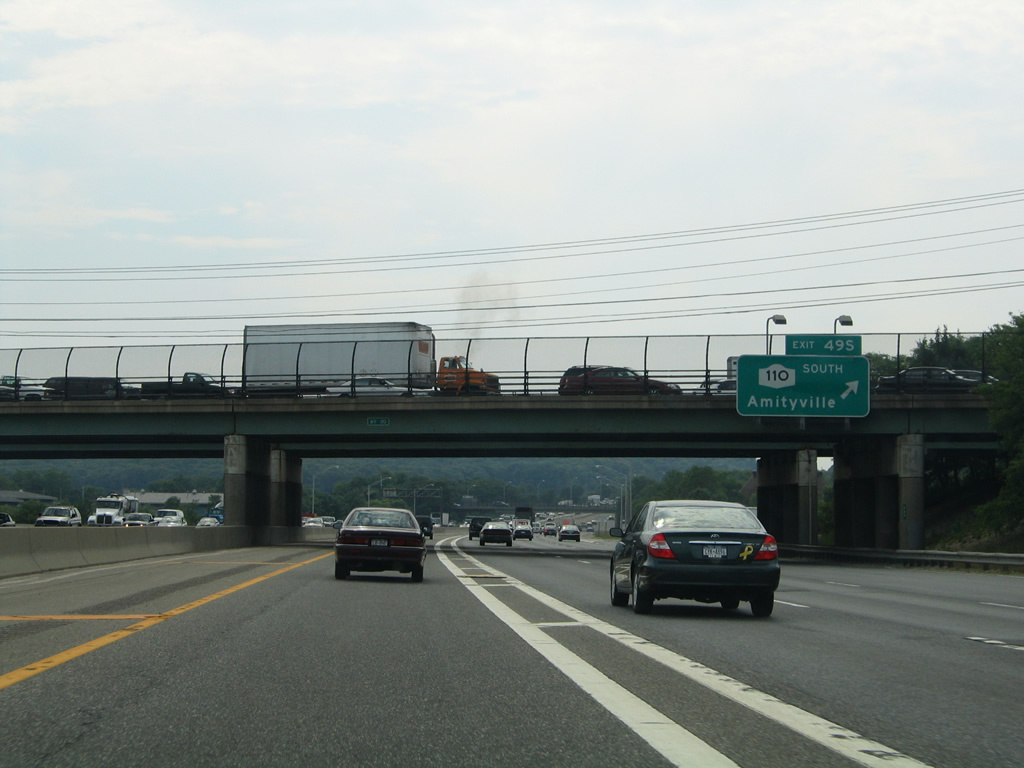
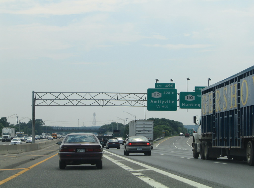
Exit 49S links Interstate 495 west directly with NY 110 (Broad Hollow Road) south through Melville to Republic Airport (FRG) and Amityville.
06/13/05
Interstate 495 gains a lane from NY 110 to the Exit 48 diamond interchange with Round Swamp Road.
06/13/05
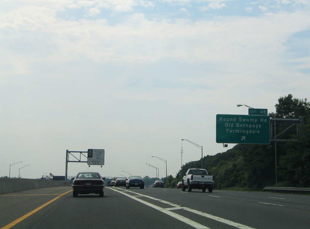
Round Swamp Road leads south from Exit 48 to the communities of Old Bethpage and Farmingdale and north alongside West Hills to NY 25 (Jericho Turnpike).
06/13/05

Westbound motorists pass over Round Swamp Road and see the next ingress point for the HOV lane as Interstate 495 enters Nassau County.
06/13/05


Photo Credits:
- Alex Nitzman, Justin Cozart: 06/13/05
Page Updated Thursday February 21, 2013.