
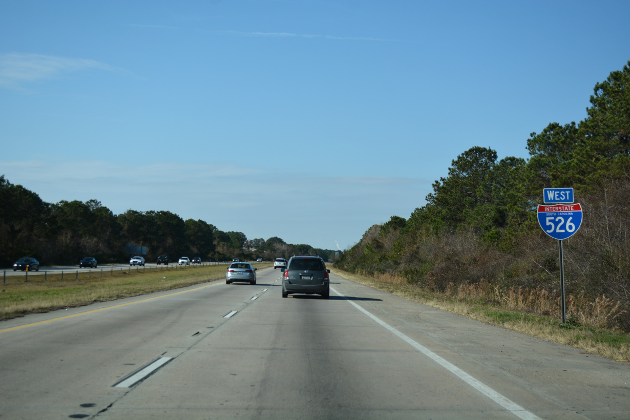
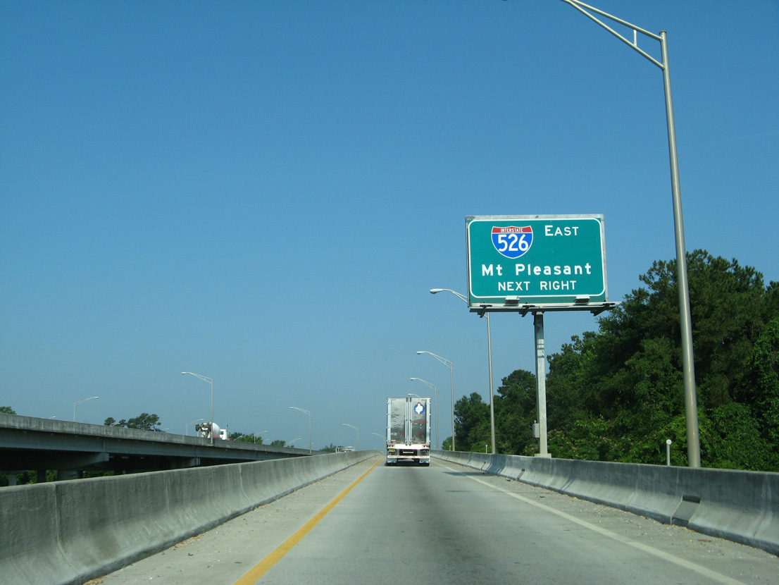
Interstate 526 West
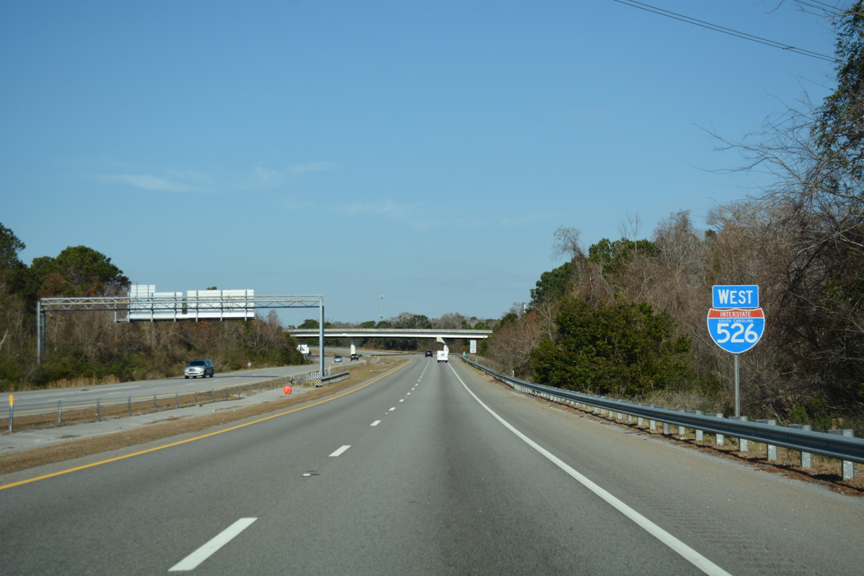
 West
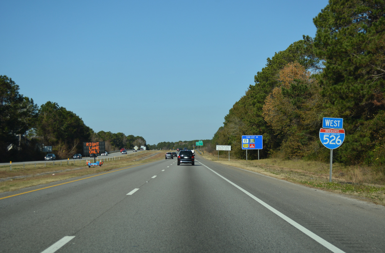
West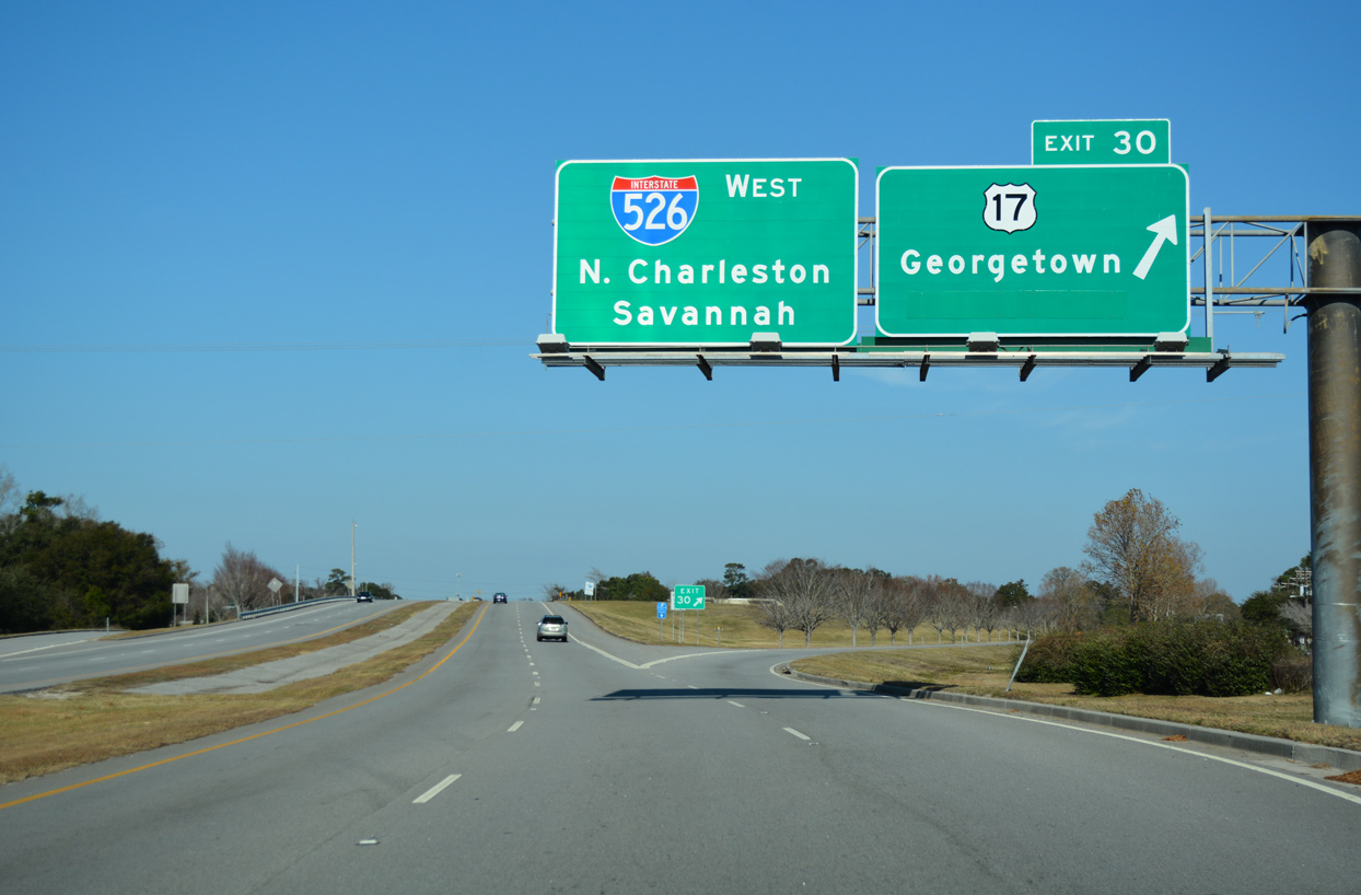
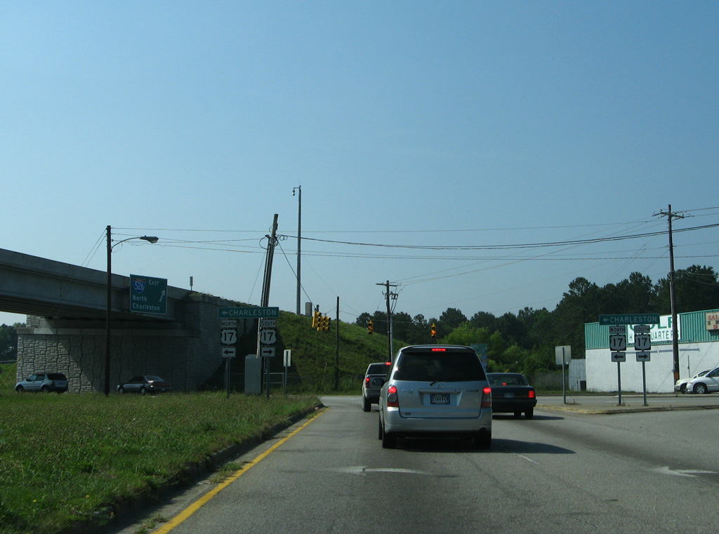
Exit 30 links the end of Business Loop I-526 with U.S. 17 north toward Georgetown. With completion of the grade separation along Bowman Road at U.S. 17 nearby, the connection with U.S. 17 southbound was eliminated here and Charleston greened out on this overhead.
12/31/17
Two branches connect with Interstate 526 westbound. The western branch links U.S. 17 north and Chuck Dawley Boulevard with the freeway. The eastern links joins a SPUI connecting Hungry Neck Boulevard and U.S. 17 with I-526. The two converge at a wye interchange beyond Shem Creek and the first northbound confirming marker .
12/31/17
05/30/07
The two freeway prongs come together ahead of the Mathis Ferry Road (SR 56) underpass and this shield assembly.
12/31/17

Subdivisions line both sides of I-526 north as the freeway spans Wakendaw Road. Cruving west across Hobcaw Creek, Interstate 526 advances a half mile to Long Point Road (Exit 28).
12/31/17
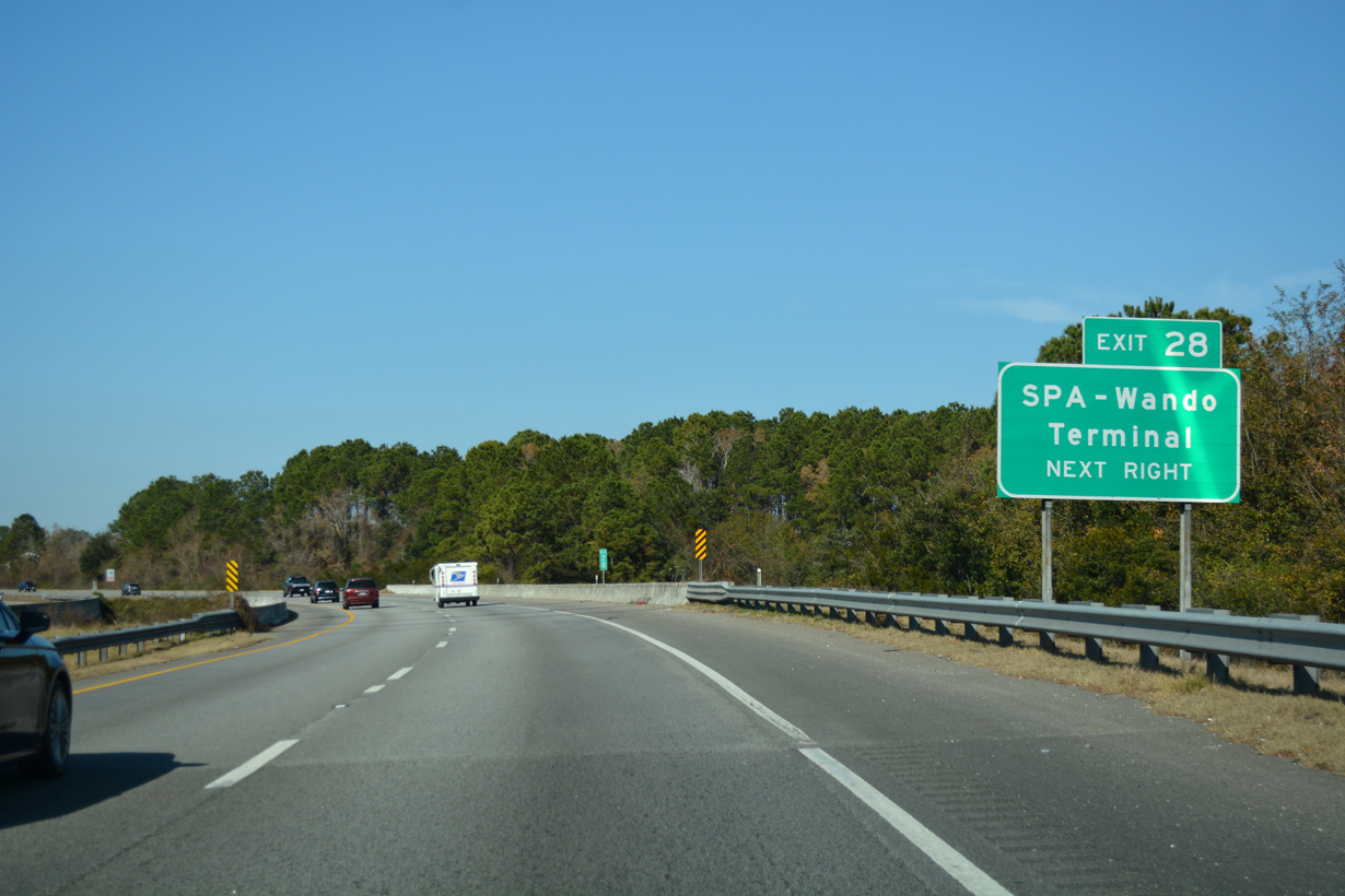
Long Point Road spurs west from Exit 28 to S.C. Ports Authority Wando Terminal. Heading east through Snowden, Long Point Road connects I-526 with Charles Pinckney National Historic Site.
12/31/17
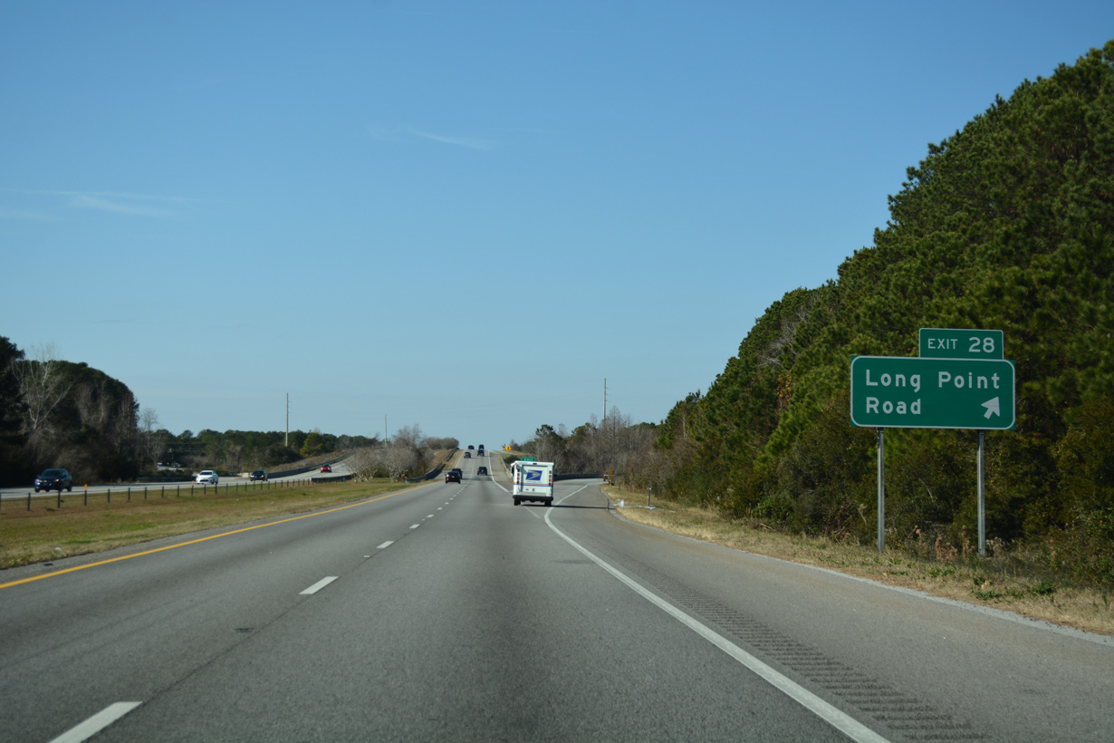
Entering the six-ramp parclo interchange (Exit 28) with Long Point Road on Interstate 526 westbound.
12/31/17
Interstate 526 bee lines northwest toward the high-level bridge across the Wando River.
12/31/17
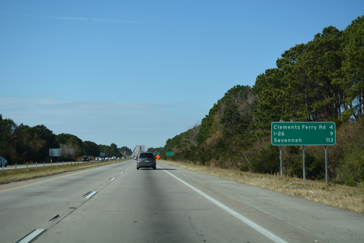
Located four miles ahead, Clements Ferry Road is the second of two interchanges along I-526 on Daniel Island. The exchange with Interstate 26 lies five miles further.
12/31/17
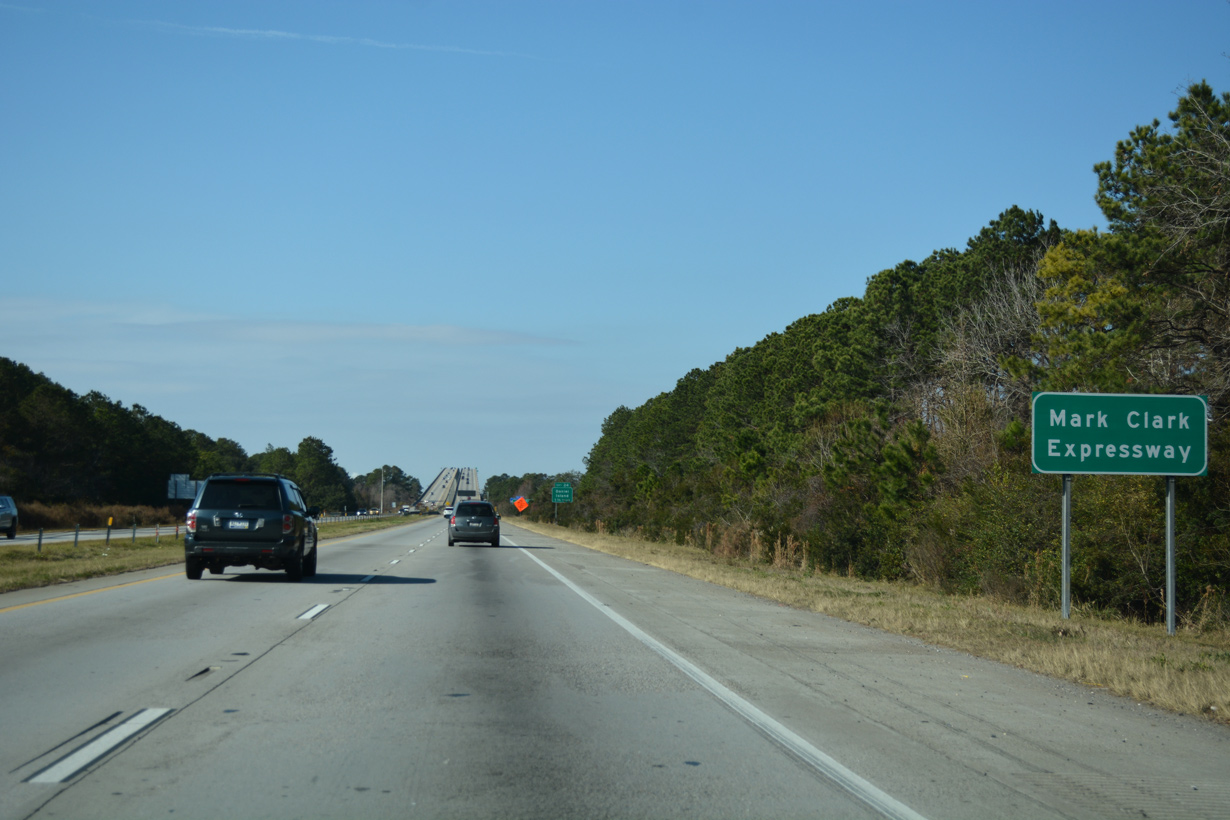
Interstate 526 is designated the Mark Clark Expressway along its entire 29.5 mile course. The western segment was initially signed as S.C. 31.
12/31/17
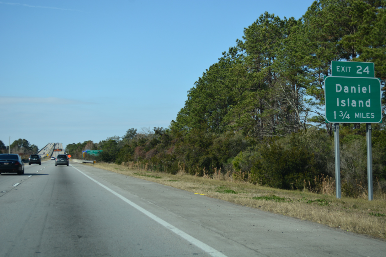
Exit 24 connects I-526 west with Seven Farms Drive and Island Park Drive on Daniel Island at the north end of the Wando River bridge.
12/31/17
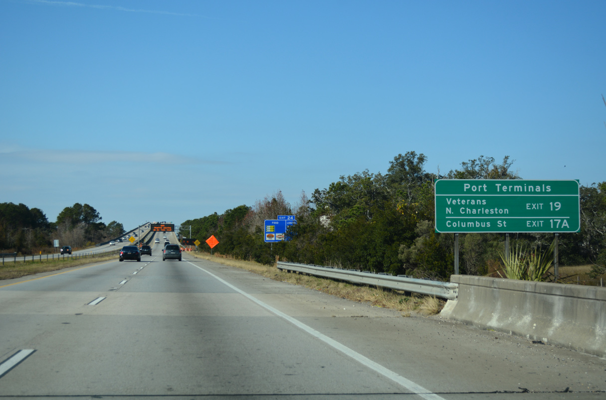
A supplemental sign references North Charleston exits for South Carolina Ports Authority facilities along the west banks of the Cooper River. The Columbus terminal lies beyond the east end of Interstate 26.
12/31/17
Climbing onto the James B. Edwards Bridge across the Wando River on I-526 west. Built in 1989, the box-girder span measures 7,900 feet in length.1
12/31/17
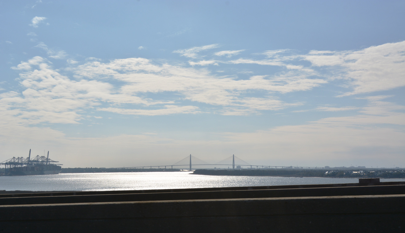
Flowing south around the east side of Daniel Island, the Wando River converges with the Cooper River ahead of the Arthur Ravenel, Jr. Bridge (U.S. 17) linking Charleston with Mt. Pleasant.
12/31/17
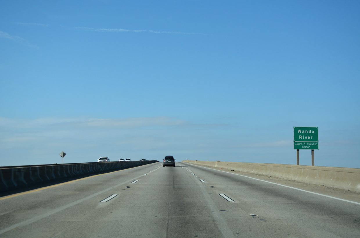
The James B. Edwards Bridge tops out at 138.1 feet above the Wando River.1
12/31/17
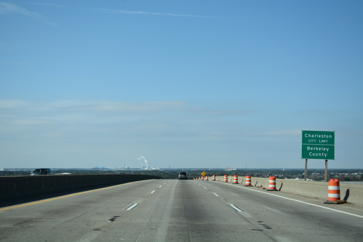
Interstate 526 crosses into Berkeley County and the Charleston city limits at the apex of the Wando River bridge.
12/31/17
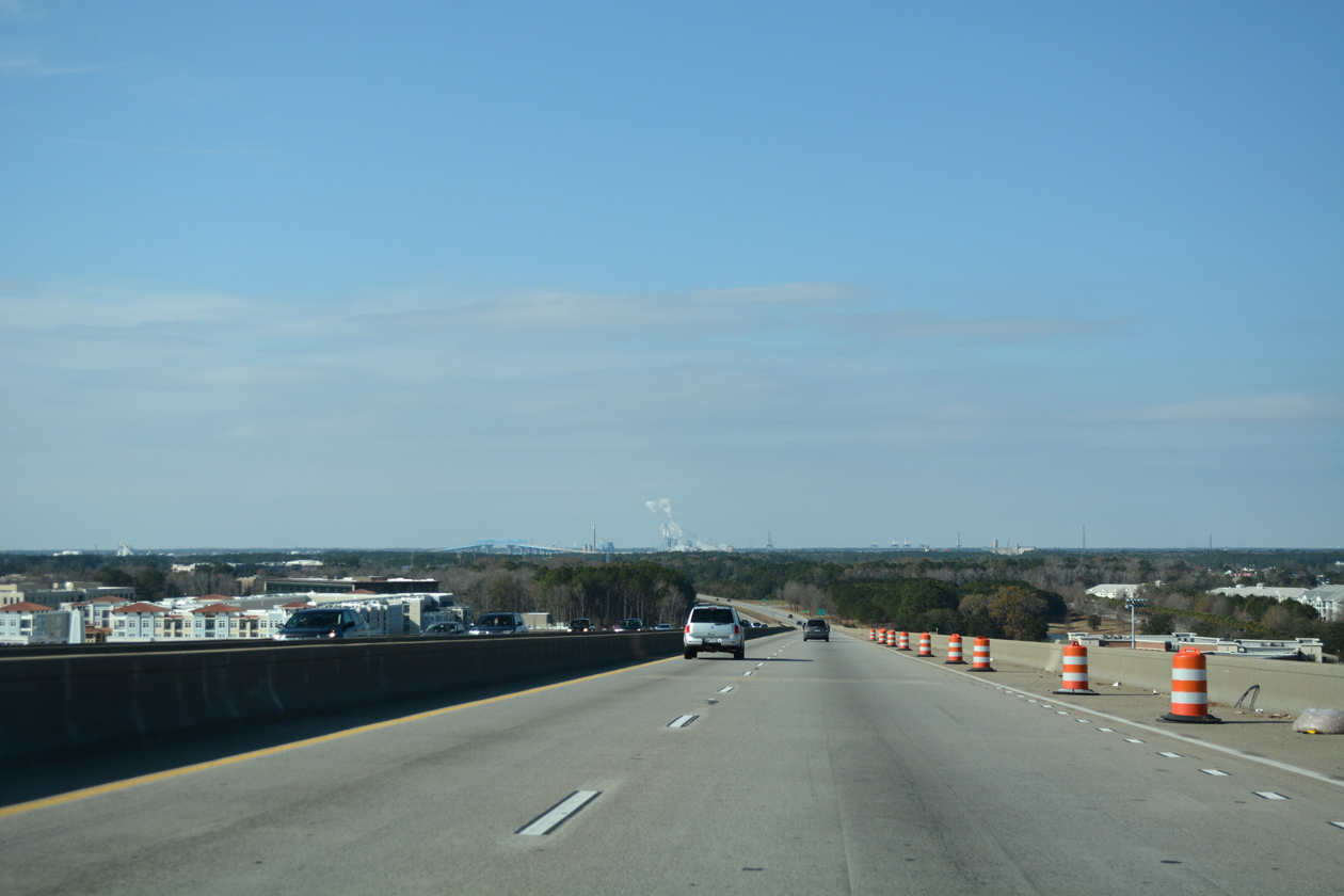
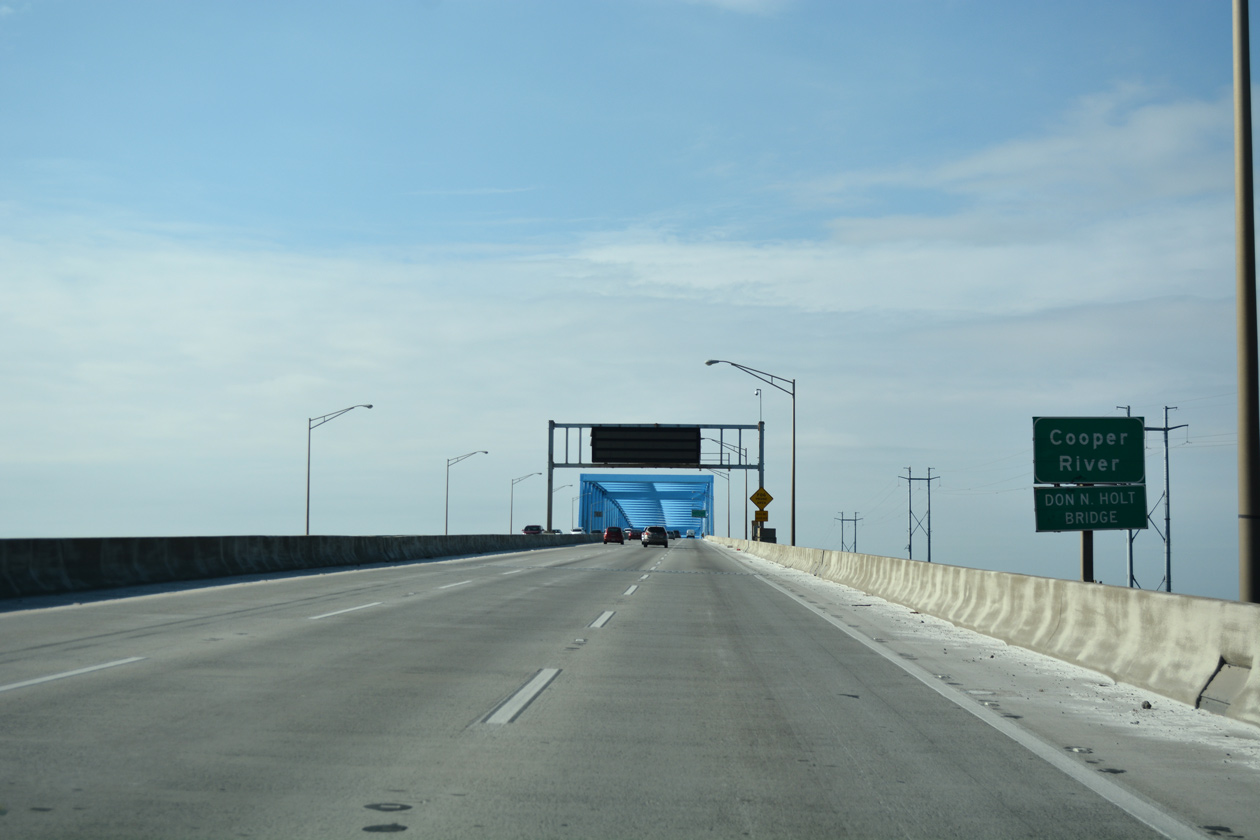
The distant Don N. Holt Bridge carrying I-526 across the Cooper River rises along the northern horizon as the freeway lowers onto Daniel Island.
12/31/17
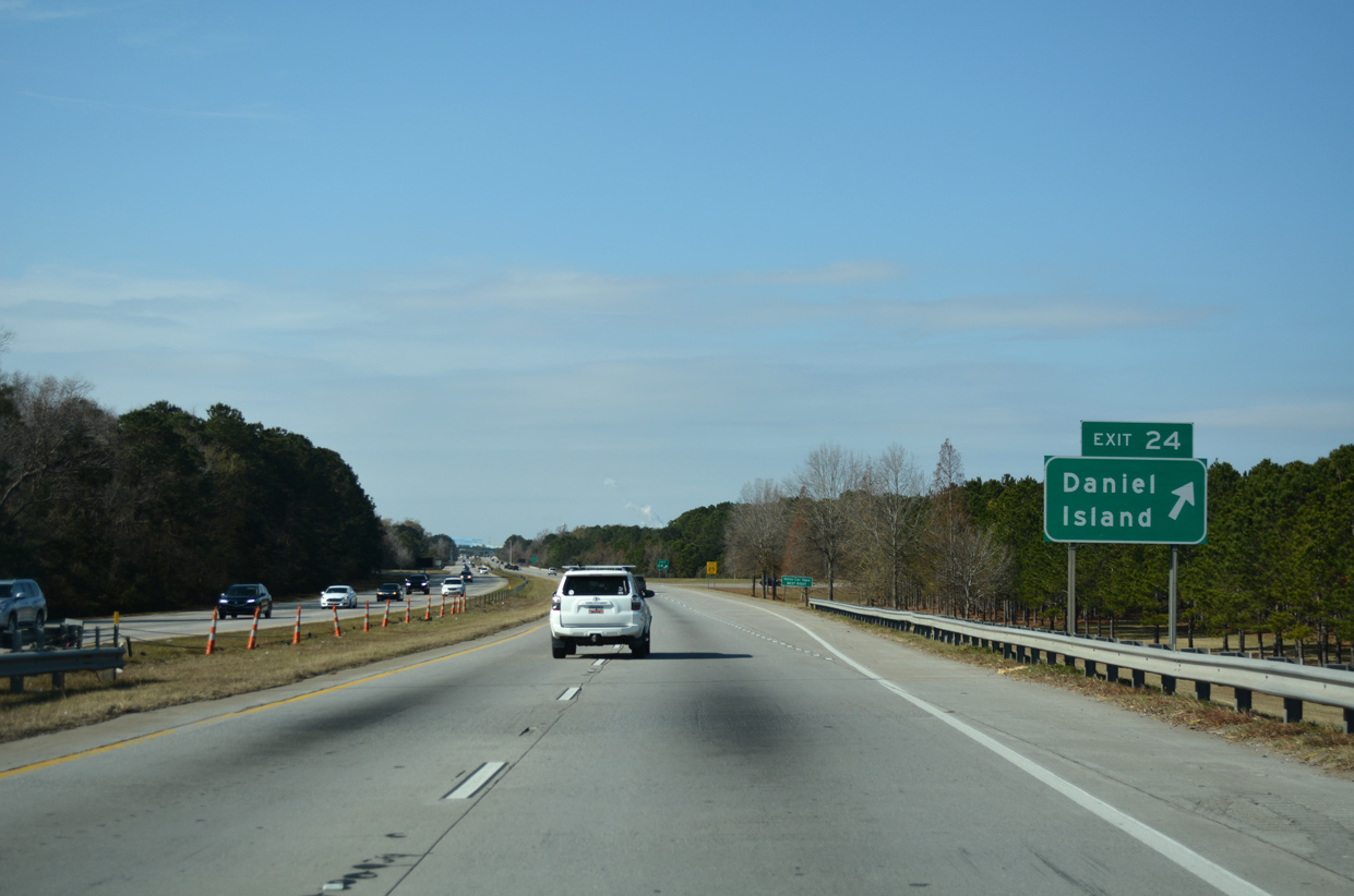
A folded diamond interchange (Exit 24) joins Interstate 526 with the commercial center of Daniel Island and Volvo Car Stadium. Seven Farms Drive arcs southwest from the exchange to Daniel Island Drive and Bishop England High School.
12/31/17
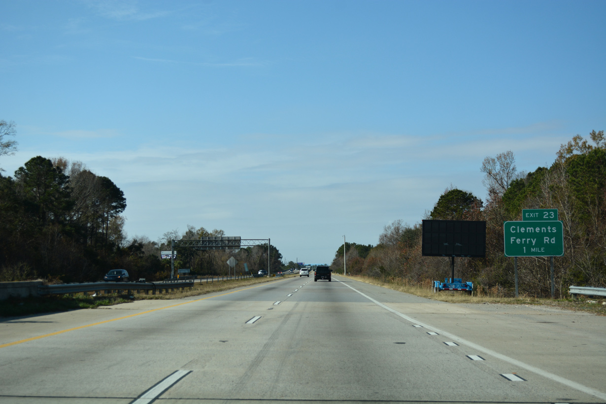
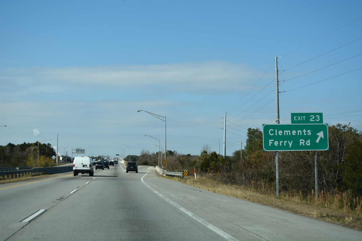
Continuing northwest, I-526 crosses over Beresford and Nowell Creeks ahead of a parclo interchange (Exit 23) with Clements Ferry Road.
12/31/17
Clements Ferry Road links I-526 with St. Thomas Island Drive south to Daniel Island and travels northeast from Exit 23 to Wando and S.C. 41.
12/31/17
I-526 rises onto the Don N. Holt Bridge to the immediate west of Clements Ferry Road and James Island. The 10,900-foot long span2 first crosses over Clouter Creek.
12/31/17

Interstate 526 makes a sweeping curve westward ahead of the Cooper River, passing over wetlands and areas of Naval Weapons Station Charleston.
12/31/17
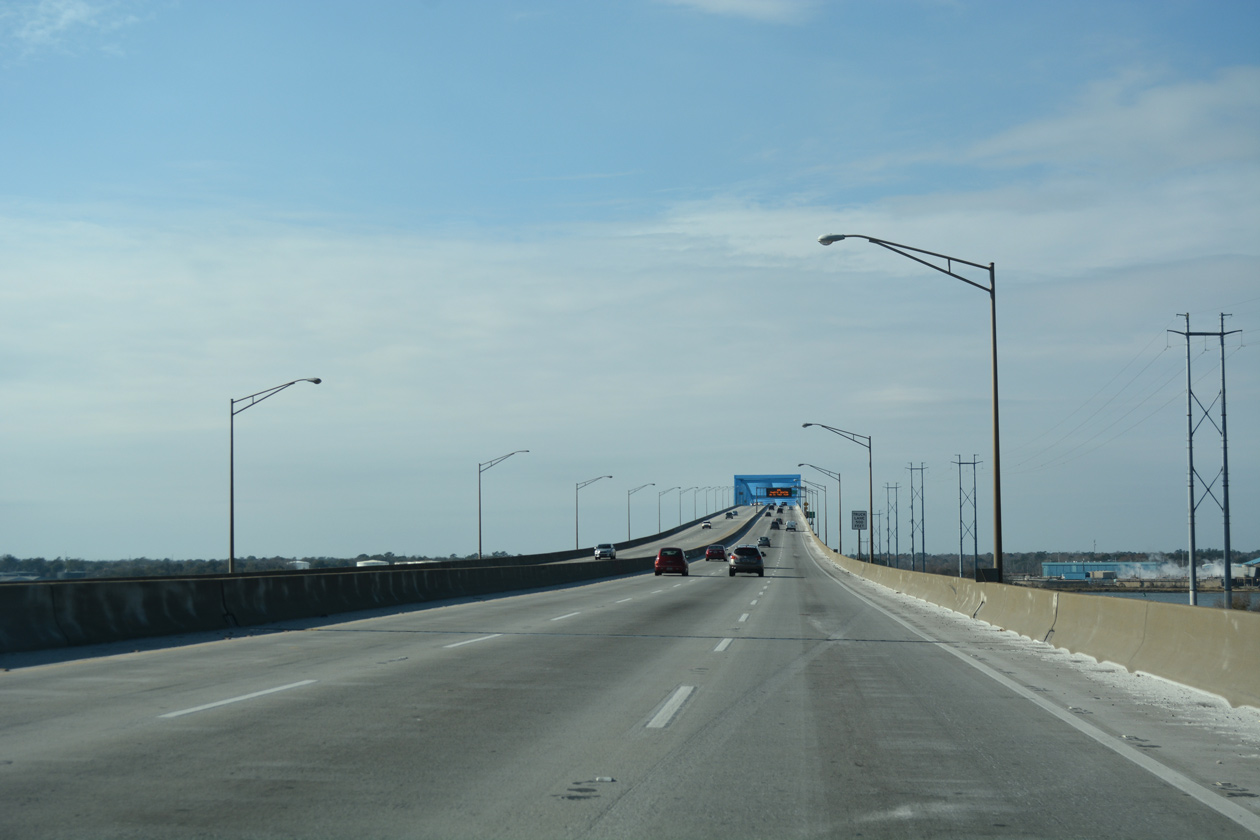
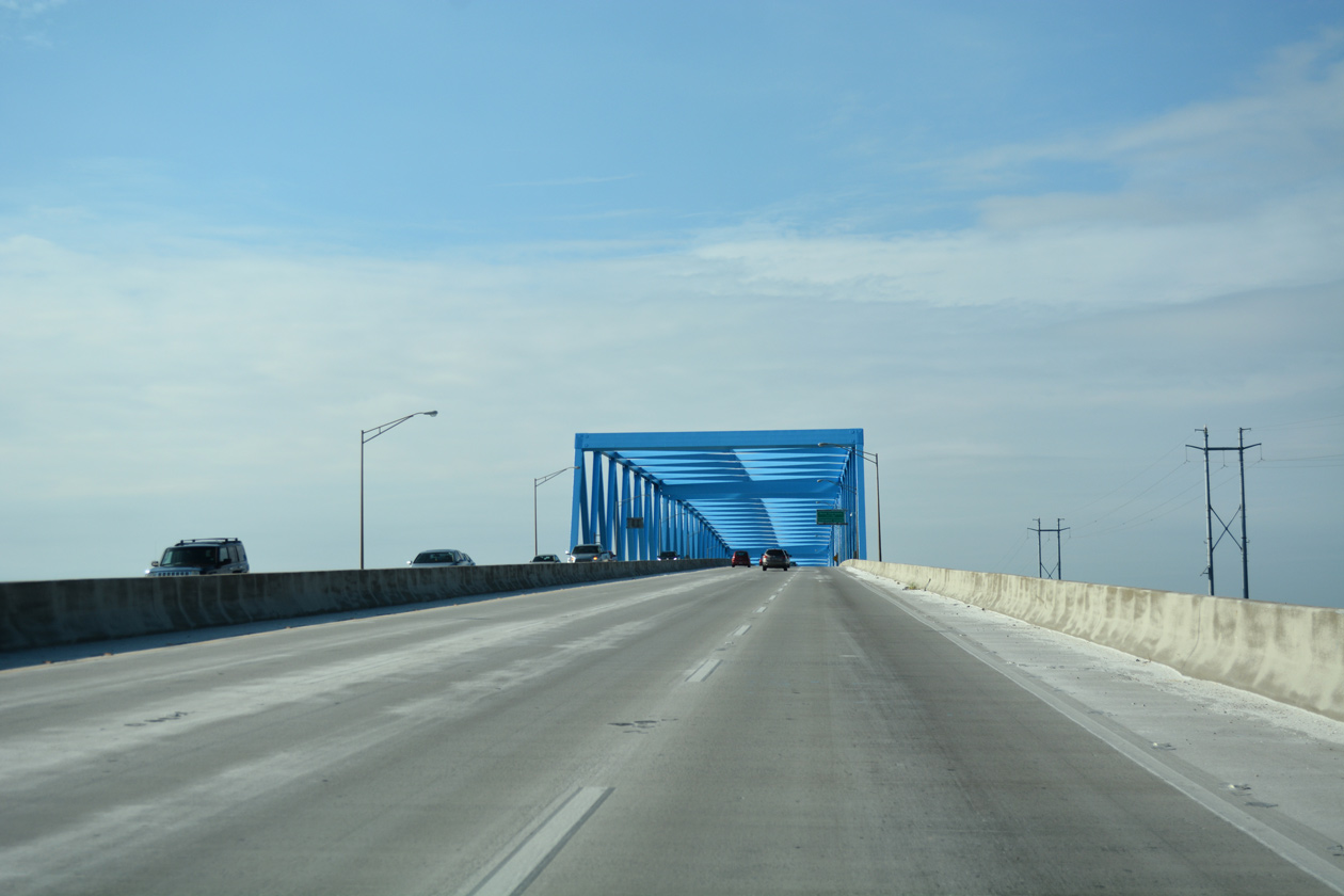
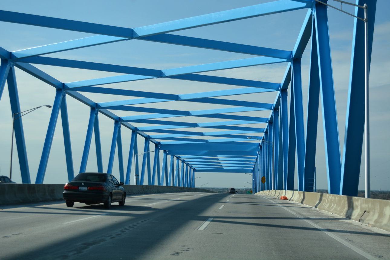
The last segment completed along Interstate 526, the Cooper River Bridge is a warren box truss span.
12/31/17
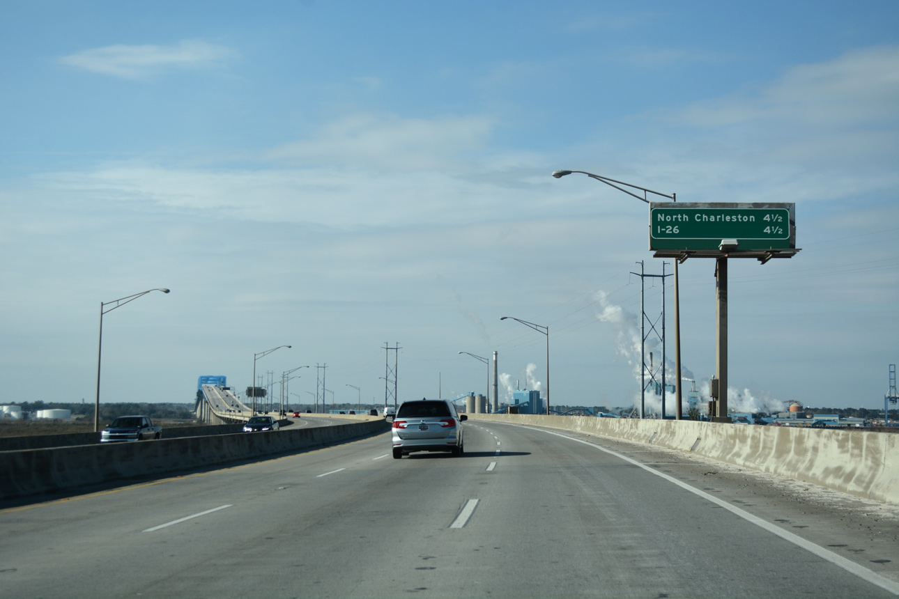
The city center of North Charleston, south of I-526 via U.S. 52/78, and Interstate 26 lie equidistant from this distance sign on the Don N. Holt Bridge.
12/31/17
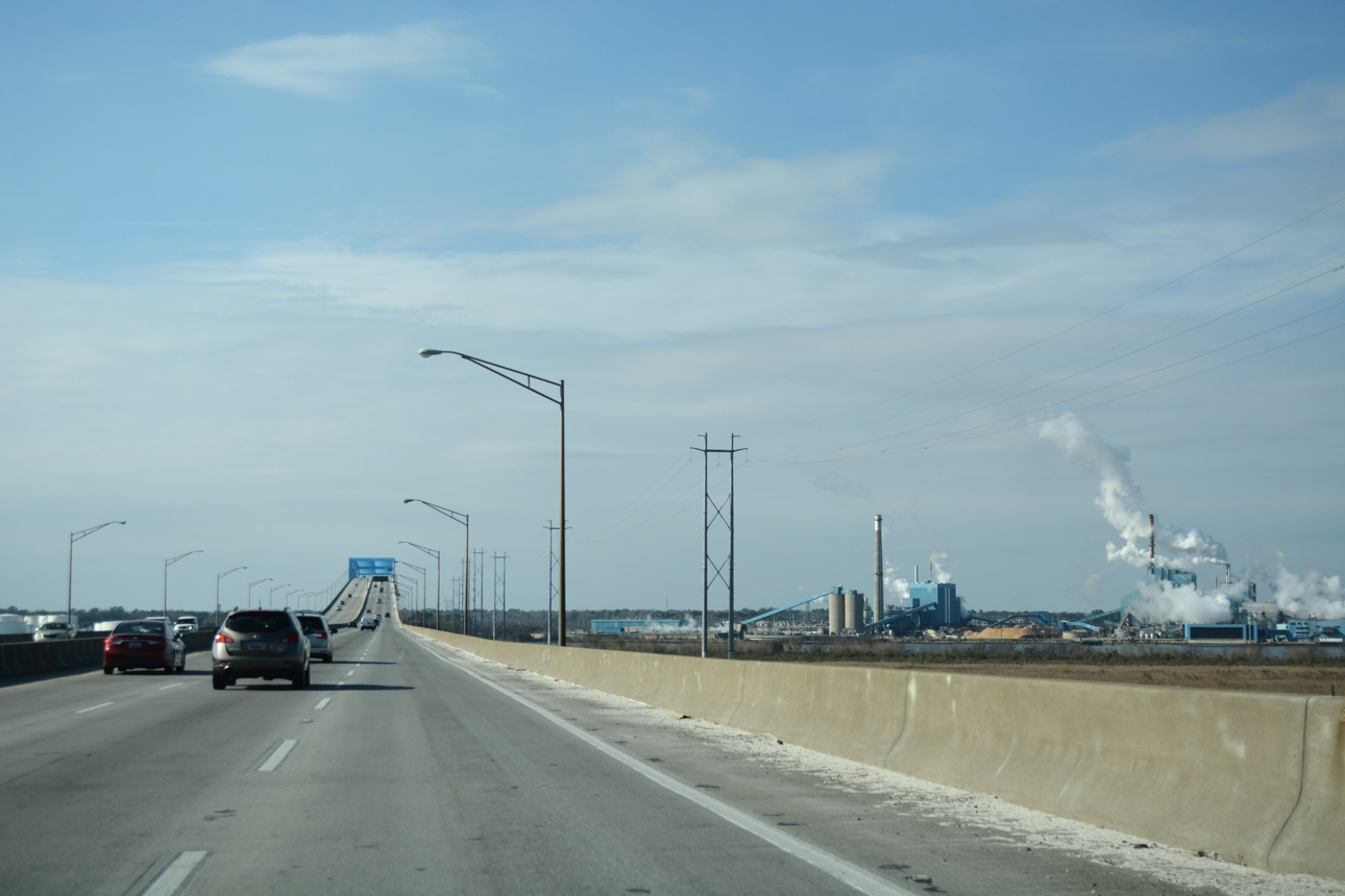
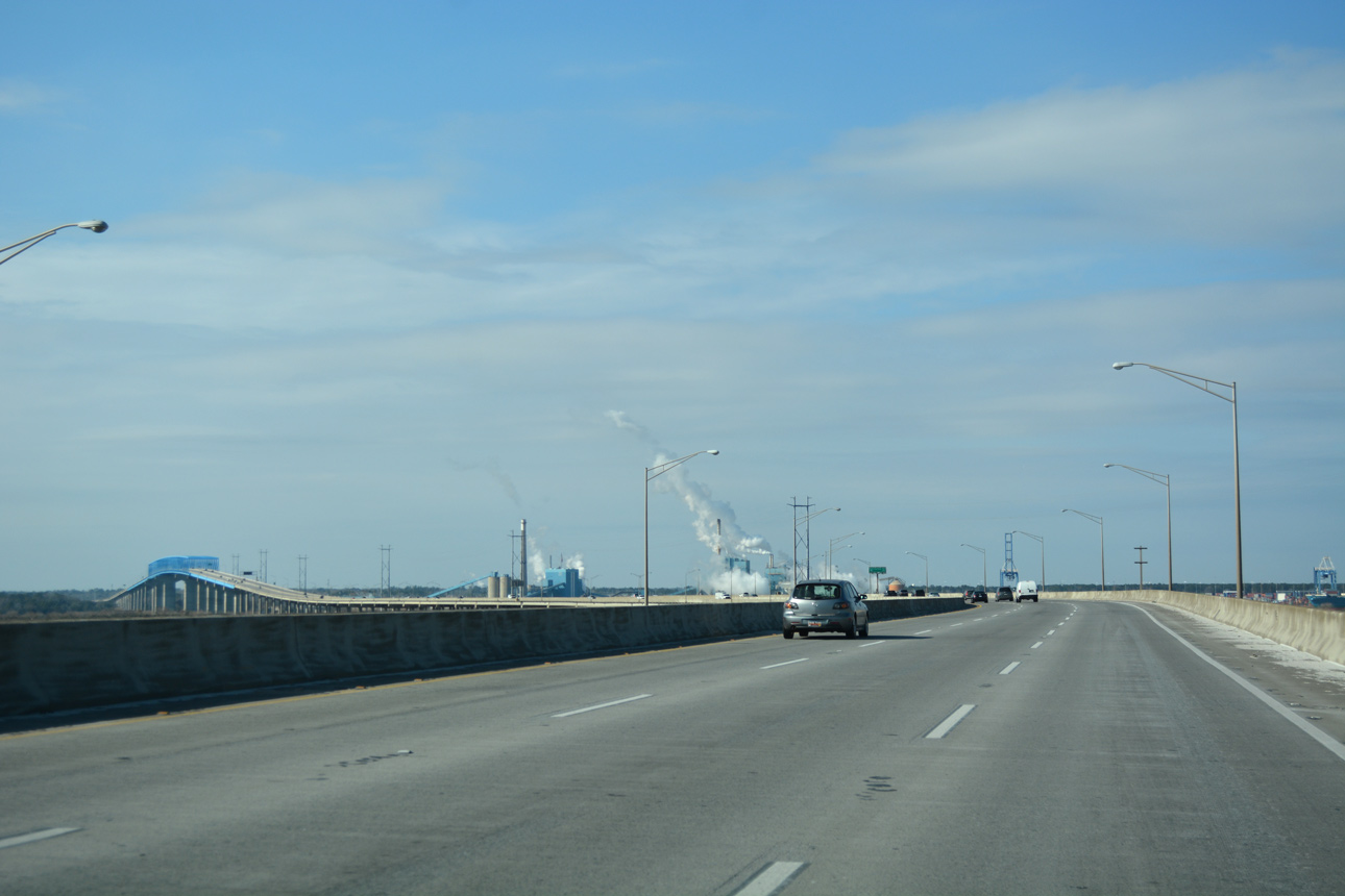
Industrial areas along the west banks of the Cooper River are home to the Port of Charleston - North Charleston Terminal and KapStone Paper Mill.
12/31/17
Interstate 526 crests 155 feet above sea level across the Cooper River. The 84.3-foot wide deck accommodates six lanes of traffic with partial outside shoulders.2
12/31/17

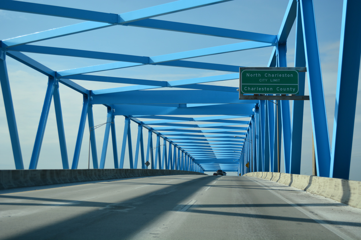
Interstate 526 reenters Charleston County midway across the Cooper River.
12/31/17
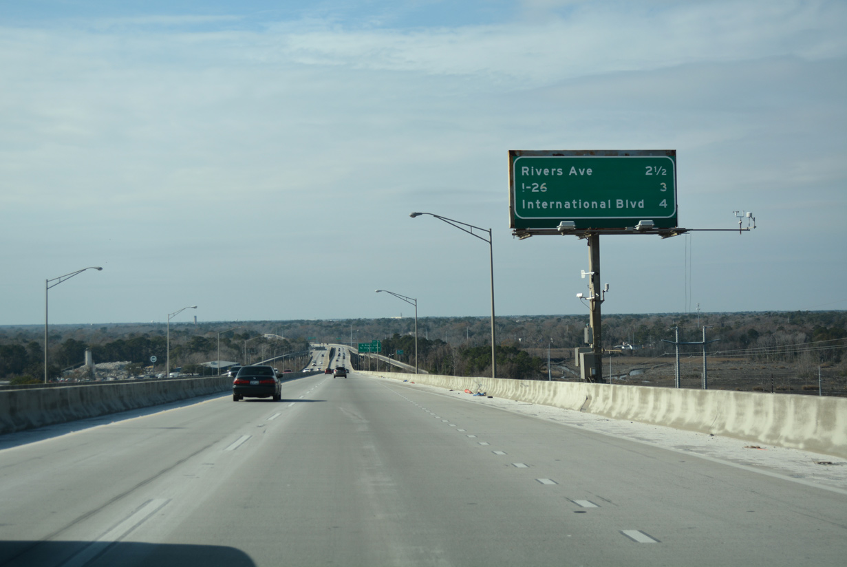
The first of six interchanges in the city of North Charleston along I-526 west is with Rivers Avenue in 2.5 miles. Descending from the Cooper River bridge apex, a lane drop occurs ahead of the half diamond interchange with Virginia Avenue.
12/31/17
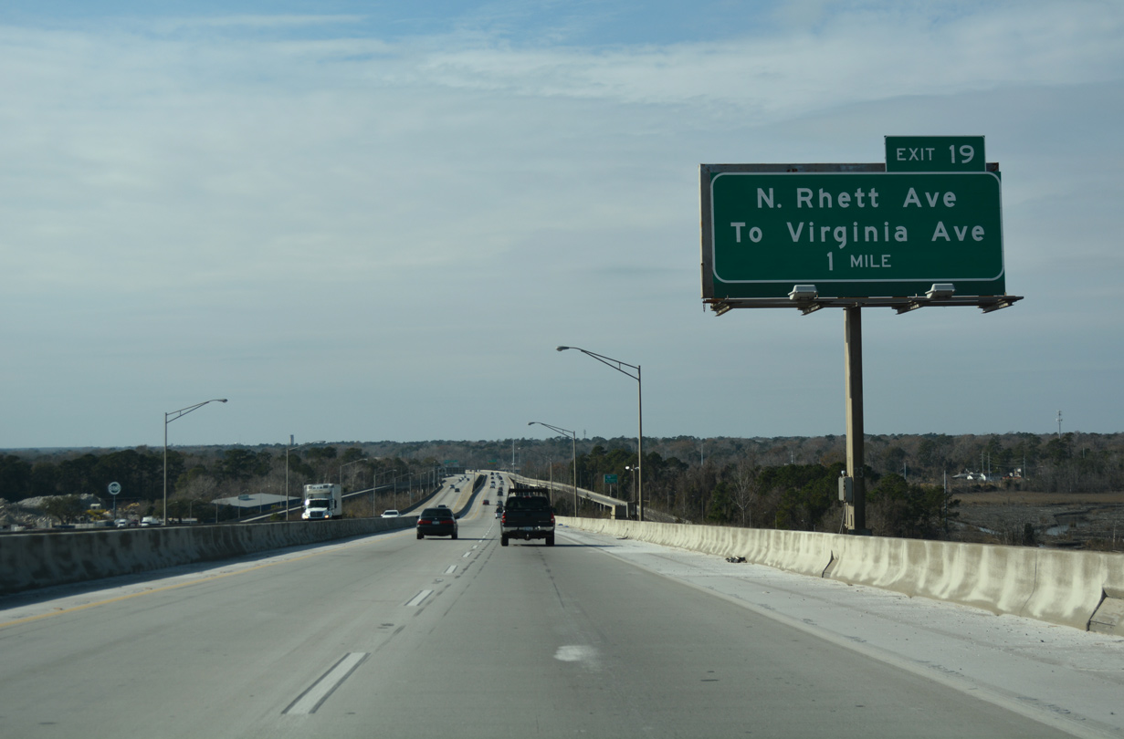
Interstate 526 enters the city of North Charleston over Filbin Creek and Virginia Avenue. Exit 19 provides access to both Rhett Avenue and I-526 east back to the Virginia Avenue off-ramp.
12/31/17
05/30/07
An auxiliary lane opens westbound from Virginia Avenue to Exit 19 with North Rhett Avenue. Rhett Avenue comprises a residential boulevard south to Park Circle and north to Remount Road.
12/31/17
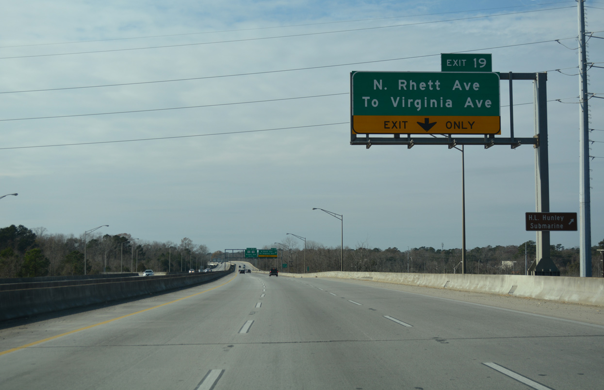
I-526 remains elevated through the folded diamond interchange (Exit 19) with Rhett Avenue and the U-turn ramp for Virginia Avenue. Filbin Creek parallels Mark Clark Expressway on the north side.
12/31/17
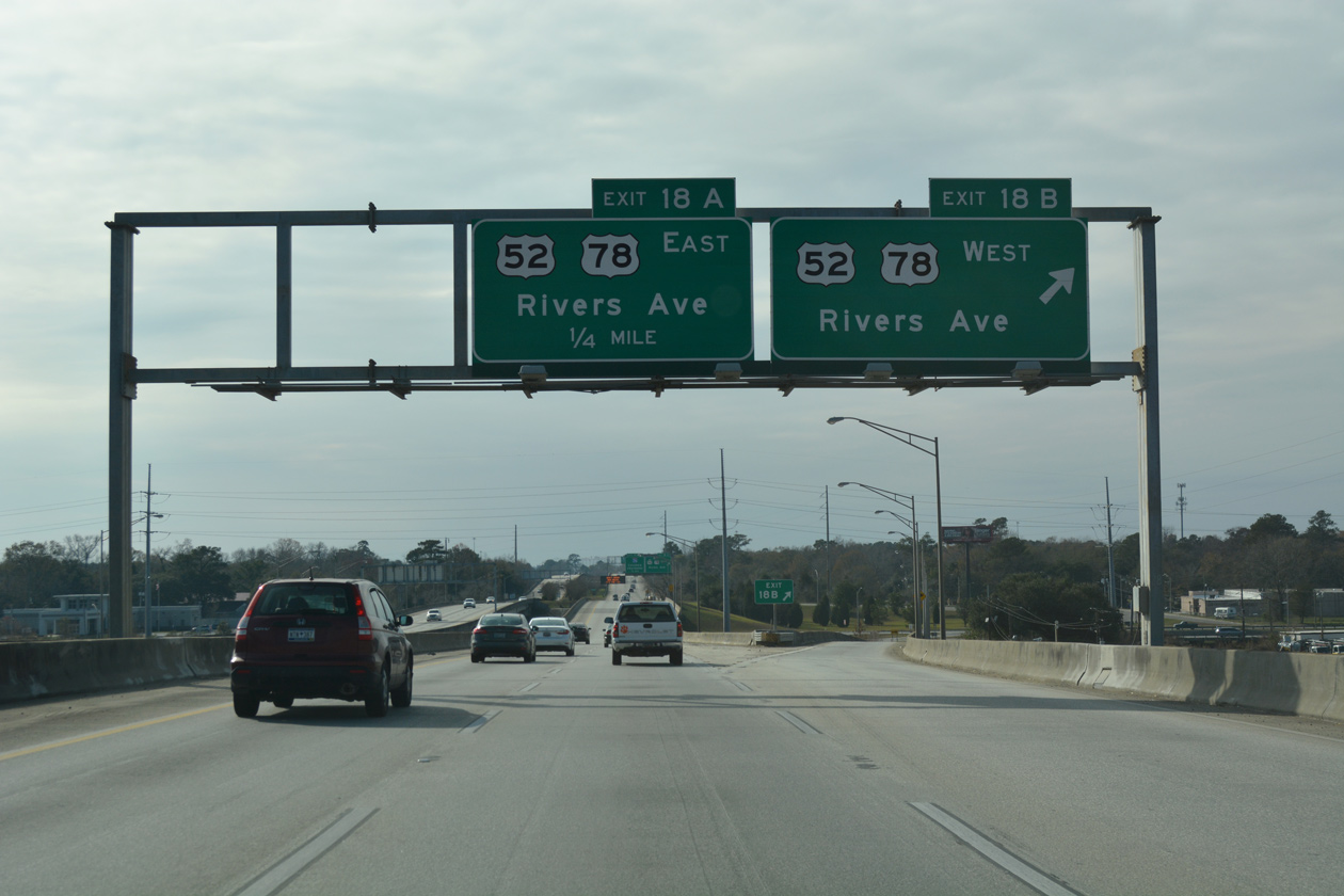
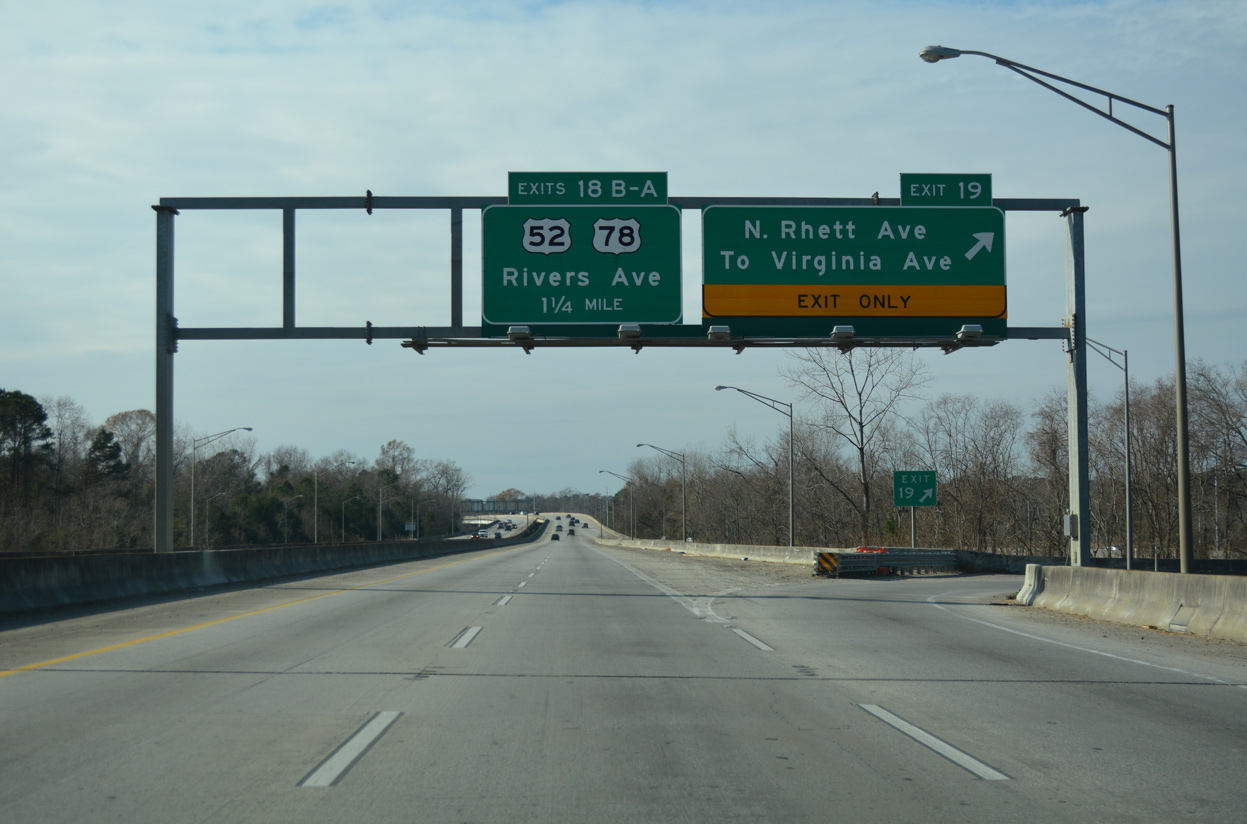
Interstate 526 gradually arcs southward west from Rhett Avenue, next meeting U.S. 52 & 78 (Rivers Avenue) at a six-ramp parclo interchange (Exits 18B/A). The two highways overlap northward through Hanahan and Goose Creek.
12/31/17
Exit 18A loops onto Rivers Avenue southbound (U.S. 52 & 78) from I-526 west. U.S. 52 & 78 overlap southward through North Charleston, separating ahead of the Charleston city line along respective courses paralleling a CSX Railroad and I-26.
12/31/17
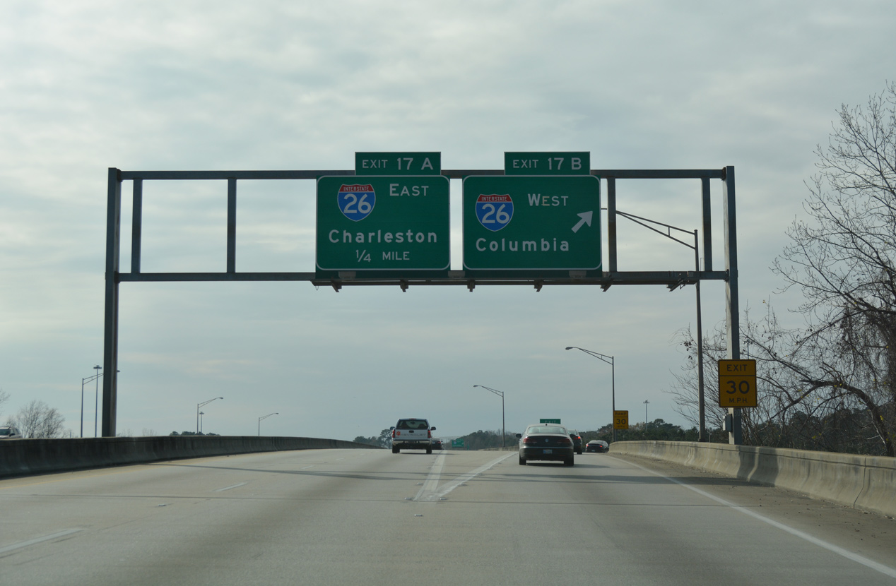
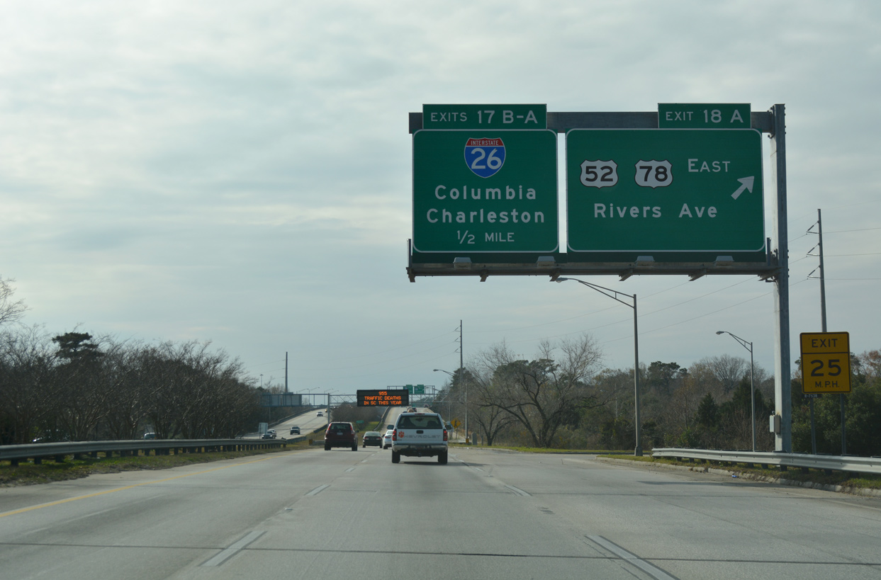
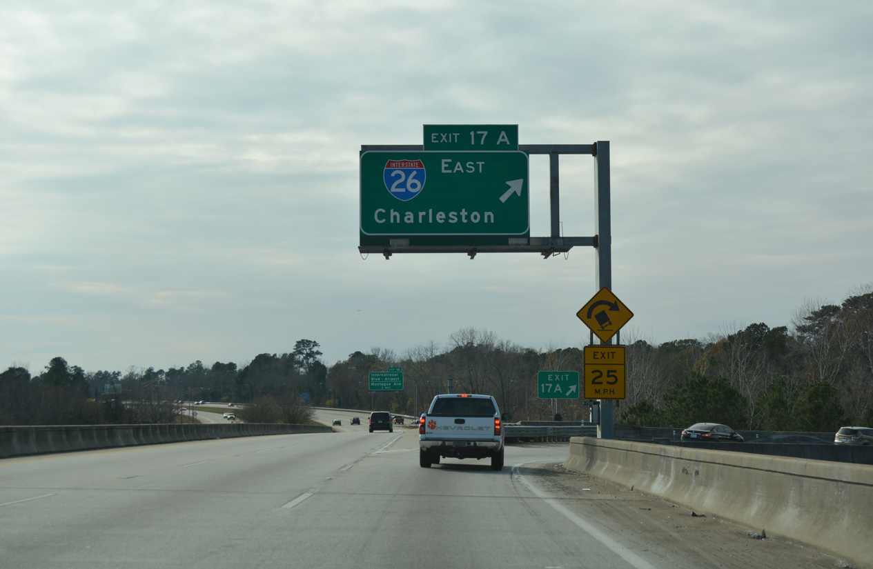
I-526 elevates along another viaduct system leading west into the directional cloverleaf interchange (Exit 17) with Interstate 26. Departing next is the ramp for I-26 westbound to Summerville, Orangeburg and Columbia.
12/31/17
Interstate 26 spurs eight miles south along the Charleston peninsula, joining North Charleston with both the Arthur Ravenel, Jr. Bridge east to Mt. Pleasant and U.S. 17 (Septima Clark Parkway) south to Downtown.
12/31/17
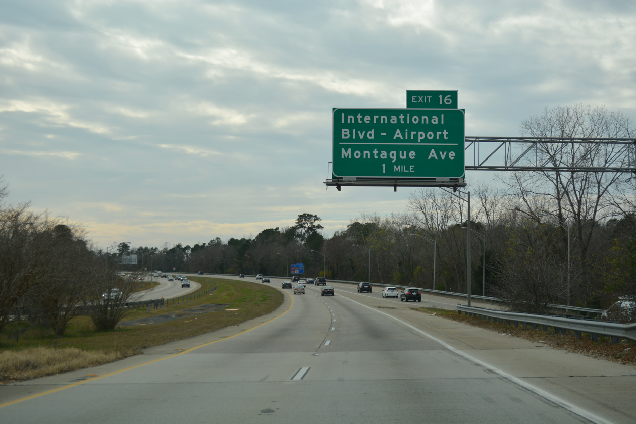
Continuing south from Interstate 26, I-526 passes east of Charleston International Airport (CHS) to Exit 16 with International Boulevard.
12/31/17
Traffic entering Interstate 526 west from I-26 forms an auxiliary lane to Exit 16.
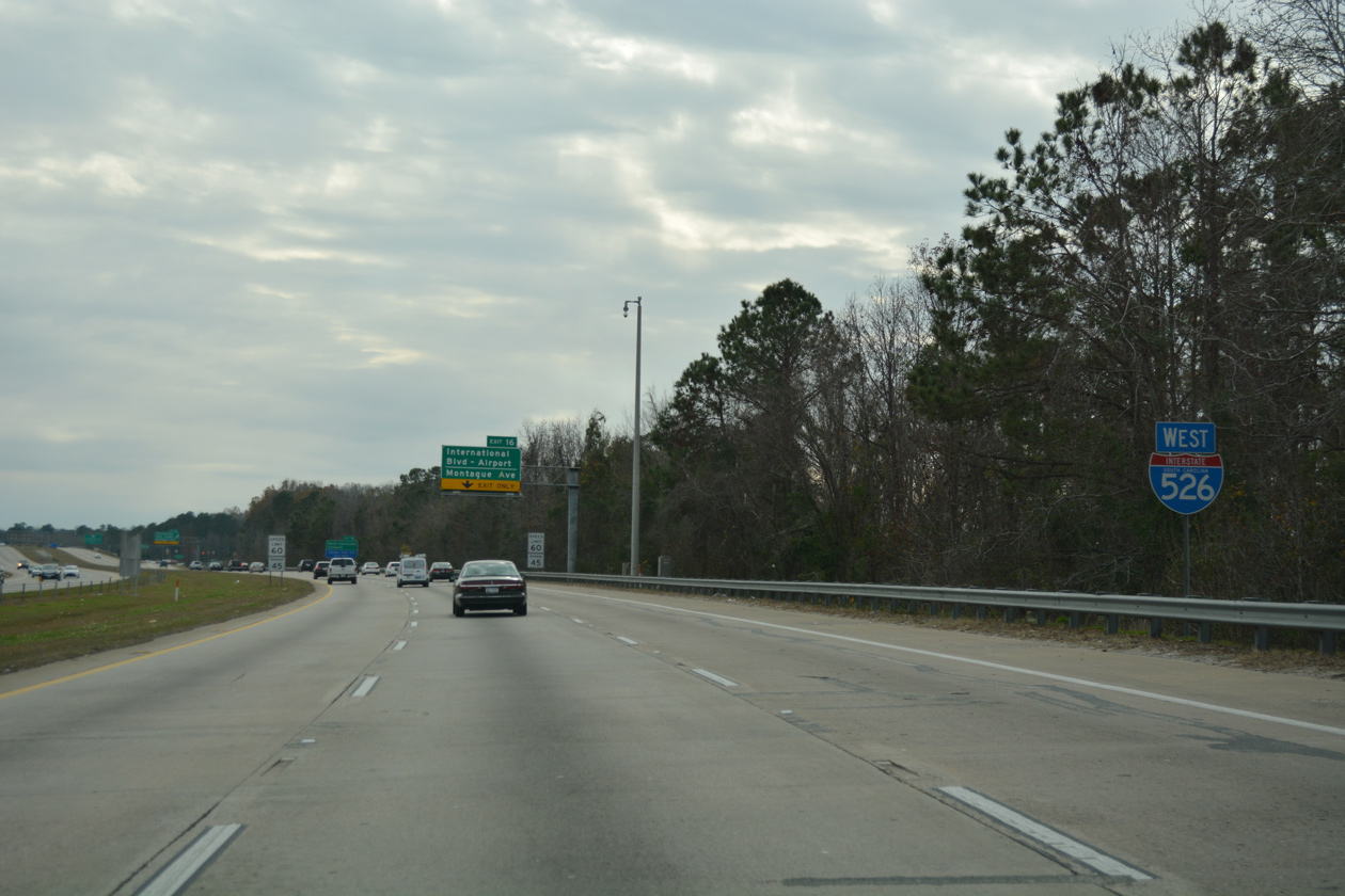
12/31/17
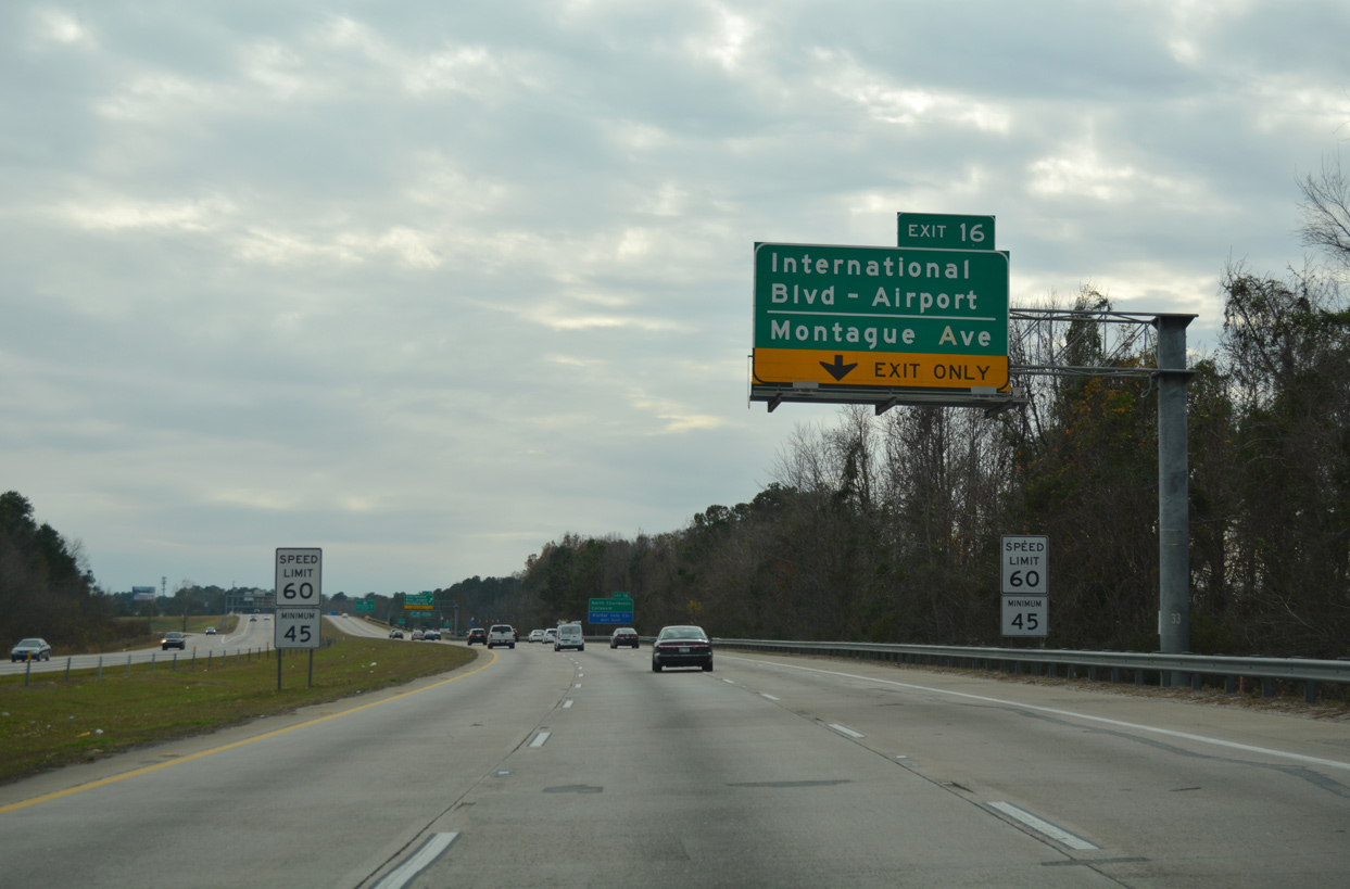
Interstate 526 maintains just four lanes from the parclo interchange (Exit 16) with International Boulevard southward to U.S. 17 (Savannah Highway).
12/31/17
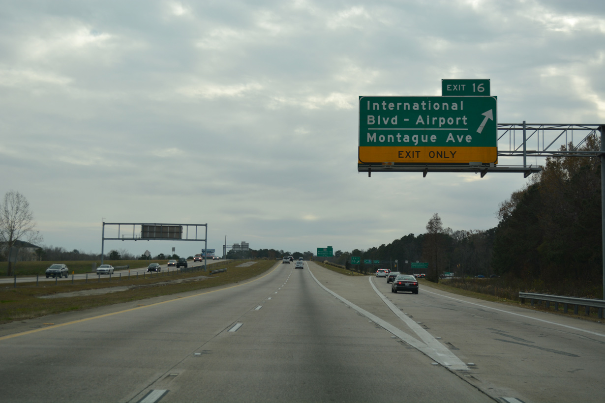
Exit 16 parts ways with I-526 westbound to International Boulevard. Service roads along the Mark Clark Expressway link with Montague Avenue by the Charleston Area Convention Center.
12/31/17
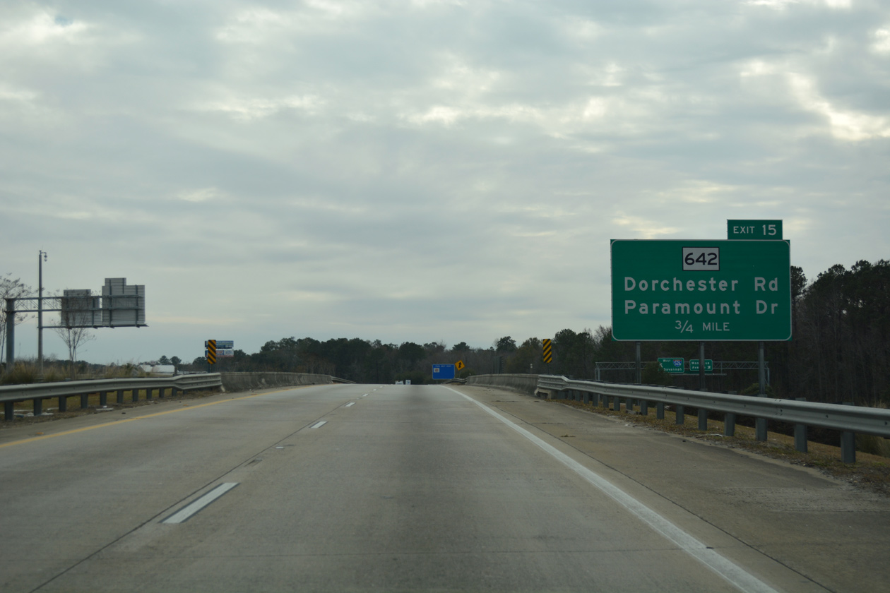
S.C. 642 (Dorchester Road) leads 2.74 miles west from U.S. 52/78 (Rivers Avenue) in North Charleston to Interstate 526 at forthcoming Exit 15.
12/31/17
A split diamond interchange connects I-526 with S.C. 642 (Dorchester Road) and Paramount Drive. Paramount Drive angles southwest from Dorchester Road to the Wando Woods community along the Ashley River. S.C. 562 extends west 16.51 miles northwest to S.C. 165 and U.S. 17 Alternate outside of Summerville.
12/31/17
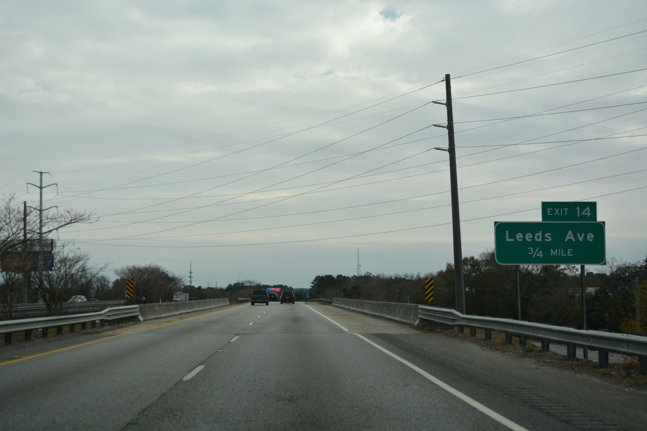
I-526 weaves southwest between Charleston County government offices and Farber Plaza business park to Leeds Avenue at Exit 14.
12/31/17
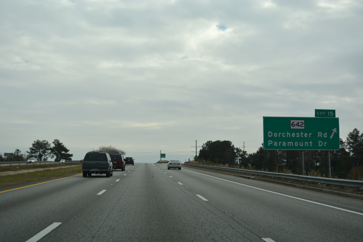
Confirming marker posted westbound at the Paramount Drive underpass.
12/31/17
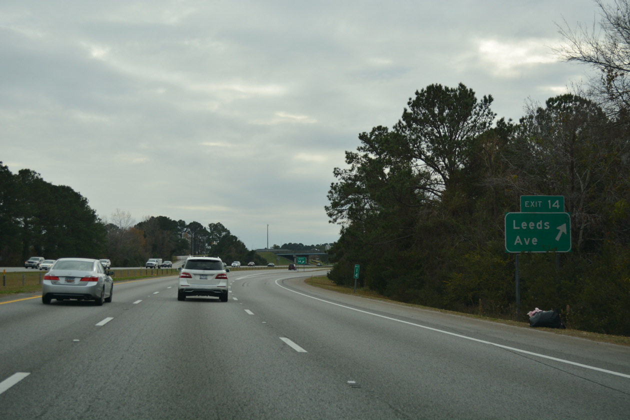
Leeds Road spurs southward from S.C. 642 (Dorchester Road) to LeedsPark International commerce center. A diamond interchange links the arterial with I-526 at Exit 14.
12/31/17
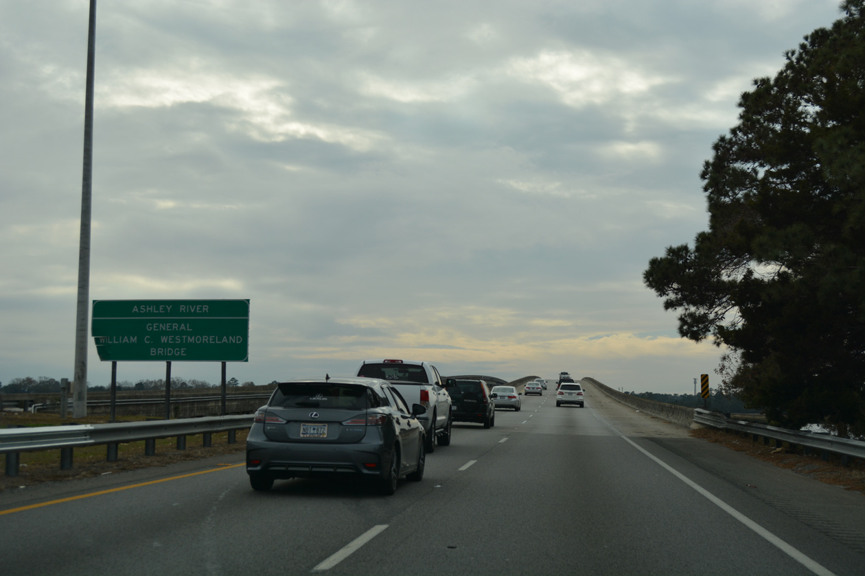
The next in a series of lengthy spans along Interstate 526 is the General William C. Westmoreland Bridge across the Ashley River.
12/31/17
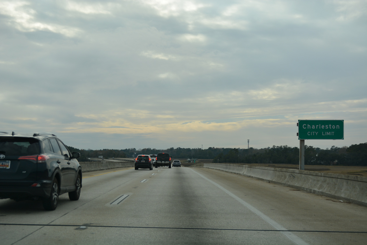
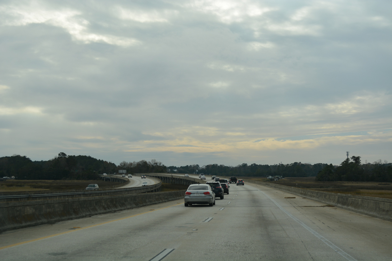
Westbound traffic enters the city of Charleston over the south banks of the Ashley River.
12/31/17
Built in 1980, the 3,908-foot long bridge3 across the Ashley River was one of the oldest sections of I-526 completed.
12/31/17
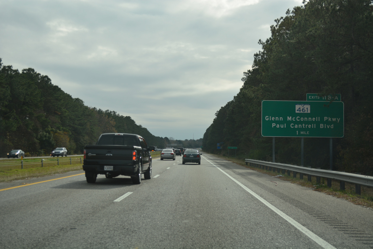
S.C. 461, a 3.37 mile long arterial to West Ashley, meets I-526 at a six-ramp parclo interchange (Exits 11B/A) in one mile.
12/31/17
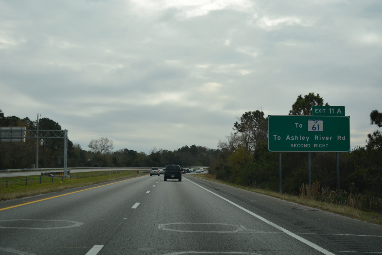
I-526 crosses over S.C. 61 (Ashley River Road) without direct access. S.C. 461 (Paul Cantrell Boulevard) east leads directly to Ashley River Road.
12/31/17
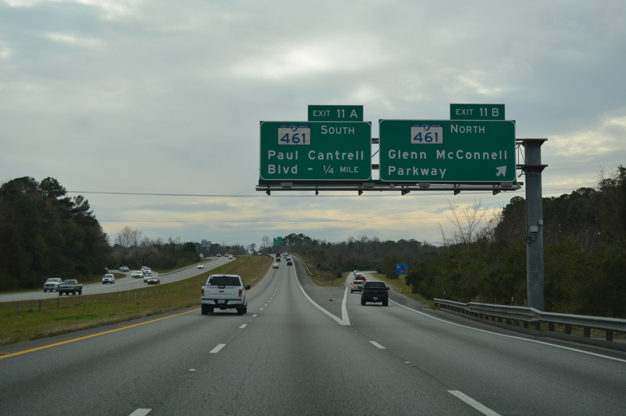
Exit 11B leaves I-526 west for Glenn McConnell Parkway (S.C. 461) northwest to Bees Ferry Road and West Ashley Circle. Glenn McConnell Parkway will be extended beyond Bees Ferry Road to the planned Long Savannah development, a 1,500 acre site. Preceding work in 2021-23 will expand S.C. 461 between Magwood Drive and Bees Ferry Road to six overall lanes at the cost of $25 million.4
12/31/17
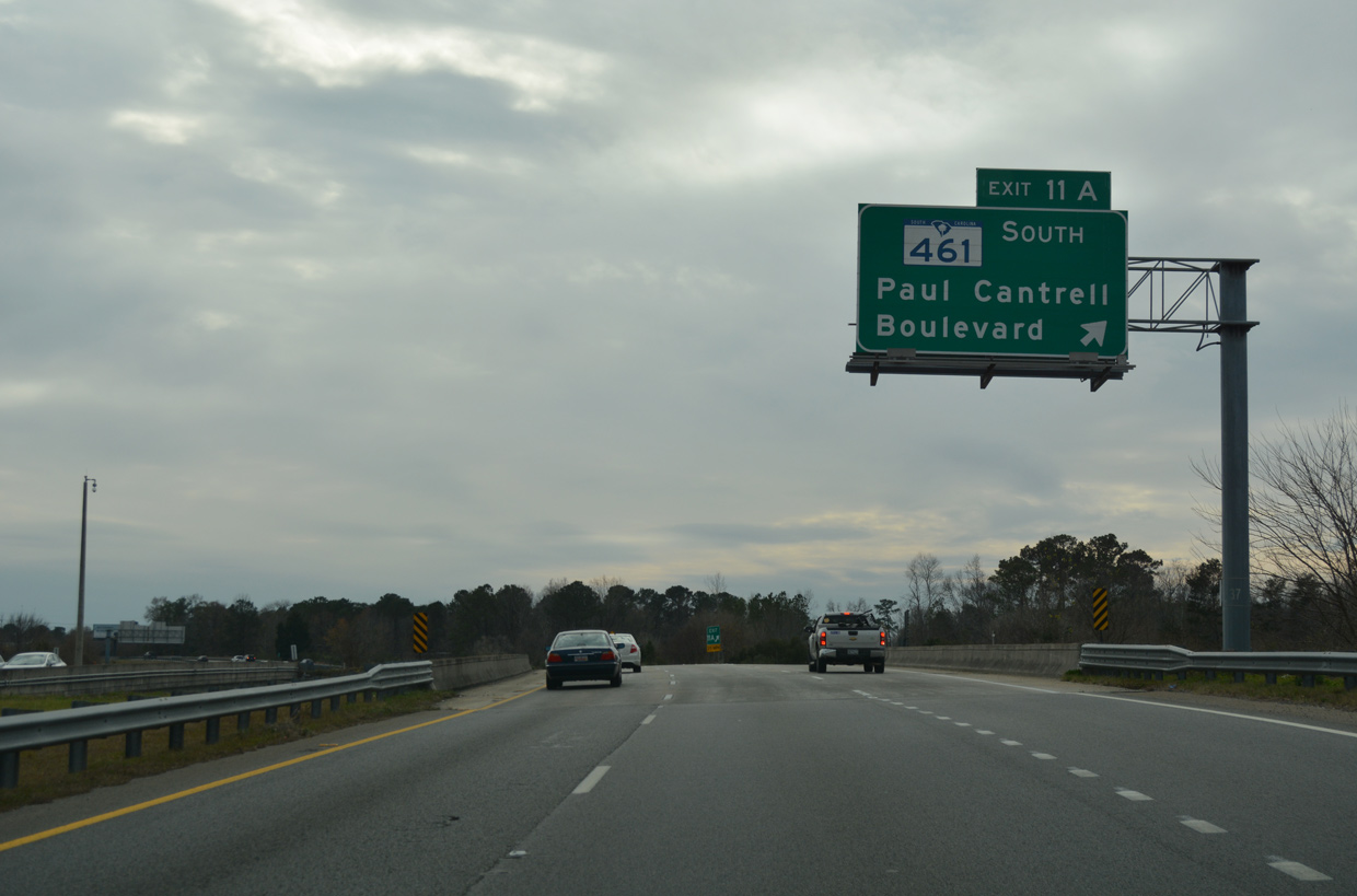
S.C. 461 follows Paul Cantrell Boulevard east from Exit 11A to Tobias Gadson Boulevard north of Citadel Mall and S.C. 61 (Ashley River Road) south to Pinecrest and Albemarle in Charleston.
12/31/17
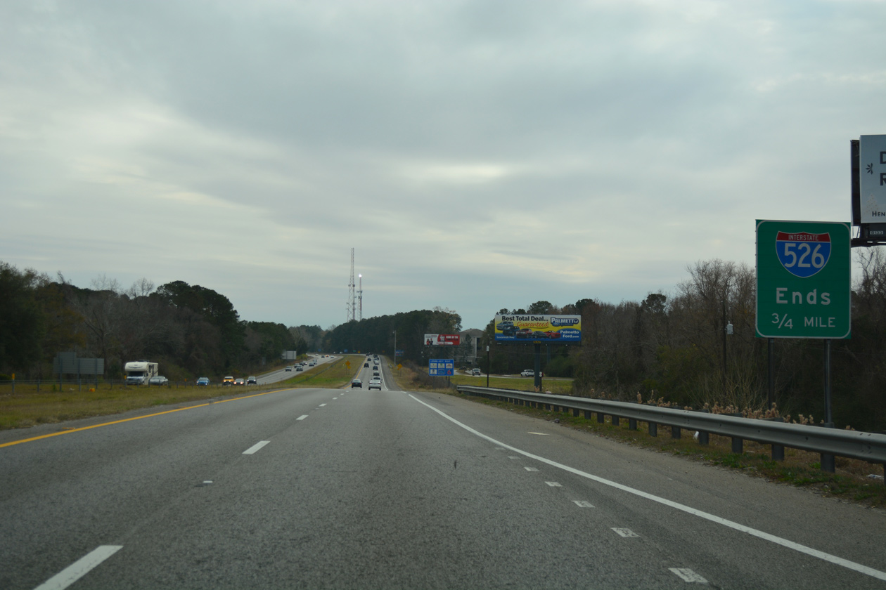
The final 1.37 miles of Interstate 526 lead south by Citadel Mall to U.S. 17 (Savannah Highway).
12/31/17
SCDOT mileposts count down to 10.00, reflecting the incomplete segment south to James Island.
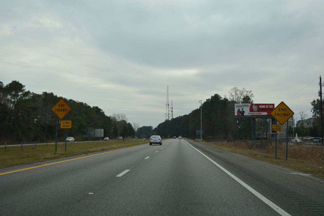
12/31/17
The westbound lanes end abruptly, while the eastbound lanes span forthcoming S.C. 7 (Sam Rittenberg Boulevard).
12/31/17
Grading and a short stub of pavement remains for the unconstructed link between Sam Rittenburg Boulevard and S.C. 171 (Folly Road) on James Island.
12/31/17
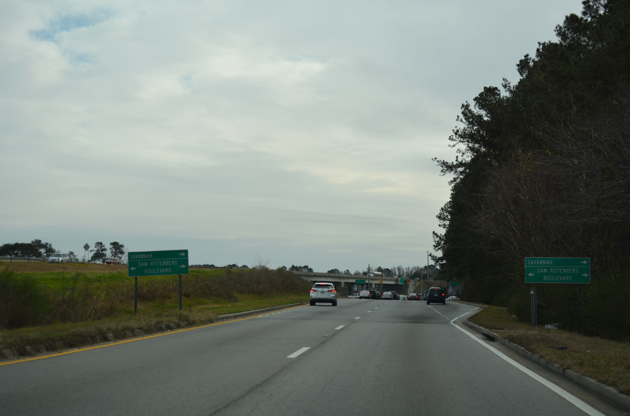
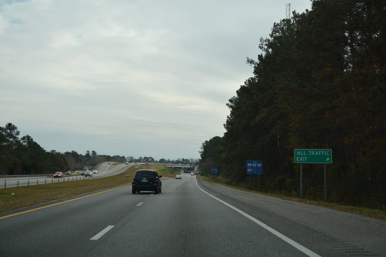
All I-526 traffic diverts onto the ramp for S.C. 7 (Sam Rittenberg Boulevard) and U.S. 17 (Savannah Highway). S.C. 7 ties into U.S. 17 just west of the freeway end, concluding a commercialized route across west Charleston.
12/31/17
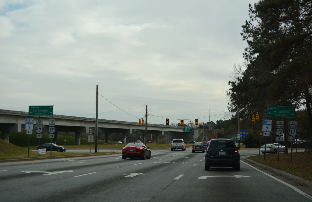
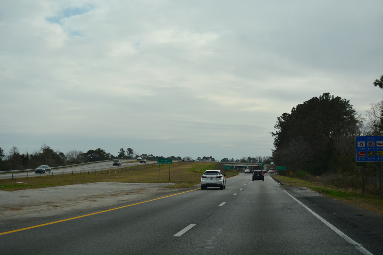
S.C. 7 south provides a short cutoff to U.S. 17 (Savannah Highway) southbound to Jacksonboro and Savannah, Georgia. The state highway measures just 5.92 miles north to U.S. 52/78 (Rivers Avenue) in North Charleston.
12/31/17
A service road extends south from S.C. 7 to link with U.S. 17 northbound toward James Island and Downtown Charleston.
05/30/07
References:
- I-526 EB over WANDO RIVER, Charleston County, South Carolina. http://bridgereports.com/1481713 BridgeReports.com
- Don Holt Bridge. http://bridgehunter.com/sc/berkeley/cooper-river/ Bridgehunter.com
- I-526 WBL over ASHLEY RIVER, Charleston County, South Carolina. http://bridgereports.com/1481726 BridgeReports.com
- "Plans for $25 million widening of Glenn McConnell Parkway in Charleston is coming together." Post and Courier, The (Charleston, SC), January 18, 2018.
Photo Credits:
- Alex Nitzman: 12/31/17
- Andy Field: 05/30/07
Connect with:
Page Updated Friday September 14, 2018.