
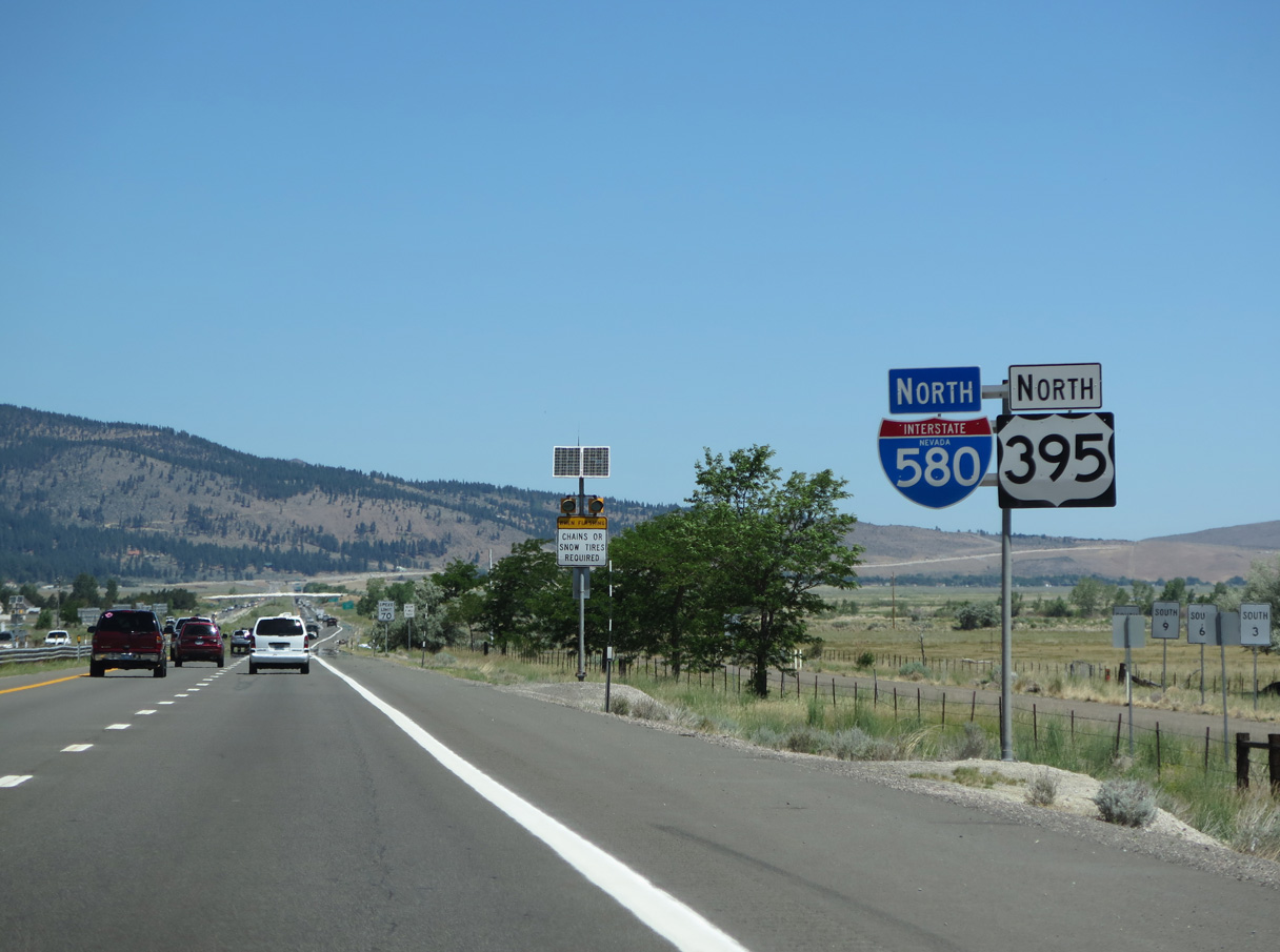
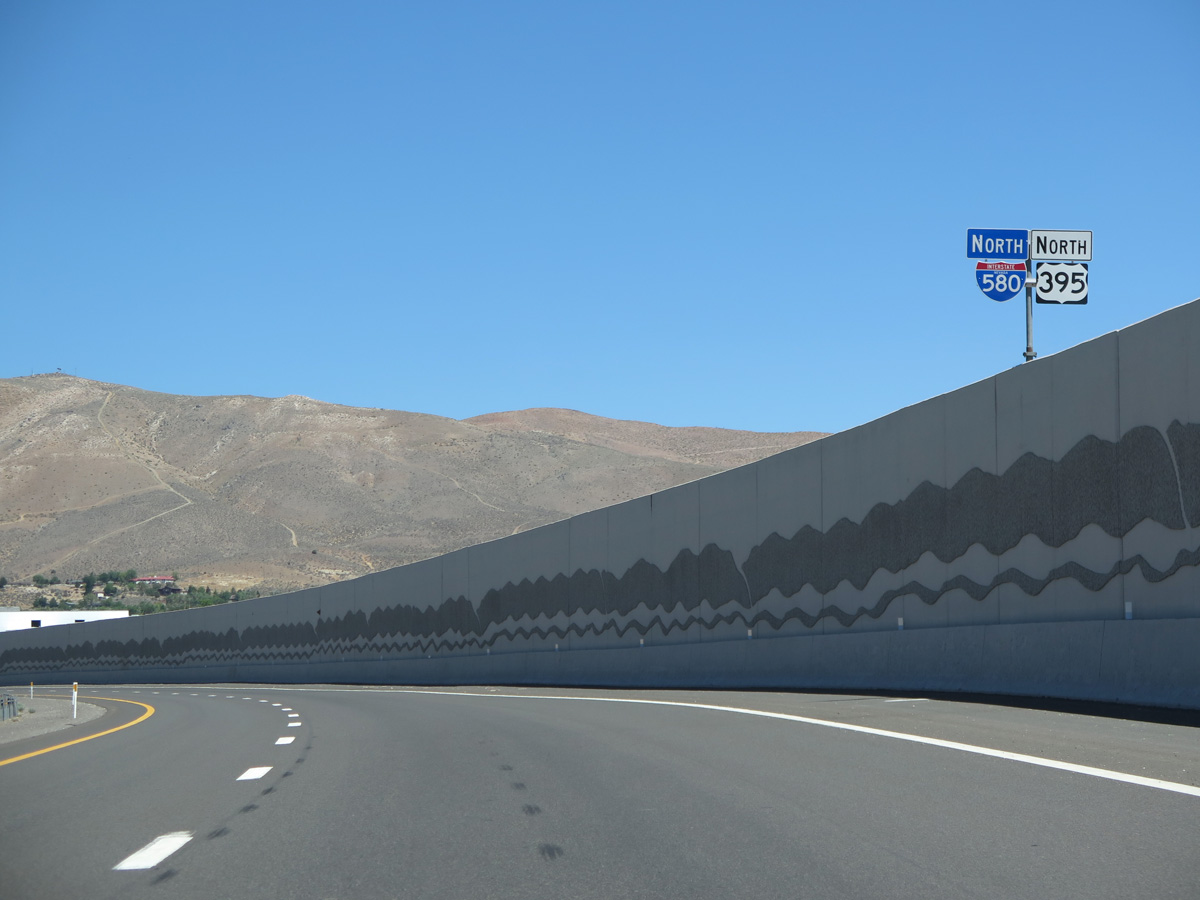
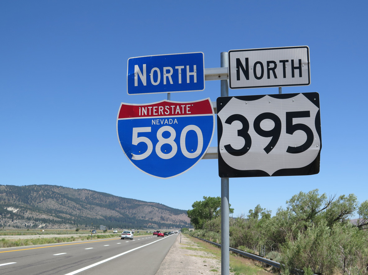
I-580/U.S. 395 North - Carson City to Washoe Lake

 North
North  East
East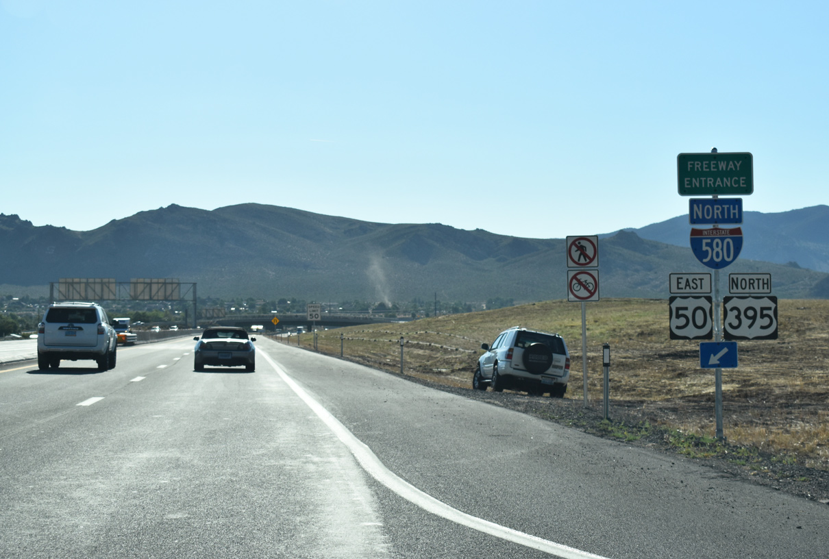
Interstate 580 commences along a 35.08 mile course from southern reaches of Carson City to I-80 in Reno. U.S. 395 runs concurrent with the freeway to Reno while U.S. 50 joins I-580 the first five miles.
07/11/18

Synder Avenue spans I-580/U.S. 395-50 one half mile east of S Carson Street (U.S. 395 Business). Artwork on the overpass reflects the Washoe Tribe heritage, including the name "Usewe Wat A" which translates to "Rabbit Drive Creek", the original name for the surrounding area.1
07/11/18
Interstate 580 arcs northward to line S Edmonds Drive near the Pete Livermore Sports Complex.
07/11/18
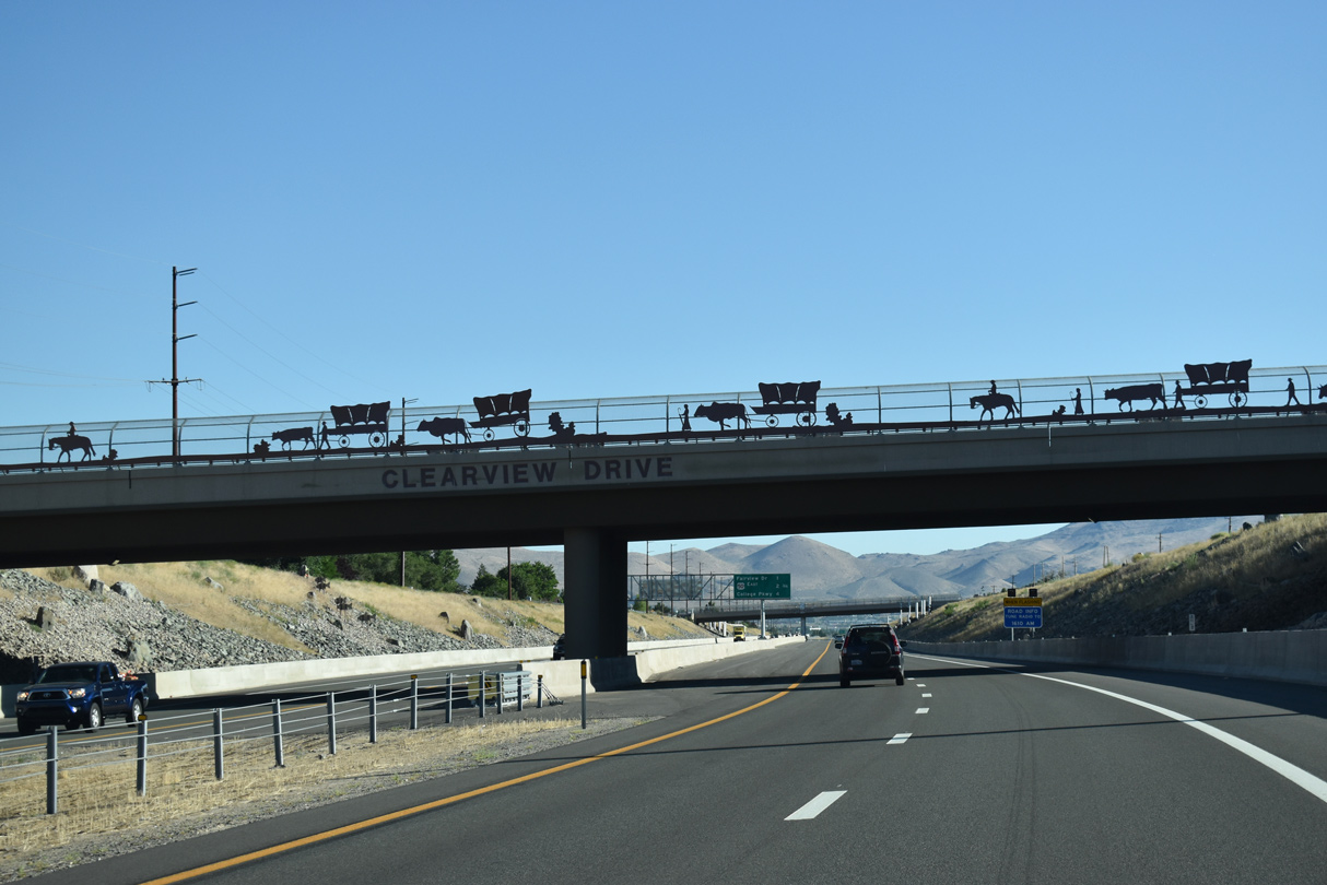
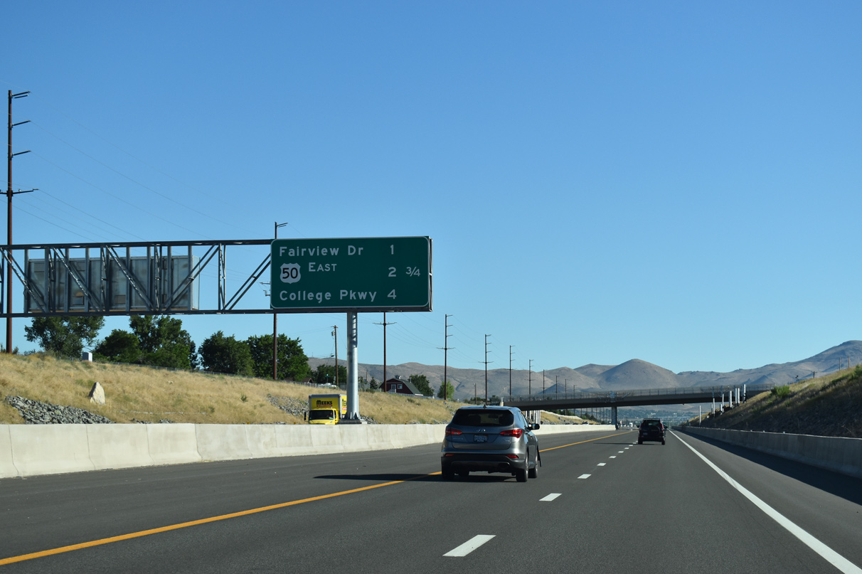
I-580/U.S. 395 north and U.S. 50 east pass under Clearview Road one mile out from Fairview Drive (Exit 3). U.S. 50 departs for Mound House and Stagecoach in 2.75 miles.
07/11/18
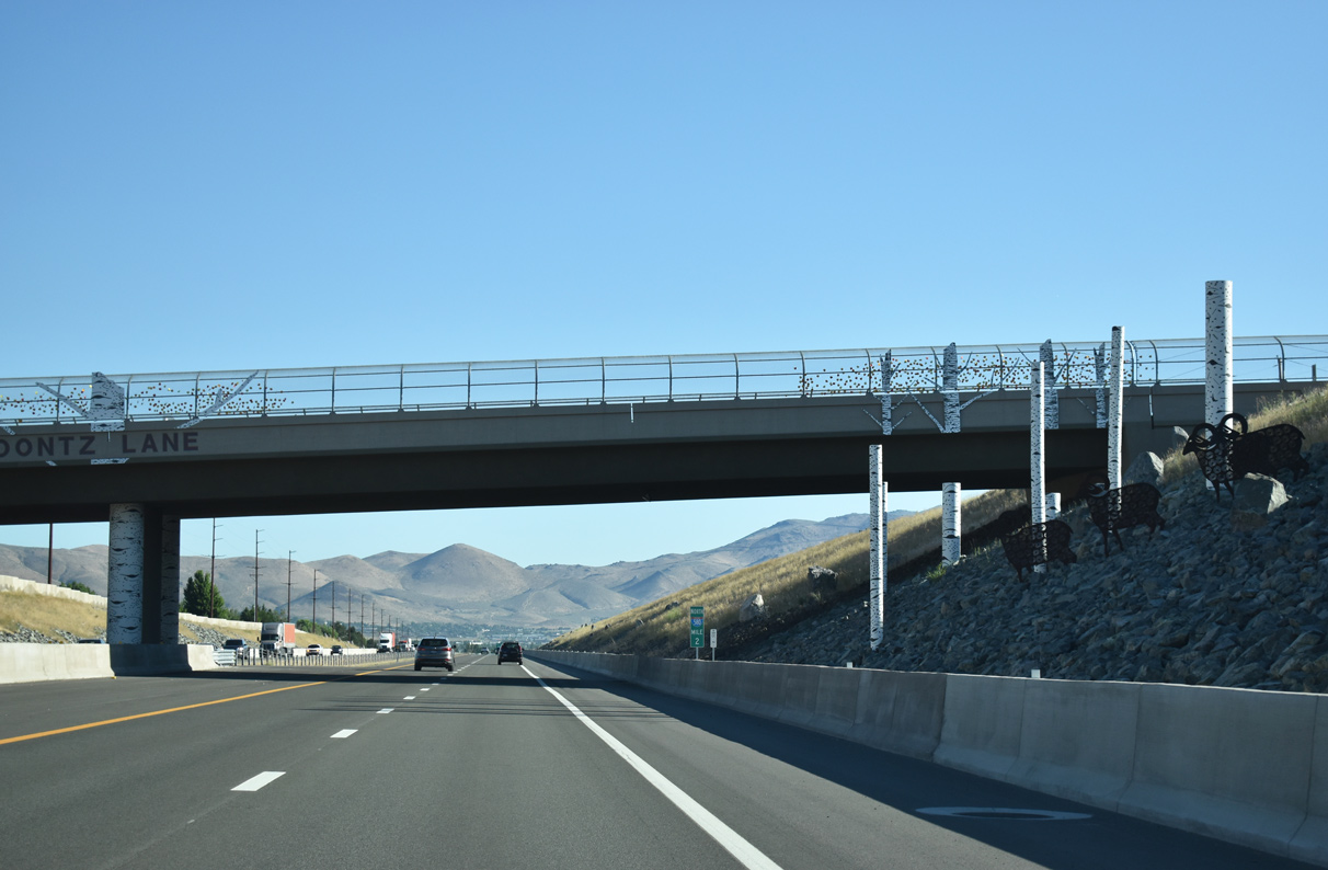
Koontz Lane travels through south Carson City, passing over Interstate 580 ahead of S Edmonds Drive.
07/11/18
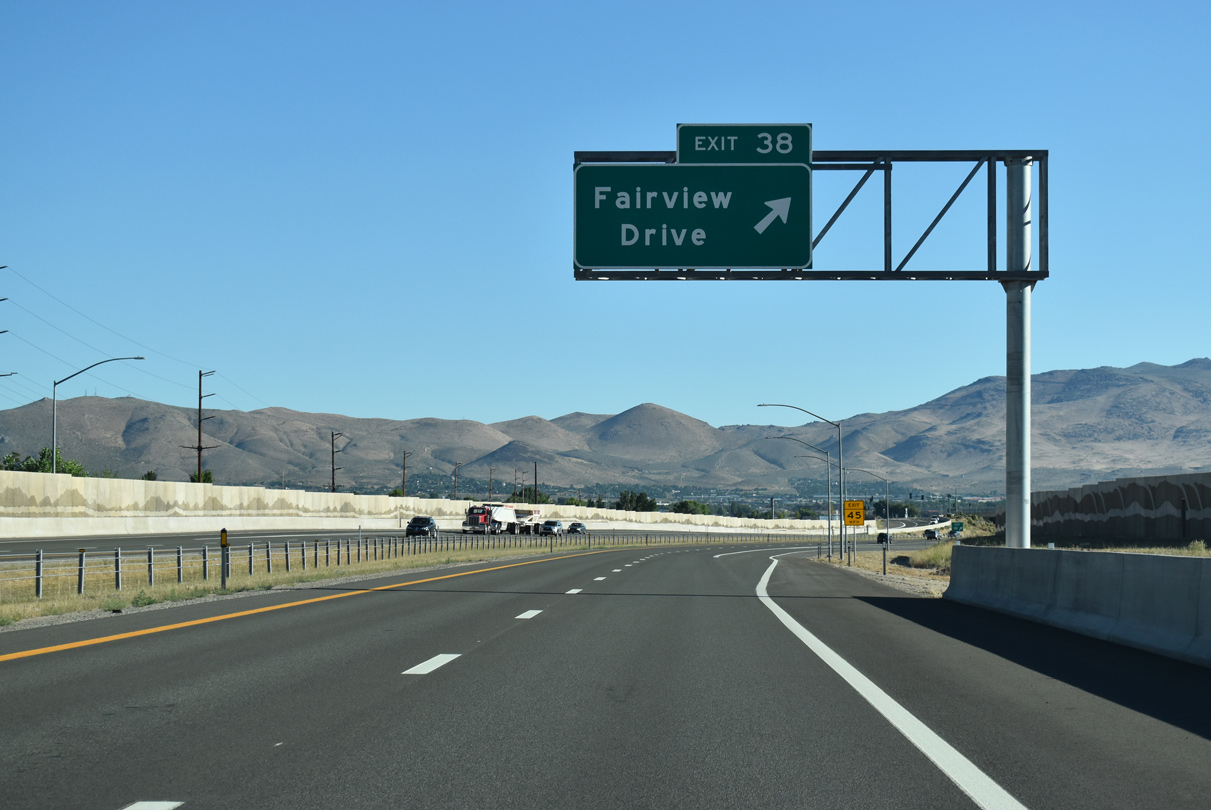
Exit 3 (former Exit 38) joins I-580 with Fairview Drive. U.S. 395-50 followed Fairview Drive prior to the opening of the final segment of the freeway.
Exit numbers changed beginning Summer 2019 to reflect I-580 mileage.2
07/11/18
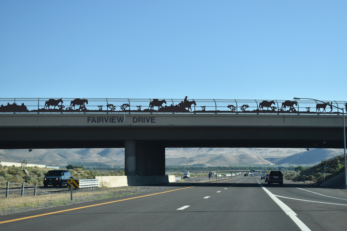
A loop ramp joins Fairview Drive east with I-580/U.S. 50-395 north. Western themed artwork accompanies the overpass.
07/11/18
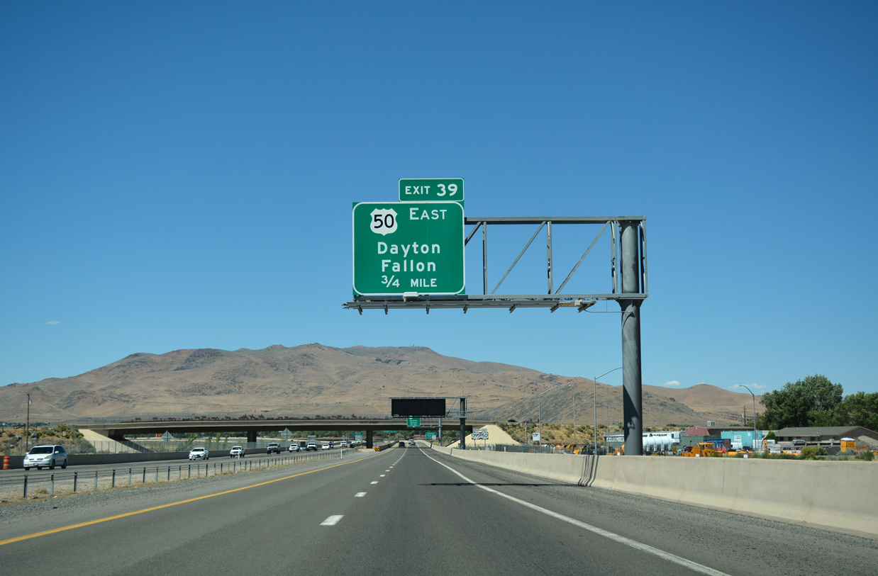
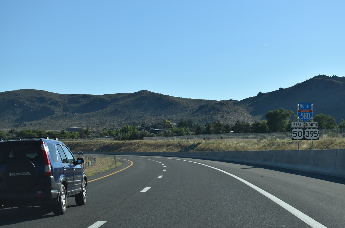
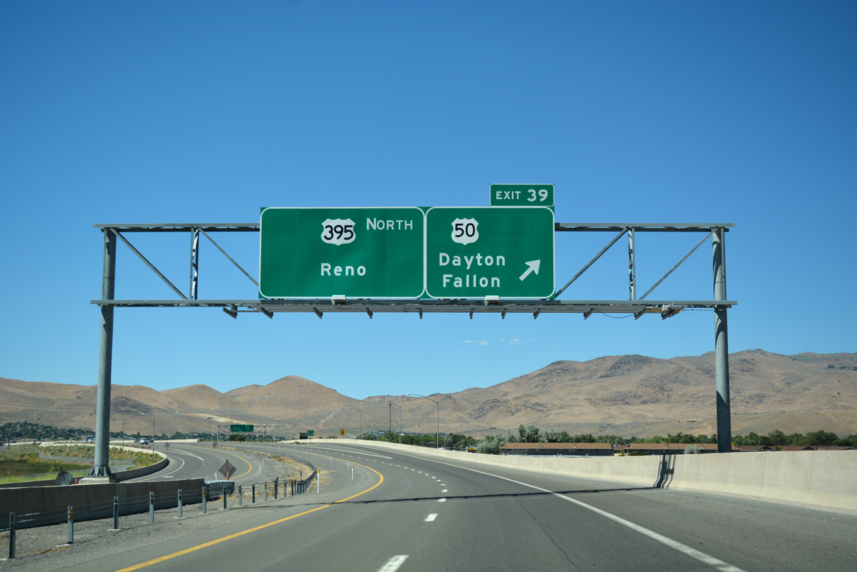
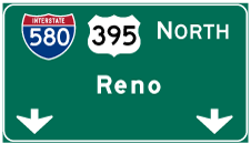
U.S. 50 concludes a 3.2 mile overlap along I-580/U.S. 395 north at the forthcoming single point interchange (Exit 39) with William Street.
07/17/17
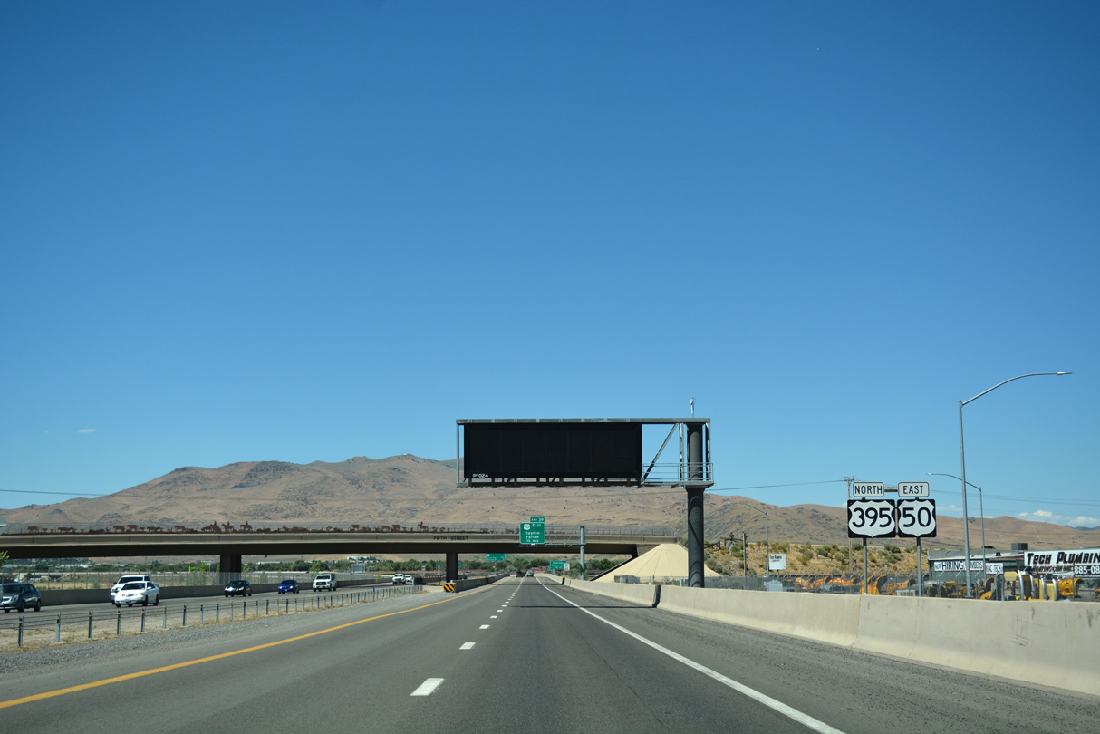
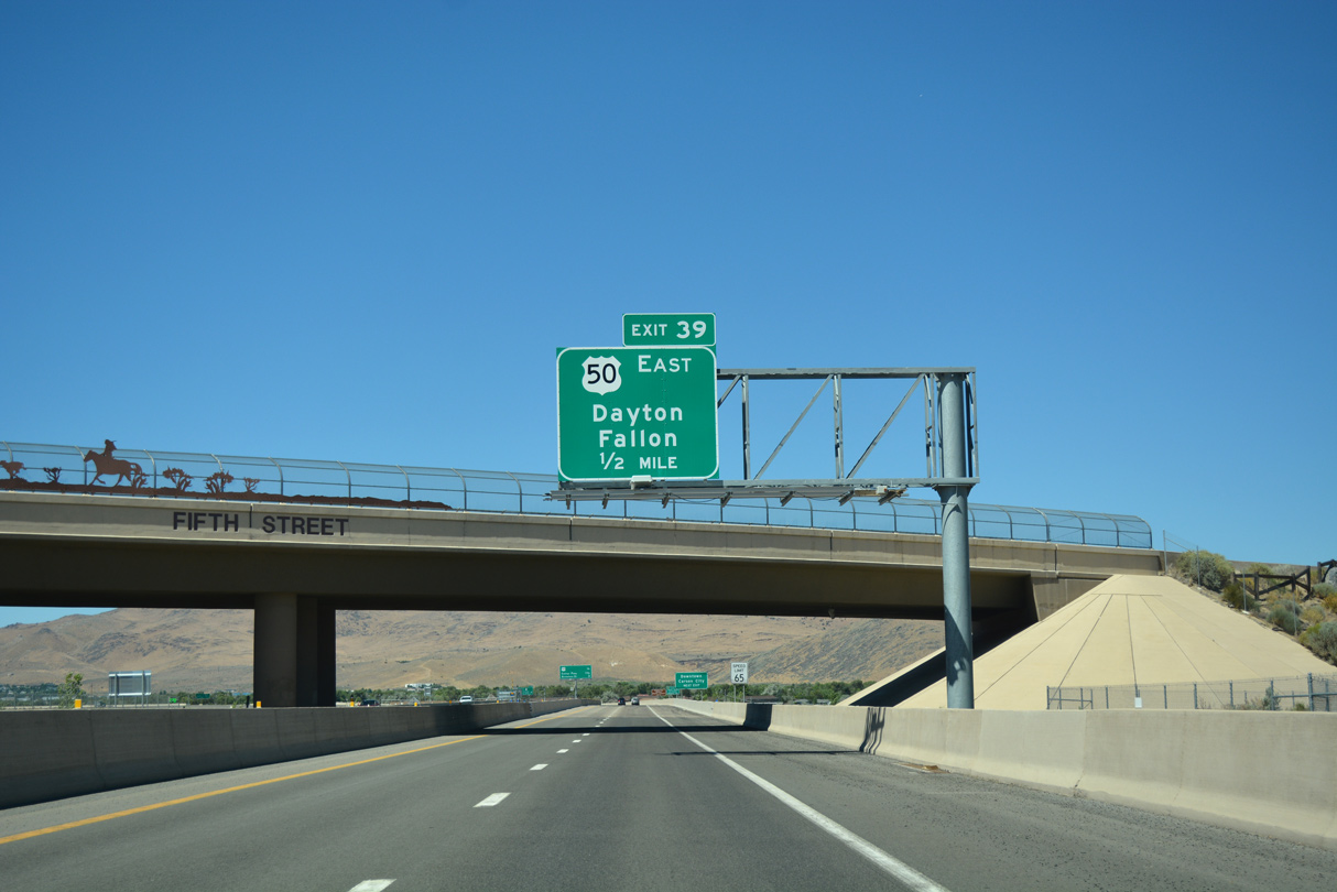
Fifth Street (former SR 513) spans Interstate 580 & U.S. 50-395 beyond this set of confirming markers.
07/17/17
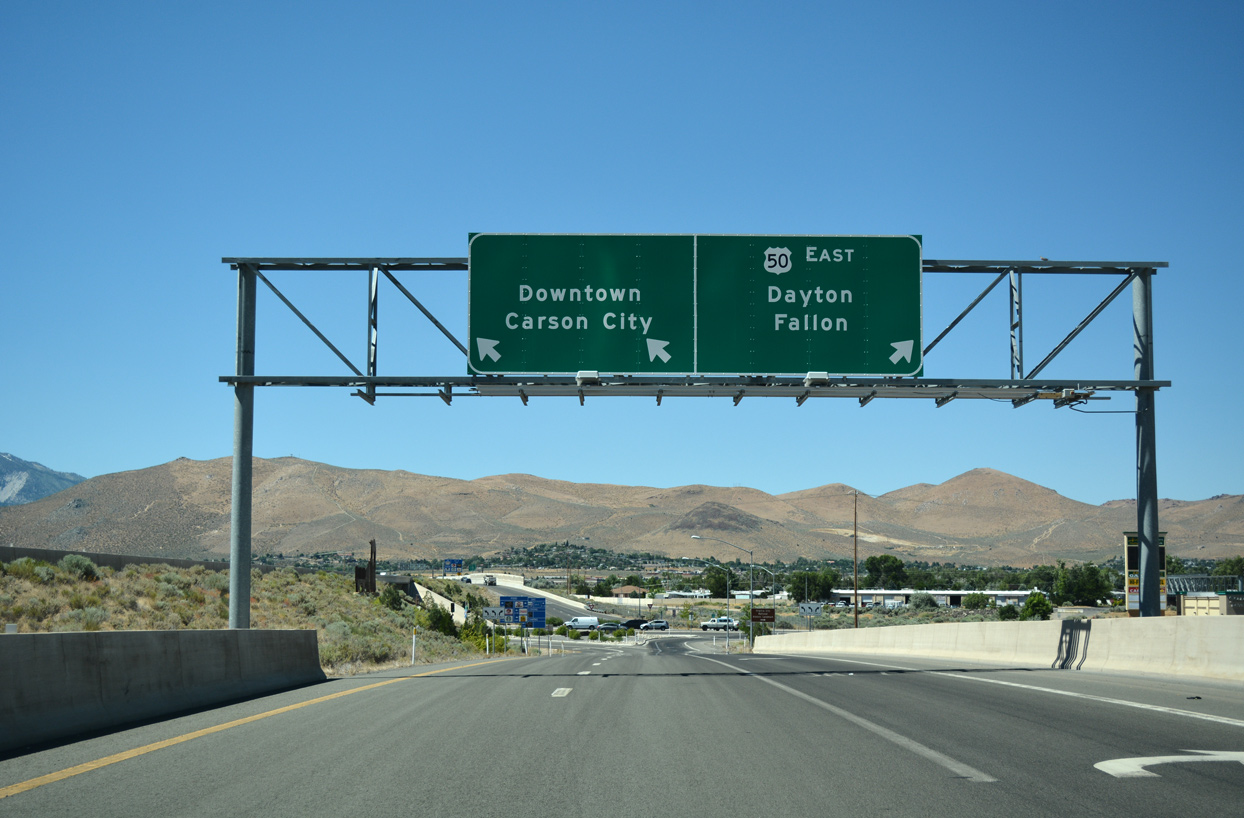
U.S. 50 joins William Street east from the Carson City Bypass through the eastern suburbs. leading away from the capital city, the US highway continues to Dayton, Silver Springs and Fallon.
07/17/17
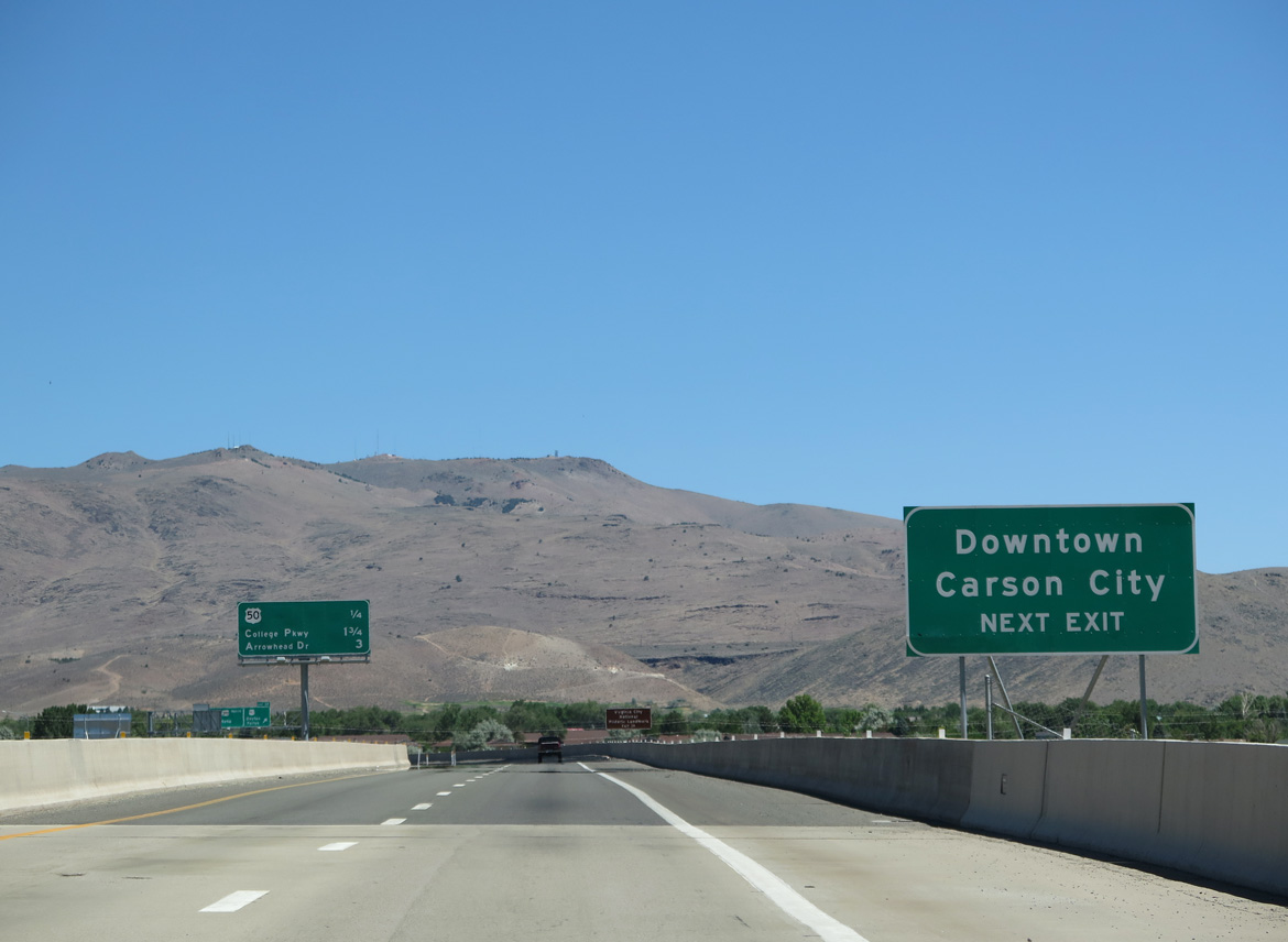
William Street extends 1.4 miles west along the pre-freeway alignment of U.S. 50 to Carson Street (old U.S. 395) in Downtown Carson City.
06/28/14
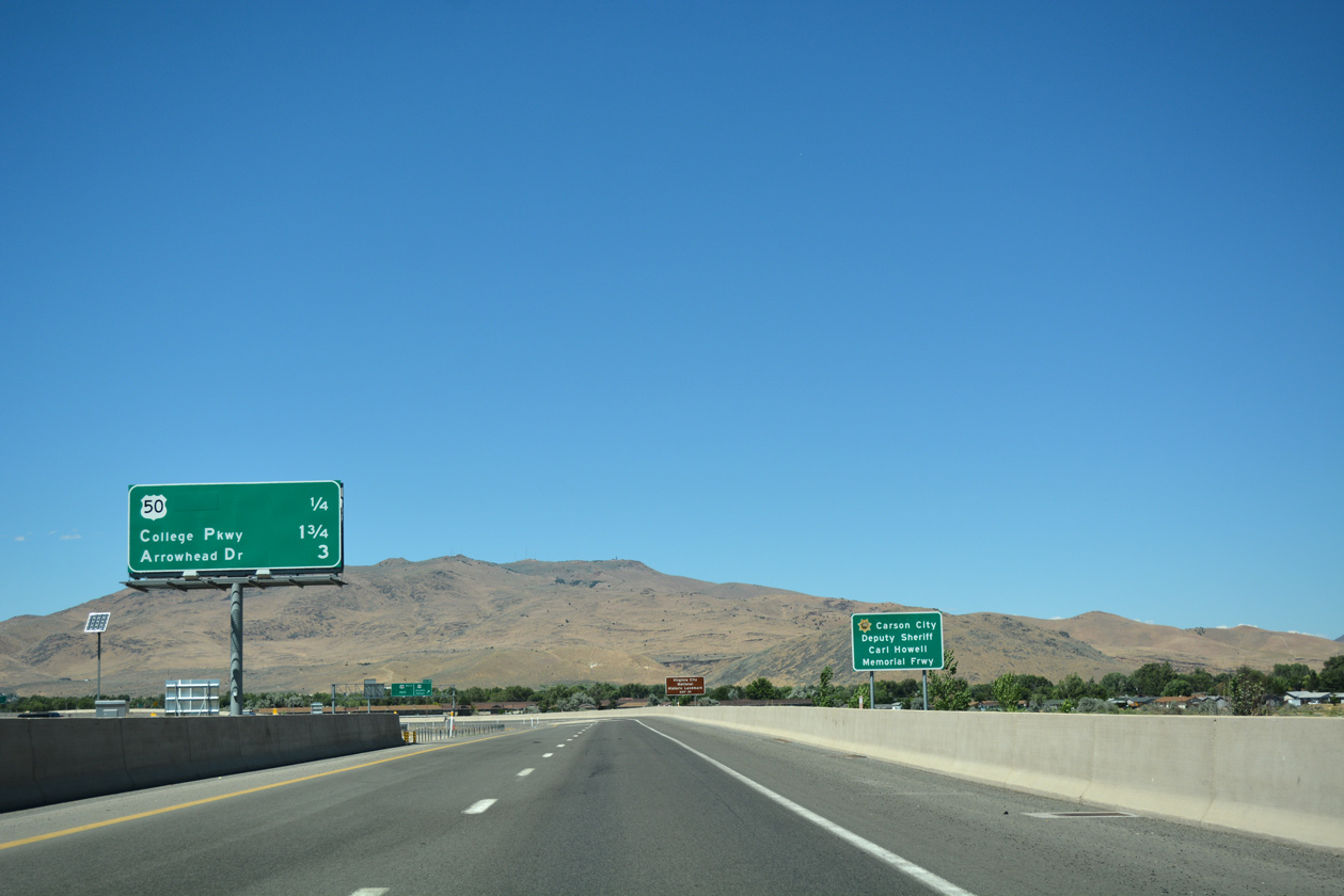
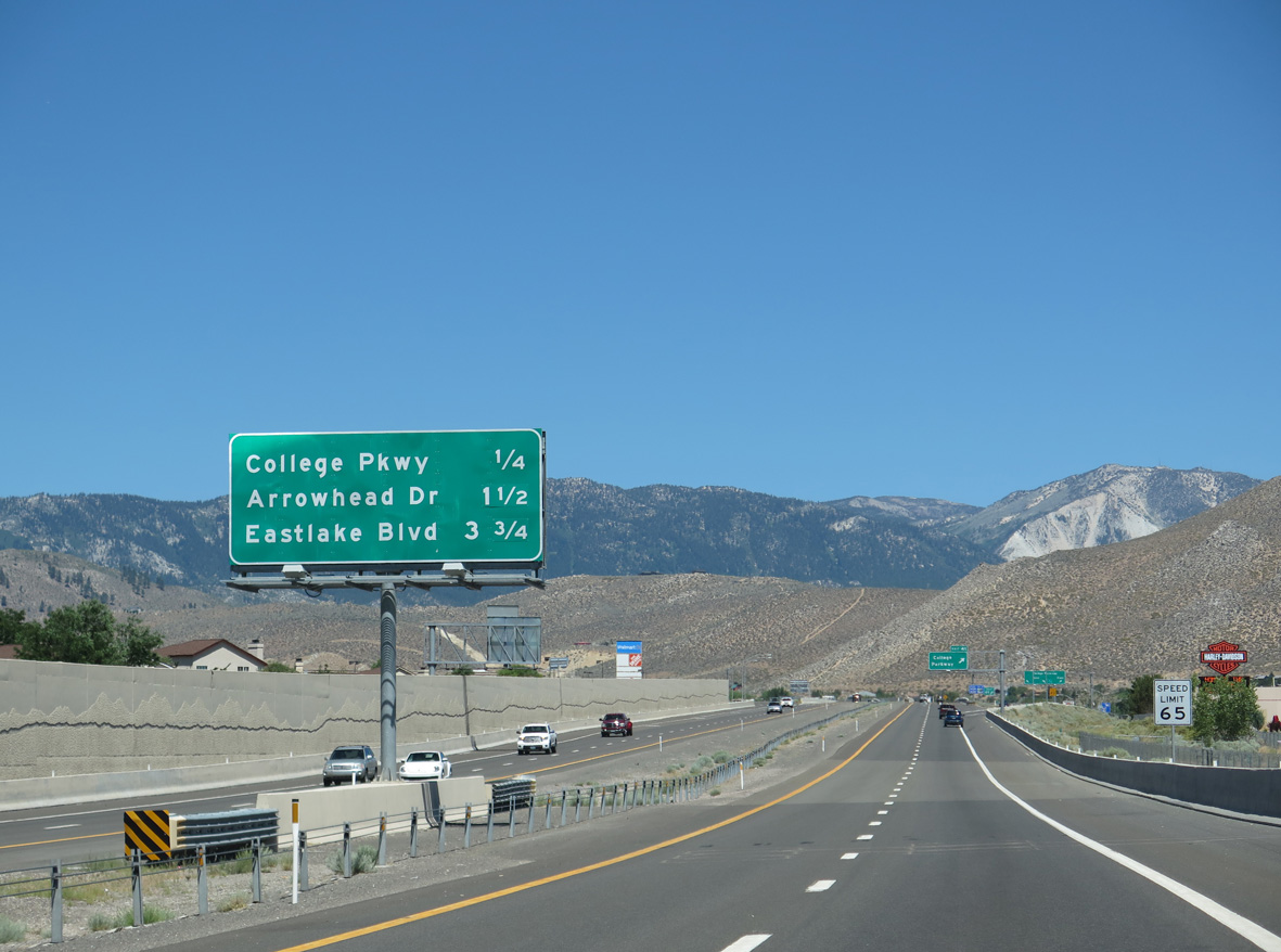
Three exits remain within Carson City along I-580 & U.S. 395 north to Arrowhead Drive.
07/17/17
U.S. 50 parts ways with I-580 & U.S. 395 north for William Street. Crossing the width of the Silver State, U.S. 50 travels the "Loneliest Road in America", from Fallon to Austin, Eureka and Ely.
07/17/17
U.S. 50 travels six miles east from Exit 39 to SR 341, which leads north to Virginia City, the seat of Storey County and home to an Old West historic district.
07/17/17
North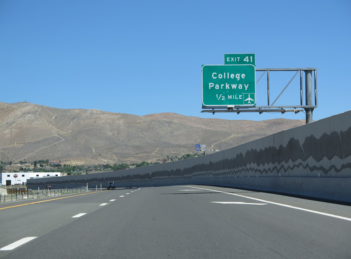
Continuing across urban areas of Eagle Valley, I-580 & U.S. 395 make a gradual western turn to Exit 41 with College Parkway.
06/28/14
The single point interchange (Exit 41) with College Parkway lies one quarter mile beyond the Northridge Drive underpass on I-580 & U.S. 395 northbound.
06/28/14
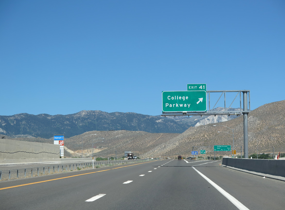
Exit 41 departs I-580 & U.S. 395 north for College Parkway west to North Carson Street and Western Nevada College and east to Carson City Airport (CXP).
06/28/14
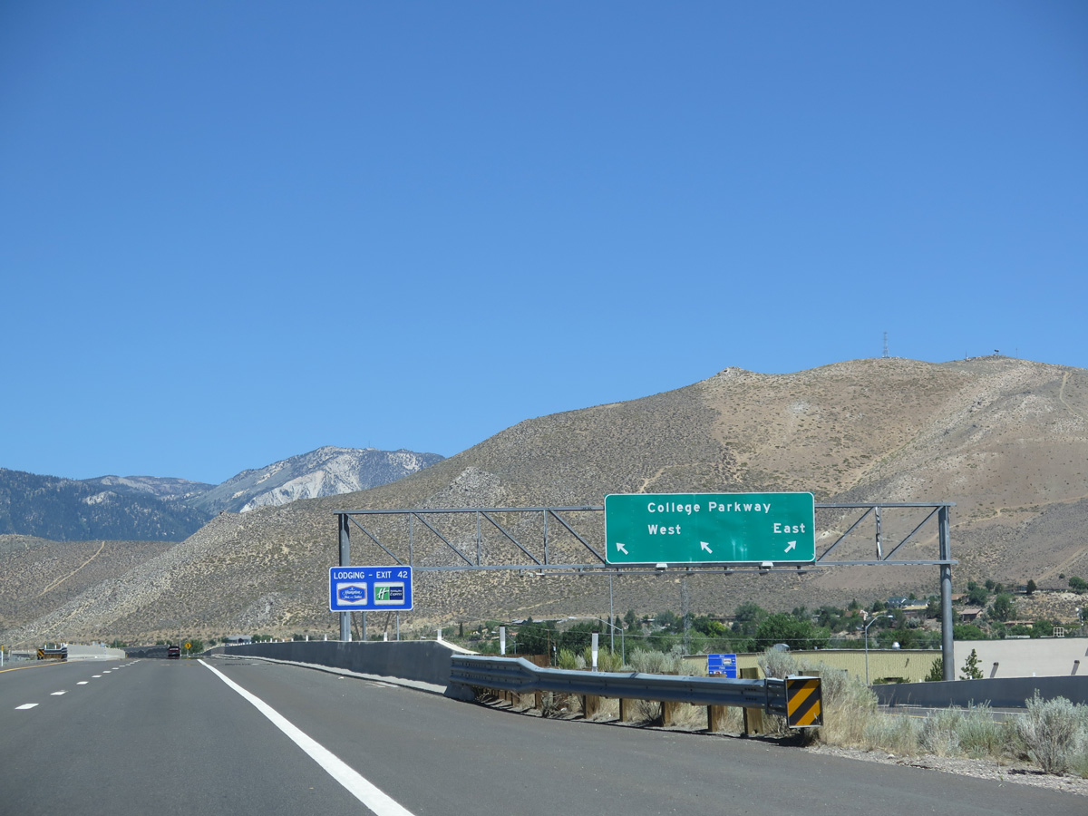
College Parkway was formerly designated as SR 531 between North Carson Street (old U.S. 395) and Airport Road (old SR 525).
06/28/14
The Carson City Bypass navigates westward through an S-curve through residential areas at Emerson Drive and Northgate Lane.
06/28/14
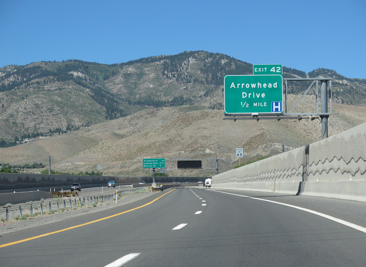
Advancing west toward the Carson Range, the succeeding off-ramp (Exit 42) connects I-580 & U.S. 395 northbound with Arrowhead Drive.
06/28/14
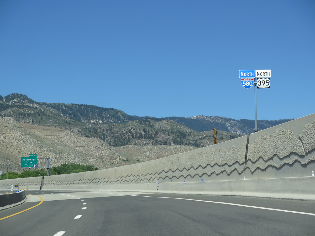
I-580 & U.S. 395 bends northwest for the departure from Eagle Valley, overtaking the former alignment of U.S. 395 at a wye interchange beyond Arrowhead Drive.
06/28/14
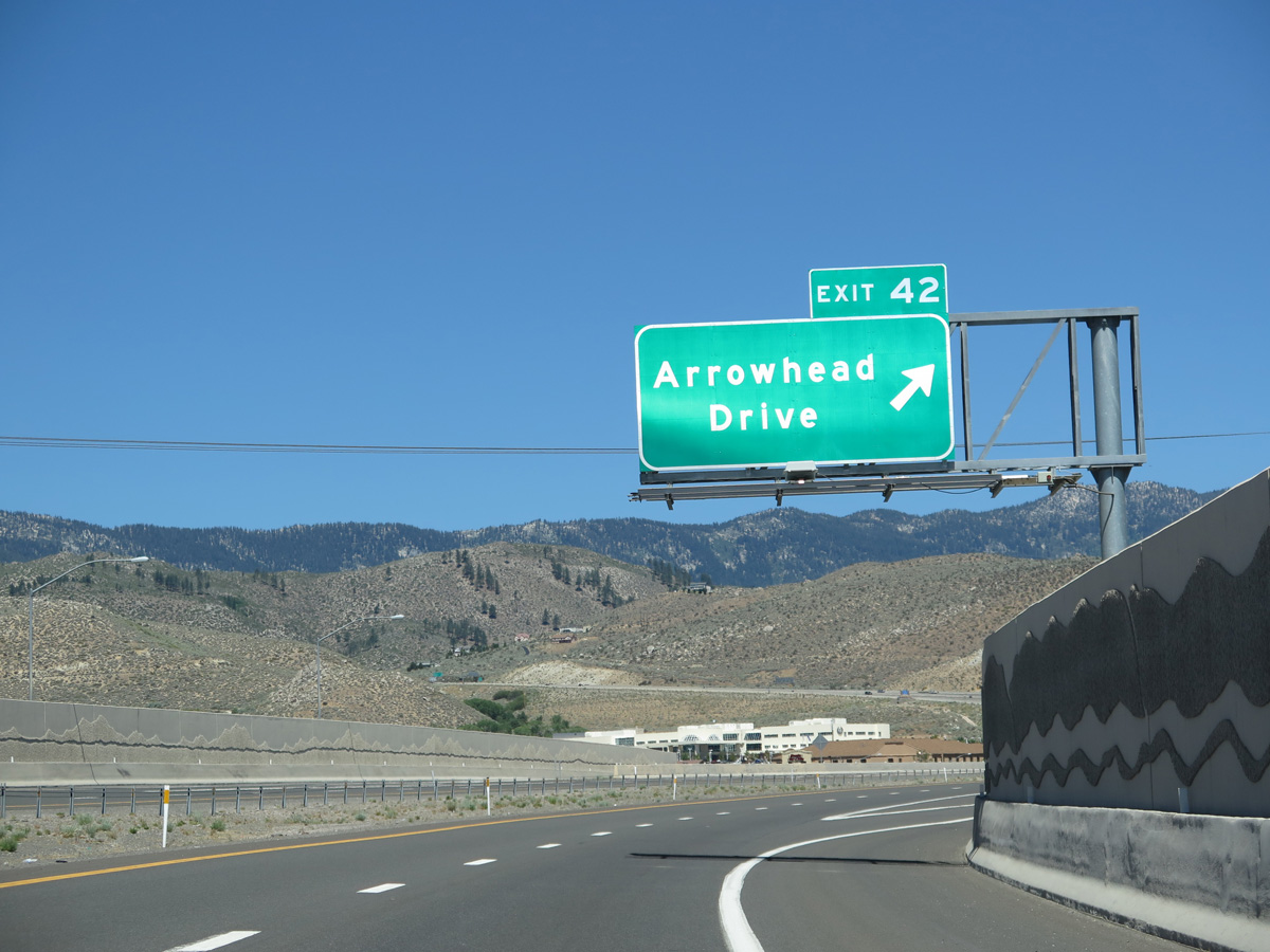
Entering a half dumbbell interchange (Exit 42) with Arrowhead Drive on Interstate 580 north. Arrowhead Drive links the freeway with North Carson Street and Carson Tahoe Regional Medical Center to the immediate west.
06/28/14
Interstate 580 climbs around 300 feet in elevation northwest into Washoe Valley between a gap separating the Carson and Virginia Ranges.
06/28/14
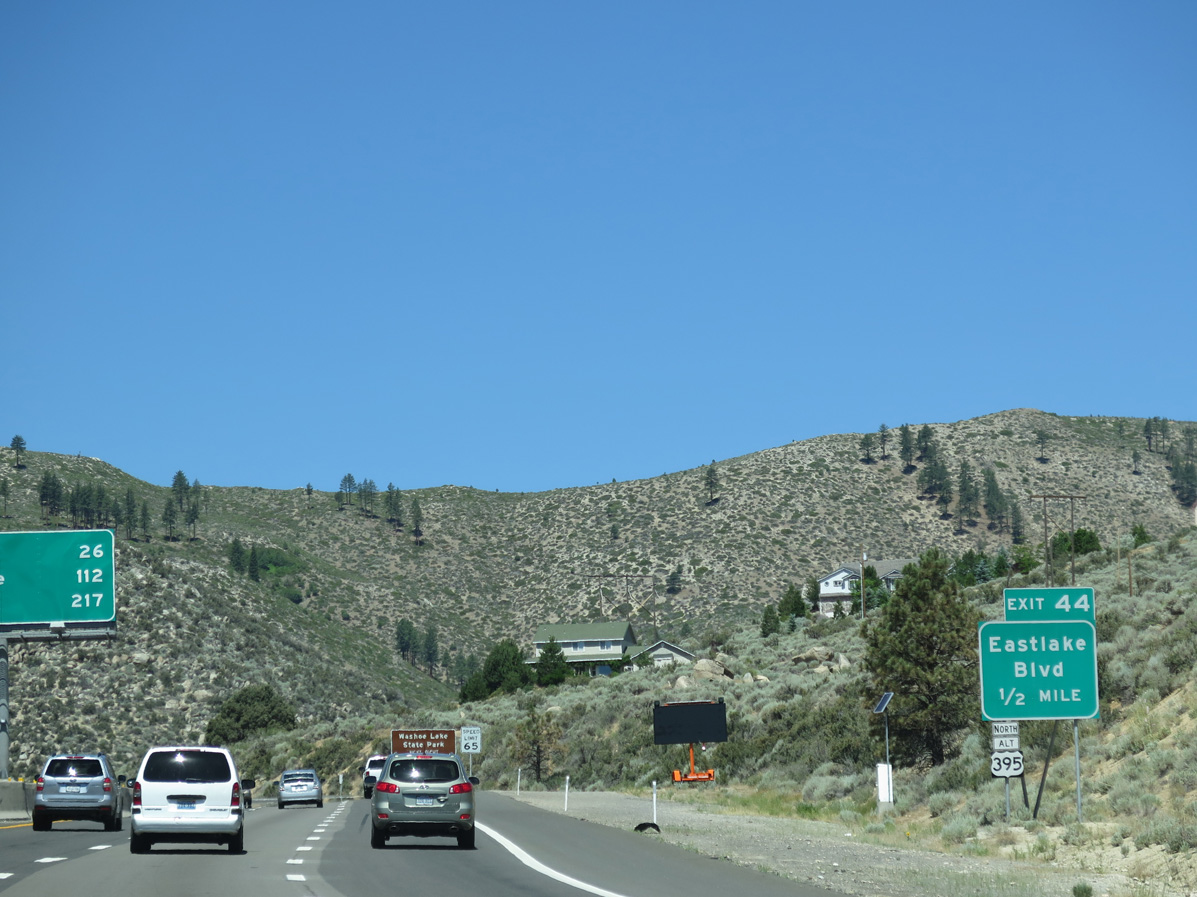
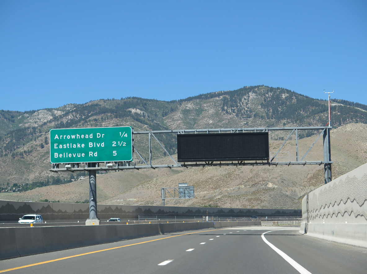
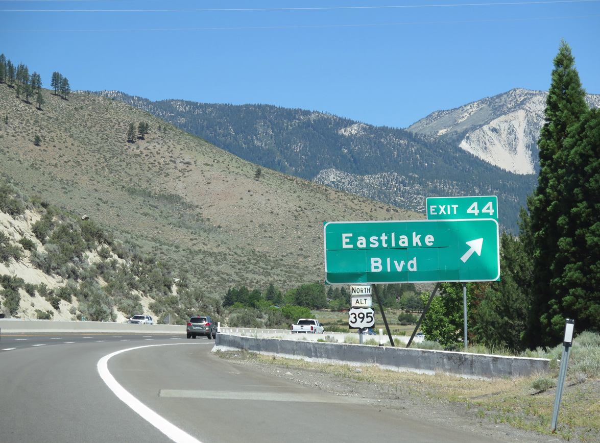
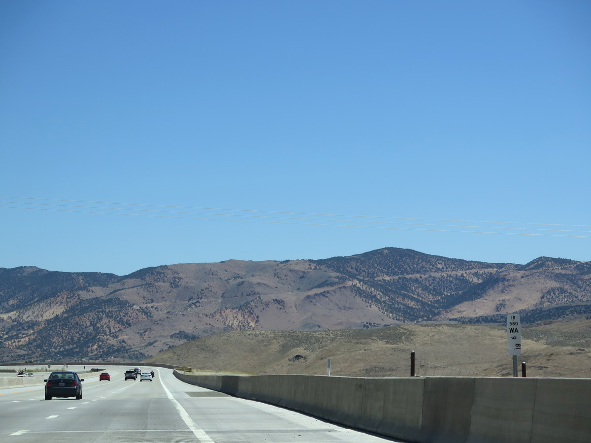
Exit 44 joins I-580 with both U.S. 395 Alternate (Old US 395) north to Franktown and Eastlake Boulevard northeast to Washoe Lake State Park.
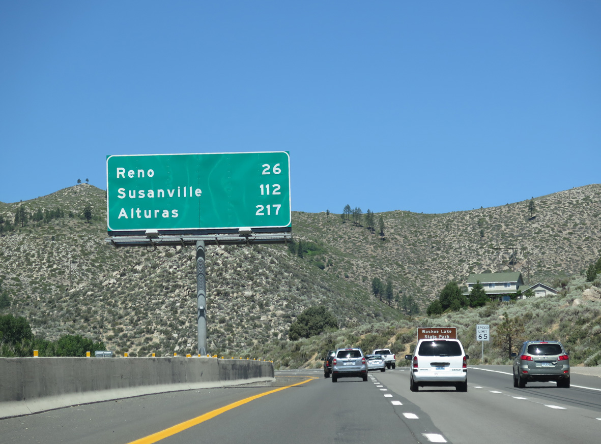
06/28/14
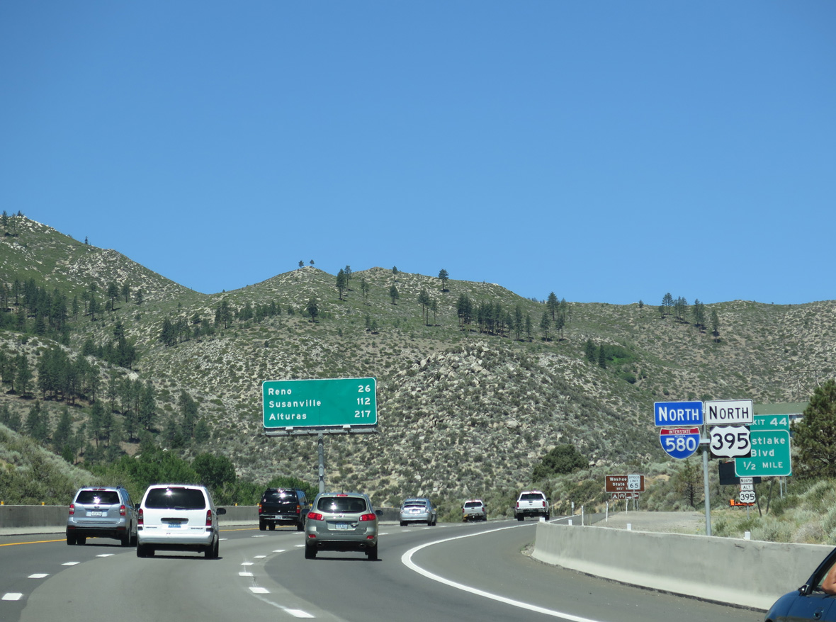
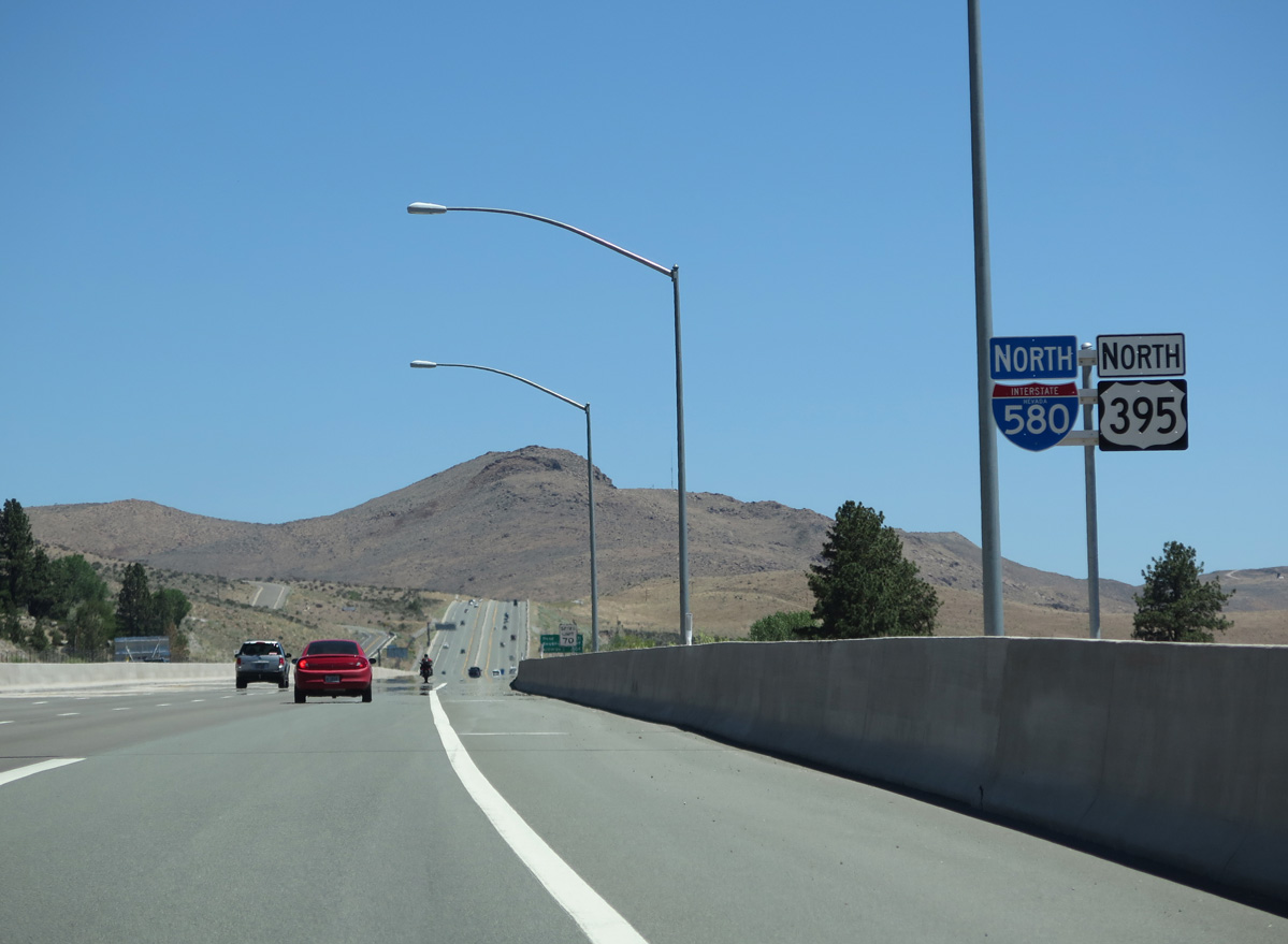
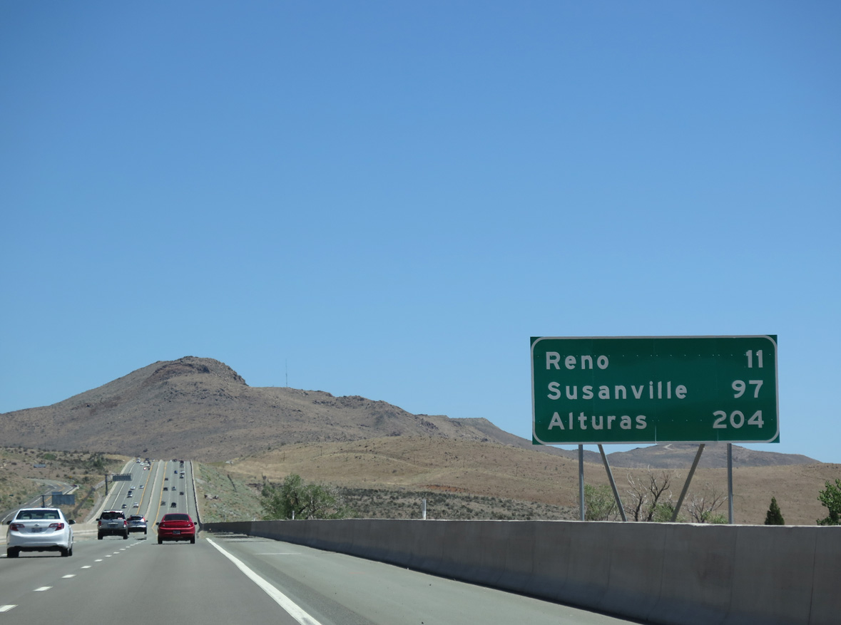
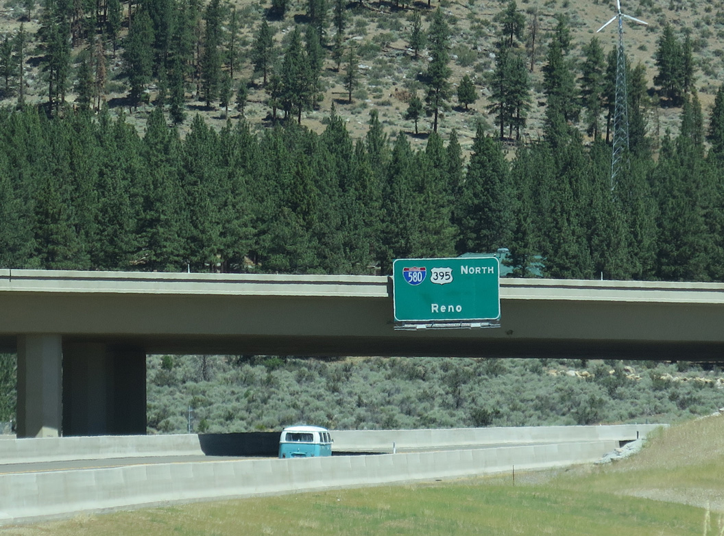
Motorists along I-580 north will reach Reno in 26 miles. Susanville and Alturas lie in northern California along the continuation of U.S. 395.
06/28/14
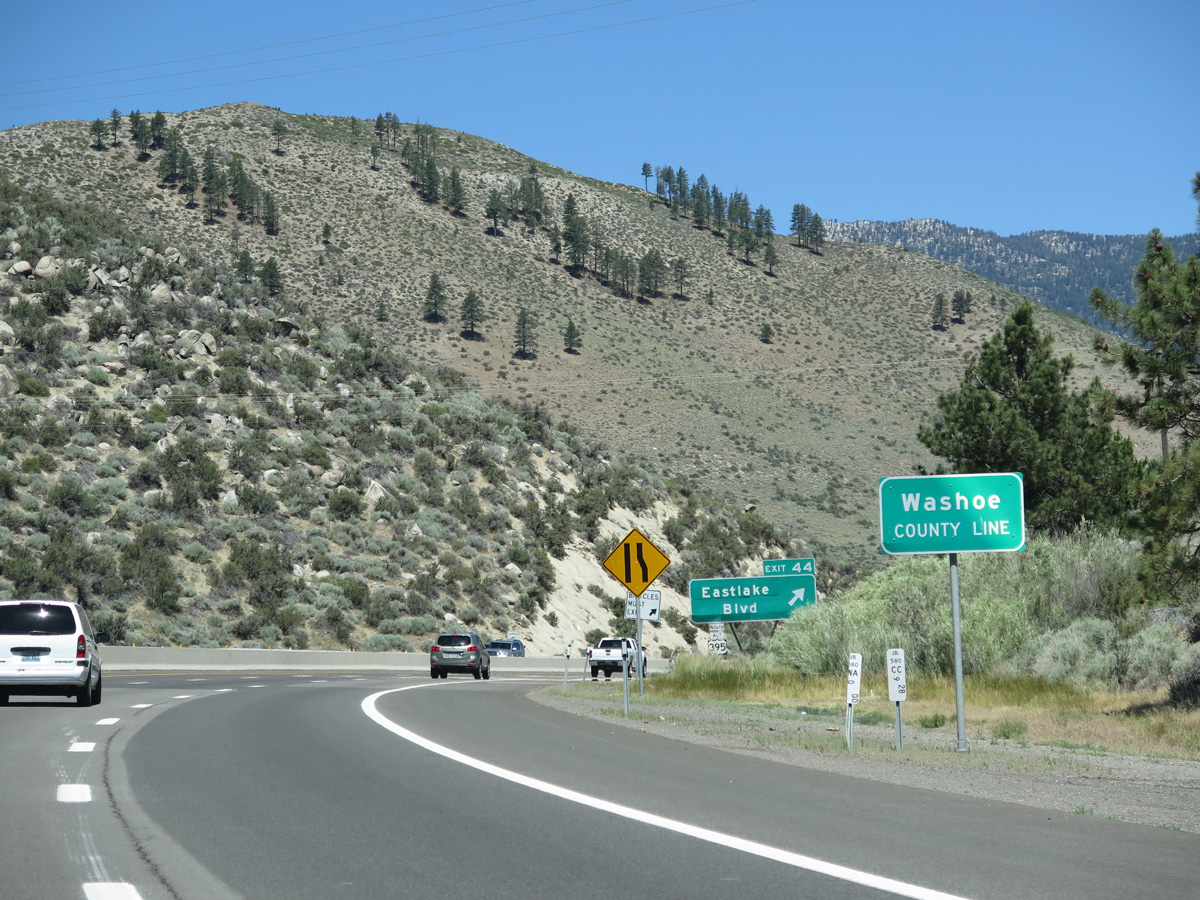
I-580 & U.S. 395 cross into Washoe County just ahead of the modified diamond interchange (Exit 44) with Eastlake Boulevard and U.S. 395 Alternate.
06/28/14
Eastlake Boulevard (former SR 428) loops around Lake Washoe between Exit 44 and New Washoe City, reconnecting with U.S. 395 Alternate by the north end of Little Washoe Lake. U.S. 395 Alternate (former SR 429) loops west to Franktown and Bowers Mansion, meeting I-580 & U.S. 395 again at Exit 50.
06/28/14
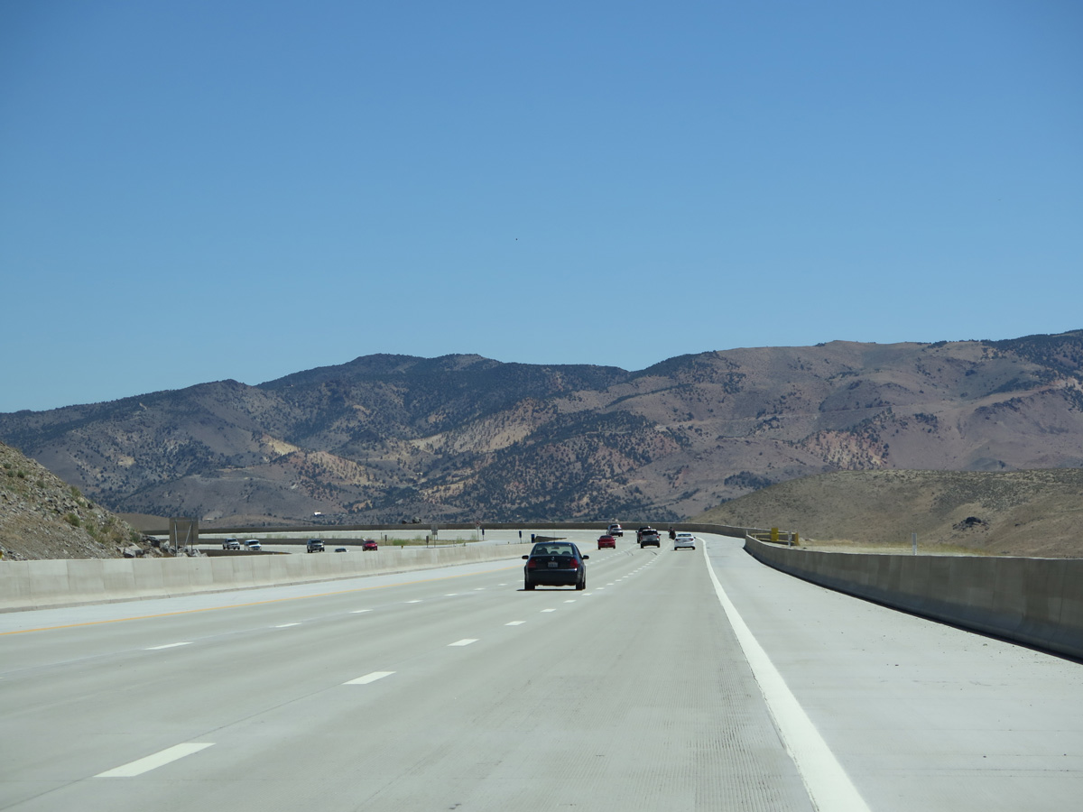
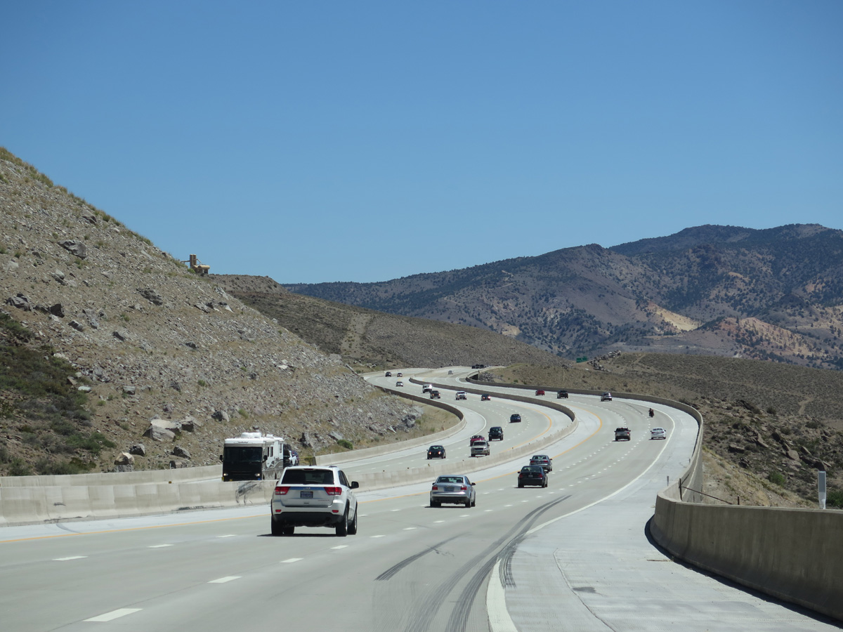
Speed limits increase from 65 to 70 miles per hour as I-580 & U.S. 395 straighten out across Lake Washoe Freeway.
06/28/14
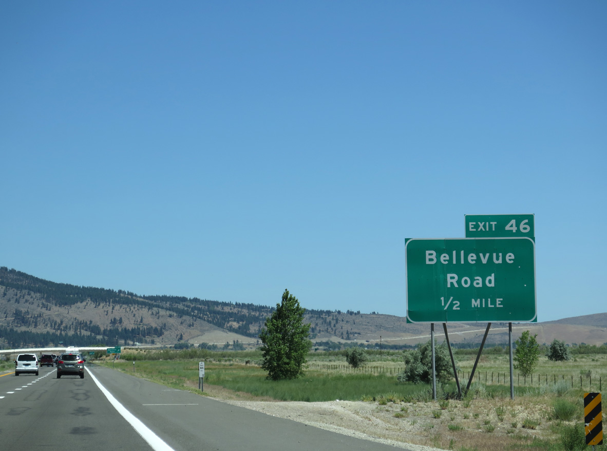
Exit 46 connects I-580 & U.S. 395 with Bellevue Road west to Old U.S. 395 in a half mile.
06/28/14
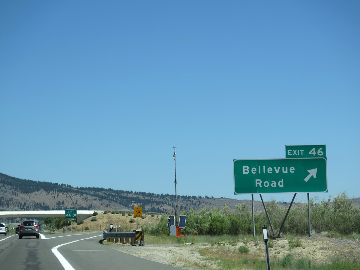
The parclo interchange (Exit 46) with Bellevue Road) lies along the west shore of Washoe Lake northeast of Thunder Canyon Golf Course.
06/28/14
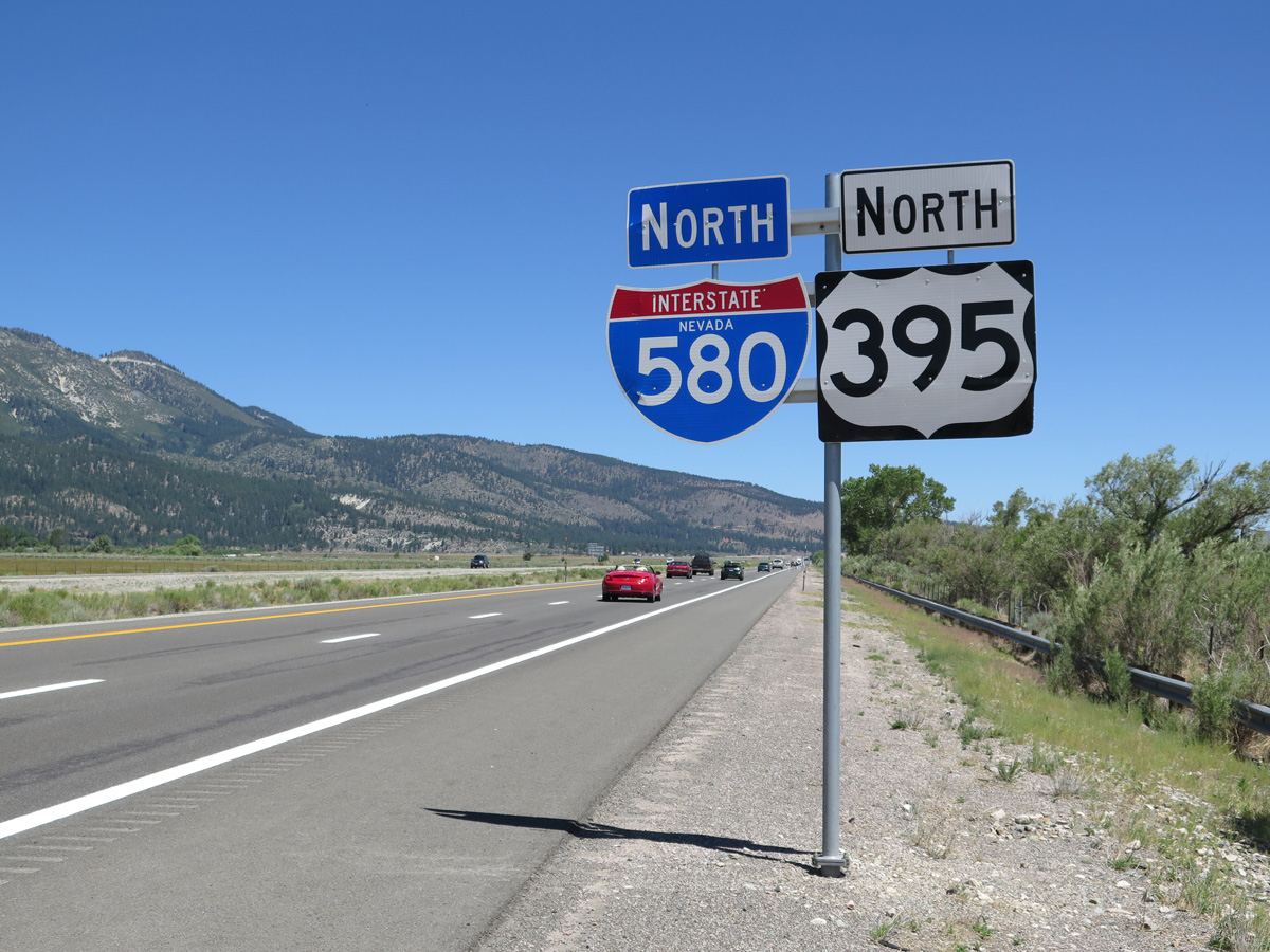
Confirming markers posted north of the Bellevue Interchange. Interstate 580 runs alongside Toiyabe National Forest and the west shore of Washoe Lake over the ensuing two miles.
06/28/14
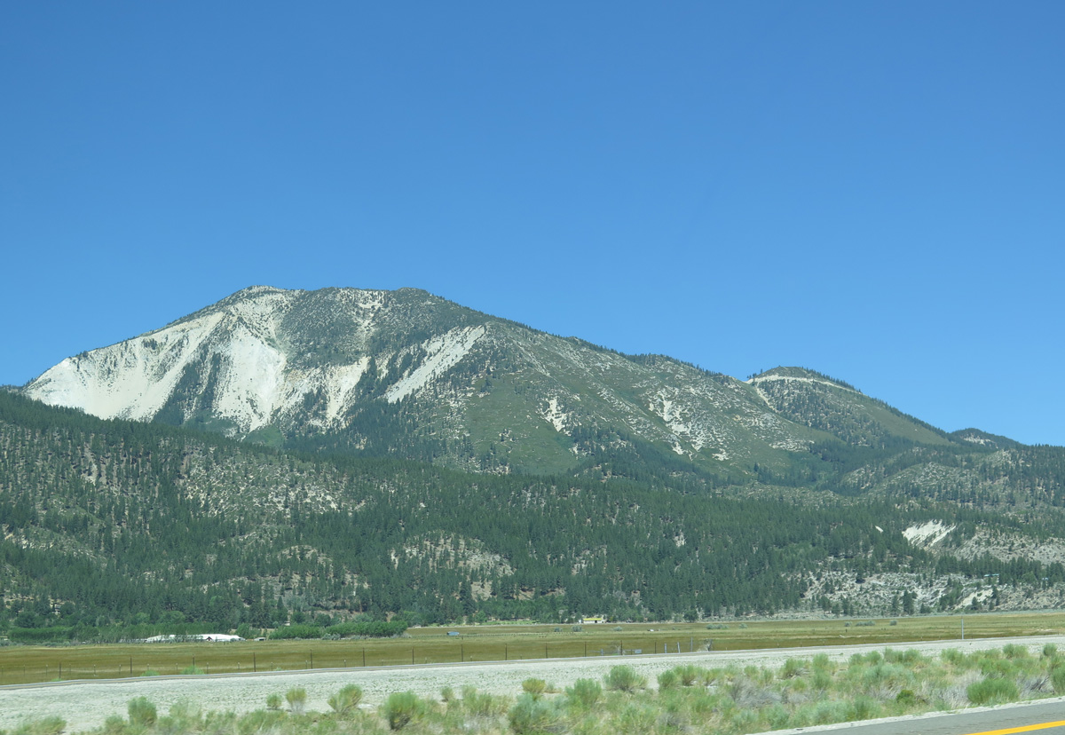
Slide Mountain (el. 9,698 feet) rises northwest of Washoe Valley.
06/28/14
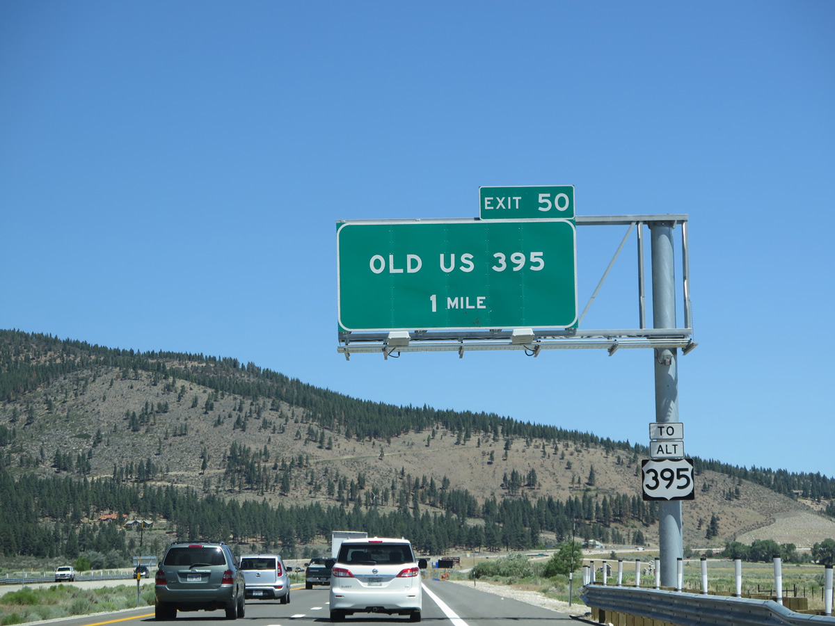
U.S. 395 Alternate (Old US 395) and Interstate 580 converge at a diamond interchange (Exit 50) adjacent to Davis Creek Regional Park in one mile.
06/28/14
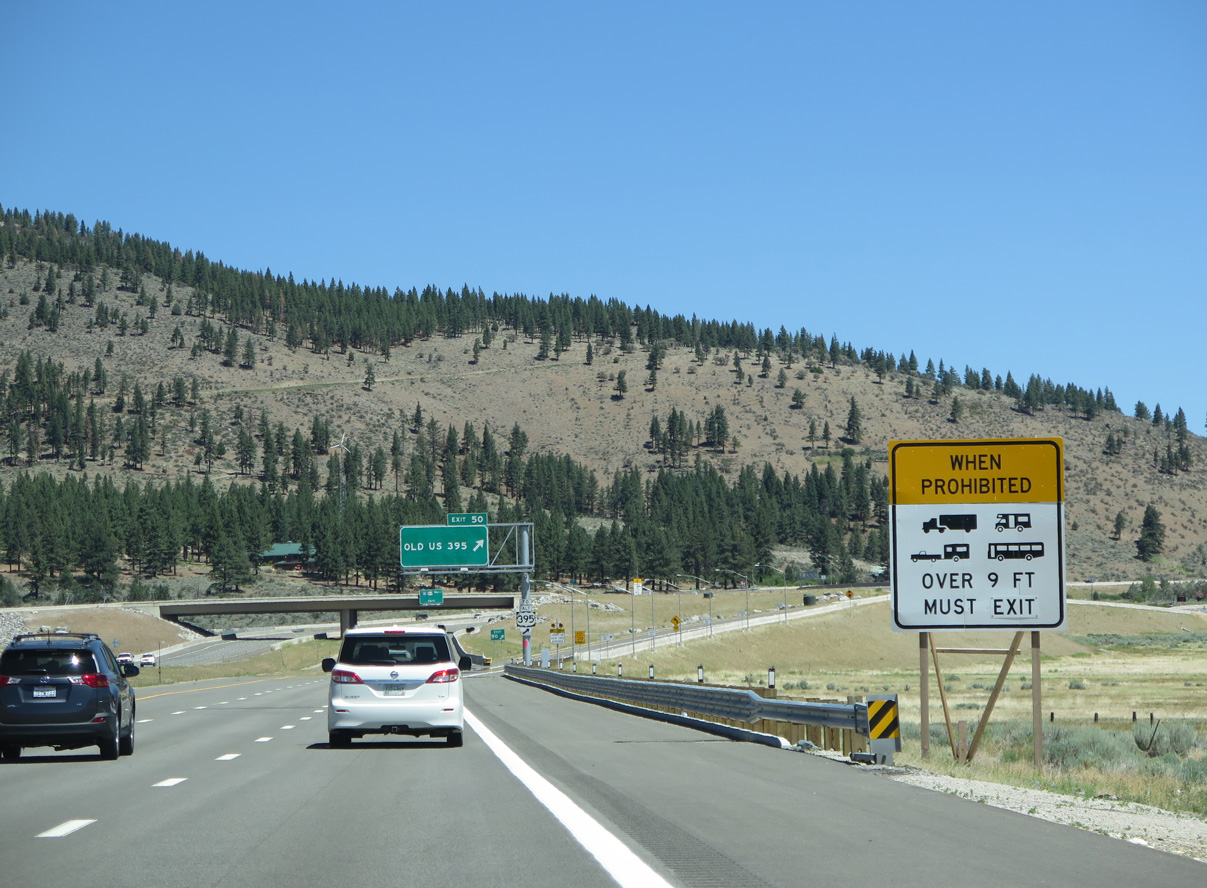
During periods of strong and gusty winds, high profile vehicles are occasionally advised to depart I-580 and use U.S. 395 Alternate instead. Dynamic message signs activate during times of the travel restriction.
06/28/14
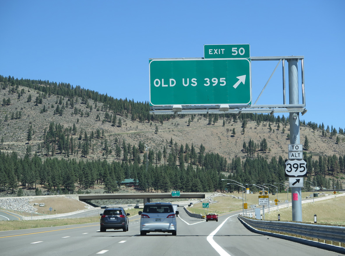
Exit 50 leaves I-580 & U.S. 395 north for Old US 395 (U.S. 395 Alternate). The freeway ended here until August 2012, and prior to May 2012, the old alignment southwest was designated as SR 429.
06/28/14
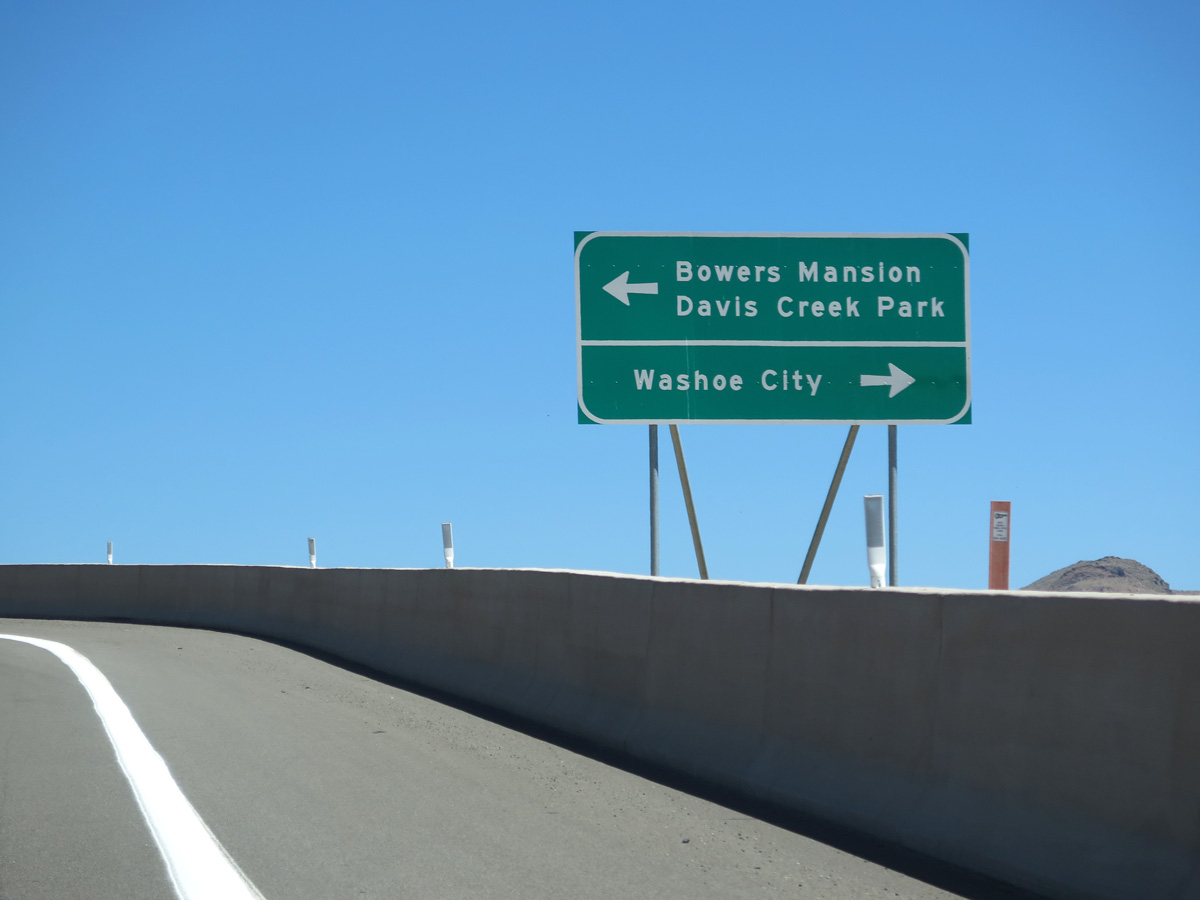
U.S. 395 Alternate winds 1.7 miles southwest from Exit 50 to Bowers Mansion Regional Park. The four lane highway continues northeast one mile to the community of Washoe City.
06/28/14
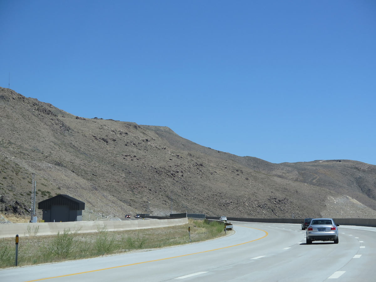
Interstate 580 travels just above parallel U.S. 395 Alternate along the eastern foothills of Slide Mountain to Washoe City.
06/28/14
Distance sign posted 11 miles south of the Meadows Parkway interchange in south Reno. I-580 enters the Reno city limits in seven miles and passes east of Downtown in 18 miles.
06/28/14
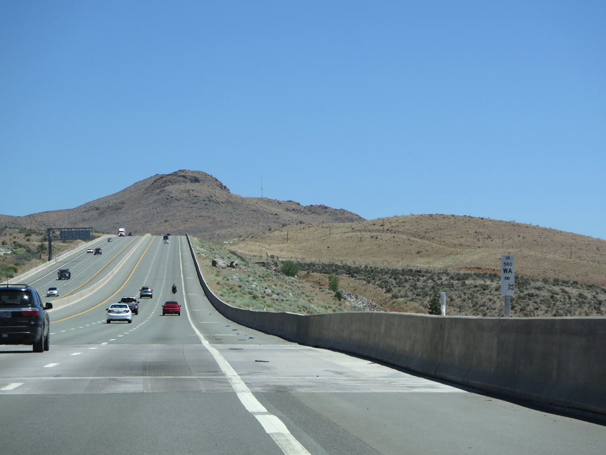
Interstate 580 & U.S. 395 spans Parker Ranch Road, which links parallel Kelly Canyon Way / Joy Lake Road with U.S. 395 Alternate, at Washoe County postmile 8.32.
06/28/14
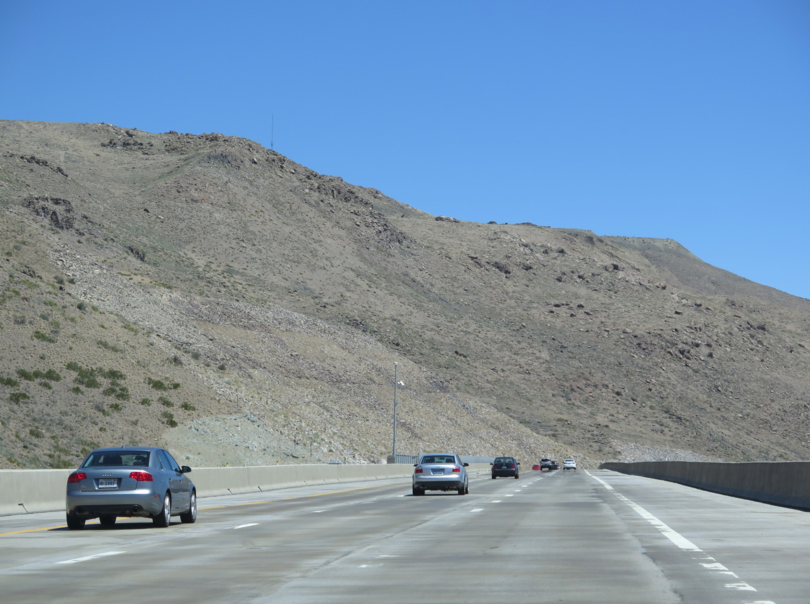
Diverging from adjacent U.S. 395 Alternate, I-580 gains elevation and crosses over a concrete arch bridge above Browns Creek at postmile 9.81.
06/28/14
I-580 & U.S. 395 make an S-curve northeast across Saint James Parkway ahead of Pleasant Valley.
06/28/14
The Galena Creek Anti-Icing Facility is one of four NDOT installations along the I-580 Freeway Extension opened in August 2012.
06/28/14
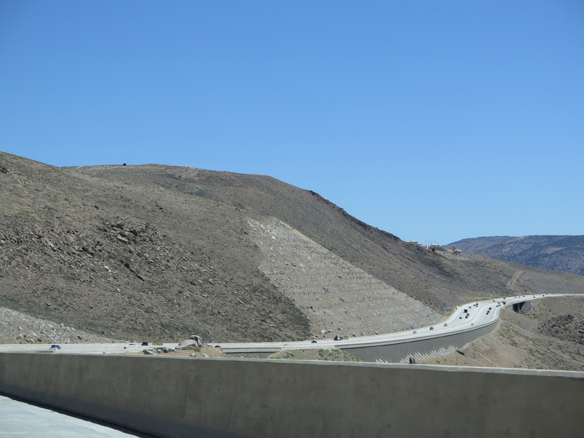
A 690 foot high bridge accommodates six lanes of traffic at postmile 10.56. Spanning Galena Creek, the concrete cathedral arch bridge overlooks the community of Pleasant Valley to the east.
06/28/14
Interstate 580 proceeds north from the Galena Creek bridge along the eastern slopes of the Steamboat Hills.
06/28/14
References:
- "Washoe history reflected on overpass", Nevada Appeal, published August 8, 2014, retrieved September 4, 2020.
- Exit Numbers Changing on I-580, Nevada DOT.
Photo Credits:
- ABRoads: 07/11/18
- Brent Ivy: 07/17/17, 07/11/18
- Andy Field: 06/28/14
Connect with:
Page Updated Friday September 04, 2020.