
I-580/U.S. 395 South - Washoe Valley to Carson City

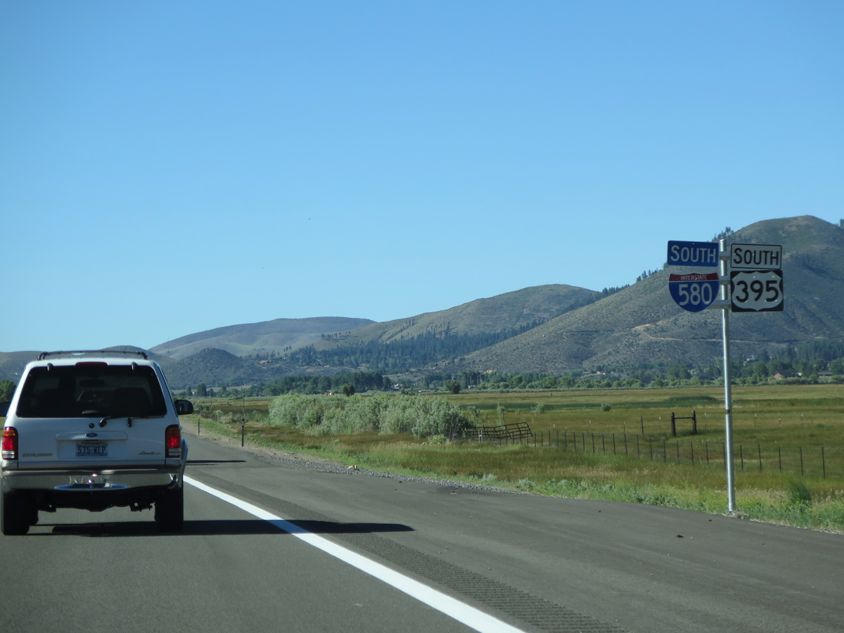
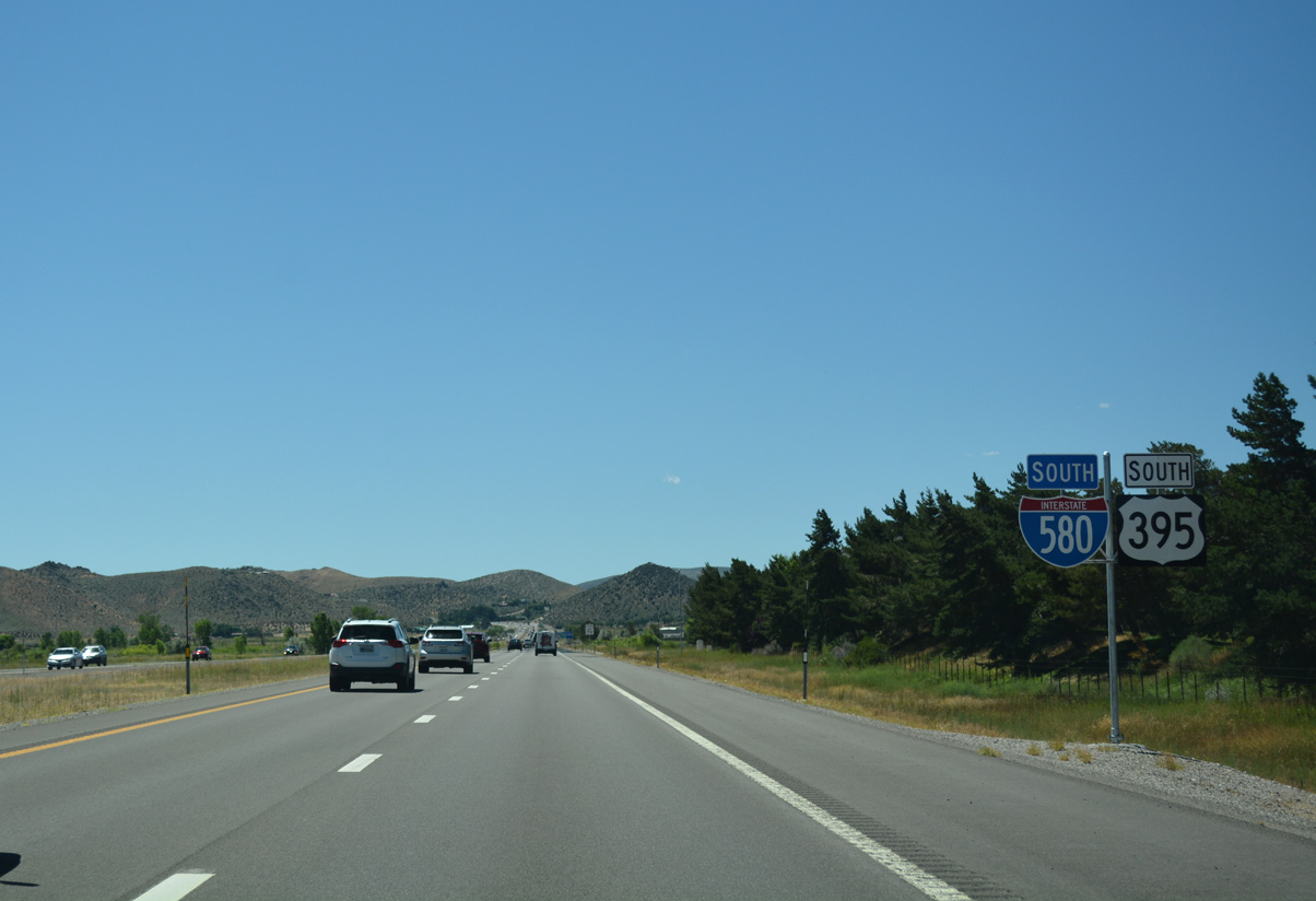
 South
South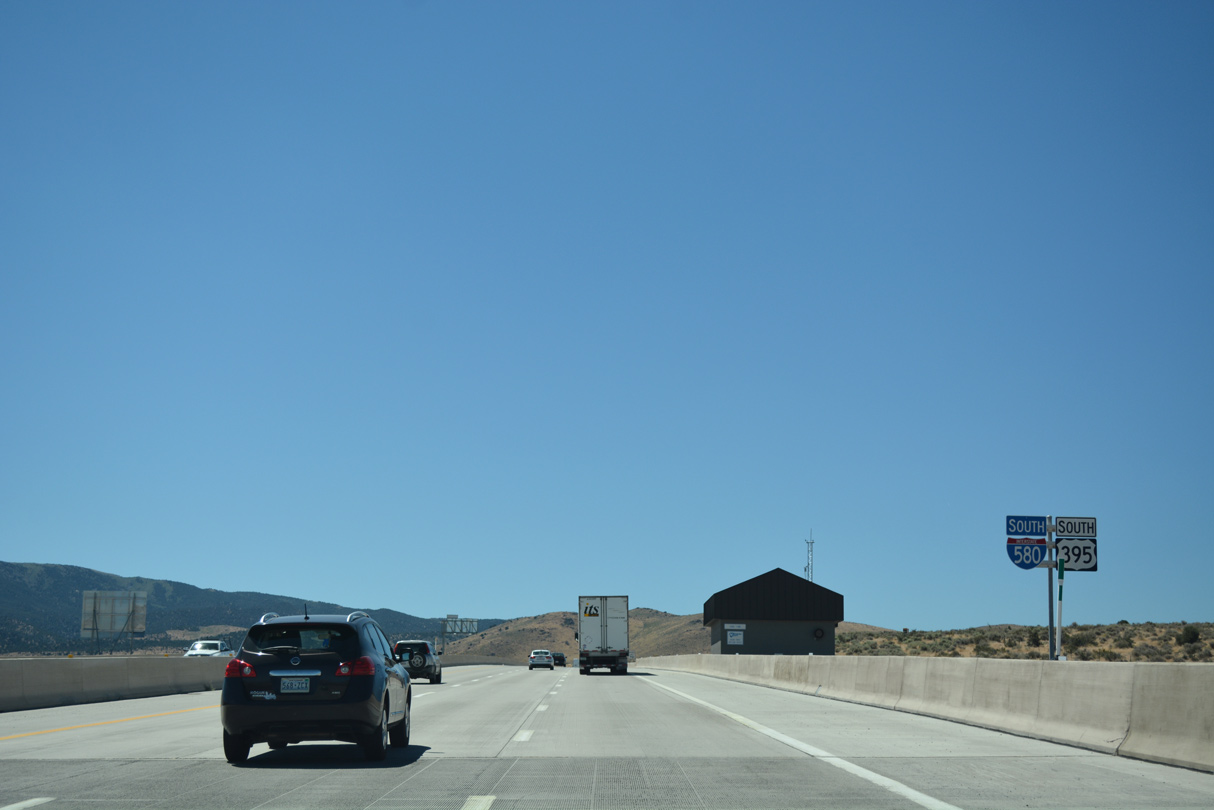
The Galena Forest NDOT Anti-Icing Facility appears along the west side of I-580 & U.S. 395 at the first of several spans along the August 2012-completed I-580 Extension section between Reno and Washoe Valley.
07/17/17
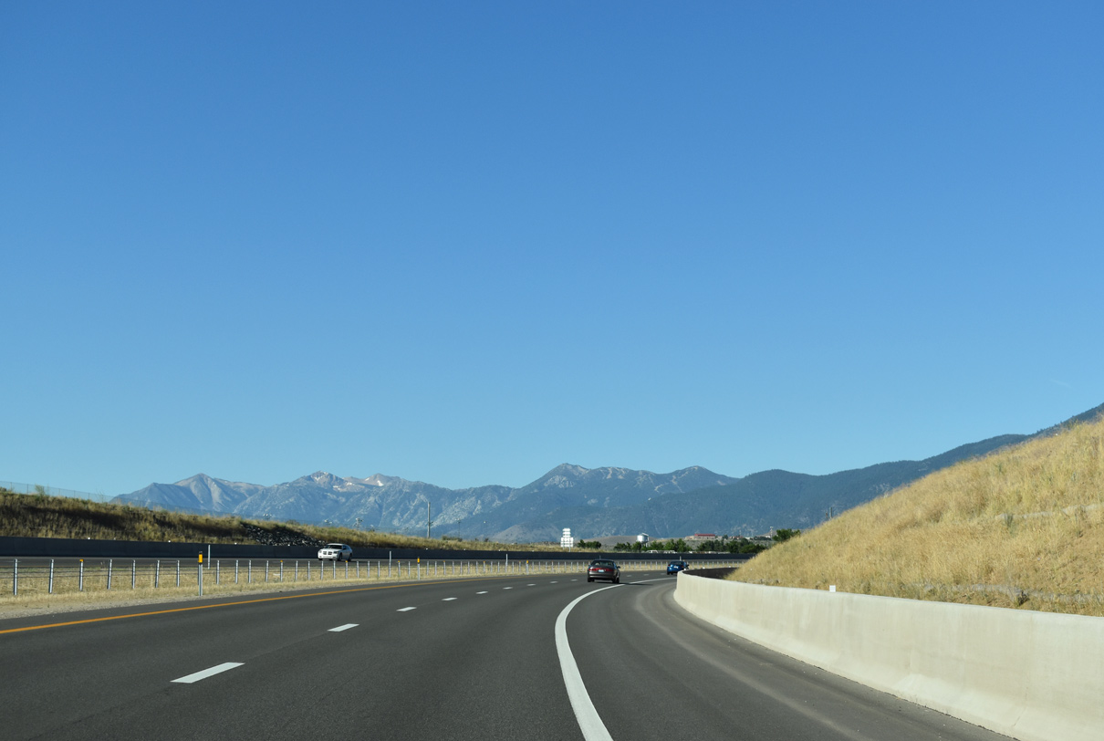
Interstate 580 & U.S. 395 straddle the eastern slopes of the Steamboat Hills overlooking Steamboat Valley.
06/29/14
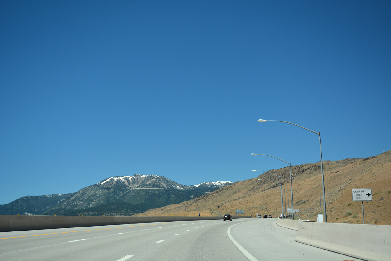
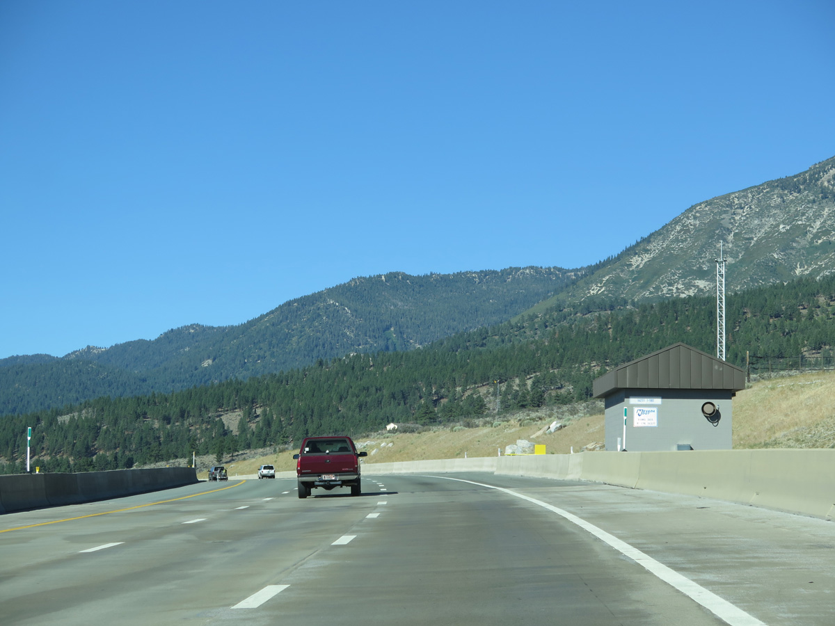
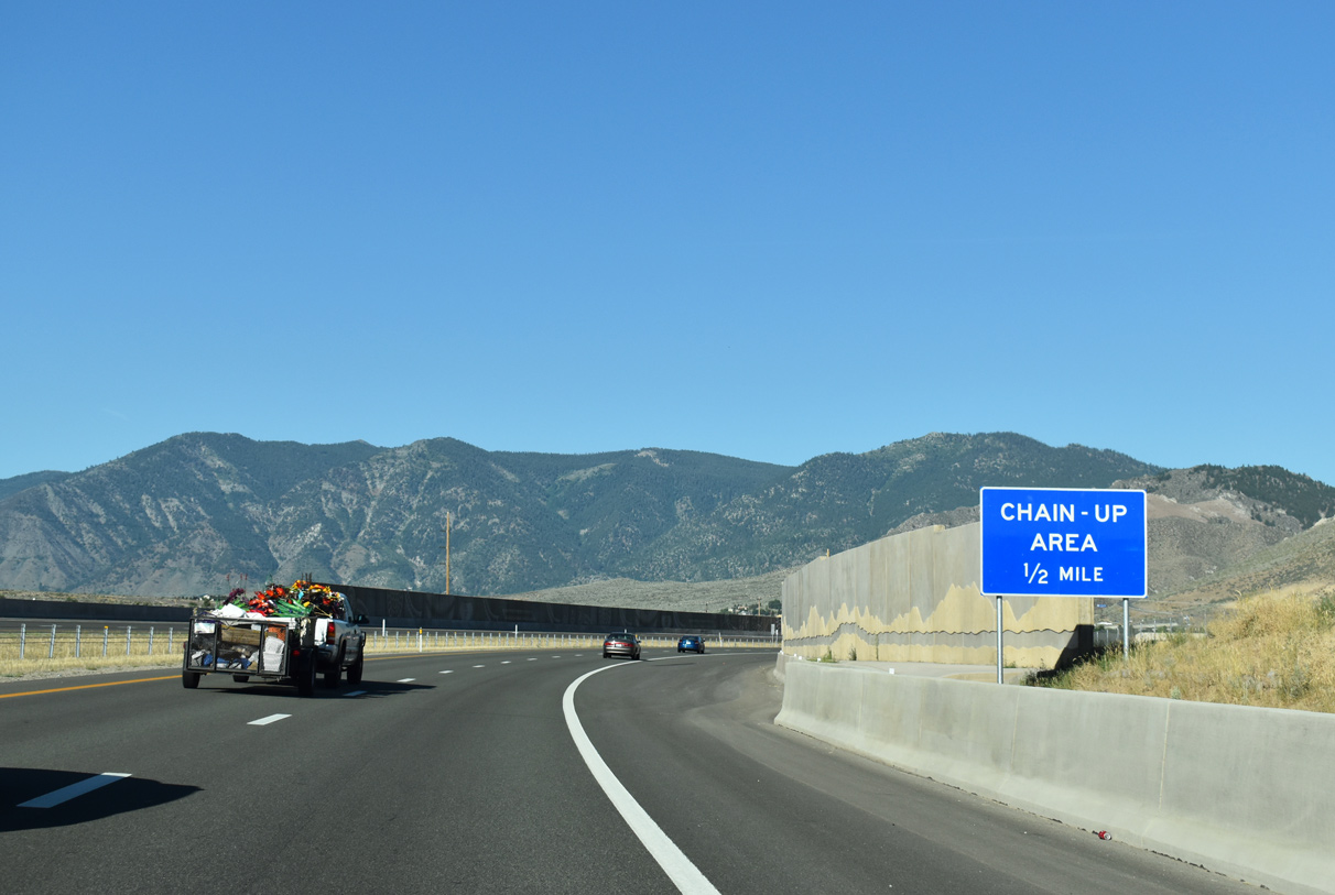
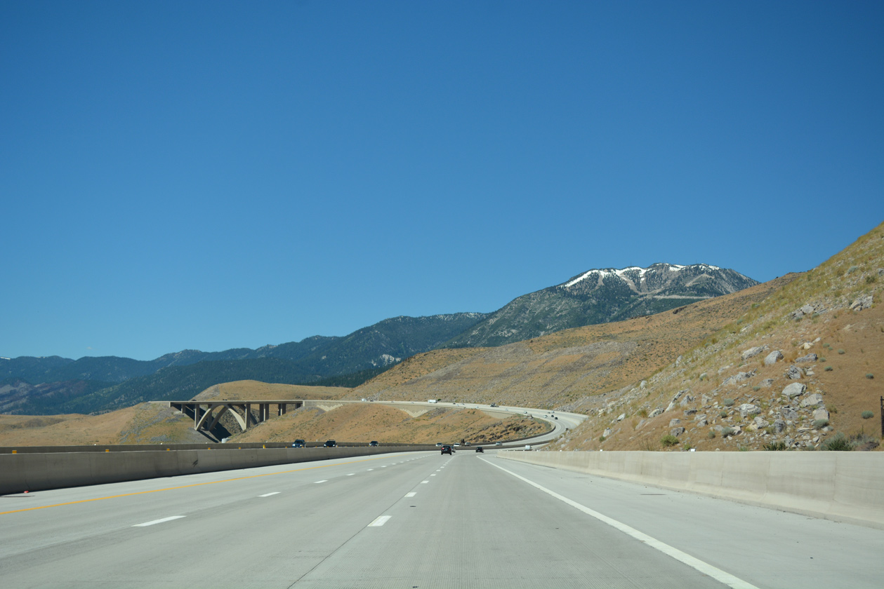
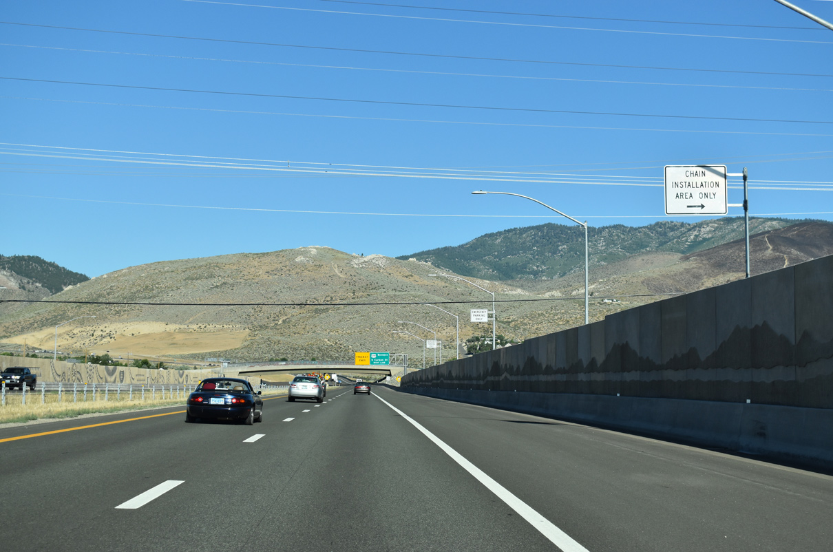
A chain up area lines the southbound lanes of Interstate 580 on the hills rising north of Pleasant Valley.
07/17/17
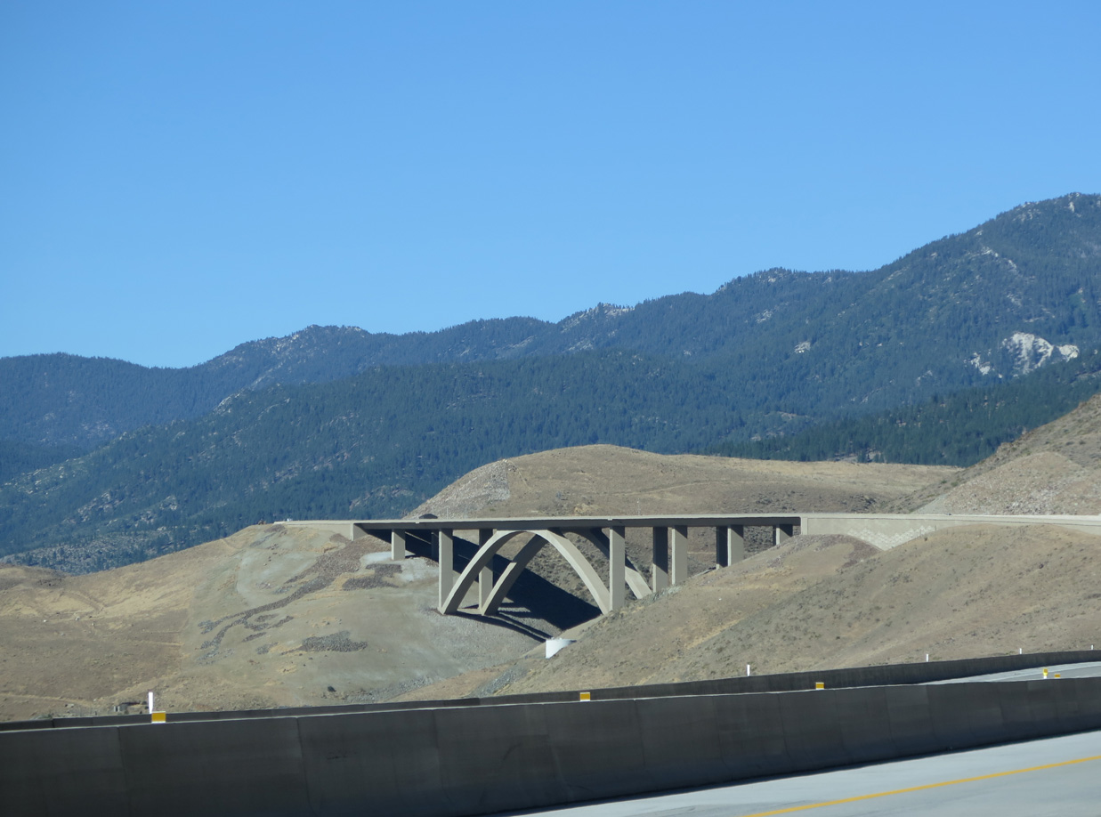
An S-curve west of Pleasant Valley takes I-580 & U.S. 395 south to the 690 foot high cathedral arch bridge spanning Galena Creek.1
07/17/17
06/29/14

Measuring 1,700 feet in length, the Galena Creek bridge accommodates six lanes of traffic.1 The bridge is located at Washoe County postmile 10.56.
07/17/17
The NDOT Galena Creek De-Icing Facility lies at the south end of the Galena Creek arch bridge.
06/29/14
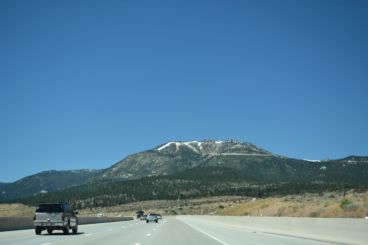
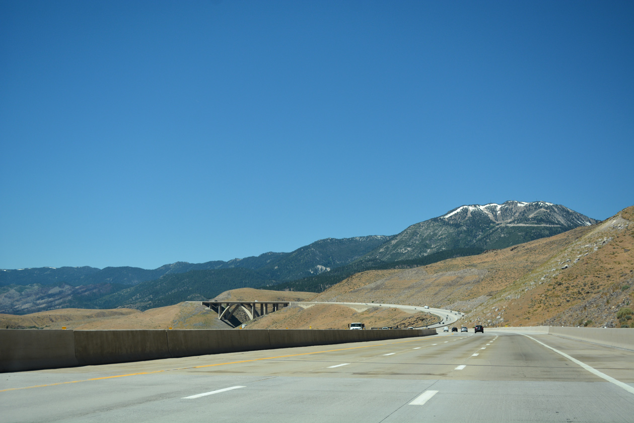
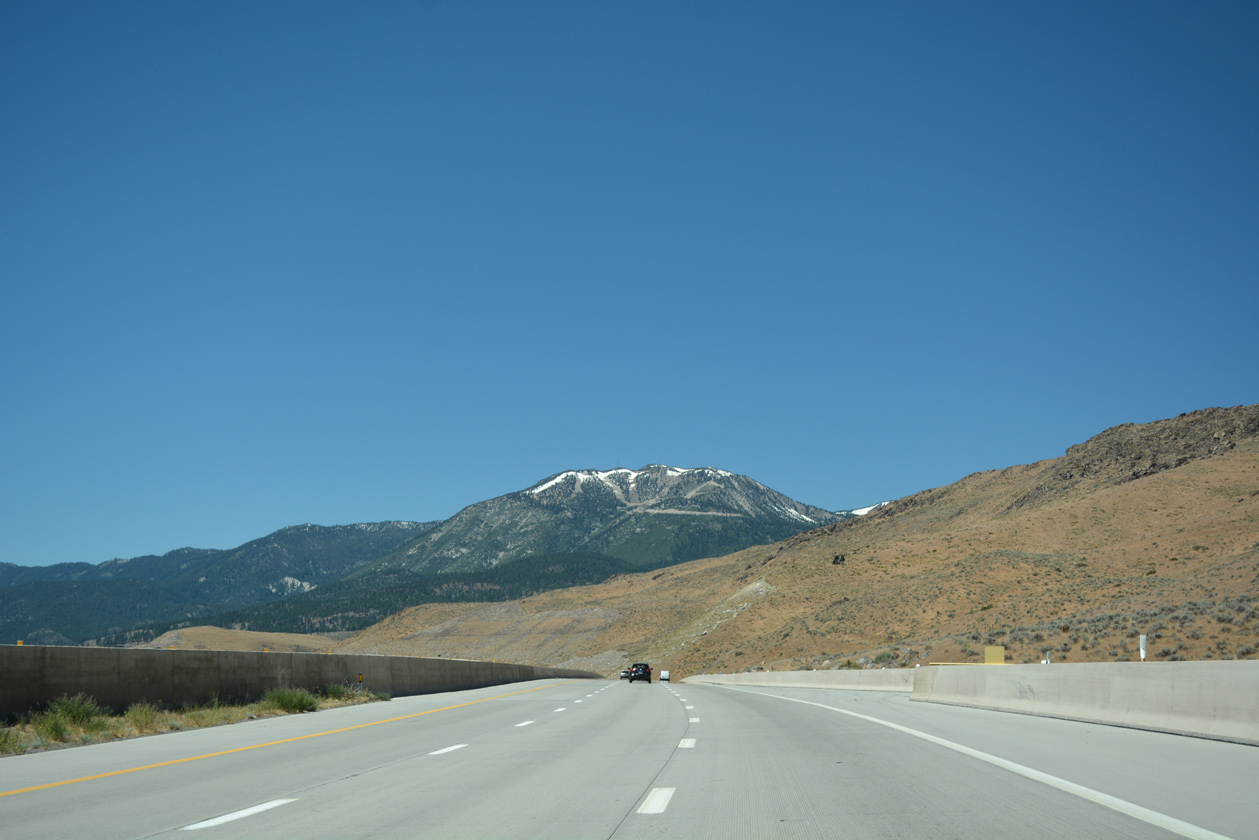
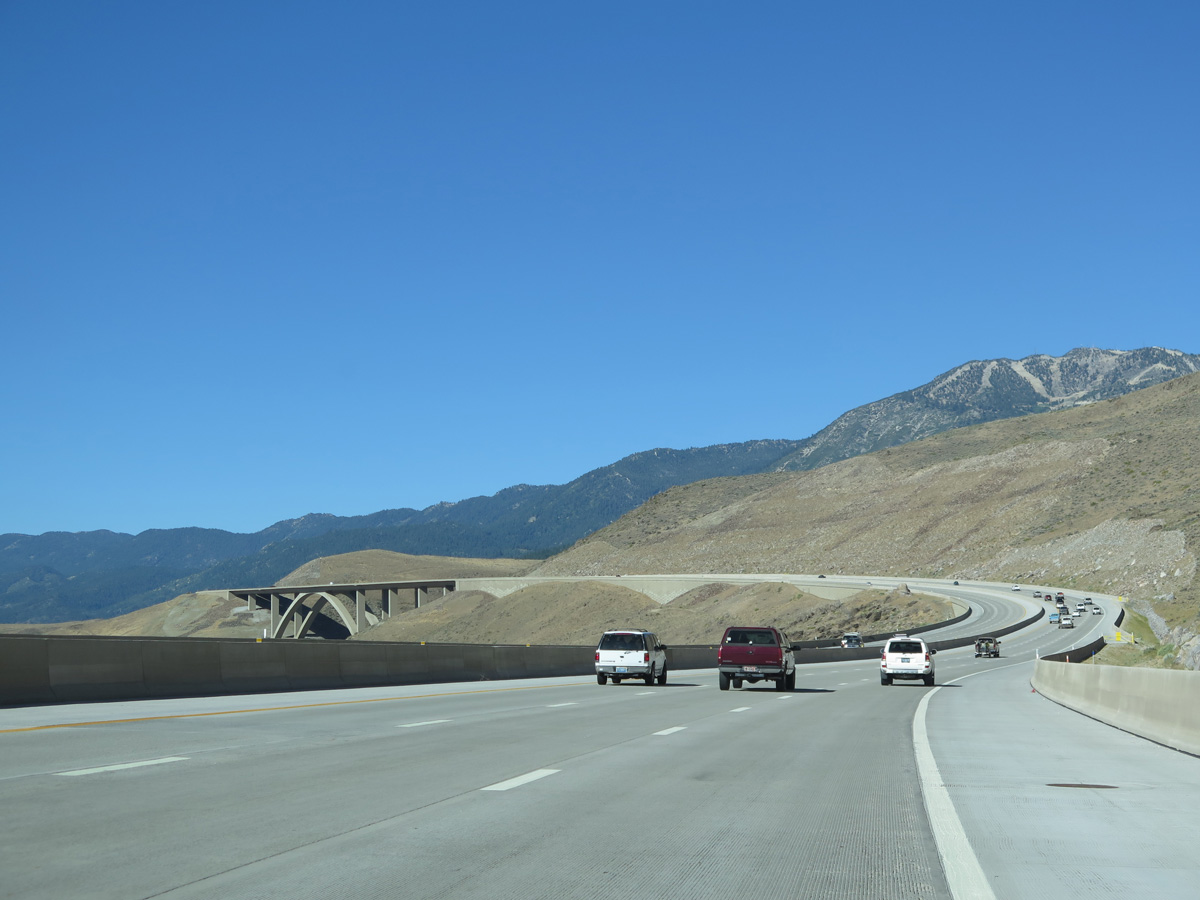
Slide Mountain (el. 9,698 feet) rises along the west side of I-580 & U.S. 395 as the freeway advances southward toward the Browns Creek bridge.
07/17/17
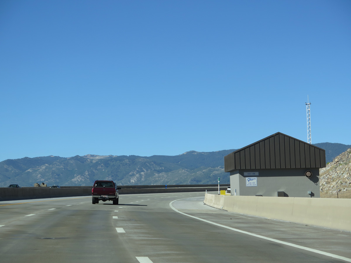
The last in a series southbound, the Browns Creek De-Icing Facility operates just west of the span.
06/29/14
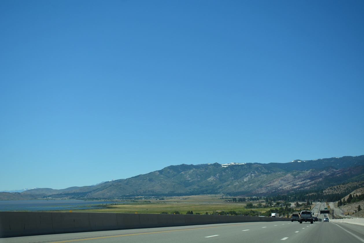
Washoe Lake and Washoe Valley spreads into view as I-580 & U.S. 395 lower alongside U.S. 395 Alternate by Washoe City.
07/17/17
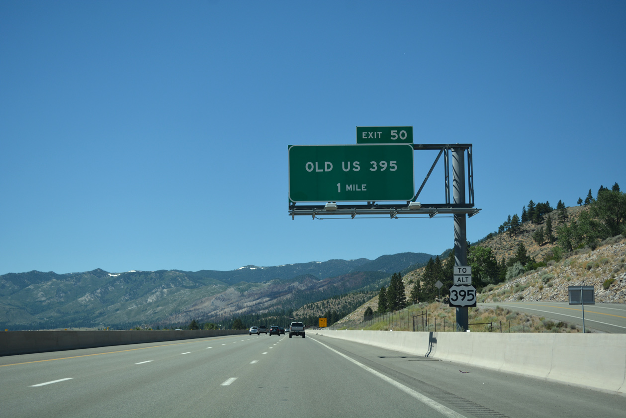
U.S. 395 Alternate (Old US 395) converges with I-580 west from Washoe Summit (el. 5,120 feet) and Washoe City at Exit 50 in one mile.
07/17/17
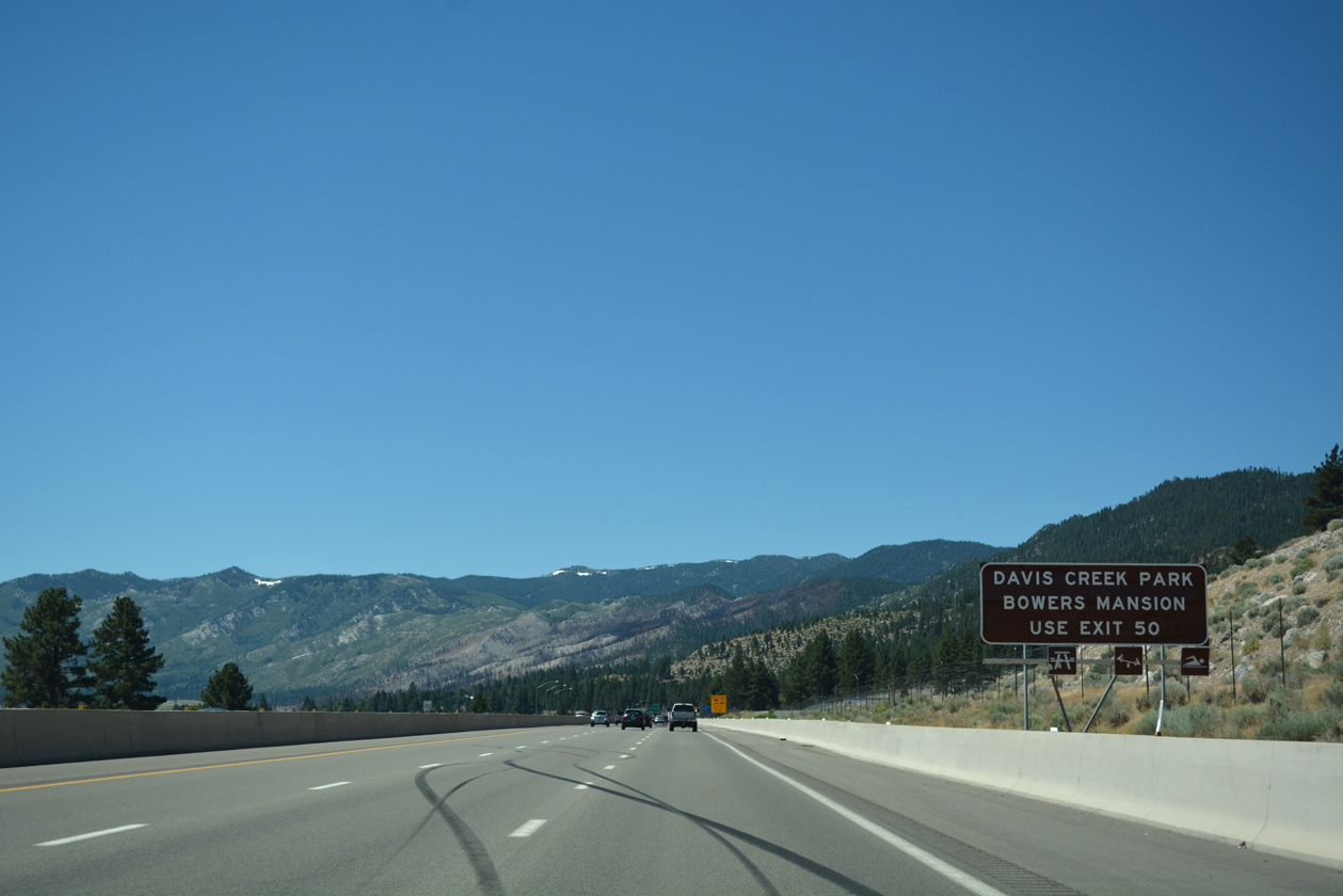
The diamond interchange (Exit 50) with Old US 395 lies along the east side of Davis Creek Regional Park. Old US 395 winds southwest from there along the eastern foothills of the Carson Range to Bowers Mansion Regional Park.
07/17/17
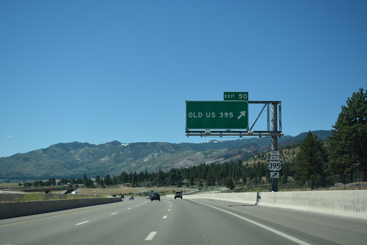
Exit 50 departs from I-580 & U.S. 395 south for U.S. 395 Alternate (Old US 395). Old US 395 (former SR 429) loops west to Franktown and back to the freeway at Exit 44. Large semi trucks and RV's are directed onto the two lane highway during high wind events.
07/17/17
Interstate 580 transitions onto the Washoe Lake Freeway, a linear route opened for U.S. 395 in 1970.
06/29/14

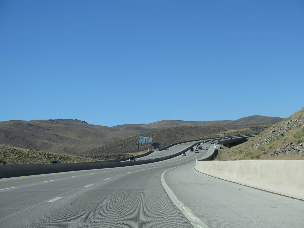
Progressing south, I-580 & U.S. 395 run between the west shore of Washoe Lake and Toiyabe National Forest over the ensuing 3.5 miles.
07/17/17
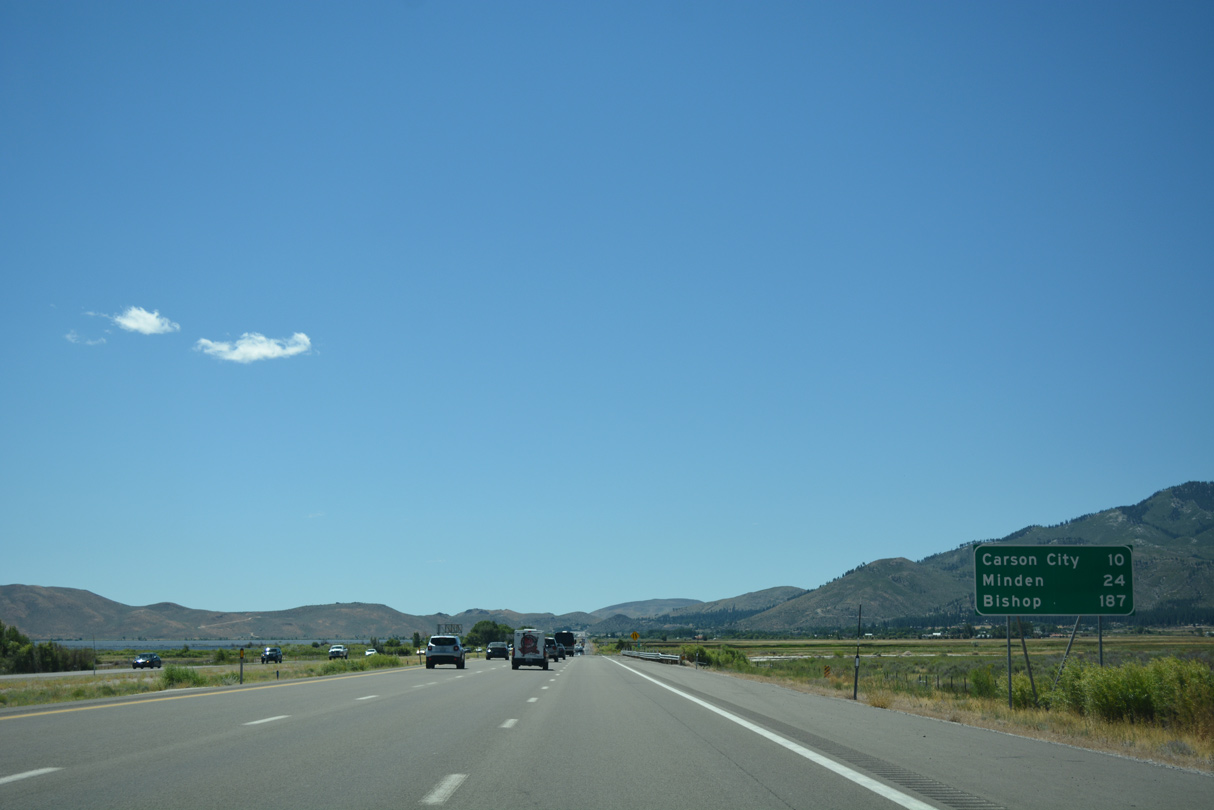
Carson City lies ten miles south along I-580 and U.S. 395 Business (North Carson Street). Minden follows in 24 miles within Carson Valley.
07/17/17
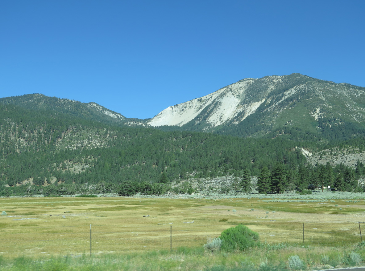
The Carson Range frames the west side of Washoe Valley. The mountain range falls within the protected lands of Humboldt-Toiyabe National Forest. The national forest covers substantial acreage in the Eastern Sierra Nevada, including lands west toward Lake Tahoe.
06/29/14
A second reassurance sign assembly stands along the Washoe Lake Freeway beyond Franktown Creek, Shields for I-580 and U.S. 395 were missing by 2017.
06/29/14
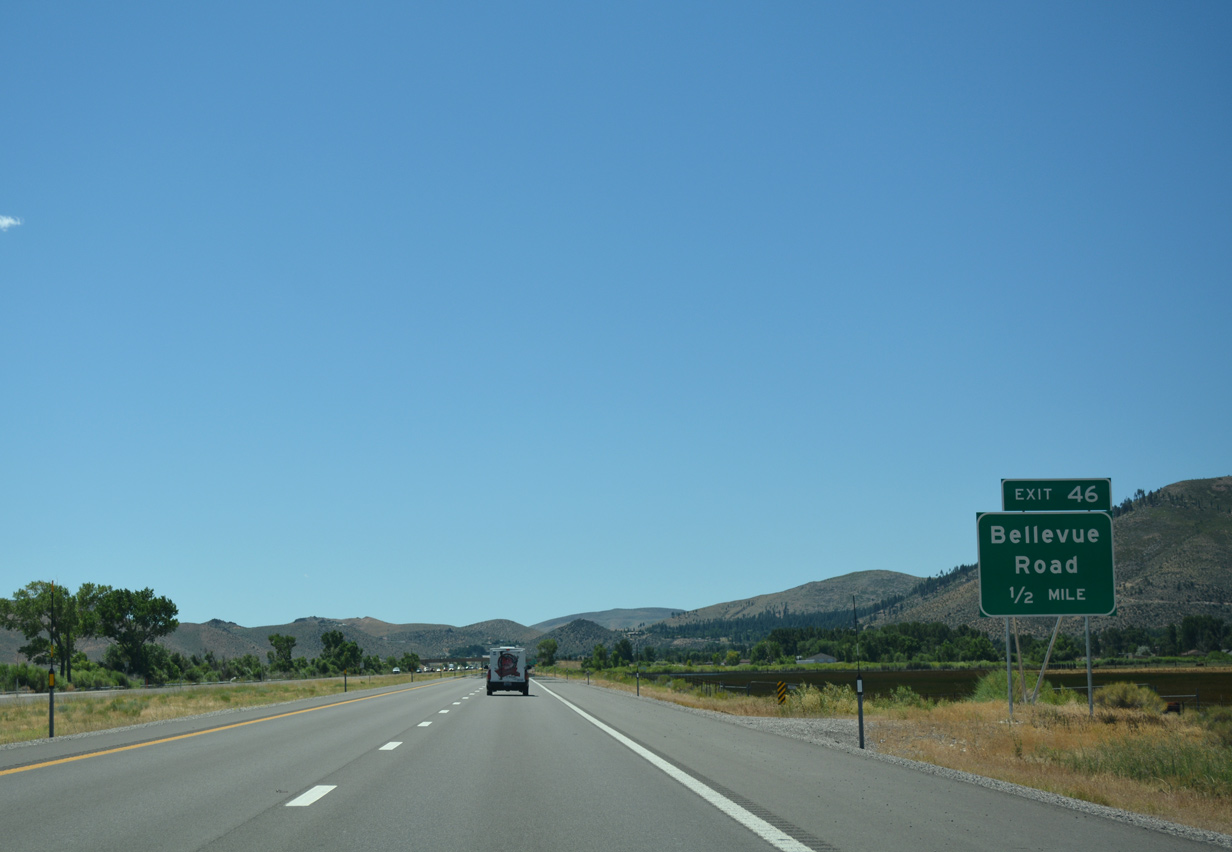
The succeeding exit joins I-580 & U.S. 395 south with Bellevue Road at the rural Bellevue Estates community. This exchange was renumbered from Exit 44 to 46 by 2009.
07/17/17
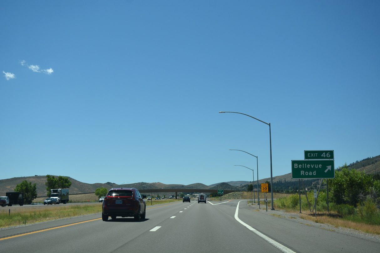
Bellevue Road leads 0.7 miles west from the parclo interchange (Exit 46) with I-580 to U.S. 395 Alternate (Old US 395). The road east ends at a cul-de-sac at Washoe Lake.
07/17/17
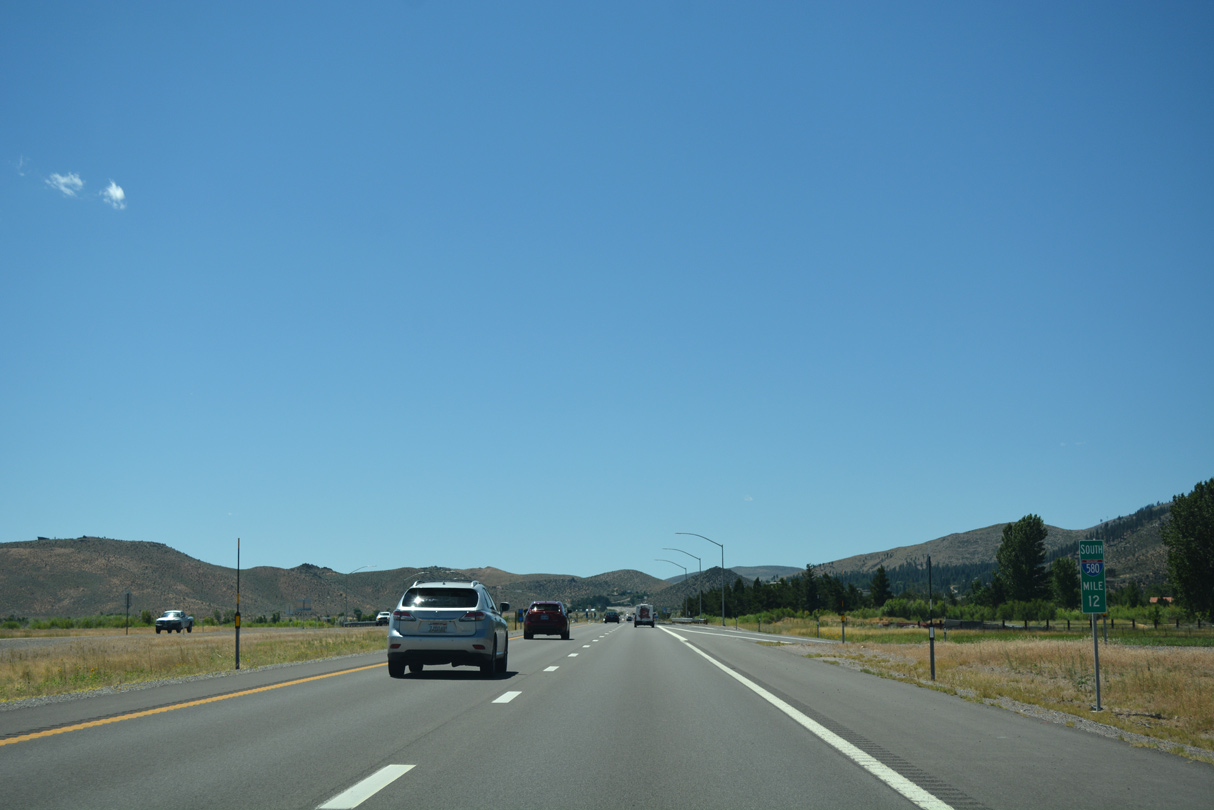
A nationally standard milepost for I-580 precedes the entrance ramp from Bellevue Road.
07/17/17
Confirming shields for southbound I-580 & U.S. 395, east of Thunder Canyon Golf Course. A state-named shield for I-580 was posted here previously.
07/17/17
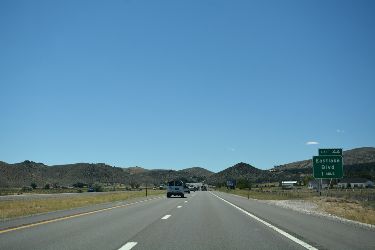
Continuing south toward the Virginia Range, I-580 & U.S. 395 next meet Eastlake Boulevard and U.S. 395 Alternate (Old US 395) north at Lakeview.
07/17/17
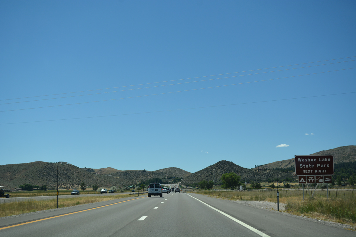
Washoe Lake State Park encompasses areas east of I-580 from Bellevue Road south to Exit 44, and along East lake Boulevard northeast toward New Washoe City.
07/17/17
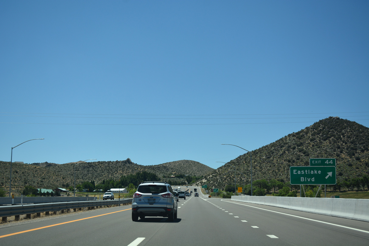
Old US 395 (former SR 429) accompanies the west frontage of I-580 & U.S. 395 leading south into the modified diamond interchange (Exit 44) with Eastlake Boulevard (former SR 428). U.S. 395 Alternate concludes at the ensuing on-ramp beyond Hobart Road at Lakeview.
07/17/17
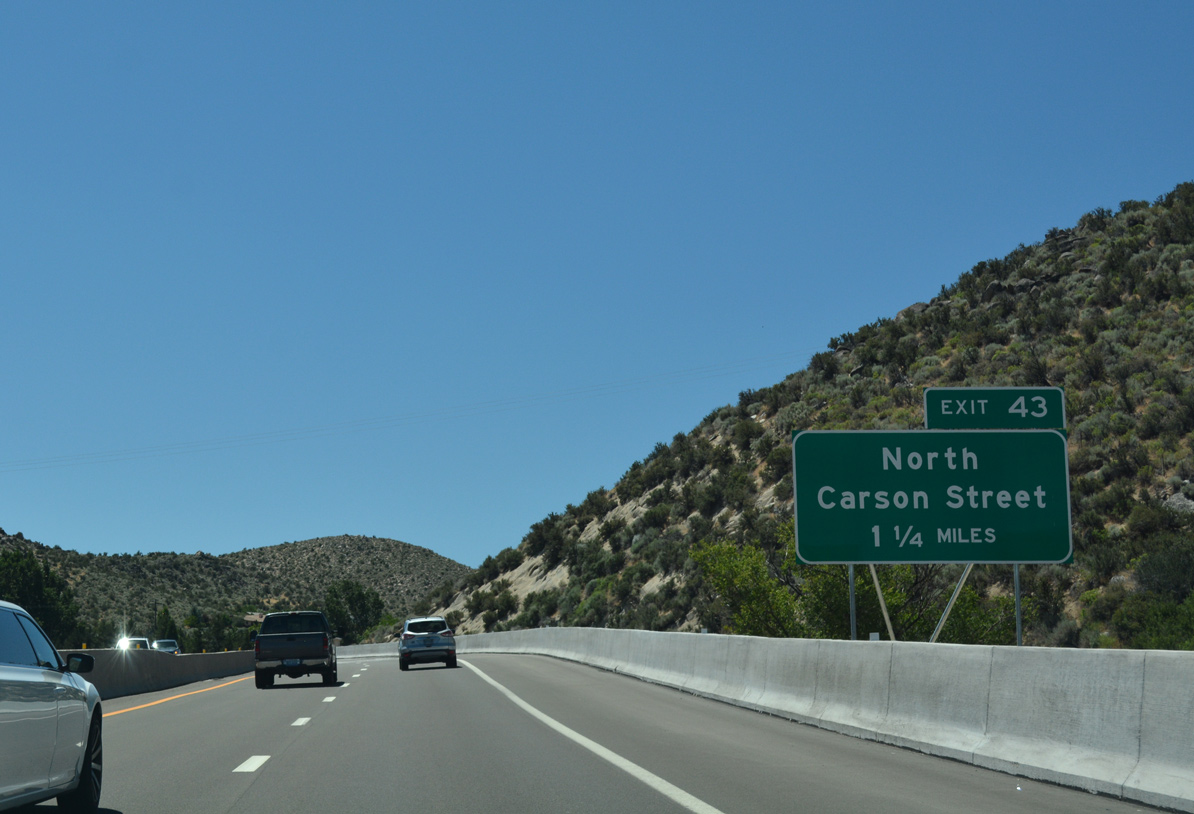
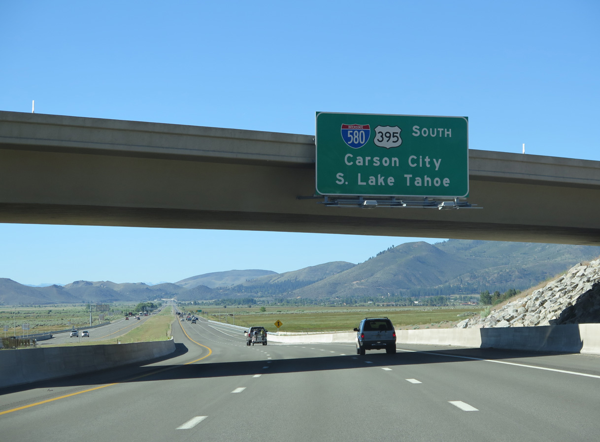
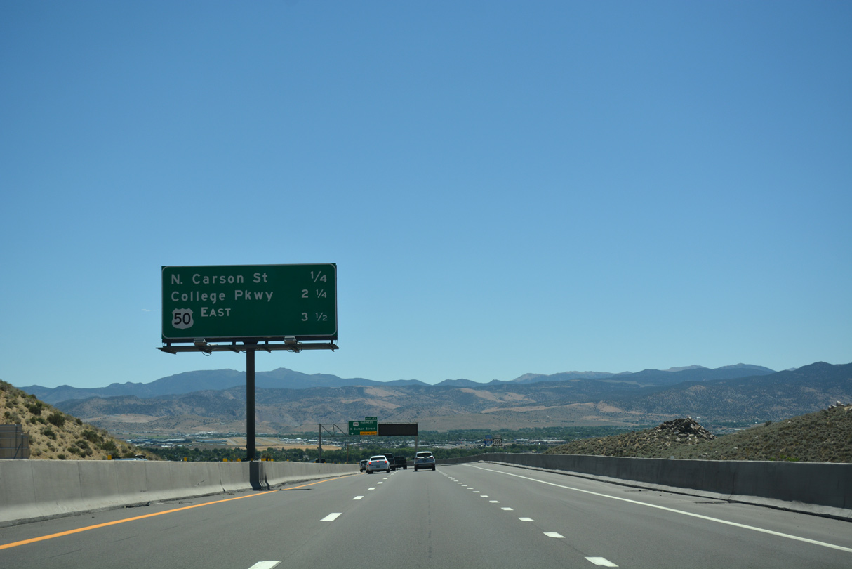
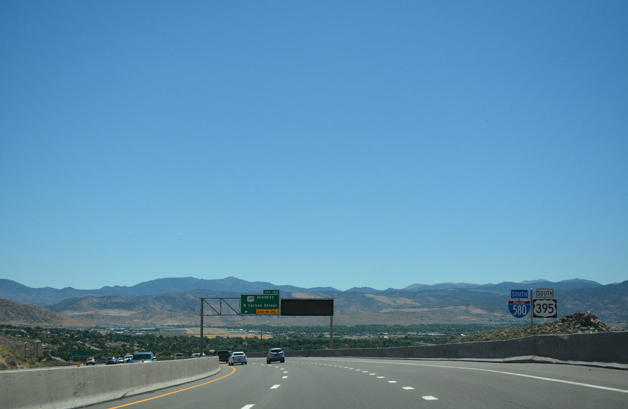
The remaining five interchanges along I-580 serve Carson City, as the freeway encircles the east side of the state capital. North Carson Street (U.S. 395 Business) splits at the succeeding off-ramp (Exit 43) in 1.25 miles.
07/17/17
Curving east, drivers along I-580 lower into Eagle Valley from Lakeview Summit (el. 5,113 feet) to a wye interchange (Exit 43) with U.S. 395 Business. North Carson Street leads three miles south to the Nevada State Capitol Building.
07/17/17
Interstate 580 & U.S. 395 formally cross into Carson City line just ahead of Lakeview Summit.
07/17/17

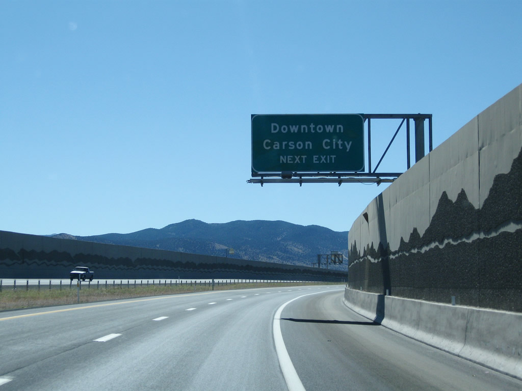
The on-ramp from the ending U.S. 395 Alternate adds a southbound auxiliary lane to Exit 43 to North Carson Street and Downtown Carson City.
07/17/17
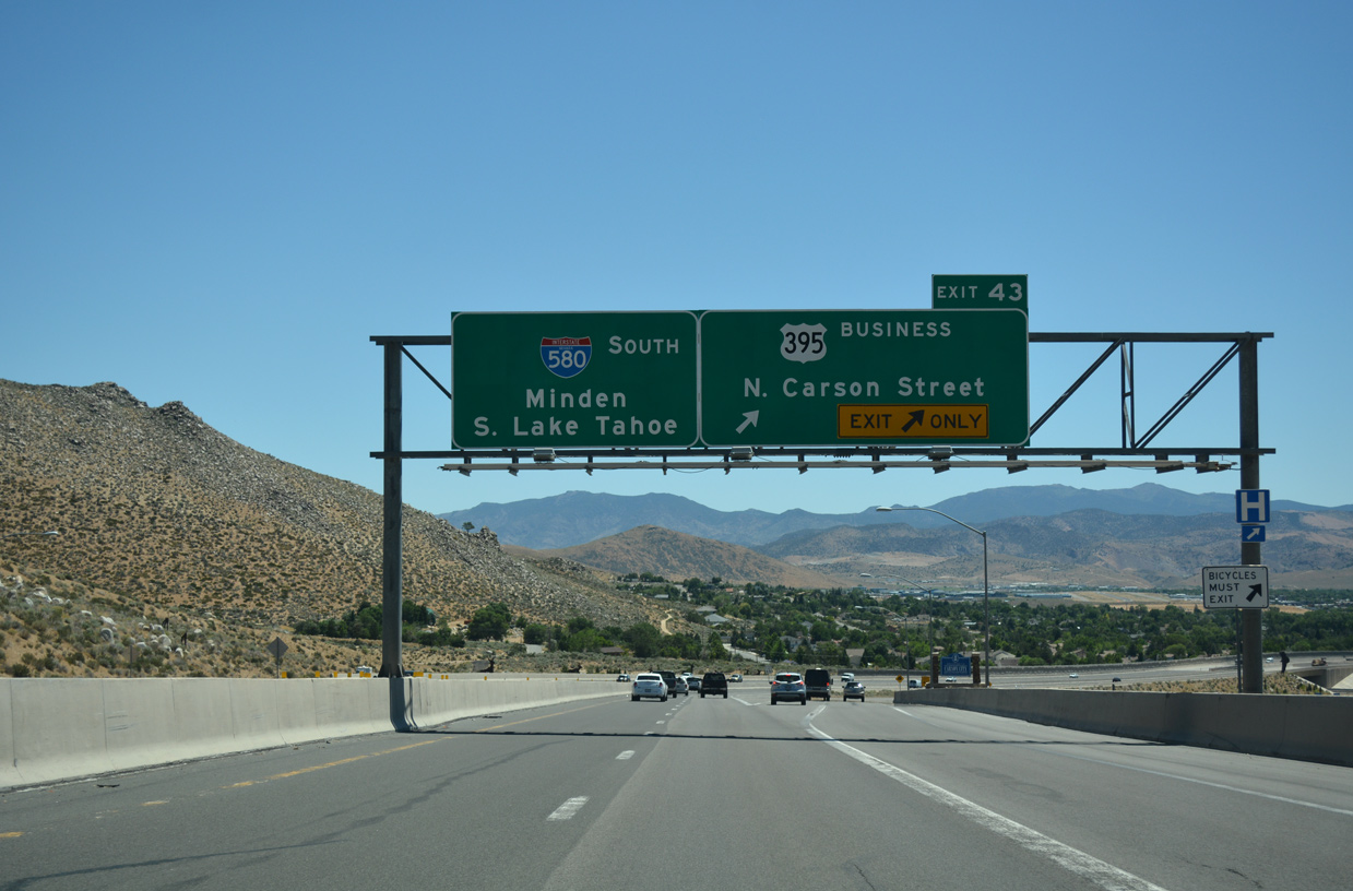
Departing with two lanes, the off-ramp from southbound I-580 & U.S. 395 to U.S. 395 Business and the West Side Historic District lowers at a 7% grade. The Carson City Freeway southeast to U.S. 50 was completed in 2006.
07/17/17
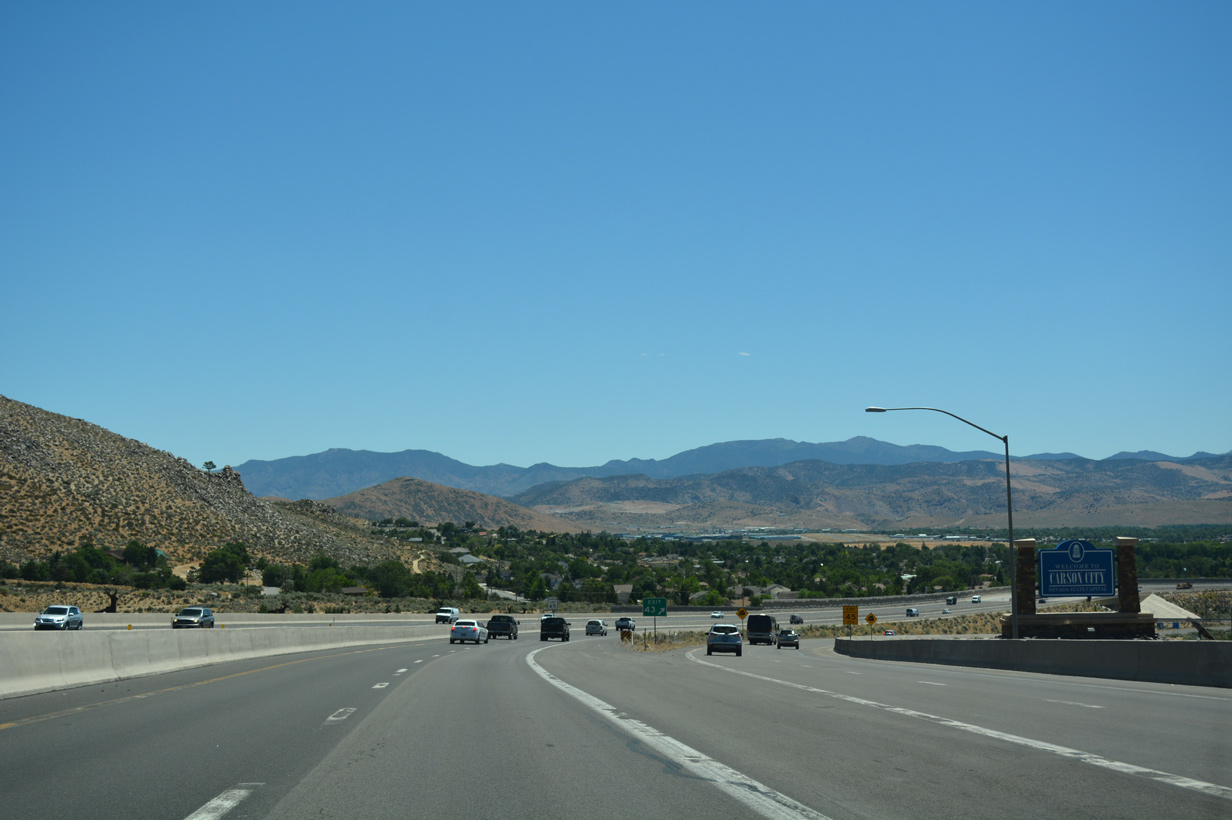
A welcome sign appears at the split with North Carson Street. An estimated 54,724 people lived in the capital city as of 2016. 52,457 called the municipality home in 2000. Founded in 1858, this historic city encompasses not only the urbanized area but also the surrounding county for approximately 146 square miles. In 1969, Carson City and Ormsby County merged together to become a consolidated city-county.
07/17/17
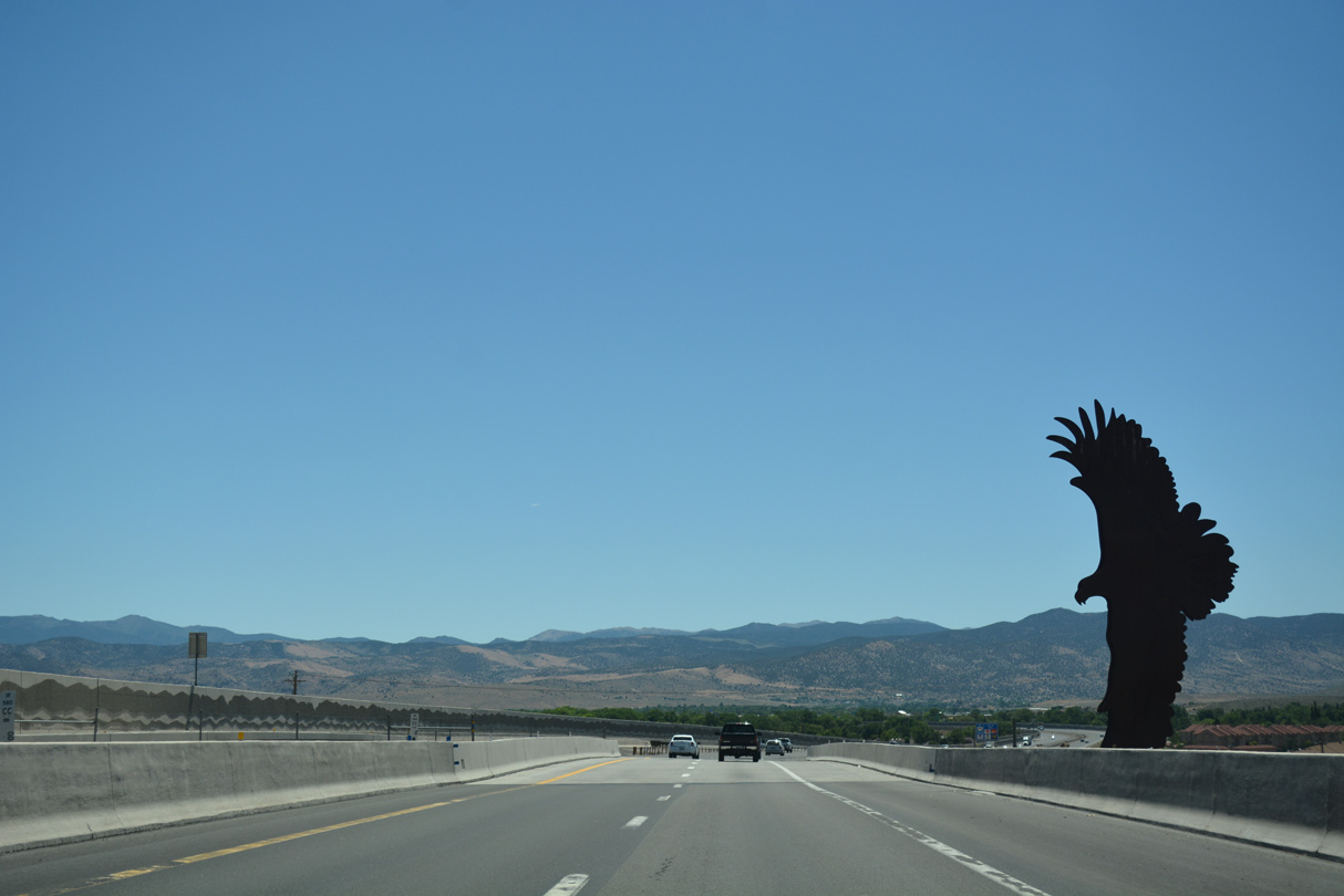
Measuring six feet in height, a sculpture at the north end of the Carson City Freeway symbolizes Eagle Valley. Similar artwork was erected at the south end of the bypass in 2017.
07/17/17
A half dumbbell interchange (Exit 42 from I-580) with Arrowhead Drive north precedes these confirming markers southbound.
07/17/17
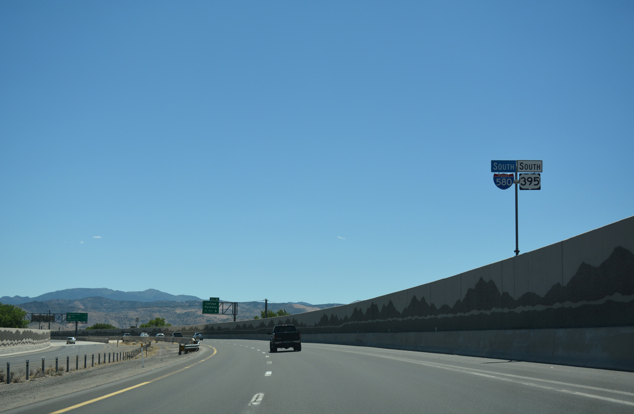
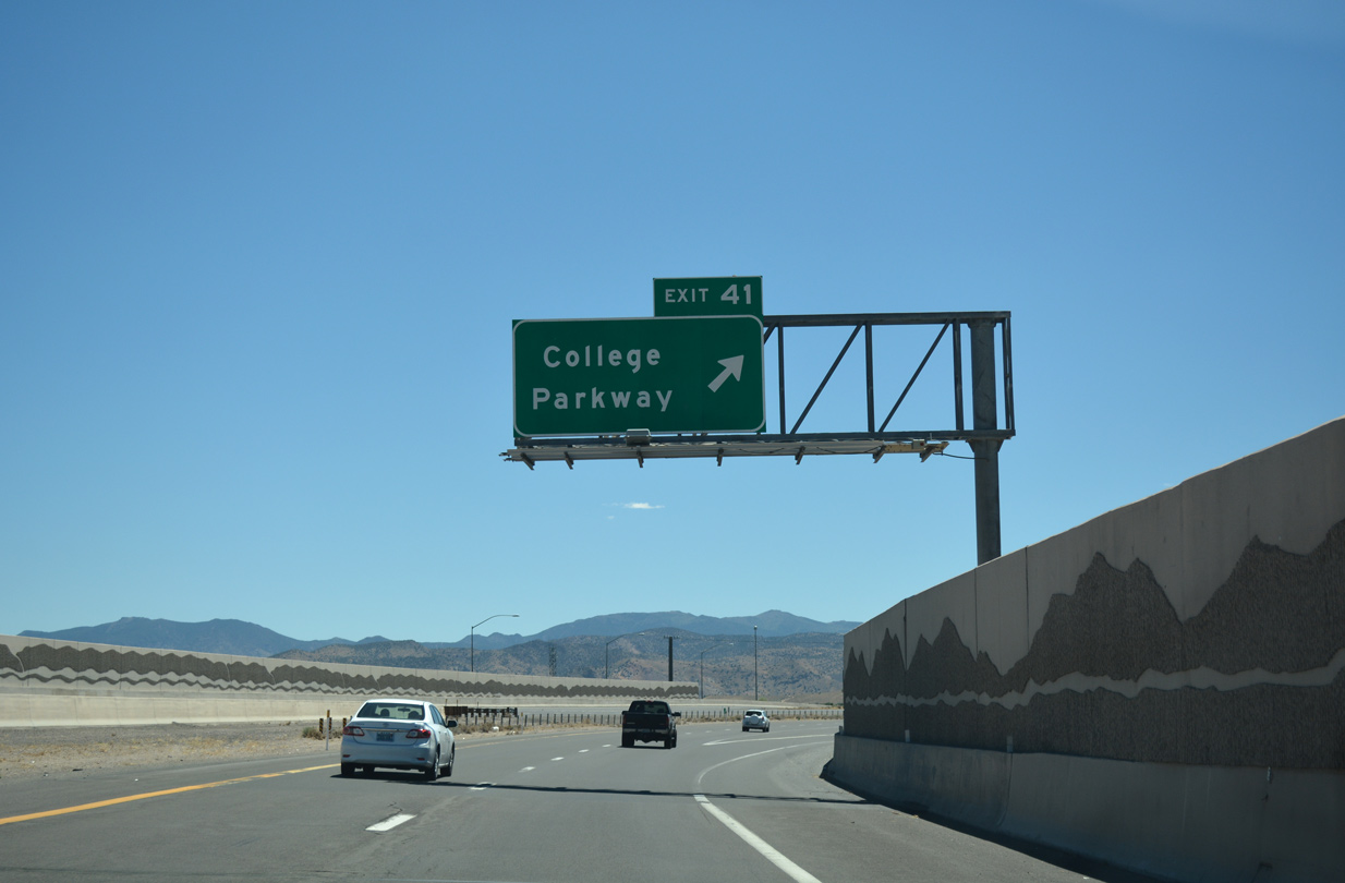
Crossing over Northgate Lane, I-580 advances southeast a half mile to a single point urban interchange (SPUI) with College Parkway.
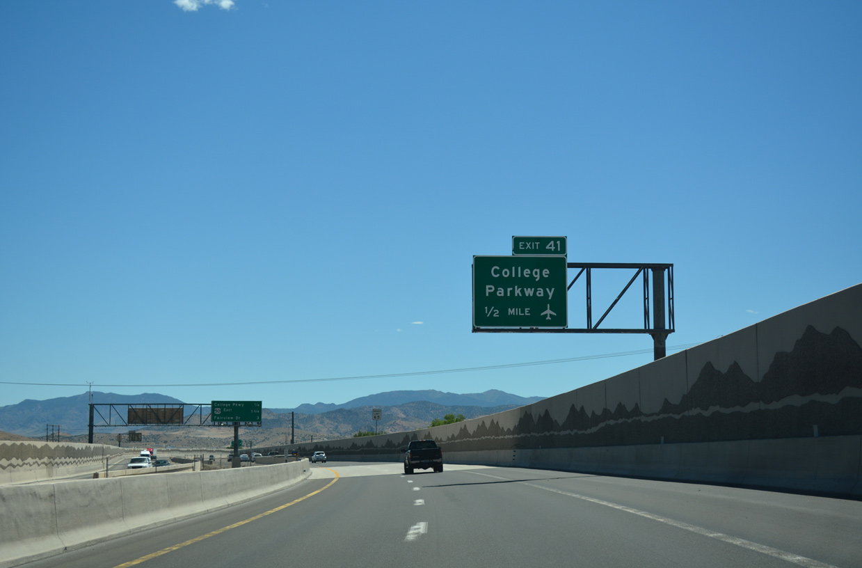
07/17/17
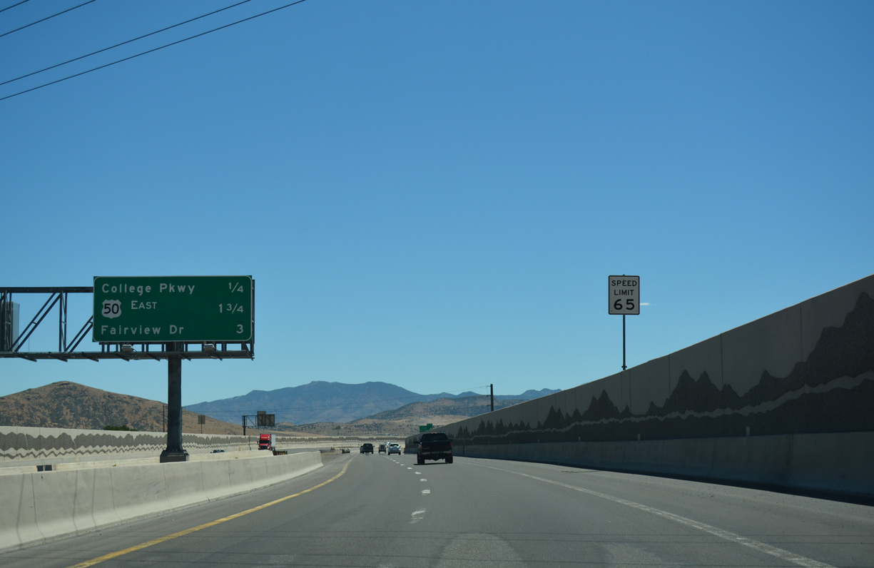
Lyon Peak in the distant Pine Nut Mountains rises along the eastern horizon on the quarter mile approach to Exit 41 with College Parkway.
07/17/17
College Parkway was formerly SR 531 west through residential areas of north Carson City to U.S. 395 Business and east to Carson City Airport (CXP). College Parkway was extended east in place of Hot Springs Road and Airport Road, which were severed by construction to build I-580.
07/17/17
The Carson City Freeway arcs more to the south between neighborhoods north of Northridge Drive and Carmine Street on the succeeding drive.
07/17/17
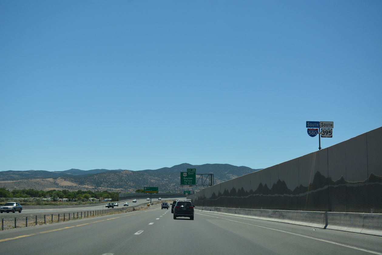
Another SPUI along I-580 south connects the Carson City bypass with U.S. 50 east and William Street west at Exit 39.
07/17/17
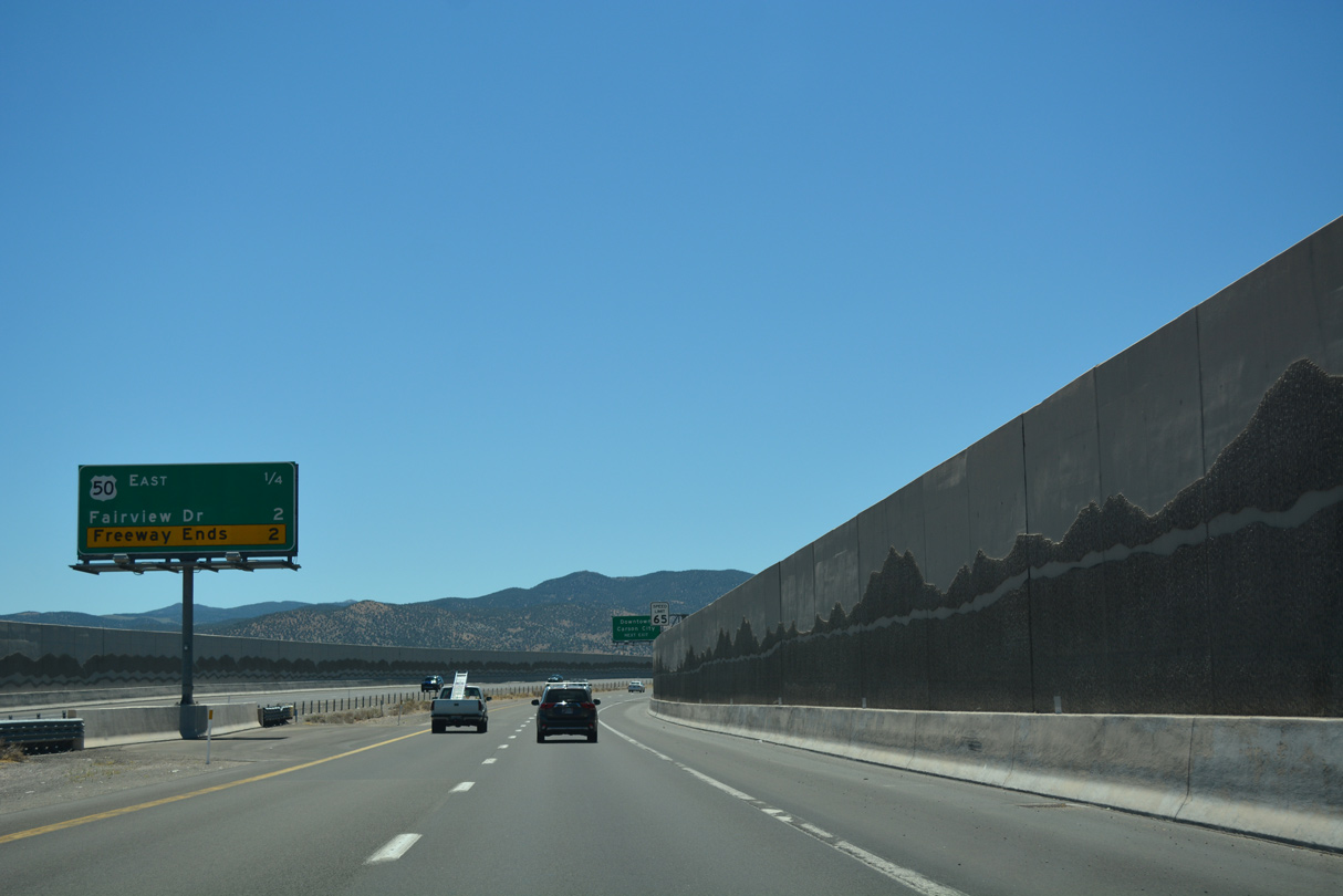
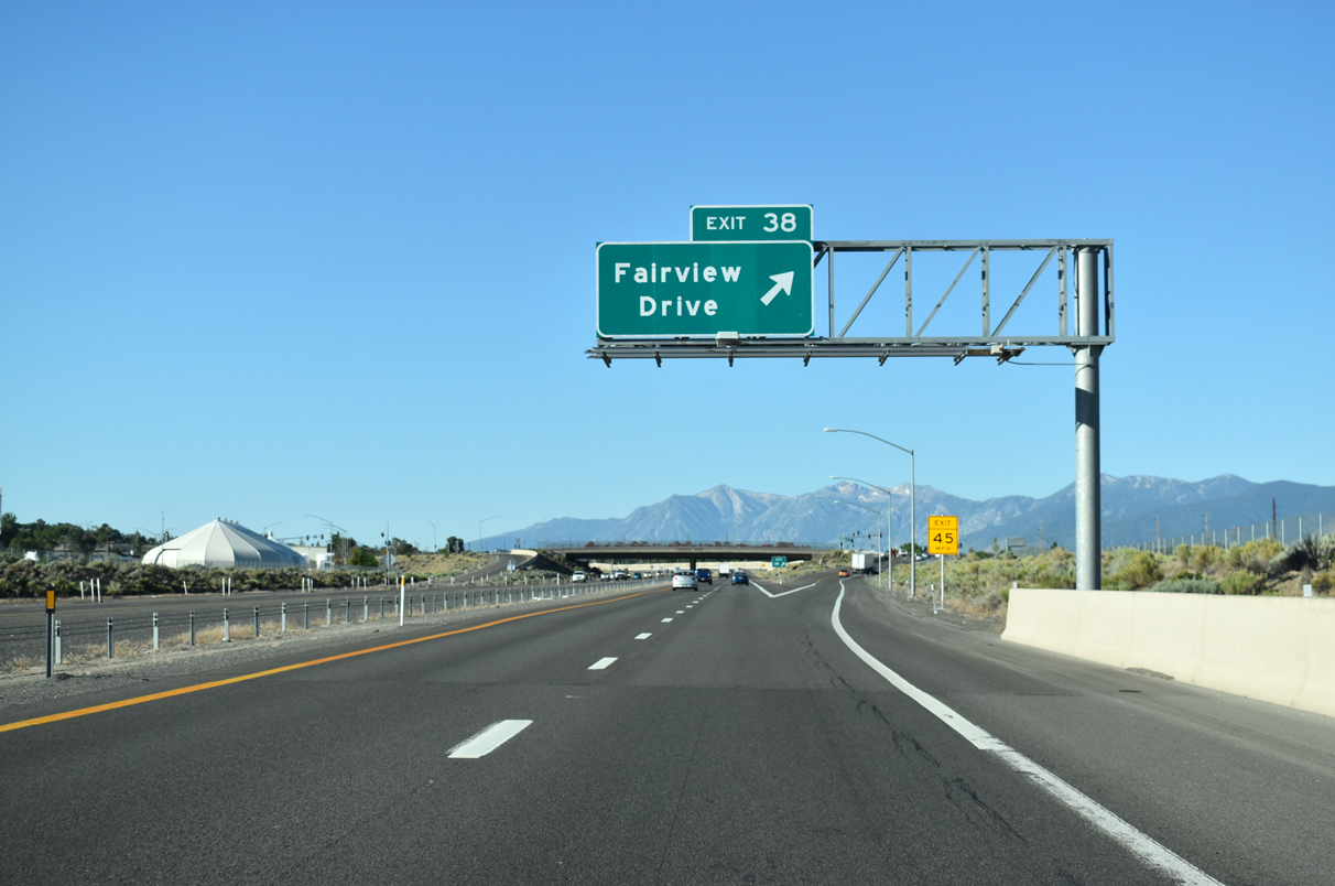
The U.S. 395 freeway ended at William Street (Exit 39) between February 2006 and September 2009, when the ensuing stretch opened south to Fairview Drive (Exit 38).
07/17/17
William Street formerly was a part of U.S. 50 heading 1.4 miles west to then-U.S. 395 (Carson Street) in Downtown Carson City. The five lane boulevard was subsequently proposed as U.S. 50 Business, but is now locally maintained.
09/05/10
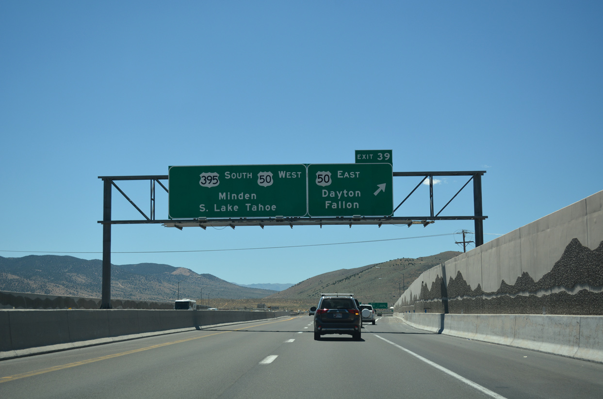
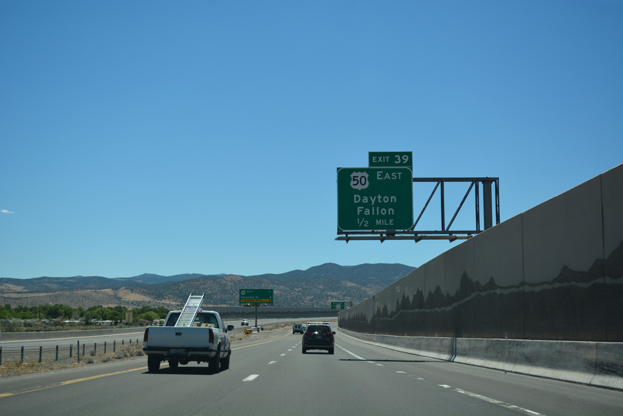
Exit 39 parts ways with I-580 & U.S. 395 south for U.S. 50 (William Street) east to Dayton and Fallon.
07/17/17
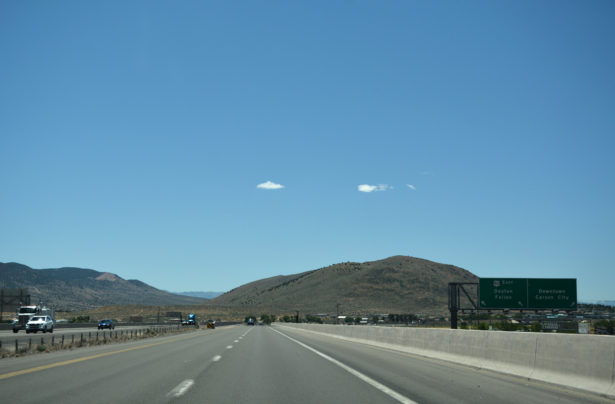
A single lane connects with William Street (old SR 530) west to the Carson City business district. Two lanes link with U.S. 50 east. U.S. 50 traverses the width of Nevada and the Great Basin along what is billed as America's Loneliest Road. Doubling as the historic Lincoln Highway, the route continues from Dayton to Silver Springs, Lahontan State Recreation Area, Austin, Eureka and Ely.
07/17/17
South  West
West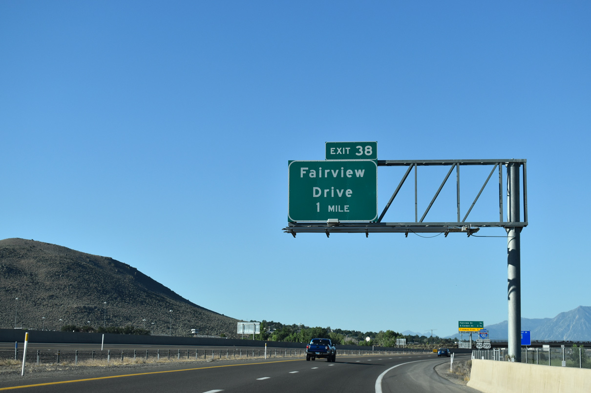
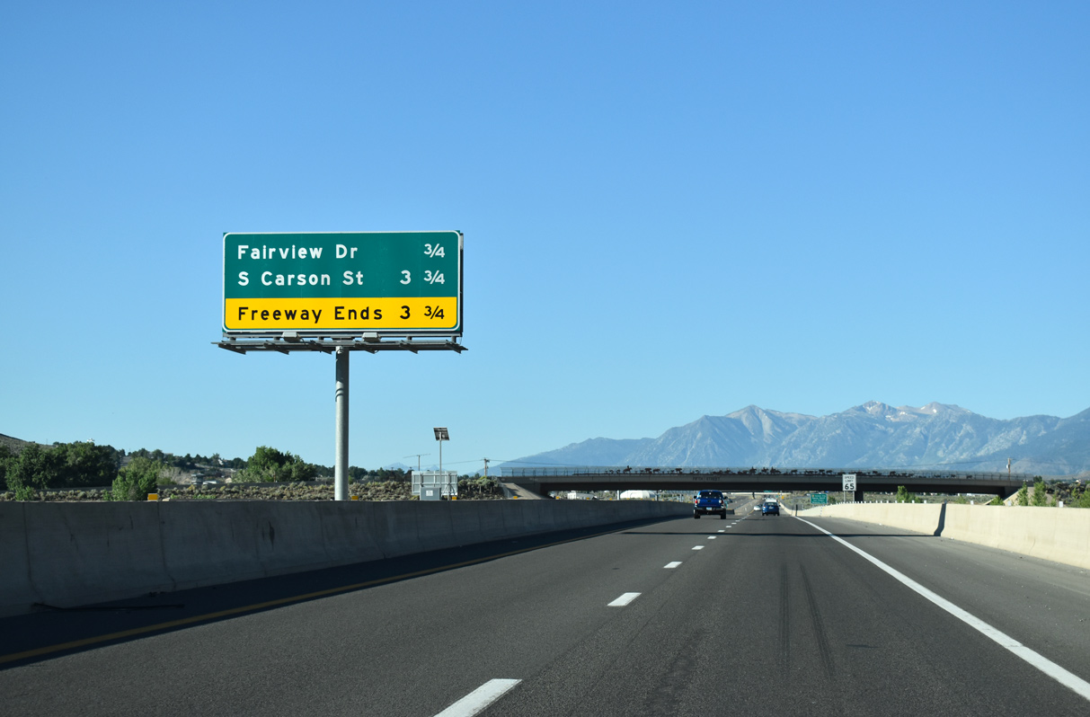
A parclo interchange (Exit 3) joins the Carson City Freeway with Fairview Drive in one mile. Fairview Drive temporarily carried U.S. 50-395 west from the freeway end to South Carson Street between 2009 and 2017.
07/11/18
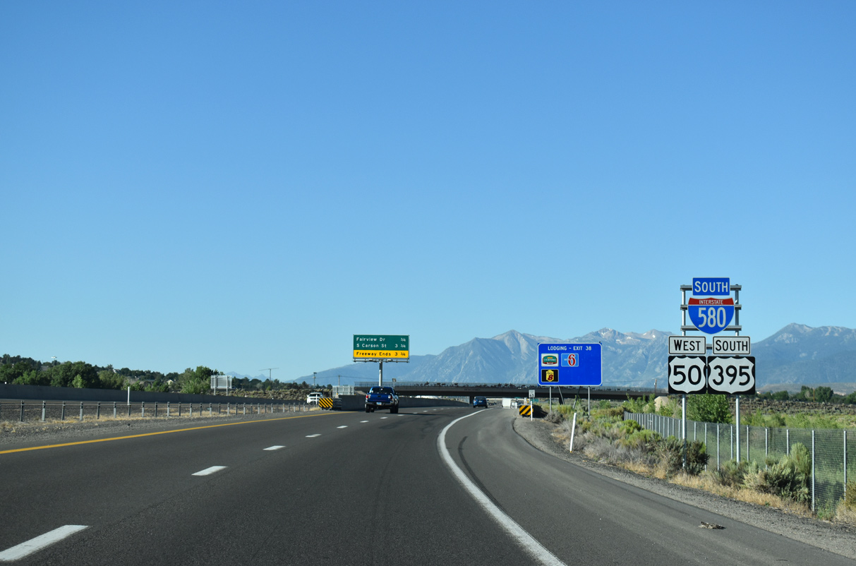
U.S. 50 combines with I-580 & U.S. 395 for 4.9 miles to circumvent Downtown Carson City to the south side of Carson City by Stewart.
07/11/18
The final section of I-580, 3.146 miles south from Fairview Drive to South Carson Street, opened to traffic on August 2, 2017.
07/11/18
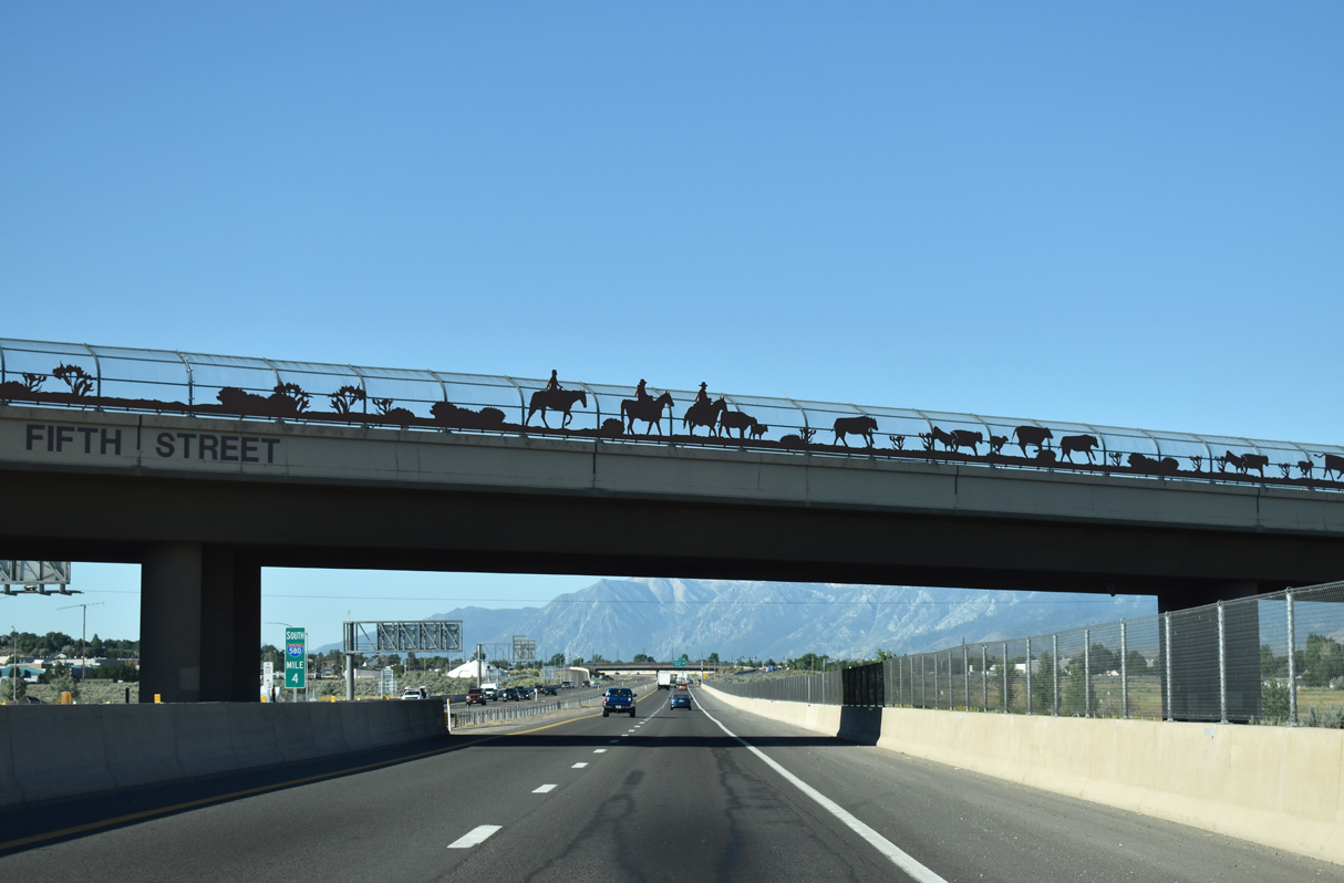
Fifth Street spans I-580 ahead of Exit 3 (former Exit 38). Fifth Street joins Fairview Drive with U.S. 395 Business (S Carson Street) south of downtown.
07/11/18
Fairview Drive extends south from College Parkway at U.S. 50 (William Street) the arterial belt route around the east side of Eagle Valley to I-580 & U.S. 50-395. West from Exit 3 (former Exit 38), the four lane boulevard serves an array of industrial businesses and retail to U.S. 395 Business at the Nevada State Railroad Museum.
07/11/18
I-580/U.S. 50-395 advances south from Fairview Road along an entrenched section of freeway.
07/11/18
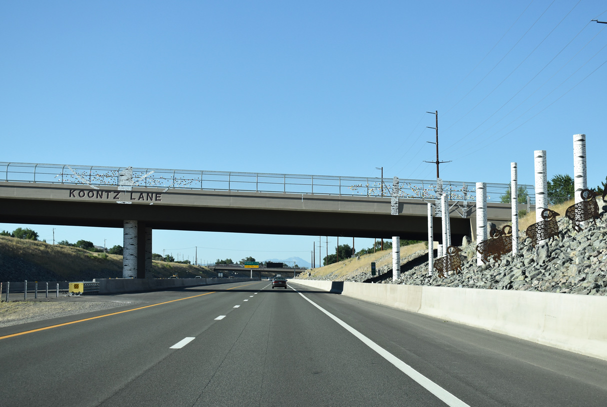
Western style art lines this section of I-580 south at its over crossings.
07/11/18
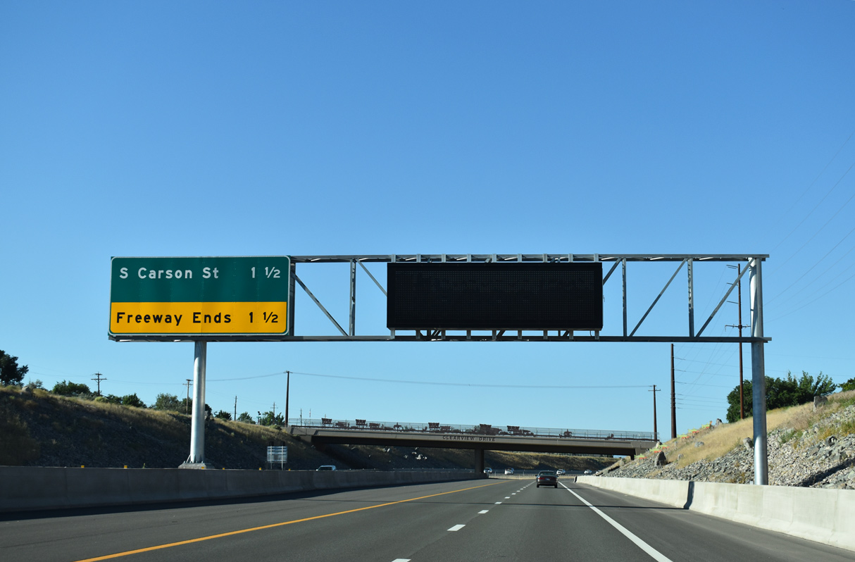
Interstate 580 concludes 1.5 miles ahead at U.S. 395 Business (S Carson Street).
07/11/18
I-580 curves west toward Lake Tahoe beyond the Clearview Drive overpass.
07/11/18
The first of several chain up areas occurs near the southern end of I-580, as U.S. 50 west crosses the Carson Range ahead of Lake Tahoe.
07/11/18
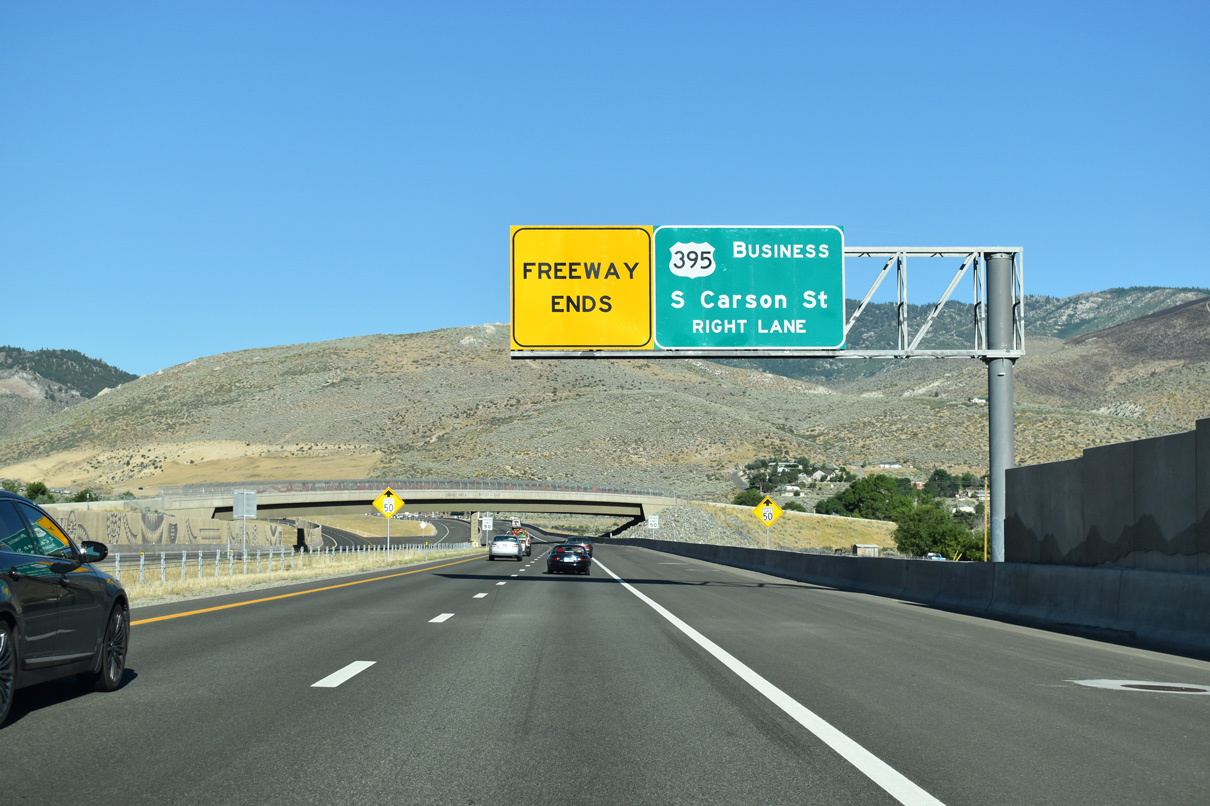
U.S. 395 Business overlays S Carson Street north from I-580/U.S. 50-395 to downtown Carson City.
07/11/18
Enough right of way was acquired for an eventual interchange with S Carson Street.
07/11/18
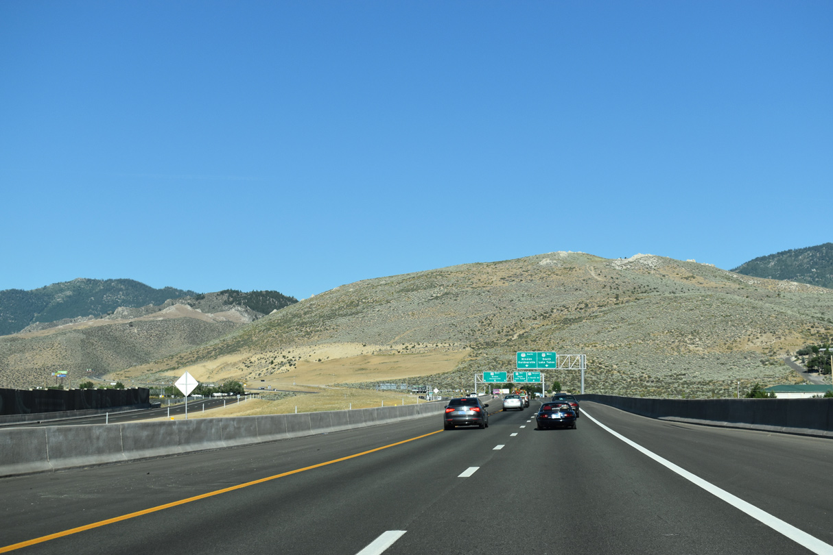
U.S. 395 follows a 34.5 mile course southeast from I-580/U.S. 50 to Topaz Lake at the California state line.
07/11/18
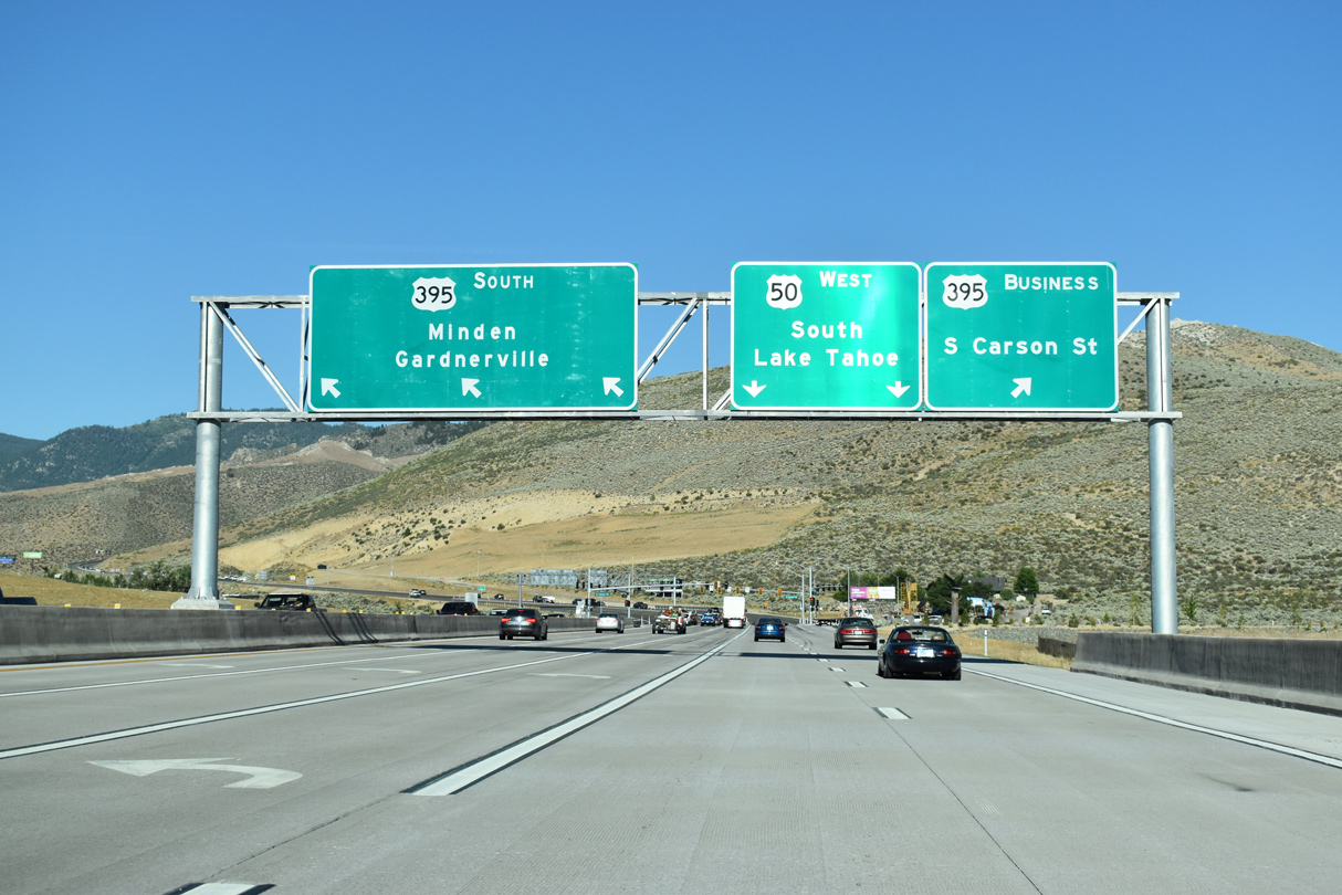
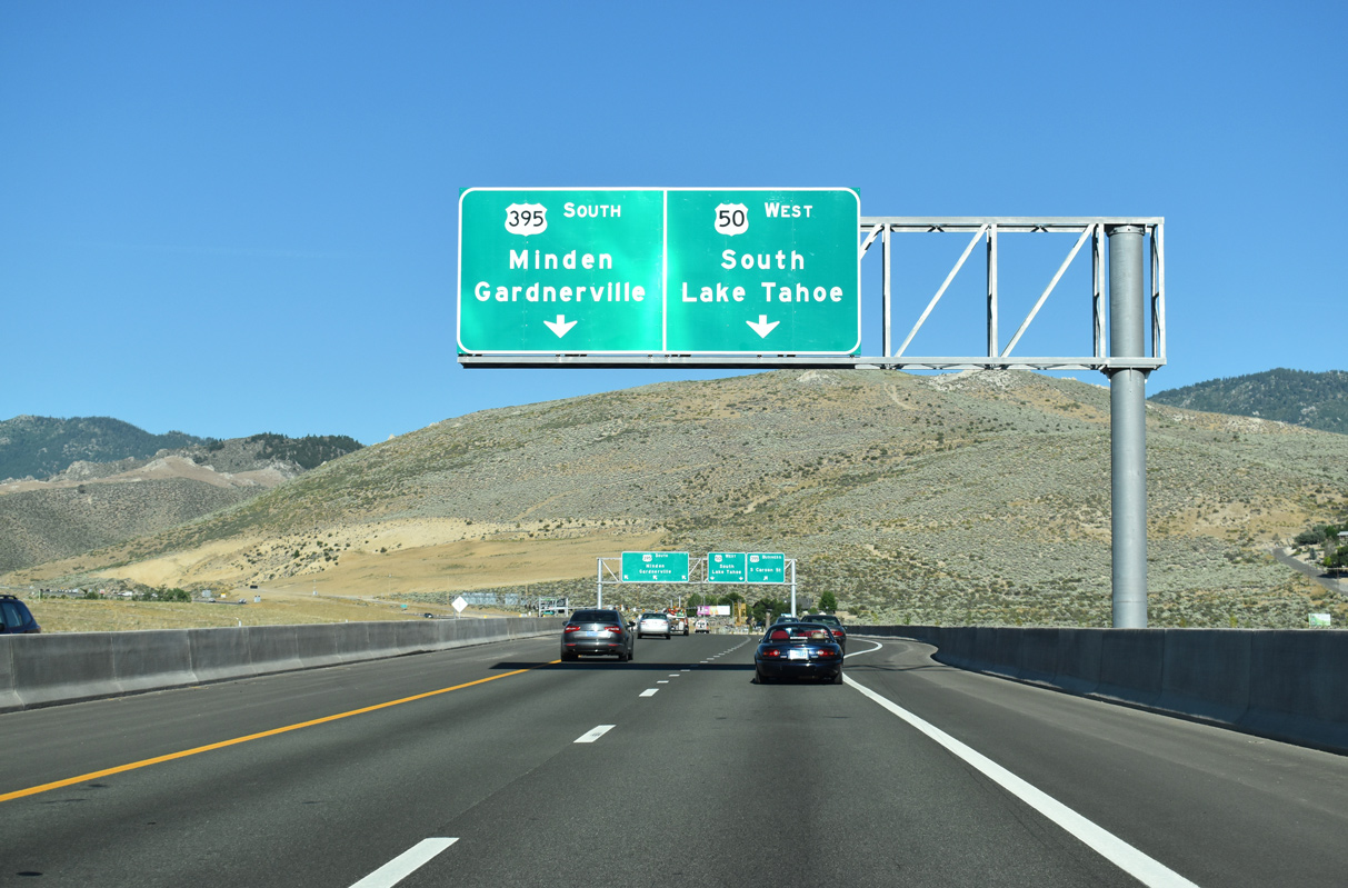
Lanes partition ahead of the signalized interchange for U.S. 395 south to Minden and Gardnerville.
07/11/18

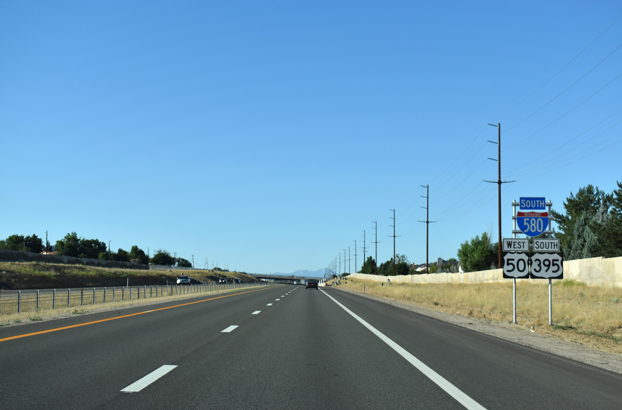
Interstate 580 ends as U.S. 50 continues west into the Carson mountain range to Stateline and South Lake Tahoe, 24.7 miles ahead.
U.S. 395 follows Carson Street south 12 miles to Minden.
07/11/18
References:
- "Gov. Brian Sandoval: I-580: The history -- and the promise by Governor Brian Sandoval." FOX-Reno News, August 14, 2012.
Photo Credits:
- Brent Ivy: 07/17/17
- Andy Field: 09/05/10, 06/29/14
- ABRoads: 07/11/18
Connect with:
Page Updated Wednesday September 02, 2020.