
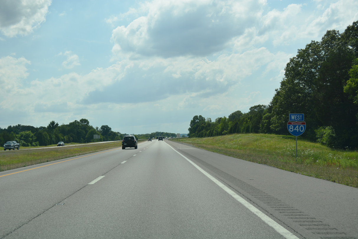
Interstate 840 West - Murfreesboro to Franklin
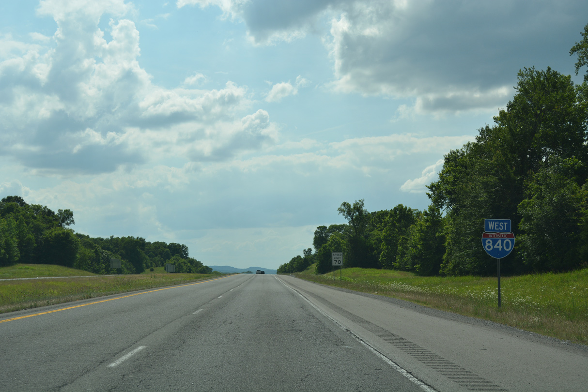
 West
West
I-840 reassurance marker posted between Interstate 24 and the Manson Pike overpass near Blackman.
06/11/17
06/11/17
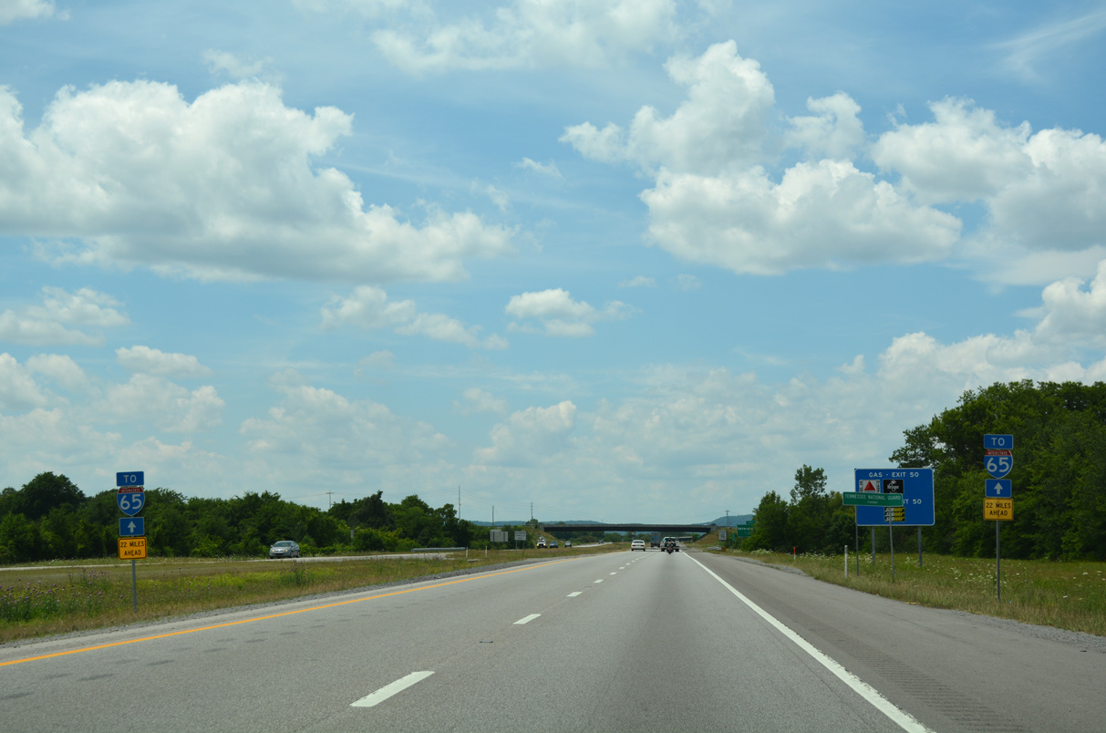
A pair of trailblazers reference the distance (22 miles) to Interstate 65.
06/11/17
06/11/17
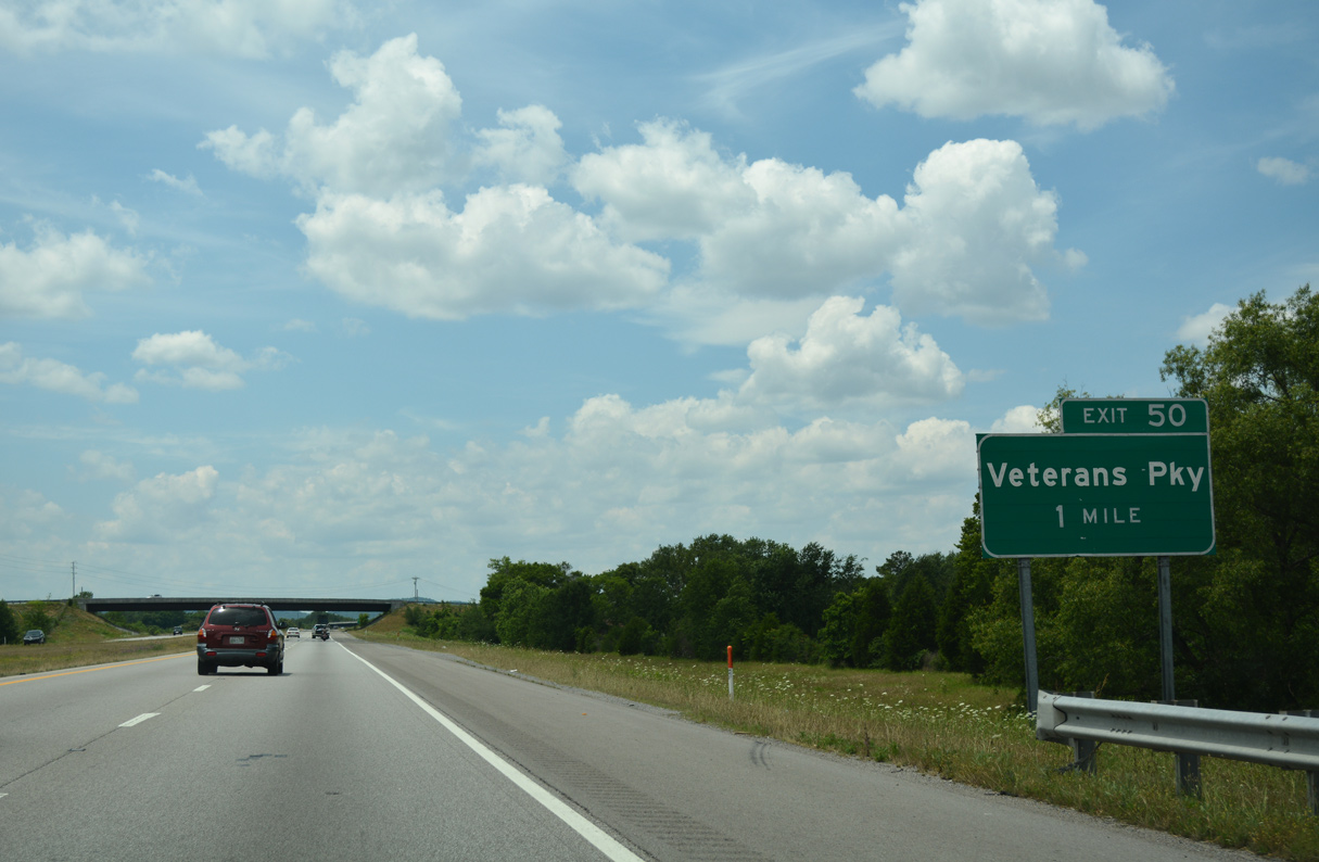
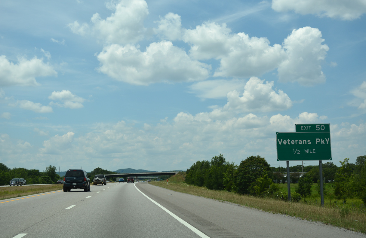
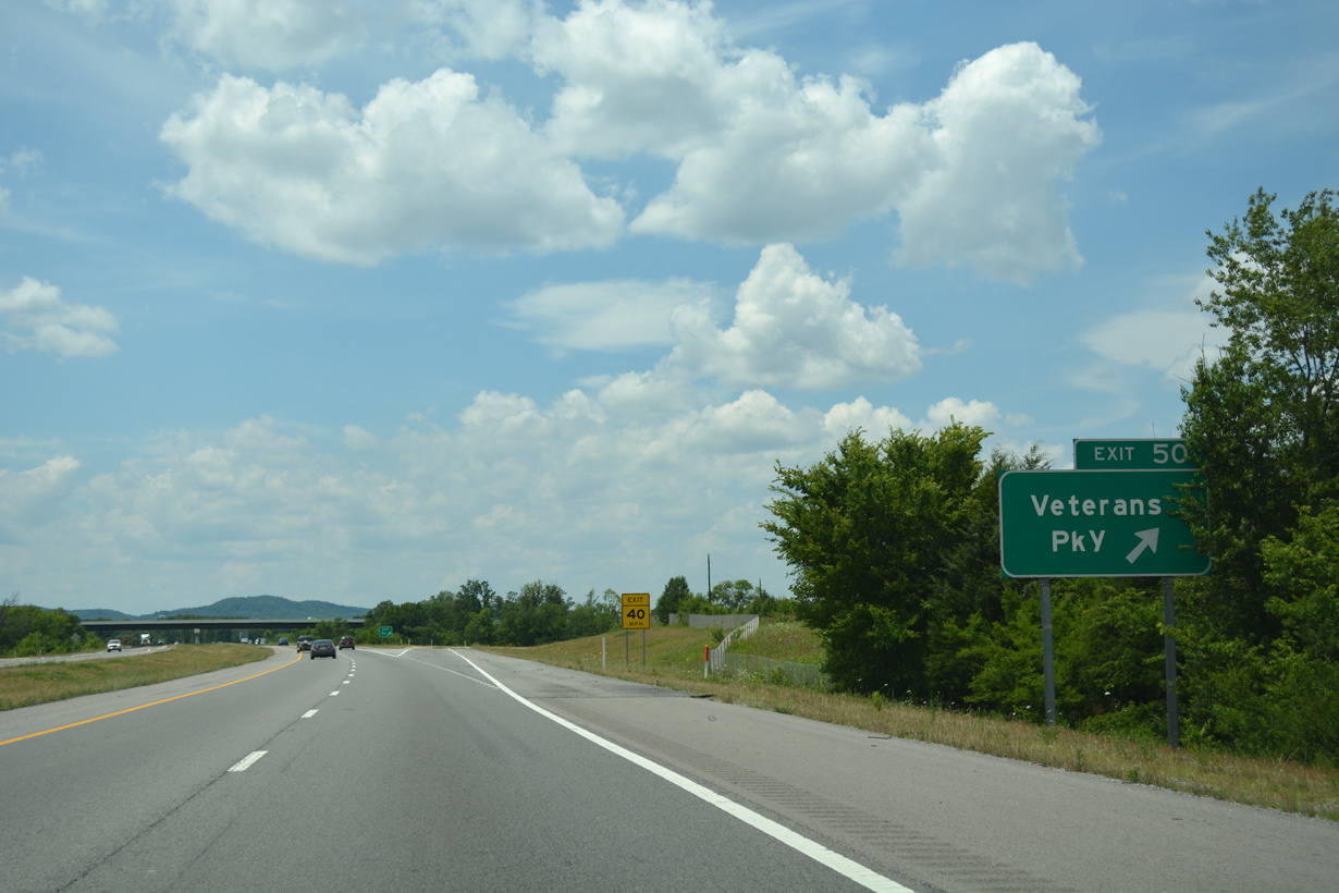
The diamond interchange (Exit 50) with Veterans Parkway opened to traffic by Fall 2008. Coinciding with the construction was a realignment of Beesley Road onto a new five lane arterial northwest 1.5 miles to Burnt Knob Road.1
06/11/17
06/11/17
Veterans Parkway was constructed as part of the Southwest/Northwest Loop Road Corridor to provide an at-grade bypass of Murfreesboro. The parkway replaced various preexisting roads, including Beesley Road north from SR 99 to Blackman Road, which was also named Beesley Road to Burnt Knob Road just north of I-840.2
06/11/17
06/11/17
Veterans Parkway arcs southeast from Interstate 840 by a number of housing developments to U.S. 231 in south Murfreesboro.
06/11/17
06/11/17
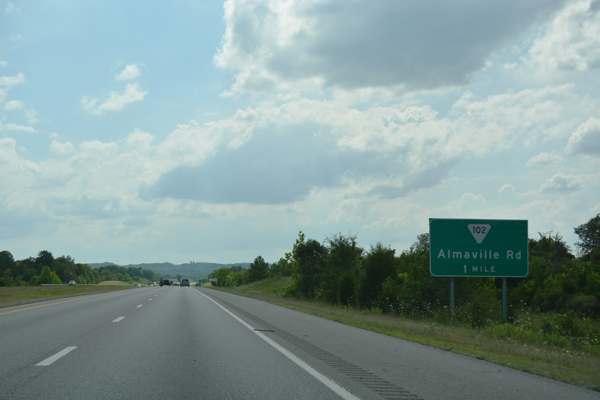
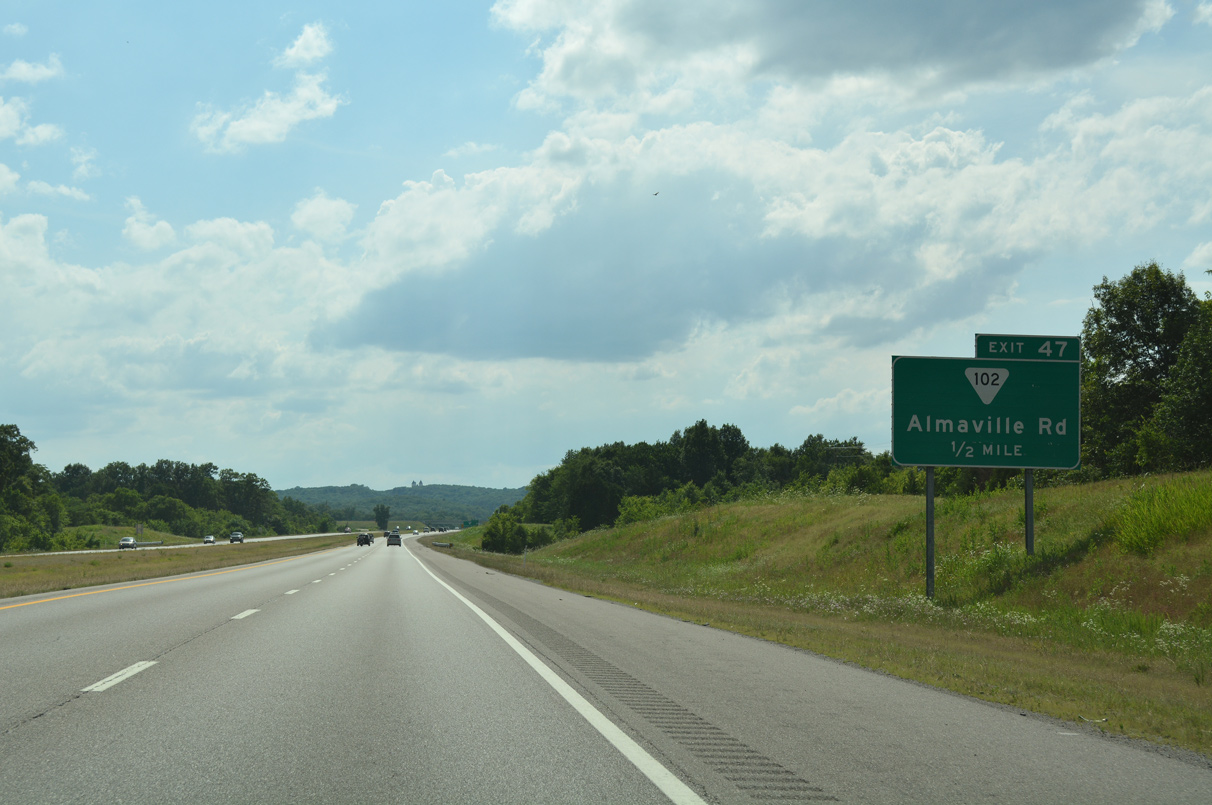
Hills along Duck River Ridge appear along the western horizon as I-840 advances toward the diamond interchange (Exit 47) with SR 102 (Almaville Road).
06/11/17
06/11/17
Hills along Duck River Ridge appear along the western horizon as I-840 advances toward the diamond interchange (Exit 47) with SR 102 (Almaville Road).
06/11/17
06/11/17
SR 102 (Almaville Road) ends just to the south of Exit 47 at SR 96, north of Scales Mountain. SR 96 parallels I-840 west from Murfreesboro and crosses over the freeway en route to Triune and Arrington.
06/11/17
06/11/17
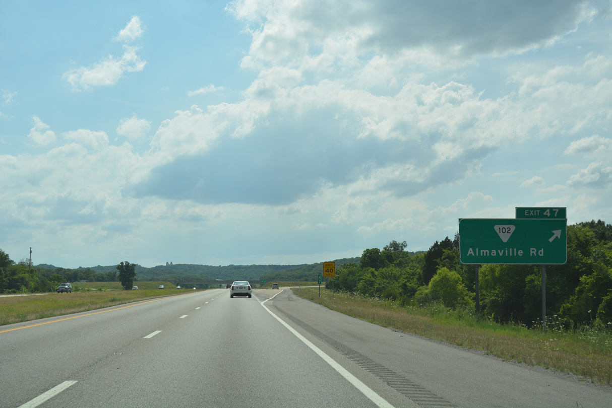
Exit 47 departs I-840 west for Almaville. SR 102 meanders northward to Smyrna where it concludes a 13.06 mile route at SR 266 (Sam Ridley Parkway).
06/11/17
06/11/17
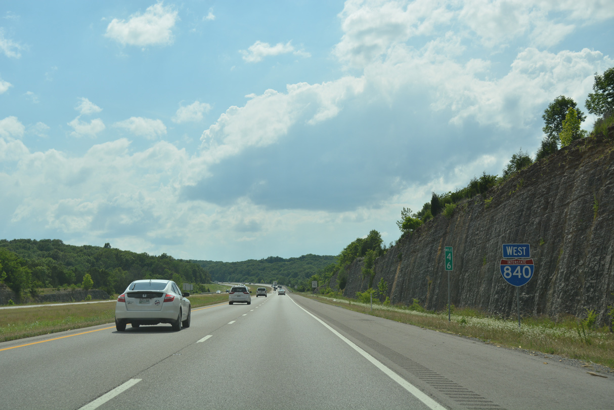
Interstate 840 confirming marker posted west of Stewart Creek.
06/11/17
06/11/17
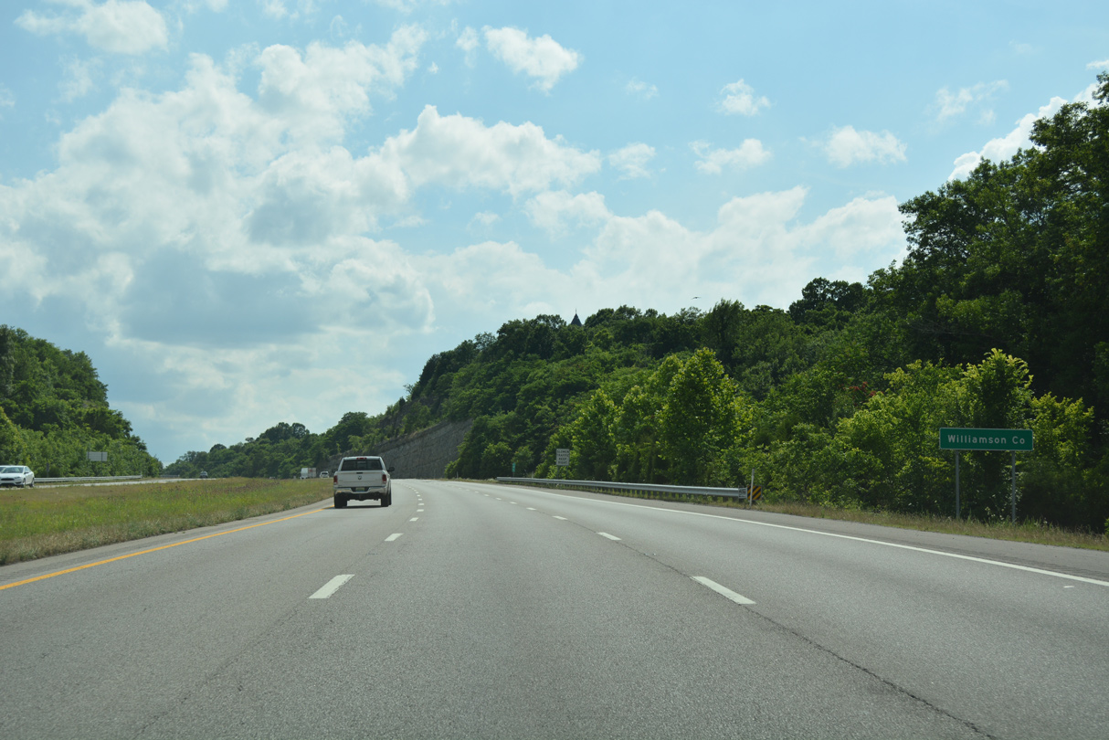
The freeway enters Williamson County across a ridge line at around 900 feet above sea level.
06/11/17
06/11/17
Sweeping southwest, Interstate 840 and SR 96 trade places ahead of Triune.
11/07/11
11/07/11
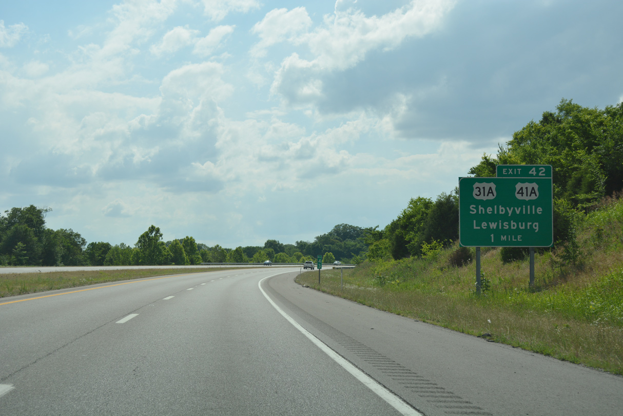
U.S. 31A/41A cross paths with I-840 at the first of nine Williamson County interchanges in one mile. The pair split 2.8 miles south of Exit 42 at Kirkland for respective paths to Lewisburg and Shelbyville.
06/11/17
06/11/17
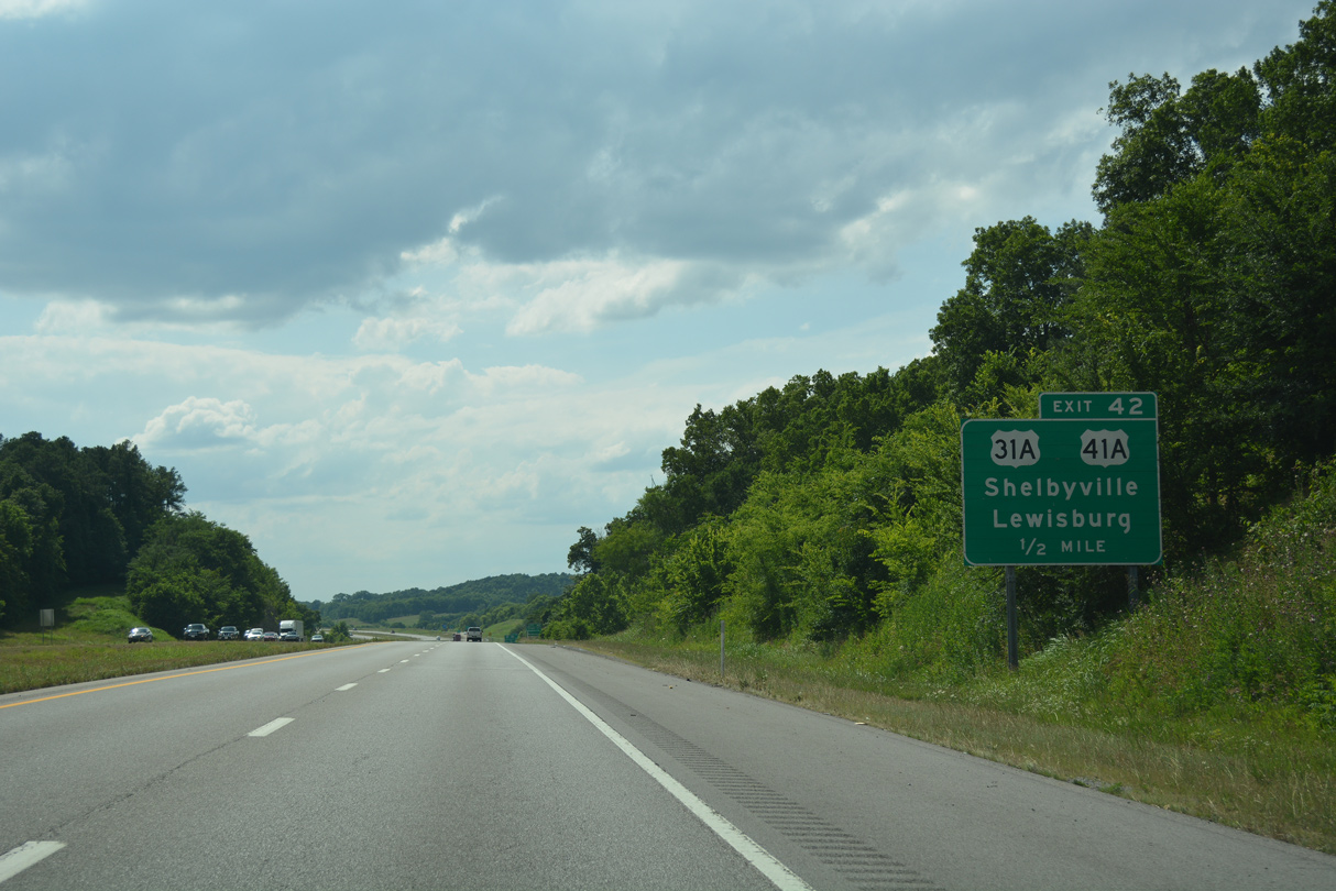
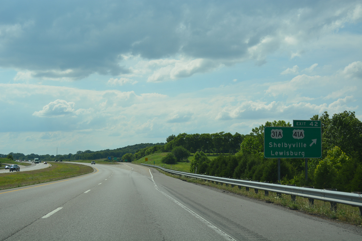
A diamond interchange (Exit 42) joins Interstate 840 with U.S. 31A/41A at Triune.
06/11/17
06/11/17
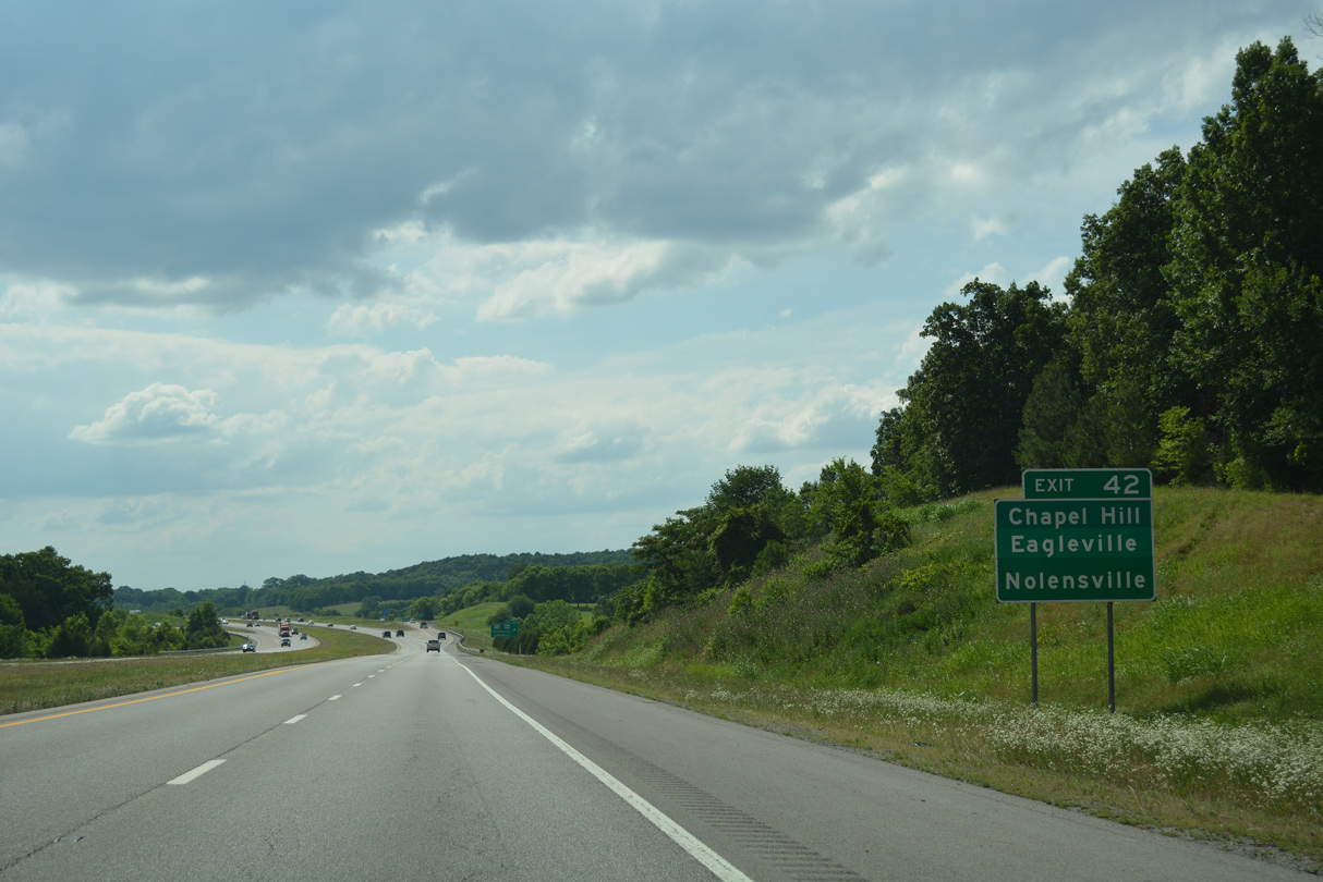
U.S. 31A/41A head north to Nolensville. South from Kirkland, U.S. 31A continues to Chapel Hill while U.S. 41A shifts eastward to Eagleville.
06/11/17
06/11/17
U.S. 31A runs south to Pulaski and north to Downtown Nashville. U.S. 41A parallels the I-24 corridor southeast to Monteagle and northwest to Hopkinsville, Kentucky.
06/11/17
06/11/17
Interstate 840 arcs southward from Triune around Peytonsville between U.S. 31A/41A and I-65.
06/11/17
06/11/17
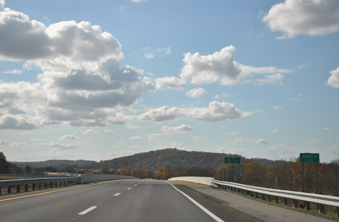
Interstate 840 spans a CSX Railroad line and the Harpeth River at milepost 39, east of Rudderville.
11/07/11
11/07/11
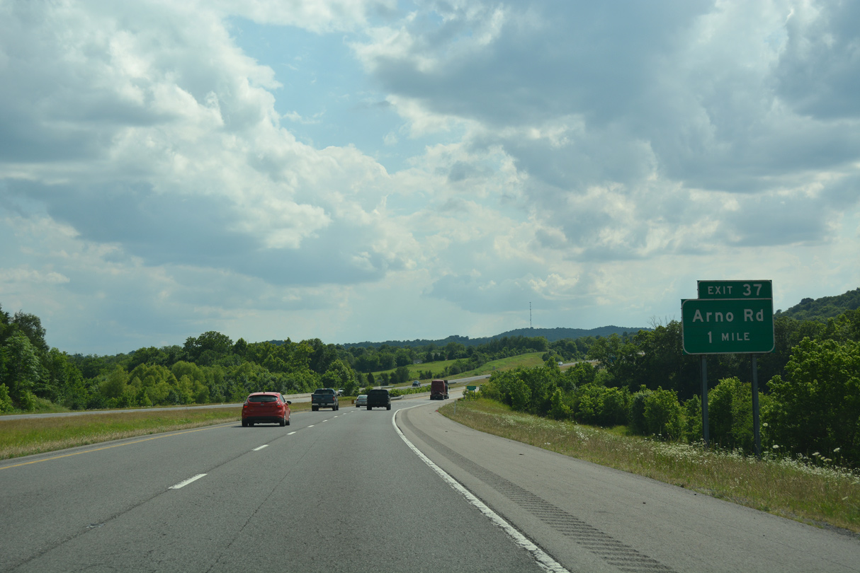
Arno Road meanders southeast from SR 96 (Murfreesboro Road) in Franklin to Millview, Rudderville and a diamond interchange (Exit 37) with I-840.
06/11/17
06/11/17
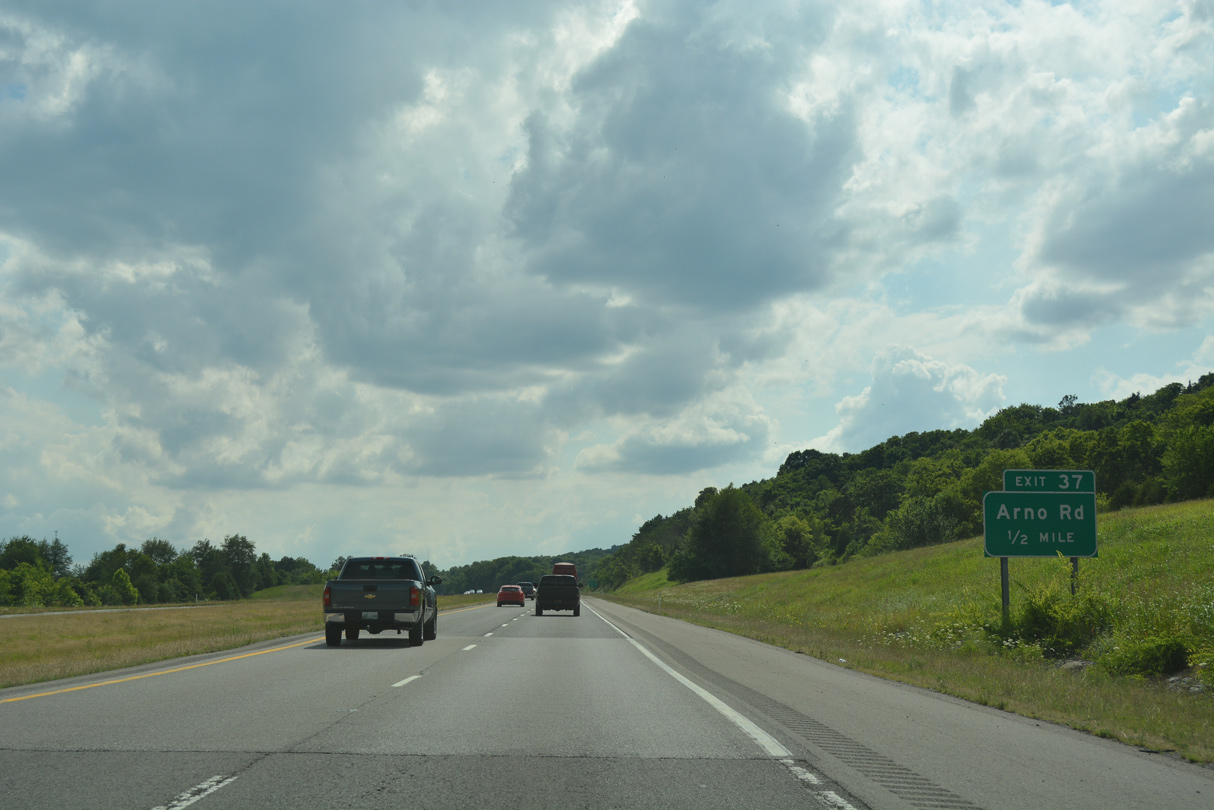
Exit 37 serves commuters from nearby developments including The Grove golf course community built in 2012.
06/11/17
06/11/17
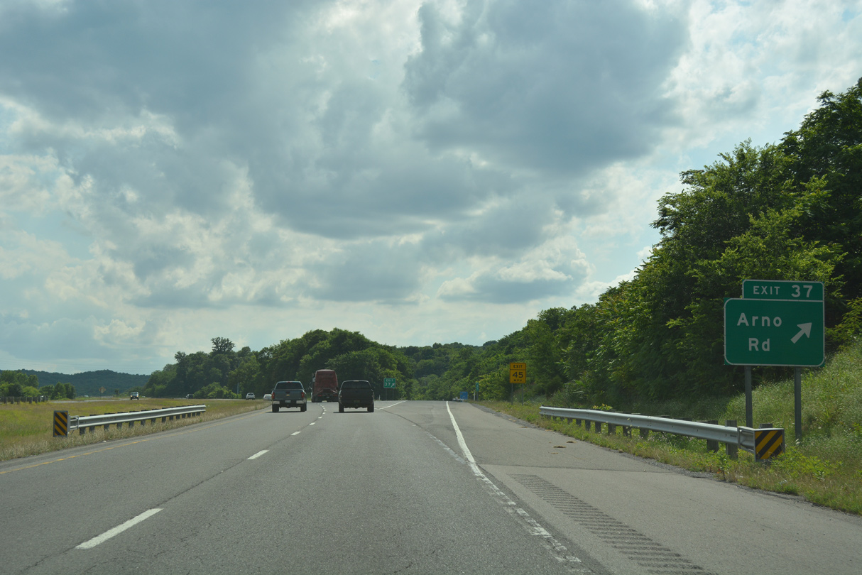
Exit 37 leaves Interstate 840 west for Arno Road. Arno Road continues south to Arno.
06/11/17
06/11/17
Nearby hills rise to 1,160 feet above sea level along Interstate 840 east of Peytonsville.
06/11/17
06/11/17
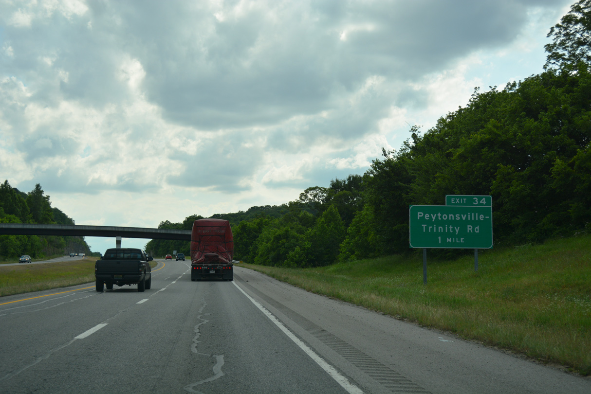
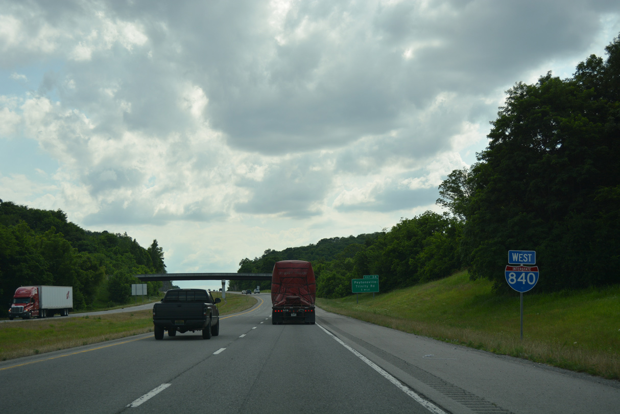
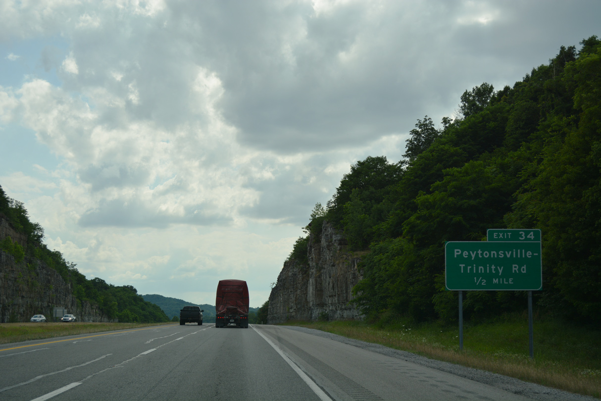
Peytonsville-Trinity Road runs three miles north from forthcoming Exit 34 to Arno Road.
06/11/17
06/11/17
Peytonsville-Trinity Road south connects I-840 with rural roads leading to Arno, Harpeth and areas of Duck River Ridge.
06/11/17
06/11/17
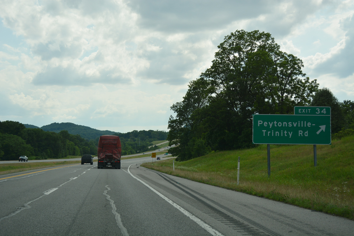
Entering the diamond interchange (Exit 34) with Peytonsville-Trinity Road along I-840 west. Peytonsville Road stems west from nearby to eastern reaches of Franklin and I-65 at Exit 61.
06/11/17
06/11/17
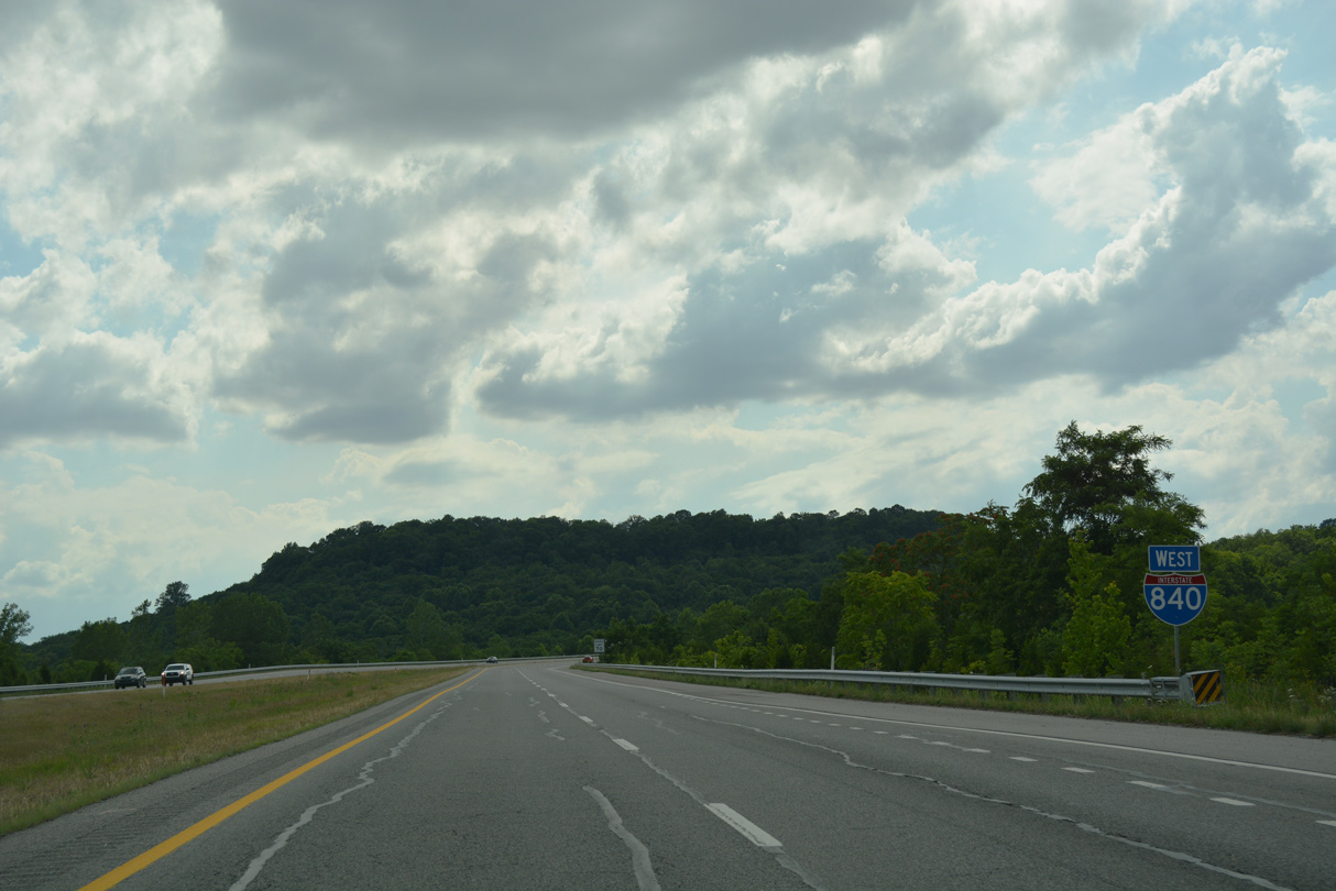
I-840 travels along a scenic stretch west from Peytonsville to Interstate 65.
06/10/17
06/10/17
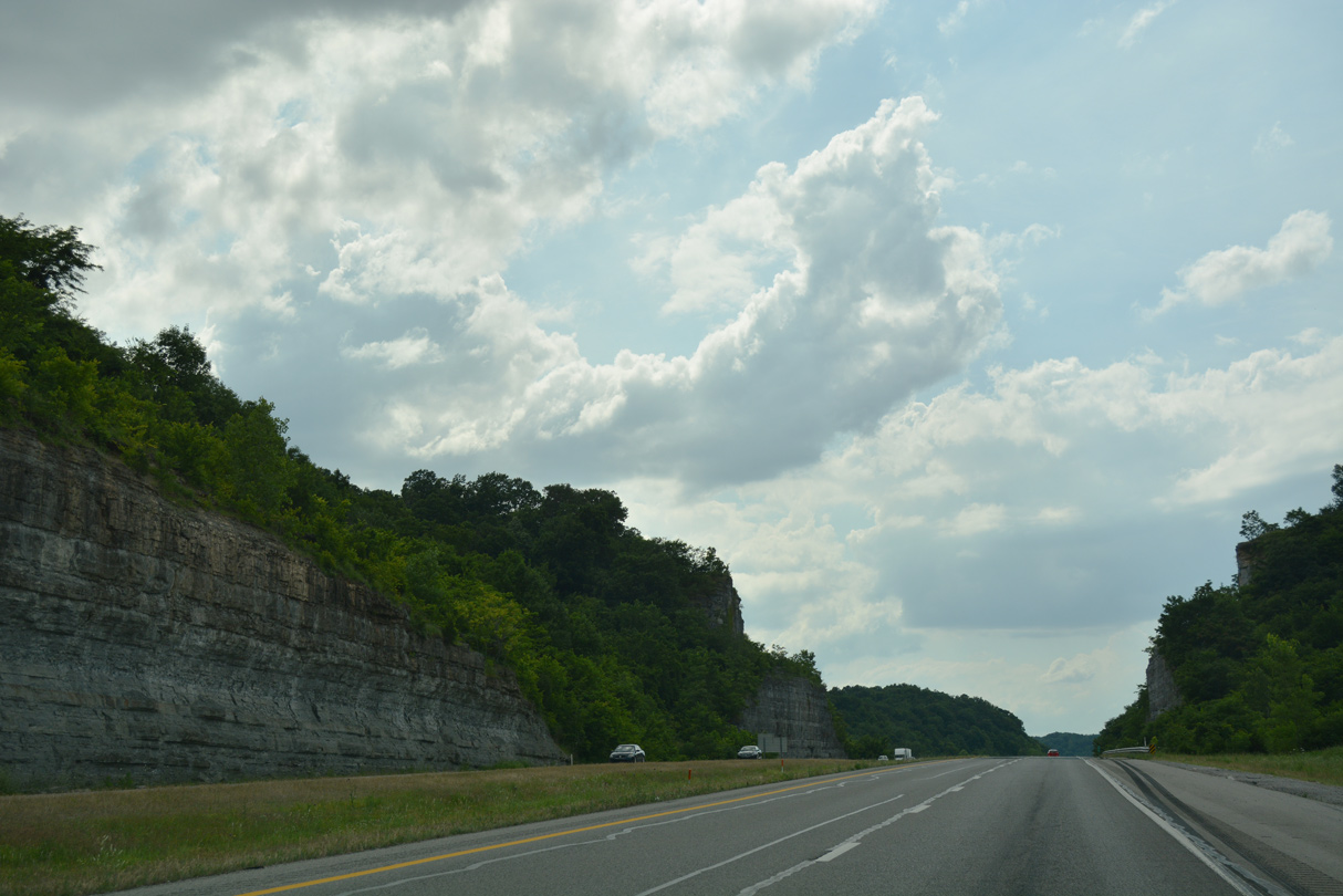
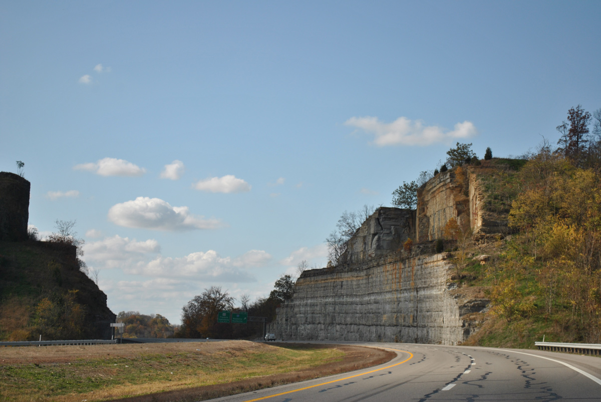
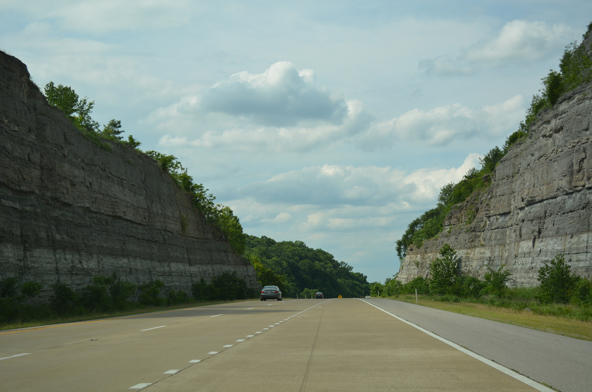
The freeway shifts northwest through a series of rock cuts onward from milepost 33.
06/11/17
06/11/17
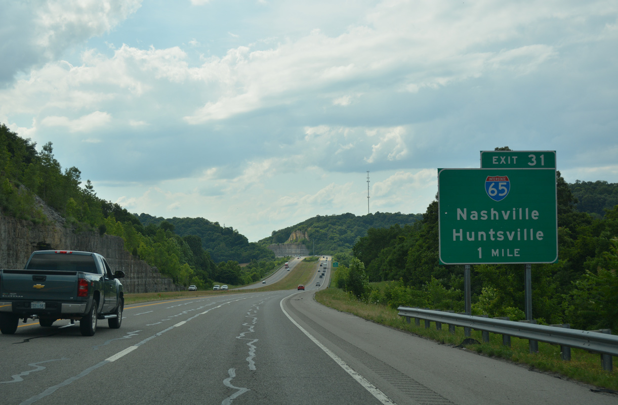
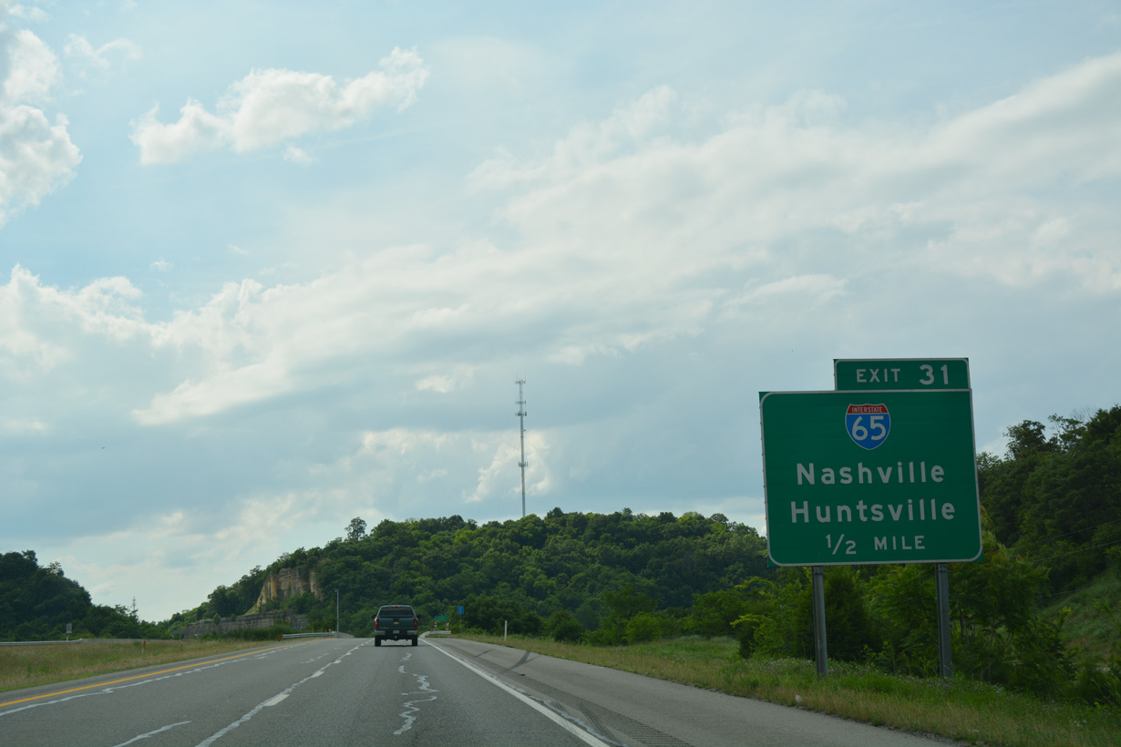
A cloverstack style interchange (Exit 31) joins I-840 with Interstate 65 in one mile.
06/11/17
06/11/17
Interstate 65 travels 121.7 miles across central Tennessee from Huntsville, Alabama to Bowling Green, Kentucky. The freeway locally joins I-840 with the suburban cities of Spring Hill to the south and Franklin to the north.
06/11/17
06/11/17
I-840 turns west and lowers to meet Interstate 65 to the south of Lookout Hill.
11/07/11
11/07/11
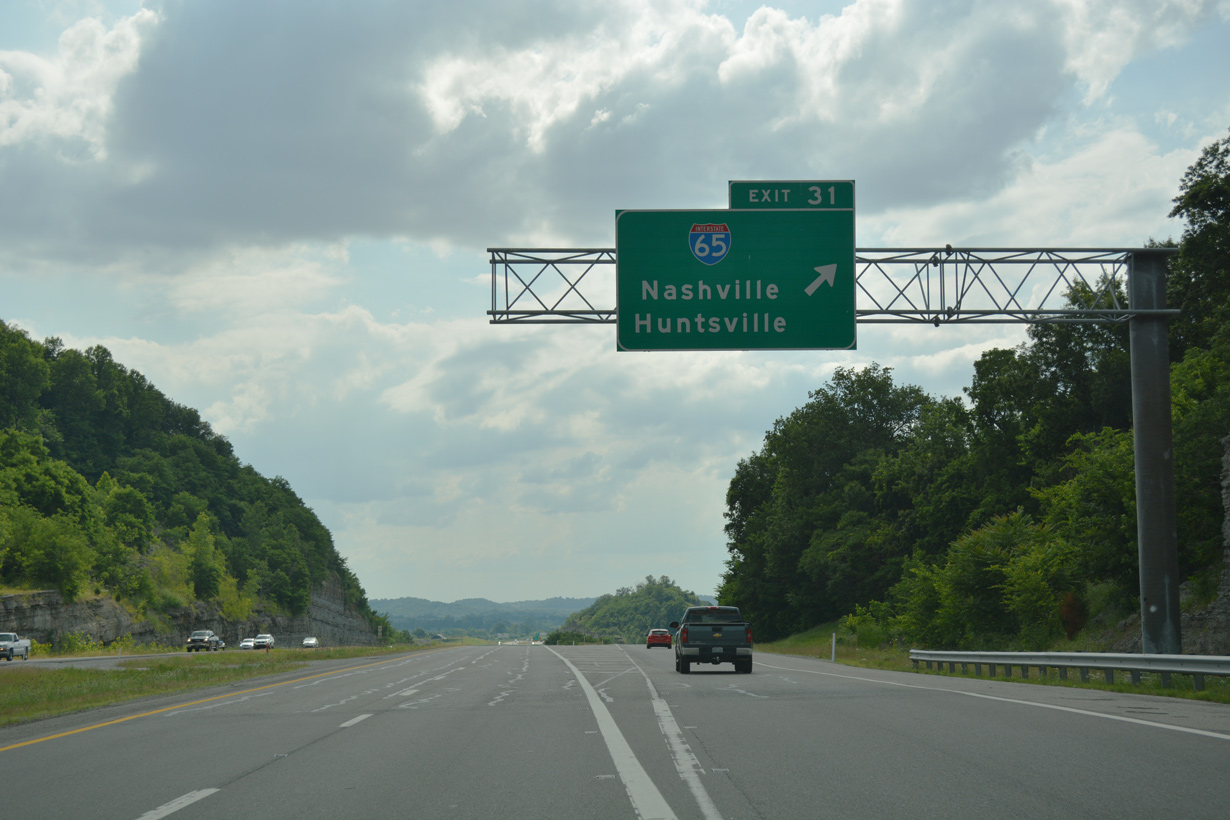
Exit 31 carries all traffic in unison to Interstate 65. I-65 heads north along a busy commuter route to Brentwood, Oak Hill and Downtown Nashville. U.S. 431 parallels the freeway to the west into Franklin and Forest Hills.
06/11/17
06/11/17
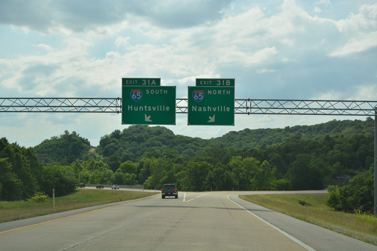
Traffic partitions into ramps for I-65 north and south. Interstate 65 overall goes for 887 miles from Mobile, Alabama on the Gulf Coast to Gary, Indiana in the Great Lakes Region.
06/11/17
06/11/17
Ramps from both directions of I-840 combine through a rock cut preceding northbound Interstate 65 into Franklin.
06/11/17
06/11/17
Photo Credits:
- Alex Nitzman: 06/10/17, 06/11/17
- ABRoads: 11/07/11
Page Updated Tuesday August 18, 2020.