Highway 64 West

Home » Guides » Iowa » Highway 64 West

U.S. 52 North Iowa 64 West
U.S. 52 north and Illinois 64 west separate from Illinois 84 north directly onto the Savanna-Sabula Bridge. The former steel truss bridge opened to traffic in 1932 and was redecked in 2008. 12/21/09
Although still officially in Illinois, an Iowa 64 shield accompanied this U.S. 52 marker. 12/21/09
U.S. 52 north crosses the state line midway across the Mississippi River. Illinois Route 64 becomes Iowa 64 for a 3.7 mile overlap with U.S. 52 through Sabula. 12/21/09
The Jackson County line sign stands at a wide spot where the original toll collection facility was located. U.S. 52/Iowa 64 turn south from here and traverse the Chain of Lakes. 12/21/09
Heading southward, motorists pass by the first shield for U.S. 52 north posted in Iowa. 12/21/09
Entering Sabula, the Island City, U.S. 52 north / Iowa 64 west become Broad Street through the community of 576 (2010 census). 12/21/09
The Iowa welcome sign preceded the Mississippi River overflow bridge carrying U.S. 52/Iowa 64 across a waterway linking Town Lake to the west with the Mississippi River main channel. 12/21/09
Broad Street leads U.S. 52 and Iowa 64 south three blocks to Sycamore Street, where the pair turn west. 12/21/09
U.S. 52 northbound at the turn onto Sycamore Street toward U.S. 67. Broad Street extends another six blocks south to a marina. 03/12/17
Sycamore Street intersects Elk and Lake Streets before transitioning onto a causeway across Sabula Lakes. 12/21/09
U.S. 52/Iowa 64 intersect the northern terminus of U.S. 67 just west of the Dakota, Minnesota & Eastern (DME) Railroad Corporation underpass. 12/21/09
Iowa 64 west leaves U.S. 52 north for a half mile overlap with U.S. 67 south. 12/21/09
U.S. 52 resumes a northward course, following the general path of the Mississippi River northwest 20 miles to Bellevue and 44 miles to Dubuque. U.S. 67 heads south 18 miles to Clinton, while Iowa 64 remains westward 7 miles to Miles. 12/21/09
U.S. 67 commences a 1,560 mile journey to Presidio, Texas from rural Jackson County, Iowa. The highway serves Clinton and the Quad Cities in Iowa before departing to Illinois, St. Louis, Little Rock, Texarkana, Dallas, and San Angelo, Texas. 03/12/17
U.S. 67 South Iowa 64 West
U.S. 67 travels south from U.S. 52 in the rural hills west of Sabula and the Mississippi River. Iowa 64 combines with the first half mile of the highway as part of a multi-state route that originates in Chicago. 03/12/17
U.S. 67/Iowa 64 ascend through a valley from the Sabula Lakes area to split ahead of open agricultural lands along either route. 12/21/09
Iowa 64 continues west seven miles to Miles and 25 miles to the Jackson County seat of Maquoketa while U.S. 67 turns south to follow the Mississippi River 17 miles to Clinton. 12/21/09
The separation of U.S. 67 south from Iowa 64 west. Iowa 64 travels 60.0 miles from Sabula west to U.S. 151 at Anamosa. 12/21/09
Iowa 64 West
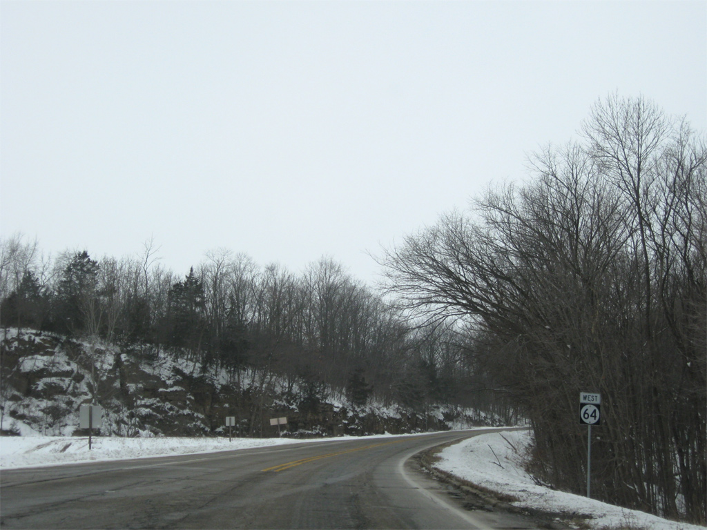
A parting shot of Iowa 64 west leading away from U.S. 67 south. 12/21/09
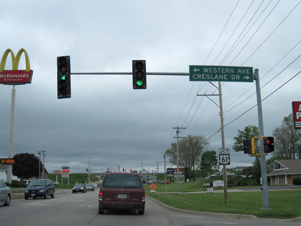
Iowa 64 (Platt Street) leaves the intersection with Creslane Drive north and Western Avenue south to approach a diamond interchange with U.S. 61 in Maquoketa. 05/08/10
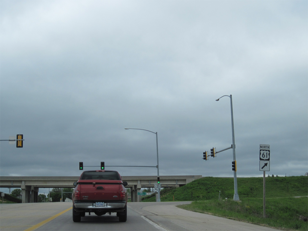
The northbound ramp to Dubuque follows the signalized entrance to Westgate Plaza on Iowa 64 (Platt Street) west. 05/08/10
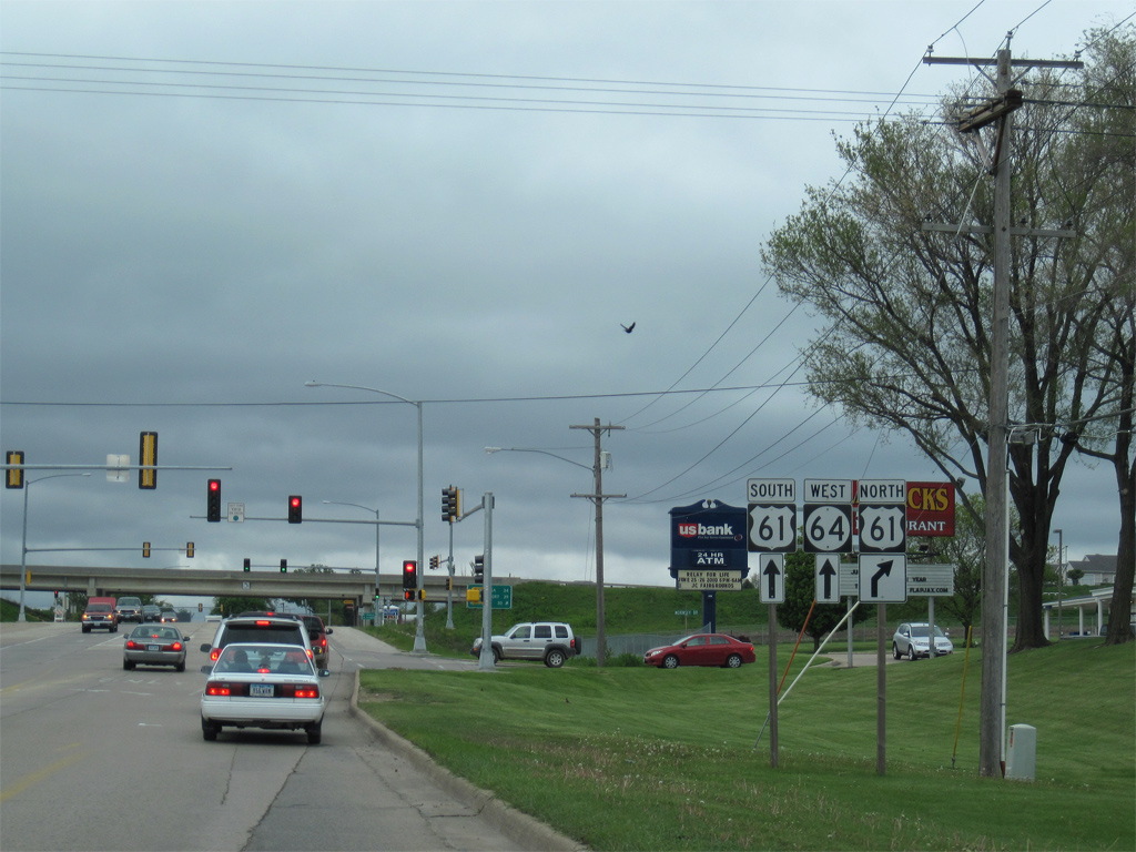
U.S. 61 proceeds north from Iowa 64 across the Maquoketa River. The freeway portion of U.S. 61 transitions into an expressway beyond the river to Fulton, Zwingle and U.S. 151 near Key West. 05/08/10


Photo Credits:

  • 12/21/09 by AARoads.
  • 05/08/10 by AARoads.
  • 03/12/17 by AARoads and Bill Gatchel.

Connect with:
U.S. 52
U.S. 61
U.S. 67
U.S. 151
Highway 38
Highway 136
County Road Y53
County Road Y60

Page Updated 05-17-2018.

Go to Top